|
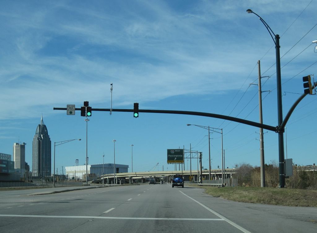
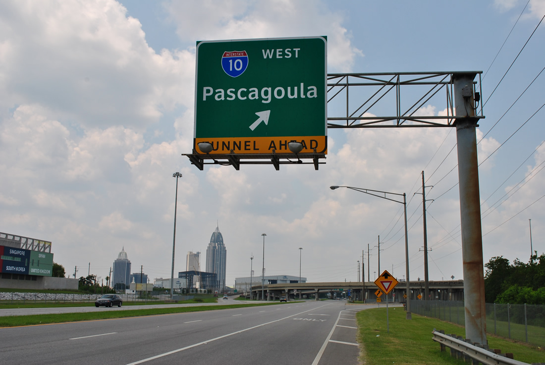
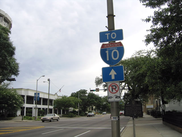
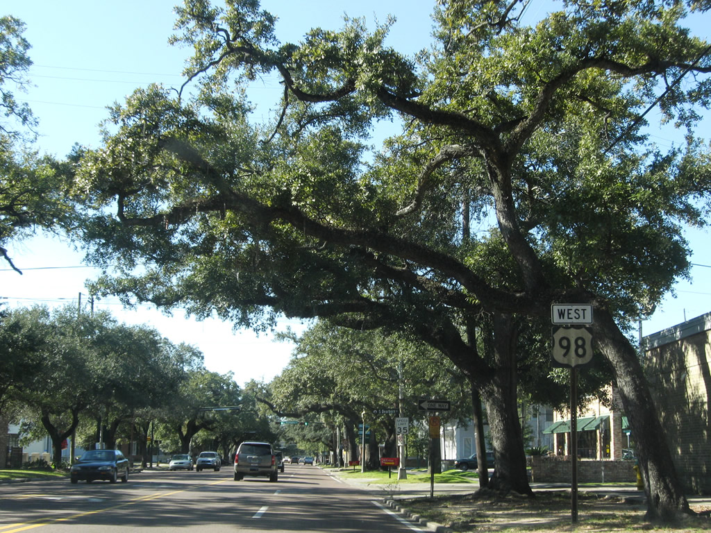
| Overlapping wye interchanges connect the west end of Battleship Parkway with Interstate 10 at the George Wallace Tunnel. 11/03/03 |
|
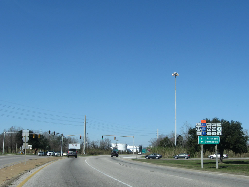
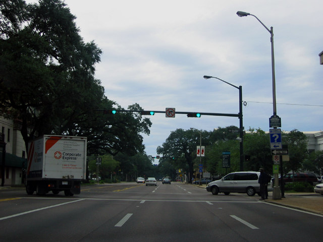
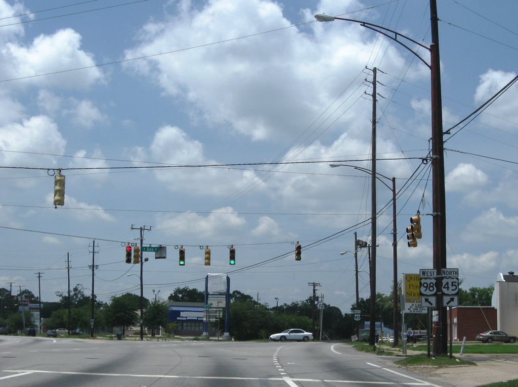
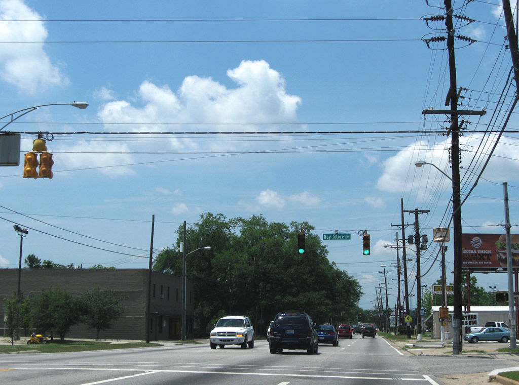
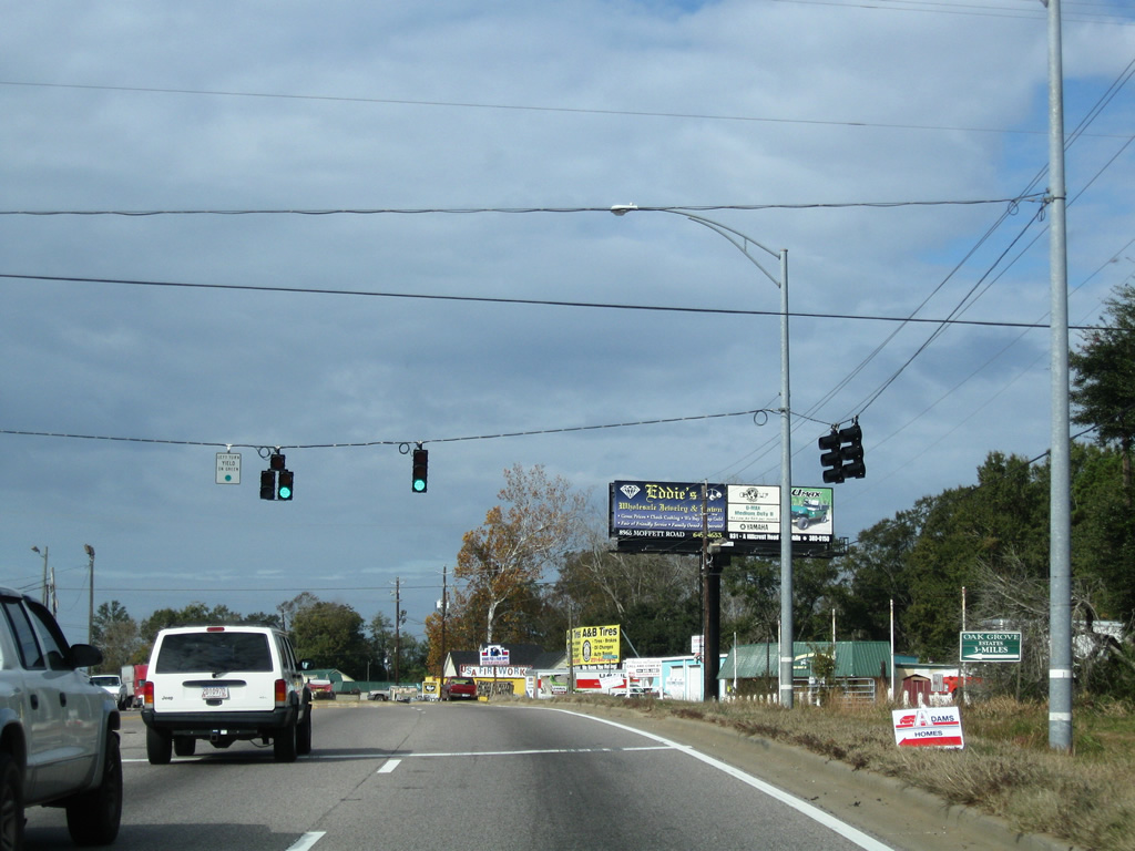
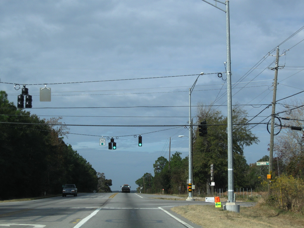
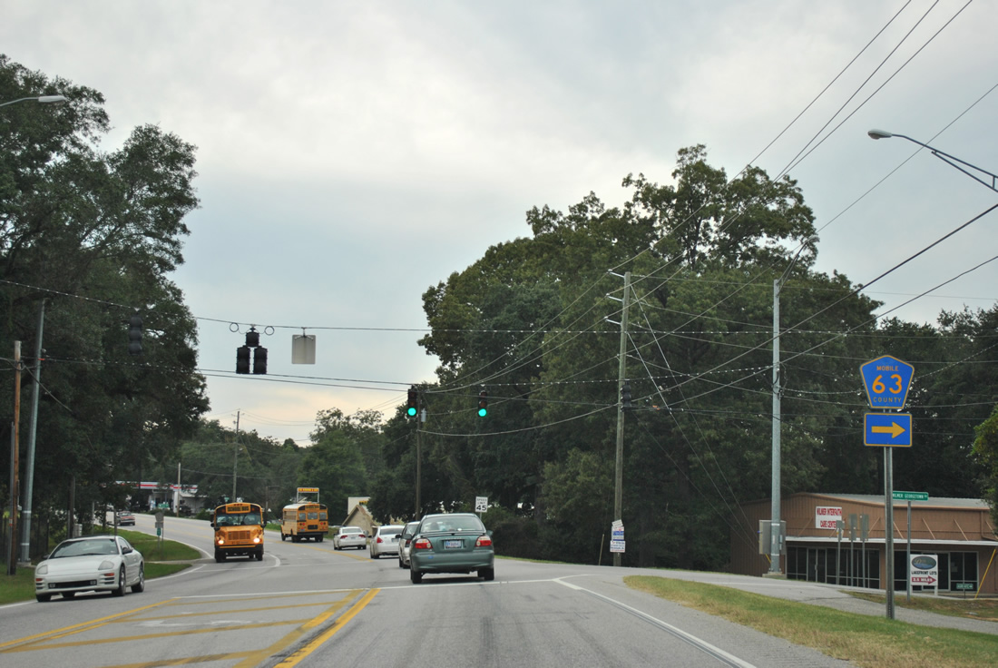
| Traffic lights were installed at U.S. 90/98 and Addsco Road in 2010 to accommodate a new shipbuilding facility. 01/02/11 |
|
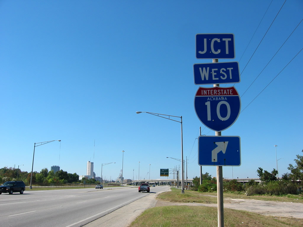
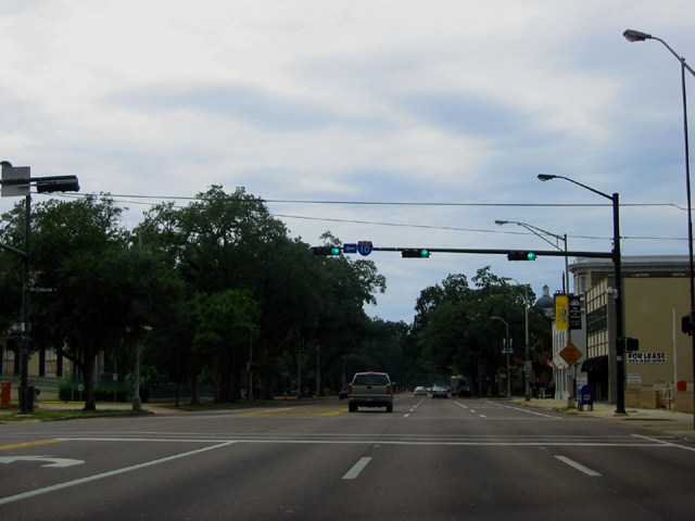
| This vintage button copy sign for Interstate 10 west on Battleship Parkway was replaced between January and April 2011. 11/22/06 |
|
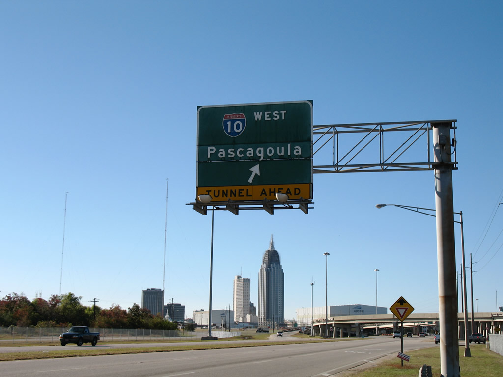
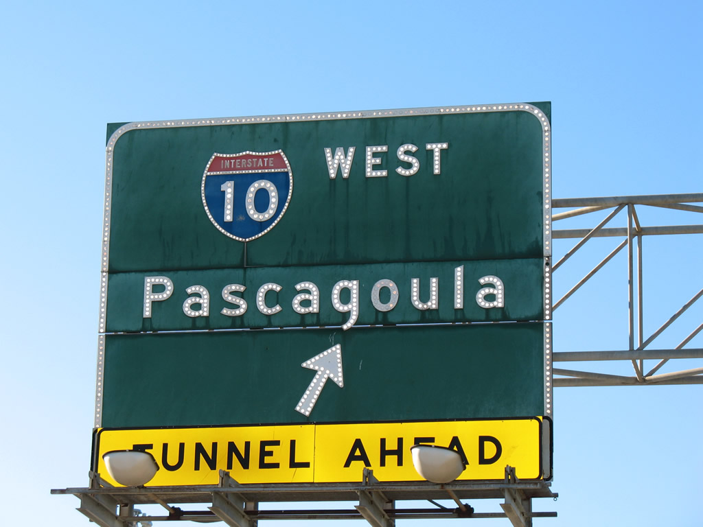
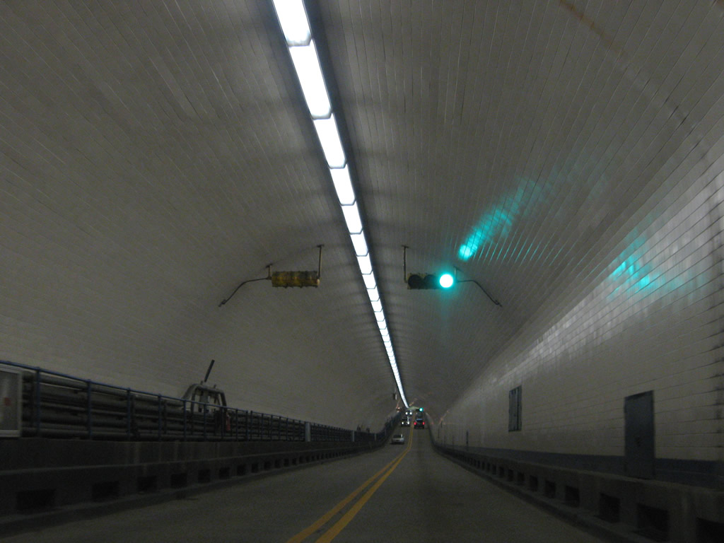
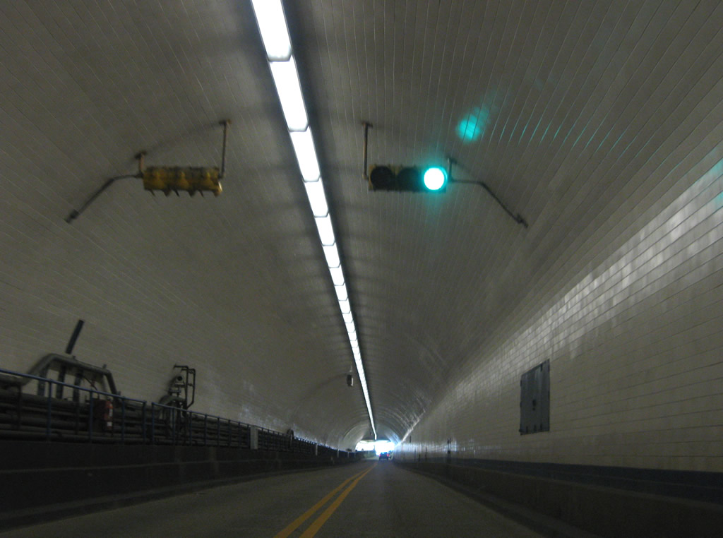
| Interstate 10 descends from the Mobile Bayway into the George C. Wallace Tunnel. The tunnel connects with Water Street and Downtown Mobile. 08/03/11 |
|
| Button copy overheads previously posted for the U.S. 90/98 westbound split at the Bankhead Tunnel. U.S. 90 originally combined with U.S. 98 west through the Bankhead Tunnel, and along Government Street through Downtown Mobile. U.S. 90 replaced Truck U.S. 90 along Cochrane Causeway and Bay Bridge Road in 1999, though sign changes were not finalized until 2001. 09/16/00 |
|
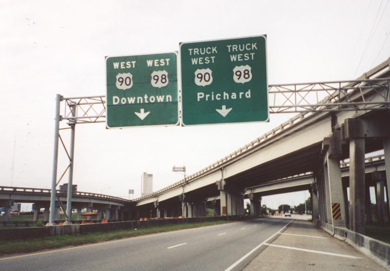
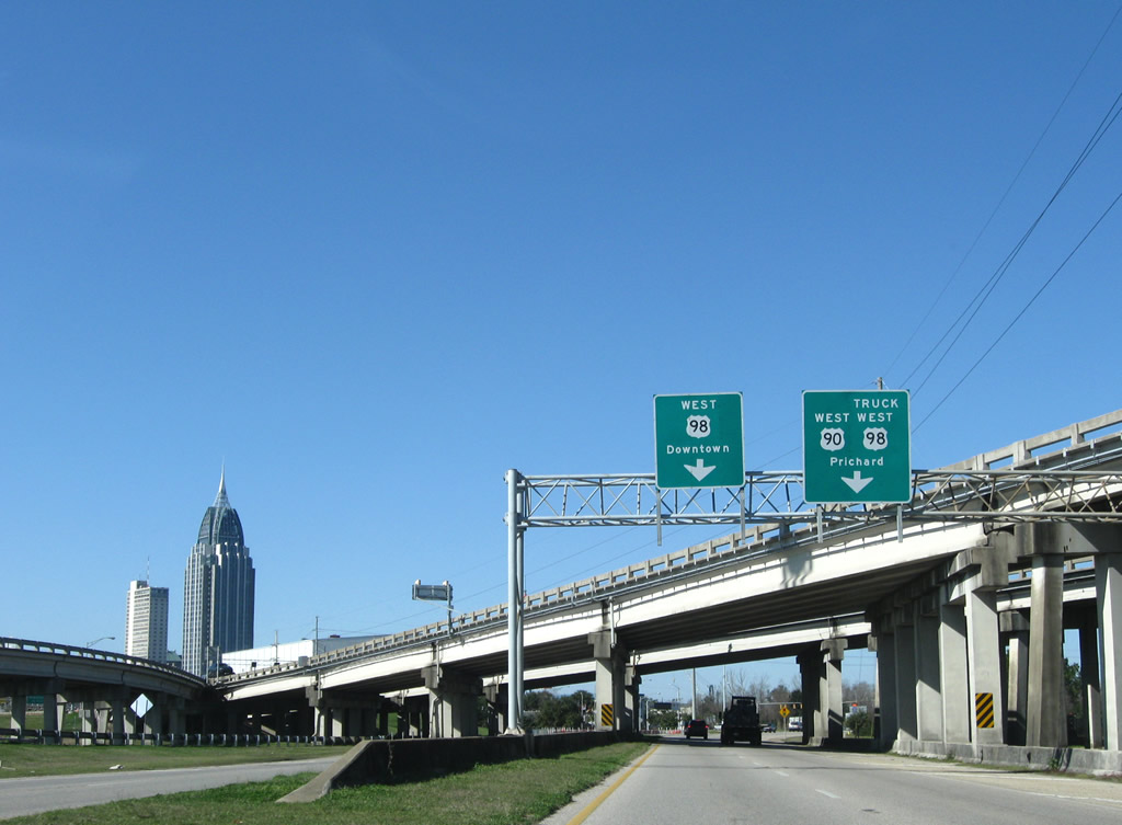
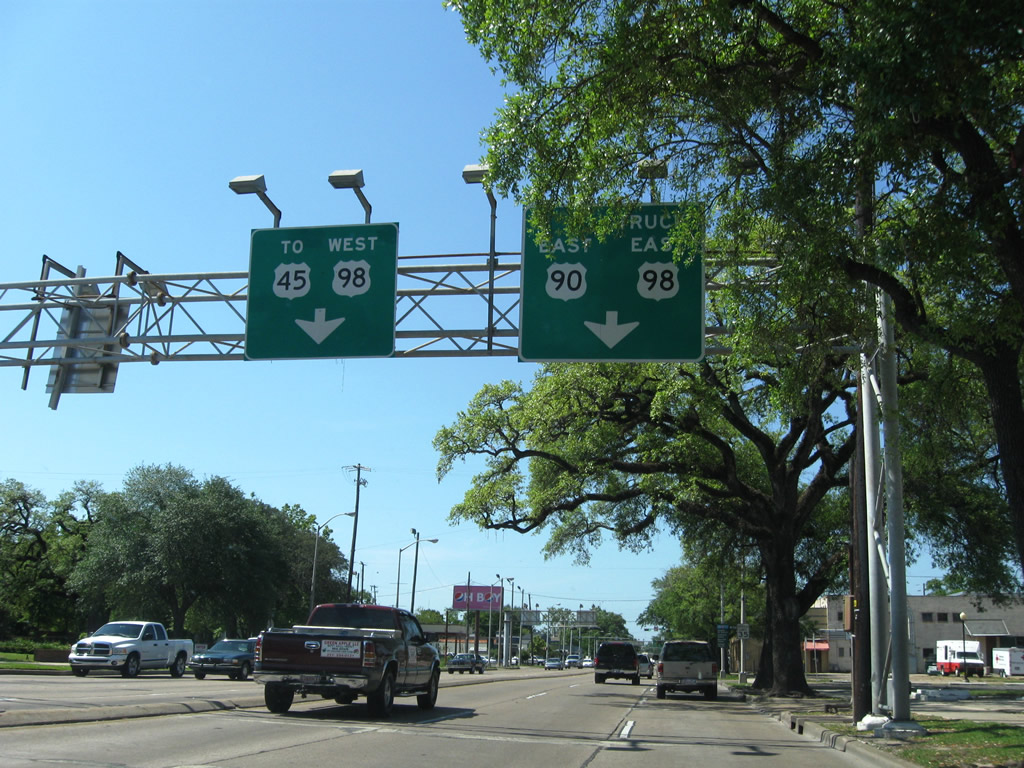
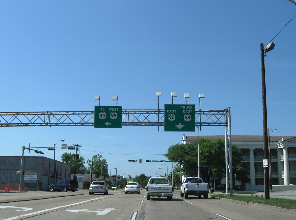
| Replacement signage installed during fall 2001 for the split of U.S. 90 and 98. Truck U.S. 98 runs concurrent with U.S. 90 west to Broad and Saint Anthony Streets in Mobile. All trucks carrying hazardous materials are routed across the Cochrane-Africatown Bridge over the Mobile River. 01/16/09 |
|
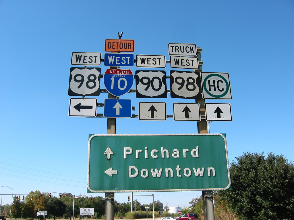
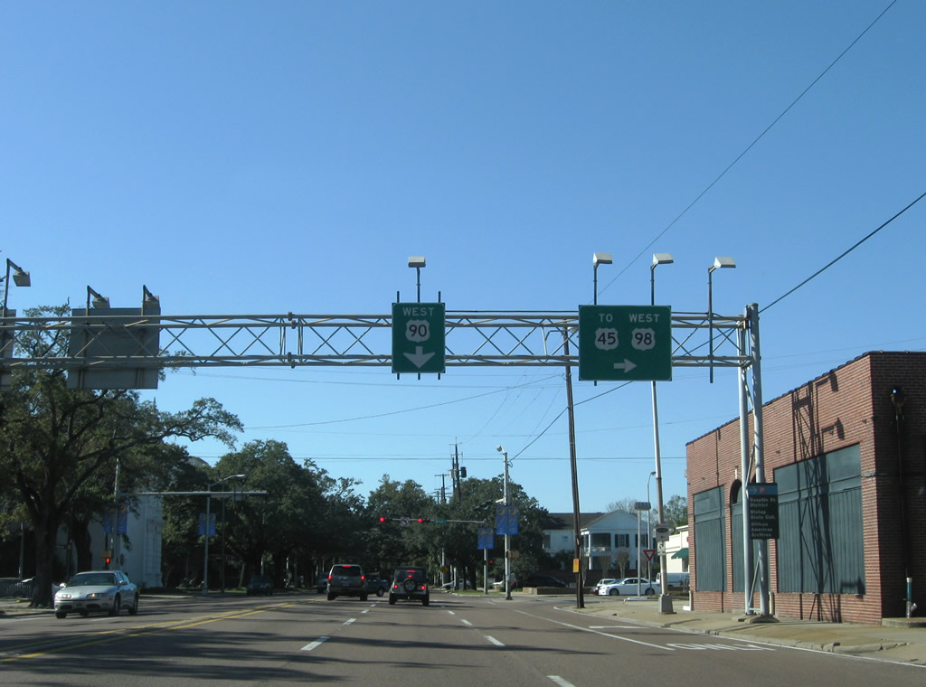
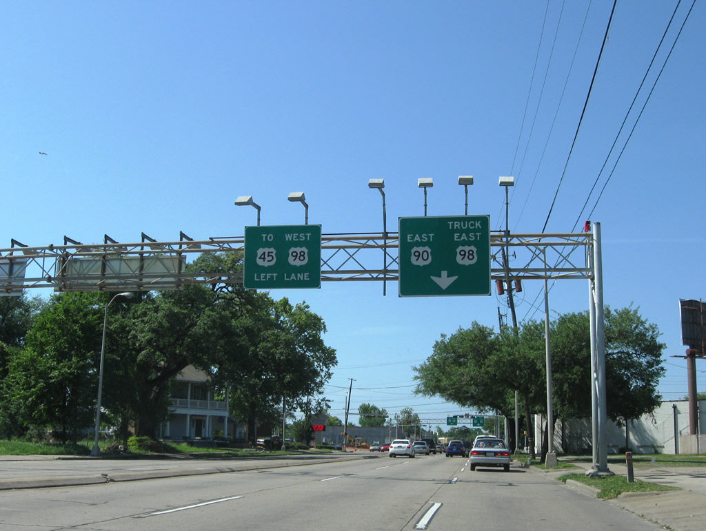
| U.S. 98 branches west from U.S. 90 through the Bankhead Tunnel to Downtown Mobile. U.S. 90 continues northward along Cochrane Causeway toward Prichard. Detour shields for I-10 were added along Battleship Parkway and Bay Bridge Road in 1999 to guide trucks carrying hazardous materials to Interstate 165. 11/03/03, 01/16/09 |
|
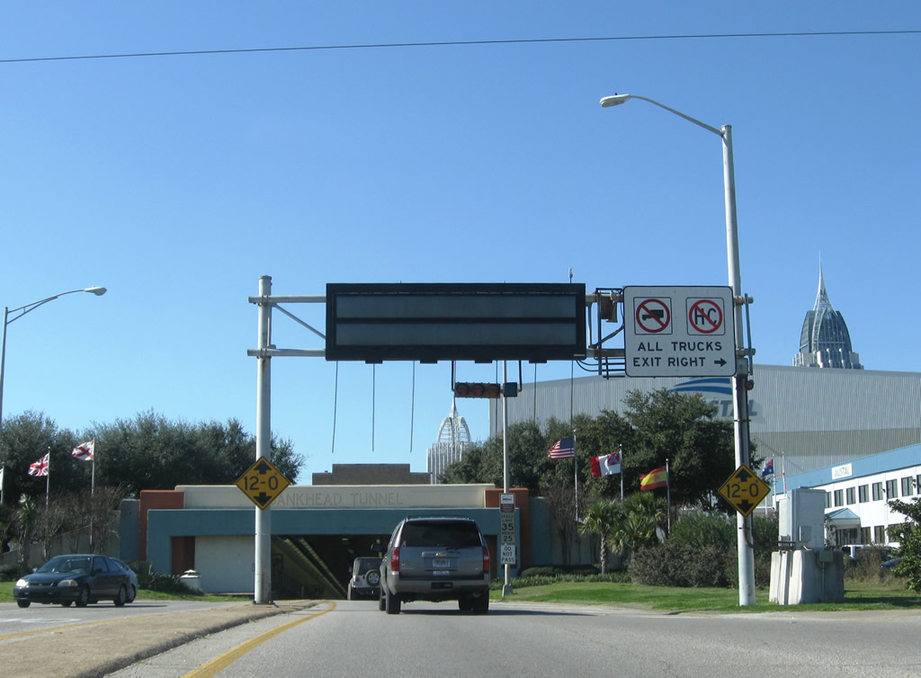
| A final truck restriction sign stands at the intersection with the Bankhead Tunnel entrance. U.S. 90 & Truck 98 loop northward 4.9 miles from Blakeley Island to Interstate 165 at Prichard. 11/03/03 |
|
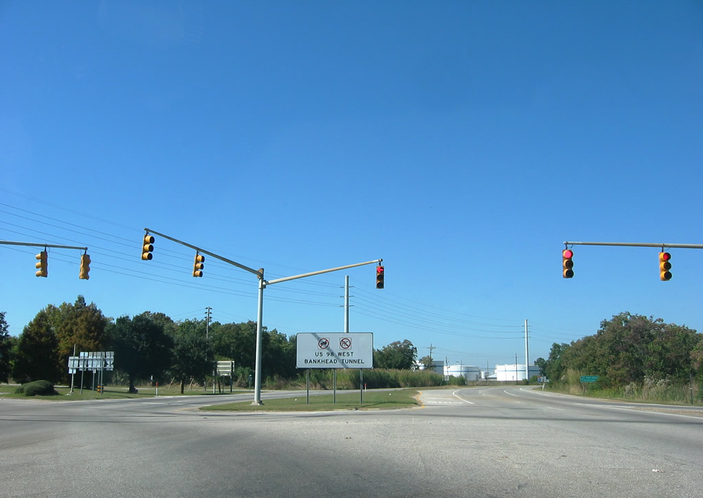
| U.S. 98 immediately enters the two lane Bankhead Tunnel after turning away from U.S. 90 (Battleship Parkway). 01/16/09 |
|
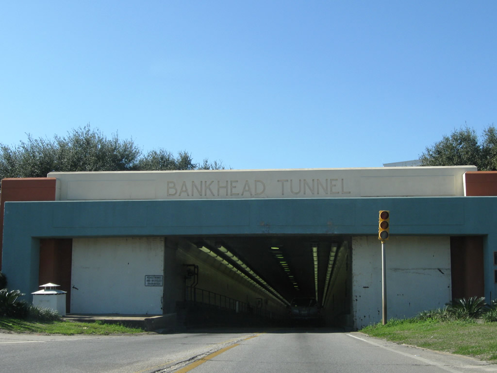
| The Bankhead Tunnel opened on February 20, 1941 at a cost of $4 million. Tolls were collected at a plaza preceding the east entrance until 1973, when the adjacent Wallace Tunnel was completed.1 01/16/09 |
|
| Passing is prohibited through the 3,389 foot long Bankhead Tunnel.1 The speed limit is 35 miles per hour. 01/16/09 |
|
| U.S. 98 rises onto Government Street ahead of Mobile Government Plaza in Downtown Mobile. 11/03/03 |
|
| The single lane from the Bankhead Tunnel combines with two westbound lanes along Government Street at Conception Street. 10/28/03 |
|
| U.S. 98 (Government Street) west at Joachim Street southbound. The adjacent Mobile Government Plaza was completed in 1993. 10/28/03 |
|
| Jackson Street crosses Government Street from the south at the succeeding traffic light. Motorists headed to I-10 westbound are directed onto forthcoming Claiborne Street south. 06/13/04 |
|
| Claiborne Street heads two blocks south to the Mobile Civic Center. An on-ramp for I-10 west lies south of there beyond Canal Street. 10/28/03 |
|
| Westbound reassurance shield posted at the intersection of Government and Franklin Streets. U.S. 98 runs alongside Spanish Plaza Park and the Mobile Chamber of Commerce over the ensuing two blocks. 11/19/03 |
|
| Reassurance marker posted by the intersection with Dearborn Street. 01/16/09 |
|
| U.S. 98 turns north from Government Street and combines with U.S. 90 eastbound along Broad Street for five blocks. U.S. 90 westbound overtakes Government Street to Midtown Mobile. 01/16/09 |
|
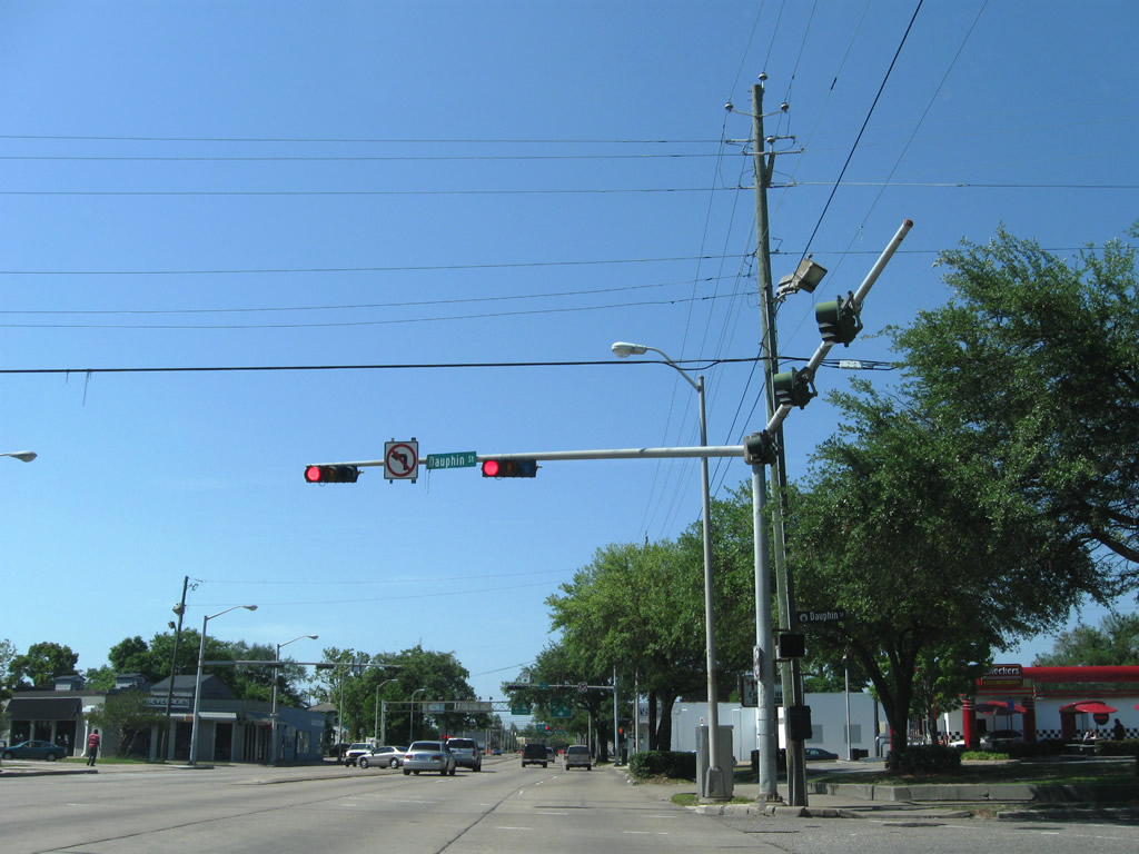
| Guide signs outline the forthcoming separation of U.S. 90 east and 98 westbound ahead of Dauphin Street. These signs date to November 2001, reflecting the relocation of U.S. 90 northward to Bay Bridge Road and the truncation of U.S. 43 at the time. 04/24/09 |
|
| Dauphin Street flows east from U.S. 90/98 (Broad Street) to the Lower Dauphin Entertainment District (LoDa) and Downtown Mobile. 04/24/09 |
|
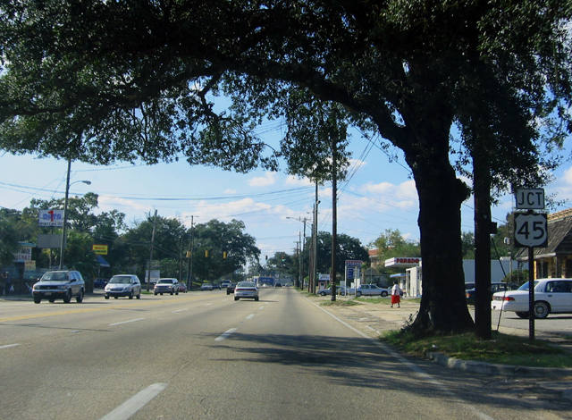
| U.S. 90 east and 98 west separate at the forthcoming intersection with St. Anthony Street. U.S. 98 follows Spring Hill Avenue west to U.S. 45 (St. Stephens Road) and areas of Midtown Mobile. U.S. 90 remains along Broad Street north to the main campus of Bishop State Community College. 04/24/09 |
|
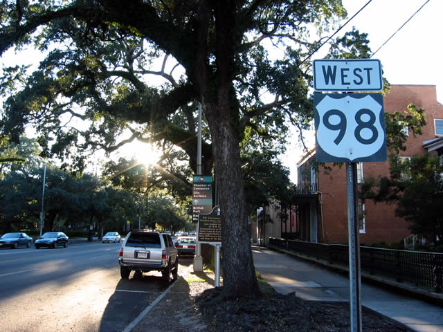
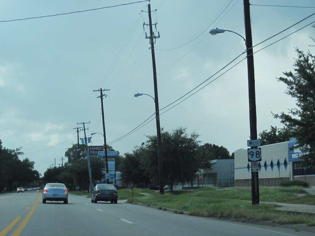
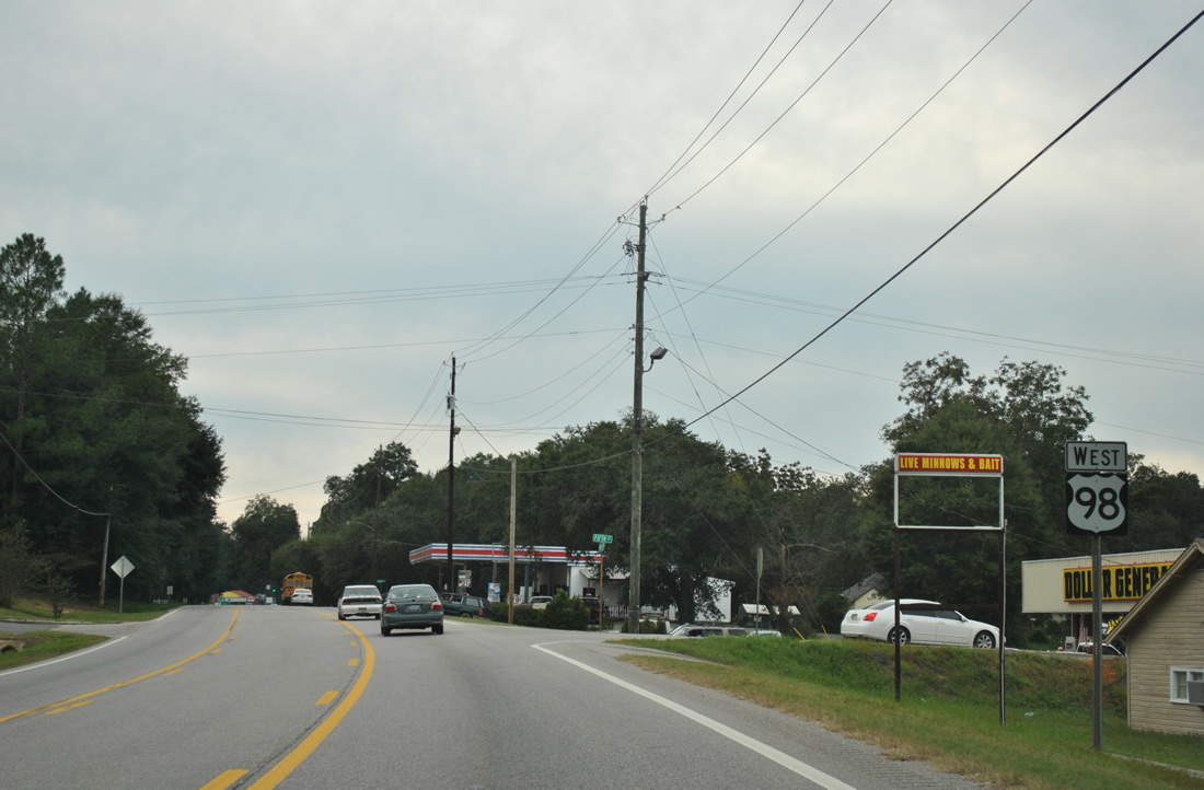
| U.S. 98 extends west from the central business district of Mobile to northwestern reaches of the city and Semmes. U.S. 90 combines with U.S. 98 Truck northward to Prichard and the Cochrane-Africatown USA Bridge. 04/24/09 |
|
| Approaching the northbound beginning of U.S. 45 on U.S. 98 (Spring Hill Avenue) west at Kennedy Street. 10/31/03 |
|
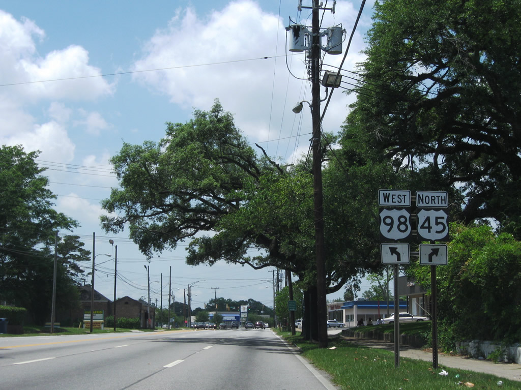
| U.S. 45 (Saint Stephens Road) branches north from U.S. 98 west (Spring Hill Avenue) to the Allenville neighborhood of Mobile. U.S. 98 shifts westward through Lyons Park to Midtown. 06/09/09 |
|
| U.S. 45 (St. Stephens Road) generally serves local traffic as it heads northward to the city of Prichard and Interstate 65. Beyond Eight Mile and SR 158, U.S. 45 forms a regional route joining Mobile with Citronelle and Meridian, Mississippi. 06/09/09 |
|
| Confirming marker for U.S. 98 west of U.S. 45 (St. Stephens Road). 09/10/10 |
|
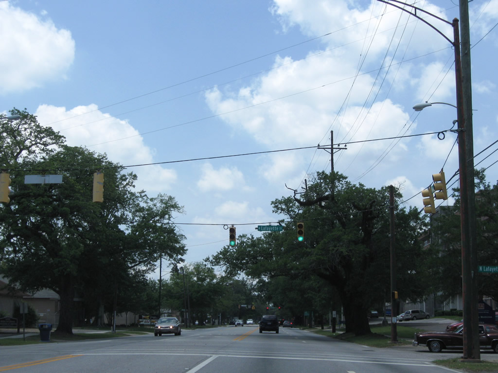
| Lafayette and parallel Catherine Streets provide north-south through streets between U.S. 45 (St. Stephens Road) and U.S. 90 (Government Street). 05/09/09 |
|
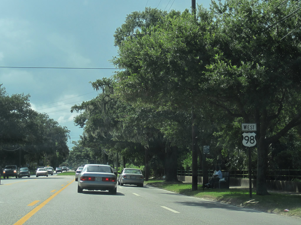
| U.S. 98 westbound shield posted after Catherine Street and Lyons Park Avenue. 09/10/10 |
|
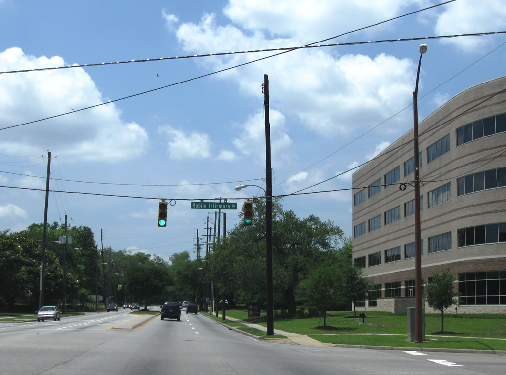
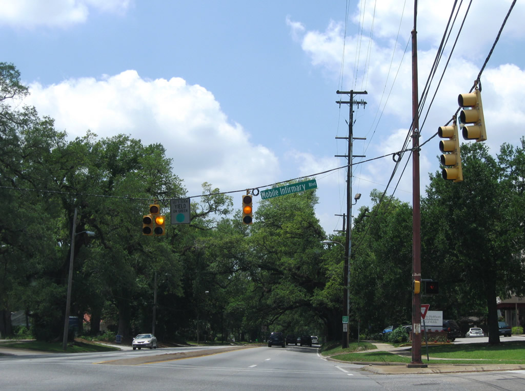
| Mobile Infirmary Drive loops north from U.S. 98 to Mobile Infirmary Medical Center. 05/09/09 |
|
| Mobile Infirmary Boulevard heads south from the aforementioned medical center to Old Shell Road at Kenneth Street. 05/09/09 |
|
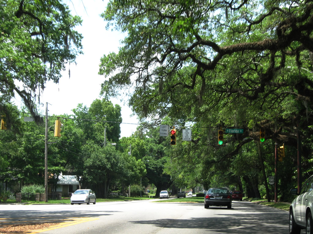
| Florida Street heads south from U.S. 98 (Spring Hill Avenue) to Airport Boulevard opposite Cottage Hill Road. This is the first through road connecting the two east-west arterials. 05/09/09 |
|
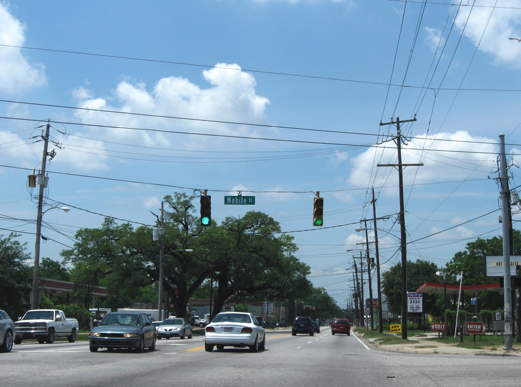
| Mobile Street stems north from Old Shell Road to U.S. 98 and Prichard Avenue in the city of Prichard. 05/09/09 |
|
| U.S. 98 (Spring Hill Avenue) transitions from residential areas into a commercial strip between Mobile Street and Interstate 65. Bay Shore Avenue offers an alternate route to north Mobile Street via Mill Street east. Southward the road ends at Old Shell Road opposite the entrance to UMS-Wright Prep School. 05/09/09 |
|
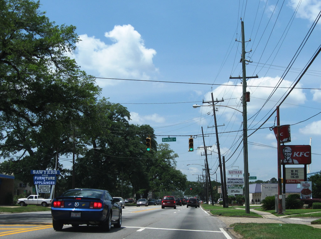
| Hosfelt Lane leads north from U.S. 98 to Pages Drive. 05/09/09 |
|
| U.S. 98 splits with Spring Hill Avenue for Moffett Road. Spring Hill Avenue continues west as a four lane boulevard to I-65, Langan Park and Zeigler Boulevard. 05/09/09 |
|
| West I-65 Service Road (Belt Line Highway) leads north from U.S. 98 (Moffett Road) near Three Mile Creek, providing access to Interstate 65 south and U.S. 45 (St. Stephens Road) in Prichard. 11/23/08 |
|
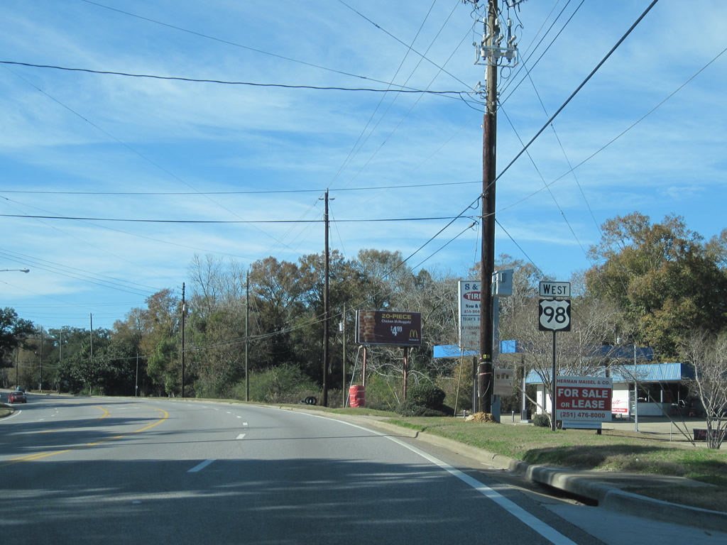
| U.S. 98 (Moffett Road) climbs westward from Interstate 65 toward Pine Grove. 01/02/11 |
|
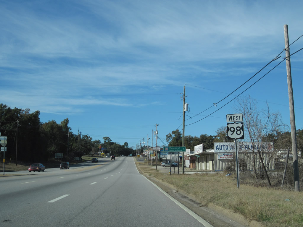
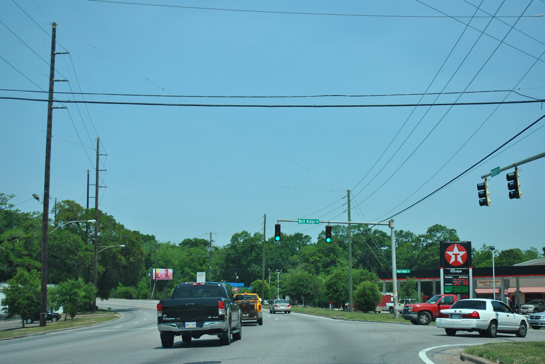
| Wolf Ridge Road connects U.S. 98 (Moffett Road) with U.S. 45 (St. Stephens Road) in the city of Prichard. 05/25/12 |
|
| U.S. 98 (Moffett Road) runs along the north side of the Bellewood neighborhood west from Wolf Ridge Road. 01/02/11 |
|
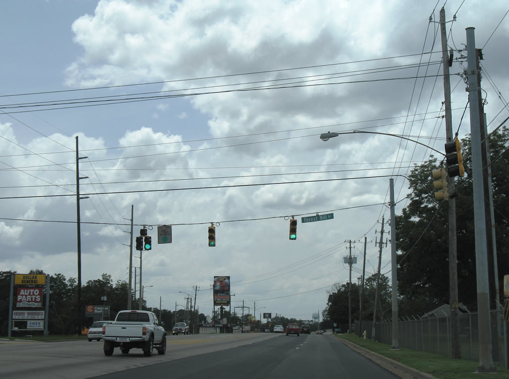
| Shelton Beach Road Extension south and Forest Hill Drive tie into Moffett Road at back to back intersections. Shelton Beach Road links Mobile with U.S. 45 and SR 213. Forest Hill Drive hooks up with Zeigler Boulevard at Langan Park. 07/17/07 |
|
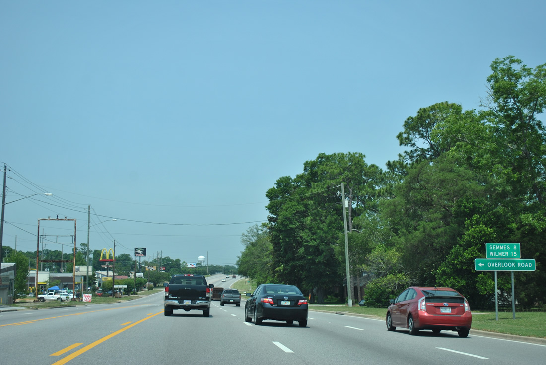
| Westbound distance sign listing the distances to Semmes and Wilmer. Both communities were unincorporated, but Semmes became a city on August 17, 2010. 05/25/12 |
|
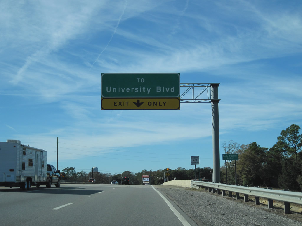
| Costing $1.1 million, the Carl Williams Bridge across University Boulevard was dedicated on November 18, 1997. Carl Williams was a founding member of the Mobile County Road Builders Association. He built a home and construction business at the site where U.S. 98 and University Boulevard would eventually meet. The state bought his property in 1969 and converted the home to a state highway department office.2 01/02/11 |
|
| University Boulevard forms part of an arterial loop stretching south to U.S. 90 and north to U.S. 45 in Prichard. Highpoint Boulevard north to SR 217 (Lott Road) was the first of six segments completed.2 University Boulevard south from the grade separated intersection with U.S. 98 to Zeigler Boulevard was completed in June 1998.3 11/19/03 |
|
| Turning northwest, U.S. 98 narrows from six to four lanes and advances toward Howells Ferry Road. 07/17/07 |
|
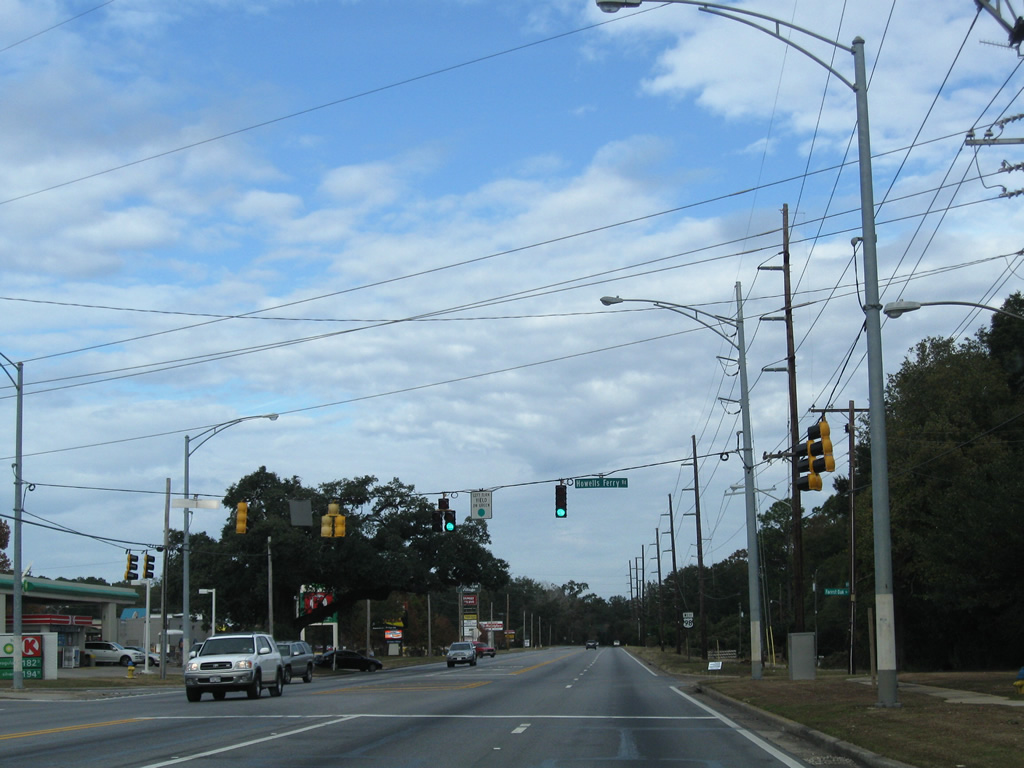
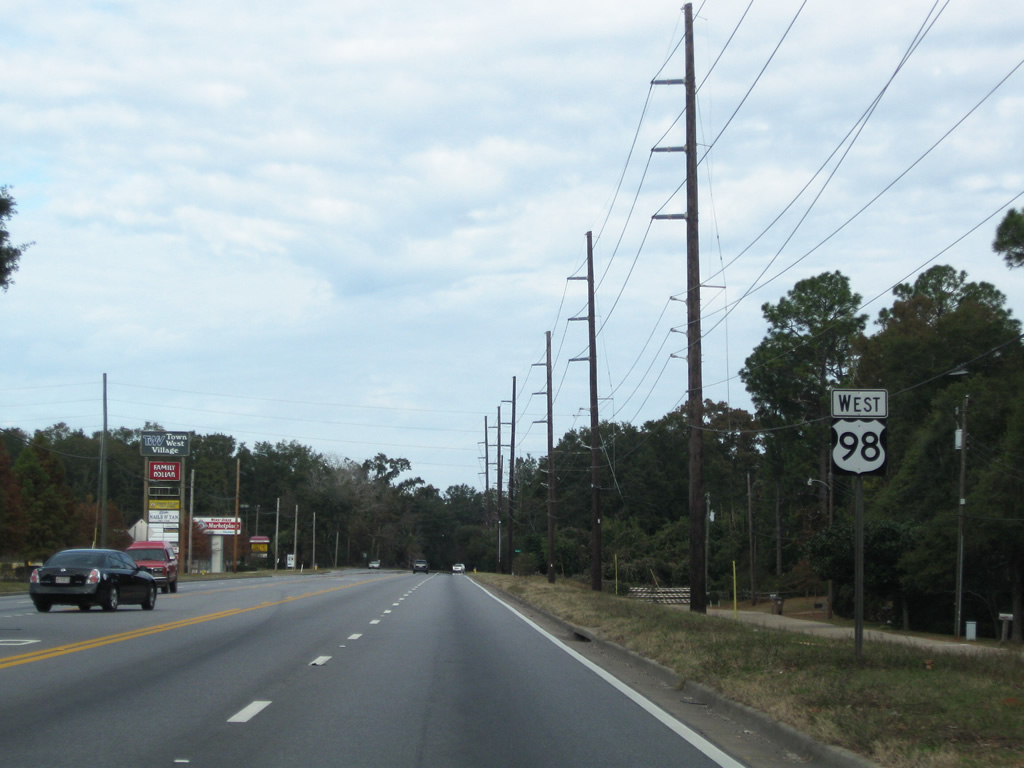
| Howells Ferry Road branches west from U.S. 98 (Moffett Road) by Town West Village Shopping Center to suburban areas of West Mobile, Semmes and a boat ramp on Big Creek Lake. The road doubles as CR 72 outside the city. 11/23/08 |
|
| U.S. 98 continues north from Howells Ferry Road through a rural stretch across Clear Creek. 11/23/08 |
|
| Bear Fork Road straddles the Mobile and Prichard city line west to end at Moffett Road as U.S. 98 exits the city. 05/25/12 |
|
| Ching Dairy Road spurs northward to a handful of subdivisions from U.S. 98. The signal with Moffett Road was added by December 2003, following a series of complaints from area residents citing safety concerns for turning traffic. 05/25/12 |
|
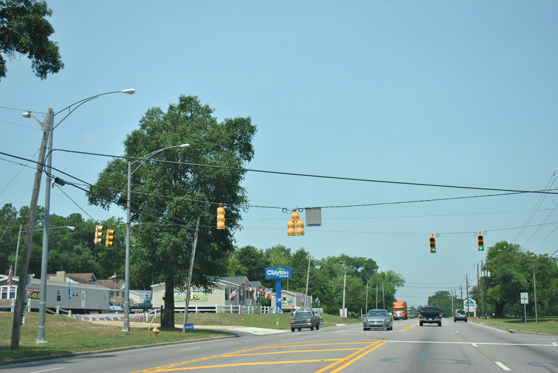
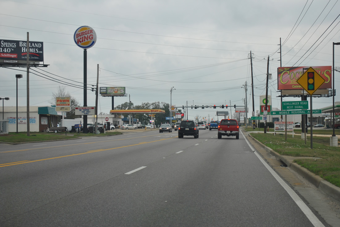
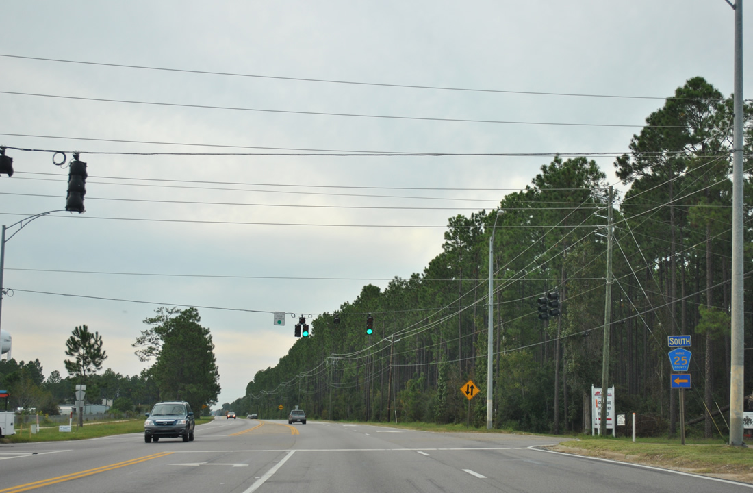
| Crossing into the city of Semmes, U.S. 98 (Moffett Road) converges with Schillinger Road (CR 31). CR 31 follows Schillinger Road south 13 miles to Theodore Dawes Road. Mast-arm signal upgrades took place here by September 2011. 01/01/12 |
|
| Schillinger Road (CR 31) extends 2.1 miles north to SR 217 (Lott Road), and another 0.9 miles as Newman Road to SR 158. Southward from Semmes, Schillinger Road represents the main commercial strip through West Mobile. 05/25/12 |
|
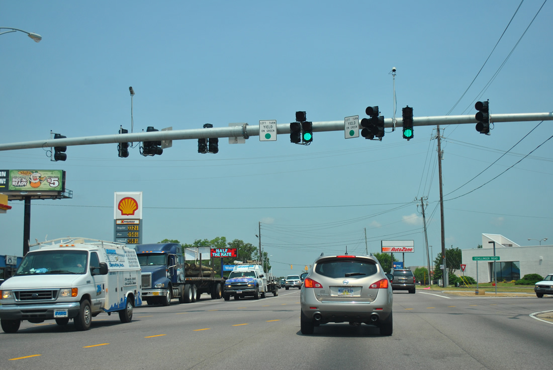
| A second traffic light was installed along the commercialized stretch of Moffett Road at Schillinger Road (CR 31) in 2005 for adjacent big box retail. 11/23/08 |
|
| U.S. 98 (Moffett Road) lowers to cross Double Branch. 11/23/08 |
|
| Firetower Road meanders southward from U.S. 98 (Moffett Road) in Semmes to Howells Ferry Road (CR 72). The two lane highway navigates through several sharp turns. 11/23/08 |
|
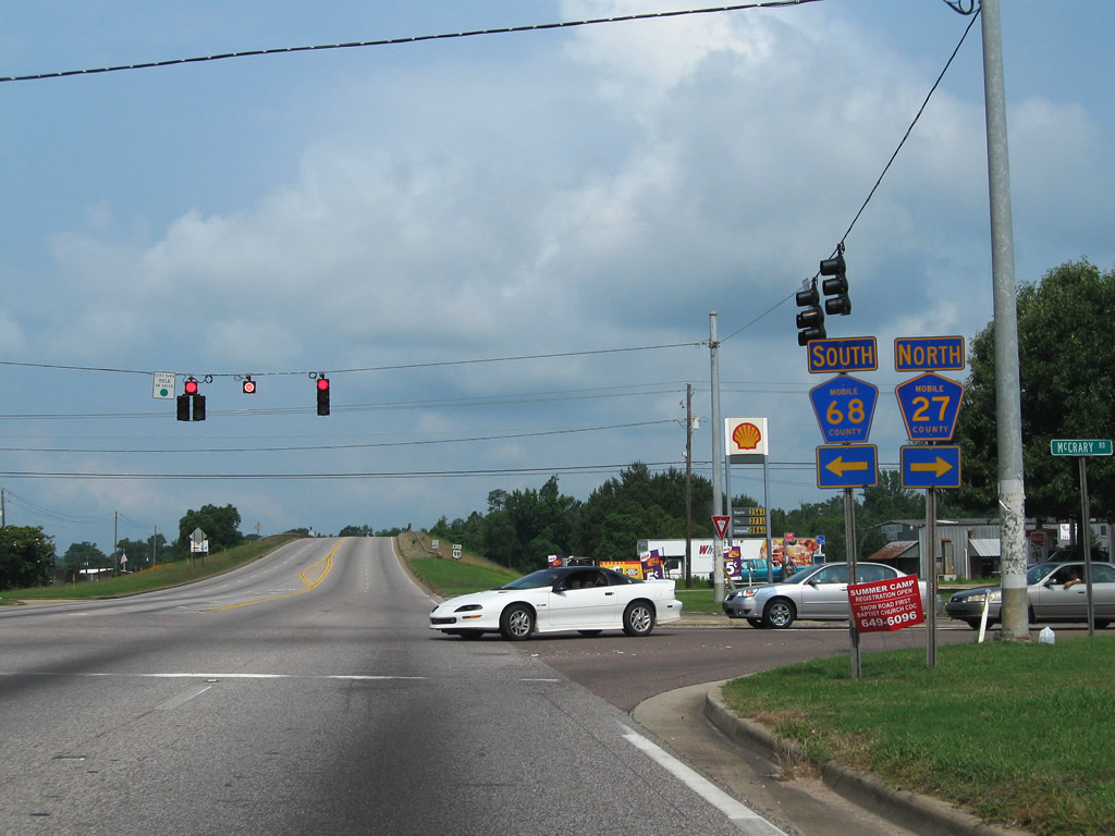
| CR 68 (Wulff Road) north and CR 27 (McCrary Road) south come together in the heart of Semmes at U.S. 98 (Moffett Road). County Road 68 is a local road leading west to Snow and Howells Ferry Roads. County Road 27 joins Semmes with Millertown and SR 217 (Lott Road). 06/01/10 |
|
| U.S. 98 (Moffett Road) rises to span the CN Railroad on the Hosea A. Weaver Overpass. The bridge was completed in 1984. 11/23/08 |
|
| Snow Road (CR 25) leads south from U.S. 98 (Moffett Road) in Semmes to western reaches of West Mobile and Jeff Hamilton Road at Dawes. 10/06/11 |
|
| U.S. 98 reduces to two lanes beyond Snow Road. 11/23/08 |
|
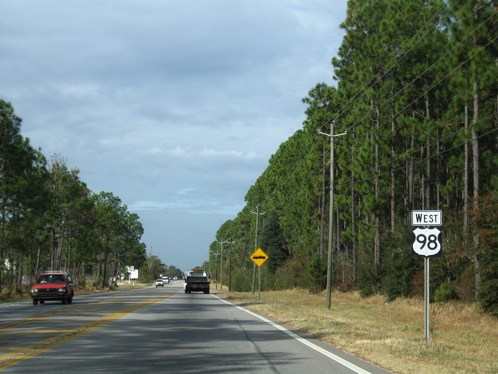
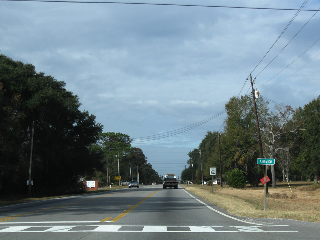
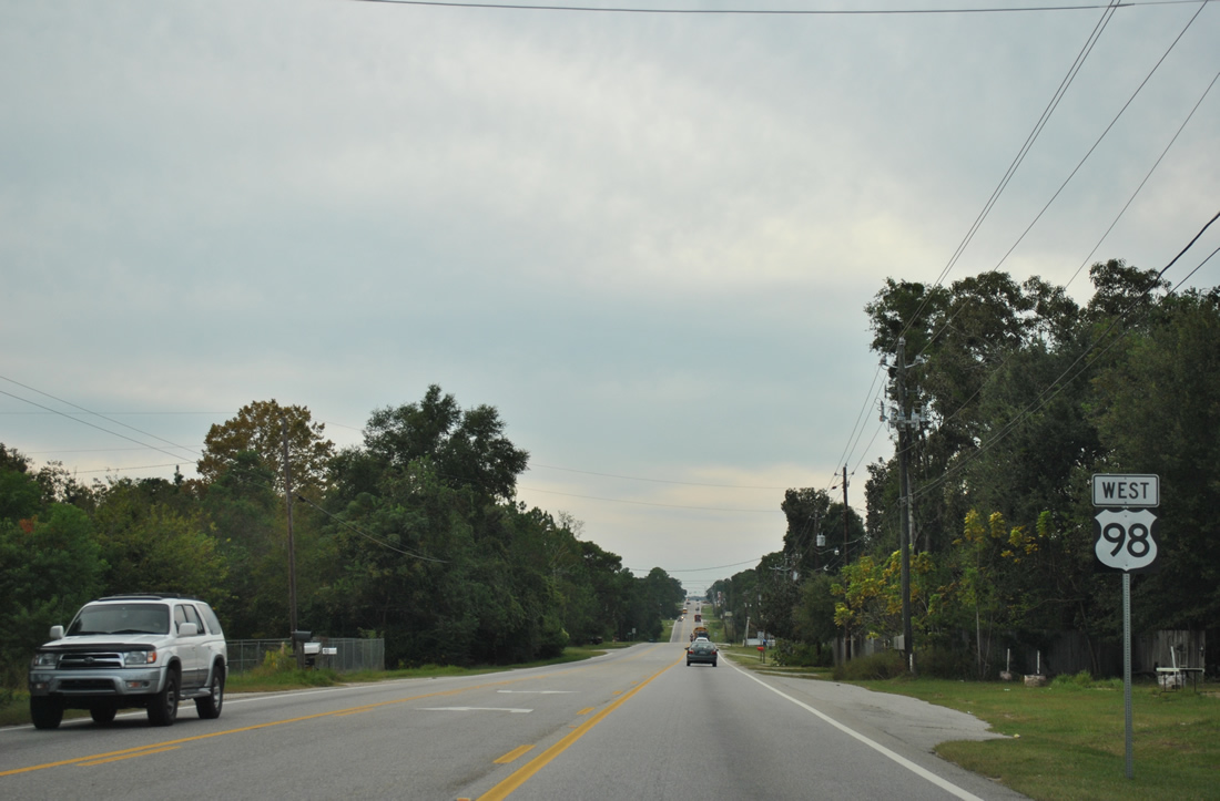
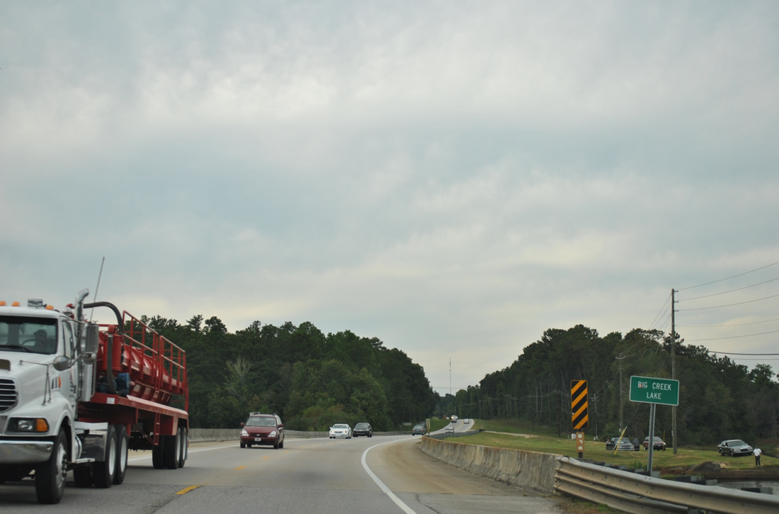
| Fairview is a rural community along U.S. 98 between Semmes and Big Creek Lake. 11/23/08 |
|
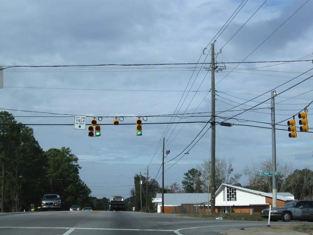
| Blackwell Nursery Road constitutes a loop west from Snow Road to U.S. 98 (Moffett Road) at Waltman Road. This signal was added in 2003. 11/23/08 |
|
| Reassurance marker posted along Moffett Road west after Blackwell Nursery Road. 10/06/11 |
|
| Glenwood Road follows at the succeeding traffic light (installed in 2006) along U.S. 98 west. The rural road meanders northward to Natchez Trace Road. 11/23/08 |
|
| Westbound U.S. 98 traffic lowers from Fairview to Big Creek Lane. 11/23/08 |
|
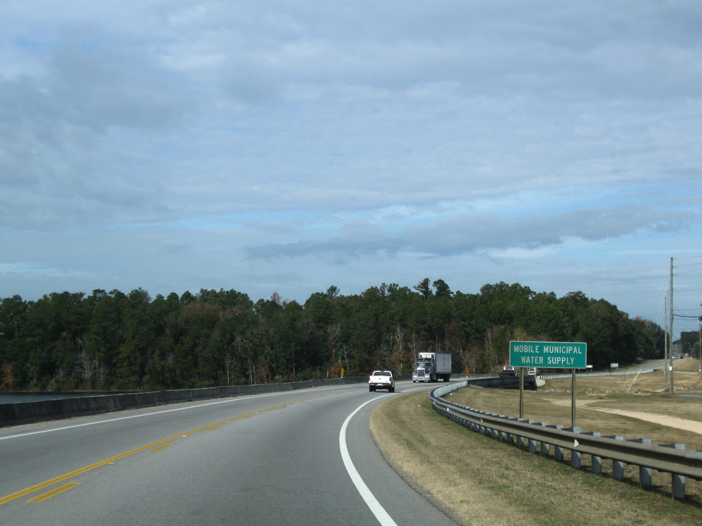
| Turning northwesterly, U.S. 98 spans Big Creek Lake, Mobile's Municipal Water Supply, along a causeway and 1984-built bridge. 10/06/11 |
|
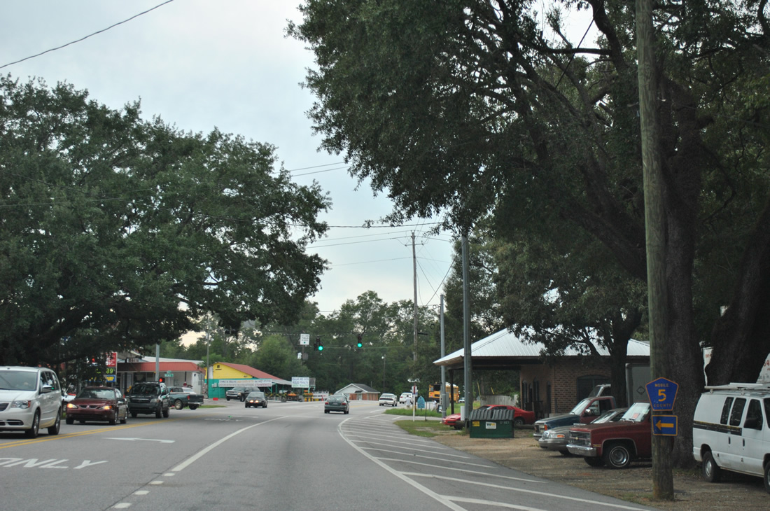
| CR 63 (6th Street) ends at U.S. 98 within the rural community of Wilmer. The county road joins Wilmer with SR 217 (Lott Road) at Georgetown. 10/06/11 |
|
| U.S. 98 (Moffett Road) again expands with a center-turn lane through Wilmer. 10/06/11 |
|
| CR 5 (Wilmer Road) winds southward from U.S. 98 and 2nd Street in Wilmer through rural areas west of Big Creek Lake to Tanner Williams and Airport Boulevard (CR 56). 2nd Street ties in as a two-block residential street on the north side of U.S. 98. Traffic lights were added here in the mid-2000s. 10/06/11 |
|
| U.S. 98 angles northwest and leaves Wilmer. 11/23/08 |
|
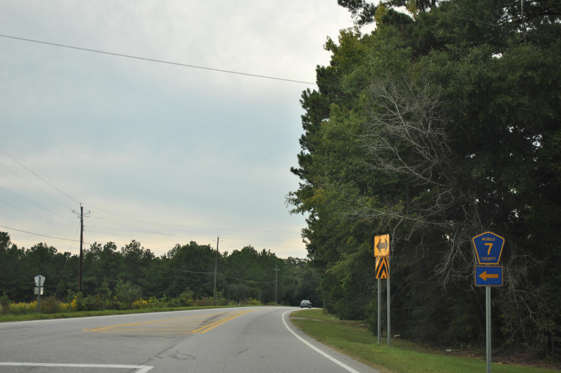
| Mobile County Road 7 (Natchez Highway) heads southwest to the state line, where Mississippi 612 begins. The state route travels seven miles from there to Mississippi 613 near Argicola. 10/06/11 |
|
| Continuing northwest from Natchez Highway toward the settlement of Moffett on U.S. 98. 10/06/11 |
|
| Winding northwest ahead of the CN Railroad underpass. The Wilmer bypass for U.S. 98 will connect with the old alignment of U.S. 98 nearby. 11/23/08 |
|
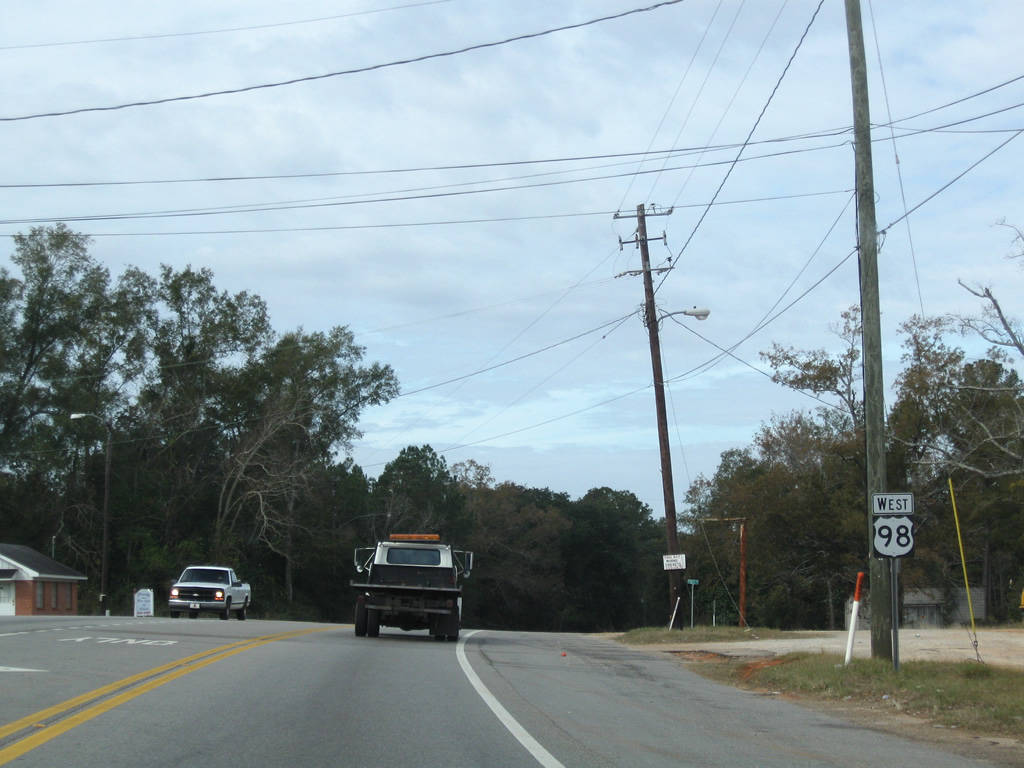
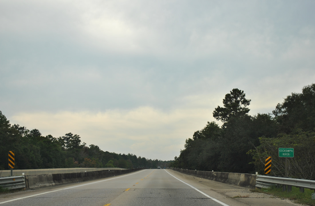
| U.S. 98 (Moffett Road) crosses the Escatawpa River at the Mississippi state line. A second span was constructed by MDOT here in 2002. With the Wilmer bypass for U.S. 98 remaining incomplete, the eastbound bridge has never opened. 10/06/11 |
|
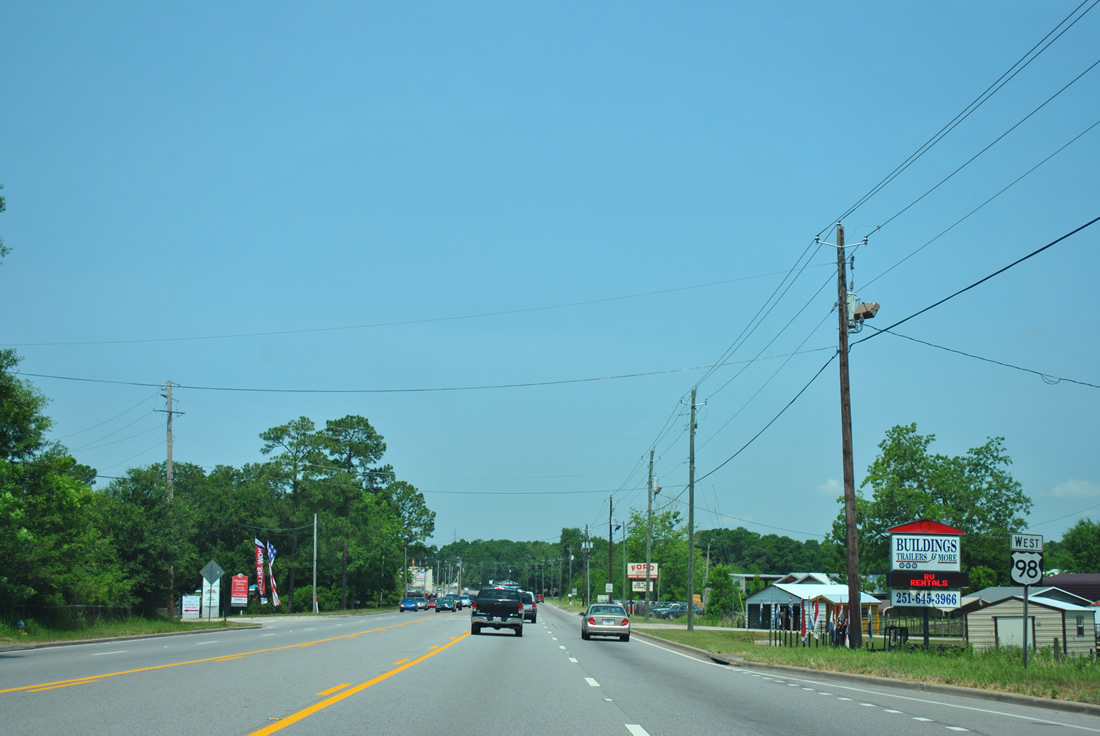
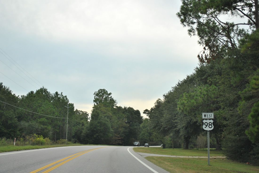
| Heading to Latonia, Lucedale and Interstate 59 at Hattiesburg, U.S. 98 widens to a four lane divided highway beyond the state line. 10/06/11 |
Page Updated 10-02-2012.


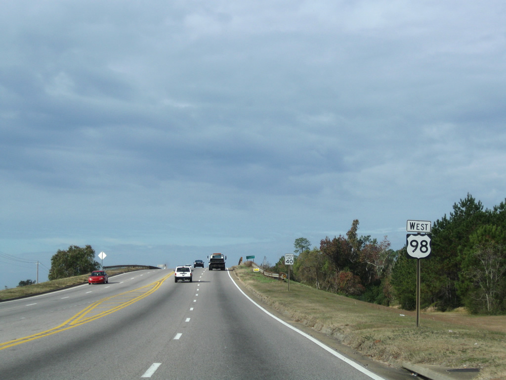
 West
West