|
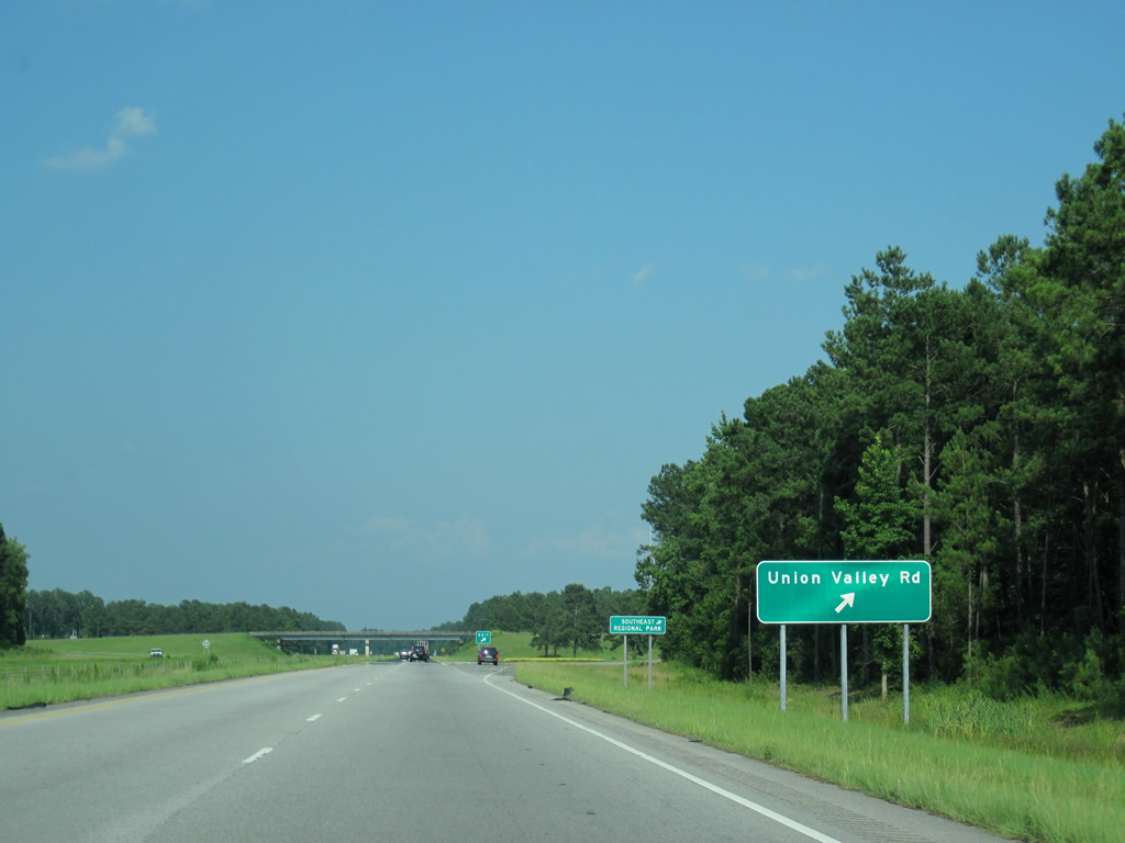
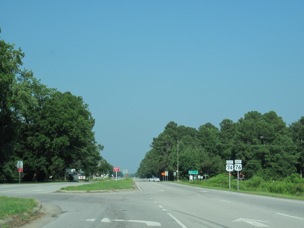
| 2.4 miles after their merge, U.S. 74/76 meet Union Valley Road at a diamond interchange. This exit serves Southeastern Community College. 06/24/10 |
|
| Union Valley Road angles southwest from U.S. 74/76 to U.S. 74-76 Business (Chadbourn Highway) at Midway Road nearby. Northeastward, SR 1585 continues to Old Lumberton Road just west of U.S. 701. 06/24/10 |
|
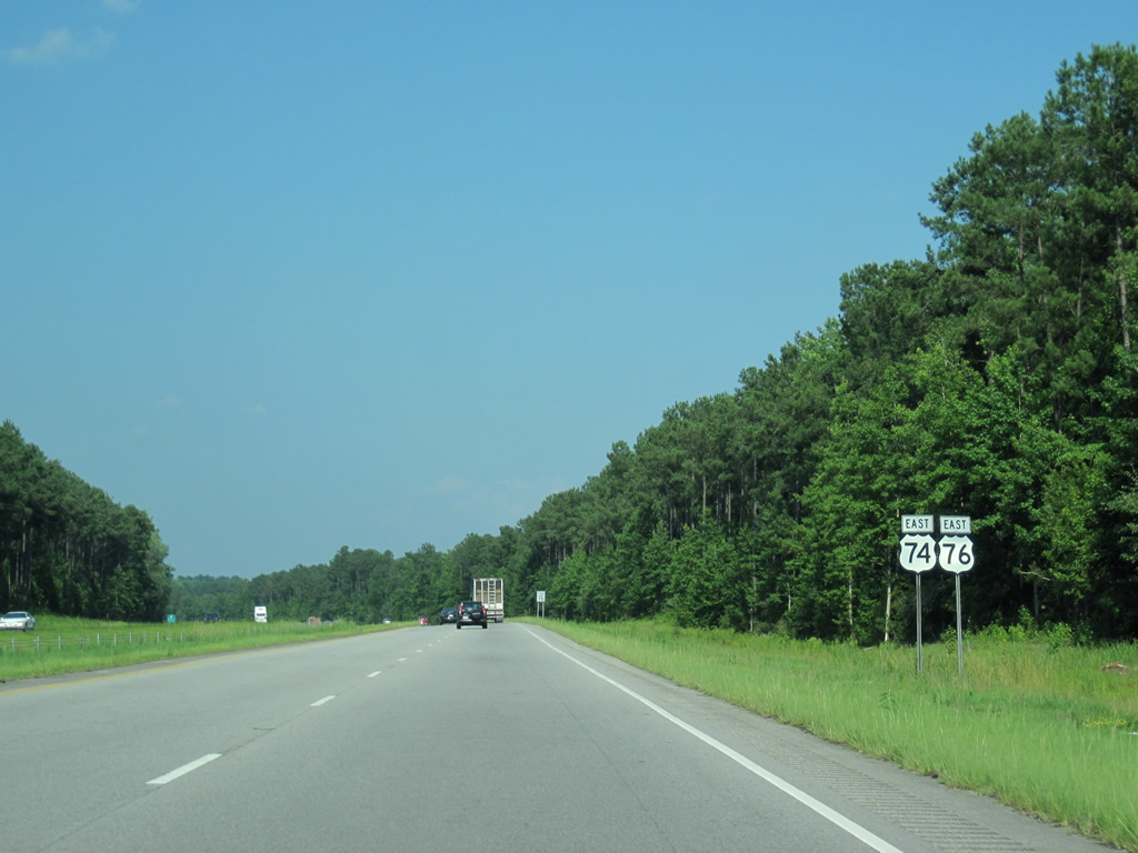
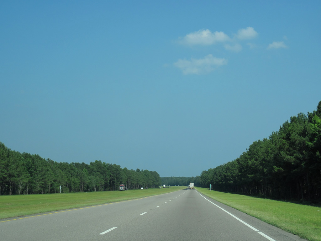
| U.S. 74/76 kink northward to bypass Whiteville in this scene ahead of Pine Log Branch. 06/24/10 |
|
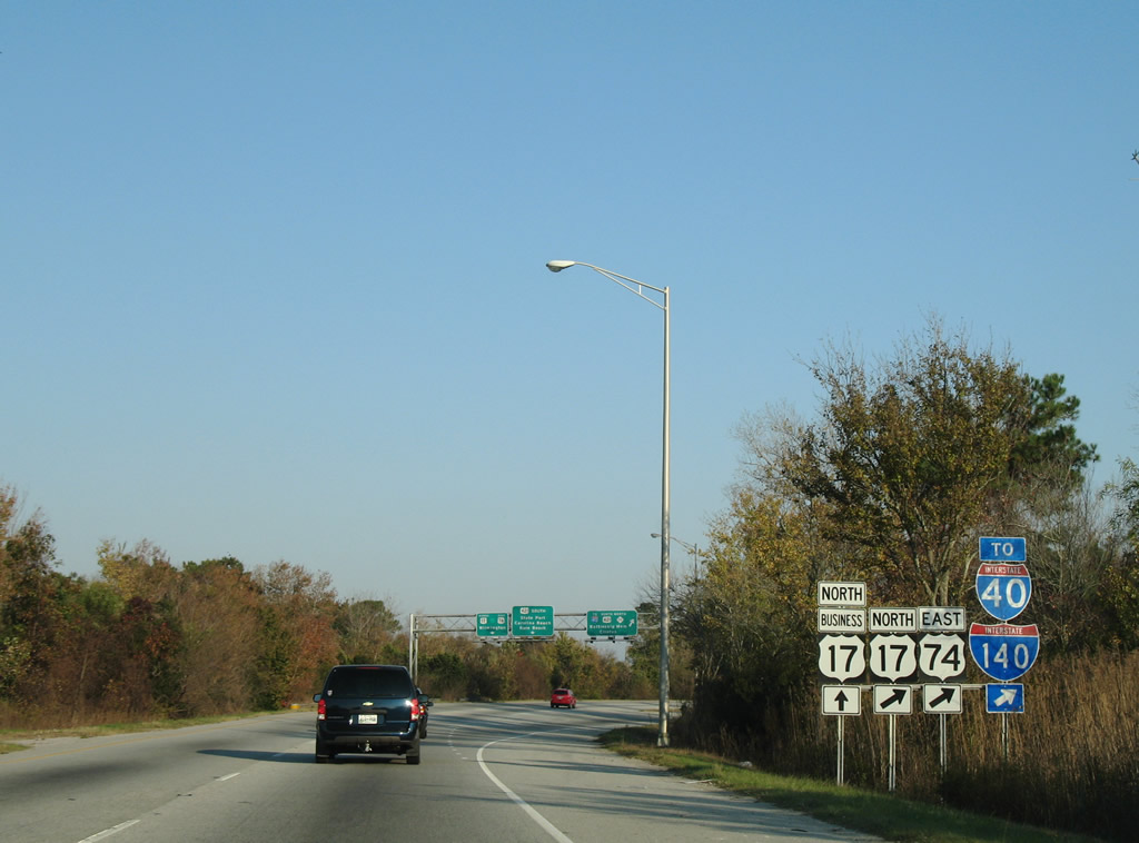
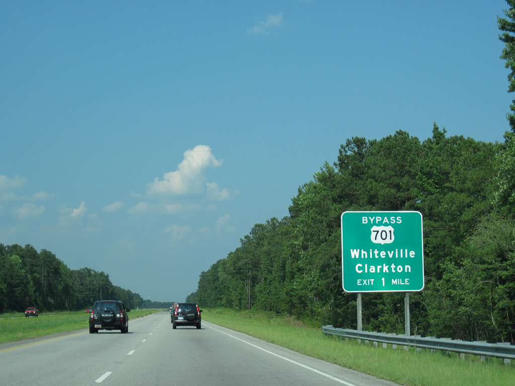
| U.S. 701, a route stretching 113 miles north across the state from Tabor City to U.S. 301 outside Smithfield, meets U.S. 74/76 at a parclo interchange. The route enters the north side of Whiteville from Clarkton, 13 miles to the northeast. 06/24/10 |
|
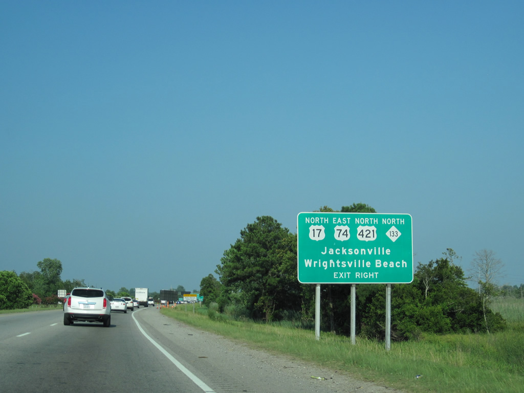
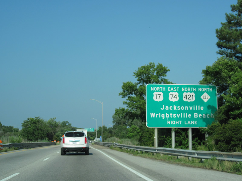
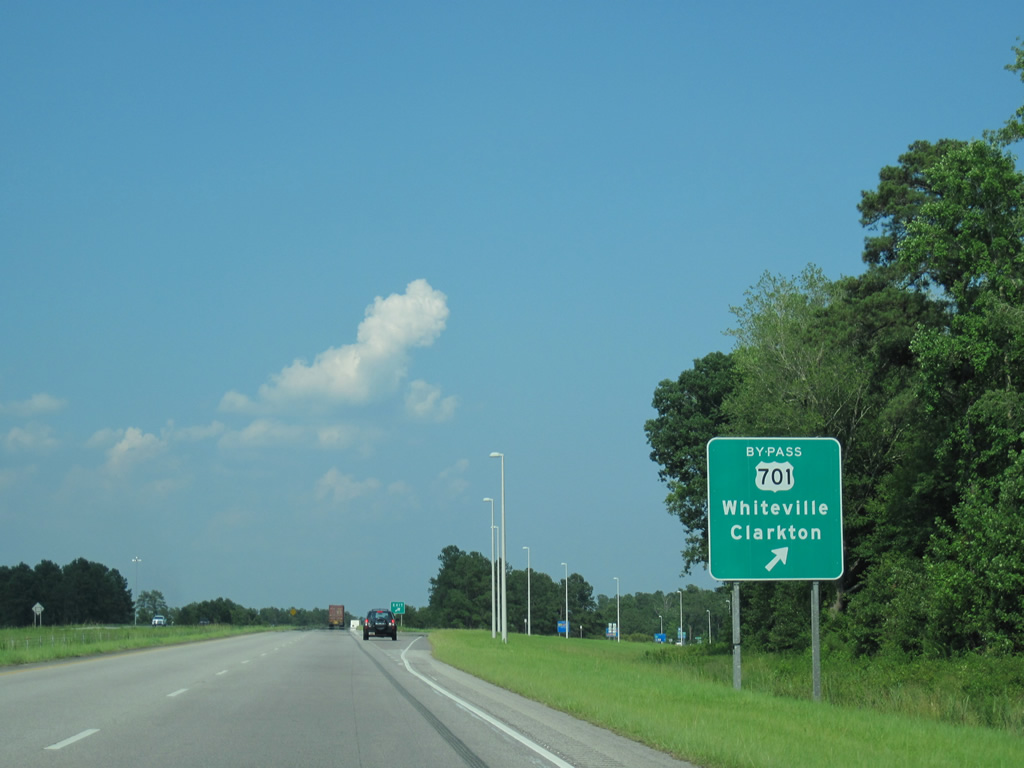
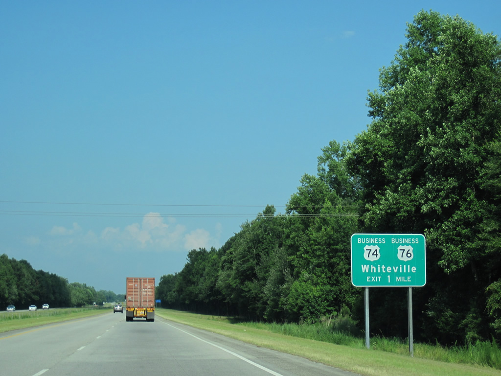
| U.S. 701 splits into Business and Bypass components through Whiteville. The Bypass route meets U.S. 74/76 directly while the business route follows James B. White Highway, Pinckney Street and Madison Street to the east through Downtown. 06/24/10 |
|
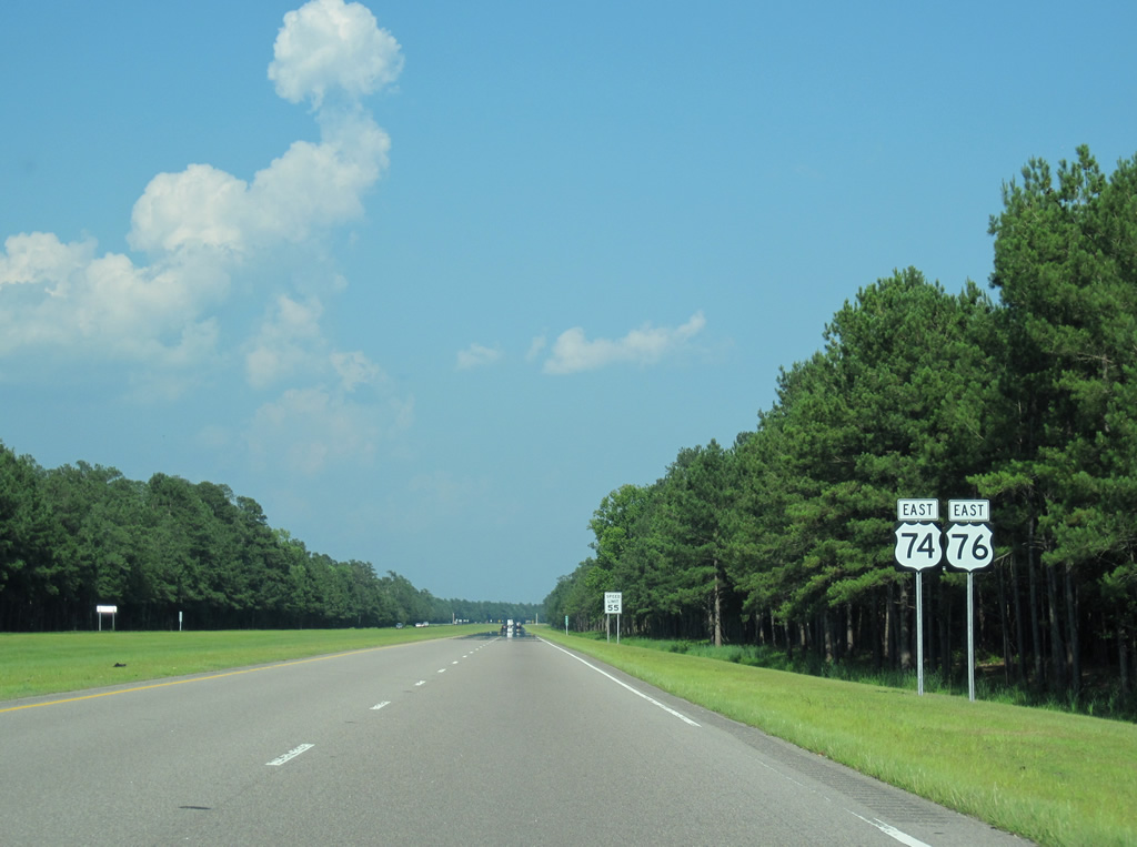
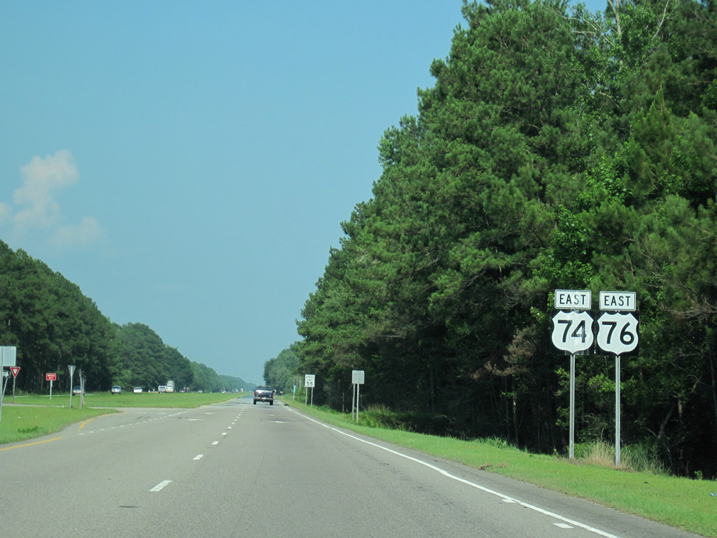
| U.S. 74/76 shields posted after the overpass for U.S. 701 Business (James B. White Highway). The freeway remains within the Whiteville city limits east to White Marsh. 06/24/10 |
|
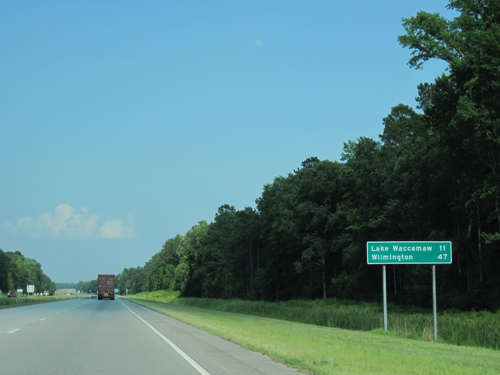
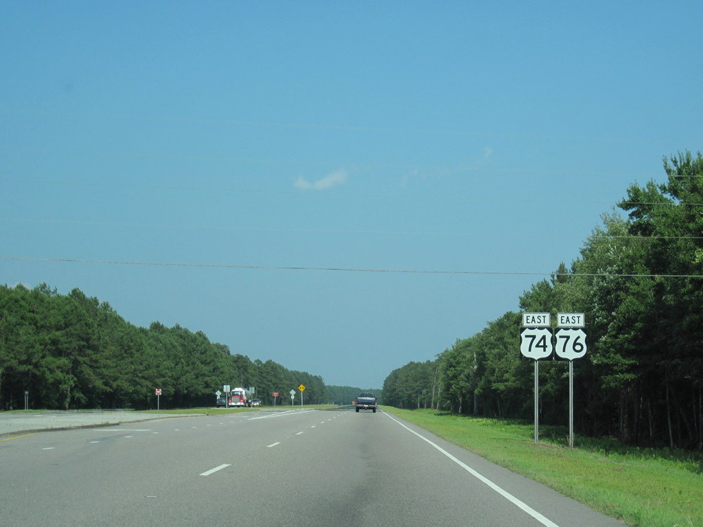
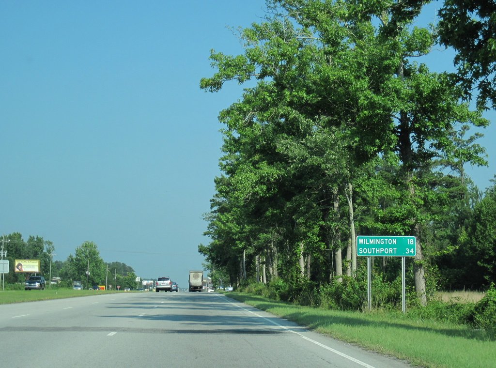
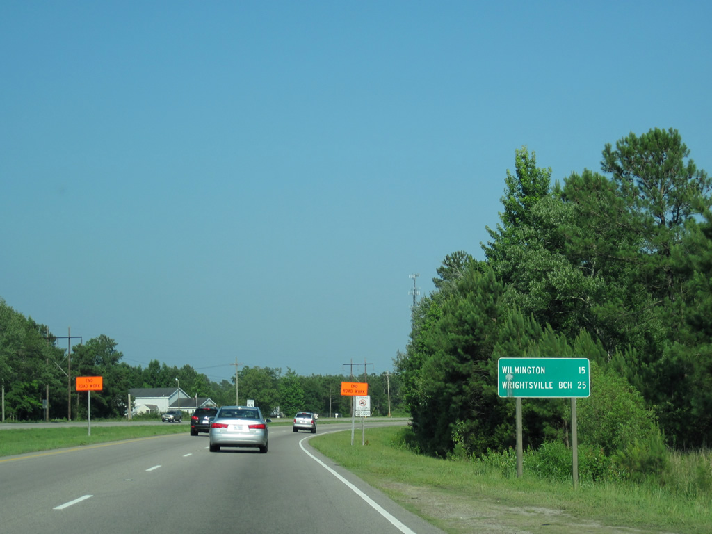
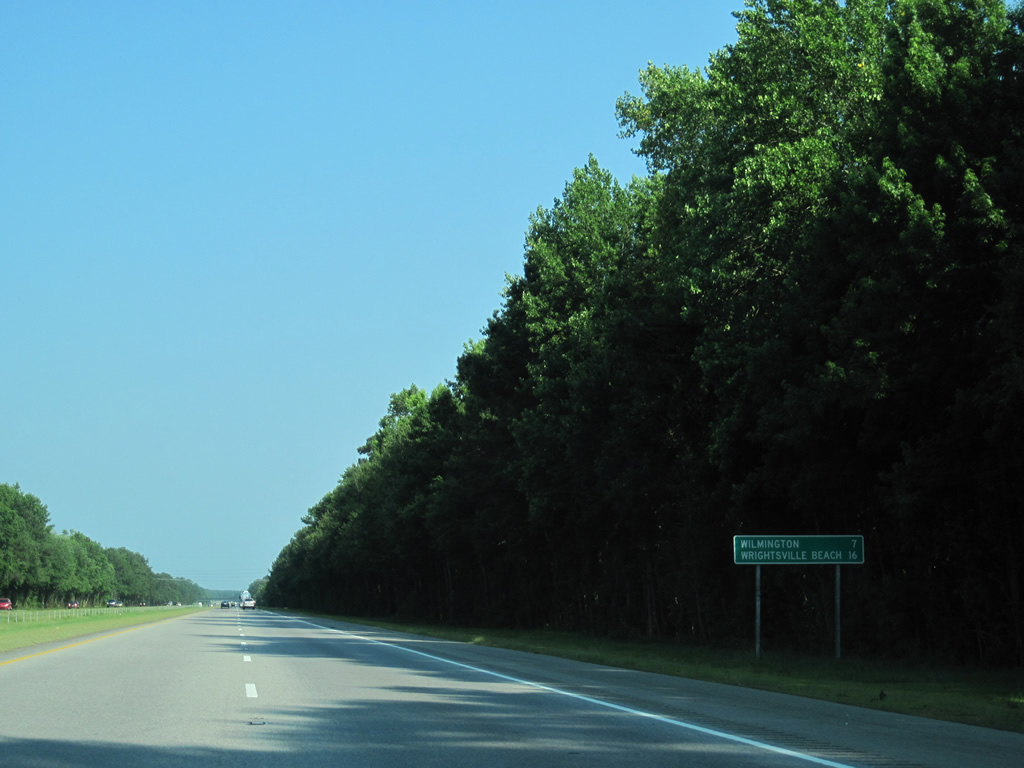
| Leaving Whiteville, U.S. 74/76 head 11 miles east to Lake Waccamaw and 47 miles to Wilmington. 06/24/10 |
|
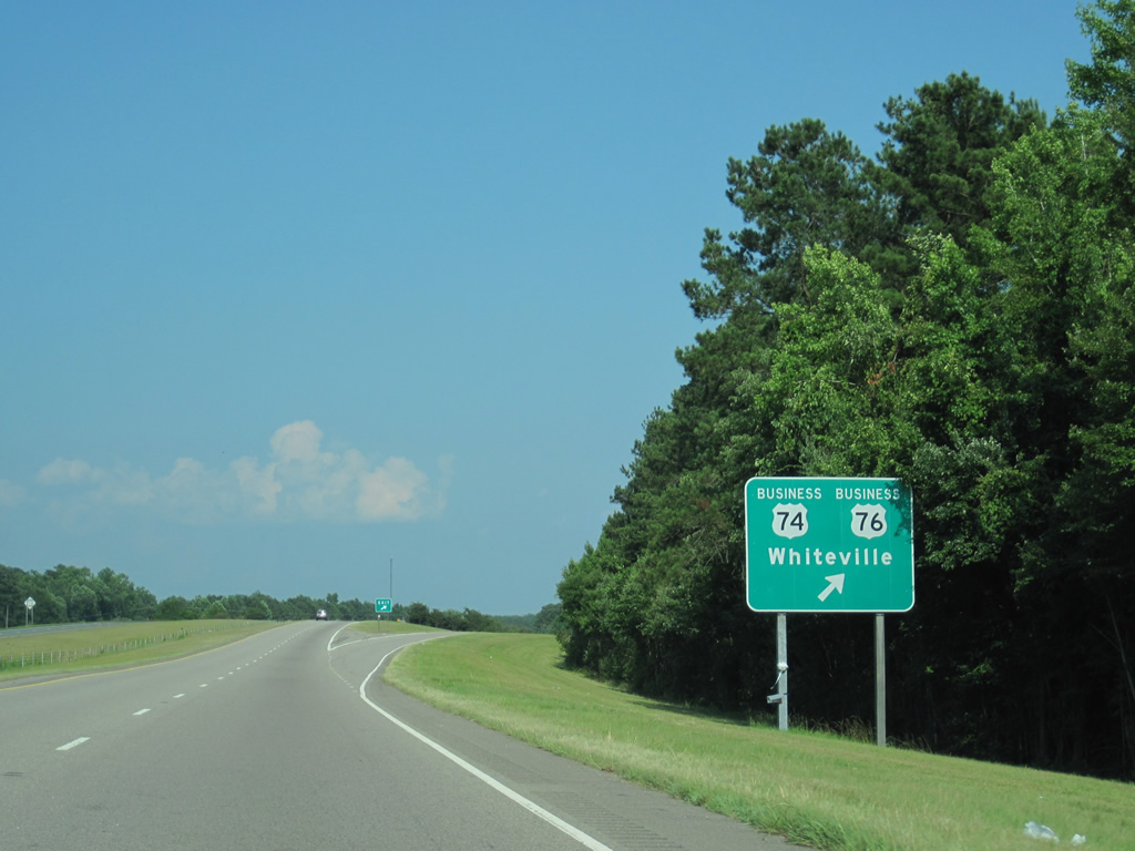
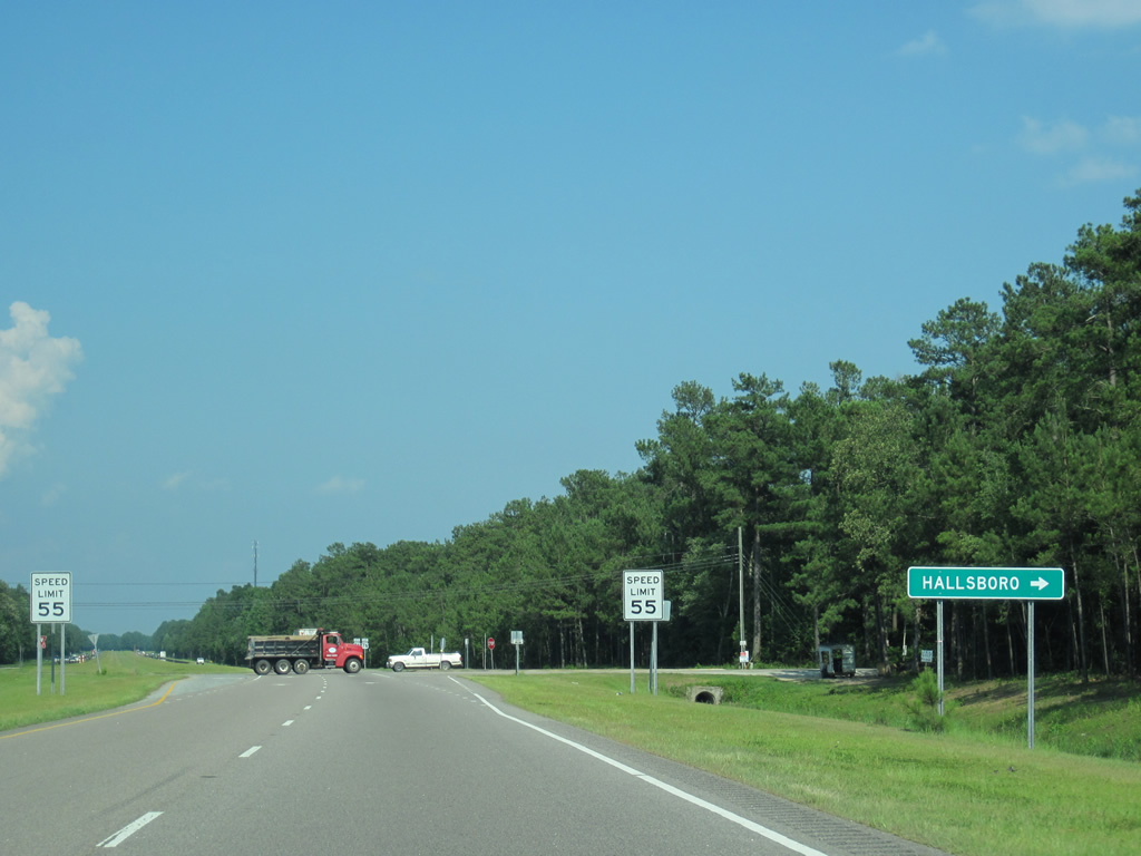
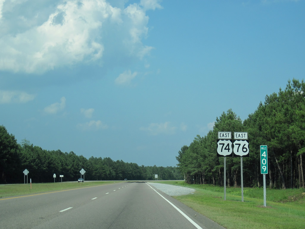
| U.S. 74-76 Business return to U.S. 74/76 from Baldwin Woods and Whiteville at the diamond interchange with Red Hill Road in one mile. 06/24/10 |
|
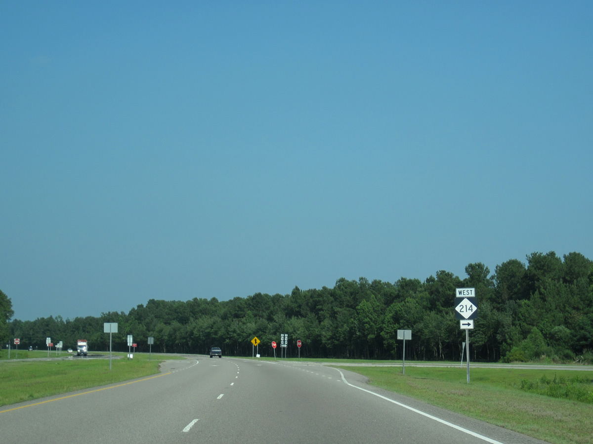
| Red Hill Road stems north from the end of the business loop to U.S. 701 Business (South College Street) outside Clarkton. NC 214 begins nearby and follows old U.S. 74/76 southward to Halls. 06/24/10 |
|
| U.S. 74/76 curve southward alongside Old Wilmington Road. 06/24/10 |
|
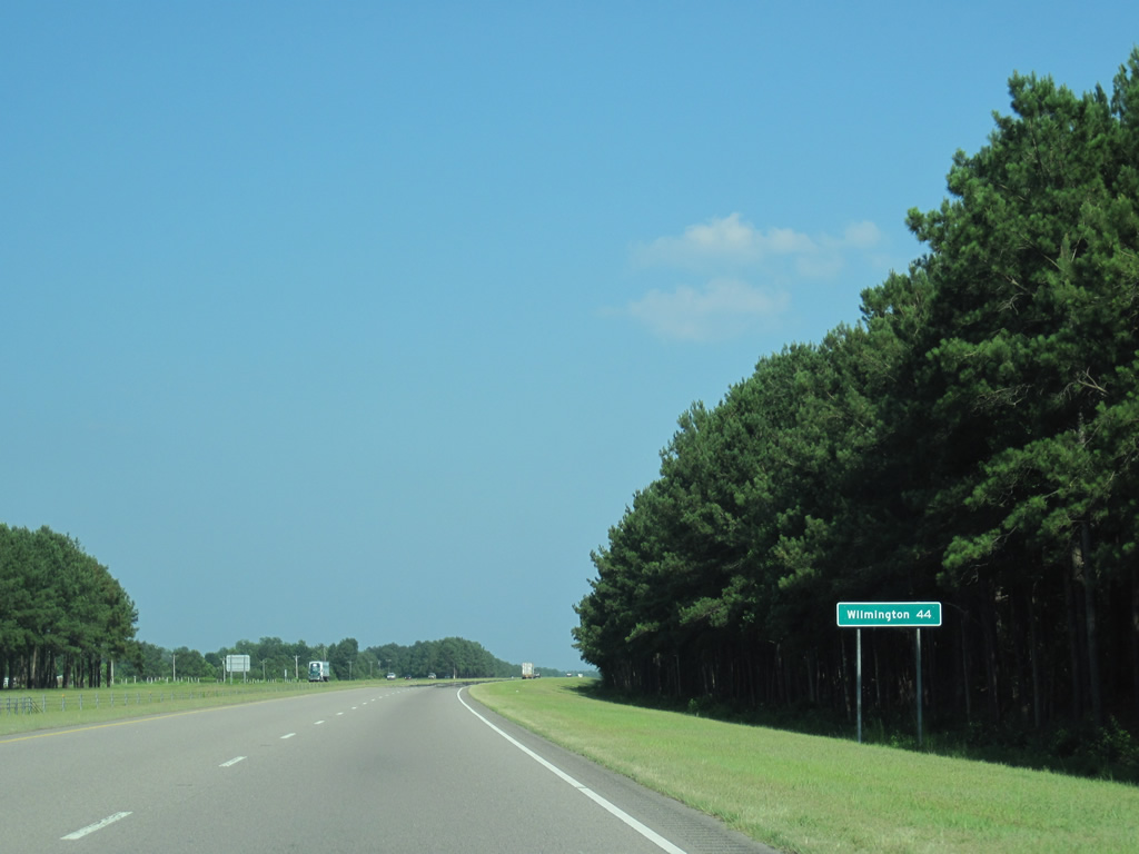
| Wilmington is the lone city referenced on this distance sign 44 miles to the east. 06/24/10 |
|
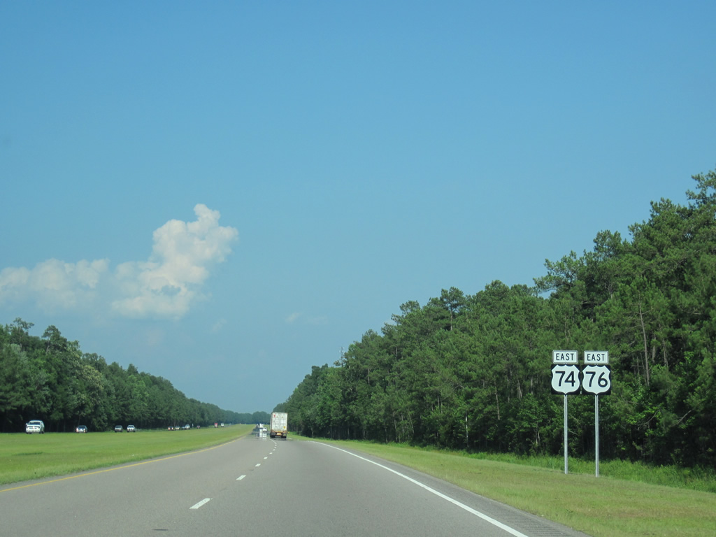
| U.S. 74/76 transition from a full freeway to a controlled-access expressway between Red Hill Road and Hallsboro Road. 06/24/10 |
|
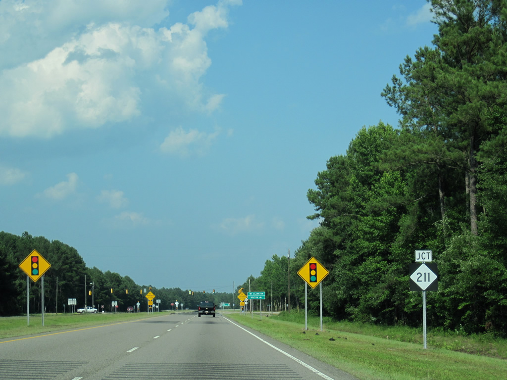
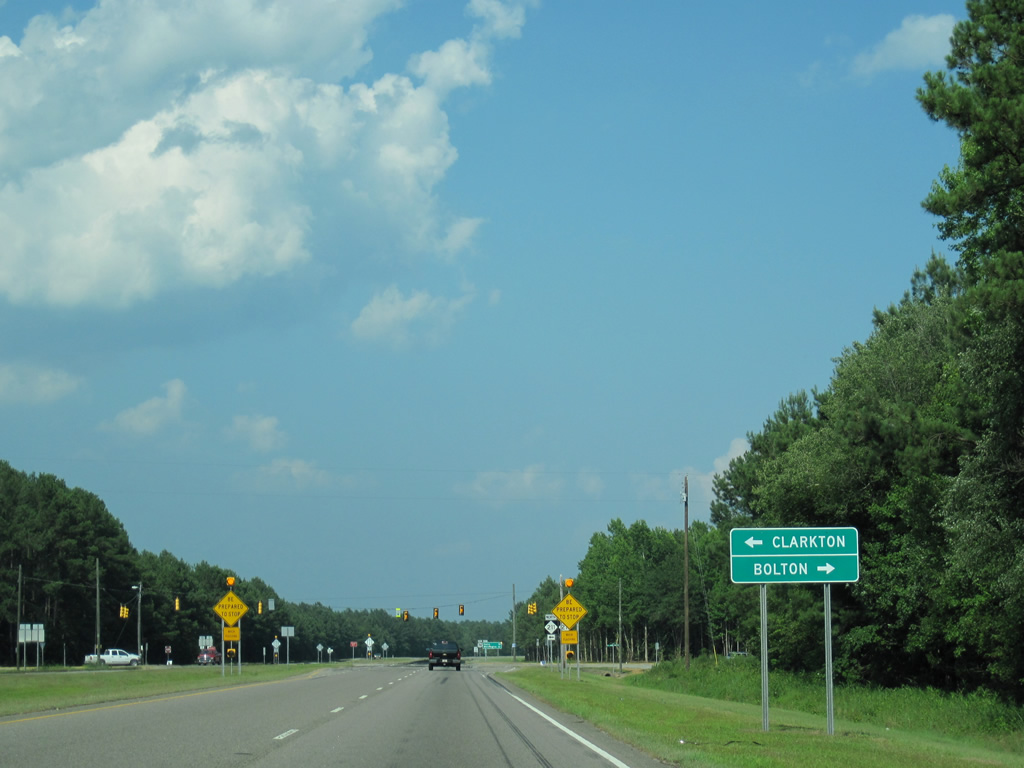
| Hallsboro Road meets U.S. 74/76 at an at-grade intersection between Hallsboro (NC 214) to the south and Elkton (NC 211) to the north. 06/24/10 |
|
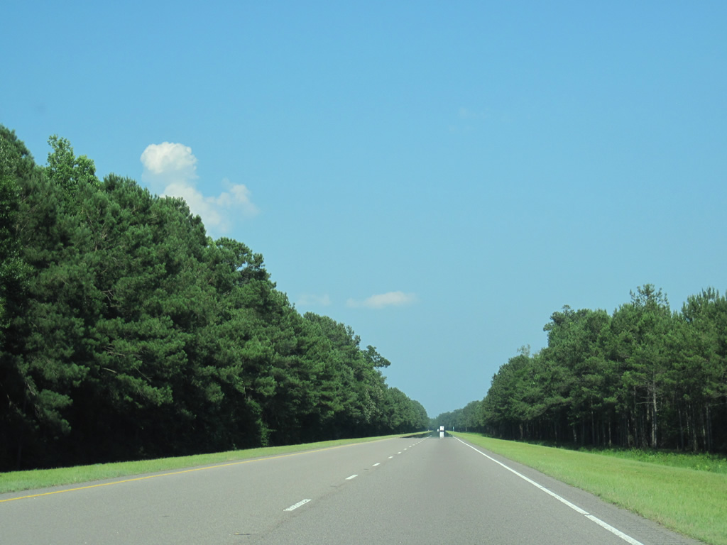
| An uninterrupted drive awaits eastbound motorists over the next 4.4 miles on U.S. 74/76. 06/24/10 |
|
| U.S. 74/76 widen to accommodate a forested median to the northwest of Lake Waccamaw. 06/24/10 |
|
| Chauncey Town Road connects the U.S. 74/76 expressway with Wananish and Lake Waccamaw to the south at NC 214 (Sam Potts Highway) ahead of these shields. Speed limits were increased on this stretch of highway from 55 to 60 miles per hour by 2011. 06/24/10 |
|
| Old Lake Road travels north toward the community of Lake Waccamaw and NC 214 (Sam Potts Highway) to intersect U.S. 74/76 en route to Buckhead. 06/24/10 |
|
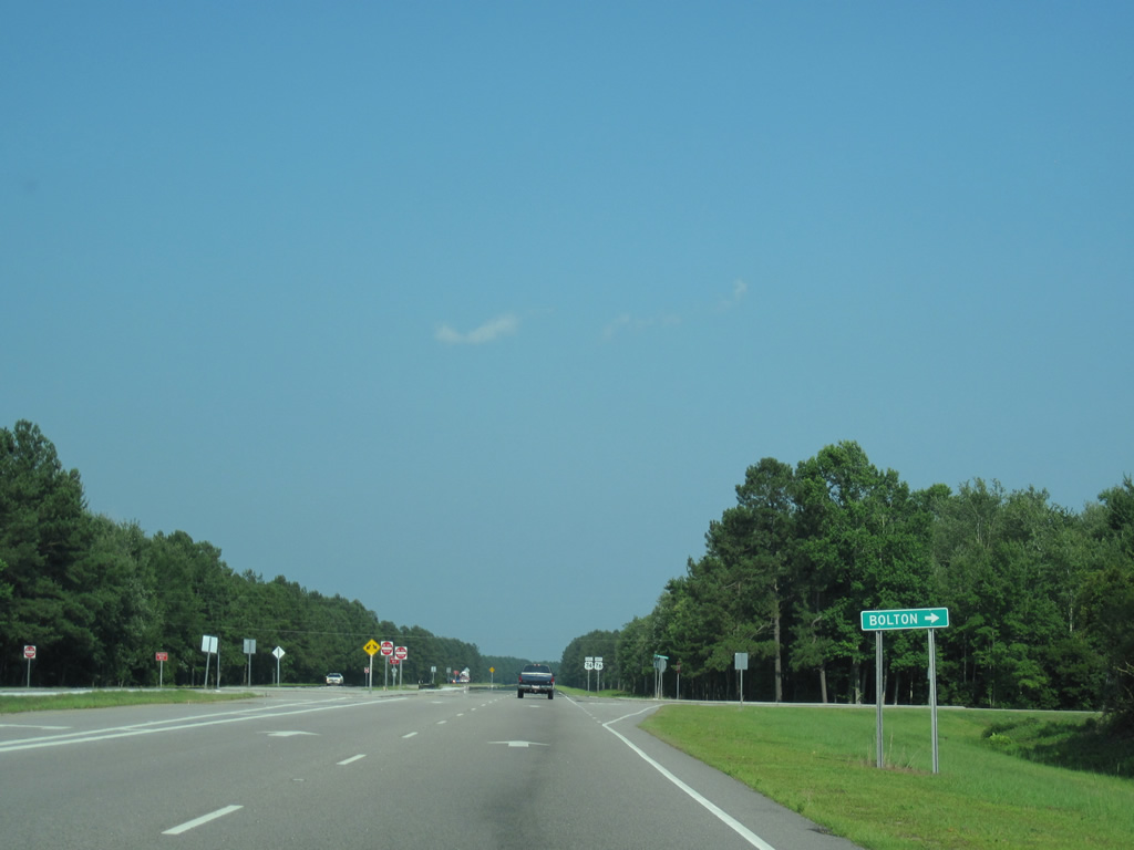
| NC 211 and U.S. 74/76 cross paths just outside the town of Bolton in eastern Columbus County. 06/24/10 |
|
| A 166 mile route, NC 211 angles southeast through Bolton en route to Supply, Southport and the Fort Fisher Ferry landing. 06/24/10 |
|
| Northwest from U.S. 74/76, NC 211 travels eight miles to Council and 20 miles to Clarkton. The state route ends at U.S. 220 Alternate in Candor after passing through both Fayetteville and Southern Pines. 06/24/10 |
|
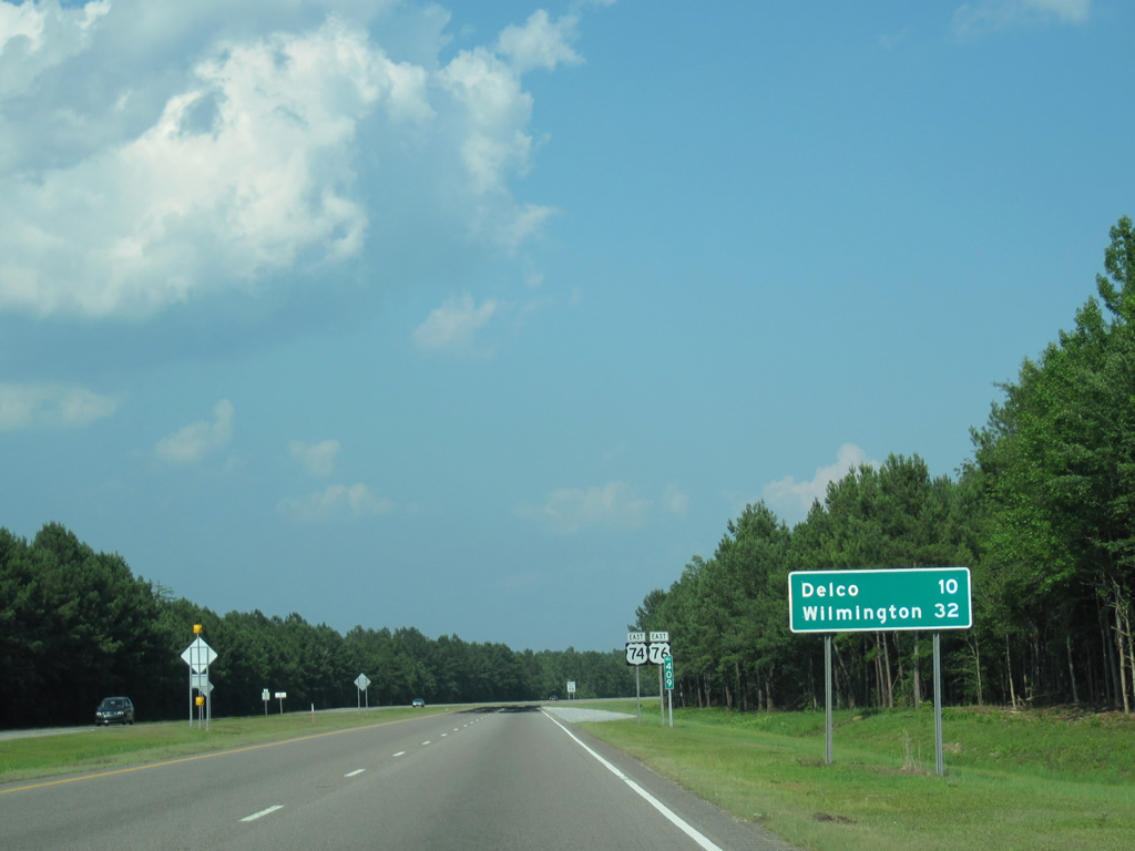
| Delco lies ten miles to the east of Bolton along U.S. 74/76. Wilmington is a half hour away. 06/24/10 |
|
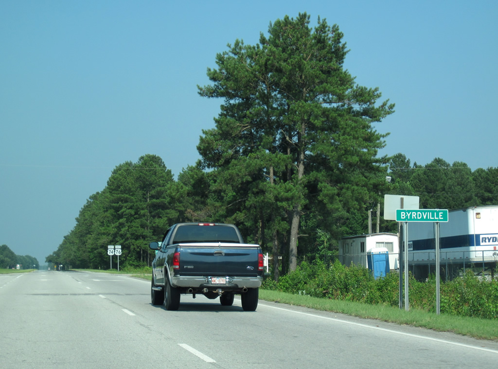
| The Bolton bypass, constructed around 1992, concludes with U.S. 74/76 rejoining its original course east to Byrdville and Freeman. 06/24/10 |
|
| Blacksmith Road provides a second access point to Bolton from U.S. 74/76 to the north. 06/24/10 |
|
| Cross traffic is prevented from Blacksmith Road at U.S. 74/76. Instead motorists must briefly turn onto U.S. 74/76 and make a U-turn to continue north or south. 06/24/10 |
|
| NC 214, a 16 mile route along former U.S. 74/76, ends at the U.S. 74/76 expressway just east of Bolton. 06/24/10 |
|
| East from Bolton, U.S. 74/76 remain a four lane divided highway but intersections increase and private driveway access appears. 06/24/10 |
|
| U.S. 74/76 east reaches the settlement of Byrdville. Byrdville Freeman Road (SR 1836) loops south from here to Livingston Chapel Road. 06/24/10 |
|
| Approaching the intersection with Oscar Blanks Road and the community of Freeman, drivers are advised of the possibility of heavy fog on the ten mile stretch leading beyond Maco. 06/24/10 |
|
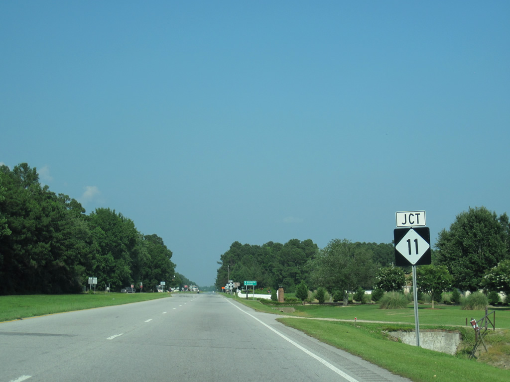
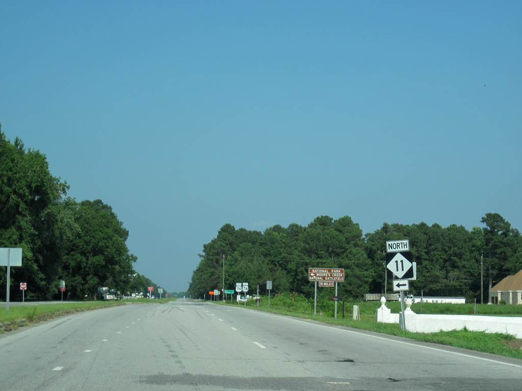
| NC 11 begins from U.S. 74/76 at Freeman and arcs northeast 30 miles to the Pender County seat of Burgaw. 06/24/10 |
|
| Traveling 196 miles overall, NC 11 ventures north from Pender County to Wallace, Kinston, Greenville and an end at Murfreesboro near the Virginia state line. The state route provides access to Moores Creek National Battlefield via NC 210 east from Bladen County. 06/24/10 |
|
| Delco lies three miles east and Wilmington 24 miles away from U.S. 74/76 at NC 11 north. 06/24/10 |
|
| NC 87 angles six miles southeast from NC 11 through Riegelwood to combine with U.S. 74/76 east at Delco. 06/24/10 |
|
| U.S. 74/76 reach Wilmington in 18 miles. NC 87 drops southward to U.S. 17 at Bishop to conclude a 239 mile course in 34 miles at Southport. 06/24/10 |
|
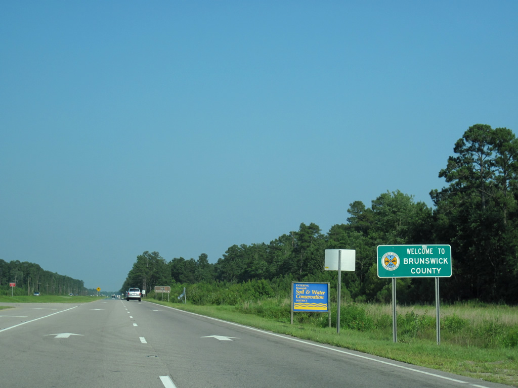
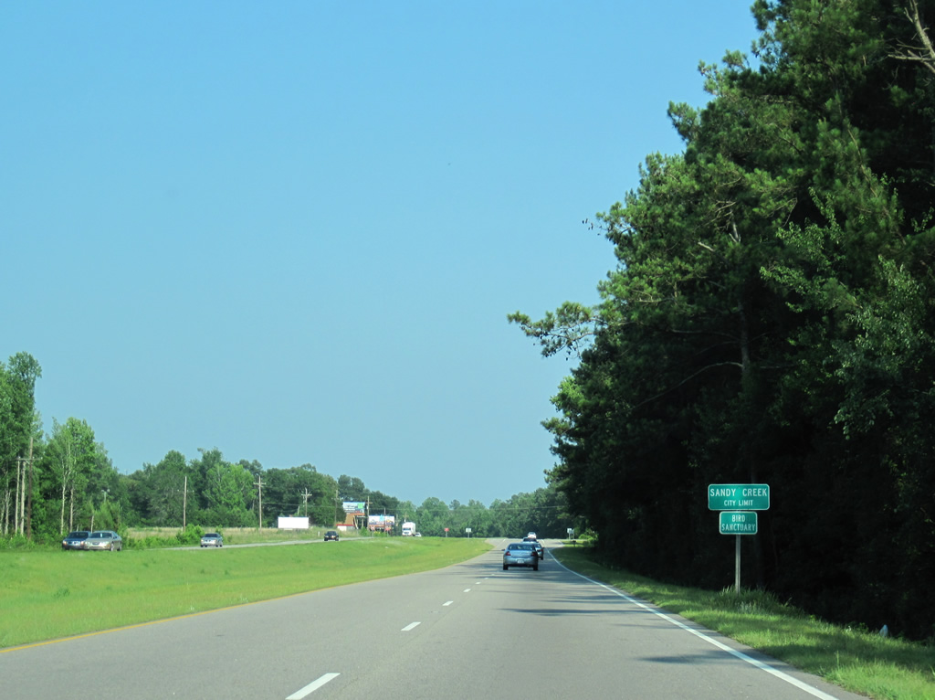
| Entering Brunswick County midway between Delco and Sandy Creek along U.S. 74-76 east/NC 87 south. 06/24/10 |
|
| A short stretch of U.S. 74-76/NC 87 passes through the town limits of Sandy Creek. 06/24/10 |
|
| NC 87 parts ways with U.S. 74/76 at Maco opposite Northwest Road. 06/24/10 |
|
| The state route winds nine miles southeast to merge with U.S. 17 south at Bishop. Northwest Road loops north from U.S. 74/76 to Northwest, becoming Fertilizer Road west to Acme in Columbus County. 06/24/10 |
|
| NC 87 continues south from U.S. 17 at Bell Swamp to Boiling Spring Lakes and NC 211 outside Southport. 06/24/10 |
|
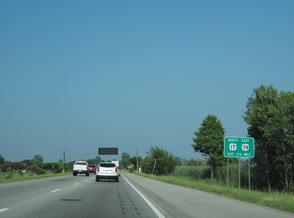
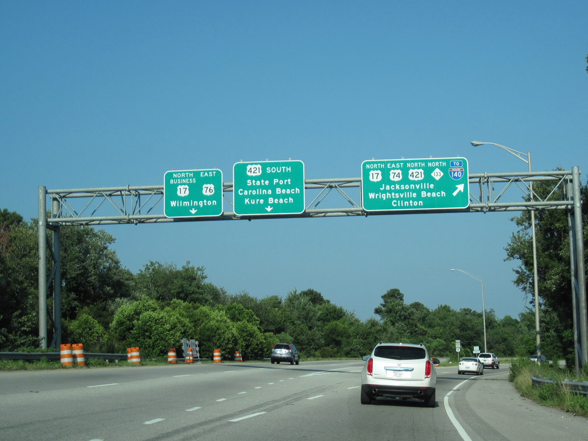
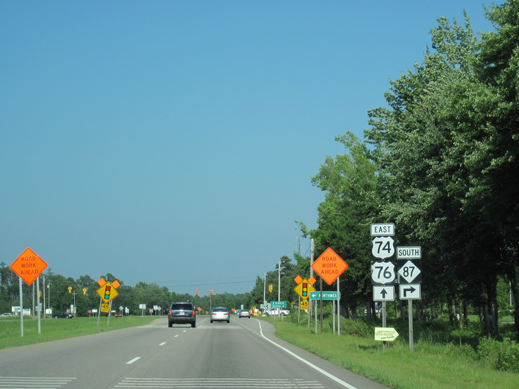
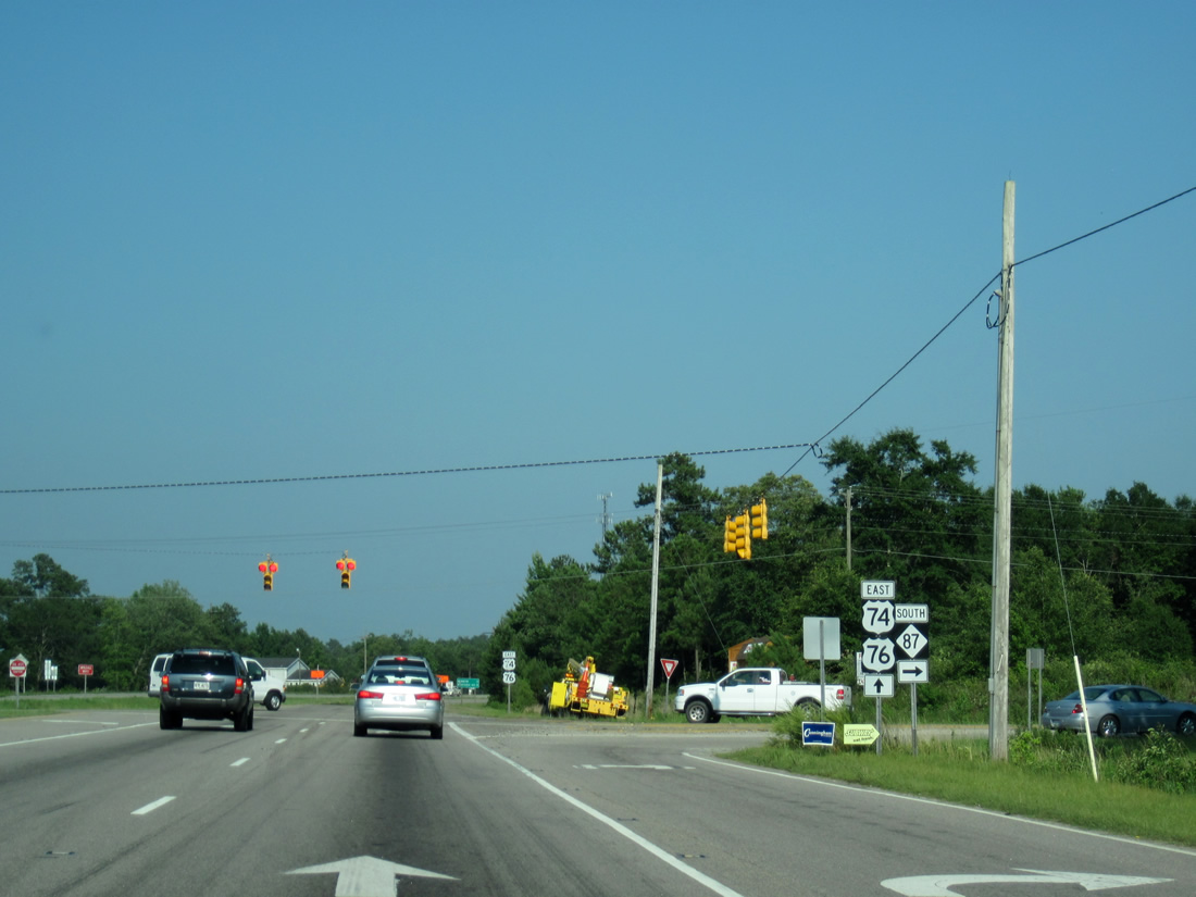
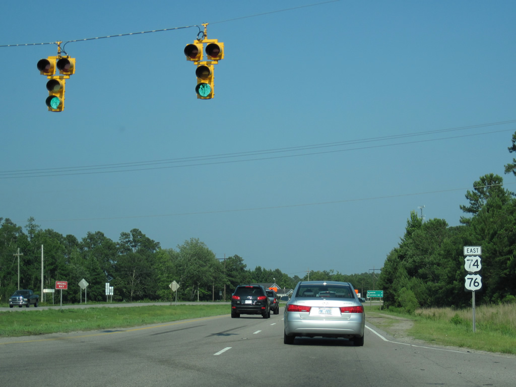
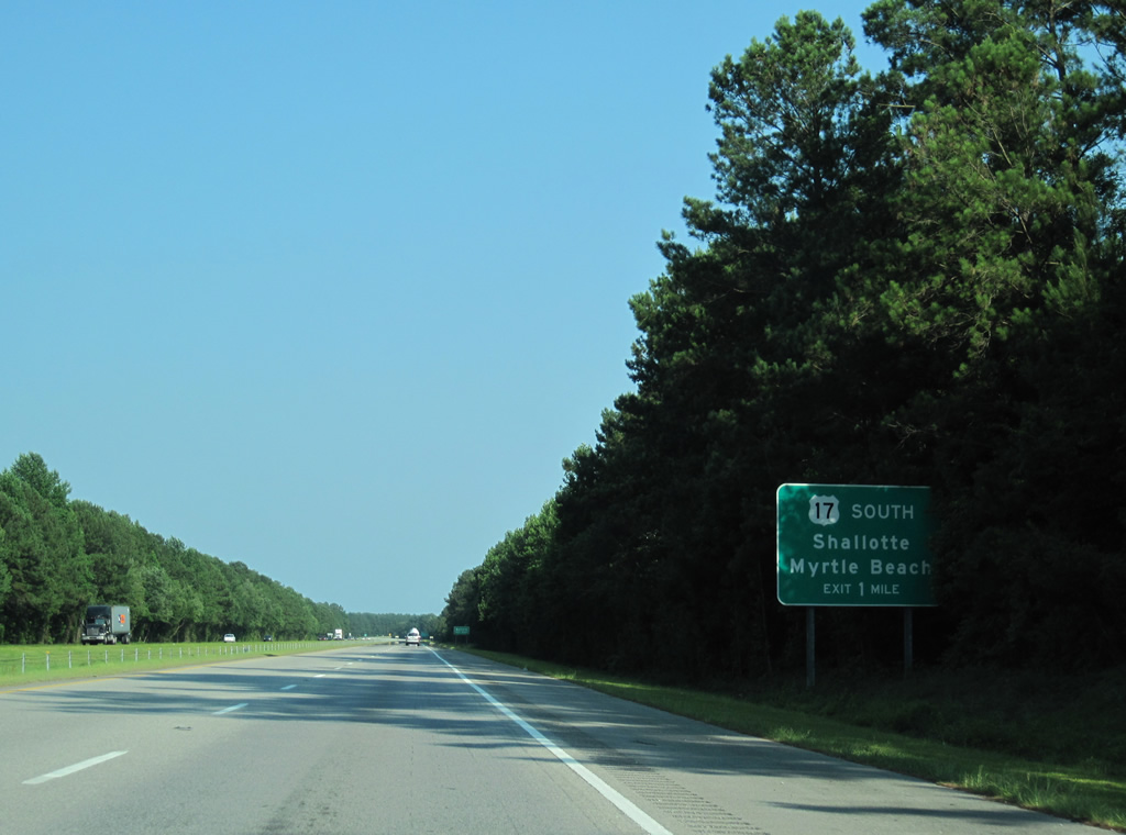
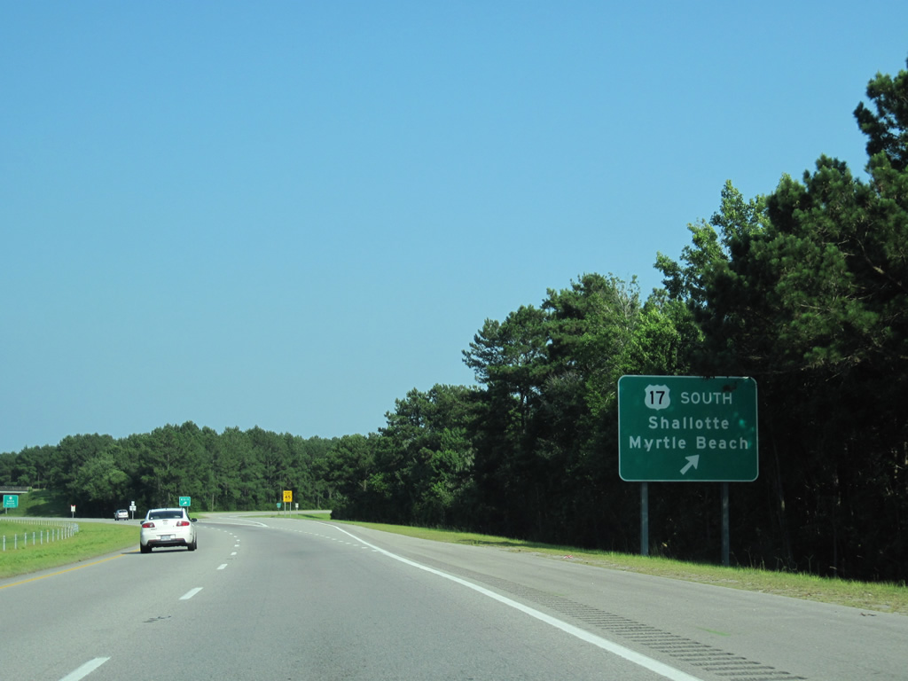
| Shield assembly and distance sign posted along U.S. 74/76 (Andrew Jackson Highway) east of the split with NC 87. Wrightsville Beach, the terminus for both US highways, appears the first time at 25 miles out. 06/24/10 |
|
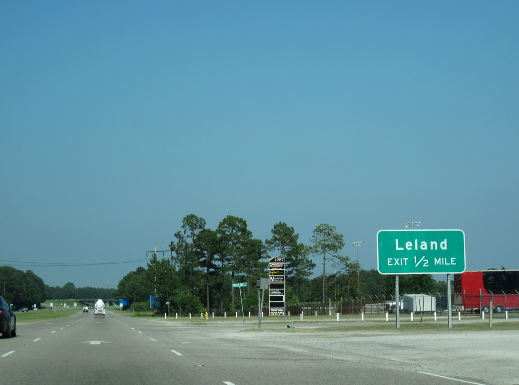
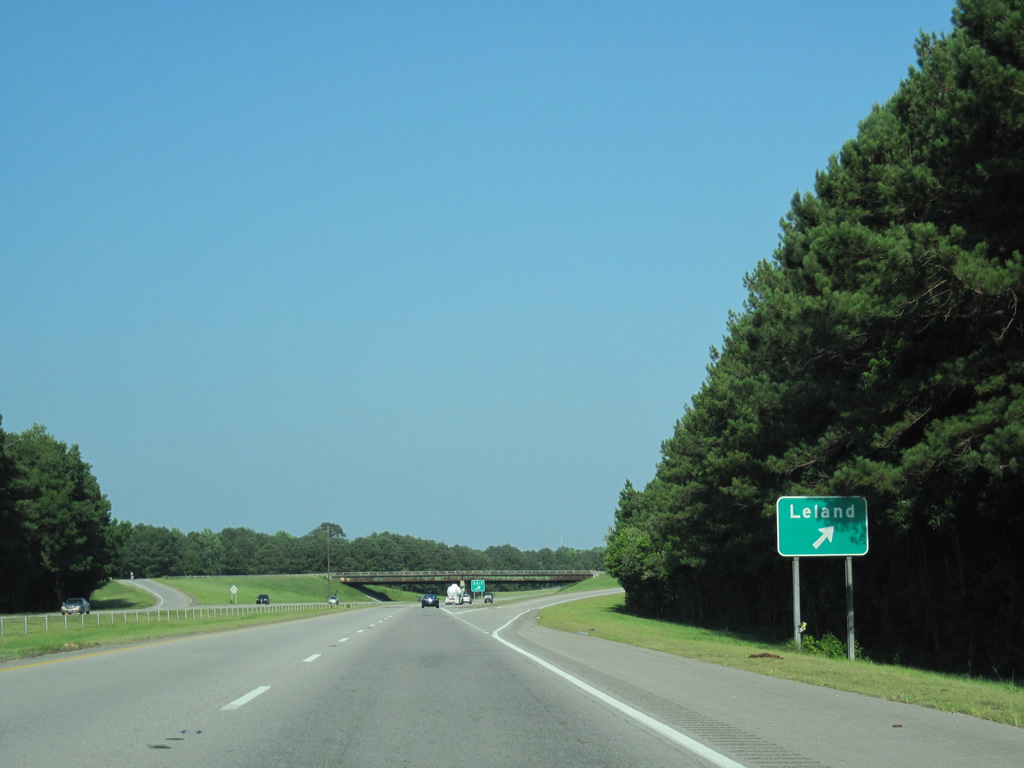
| An industrialized stretch of U.S. 74/76 precedes the diamond interchange with Lanvale Road south and Mt. Misery Road north at the town of Leland. 06/24/10 |
|
| Mt. Misery Road (SR 1426) loops east from Northwest Road through Phoenix to become Lanvale Road (SR 1438) south of U.S. 74/76 through Eliah, western reaches of Leland, and U.S. 17 at Lanvale. Village Road (old U.S. 74/76) stems east from Lanvale Road nearby across Leland. 06/24/10 |
|
| A late-1970s freeway carries U.S. 74/76 southeast through Leland. 06/24/10 |
|
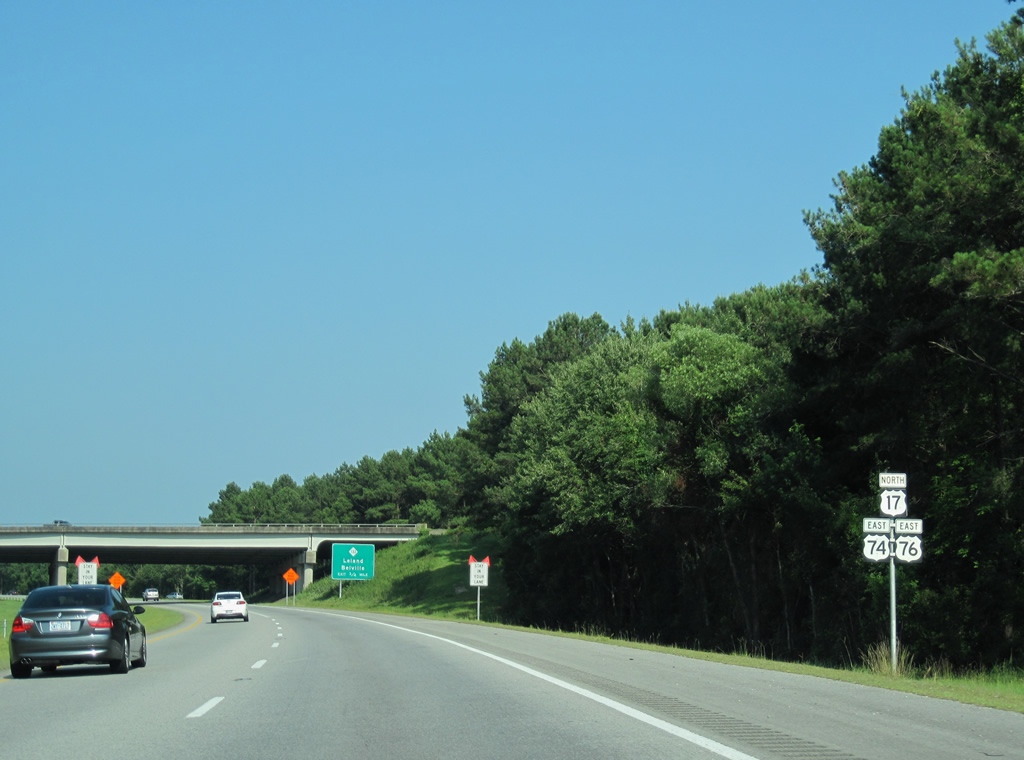
| Downtown Wilmington is just seven miles away via U.S. 76 east. U.S. 74 and U.S. 76 take different routes before reconvening ahead of Wrightsville Beach in 16 miles. 06/24/10 |
|
| U.S. 74/76 next merge with U.S. 17 north at a trumpet interchange in Leland. U.S. 17 enters Leland from Bishop, Bolivia and Shalotte to the southwest. 06/24/10 |
|
| U.S. 17 (Ocean Highway) travels southwest along a four lane divided highway to Myrtle Beach, South Carolina. Northward the route combines with U.S. 74/76 to Eagle Island. 06/24/10 |
|
| This reassurance shield assembly precedes the point where U.S. 17 northbound traffic merges onto U.S. 74-76. 06/24/10 |
|
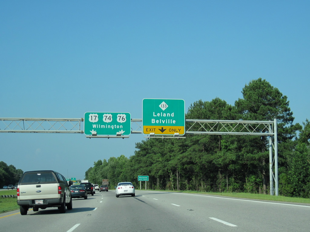
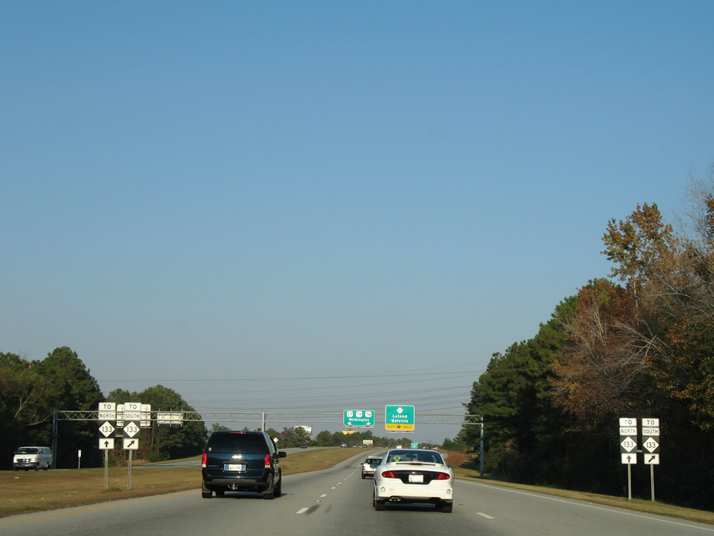
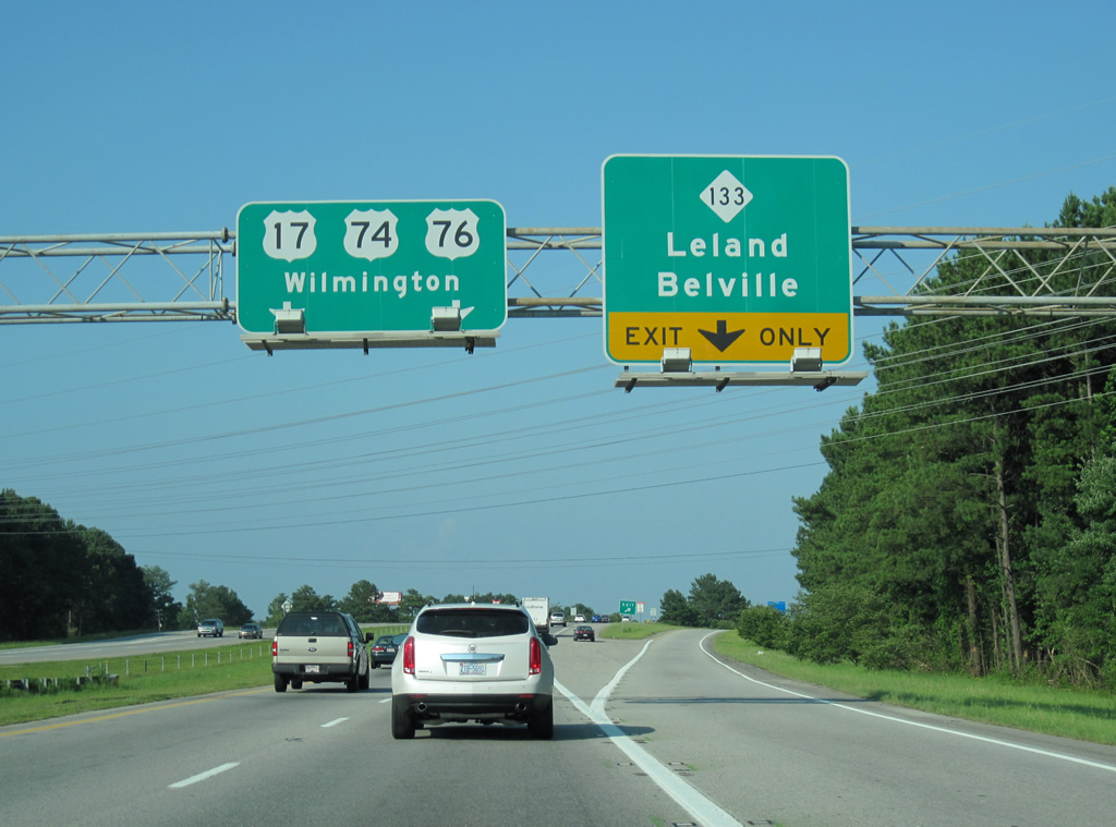
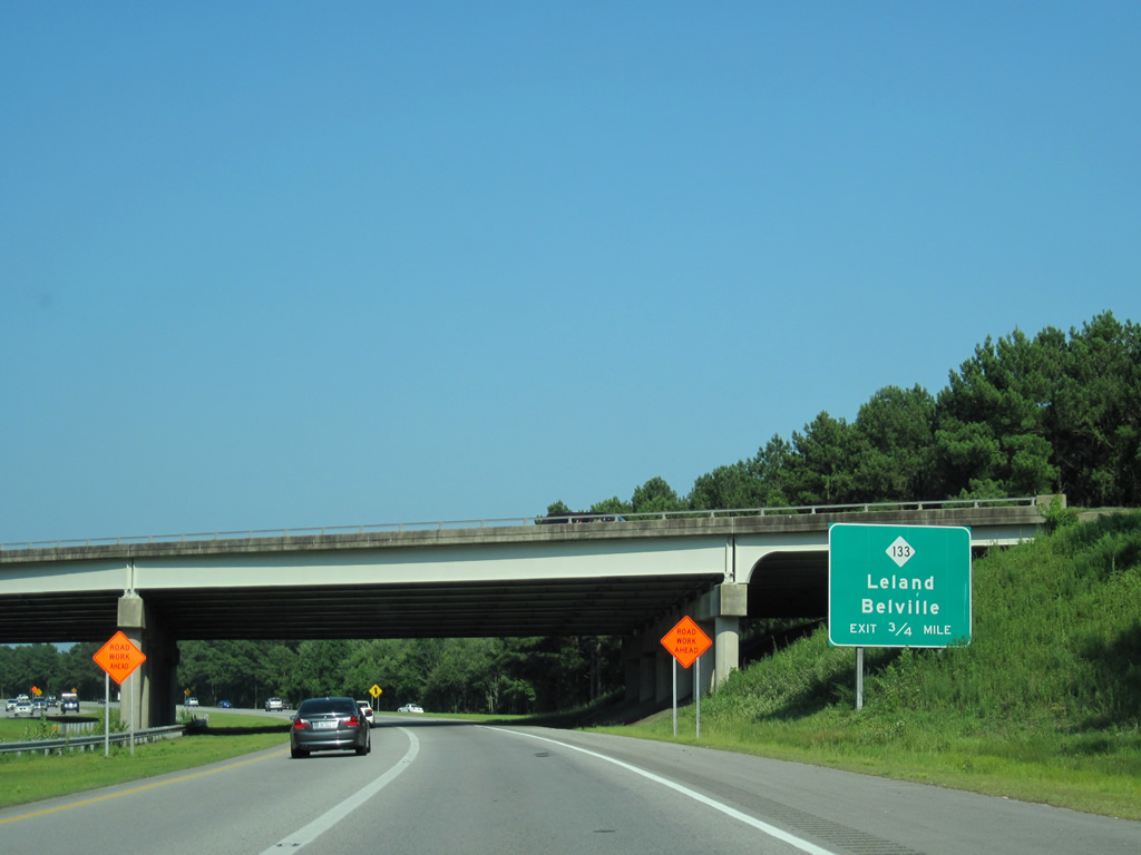
| U.S. 17-74-76 remains as a freeway east to Eagle Island and Cape Fea Memorial Bridge. The succeeding exit along eastbound is with NC 133 (River Road) south to Belville and Southport and Village Road (SR 1472) north to Leland and Navassa. 06/24/10 |
|
| U.S. 17-74-76 advance 1.06 miles east to a diverging diamond interchange (DDI) with NC 133 (River Road) south and Village Road (SR 1472) north. 06/24/10 |
|
| The Causeway Bridge Project included conversion of the diamond interchange with NC 133 and Village Road (old U.S. 74/76) into a DDI. The revised exchange debuted to traffic on April 15, 2016. 06/24/10 |
|
| NC 133 (River Road) parallels the west bank of the Cape Fear River along a two lane highway south from U.S. 17-74-76 to NC 87 near Boiling Spring Lakes. The two overlap briefly before splitting to Southport, near the Southport-Fort Fisher Ferry, and Oak Island respectively. 06/24/10 |
|
| Underway from January 2014 to November 2016, the Causeway Bridge Project replaced the U.S. 17-74-76/NC 133 bridges over the Brunswick River with a new eight lane span. 11/11/06 |
|
| U.S. 74 east / NC 133 north part ways with U.S. 17 north / U.S. 76 east 1.57 miles beyond the Brunswick River at U.S. 421. U.S. 421 combines with U.S. 74 northward from the U.S.S. North Carolina Battleship Memorial to the Isabel Holmes Bridge over the Cape Fear River. 06/24/10 |
|
| A third eastbound lane was constructed during the Causeway Bridge Project to the trumpet interchange with U.S. 421. 06/24/10 |
|
| U.S. 17-74-76 / NC 133 cross Alligator Creek just ahead of their separation on Eagle Island. U.S. 421 originates at Fort Fisher south of Kure Beach and Wilmington. The route runs north to Clinton and Dunn, and overall mostly paralleling U.S. 52 to Michigan City, Indiana. 06/24/10 |
|
| U.S. 17 was realigned to bypass Wilmington along I-140 from 2006 to 2017. The former route into Wilmington was redesignated as U.S. 17 Business during that time frame. 11/11/06 |
|
| U.S. 74 east provides a bypass of central Wilmington via Martin Luther King, Jr. Parkway east to Wilmington International Airport (ILM). NC 133 overlays the route to Hightsville. U.S. 421 leads north 4.6 miles to I-140 at the Dan Cameron Bridge. 06/24/10 |
Page Updated 09-12-2018.


 East
East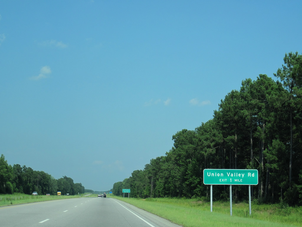


 South
South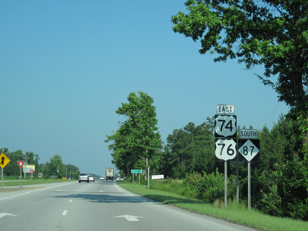

 North
North