|
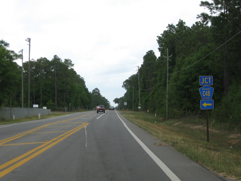
| SR 4 branches northwest from U.S. 90 at Milligan en route to Baker. The state road meets County Road 4B (Charlie Day Road), a 1.21 mile connector leading west from SR 4 to Okaloosa County Road 189 (Galliver Cutoff). 05/02/09 |
|
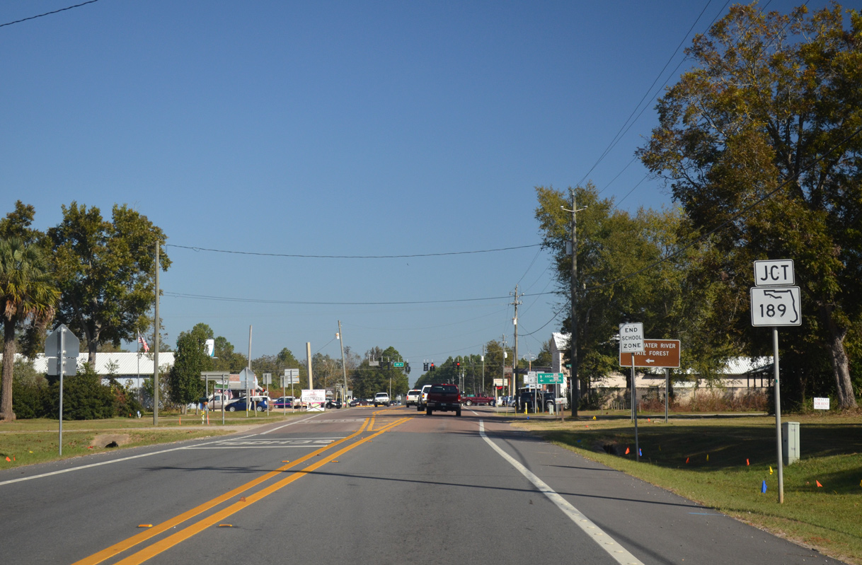
| SR 4 curves northward from CR 189 (Galliver Cutoff) into the unincorporated community of Baker. 11/03/12 |
|
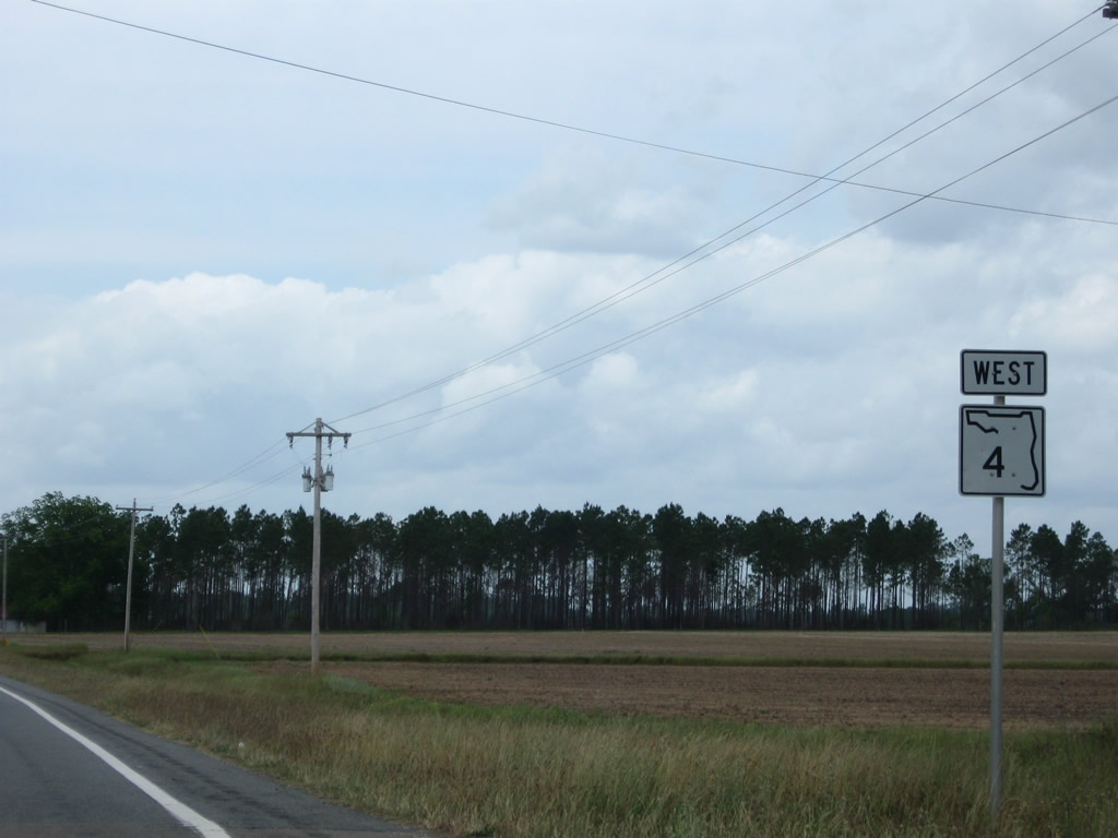
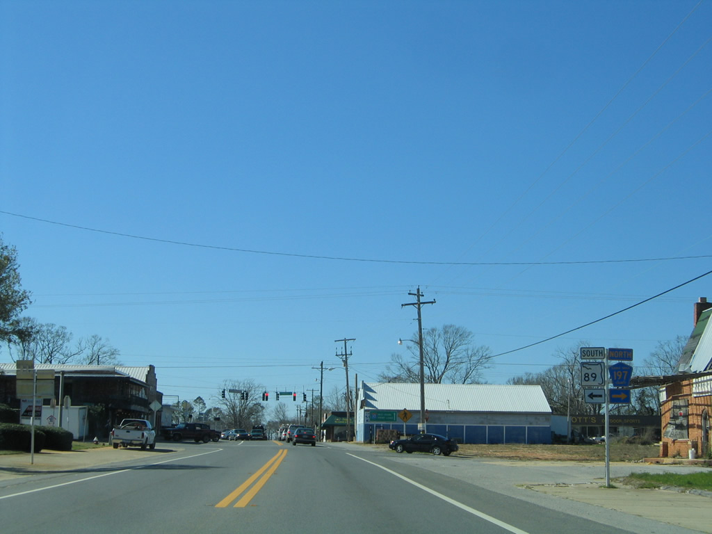
| SR 4 turns west onto Georgia Avenue in Baker where the northern section of SR 189 begins. 11/03/12 |
|
| SR 189 extends north from SR 4 at Baker to Blackman, Escambia Farms and Alabama State Route 137 at Escambia County. SR 137 north from Wing to U.S. 29 connects the state road with Andalusia. 11/03/12 |
|
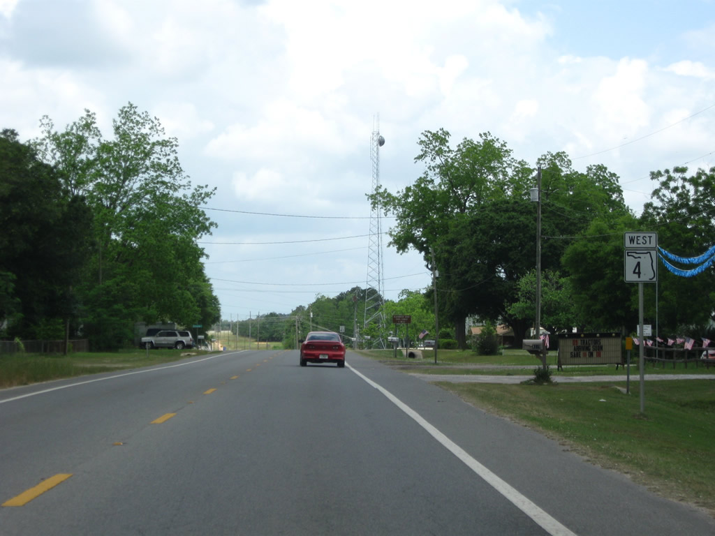
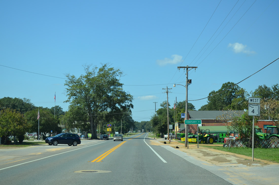
| Resuming a westward course, SR 4 leaves Baker for a 13 mile drive to Munson. Century and the west end is 38 miles away. 05/02/09 |
|
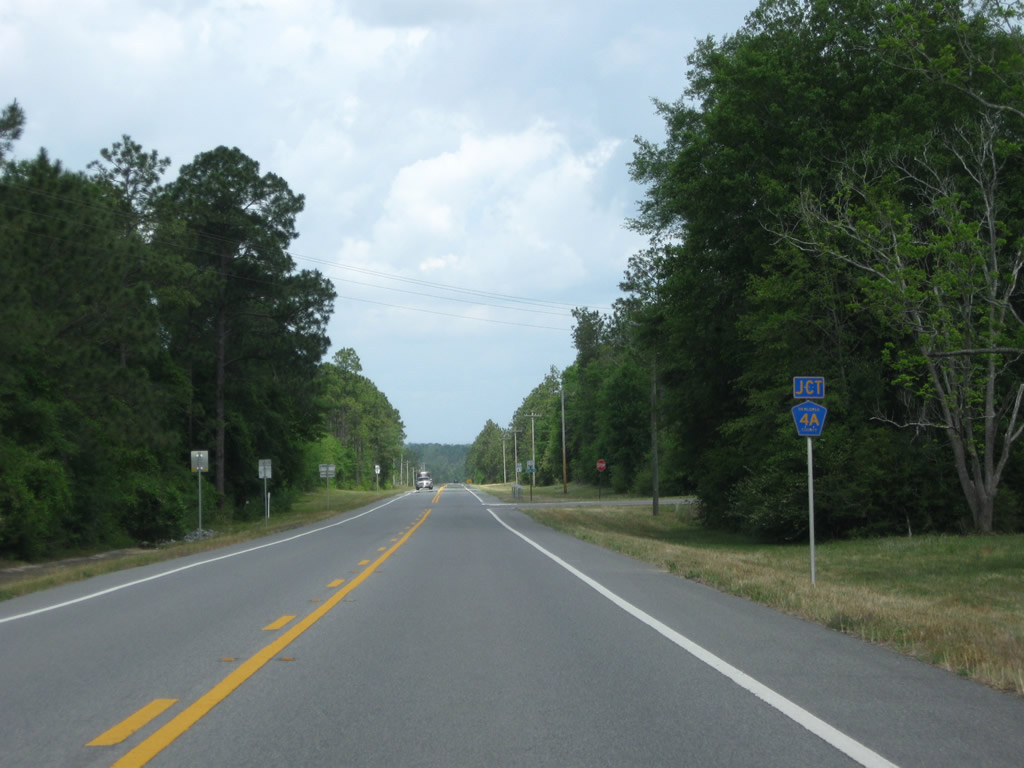
| Okaloosa County Road 4A ventures west from SR 189 at Holloway Road to end at SR 4. 05/02/09 |
|
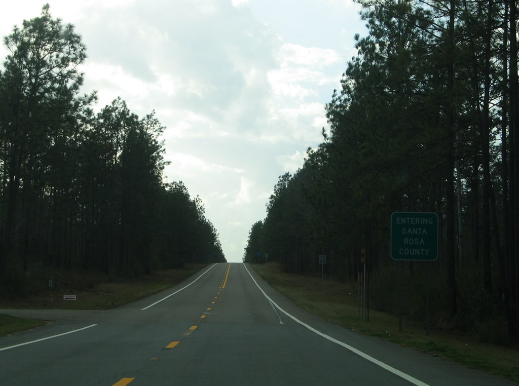
| 12.71 miles west from U.S. 90, State Road 4 crosses the Santa Rosa County line. Areas surrounding the highway lie within Blackwater River State Forest along this stretch. 06/06/06 |
|
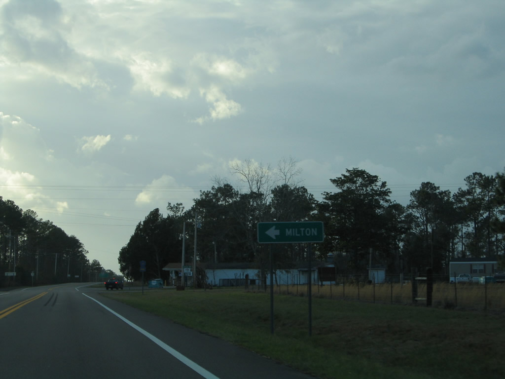
| SR 4 and Santa Rosa County Road 191 (Munson Highway) cross paths at the settlement of Munson. CR-191 leads southwest to White Field Naval Air Station and the county seat of Milton. 06/06/06 |
|
| North from SR 4, CR-191 (Munson Highway) splits with Belandville road nearby for McLellan and Alaflora, Alabama. 06/06/06 |
|
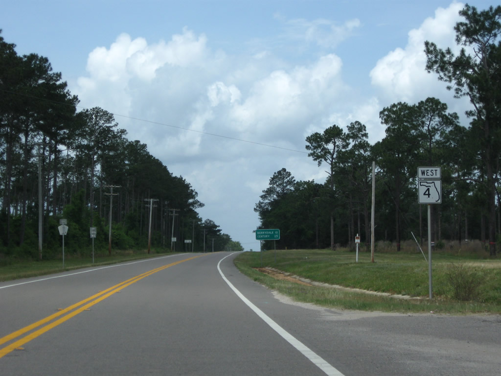
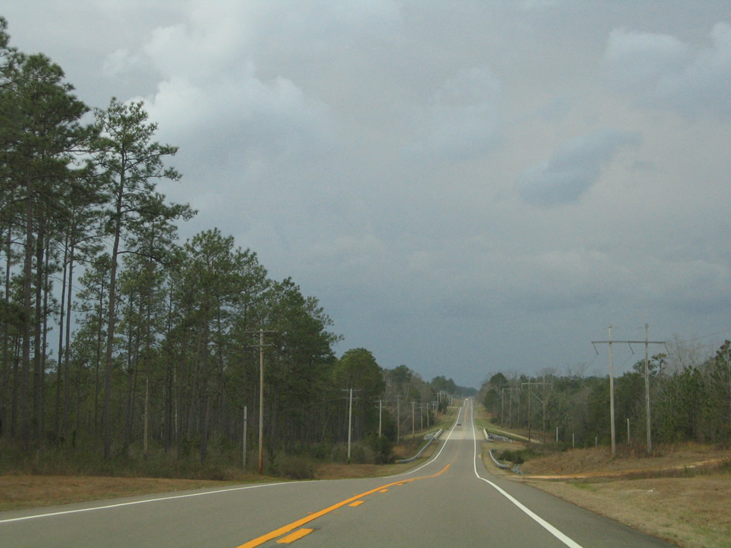
| West from Munson and County Road 191, SR 4 continues ten miles to Berrydale and 25 miles to Century. 05/03/09 |
|
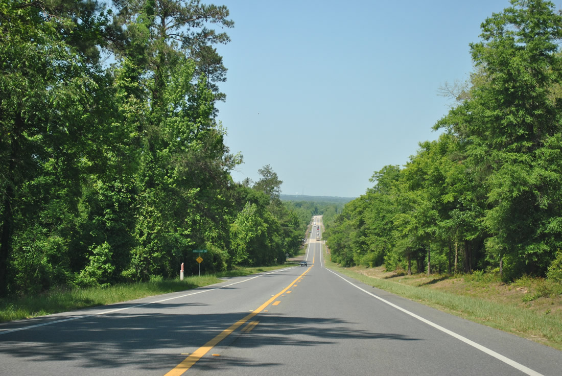
| Nearing the crossing over Big Juniper Creek on the rural and vastly uninterrupted stretch of SR 4 between Munson and Berrydale. 06/06/06 |
|
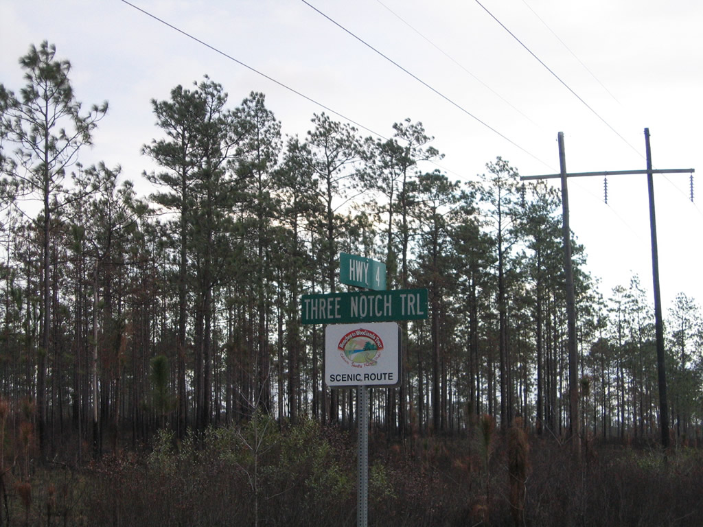
| A trailblazer for the Beaches to Woodlands Tour posted at the intersection of SR 4 and Three Notch Trail. 06/06/06 |
|
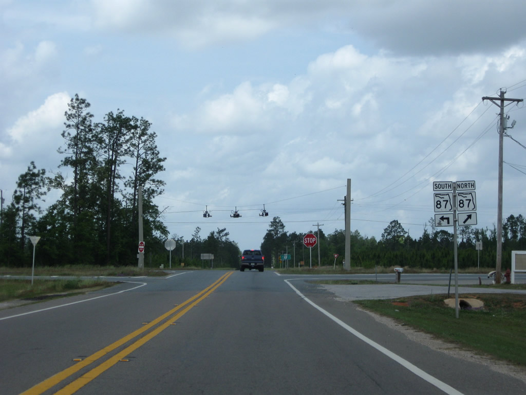
| Drivers along westbound SR 4 reach the settlement of Berrydale and SR 87. 05/03/09 |
|
| Arguably the most important north-south road in Santa Rosa County, SR 87 joins Milton with Brewton, Alabama (via Alabama 41) to the north both as a through route and hurricane evacuation route. Much of the highway is rural in nature with 55 mile per hour speed limits from Point Baker and Whiting Field NAS northward to Allentown and Berrydale. 05/03/09 |
|
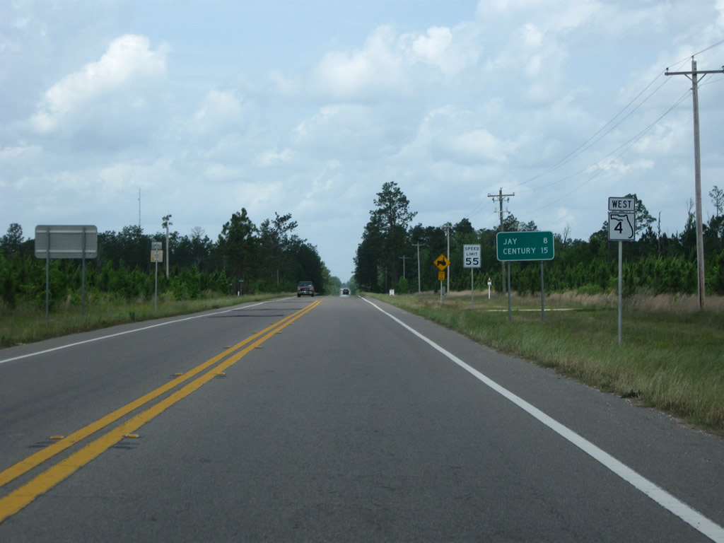
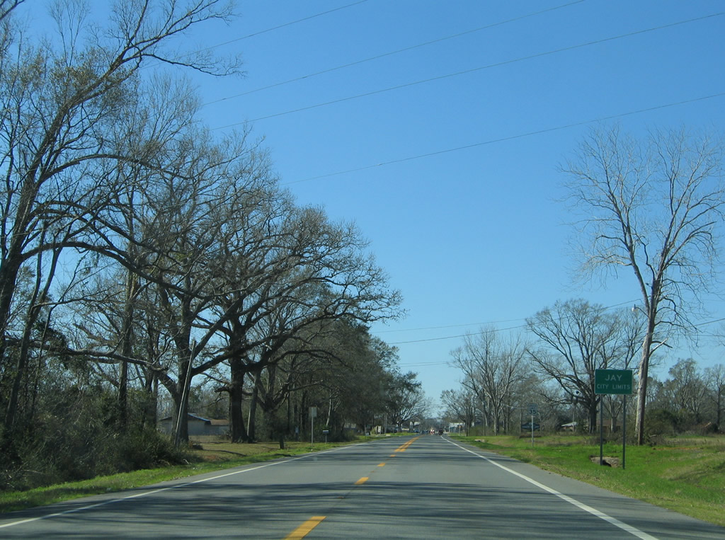
| Reassurance shield and distance sign posted for SR 4 west after SR 87. The city of Jay is next at eight miles out. 05/03/09 |
|
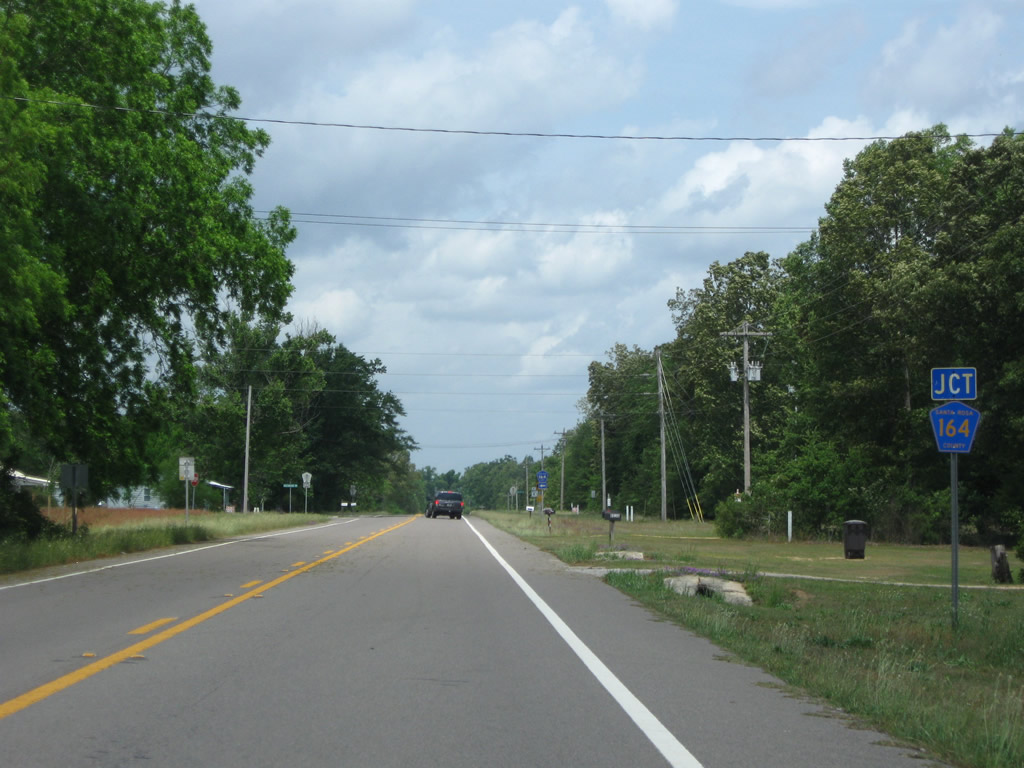
| County Road 164 follows Greenwood Road north from County Road 399 (Country Mill Road) to end at SR 4, 2.8 miles west of Berrydale. 05/03/09 |
|
| The Greenwood Road segment of Santa Rosa County Road 189 stretches 8.85 miles in an arc southwest from SR 4 to Cobbtown and SR 89. A second branch of CR-164 exists along Harvest Road for 3.81 miles between SR 89 and County Road 197 at Brownsdale. 05/03/09 |
|
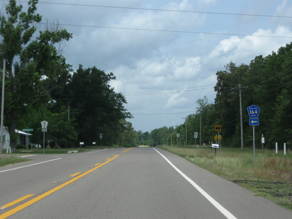
| SR 4 turns more westerly from CR-164 and crosses Clear Branch on the approach to Jay. 05/03/09 |
|
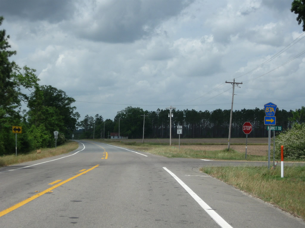
| County Road 87A (Market Road) links State Roads 4 and 87 along a 2.99 mile alignment. The county highway provides an alternate route between Jay and Brewton, Alabama. 05/03/09 |
|
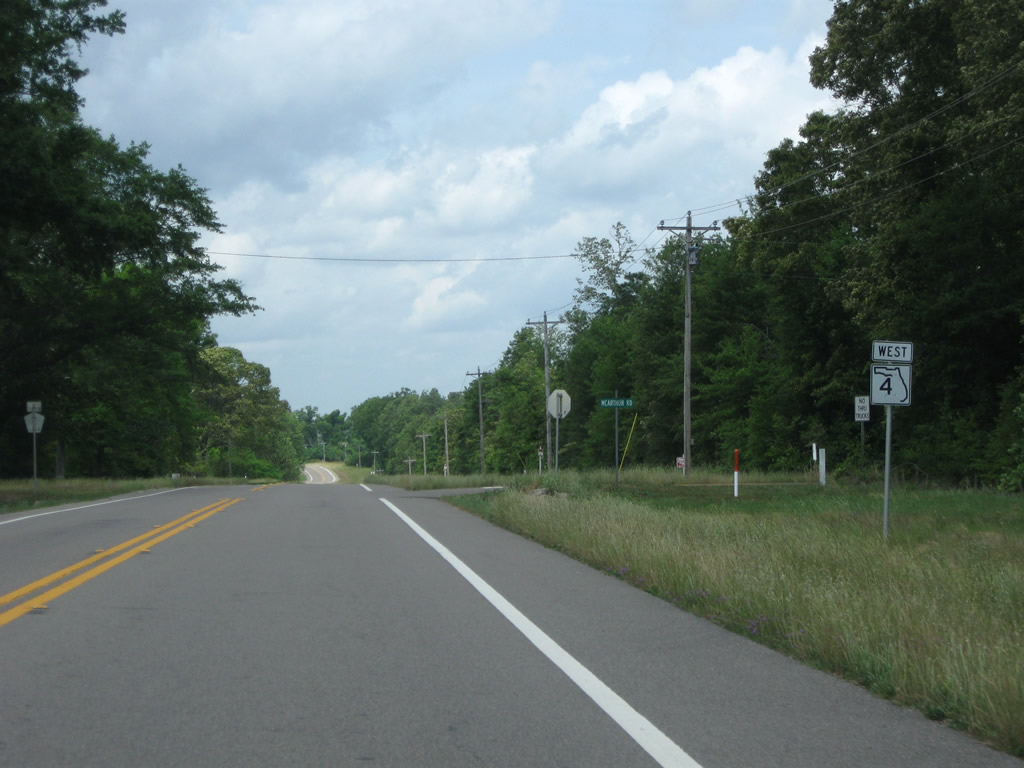
| Heading almost due west, SR 4 leaves the intersection with Market Road and approaches the West Fork of Big Coldwater Creek. 05/03/09 |
|
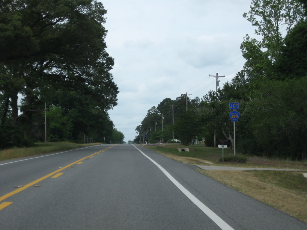
| County Road 399 loops northwest 7.08 miles from SR 87 at Whitfield to end at SR 4, east of Jay. 05/03/09 |
|
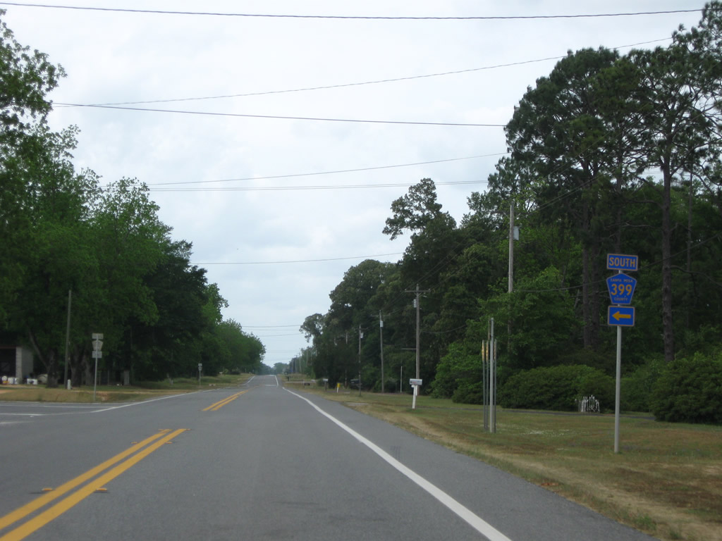
| Westbound at the Country Mill Road section of Santa Rosa County Road 399. Two other segments of CR-399 exist below Eglin Air Force Base to link Navarre with Midway to the west and Navarre Beach to the south. 05/03/09 |
|
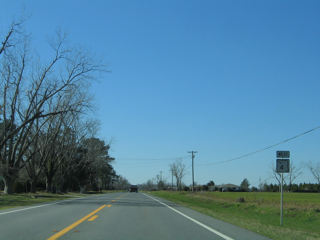
| The northernmost segment of County Road 399 follows Tractor Trail north from SR 87 to SR 89 at Carmel. This view looks after Tractor Trail along SR 4 west. 02/07/06 |
|
| A mile west of CR-399 north, SR 4 enters the city limits of Jay. Jay is a farming community with a population of less than 750. 02/07/06 |
|
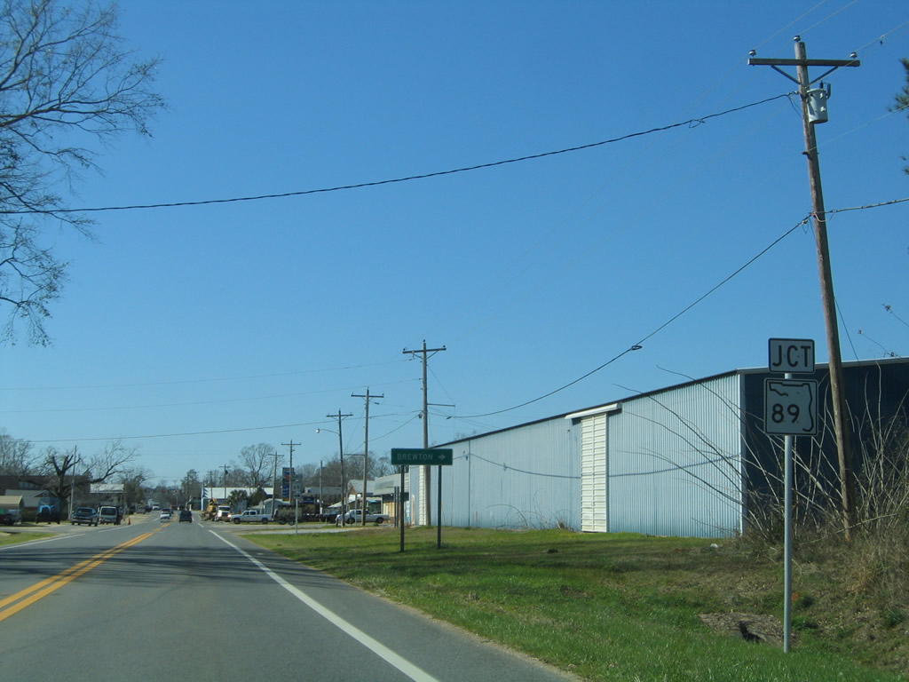
| SR 89 enters Jay from Mt. Carmel to the northeast. The state road along with Escambia County Road 55 in Alabama, connects Jay with Riverview and Brewton via Alabama 41. 02/07/06 |
|
| SR 89 ventures 4.03 miles northward from SR 4 in Jay to end at the state line and County Road 55. 02/07/06 |
|
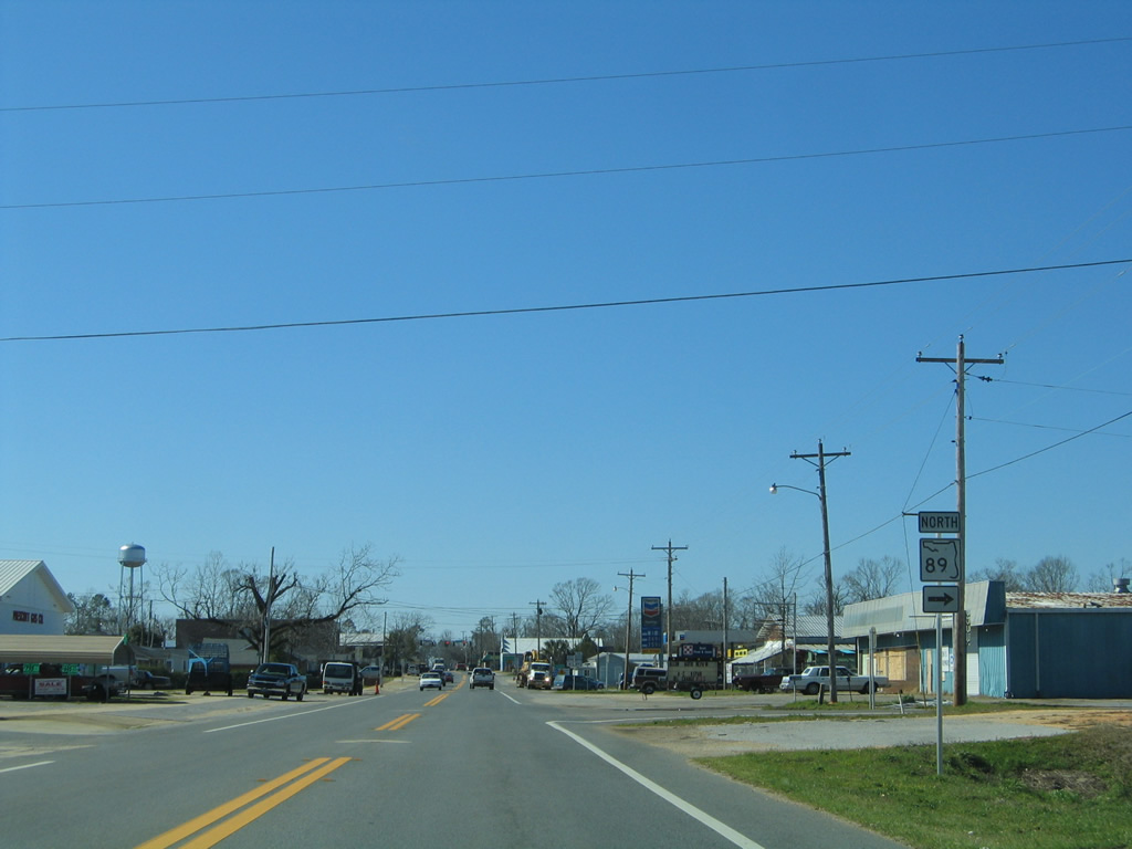
| SR 89 south joins SR 4 west for 0.187 miles to Alabama Street in Jay. 02/07/06 |
|
| One block before the only traffic light (Commerce Street) in Jay, SR 89 turns southward onto Alabama Street. Alabama Street north represents the northernmost stretch of Santa Rosa County Road 197, which provides a cutoff to SR 89 north from downtown. SR 89 south leads away from Jay and splits with CR-197; CR-197 heads southwest to Brownsdale, Chumuckla and Pace while SR 89 turns southeast to Point Baker and Milton. 02/07/06 |
|
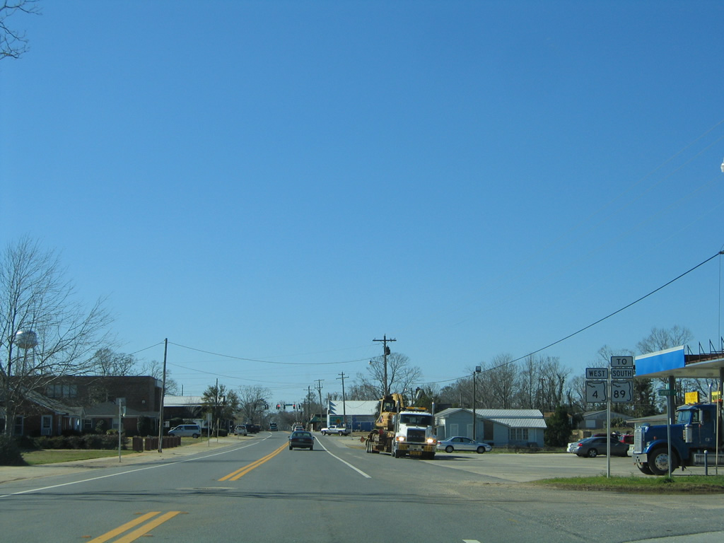
| Leaving downtown Jay, SR 4 continues from Commerce Street (County Road 197A) for a seven mile drive to Century. 10/06/12 |
|
| State Road 4 lowers dramatically, at least for Florida standards, from a bluff above the Escambia River. 04/13/12 |
|
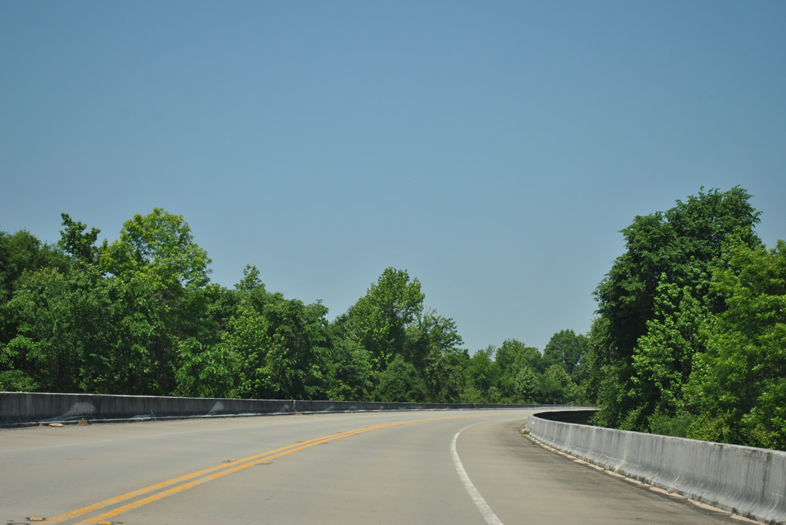
| Entering a realigned stretch of SR 4, where the state road shifts southward from its original alignment onto a 1996-opened 1.2 mile viaduct. 04/13/12 |
|
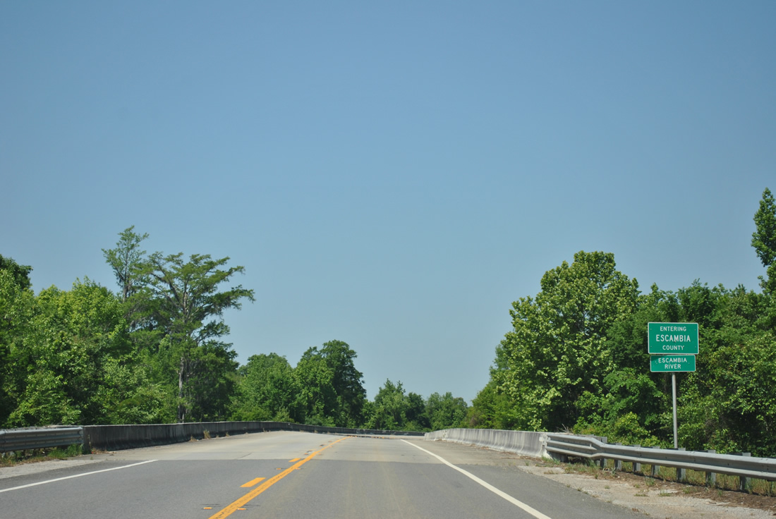
| Curving northward ahead of the Escambia River, which formally marks the Escambia and Santa Rosa County line across SR 4. 04/13/12 |
|
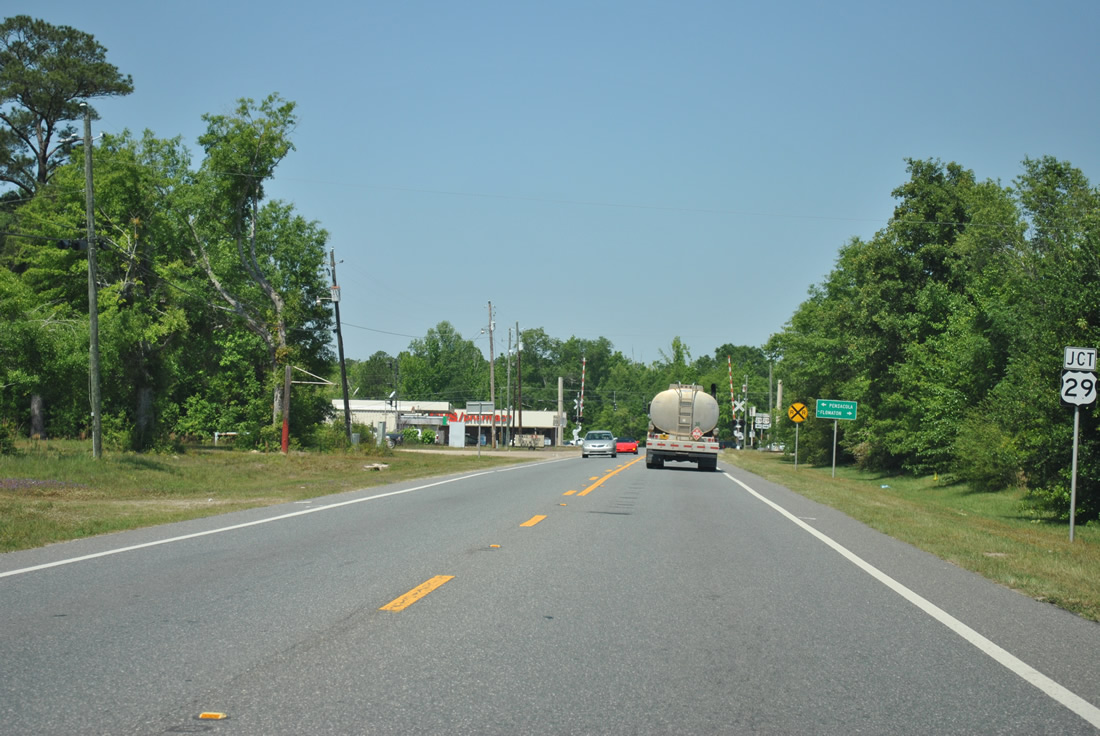
| Within the city limits of Century now, SR 4 (Jay Road) nears the western terminus at U.S. 29 (Century Boulevard). 04/13/12 |
|
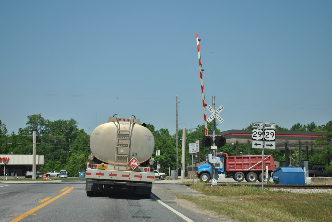
| Drivers must cross a CSX Railroad line before entering the signalized intersection with U.S. 29 (Century Boulevard). U.S. 29 comprises a five lane arterial both through Century and adjacent Flomaton, Alabama. 04/13/12 |
|
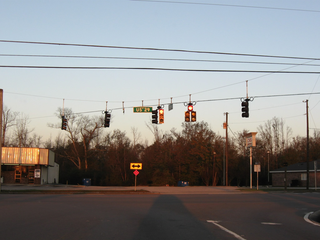
| An unobstructed view of the west end of SR 4. U.S. 29 joins Century with Brewton, Alabama to the northeast and Cantonment, Ensley and Pensacola at its southern terminus. Connections with Alabama 113 lead motorists northward to Interstate 65 and Montgomery. 12/19/09 |
02/07/06, 06/06/06, 05/02/09, 05/03/09, 12/19/09, 04/13/12, 10/06/12, 11/03/12 by AARoads
Page Updated 11-26-2012.