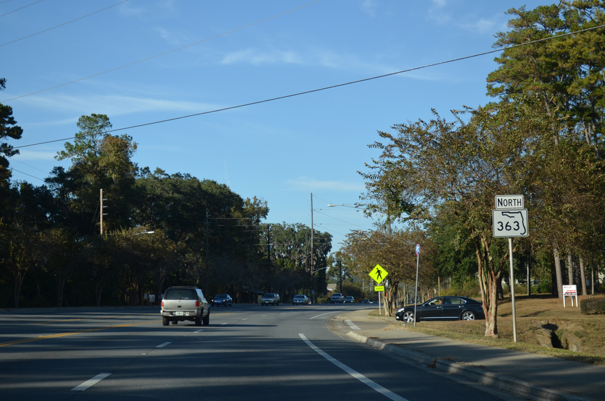
Traveling north-south, Florida State Road 363 begins in the city of St. Marks by the St. Marks River. The state road follows a rural routing northward to Wakulla and Woodville, two unincorporated communities, into Leon County. Once in Tallahassee, SR 366 transitions into an urban boulevard, first following Woodville Highway, and then swapping places with SR 61 along Adams Street into the center of the city.
SR 363 travels 20.04 miles from St. Marks in Wakulla County to Van Buren Street on the south side of Downtown Tallahassee. A one-way couplet carries a branch of SR 363 west along Bronough and Duval Streets for 0.518 miles southbound and 0.506 miles northbound. The couplet includes viaducts above a CSX Railroad line, Van Buren Street and FAMU Way.
|
| A short distance north of Riverside Drive and the St. Marks commercial area is the first northbound reassurance marker of SR 363. SR 363 follows Port Leon Drive northward to Newport Road near the north edge of town. Newport Road and SR 363 represent the only connections to U.S. 98 from St. Marks. 12/31/06 |
|
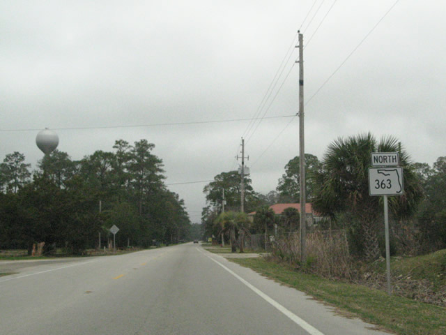
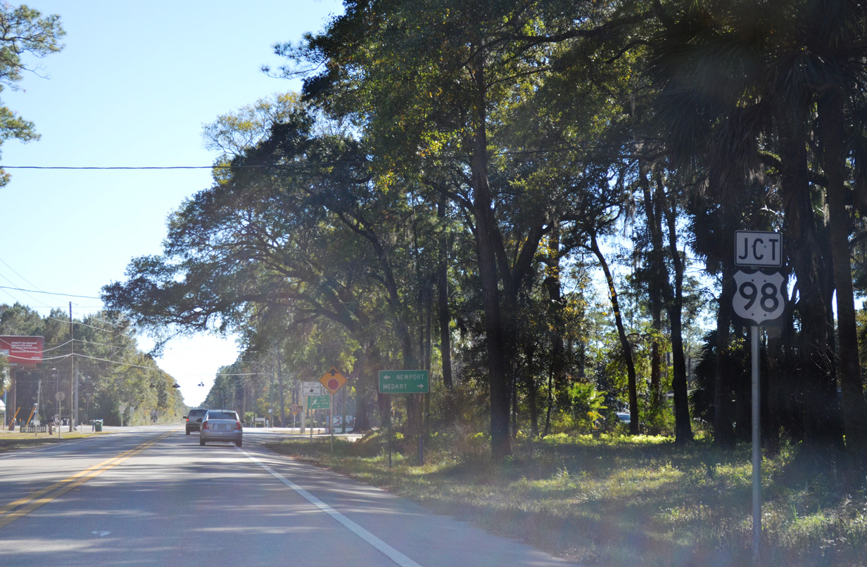
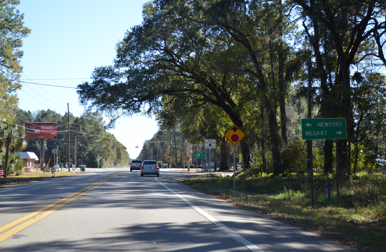
| SR 363 (Port Leon Drive) northbound on the approach to U.S. 98 (Coastal Highway). U.S. 98 travels west to Medart and east to Newport. 12/31/06 |
|
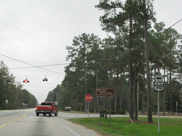
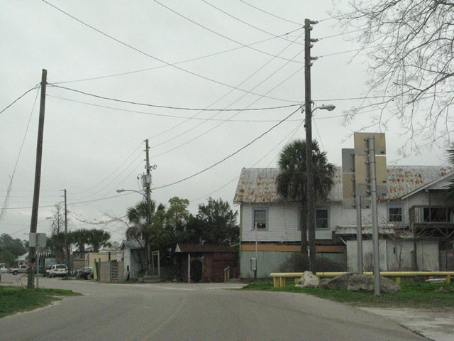
| A set of flashers hang above the SR 363 intersection with U.S. 98. SR 363 continues northward along Woodville Highway to Wakulla, Woodville and ultimately Tallahassee. U.S. 98 east travels a rural route to Perry and west to Sopchoppy and Carabelle. 12/31/06 |
|
| SR 363 overtakes Adams Street northward from SR 61 and Paul Russell Road toward the campus of Florida A&M University. 11/20/14 |
|
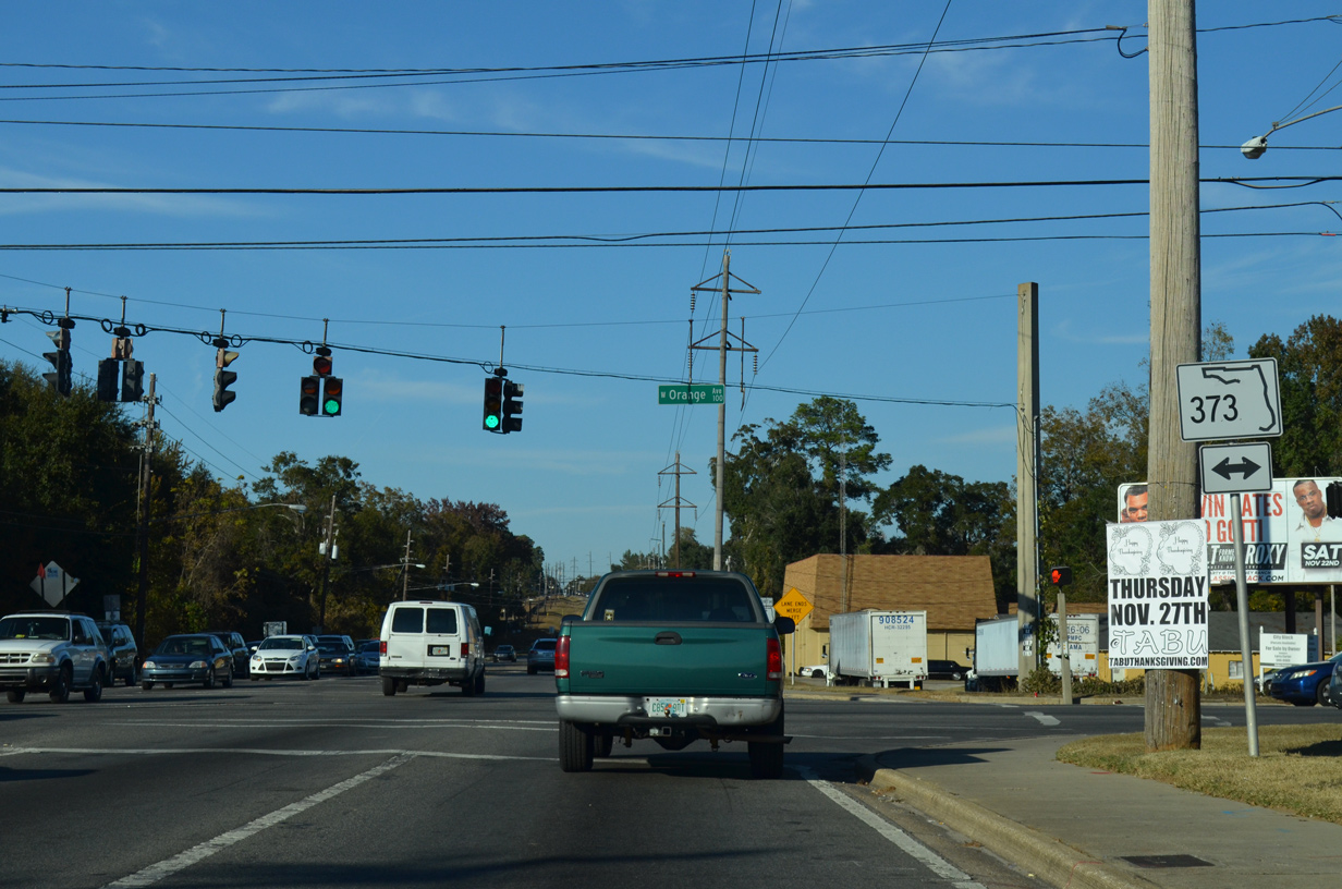
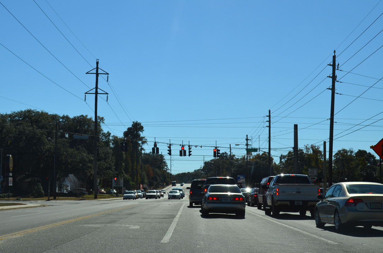
| SR 373 (Orange Avenue) crosses paths with SR 363 (Adams Street) north at the next traffic light. SR 373 travels Orange Avenue for 1.71 miles between adjacent SR 61 (Monroe Street) and the western turn of SR 371 (Lake Bradford Road) ahead of Black Swamp. 11/20/14 |
|
| Adams Street narrows to two lanes north of Orange Avenue (SR 373). SR 363 climbs to intersect Magnolia Drive ahead. 11/20/14 |
|
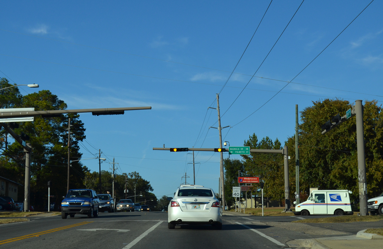
| Magnolia Drive stems east from SR 363 (Adams Street) at Palmetto Street and FAMU to form an arc northeast to U.S. 27 (Apalachee Parkway) by Governor's Square Mall. Magnolia Street east of SR 61 was formerly CR 265. 11/20/14 |
|
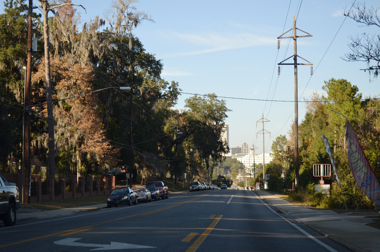
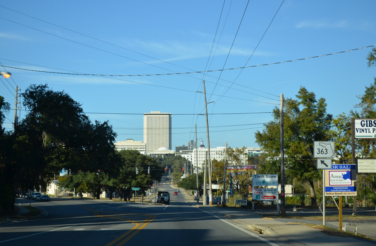
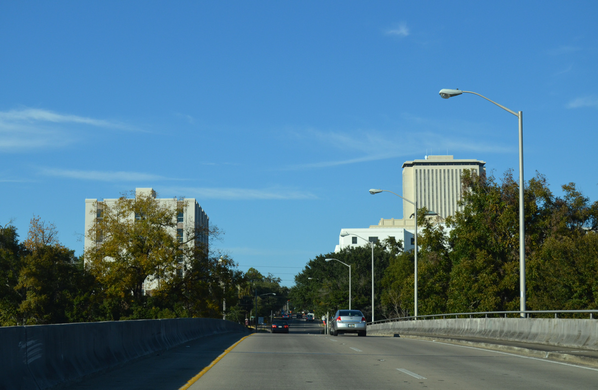
| SR 363 (Adams Street) runs along eastern reaches of the FAMU campus between Barbourville Drive and Palmer Avenue West as the Tallahassee skyline comes into view. 11/20/14 |
|
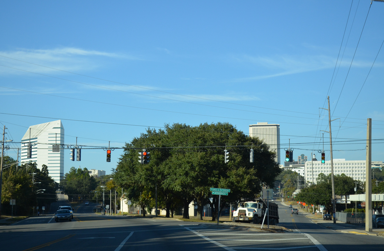
| The signed portion of State Road 373 veers westward from Adams Street onto Bronough Street at Jennings Street east and Jakes & Patterson Street west. 11/20/14 |
|
| Adams Street extends northward at-grade to the Florida State Capitol. An unsigned branch of SR 363 lines the street to Van Buren Street. 11/20/14 |
|
| The final reassurance marker for SR 363 north stands along Bronough Street ahead of Harrison Street. 11/20/14 |
|
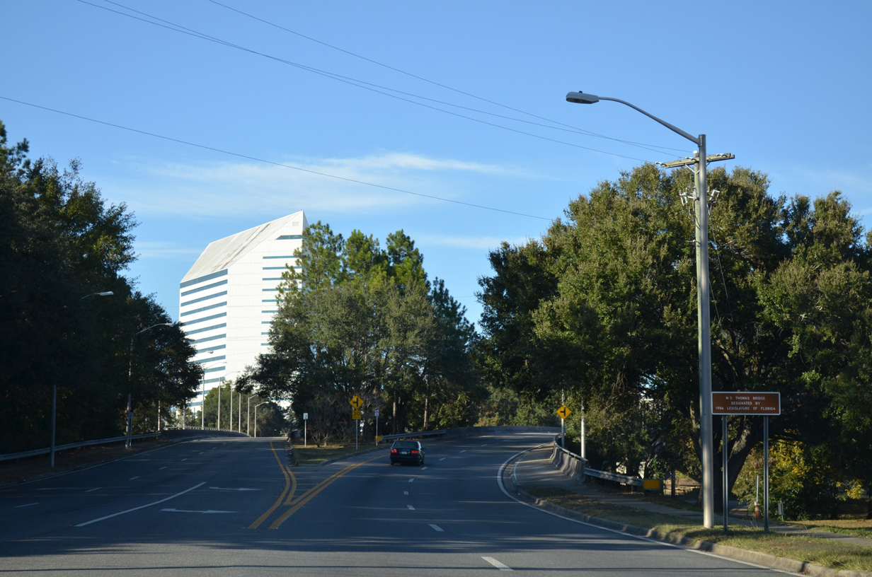
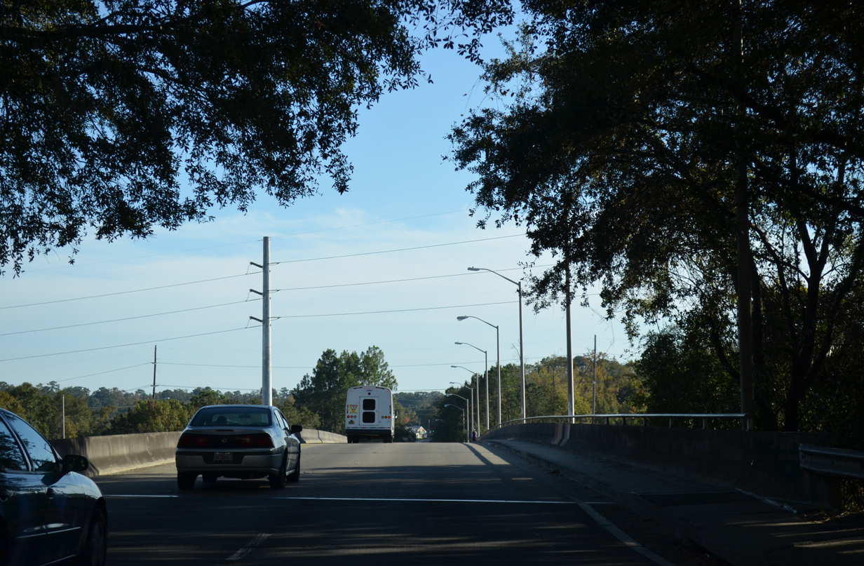
| A pair of viaducts carry SR 363 above FAMU Way, Van Buren Street and a CSX Railroad between Harrison and Blount Streets. The elevated roadways were designated the M.S. Thomas Bridge by the 1986 State Legislature. 11/20/14 |
|
| Northbound SR 363 follows the Duval Street viaduct into southern reaches of Downtown Tallahassee. Both bridges for SR 363 were completed in 1985. 11/20/14 |
|
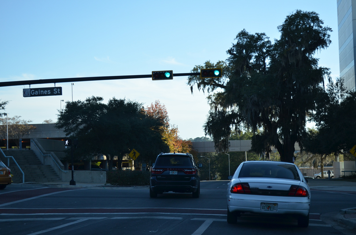
| SR 363 ends at the former route of SR 371 (Gaines Street). SR 371 along Gaines Street was turned over to the city of Tallahassee by 2008. 11/20/14 |
|
| Gaines Street leads west to the Florida State University Campus at Varsity and Stadium Drives by Doak Campbell Stadium and east to Cascades Park at Meridian Street. The portion between Lake Bradford Road and Monroe Street (SR 61) was originally a part of SR 371. 11/20/14 |
|
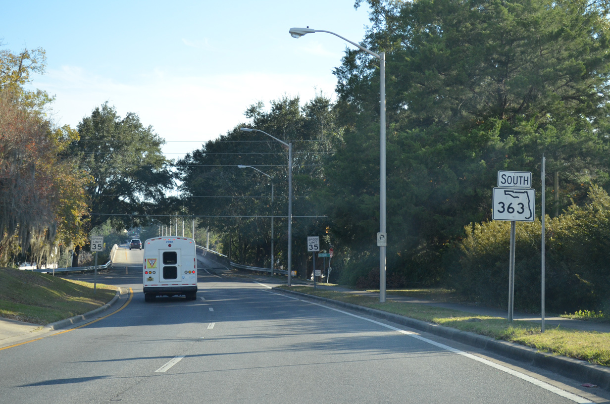
| SR 363 begins at the intersection of Bronough and Gaines Streets in Downtown Tallahassee. Gaines Street formerly was a part of SR 371 west to Lake Bradford Road and east to SR 61 (Monroe Street). 11/20/14 |
|
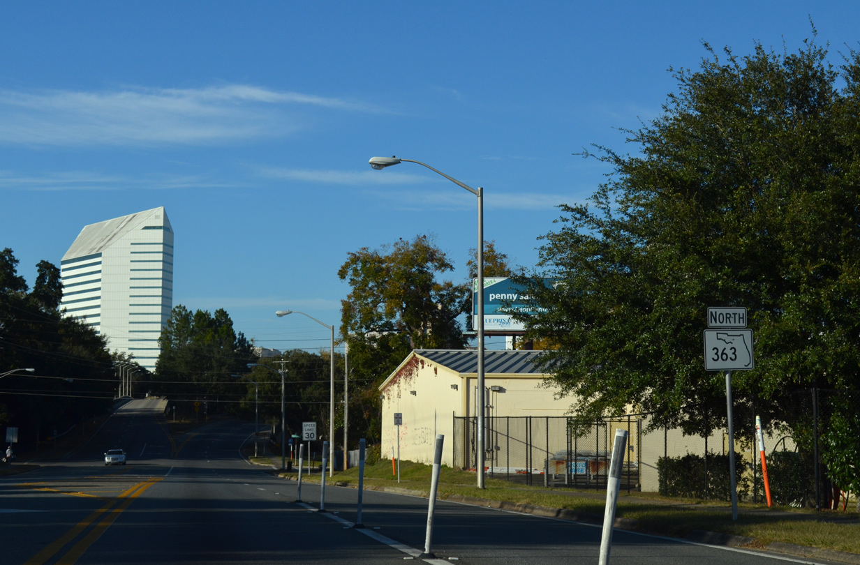
| The first shield for SR 363 south appears along Bronough Street south between Bloxham and Blount Streets. 11/20/14 |
|
| SR 363 (Bronough Street) elevates over a CSX Railroad, Van Buren Street and FAMU Way between Blount Street and Harrison Street. 11/20/14 |
|
| Lowering toward Harrison Street on the 1985-built viaduct for SR 363 (Bronough Street) south. Northbound follows Duval Street to the immediate east. 11/20/14 |
|
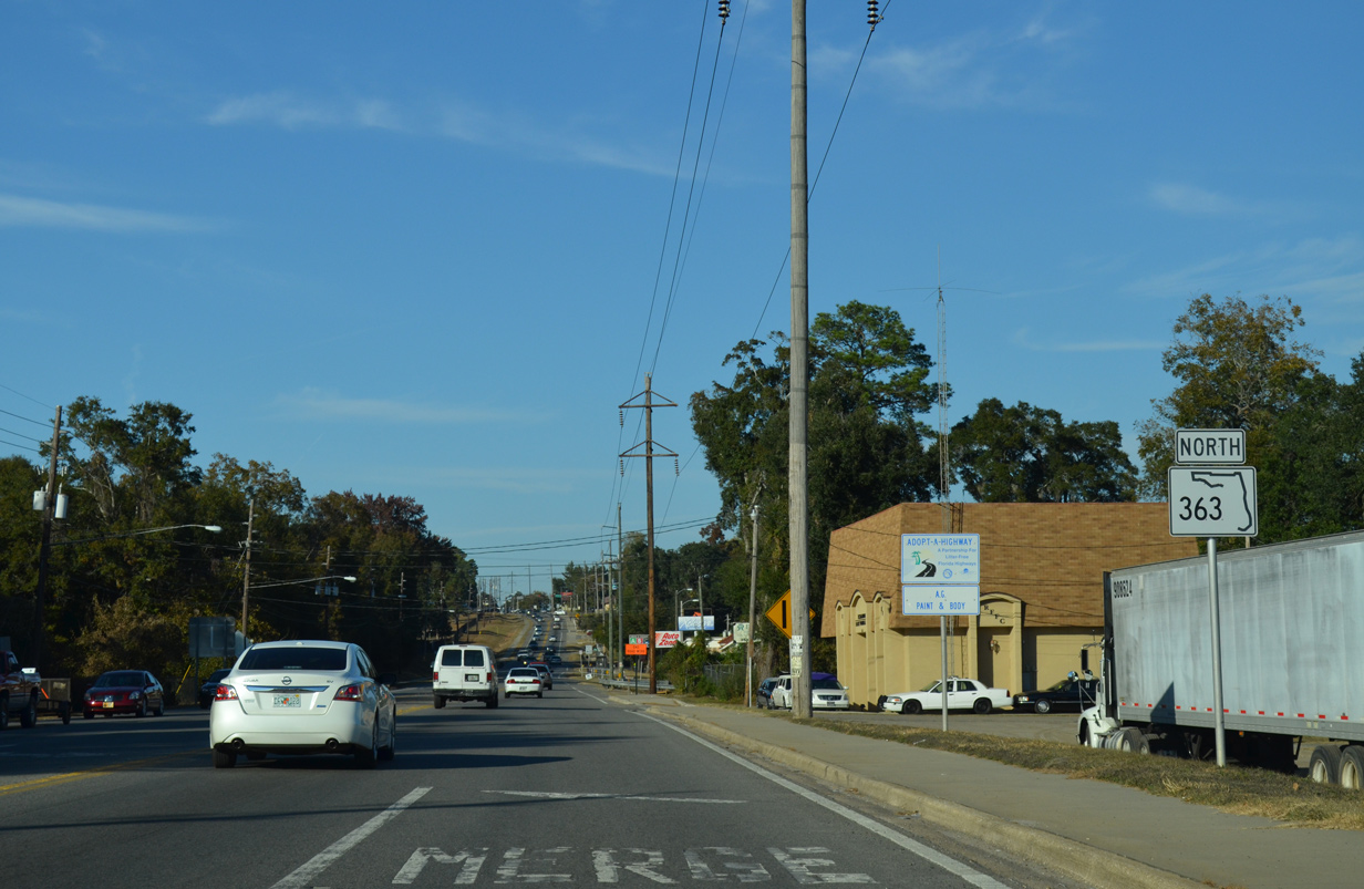
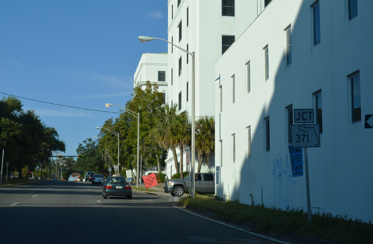
| SR 363 follows Adams Street south along the east side of Florida A&M University to SR 373 (Orange Avenue). SR 373 runs west along FAMU to SR 371 (Lake Bradford Road) and east to become County Road 373 beyond adjacent SR 61 (Monroe Street). 11/20/14 |
|
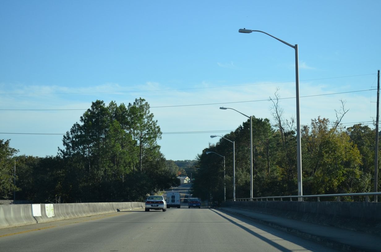
| SR 363 overtakes Monroe Street from SR 61 at Paul Russell Road in south Tallahassee. The state road travels by the Leon County Fairgrounds before transitioning onto Woodville Highway. 11/20/14 |
|
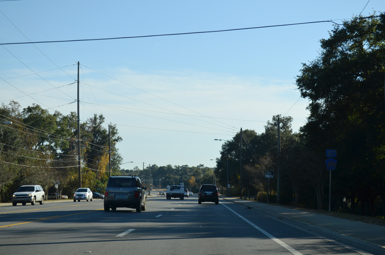
| Junction Leon County Road 259 shield posted along SR 363 (Monroe Street) southbound. County Road 259 follows Tram Road southeast toward the Southwood community and Walton in rural reaches of southeast Leon County. 11/20/14 |
|
| Tram Road departs SR 363 (Monroe Street) southbound at the Leon County Fairgrounds toward Capital Park. Leon County Road 259 is only sparsely signed along Tram Road throughout Leon County, but does connect with Jefferson County Road 259 to provide a through route to Wacisssa, Waukeenah and U.S. 27.
This shield was removed by 2014. 12/31/06 |
|
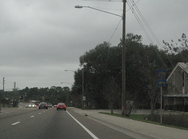
| Gaile Avenue provides the last direct link between SR 363 (Woodville Highway) and adjacent SR 61 (Crawfordville Road) as the pair diverge from one another. The 0.103 mile link doubles as unsigned SR 61A. 11/20/14 |
|
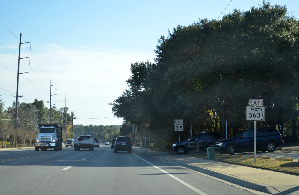
| Leading away from SR 61 (Adams Street / Crawfordville Road), SR 363 (Woodville Highway) reduces from four to two lanes. 11/20/14 |
|
| Ross Road ties into SR 363 (Woodville Highway) east from SR 61 (Crawfordville Road) on the south side of Tallahassee. 11/20/14 |
|
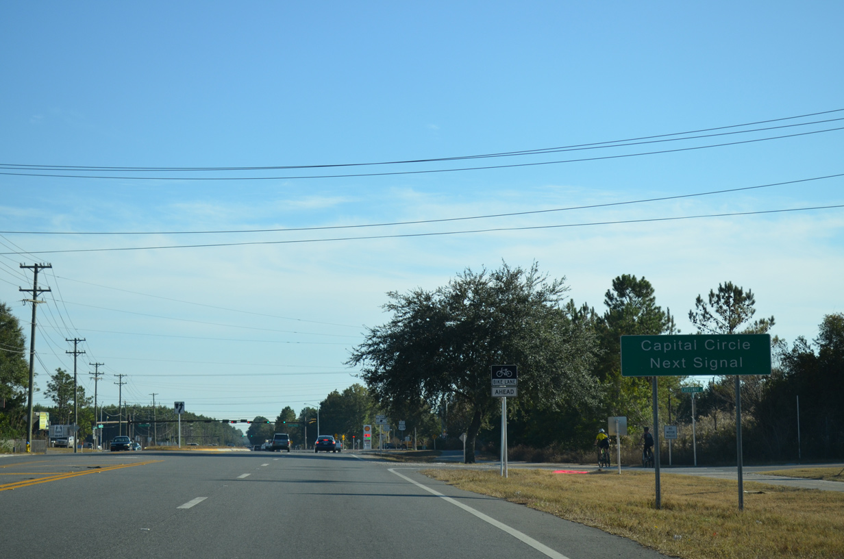
| Nearing U.S. 319 (Capital Circle Southeast) on SR 363 (Woodville Highway) southbound. Woodville Highway widens briefly into a four lane highway at Capital Circle Southeast.
A distance sign posted here with the distance to Woodville (four miles) and Tallahassee Regional Airport (six miles) was replaced by 2013. 11/20/14 |
|
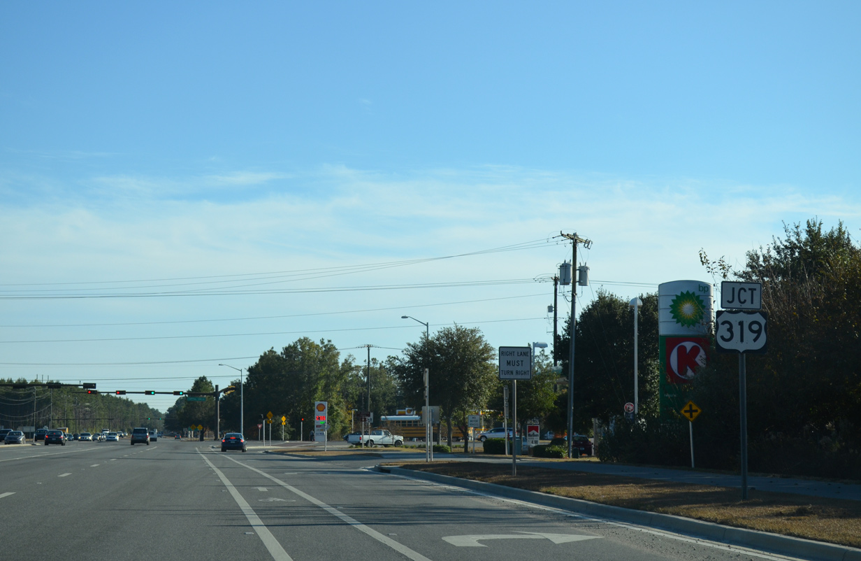
| U.S. 319 shield posted on SR 363 (Woodville Highway) southbound. U.S. 319 follows Capital Circle northeast from SR 61 (Crawfordville Road) to SR 61 (Thomasville Road). The majority of the road consists of a multi-lane commercial arterial. However southern reaches of Capital Circle remain rural by Apalachicola National Forest. 11/20/14 |
|
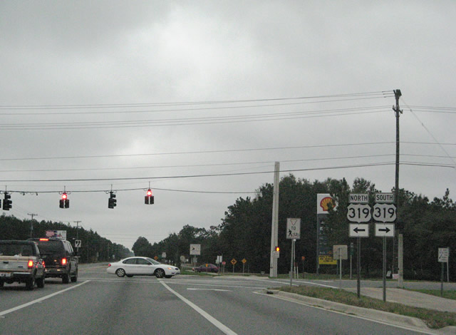
| Capital Circle SW leads toward Tallahassee Regional Airport (TLH) beyond the turn of U.S. 319 onto Crawfordville Road as SR 263. U.S. 319 & SR 61 south take Crawfordville Road toward Crawfordville in Wakulla County. U.S. 319 north meanwhile travels east to Tram Road (CR 259) and north to Blair Stone Road at Southwood. 12/31/06 |
|
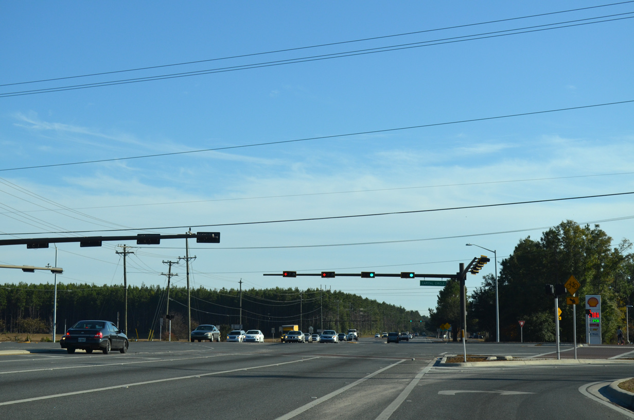
| Entering the expanded intersection with U.S. 319 (Capital Circle Southeast) on SR 363 (Woodville Highway) south. Widening of Capital Circle from two to seven lanes to the west resulted in the removal of the U.S. 319 shield assembly posted along SR 363 south. 11/20/14 |
|
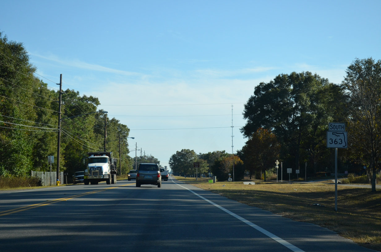
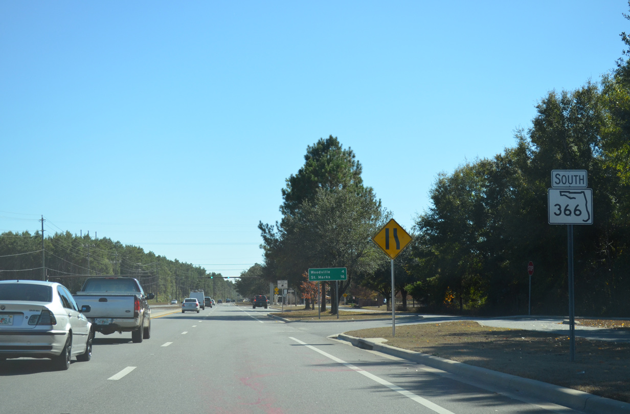
| Signed here incorrectly as SR 366, SR 363 (Woodville Highway) continues south from Capital Circle SE. The forthcoming traffic light lies at the entrance to The Lakes at San Marcos Apartments and the trail head for the Tallahassee - St. Marks Historic Railroad State Trail. 11/26/14 |
|
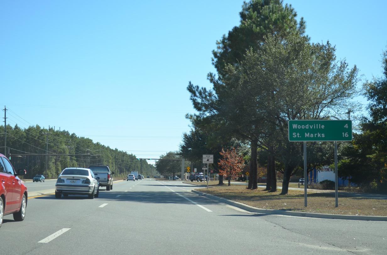
| SR 363 advances southward four miles to Woodville in southern Leon County and 16 miles to end in St. Marks. 11/26/14 |
|
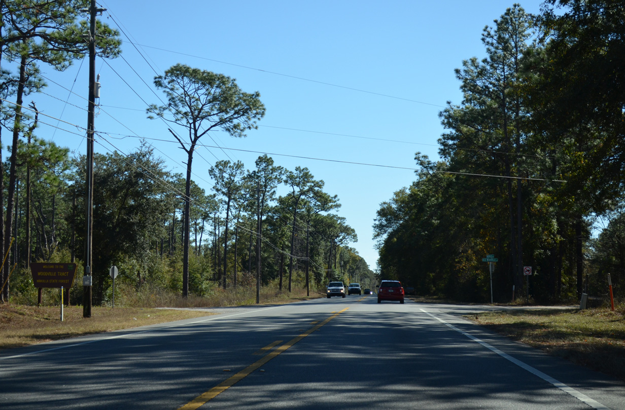
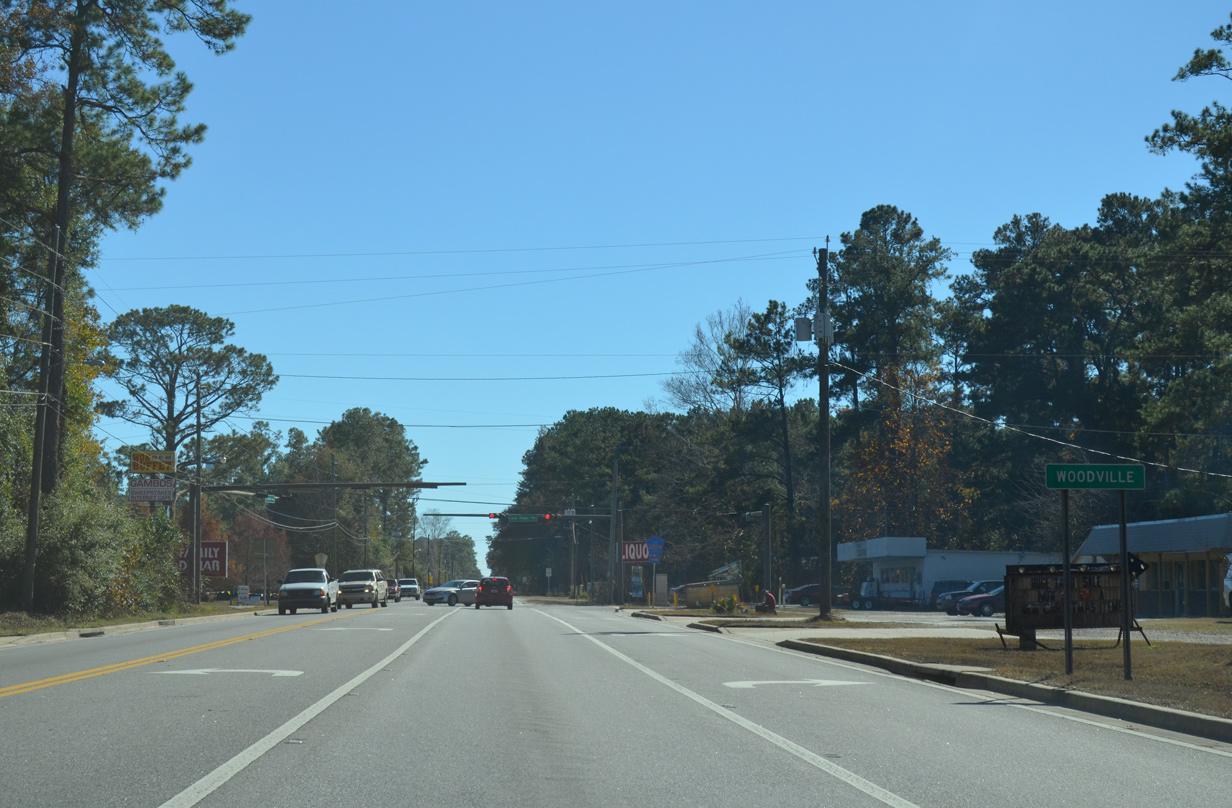
| Woodville Highway leaves the city of Tallahassee to run between Apalachicola National Forest and the Woodville Tract of Wakulla State Forest. 11/26/14 |
|
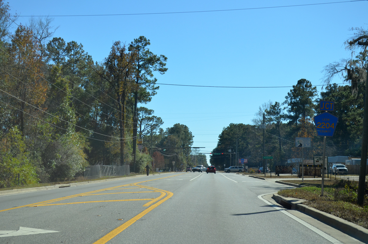
| Like Volusia and Alachua Counties, Leon County utilizes four-digit County Road designations. Pictured here is the junction shield for CR 2204 posted along SR 363 (Woodville Highway) south. 11/26/14 |
|
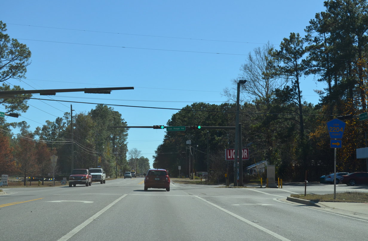
| SR 363 bisects the unincorporated community of Woodville through over the next mile and a half. 11/26/14 |
|
| CR 2204 (Oak Ridge Road) leads west from Woodville to SR 61 (Wakulla Springs Road) near Eight Mile Pond. 11/26/14 |
|
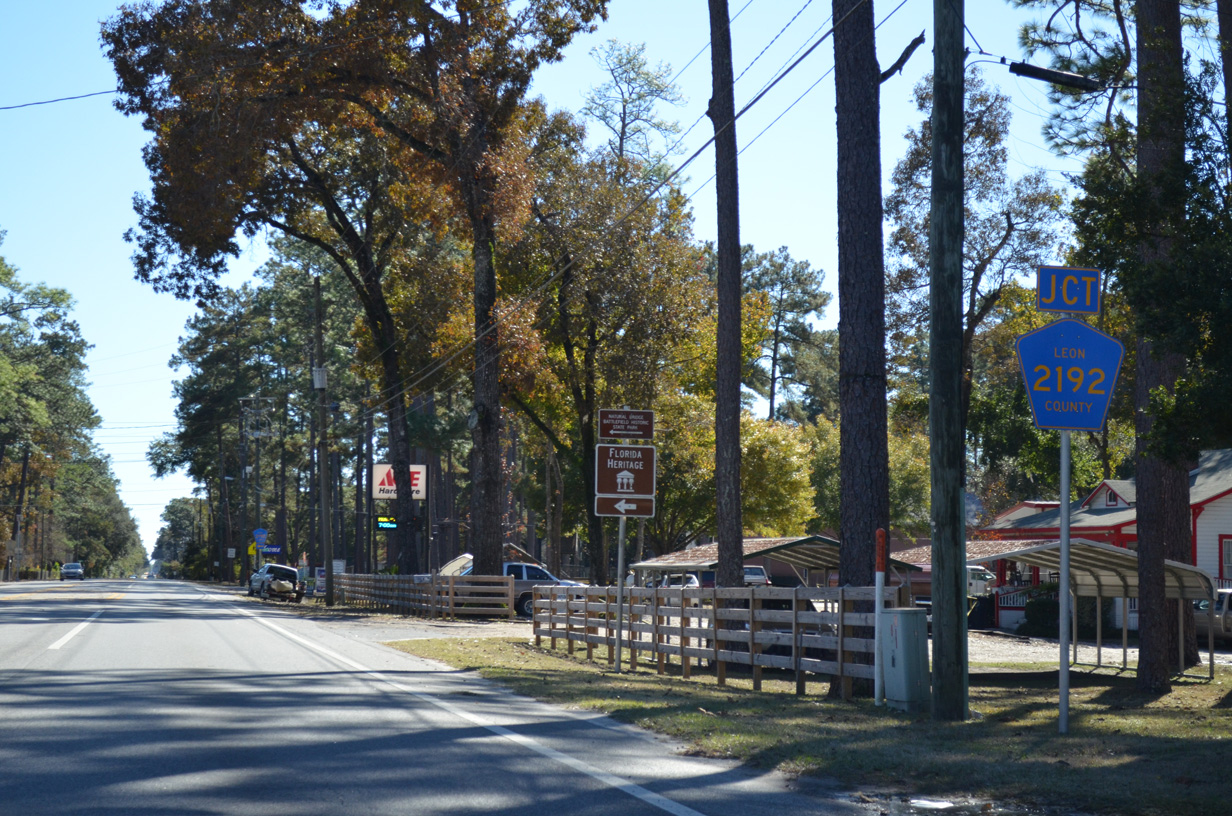
| Leon County Road 2192 (Natural Bridge Road) also ends at SR 363 in Woodville. Natural Bridge Road heads east to Natural Bridge Battlefield Historic State Park in rural southeast Leon County. 11/26/14 |
|
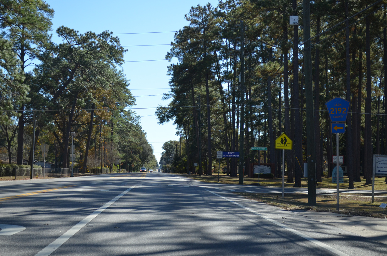
| Southbound SR 363 (Woodville Highway) at Leon County Road 2192 (Natural Bridge Road) east. Natural Bridge Road west ends at nearby Old Woodville Road. CR 2192 totals 10.92 miles east to the Jefferson County line, mostly as an unsigned route. 11/26/14 |
|
| SR 363 leaves unincorporated Woodville and Leon County for Wakulla County. 11/26/14 |
|
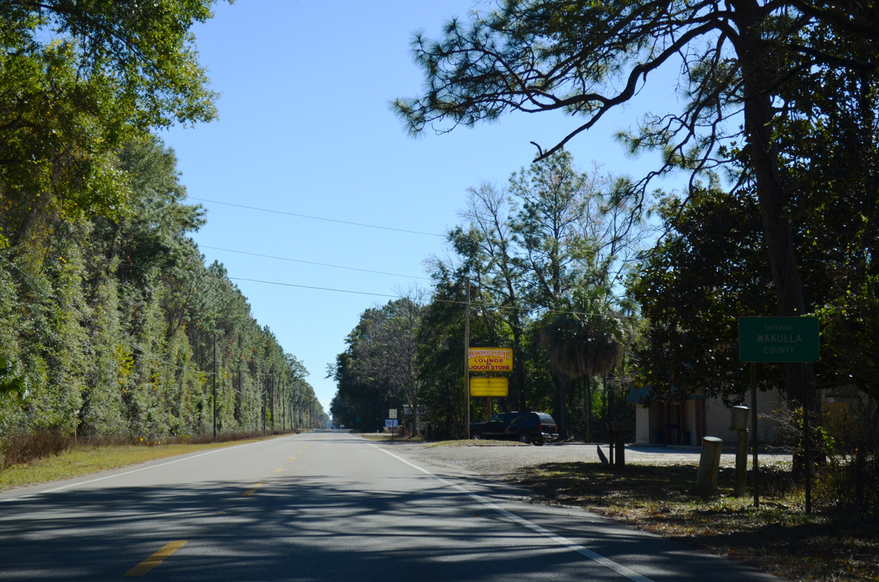
| Less then three miles south of the county line, SR 363 (Woodville Highway) meets SR 267 (Bloxham Cutoff Road) at Wakulla. 11/26/14 |
|
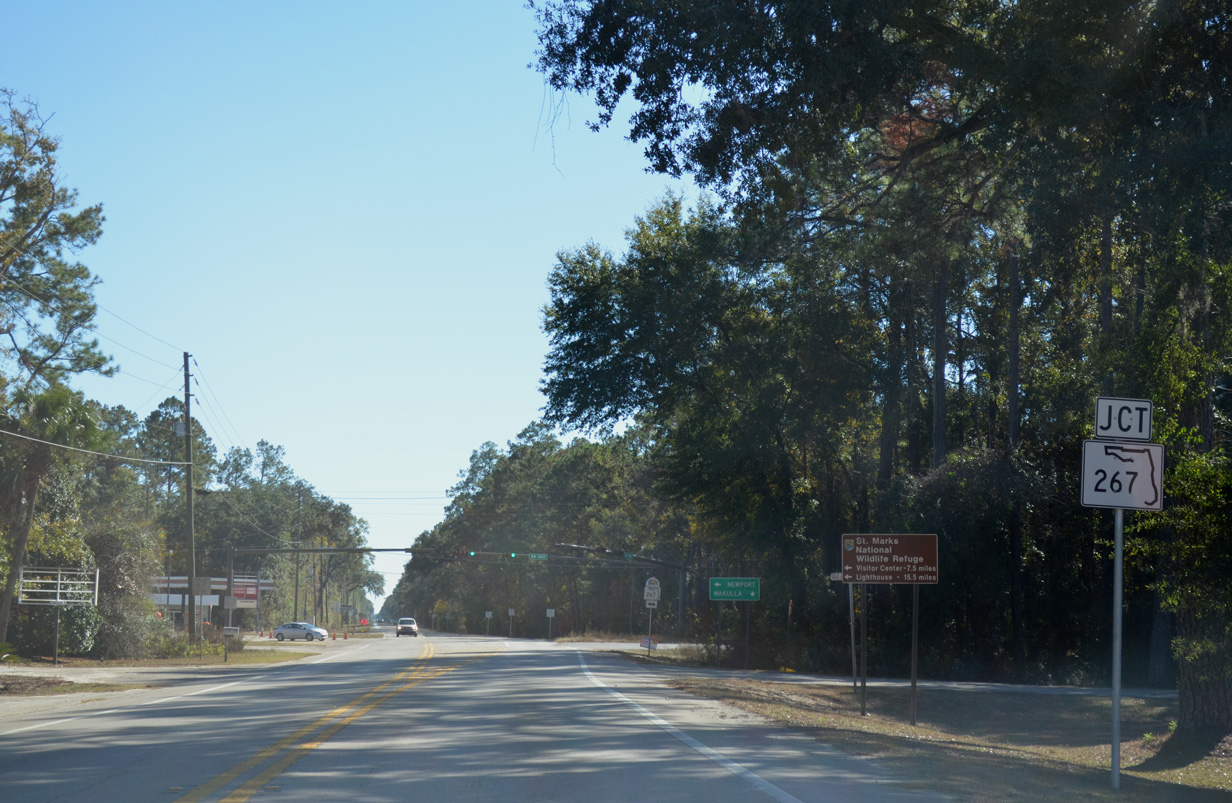
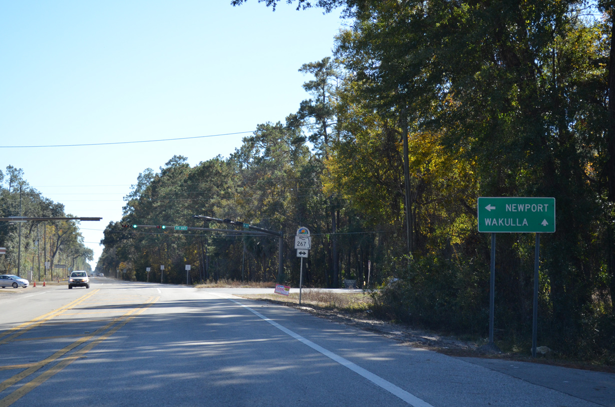
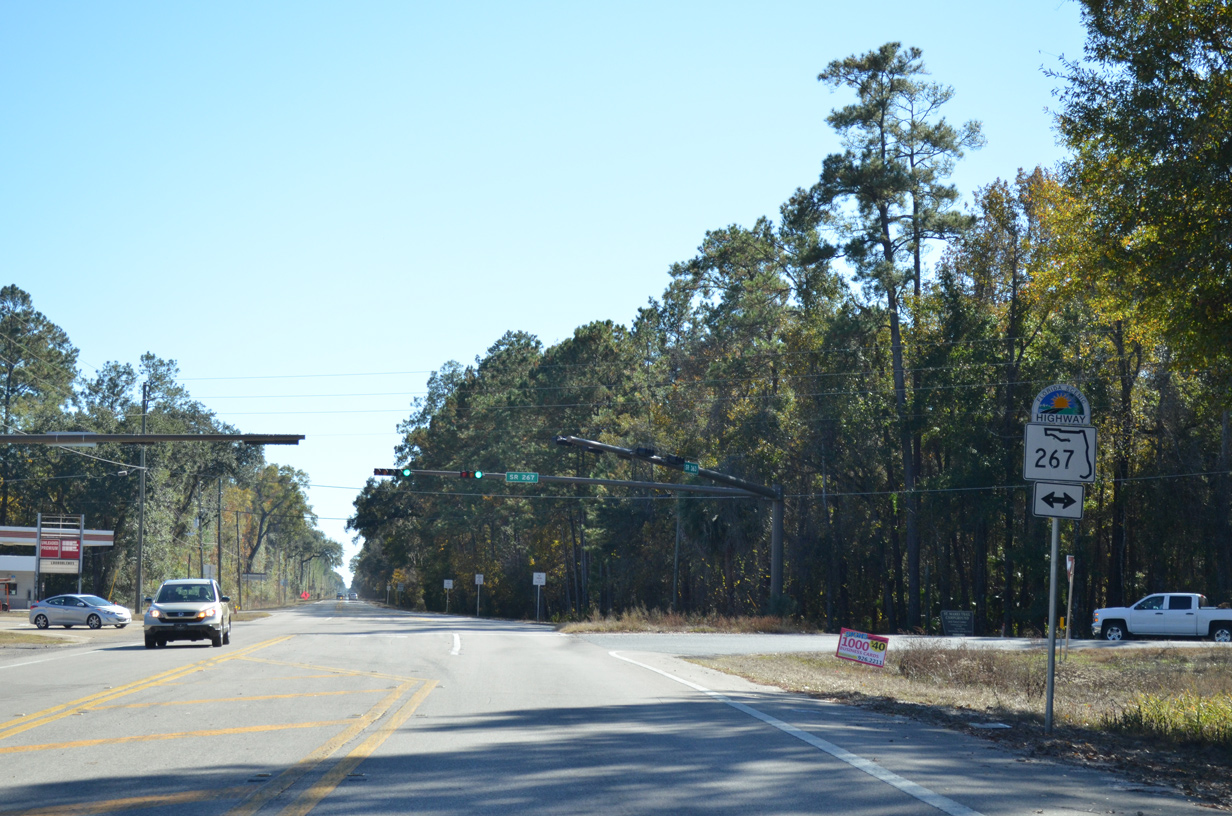
| SR 267 provides a direct connection from SR 20 in western Leon County to U.S. 98 at Newport. St. Marks Wildlife Refuge lies to the southeast via SR 267 and U.S. 98. 11/26/14 |
|
| SR 267 stretches 30.79 miles from U.S. 98 west to SR 20. A north-south branch of SR 267 links SR 20 with U.S. 90 at Quincy as well. Connections with nearby Wakulla County Road 365 lead drivers west to Shadeville and Crawfordville. 11/26/14 |
|
| Continuing southward along SR 363 (Woodville Highway) toward St. Marks and U.S. 98. 11/26/14 |
|
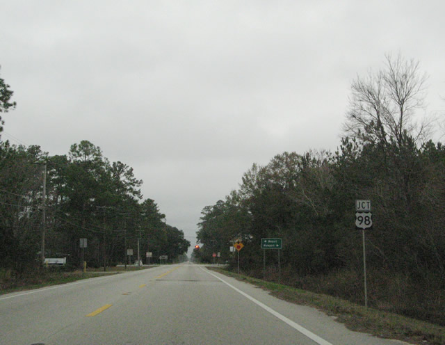
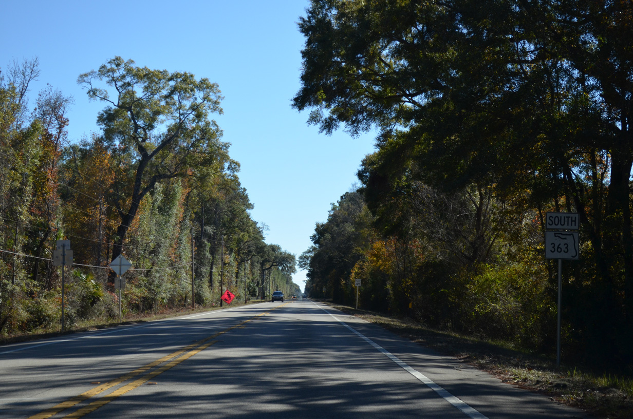
| Nearing the crossroads with U.S. 98 on SR 363 (Woodville Highway) south. U.S. 98 remains a rather rural road through Wakulla County, bypassing the built-up area of Crawfordville to the south. 11/26/14 |
|
| U.S. 98 leads west to the rural communities of Medart (split with U.S. 319 north of Panacea) and east to Newport (merge with SR 267). Wakulla County Road 365 south links U.S. 98 with the coastal communities of Shell Point, Spring Creek and Live Oak Island. 11/26/14 |
|
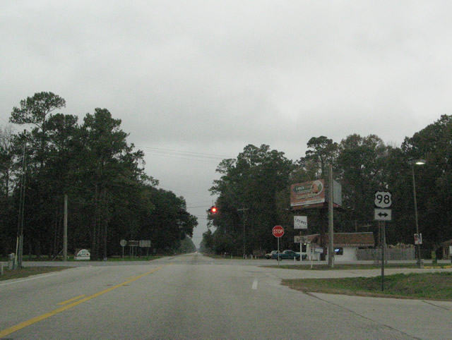
| A set of flashers on SR 363 (Woodville Highway) at U.S. 98. U.S. 98 travels a coastal route throughout the Big Bend and Panhandle of Florida. Eastward the rural highway leads to Perry; U.S. 98 west continues toward Sopchoppy and Apalachicola. 12/31/06 |
|
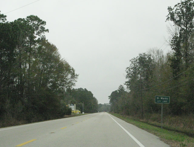
| SR 363 (Port Leon Drive) enters the St. Marks city limits 1.4 miles south of U.S. 98. St. Marks lies at the confluence of the Wakulla and St. Marks River, several miles inland from Apalachee Bay. 12/31/06 |
|
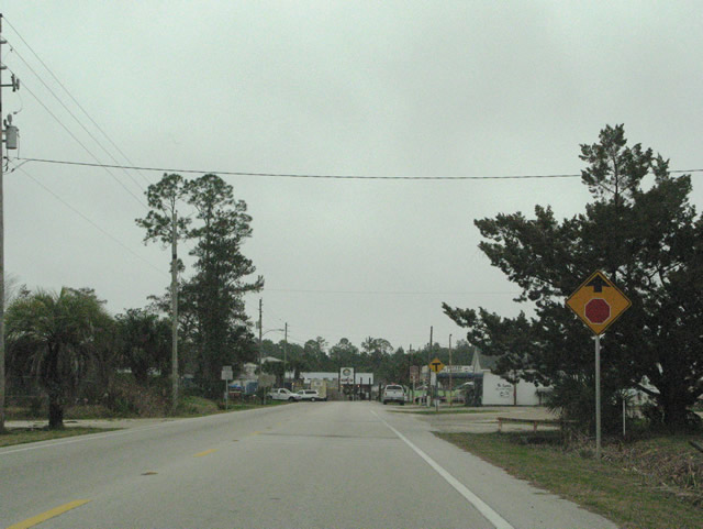
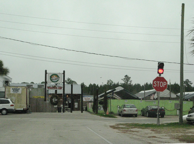
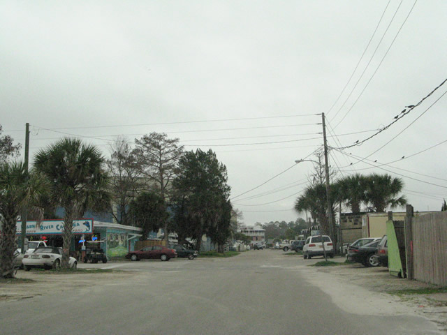
| Nearing the end of Port Leon Drive on SR 363 southbound. SR 363 concludes at the intersection with Riverside Drive in the small business district of St. Marks. 12/31/06 |
|
| SR 363 at Riverside Drive. Riverside Drive east heads to a marina while westbound links with Old Fort Road and San Marcos De Apalache Historic State Park. 12/31/06 |
|
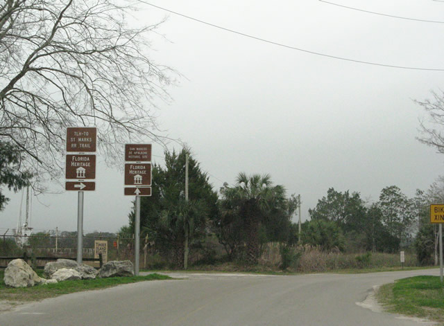
| Riverside Drive west at the transition into Old Fort Road. Forthcoming is San Marcos De Apalache Historic State Park and the beginning of the Tallahassee-St. Marks Historic Railroad State Trail. 12/31/06 |
|
| Old Fort Road eastbound at the turn onto Riverside Drive in St. Marks. Riverside Drive travels a short distance to SR 363 (Port Leon Drive) and Tallahassee Avenue before ending at a marina on the St. Marks River. 12/31/06 |
|
| Riverside Drive east at the northbound beginning of SR 363. The state road follows Port Leon Drive northward to U.S. 98. 12/31/06 |
Photo Credits:12/31/06, 11/20/14, 11/26/14 by AARoads
Connect with:
U.S. 98
U.S. 319
State Road 61
State Road 267
Page Updated 05-05-2015.