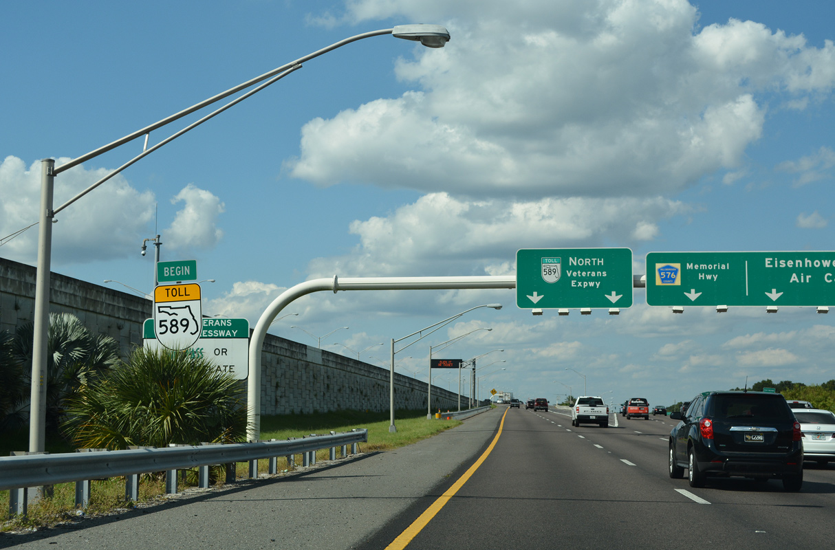
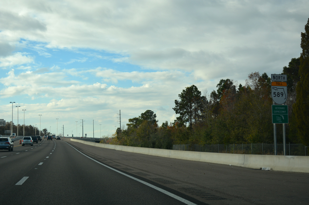
Separate roadways depart SR 60 west for SR 589 north at the three-wye interchange with Courtney Campbell Causeway west. The inner roadway splits from the SR 60 (Memorial Highway) mainline while the outer roadway starts from the I-275 northbound off-ramp and TPA Airport interchange.
|
| The outer roadway of SR 60 (Memorial Highway) west connects I-275 north with SR 616 (Spruce Street) west, Tampa International Airport (TPA) and SR 589 north to Memorial Highway (CR 576). 01/13/17 |
|
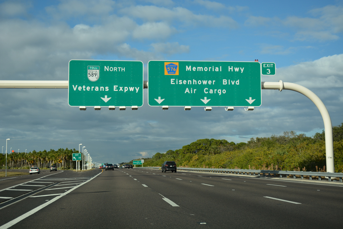
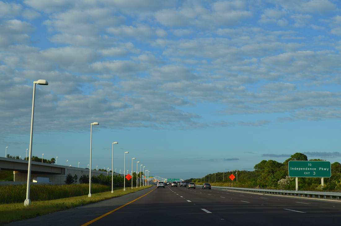
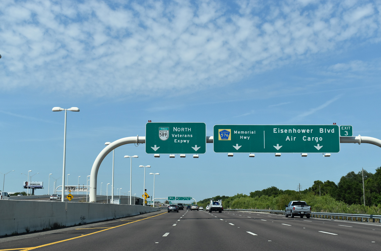
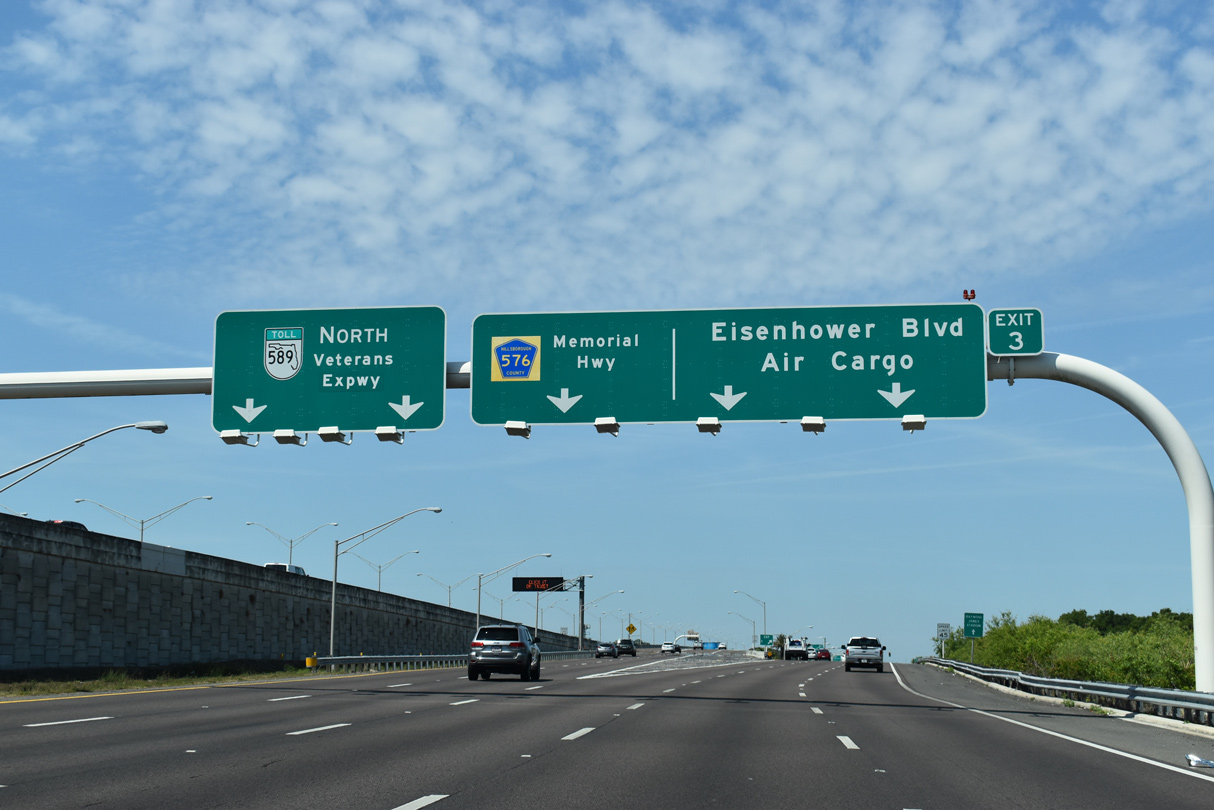
| Exit 3 connects the outer roadway of SR 589 with Memorial Highway (CR 576) west to George Road south for Independence Parkway. 11/05/13 |
|
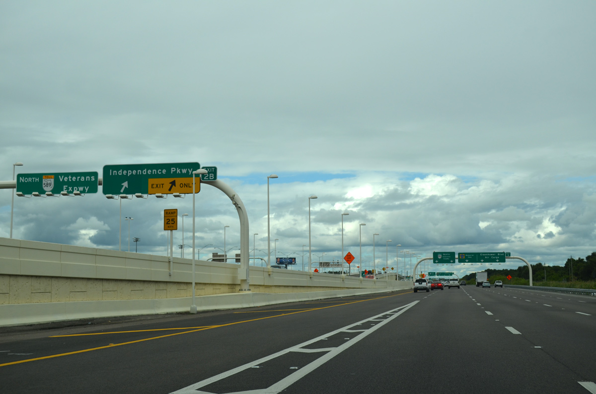
| Independence Parkway branches west from the SR 589 inner roadway to Memorial Parkway (CR 576) via Exit 2B. 10/05/15 |
|
| Three lanes depart from the outer roadway of SR 589 north for the continuation of Memorial Highway west to Town 'N' Country and Eisenhower Boulevard, an east side frontage road to SR 580 (Hillsborough Avenue). 04/03/20 |
|
| A begin shield for State Road 589 precedes the Exit 3 gore point. 09/27/21 |
|
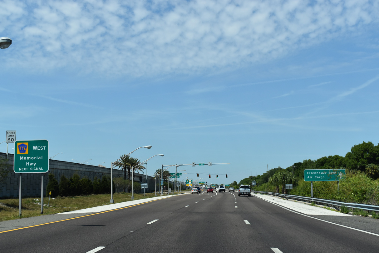
| A mostly unsigned route, CR 576 follows Memorial Highway 2.65 miles west to SR 580 (Hillsborough Avenue) and CR 589 (Shelton Road). Memorial Highway continues northwest from there as a local roadway to the Countryway community. 04/03/20 |
|
| Eisenhower Boulevard extends north with three lanes to the left turn for CR 576 (Memorial Highway) west. A second section of CR 576 is assigned in Hernando County. 04/03/20 |
|
| The diamond interchange (Exit 3) with Eisenhower Boulevard is the only place where Hillsborough County Road 576 is signed for Memorial Highway. 04/03/20 |
|
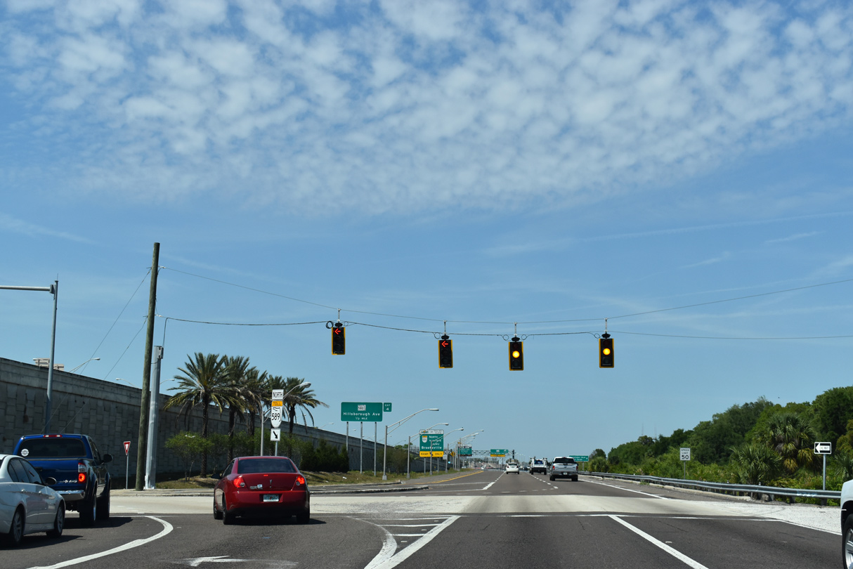
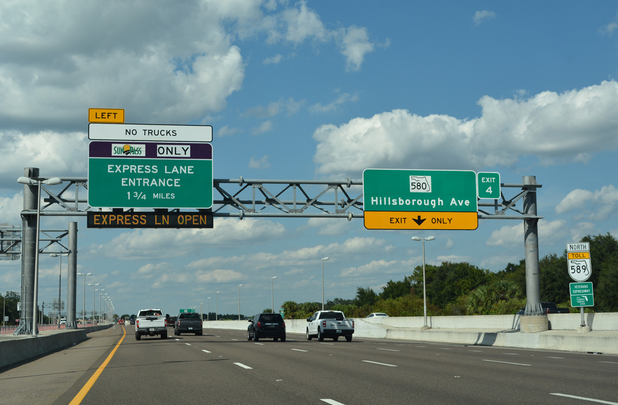
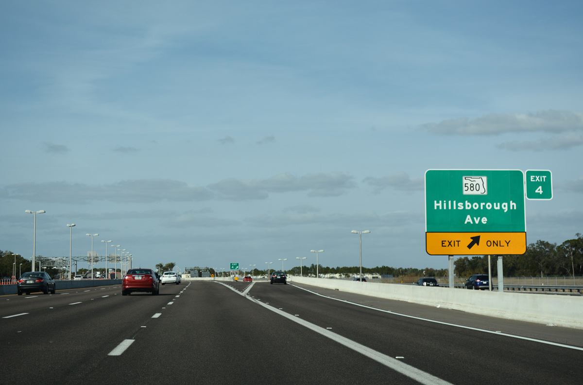
| SR 589 advances north across Memorial Highway (CR 576) to Exit 4 for SR 580 (Hillsborough Avenue). 09/27/21 |
|
| The diamond interchange (Exit 4) with SR 580 utilizes parallel Eisenhower Boulevard to connect with Hillsborough Avenue. 01/26/18 |
|
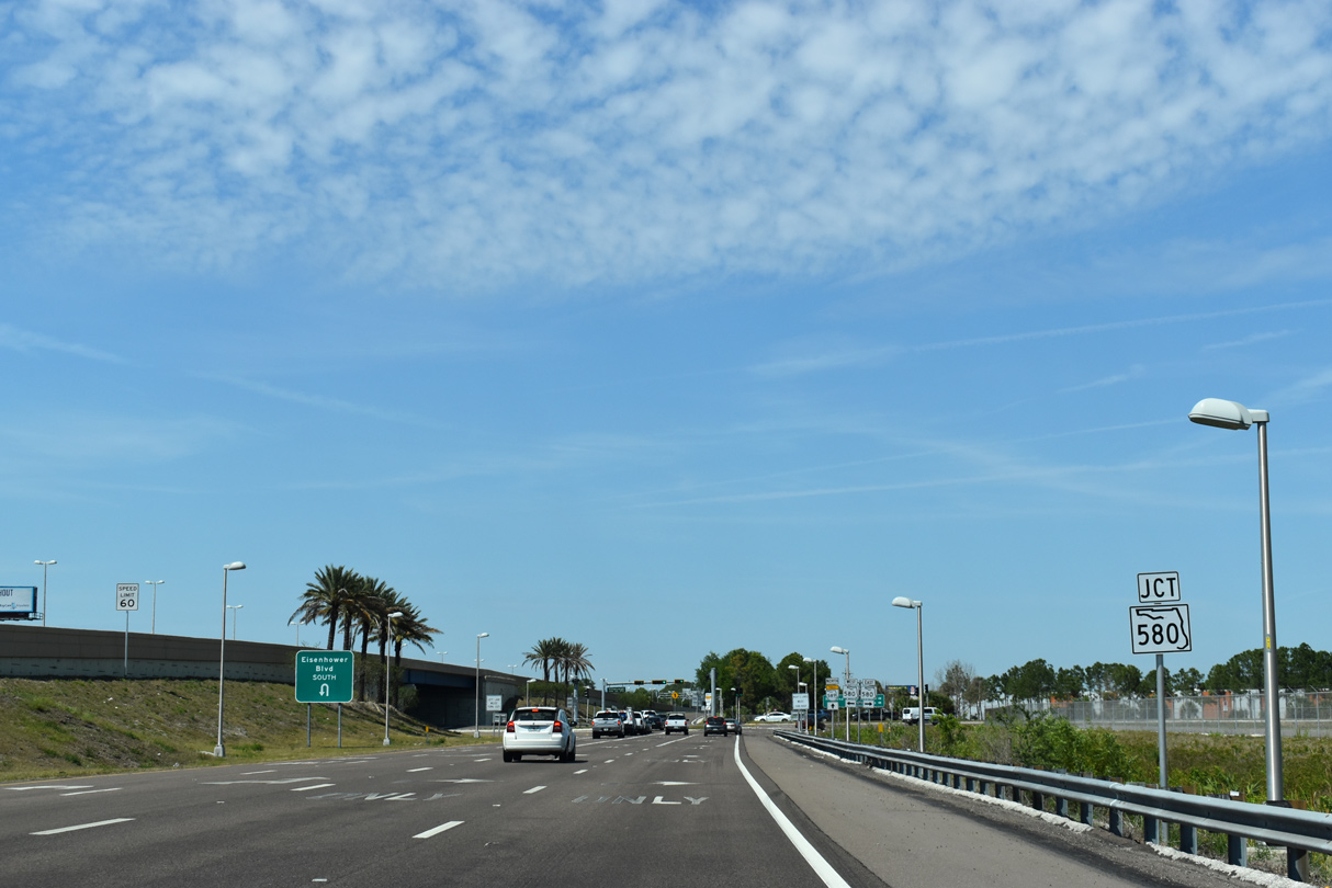
| SR 580 (Hillsborough Avenue) lines the northern periphery of Tampa International Airport (TPA) east from Eisenhower Boulevard to Drew Park in Tampa. 04/03/20 |
|
| West from SR 589, SR 580 (Hillsborough Avenue) leads to Town 'N' Country, Oldsmar, Safety Harbor and Dunedin in Pinellas County. 04/03/20 |
|
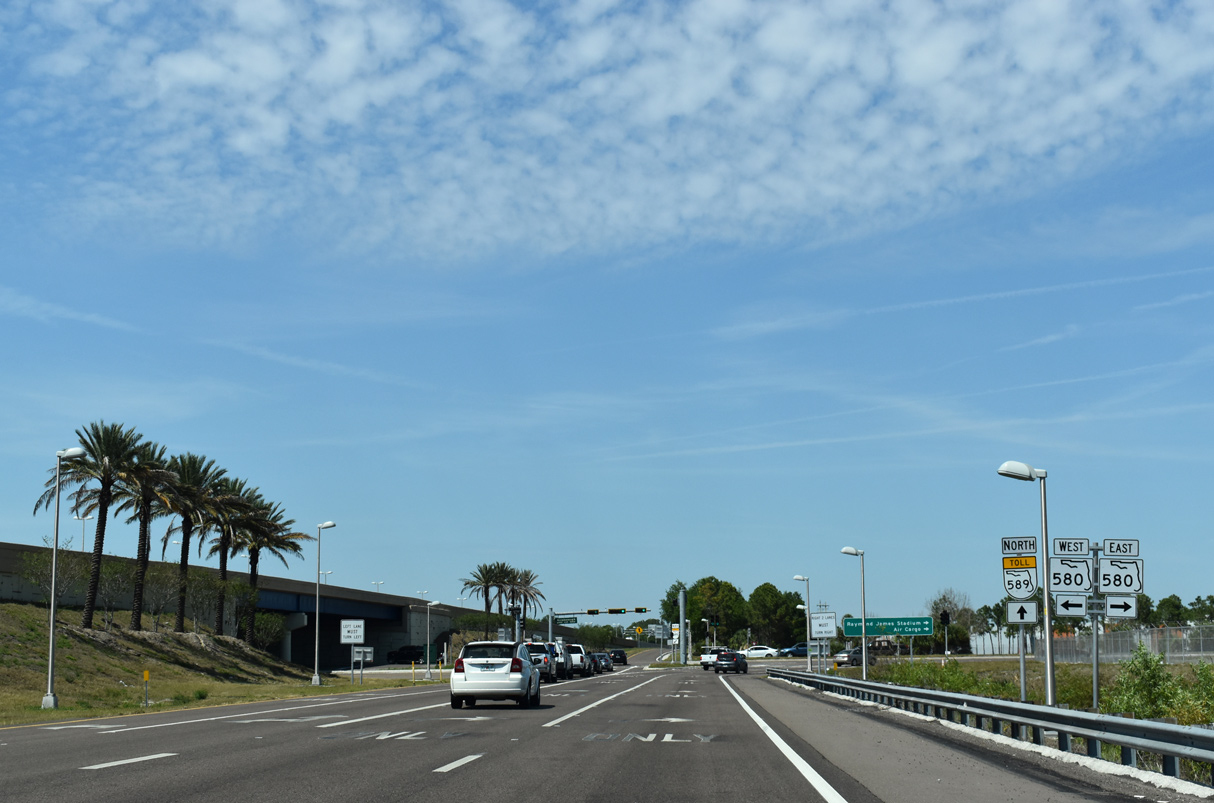
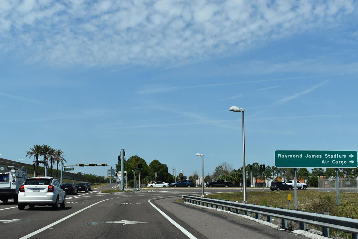
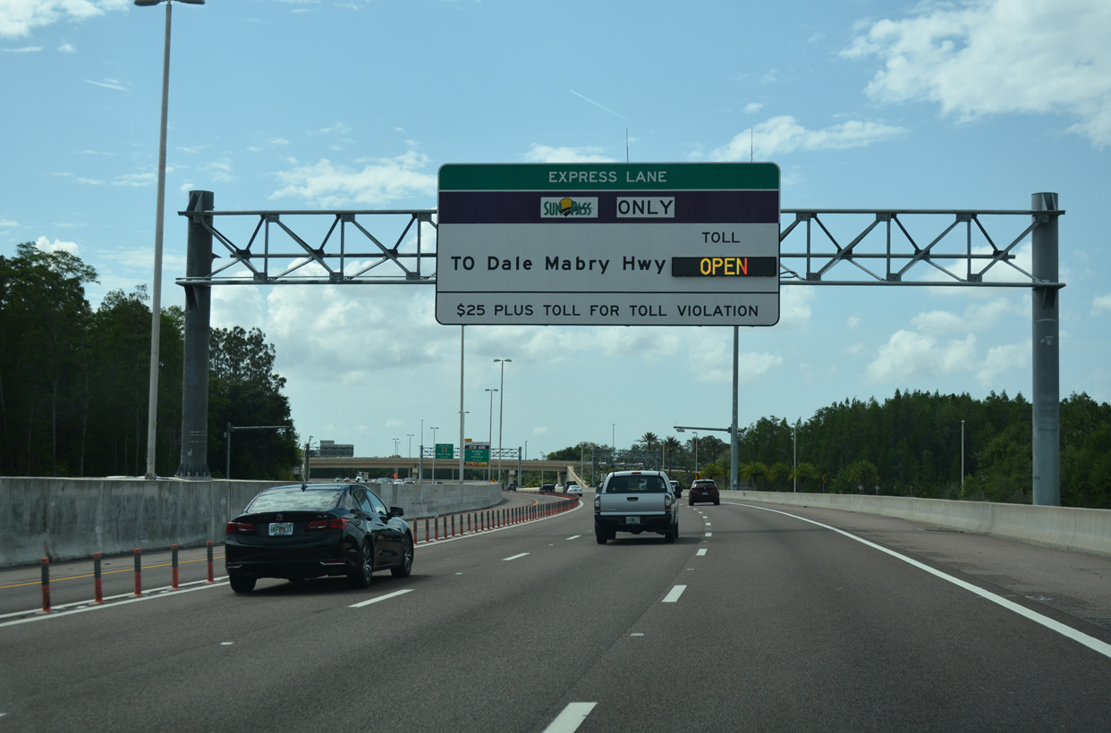
| SR 580 (Hillsborough Avenue) east connects with Air Cargo Road south at Drew Park and Dale Mabry Highway (U.S. 92) south to Raymond James Stadium and north to Carrollwood. 04/03/20 |
|
| Confirming marker for SR 589 north posted after the SR 580 underpass. Prior to the 2013-17 widening, the Veterans Expressway narrowed to four overall lanes at this point. 01/26/18 |
|
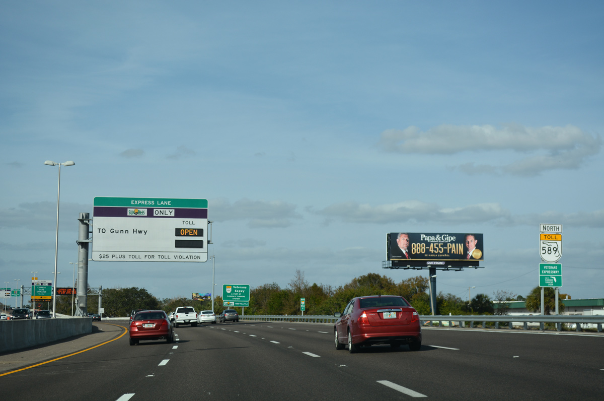
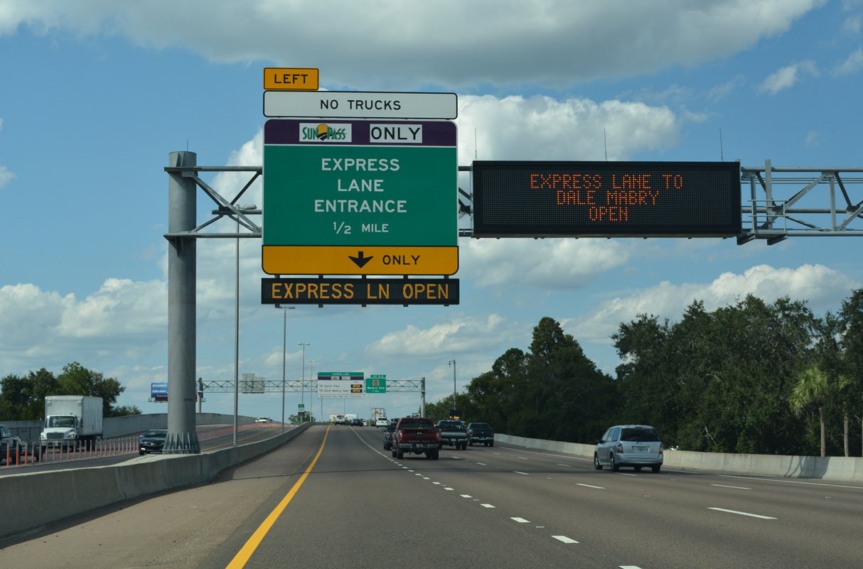
| The Veterans Express Lane begins north of milepost 4 at the Johns Road underpass. Toll rates vary depending upon traffic flow in the general travel lanes. 09/27/21 |
|
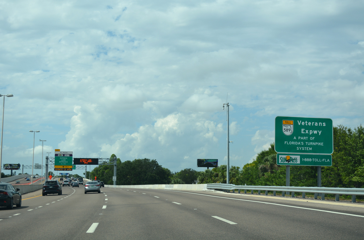
| A sign at the Johns Road underpass identifies SR 589 as a part of Florida's Turnpike System. SunPass is accepted on SR 589, like all other segments of the Florida's Turnpike Enterprise (FTE) operated roads. 05/04/19 |
|
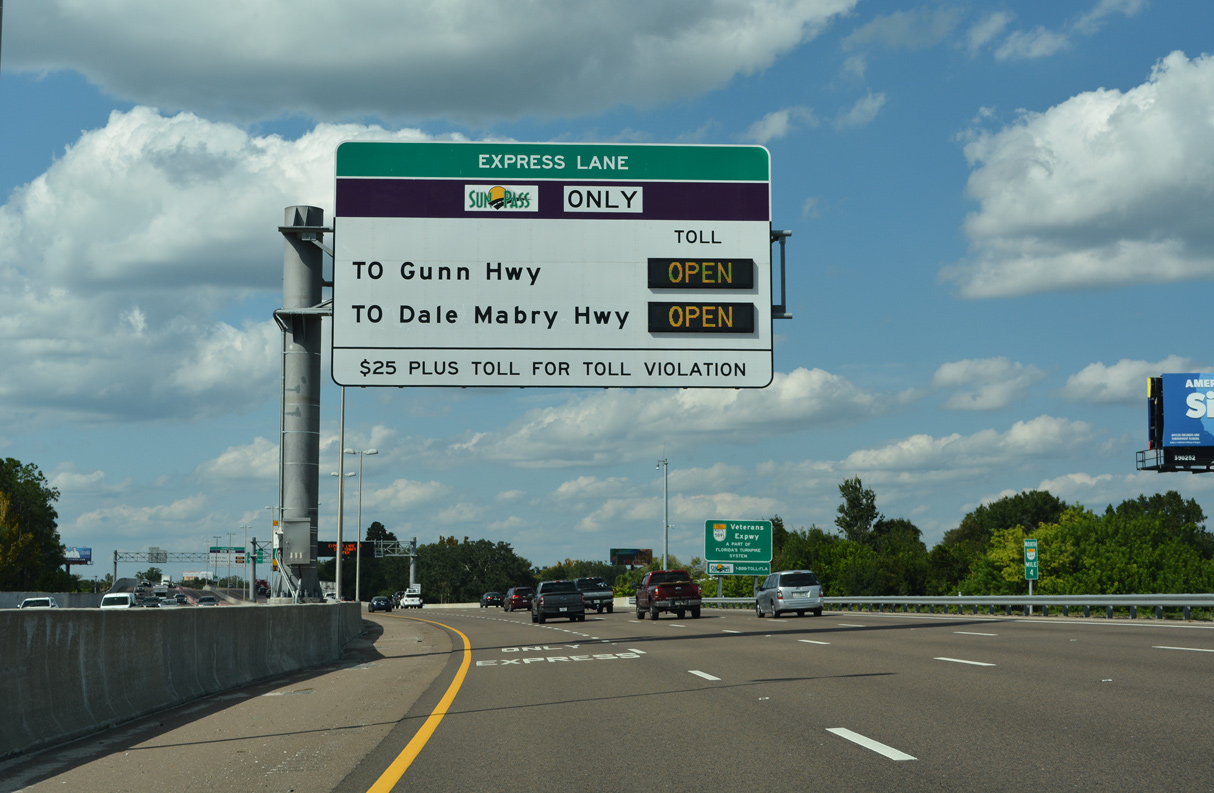
| The forthcoming Express Toll lanes provide uninterrupted travel northward to Gunn Highway (Exit 9). 09/27/21 |
|
| The next two exits along the Veterans Expressway serve the Carrollwood area. 09/27/21 |
|
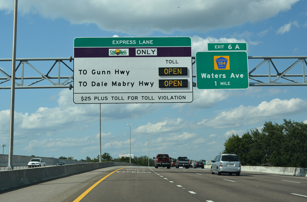
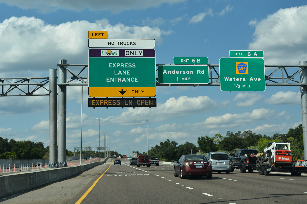
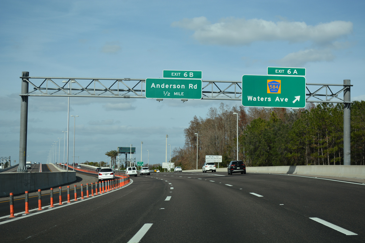
| A diamond interchange (Exit 6A) joins SR 589 with Waters Avenue (CR 584) in one half mile. 09/27/21 |
|
| Measuring 7.22 miles in length, County Road 584 overlays Waters Avenue east to SR 580 (Dale Mabry Highway) south of Carrollwood and west to Countryway. 01/26/18 |
|
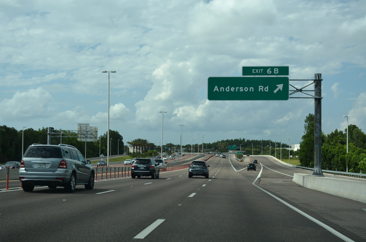
| A wye interchange joins SR 589 north with adjacent Anderson Road. Anderson Road runs north to Carrollwood and south to Sligh Avenue in the Airport industrial area. 05/04/19 |
|
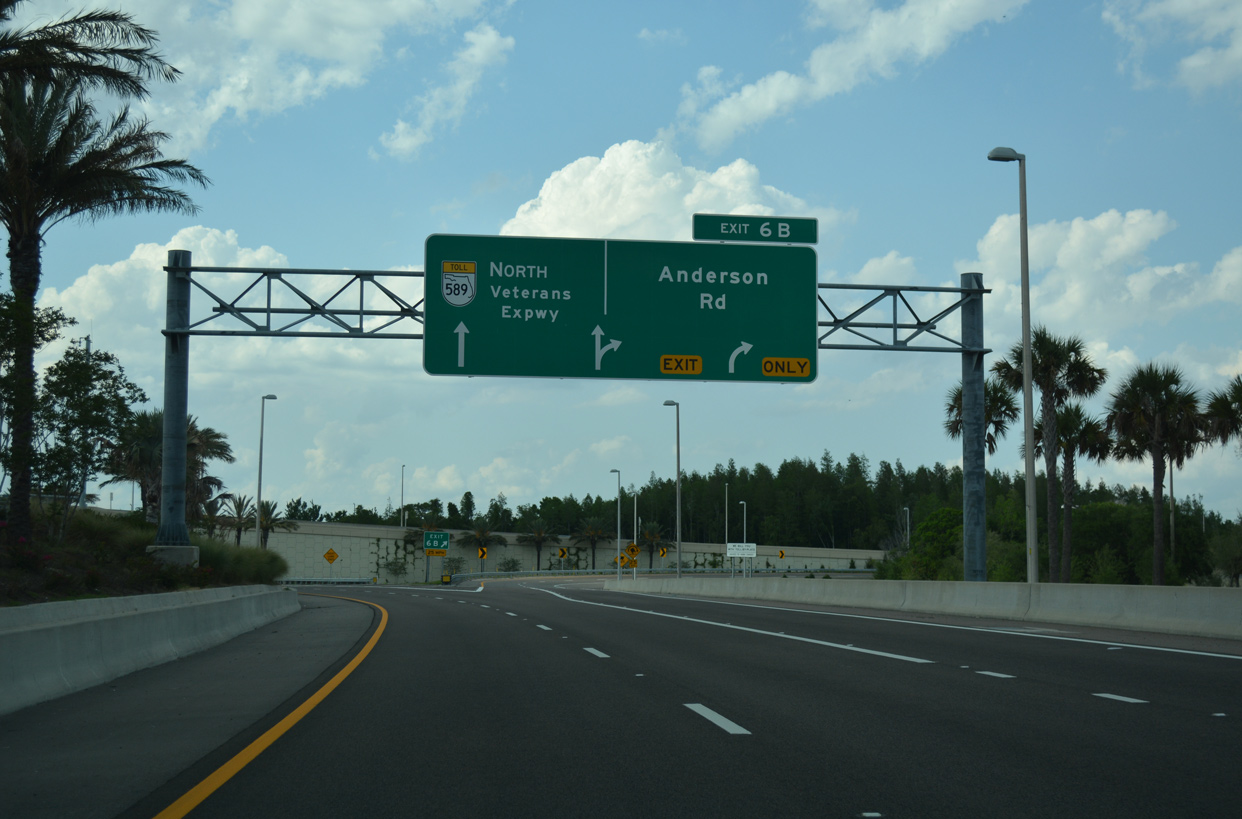
| The Waters Street entrance ramp forms a collector distributor roadway to Exit 6B. The roadway was added during the Veterans Expressway widening, which replaced left side ramps for Anderson Road and a main line toll plaza here. 04/21/18 |
|
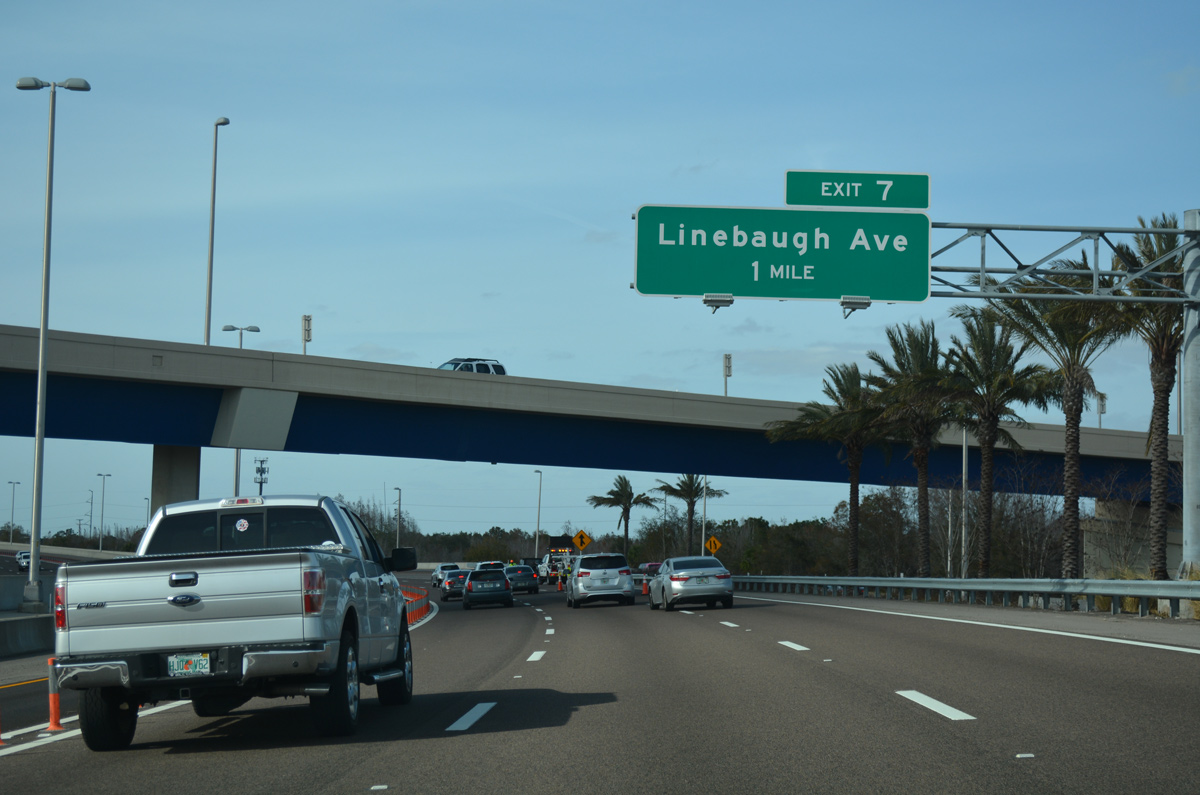
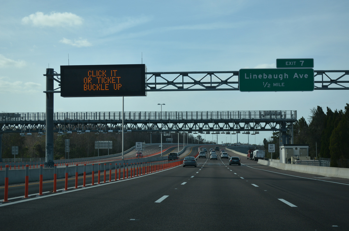
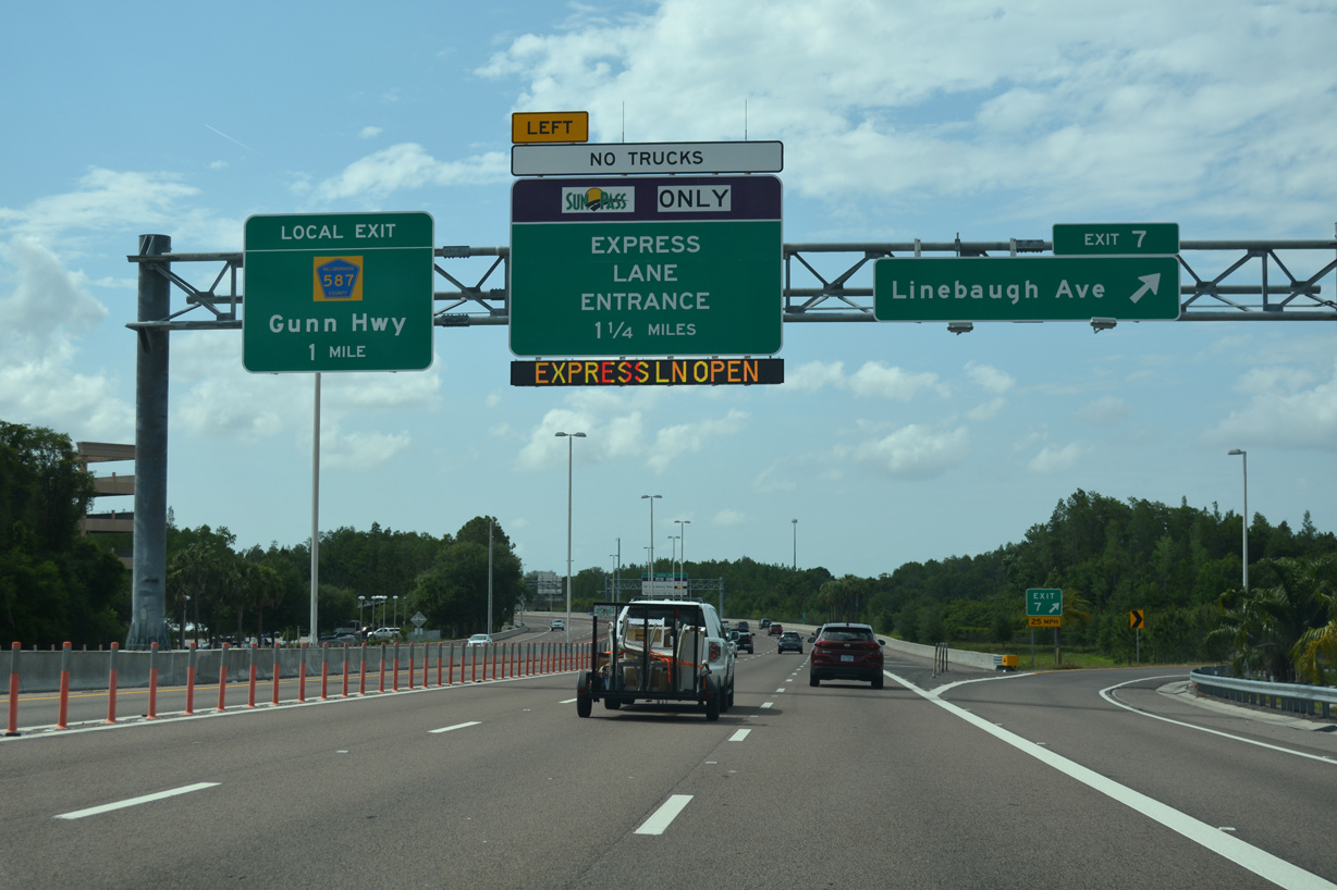
| The Veterans Expressway winds west to pass over Henderson Road. The succeeding exit departs in one mile for Linebaugh Avenue. 01/26/18 |
|
| The first of two main line all electronic toll (AET) collection points lies one half mile south of the loop ramp (Exit 7) for Linebaugh Avenue. The toll gantry replaced toll booths located at the Anderson Road off-ramp. 01/26/18 |
|
| Reassurance marker posted ahead of the CSX Railroad underpass on SR 589 north. 01/13/17 |
|
| Linebaugh Avenue leads west from SR 580 (Dale Mabry Highway) at Carrollwood to Westchase and the Tampa Downs Race Track. Prior to 2016, there was no direct access to the arterial eastbound from SR 589. Veterans Expressway widening included construction of a broader loop ramp to Linebaugh Avenue with a new left turn lane for eastbound. 05/04/19 |
|
| Plastic pylons separate the Express Lane north to the egress point after Wilsky Boulevard. A toll schedule sign precedes the subsequent ingress point. 05/04/19 |
|
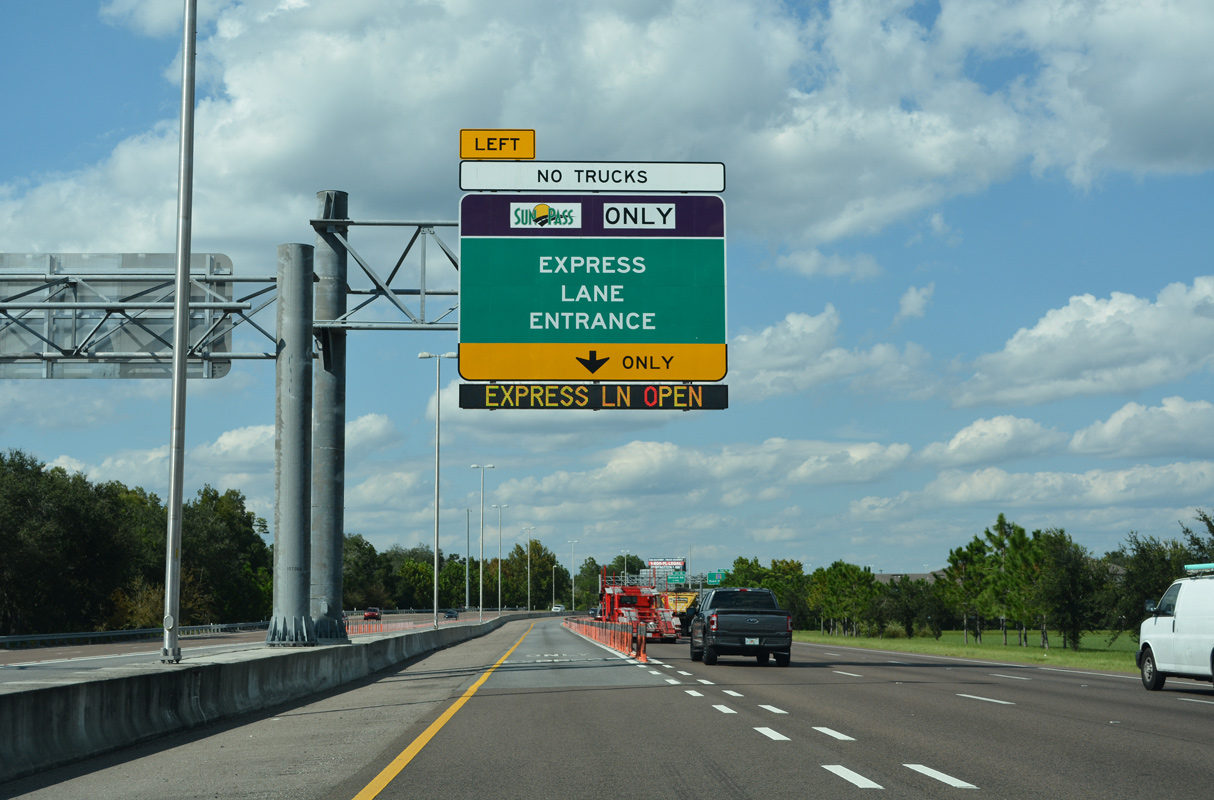
| A loop ramp joins SR 589 north from Wilsky Boulevard three quarters of a mile from the Express Lanes ingress point. 09/27/21 |
|
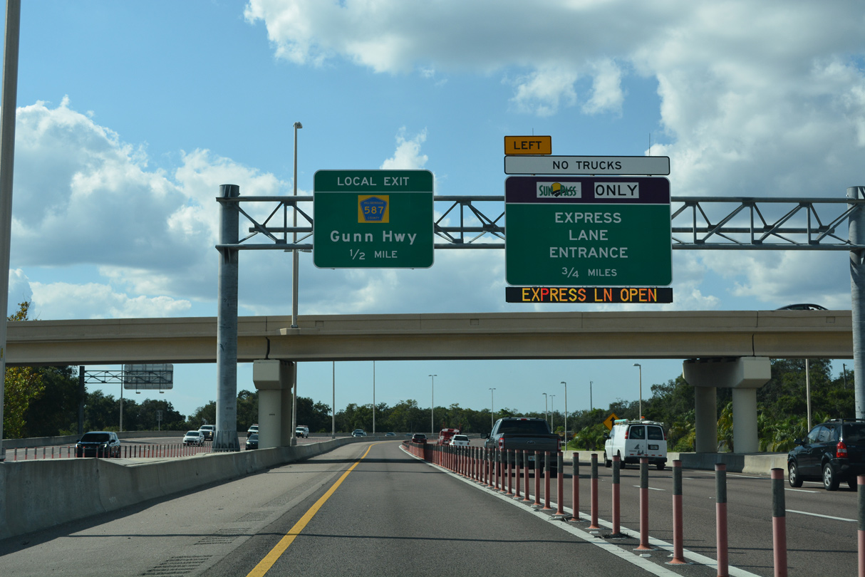
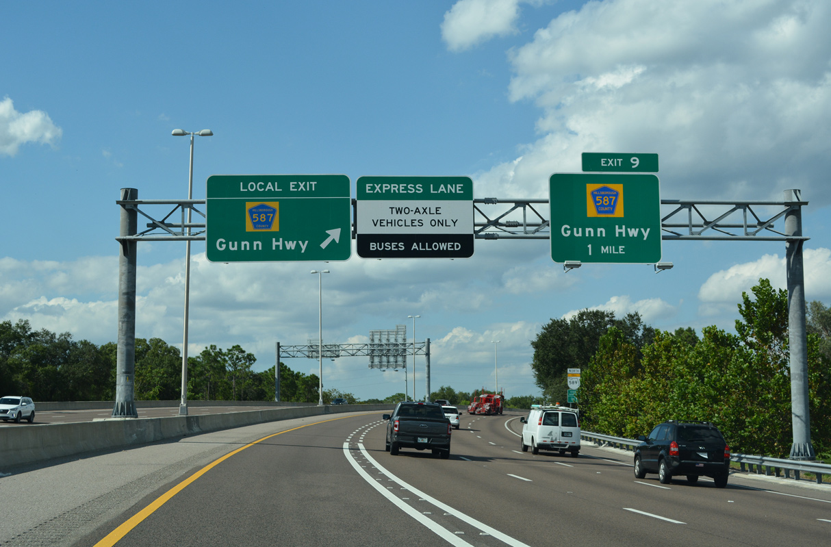
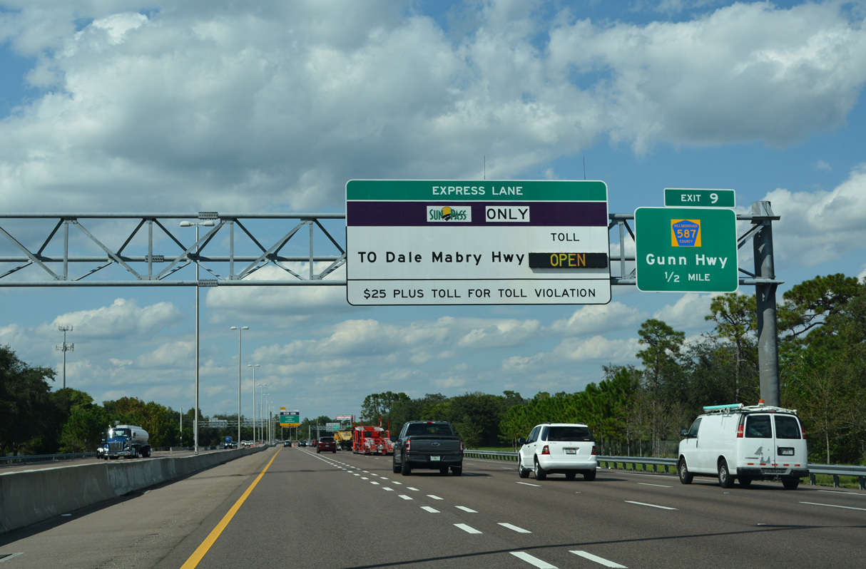
| Phase one of the Veterans Express Lanes extended to a point one mile south of the diamond interchange with Gunn Highway (County Road 587). 09/27/21 |
|
| SR 589 north crosses Rocky Creek near this shield assembly posted north of Exit 8 (southbound only off-ramp). 05/04/19 |
|
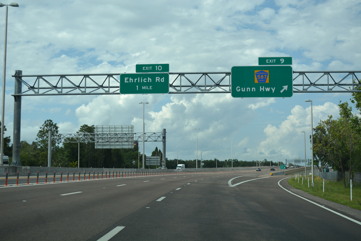
| CR 587 (Gunn Highway) constitutes an arterial route southeast through Carrollwood to the interchange joining Busch Boulevard (SR 580 east) and Dale Mabry Highway (SR 597 north / SR 580 west). 09/27/21 |
|
| The second ingress point for the Veterans Express Lanes lies just ahead of Gunn Highway. 09/27/21 |
|
| CR 587 takes a stair stepped route west from Exit 9 near Citrus Park Mall northwest through Citrus Park, Cosme, Fern Lake and Odessa. The 14.64 mile long route concludes at SR 54 in southern Pasco County. 05/04/19 |
|
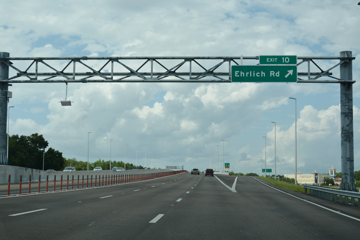
| Passing over Rocky Creek again, SR 589 (Veterans Expressway) angles northeast toward a diamond interchange (Exit 10) with Ehrlich Road. 05/04/19 |
|
| Ehrlich Road stems east from adjacent Gunn Highway (CR 587) at Citrus Park to Northdale, Carrollwood and Bearrs Avenue at Dale Mabry Highway. 05/04/19 |
|
| SR 589 curves east across Bellamy Road by this northbound confirming marker. 05/04/19 |
|
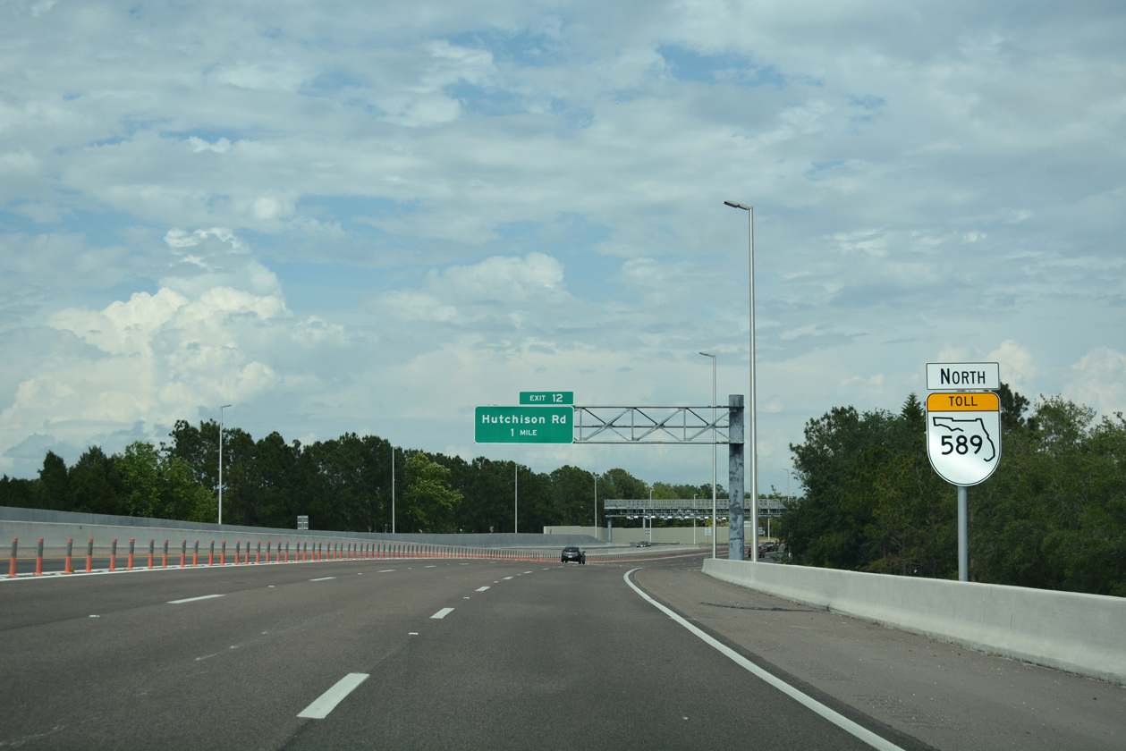
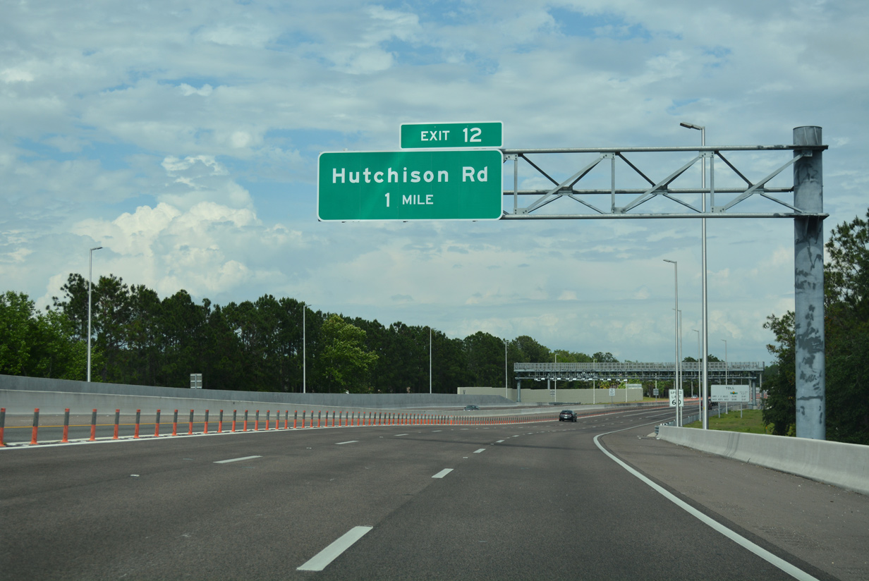
| The Veterans Expressway curves northward again beyond the upcoming AET gantry toward a diamond interchange (Exit 12) with Hutchinson Road. 05/04/19 |
|
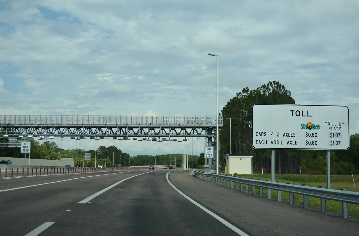
| Rate schedule sign for the second toll collection point. The AET gantry replaced the Sugarwood Mainline Plaza. 05/04/19 |
|
| Sound walls were erected along the east side of SR 589 during the 2014-18, Phase II widening project . Exit 12 departs just beyond the Rawls Road underpass. 05/04/19 |
|
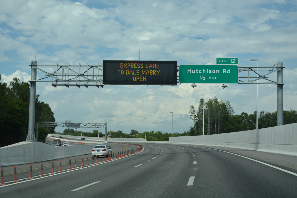
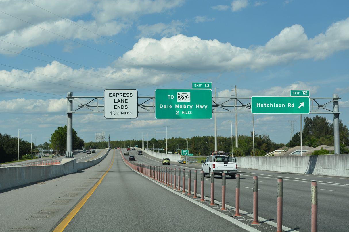
| Exit 12 leaves SR 589 north for Hutchinson Road at the Northdale community. Hutchinson Road heads south to Ehrlich Road and west to Mobley Road by Pretty Lake. 09/27/21 |
|
| The next exit along northbound is the split between the Veterans Expressway and Suncoast Parkway. 05/04/19 |
|
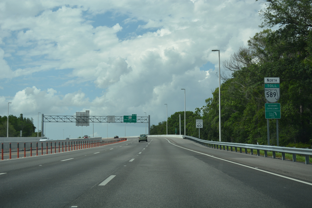
| SR 589 continues north along the Suncoast Parkway, while SR 568 takes over for Veterans Expressway spur to Dale Mabry Highway (SR 597). 09/27/21 |
|
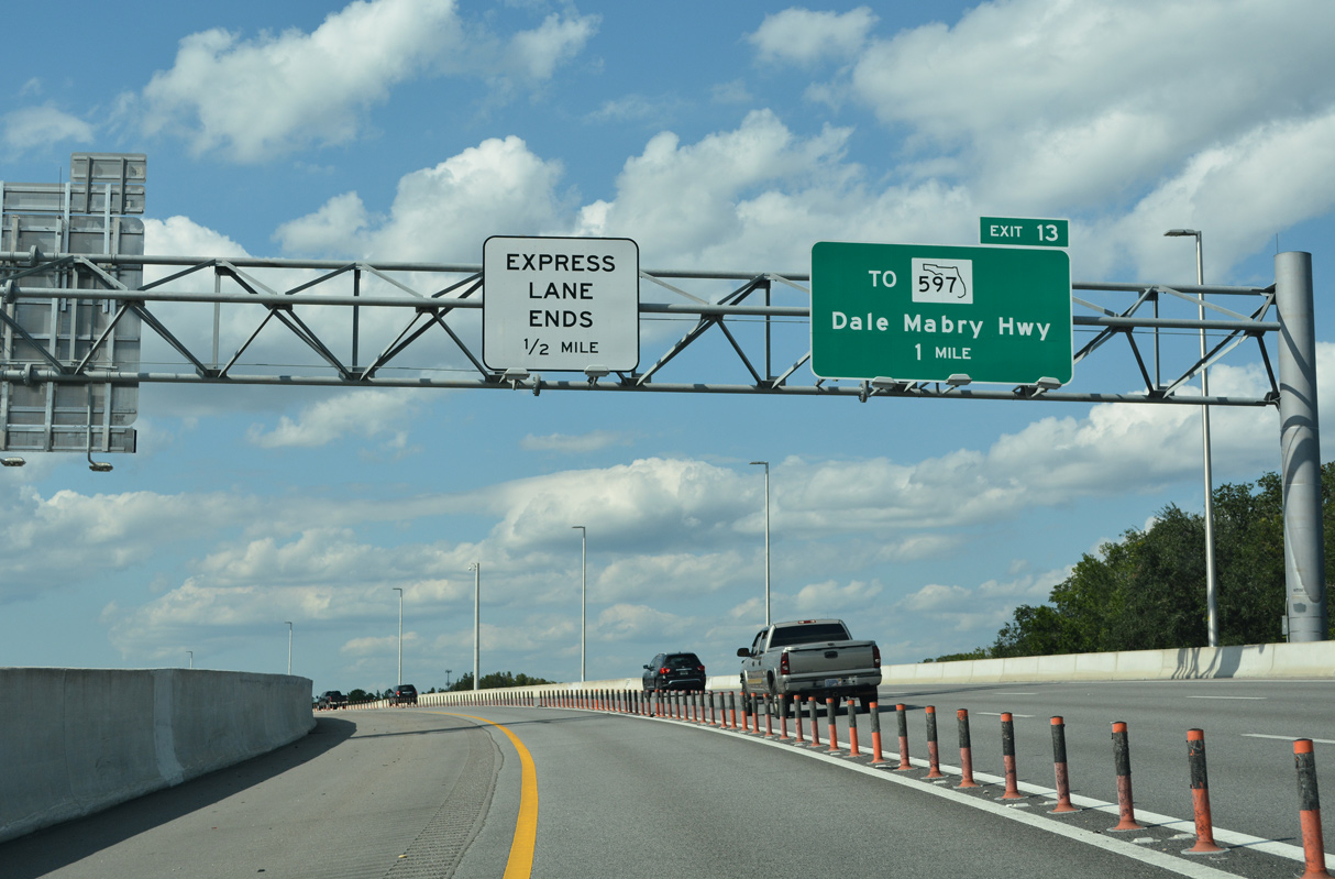
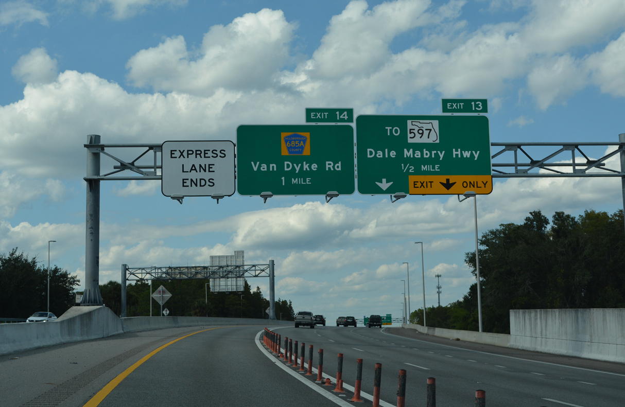
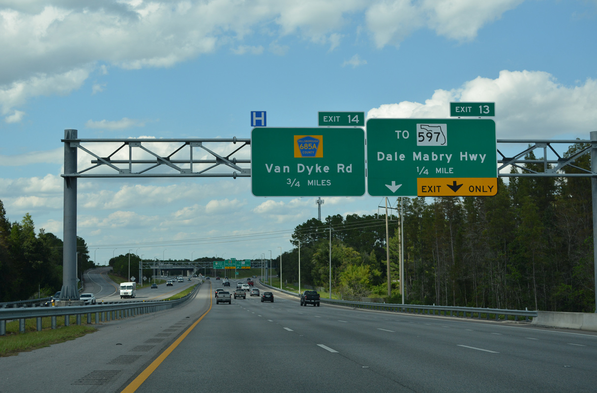
| Turning again ahead of Lake Le Clare Road, SR 589 north advances to within a half mile of SR 568 east. Van Dyke Road (CR 685A) follows immediately north of Exit 13 as it parallels SR 568 east to Dale Mabry Highway. 09/27/21 |
|
| The wye interchange (Exit 13) with the departing Veterans Expressway (SR 568) east comes into view. SR 568 extends the route 3.02 miles to SR 597. While not signed on overheads here, reassurance markers are posted along the route. 09/27/21 |
|
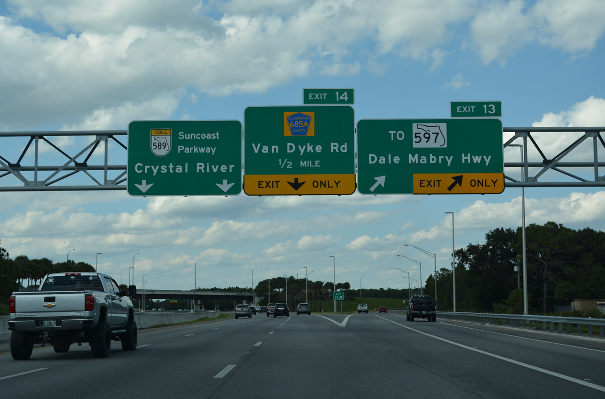
| Two lanes separate at Exit 13 for the Veterans Expressway east to Lutz while the Suncoast Parkway commences northward to Pasco and Hernando Counties. Phase 2 of the Express Lanes concluded here. 09/27/21 |
11/05/13, 10/05/15, 01/13/17, 01/26/18, 04/21/18, 05/04/19, 04/03/20, 09/27/21 by AARoads
Page Updated 02-28-2022.

 North
North