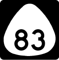
Hawaii Route 83 encircles travels along the North Shore of Oahu from Kamehameha Highway (Route 99/930 by Weed Circle and Haleiwa north to Kawela and south to Route 61 (Pali Highway) by Maunawili. The bulk of the 43.90 mile long route follows Kamehameha Highway.
Hawaii Route 83 Guides
Route 83 initially follows Joseph P. Leong Highway, 1.86 mile long bypass of Kamehameha Highway through Haleiwa. Prior to the construction of the bypass, Route 83 remained along Kamehameha Highway south to Weed Circle. The state route historically continued further south along Kaukonahua Road to Farrington Highway at Thompson Corner. The route through Hale'iwa was renumberd to Route 8300, and Kaukonahua Road and Kamehameha Highway east to Route 99 were redesignated as part of Route 930.
Heading northeast along Kawailoa Beach, Route 83 (Kamehameha Highway) straddles the Pacific Ocean to Waimea, Sunset Beach and Kawela along Oahu's North Shore. Kamehameha Highway diverges from the coast east to James Campbell National Wildlife Refuge. Route 83 rejoins coast south from Kahuku.
Kamehameha Highway travels south to La'ie and Hau'ula before a less populated stretch around Kahana Bay. Turning west around Kane'ohe Bay, Route 83 proceeds to Waikane. Kamehameha Highway separates from Route 83 at Kahalu'u for a coastal route along Kane'ohe Bay. Route 83 shifts inland along Kahekili Highway south to Ahuimanu.
Kahekili Highway stays west of Kamehameha Highway south to a jughandle intersection with Route 63 (Likelike Highway) in the census designated place of Kaneohe. Route 83 overtakes Likelike Highway east 0.483 miles to Kamehameha Highway (Route 6510). Route 83 rejoins Kamehameha Highway for 2.32 miles south to Route 61 (Pali Highway / Kalaniana'ole Highway), where both highways end.
Connect with:
Interstate H3 / John A. Burns Freeway
Route 61
Route 63
Route 99
Page Updated 01-23-2024.
