Interstate 5 transitions from hilly mountains into flat valleys on the drive northward from Roseburg to Eugene. The freeway straightens out for the first time since the Central Valley in California through the Eugene and Springfield metro area.
|
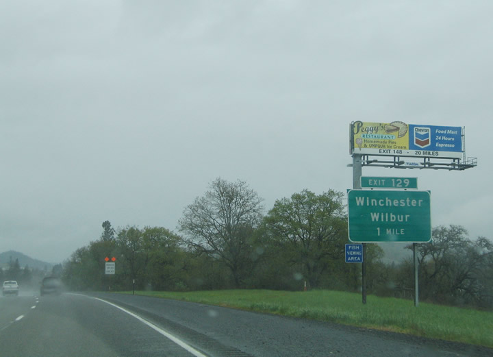
| Interstate 5 north & OR 138 westbound leave the Roseburg area and cross the North Little River en route to Sutherlin. Exit 129 constitutes a folded diamond interchange with Del Rio Road and OR 99 (Oakland-Shady Highway) midway between Winchester and Wilbur. OR 99 parallels the freeway to the east. Wilbur lies north of Del Rio Road along old U.S. 99. The town was named for James H. Wilbur, D. D., otherwise known as Father Wilber, one of Oregon's best-known pioneer Methodist ministers. 04/01/05 |
|
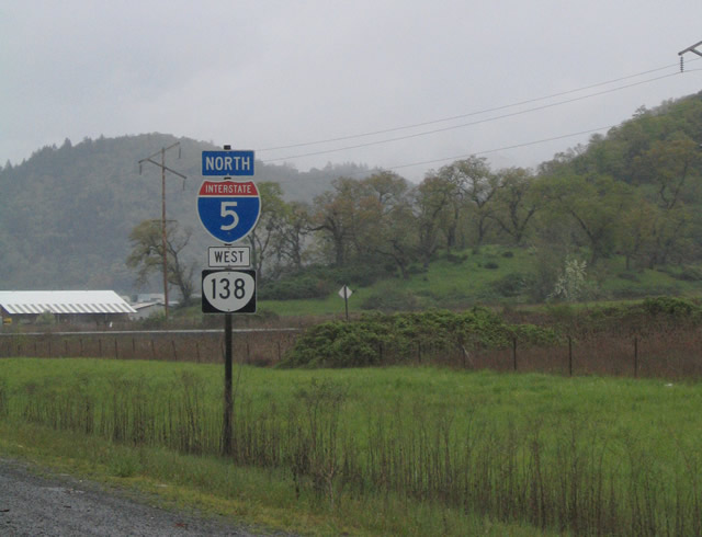
| Interstate 5 & OR 138 shield assembly posted along the freeway northbound between Exits 129 and 135. OR 138 comprises a lengthy route between Elkton, Roseburg and Diamond Lake. 04/01/05 |
|
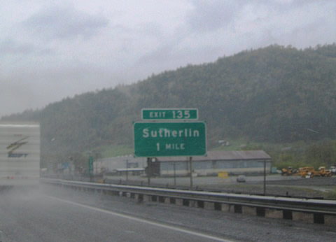
| Exit 135 is the first of two interchanges along I-5 & OR 138 for the city of Sutherlin. Northbank Road meets the freeway at the south edge of town between OR 99 (Oakland-Shady Highway) and Rathburn Road. OR 99 branches northeast along Calapooia Street to Downtown Sutherlin. 04/01/05 |
|
| Entering the diamond interchange (Exit 135) with Northbank Road at Sutherlin. Comstock Road stems north from Northbank Road to Elkton-Sutherlin Highway (former OR 138). OR 99 meets Central Avenue (former OR 138) 1.75 miles to the northeast. Founded in 1911, Sutherlin lies 518 feet above sea level and is home to over 7,000. 04/01/05 |
|
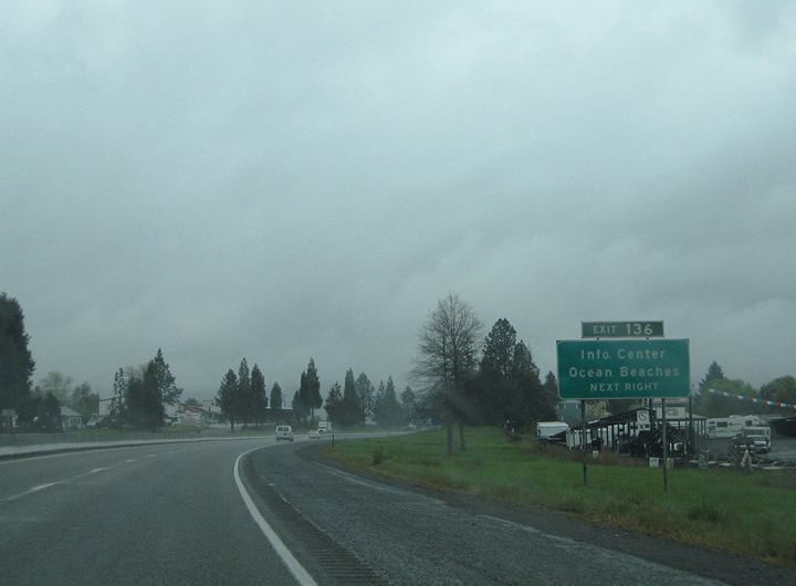
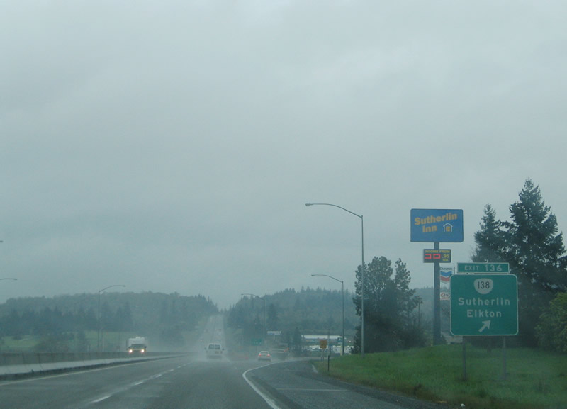
| A tourist information center is located near the parclo interchange (Exit 136) with OR 138 and Elkton-Sutherlin Highway. OR 138 departs the freeway here for its northwest leg between Sutherlin and Elkton (OR 38). OR 38 travels west over the Coast Ranges to Reedsport (U.S. 101) along the Oregon coast. 04/01/05 |
|
| OR 138 follows Elkton-Sutherlin Highway northwest 25 miles to Elkton and OR 38 (Umpqua Highway). OR 138 originally continued east into Sutherlin via Central Avenue to intersect OR 99 (Calapooia Street) at Downtown. 04/01/05 |
|
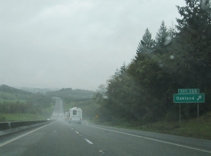
| OR 99 (Oakland-Shady Highway) continues a short distance north from Sutherlin into city of Oakland. Steams Lane links Exit 138 from I-5 northbound into Oakland. Steams Lane meets OR 99 at Walnut Street 1.6 miles to the east. Oakland is known as the &quit;Turkey Capital of the World" for its role as the leading turkey shipping center in the western United States at the turn of the 20th century. 04/01/05 |
|
| OR 99 returns to Interstate 5 at a wye interchange (Exit 140) northwest of Oakland. The two routes combine from there northwest to a diamond interchange with Metz Hill and Goodrich Roads and an adjacent rest area. Metz Hill Road travels west to Green Valley Road. Goodrich Road parallels the freeway briefly before turning east to Wild Horse Lane and north to Rice Hill. 04/01/05 |
|
| Interstate 5 continues north over Rice Hill Summit (elevation 723 feet) into Rice Valley. Meeting the freeway at Exit 146 is Oakhill Drive and Rice Valley Road. Oakhill Drive turns east from the Isadore Road frontage road to Oakwood Drive and Goodrich Highway. Rice Valley Road parallels the Cabin Creek northwest of Interstate 5. 04/01/05 |
|
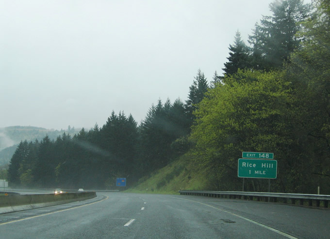
| One mile ahead of Exit 148 to Rice Hill posted on Interstate 5 northbound. John Long Road and Thurman Lane meet the freeway at a folded diamond interchange. Rice Hill lies at the intersection of John Long Road and Goodrich Highway nearby. John Long Road (old U.S. 99) travels north from Rice Hill to meet the freeway again at Eagle Valley Road (OR 99). 04/01/05 |
|
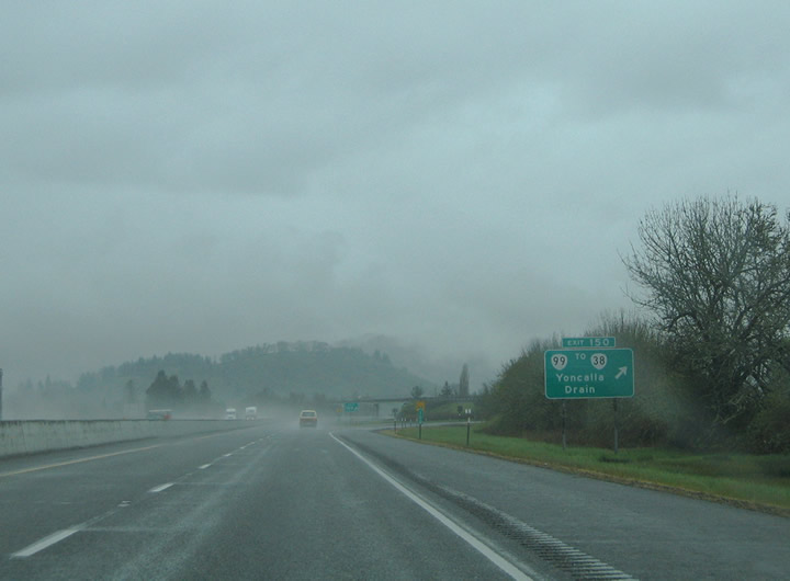
| OR 99 splits from I-5 again at the parclo interchange (Exit 150) with John Long Road south and Eagle Valley Road north. OR 99 heads three miles north to Yoncalla and eight miles to Drain and OR 38 west. The state route loops back to I-5 at Curtin (Exit 161). OR 38 provides a through route to the Oregon coast between Reedsport and Drain. Yoncalla derives its name from nearby Mount Yoncalla, which Indians referred to as home of the eagles. First settled in 1847, Drain represents a historic timber community. The settlement incorporated in 1888 under the leadership of mayor John Drain. 04/01/05 |
|
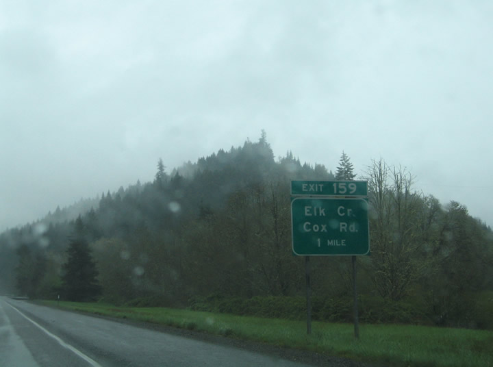
| Interstate 5 travels northeast from Exit 150 to Exit 154 (Scotts Valley Road / Elkhead Road) and north from there to Exit 159. Elk Creek Road parallels the freeway northward from Elkhead Road to Cox Road at Exit 159. Pictured here is the one mile guide sign for Elk Creek and Cox Road on Interstate 5 north. 04/01/05 |
|
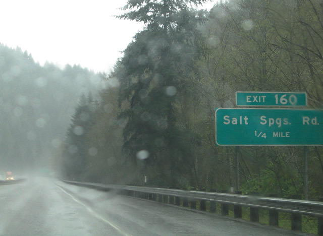
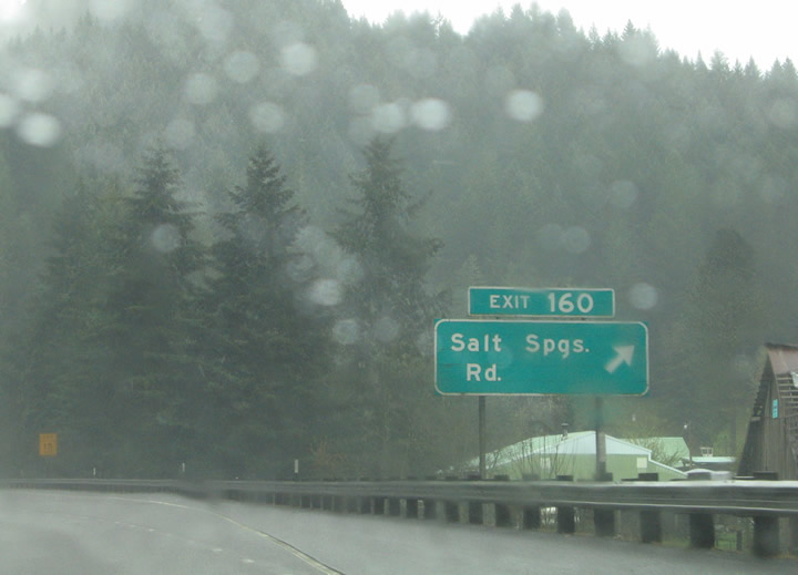
| Interstate 5 continues a short distance north from Elk Creek to Salt Springs Road (Exit 160). 04/01/05 |
|
| Northbound at Exit 160 to Salt Springs Road. Salt Springs Road serves an isolated area along Interstate 5 between Elk Creek and Anlauf. 04/01/05 |
|
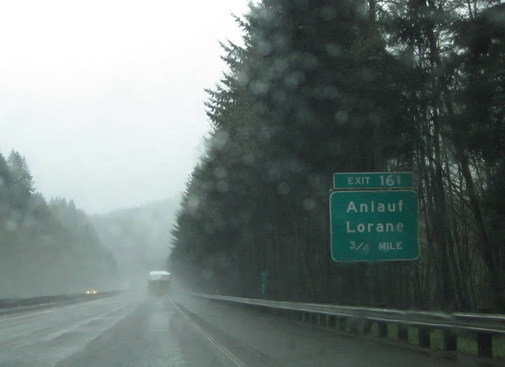
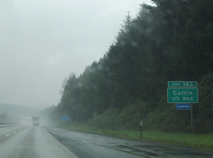
| Nearing Exit 161 for Buck Creek Road along Interstate 5 northbound. Buck Creek Road travels west along Buck Creek to OR 99 (Umpqua Highway) at Anlauf. OR 99 turns east onto a connector between Old U.S. 99 and Exit 162. Old U.S. 99 ventures northeast from the OR 99 connector to intersect Territorial Highway en route to Exit 163. Territorial Highway leads north nine miles to Lorane in southern Lane County. 04/01/05 |
|
| OR 99 (Umpqua Highway) recombines with Interstate 5 northbound at a trumpet interchange
In Anlauf. The state route travels west 0.4 miles to former U.S. 99 and 7.2 miles to OR 38 in downtown Drain. 04/01/05 |
|
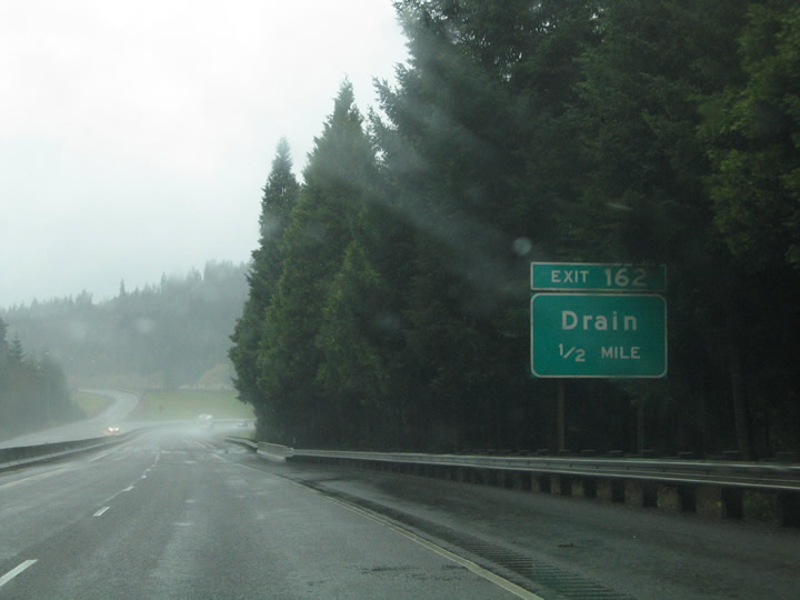
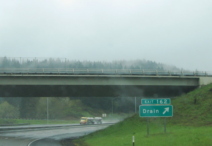
| Exit 162 loops onto OR 99 (Umpqua Highway) southbound from Interstate 5 north. OR 99 parallels the Southern Pacific Railroad and Pass Creek southwest to Drain (OR 38). OR 38 travels west from Drain 14 miles to Elkton, 34 miles to Scottsburg and 50 miles to Reedsport. 04/01/05 |
|
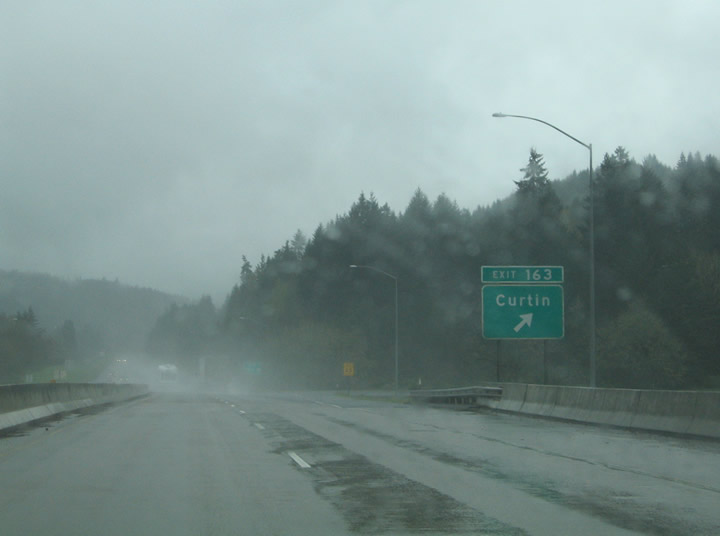
| Old U.S. 99 intersects Curtin and Bear Creek Roads at the settlement of Curtin. Bear Creek Road stems east across the Southern Pacific Railroad to meet Interstate 5 at Exit 163. Curtin began as the site of a sawmill in the early 1890s operated by Daniel Curtin. In 1908 Curtin attained a post office. 04/01/05 |
|
| A parclo interchange joins Interstate 5 with Bear Creek Road adjacent to Pass Creek County Park. Bear Creek Road parallels Bear Creek east into the nearby mountains. Curtin Road continues old U.S. 99 alongside the Southern Pacific Railroad and Interstate 5 to Comstock. 04/01/05 |
|
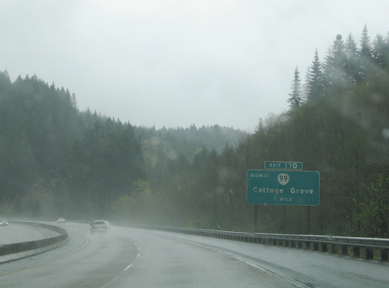
| OR 99 leaves Interstate 5 again for the Cottage Grove business loop. The state route follows Goshen Divide Highway 4.8 miles north from Exit 170 into Downtown Cottage Grove. The loop returns to Interstate 5 at Exit 174 (Cottage Grove Connector) for Dorena Reservoir to the east via Row River Road. 04/01/05 |
|
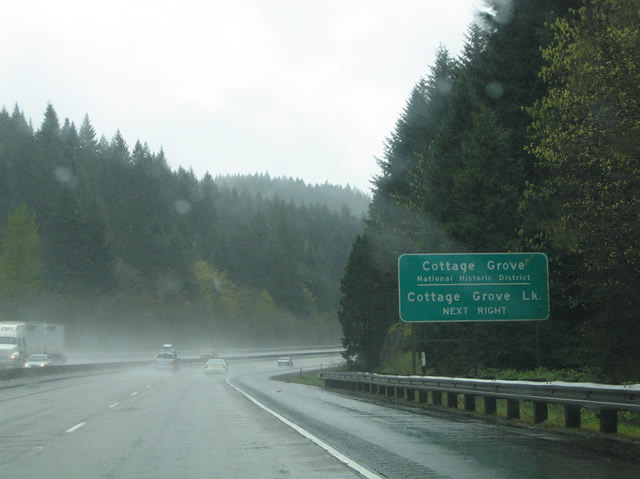
| Button copy guide sign for Exit 170 to Cottage Grove National Historic District and Cottage Grove Lake. Cottage Grove Lake resides 4.5 miles south of OR 99 via London Road.
Settlers arrived at Cottage Grove in 1848 via the Oregon and Applegate Trails. The first post office was established in 1855 and the discovery of gold in 1863 in the nearby Bohemia Mountains caused the town to prosper. The timber industry and arrival of the railroad in 1872 and Pacific Highway in 1909 continued to maintain the economic strength of Cottage Grove. Interstate 5 opened to traffic at Cottage Grove in 1957. 04/01/05 |
|
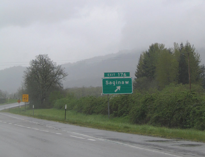
| Interstate 5 and OR 99 (Goshen Divide Highway) both leave Cottage Grove north for Saginaw. Saginaw Road links the freeway with Goshen Divided Highway at Exit 176. Saginaw began as a settlement built by the Booth-Kelly Lumber Co. and was named after Saginaw, Michigan. Sears Road travels north from Row River Road to Saginaw Road adjacent to Exit 176. Sears Road continues north alongside Interstate 5 to the Row River east of Creswell. 04/01/05 |
|
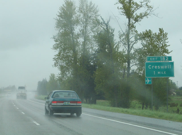
| A rest area lines I-5 between Saginaw and Creswell. Meeting the freeway next is Oregon Avenue / Springfield-Creswell Highway at Exit 182. The city of Creswell began in 1872 by settlers Alvin Huges and James Robinett near the California & Oregon Railroad. A post office opened at the site in 1873 with the name of Creswell after the U.S. Postmaster General John Creswell. Agriculture fueled the economy early and fruit orchards, a cannery, and a packing plant joined the town by the time Creswell incorporated in 1909. The Friendly City continued to grow with connections to the Eugene-Springfield metropolitan area. 04/01/05 |
|
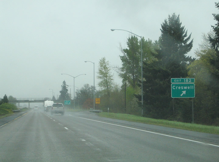
| Northbound at the Exit 182 with Oregon Avenue west and Springfield-Creswell Highway east. Oregon Avenue leads into Downtown Creswell, meeting OR 99 (Front Street / Mill Street) nearby. Springfield-Creswell Highway continues Oregon Avenue east of Interstate 5 to Cloverdale. Cloverdale Road travels north from there to OR 58 (Willamette Highway). 04/01/05 |
|
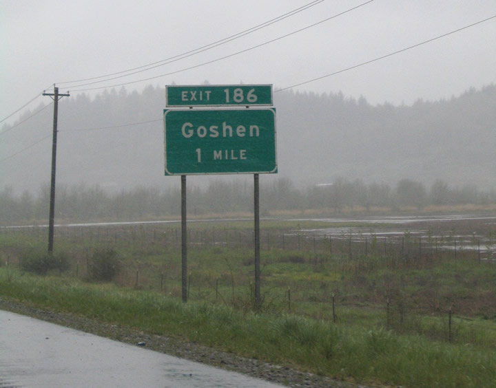
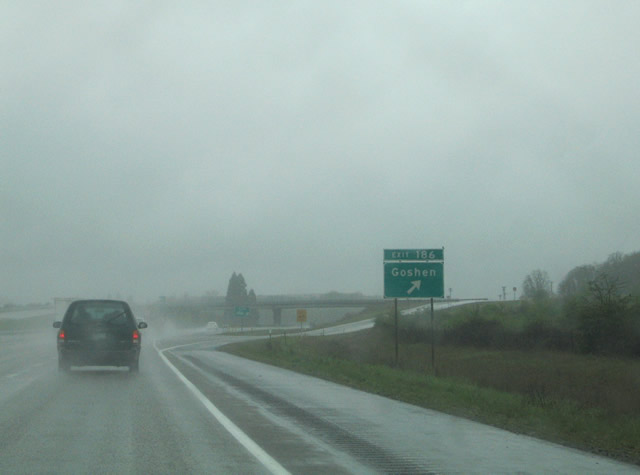
| Exit 186 departs I-5 north next to OR 99 and Dillard Access Road. OR 99 and Dillard Access Road both head north alongside Interstate 5 to Goshen. Dillard Road travels west from OR 99 toward Spencers Butte and south Eugene. 04/01/05 |
|
| Exit 186 leaves I-5 northbound for Dillard Access Road north to Mathews Road and OR 58 (Willamette Highway), and adjacent OR 99. OR 99 parallels the Southern Pacific Railroad line northward into Goshen. Goshen began with the establishment of a post office on September 6, 1874. Goshen was named after the Goshen region in lower Egypt. 04/01/05 |
|
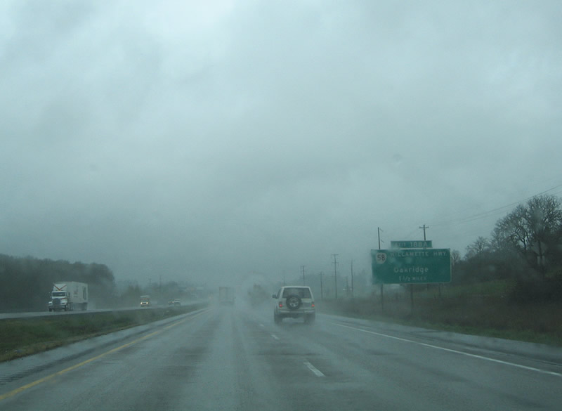
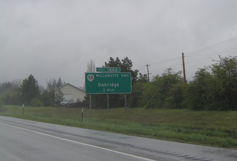
| OR 58 (Willamette Highway) ties into Interstate 5 at a parclo interchange (Exit 188A) in Goshen. The state route provides a major through route between Eugene and the U.S. 97 corridor east of the Cascade Range. Named the Willamette Highway because of the river it parallels, OR 58 leads east four miles to Pleasant Hill, 13 miles to Lowell and 34 miles to Oakridge. 04/01/05 |
|
| OR 58 (Willamette Highway) provides a main trucking route between Interstate 5 and California via its connection to U.S. 97 east of the Cascades. Most of the state route on the ascent to Willamette Pass (elevation 5,128 feet) travels through Willamette National Forest. 04/01/05 |
|
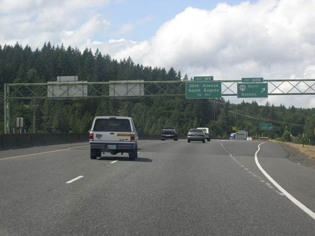
| OR 99 lines Franklin Boulevard north from Goshen to converge with Interstate 5 again just west of the OR 58. Exit 188B departs the freeway for OR 99 (Franklin Boulevard) south. 05/22/06 |
|
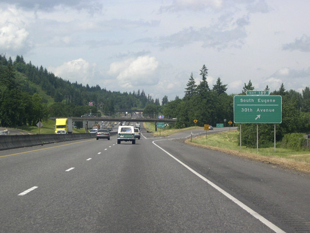
| Exit 189 departs I-5 & OR 99 northbound for 30th Street west and Franklin Boulevard. 30th Street constitutes an expressway from Interstate 5 west to Lane Community College, Spring Boulevard and south Eugene. The expressway transitions into a surface street west of Onyx Street. 05/22/06 |
|
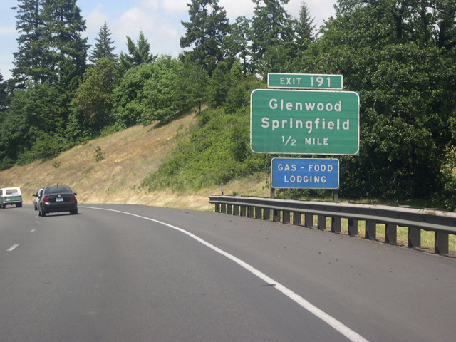
| I-5 & OR 99 curve west into the city of Eugene ahead of a folded diamond interchange (Exit 191 ) with Glenwood Boulevard. Glenwood Boulevard leads north from Laurel Hill Drive to OR 126 Business (Franklin Boulevard). OR 126 Business travels east across the Willamette River into the city of Springfield. 05/22/06, 04/01/05 |
|
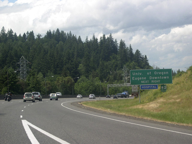
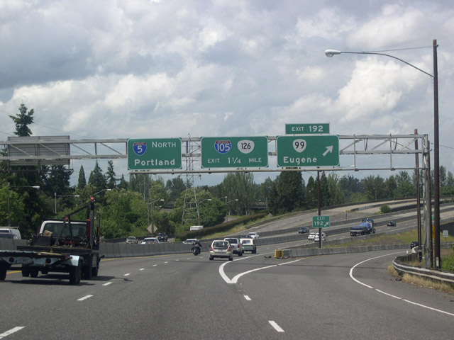
| Traffic interests to Downtown Eugene and the University of Oregon are directed from I-5 north to Exit 192. OR 99 departs the freeway here to join OR 126 Business along Franklin Boulevard west to the Eugene central business district. The University of Oregon Ducks football team play their home games at Autzen Stadium, located north of the Willamette River along Centennial Boulevard. 05/22/06 |
|
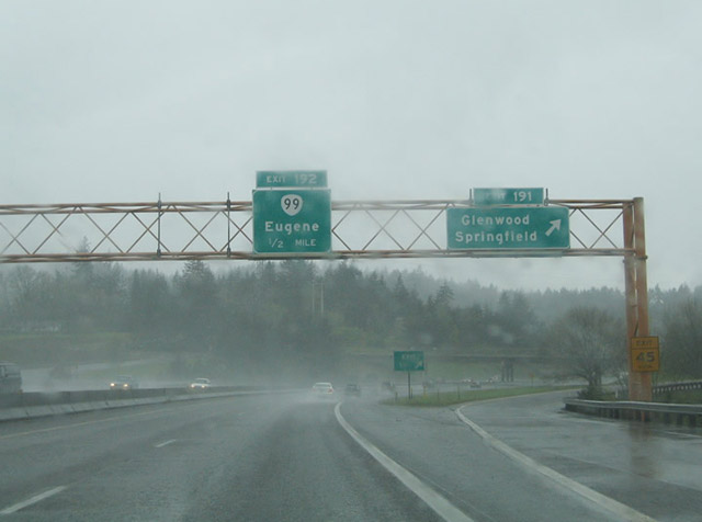
| OR 99 parts ways with I-5 north at Exit 192 for OR 126 Business (Franklin Boulevard) westbound. OR 126 Business follows the former alignment of U.S. 126 through both Eugene and Springfield. OR 126 follows a freeway north of Downtown Springfield and overlaps with Interstate 105 west of Exit 194. OR 99 & 126 Business combine along a one way couplet on 6th & 7th Avenues. 05/22/06 |
|
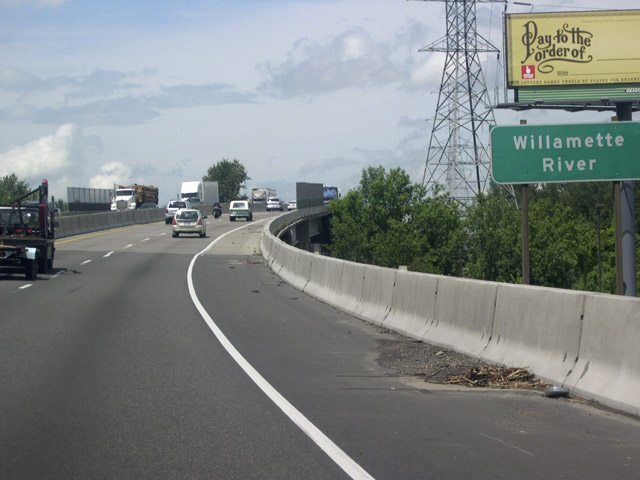
| Interstate 5 crosses the Willamette River with four overall lanes. Construction started in 2009 replaced the crossing with two new spans. The previous structure was deemed unsafe for heavy freight traffic by ODOT due to the discovery of shear cracks. 05/22/06 |
|
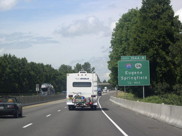
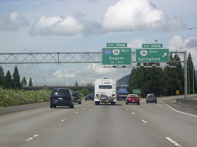
| A directional cloverleaf interchange connects I-5 with Interstate 105 west and OR 126 (McKenzie Highway). Exit 194A departs for the OR 126 freeway east 5.5 miles to 52nd Street in Springfield. The state route travels 72 miles from Springfield to U.S. 20 in the Cascade Mountains. 05/22/06 |
|
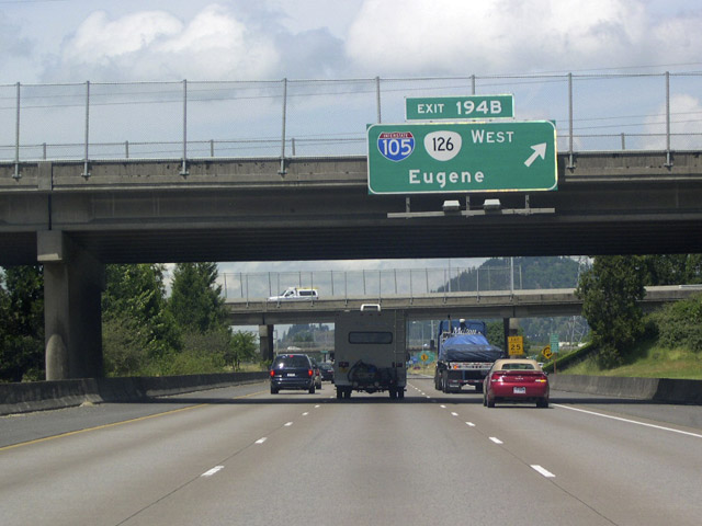
| Exit 194B loops onto I-105 & OR 126 west from I-5 north. Interstate 105 and OR 126 comprise an urban freeway spur leading west Delta Highway for northern Eugene and Downtown Eugene. 05/22/06 |
|
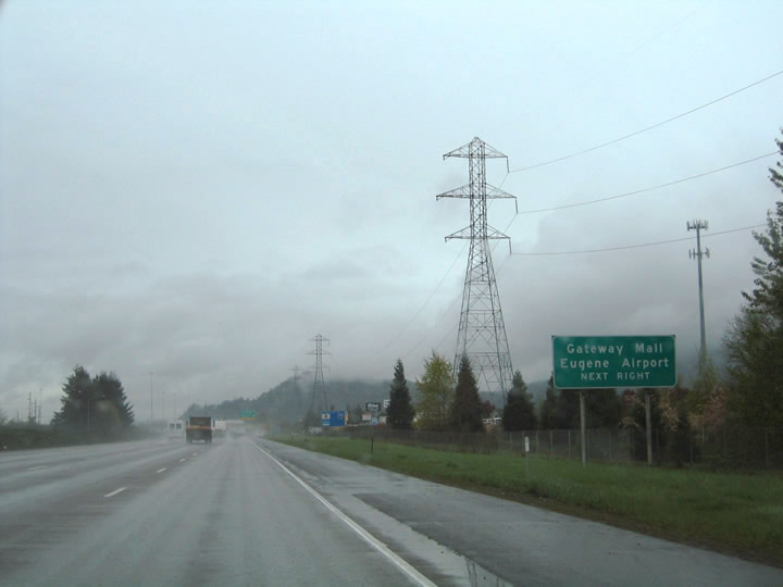
| The final interchange for Eugene and Springfield joins Interstate 5 with OR 569 (Randy Pape Beltine), a freeway to west Eugene. Belt Line Road ties into Exit 195 from Gateway Street near The Shoppes at Gateway mall, and Martin Luther King, Jr. Parkway to the east. Eugene Airport (EUG) lies 9.7 miles northwest of the flyover (Exit 195A) for OR 569 west. 04/01/05 |
|
| Construction underway in 2007/08 reconfigured the exchange with OR 569 (Belt Line Highway). A high speed flyover replaced the loop ramp (Exit 195B) for OR 569 west and the loop ramp from I-5 south to Beltline Road east was replaced with a signalized left turn. 05/22/06 |
Page Updated 07-07-2005.

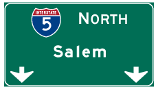
 north & OR 138 west