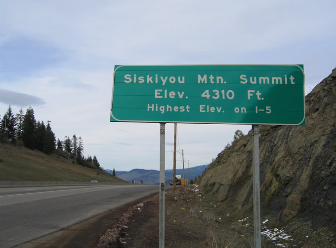
Interstate 5 enters the Beaver State at Siskiyou Summit south of Ashland. The mountainous stretch in southern Jackson County rises to 4,310 feet above sea level, the highest point anywhere along I-5. The freeway begins a pronounced descent from the summit into the city of Ashland.
Passing along the eastern edges of Ashland between Exits 11 and 19, Interstate 5 continues from short distance to Medford, the Jackson County seat. Once in Medford, the freeway navigates through the heart of the city including an elevated section. West of Central Point, the freeway progresses toward Gold Hill, Rogue River, and Grants Pass.
The city of Grants Pass began in 1865 as the site of a stage station and post office. The site was named "Grant" in honor of Union General Ulysses S. Grant, however that would quickly be changed as another Grant, Oregon already existed at the time. At the same time a new roadway linking the area with Merlin to the north was constructed. Crews working on the project suggested calling the road over the pass of Merlin Hill, Grant's Pass. The name caught on and eventually encompassed the post office. In 1883 the Southern Pacific Railroad line entered the valley and the community of Grants Pass grew. Expansion of Grants Pass followed as the town prospered as a shipping center. Incorporation followed in 1885 at the same time Grants Pass became the seat of government for Josephine County.
|
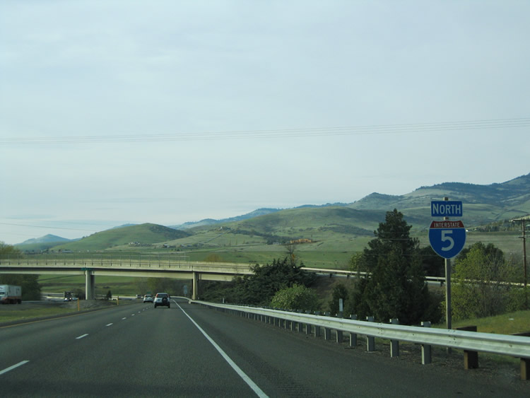
| Interstate 5 north enters Jackson County from the Golden State ahead of a wye interchange (Exit 1) with Old Highway 99 S (former U.S. 99). Though not signed for the most part, the route doubles as Oregon State Route 273. 03/31/05 |
|
| Old Highway 99 S (OR 273) winds 5.5 miles north through Siskiyou Summit, returning to I-5 at Exit 6. 03/31/05 |
|
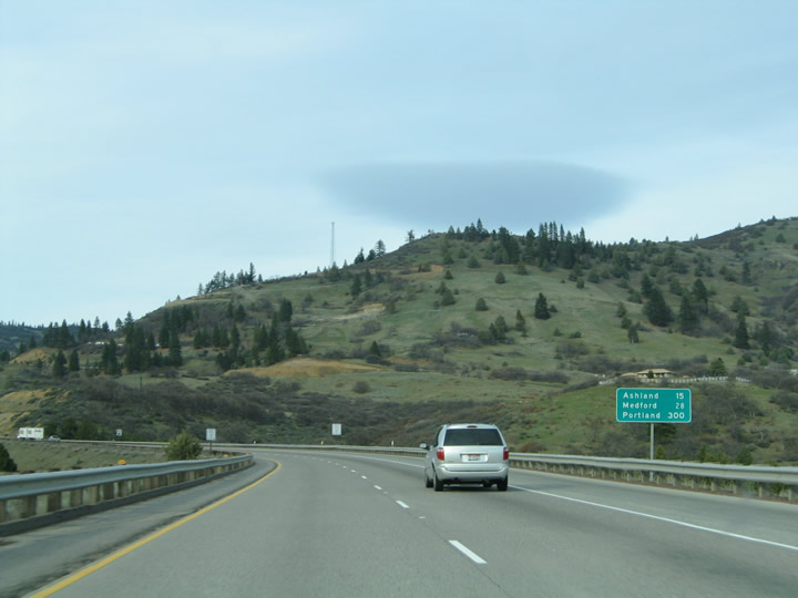
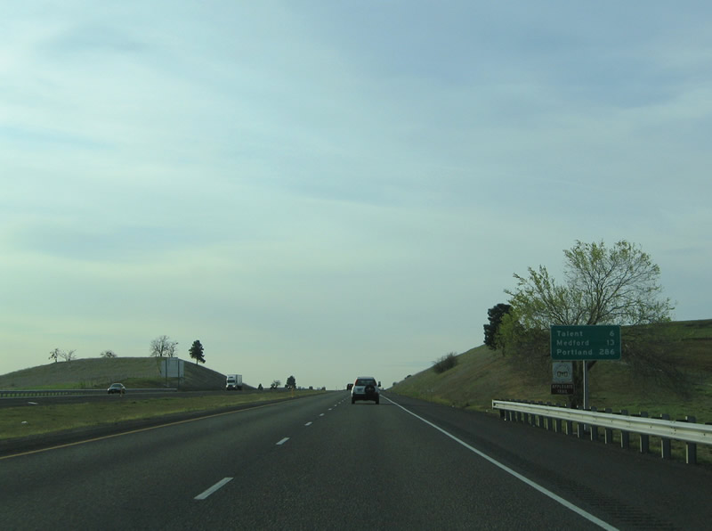
| Ashland is located 15 miles ahead followed by the Jackson County seat of Medford in 28 miles. 03/31/05 |
|
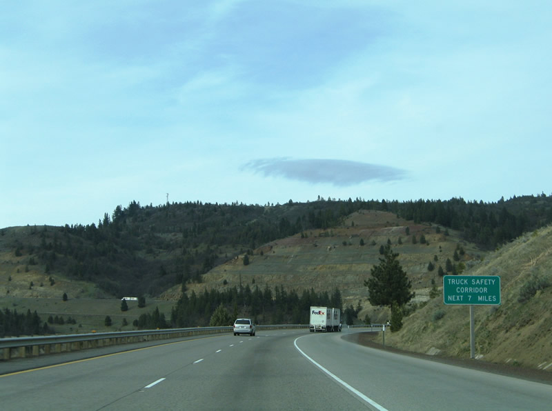
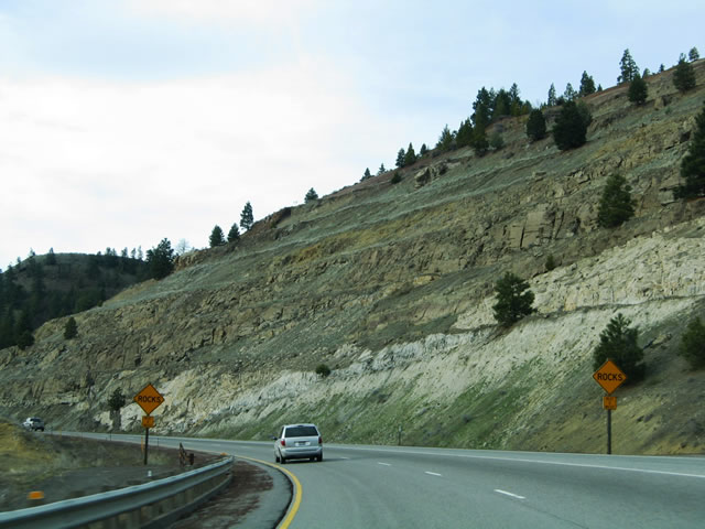
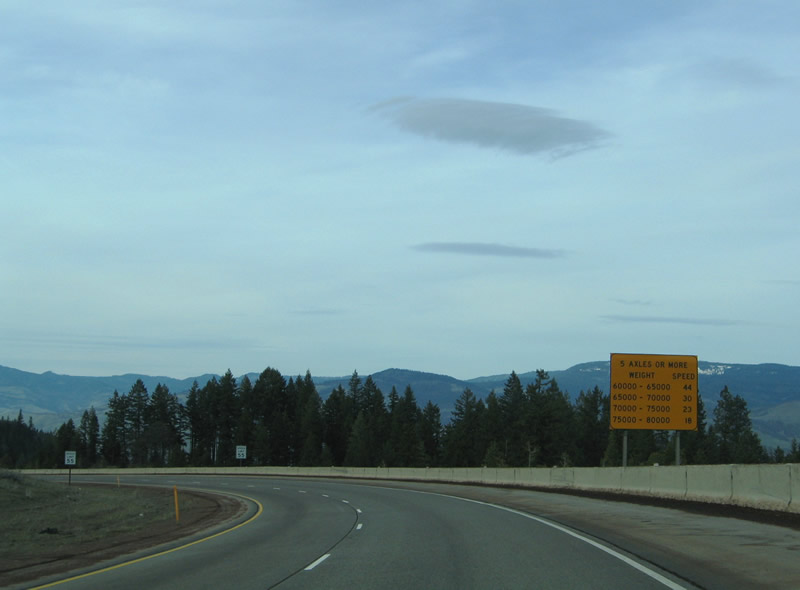
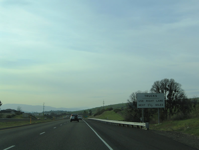
| The ensuing seven miles of I-5 was previously designated by ODOT as a Truck Safety Corridor. 03/31/05 |
|
| The northbound lanes of I-5 rise over 20 feet higher than the southbound roadway as the freeway ascends to Siskiyou Summit. 03/31/05 |
|
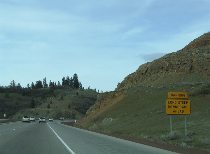
| A 6% downgrade ensues beyond Siskiyou Mountain Summit along Interstate 5 north. 03/31/05 |
|
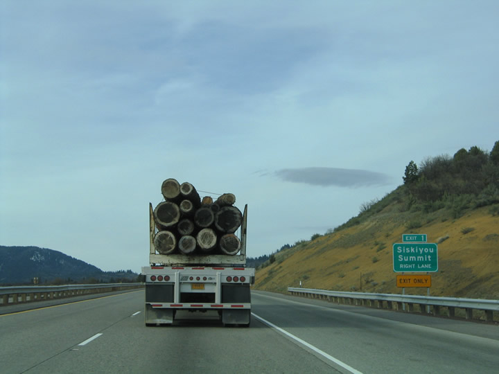
| Interstate 5 peaks at the highest elevation (4,310 feet above sea level) along its entire course between Mexico and Canada at Siskiyou Mountain Summit. A brake area for semis is also located at the summit. 03/31/05 |
|
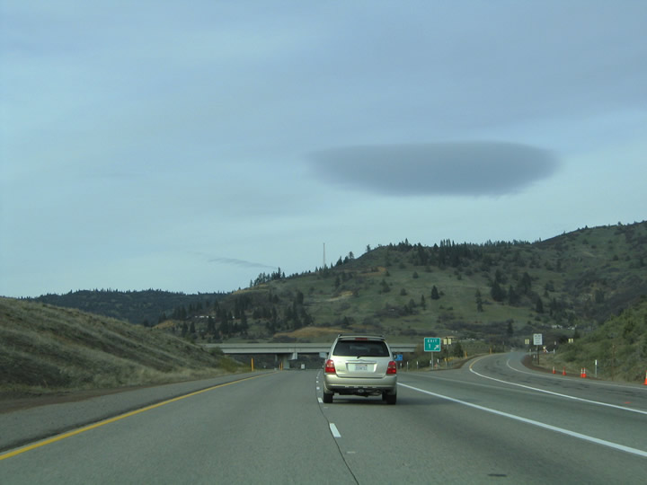
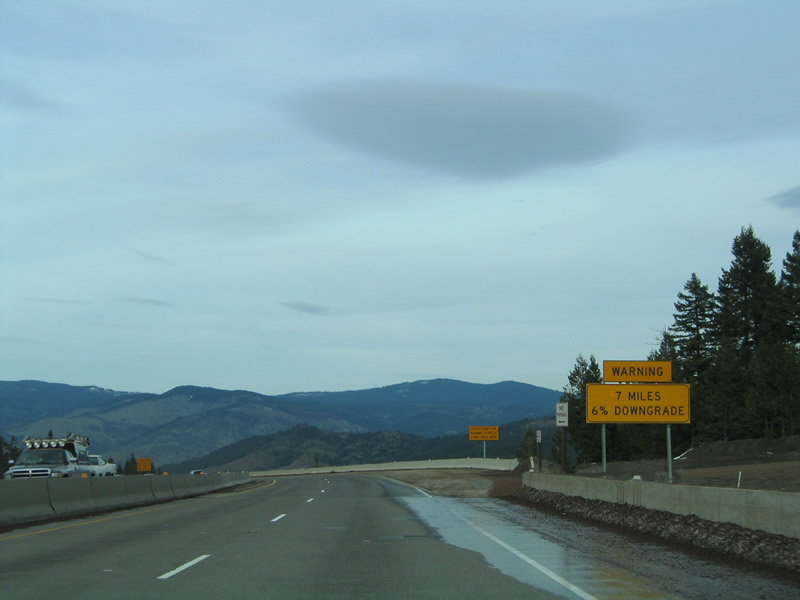
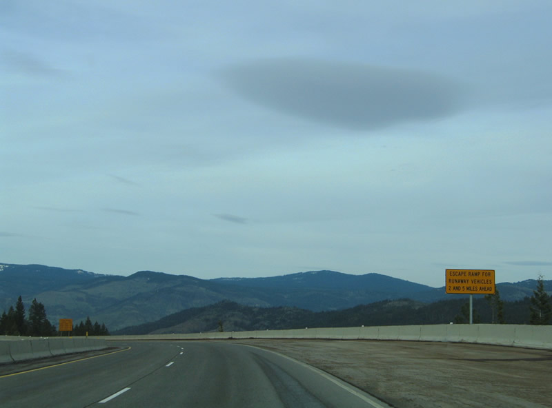
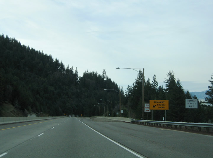
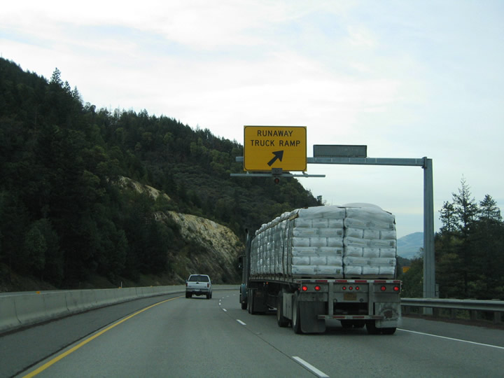
| A series of warning signs line the northbound roadway of Interstate 5 as the freeway lowers from Siskiyou Summit. The 6% grade concludes seven miles to the north at Ashland (el. 1,951 feet) with a pair of runaway truck ramps along the stretch. 03/31/05 |
|
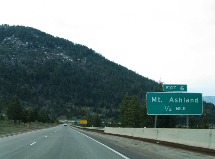
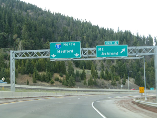
| Old Highway 99 S (OR 273) returns to I-5 at a folded diamond interchange (Exit 6) opposite Old Siskiyou Highway. Old Highway 99 S connects I-5 with Mt. Ashland Ski Road west to Mount Ashland. 03/31/05 |
|
| A loop ramp joins I-5 with Old Highway 99 S / Old Siskiyou Highway (OR 273) at Exit 6. Old Siskiyou Highway continues OR 273 (former U.S. 99) north along a convoluted path east of I-5 to OR 66 (Green Springs Highway) and Emigrant Lake. 03/31/05 |
|
| Interstate 5 continues north from Exit 6 on a gradual descent 10 miles to Ashland. This distance sign was missing by 2007 and never replaced. 03/31/05 |
|
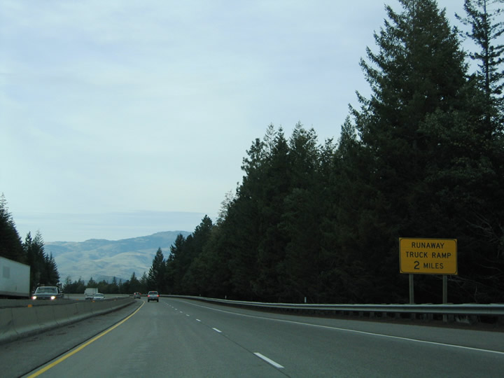
| The first of two northbound truck escape ramps precedes the Central Oregon and Pacific Railroad overpass. 03/31/05 |
|
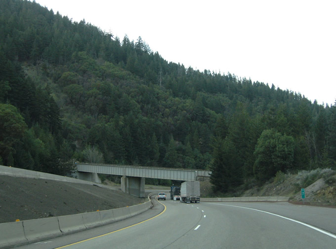
| The Central Oregon and Pacific Railroad parallels I-5 to the west before navigating through a switch back, turning south over the freeway midway between Exits 6 and 11. The railroad makes a second switch back east of I-5 to resume north to Ashland. 03/31/05 |
|
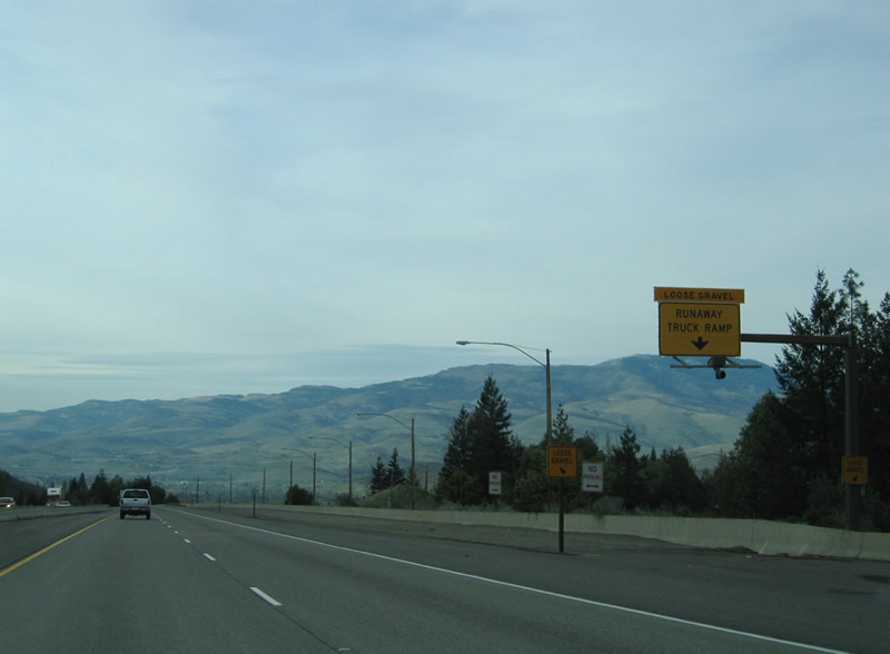
| The second runaway truck ramp along Interstate 5 north precedes the Neil Creek Road underpass. 03/31/05 |
|
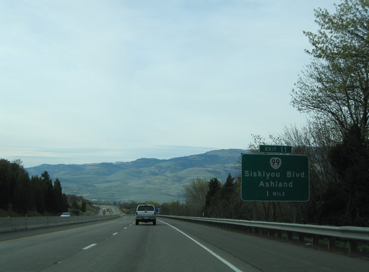
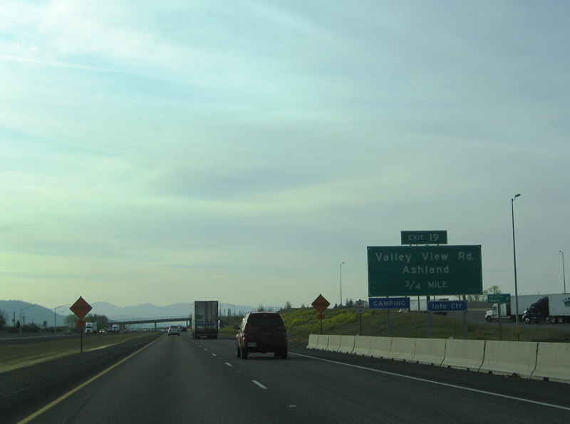
| OR 99 (former U.S. 99) begins along Siskiyou Boulevard from a wye interchange at Exit 11. The state highway acts as a business loop through the city of Ashland from Interstate 5 north to Valley View Road (Exit 19). 03/31/05 |
|
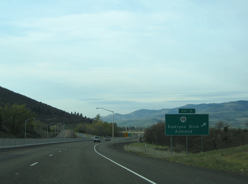
| Interstate 5 northbound at Exit 11 to OR 99 (Siskiyou Boulevard) north. Founded in 1874, the city of Ashland is home to Southern Oregon University and the Oregon Shakespeare Festival. 03/31/05 |
|
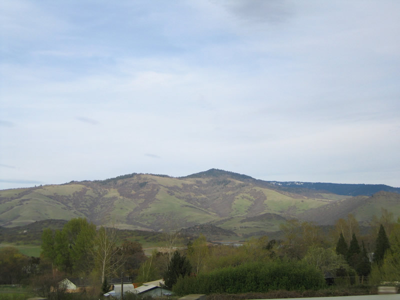
| Dunn Butte and Tom Spring Mountain rises east of Ashland and the Rogue River Valley. The Siskiyou Rest Area and Welcome Center was built along this stretch of Interstate 5, opening July 30, 2019 at a cost of $12 million1. 03/31/05 |
|
| Dunn Butte and Tom Spring Mountain rises east of Ashland and the Rogue River Valley. The Siskiyou Rest Area and Welcome Center was built along this stretch of Interstate 5, opening July 30, 2019 at a cost of $12 million1. 03/31/05 |
|
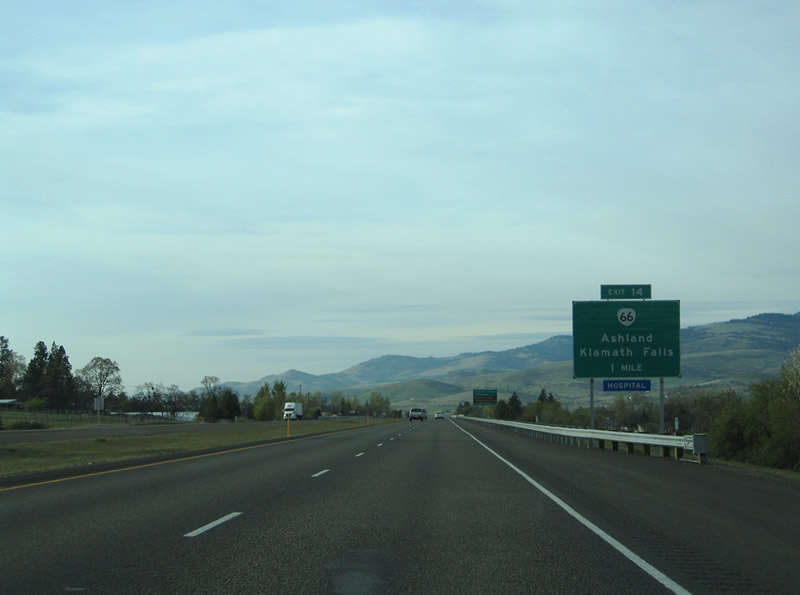
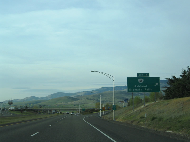
| The second of three Ashland exits joins OR 66 (Ashland Street) with Interstate 5 at Exit 14. OR 66 begins 1.3 miles west of I-5 at OR 99 (Siskiyou Boulevard) opposite Southern Oregon University. The state highway follows Green Springs Highway east from Ashland four miles to the Emigrant Lake Recreation Area. 03/31/05 |
|
| Northbound at the diamond interchange (Exit 14) with OR 66 (Ashland Street). OR 66 provides the most direct route between Ashland and Klamath Falls to the east. The state highway ends at OR 140 near U.S. 97 in 58 miles. Dead Indian Memorial Road links Ashland with OR 140 near Mt. McLaughlin (el. 9,495 feet). 03/31/05 |
|
| The first Interstate 5 northbound reassurance marker in Oregon appeared beyond the entrance ramp from OR 66 (Ashland Street) at Exit 14. Main Street passes over the freeway ahead. 03/31/05 |
|
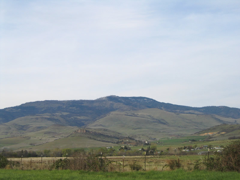
| Interstate 5 continues on a northwest course 5.6 miles to Talent. The freeway serves as a buffer between urban areas of Ashland and rural farmland to the north. 03/31/05 |
|
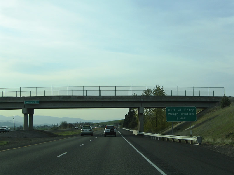
| The first Oregon Port of Entry is located in advance of S Valley View Road (Exit 19). 03/31/05 |
|
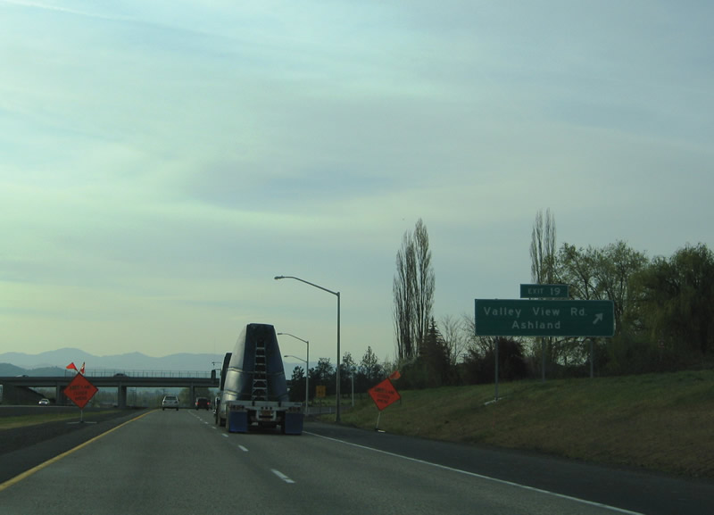
| Three quarters of a mile separate the Port of Entry with the diamond interchange (Exit 19) with South Valley View Road along I-5 north. South Valley View Road spurs north from OR 99 (Rogue Valley Highway) one half mile north to Exit 19. 03/31/05 |
|
| Exit 19 departs Interstate 5 northbound for South Valley View Road. Valley View Road in conjunction with OR 99 (Rogue Valley Highway) south provides a direct route to Main Street and downtown Ashland. South Valley View Road otherwise continues into farming areas north of the freeway. 03/31/05 |
|
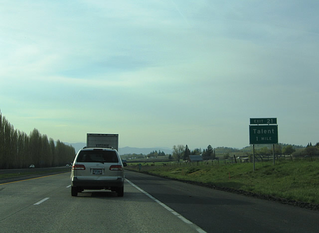
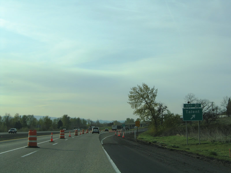
| West Valley View Road intersects Interstate 5 at Exit 21 for the city of Talent. The road meets the freeway at a parclo interchange just one half mile east of OR 99 (Pacific Highway). 03/31/05 |
|
| Interstate 5 northbound at Exit 21 to West Valley View Road. West Valley View Road ventures two miles from South Valley View Road to Exit 21 and 0.7 miles west to Talent Street in Talent. Located 1,635 feet above sea level, Talent began as the homestead for Jacob Wagner in 1853 and later as the military post, Fort Wagner. The fort never really saw combat and instead became a focal point for social and religious activities. Growth continued in 1889 when A.P. Talent designated a town site here, naming it Talent. Incorporation followed on November 11, 1911. 03/31/05 |
|
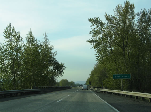
| Interstate 5 continues northwest two miles from Talent to Phoenix. The four lane freeway crosses the Bear Creek midway between Exits 21 and 24. 03/31/05 |
|
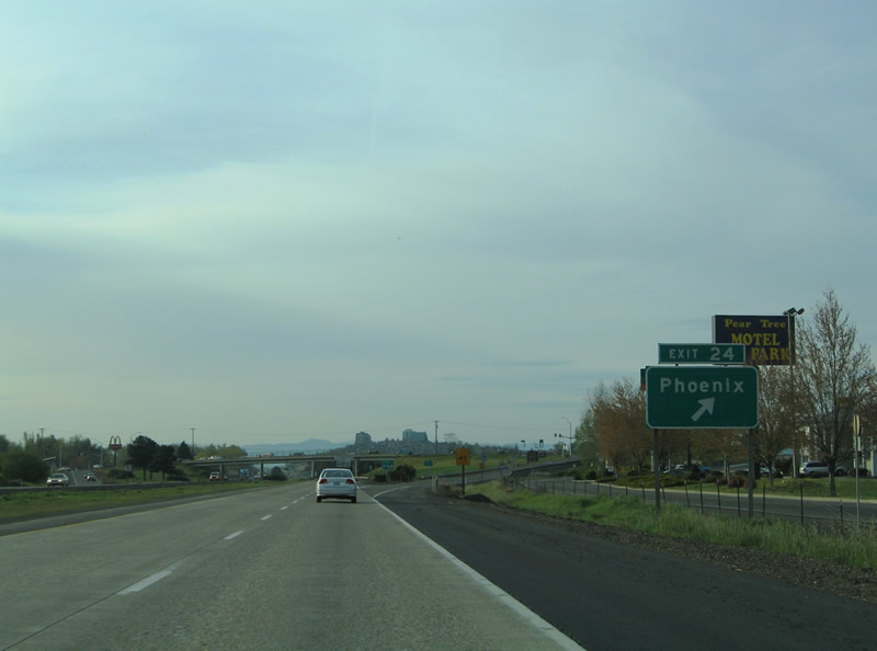
| The succeeding exit connects I-5 with Fern Valley Road at Phoenix. The city of Phoenix, dubbed "The Other Phoenix" in reference to Phoenix, Arizona, began with the residence of early pioneer Sam Colver in 1851. The Rogue Valley became a gold mining area with the discovery of the Jacksonville gold fields soon thereafter and Phoenix grew as a popular stage stop known as Gasburg around the original Colver House. Growth continued and the establishment of a post office by S.M. Waite introduced the name Phoenix for the town. Waite had a policy with the Phoenix Fire Insurance Company and decided to name his post office Phoenix. The name eventually stuck. 03/31/05 |
|
| Interstate 5 reaches the city of Phoenix at Exit 24. Fern Valley Road travels east 0.4 miles from OR 99 (Main Street) to the freeway and another 1.8 miles to Payne Road. Interstate 5 briefly gains a frontage road system at Phoenix. Points of interest for Exit 24 include Eden Valley Orchards and Historic Jacksonville. 03/31/05 |
|
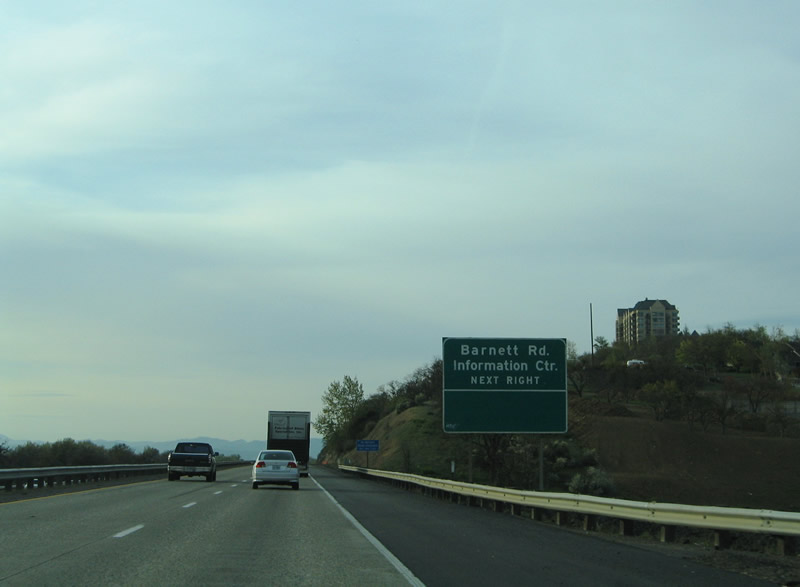
| The southern reaches of Medford include high rise buildings on a bluff over looking the city. A pair of interchanges directly serve the city of Medford. Barnett Road crosses paths with Interstate 5 ahead midway between OR 99 (Riverside Avenue) and Highland Drive. 03/31/05 |
|
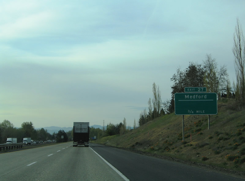
| Exit 27 with Barnett Road serves a Tourist Information Center for the Rogue River Valley and Medford. Barnett Road travels 2.5 miles east from OR 99 (Riverside Avenue) to Phoenix Road. 03/31/05 |
|
| Medford began as an early 1880s railroad town built by the Oregon & California Railroad at a site along Bear Creek. Originally dubbed Middle Ford, railroad engineer David Loring shortened the name to Medford based upon his home town of Medford, Massachusetts. The O & C Railroad reached the settlement by 1884, and incorporation of the town occurred on February 24, 1885. Medford's growth continued as a agricultural and timber center and the seat of Jackson County. The largest city in southern Oregon operates as a regional trade center today. 03/31/05 |
|
| 0.75 miles south of the six-ramp parclo interchange with Barnett Road on Interstate 5 north. Barnett Road west to OR 99 (Riverside Avenue) north links I-5 with Downtown Medford. OR 99 partitions into the one way street couplet of Riverside Avenue (north) and Central Avenue (south) through the Medford business district. I-5 parallels Bear Creek to the east. 03/31/05 |
|
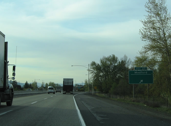
| Exit 27 departs I-5 northbound for Barnett Road. Barnett Road, OR 99, and OR 62 form a business loop through Downtown Medford. A large commercial district fronts the freeway west of Exit 27 and east of OR 99 (Rogue Valley Boulevard). Barnett Road continues west of Riverside Avenue as Barnett Street to Holly and Grape Streets. 03/31/05 |
|
| Interstate 5 travels through the heart of Medford over a four lane viaduct between 12th and Jackson Streets alongside Bear Creek. Like its path through the Ashland area, the freeway remains vastly uninterrupted with no interchanges. 03/31/05 |
|
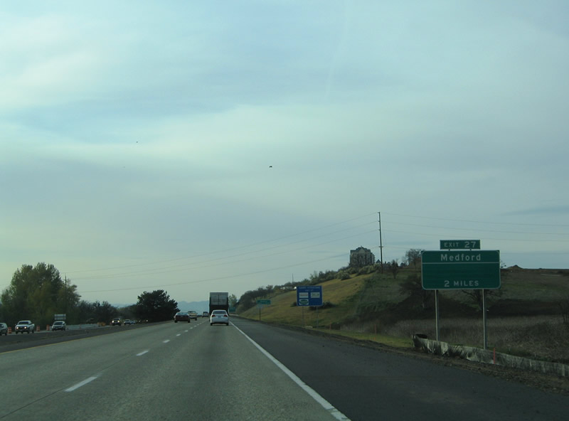
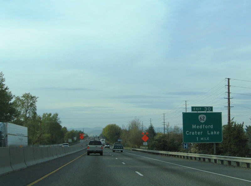
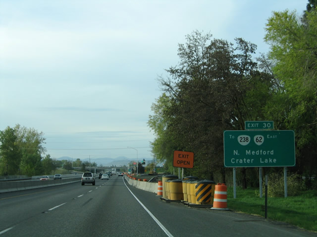
| The second Medford interchange joins the freeway with OR 62 (Crater Lake Highway) at Exit 30. OR 62 links the Medford area with Crater Lake National Park to the far northeast. The state route constitutes a lengthy loop between OR 99 (Riverside Avenue / Court Street) in Medford and U.S. 97 near Chiloquin. 03/31/05 |
|
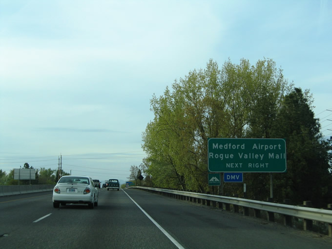
| Exit 30 serves both Rogue Valley International-Medford Airport and Rogue Valley Mall. The airport lies north of OR 62 (Crater Lake Highway) along Biddle Road. Rogue Valley Mall lies east of OR 99 (Riverside Avenue) between McAndrews Road and OR 62. OR 99 southbound follows Court Street to Central Avenue. 03/31/05 |
|
| The six-ramp parclo interchange (Exit 30) with OR 62 (Crater Lake Highway) feeds into an adjacent loop ramp with parallel Biddle Road. OR 62 ends nearby at OR 99 (Rogue Valley Highway) and OR 238 (Jacksonville Highway). OR 238 extends west to Rossanley Drive and Jacksonville. The state route loops west from Medford to Applegate and north to Murphy and Grants Pass. 03/31/05 |
|
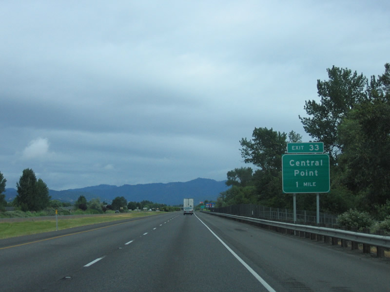
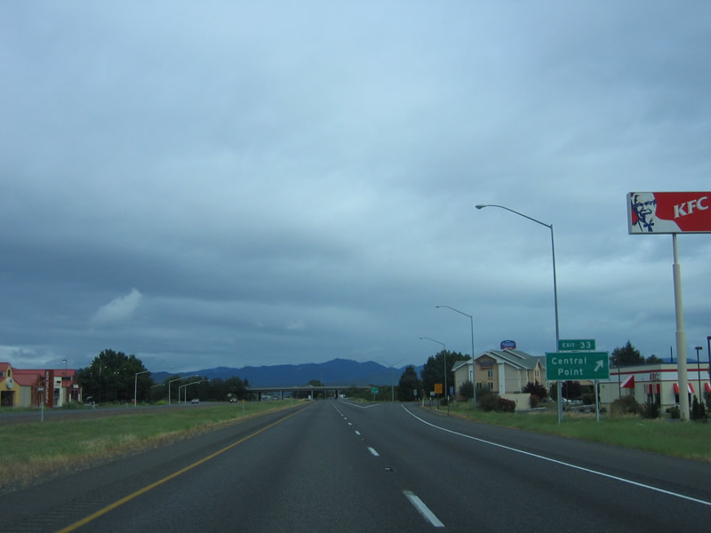
| Interstate 5 departs the city of Medford for the city of Central Point. Founded in 1889, Central Point lies at 1,282 feet above sea level and is home to over 17,000 residents. The city's economy is fueled by agriculture, tourism, timber products, and retail trade industries. Exit 33 provides access to Downtown Central Point and the Jackson County Expo Center via ramps to Pine Street. 05/28/06 |
|
| Northbound Interstate 5 at the diamond interchange (Exit 33) with Pine Street at Central Point. Pine Street continues Biddle Road west from Rogue Valley International-Medford Airport to SR 99 (Front Street) in Downtown Central Point. Pine Street leads south to Hanley Road and OR 238 (Rossanley Drive) from the city. 05/28/06 |
|
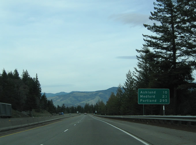
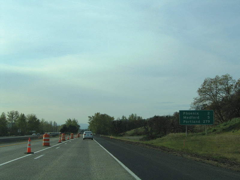
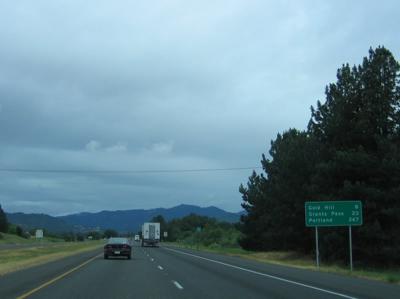
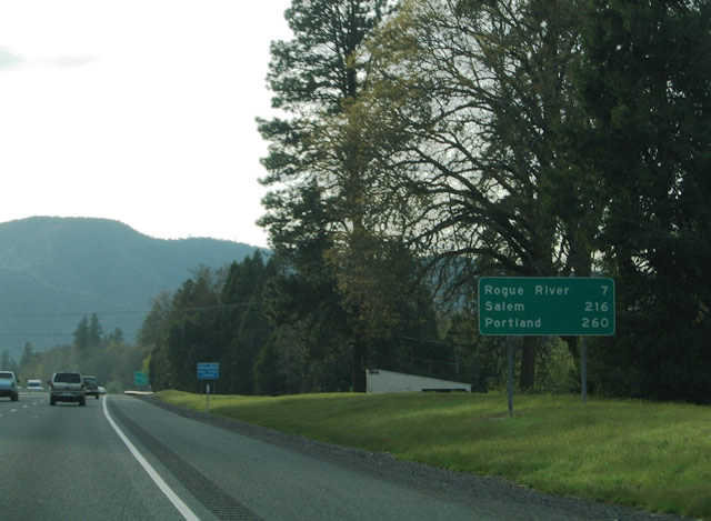
| Continuing from Pine Street, I-5 advances north eight miles to Gold Hill, 23 miles to Grants Pass and 267 miles to Portland. 05/28/06 |
|
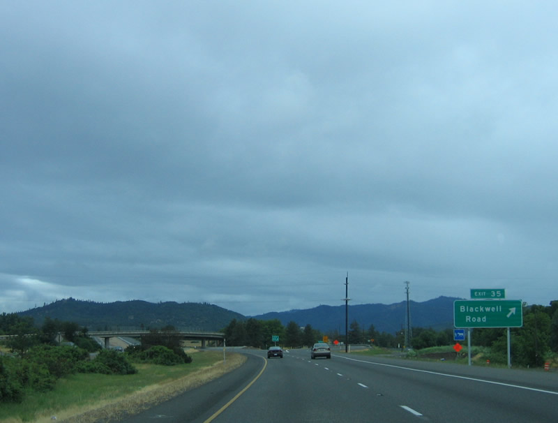
| OR 99 (Rogue Valley Highway) merges onto Interstate 5 ahead at the diamond interchange (Exit 35) with Blackwell Road. The state route overlaps with the freeway five miles west to Gold Hill. Blackwell Road represents the former alignment of U.S. 99 west to Gold Hill, north of I-5. 05/28/06 |
|
| Interstate 5 northbound at Exit 35 to Blackwell Road west and OR 99 (Rogue Valley Highway) south. Blackwell Road heads north 1.2 miles to Kirtland Road. Kirtland Road stems east four miles to Table Rock road outside of White City. 05/28/06 |
|
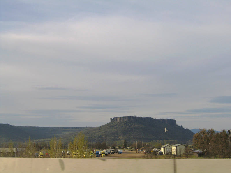
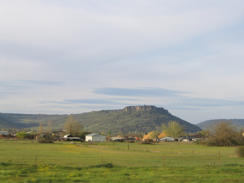
| North facing views of Table Rock and the mountains north of the Rogue River Valley. Interstate 5 travels east-west between Grants Pass and Central Point. 03/31/05 |
|
| OR 99 is omitted from reassurance shields along Interstate 5 north of Blackwell Road and Exit 35. 05/28/06 |
|
| Continuing northbound, Interstate 5 and OR 99 (Pacific Highway) narrow with a concrete barrier separating the four lane freeway. 05/28/06 |
|
| Beyond Milepost 38, Interstate 5 and OR 99 descend toward the Rogue River valley. 05/28/06 |
|
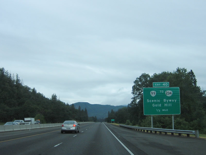
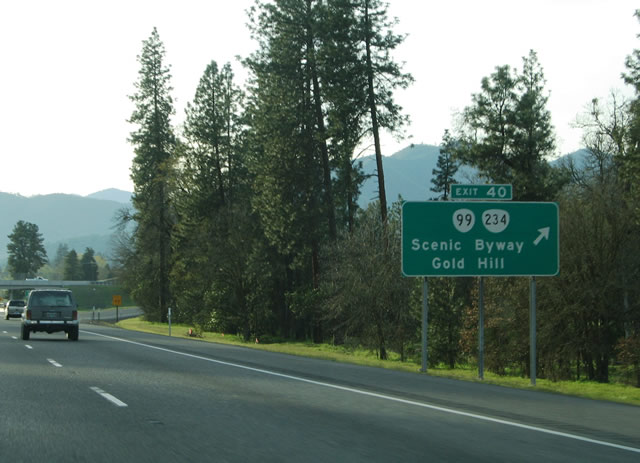
| Interstate 5 and OR 99 north separate at Exit 40. The state route travels north from Old Stage Road to Blackwell Road and the Gold Hill Spur. OR 99 crosses the Rogue River and enters Gold Hill via 2nd Street ahead of OR 234 (7th Street). Incorporated in 1895, Gold Hill began as a mining town after the discovery of a single gold nugget. The town grew as a trading post. 05/28/06 |
|
| Northbound at the diamond interchange (Exit 40) with Old Stage Road south and OR 99 north to Gold Hill. Old Stage Road travels seven miles northwest from Beall Lane outside of Central Point to I-5. OR 234 is an Oregon Scenic Byway from Gold Hill northeast to OR 62 north of Eagle Point. The scenic byway extends along OR 62 northeast to OR 230, and on OR 230 and 138 around Crater and Diamond Lakes. 03/31/05 |
|
| I-5 and adjacent OR 99 parallel the Rogue River west from Gold Hill to the Josephine County line and Grants Pass. Salem, Oregon debuts on distance signs at 216 miles out. 03/31/05 |
|
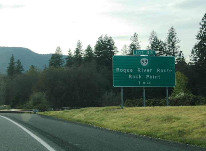
| OR 99 follows 2nd Avenue through Gold Hill and Sams Valley Highway west to Rock Point. The Rogue River Highway crosses the Rogue River via the Rock Point concrete arch Bridge ahead of Exit 43. The parallel state highway hugs the southern banks of the Rogue River between Rock Point and the Josephine County line. 03/31/05 |
|
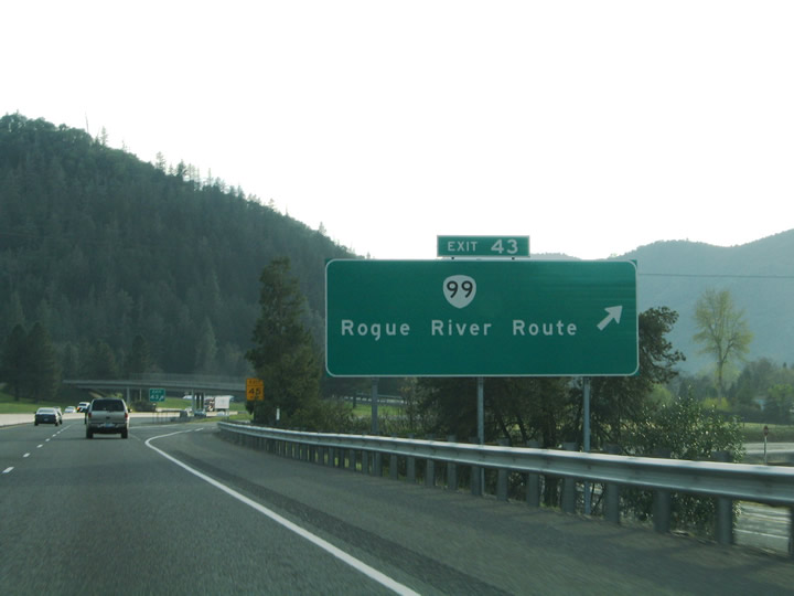
| Entering the diamond interchange (Exit 43) for OR 99 on I-5 north. A short access road joins Interstate 5 with Profetta Lane, an east side frontage road, and OR 99 (Rogue River Highway) along the west side of the freeway. Rock Point lies across the river to the north. 03/31/05 |
|
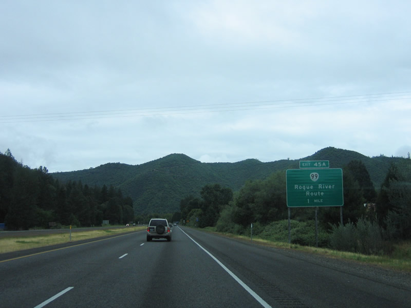
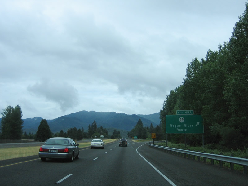
| OR 99 (Rogue River Highway) crosses paths with Interstate 5 again at a folded diamond interchange (Exit 45A) at the crossing of the Rogue River. 05/28/06 |
|
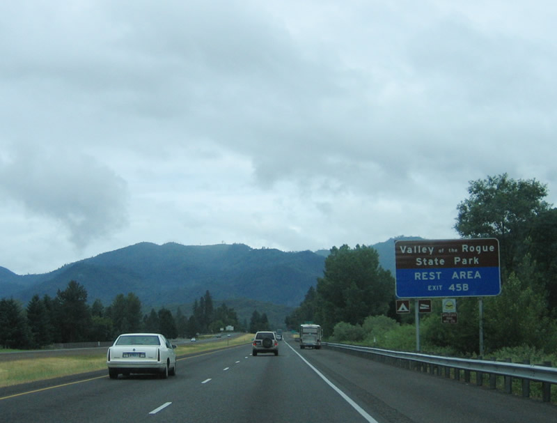
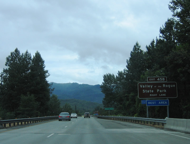
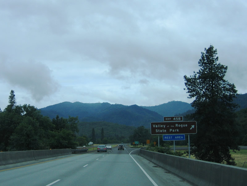
| Exit 45B departs Interstate 5 at north for Valley of the Rogue State Park. The riverside park acts as a rest area for Interstate 5 travelers. 05/28/06 |
|
| OR 99 stays south of Interstate 5 and the Rogue River from Exit 45A to the city of Rogue River, Fruitdale and Grants Pass. 05/28/06 |
|
| Crossing over OR 99 (Rogue River Highway) and the Rogue River, I-5 reaches the folded diamond interchange (Exit 45B) with Valley of the Rogue State Park and North River Road. 05/28/06 |
|
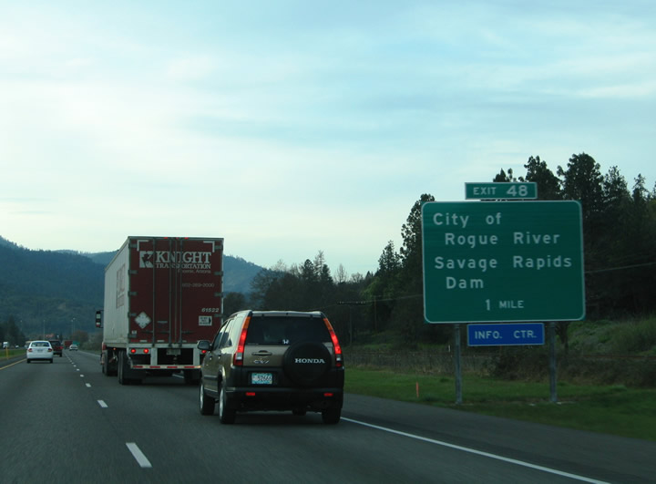
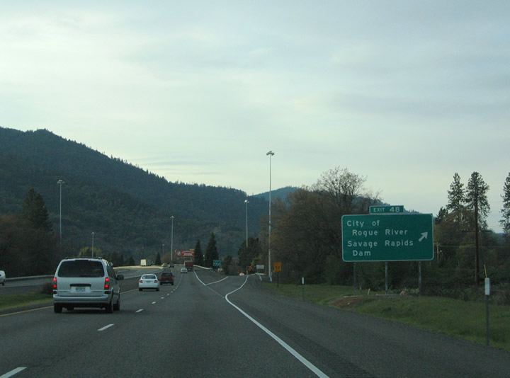
| Interstate 5 straddles the north banks of the Rogue River to Exit 48 in Rogue River. The Rogue River derives its name from native Americans that settled along the banks. Trappers and traders later settled in the valley and the discovery of gold in 1851 brought thousands of miners to the area. Gold mining prospered here with over $70 million of the precious metals taken. Once the gold reserves tapped out, the economic staple of the area switched to agriculture. 03/31/05 |
|
| The diamond interchange (Exit 48) with Depot Street links I-5 with OR 99 (Rogue River Highway) and Main Street in Downtown Rogue River. Pine Street and West Evans Creek Road head north into the adjacent mountains. The Savage Rapids Dam was formerly located four miles east of Grants Pass nearby. The controversial dam was constructed by the U.S. Bureau of Reclamation to serve the Grants Pass Irrigation District. Opponents of the structure advocated for its removal, claiming that the blockage was detrimental to the passage of salmon and steelhead. Federal legislation agreeing with the claim was passed and the dam was fully removed by 2009 and replaced with pumps. 03/31/05 |
|
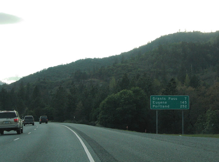
| Interstate 5 leaves the city of Rogue River and continues seven miles to the Josephine County seat of Grants Pass. Eugene appears for the first time at 145 miles out. 03/31/05 |
|
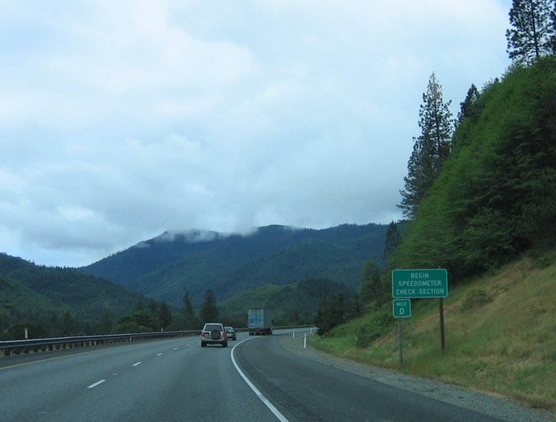
| Interstate 5 bends along the trajectory of the Rogue River ahead of Grants Pass. A speedometer check section lies along the approach to the Josephine County line. 05/28/06 |
|
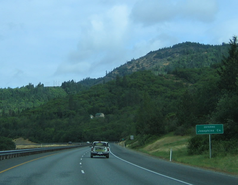
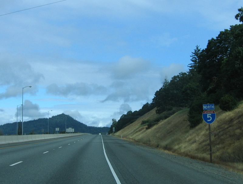
| Interstate 5 enters Josephine County. 05/28/06 |
|
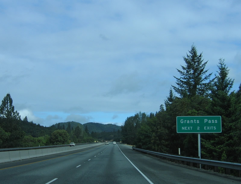
| The next two interchange on northbound Interstate 5 serve the city of Grants Pass: Exit 55, U.S. 199 south and Exit 58, OR 99 and Business U.S. 199 (6th and 7th Streets) south. 05/28/06 |
|
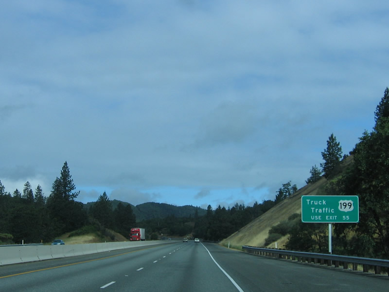
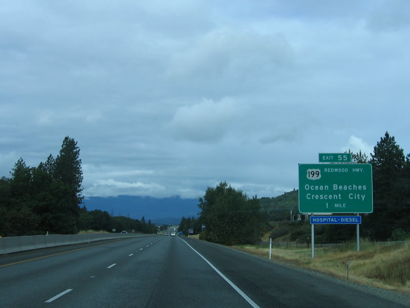
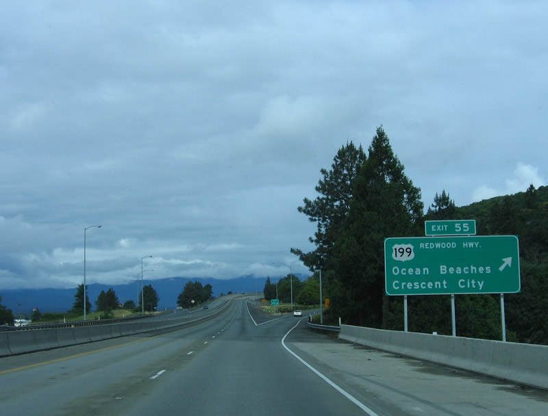
| Traveling west toward trumpet interchange (Exit 55) with the east end of U.S. 199 at Grants Pass on I-5. U.S. 199 follows Redwood Highway southwest from Grants Pass to the California state line south of O'Brien. Redwood forests spread along the ocean facing mountains of northwestern California and southwestern Oregon. 05/28/06 |
|
| U.S. 199 (Grants Pass Highway) follows a bypass of Downtown Grants Pass between Exit 55 and OR 99 (Rogue River Highway) and OR 238 (Williams Highway). Redwood Highway (former U.S. 199) overlays OR 99 (6th and 7th Streets) through Downtown. U.S. 199 and Redwood Highway combine west of OR 99/238 en route to Wilderville, Selma and Cave Junction. U.S. 199 ends at Crescent City (U.S. 101) along the Pacific coastline in Del Norte County, California. 05/28/06 |
|
| I-5 angles northwest from U.S. 199 along the Grants Pass street grid. 05/28/06 |
|
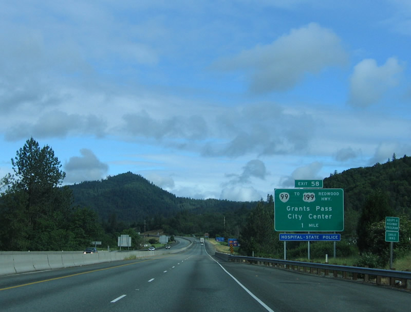
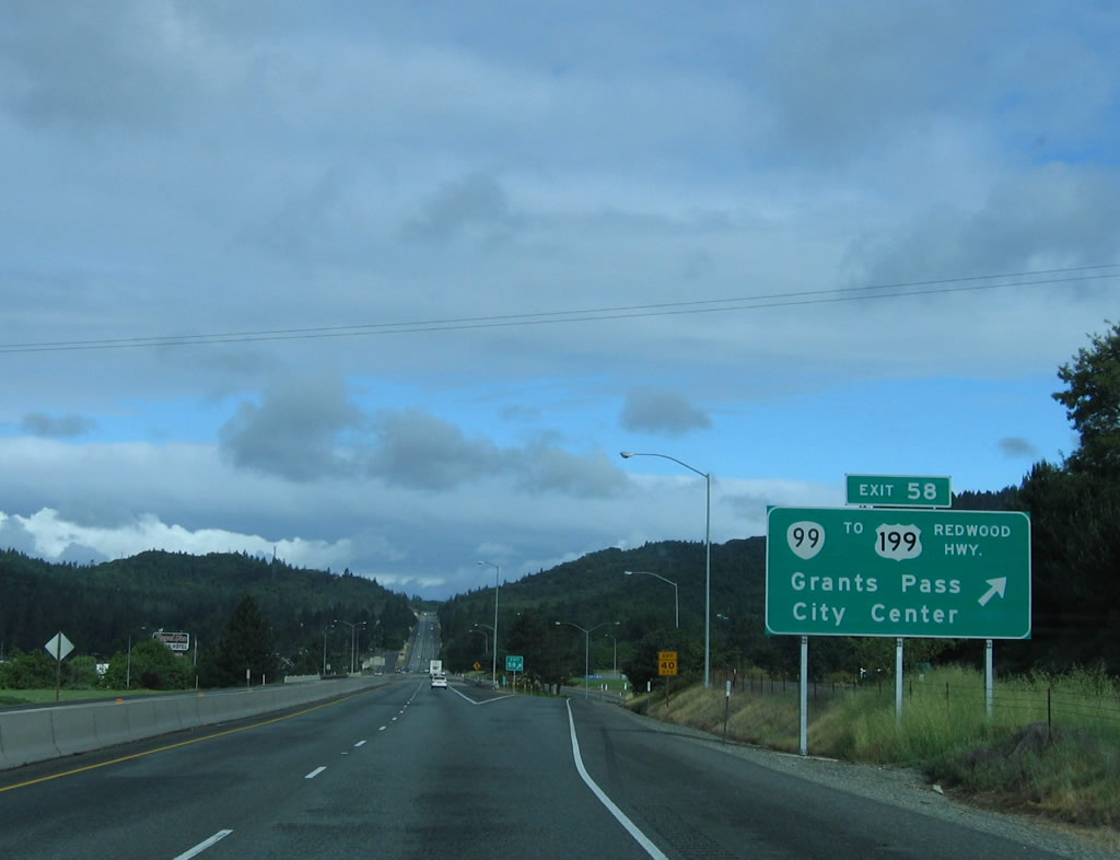
| Forthcoming Exit 58 joins the freeway with the one way couplet of OR 99 (6th & 7th Streets) in north Grants Pass. OR 99 travels through Downtown between U.S. 199 (Grants Pass Highway / Redwood Highway) and OR 238 (Williams Highway). 05/28/06 |
|
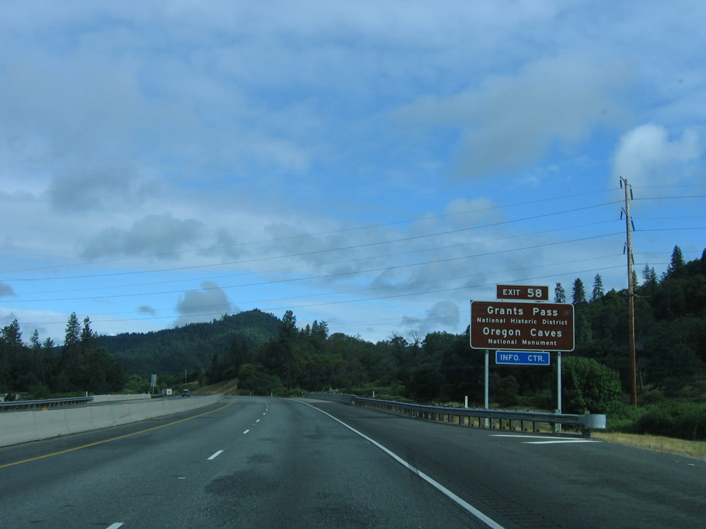
| Exit 58 serves the National Historic District of Grants Pass and the Oregon Caves National Monument. Oregon Caves N.M. is 19 miles east of U.S. 199 (Redwood Highway) and Cave Junction via OR 46 (Caves Highway). A marble cave lies below and old coniferous forest that includes the widest known Douglas-fir tree in Oregon. 05/28/06 |
|
| OR 99 follows 6th Street (north) and 7th Street (south) through the Grants Pass city center. The state route follows Rogue River Highway east from U.S. 199 (Redwood Highway) and OR 238 (Williams Highway) to Fruitdale. 05/28/06 |
|
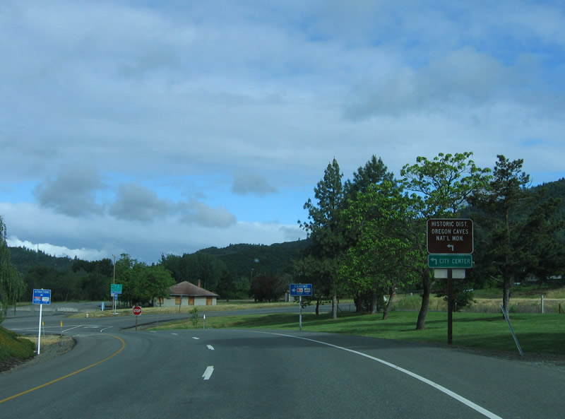
| At the base of the ramp is this sign, pointing to the city center and Oregon Caves National Park via a left turn onto OR 99 south. 05/28/06 |
|
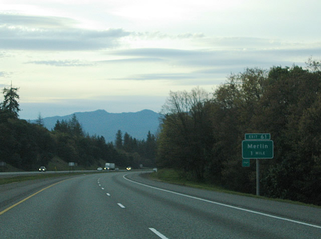
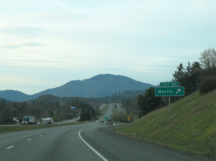
| Although not signed, OR 99 combines with I-5 north for the second time between Grants Pass (Exit 58) and Tri City (Exit 103). The succeeding exit northbound is with Merlin Road. Merlin Road stems west from Highland Avenue (Historic U.S. 99) and Exit 61 west 4.5 miles to the unincorporated community of Merlin. 03/31/05 |
|
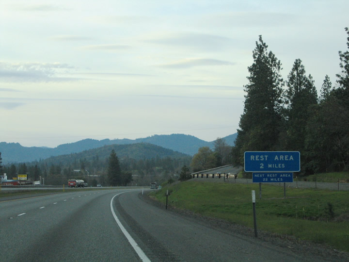
| The Manzanita Rest Area lies north of the diamond interchange (Exit 61) with Merin Road. 03/31/05 |
|
| Exit 61 parts ways with I-5 north for Merlin Road west and Highland Avenue (old U.S. 99). Merlin Road travels west to Merlin to Galice and Hugo Roads. Merlin is the gateway to the "The Wild & Scenic Rogue River" and Hellgate Canyon. 03/31/05 |
Sources:
- "New I-5 rest area-welcome center opens near Ashland", News Channel 21 (www.ktvz.com), retrieved 06/24/23.
03/31/05 by AARoads. 05/28/06 by AARoads and Joel Windmiller.
Connect with:
U.S. 199 Oregon
Route 62
Route 99 and Historic U.S. 99
Page Updated 03-04-2007.

 North
North