|
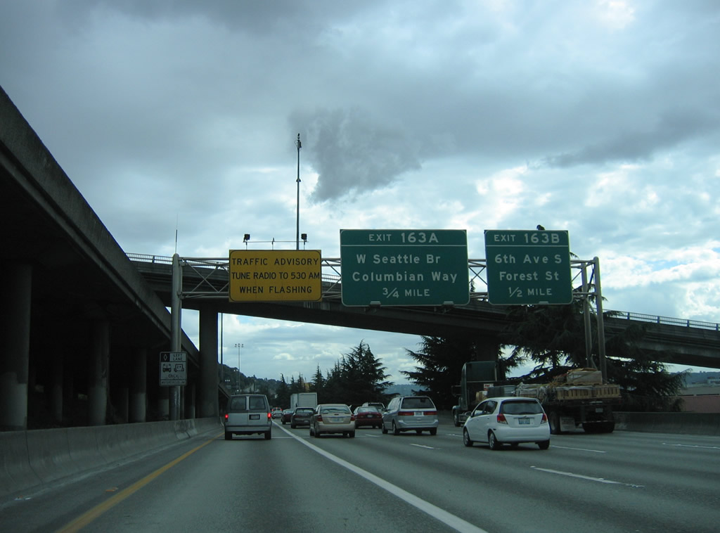
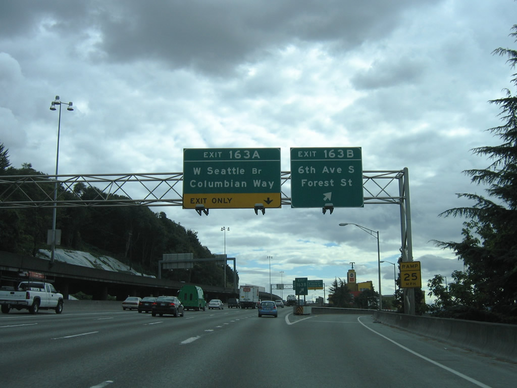
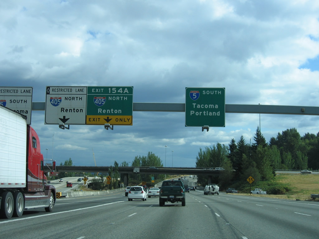
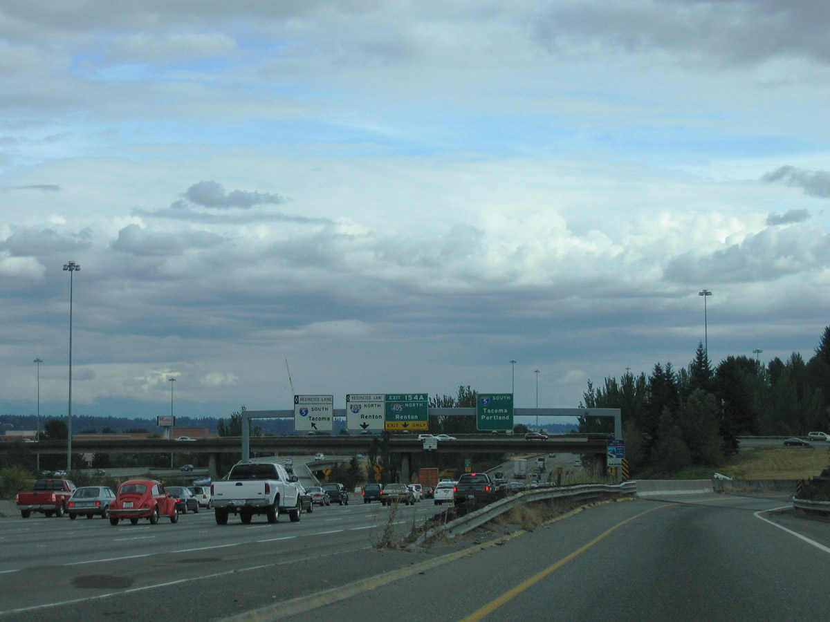
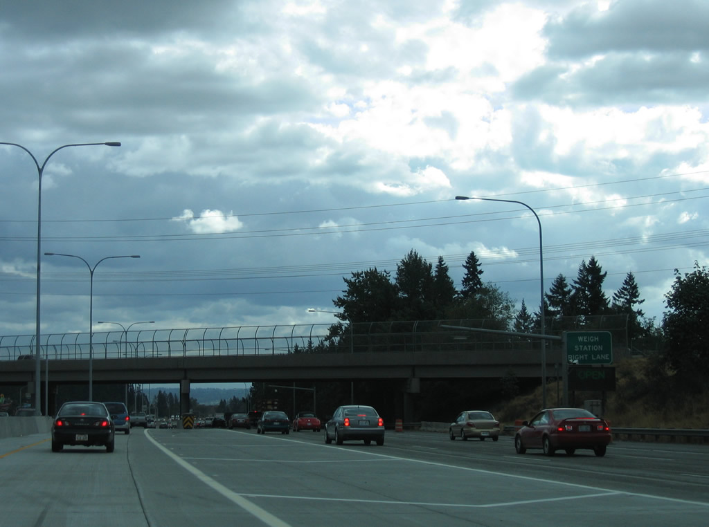
| Interstate 5 south travels below I-5 north along the hill side west of Beacon Hill. Passing under Beacon Avenue, the freeway advances toward the off-ramp (Exit 163B) for Forest Street west. A stack interchange with the Spokane Street Viaduct west and Columbian Way east follows at Exit 163A. 08/29/06 |
|
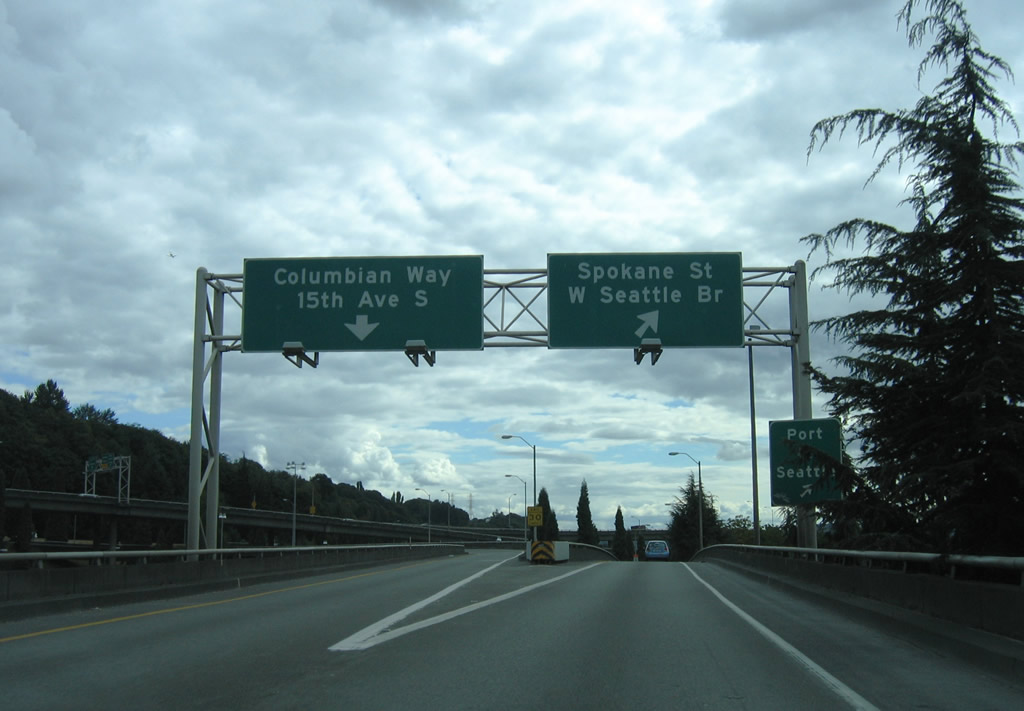
| Exit 163A joins Interstate 5 south with the West Seattle Bridge to Harbor Island and West Seattle and Spokane Street below to the Duwamish industrial area and Port of Spokane facilities. The West Seattle Bridge constitutes an elevated freeway west to Fauntleroy Way in West Seattle. 08/30/06 |
|
| The Forest Street off-ramp drops from Interstate 5 (Exit 163B) ahead of the intersection with 6th Avenue South. 6th Avenue South provides access to northern areas of the Duwamish Industrial area. 08/30/06 |
|
| Exit 163A carries all traffic in unison to Columbian Way east to Beacon Hill and South Seattle and the Spokane Street Viaduct west to Harbor Island, Youngstown, and West Seattle. The freeway was completed in the early 1980s and is undergoing expansion and modernization in 2010. 08/30/06 |
|
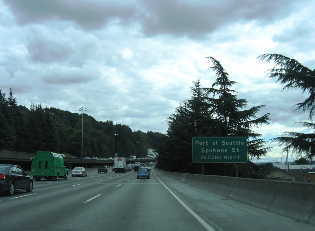
| Columbian Way continues the Spokane Street Viaduct freeway to the Beacon Hill street grid at 14th and 15th Avenues south. The viaduct west provides access to Spokane Street and the Port of Seattle facilities below at 1st Avenue South and Harbor Island. 08/30/06 |
|
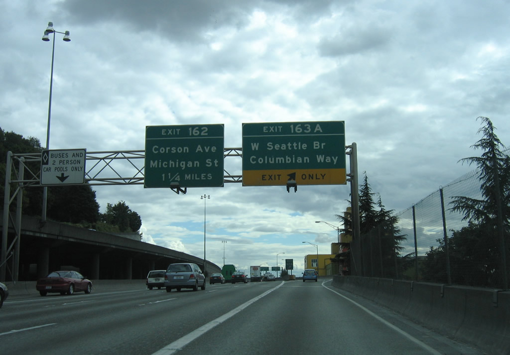
| A pair of off-ramps join Interstate 5 with the Georgetown and Van Asselt areas of south Seattle at Exits 162 and 161. 08/29/06 |
|
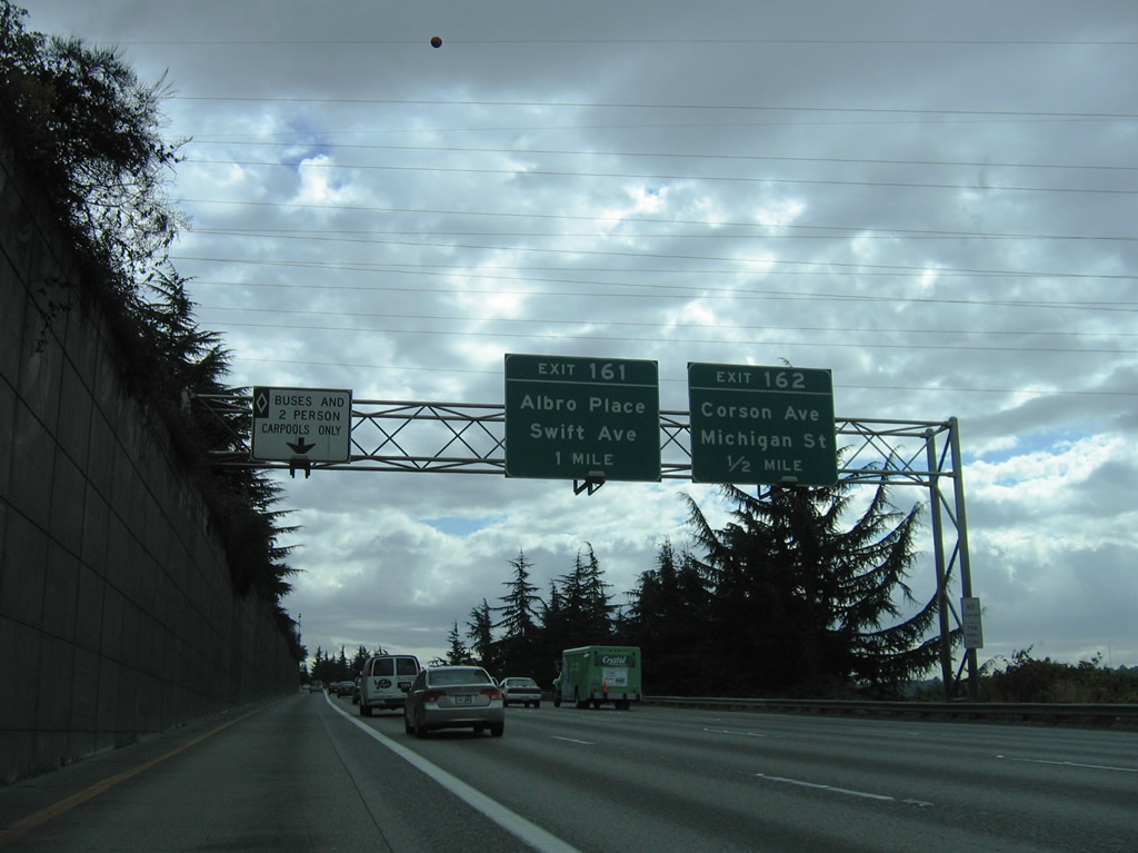
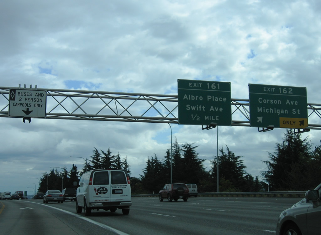
| Exit 162 carries two lanes as it leaves Interstate 5, passes over the parallel BNSF Railroad, and drops down onto Corson Avenue ahead of Michigan Street. Much of the Georgetown area west of Corson Avenue is industrialized. Michigan Street connects Bailey Street with SR 99 and the 1st Avenue Bridge over the Duwamish Waterway. 08/29/06 |
|
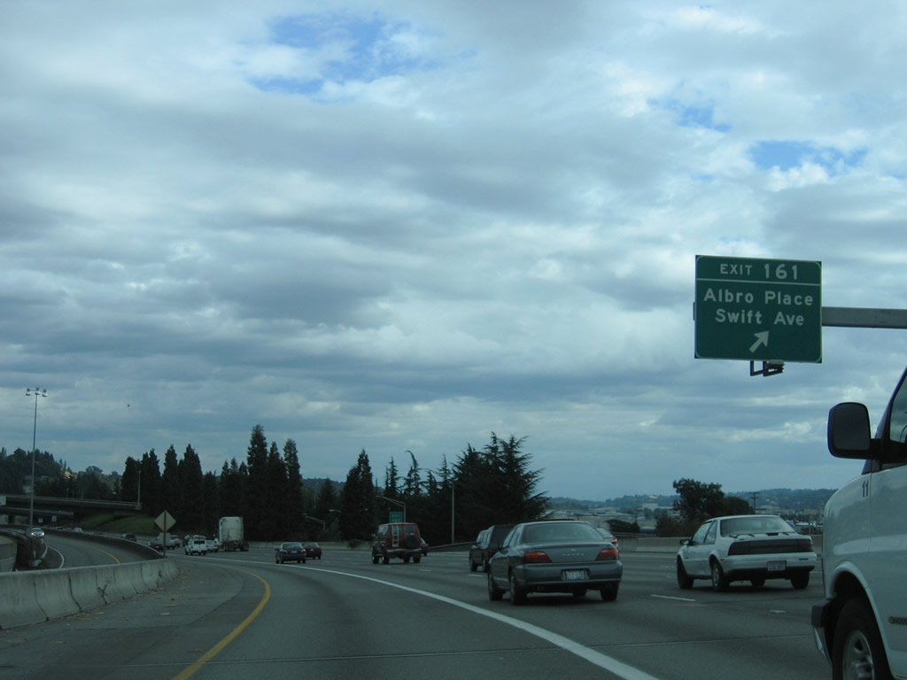
| Exit 161 follows and leads directly to Albro Place at Corglat Drive. Albro Place connects Interstate 5 with Ellis Avenue at Georgetown to the west and Swift Avenue near Holly Park on the adjacent hillside. 08/29/06 |
|
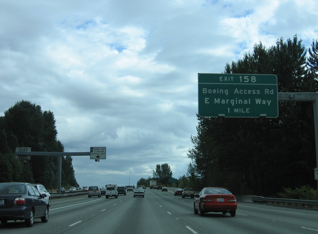
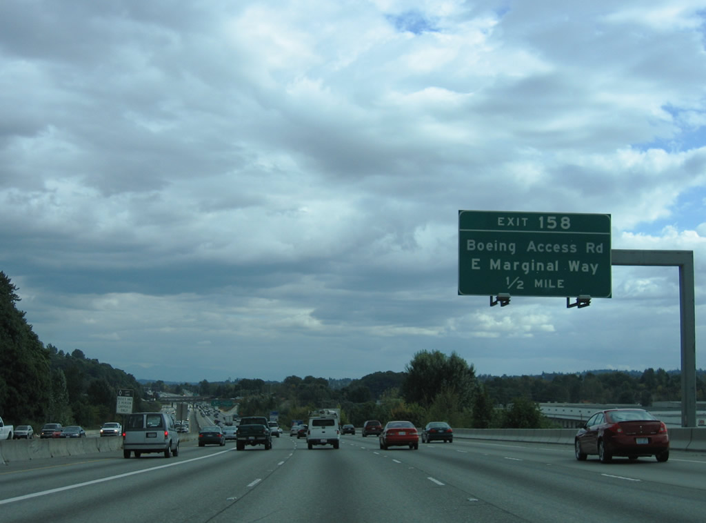
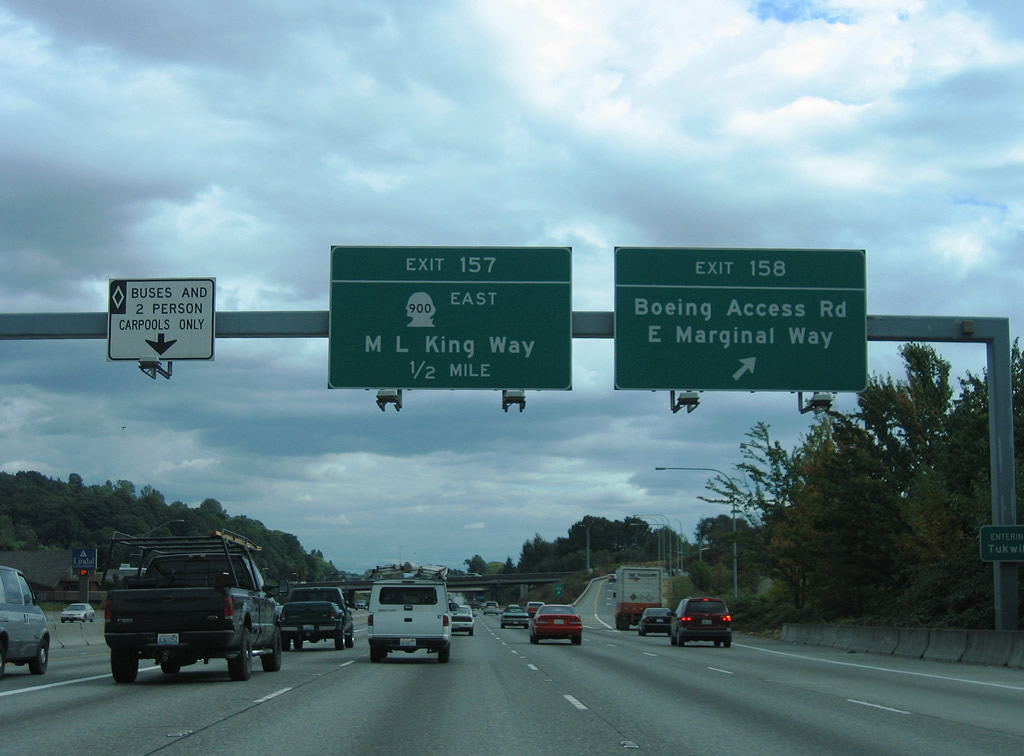
| Exit 158 provides access to South Boeing Access Road west to Airport Way and East Marginal Way south of the Seattle Boeing plant and adjacent airport. South Boeing Access Road comprises a short expressway between SR 900 (Martin Luther King Jr., Way) and Pacific Highway South (historic U.S. 99). 08/29/06 |
|
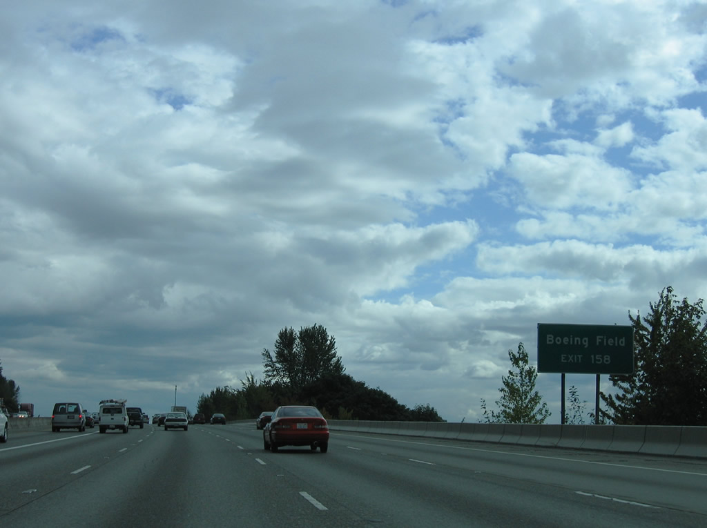
| Interests to Boeing Field / King County International Airport (BFI) should take Exit 158 onto South Boeing Access Road west to its trumpet interchange with Airport Way South. Airport Way began at 4th Avenue South near CenturyLink Field and ends here. 08/29/06 |
|
| East Marginal Way splits with historic U.S. 99 (Pacific Highway) at Duwamish and Boeing Access Road west of Exit 158. Pacific Highway angles southwest to Riverton Heights in Tukwilla while East Marginal Way shadows the SR 599 freeway near the Allentown and Foster communities. 08/29/06 |
|
| Southbound at the Exit 158 ramp departure to South Boeing Access Road. SR 900 begins nearby and follows Martin Luther King, Jr. Way southeast from northeast Tukwila to Renton. The state route originally continued along MLK Way north to Interstate 90. 08/29/06 |
|
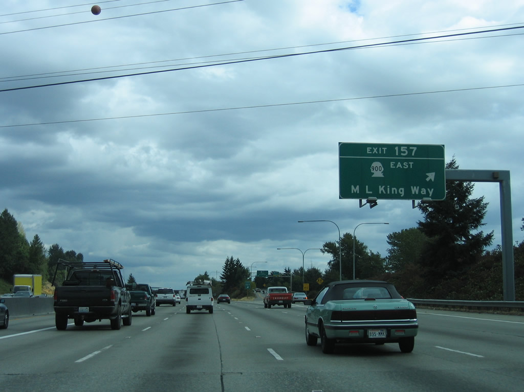
| SR 900 (Martin Luther King, Jr. Way) separates into one way roadways and parallels Interstate 5 briefly at Exit 157. A slip ramp provides access onto SR 900 east before Interstate 5 curves west over the Duwamish River. SR 900 continues into unincorporated Skyway and the city of Renton via Sunset Boulevard. Overall the state route comprises 16.20 miles east to I-90 (Exit 15) at Issaquah. 08/29/06 |
|
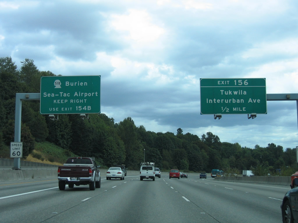
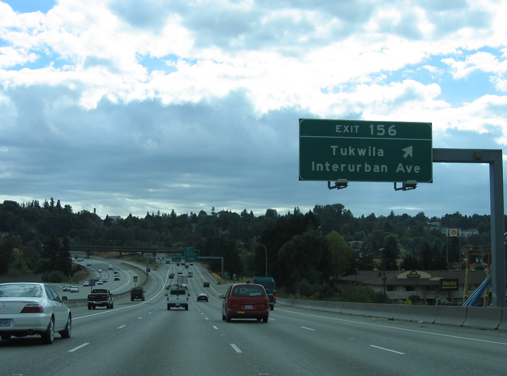
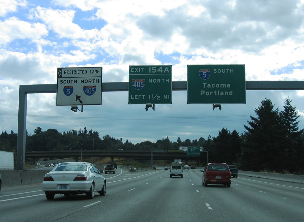
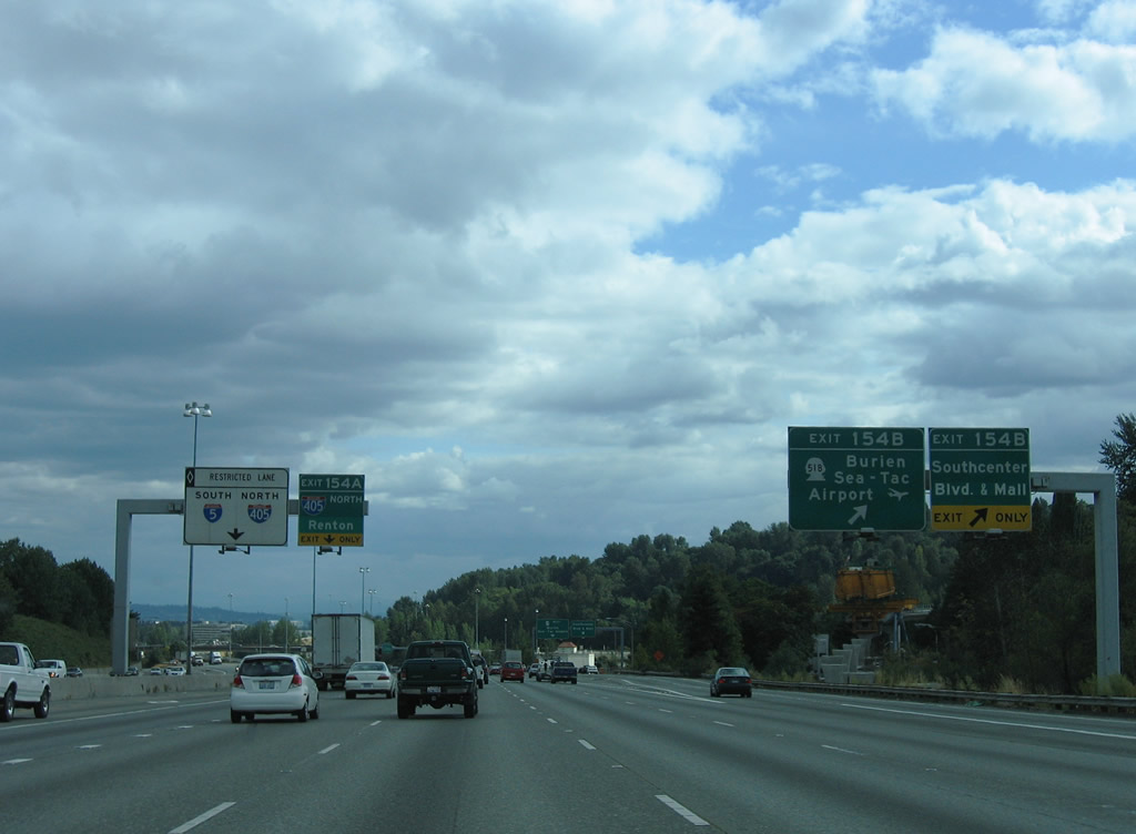
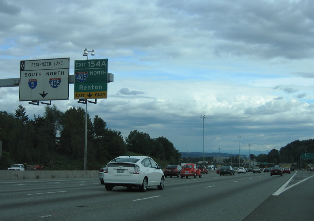
| Interstate 5 bisects northern Tukwila, meeting Interurban Avenue (Exit 156), SR 599 south (via a wye interchange), and SR 518 (Exit 154B) over the next three miles. 08/29/06 |
|
| Lowering to cross the BNSF Railroad and Duwamish River on Interstate 5 south. The left HOV-2 lane splits into its own roadway to the Interstate 405 north & SR 518 (Exit 154) junction. Motorists destined for the airport should leave the HOV-lane before Exit 156. 08/29/06 |
|
| Interurban Avenue travels north from Exit 156 to East Marginal Way near Duwamish and south to Interstate 405 and SR 181 (West Valley Highway) in east Tukwila. The north-south road was originally part of an extended SR 181 to Boeing Access Road.1 08/29/06 |
|
| Interstate 5 leaves the half diamond interchange with Interurban Avenue and prepares to merge with SR 599 south, 1.50 miles out from the directional cloverleaf interchange with Interstate 405 north and SR 518 west. The HOV-lane shifts to its own lane and merges with an on-ramp from the ending SR 599. 08/29/06 |
|
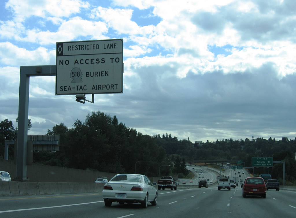
| SR 518 continues the Interstate 405 southbound freeway west to Seattle-Tacoma International Airport and Burien at SR 509. 08/29/06 |
|
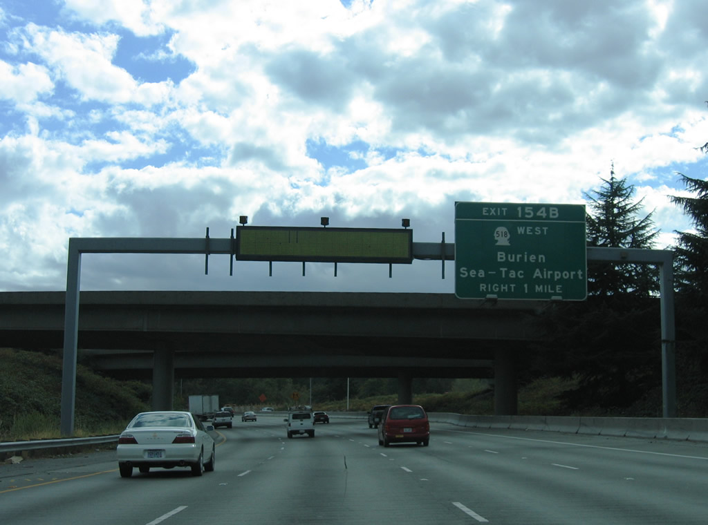
| Exit 154B splits into ramps for SR 518, a 3.42 mile freeway, and Southcenter Boulevard, a parallel road linking the Southcenter Mall area with South 154th Street (former SR 518) at Riverton Heights. Exit 154A meanwhile constitutes a left side ramp onto Interstate 405 north to Renton, Newcastle, and Bellevue. 08/29/06 |
|
| Exit 154B parts ways with Interstate 5 south for Southcenter Mall and Seattle-Tacoma International Airport. SR 518 leads west through SeaTac to end as 148th Street near the Burien city center. 08/29/06 |
|
| The connection with Interstate 405 north follows and joins the left side of the freeway loop ahead of SR 181 and Renton. Interstate 405 travels 30.30 miles north to Bellevue, Kirkland, and Bothell. 08/30/06 |
|
| Following the Exit 154B ramp to its partition into components for SR 518 west and Southcenter Boulevard. Southcenter Boulevard parallels Interstate 405 east to 51st Avenue for access to the mall and SW Grady Way in Renton. Westward, South 154th Street, the original alignment of SR 518, continues the road west to Five Corners and Sunnydale in Burien. 08/29/06 |
|
| Interstate 5 south at the northbound ramp for I-405 (Exit 154B). Direct HOV lane connections are available due to the left side ramp. Interstate 405 first opened between Tukwila and Renton on September 3, 1965 as SR 405.2 08/29/06, 08/30/06 |
|
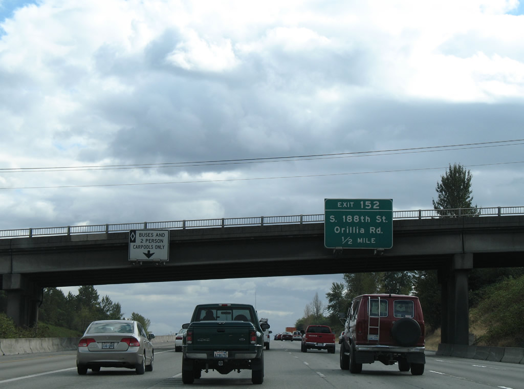
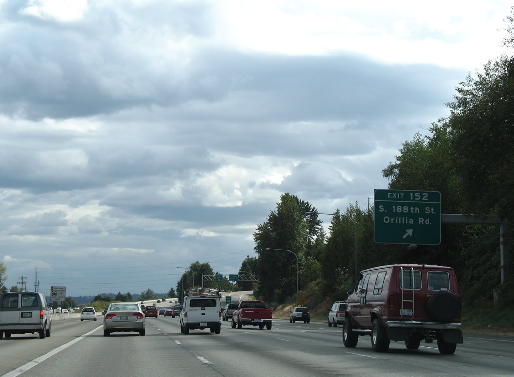
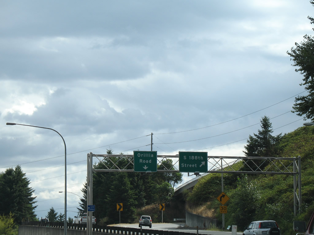
| Continuing south, Interstate 5 enters the city limits of SeaTac and next meets South 188th Street west to Angle Lake and east to Orillia Road south at Exit 152. 08/29/06 |
|
| Orillia Road commences its path on the north side of Interstate 5 from Exit 152 to South 212th Street in south Tukwila. South 188th Street heads west to Seattle-Tacoma International Airport and the SR 509 freeway at Burien. 08/29/06 |
|
| A diamond interchange joins Interstate 5 with South 188th Street, with a separate ramp passing under Military Road to 188th Street west. 08/29/06 |
|
| Southbound reassurance marker posted for Interstate 5 at milepost 152. 08/29/06 |
|
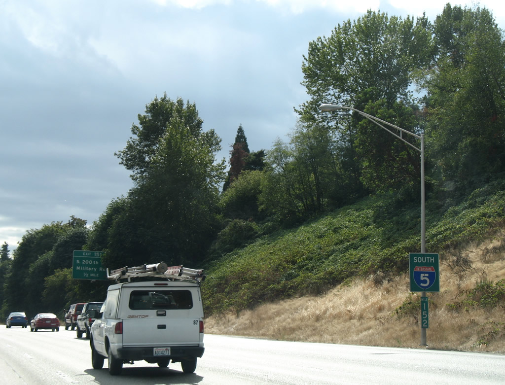
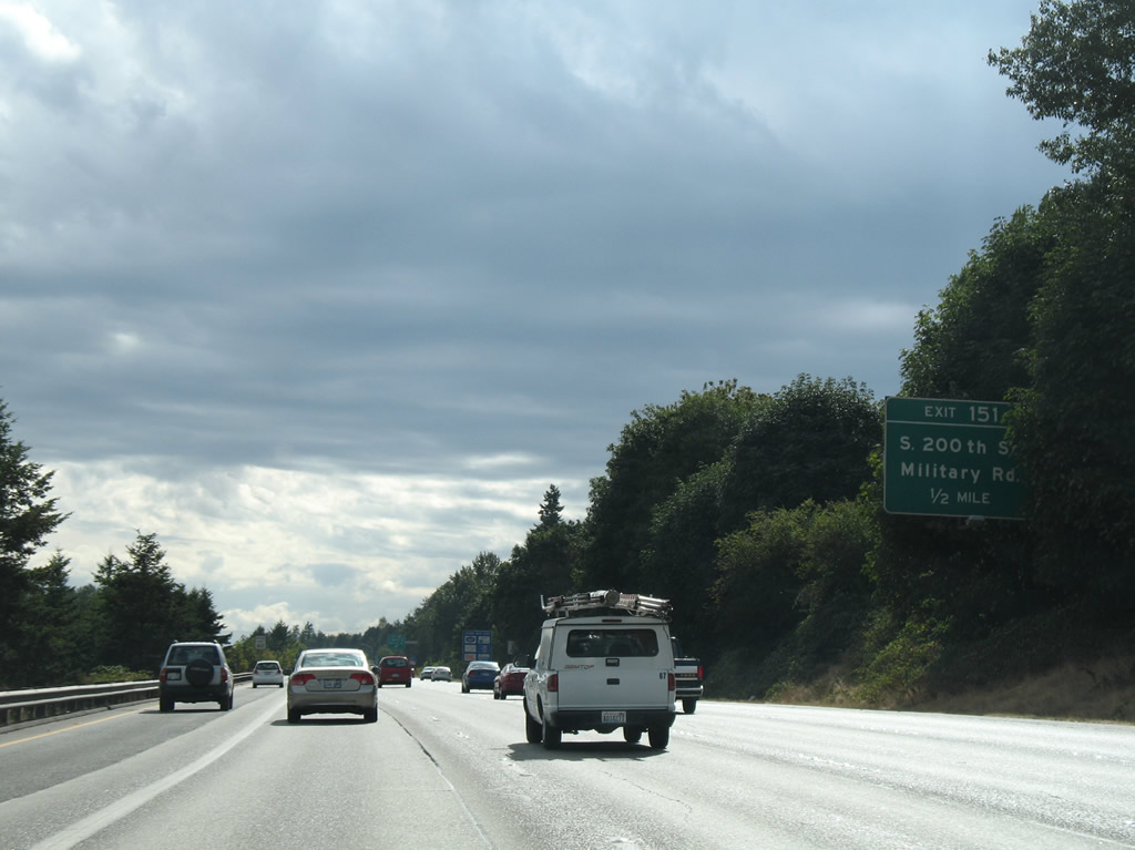
| Military Road begins at South 160th Street in SeaTac and winds southward and travels alongside Interstate 5 from South 188th Street to a folded-cloverleaf interchange at Exit 151 / South 200th Street. 08/29/06 |
|
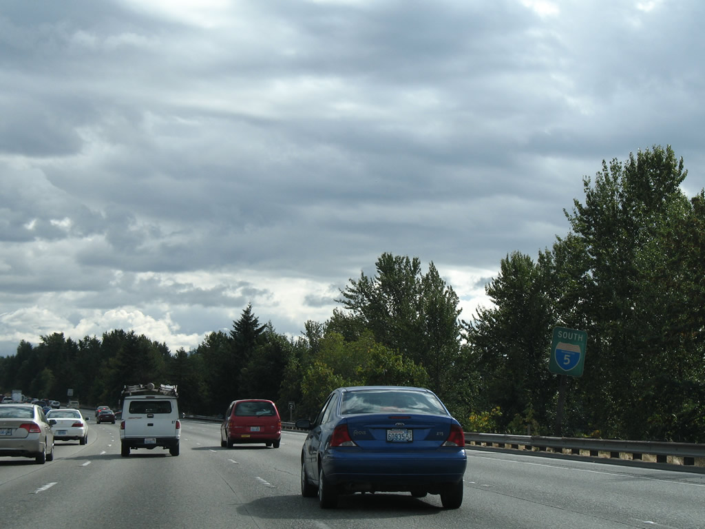
| Interstate 5 straddles the Des Moines and SeaTac city line between Exits 151 and 149. A rare state-named reassurance marker is pictured here. 08/29/06 |
|
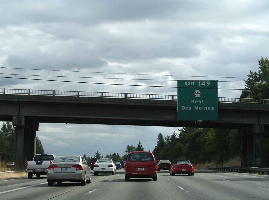
| Attached to the South 216th Street overpass is the first sign of SR 516 (Exit 149). A six-ramp parclo interchange joins Interstate 5 with Kent des Moines Road west to Des Moines and east to Kent.
The planned extension of the SR 509 freeway south from South 188th Street will tie into Interstate 5 near the SR 516 exit. SR 509 presently follows a surface route west through Normandy Park and Des Moines, but will be upgraded to a freeway to better serve the Port of Seattle area in Seattle. 08/29/06 |
|
| SR 516 constitutes a 16.49 mile route between Marine View Drive (transition to SR 509 north) near the Des Moines city center and Maple Valley. The state route connects Interstate 5 with Highline Community College to the west and the Midway community to the east. 08/29/06 |
|
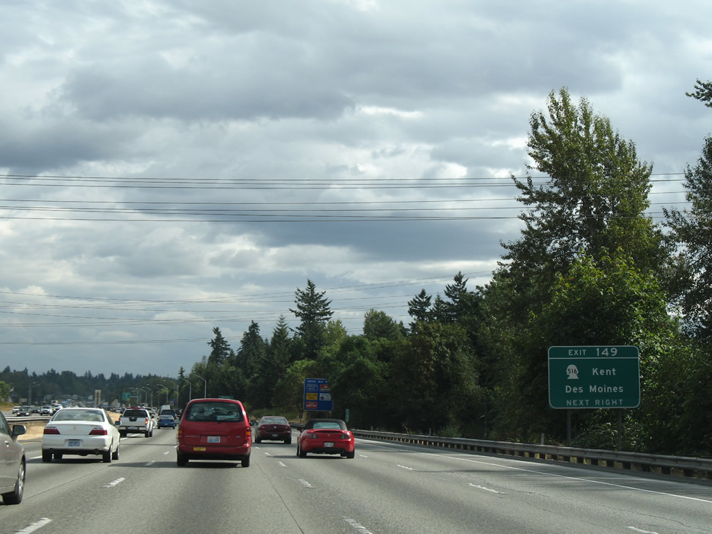
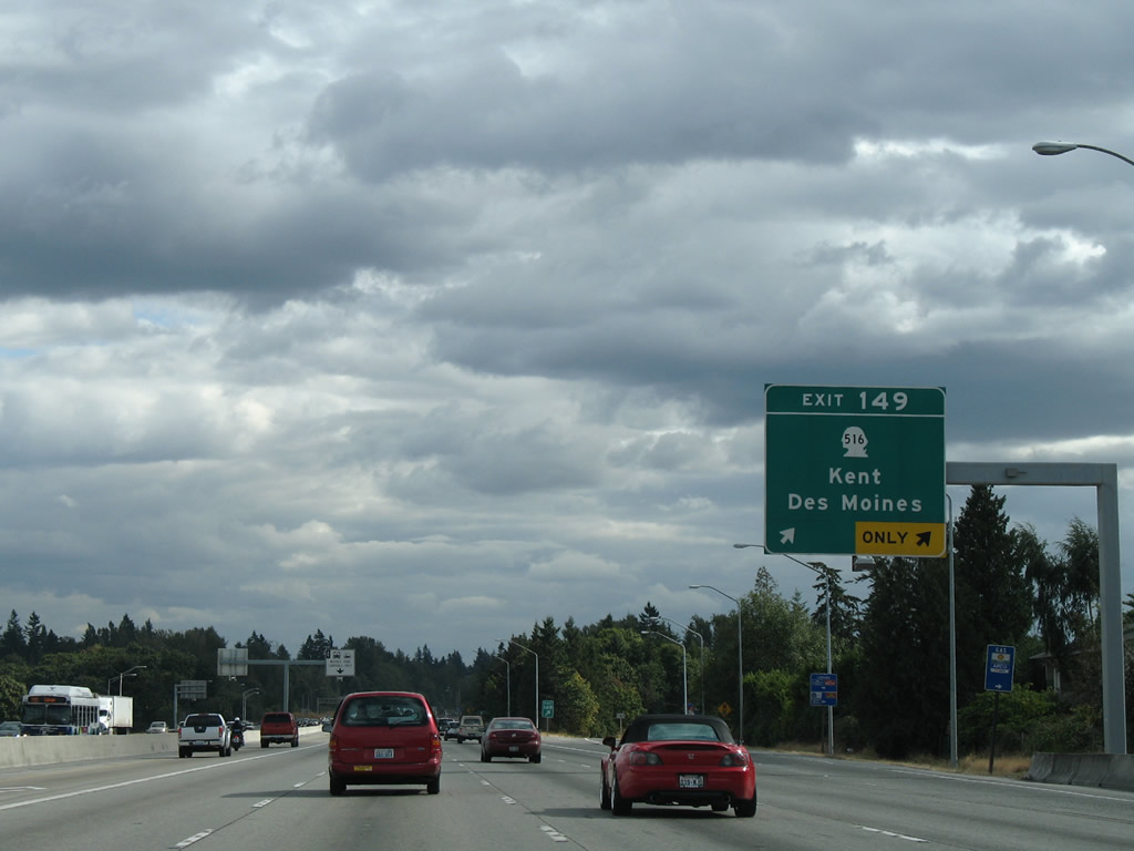
| Exit 149 drops down from Interstate 5 south to SR 516 (Kent des Moines Road). SR 516 intersects SR 99 south (Pacific Highway) nearby and winds east three miles to the Kent city center. The state route constitutes an expressway between Interstate 5 and SR 167.
The interchange with SR 516 will be upgraded once SR 509 ties into Interstate 5 from the north. Included in the design are connections with South 231st Way. 08/29/06 |
|
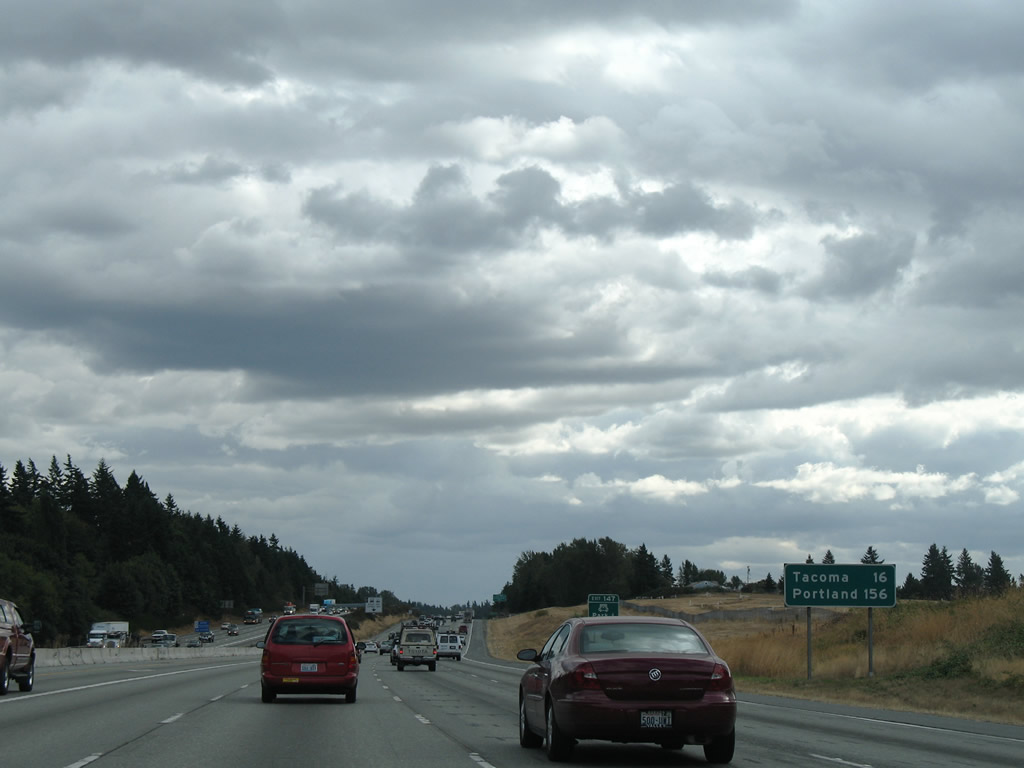
| Southbound distance sign posted 16 miles north of Tacoma and 156 miles from Portland, Oregon. This stretch of Interstate 5 will see expansion as part of the I-5 - SR 509 Corridor Completion and Freight Improvement Project. 08/29/06 |
|
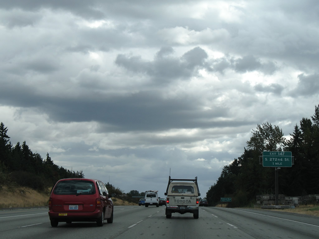
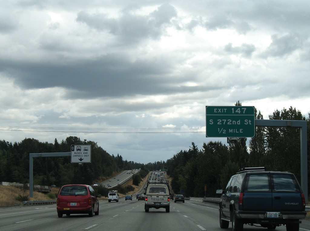
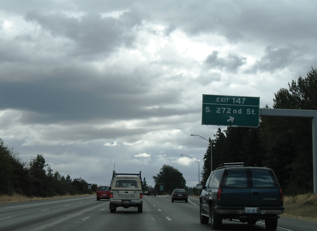
| Exit 147 provides the first of three exits to serve the city of Federal Way. South 272nd Street travels the municipal boundary between Federal Way and Kent west to SR 99 (Pacific Highway). 08/29/06 |
|
| South 272nd Street travels west to Woodmont Beach and east to Star Lake and South 277th Street to SR 167 near Thomas. 08/29/06 |
|
| Southbound at the Exit 147 diamond interchange with South 272nd Street on Interstate 5. 08/29/06 |
|
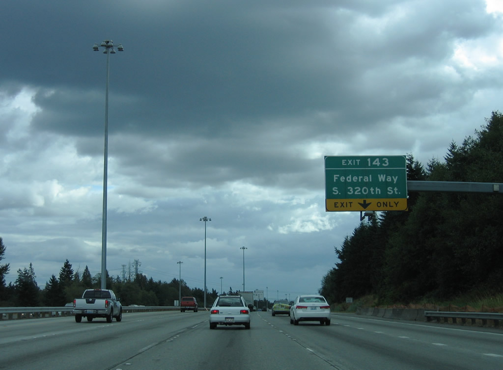
| The second Federal Way interchange joins Interstate 5 with South 320th Street near the city center and The Commons at Federal Way (formerly the Seatac Mall). 08/29/06 |
|
| A parclo interchange joins Interstate 5 with South 320th Street in Federal Way. South 320th Street exits the city to the east, becoming Peasley Canyon Road toward Auburn. 08/29/06 |
|
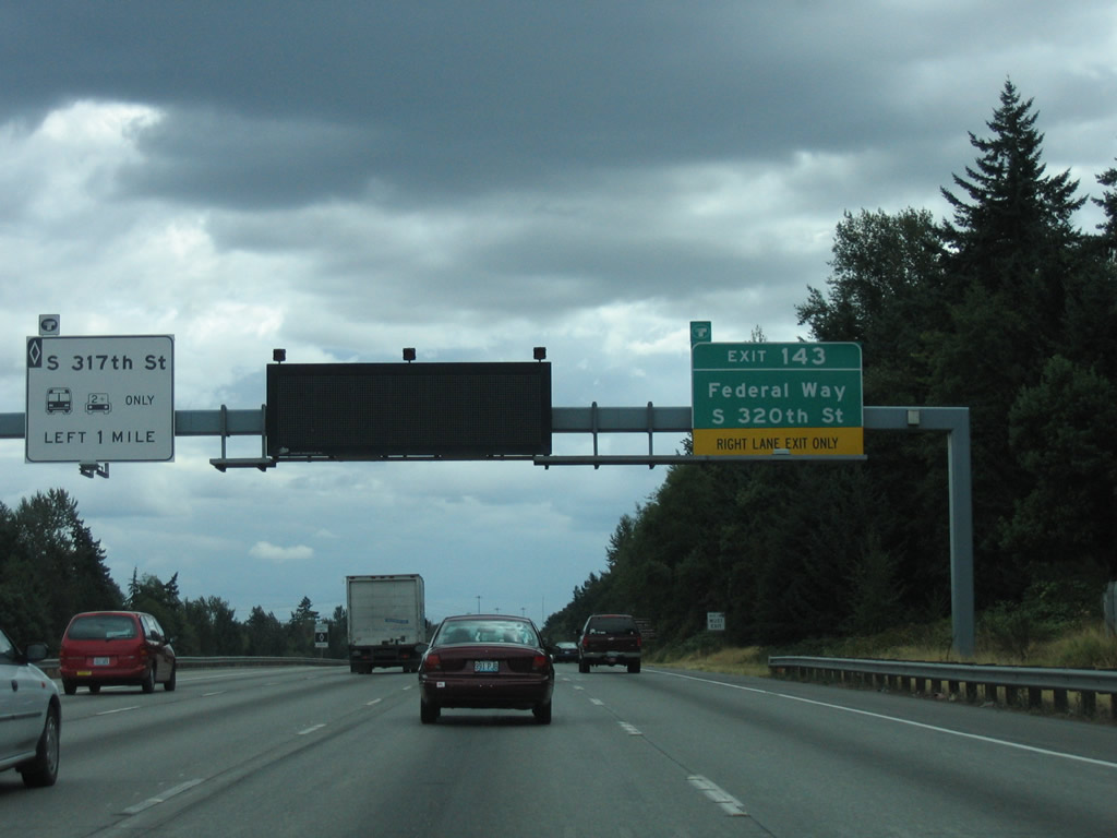
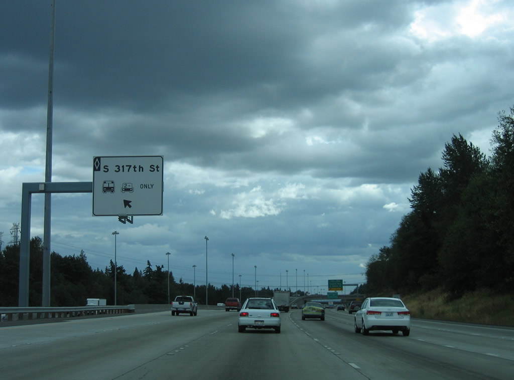
| The HOV-2 lane also has an exit ramp for downtown Federal Way. Departing to the left, the ramp connects with an access road to a roundabout between South 317th Street and 28th Avenue South. 08/29/06 |
|
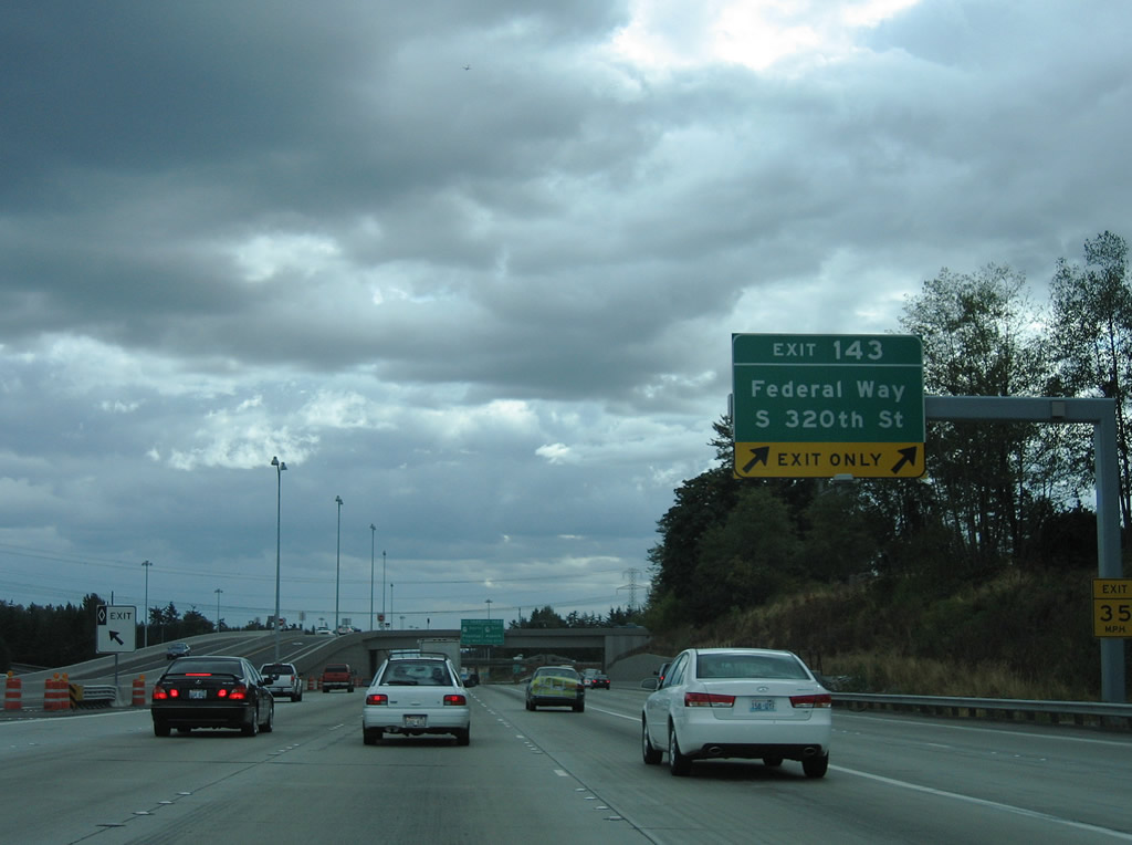
| Exit 143 leaves Interstate 5 south as a two lane off-ramp to South 320th Street. 320th Street continues west to 47th Avenue SW near Dash Point State Park. 08/29/06 |
|
| SR 18, a 28.41 mile route, sees a cloverleaf interchange with Interstate 5 at Exit 142 in Federal Way. SR 18 stretches as a freeway for all but the eastern seven miles between Hobart and Interstate 90. A WSDOT project entails widening of that final stretch to four lanes. 08/29/06 |
|
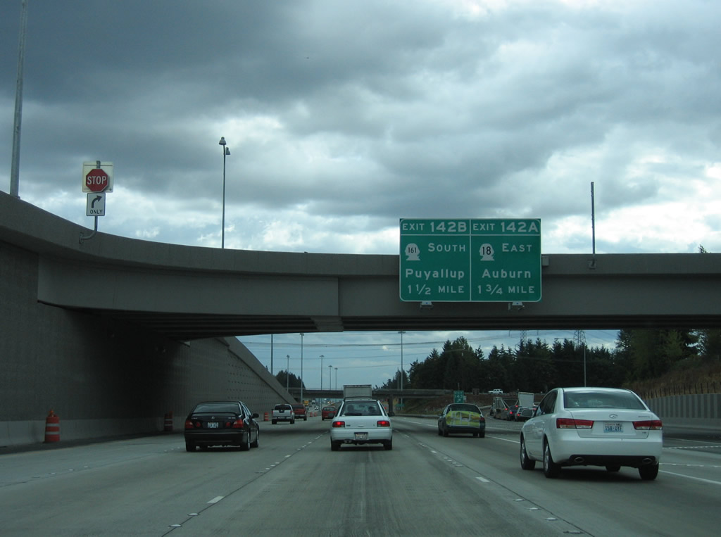
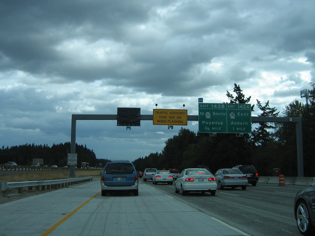
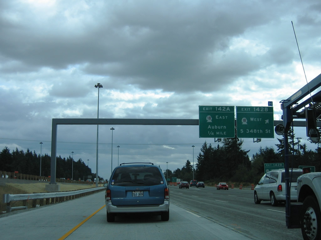
| Exit 142B departs in three quarters of a mile for SR 18 (South 348th Street) west to SR 161 (16th Avenue South) and SR 99, the route's western terminus. Exit 142A connects with the SR 18 freeway east to Auburn, Covington, and Maple Valley. 08/29/06 |
|
| SR 18 connections with SR 164 at Auburn or SR 167 south to SR 410 (historic U.S. 410) at Sumner lead drivers to Enumclaw and Mount Rainer. 08/29/06 |
|
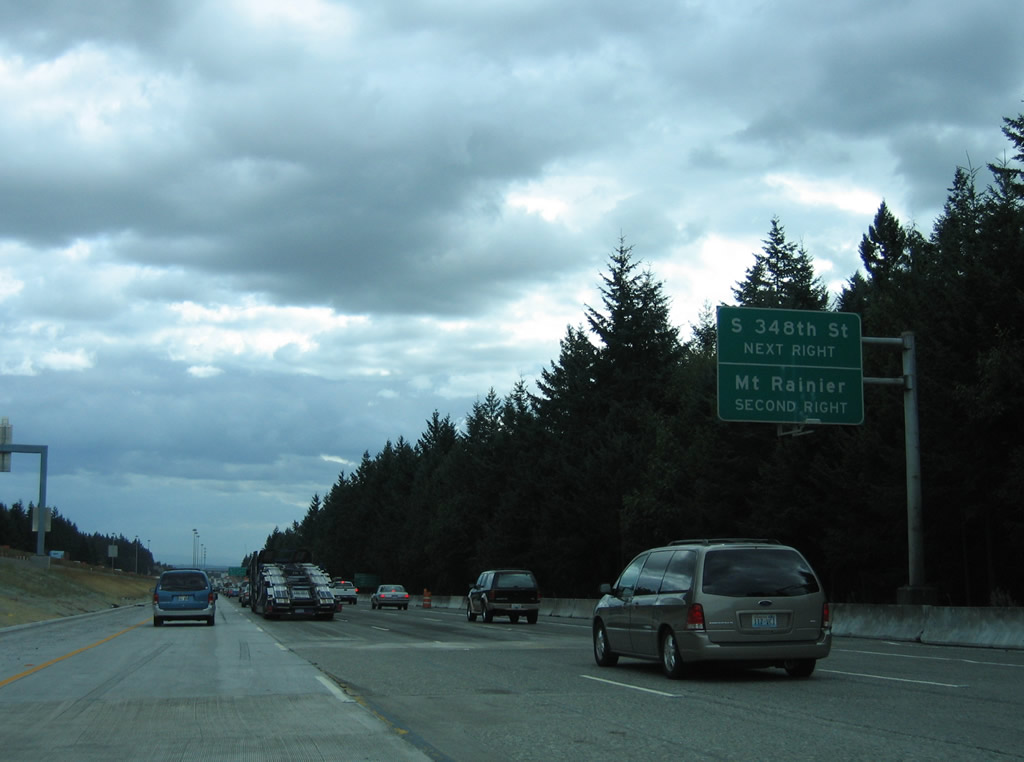
| Southbound Interstate 5 at the westbound off-ramp to SR 18 (Exit 142B). There is no direct access to nearby SR 161 (Enchanted Parkway) from Interstate 5. Instead motorists are directed onto SR 18 (South 348th Street) west to make the connection with the north-south highway. SR 161 is a 36.25 mile state route that leads south from SR 18 to the Six Flags theme park of Wild Waves Enchanted Village, Milton, Edgeway, and Puyallup. 08/29/06 |
|
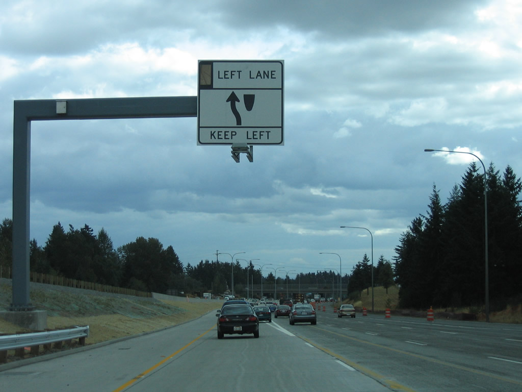
| The HOV-2 lane diverges briefly at the SR 161 (Enchanted Parkway) overpass to avoid a bridge support. 08/29/06 |
|
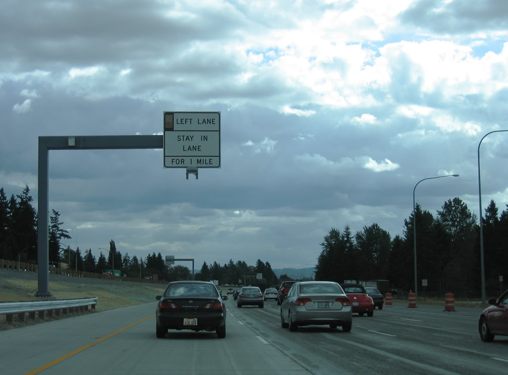
| A truck weigh station lies along Interstate 5 south after SR 161. Unlike the northbound facility, no rest area provisions are provided for motorists. 08/29/06 |
|
| Motorists in the Interstate 5 carpool lane must not make lane changes until after the South 375th Street overpass near the Pierce County line. 08/29/06 |
Page Updated 10-27-2010.

 South
South