|
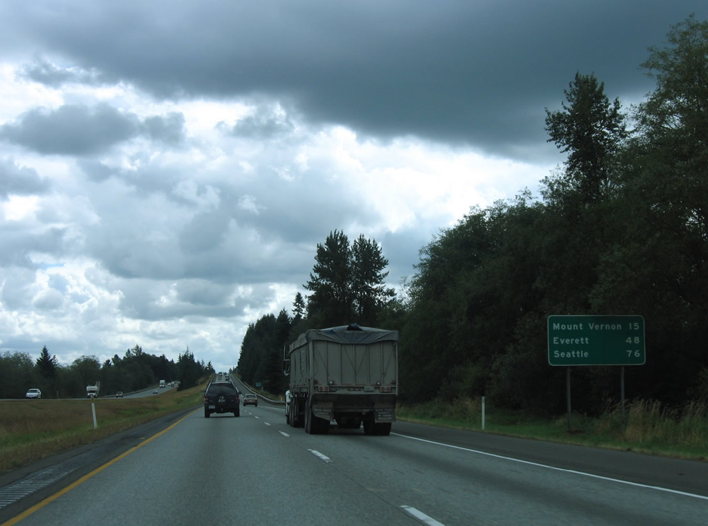
| Interstate 5 leaves the Lake Samish area and Whatcom County. The freeway travels 24.98 miles through Skagit County, serving the county seat of Mt. Vernon in 15 miles. 08/30/06 |
|
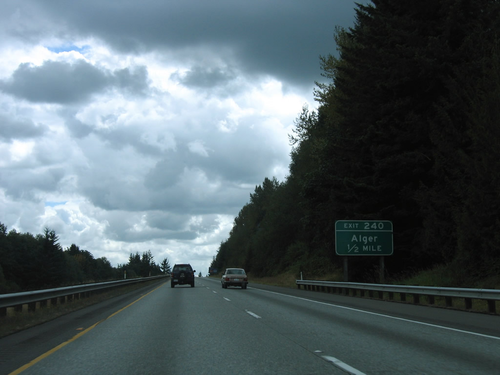
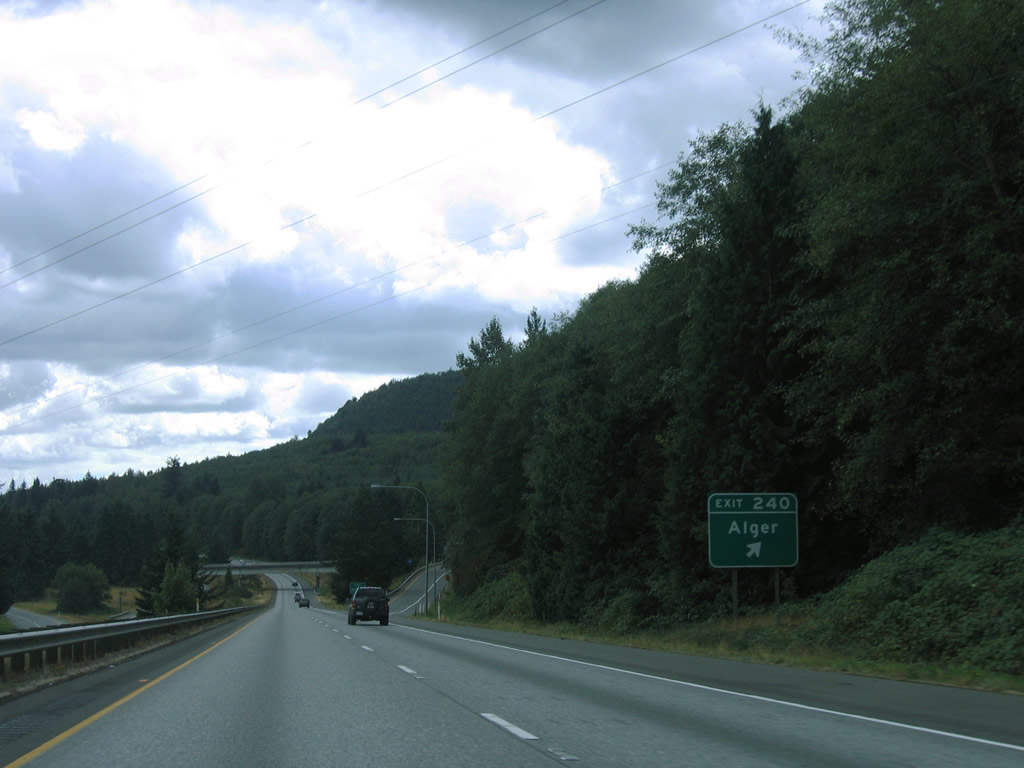
| Lake Samish Road stems south from Nulle Road and West Lake Samish Drive on the Whatcom county line to meet Interstate 5 at the Exit 240 diamond interchange near Alger. 08/30/06 |
|
| Lake Samish Road continues east from Exit 240 to Old SR 99 (former U.S. 99) and Alger Cain Lake Road at Alger. Alger Cain Lake Road winds northward to Glenhaven and Lake Whatcom. 08/30/06 |
|
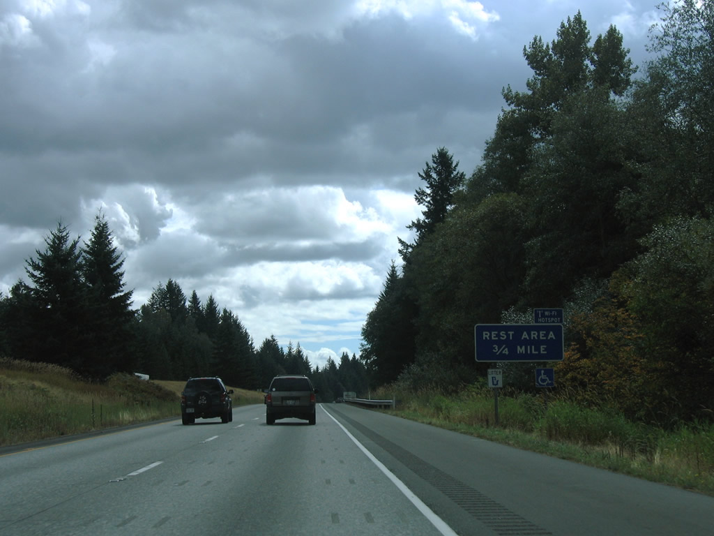
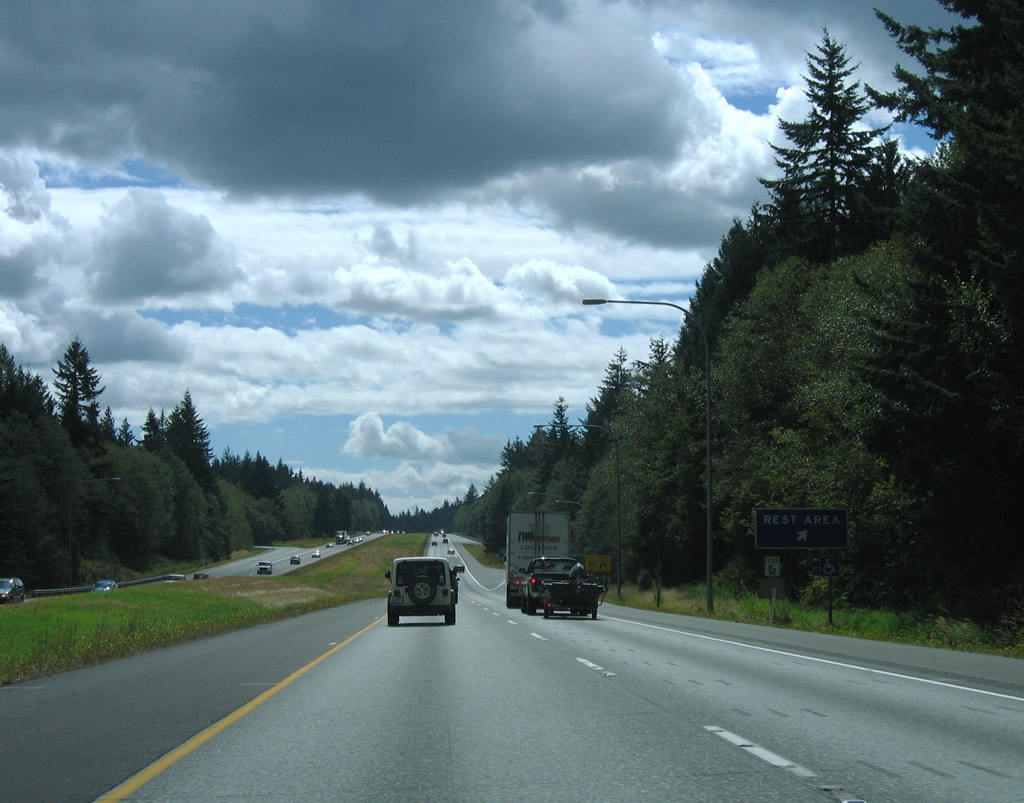
| The second Interstate 5 rest area facility along southbound lies on the plateau east of Chuckanut Mountain and west of Friday Creek. A companion northbound area is available at the same location. 08/30/06 |
|
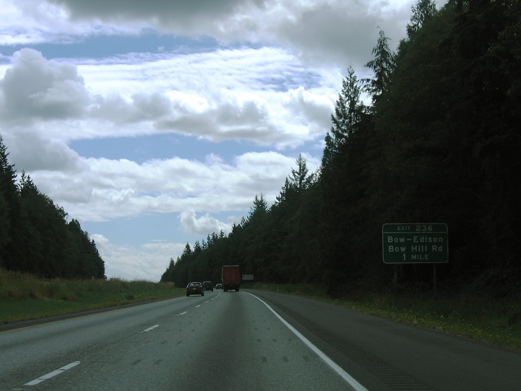
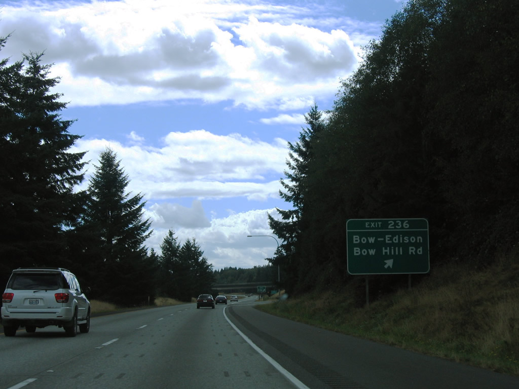
| Next in line for southbound travelers of Interstate 5 is the Exit 236 diamond interchange with Bow Hill Road. Bow Hill Road connects the freeway with the rural communities of Bow, Edison Station, and Edison to the west. 08/30/06 |
|
| Exit 236 leaves Interstate 5 south for Bow Hill Road. Bow Hill Road drops onto the Jarman Prairie near Belfast to the east, meeting old U.S. 99 opposite Prairie Road. The east-west road was once a part of SR 237 west of Edison Station (SR 11). All 9.07 miles of that state route, between SR 11 and SR 20, were decommissioned in 1991.1 08/30/06 |
|
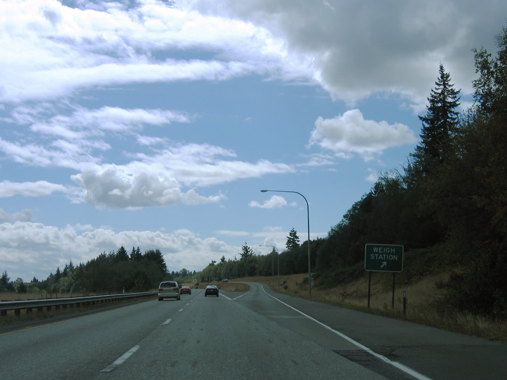
| A southbound side weigh station facility follows the Bow Hill Road on-ramp of Interstate 5. 08/30/06 |
|
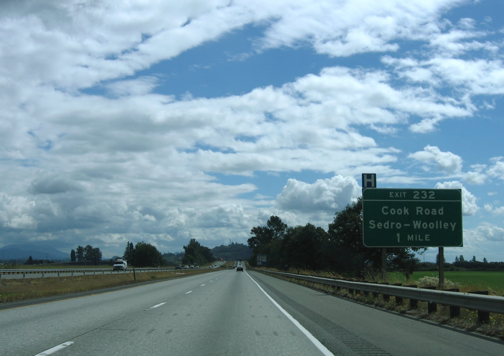
| Interstate 5 lowers to Butler Flat on the one mile approach to Exit 232 with Cook Road. 08/30/06 |
|
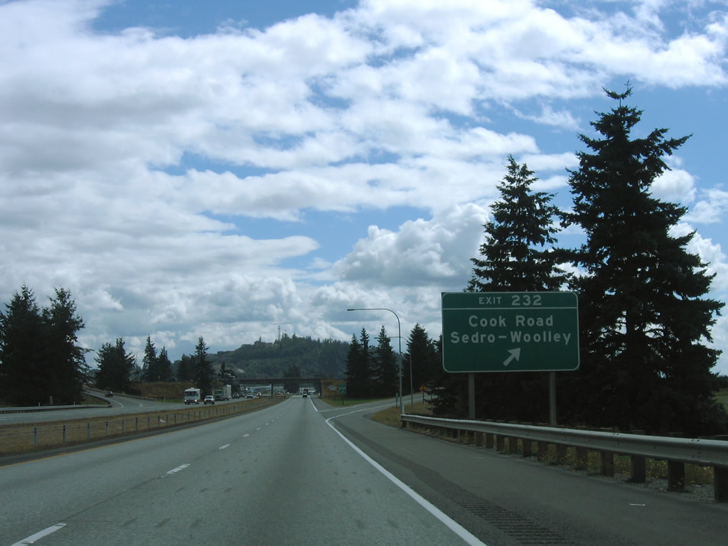
| Cook Road travels east-west between SR 11 (Chuckanut Drive) near Allen and SR 9 & 20 (North Cascade Highway) at Ferry Street in Sedro-Woolley. A diamond interchange joins the rural highway with Interstate 5 at Exit 232. 08/30/06 |
|
| WSDOT often posts reassurance shields for U.S. and state routes within a green box sign. Occasionally Interstate shields receive the same practice, as is the case with this I-5 marker south of Cook Road. 08/30/06 |
|
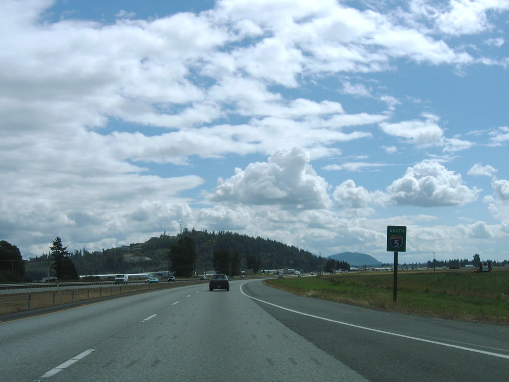
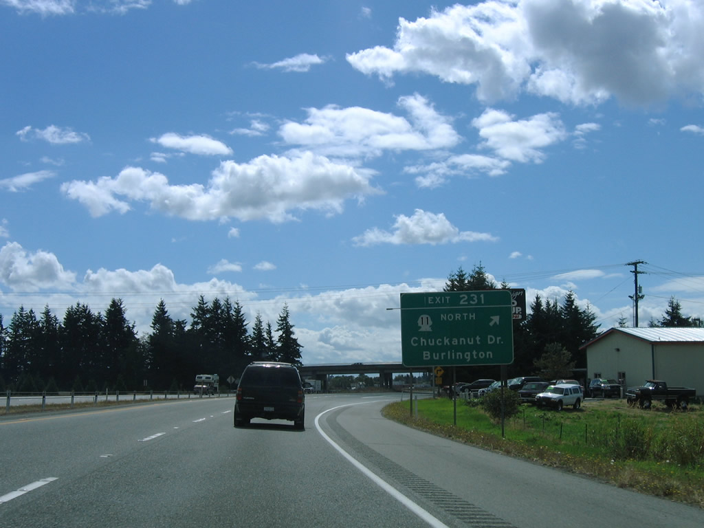
| SR 11 angles southeast from Edison Station and Allen to end its 21.28 mile journey at Exit 231 of Interstate 5. SR 11 was once a part of U.S. 99 Alternate leading northwest to Bellingham. 08/30/06 |
|
| Southbound at the folded-cloverleaf interchange with SR 11 (Chuckanut Drive) north and Burlington Boulevard (old U.S. 99) south on Interstate 5. Old U.S. 99 parallels Interstate 5 closely from Cook Road southward to SR 20 (Avon Avenue) at the Burlington city center. 08/30/06 |
|
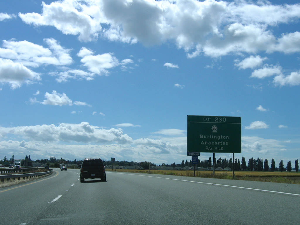
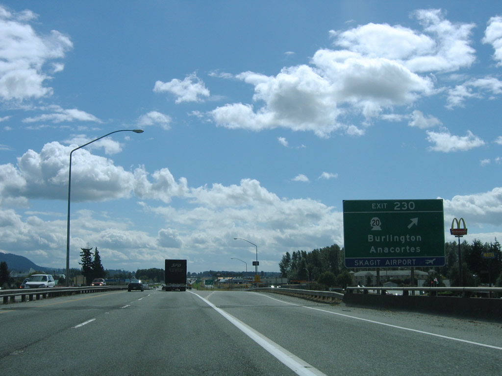
| The second Burlington interchange joins Interstate 5 with SR 20 (Avon Cutoff / North Cascades Highway) at Exit 230. The state route provides the first route to Island County leading west to the Swinomish Indian Reservation and south across Deception Pass onto Whidbey Island.
SR 20 is a lengthy route, traveling 436.13 miles across the state from U.S. 101 at Discovery Bay to U.S. 2 at Newport near the Idaho state line. 08/30/06 |
|
| A folded diamond interchange facilitates the movements between Interstate 5 south and SR 20 (Avon Cutoff) in City of Burlington. SR 20 dog legs through the city via Rio Vista Avenue east, Burlington Boulevard (old U.S. 99) north, and Avon Avenue east to reach the North Cascades Highway. The state route exits the city for Sedro-Woolley, Lyman, Hamilton, Concrete and North Cascades National Park. 08/30/06 |
|
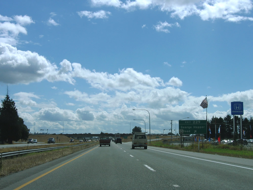
| Goldenrod Road accompanies Interstate 5 southbound from Exit 230 across Gages Slough to Exit 229 with George Hopper Road. Old U.S. 99 remains to the east along Burlington Boulevard, serving Cascade Mall. 08/30/06 |
|
| Interstate 5 reaches the Exit 229 diamond interchange with George Hopper Road. George Hopper Road mainly serves an assortment of retail including car dealerships and big box retail. The road arcs eastward from Old U.S. 99 to an industrial area as Port Drive. 08/30/06 |
|
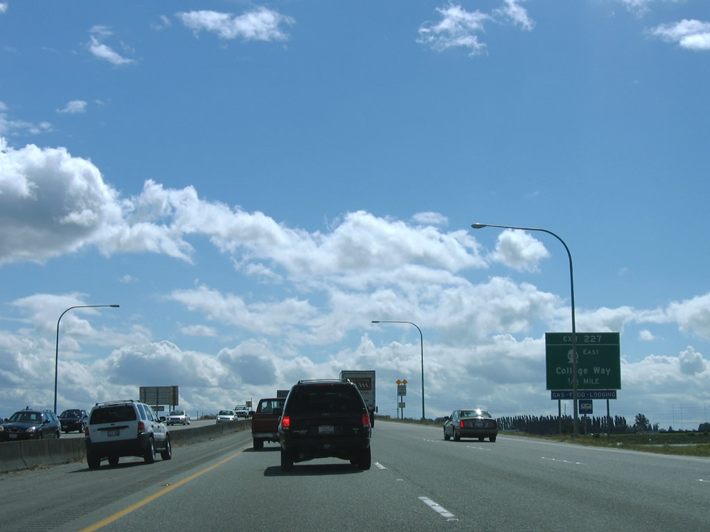
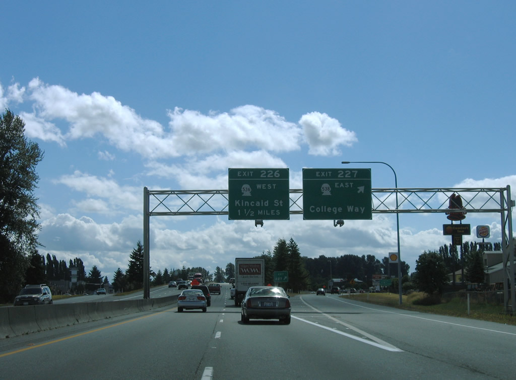
| SR 538 (College Way) begins at the first of three exits for Mount Vernon in one half mile. The east-west state route totals 3.61 miles between Exit 227, Skagit Valley College and SR 9 at Baker Heights. 08/30/06 |
|
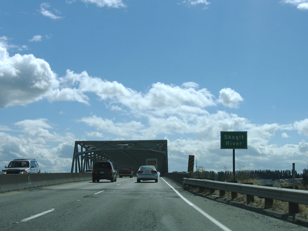
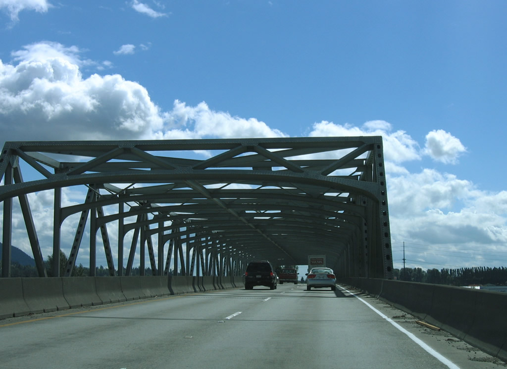
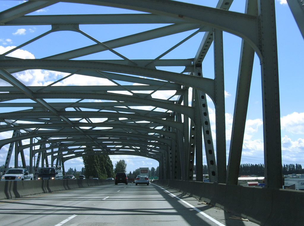
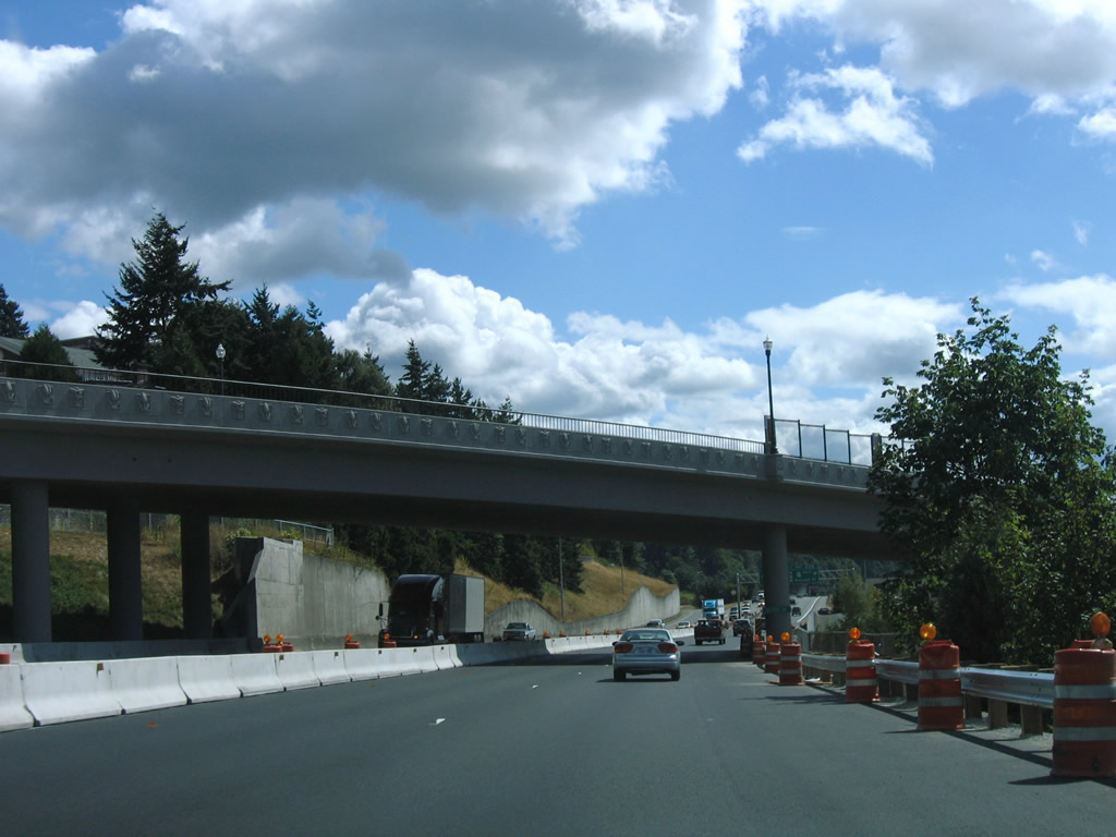
| A 1955 steel through truss bridge carries Interstate 5 across the Skagit River. The four lane freeway leaves Burlington and enters the county seat of Mount Vernon.
The Skagit River bridge partially collapsed on May 23, 2013 when a semi-truck hit several crossbeams of the truss, causing a support failure of the north span of the crossing. A temporary "Baily" bridge will fill the 160 foot gap caused by the collapse, restoring the bridge to service in mid-June. A permanent span will be installed in September 2013.2 08/30/06 |
|
| College Way leads east from Interstate 5 (Exit 227) as SR 538 along a commercial arterial to Skagit College. Freeway Drive lines the west side of Interstate 5, hosting a variety of businesses north and south of College Way. 08/30/06 |
|
| Constructed in the mid-1950s, Interstate 5 maintains just four lanes with a jersey barrier median through the Mt. Vernon city center. 2nd Street (former U.S. 99) passes over the freeway in this scene. 08/30/06 |
|
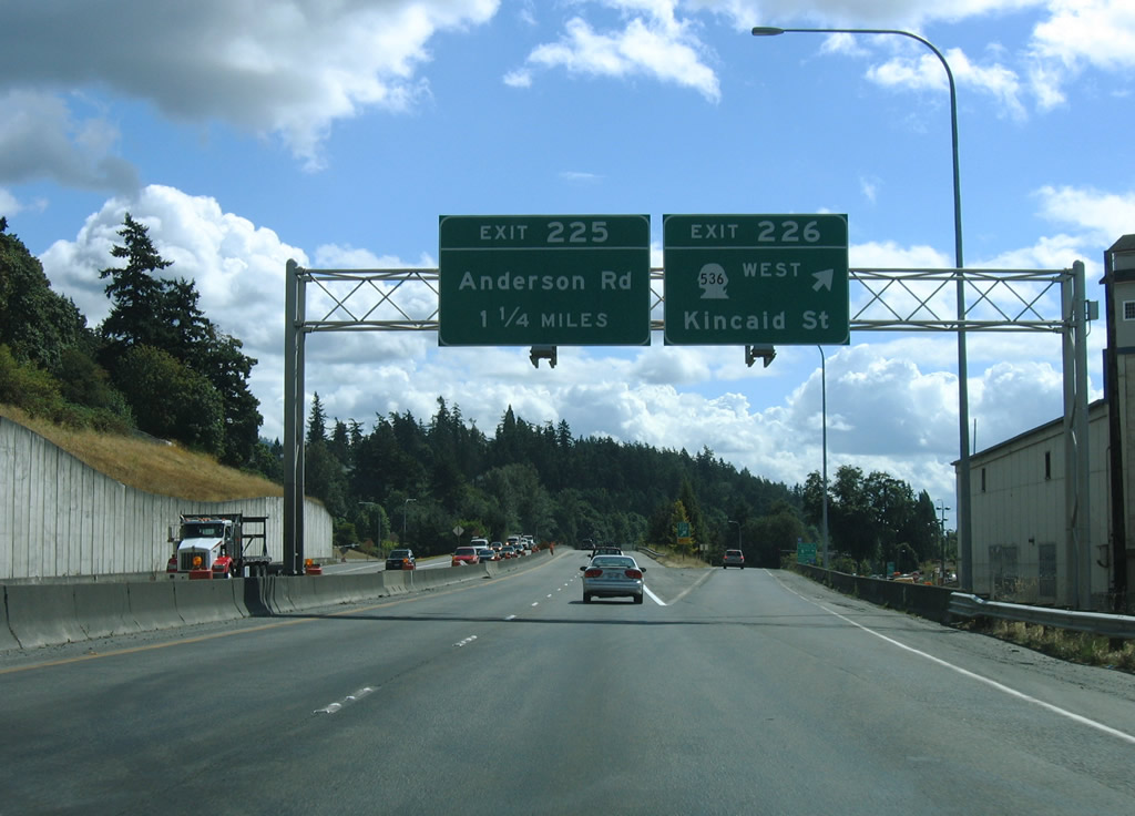
| Exit 226 joins Interstate 5 with the westbound beginning of SR 536 (Kincaid Street) and Broad Street east adjacent to the Mt. Vernon city center. The state route totals 5.38 miles from Mount Vernon to SR 20 near Fredonia.Skagit Station provides multimodel transportation options at the corner of Exit 226 and Kincaid Street. 08/30/06 |
|
| Anderson Road serves the industrial south side of Mount Vernon via the Exit 225 diamond interchange of Interstate 5. 08/30/06 |
|
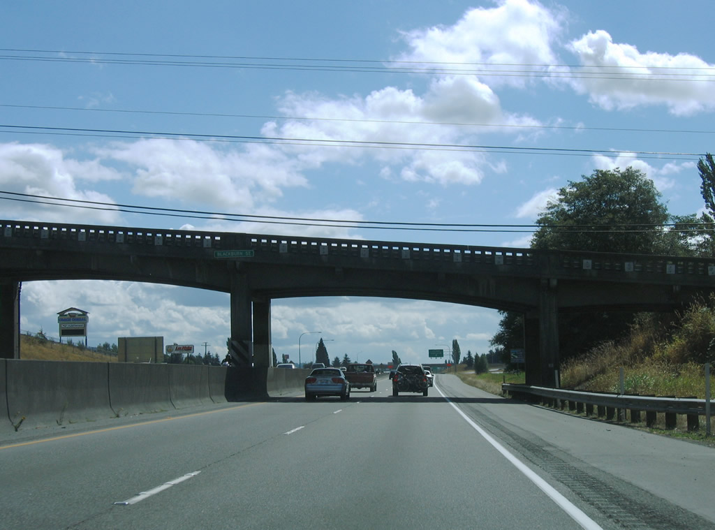
| Blackburn Road passes over Interstate 5 in this scene from the Little Mountain area to the east to 2nd Street and Old Highway 99 South Road. 08/30/06 |
|
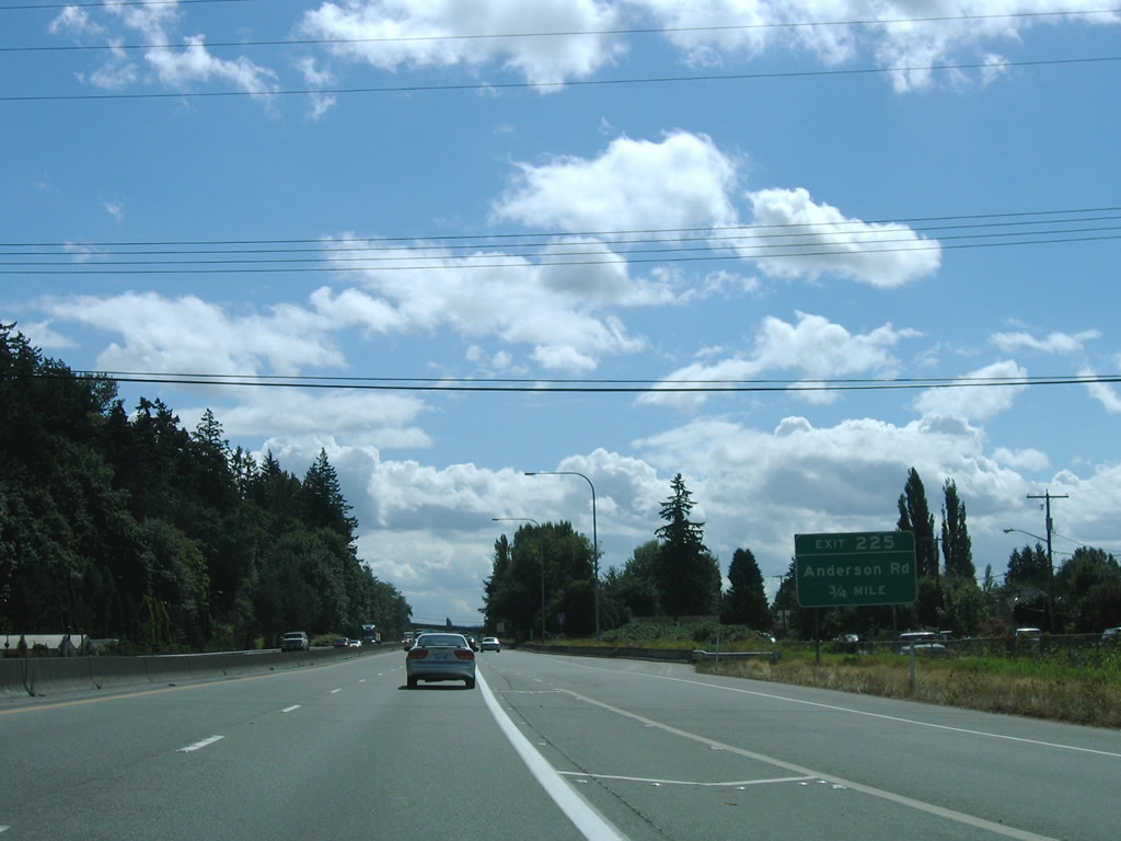
| Motorists bound for Anderson Road depart Interstate 5 south at Exit 225. Anderson Road simply connects the four lane freeway with parallel Old U.S. 99 to the west and Blodgett Road to the east. 08/30/06 |
|
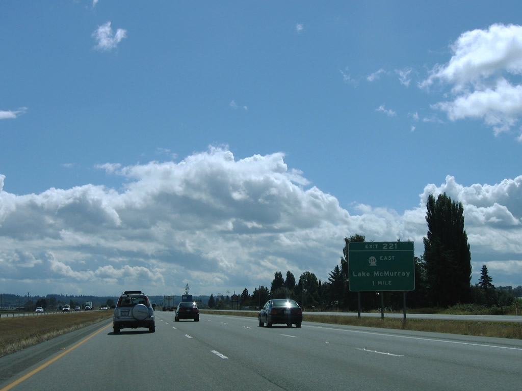
| SR 534 west and Pioneer Highway (former SR 530) north come together at a diamond interchange (Exit 221) near Conway in one mile. Old U.S. 99 comprises one of the frontage roads south from a half diamond interchange (Exit 224) with I-5 north. 08/30/06 |
|
| SR 534 travels 5.08 miles east to SR 9 at Lake McMurray. Fir Island Road stems west from Pioneer Highway and Conway to Best Road north for interests to La Conner. 08/30/06 |
|
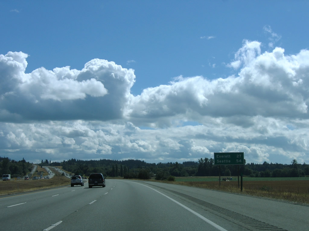
| Kinking southeastward again, Interstate 5 travels 27 miles to Everett and 54 miles to Seattle. 08/30/06 |
|
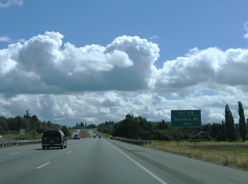
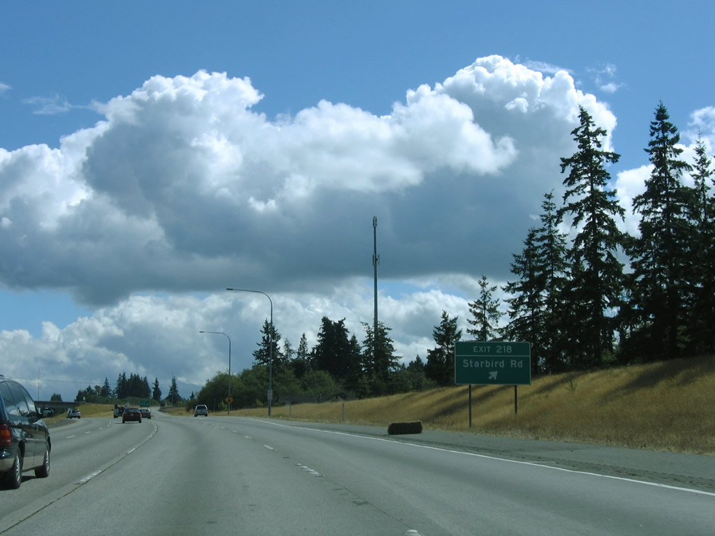
| Starbird Road meets Interstate 5 at a rural diamond interchange in southern Skagit County. The east-west road becomes Milltown Road west to Pioneer Highway (former SR 530) at Milltown. 08/30/06 |
|
| Exit 218 leaves Interstate 5 south for Starbird Road east and Milltown Road west. Pacific Highway (Old U.S. 99) stems south from Starbird Road and follows the southbound side of I-5 into Snohomish County. 08/30/06 |
|
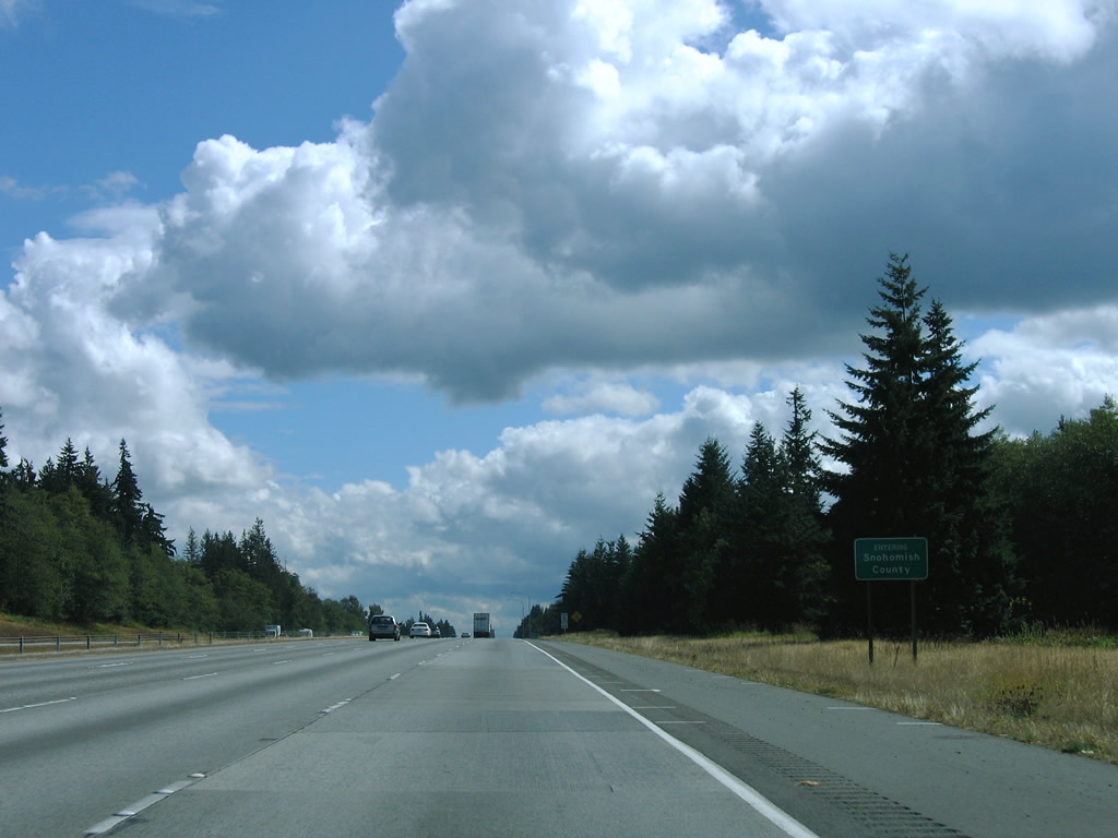
| Interstate 5 exits Skagit County for 39.89 miles within Snohomish County. 08/30/06 |
Page Updated 06-11-2013.

 South
South