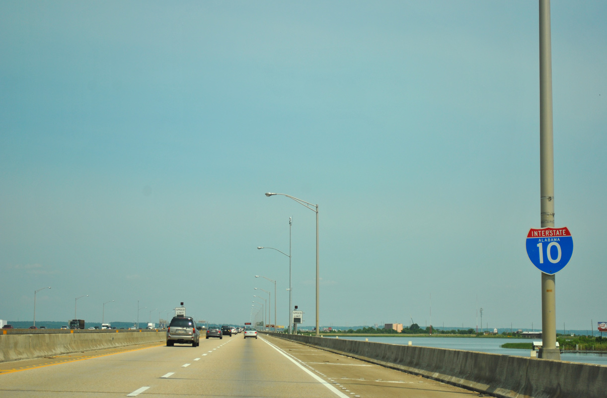
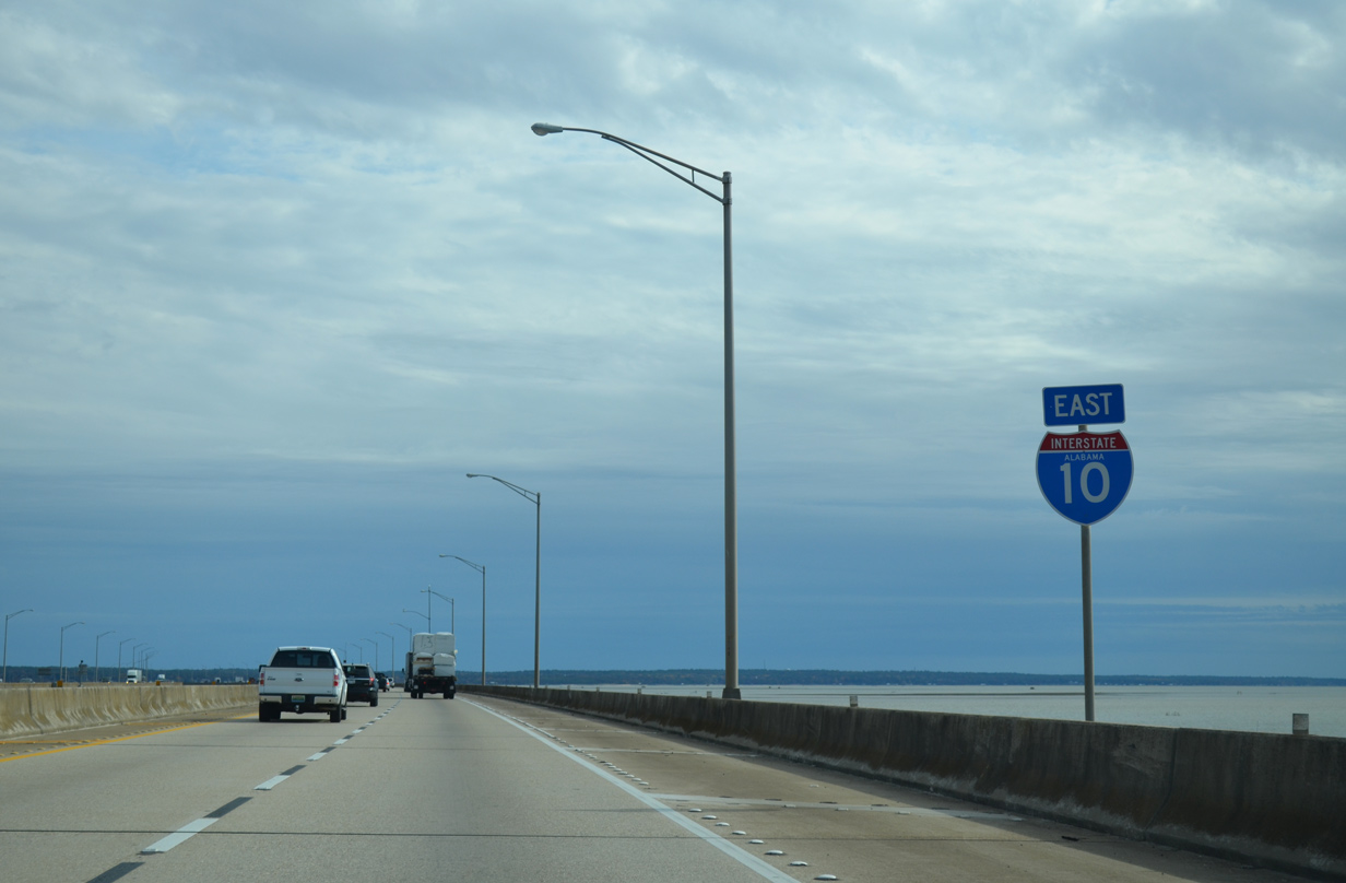
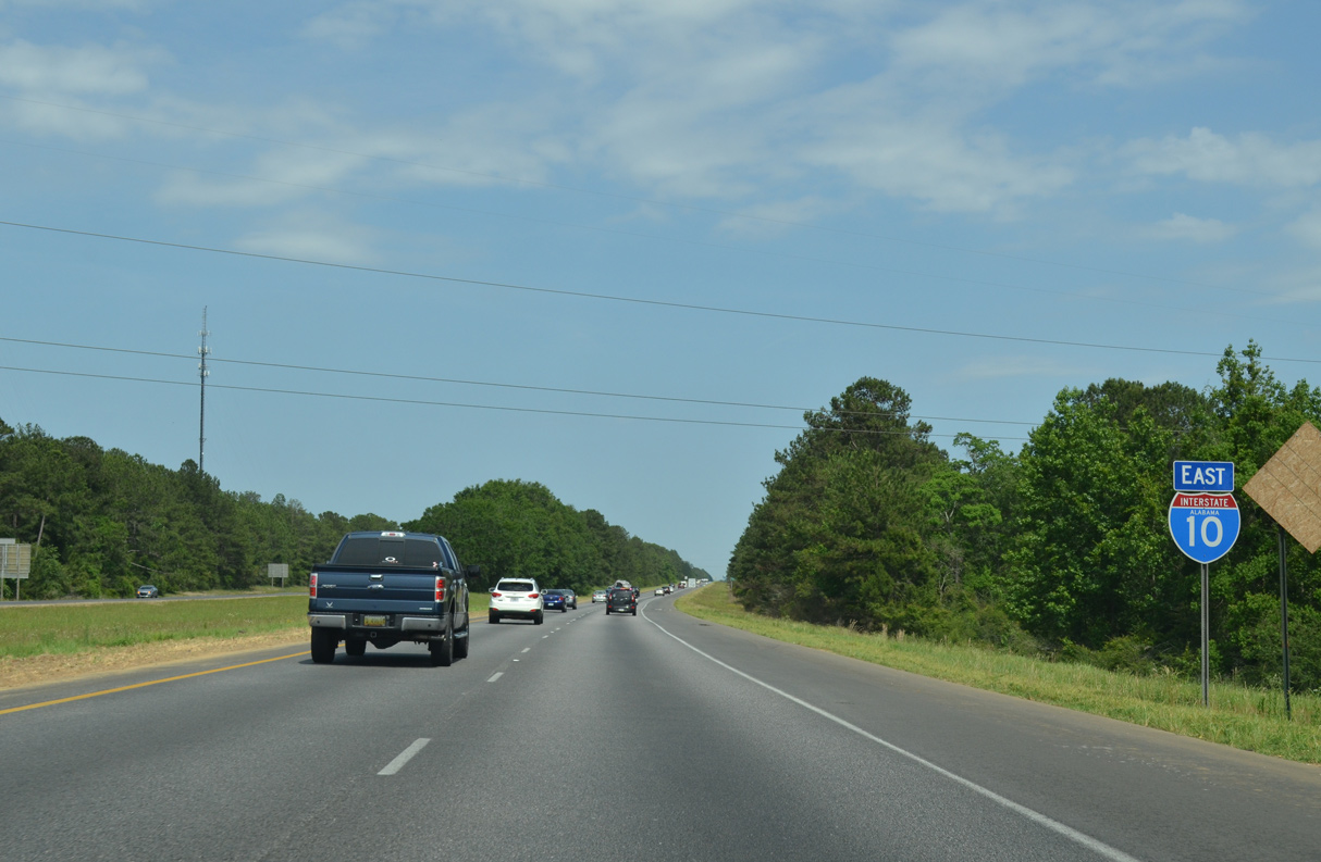
Interstate 10 east at north end of the Baldwin Beach Express. An interchange opened between the two four lane highways on August 15, 2014. 05/21/14
|
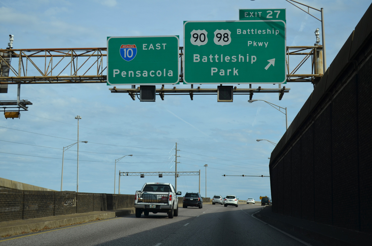
| Exit 27 departs I-10 just beyond the Wallace Tunnel for U.S. 90/98 (Battleship Parkway) on Blakeley Island. Battleship Parkway parallels I-10 along a series of islands from USS Alabama Battleship Memorial Park east to the city of Spanish Fort. 11/25/14 |
|
| U.S. 90/98 split just north of Exit 27. U.S. 98 crosses the Mobile River through the Bankhead Tunnel into Downtown Mobile while U.S. 90 heads north along Cochrane Causeway to the Cochrane-Africatown Bridge. 07/17/07 |
|
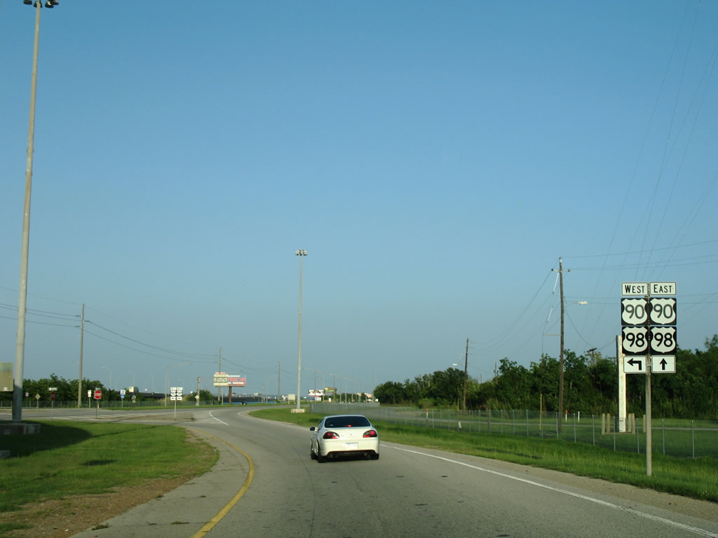
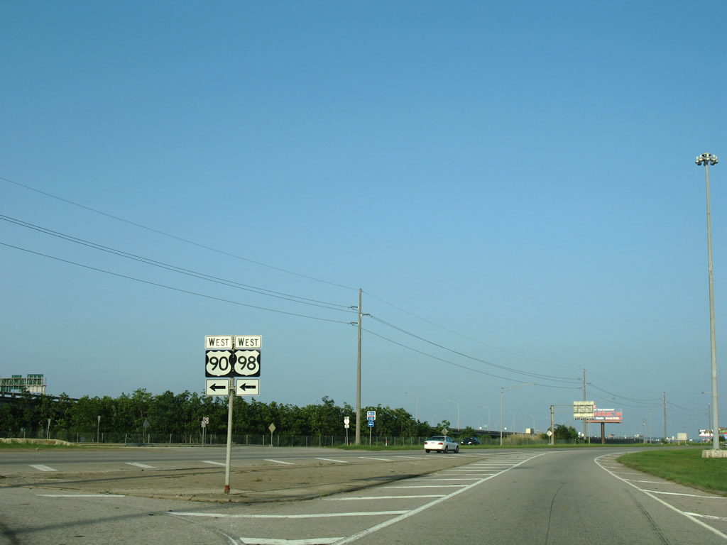
| U.S. 90 combines with U.S. 98 Truck west from Blakeley Island to U.S. 43 at Magazine in Mobile and Interstate 165 in Prichard. 07/17/07 |
|
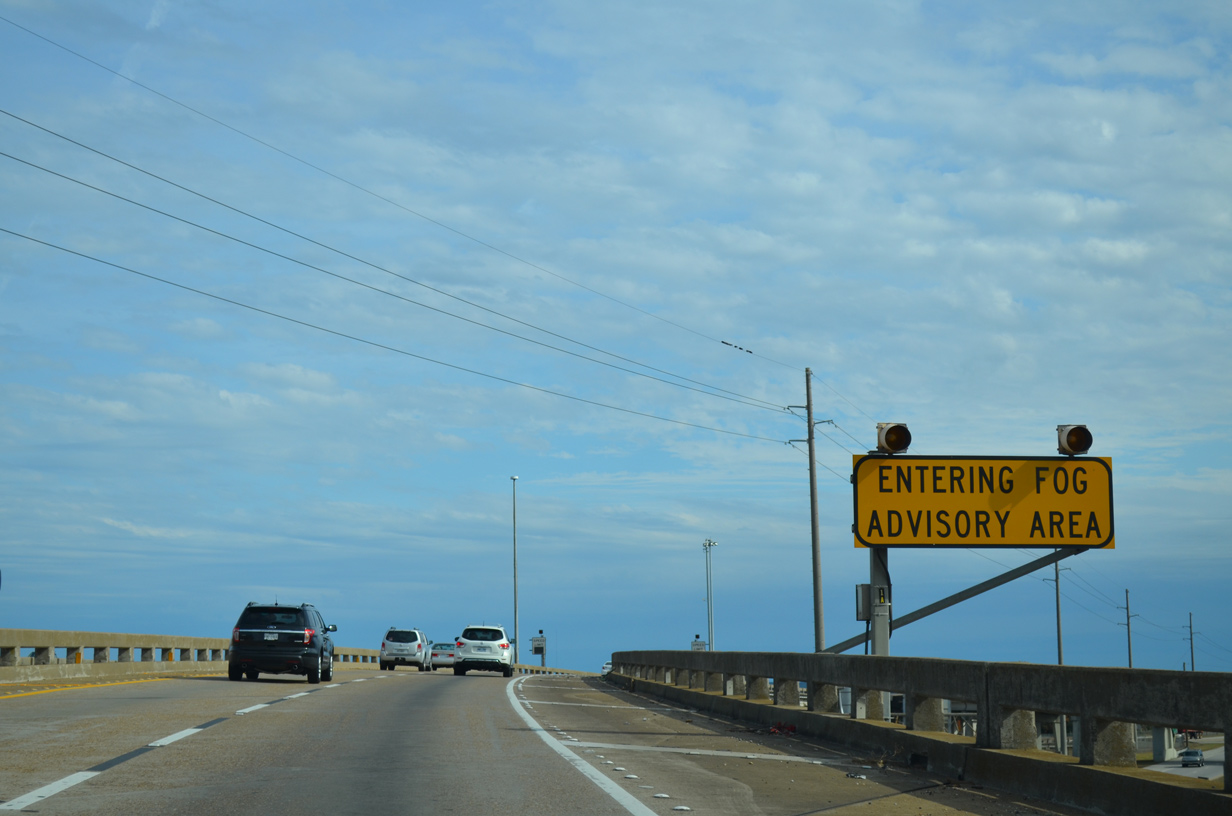
| I-10 continues east from Blakeley Island along the Mobile Bayway, a pair of two lane viaducts stretching eight miles across portions of Polecat and Mobile Bays. Variable speed limits were implemented along the Bayway after a 200 vehicle pile-up during dense fog on the morning of March 20, 1995 that injured 90 and resulted in one fatality.1 11/25/14 |
|
| Interstate 10 follows the Mobile Bayway across southern reaches of Pinto Bay to the Tensaw River and Baldwin County line. 11/25/14 |
|
| The Mobile Bayway is also named Jubilee Parkway for the generally annual fish jubilee, a natural phenomenon where large congregations of fish, crab, shrimp and other water life crowd in the shallow waters of Mobile Bay. 05/25/12 |
|
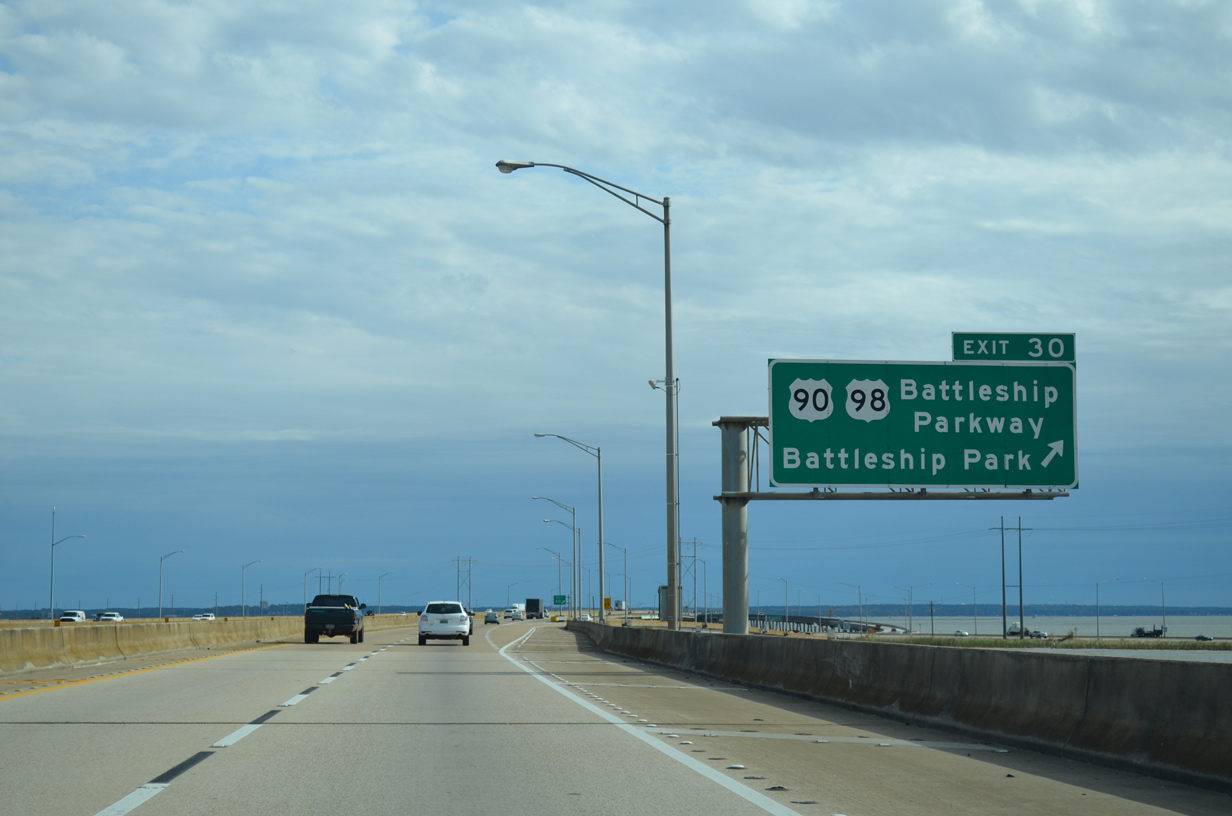
| I-10 (Mobile Bayway) and U.S. 90/98 (Battleship Parkway) converge east of the Tensaw River at a diamond interchange (Exit 30). Battleship Parkway shifts to the north of I-10 alongside Chacaloochee Bay into the city limits of Spanish Fort. 11/25/14 |
|
| Exit 30 lowers from the Bayway to a narrow strip of land along U.S. 90/98. Traveling just above sea level, Battleship Parkway is sometimes compromised during tropical storms and other astronomical tide periods. 11/25/14 |
|
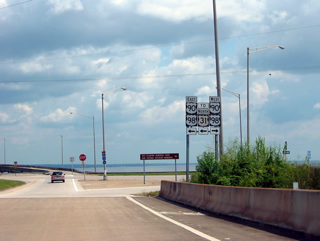
| U.S. 31 previously overlapped with U.S. 90/98 across Mobile Bay. The route was truncated east from Downtown Mobile to Spanish Fort in 1991. 08/24/03 |
|
| Interstate 10 bends southward from Battleship Parkway to the mouth of the Apalachee River. The fog advisory system along the Bayway was damaged by Hurricane Katrina in 2005 and replaced by early 2010. 11/25/14 |
|
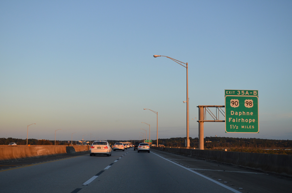
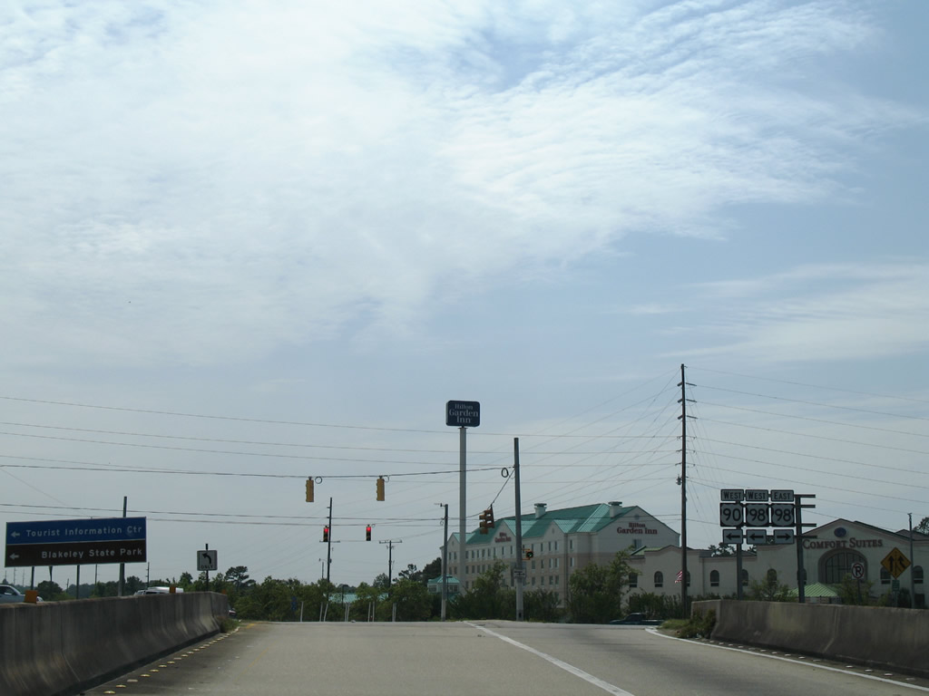
| Approaching the Eastern Shore of Mobile Bay, I-10 meets U.S. 90/98 again. Exit 35A departs next for U.S. 98 south into Daphne and Fairhope. Exit 35B follows for U.S. 90 west to U.S. 98 and Old Spanish Trail north into Spanish Fort. 11/20/15 |
|
| U.S. 90 (Old Spanish Trail) runs north from I-10 to U.S. 31 (Spanish Fort Boulevard) before combining with U.S. 98 west across Battleship Parkway.
Exit 35A departs in one quarter mile, despite this sign referencing 0.75 miles. 11/25/14 |
|
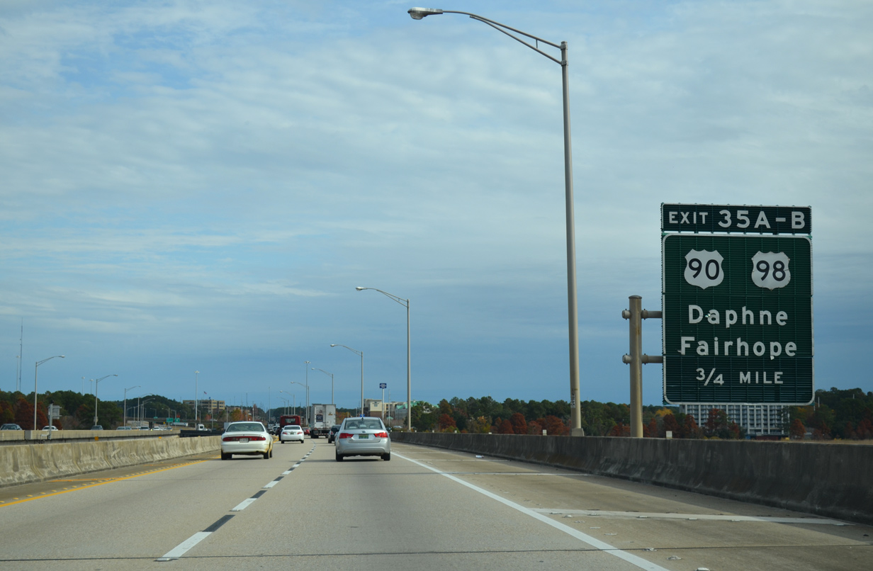
| U.S. 98 runs south from Exit 35A and U.S. 90 along a four lane arterial to Montrose and Fairhope. The route turns east from rural Barnwell to Foley, Elberta and Lillian. Added when Exit 35B opened, the greenout here covers a U.S. 90 shield. 11/20/15 |
|
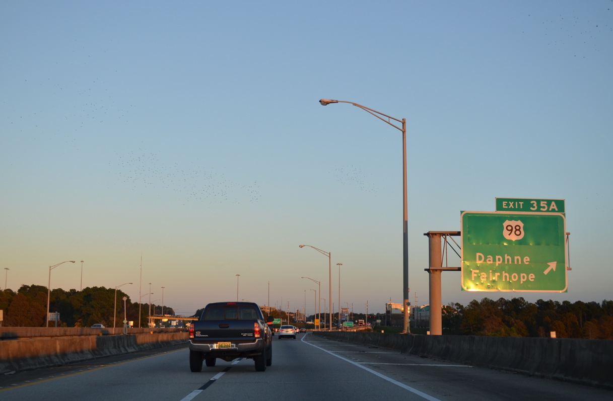
| The off-ramp at Exit 35A provides access to U.S. 98 eastbound for Daphne and U.S. 90/98 west to adjacent Spanish Fort Town Center (built in 2006) and Spanish Fort. Cross traffic to U.S. 90 east for Malbis is restricted. 06/07/06 |
|
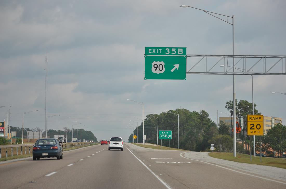
| Exit 35B links I-10 east with adjacent U.S. 90 across from Jubilee Square shopping center. U.S. 90 parallels I-10 east to Malbis and Loxley. 11/20/15 |
|
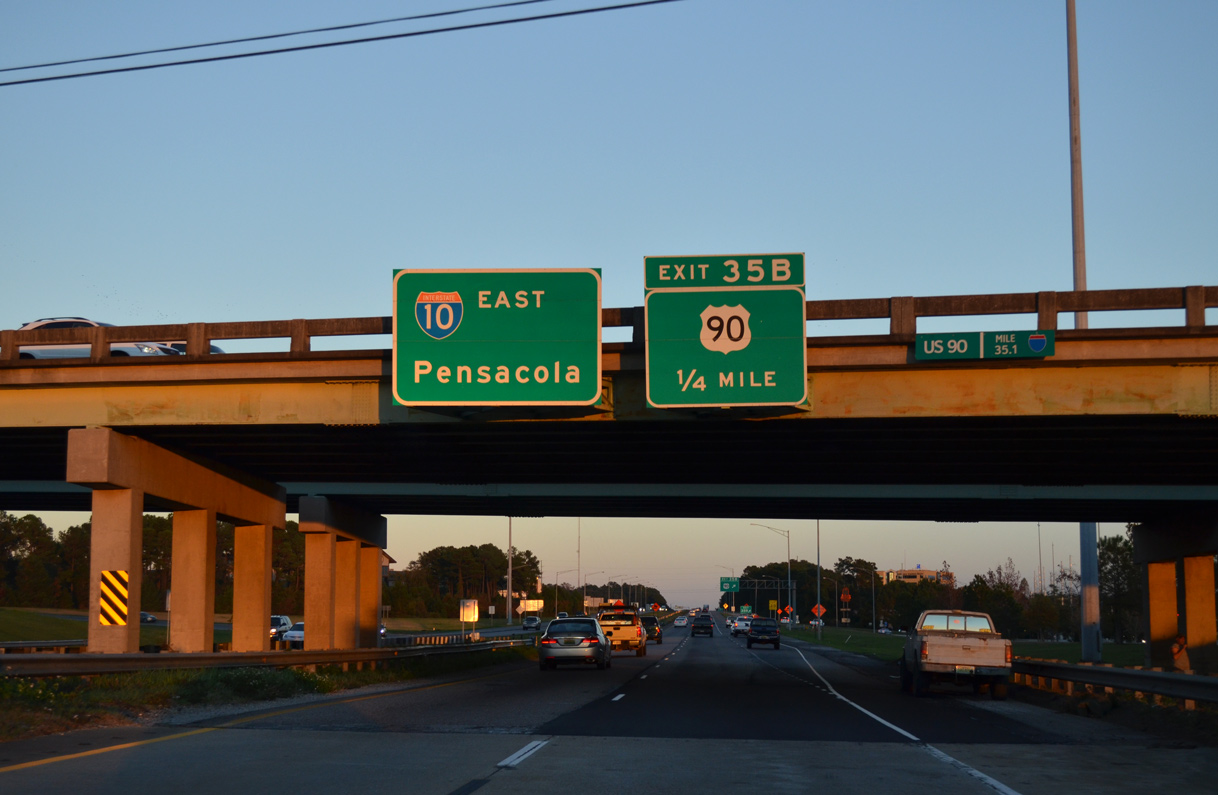
| Exit 35B is the last meeting of I-10 and U.S. 90 for 47 miles until Exit 17 with Scenic Highway outside Pensacola, Florida. 01/01/12 |
|
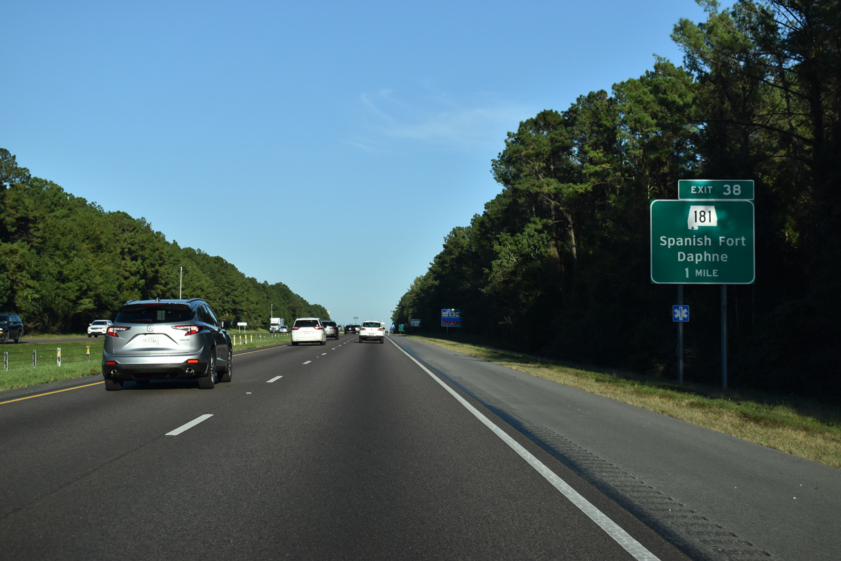
| Interstate 10 gains over 100 feet in elevation from Exit 35B by D'Olive Creek to Exit 38 at Malbis. 10/08/21 |
|
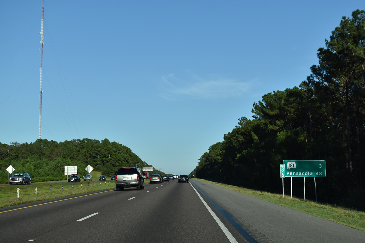
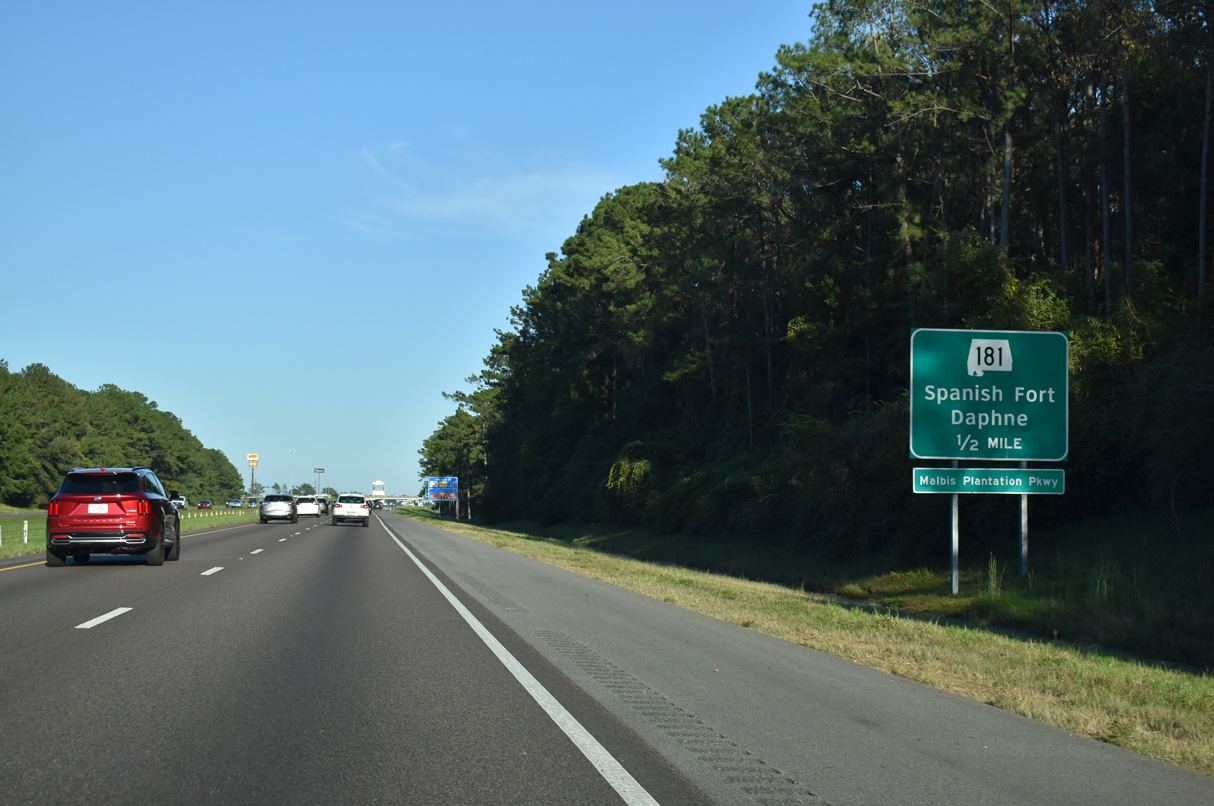
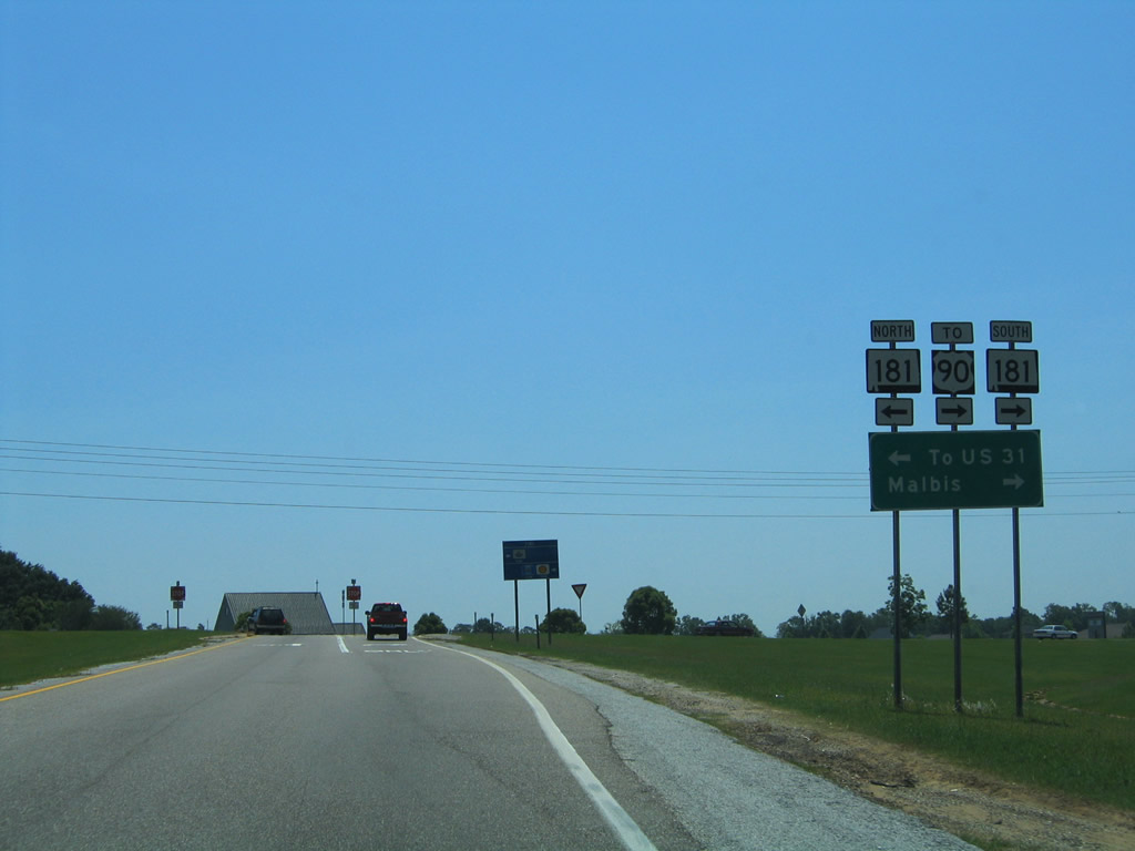
| The distance sign referencing SR 181 was installed in 2005. Development from the early 2000s onward, including Eastern Shore Center and Eastern Shore Park retail plaza, transitioned SR 181 (Malbis Plantation Parkway) from a rural parkway into a congested commercial arterial. 10/08/21 |
|
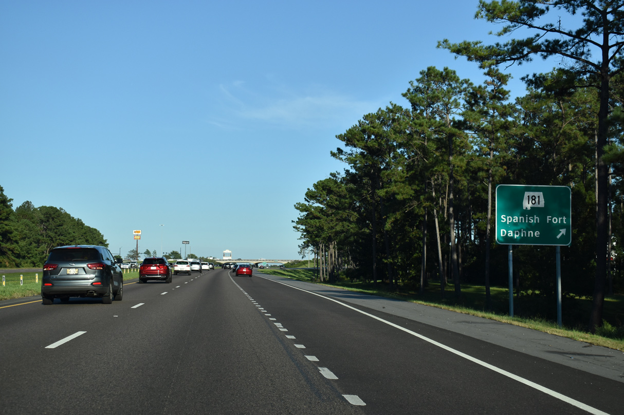
| SR 181 locally links Interstate 10 with U.S. 31 at Spanish Fort and U.S. 90 at Malbis. 10/08/21 |
|
| Southward, SR 181 represents an increasingly busy commuter corridor serving areas of east Daphne and Fairhope. Jimmy Faulkner Drive (CR 27) extends north from SR 181 at U.S. 31 to Spanish Fort High School and Bromley Road. 10/08/21 |
|
| Signed in 2006, SR 181 was lengthened southward along CR 27 (Belforest Road) from U.S. 90 to U.S. 98 near Weeks Bay during a mileage swap between ALDOT and Baldwin County in 2004. Four lane expansion of SR 181 south to CR 64 (Daphne Road) followed. 10/08/21 |
|
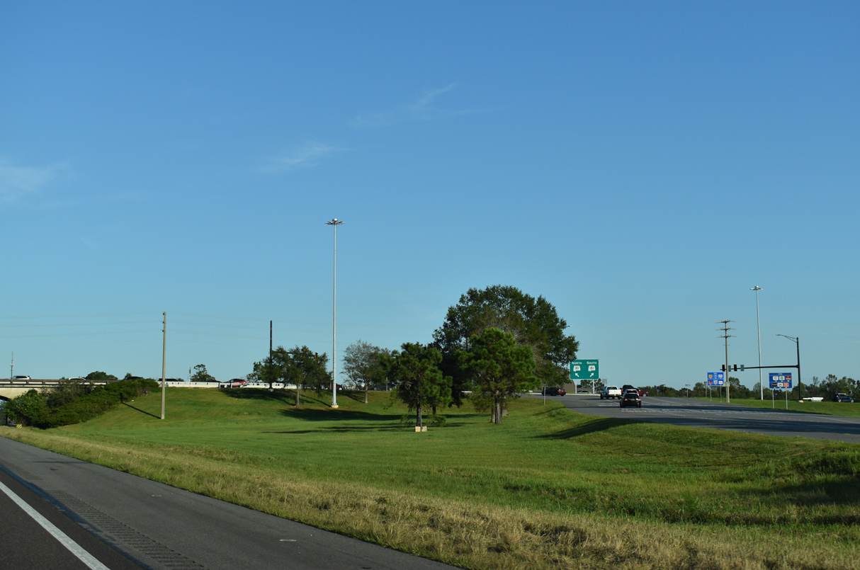
| $7.3 million in construction from March 2019 to Fall 2020 rebuilt the exchange with SR 181 into Alabama's first diverging diamond interchange (DDI). The DDI debuted to motorists on July 1, 2020.2 10/08/21 |
|
| Traffic lights were installed for the SR 181 westbound ramps from I-10 in 2004 and for the eastbound ramps in 2006. Six signalized intersections line SR 181 between U.S. 31 and U.S. 90. There were none in 2000. 05/07/04 |
|
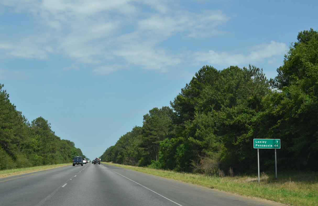
| The right of way for Interstate 10 expands with a forest median east from Turkey Branch to Threemile Creek near the town of Loxley. 05/15/16 |
|
| A second distance sign was added in 2015 after Exit 38, referencing SR 59 as one of two exits from Interstate 10 to the Baldwin County Beaches. 05/15/16 |
|
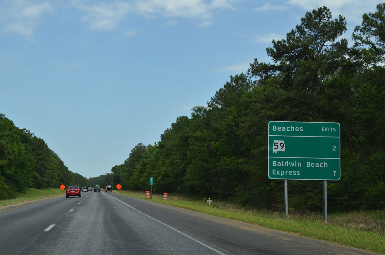
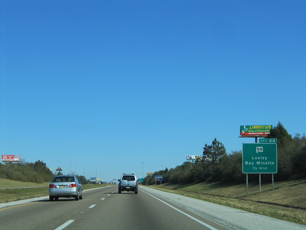
| The succeeding exit joins Interstate 10 with SR 59 (Gulf Shores Parkway), the main route south to the popular resort cities of Gulf Shores and Orange Beach along the Gulf of Mexico. 05/15/16 |
|
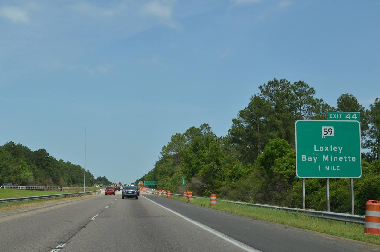
| Locally SR 59 follows Hickory Street south to U.S. 90 and the Loxley town center. A folded diamond interchange (Exit 44) links the arterial with I-10 opposite the abandoned Louisville and Nashville Railroad line that paralleled SR 59 south to Loxley and Robertsdale. 02/12/06 |
|
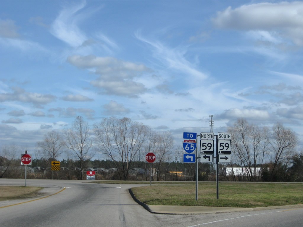
| Continuing north from I-10, SR 59 combines with U.S. 31 from Stapleton to Bay Minette. SR 287 continues Gulf Shores Parkway from the Baldwin County seat directly to I-65. 11/25/14 |
|
| Traffic lights were installed for the I-10 eastbound ramps with SR 59 in 2019. SR 59 (Gulf Shores Parkway) travels south to Summerdale and Foley and north to Stockton and Uriah in Monroe County. 01/23/09 |
|
| Interstate 10 leaves annexed areas within the town of Loxley for unincorporated Baldwin County. 22 miles of I-10 east in Alabama remain. 10/08/21 |
|
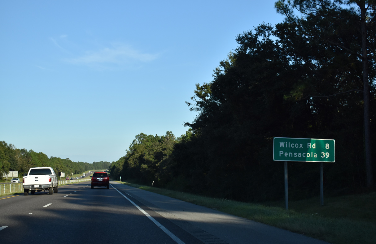
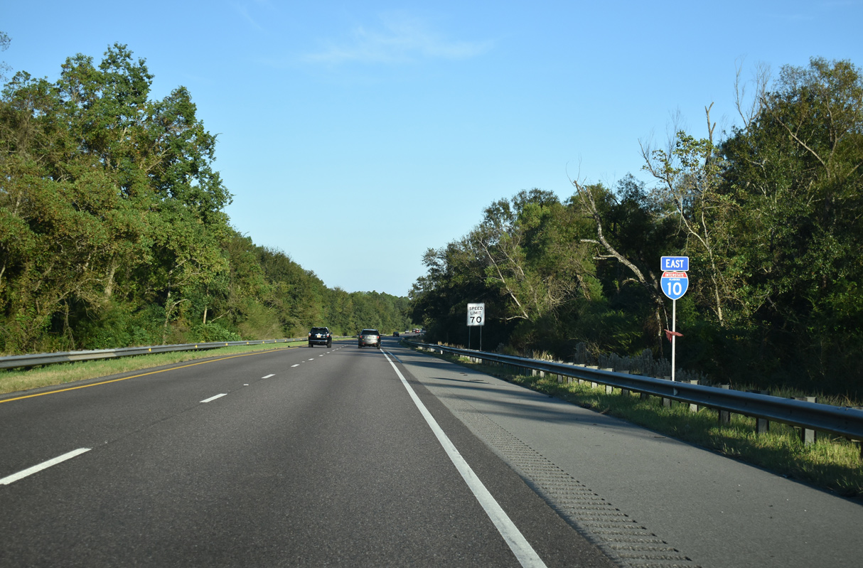
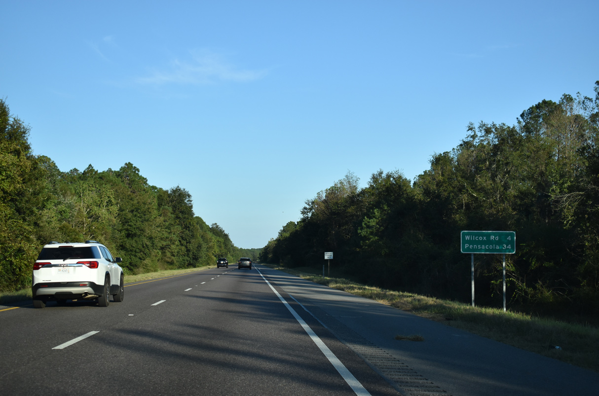
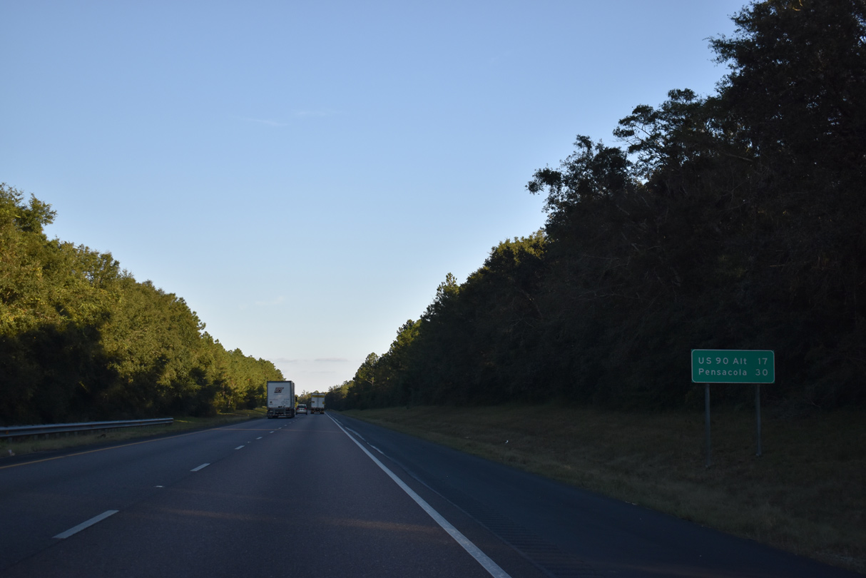
| Wilcox Road previously represented the lone interchange along I-10 over a 27 mile stretch between SR 59 and U.S. 90 Alternate in Escambia County, Florida. Pensacola lies 39 miles to the east via I-110 south. 10/08/21 |
|
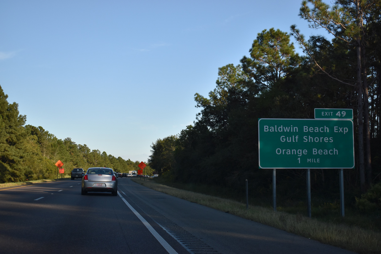
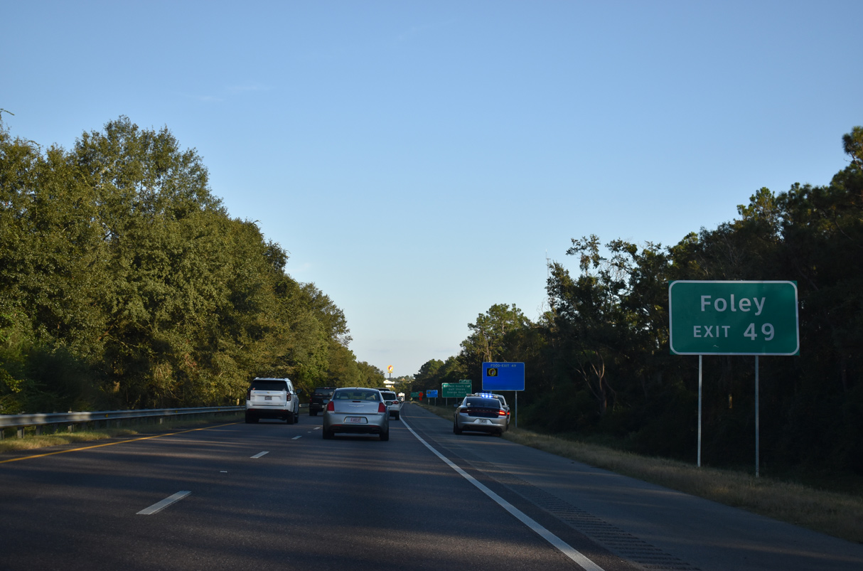
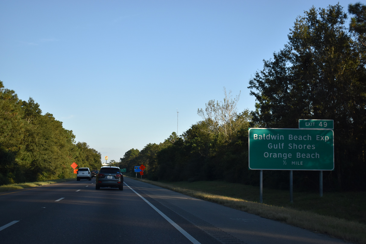
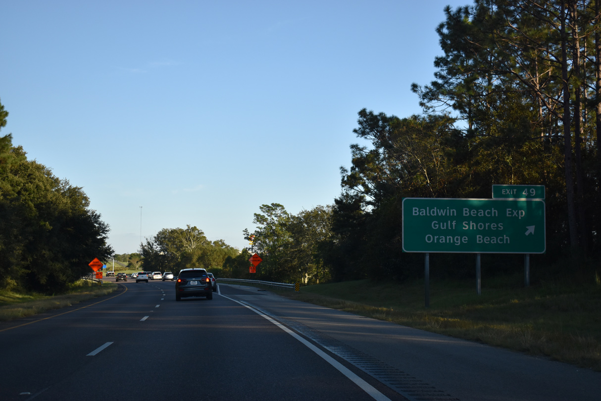
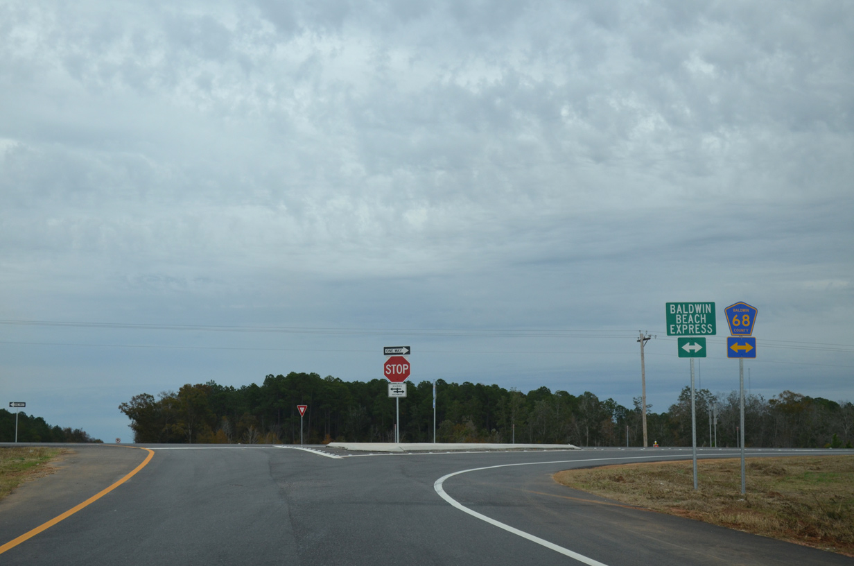
| The diamond interchange (Exit 49) with the Baldwin Beach Express south opened to traffic on August 15, 2014. The exchange also connects with CR 68, a rural route east from Loxley to Styx River. 10/08/21 |
|
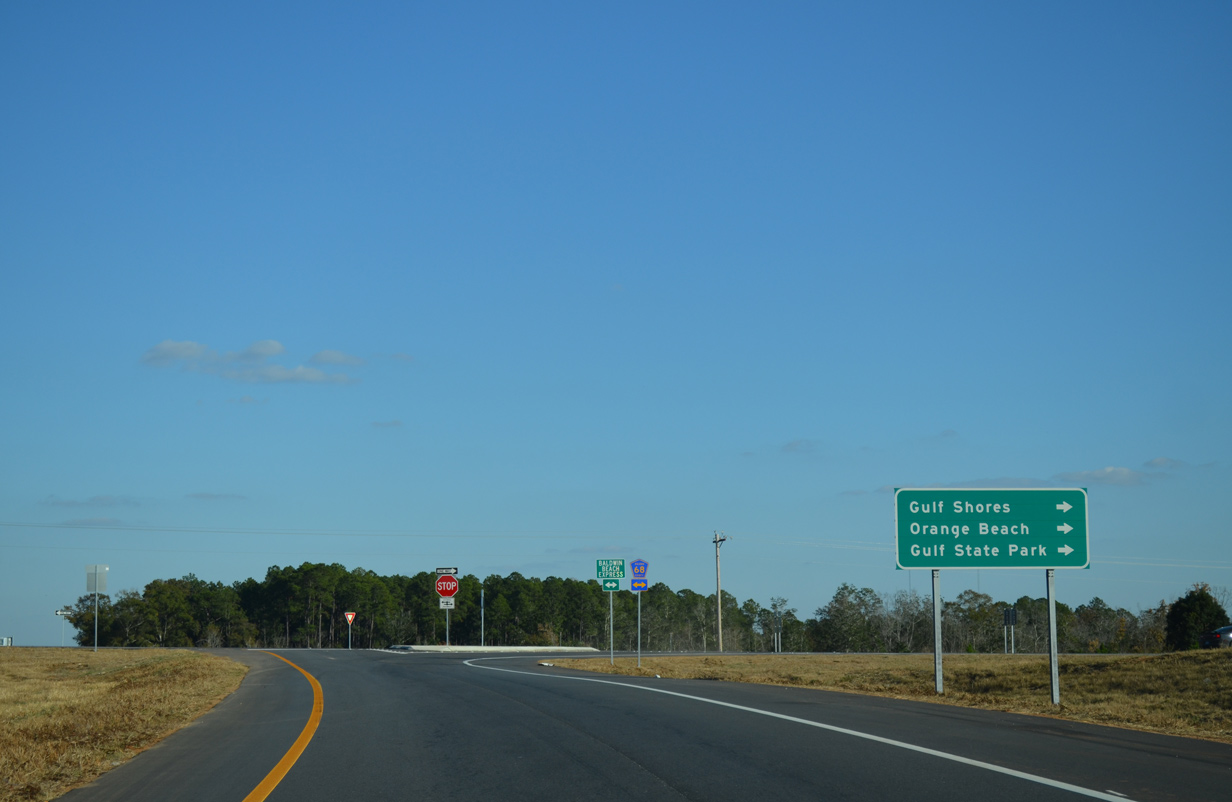
| Baldwin Beach Express leads 13 miles south from I-10 to the Foley Beach Express. The controlled access arterial provides an alternate route to SR 59 in conjunction with the Foley Beach Express to Orange Beach and Gulf Shores. 10/08/21 |
|
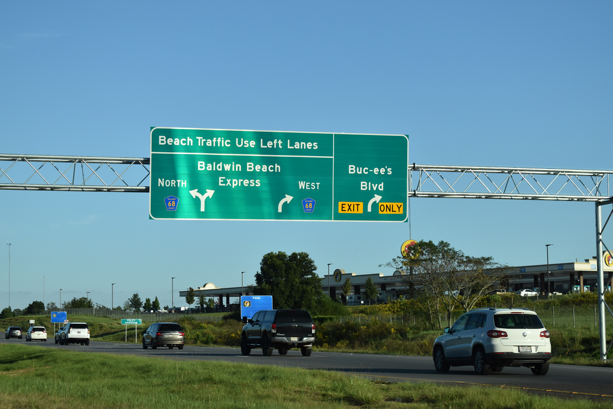
| Construction underway from November 2020 to Fall 2021 expanded the exit ramp to the Baldwin Beach Express with a dedicated lane south for CR 68 (Buc-ee's Boulevard) to service the adjacent Buc-ee's Travel Center.3 10/08/21 |
|
| 2009-14 construction of the Baldwin Beach Express superseded CR 83 south from CR 64 to the east of Loxley and Robertsdale. Opened in 2000, the 13.5 mile route of the Foley Beach Express from SR 59 near Foley to SR 180 in Orange Beach, includes a toll bridge across the Intracoastal Waterway. 10/08/21 |
|
| A 900 foot long section of CR 68 west from the Baldwin Beach Express was renamed Buc-ee's Boulevard in Winter 2020. The change and the addition of a new overhead sign were designed to better separate traffic from Exit 49.4 10/08/21 |
|
| Opened on January 21, 2019, the 50,000 square foot Buc-ee's Travel Center at the corner of CR 68 and the Baldwin Beach Express elevated the usage of the exchange with I-10. Accommodating increased traffic, the Baldwin County Highway Department activated traffic lights at both the I-10 westbound ramps and at CR 68 on January 17, 2019.5 11/21/14 |
|
| County Road 68 originally followed a dog leg north across I-10 from alignments west to Loxley and east to the Styx River. 11/25/14 |
|
| A wide forested median separates the roadways as Interstate 10 runs alongside Permission Creek east to Wilcox Road (Exit 53). 10/08/21 |
|
| County Route 64 heads east from the Baldwin Beach Express to Wilcox Road and the diamond interchange at Exit 53. 10/08/21 |
|
| CR 64 turns north at Wilcox Road and I-10 to timberland and CR 112 near Gateswood. Wilcox Road extends a half mile south from CR 64 to Patterson Road near the Forest View Estates residential area. 10/08/21 |
|
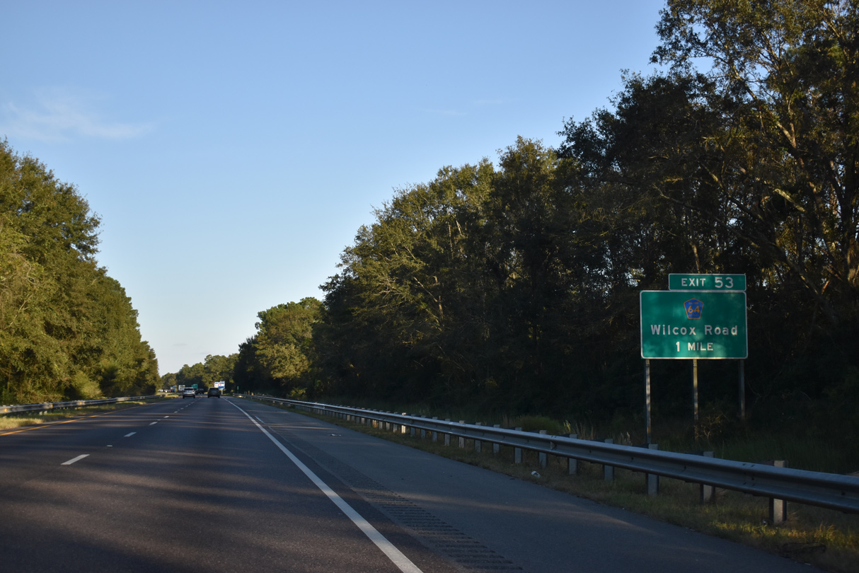
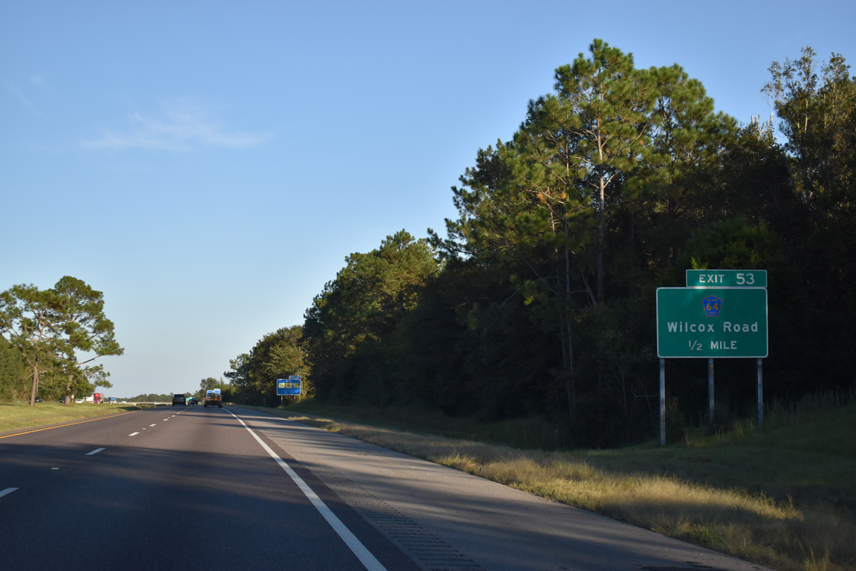
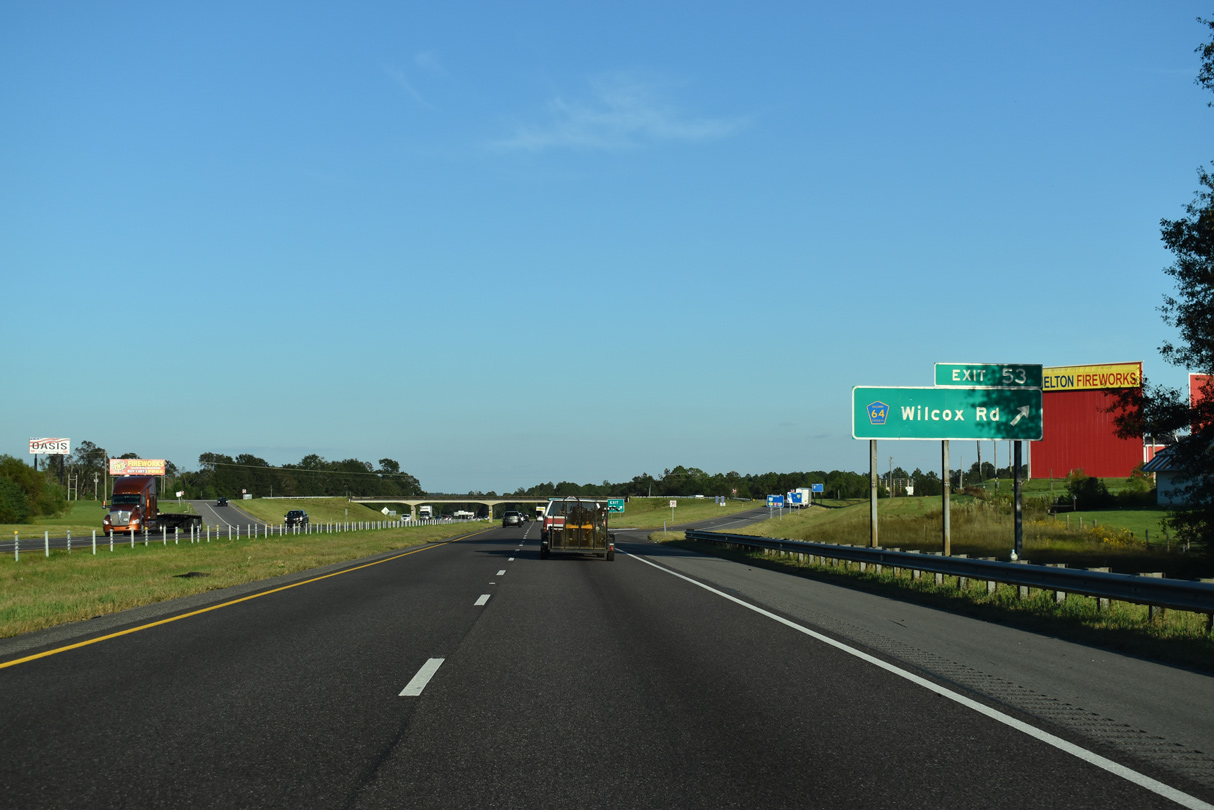
| Exit 53 departs Interstate 10 east for CR 64 (Wilcox Road). CR 64 travels west to Rosinton and Union Avenue in Loxley. 10/08/21 |
|
| The next exit from I-10 east is with U.S. 90 Alternate (Nine Mile Road) in 17 miles. This will be three miles less with the planned construction of an interchange with Florida State Road 99. 10/08/21 |
|
| The bridges spanning Cowpen Creek along Interstate 10 are substandard without shoulders. They were built in 1965. 10/08/21 |
|
| A wide median separates the roadways along Interstate 10 ahead of the Styx River. 10/08/21 |
|
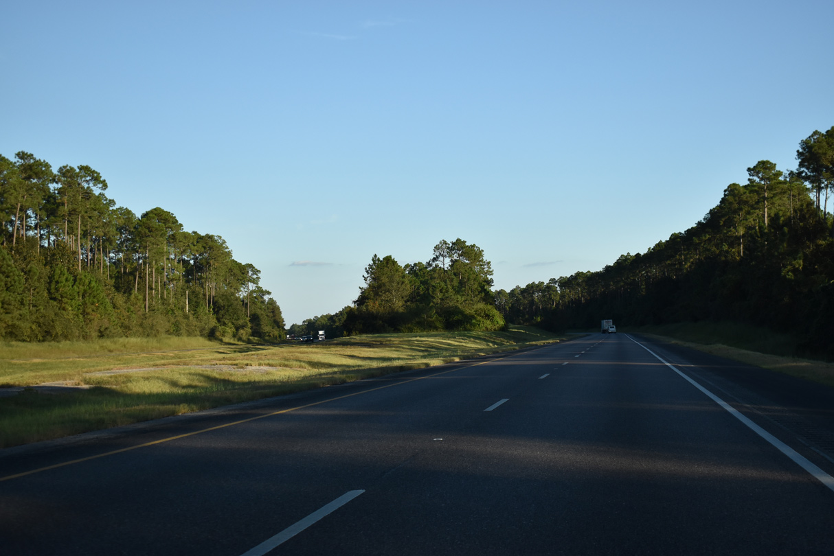
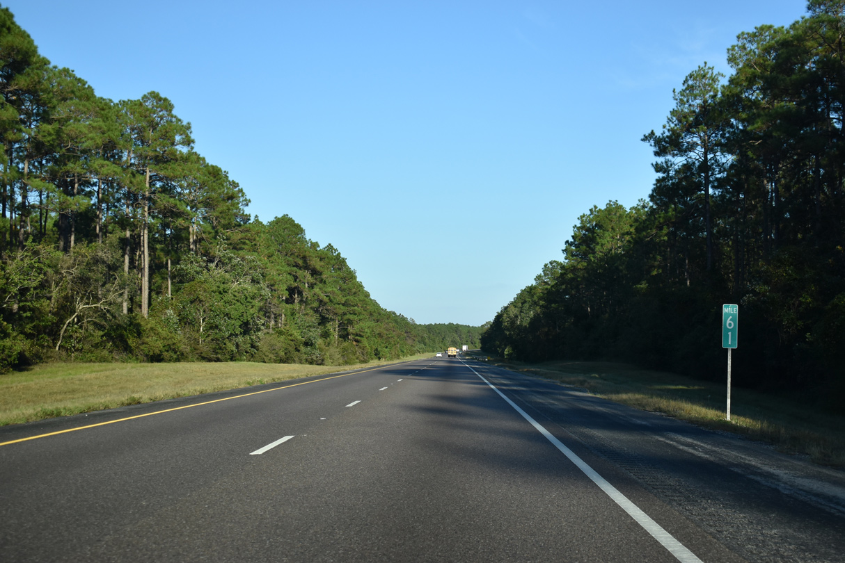
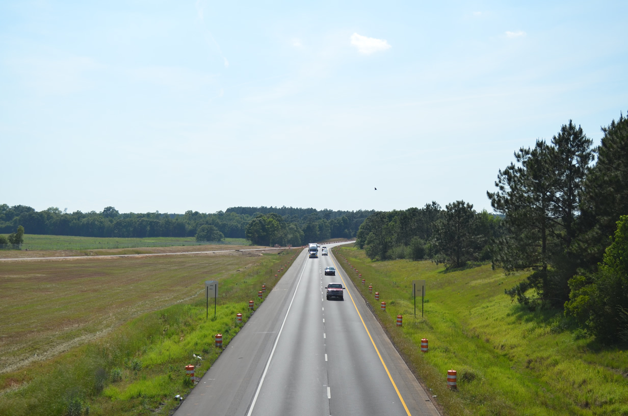
| Paralleling Bear Branch, Interstate 10 advances east through areas of timberland to the Florida state line. 10/08/21 |
|
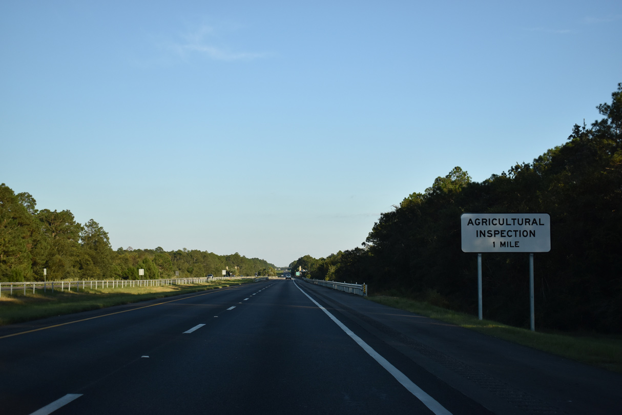
| The Florida Agricultural Inspection Station lies three quarters of a mile beyond the Alabama border. 10/08/21 |
|
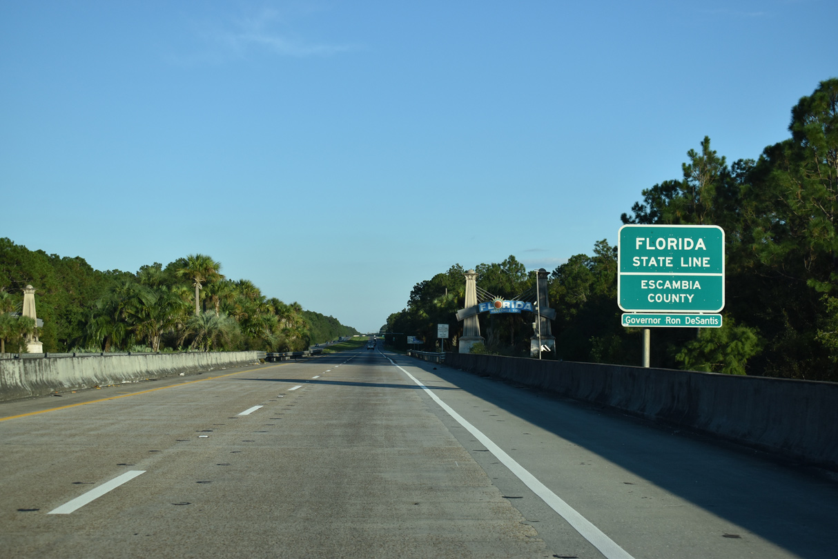
| Interstate 10 traverses large swaths of pine forest along an uninterrupted stretch 12 miles to the Florida state line at the Perdido River. 10/08/21 |
Page Updated 10-10-2021.

 East
East