
 East
East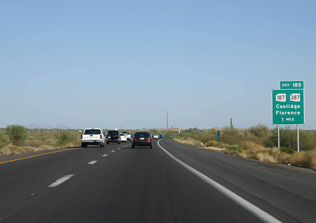
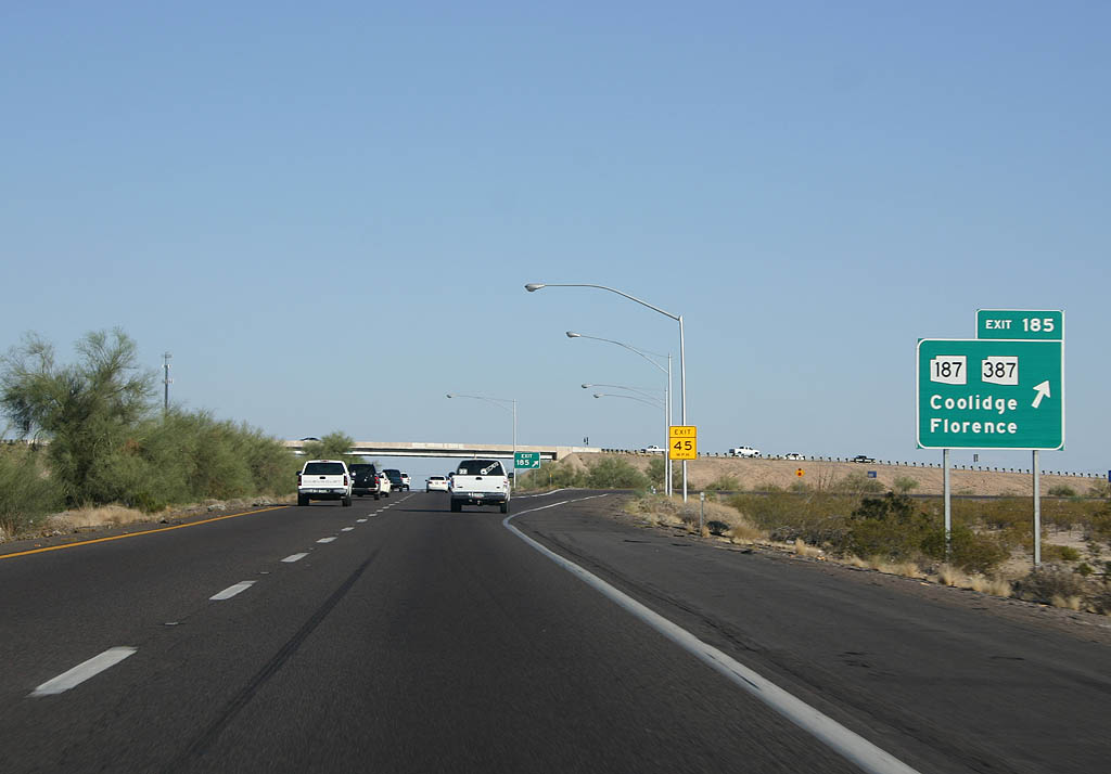
SR 187 angles 5.43 miles southwest across the Sacaton Mountains from SR 87 to SR 387 adjacent to the forthcoming diamond interchange at Exit 185. SR 387 continues 8.39 miles south from Exit 185 along former SR 93/Business Loop I-10 heads to SR 84 in Casa Grande.
06/19/07
SR 387 heads 7.32 miles east to SR 87 west of Coolidge and Florence. Additionally, SR 387 east also leads to Casa Grande Ruins National Monument, which features ruins of a large building constructed by the Hohokam Indians well before the arrival of Christopher Columbus, perhaps as far back as the 1300s.
06/19/07
01/17/05
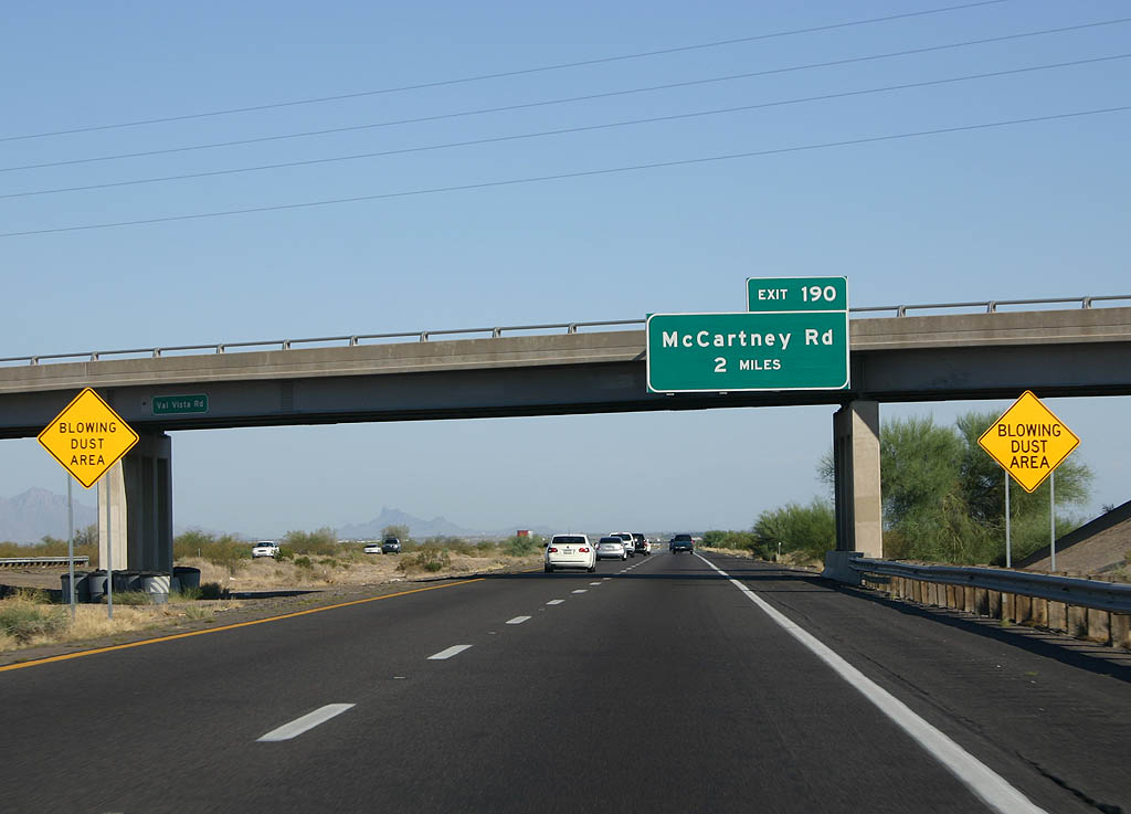
Interstate 10 travels southeast along the Casa Grande city line to a diamond interchange (Exit 190) with McCartney Road.
06/19/07
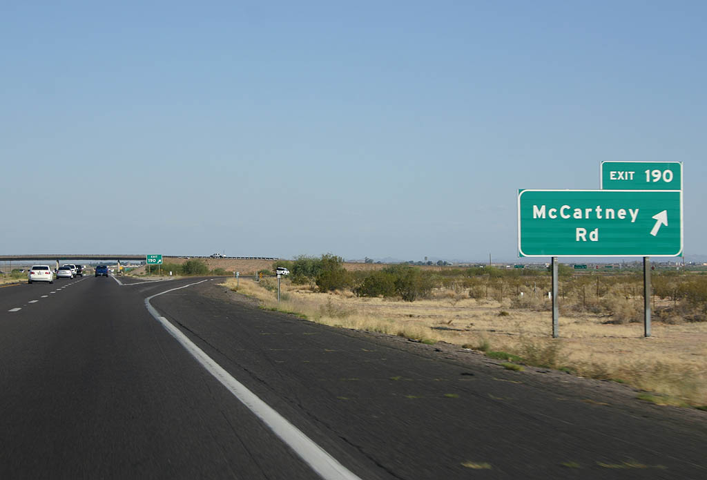
McCartney Road heads 2.85 miles west from Exit 190 to SR 387 (Pinal Avenue) and east past Black Butte 4.93 miles to Signal Peak Road.
06/19/07
01/17/05
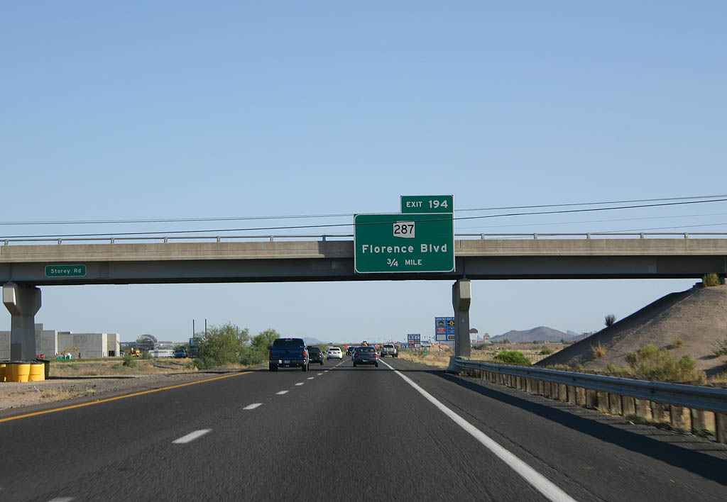
Business Loop I-10 from Casa Grande returned alongside what was SR 287 east along Florence Boulevard 3.93 miles from SR 84/387 to the diamond interchange at Exit 194.
06/19/07
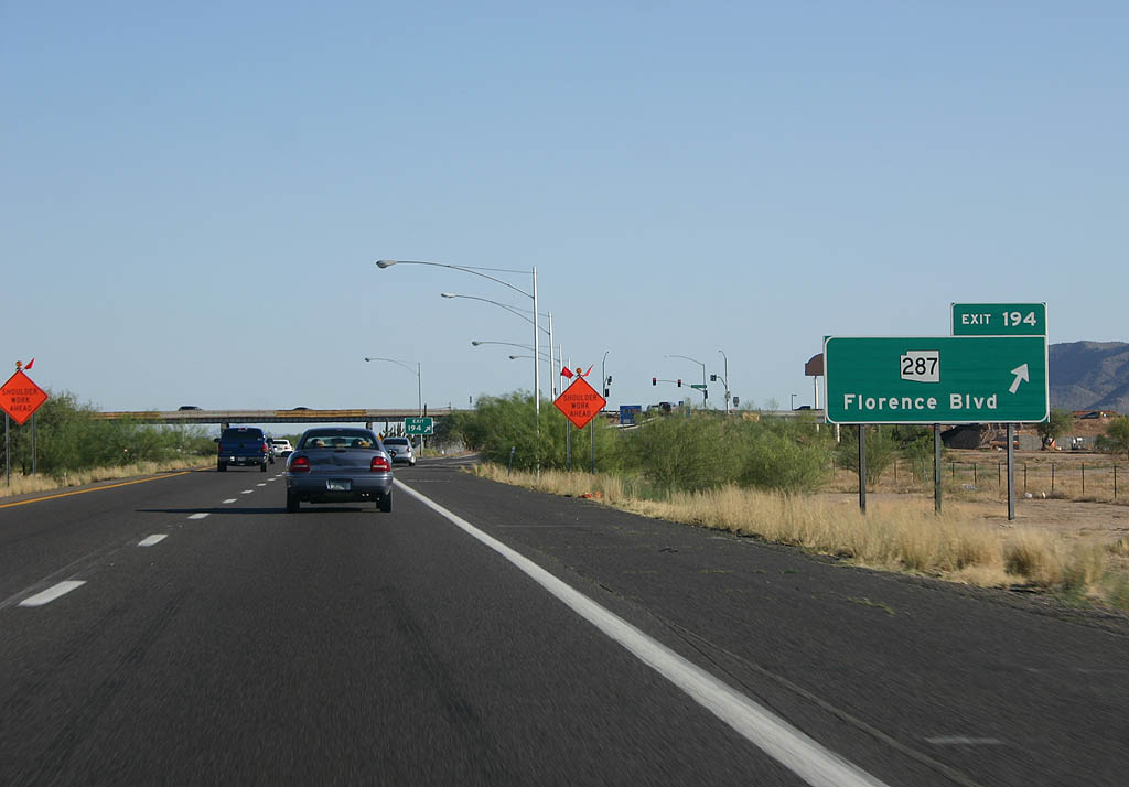
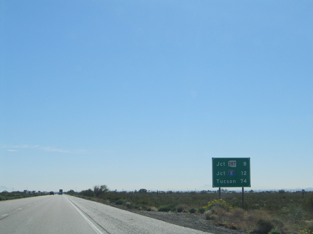
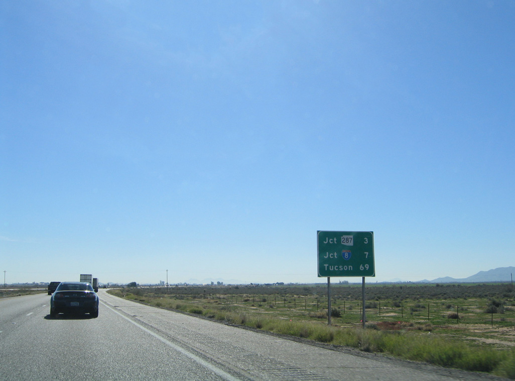
SR 287 extends 10.15 miles east from I-10 at Casa Grande to Eleven Mile Corner and SR 87 at La Palma.
06/19/07
06/19/07

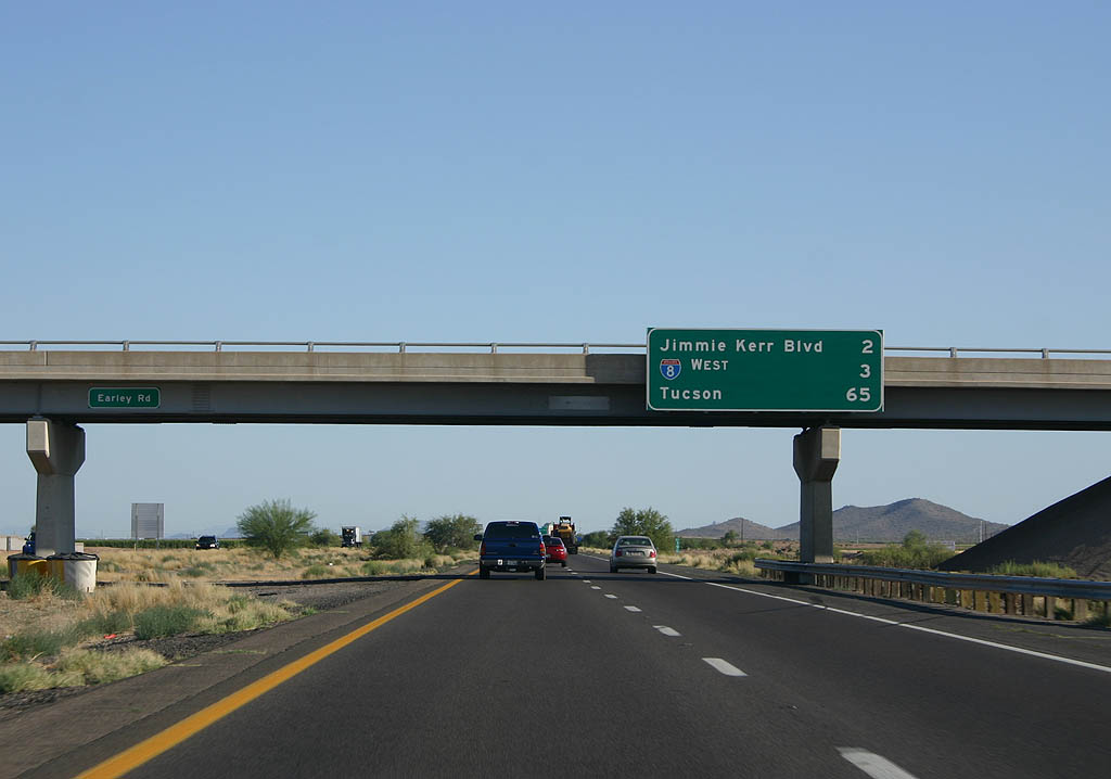
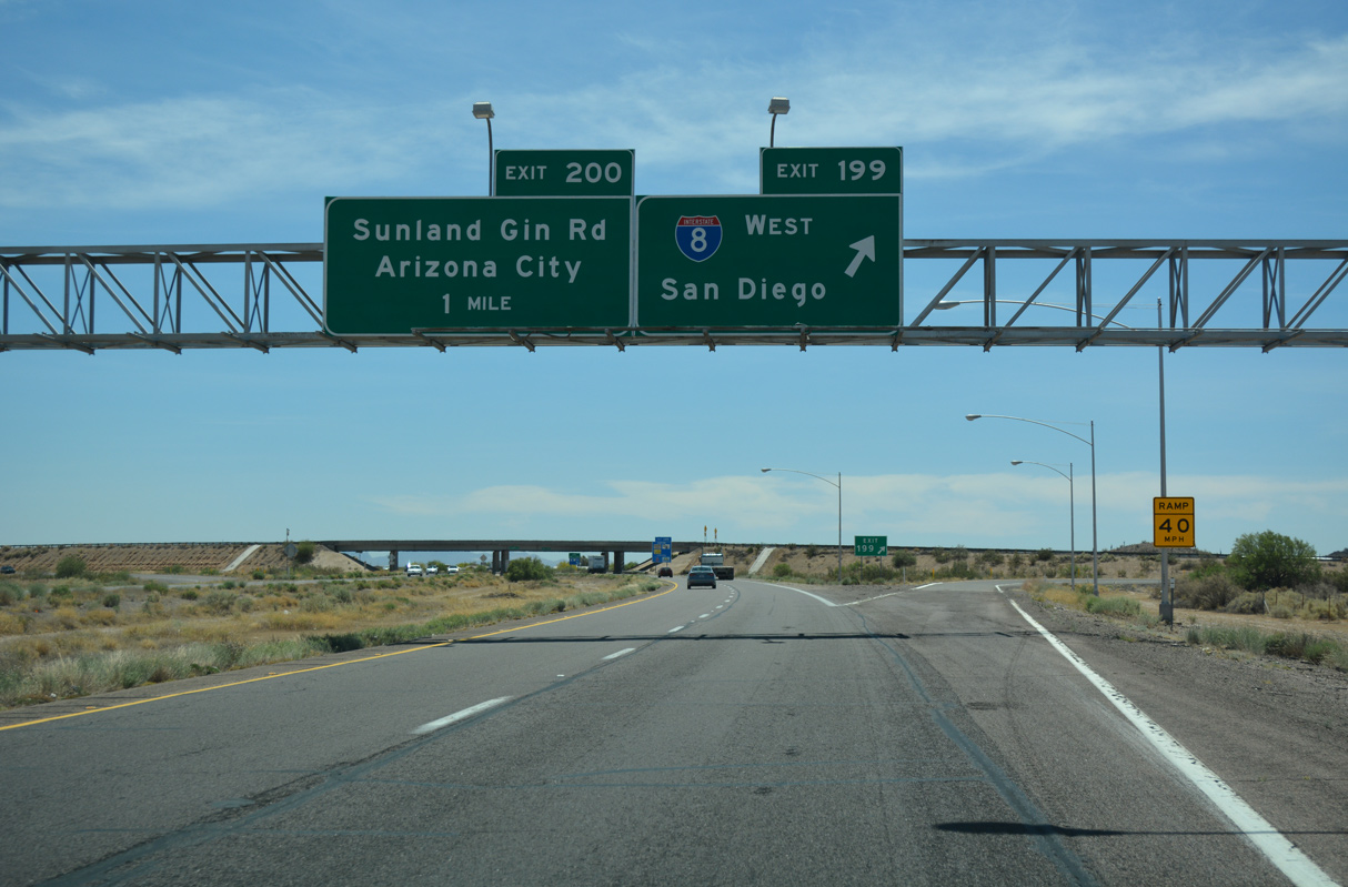
Jimmie Kerr Boulevard angles southeast from Arizola to meet Interstate 10 at Exit 198, one mile from the west end of Interstate 8.
06/19/07
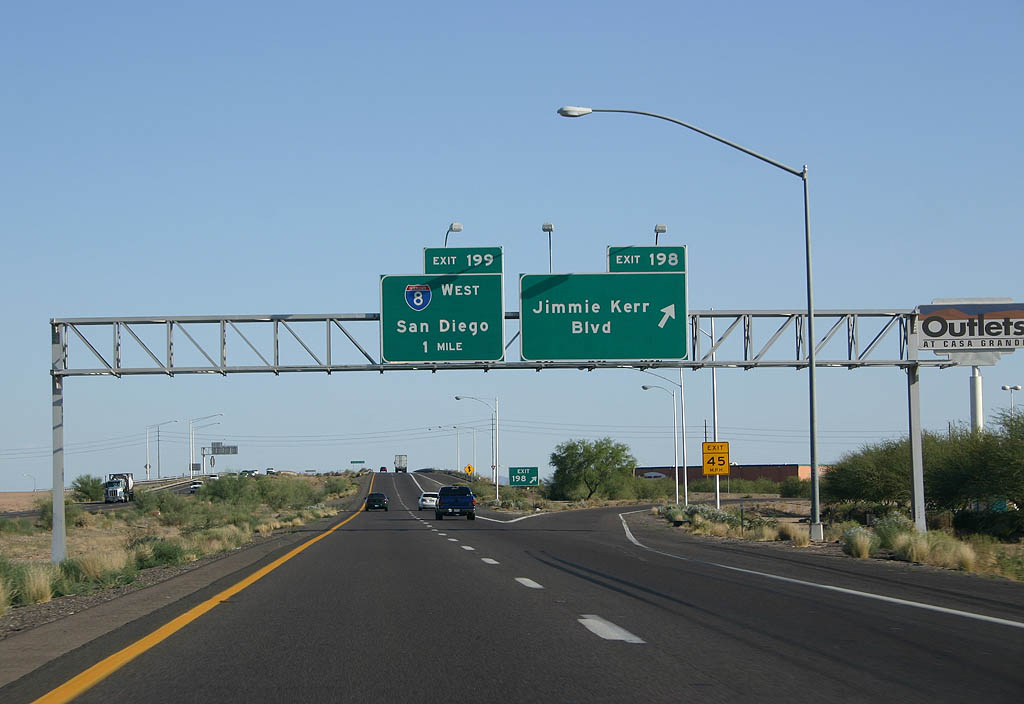
Following former SR 84, Jimmie Kerr Boulevard leads northwest back into Casa Grande. Interstate 8 travels 179.67 miles west to Gila Bend and Yuma in southwestern Arizona.
06/19/07
04/26/17
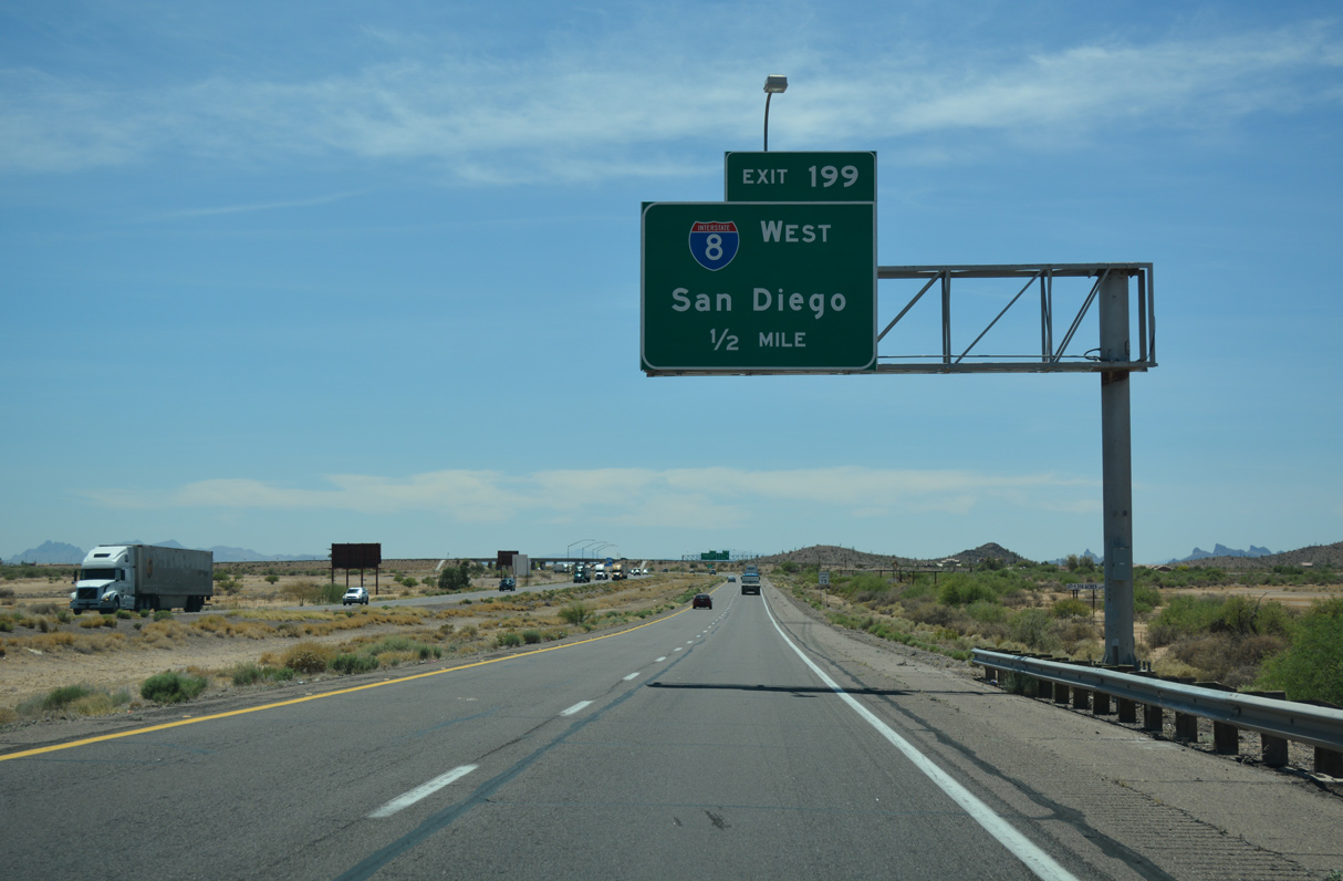
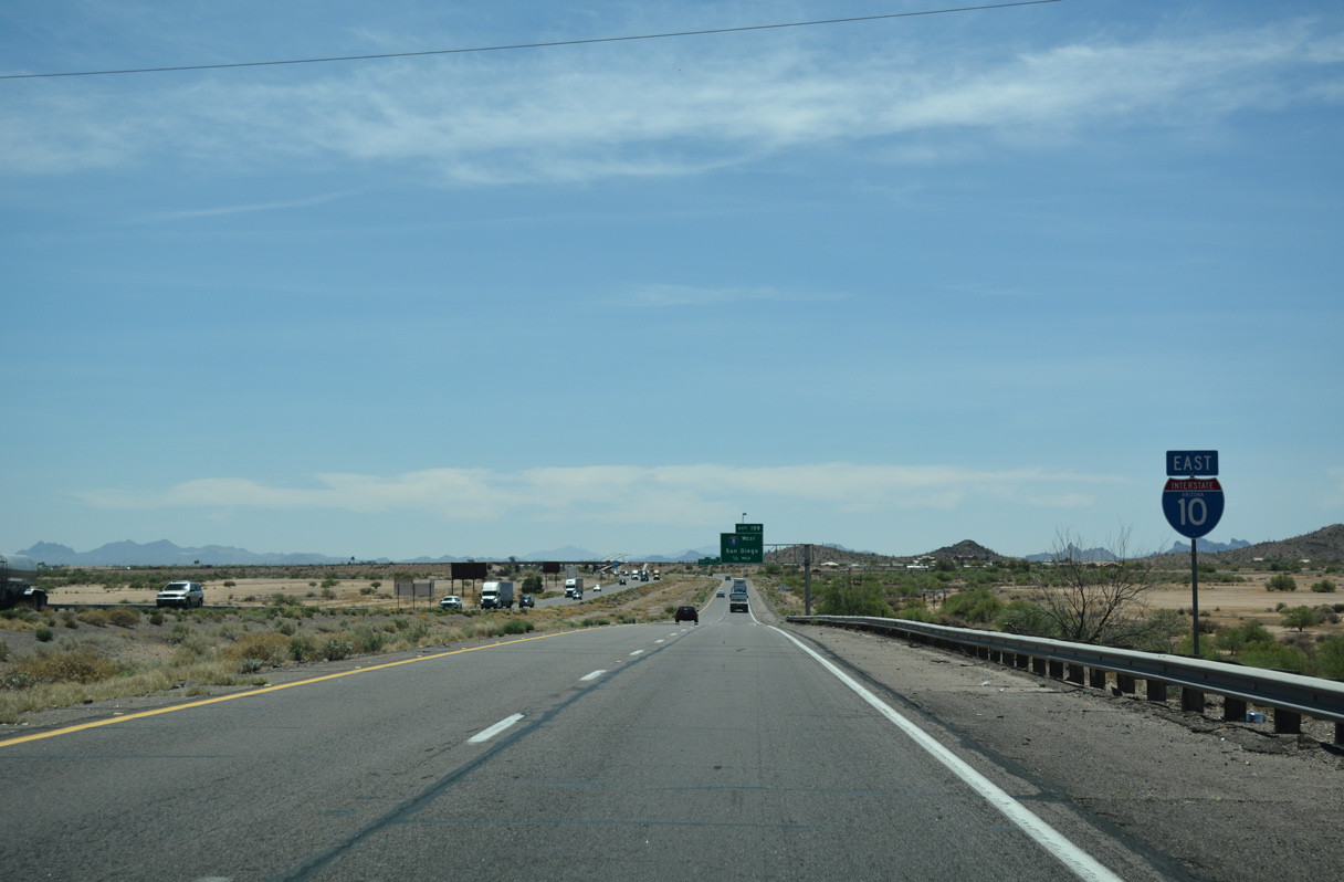
Interstate 8 travels overall from I-10 near Casa Grande west to El Centro in California's Imperial Valley and San Diego.
04/26/17
Combined with Business Loop I-8 at Gila Bend and SR 85 north from there to Buckeye, I-8 provides a regional bypass of Phoenix for Interstate 10 west into Southern California.
04/26/17

A major truck stop, Sunland Gin Road at forthcoming Exit 200 is one of the access points from Interstate 10 into the city of Eloy.
06/19/07
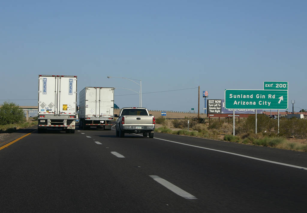
Sunland Gin Road stems south from Jimmie Kerr Boulevard (old SR 84) to a diamond interchange (Exit 200) with I-10 and the community of Arizona City.
06/19/07
01/13/06
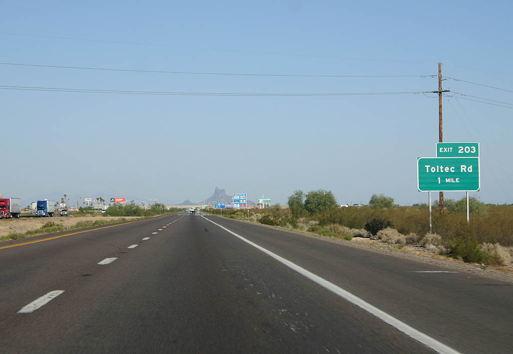
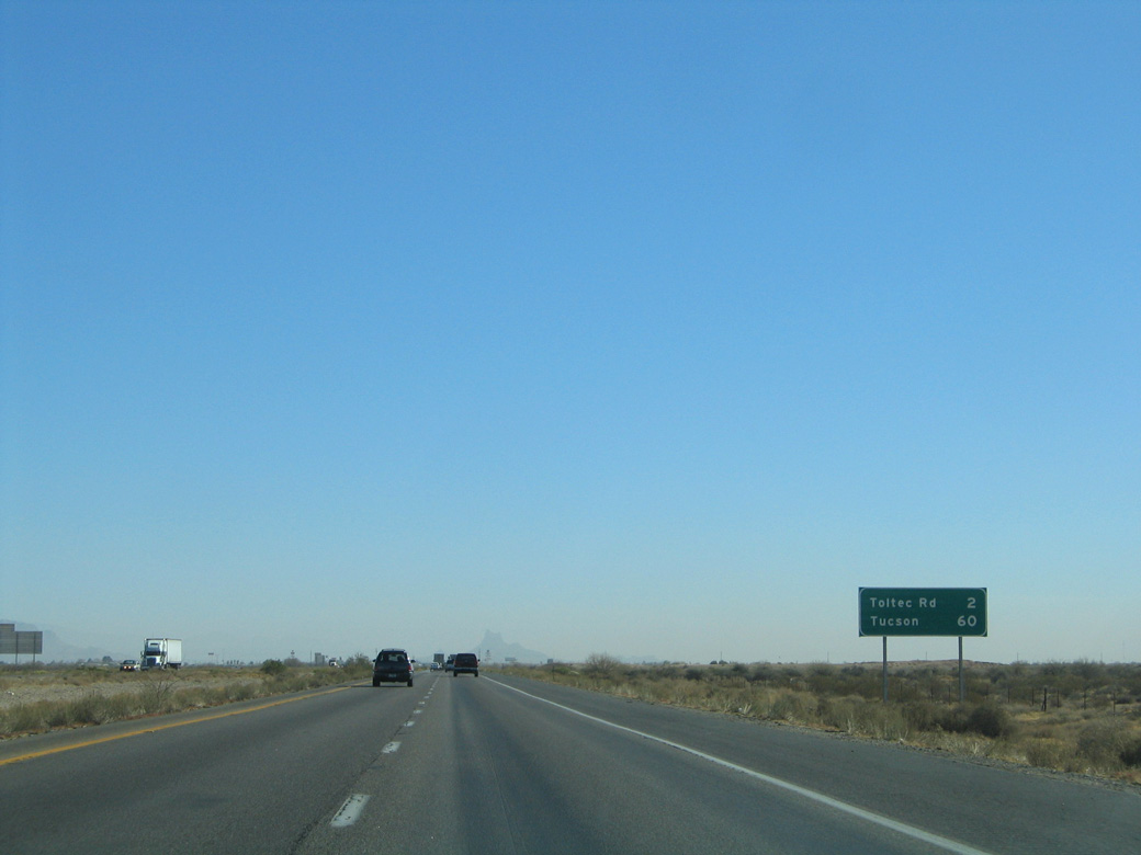
Exit 203 for Toltec Road includes a number of motorist services.
06/19/07
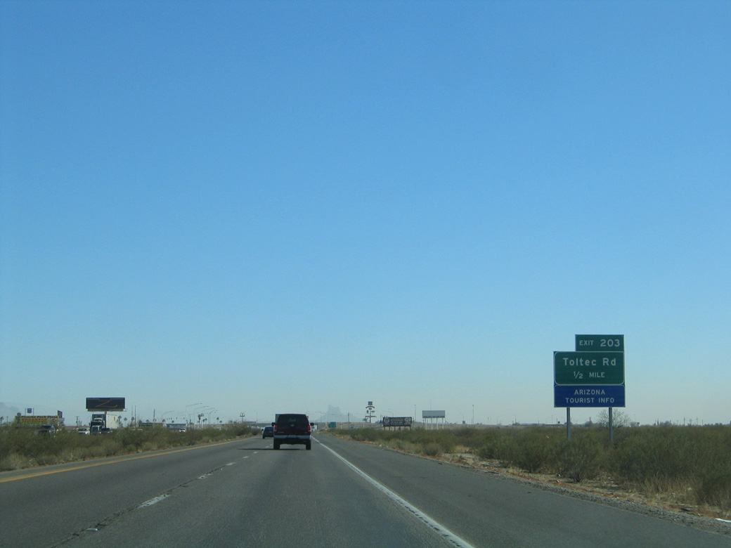
One half mile from the diamond interchange (Exit 203) with Toltec Road at Eloy on the Santa Cruz Flats.
01/13/06

06/19/07

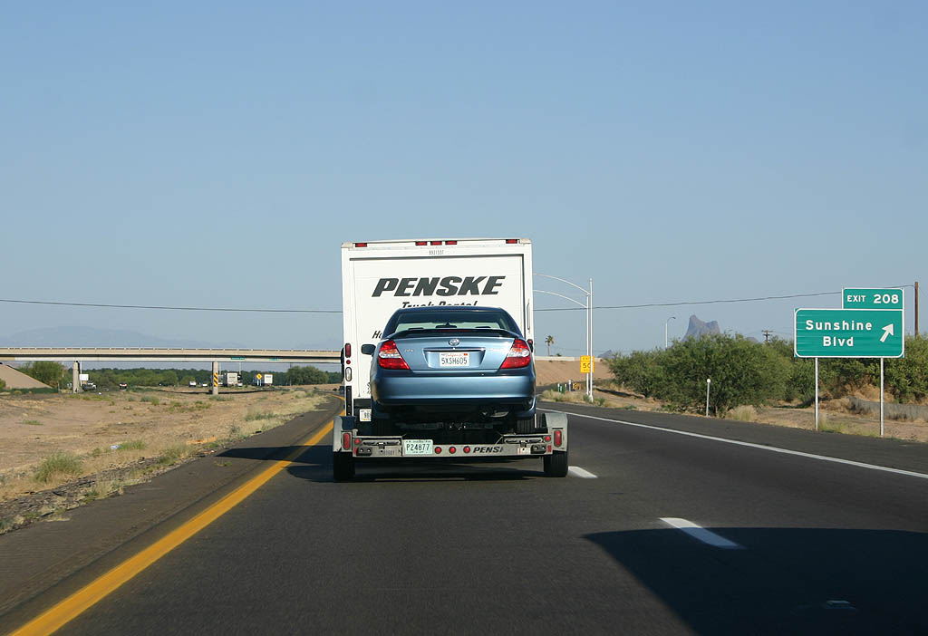
I-10 advances one mile southeast by Eleven Mile Corner Road and the remains of a miniature golf course built alongside the freeway to Exit 208 for Sunshine Boulevard.
06/19/07
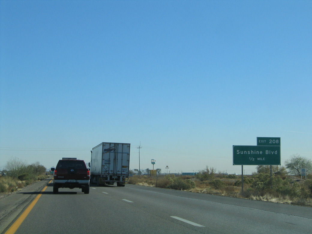
Sunshine Boulevard is the last exit for Eloy along Interstate 10 eastbound.
01/13/06
06/19/07
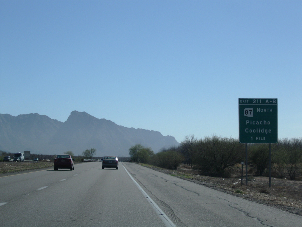
A $72 million widening project completed in Fall 2019 straightened out Interstate 10 at Exit 211 and rebuilt the exchange with SR 87 north into a diamond interchange.1
02/28/09
Exit 211A formerly linked I-10 east with Peak Lane, the west side frontage road, adjacent to a pecan grove. 2019 construction included building a five lane boulevard extending south from SR 87 to Phillips Road.
02/28/09
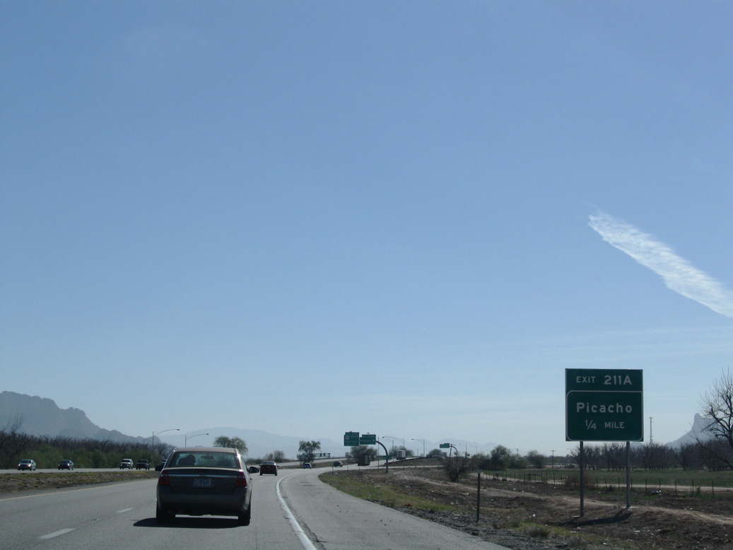
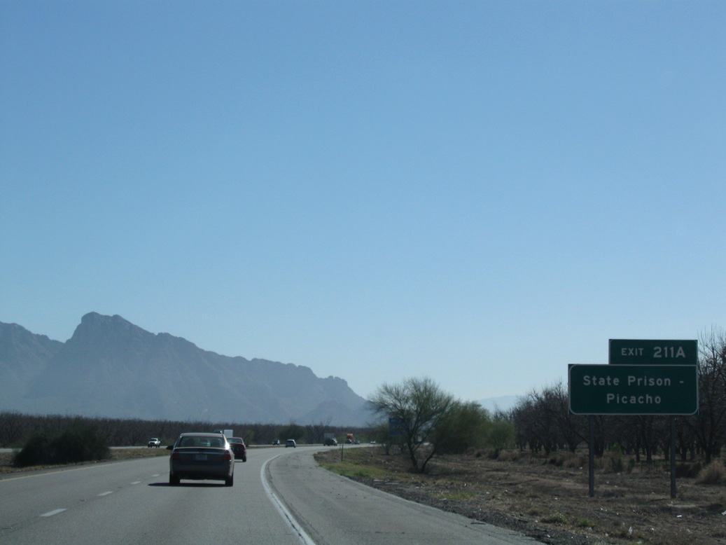
Peak Lane east from Phillips Road joins Exit 211 with Picacho, an unincorporated community located immediately off the freeway.
02/28/09
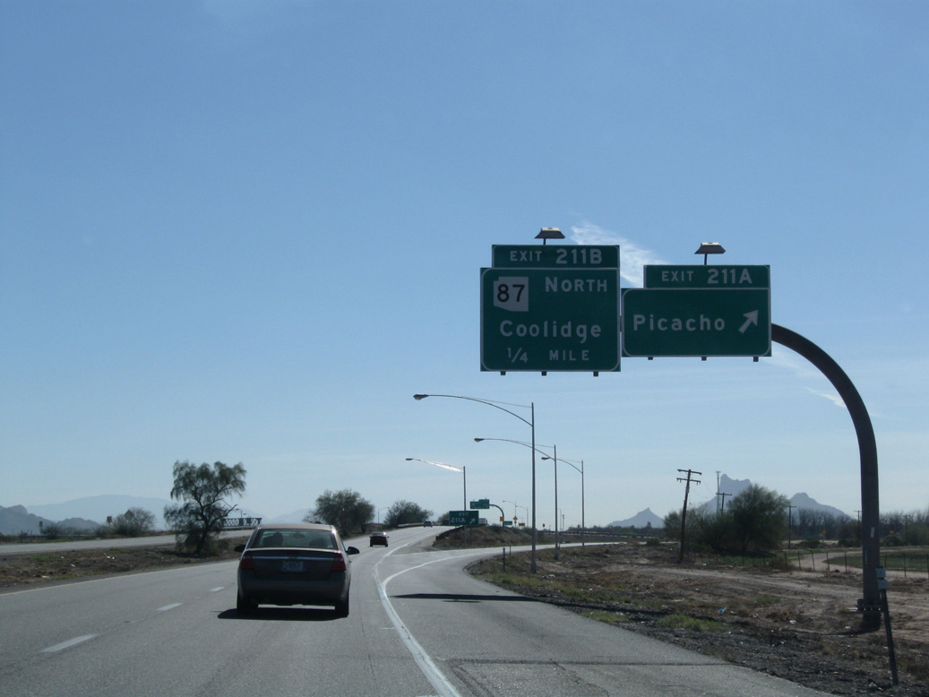
Separate ramps previously departed from I-10 at Exit 211 for Picacho and SR 87 north to La Palma and the city of Coolidge.
02/28/09
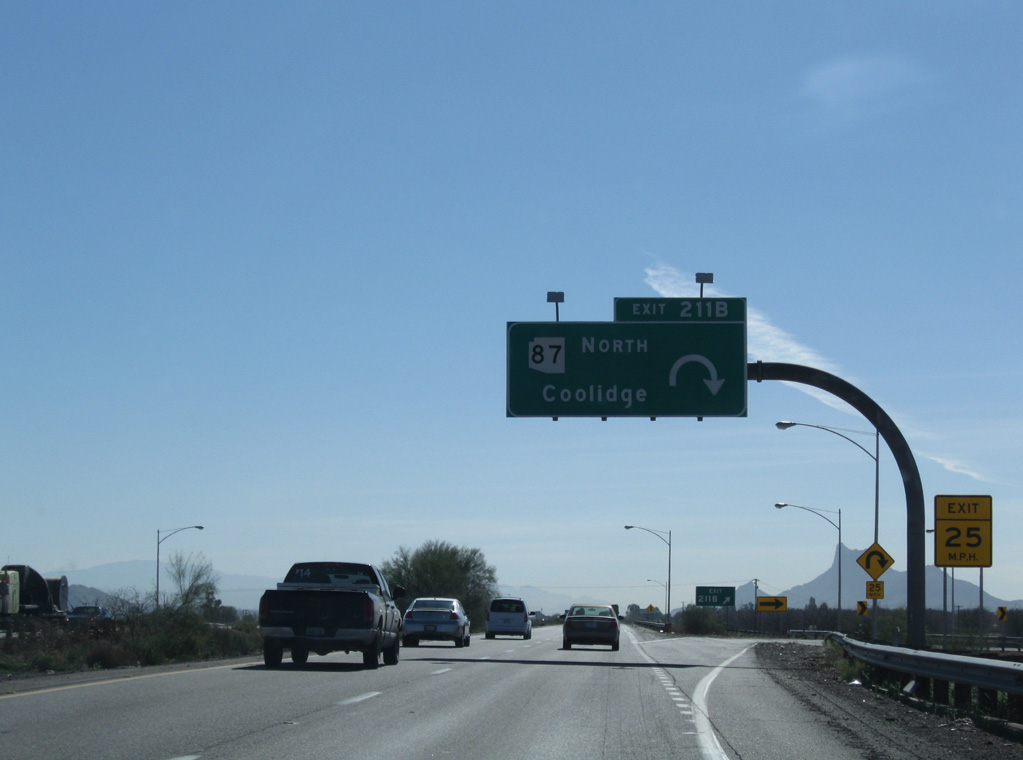
SR 87 travels 19.63 miles north from nearby Peak Lane to SR 287 in Coolidge and 287.26 miles to SR 264 at Second Mesa in the Hopi Reservation.
02/28/09
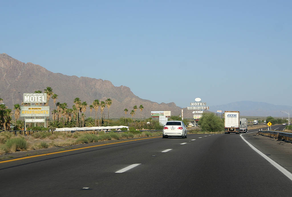
The Picacho Motel was one of the few stops along old SR 84 for decades. Construction of Interstate 10 in 1967 hit Picacho hard economically, and the town subsequently struggled. Until the late 1990s, the old neon sign for the motel was still regularly lit at night. The old motel was demolished with the realignment of I-10 in 2018/19.
06/19/07
A previous widening project underway in 2008 expanded Interstate 10 to six lanes between Picacho Peak Road and Marana.
01/13/06
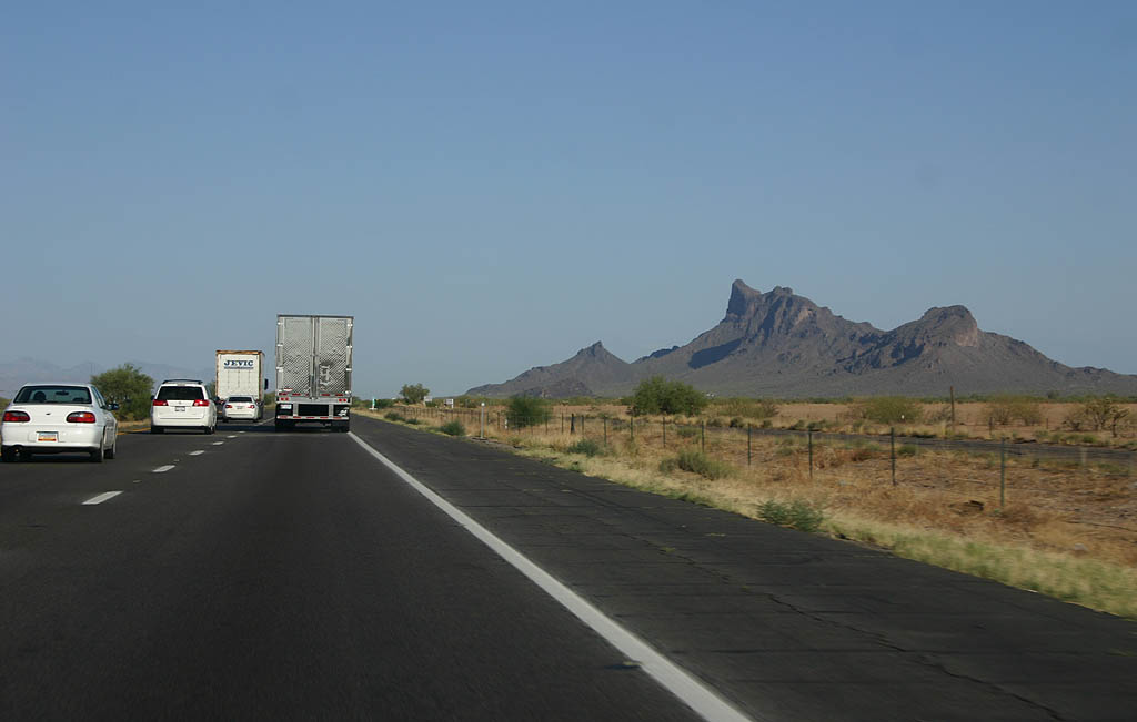
Rising southwest of Exit 219, Picacho Peak is the site of the only Civil War battle in Arizona. The peak has long been used as a waypoint due to the water sources nearby.
06/19/07
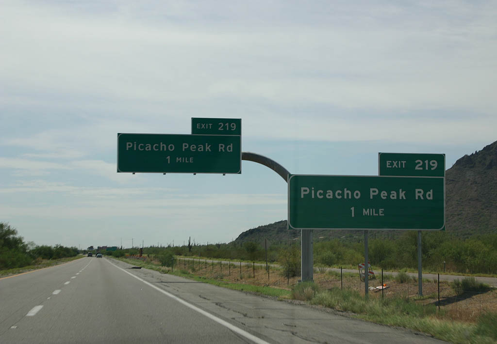
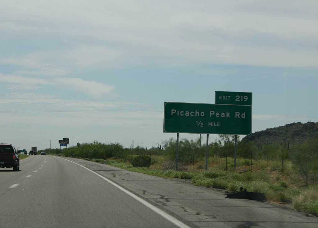
Exit 219 links Interstate 10 east with Picacho Peak Road to Picacho Peak State Park and Rooster Cogburn Ostrich Ranch.
07/26/08
07/26/08
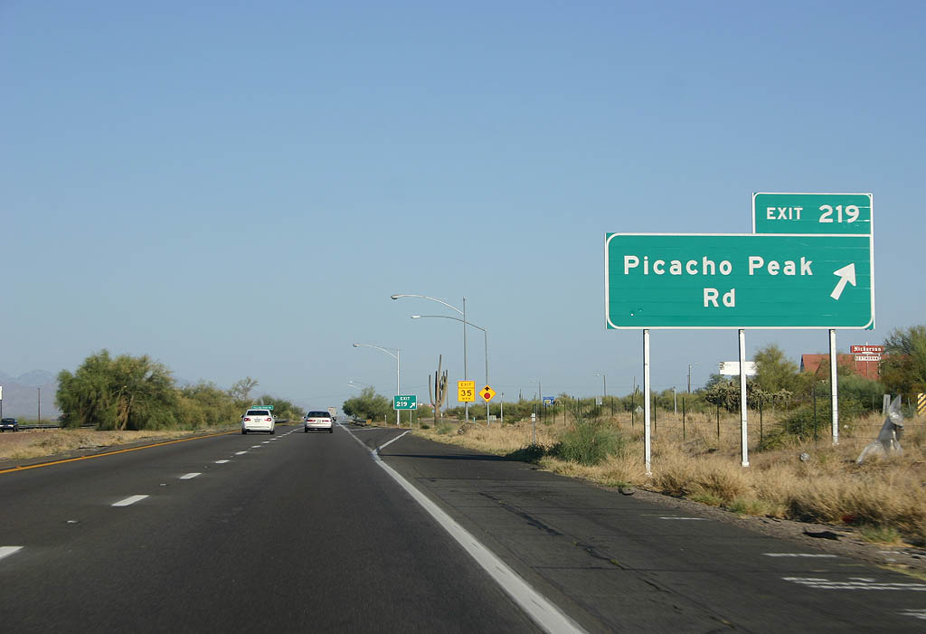
Interstate 10 passes over Picacho Pass (el. 1,800 feet) beyond the diamond interchange (Exit 219) with Picacho Peak Road.
06/19/07
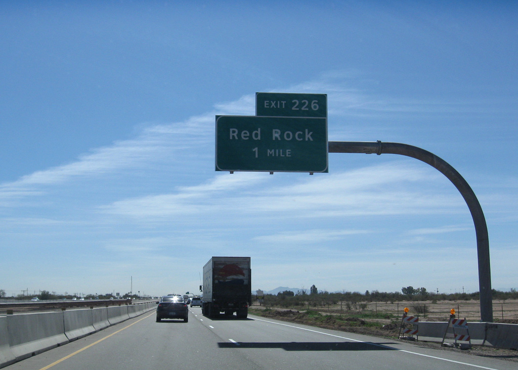
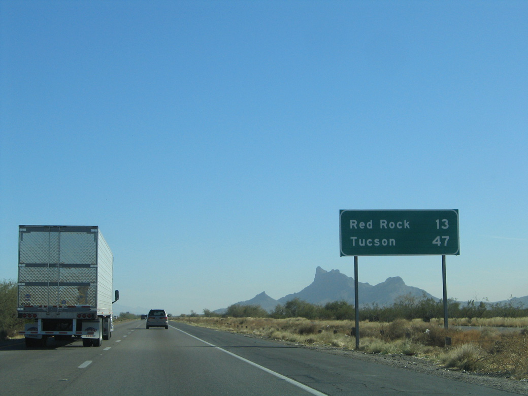
The next exit along eastbound Interstate 10 is for Camino Correo, Camino Adelante and E Sasco Road at Red Rock.
02/28/09
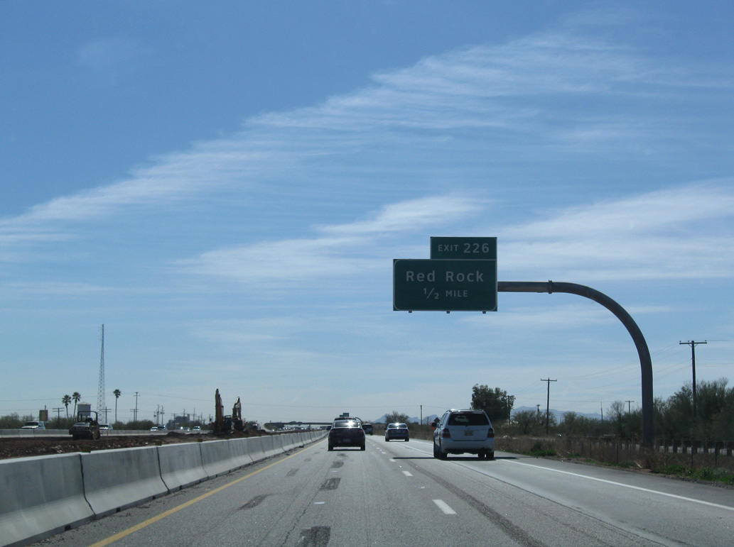
Red Rock originally was a railroad siding along the Union Pacific line.
02/28/09
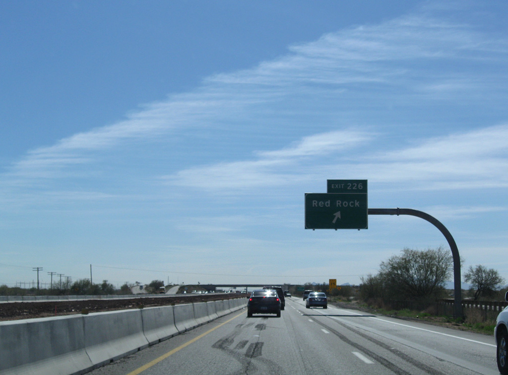
Sasco Road comprises a four lane suburban boulevard west to the Red Rock Village development.
02/28/09
01/13/06
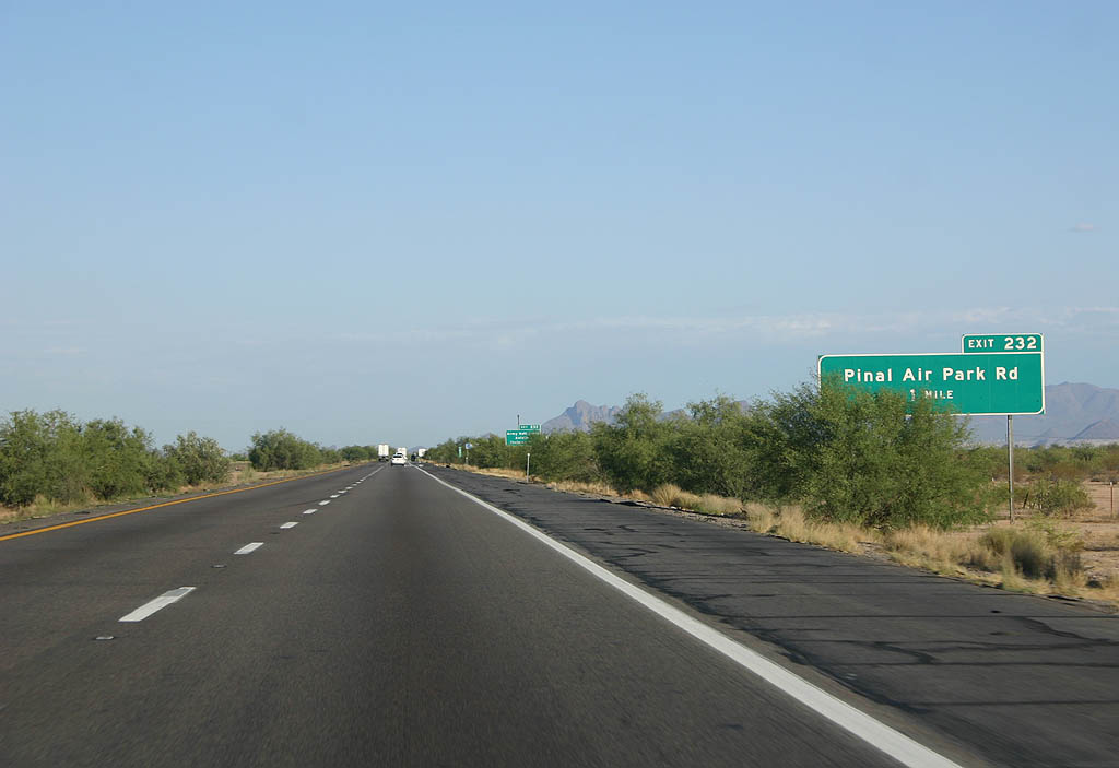
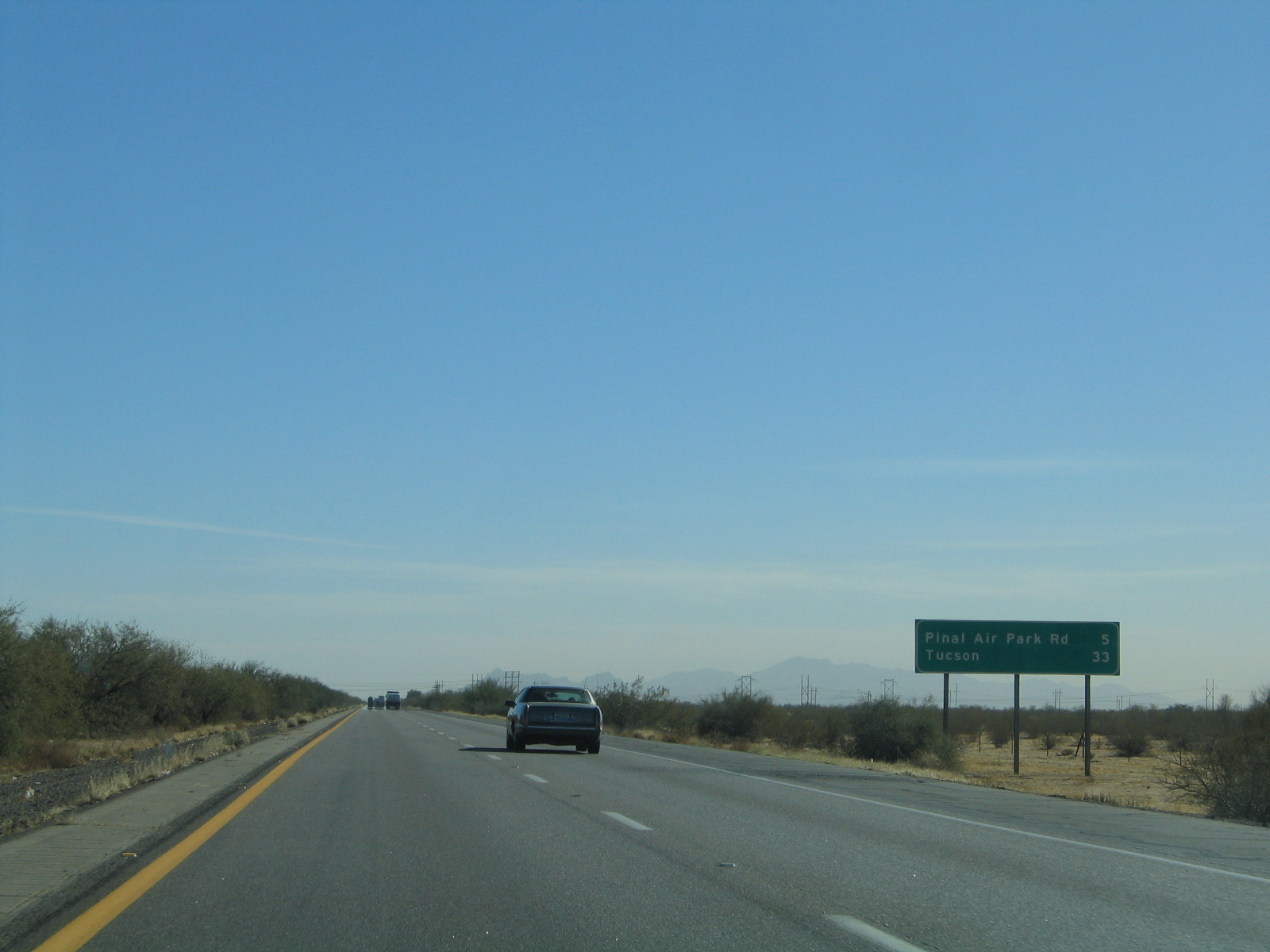
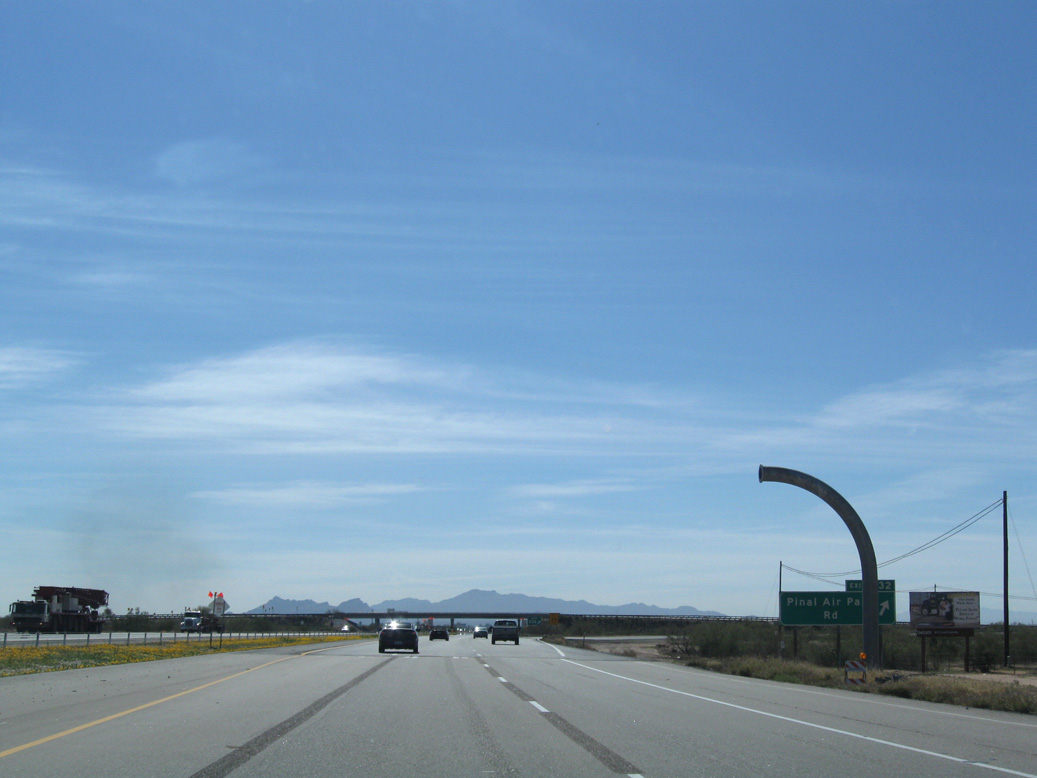
Pinal Air Park Road serves Pinal Air Park, a well-secured facility used to store retired commercial aircraft.
06/19/07
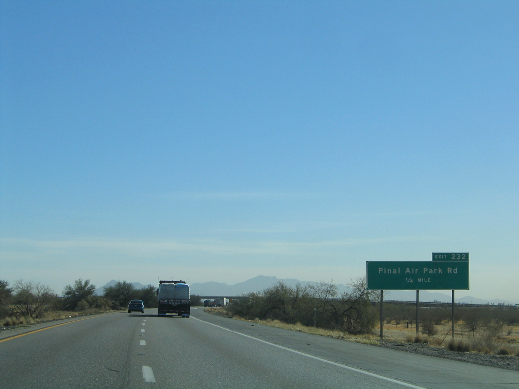
Pinal Air Park Road stems 3.84 miles west from a half cloverleaf interchange (Exit 232) with Interstate 10.
01/13/06
02/28/09
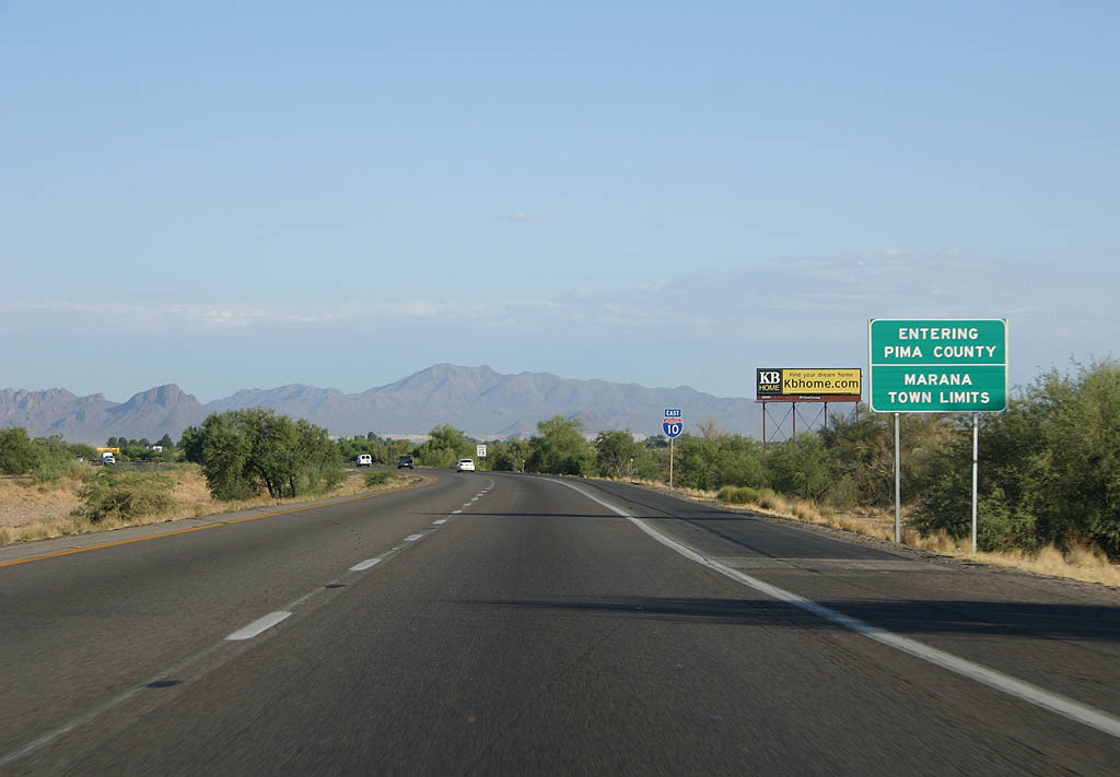
Interstate 10 crosses the Pima County and Marana town line just south of Exit 292.
06/19/07

02/28/09
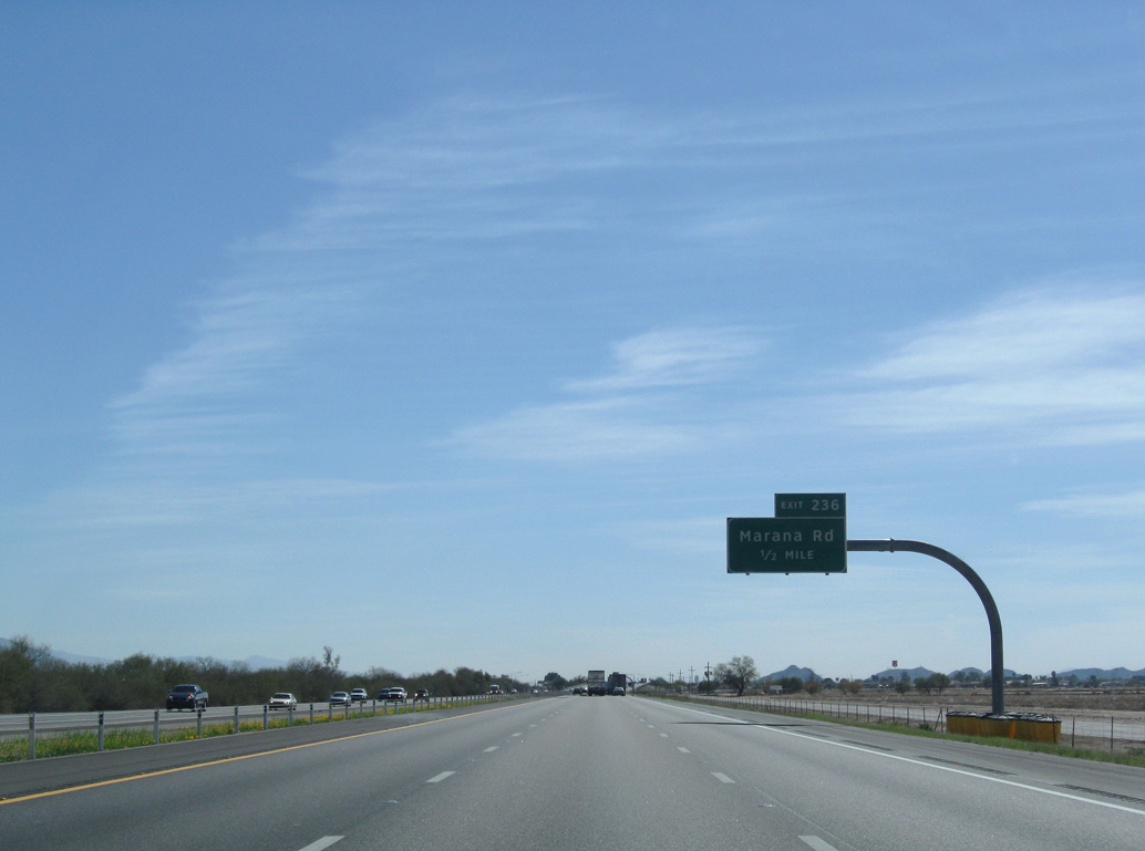
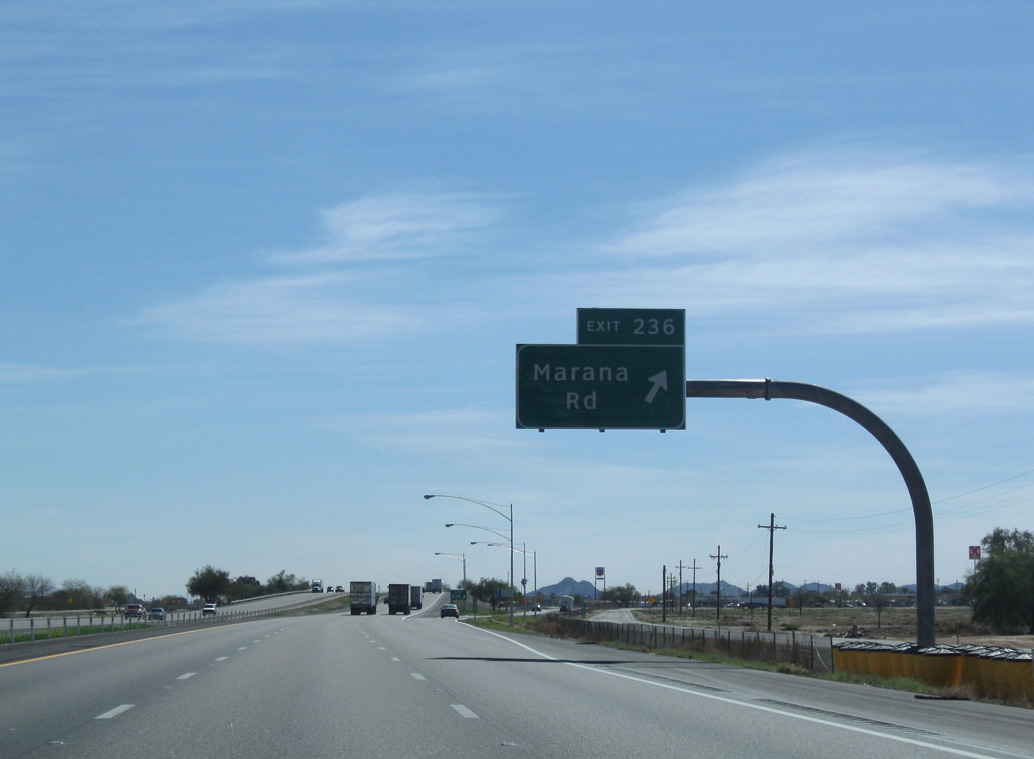
N Sandario Road and W Cochie Canyon Trail come together at a diamond interchange (Exit 236) with Interstate 10 in one mile.
02/28/09
02/28/09
02/28/09
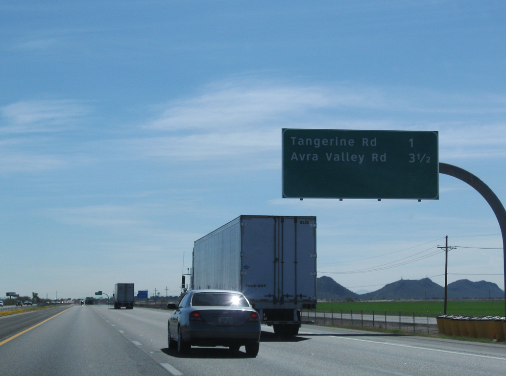
Interstate 10 was widened from Tangerine Road to Ina Road progressively from 2003 to 2006.
06/19/07
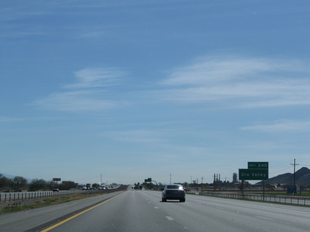
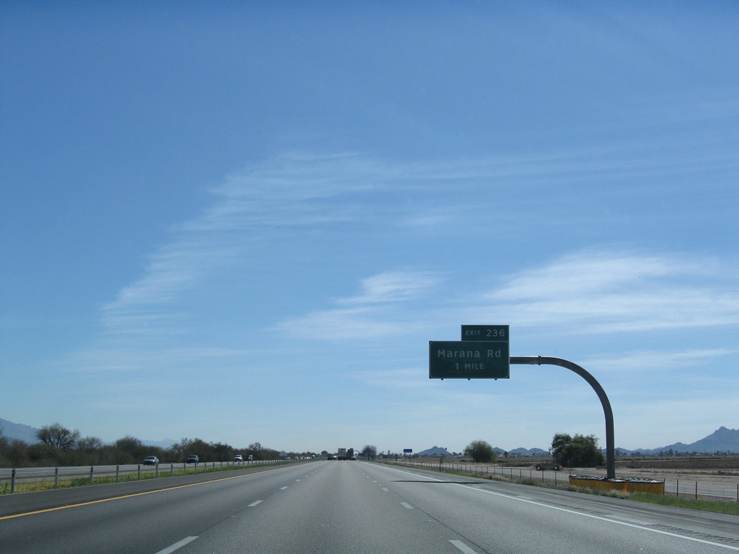
Tangerine Road heads east from the diamond interchange at Exit 240 to the town of Oro Valley.
06/19/07
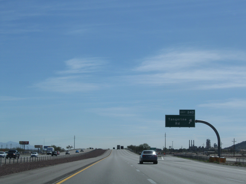
Exit 240 departs I-10 east for Tangerine Road in Marana. Interstate 10 travels from northwest to southeast through Pinal County.
02/28/09
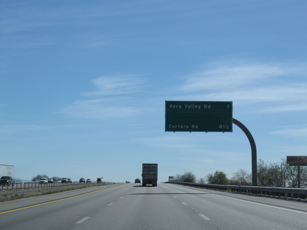
With suburban growth in south Marana, a diamond interchange (Exit 244) for Twin Peaks Road was added along I-10 between Avra Valley Road and Cortaro Road. A $19.5 million extension of Twin Peaks Road to the east connects Continental Ranch and the Dove Mountain area.2
02/28/09

Marana Regional Airport (AVQ) lies west of Interstate 10 along Avra Valley Road in Avra Valley. Saguaro National Park is located to the southwest in the Tucson Mountains.
02/28/09
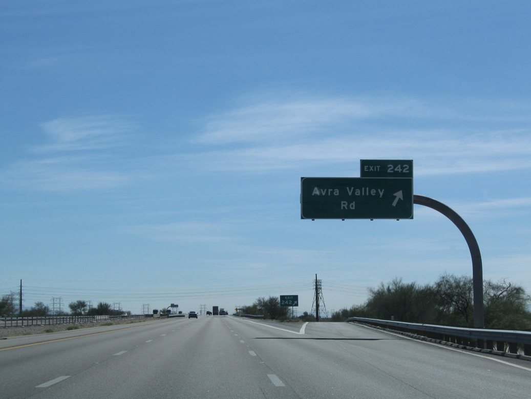
Interstate 10 passes by the community of Rillito ahead of Exit 242 for Avra Valley Road west in Marana.
02/28/09
First discussed in 1988, construction on the exchange with Twin Peaks Road got underway in August 2009. Costing $50.05 million with funds derived from the Regional Transportation Authority, Marana and the federal government, the exit opened the day after a ribbon cutting event held on November 18, 2010.2
02/28/09
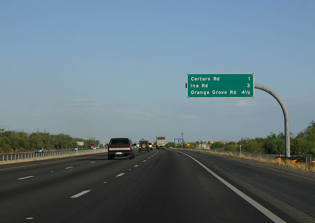
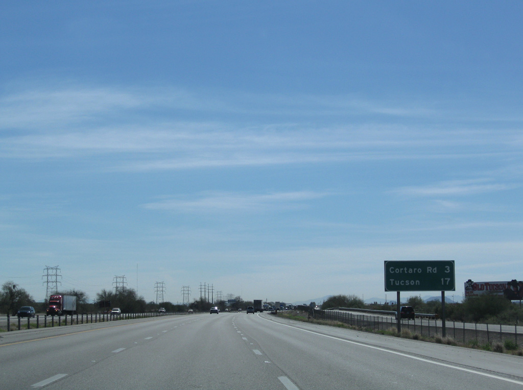
Forthcoming Exit 246 joins Interstate 10 with Cortaro Road south and Cortaro Farms Road east at the Cortaro neighborhood in Marana.
06/19/07
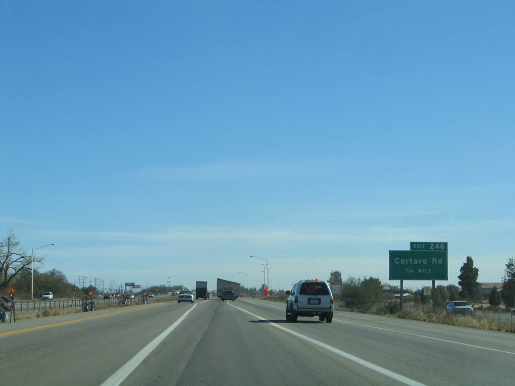
Ramps at the diamond interchange (Exit 246) for Cortaro Road utilize the adjacent Frontage Roads.
01/13/06
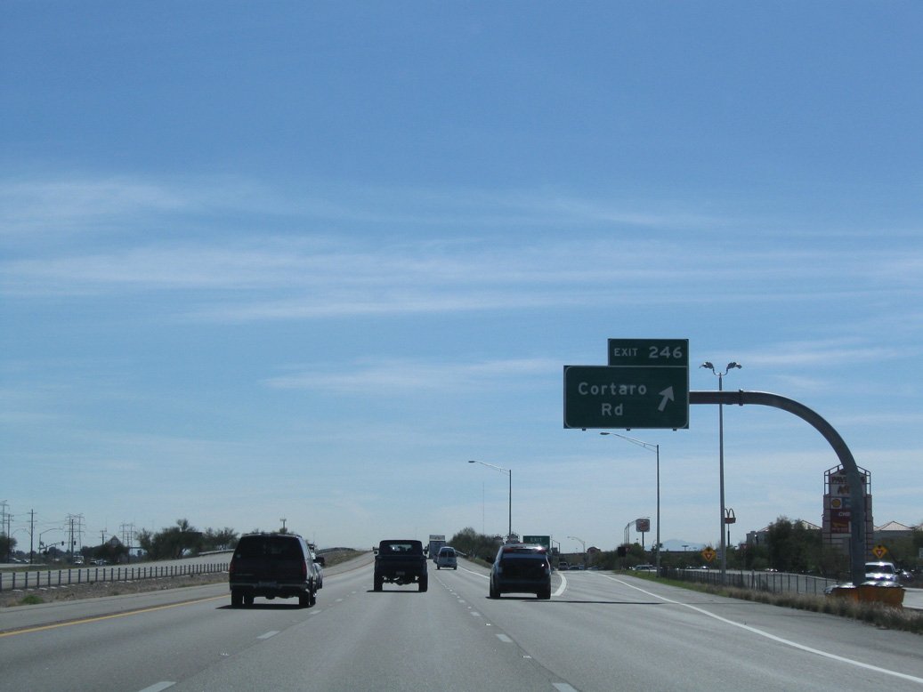
Eastbound Interstate 10 at Exit 246 for Cortaro Road. I-10 between Exit 246 and 263 parallels the often dry Santa Cruz River. The river lies to the southwest of the freeway and east of Silverbell Road.
02/28/09

Underway from February 2017 to April 2019, a $128 million project at Ina Road expanded I-10 to six overall lanes, widened a 1.6 mile long stretch of Ina Road between N Silverbell Road and N Camino De La Cruz, and built new bridges for Ina Road over the UP Railroad and Santa Cruz River.3
06/19/07
The Foothills Mall lies east of Exit 248 by the intersection of Ina Road and La Cholla Boulevard.
01/13/06
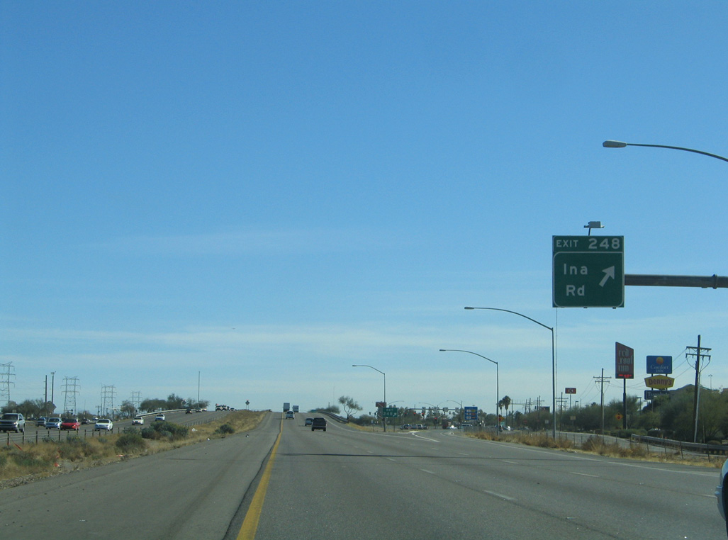
Entering the diamond interchange (Exit 248) with Ina Road on I-10 east.
01/13/06
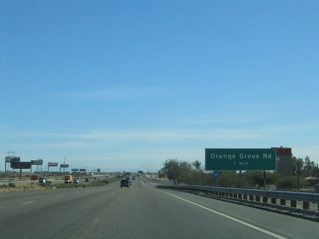
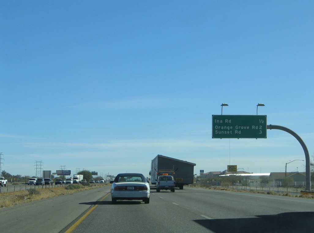
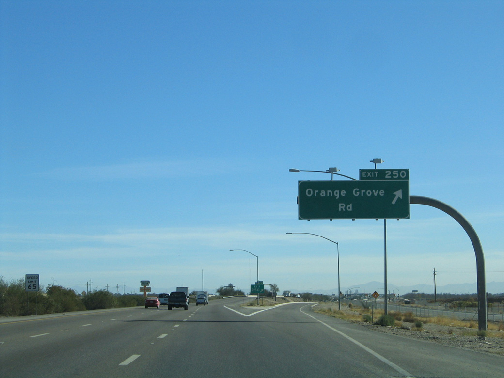
2017-19 reconstruction of Interstate 10 at Ina Road lowered the six lane freeway below grade.3 The succeeding exit is with Orange Grove Road.
01/13/06
02/28/09
01/13/06
01/13/06
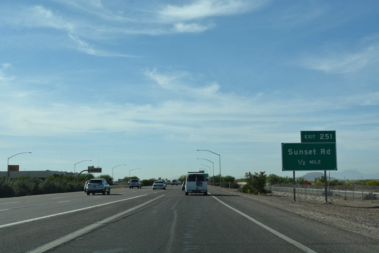
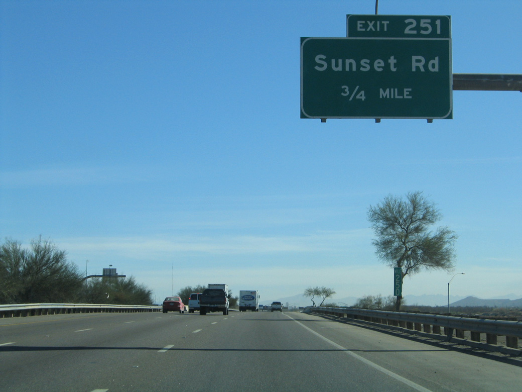
04/26/17
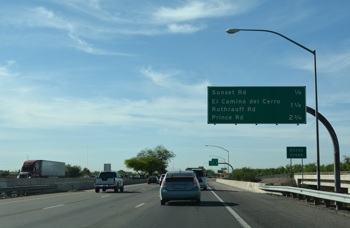
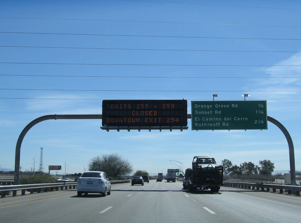
I-10 crosses Rillito Creek just ahead of the diamond interchange (Exit 251) with Sunset Road.
04/26/17

Sources:
- "Both directions of I-10 now three lanes all the way between Tucson and Casa Grande." Arizona Department of Transportation (ADOT), news release. September 27, 2019.
- "Twin Peaks project makes its debut." Arizona Daily Star, The (Tucson, AZ), November 18, 2010.
- "New Ina Road interchange promises increased capacity, improved safety." Inside Tucson Business (AZ) , April 26, 2019.
Photo Credits:
- 01/17/05 by AARoads.
- 01/13/06 by AARoads.
- 06/19/07 by Kevin Trinkle.
- 07/26/08 by Kevin Trinkle.
- 02/28/09 by AARoads.
- 04/26/17 by AARoads.
Connect with:
Interstate 8
State Route 87 - Beeline Highway
Page Updated 04-11-2022.