|
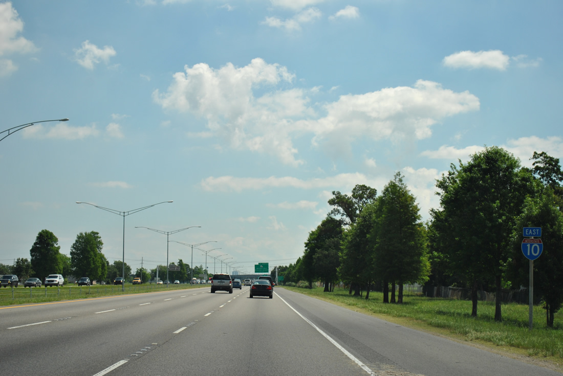
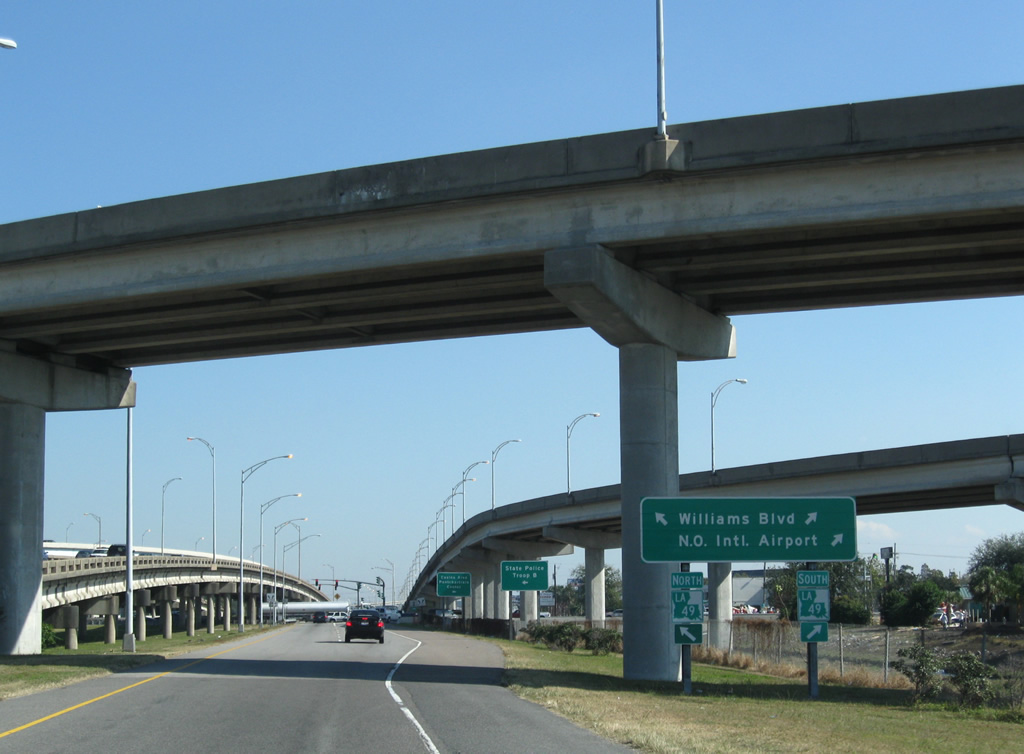
| Exit 221 quickly departs Interstate 10 east for Loyola Drive beyond the parish line. Exit 223 follows for Louis Armstrong New Orleans International Airport (MSY) via LA 49 (Williams Boulevard) south to Veterans Boulevard west. 04/20/12 |
|
| Interstate 10 parallels Canal Number 13 to the south and Veterans Memorial Boulevard to the north through Kenner. 04/20/12 |
|
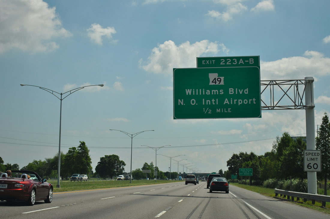
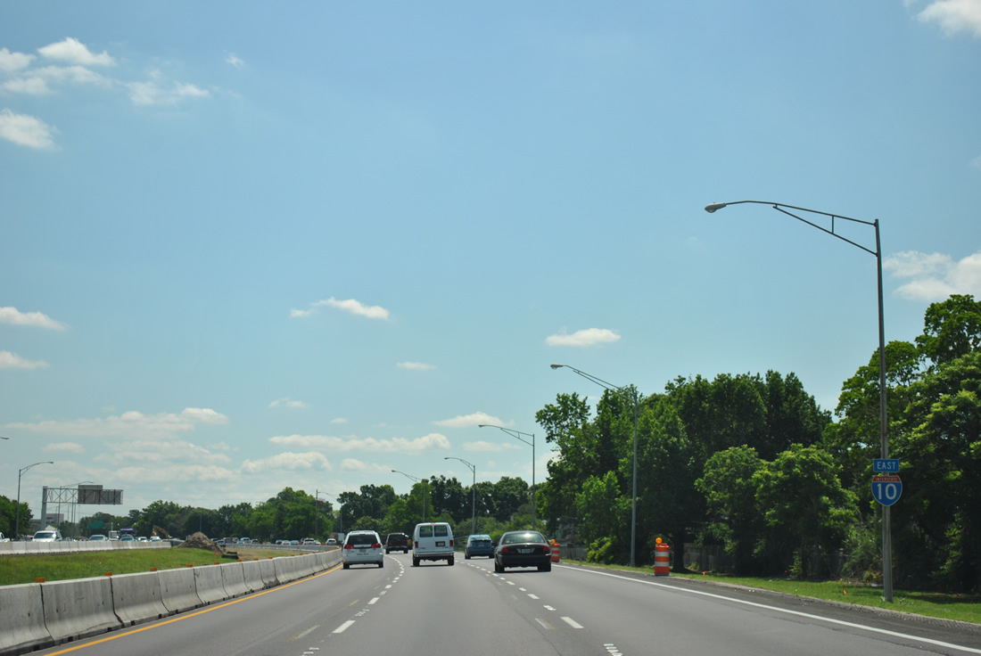
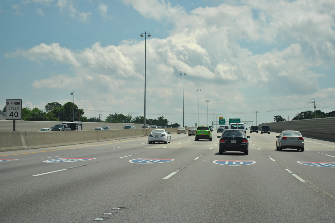
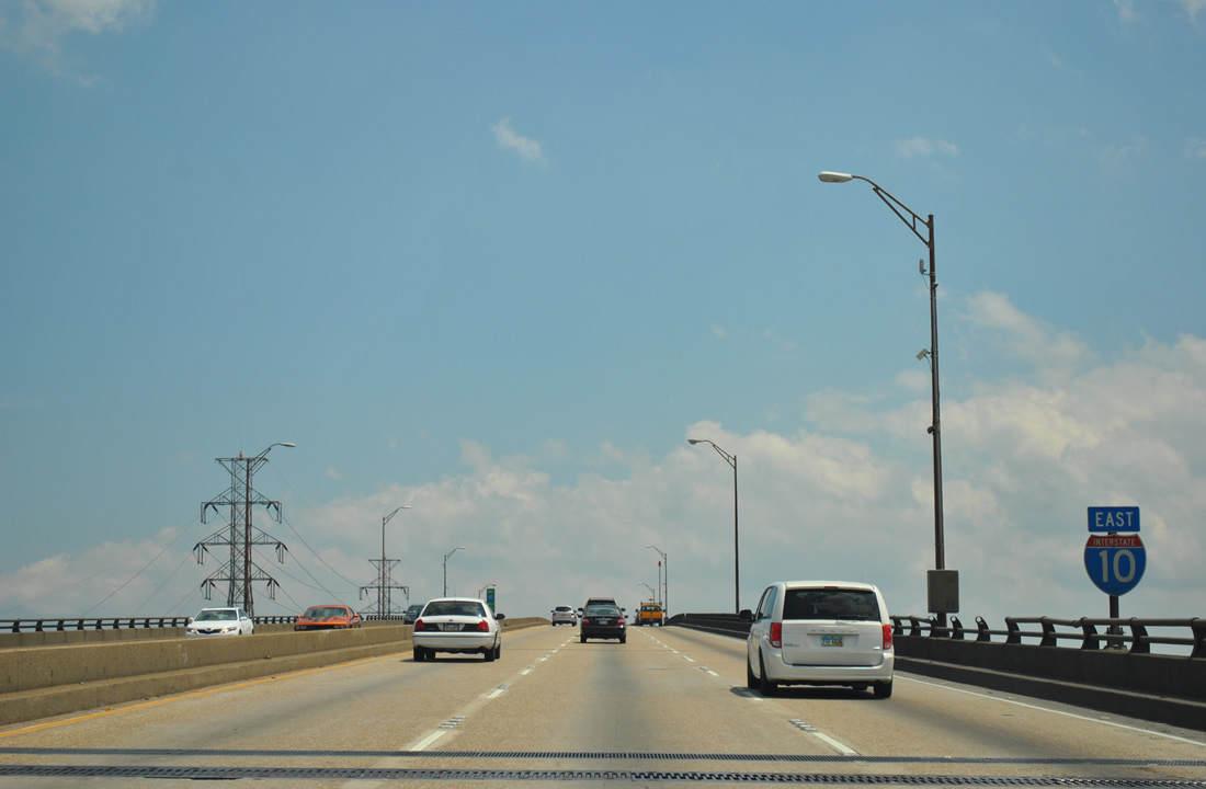
| Traffic volumes increase to 95,154 vehicles per day (vpd) [2011] on the stretch between Loyola Drive and the Williams Boulevard (Exits 223A/B) off-ramp. The speed limit of Interstate 10 is 60 miles per hour throughout the New Orleans metropolitan area. 04/20/12 |
|
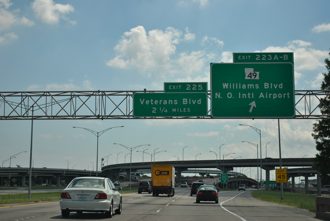
| Exits 223A/B consists of a single lane ramp to Williams Boulevard (LA 49) alongside Canal Number 3. LA 49 follows 3.9 miles of Williams Boulevard between Joe Yenni Boulevard and U.S. 61 (Airline Highway). 04/20/12 |
|
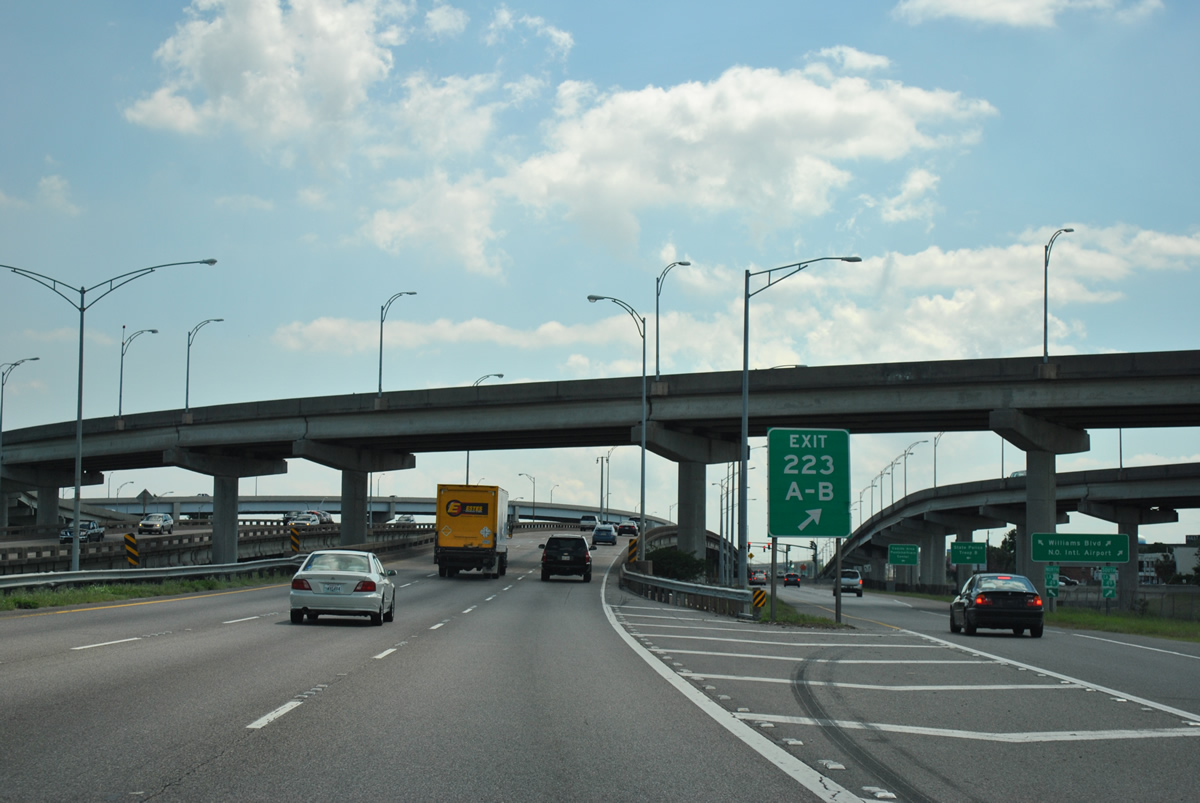
| The exchange joining Interstate 10 and Williams Boulevard (LA 49) features flyover ramps from a wye interchange between I-10 west and the airport access road south, and the airport road north to I-10 east. 04/20/12 |
|
| Taking Exit 223, motorists approach a signalized intersection with LA 49. LA 49 intersects Veterans Memorial Boulevard just south of Canal Number 3. The east-west arterial connects with the airport access road via a half diamond interchange nearby.
Northward, Williams Boulevard ends at Lake Pontchartrain by the Treasure Chest Casino and Pontchartrain Civic Center. 11/20/08 |
|
| Eastbound reassurance shield posted ahead of the Williams Boulevard on-ramp. Canal Number Three now parallels I-10 east to Exit 225. 04/20/12 |
|
| A wye interchange (Exit 224 along I-10 west) joins Powers Boulevard with Interstate 10 east. The high flyover to I-10 was constructed by 1994. 04/20/12 |
|
| Traveling underneath Powers Boulevard, eastbound I-10 next meets Veterans Memorial Boulevard at a parclo interchange (Exit 255). The arterial parallels the freeway from the west Kenner city line to Pontchartrain Boulevard within the New Orleans city limits. 04/20/12 |
|
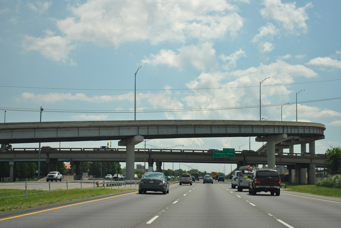
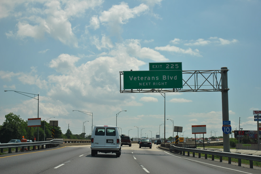
| Interstate 10 curves southeast over Canal Number 3 ahead of Exit 225. Veterans Memorial Boulevard comprises a busy commercial strip both east and west of the freeway exchange. 04/20/12 |
|
| A loop ramp serves Veterans Memorial Boulevard from Interstate 10 eastbound at Exit 225. Veterans Memorial Boulevard intersects David Drive and Power Boulevard to the west and Transcontinental Drive to the east in west Metairie. 04/20/12 |
|
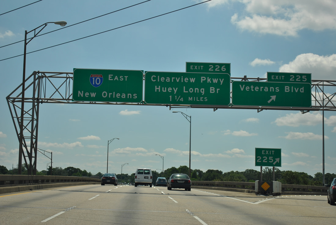
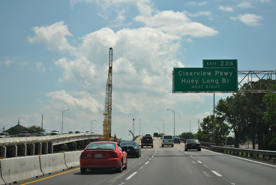
| A project to expand Interstate 10 between Veterans Boulevard and Clearview Parkway broke ground on October 12, 2011. The $42.4 million project addressed congestion along 1.2 miles of I-10 by expanding the roadway to ten overall lanes. With an anticipated completion by June 2013, work included the addition of sound walls.1 04/20/12 |
|
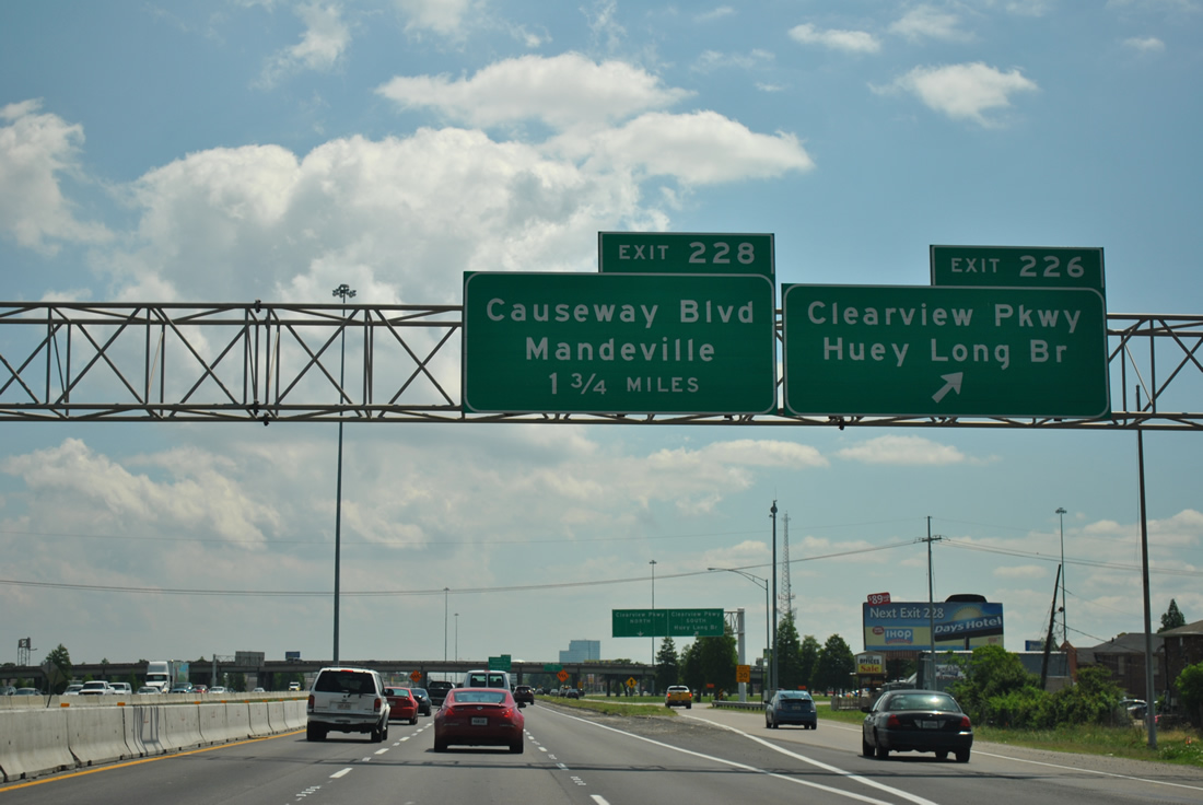
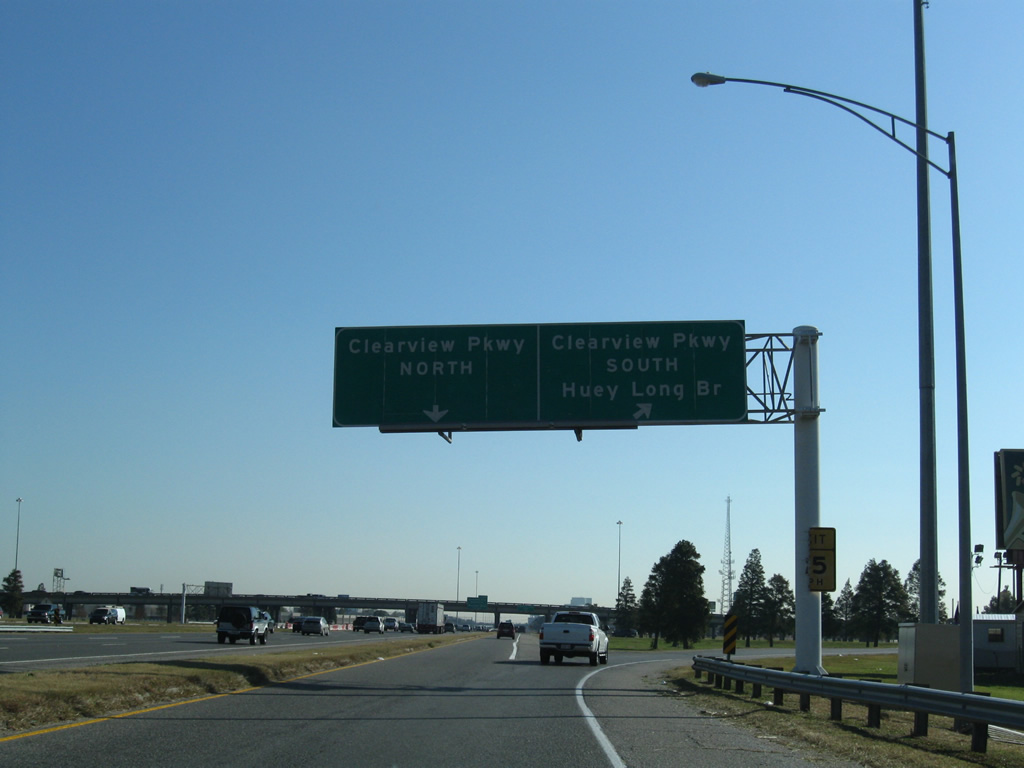
| Some of the busiest commuter exchanges within the metropolitan area, Exit 226 (Clearview Parkway) and Exit 228 (Causeway Boulevard) serve Metairie, an unincorporated community of 138,481 (2010 census). I-10 eastbound elevates over Transcontinental Drive ahead of the cloverleaf interchange with Clearview Parkway. 04/20/12 |
|
| A c/d roadway separates at Exit 226 for Clearview Parkway. The multi lane arterial, which doubles as LA 3152 southward, links I-10, U.S. 61 (Airline Highway) and LA 3139 (Earhart Expressway) with the Huey P. Long Bridge (U.S. 90) to Bridge City and the Westbank. The bridge is the second to last crossing of the Mississippi River heading down river. 04/20/12 |
|
| Clearview Parkway meets Napolean Avenue just south of I-10 en route to Jefferson. U.S. 90 turns south from Jefferson Highway onto the cantilevered Huey P. Long Bridge from Jefferson to Bridge City. LA 48 meets the two highways at the north end of the span to provide connections for Harahan. 11/20/08 |
|
| Interstate 10 eastbound continues another 1.50 miles to the directional cloverleaf interchange (Exit 228) with Causeway Boulevard. The exit for Clearview Parkway north departs from the adjacent c/d roadway to northwest Metairie. Clearview Parkway ends at Folse Drive along the Lake Pontchartrain coastline. 04/20/12 |
|
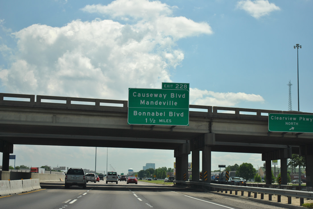
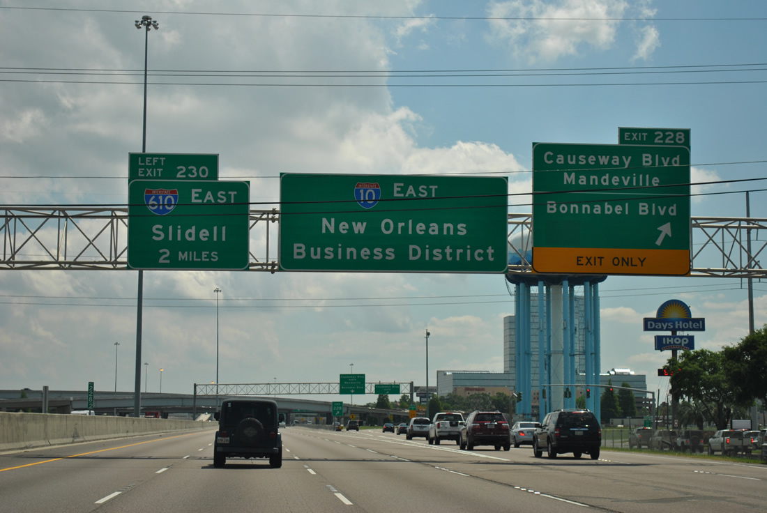
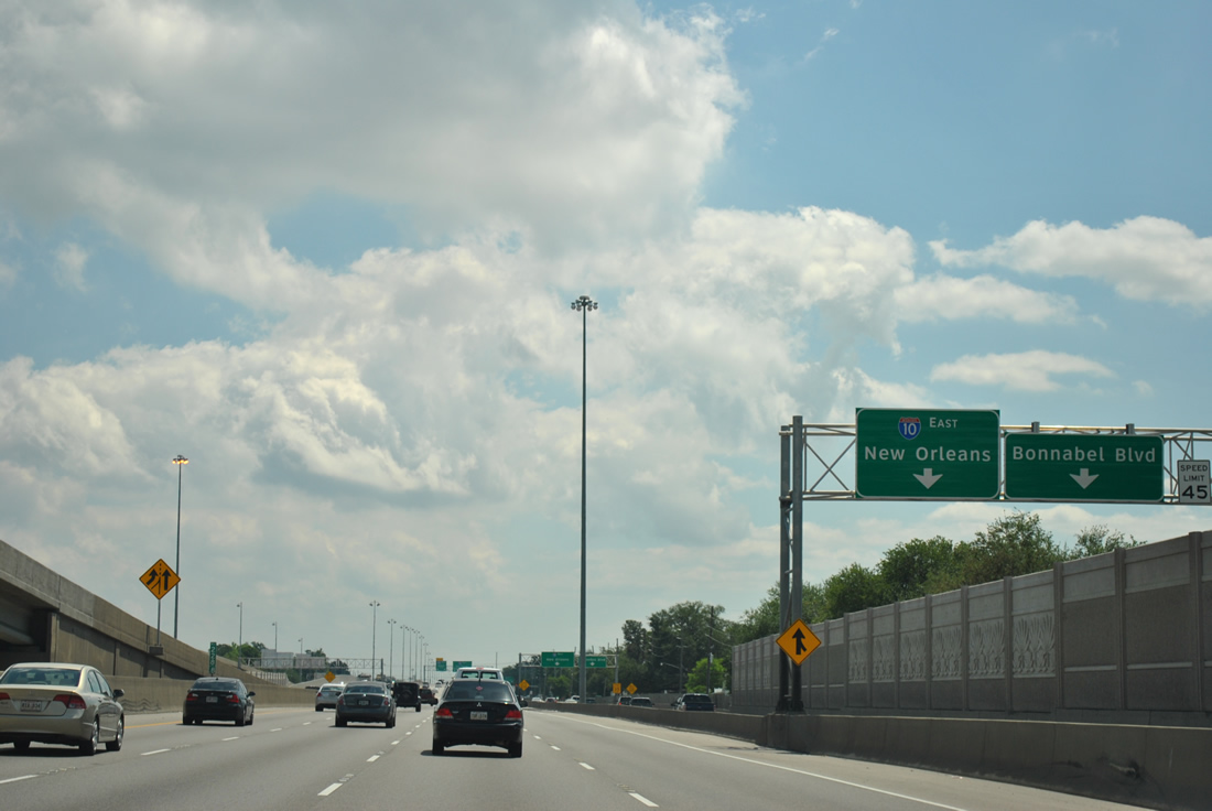
| 2004-05 construction resulted into the expansion of Interstate 10 between Clearview Parkway and Exit 228 (Causeway Boulevard). The widening includes an expanded two lane c/d roadway departure for the ramps to Causeway Boulevard and a continuation to the adjacent interchange with Bonnabel Boulevard. New sound walls were installed between the freeway mainline and adjoining service roads. 04/20/12 |
|
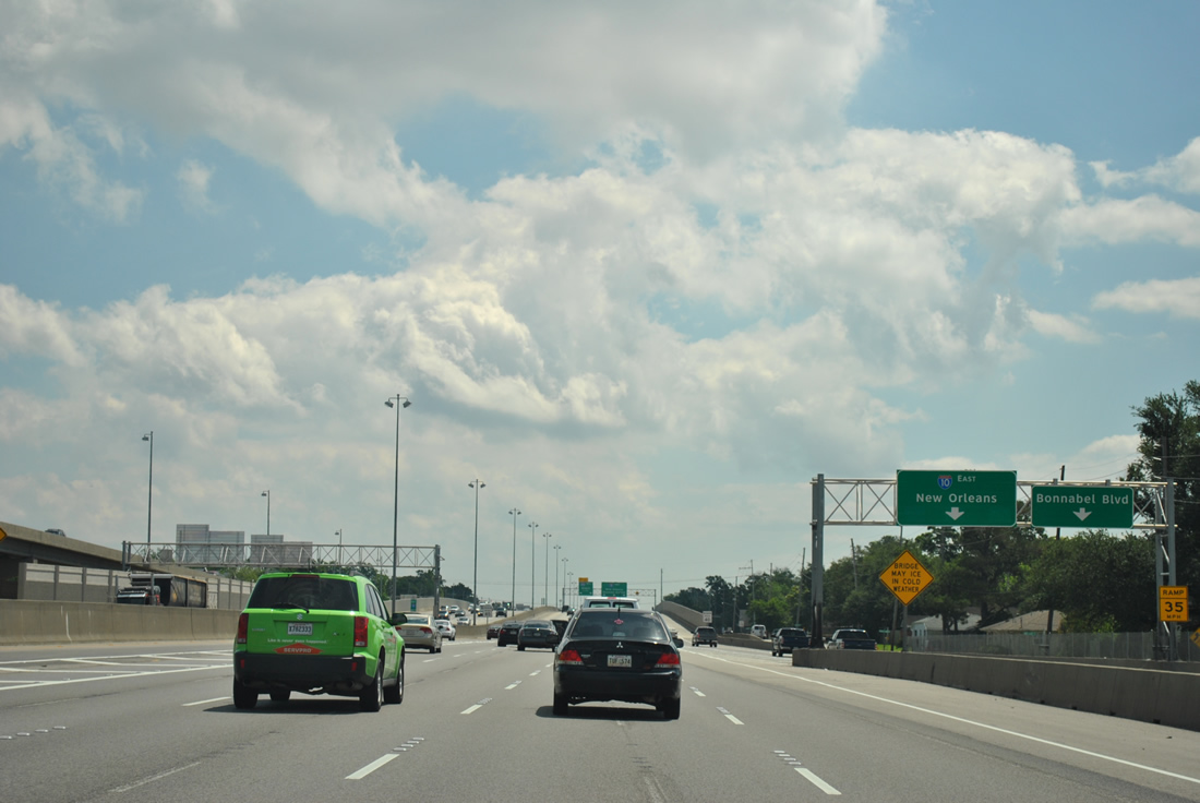
| A second 2004-installed sign bridge advises motorists of the Exit 228 c/d roadway split for Causeway Boulevard and Bonnabel Boulevard. Causeway Boulevard comprises a busy surface arterial between U.S. 90 (Jefferson Highway) at Jefferson and the Lake Pontchartrain Causeway toll bridge. Commuters traveling as far north as Mandeville and Covington, beyond Lake Pontchartrain, utilize the twin bridges across the lake and Causeway Boulevard to access Interstate 10 for the city of New Orleans. 04/20/12 |
|
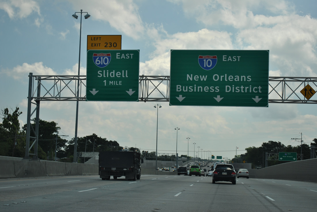
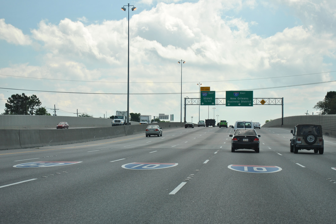
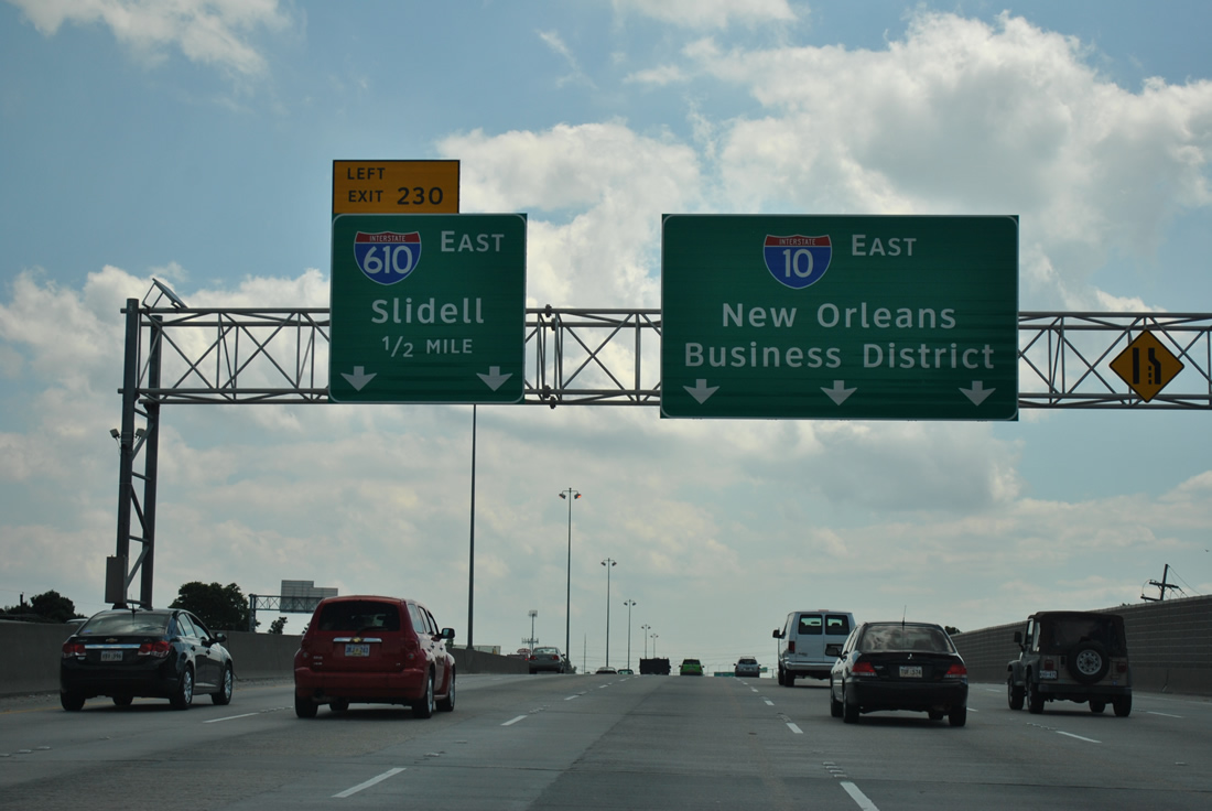
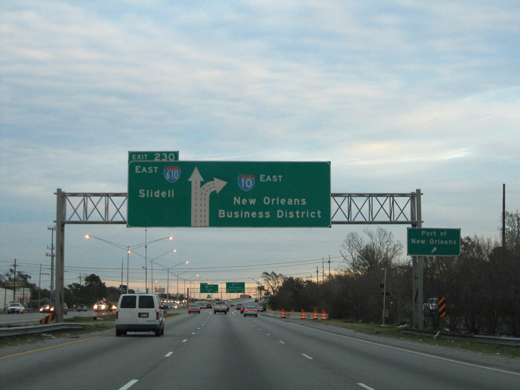
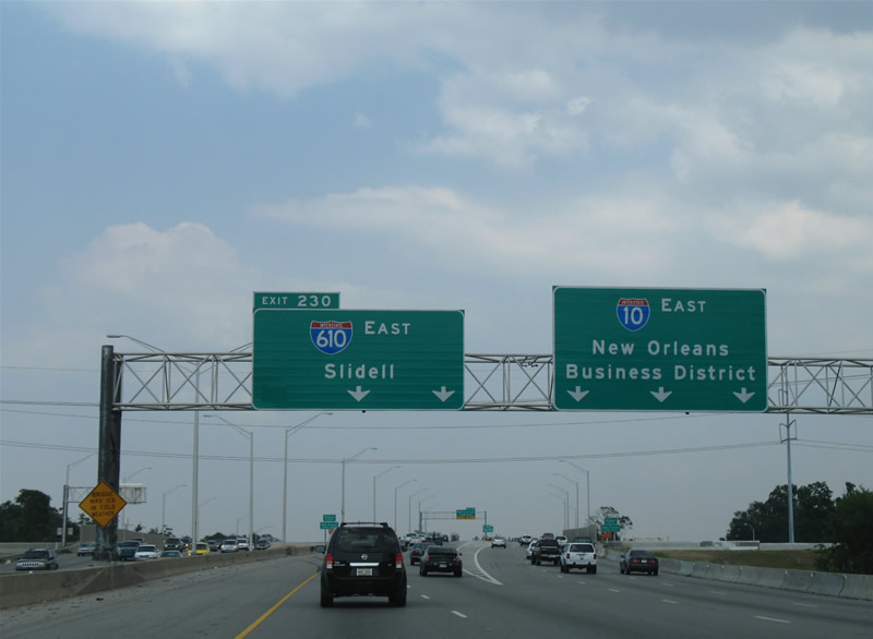
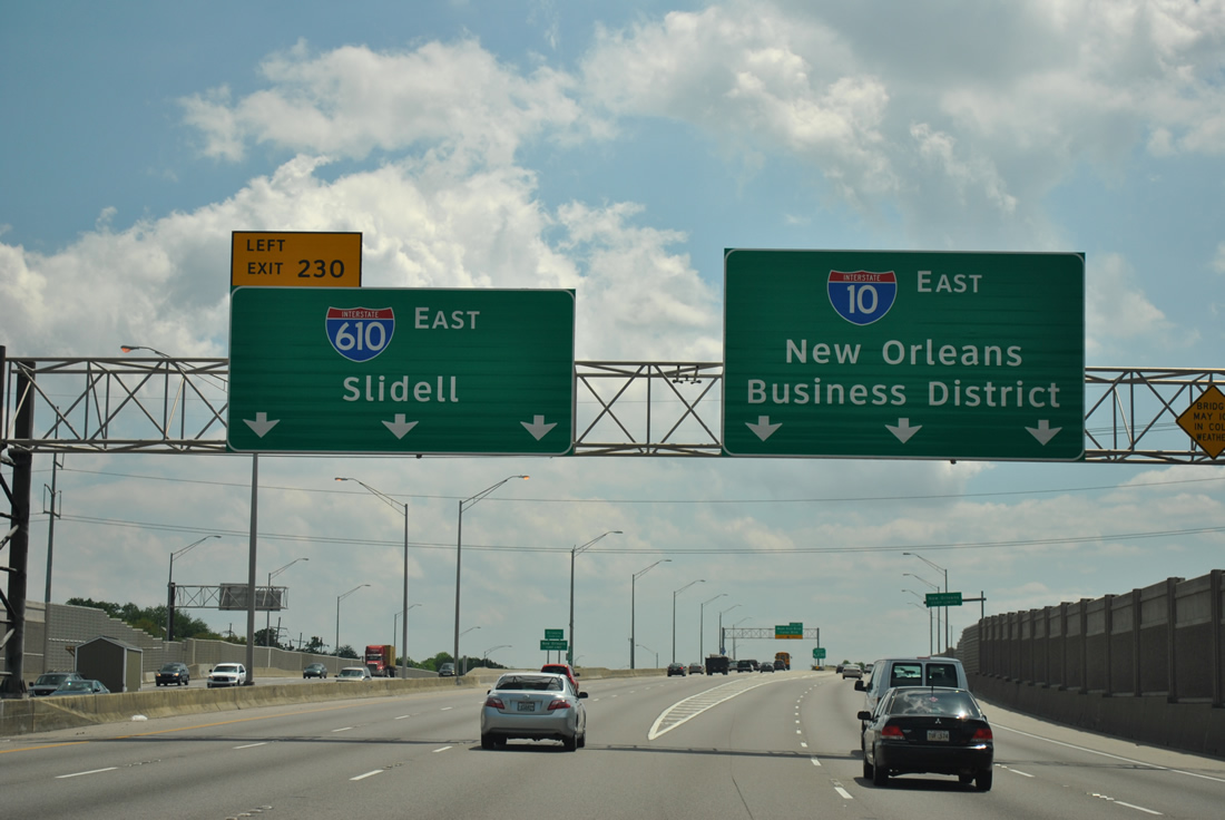
| The Exit 228 c/d roadway partitions from the Interstate 10 mainline as Interstate 610 (Exit 230) appears for the first time. Causeway Boulevard interchanges with Veterans Memorial Boulevard to the north ahead of its transition into the 23 mile long Lake Pontchartrain Causeway. To the south, Causeway Boulevard links Interstate 10 with Napolean and Metairie Avenues ahead of the interchange with U.S. 61 (Airline Highway). The portion of Causeway Boulevard between U.S. 61 and U.S. 90 (Jefferson Highway) constitutes a full freeway designated LA 3046. 04/20/12 |
|
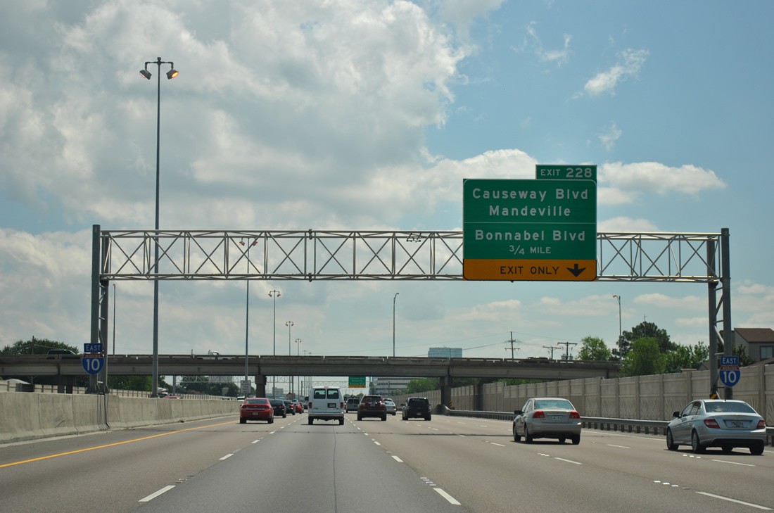
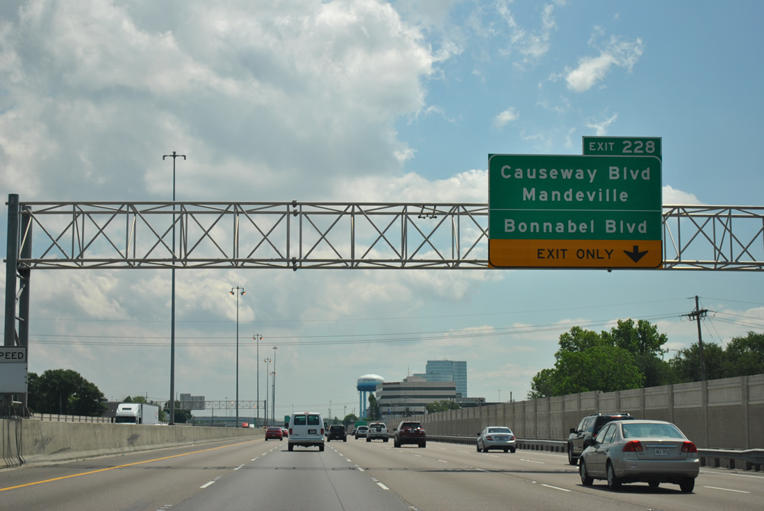
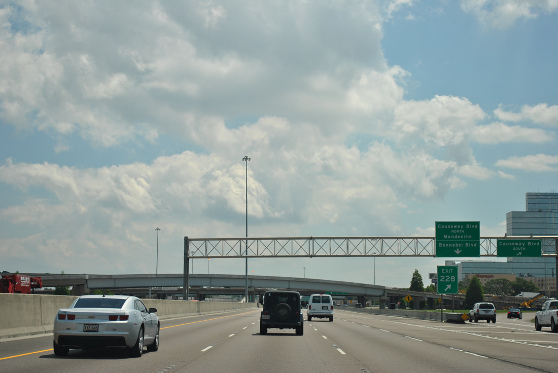
| 2004-installed signs direct motorists to Causeway Boulevard south and the c/d roadway east for Causeway Boulevard north and Bonnabel Boulevard. Causeway Boulevard is often congested with motorists using the four to six lane arterial between the causeway and U.S. 61. The roadway is not a freeway on this stretch despite the interchanges with Veterans Boulevard and Interstate 10. 04/20/12 |
|
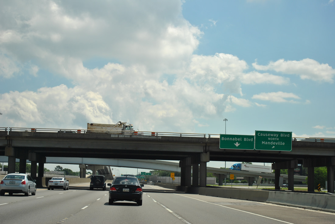
| Clearview-based signs hang above the Exit 228 c/d roadway split of the loop ramp to Causeway Boulevard north and continuation of the roadway to Bonnabel Boulevard. A $100 million project2 underway at the Causeway interchange between April 2009 and Summer 2012 addressed congestion issues associated with the underpower cloverleaf interchange by reconfiguring ramps between the two highways to eliminate weaving traffic concerns. A new flyover ramp carries southbound motorists from Causeway Boulevard onto the c/d roadway east for Bonnabel Boulevard. A second flyover added passes over I-10 from Causeway Boulevard north to a loop ramp to westbound. 04/20/12 |
|
| The third flyover, opened March 1, 2012,2 links Causeway Boulevard southbound with Interstate 10 eastbound. 04/20/12 |
|
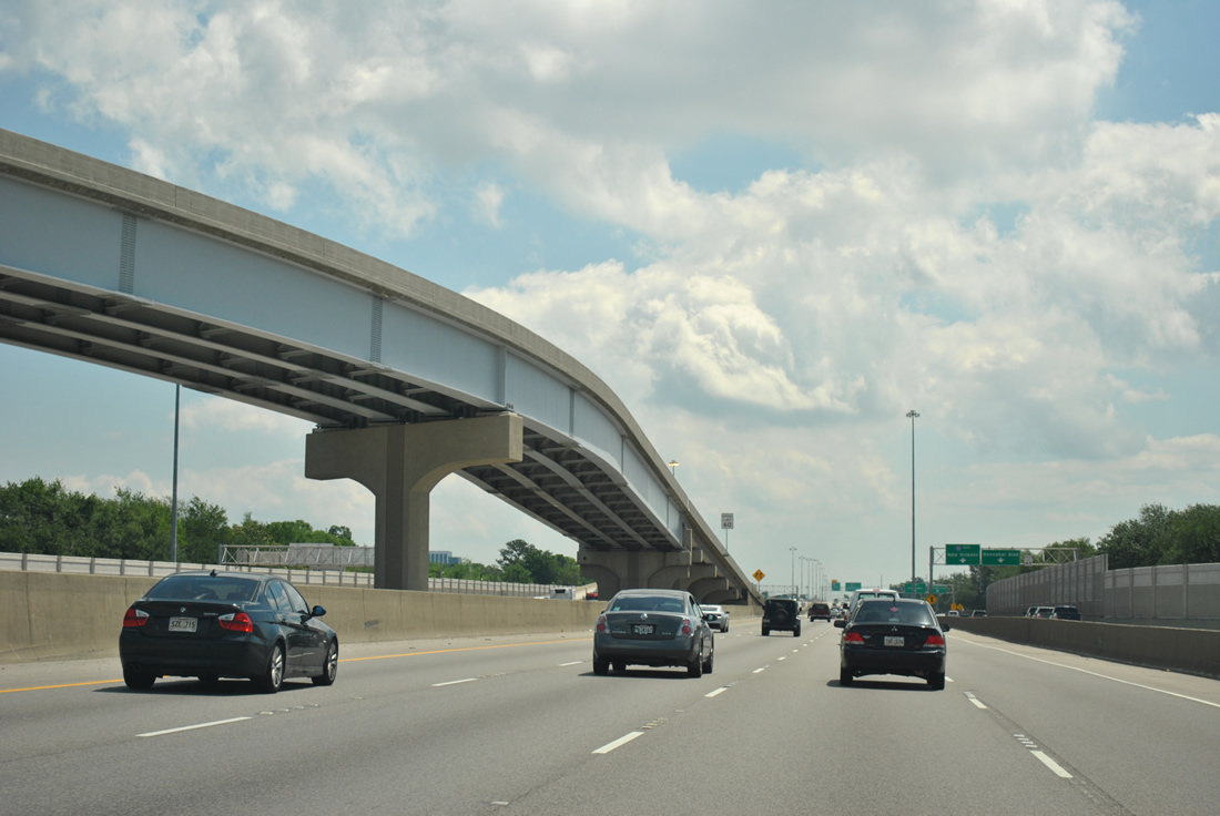
| As traffic merges onto the left side of Interstate 10 east, the Exit 228 c/d roadway reaches Bonnabel Boulevard and the return ramp to I-10. Bonnabel Boulevard begins at LA 611-9 (Metairie Road) and migrates northward to Interstate 10, Veterans Boulevard and Esplanade Avenue near Bucktown. 04/20/12 |
|
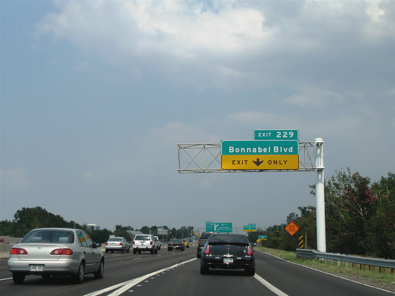
| The Causeway Boulevard c/d roadway originally returned to form a fourth auxiliary lane to the Bonnabel Boulevard diamond interchange (original Exit 229). 06/10/06 |
|
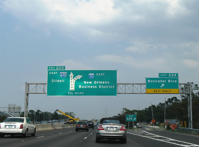
| A diagrammatic overhead for Exit 230, the split of I-10/610, that was posted at Exit 229 before widening of I-10 between Causeway Boulevard and the 17th Street Canal was completed in 2009. 06/10/06 |
|
| Six overall eastbound lanes pass over Bonnabel Boulevard in anticipation of Exit 230 for Interstate 610 east. Painted shields join overhead signs to advise motorists of the left side ramp. 04/20/12 |
|
| Interstate 610 travels 4.52 miles between Exits 230 and 238B of Interstate 10, providing a bypass of the central business district of New Orleans for through traffic interests. The freeway opened by 1975. 04/20/12 |
|
| Another set of painted shields precedes the wye interchange between Interstates 10 and 610 east as the freeway passes over Canal Street by De Limon Place in Metairie. 04/20/12 |
|
| The Exit 230 interchange with Interstate 610 was reconstructed between 1999-2000 to improve the ramps between the two freeways and widen the eastbound mainline to three lanes. I-10 turns southeast along the Pontchartrain Expressway to downtown while I-610 straddles Lakeview to City Park. 04/20/12 |
|
| A look at Interstate 10 eastbound beyond the Rosa Avenue under crossing at the onset of the 2009-completed widening. The split of the two freeways occurs at the 17th Street Canal and New Orleans city line. 01/15/06 |
|
| Interstate 610 eastbound begins as Interstate 10 turns southerly onto the Pontchartrain Expressway. Exit 1A of Interstate 610 departs in 0.5 miles for Pontchartrain Boulevard. This portion of I-610 opened with the Pontchartrain Expressway by 1964. 06/10/06, 04/20/12 |
|
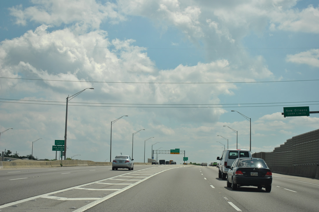
| Entering Orleans Parish, which doubles as the city of New Orleans, along Interstate 10 east at Exit 230. 04/20/12 |
|
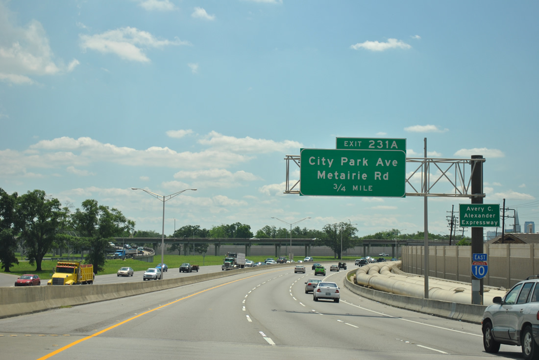
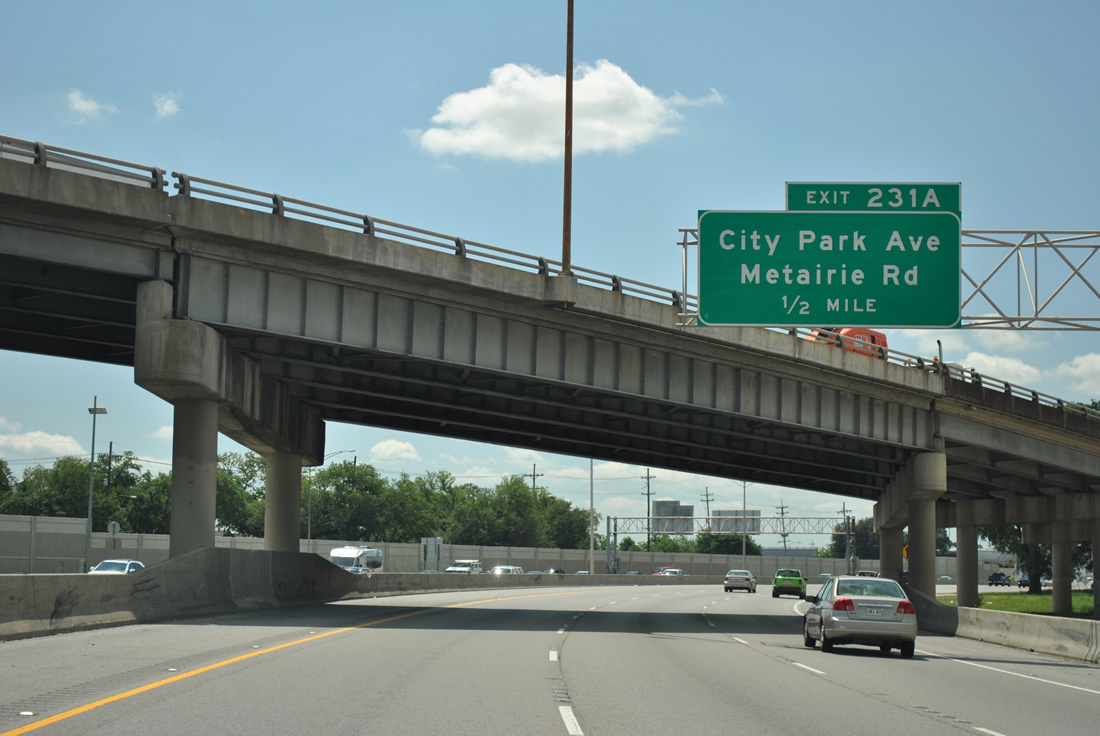
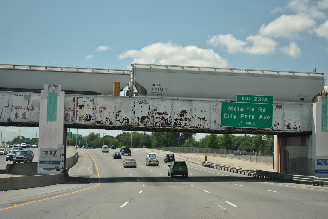
| Turning south, Interstate 10 next meets Metairie Road (LA 611-9) west and City Park Avenue east at a diamond interchange (Exit 231A). 04/20/12 |
|
| Expansion of Interstate 10 from Pontchartrain Boulevard southward to Exit 231A occurred during 2003/04. Forthcoming City Park Avenue ventures east from Greenwood Cemetery to Canal Street and Boulevard, City Park and Wisner Boulevard at Carrollton Avenue. 04/20/12 |
|
| Interstate 10 sinks below the Norfolk Southern Railroad bridge as Pontchartrain Boulevard merges. A section of Pontchartrain Boulevard comprises an eastbound side service road from Metairie Road south to Lakewood. 04/20/12 |
|
| Metairie Road (LA 611-9) meanders west from Exit 231A and Metairie Cemetery to the Jefferson Parish communities of Old Metairie and De Limon Place. LA 611-9, a 3.5 mile route, ends at U.S. 61 (Airline Highway) near Causeway Boulevard. 04/20/12 |
|
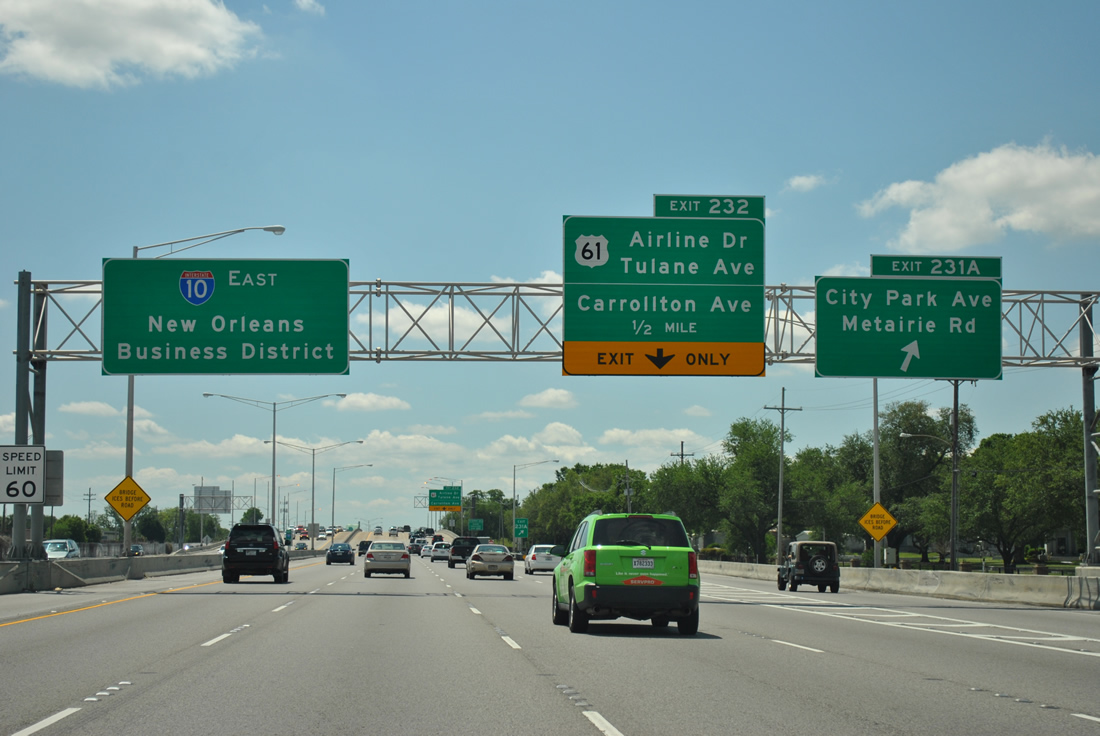
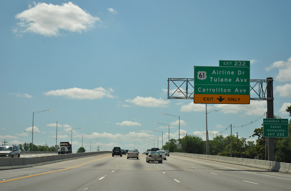
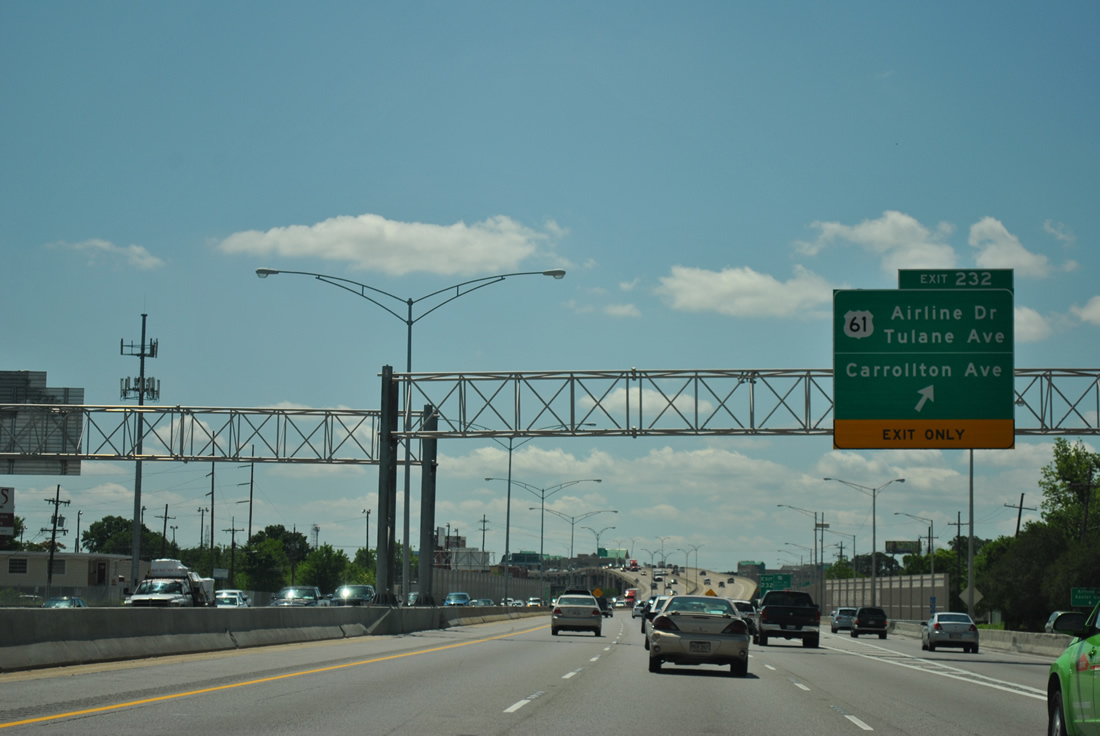
| Exit 231A departs Interstate 10 eastbound for Metairie Road and City Park Avenue, one half mile north of U.S. 61 (Exit 232). U.S. 61 follows Airline Drive west to Jefferson Parish and Tulane Avenue east for 14 blocks to U.S. 90 (Broad Avenue). The US highway travels 1,400 miles overall between New Orleans and Wyoming, Minnesota, though the route originally ended at the Canadian border (Grand Portage, MN). 04/20/12 |
|
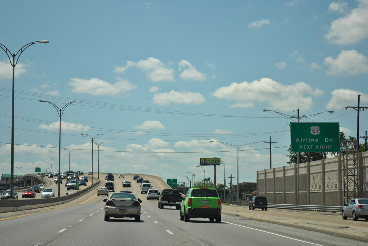
| Four lanes of Interstate 10 eastbound ascend over Metairie Road. The right lane defaults onto the Exit 232 ramps to U.S. 61 (Airline Drive, Tulane Avenue) and Carrollton Avenue. U.S. 61 (Airline Drive) enters the city at the Hollygrove neighborhood, passes underneath Palmetto Street, and meets Interstate 10 and Carrollton Avenue. Airline Drive transitions to Tulane Avenue south of its intersection with Carrollton Avenue. 04/20/12 |
|
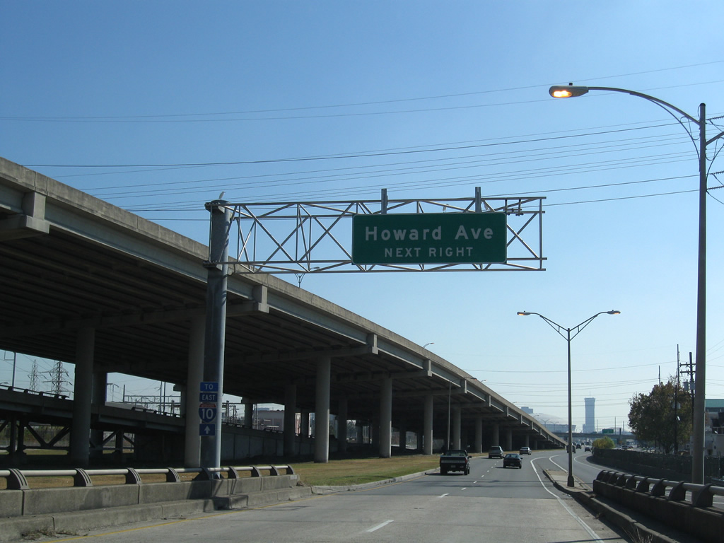
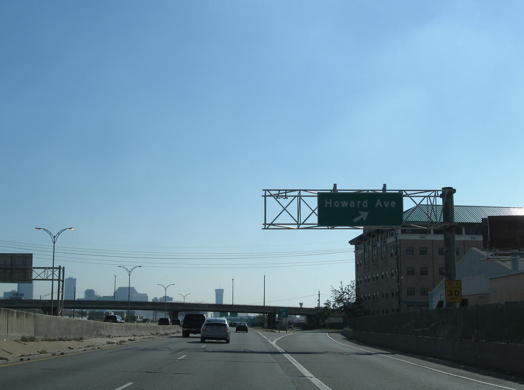
| The Exit 232 ramps depart for U.S. 61 (Airline Drive), Carrollton Avenue south, and Howard Avenue. Carrollton Avenue south meets Palmetto Street, Earhart Boulevard, and U.S. 90 (Claiborne Avenue) on the drive to the Carrollton and Uptown communities along the Mississippi River. Use Carrollton Avenue south to Leake Avenue for Audubon Park and Zoo. 04/20/12 |
|
| East from Exit 232, U.S. 61 continues from Airline Drive along Tulane Drive 14 blocks to its southern terminus at U.S. 90 (Broad Avenue). U.S. 61 and Carrollton Avenue north serve the Mid-City neighborhood of the city. 04/20/12 |
|
| The Exit 232 ramp forms a collector distributor roadway, carrying traffic from both U.S. 61 (Airline Drive) and Carrollton Avenue southeast to Howard Avenue (eastbound side frontage road) and Interstate 10 east. 11/20/08 |
|
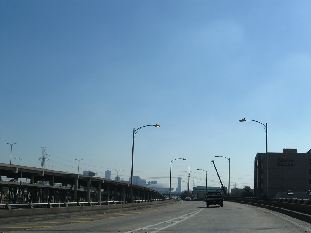
| Passing above U.S. 61 and Carrollton Avenue, the superstructure of the U.S. 90 Huey P. Long Bridge comes into view to the southwest. The 1935 bridge underwent $1.2 billion in construction between 2006 and 2013 to expand the span to six overall 11 foot lanes with full outside shoulders and two foot inside shoulders. The bridge was built with just four nine foot lanes. 11/19/08 |
|
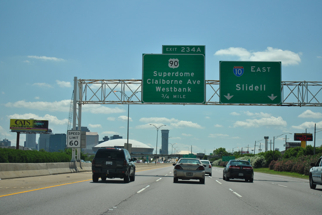
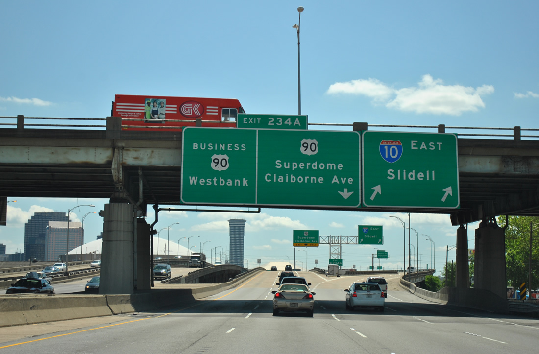
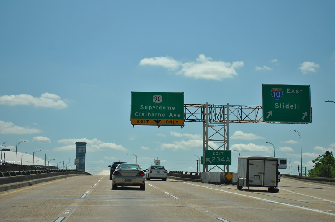
| The 1.50 mile overhead of Exit 234A for U.S. 90 Business (unsigned Interstate 910) east and U.S. 90 (Claiborne Avenue) follows. 04/20/12 |
|
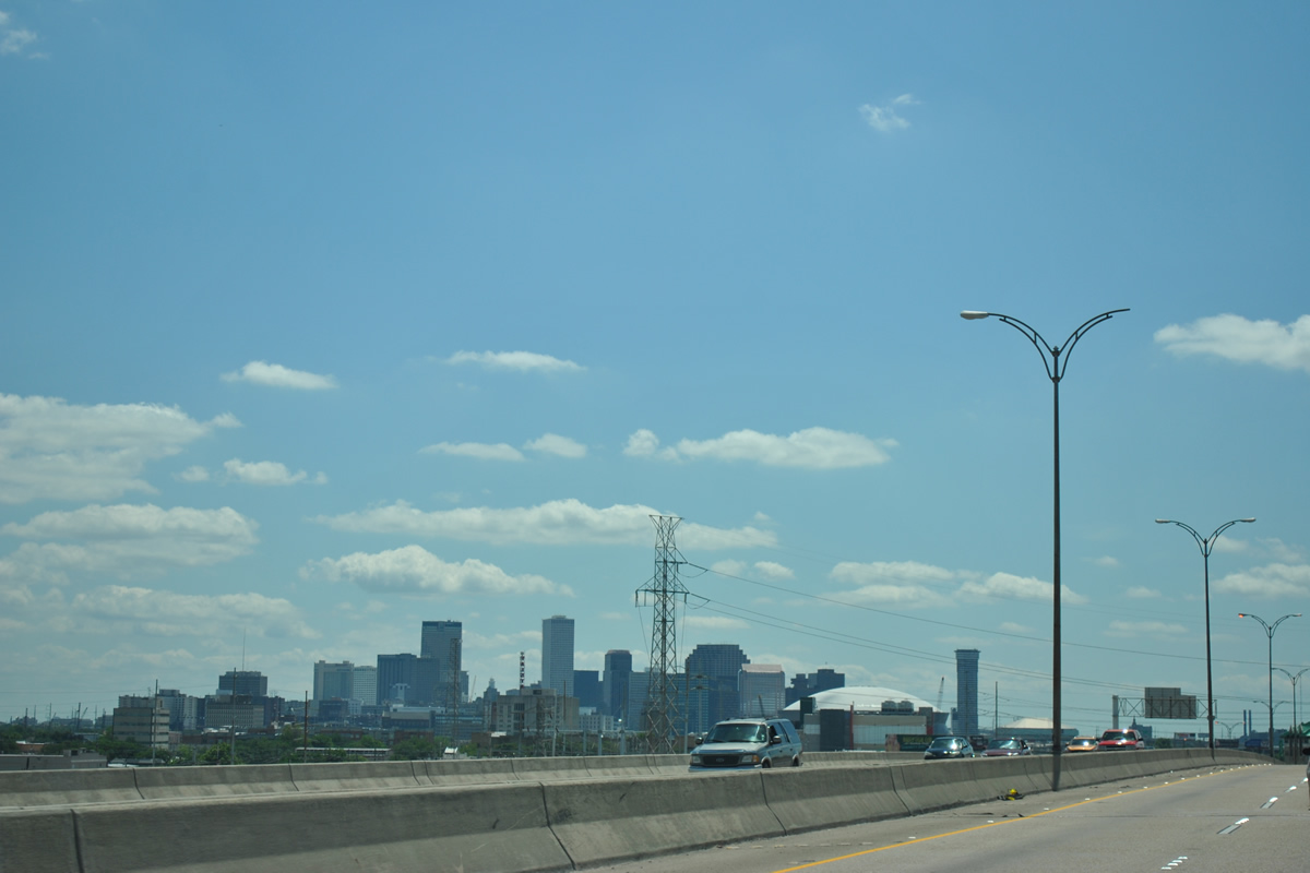
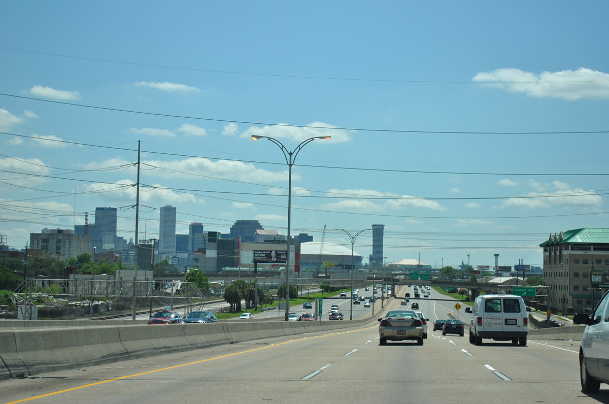
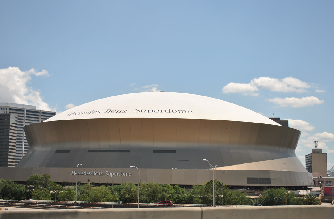
| The New Orleans skyline comes into view along I-10 beyond Exit 232. Appearing in the foreground is Caesars Superdome, home of the New Orleans Saints NFL franchise. 04/20/12 |
|
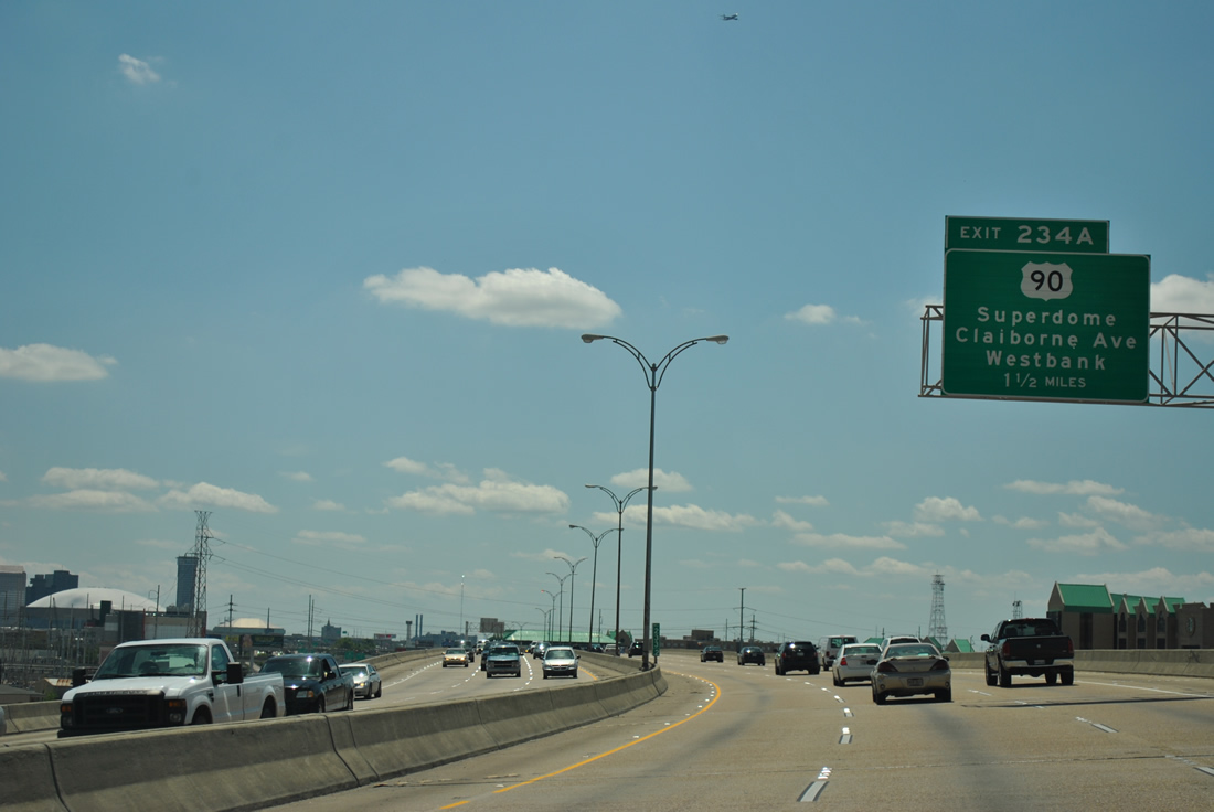
| The Pontchartrain Expressway continues south from Interstate 10 at Exit 234A to the Greater New Orleans and Crescent City Connection Bridges. U.S. 90 Business (unsigned Interstate 910) begins and follows the expressway southeast to the Algiers section of New Orleans, Gretna, and other Westbank communities south of the Mississippi River. 04/20/12 |
|
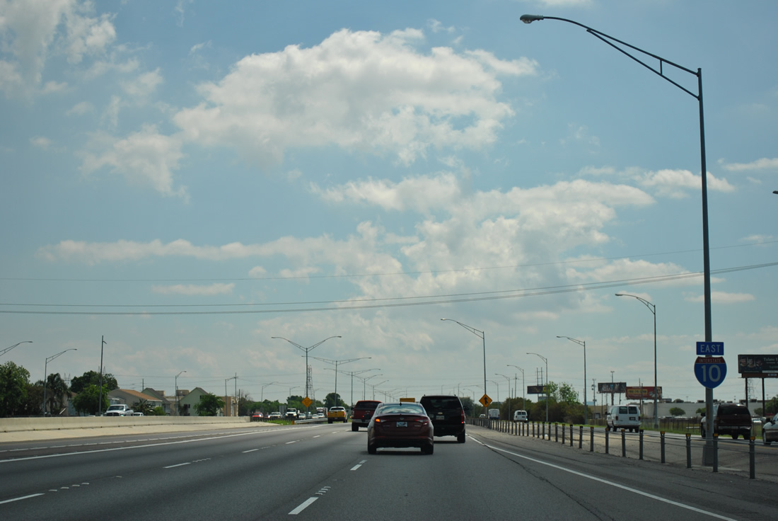
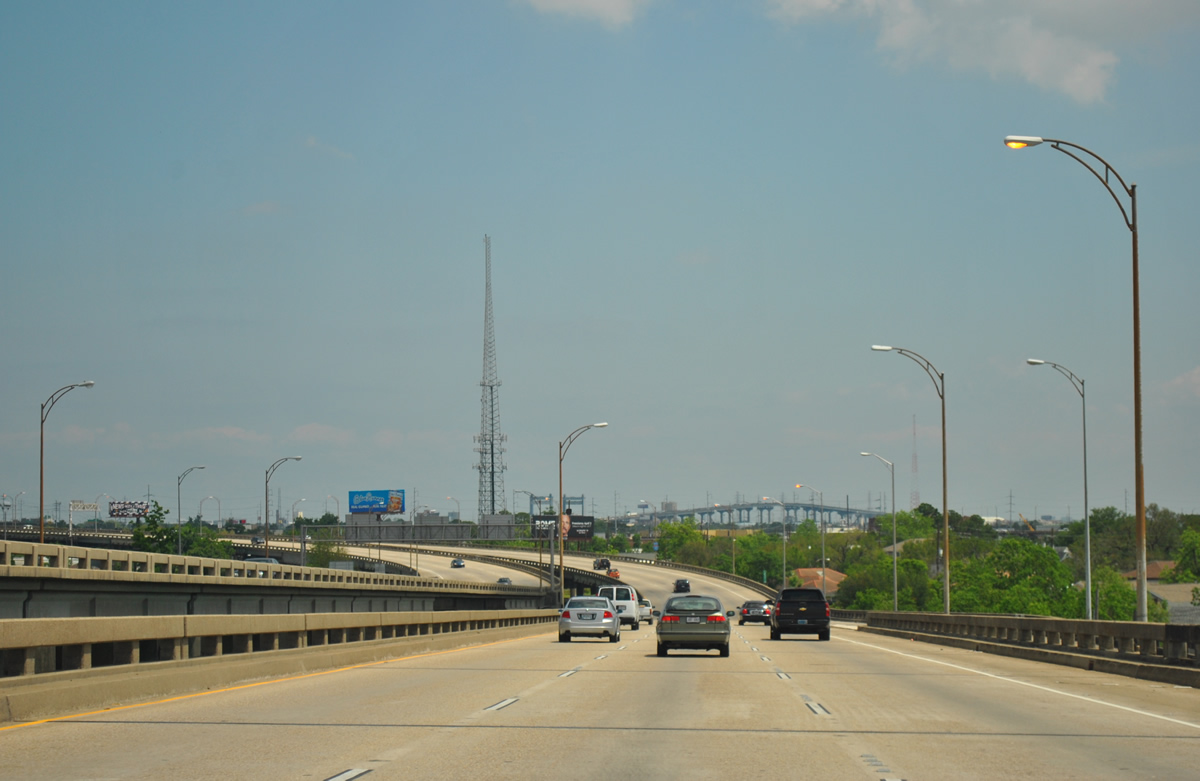
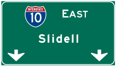
| Painted shields mark the right two lanes for through traffic along Interstate 10 east toward Slidell. 04/20/12 |
|
| The junction between Interstate 10 with U.S. 90 Business (Pontchartrain Expressway) and U.S. 90 (Claiborne Avenue) involves an elaborate stack interchange over the city street grid below. U.S. 90 Business appears for the first time on Exit 234A overheads at Broad Avenue. The business loop for U.S. 90 follows the Westbank Expressway west from Algiers to Marrero and Westwago. The Westbank Expressway is also unsigned Interstate 910, a predecessor for the eventual Interstate 49 designation planned for the future. 04/20/12 |
|
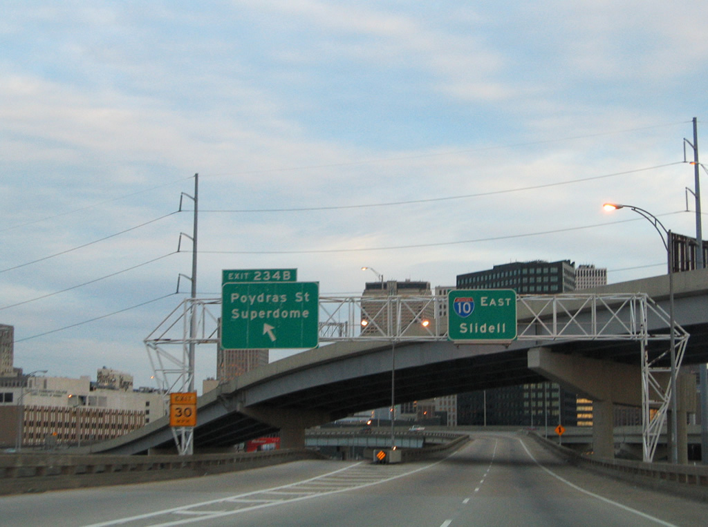
| Interstate 10 mainline traffic veers to the right at the Exit 234A split with the Pontchartrain Expressway. U.S. 90 Business begins and quickly encounters the U.S. 90 (Claiborne Avenue) off-ramp. U.S. 90 follows Claiborne Avenue east from the Jefferson Parish line to the Superdome area at Poydras Street. Claiborne Avenue parallels Interstate 10 below its viaduct from Poydras Street north to St. Bernard Avenue. U.S. 90 east turns northwest onto Tulane Avenue nearby. 04/20/12 |
|
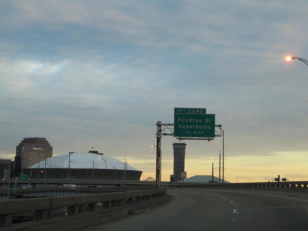
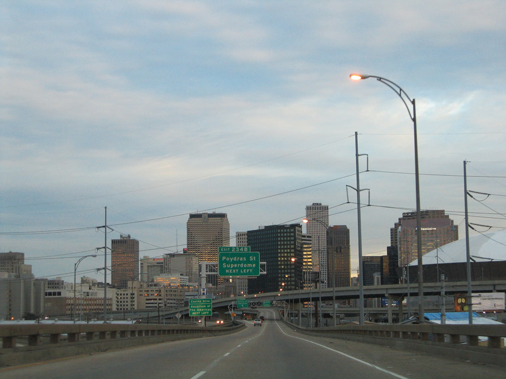
| Exit 234B quickly follows from Interstate 10 east to Poydras Street south at the Superdome. 01/15/06 |
|
| The Interstate 10 eastbound mainline curves northeast toward the Vieux Carre and Treme sections of the city. The central business district skyline lies just south of the freeway between Poydras and Canal Streets. 01/15/06 |
|
| Exit 234B parts ways with I-10 east below the westbound flyover to U.S. 90 Business. Poydras Street continues from the Superdome to New Orleans City Hall and British Plaza by the World Trade Center and the Ernest N. Morial Convention Center. 01/15/06 |
|
| Caesars Superdome from the flyover joining U.S. 90 Business east with Interstate 10 east above Lafayette Street. 04/20/12 |
|
| Ramps from U.S. 90 Business east and U.S. 90 east come together as Interstate 10 travels a viaduct above Claiborne Avenue by the Central Business District and Iberville. 04/20/12 |
|
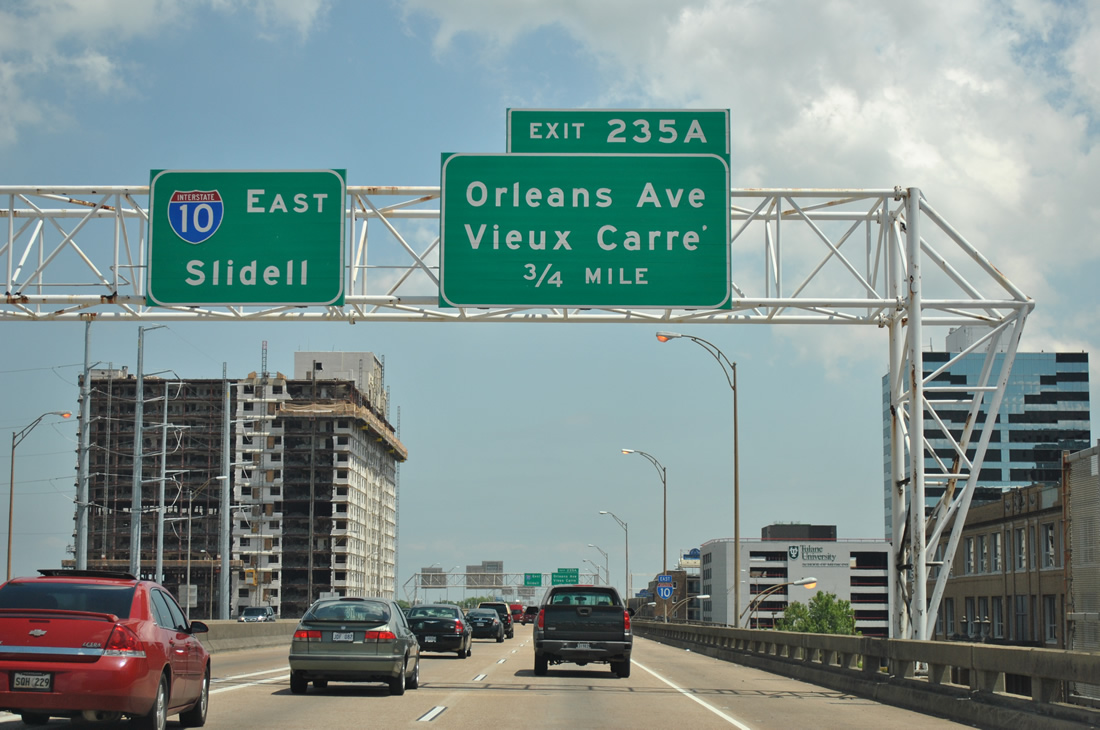
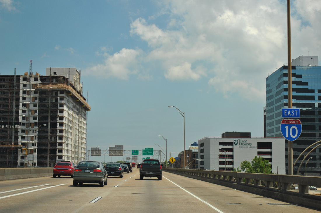
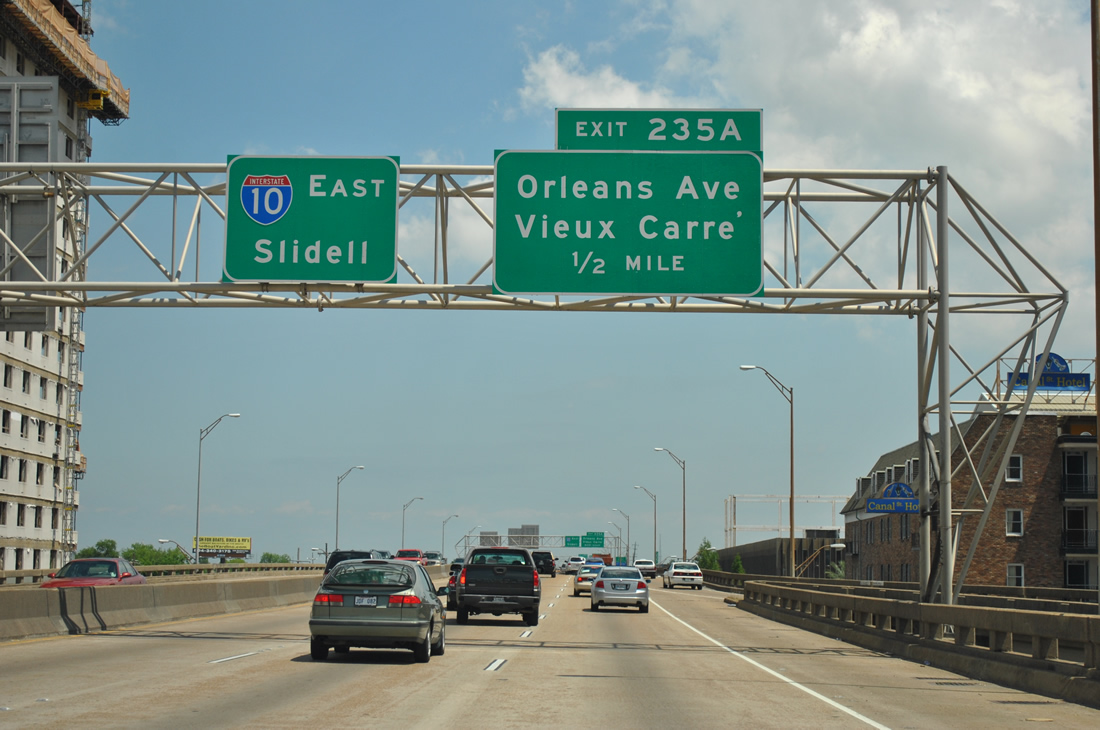
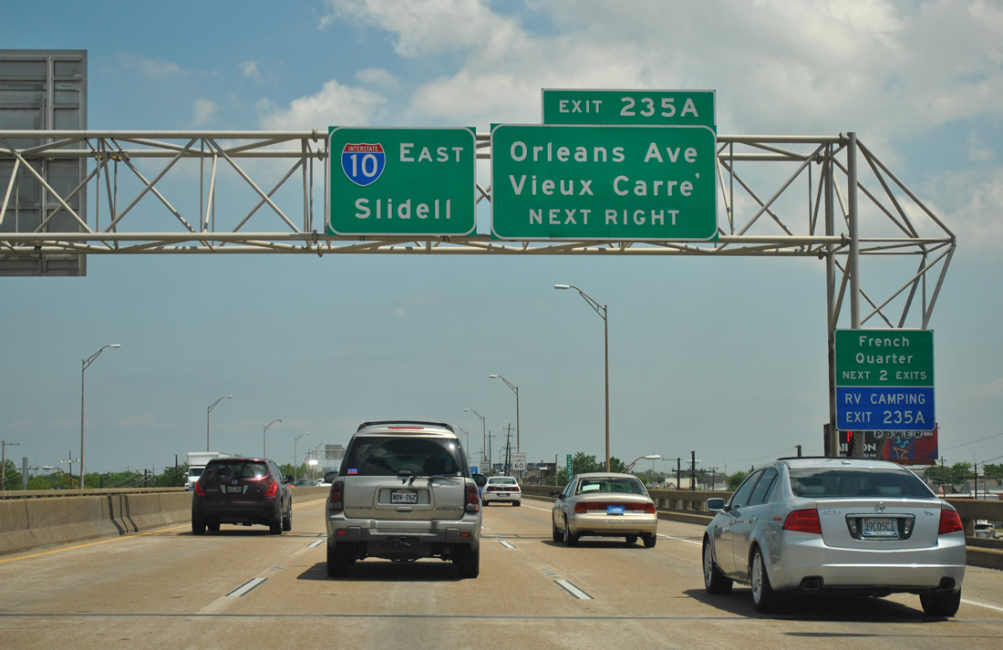
| Exit 235A provides the first of two routes into the French Quarter from Interstate 10 eastbound. A forthcoming elevated ramp drops from I-10 onto Basin Street near Louis Armstrong Park. Connections with Toulouse Street lead motorists into the French Quarter nearby. 04/20/12 |
|
| Six overall lanes of Interstate 10 travel above Claiborne Avenue. Visible to the left is the former New Orleans' Grand Palace Hotel. The 1950 high rise was imploded on July 22, 2012 to make way for the new University Medical Center.3 04/20/12 |
|
| One half mile west of the Orleans Avenue off-ramp (Exit 235A) at the Tulane Avenue on-ramp. Orleans Avenue travels southeast from City Park Avenue to the Treme'/Lafitte neighborhood. 04/20/12 |
|
| Basin Street west from Orleans Avenue and Exit 235A serves the Vieux Carre' via Conti and Iberville Street south and the Central Business District at Canal Street.
St. Louis Cemetery Number 2 lies along the south side of the Interstate 10 viaduct between Iberville and St. Louis Streets. The site is home to a number of mausoleums visible from the freeway. 04/20/12 |
|
| Exit 235A leaves Interstate 10 east for Basin Street and the Vieux Carre'. Exit 236A to Esplande Avenue provides a second exit to the French Quarter in one quarter mile.
The French Quarter is home to Bourbon Street, the popular street mall made famous by its party atmosphere, and other cultural attractions ranging from Jackson Square to the Cabildo. One will also find many live jazz bars and clubs in the Quarter along with creole eateries offering anything from gumbo to crawfish. 04/20/12 |
|
| Exit 236A departs and lowers to join Claiborne Avenue ahead of its intersection with Esplanade Avenue. Esplanade Avenue travels north from Decatur Street, near French Market, to the Treme'/Lafitte and Seventh Ward sections of the city. 04/20/12 |
|
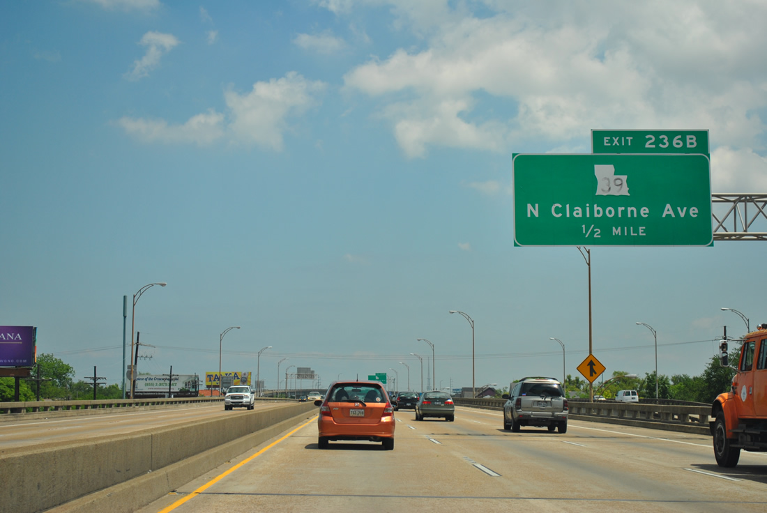
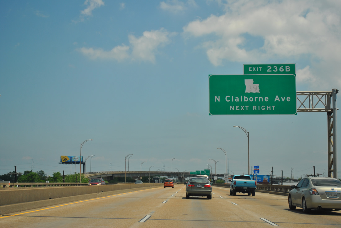
| Departing the freeway next is LA 39 east to St. Claude, Lower Ninth Ward, Arabi, and Chalmette. LA 39 begins at a wye interchange (Exit 236B) and merges with North Claiborne Avenue ahead of Elysian Fields Avenue (LA 46). 04/20/12 |
|
| Interstate 10 eastbound nearing the split with LA 39 (North Claiborne Avenue). Claiborne Avenue emerges from under Interstate 10 as LA 39 east through the Seventh Ward to the St. Roch neighborhood. 04/20/12 |
|
| Interstate 10 eastbound shield posted as the viaduct passes over Columbus Street. Claiborne Avenue below originally consisted of a tree-lined boulevard between Earhart Boulevard and St. Bernard Avenue. The park-like corridor was selected for Interstate 10's path due to the lack of structures within its right of way. 04/20/12 |
|
| Eastbound at the Exit 236B ramp departure to LA 39 (North Claiborne Avenue) east. LA 39 exits the city to St. Bernard Parish and Chalmette. West from Poydras, LA 39 straddles the east banks of the Mississippi River south from Braithwaite to Pointe A La Hache in Plaquemines Parish. 04/20/12 |
|
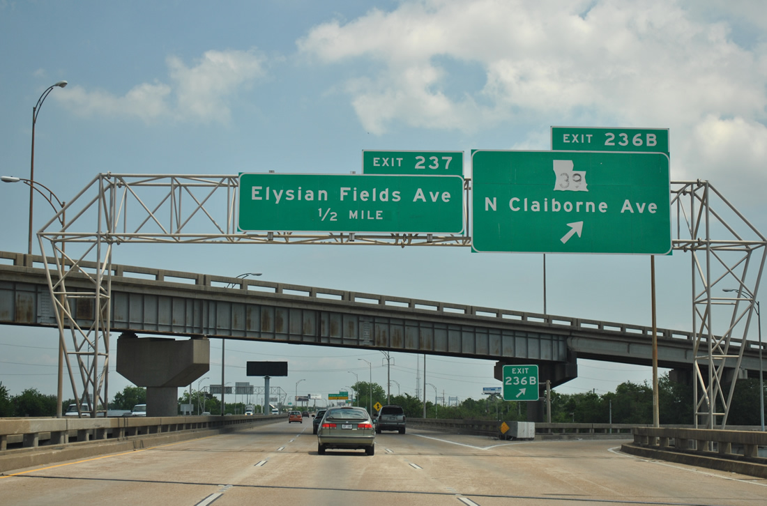
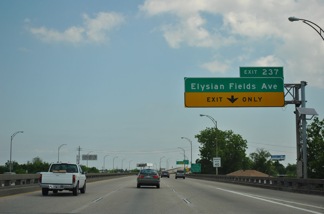
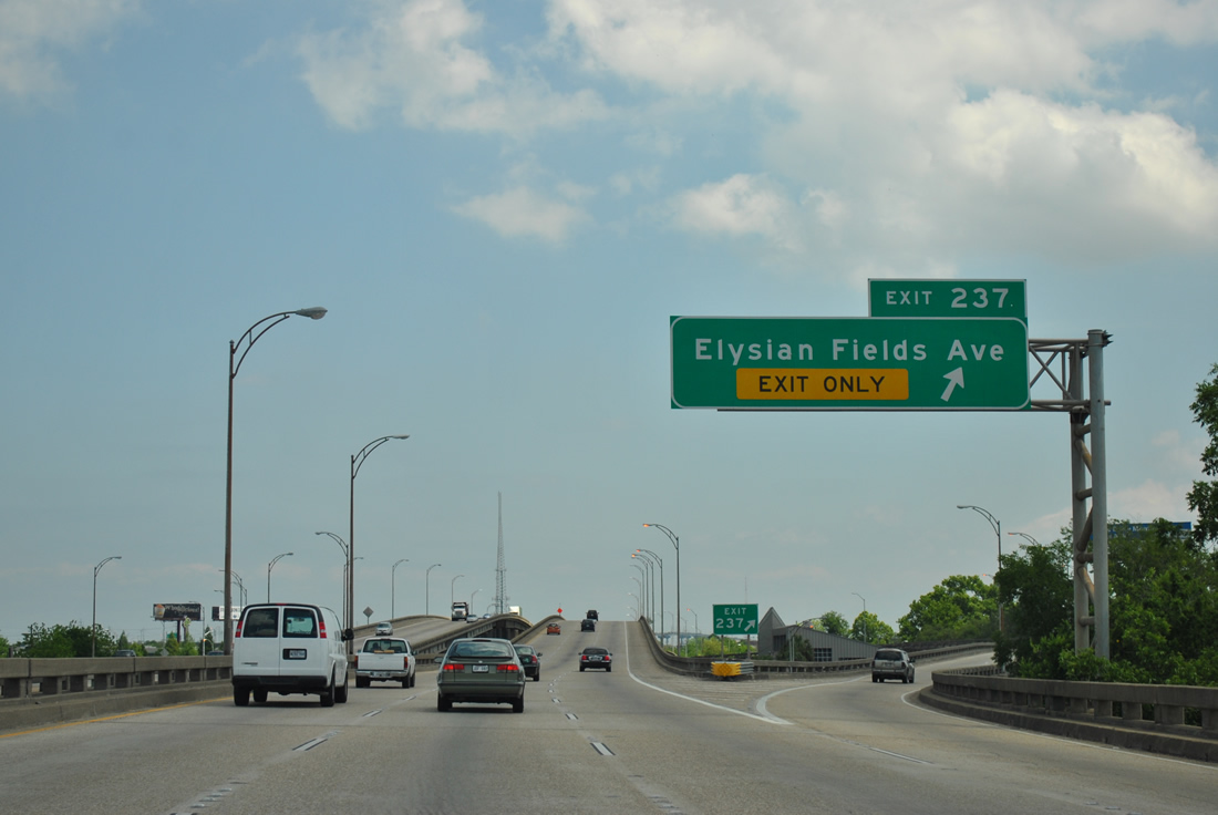
| An on-ramp joins I-10 east from Claiborne Avenue to add a fourth eastbound lane to nearby Exit 237 (Elysian Fields Avenue). Elysian Fields Avenue travels between the east edge of the French Quarter at North Peters Street to Pontchartrain Beach. LA 3021 follows the boulevard north from LA 39 to U.S. 90 (Gentilly Boulevard). 04/20/12 |
|
| Exit 237 leaves Interstate 10 east and connects with Elysian Fields Avenue (LA 3021) northbound ahead of Florida Avenue. Elysian Fields Avenue separates Dillard from Gentilly Terrance northward to U.S. 90. 04/20/12 |
|
| Winding northward, Interstate 10 passes over Florida Avenue and a CSX Railroad line as the High Rise, the bridge over the Inner Harbor Navigation Canal comes into view. The canal, simply referred to in New Orleans as the Industrial Canal, links Lake Pontchartrain and the Mississippi River Gulf Outlet Canal. 04/20/12 |
|
| The Elysian Fields Avenue (LA 3021) northbound on-ramp joins Interstate 10 east ahead of this reassurance marker. 04/20/12 |
|
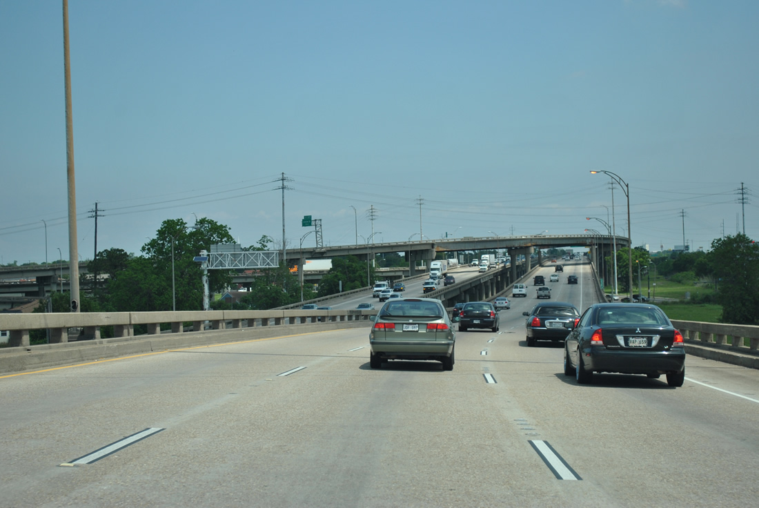
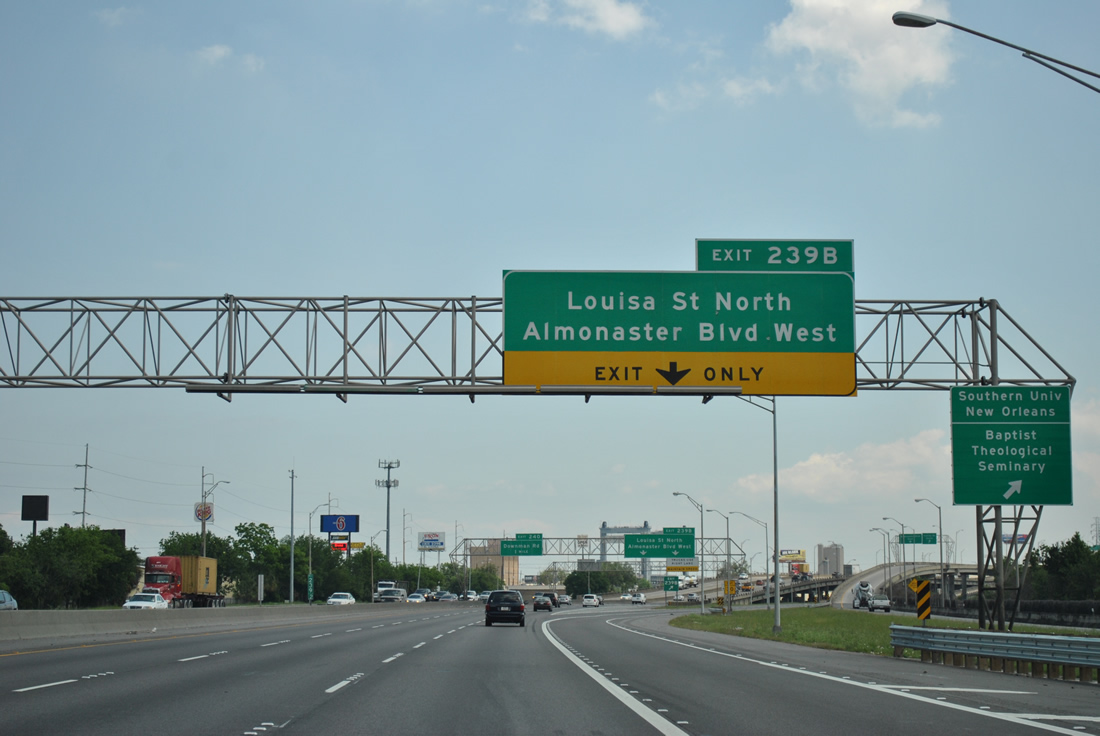
| Interstate 10 continues northeast through the St. Roch neighborhoods to Gentilly Terrace and Desire. The next interchange joins the freeway with Louisa Street and Almonaster Boulevard at industrial areas alongside the Industrial Canal. 04/20/12 |
|
| Interstate 610 eastbound returns to Interstate 10 east at a wye interchange (Exit 238B) above Franklin Avenue. A half diamond interchange also joins I-10 west with Franklin Avenue below. 04/20/12 |
|
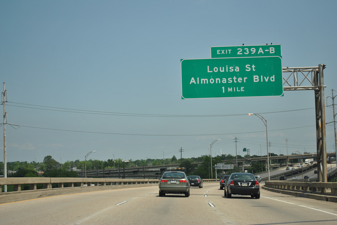
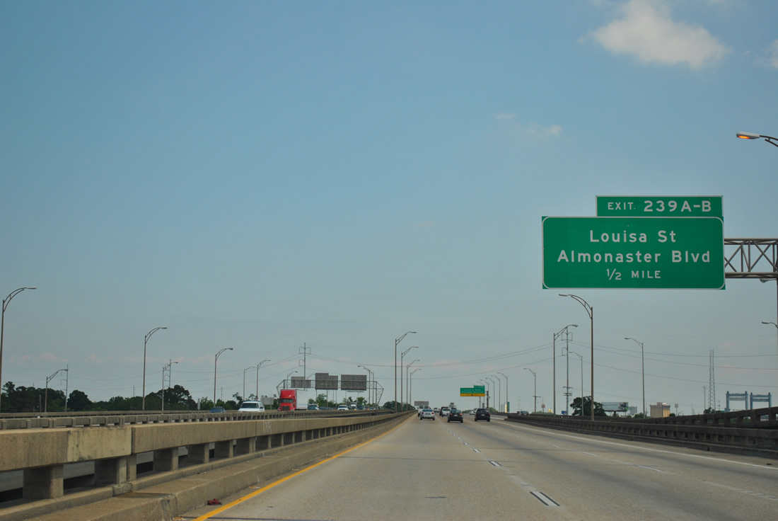
| Interstate 610 eastbound merges onto Interstate 10 east ahead of the Exit 239A ramp departure to Louisa Street south to Desire and Almonaster Boulevard east to the New Orleans Business & Industrial District. 04/20/12 |
|
| The Interstate 610 ramp adds an auxiliary lane for Exit 239A. Louisa Street travels south through the Desire and St. Claude neighborhoods, ending at LA 46 (St. Claude Avenue) at Bywater. 04/20/12 |
|
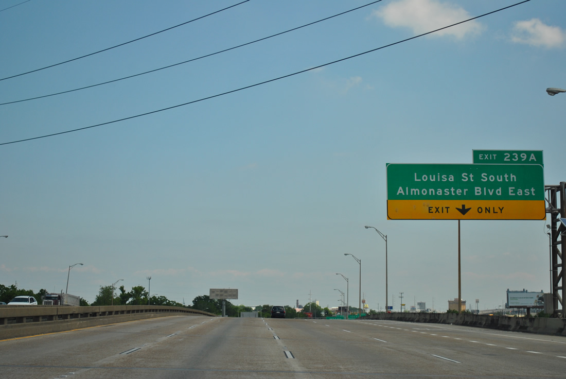
| Exit 239A leaves Interstate 10 east for ramps to Louisa Street south and Almonaster Boulevard east. Almonaster Boulevard crosses the Industrial Canal to the south of a large CSX Transportation railroad yard. The road serves the industrial areas of New Orleans East between Louisa Street and Interstate 510 & LA 47. 04/20/12 |
|
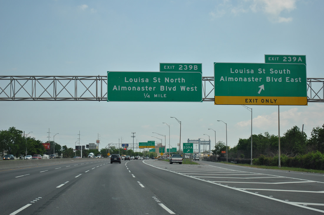
| Exit 239B departs from Interstate 10 east to intersect Louisa Street between its intersections with Almonaster Boulevard and Old Gentilly Road. Almonaster Boulevard west turns southward to intersect Florida and Franklin Avenues. 04/20/12 |
|
| Exit 239B expands to two lanes ahead of Louisa street. Louisa Street north meets U.S. 90 (Chef Menteur Highway) in the busy commercial district of Gentilly Woods.
Visible to the left of Exit 239B is the U.S. 90 lift bridge over the Industrial Canal. 04/20/12 |
|
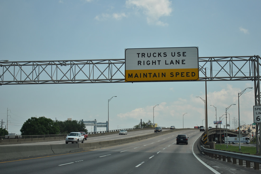
| Interstate 10 spans the Industrial Canal over the six lane High Rise bridge. The shoulder-less span includes a truck restriction mandating commercial vehicles to the right lane as it passes over the canal, the Public Belt Railroad, and France and Jourdan Roads. 04/20/12 |
|
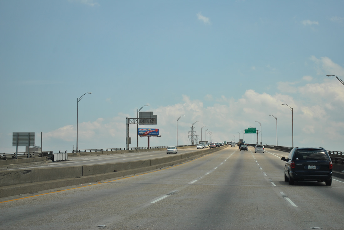
| Rising high above the Industrial Canal along Interstate 10 east. The High Rise was completed in 1966 and travels 6,714 feet in length. 04/20/12 |
|
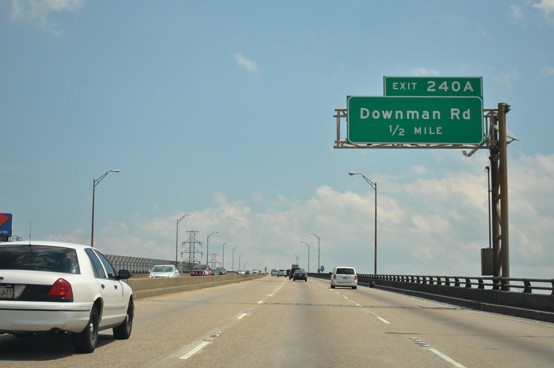
| Interstate 10 meets Downman Road at the east end of the High Rise. Downman Road travels north from Exit 240A to U.S. 90 (Chef Menteur Highway), Morrison Road, and Hayne Boulevard (LA 47 east). 04/20/12 |
|
| Interstate 10 eastbound reassurance shield posted along the High Rise. The bridge provides 114 feet of vertical clearance. 04/20/12 |
|
| Lowering from the crest of the High Rise, the pervasive CSX Railroad yard comes into view, as does the Intracoastal Waterway bridge of LA 47 near Michoud. 04/20/12 |
|
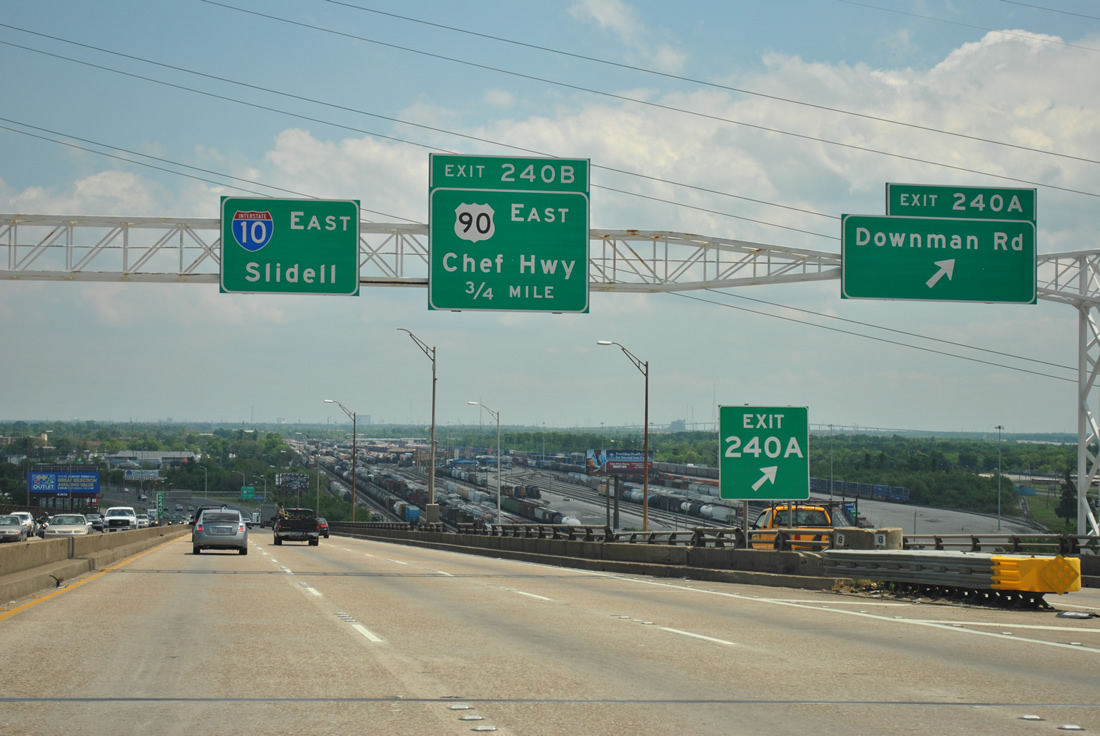
| A wye interchange joins Interstate 10 with Downman Road on the eastbound descent from the High Rise bridge. Downman Road begins at the interchange and quickly intersects the east end of the U.S. 90 - Danziger Bridge across the Industrial Canal. Direct access to U.S. 90 (Chef Menteur Highway) east exists at Exit 240B. 04/20/12 |
|
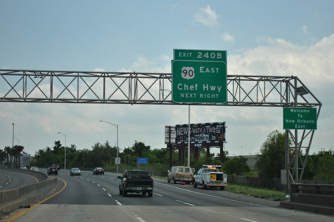
| Interstate 10 eastbound touches ground ahead of the Exit 240B parclo interchange with U.S. 90 (Chef Menteur Highway). U.S. 90 ventures east from I-10 to the Plum Orchard and Lake Forest communities of New Orleans East. 04/20/12 |
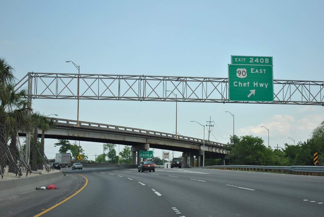
|
| Old Gentilly Road passes over Interstate 10 eastbound at its split with Exit 240B to U.S. 90 (Chef Menteur Highway). U.S. 90 straddles the southern reaches of the commercial and residential areas of New Orleans East parallel to the CSX Railroad line. The US highway, while never straying too far away from Interstate 10, next meets it directly at Tillman's Corner, Alabama. 04/20/12 |
|
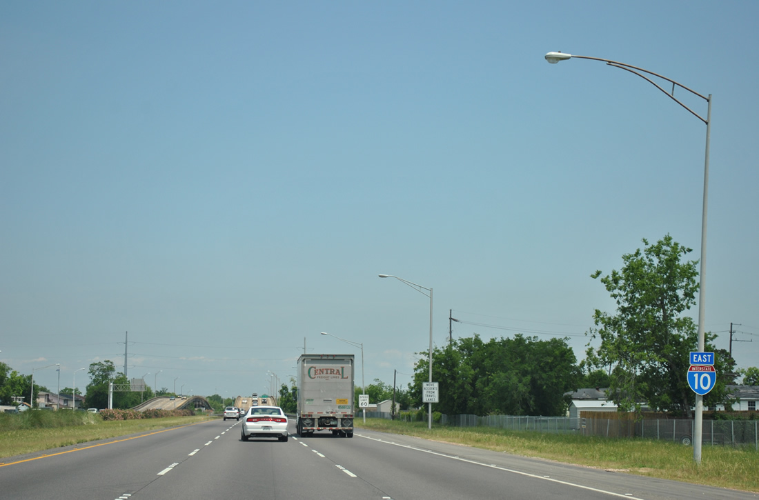
| Interstate 10 ascends to pass over both Dwyer Street and Dwyer Canal on the approach to Exit 241 with Morrison Road. Morrison Road provides the most direct route to New Orleans Lakefront Airport (NEW) from central New Orleans. The airport lies along Stars and Stripes Boulevard north of Downman Road. 04/20/12 |
|
| Nearing the Morrison Road trumpet interchange (Exit 241) at the eastern turn of Interstate 10 near Lake Forest. Morrison Road lines Morrison Canal eastward from Downman Road through Little Woods of New Orleans East. The divided highway, from Downman Road east to the Exit 241 connector, represents the original west end of the Eastern Expressway (Interstate 10 / LA 3021) from before the High Rise was completed. 04/20/12 |
|
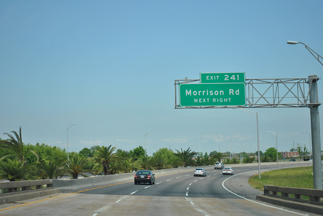
| Exit 241 loops onto Morrison Road westbound from Interstate 10 east. Morrison Road and Downman Road south to U.S. 90 were once a part of LA 3021. Unsigned LA 1253 now entails the short connector between I-10 and Downman Road. 04/20/12 |
|
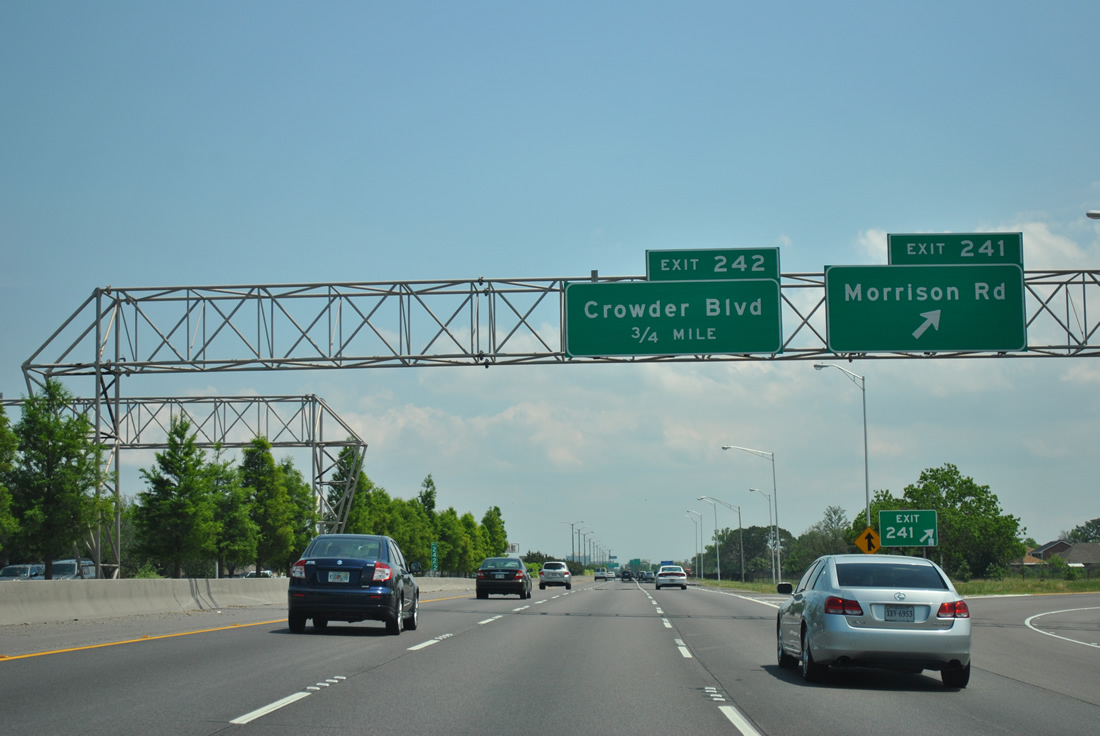
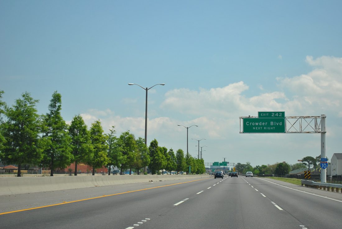
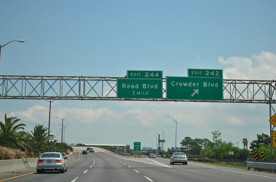
| The next New Orleans East interchange joins Interstate 10 with Crowder Boulevard at Exit 242. 04/20/12 |
|
| Eastbound at the diamond interchange (Exit 242) for Crowder Boulevard. Crowder Boulevard travels through the Little Woods, West Lake Forest and Plum Orchard neighborhoods of the city from U.S. 90 to Hayne Boulevard (LA 47). 04/20/12 |
|
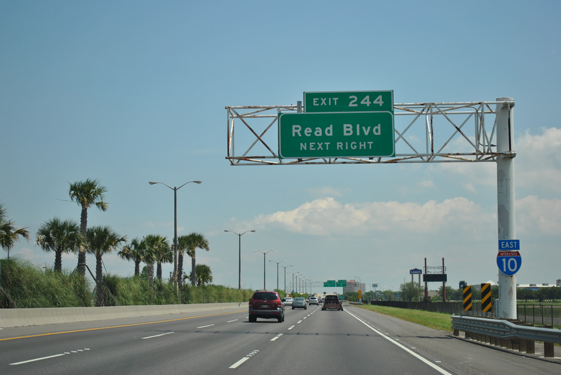
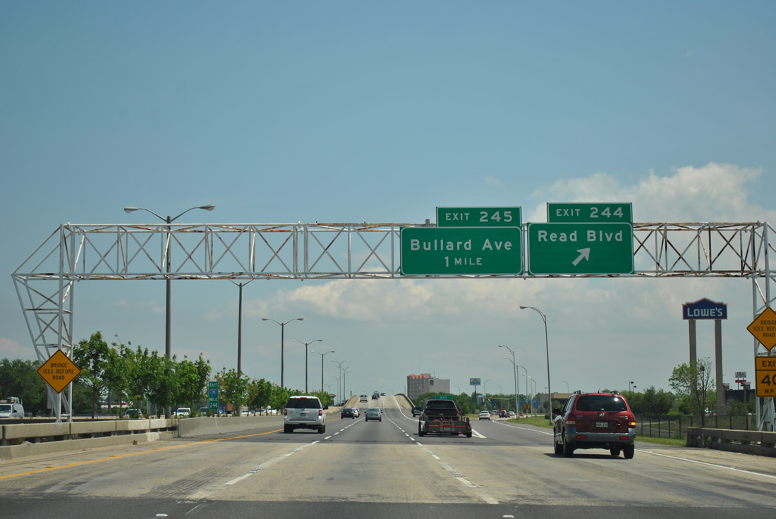
| Next in line for Interstate 10 east is the Exit 244 diamond interchange with Read Boulevard. Read Boulevard served a busy commercial area to the north and south of Interstate 10. 04/20/12 |
|
| Read Boulevard, like Crowder Boulevard, travels south from Hayne Boulevard (LA 47) to U.S. 90 (Chef Menteur Highway). Read Boulevard however continues a short distance beyond the Chef Menteur Highway to Almonaster Boulevard. 04/20/12 |
|
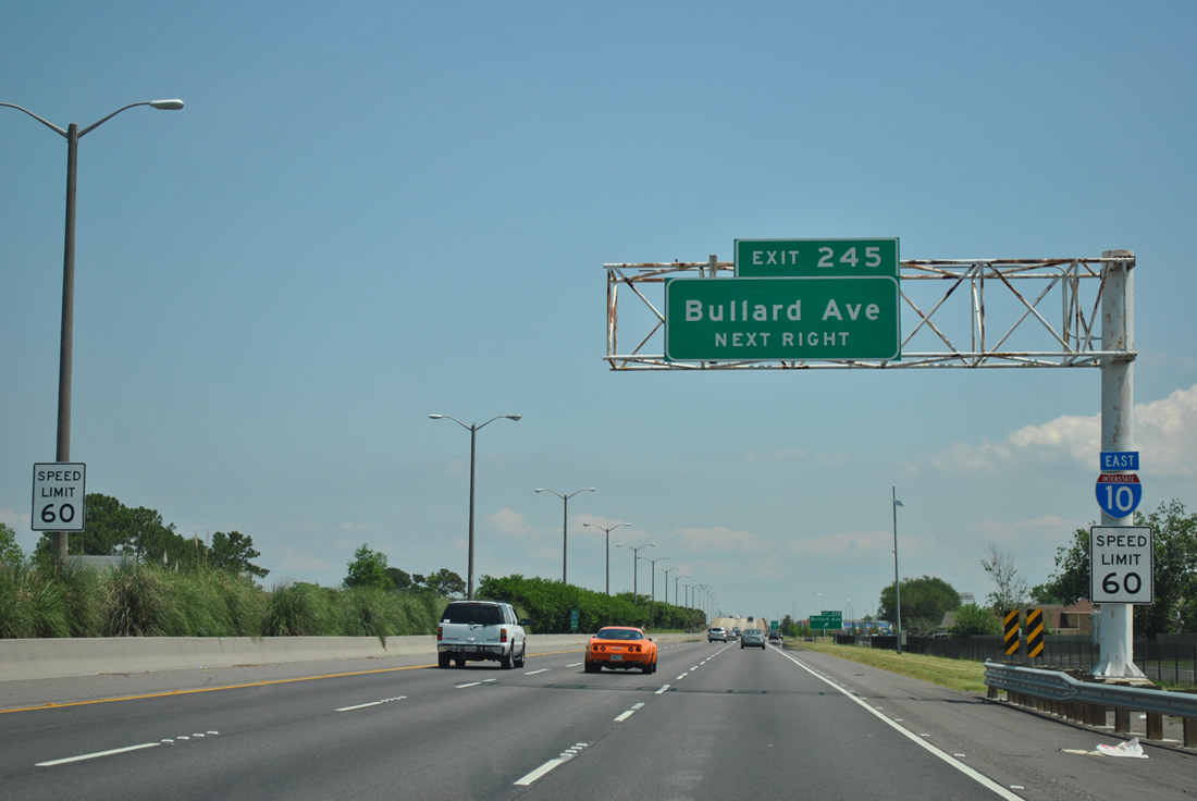
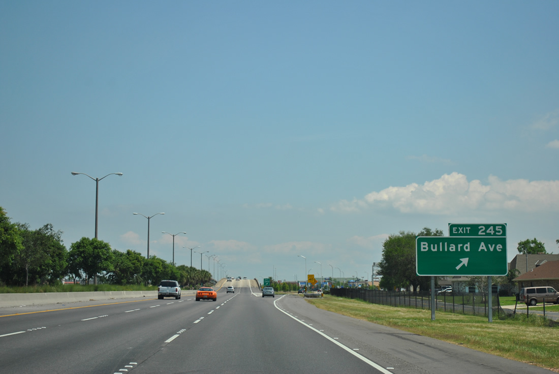
| Interstate 10 eastbound approaching the Bullard Avenue diamond interchange (Exit 245). Bullard Avenue constitutes a north-south surface boulevard between U.S. 90 (Chef Menteur Highway) and Hayne Boulevard (LA 47). 04/20/12 |
|
| Winds from Hurricane Katrina claimed the Bullard Avenue (Exit 245) overhead. A ground level sign was added sincee for the off-ramp near the Eastover community. Bullard Avenue south intersects Lake Forest Boulevard just west of its interchange with Interstate 510 & LA 47. 04/20/12 |
|
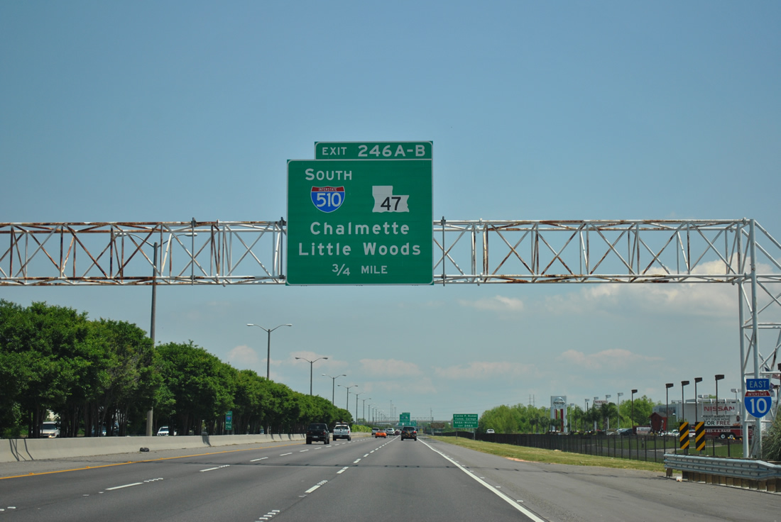
| Hurricane Katrina also blew the initial guide sign for Interstate 510 & LA 47 (Exits 246A/B) down as well, this is the replacement. The forthcoming stack interchange represents the north end of the 3.16 mile Interstate linking Interstate 10 with Michoud and Chalmette. 04/20/12 |
|
| Interstate 10 sees frontage roads throughout most of New Orleans East. The eastbound frontage road becomes Interstate 510's southbound frontage road (Paris Road), at Exit 246A. Paris Road, the original route of LA 47, was replaced by Interstate 510 as the main north-south route between Interstate 10 and the LA 47 Intracoastal Waterway Bridge south to St. Bernard Parish. 04/20/12 |
|
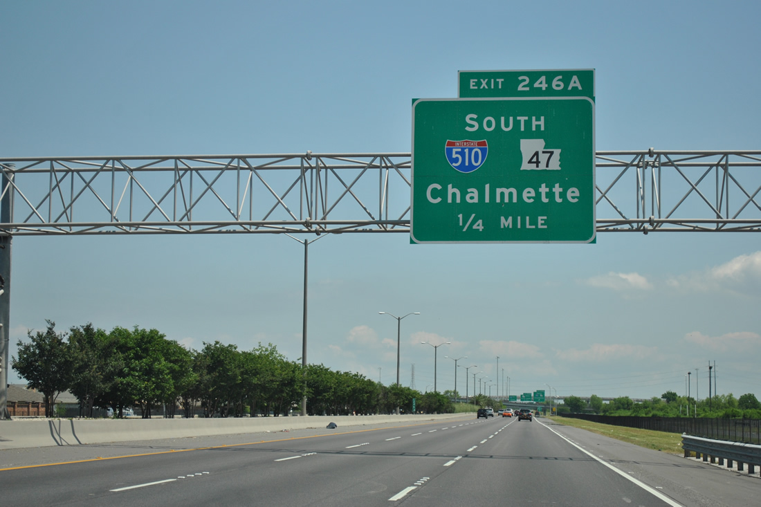
| Exit 246A departs Interstate 10 eastbound for Interstate 510 & LA 47 south to St. Bernard Parish. LA 47 overlaps with the entire Interstate 510 routing and ends nine miles south in Chalmette. 04/20/12 |
|
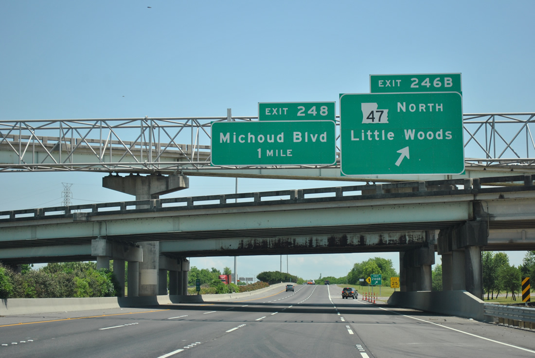
| Exit 246B comprises a loop ramp onto LA 47 (Paris Road) northbound for the Little Woods community of New Orleans. Paris Road carries LA 47 north 1.2 miles to become Hayne Boulevard west. The state route is unsigned beyond the I-10 Service Road. 04/20/12 |
Page Updated 09-18-2012.

 East
East