
 East
East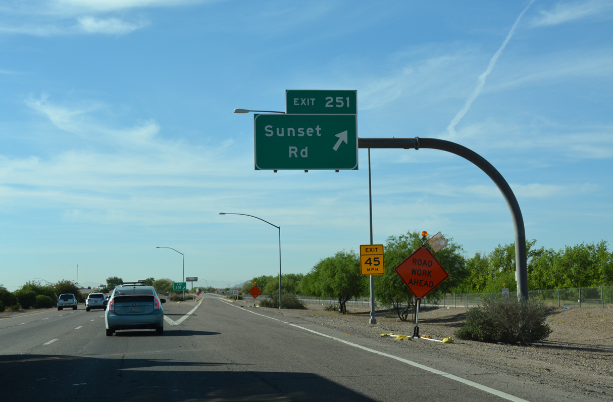
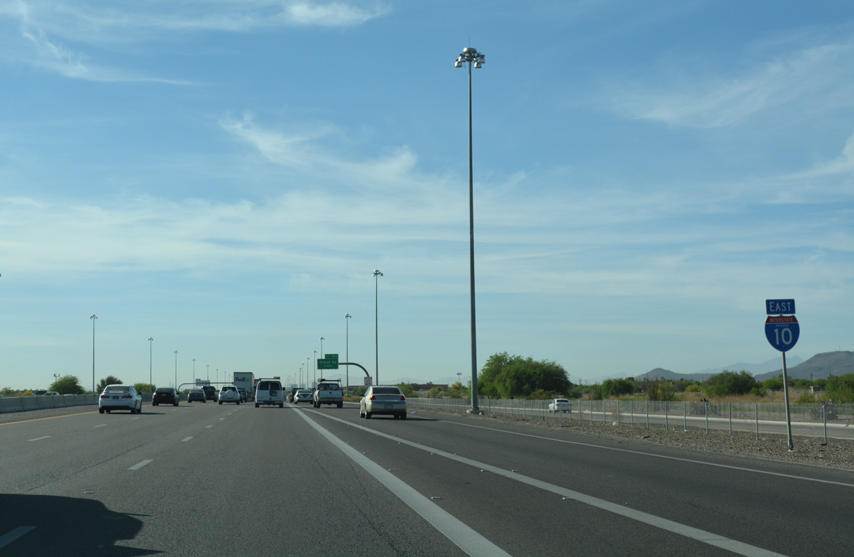
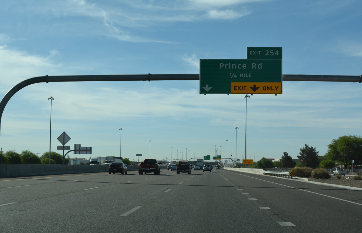
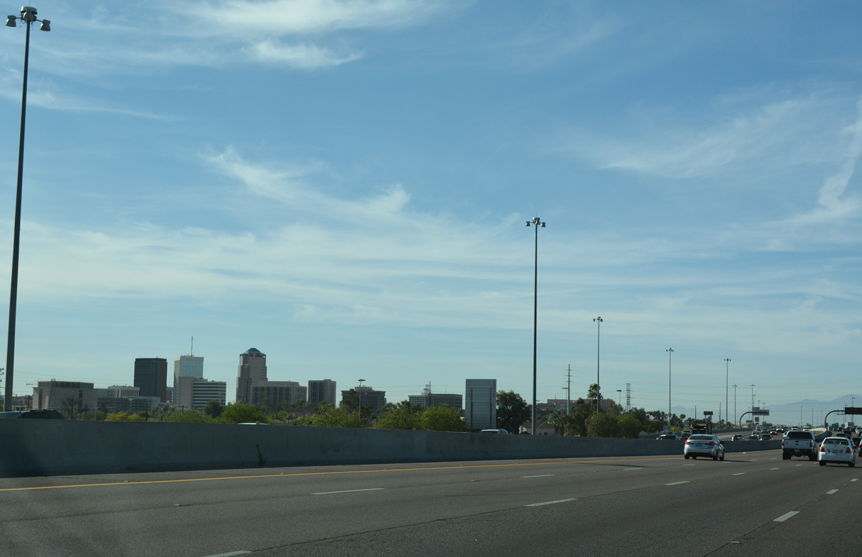
Interstate 10 east enters the city of Tucson at Exit 251.
04/26/17
04/26/17
04/26/17
04/26/17
04/26/17
04/26/17
04/26/17
04/26/17
04/26/17

04/26/17
04/26/17
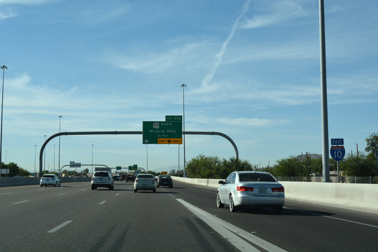
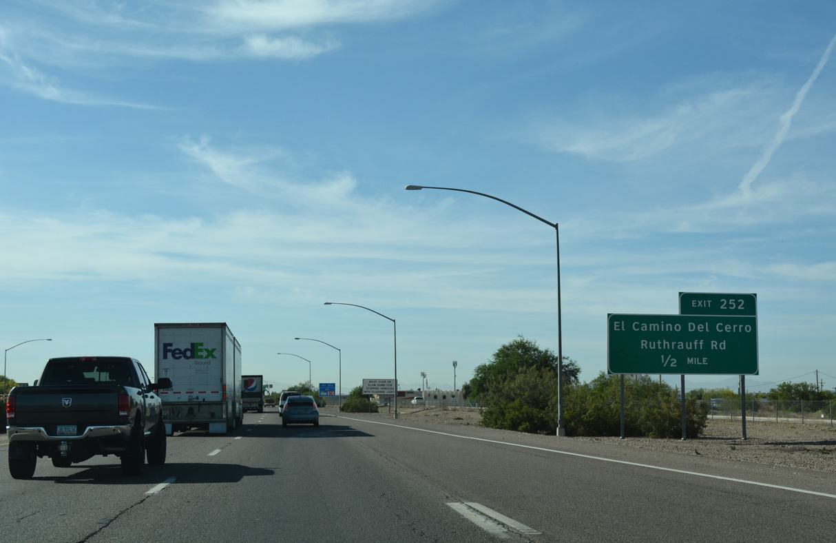
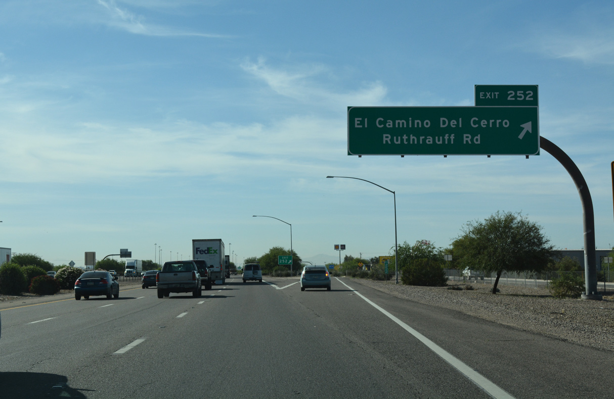
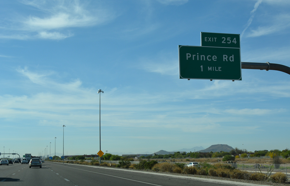
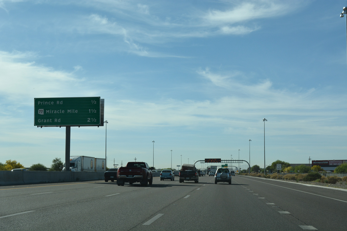
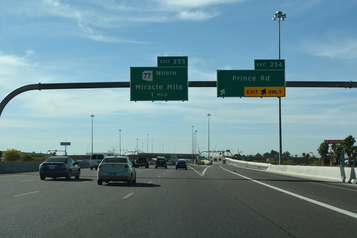
I-10 proceeds a quarter mile southeast to Exit 255 with SR 77 (Miracle Mile) north to Oracle Road. Miracle Mile was still classified by ADOT as Business Loop I-10 until 1992, when it was decommissioned as part of action truncating U.S. 89 north from Nogales to Flagstaff.
04/26/17
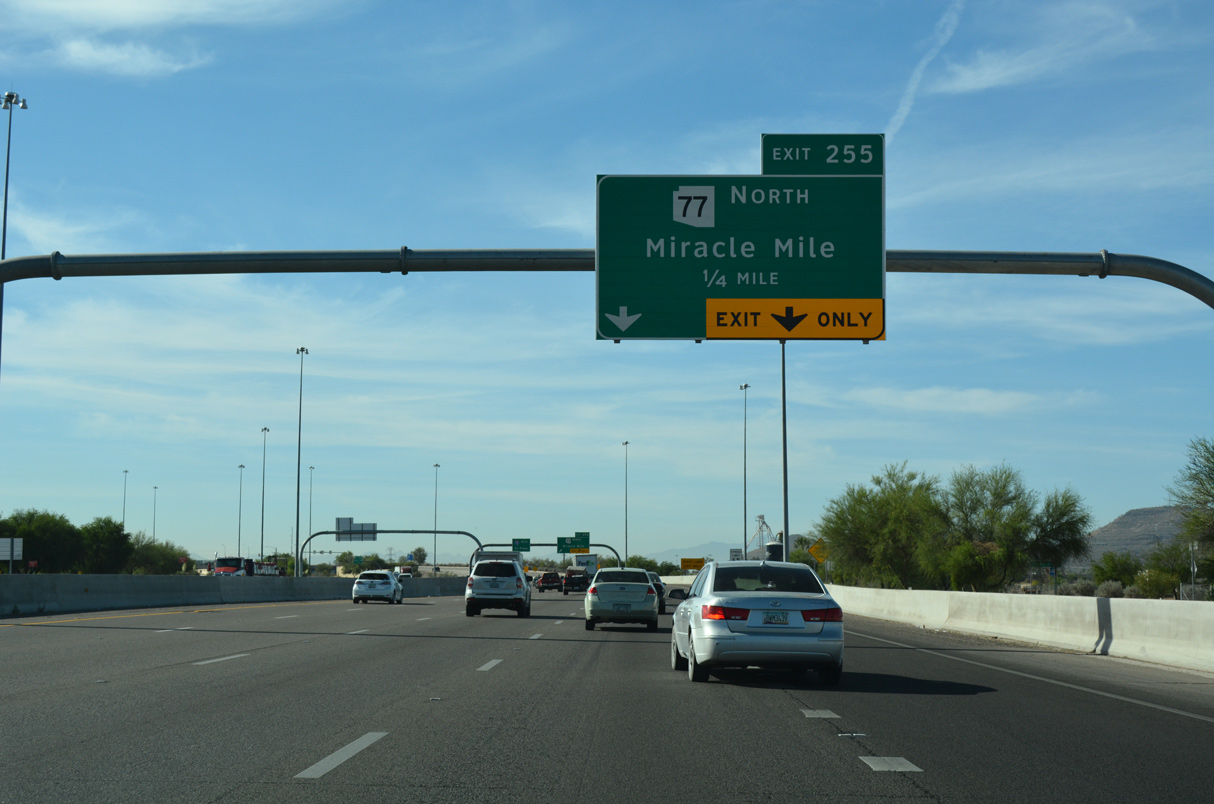
Prior to 1997, Miracle Mile was part of Business Loop I-10. Following old SR 84/U.S. 80, the business route served Downtown Tucson via Miracle Mile, Oracle Road, Drachman Street and the Stone Avenue/6th Avenue couplet. The business route was eliminated when maintenance of the Downtown streets was transferred from the state to the city.
04/26/17
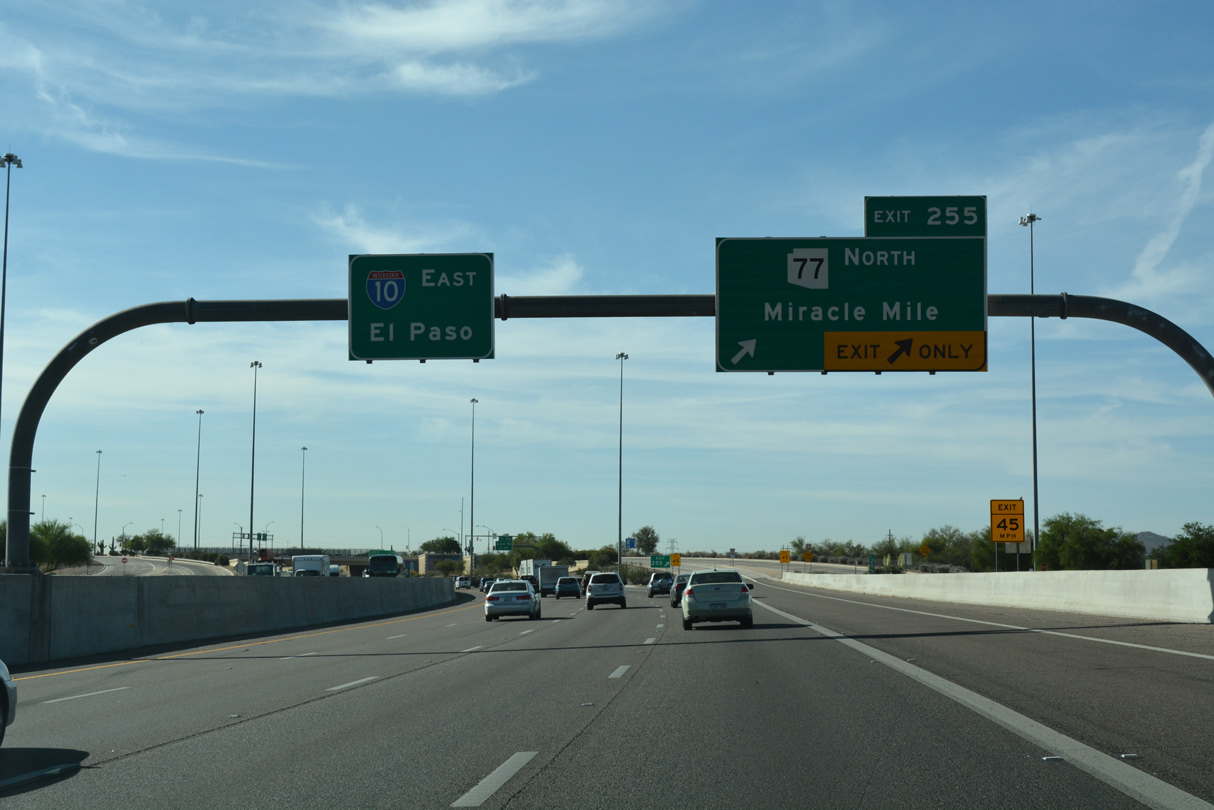
SR 77 (Miracle Mile) leads 1.49 miles east from Exit 255 to Oracle Road. Turning north, SR 77 follows Oracle Road out from Tucson en route to Oro Valley and Catalina.
04/26/17
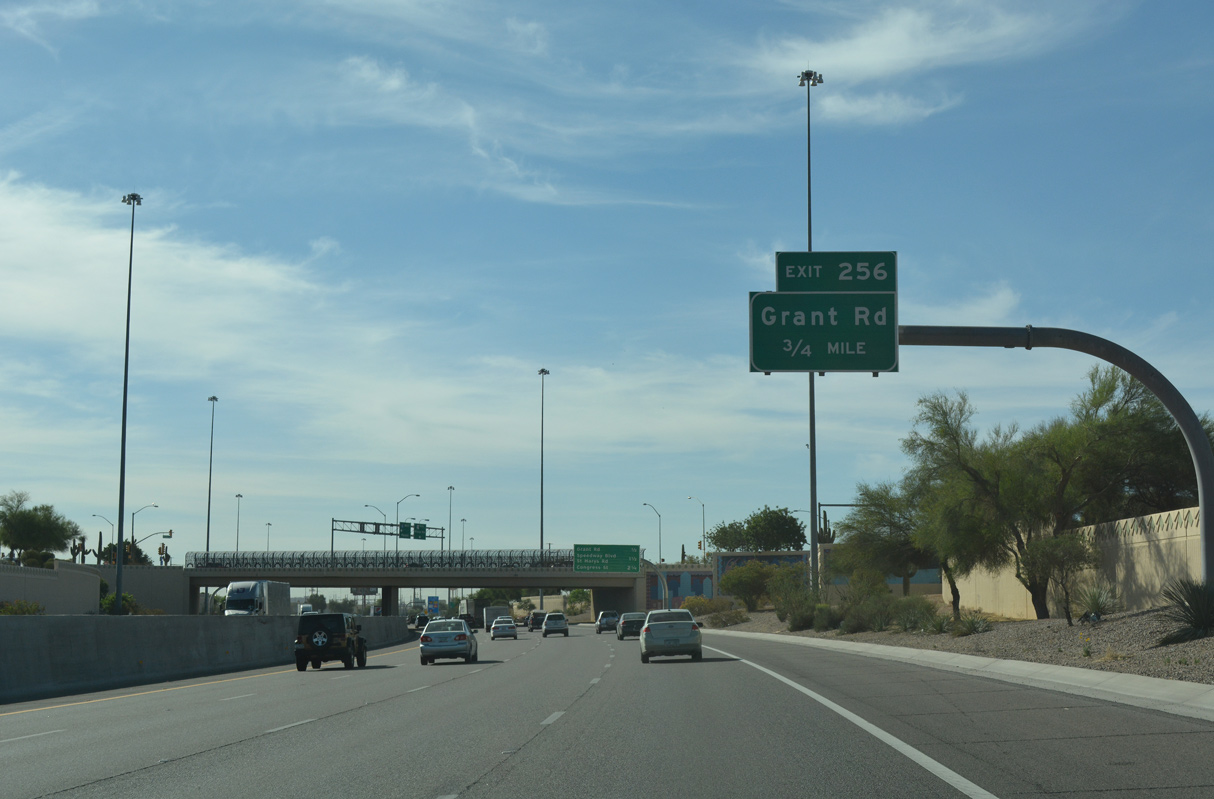
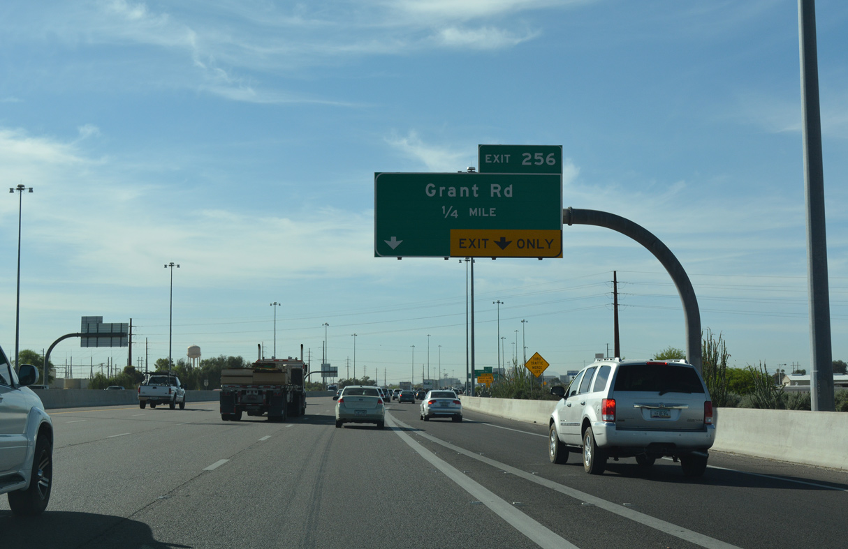
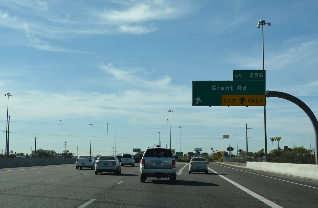
Construction widening Interstate 10 to eight lanes southeast to Exit 256 for Grant Road was underway in 2007.
04/26/17
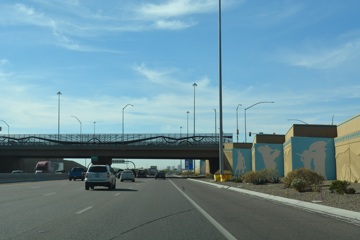
The exchange with Miracle Mile was where old SR 84 and SR 84A separated prior to 1964. It was reconstructed in 1995 with this elaborately decorated overpass, as part of a 1996 reconstruction project along Interstate 10 through Tucson.
04/26/17
Grant Road heads east toward the Tucson Botanical Gardens and west over the Santa Cruz River to become Ironwood Hill Drive.
04/26/17
04/26/17
04/26/17
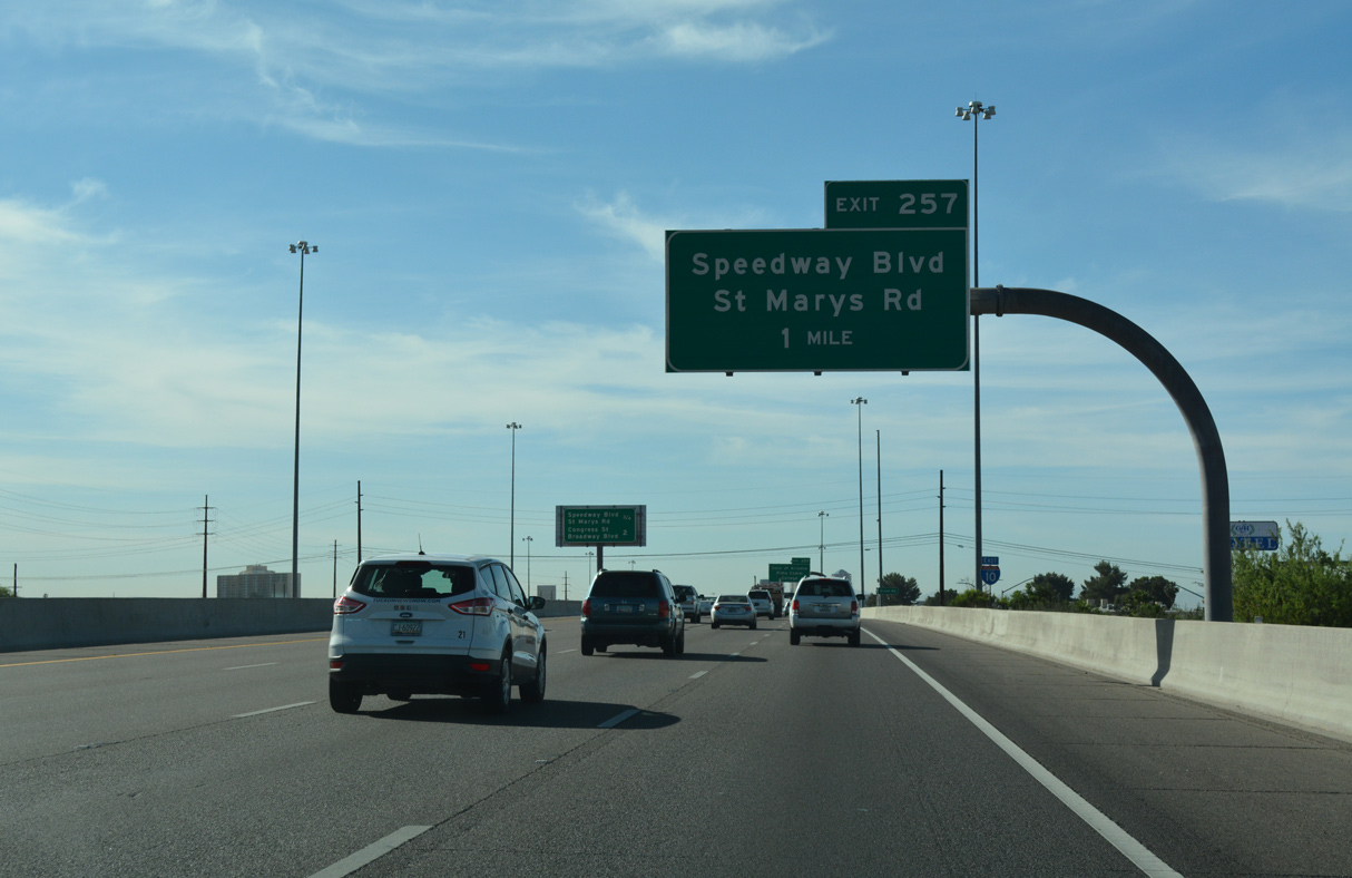
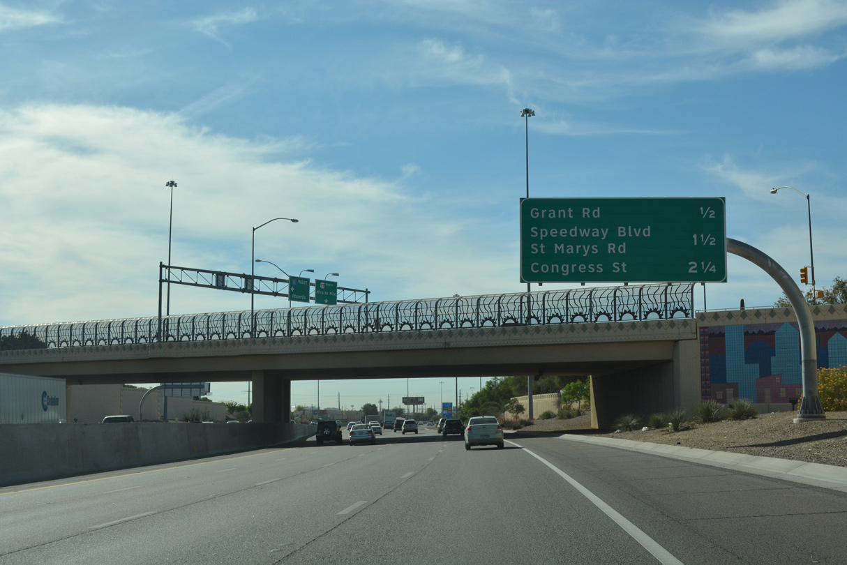
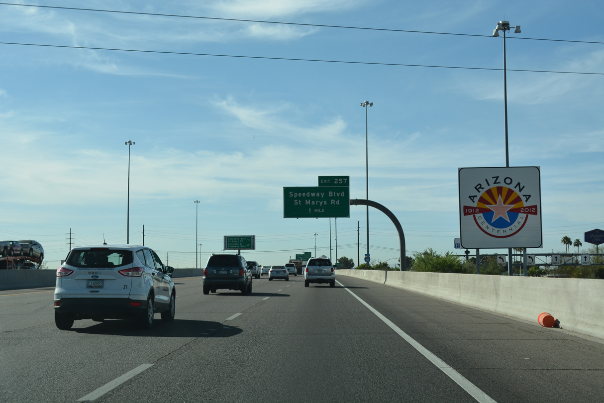
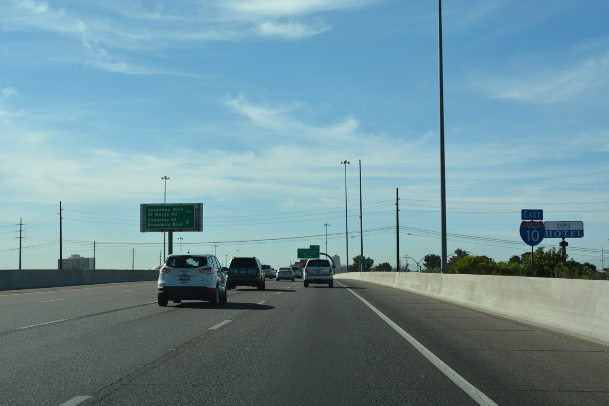
The succeeding exit along eastbound Interstate 10 is for Speedway Boulevard and parallel St Marys Road. Speedway Boulevard is a major arterial across Tucson.
04/26/17
04/26/17
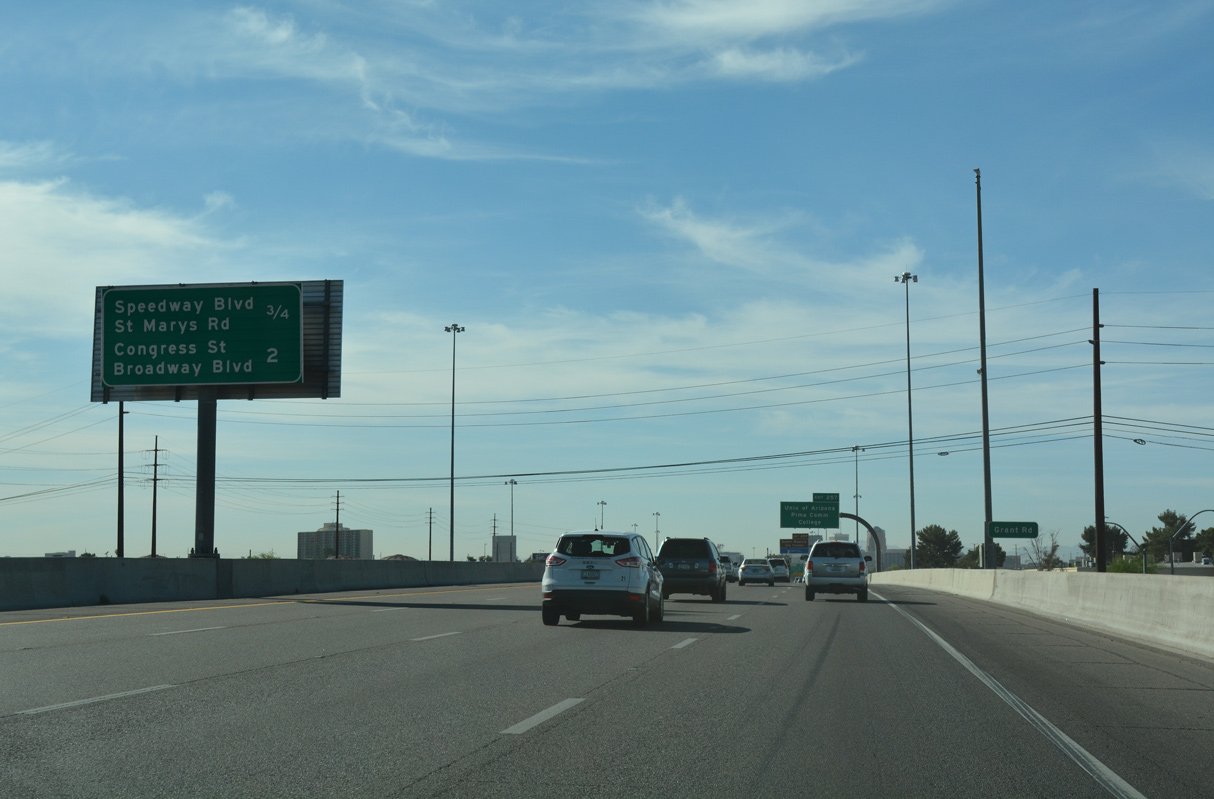
East from I-10, St. Marys Road changes into E 6th Street as it serves the northern fringe of Downtown and the University of Arizona.
04/26/17
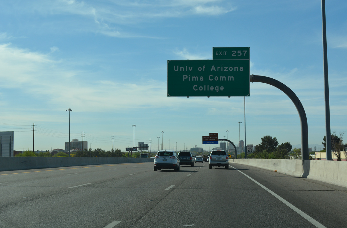
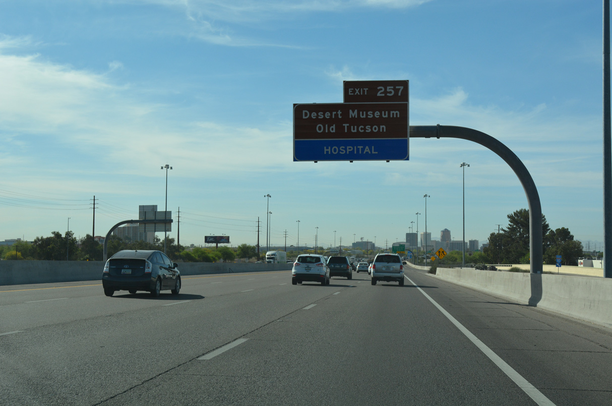
The University of Arizona lies northeast of Downtown between Speedway Boulevard and E 6th Street.
04/26/17
04/26/17
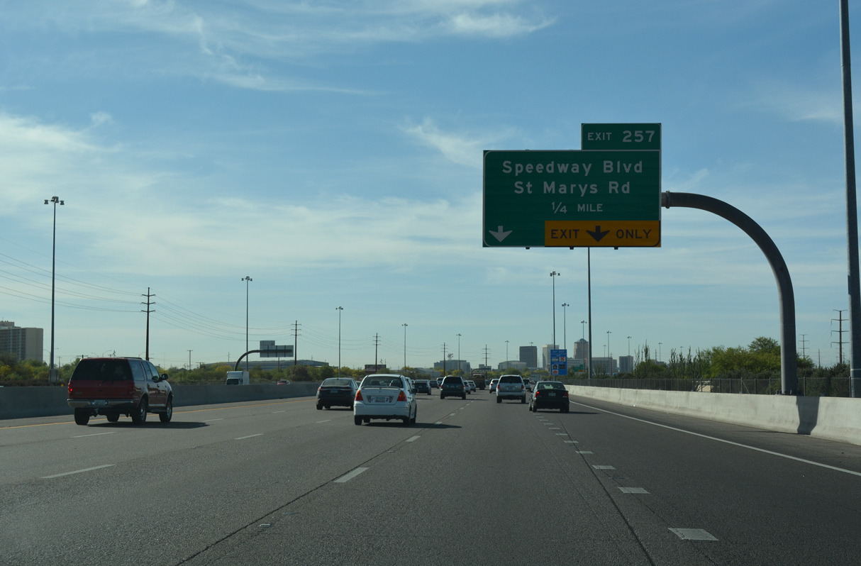
Prior to the 1996 reconstruction, there were separate exits from eastbound I-10 to Speedway Boulevard and St. Marys Road.
04/26/17

04/26/17
04/26/17
04/26/17
04/26/17
Downtown Tucson
04/26/17
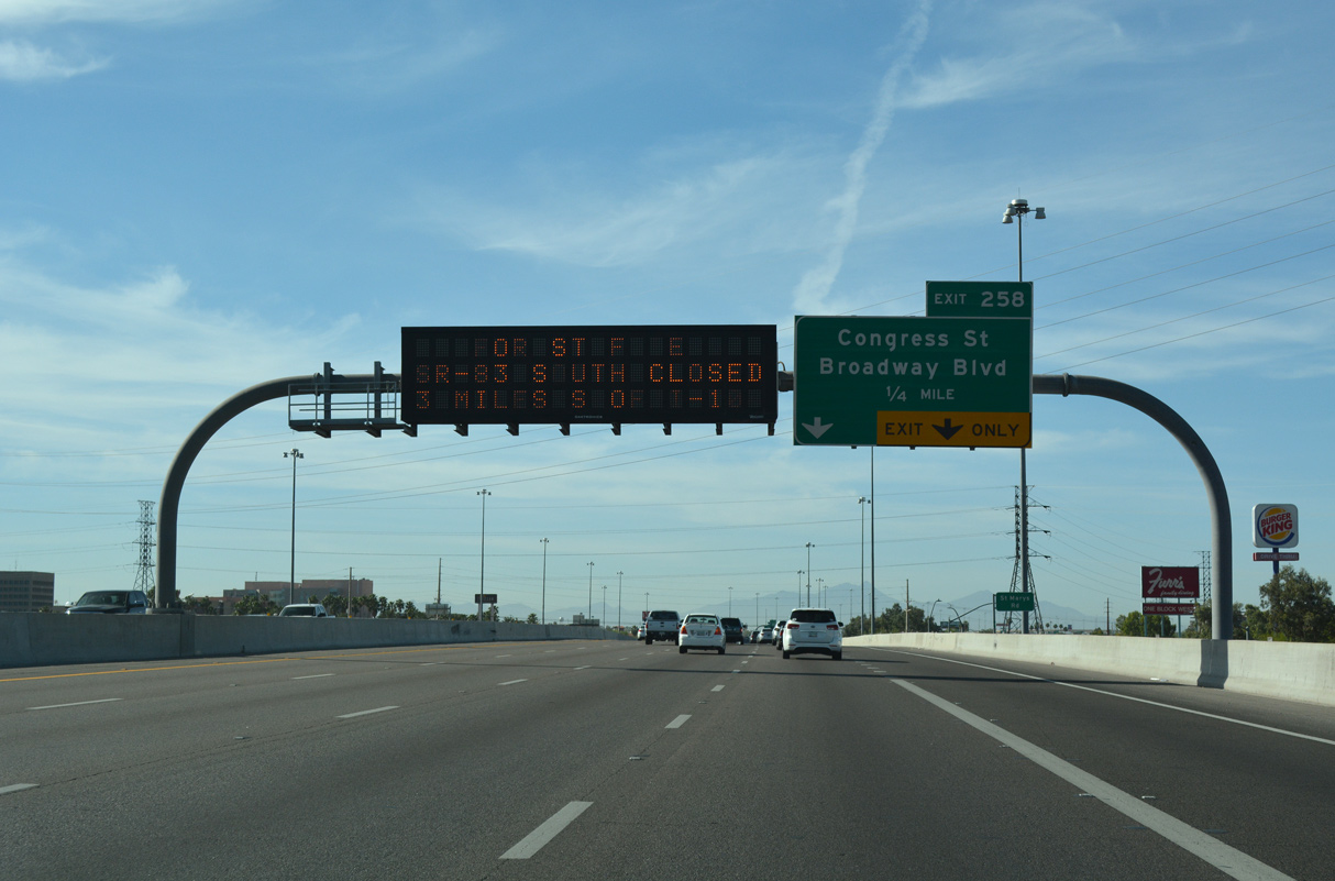
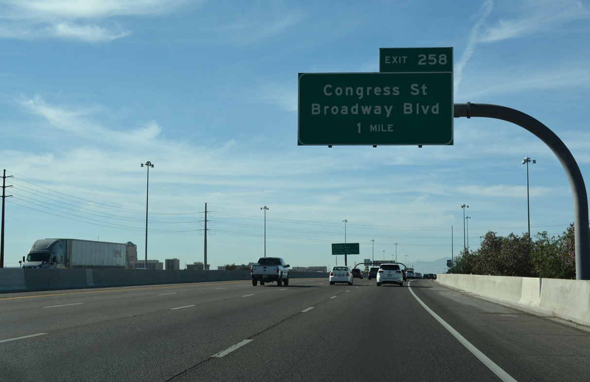
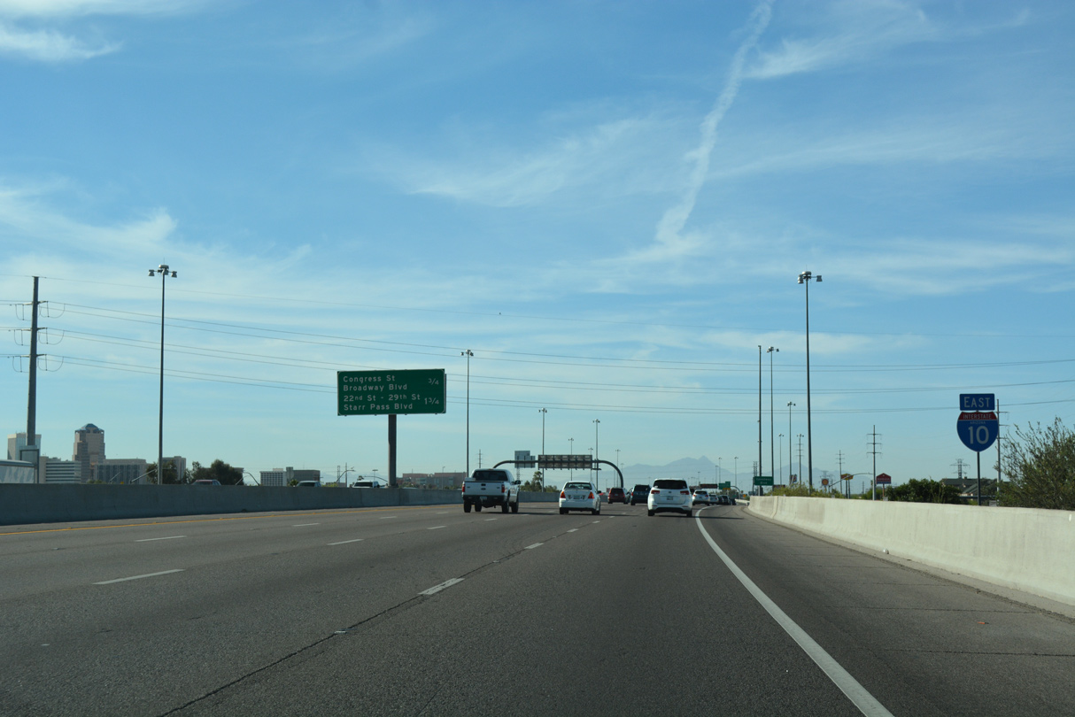
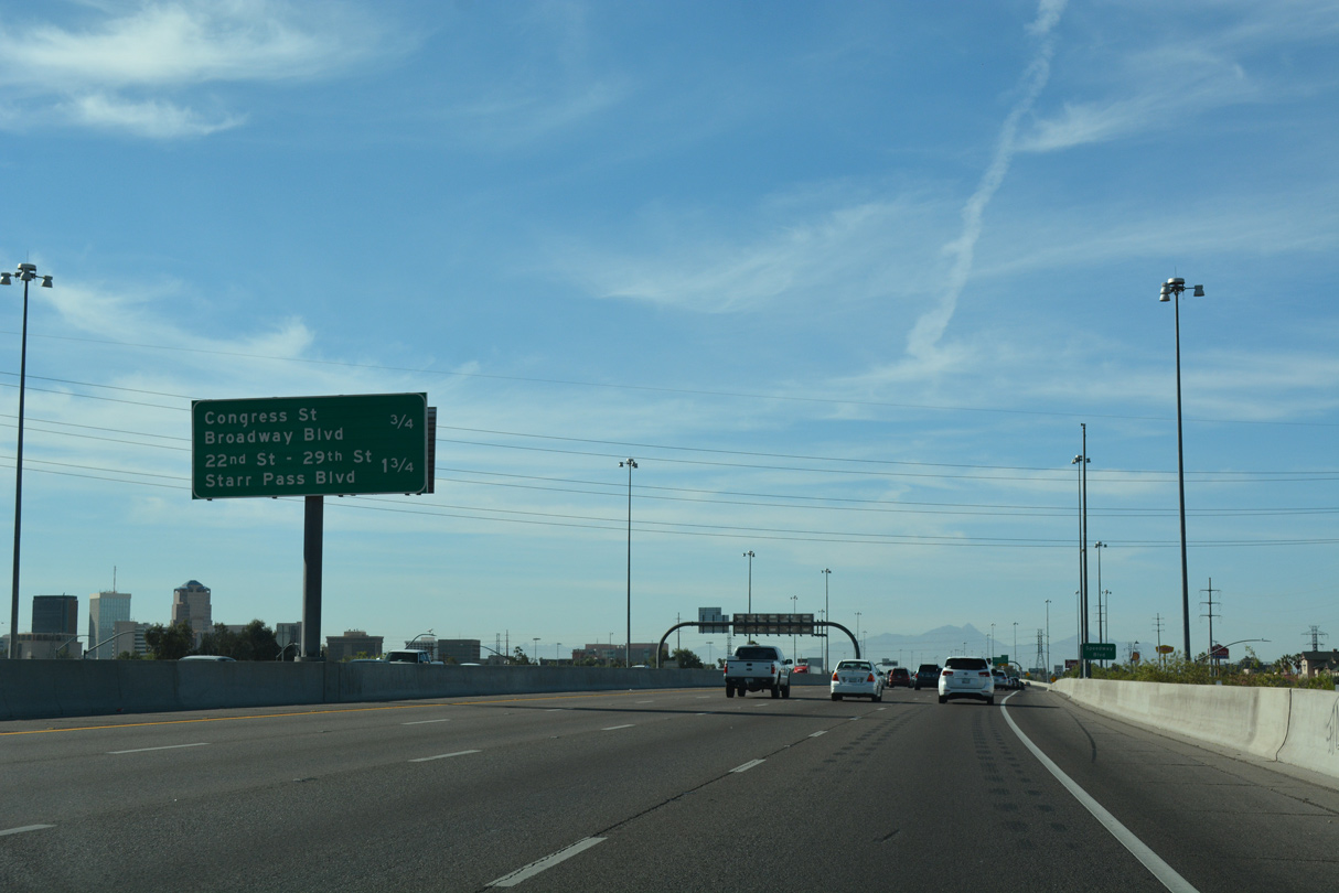
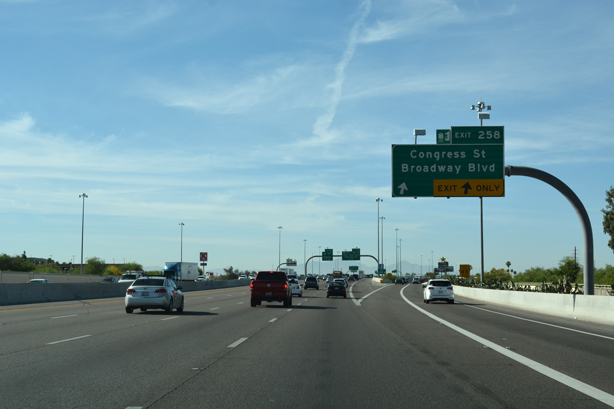
East from Exit 258, Congress Street partitions with Broadway Boulevard to a form a couplet across Downtown Tucson.
04/26/17
04/26/17
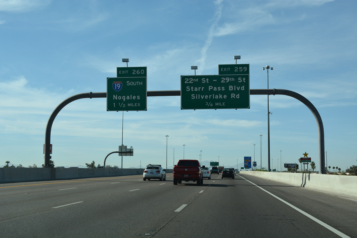
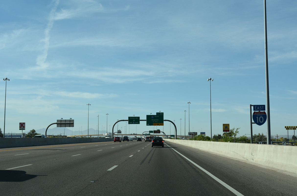
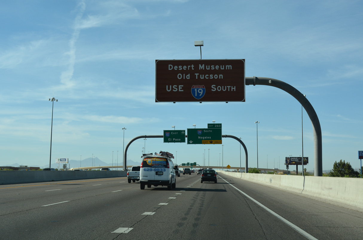
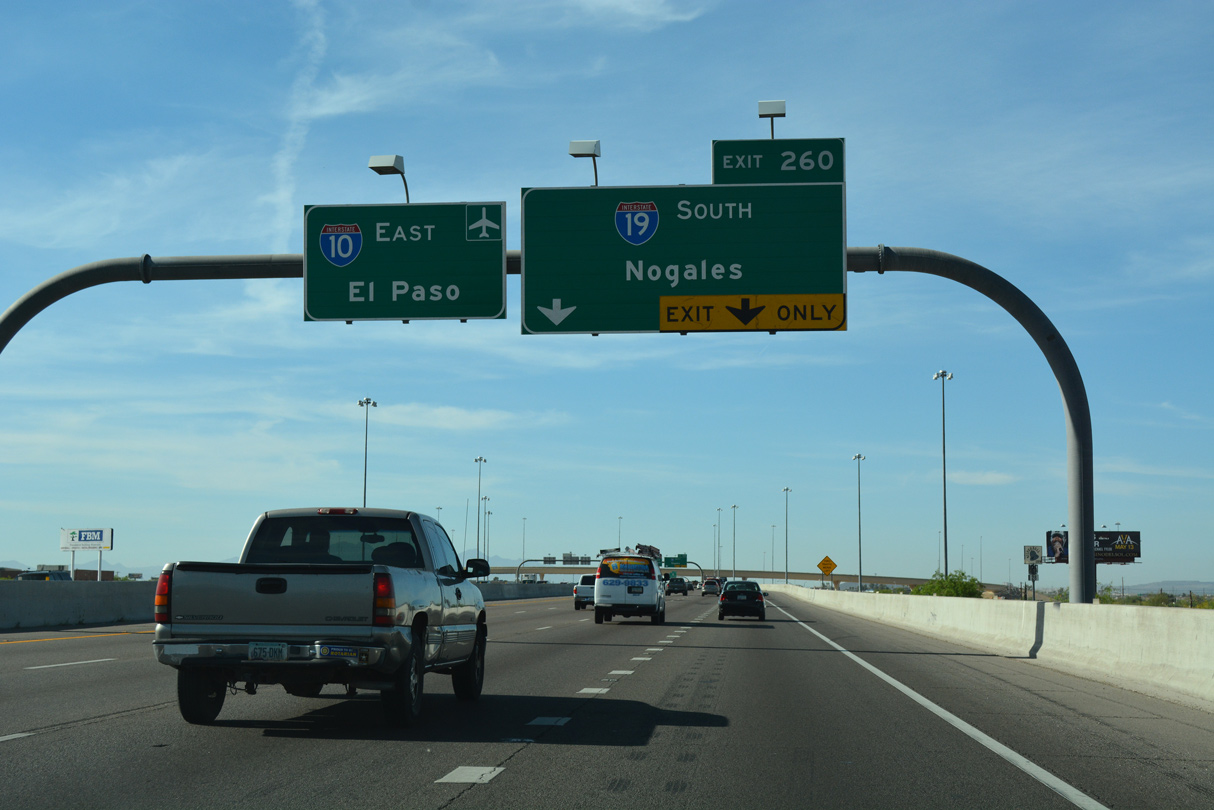
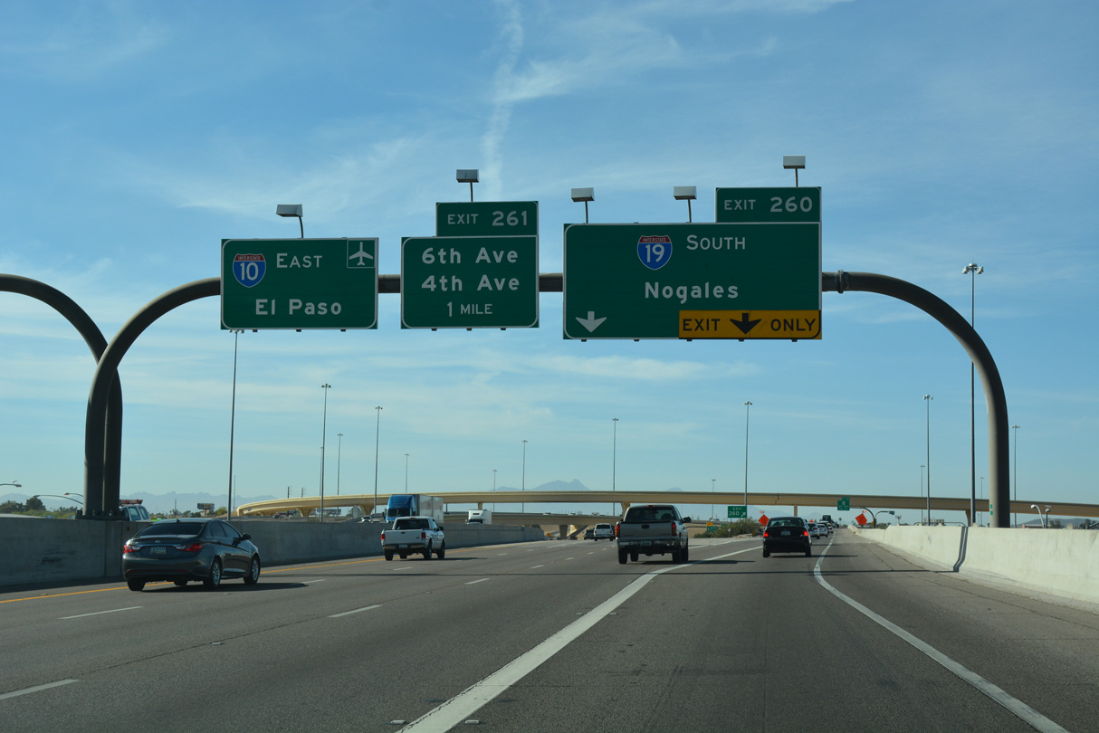
Advancing south from Downtown Tucson, I-10 converges with the north end of Interstate 19 at Exit 260.
04/26/17
04/26/17
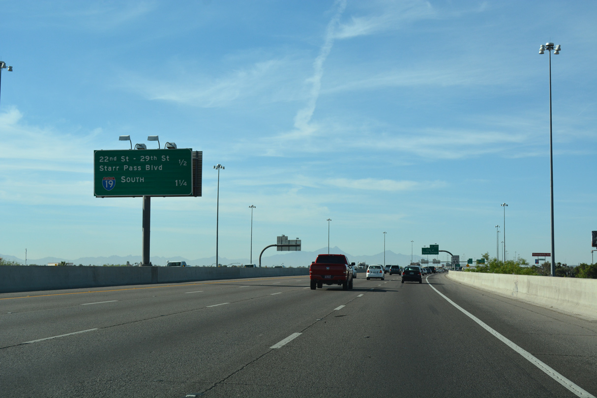
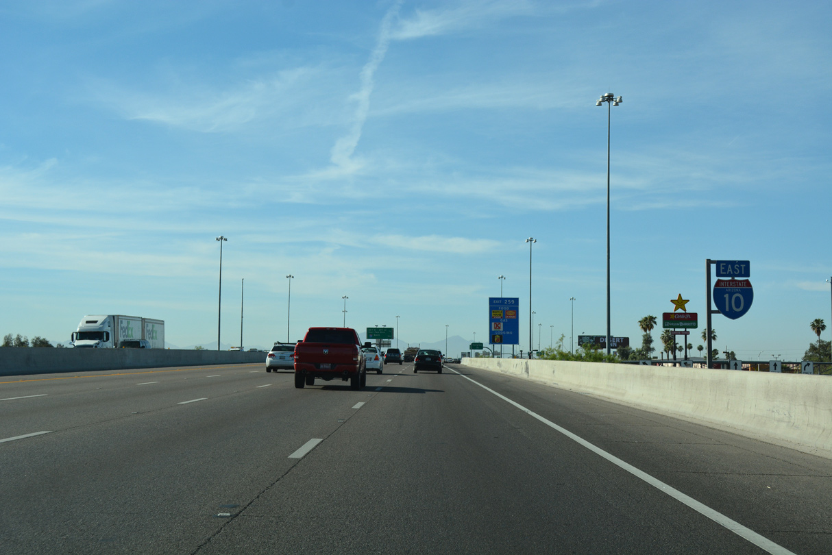
The split diamond interchange at Exit 259 links I-10 with W 22nd Street and W 29th Street.
04/26/17
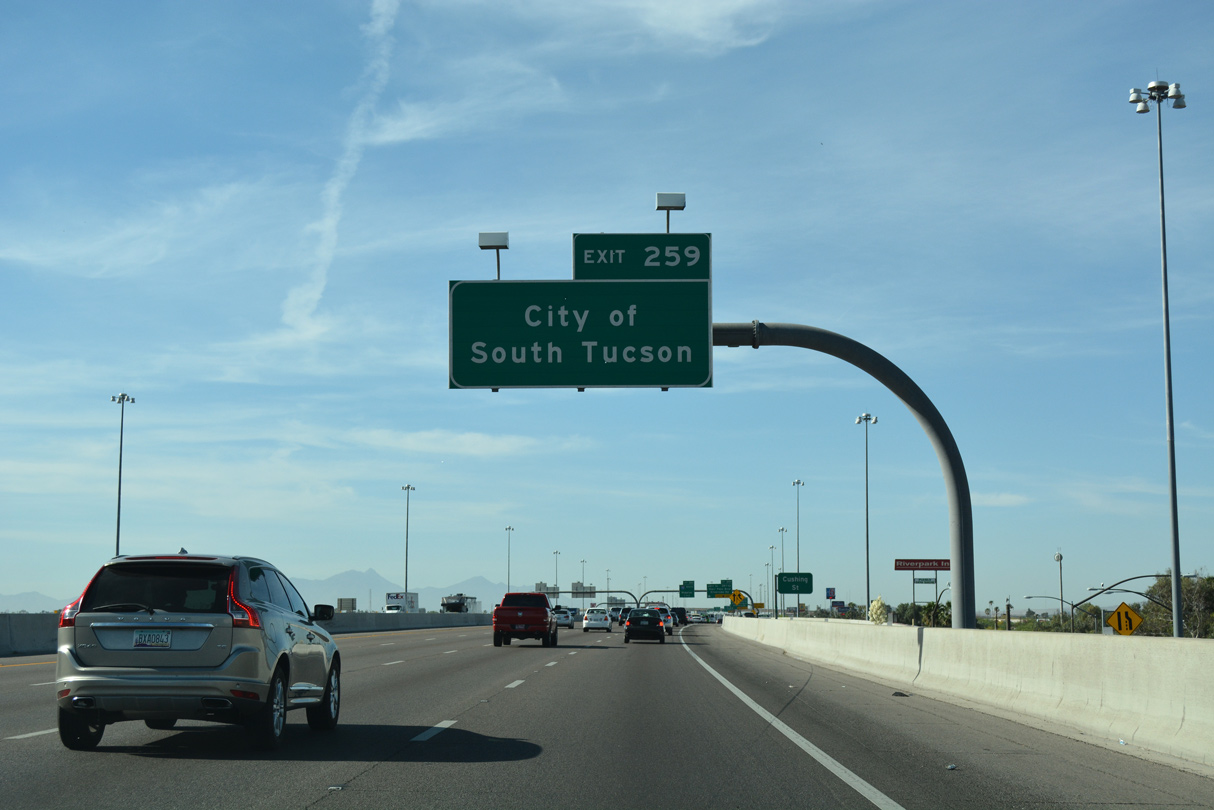
Surrounded by Tucson, the city of South Tucson lies east of I-10 at the exchange with I-19 and south of 25th Street.
04/26/17
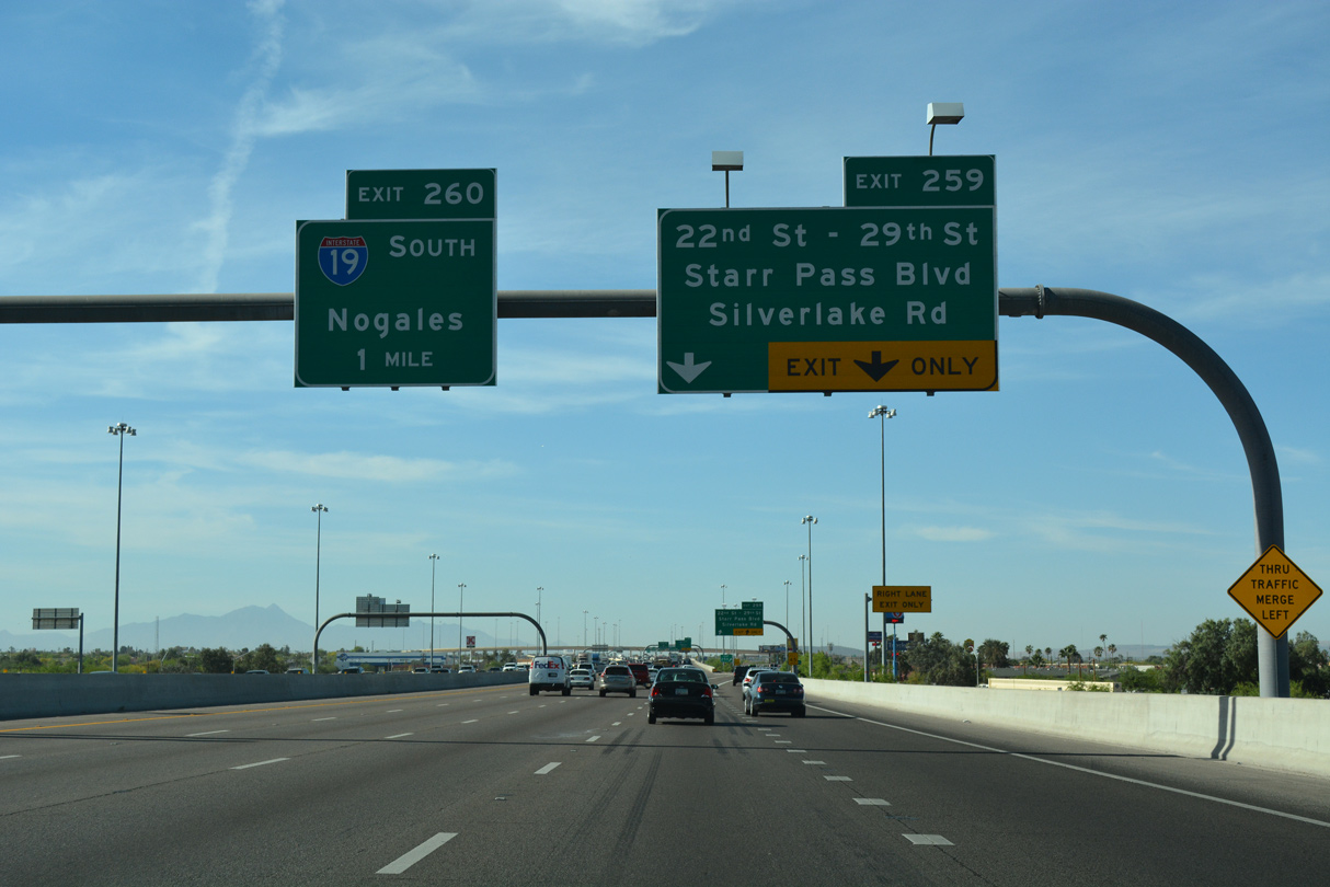
Interstate 19 joins Tucson with Green Valley, Nogales and old U.S. 89 to Mexico Federal Route 15.
04/26/17
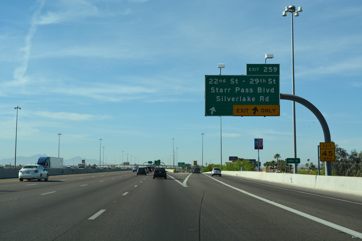
Passing south of Sentinel Peak Park and Tumamoc Hill, 22nd Street west becomes Starr Pass Boulevard. Silverlake Road extends 29th Street west across the Santa Cruz River.
04/26/17
04/26/17
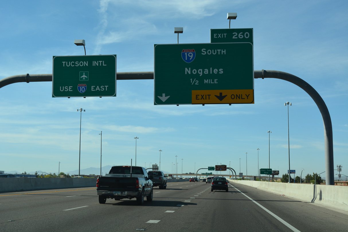
Traffic to Tucson International Airport (TUS) is advised to use I-10, even though the airport can be accessed via Interstate 19 at Valencia Boulevard.
04/26/17
04/26/17
The Crossing, a $54.3 million project, rebuilt the trumpet interchange joining I-10/19 into a three level, systems exchange. Following over two years of work, an event held on August 7, 2004 celebrated completion of work.2,3
04/26/17
Replacing U.S. 89, Interstate 19 travels 63.70 miles south from Exit 260 to Business Loop I-19 (Compound Street) at West Street outside Downtown Nogales.
04/26/17
Curving east, Interstate 10 passes through South Tucson to Exit 261 for S 6th Avenue.
01/13/06
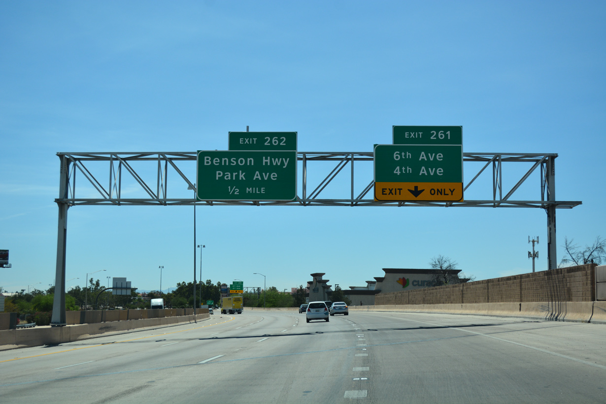
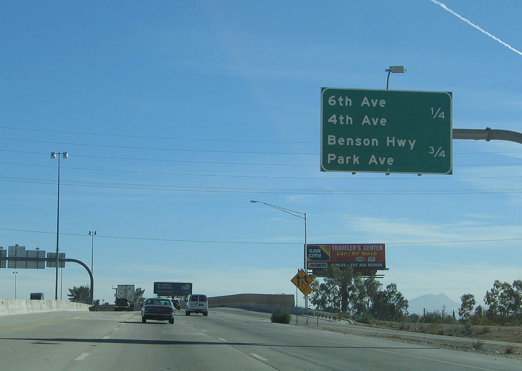
The split diamond interchange (Exit 261) joining S 6th and 4th Avenues utilizes Benson Highway, the I-10 frontage road system.
04/26/17
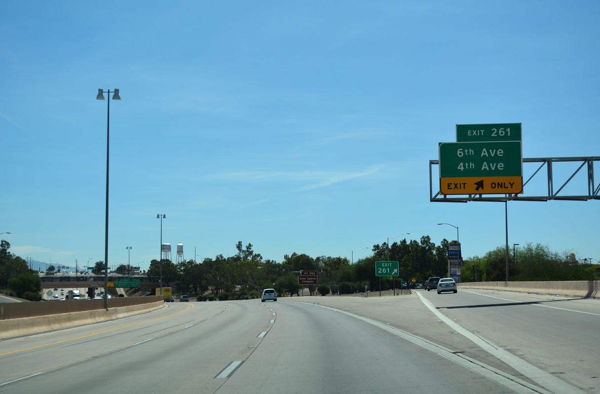
The exchange at S 6th Avenue is where U.S. 80 and U.S. 89 historically met.
04/26/17
04/26/17
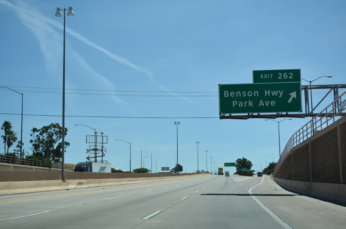
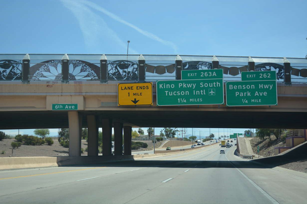
Exit 262 comprises a slip ramp onto adjacent Benson Highway. Branching southeast to Valencia Road, Benson Highway is old U.S. 80 and was Business Loop I-10 until 2003.
04/26/17
04/26/17
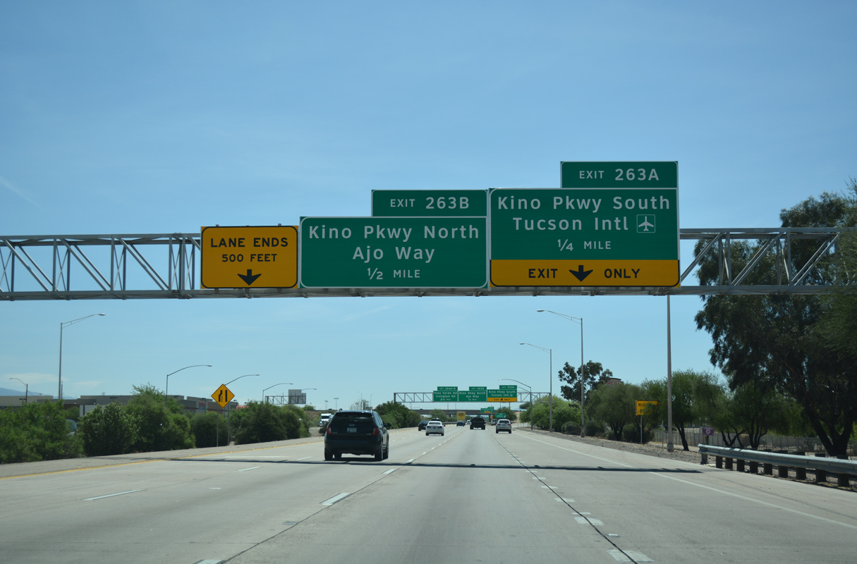
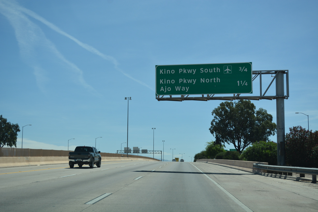
Leading north into Tucson, Kino Parkway is an arterial connecting with SR 210 (Aviation Parkway) between Downtown and the Davis-Monthan Air Force Base.
04/26/17
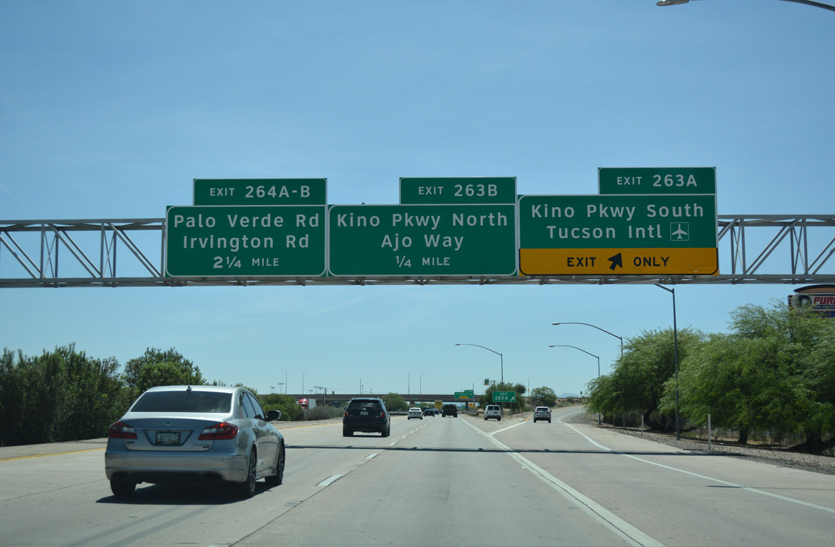
South from Exit 263A, Kino Parkway becomes Campbell Avenue en route to Valencia Road at Tucson International Airport (TUS).
04/26/17
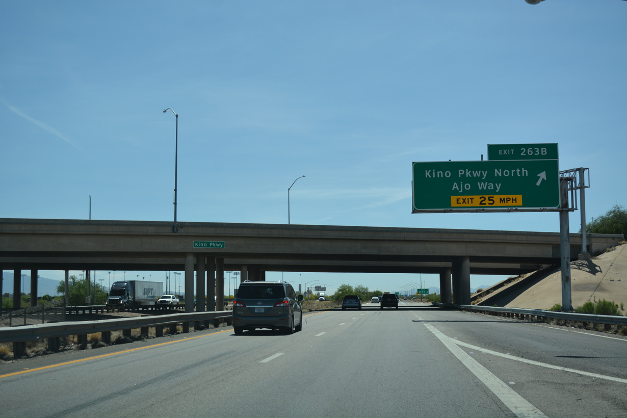
Exit 263B loops north onto Kino Parkway north ahead of Ajo Way. Ajo Way is an arterial that becomes SR 86 west of Interstate 19.
04/26/17
02/28/09
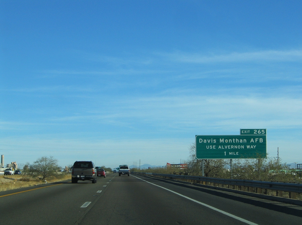
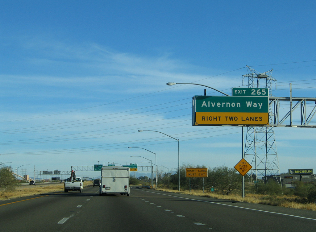
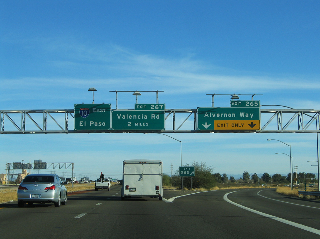
Davis-Monthan Air Force Base lies east of forthcoming Alvernon Way and north of Valencia Road.
01/13/06
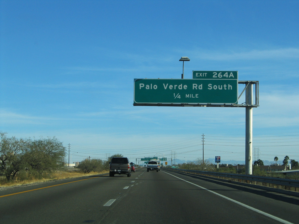
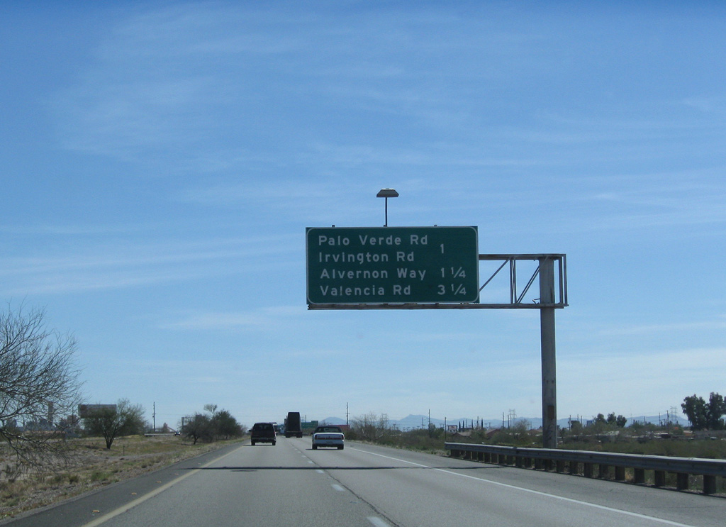
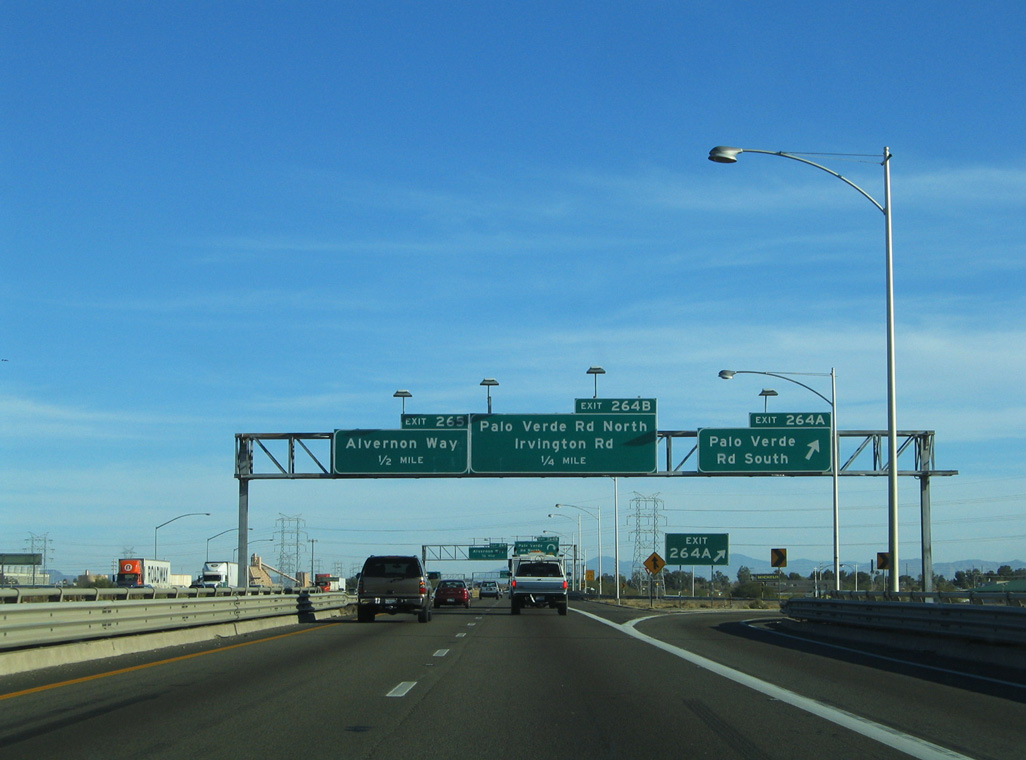
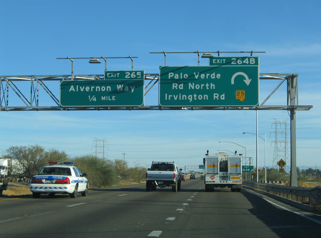
A three quarter cloverleaf interchange at Exits 264 A/B joins Interstate 10 with Palo Verde Road south of Irvington Road.
01/13/06
01/13/06
01/13/06
01/13/06
01/13/06
01/13/06
01/13/06
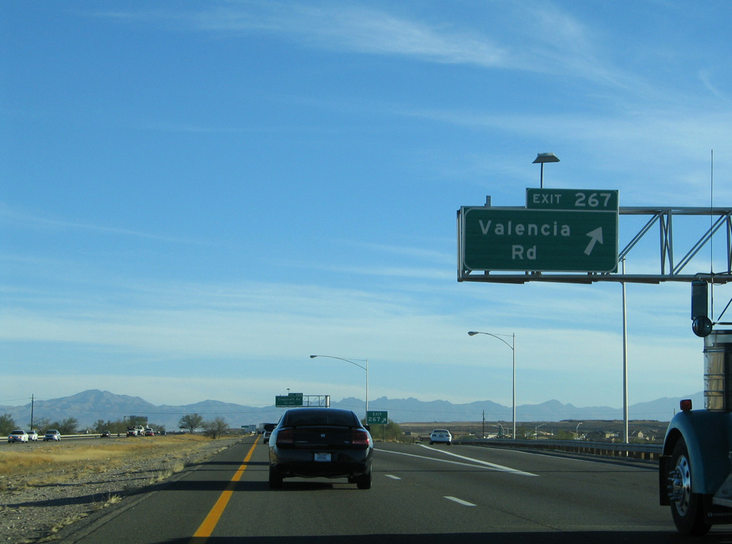
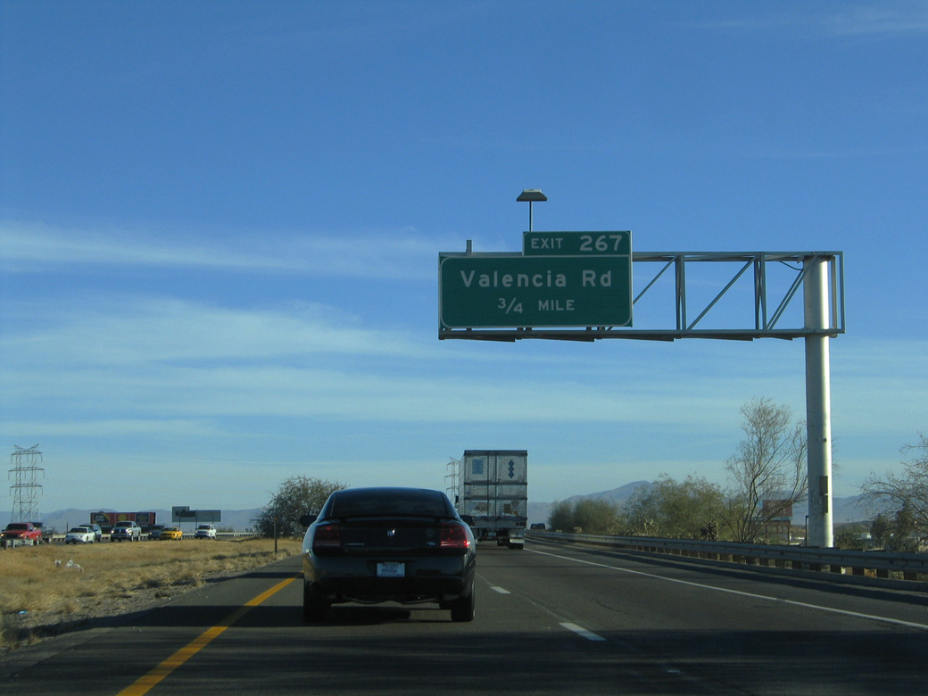
Valencia Road runs west to Tucson International Airport (TUS) and east to the Pima Air and Space Museum south of Davis Monthan-Tucson Air Force Base.
01/13/06
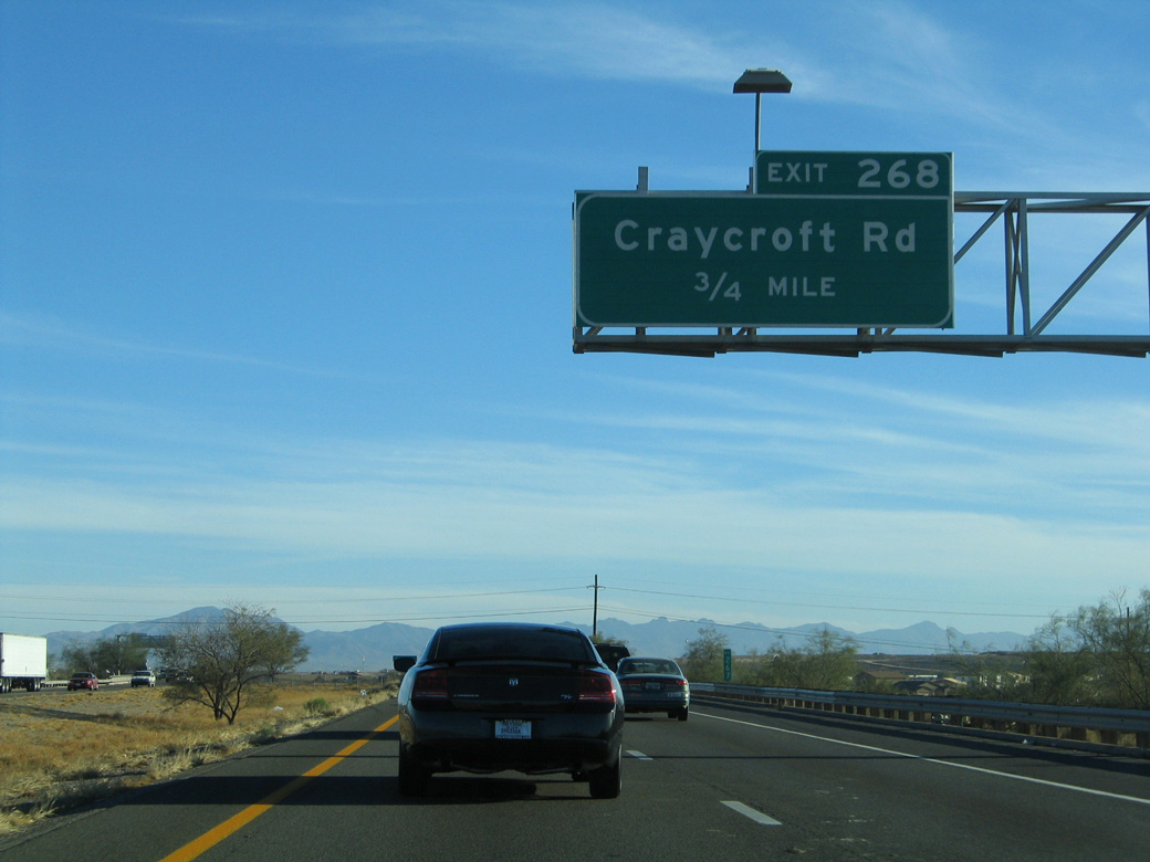
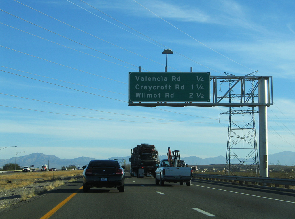
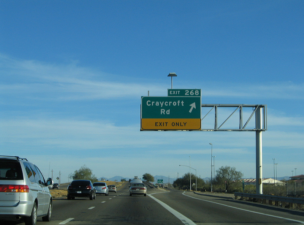
Continuing southeast, Interstate 10 meets Craycroft Road at Exit 268 and the community of Littletown.
01/13/06
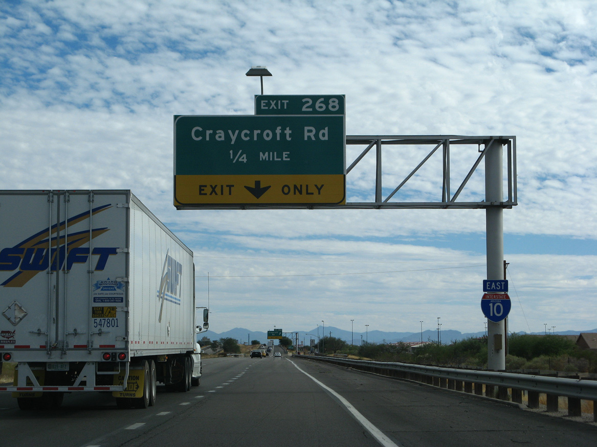
Craycroft Road south links Interstate 10 with Los Reales Road west toward Tucson International Airport (TUS).
11/10/07
01/13/06

Sources:
- "I-19 project nearly complete; city, county projects abound." Inside Tucson Business (AZ) , July 19, 2004.
- "I-10/I-19 work's end cause for celebration." Arizona Daily Star, The (Tucson, AZ), August 3, 2004.
Photo Credits:
01/13/06, 11/10/07, 02/28/09, 04/26/17 by AARoads
Connect with:
Interstate 19
Former Business Loop I-10 - Benson Highway
State Route 77
Page Updated 04-11-2022.