|
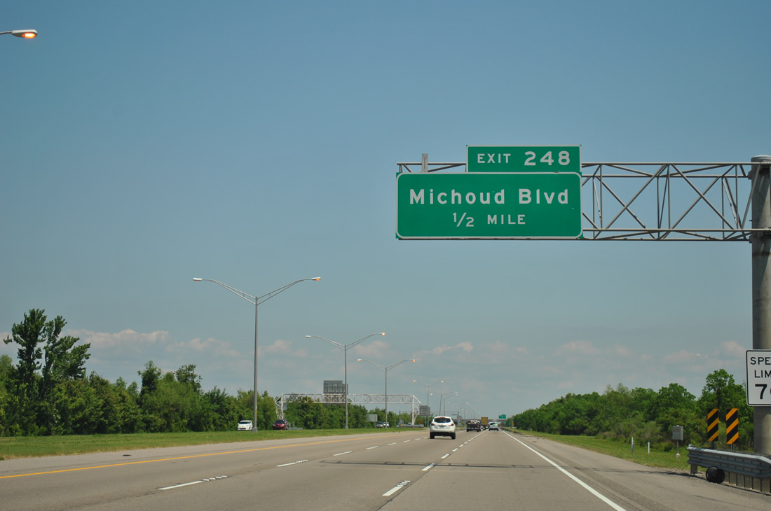
| The last exit for the city of New Orleans on eastbound Interstate 10 is Exit 248 (Michoud Boulevard). Speed limits increase to 70 mph as the freeway departs the urban area of New Orleans East. Michoud Boulevard begins at the forthcoming diamond interchange and travels southward from there to Lake Forest Boulevard, U.S. 90 (Chef Menteur Highway), and Old Gentilly Road (at the NASA Michoud Facility). 04/20/12 |
|
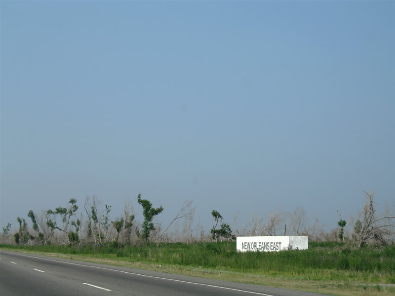
| The New Orleans East sign block lies near the former Oak Island Apartments between Interstate 10 and Michoud Boulevard. Tree damage to New Orleans East was catastrophic in the areas near the Villages of Oak Island subdivision and Michoud though nature has made a strong comeback as of 2012. 06/10/06 |
|
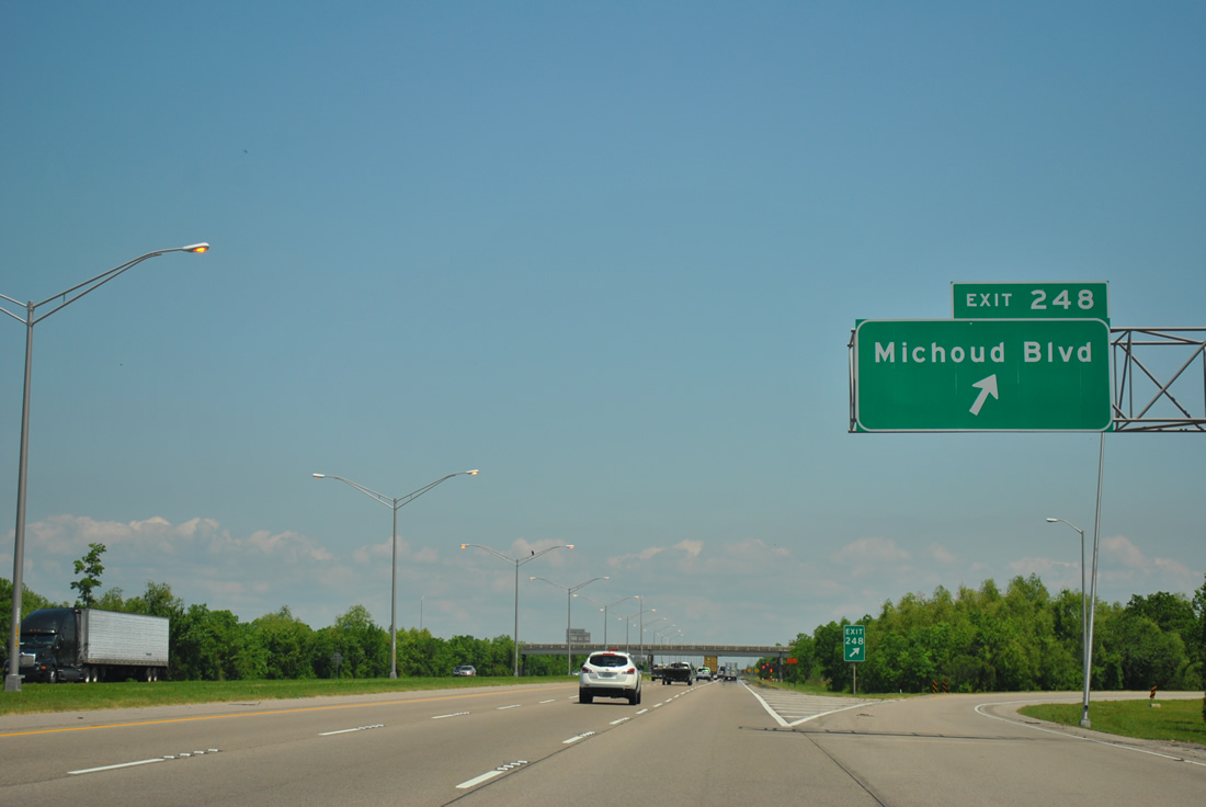
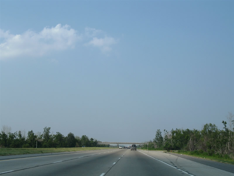
| Interstate 10 eastbound at the Exit 248 ramp departure to Michoud Boulevard south. Michoud Boulevard travels south from Lake Marseille and the Villages of Oak Island to Lake Forest Boulevard near the former Six Flags New Orleans theme park. 04/20/12 |
|
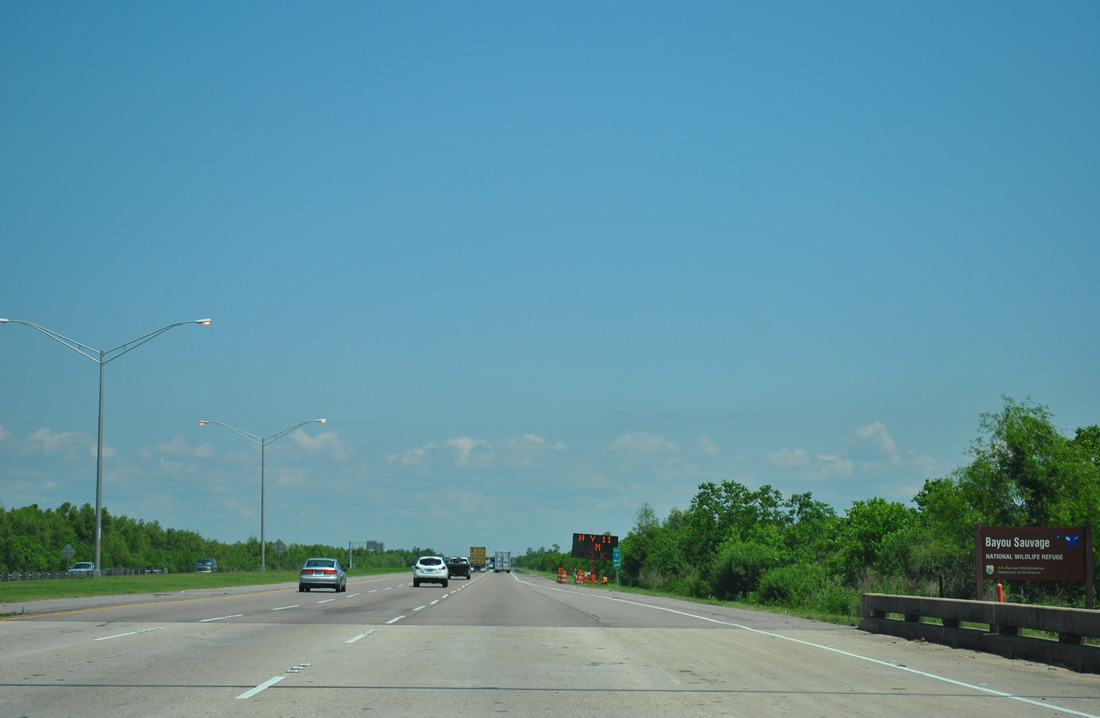
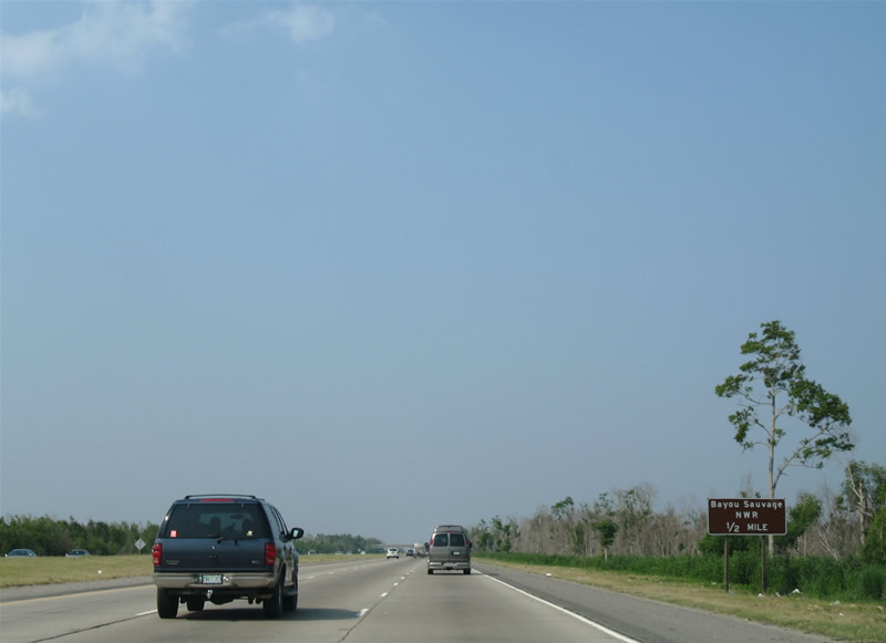
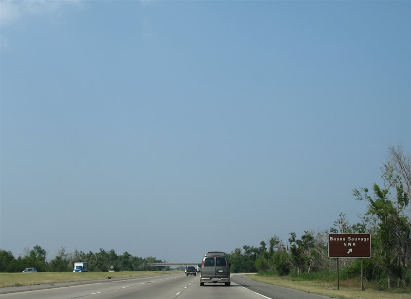
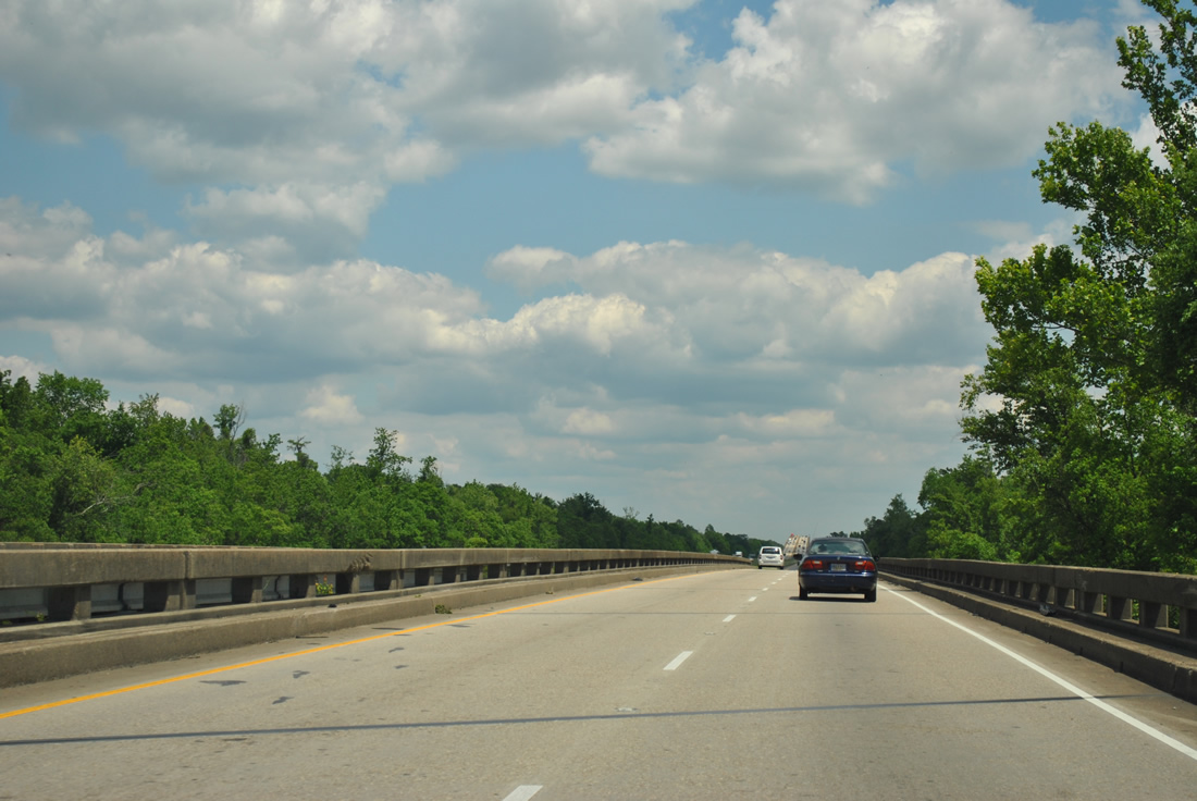
| The freeway enters the Bayou Sauvage National Wildlife Refuge in northeastern New Orleans. Established in 1990, the refuge represents the largest such preserve within an urban area in the United States. 04/20/12 |
|
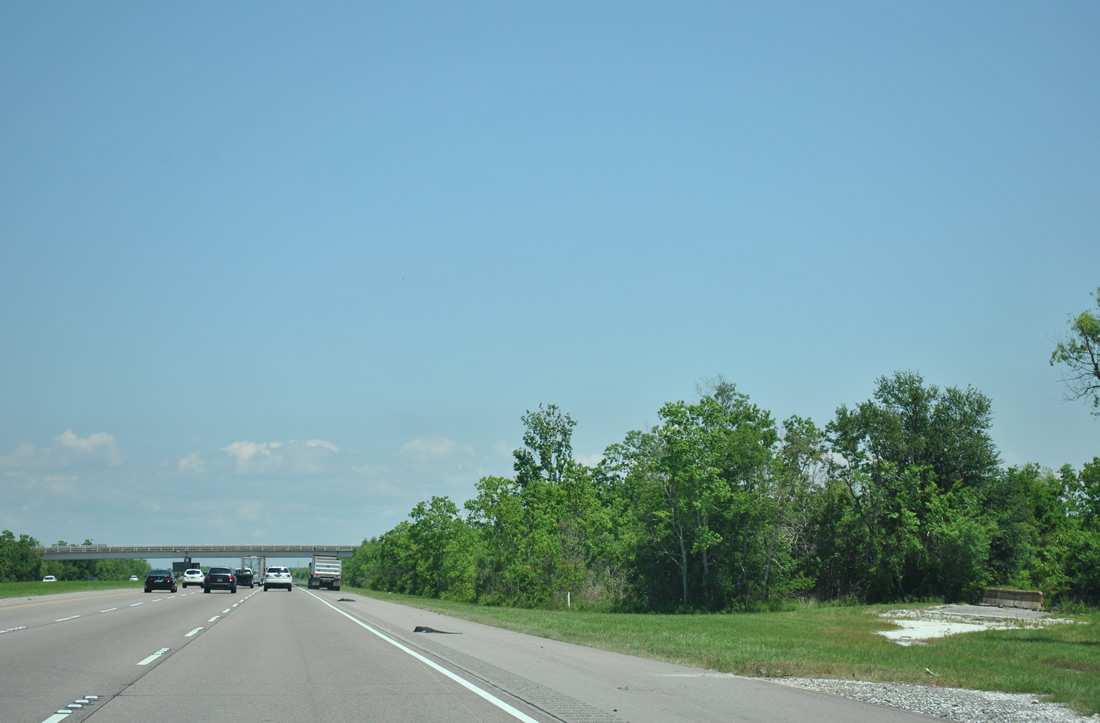
| The first of two abandoned interchanges within the Bayou Sauvage National Wildlife Area on Interstate 10 eastbound is the Exit 250 diamond interchange. Overgrown with vegetation, concrete barricades prevent motorists from using the ramps to the overpass. Repaving of Interstate 10 with asphalt corresponded with the removal of the concrete acceleration and deceleration lanes to the former Exit 250. 06/10/06, 04/20/12 |
|
| The second Bayou Sauvage National Wildlife Refuge interchange joined the freeway with the Wildlife Refuge Bikeway, alligator park, and swamp tour parking area. 06/10/06 |
|
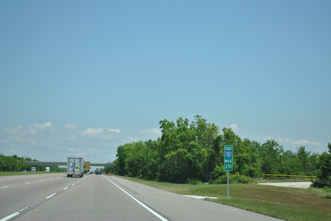
| Eastbound at the former Exit 251 to Bayou Sauvage National Wildlife Refuge. The ramps connected to an overpass and an adjacent nearby parking area. This interchange reopened in 1999 and was permanently closed after 2006. 06/10/06, 04/20/12 |
|
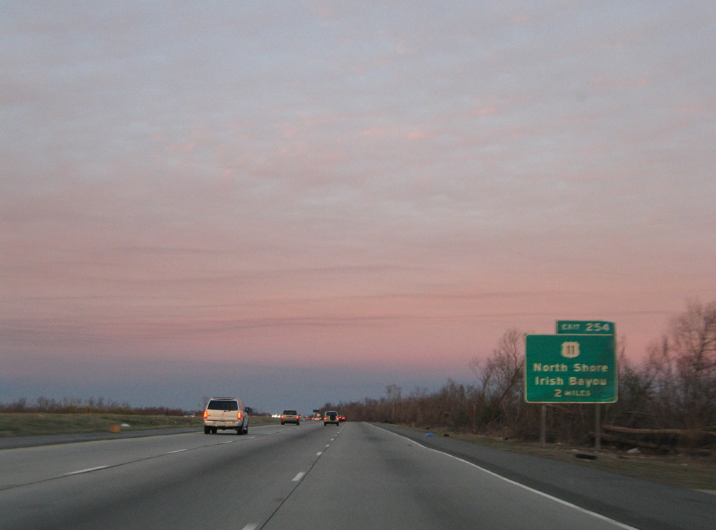
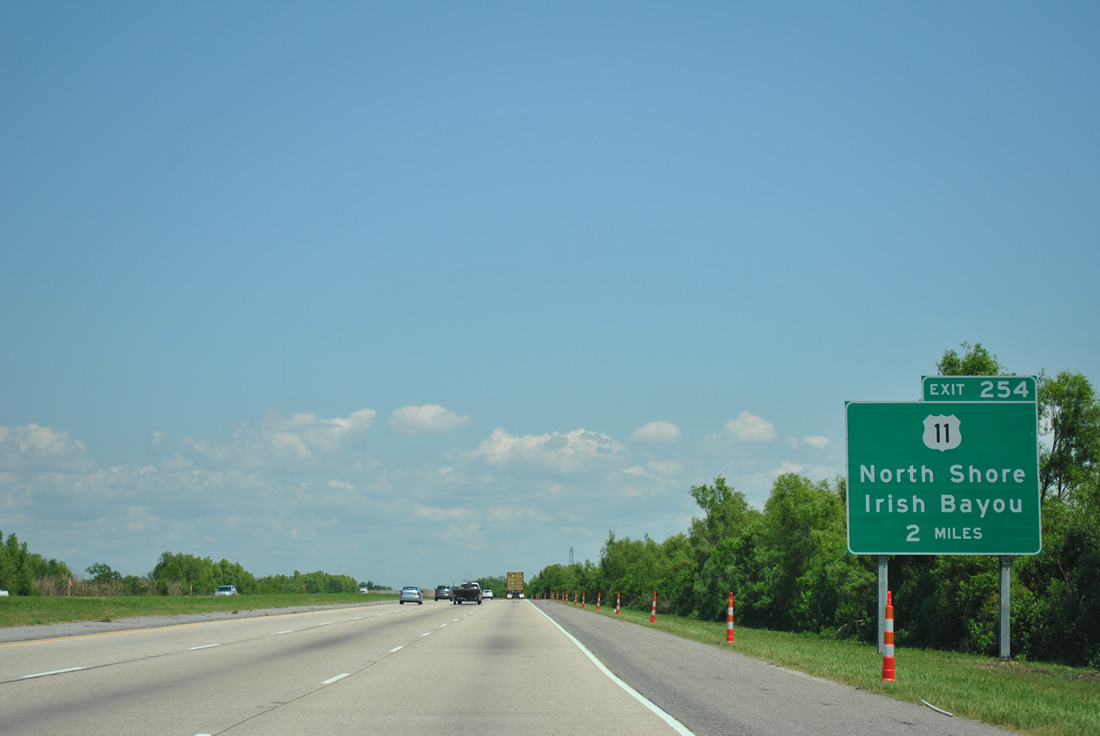
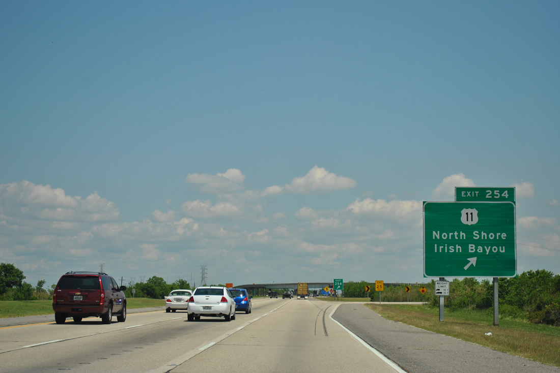
| Hurricane Katrina toppled or damaged most guide signs for the Exit 254 interchange with U.S. 11 at Irish Bayou. New signs were installed between 2011-12 in both directions for the exit.
U.S. 11 enters the Irish Bayou area from Powers Junction and U.S. 90 (Chef Menteur Highway) 5.75 miles to the south. The US highway crosses paths with Interstate 10 ahead of the 5-Mile Bridge over Lake Pontchartrain. 01/15/06, 04/20/12 |
|
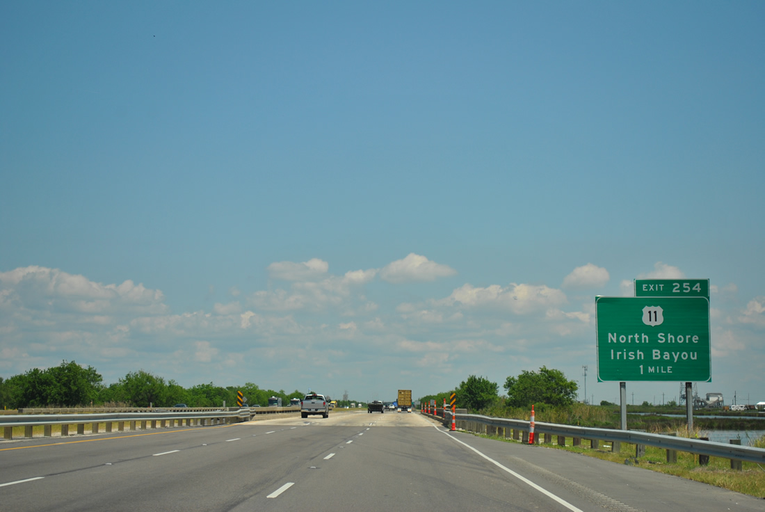
| One mile southwest of the Exit 254 parclo interchange with U.S. 11 along Interstate 10 east. U.S. 11 begins in New Orleans and ends at the Canadian border near Rouses Point, New York, 1,645 miles to the north. 04/20/12 |
|
| U.S. 11 continues north from Irish Bayou and Point aux Herbes to the Lake Pontchartrain Northshore at Slidell. The 5-Mile Bridge consists of a two lane concrete bridge with two draw spans at the lake navigation channels. For a short period of time after Hurricane Katrina's landfall, the U.S. 11 span was the only in operation between New Orleans and Slidell. 04/20/12 |
|
| Interstate 10 switches sides with U.S. 11 as both head northward across Lake Pontchartrain to Slidell. The U.S. 11 crossing opened on February 18, 1928 as a private toll bridge. It was purchased by the state in 1938 and reassigned as U.S. 11 by 1941 as tolls were removed.1 04/20/12 |
|
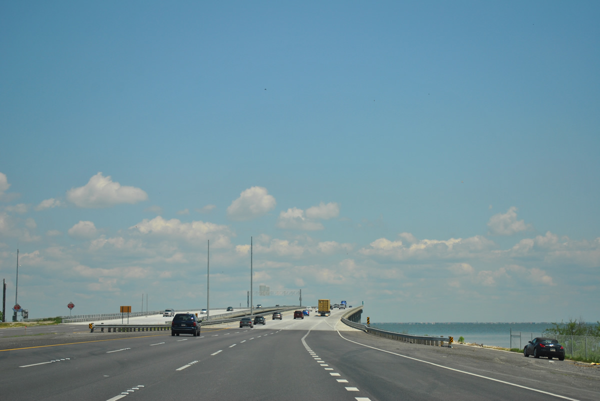
| The U.S. 11 eastbound on-ramp joins Interstate 10 as the freeway begins to cross Lake Pontchartrain at Point aux Herbes. A $733 million project constructed two new three lane bridges with full shoulders to replace the 1965 Twin Bridges severely damaged by Hurricane Katrina in 2005. 04/20/12 |
|
| The new Twin Bridges were completed in September 2011 at a cost $70 million below the estimated $833 million price tag given in January 2006. Designed to have a 100-year lifespan, the bridge uses high performance concrete. These elements and the cost savings led the bridge to be nominated for the American Association of State Highway & Transportation Officials (AASHTO), AAA, and the US Chamber of Commerce sponsored People's Choice Award in 2012. 04/20/12 |
|
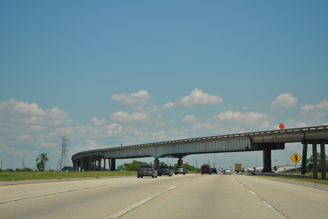
| Nearing the first of three emergency crossovers linking the two Twin Bridges of Interstate 10. The end crossovers were used to connect traffic between the two spans during construction as sections of both bridges were utilized as a seamless mainline until the land approaches were completed. 04/20/12 |
|
| Far to the east of Interstate 10 is the U.S. 90 Rigolets Bridge at Fort Pike. Replacement of the 1930 Rigolets bridge commenced in October 2004, but was delayed eight months due to Hurricane Katrina. The $50 million span opened January 15, 2008.2 04/20/12 |
|
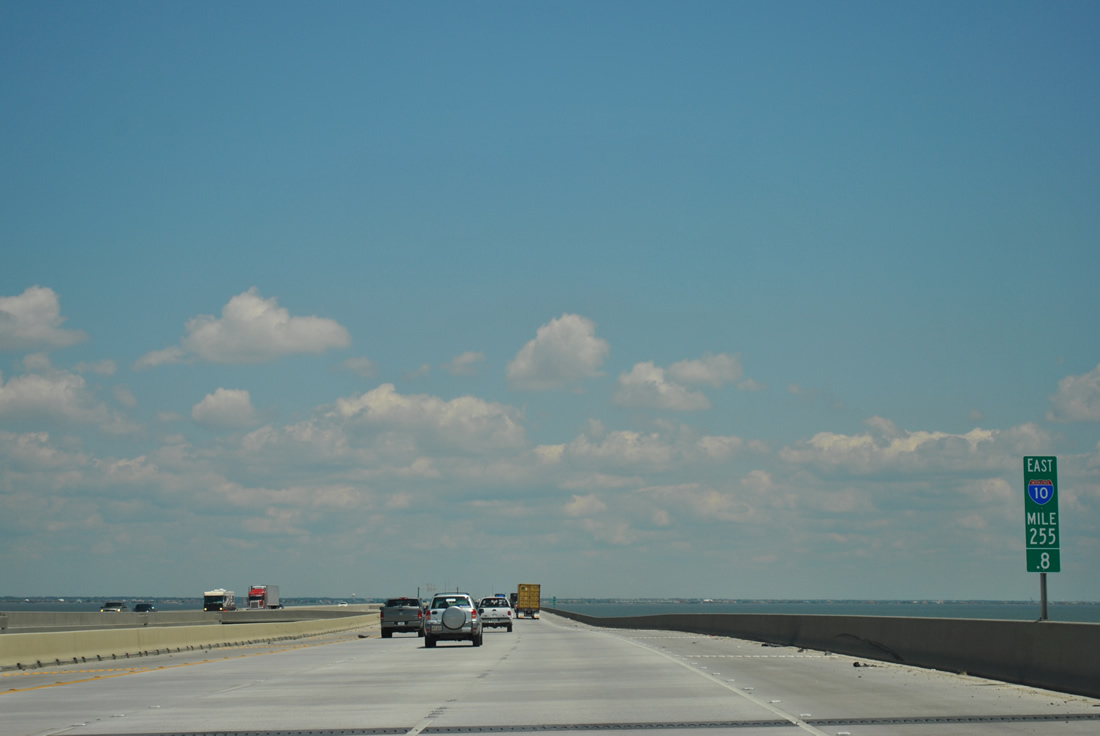
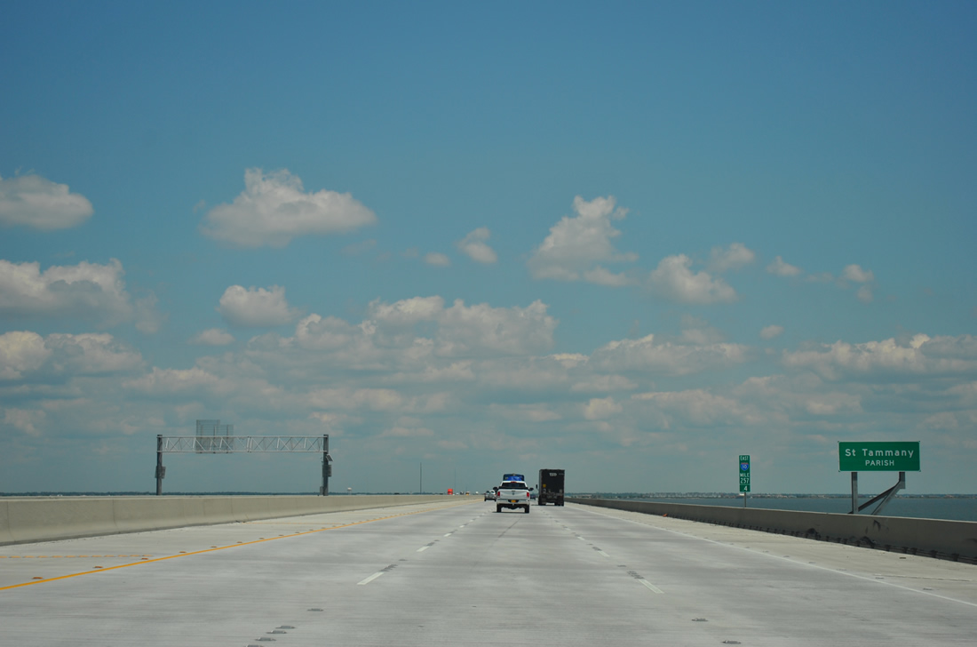
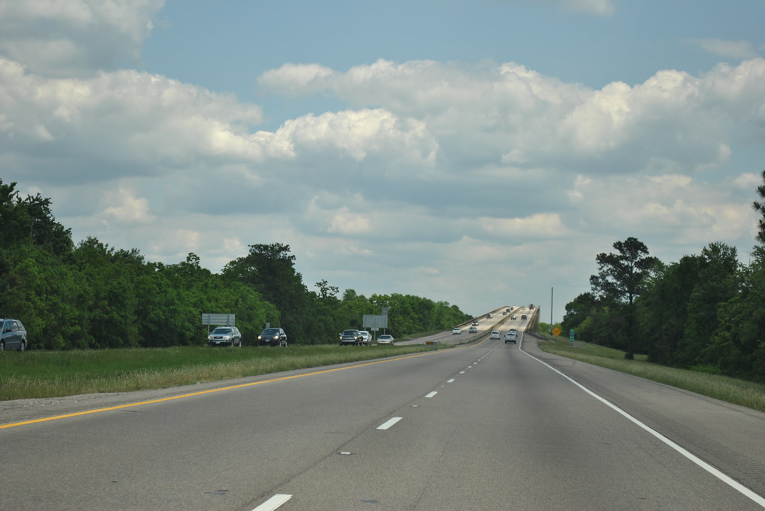
| Interstate 10 enters St. Tammany Parish, the last parish encountered along the 274 mile trek across the Pelican State. 04/20/12 |
|
| 60 mile per hour speed limits, the same as the 1965 Twin Bridges, are posted. Each bridge includes 12 foot inner and outer shoulders and travels at a height of 30 feet above the brackish waters of Lake Pontchartrain below. 04/20/12 |
|
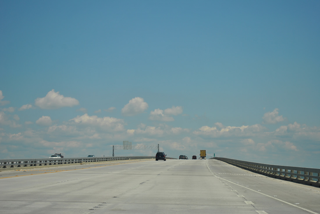
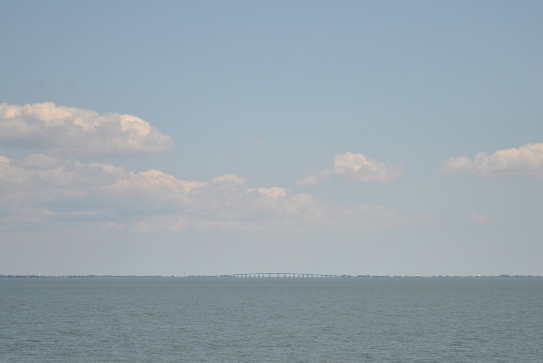
| Cresting to a height of 80 feet along Interstate 10 east at the main navigation channel of Lake Pontchartrain. 04/20/12 |
|
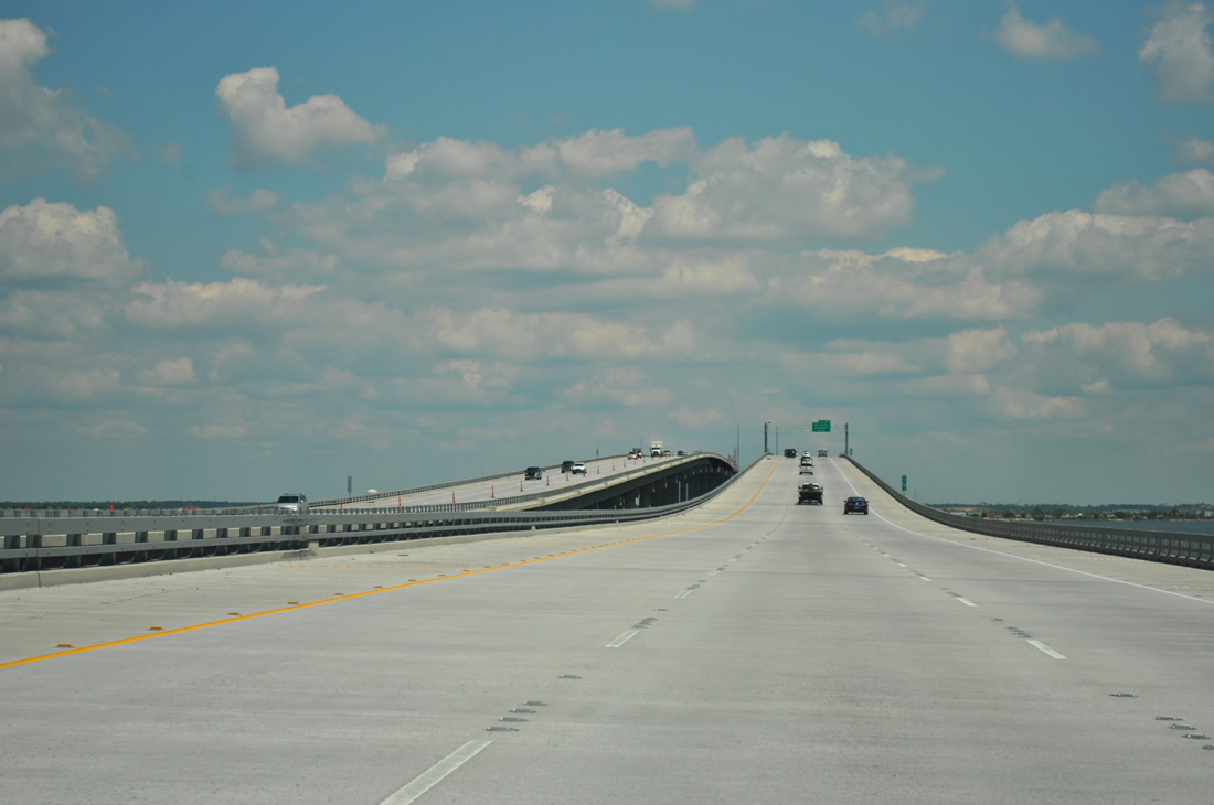
| Exit 261 with Oak Harbor Boulevard at Eden Isles resides just past the northern end of the bridge in two miles. 04/20/12 |
|
| Lowering toward the Northshore, Lakeshore Estates and Eden Isles come into view as does the St. Tammany Fishing Pier, two sections of the 1965 Twin Bridges retained for use as a public fishing facility. The final crossover also appears. 04/20/12 |
|
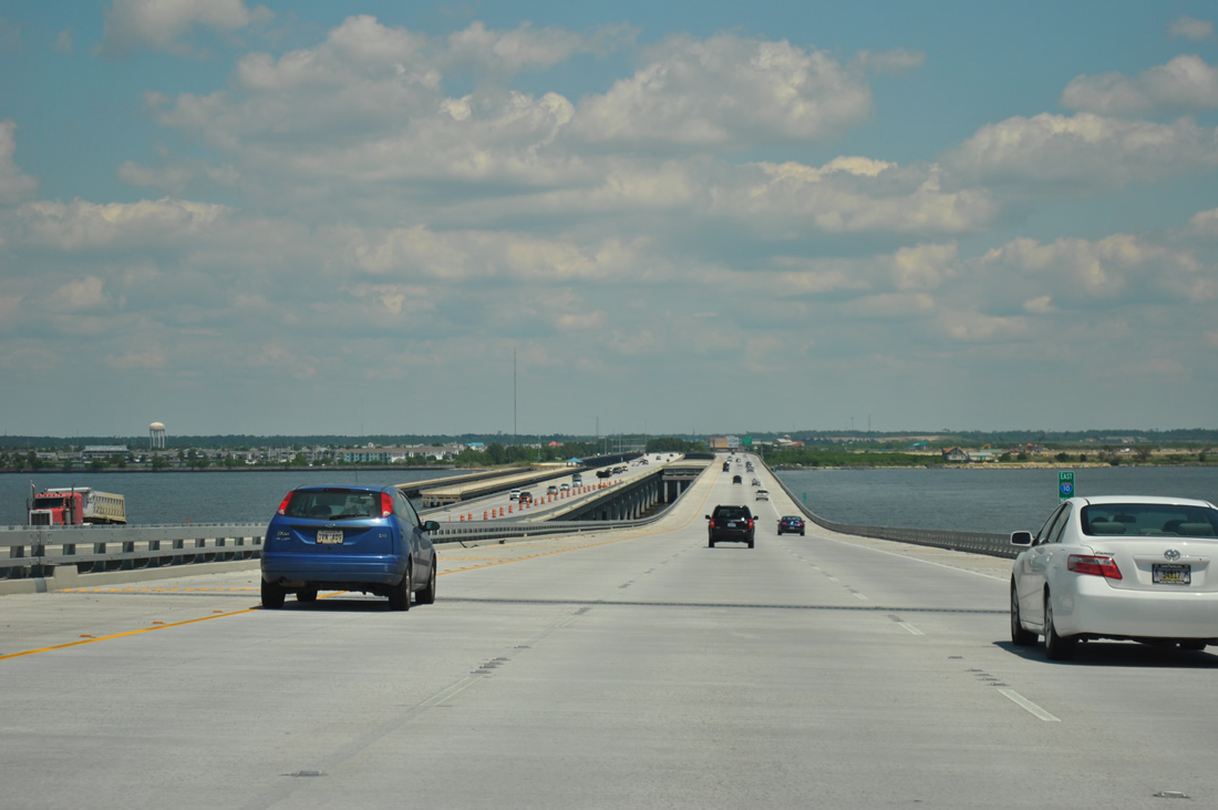
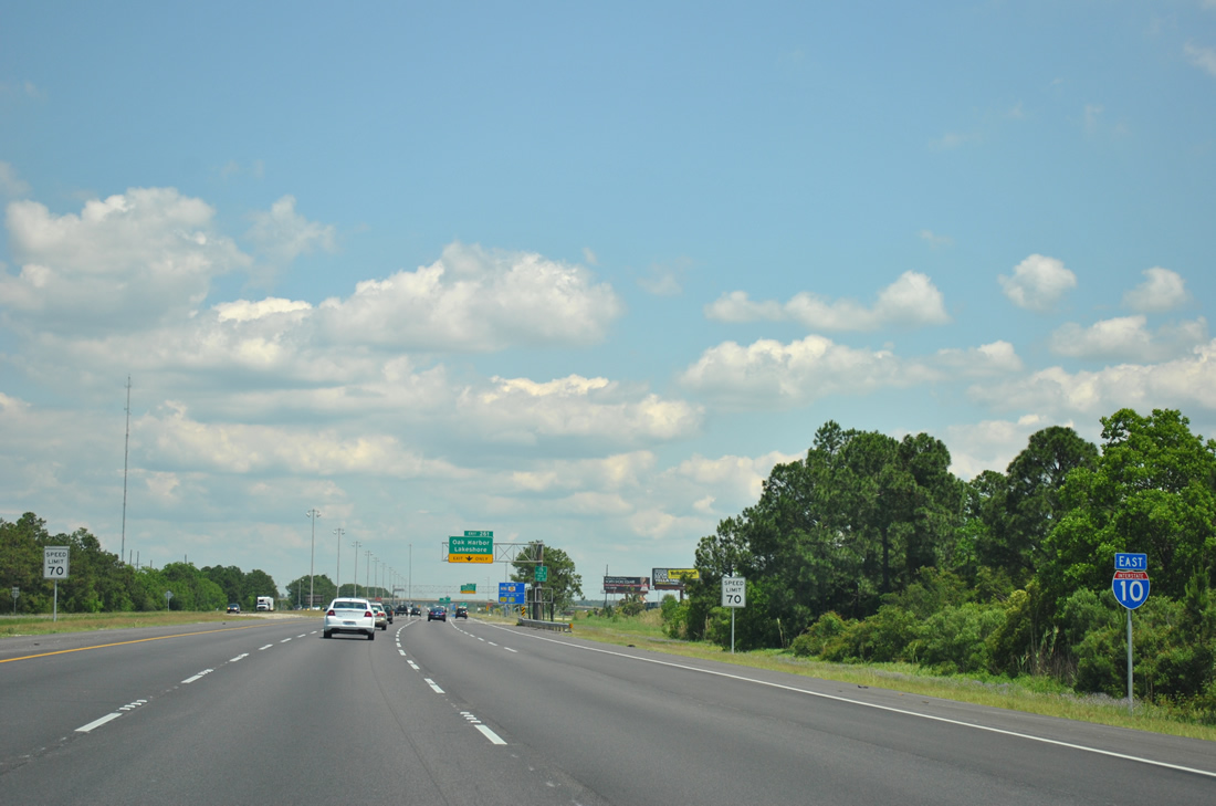
| One mile south of Exit 261 on Interstate 10 eastbound. This exit serves the growing Lakeshore community to the east and Oak Harbor between I-10 and U.S. 11 (Pontchartrain Drive) to the west. 04/20/12 |
|
| Reassurance shield posted as Interstate 10 leaves the Twin Bridges and enters the Slidell area. 04/20/12 |
|
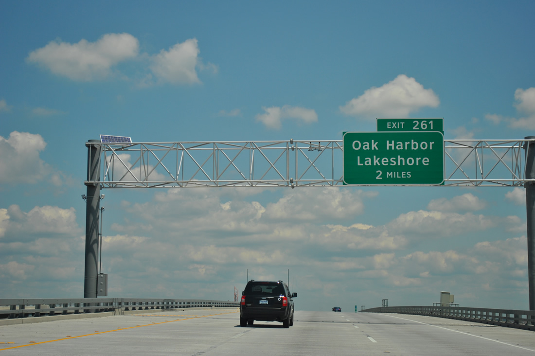
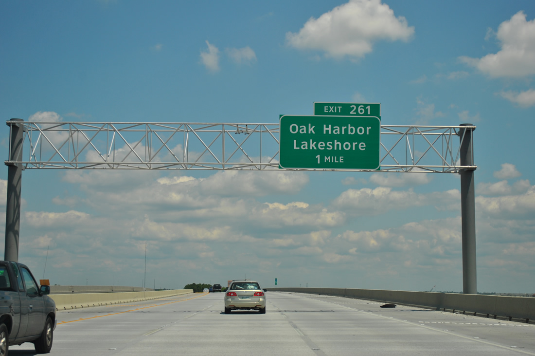
| Interstate 10 east expands from the Twin Bridges to four overall lanes to Exit 261. Eden Isles lies along Oak Harbor Boulevard and Eden Isles Drive to the west between the freeway and U.S. 11 (Pontchartrain Drive).
Sign changes made at Exit 261 between 2006 and 2009 replaced Eden Isles with Lakeshore. 06/10/06 |
|
| Interstate 10 east expands from the Twin Bridges to four overall lanes to Exit 261. Eden Isles lies along Oak Harbor Boulevard and Eden Isles Drive to the west between the freeway and U.S. 11 (Pontchartrain Drive).
Sign changes made at Exit 261 between 2006 and 2010 replaced Eden Isles with Lakeshore. 04/20/12 |
|
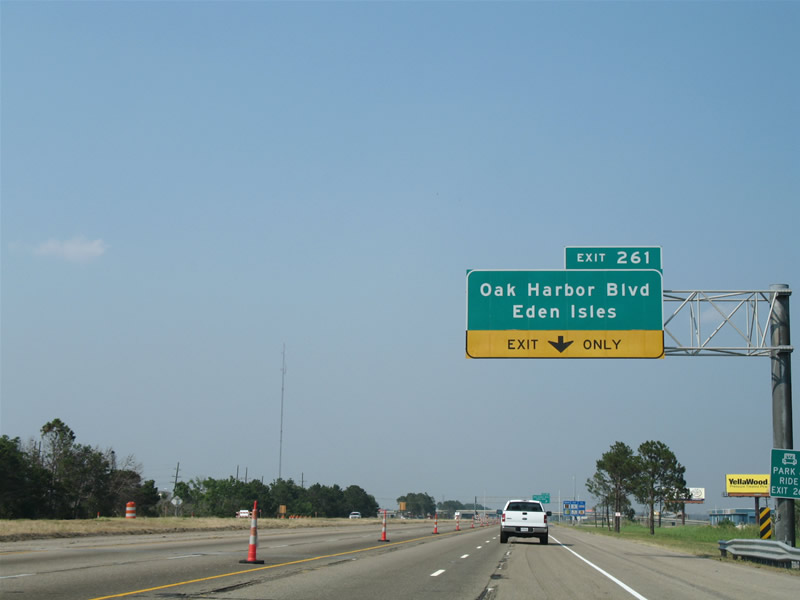
| Eastbound at the Exit 261 two lane off-ramp to Oak Harbor Boulevard. Oak Harbor Boulevard ends at U.S. 11 to the west and at the intersection with Lake Shore Boulevard East, North and South to the east. There is no access to LA 433, outside of the I-10 Frontage Road. 10/24/09, 04/20/12 |
|
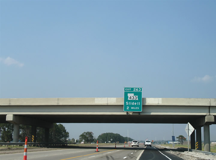
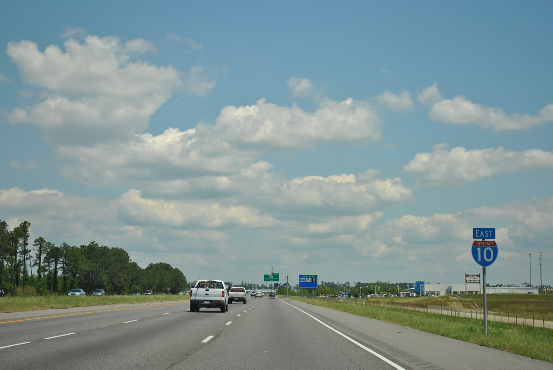
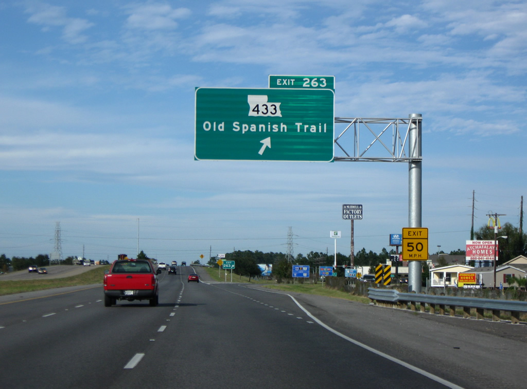
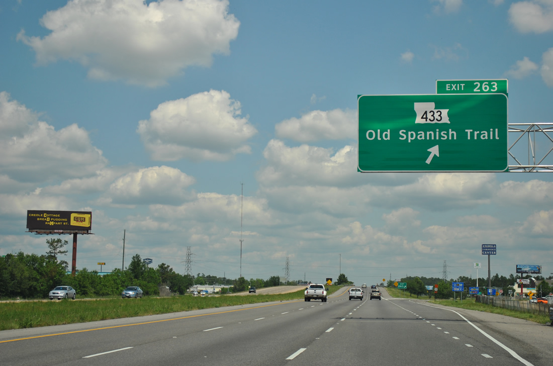
| Two mile overhead, and the replacement, for the Exit 263 (LA 433) diamond interchange on Interstate 10 eastbound. LA 433 is a 14.86 mile route between U.S. 90 at the Rigolets and U.S. 190 west of Slidell. Locally the state highway parallels the East Diversion Canal along Rigolets Avenue southeast and Old Spanish Trail westward to U.S. 11. 06/10/06, 04/20/12 |
|
| Interstate 10 straddles the Slidell city line and an eastbound side frontage road to Exit 263. 04/20/12 |
|
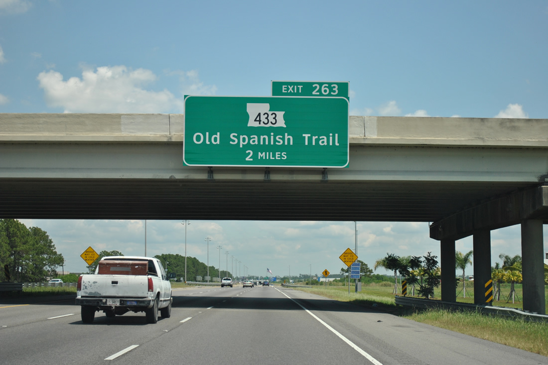
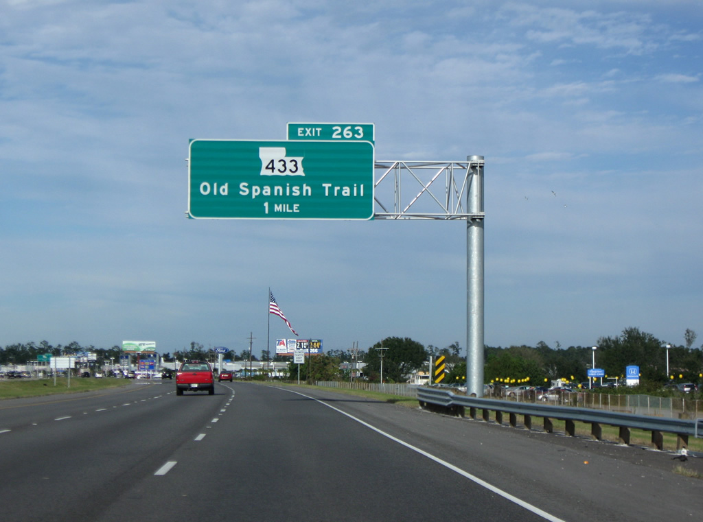
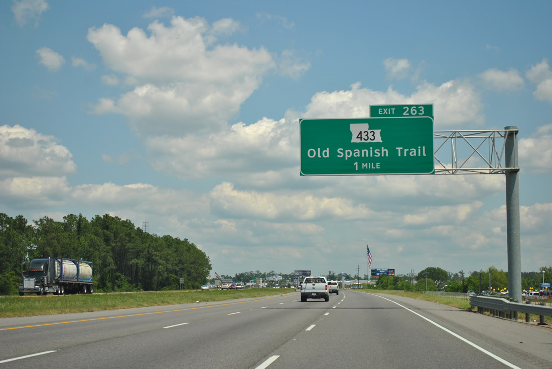
| Interstate 10 eastbound one mile ahead of Exit 263 (LA 433). LA 433 (Old Spanish Trail & Rigolets Avenue) represents the original LA 2 and U.S. 90 alignment through the Slidell area. U.S. 11 and 90 once shared pavement from Slidell northward to Saint Rose, Mississippi. The cosigning existed before the completion of the U.S. 90 Pearl River crossing at Pearlington. Before that time, U.S. 90 traveled along LA 433 northward from the Rigolets to its merge with U.S. 11 through downtown Slidell. 10/24/09, 04/20/12 |
|
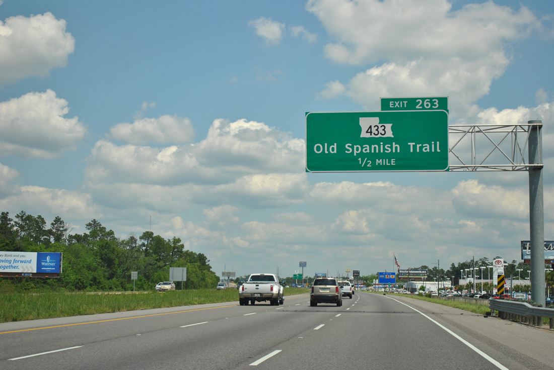
| LA 433 (Old Spanish Trail) merges with U.S. 11 (Pontchartrain Drive) briefly to the west before departing the Slidell area for the communities of Bayou Liberty and Bontouca. 04/20/12 |
|
| Exit 263 departs Interstate 10 eastbound to LA 433 (Old Spanish Trail). This exit serves south Slidell and the Rigolets area near Lake St. Catherine and south of downtown via U.S. 11 (Front Street) north. 10/24/09, 04/20/12 |
|
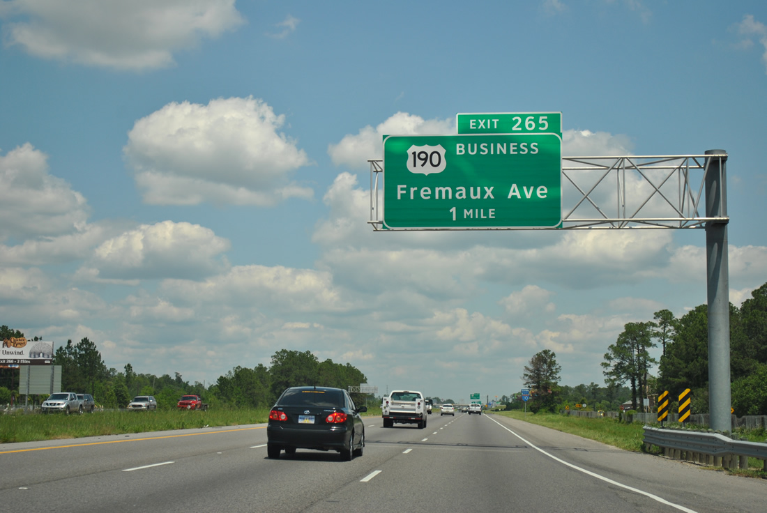
| A new interchange (Exit 265) opened on September 25, 2008 linking Interstate 10 with U.S. 190 Business (Fremaux Avenue). The $20 million project commenced in August 2006.3 04/20/12 |
|
| Continuing northward, drivers see this reassurance shield as Interstate 10 and adjacent Voters Road part ways. Construction of Exit 265 resulted in the removal of weigh stations along both sides of I-10, south of U.S. 190 Business. 04/20/12 |
|
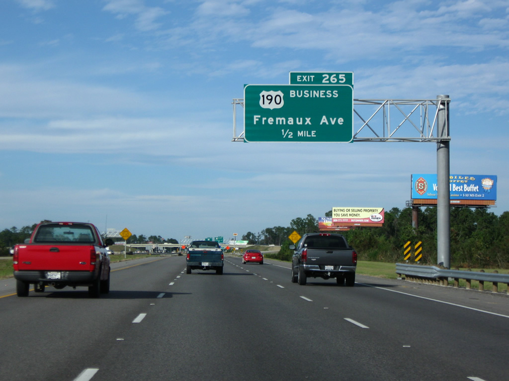
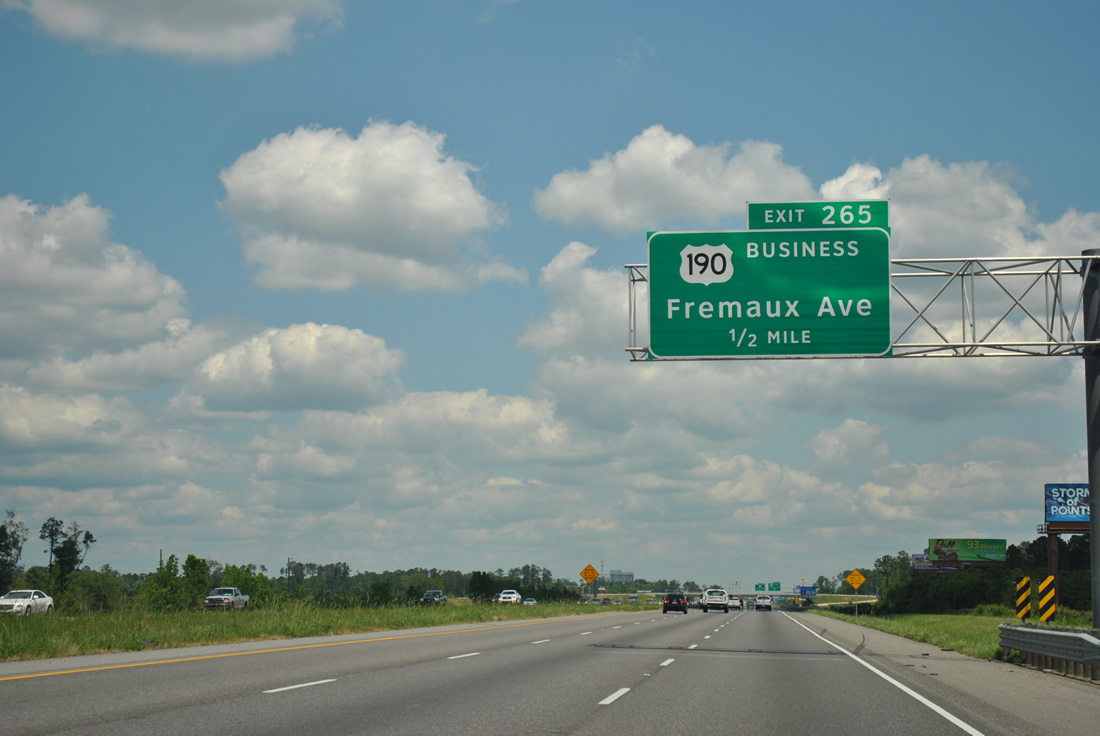
| One half mile south of the Exit 265 diamond interchange with Fremaux Avenue. U.S. 190 Business travels 3.9 miles between U.S. 11 (Front Street) and U.S. 190 (Military Road). 10/24/09, 04/20/12 |
|
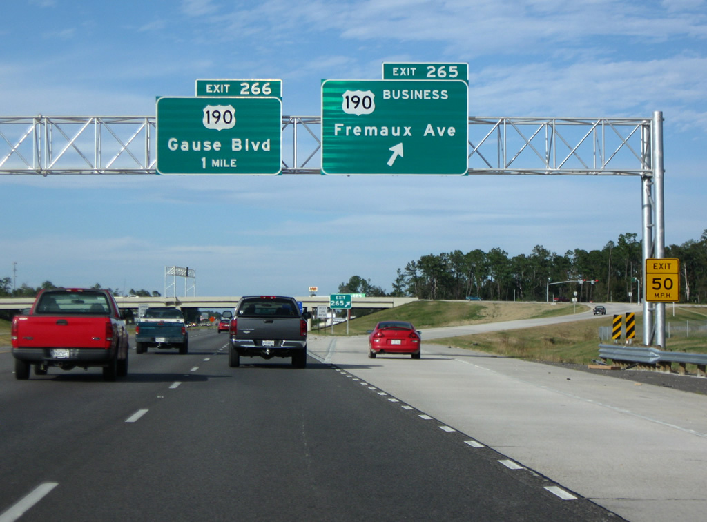
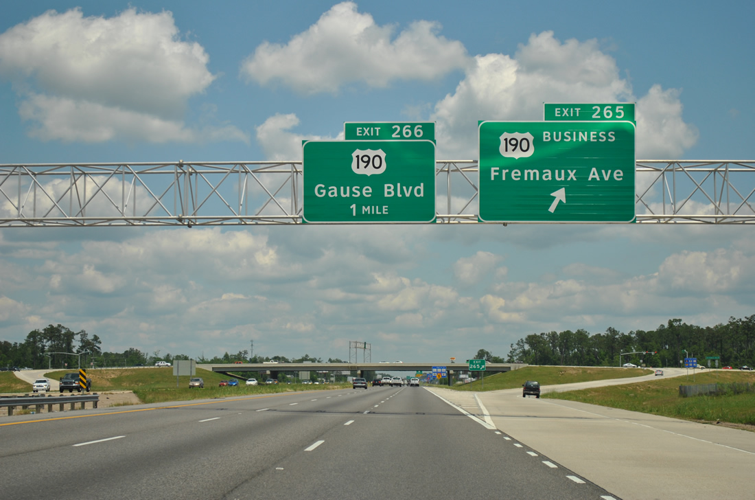
| Eastbound I-10 at Exit 265 to U.S. 190 Business. Fremaux Avenue carries the route westward to U.S. 11 (Front Street) and Downtown Slidell. Short Cut Highway continues the US route east to U.S. 190 (Military Road), 3.8 miles west of its conclusion at White Kitchen (U.S. 90). 10/24/09 |
|
| Eastbound at the ramp departure (Exit 265) to U.S. 190 Business on I-10. Fremaux Avenue carries the route westward to U.S. 11 (Front Street) and Downtown Slidell. Short Cut Highway continues the US route east to U.S. 190 (Military Road), 3.8 miles west of its conclusion at White Kitchen (U.S. 90). 04/20/12 |
|
| Traveling under U.S. 190 (Business) before construction of Exit 265 commenced. Ground level guide signs for forthcoming Exit 266 and U.S. 190 were replaced with overheads after the Fremaux Avenue interchange was completed. 06/10/06 |
|
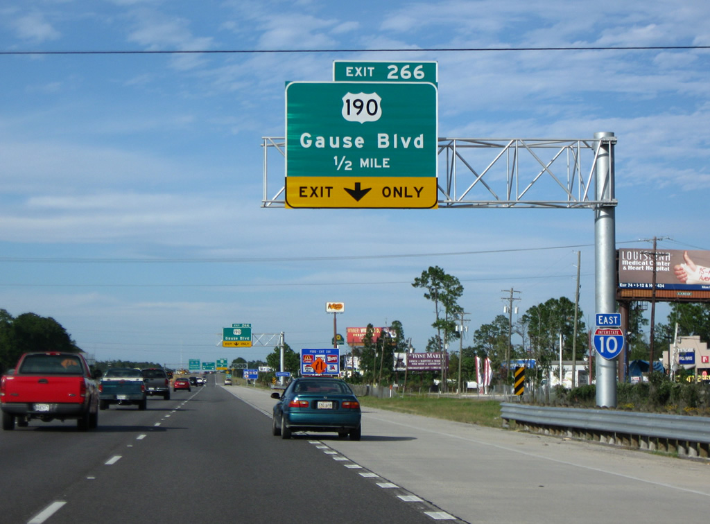
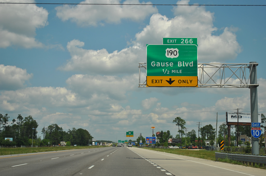
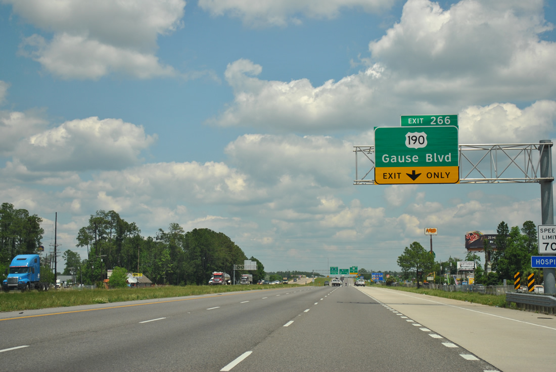
| Interstate 10 next meets U.S. 190 (Gause Boulevard) at the Exit 266 diamond interchange east of downtown Slidell. Gause Boulevard comprises one of the main east-west arterials through the city of Slidell, between LA 1090 (Military Road) and Northshore Boulevard. 10/24/09, 04/20/12 |
|
| The Fremaux Avenue on-ramp forms a fourth eastbound lane to Exit 266 and U.S. 190. U.S. 190 stretches 875 miles west from the Slidell area to Covington, Hammond, Baton Rouge, Opelousas, and Iraan, Texas. 04/20/12 |
|
| Exit 266 to U.S. 190 (Gause Boulevard) leaves Interstate 10 east, 1.50 miles south of the junction with Interstates 12 west and 59 north (Exit 266). Gause Boulevard represents the last opportunity for traveler services along Interstate 10 east until eastern Hancock County, Mississippi, over 20 miles away. 06/10/06, 04/20/12 |
|
| U.S. 190 shields posted along the Exit 266 off-ramp to Gause Boulevard. 06/10/06 |
|
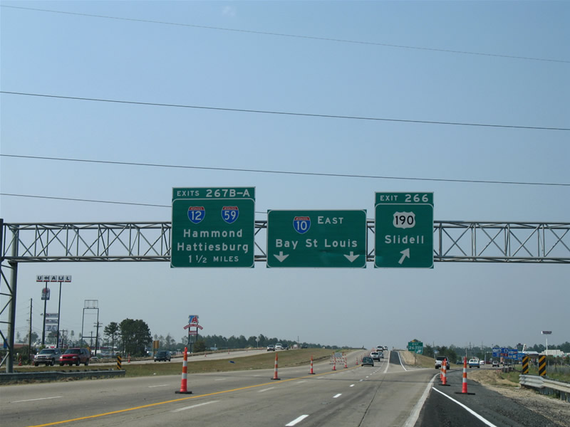
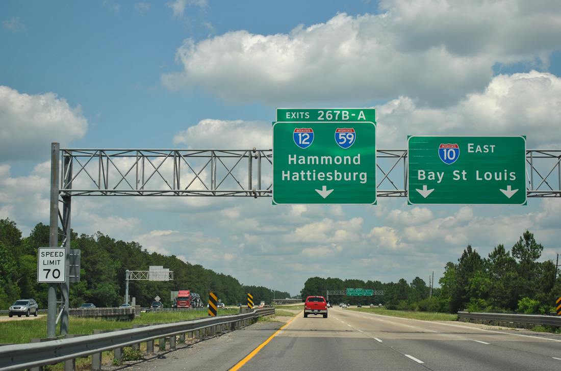
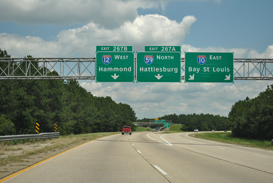
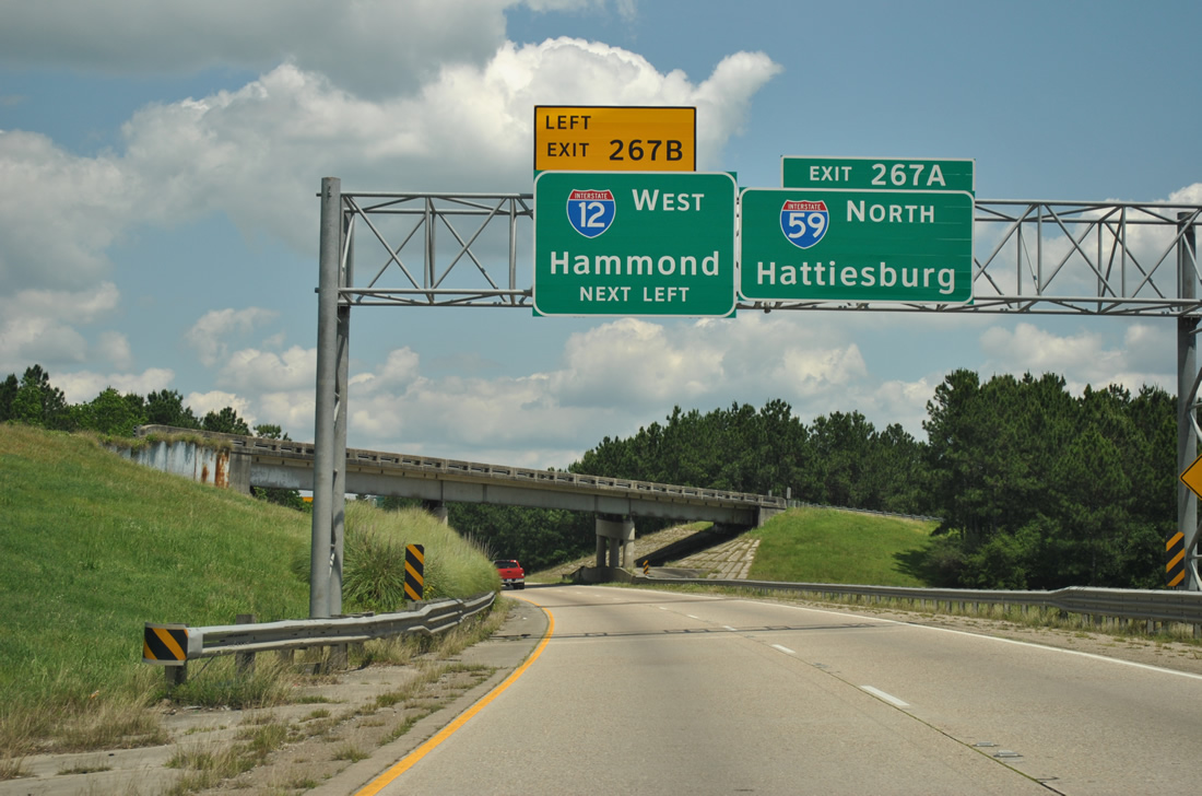
| Leaving the U.S. 190 interchange, Interstate 10 prepares to split with Interstate 59 northbound from its mainline at Exit 267A. Interstate 12 begins via a left side ramp from the Interstate 59 beginning as Exit 267B. Interstate 12 travels 80 miles westward to Baton Rouge while Interstate 59 travels 160 miles to Meridian. 06/10/06, 04/20/12 |
|
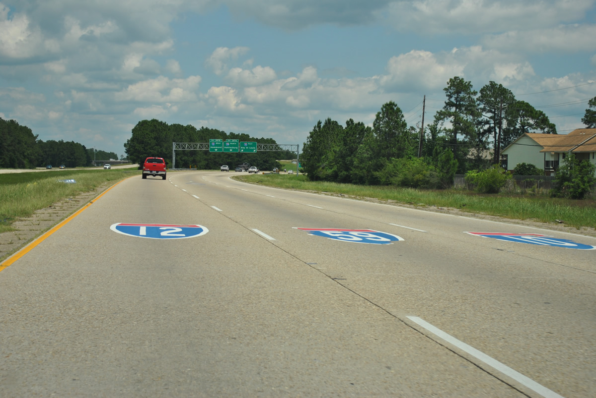
| Painted shields precede the Exit 267A/B directional cloverleaf interchange with Interstate 12 west and Interstate 59 north. These were added by 2008. 04/20/12 |
|
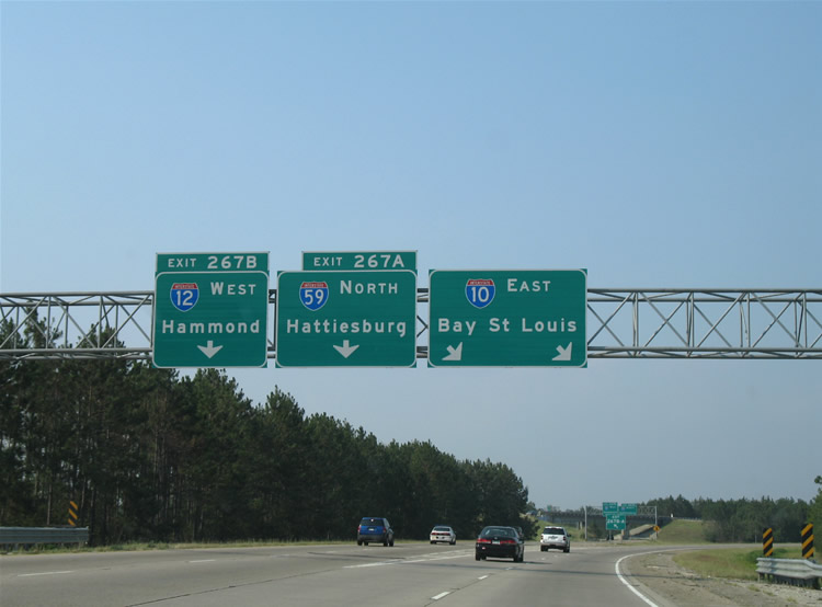
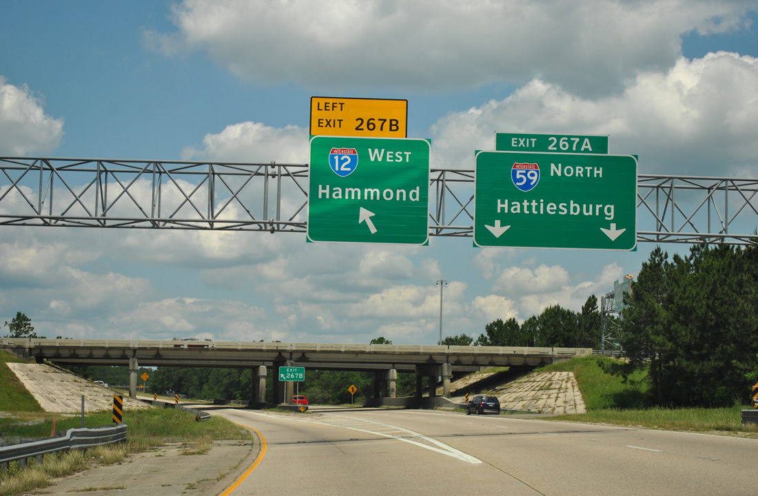
| Interstate 10 turns and resumes an east-west orientation at the northbound beginning of Interstate 59 (Exit 267A). Interstate 59 ventures northeast parallel to U.S. 11 for Pearl River, Picayune, Hattiesburg and Laurel, Mississippi while Interstate 10 continues east to Bay Saint Louis, Gulfport, Biloxi, Moss Point, and Mobile. 06/10/06, 04/20/12 |
|
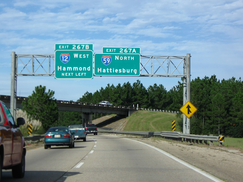
| Interstate 59 north provides the short connection for I-10 east to the westbound beginning of Interstate 12 to Mandeville, Covington, Hammond and Baton Rouge. The first interchange of both I-12 and I-59 connects with U.S. 11. 10/24/09, 04/20/12 |
|
| Exits 267A/B split below the Interstate 12 mainline. Interstate 59 continues north to Pearl River and overall 445 miles to Interstate 24, west of Chattanooga, Tennessee. Interstate 12 travels 85 miles to Interstate 10 at Baton Rouge. 10/24/09, 04/20/12 |
|
| What was the final reassurance shield of Interstate 10 eastbound in Louisiana included the state name. This shield was removed by October 18, 2003. 06/15/01 |
|
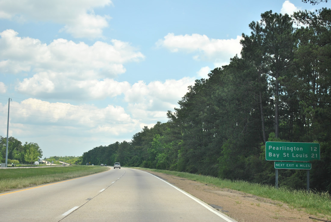
| Interstate 10 travels eight miles between Interstates 12 & 59 and the first Mississippi interchange (junction Mississippi 607). Mississippi 607, in conjunction with Mississippi 604, serves the community of Pearlington from Exit 2. Bay St. Louis lies 21 miles ahead, to the south of Exit 13. 04/20/12 |
|
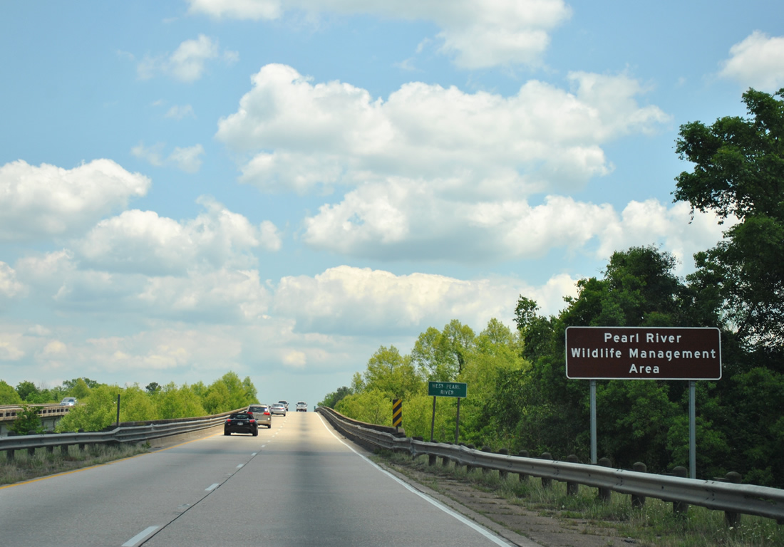
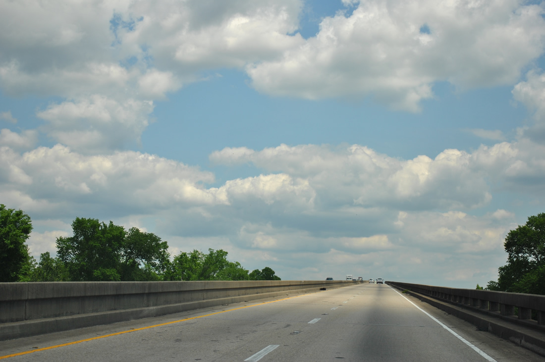
| The freeway enters the Pearl River Wildlife Management Area between Slidell and the Mississippi State line at the West Pearl River crossing of Interstate 10 east. 04/20/12 |
|
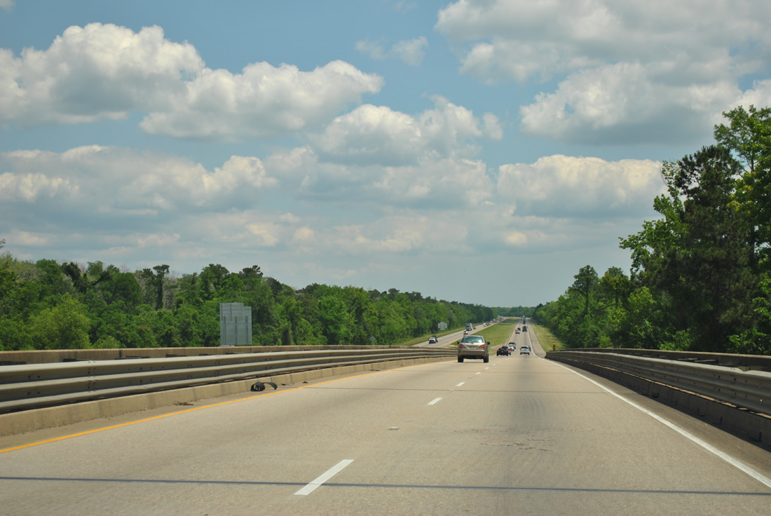
| Interstate 10 spans the Middle Pearl River in this scene. The shoulder less bridges along this stretch reflect the design standards of 1970, the year they were built. 04/20/12 |
|
| A fixed high-level bridge carries Interstate 10 over the Pearl River between St. Tammany Parish, Louisiana and Hancock County, Mississippi. The bridge is shoulder less like the previous span. 04/20/12 |
|
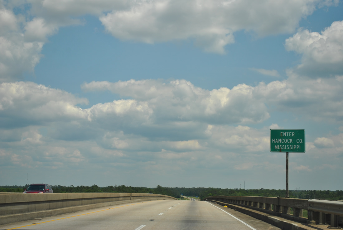
| A Hancock county line sign sign marks the state boundary midway across the Pearl River Bridge. A weigh station lies ahead of the Exit 2 interchange with Mississippi 607 and the Mississippi Welcome Center. 04/20/12 |
Page Updated 09-13-2012.

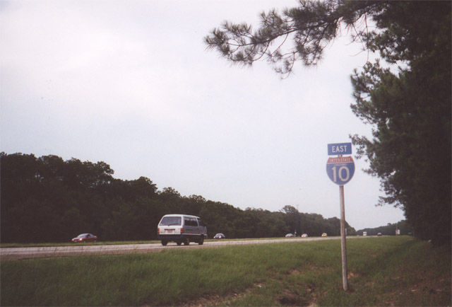
 East
East