|
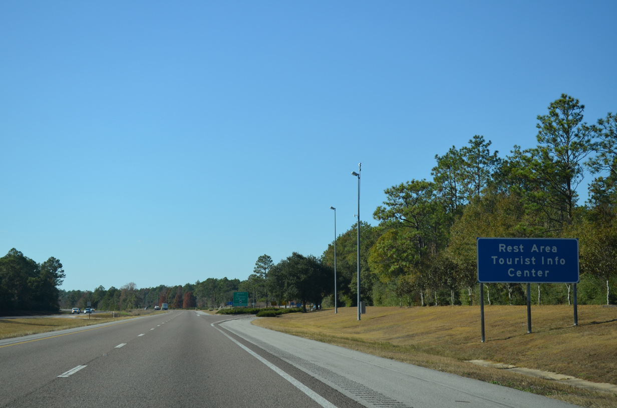
| The Alabama State Welcome Center lies just west of the Perdido River bridge. Official state maps, tourist information, and a schedule for the Mobile Bay Ferry are available in addition to the standard rest area facilities. 11/21/14, 05/16/16 |
|
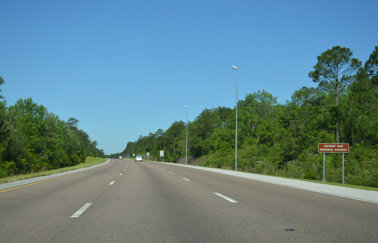
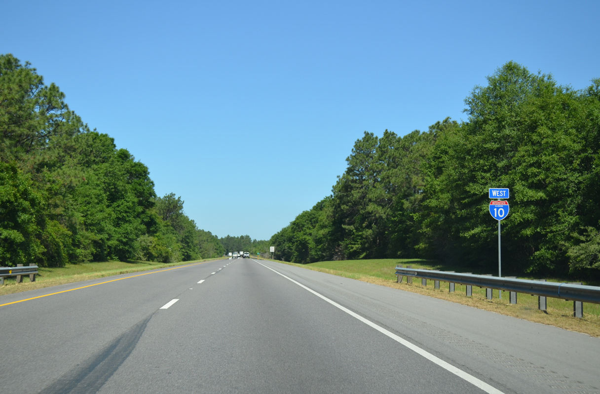
| New signs were installed during winter 2012 near both entrances of Interstate 10 in the state of Alabama designating it the Vietnam War Memorial Highway. 05/06/16 |
|
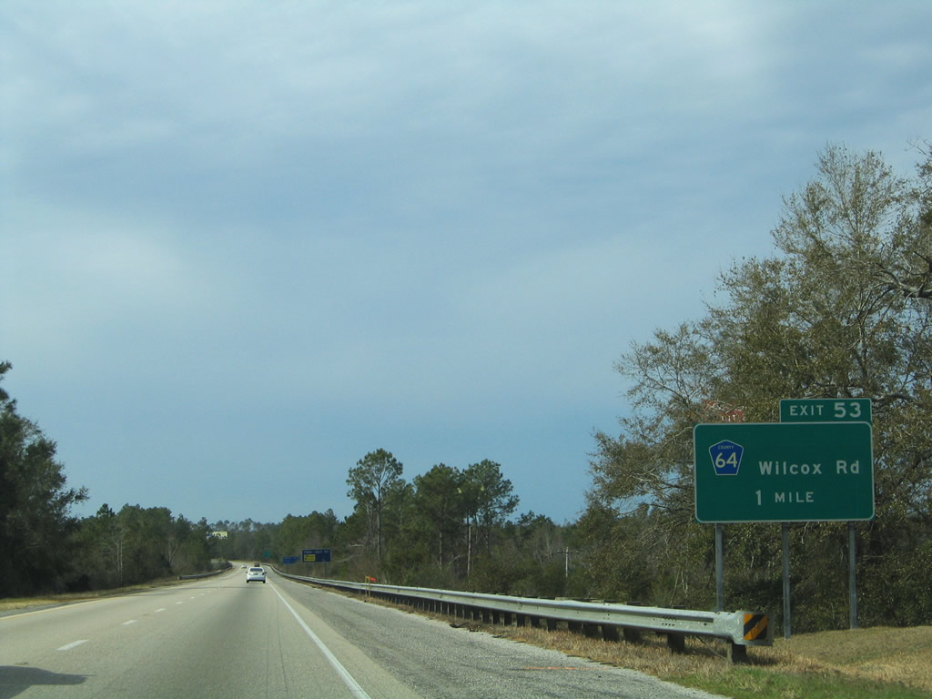
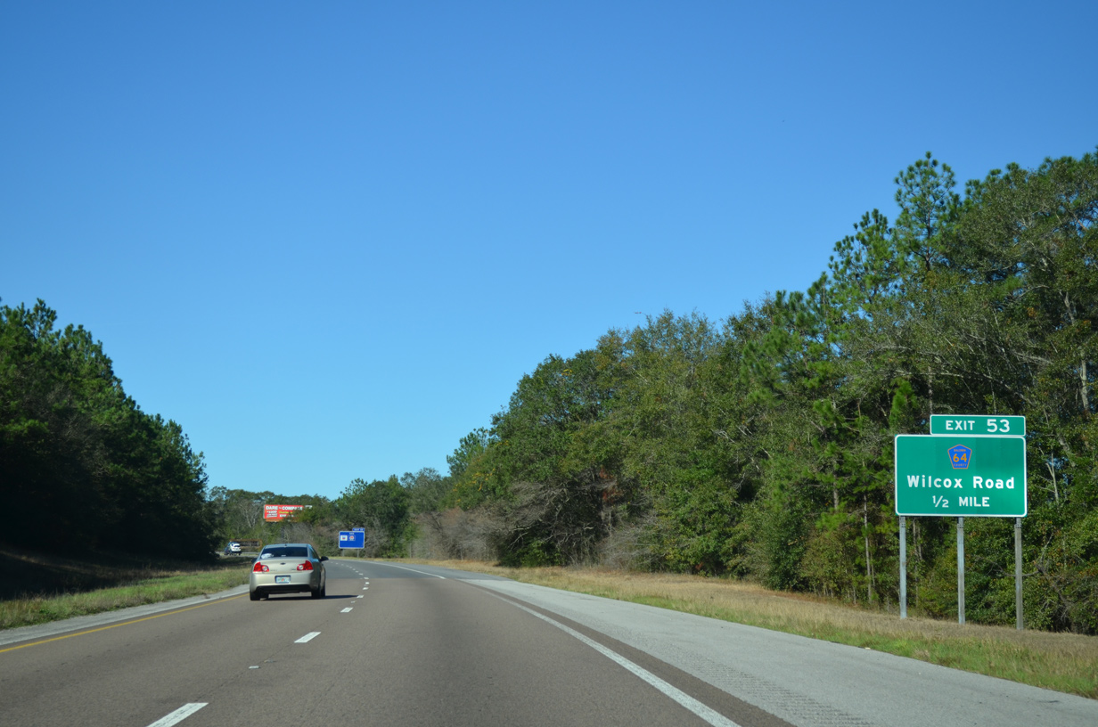
| Interstate 10 crosses the Styx River and then angles northwest to parallel the waterway to Exit 53. 11/21/14 |
|
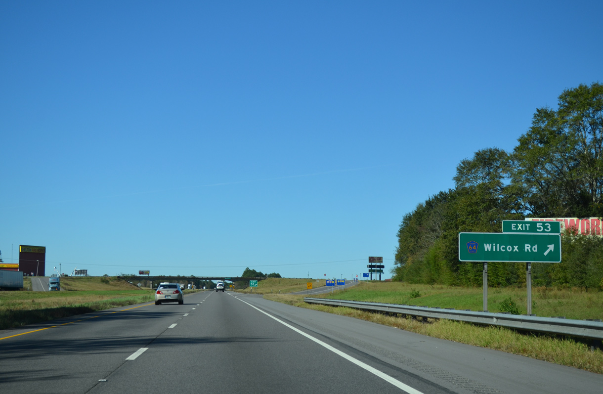
| An 18 mile exit less stretch ends at the diamond interchange (Exit 53) with Baldwin County Road 64 (Wilcox Road). The rural exit is home to two fireworks stores and a truck stop. 02/10/06 |
|
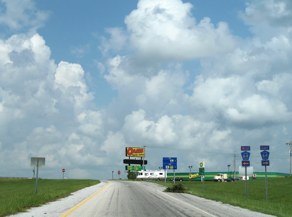
| CR 64 follows Wilcox Road just south of Exit 53. Wilcox Road continues to Patterson Road as CR 64 turns west to the Baldwin Beach Express and Rosinton. 11/20/15 |
|
| CR 64 extends north from Interstate 10 and Wilcox Road to CR 112 west of Gateswood. CR 64 is lightly traveled and mainly serves pine forest farms. Located nearby is the former Styx River Water World, which closed in 2001. 11/20/15 |
|
| West from Exit 53, Baldwin County Road 64 leads directly to Loxley and ultimately to Daphne. 07/08/09 |
|
| Detour Interstate 10 shields were posted along CR 64 and CR 83 in Fall 2010. 12/24/10 |
|
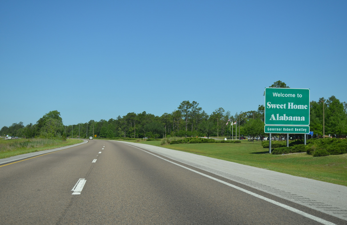
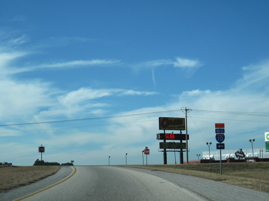
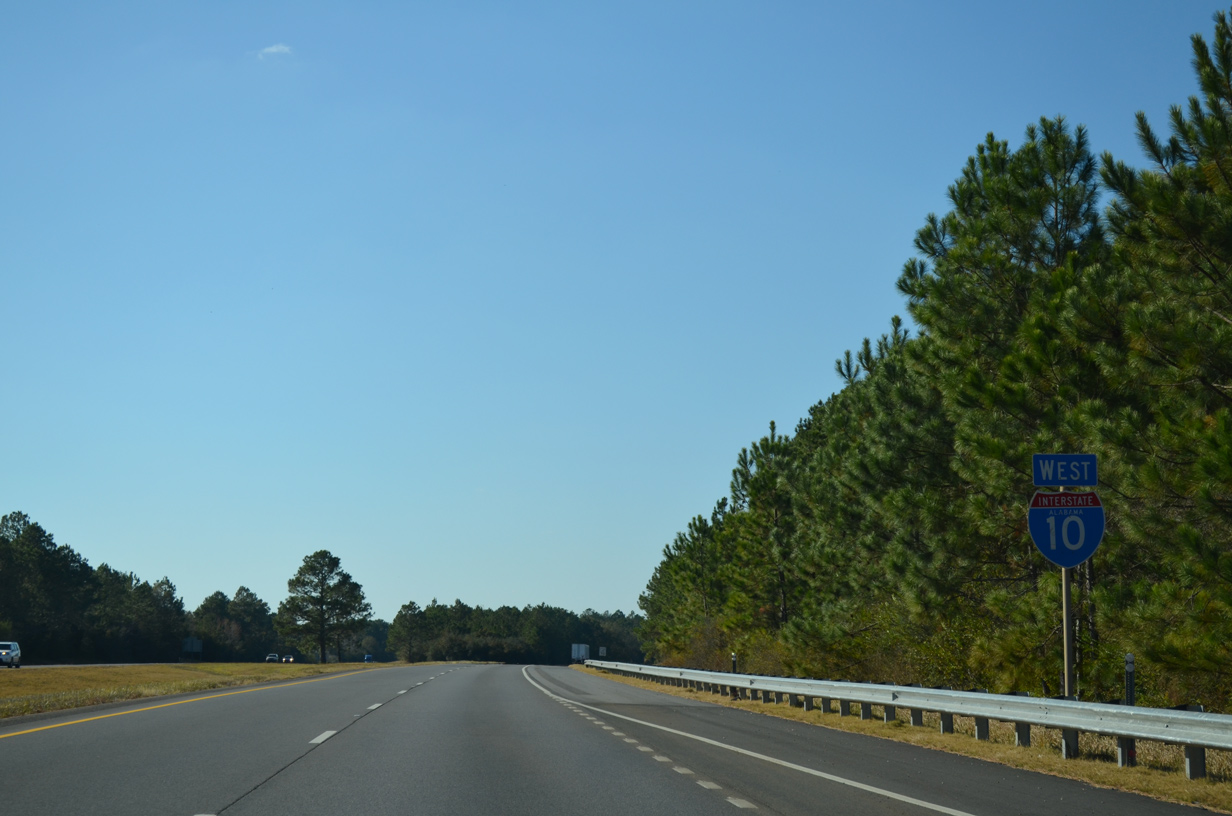
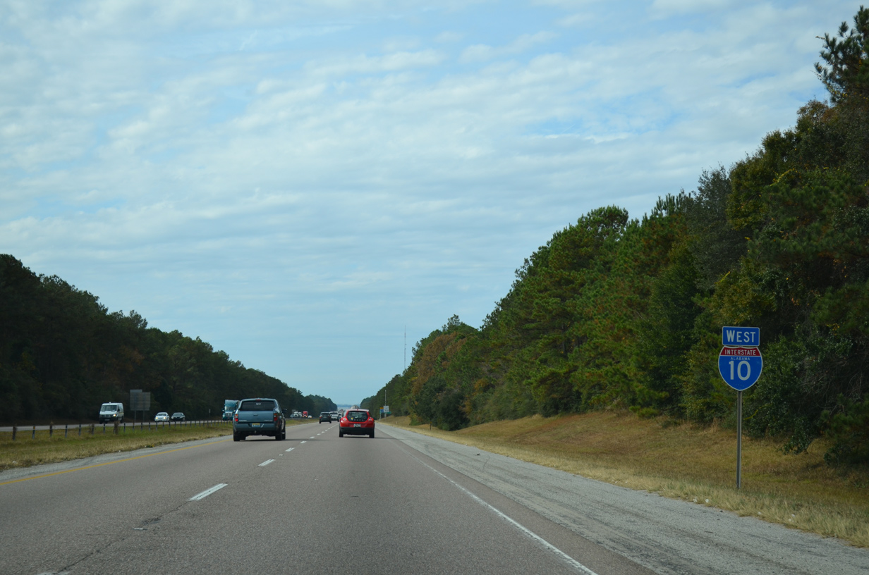
| The roadways of I-10 diverge across Persimmon Creek, which flows east into Styx River. This is the first state named shield for Interstate 10, which began 375 miles to the east. 11/21/14 |
|
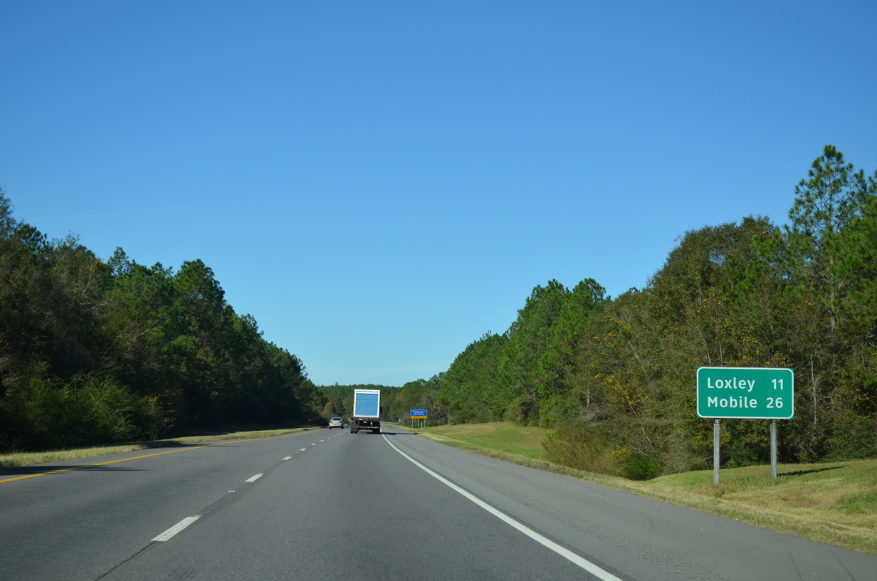
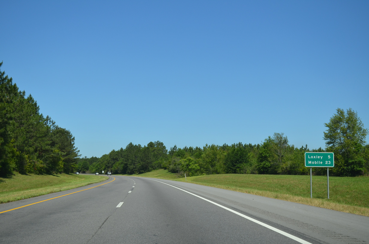
| Posted in 2010, this sign west of CR 64 lists the distances to Loxley (Exit 44) and Mobile (Exit 26). 11/20/15 |
|
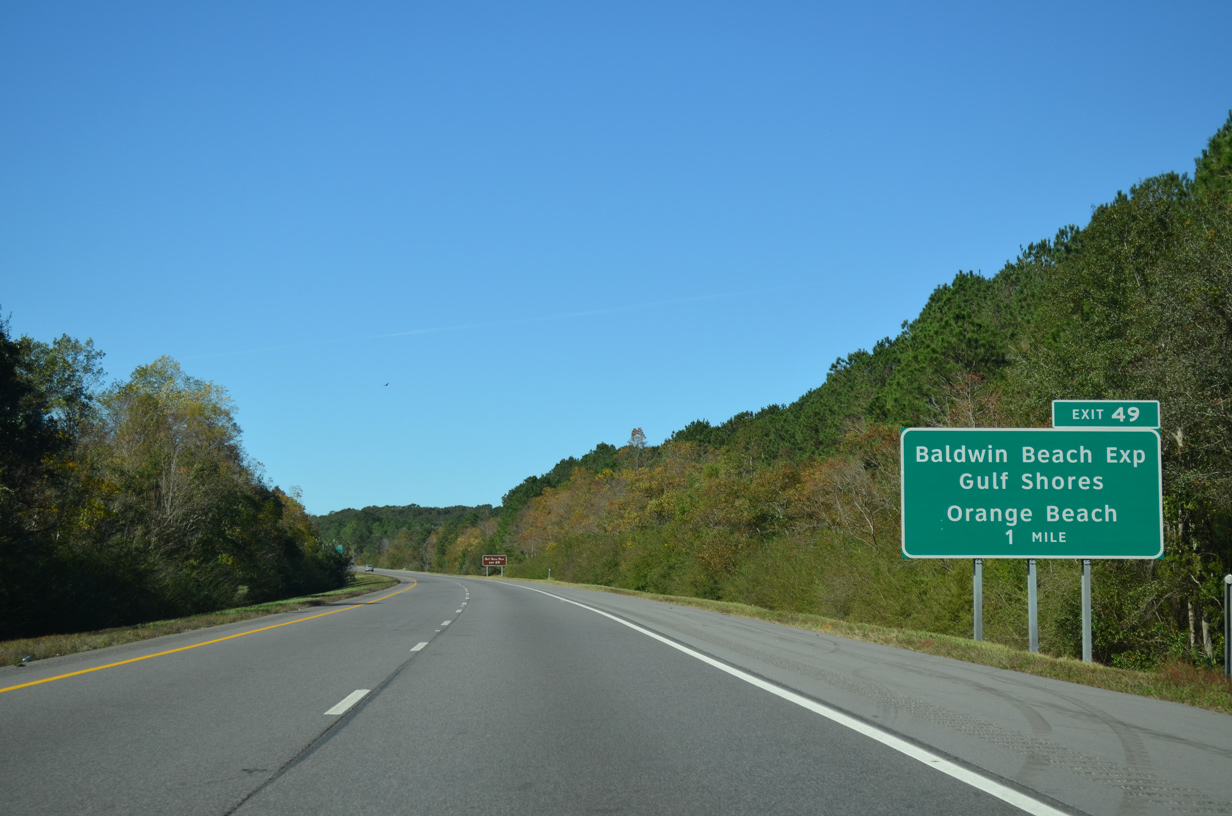
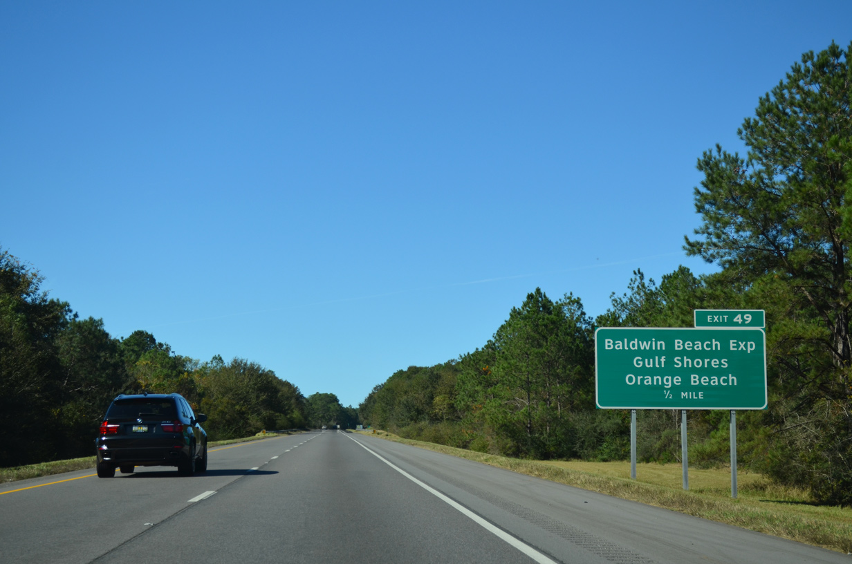
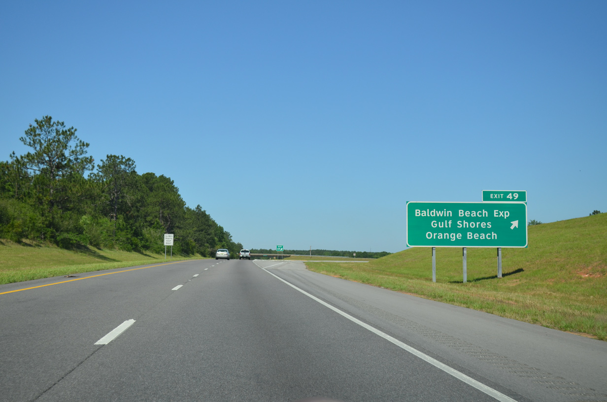
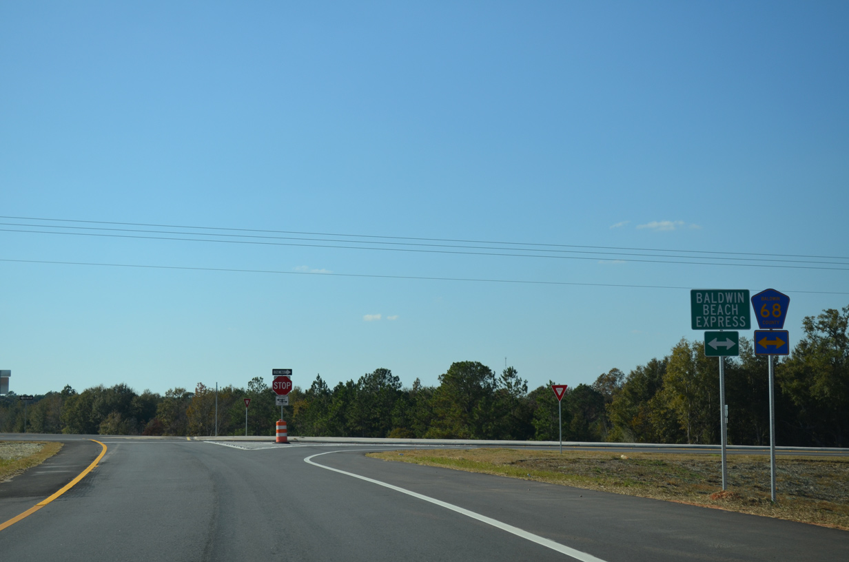
| The diamond interchange (Exit 49) with the Baldwin Beach Express and CR 68 opened to traffic on August 15, 2014. Completion of the exchange followed 15 years of work to provide a new route to the Baldwin County beaches from I-10. 11/20/15 |
|
| The Baldwin Beach Express superseded CR 68 across I-10, with a new bridge built for southbound. CR 68 branches west from the four lane highway to Loxley and east to the Styx River. 11/20/15 |
|
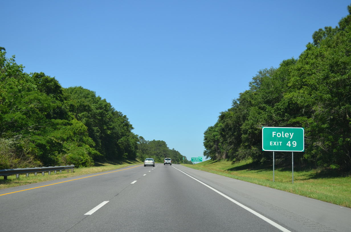
| The Baldwin Beach Express heads south from I-10 over the previous route of CR 83 to the east of Robertsdale. The four lane highway continues south over former CR 28 to the Foley Beach Express northeast of Foley. 05/06/16 |
|
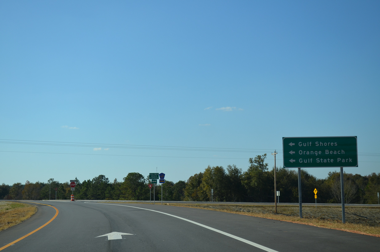
| Travelers headed to Gulf Shores or Orange Beach are directed onto the Baldwin Beach Express south to the Foley Beach Express and its toll bridge across the Intracoastal Waterway. 11/21/14 |
|
| Together the Baldwin and Foley Beach Express routes provide a 26 mile link between I-10 and SR 180 (Canal Road) in the city of Orange Beach. The majority of the route is rural, but development lines the highway at I-10 and alomg the east side of Foley. 11/21/14 |
|
| Interstate 10 winds west from Exit 49 with a forested median for the next three plus miles. 05/06/16 |
|
| Loxley is five miles away, followed by Downtown Mobile in 23 miles. 05/06/16 |
|
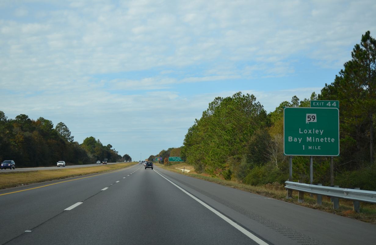
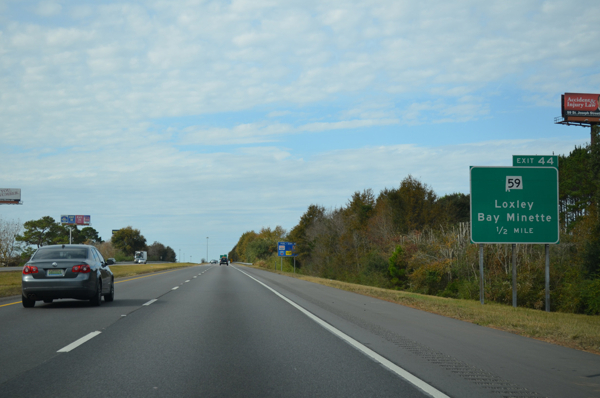
| A folded diamond interchange joins I-10 with SR 59 (N Hickory Street) on the north side of Loxley by a truck stop, fast food franchises and Flowerwood Nursery. 11/25/14 |
|
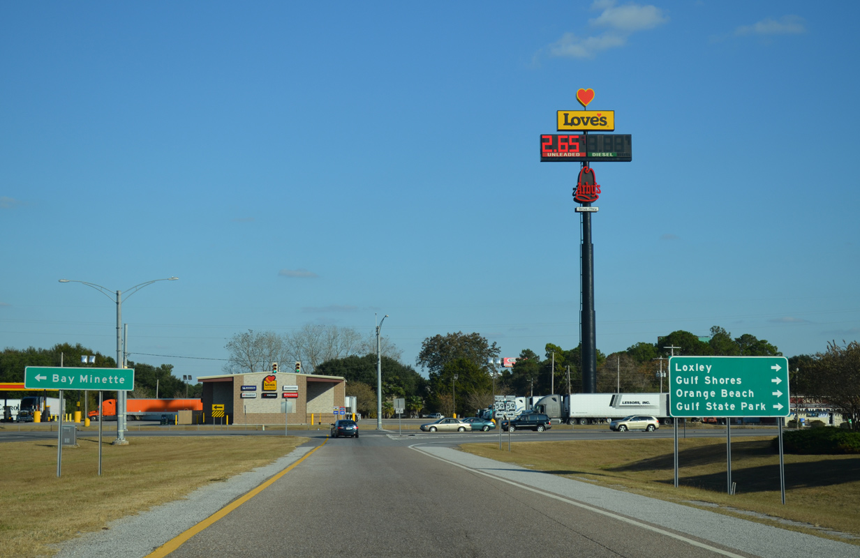
| SR 59 represents the main route from I-65 to Orange Beach, Gulf Shores and Gulf Shores State Park. The four lane highway originates at SR 182 along the Gulf of Mexico and extends north to SR 287 at Bay Minette. 11/25/14 |
|
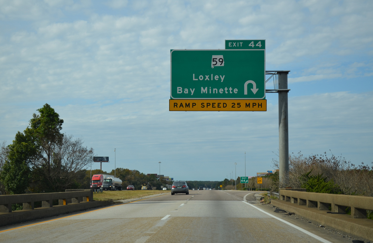
| Exit 44 loops away from Interstate 10 west to SR 59 (N Hickory Street) below. The design of the exchange remains from a time when the Louisville and Nashville Railroad line paralleled the east side of SR 59. 11/25/14 |
|
| SR 59/287 (Gulf Shores Parkway) provide a direct four lane route to I-65 north of the Baldwin County seat of Bay Minette. Southward, SR 59 stays somewhat rural outside Foley, Robertsdale, Summerdale and Loxley, but with increasing suburbanization. 11/21/14 |
|
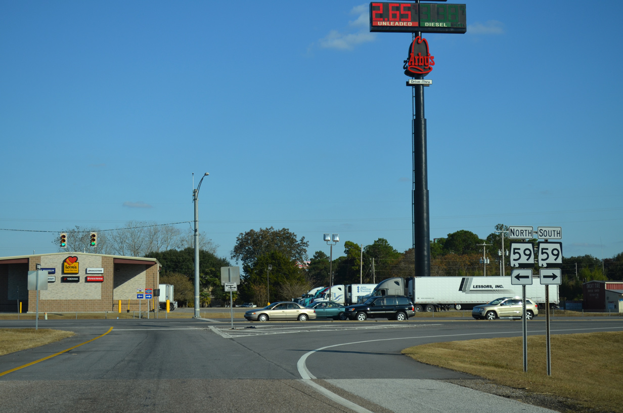
| An overall 94.1 mile route, SR 59 travels the height of Baldwin County from the Gulf of Mexico to SR 21 at Uriah in adjacent Monroe County. 11/21/14 |
|
| Interstate 10 shield posted after the on-ramp from SR 59 and Loxley. 06/01/10 |
|
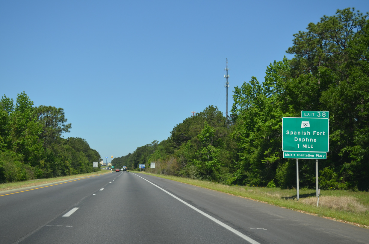
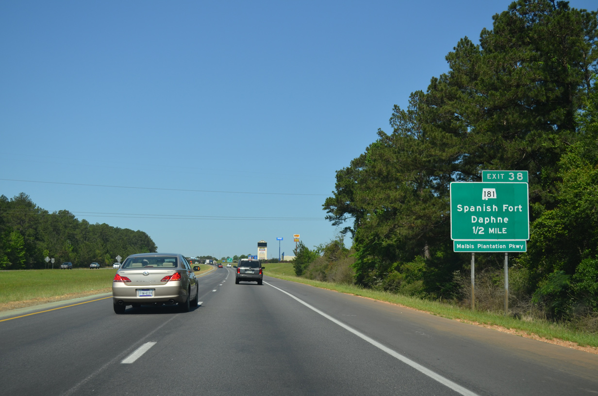
| A DDI (Exit 38) joins I-10 with SR 181 near the community of Malbis. SR 181 constituted a short four lane connector between U.S. 90 and U.S. 31 east of Spanish Fort and Daphne originally, but was extended southward in 2005 over CR 27 (Belforest Road) to a point just north of U.S. 98 near Weeks Bay. 05/06/16 |
|
| Rapid development of SR 181 between U.S. 90 and U.S. 31 in the mid-2000s transitioned Malbis Plantation Parkway from a rural highway into a commercial arterial. Further south, SR 181 was four laned to County Road 64 in east Daphne. 05/06/16 |
|
| SR 181 (Malbis Plantation Parkway) meets I-10 by the Eastern Shore Centre retail complex, which when built added five signals to the arterial. Additional growth in the area included Jimmy Faulkner Drive (CR 27), which opened north from SR 181 and U.S. 31 to Spanish Fort High School in 2006. 10/11/16 |
|
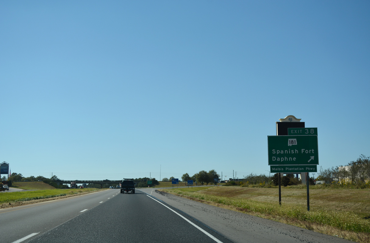
| Construction from March 2019 to Fall 2020 converted Exit 38 into Alabama's first diverging diamond interchange (DDI). The DDI with SR 181 opened on July 1, 2020.1 05/06/16 |
|
| A new exit was planned one mile west of SR 181 with County Road 13. Originally planned as a trumpet interchange, the design changed with possible access to the north side of I-10 with an extended service road from SR 181. 11/25/14 |
|
| Interstate 10 lowers toward Mobile Bay four miles to central Spanish Fort. Downtown Mobile lies 11 miles to the west. 05/06/16 |
|
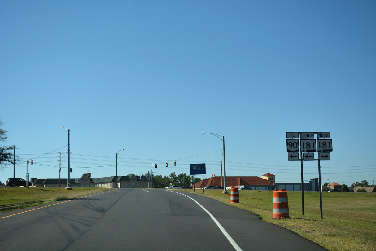
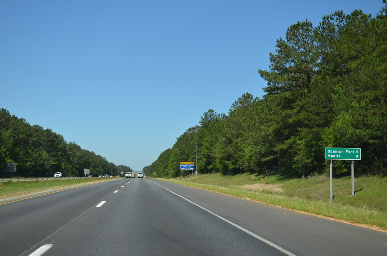
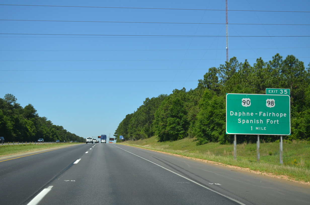
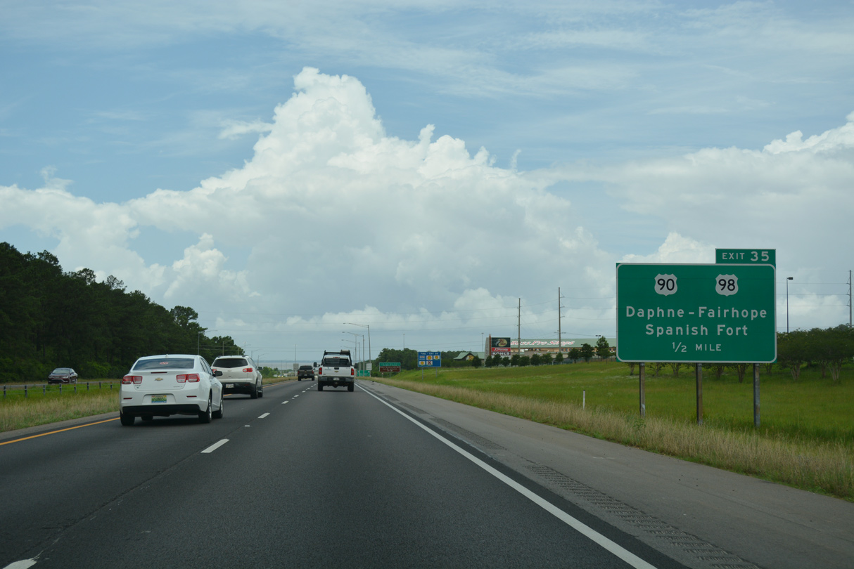
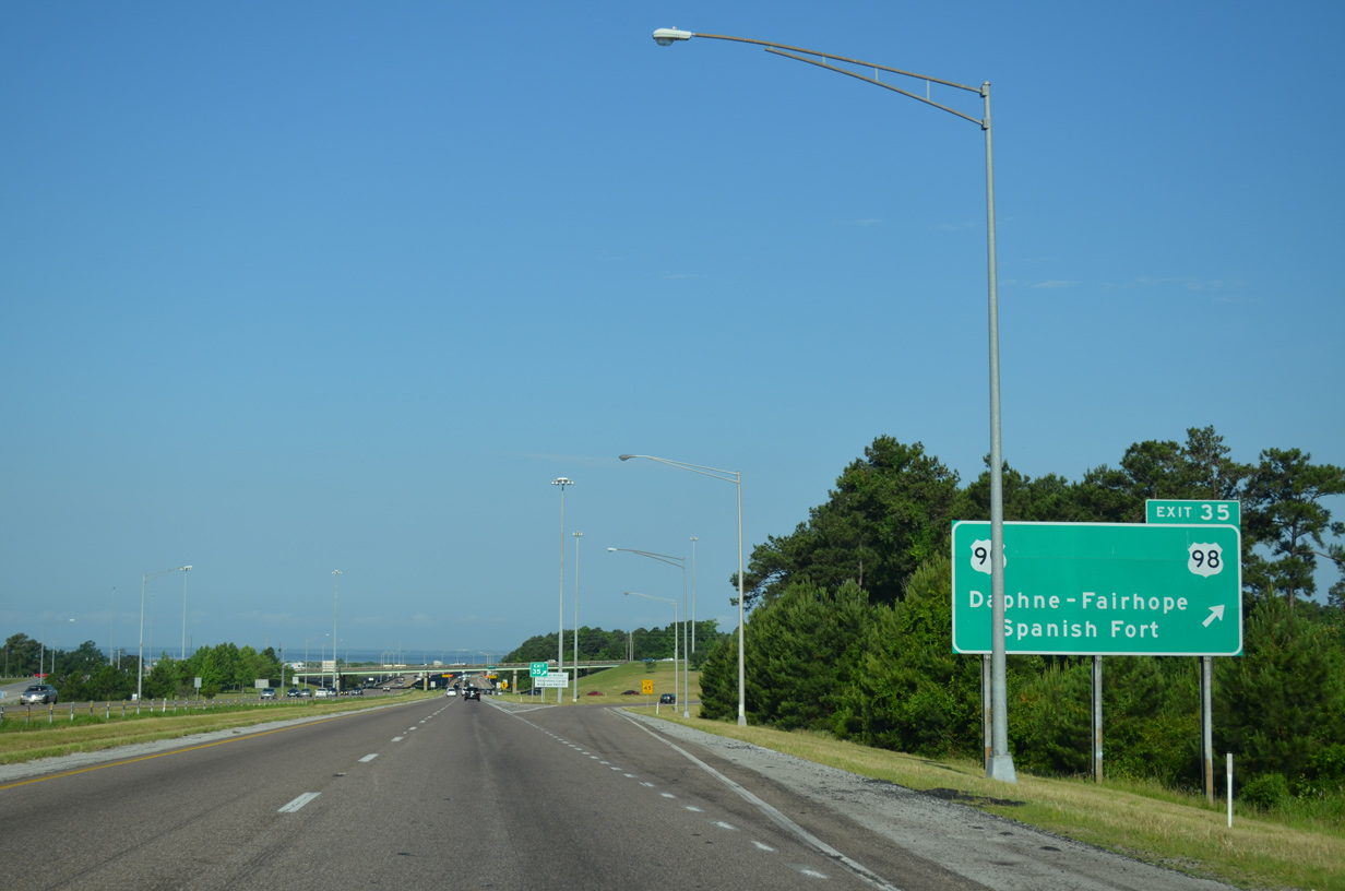
| I-10 converges with U.S. 90/98 at a parclo interchange (Exit 35) along the Daphne / Spanish Fort city line by D'Olive Creek. U.S. 90 parallels I-10 from Malbis into Daphne, merging with U.S. 98 briefly at Exit 35. U.S. 98 heads south to Fairhope and Montrose along Baldwin County's Eastern Shore. 05/06/16 |
|
| U.S. 90/98 combine northward through the parclo interchange (Exit 35) with I-10. Located along U.S. 90 (Old Spanish Trail) nearby is Spanish Fort Town Center, a sprawling retail center anchored by Bass Pro Shops. 06/05/17 |
|
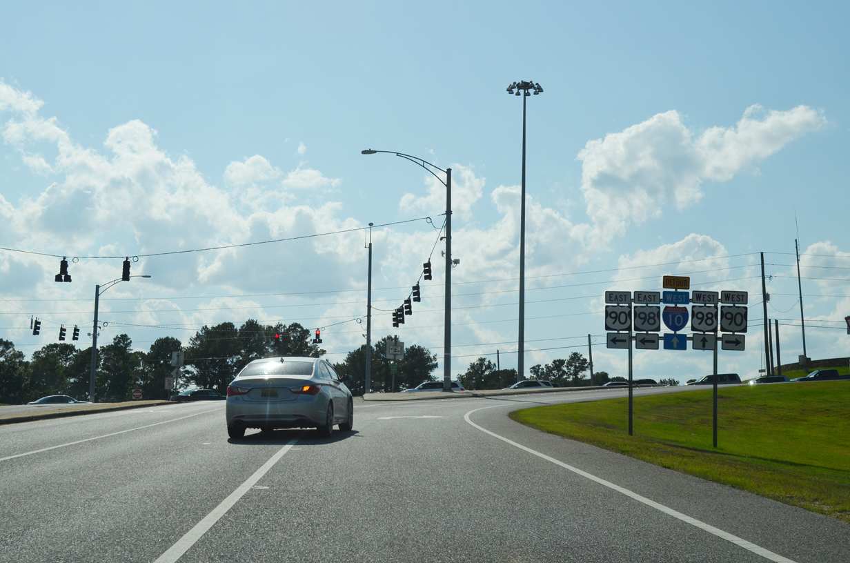
| U.S. 90/98 follow Battleship Parkway west from Spanish Fort to Mobile. Eastbound U.S. 98 runs south along a congested arterial route to Daphne, Fairhope and a point east of Point Clear. U.S. 98 extends south to Barnwell and east to Foley through less developed areas. 05/09/15 |
|
| U.S. 90 (Old Spanish Trail) dog legs north from I-10 to the south end of U.S. 31 at Spanish Fort Boulevard. U.S. 31 connects with SR 225 (Blakeley Drive) north to Historic Blakeley State Park, site of one of the final conflicts during the Civil War. 05/13/16 |
|
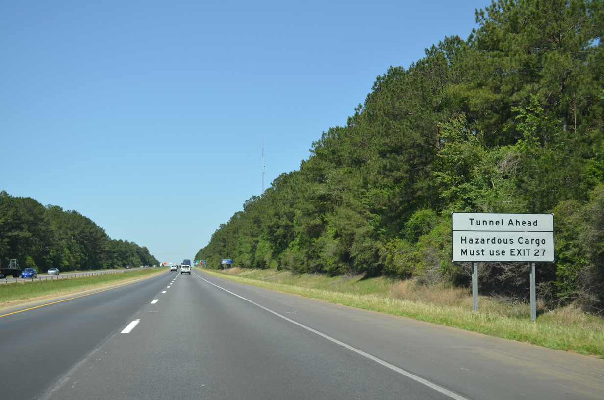
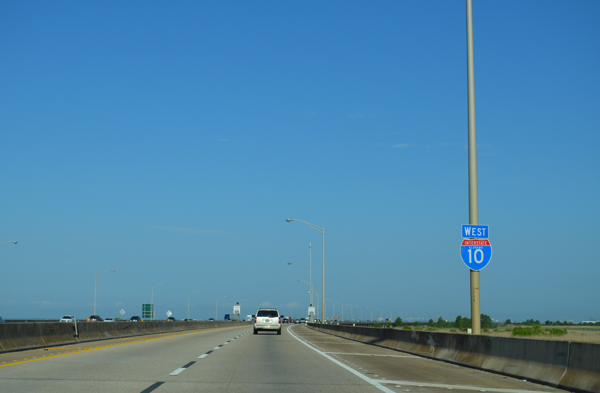
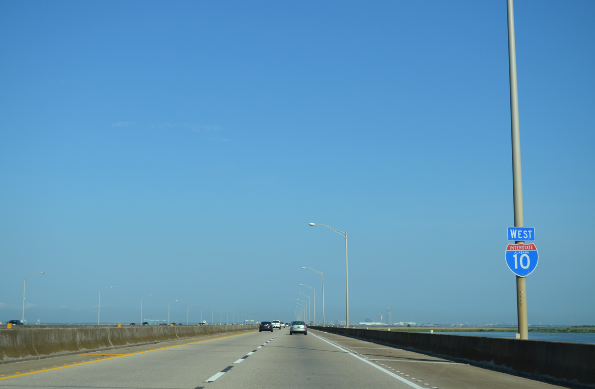
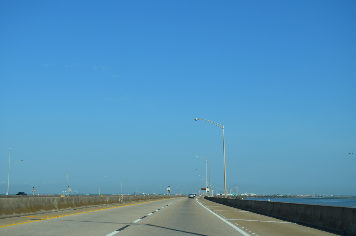
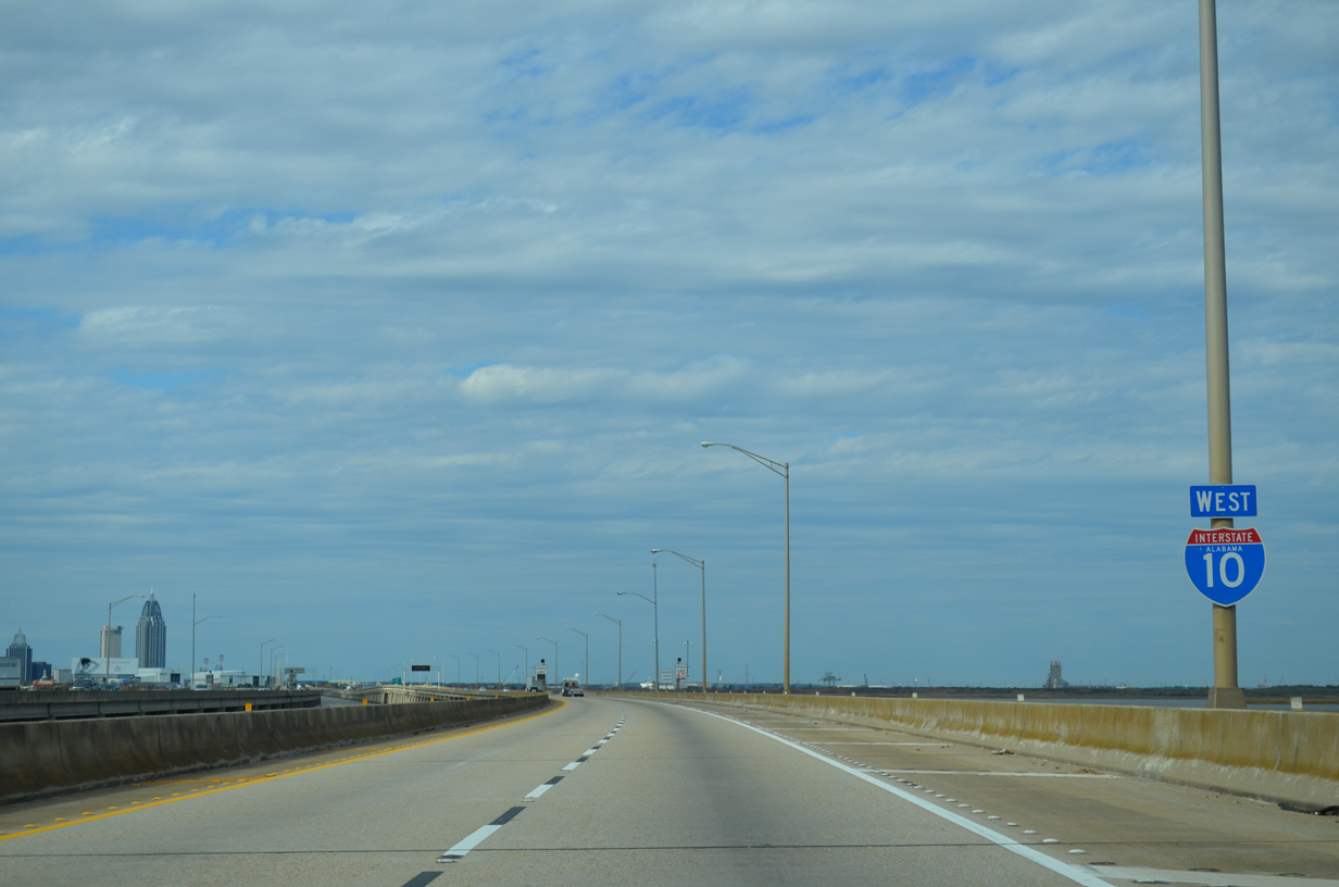
| The Mobile Bayway comprises twin two lane viaducts spanning shallow waters of northern Mobile Bay and southern Polecat Bay. Dynamic message and variable speed limit signs are used along the eight mile long bridge system due to potential fog and traffic incidents. 05/06/16 |
|
| A pair of reassurance markers stand along the eight mile long viaduct ahead of the Apalachee River. 05/09/15 |
|
| Advancing west, Interstate 10 spans the Blakeley River and skims southern reaches of Meaher State Park along the Mobile Bayway. 05/09/15 |
|
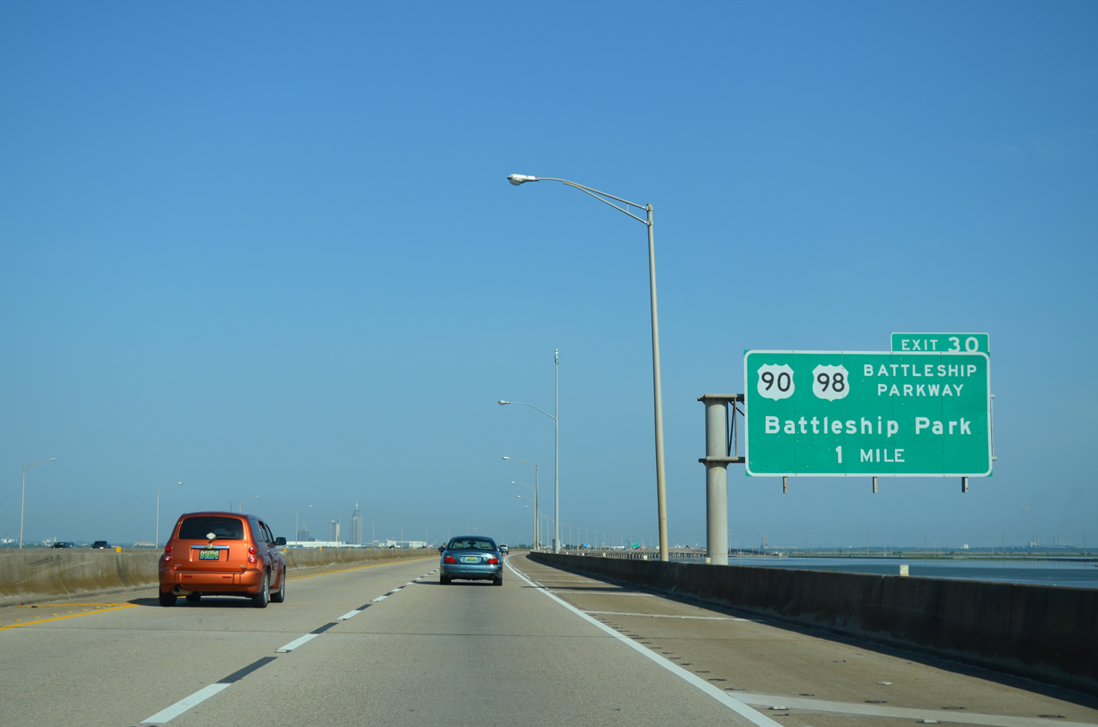
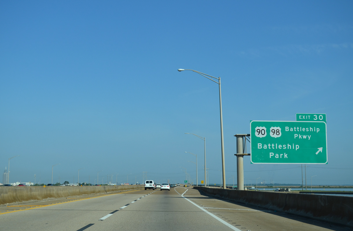
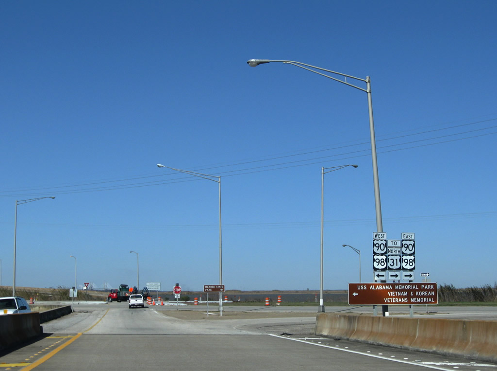
| Angling northwest, I-10 converges with U.S. 90/98 (Battleship Parkway) at a diamond interchange (Exit 30) in one mile. U.S. 90/98 parallel along a causeway west from Spanish Fort to USS Alabama Battleship Memorial Park and Blakeley Island in Mobile County. 05/09/15 |
|
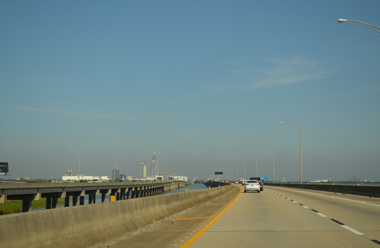
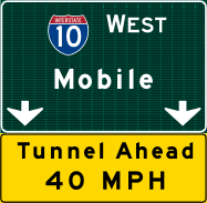
| The Spanish Fort city limits extend along U.S. 90/98 (Battleship Parkway) and a narrow strip of land to Exit 30 and the Tensaw River and Mobile County line. U.S. 90/98 continue west alongside I-10 to their split at the Bankhead Tunnel and Cochrane Causeway. 05/09/15 |
|
| U.S. 31 originates in Spanish Fort at the turn of U.S. 90 south to I-10 at Exit 35. Extending north to near Mackinaw City, Michigan, U.S. 31 formerly continued west alongside U.S. 98 to Downtown Mobile. 01/16/09 |
|
| Interstate 10 continues west and crosses the Tensaw River, the boundary between Mobile and Baldwin Counties. 11/25/14 |
|
| Advancing toward Downtown Mobile, the Mobile Bayway skims southern reaches of Polecat Bay west of the Tensaw River. 05/19/14 |
02/10/06, 01/16/09, 07/08/09, 06/01/10, 12/24/10, 05/19/14, 11/21/14, 11/25/14, 05/09/15, 11/20/15, 05/06/16, 05/13/16, 05/16/16, 10/11/16, 06/05/17 by AARoads
Page Updated 11-22-2020.


 West
West