|
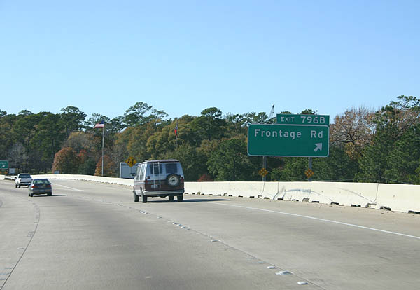
| IH 10 elevates across a Union Pacific Railroad line just beyond Cedar Bayou and the Harris County line to Exit 796B with the freeway service road. 12/24/05 |
|
| Exit 796B departs from IH 10 west to serve a nearby petrochemical refinery and eastern reaches of Baytown. 12/24/05 |
|
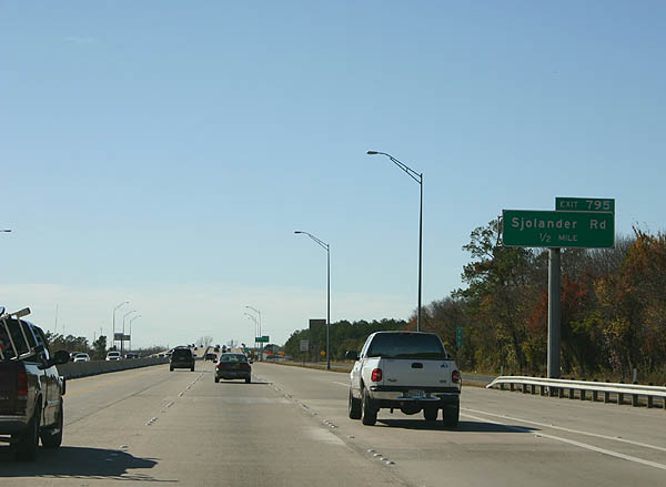
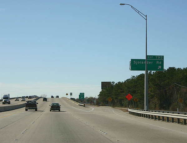
| Continuing along the Baytown city line, the next exit along IH 10 west is for Sjolander Road. 12/24/05 |
|
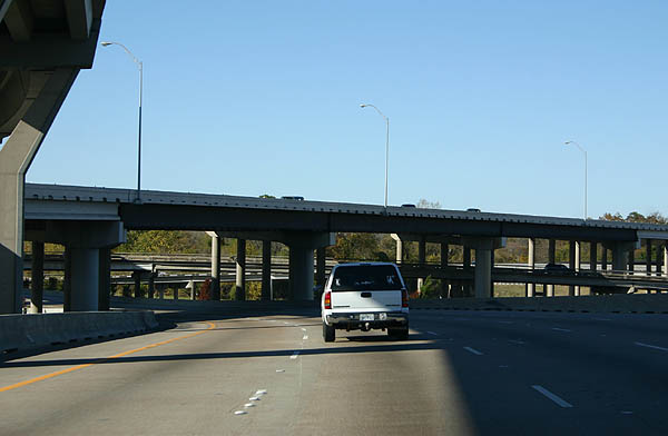
| Downtown Houston lies 27 miles west of Sjolander Road at Baytown. San Antonio is another 199 miles west via IH 10. 12/24/05 |
|
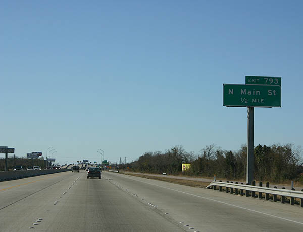
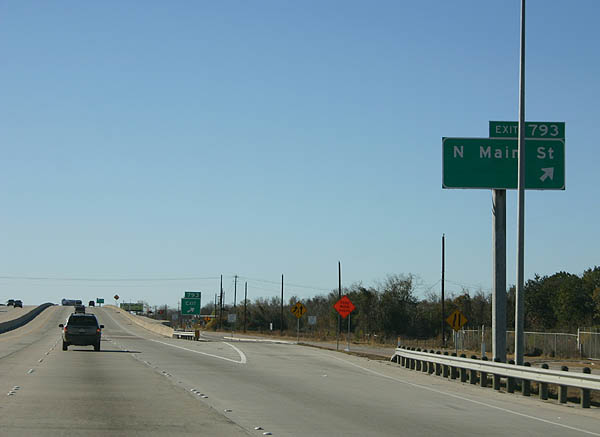
| A diamond interchange (Exit 793) joins IH 10 with Main Street north to FM 1942 (Crosby Barbers Hill Road) and south to SH 146 (Baytown Loop) and Downtown Baytown. 12/24/05 |
|
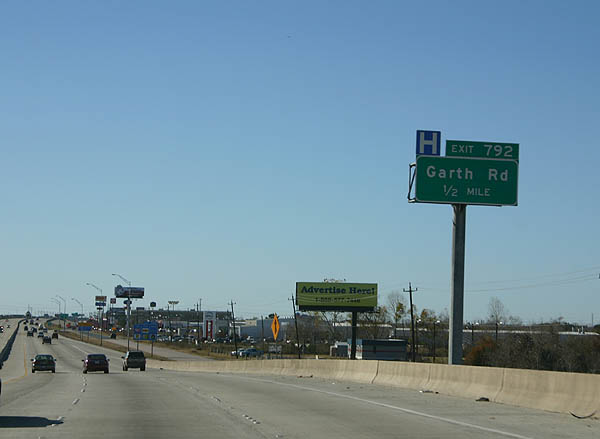
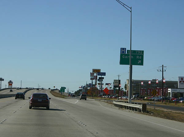
| Garth Road meets IH 10 at a diamond interchange (Exit 792) on the north side of San Jacinto Mall. 12/24/05 |
|
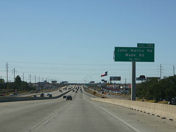
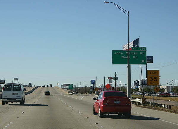
| John Martin Road forms a semi rural road north from Exit 791 to Wallisville Road and south through a portion of Baytown to Cedar Bayou Lynchburg Road. 12/24/05 |
|
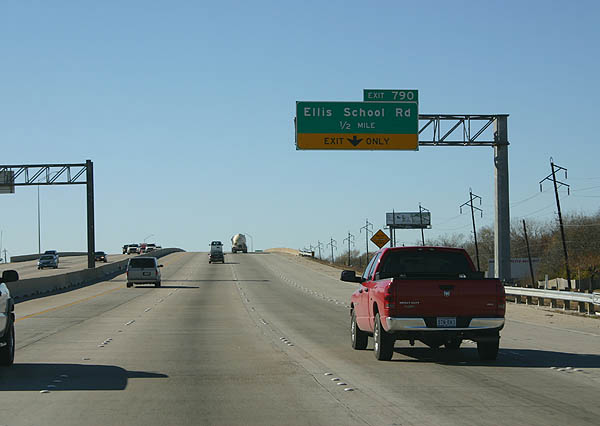
| IH 10 spans another UP Railroad at Wade Road just ahead of Exit 790 to Ellis School Road. 12/24/05 |
|
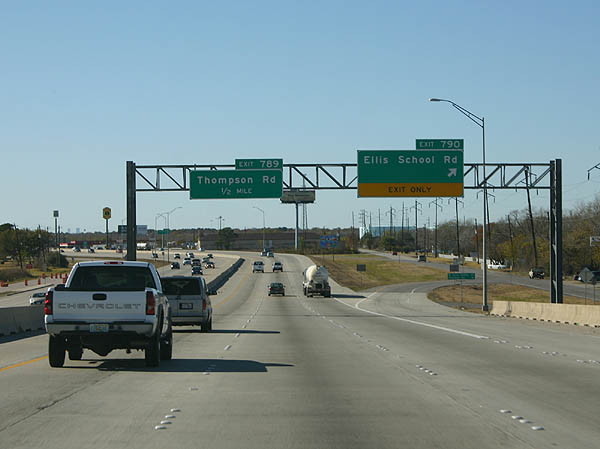
| Ellis School Road branches west from the I-10 Frontage Road at Exit 790, providing a cutoff to Thompson Road north. 12/24/05 |
|
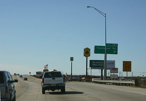
| IH 10 shifts southward into the diamond interchange (Exit 789) with Thompson Road. Thompson Road south becomes Bayway Drive south of the Spur 330 freeway en route to Scott Bay. 12/24/05 |
|
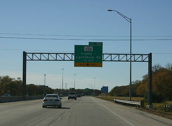
| Spur 330 (Decker Drive) west converges with Interstate 10 at a wye interchange (Exit 788) ahead of the San Jacinto River. Exit 787 from IH 10 west joins the frontage road ahead of Main Street. 12/24/05 |
|
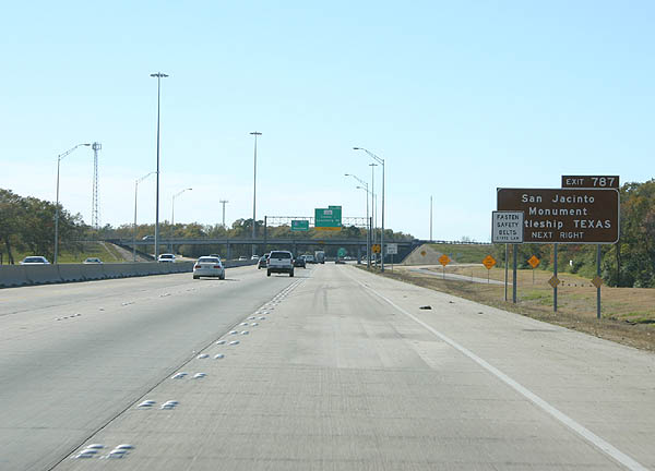
| San Jacinto Monument and the Battleship Texas State Historic Site is located along Buffalo Bayou south of the Lynchburg Ferry and Independence Parkway. Independence Parkway extends Main Street south from IH 10 at Exit 787. 12/24/05 |
|
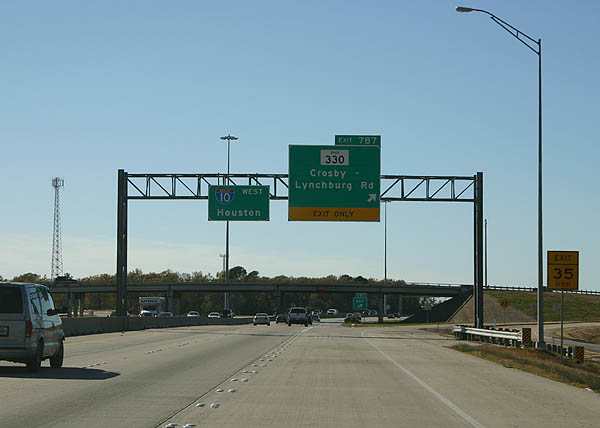
| Exit 787 leaves IH 10 west for the frontage road to Main Street. SH 330 splits from IH 10 east along Decker Drive. The 5.91 mile long highway to Texas Avenue in Baytown comprises a limited access highway southeast to the SH 146 freeway 12/24/05 |
|
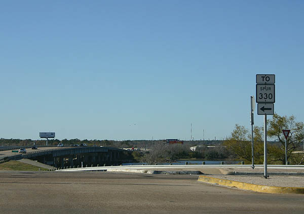
| The connection to Spur 330 requires motorists to turnaround at Main Street / Crosby-Lynchburg Road) to access the IH 10 and SS 330 frontage roads east toward Thompson Road. 12/24/05 |
|
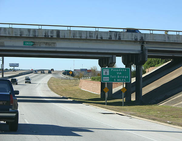
| Passing under Crosby-Lynchburg Road, this first advance sign for Beltway 8 and the Ship Channel bridge appears. 12/24/05 |
|
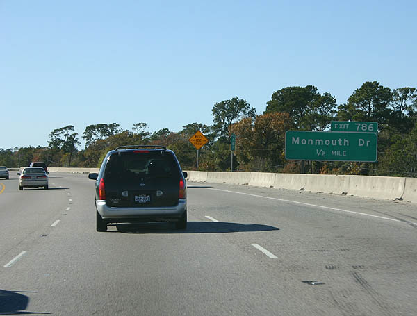
| IH 10 spans the San Jacinto River on the approach to Exit 786 with Monmouth Drive. 12/24/05 |
|
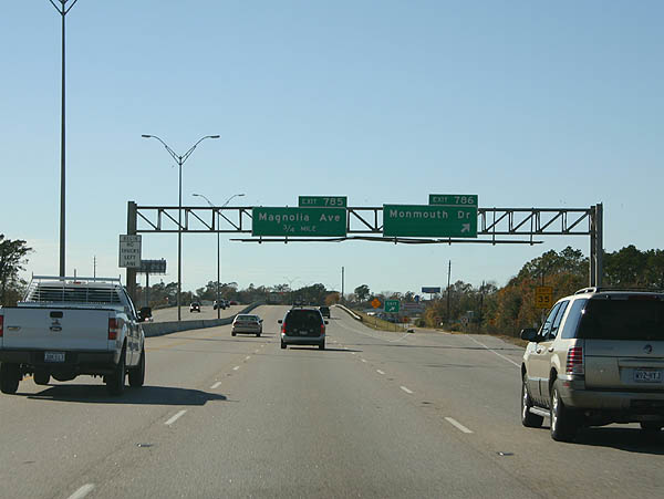
| A diamond interchange (Exit 786) joins IH 10 with Monmouth Dive by Lake Sandy and the Old River. 12/24/05 |
|
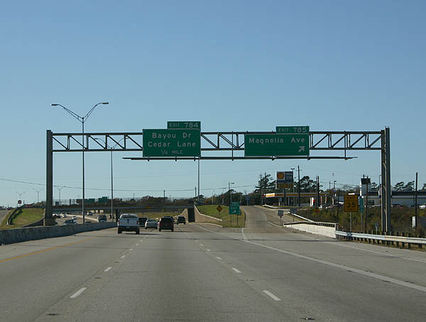
| A half diamond interchange (Exit 785) follows from IH 10 westbound at Magnolia Street. Magnolia Street stems north from parallel Market Street to River Road off Bear Lake. 12/24/05 |
|
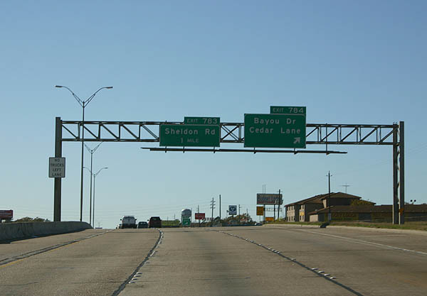
| Exit 784 departs 0.75 miles ahead of Bayou Drive and Cedar Lane, local roads spurring north from Market Street at the Channelview community. 12/24/05 |
|
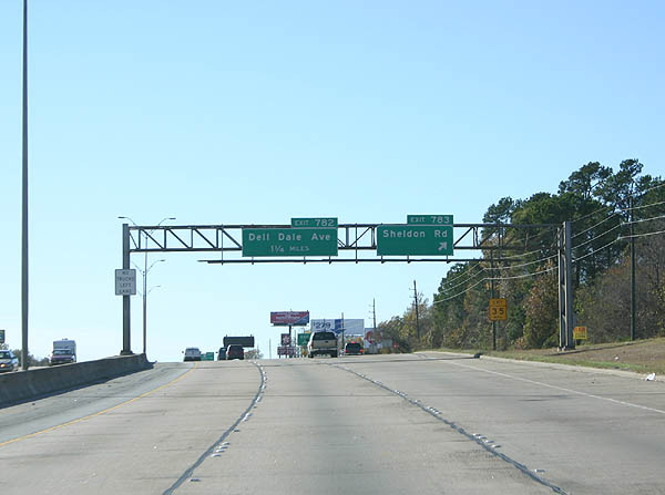
| Exit 783 separates from IH 10 west beyond the Cedar Lane overpass for the freeway service road one mile east of Sheldon Road. Sheldon Road is a commercial arterial through Channelview that connects with U.S. 90 (Crosby Freeway) and Sheldon to the north. 12/24/05 |
|
| A pedestrian bridge spans IH 10 at Crockett Street in Channelview, two miles east of the systems interchange (Exit 781) with Beltway 8 (Sam Houston Parkway). 12/24/05 |
|
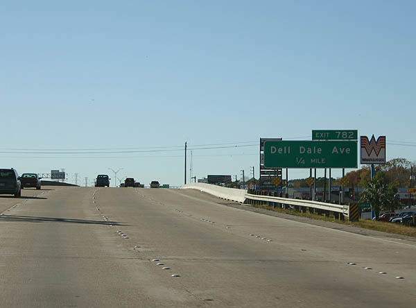
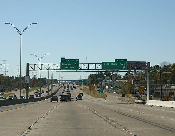
| IH 10 crosses over Sheldon Road on the half mile approach to Exit 782 with Dell Dale Street. 12/24/05 |
|
| Dell Dale Road runs north from Market Street and IH 10 to suburban areas of Channelview 12/24/05 |
|
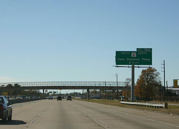
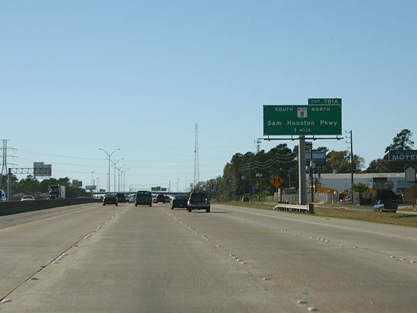
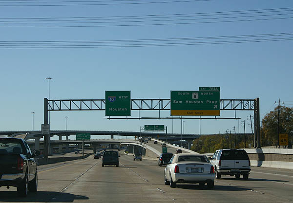
| Exit 781A departs from IH 10 in one mile for Sam Houston Parkway south to Pasadena and north to Summerwood and George Bush Intercontinental Airport (IAH). 12/24/05 |
|
| A slip ramp (Exit 781B) joins IH 10 west with the freeway service road to the Beltway 8 frontage roads and Market Street. 12/24/05 |
|
| Beltway 8 (Sam Houston Tollway) south elevates across the Houston Ship Channel bridge to Pasadena. The beltway connects with IH 45 south to Galveston and SH 288 (South Freeway) at Pearland. 12/24/05 |
|
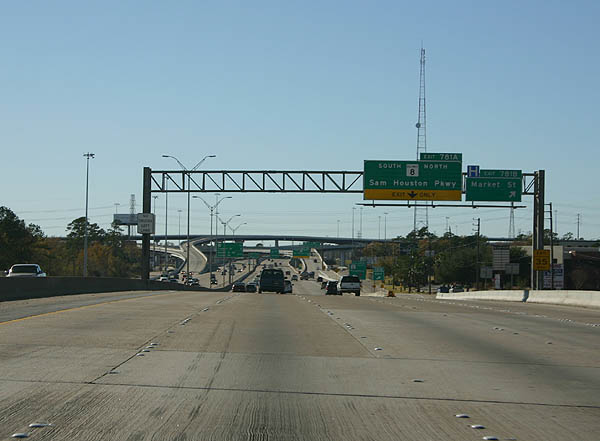
| Exit 781A departs IH 10 for Beltway 8 at a four-level interchange. Sam Houston Parkway / Tollway encircles the north side of Houston from Humble west to IAH Airport and Jersey Village. 12/24/05 |
|
| The succeeding exits along Interstate 10 west from Beltway 8 serve the Cloverleaf community. 12/24/05 |
|
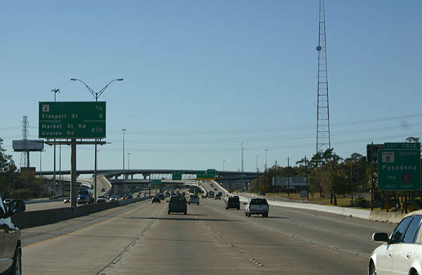
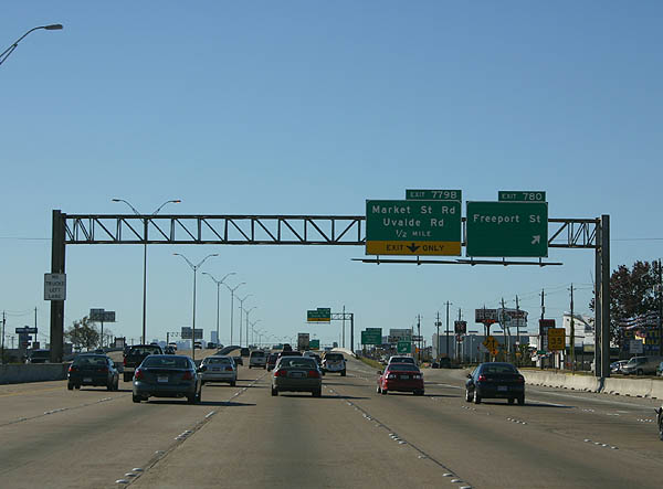
| A half diamond interchange joins IH 10 with Freeport Street and adjacent big box retail at Exit 780. 12/24/05 |
|
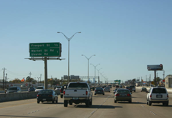
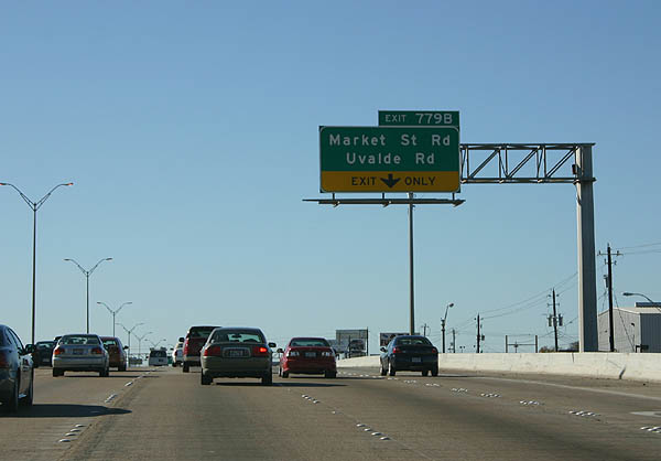
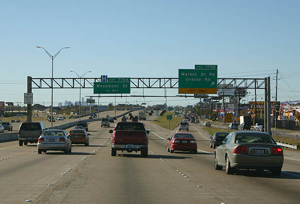
| A lane drop occurs westbound at Exit 779B for Uvalde Road north and Market Street Road west. 12/24/05 |
|
| Market Street Road branches south from IH 10 across Greens Bayou and parallels the freeway west into Jacinto City. Uvalde Road is a commercial boulevard leading north through the Northshore area of Houston. 12/24/05 |
|
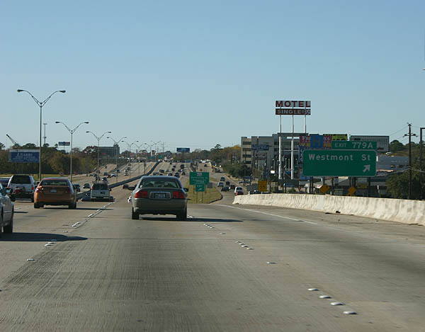
| Shifting slightly north, IH 10 partitions with Exit 779A for Westmont Street ahead of Greens Bayou. 12/24/05 |
|
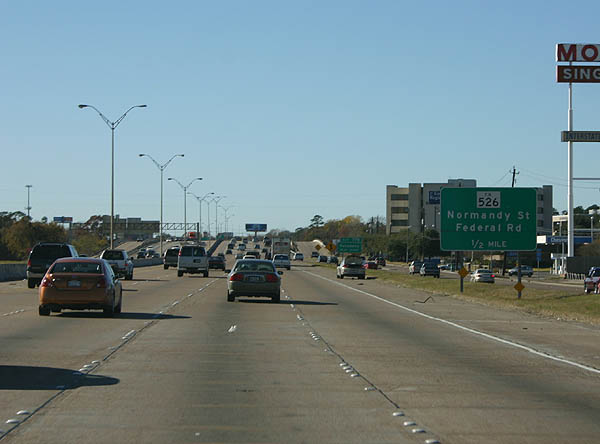
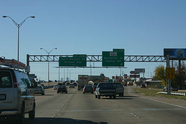
| Exit 778 follows Greens Bayou for Normandy Street at Northshore in east Houston and FM 526 (Federal Road) north. 12/24/05 |
|
| FM (UR) 526 travels 4.67 miles north to BU 90-U (former U.S. 90). Federal Road continues south to the Washburn tunnel under the Houston Ship Channel. 12/24/05 |
|
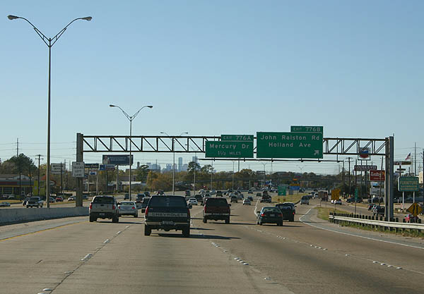
| Exit 776B partitions from IH 10 westbound beyond the Federal Road underpass for John Ralston Road north and Holland Avenue south to the city of Galena Park. 12/24/05 |
|
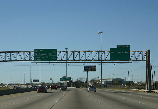
| Advancing west from the systems interchange with IH 610 and U.S. 90 (Crosby Freeway), IH 10 enters the Pleasantville Area of Houston. Exit 773B departs next for McCarty Drive (U.S. 90 Alternate east). 12/24/05 |
|
| Unmarked from IH 10/U.S. 90 west, U.S. 90 Alternate follows McCarty Drive northeast 1.58 miles to IH 610 at U.S. 90 Business. U.S. 90 Business continues the arterial northeast 14.12 miles to Crosby. 12/24/05 |
|
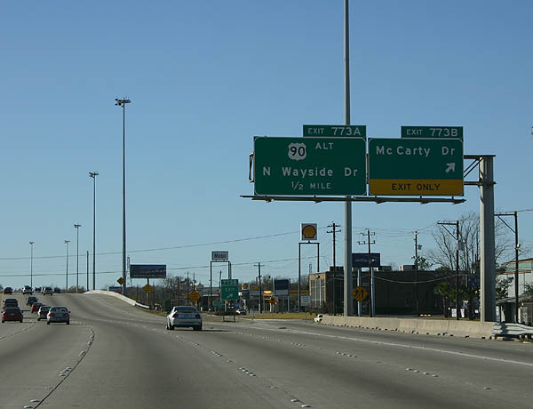
| IH 10 drops under a Union Pacific Railroad line before reaching Exit 773A with the continuation of U.S. 90 Alternate west along Wayside Drive. 12/24/05 |
|
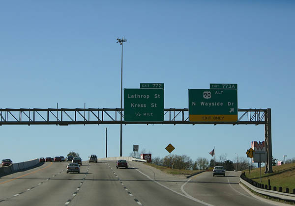
| A diamond interchange (Exit 773A) joins IH 10 with U.S. 90 Alternate west and North Wayside Drive. U.lS. 90 Alternate travels on the original route of U.S. 90 north to BU 90-U, and south toward IH 69/U.S. 59. 12/24/05 |
|
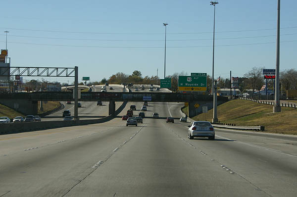
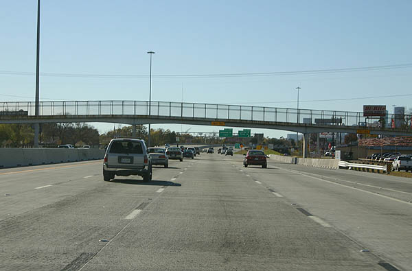
| ThE pedestrian overpass at Port Street in the Denver Harbor / Port Houston community shows the typical architecture along the Baytown East freeway. 12/24/05 |
|
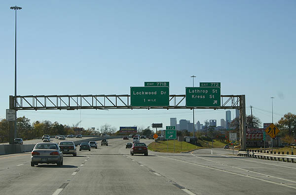
| IH 10 resumes a westward heading south of Lyons Avenue at the split diamond interchange (Exit 772) with Lathrop Street and Kress Street. 12/24/05 |
|
| Progressing west IH 10 enters the Greater Fifth Ward of Houston. 12/24/05 |
|
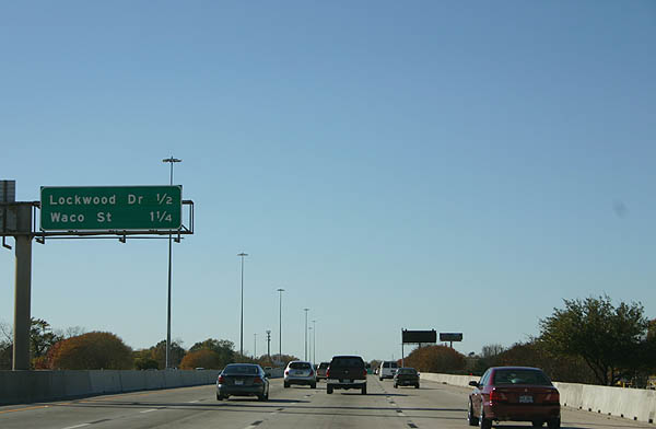
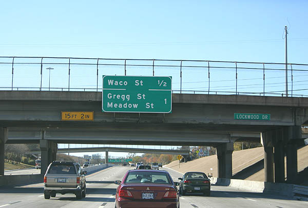
| Lockwood Drive connects with IH 10 at a diamond interchange (Exit 771B) south of the Union Pacific Englewood Yard. 12/24/05 |
|
| Turning southward again, IH 10 continues a half mile to Exit 771A for Waco Street and one mile to Exit 770B for Gregg Street. 12/24/05 |
|
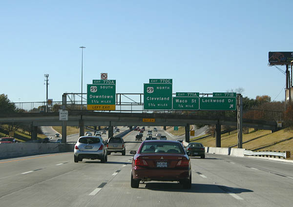
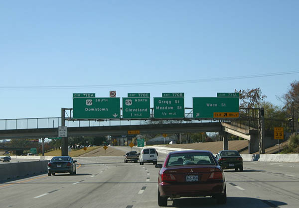
| Two lanes depart IH 10 west for Waco Street in the Greater Fifth Ward. The systems interchange (Exits 770C/B) with IH 69 and U.S. 59 lies one mile ahead. 12/24/05 |
|
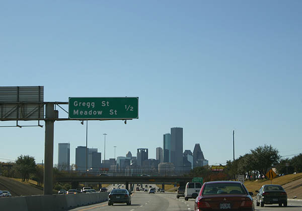
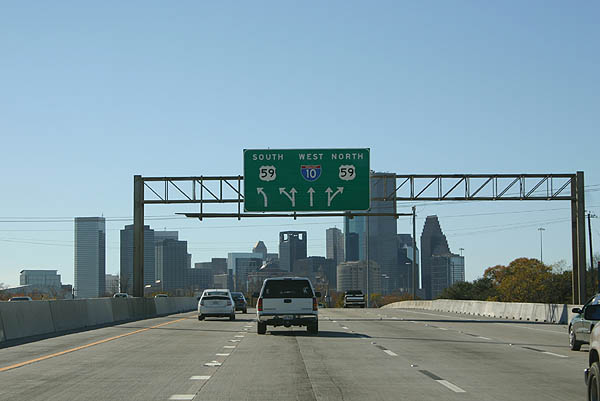
| The Downtown Houston skyline comes into view on the approach to Exit 770B with Gregg and Meadow Streets. 12/24/05 |
|
| Gregg and Meadow Streets serve residential areas of the Greater Fifth Ward adjacent to IH 69/U.S. 59 (Eastex Freeway). IH 69 was designated along the Eastex Freeway within Loop 610 in 2015. The interstate overlaps with U.S. 59 for 75 miles between Rosenburg and Cleveland. 12/24/05 |
|
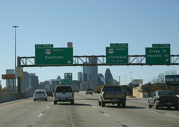
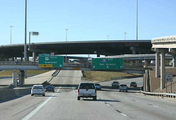
| Back to back ramps depart from IH 10 west for IH 69/U.S. 59. Exit 770C leaves first for the freeway north to the Easttex - Jensen Area and Kashmere Gardens communities and George Bush Intercontinental Airport (IAH). 12/24/05 |
|
| Left Exit 770A joins IH 69/U.S. 59 southwest through Downtown Houston to Midtown and the Greeway / Upper Kirbay Area. 12/24/05 |
|
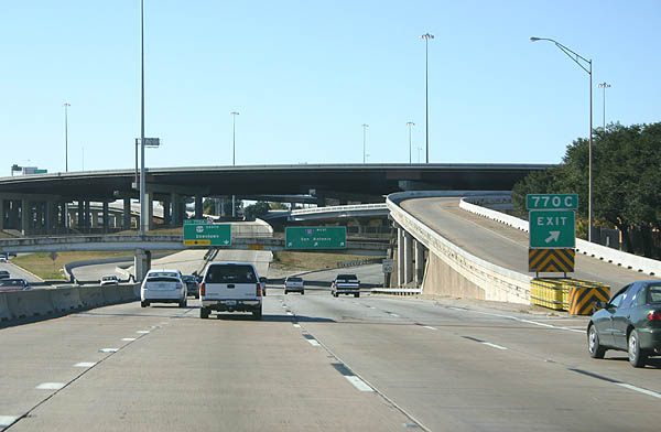
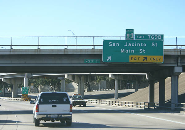
| IH 10 goes below grade on the north side of Downtown Houston. The ensuing exit connects with Providence Street west to San Jacinto Street south and Main Street. 12/24/05 |
|
| IH 10 navigates through an S-curve west across Whiteoak Bayou to the directional T interchange (Exit 786) with IH 45. 12/24/05 |
|
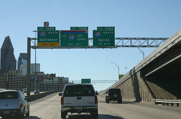
| Left Exit 768B departs next for IH 45 south for Downtown west, the Fourth Ward and Midtown. 12/24/05 |
|
| Curving northward alongside White Oak Bayou, IH 10 separates with Exit 786A for IH 45 north to Dallas. The two freeways run side by side over the succeeding stretch. 12/24/05 |
|
| IH 10 and IH 45 pass under a Union Pacific Railroad line along their concurrent section by the Near Northside community. A high flyover carries the IH 10 HOV lane to and from Downtown. 12/24/05 |
|
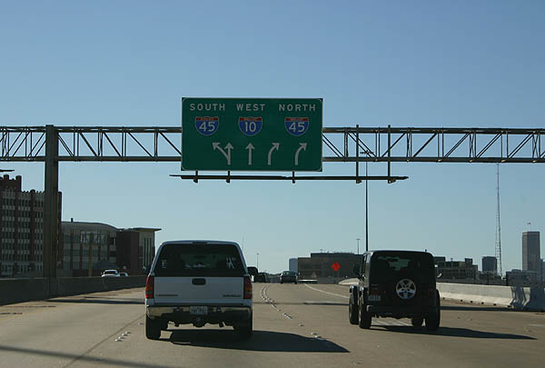
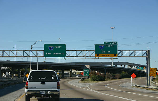
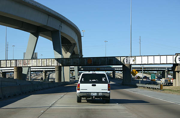
| IH 45 separates from IH 10 west at a three wye interchange north of Crockett / Hogan Street. IH 10 follows the Katy Freeway from this exchange westward. 12/24/05 |
Page Updated 07-15-2019.

 West
West

 West
West