
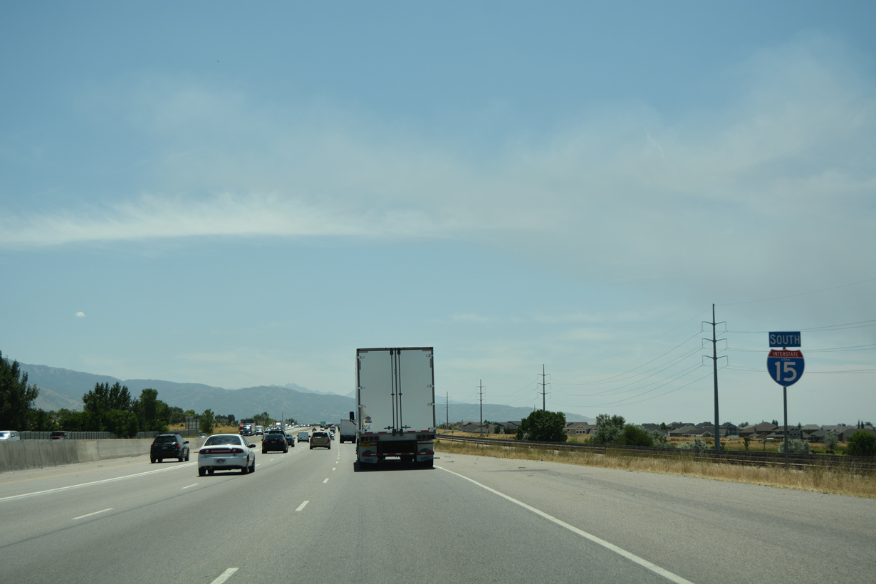
 South
South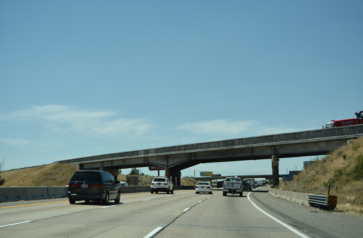
Interstate 15 curves southward from the split with I-84 east and the 4400 South overpass just inside the Riverdale city limits.
07/08/16
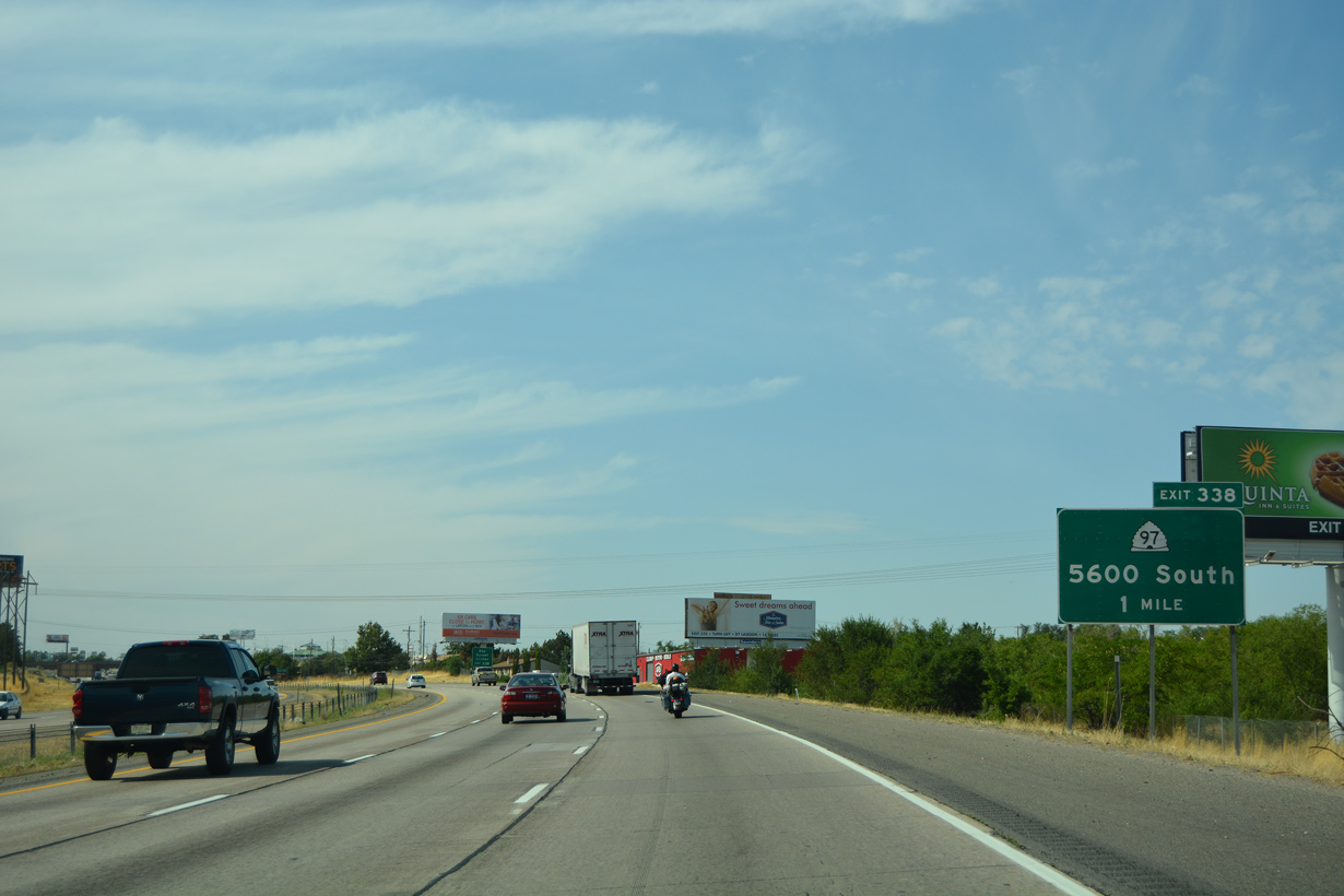
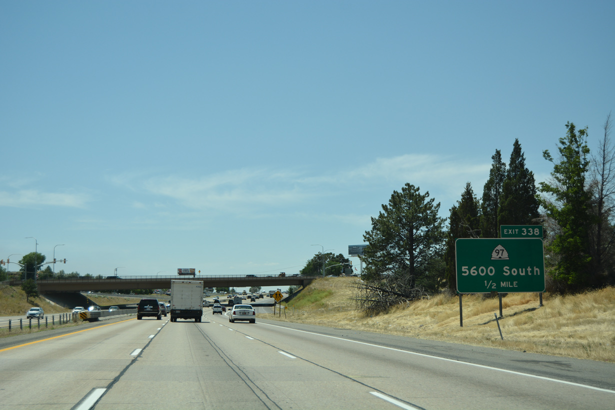
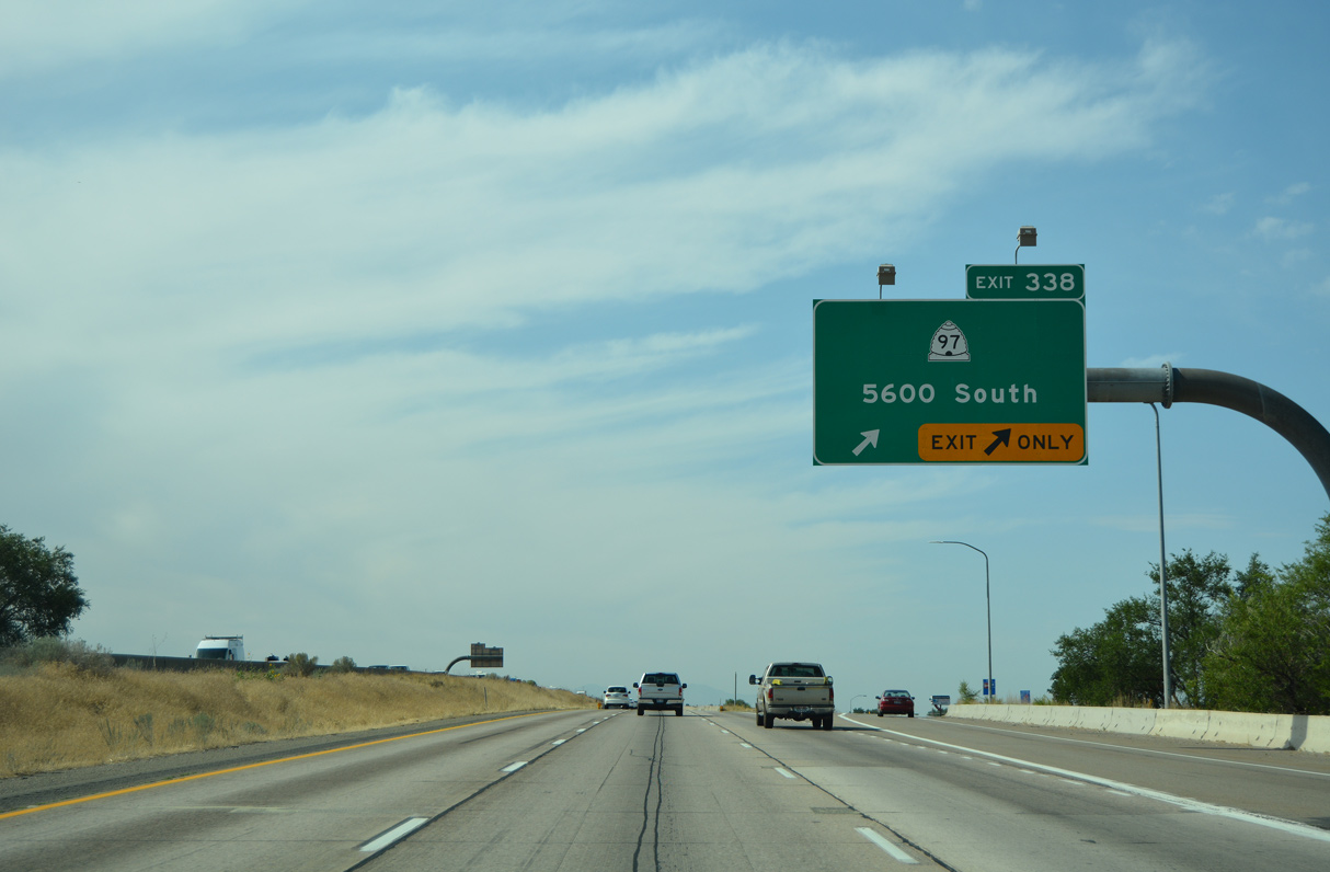
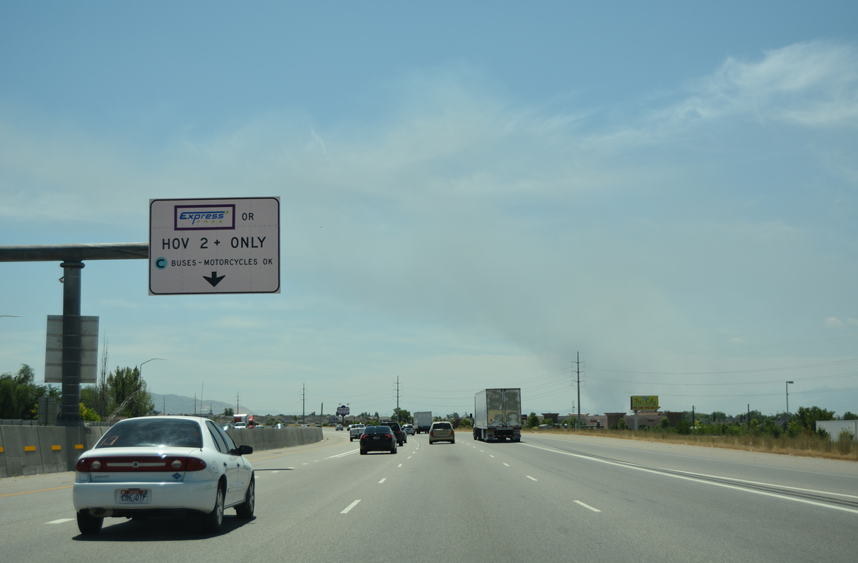
The succeeding exit along Interstate 15 south is with SR 97 (5600 South), a 5.33 mile long route west to SR 37 (5900 West) in Hooper.
08/10/16
Incorporated on March 10, 1937, the city of Roy had 39,306 residents as of the 2020 Census. It is notable for being the home of Chicago Bears Quarterback Jim McMahon.
07/08/16
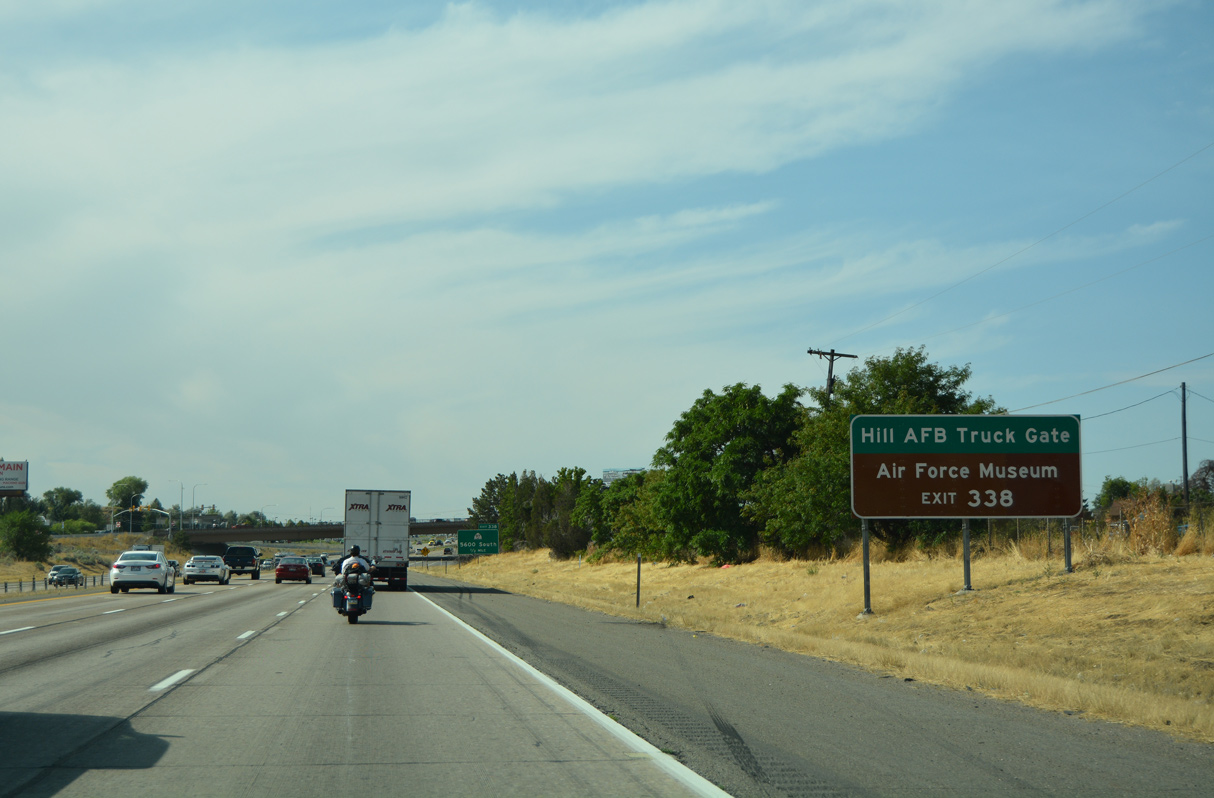
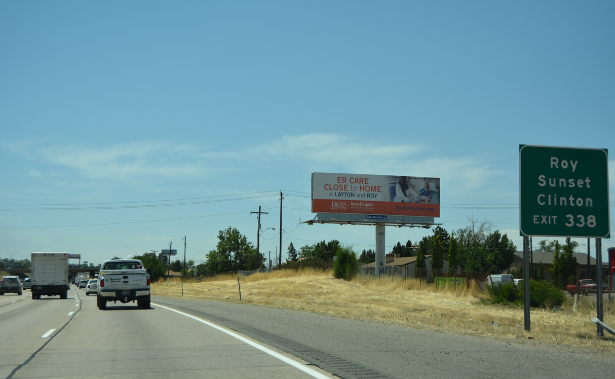
Wardleigh Road ties into the parclo interchange at Exit 338 from the Truck Gate to adjacent Hill Air Force Base. The Hill Aerospace Museum lies just east of I-15 as well.
08/10/16
A loop ramp connects SR 26 (Riverdale Road) with Interstate 15 south ahead of Exit 338. Parallel SR 126 (1900 West) links SR 79 with SR 26 and the city of Sunset to the south.
07/08/16
08/10/16
Interstate 15 proceeds south from Roy into northern Davis County and the city of Sunset.
07/08/16
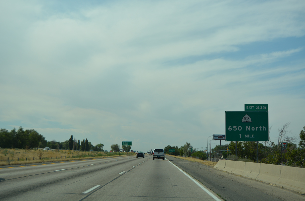
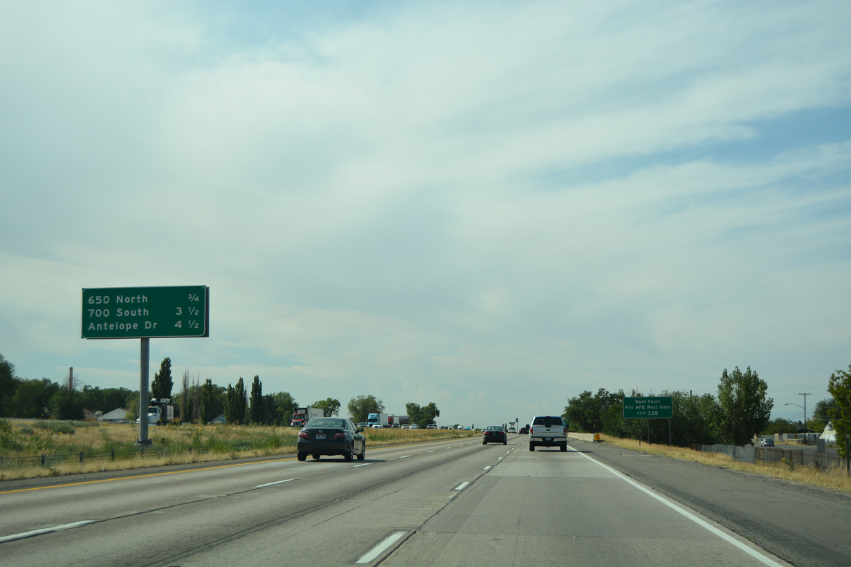
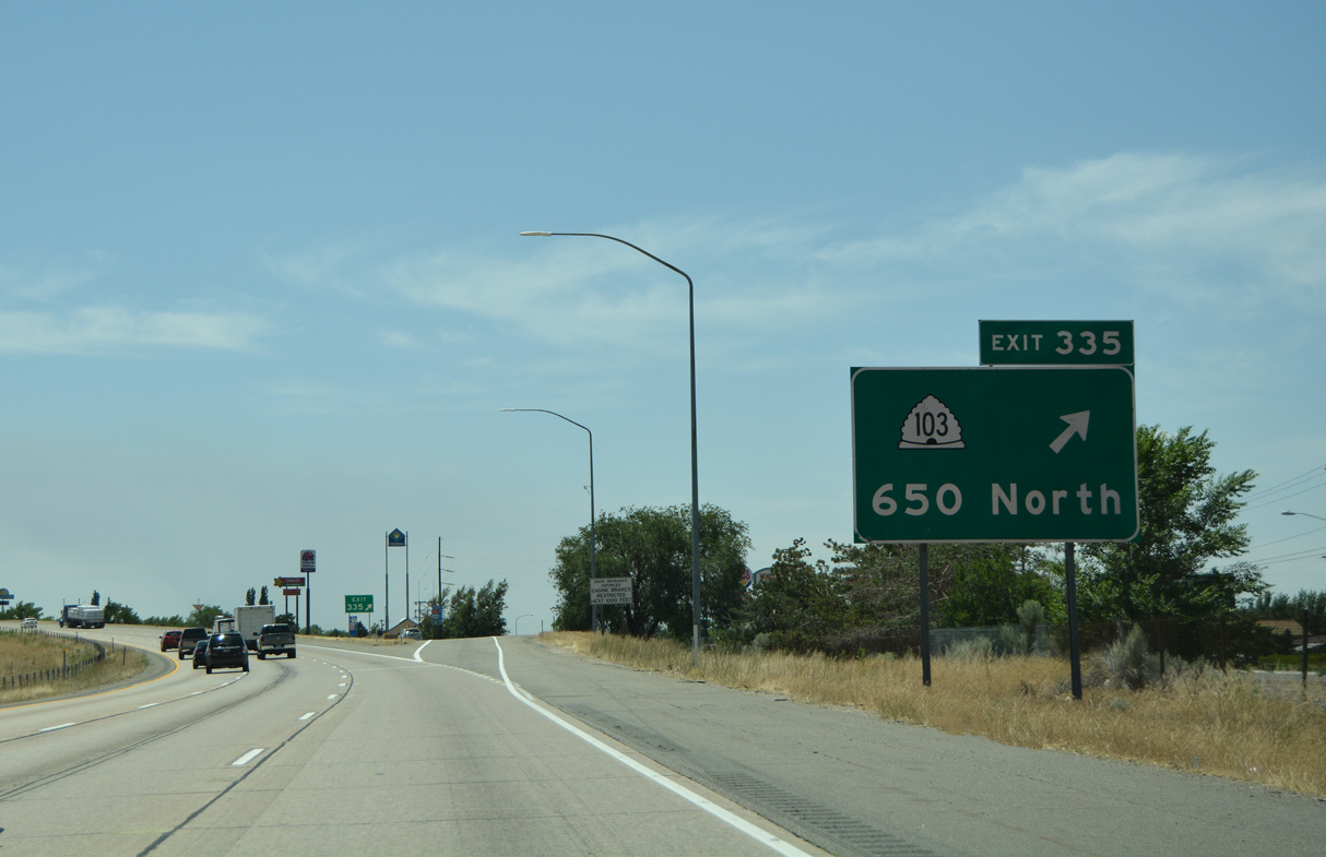
I-15 and adjacent SR 126 (Main Street) advance south through Sunset to SR 103 (650 North) in the city of Clearfield. SR 37 (1800 North) stems west from SR 126 to the city of Clinton along this stretch.
08/10/16
08/10/16
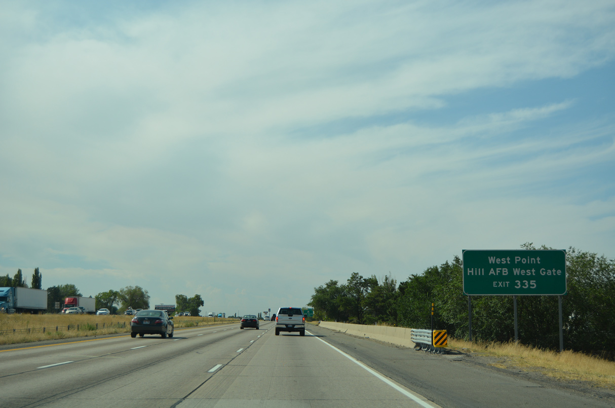
SR 103 (650 north) east leads to M Avenue and the West Gate of Hill Air Force Base.
08/10/16
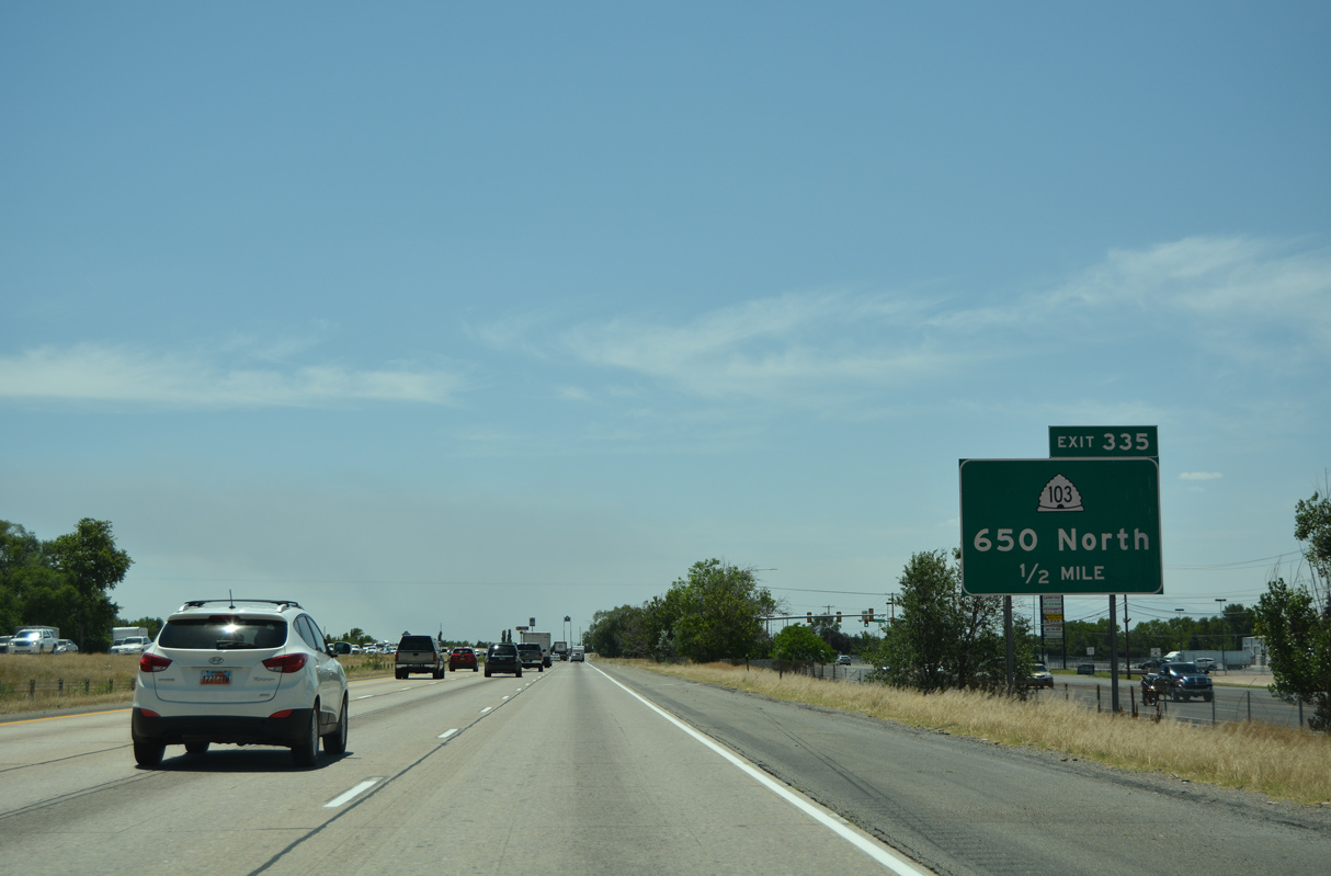
Linking SR 126 (old U.S. 91) and I-15 at Exit 335, State Route 103 is just 0.213 miles in length.
07/08/16
SR 126 shifts southeast onto State Street through Clearfield beyond SR 103 and the diamond interchange at Exit 335. SR 126 (old U.S. 91) meets Interstate 15 again at Exit 330.
07/08/16
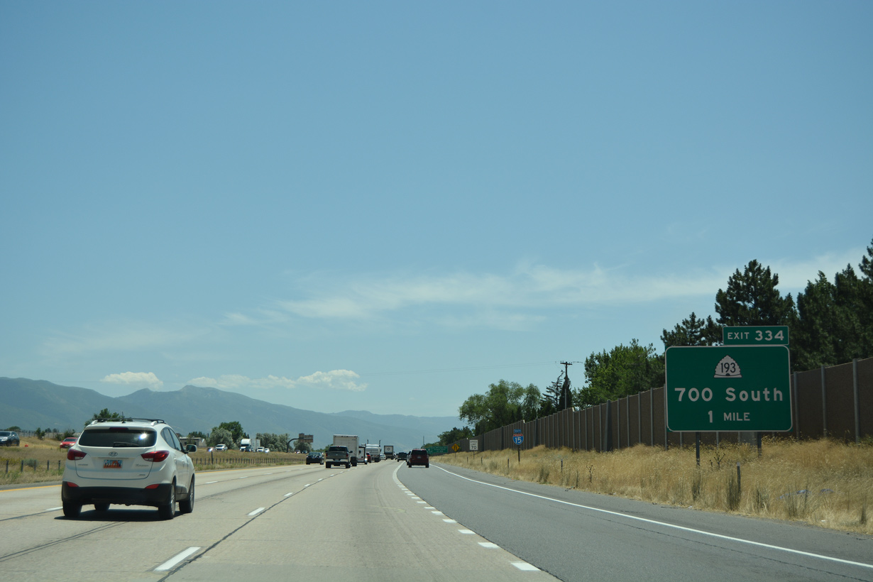
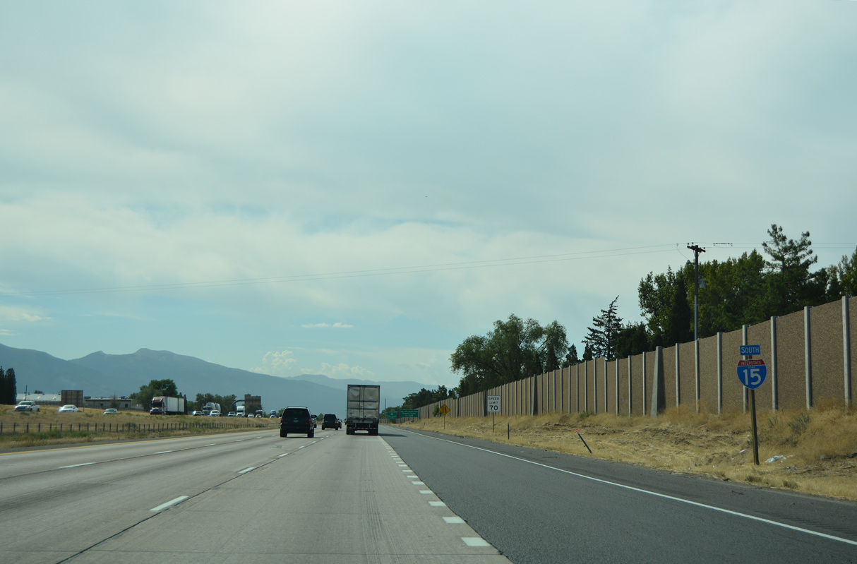
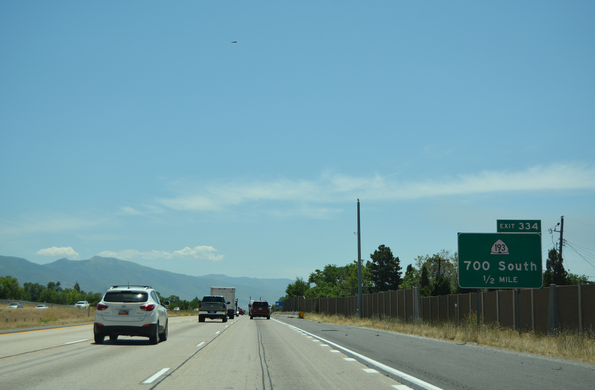
The Wasatch Range comes back into view as Interstate 15 angles southeast to the modified diamond interchange (Exit 334) with SR 193 (700 South).
07/08/16
08/10/16
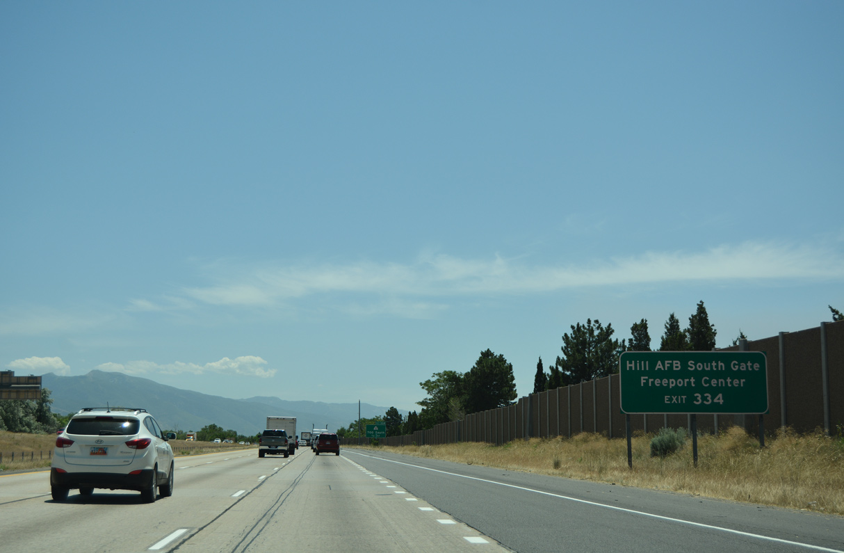
A five lane boulevard, SR 193 (700 South) leads west to the Freeport Center in Clearfield and east to SR 202 (Hill Field Road) at the Hill Air Force Base South Gate.
07/08/16
Measuring 9.46 miles in length, SR 193 runs west to 3000 West along the Syracuse and West Point city line and east from I-15 to U.S. 89 in northeast Layton.
07/08/16
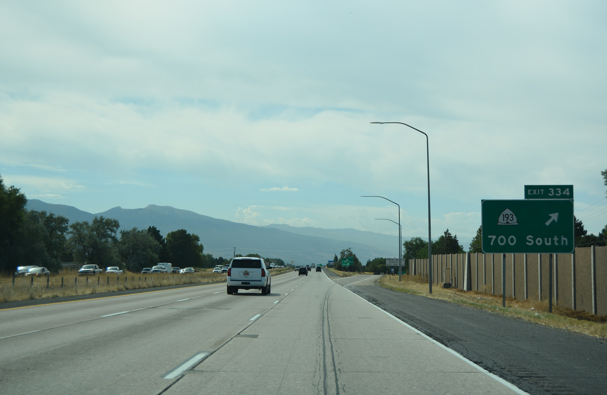
Exit 334 departs I-15 south for SR 193 (700 South) in Clearfield. The Clearfield city motto is "We've Got It Made". The city incorporated on March 21, 1946 and had a population of 31,900 as of the 2020 Census.
08/10/16
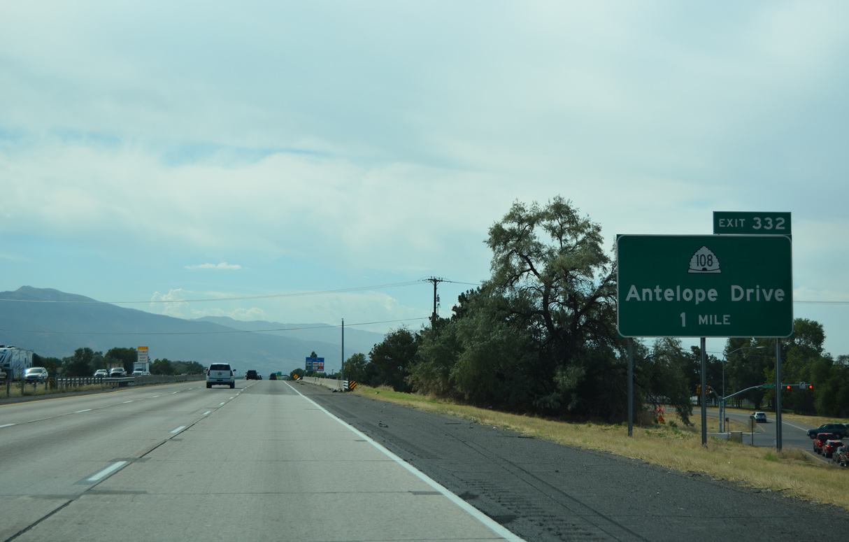
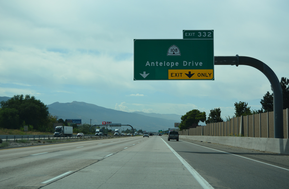
SR 108 concludes a 12.92 mile long loop south from SR 126 at West Haven along Antelope Drive east at Exit 332 in Layton.
08/10/16
Antelope Drive extends east from SR 108 and I-15 across Layton to the expressway along U.S. 89. The largest city in Davis County with 81,7273 as of the 2020 Census, Layton incorporated in 1920.
08/10/16
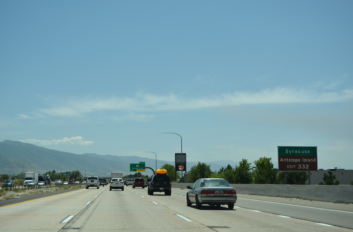
Centered on the junction of SR 108 and SR 127 along Antelope Drive, the city of Syracuse incorporated on September 3, 1935 and was home to 32,141 as of the 2020 Census.
07/08/16
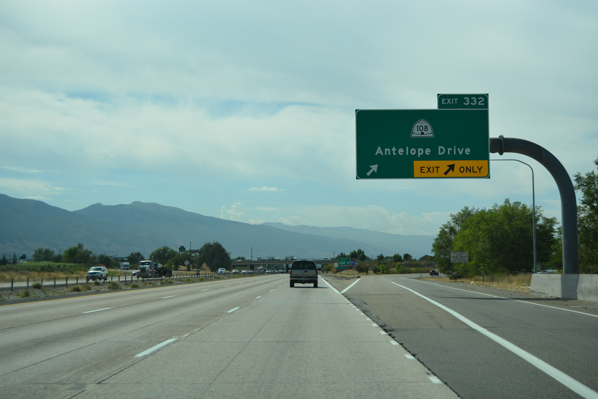
SR 108 mostly consist of urban arterials or streets west along Antelope Drive to Clearfield and SR 127, north along 2000 West to West Point and Clinton, and northeast on Midland Drive in Roy.
07/08/16
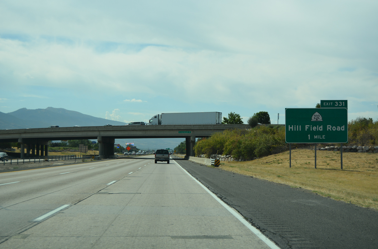
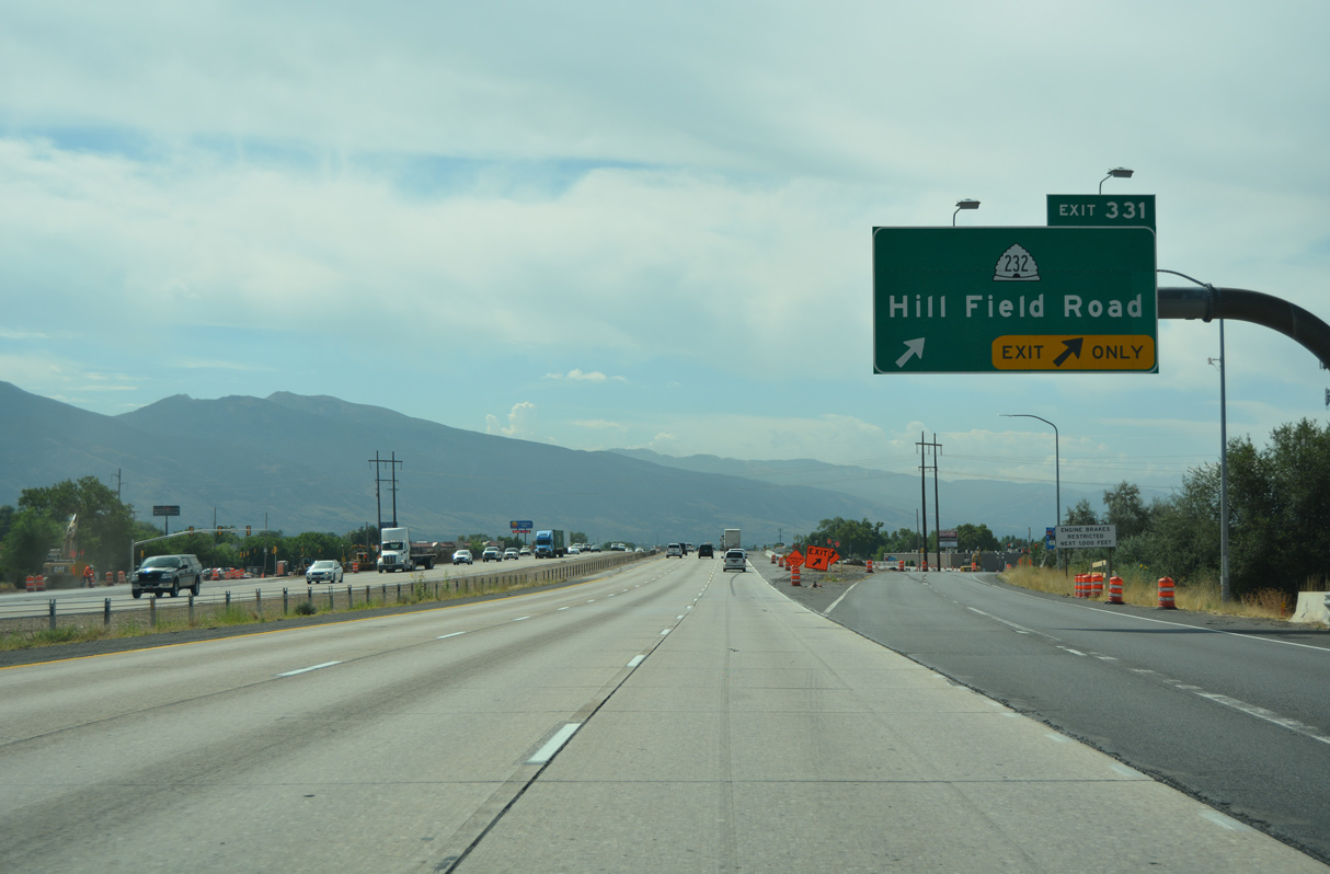
SR 232 (Hill Field Road) south converges with Interstate 15 at a single point interchange (Exit 331) in Layton.
08/10/16
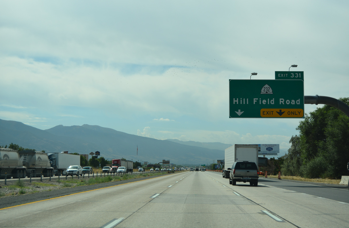
A 2.43 mile long route, Hill Field Road leads SR 232 north to SR 193 (3000 North) at the South Gate of Hill AFB and south to adjacent SR 126 (Main Street).
08/10/16
08/10/16
07/08/16
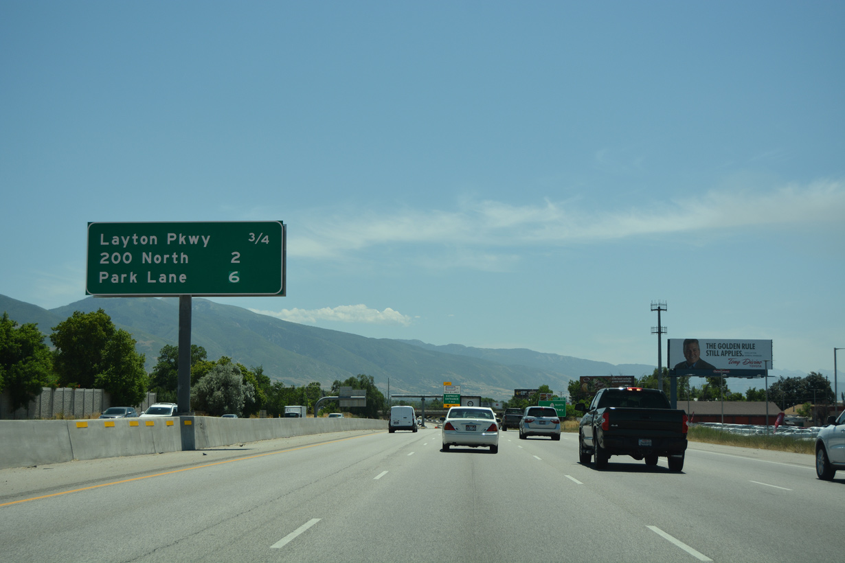
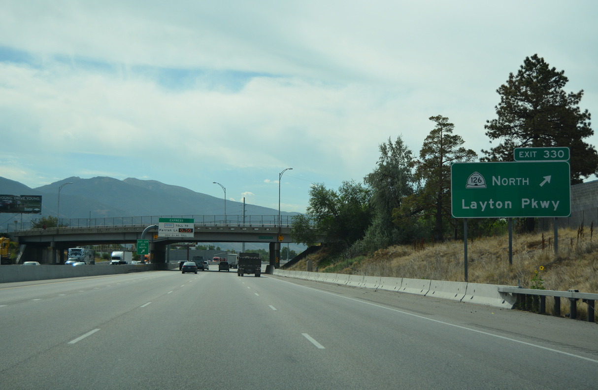
SR 126 returns to I-15 at Exit 330 via Layton Parkway east from Main Street to S Fort Lane in Layton.
07/08/16
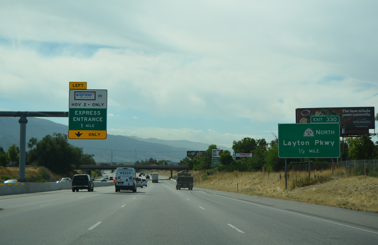
The SPUI (Exit 330) with Layton Parkway (SR 126) opened on November 20, 2010.
08/10/16
Layton Parkway was built to improve access across Layton from Flint Street east to Fort Lane; it was extended in 2011-2012 west to Angel Street. A section of old U.S. 91 was eliminated when Exit 330 was built.
08/10/16
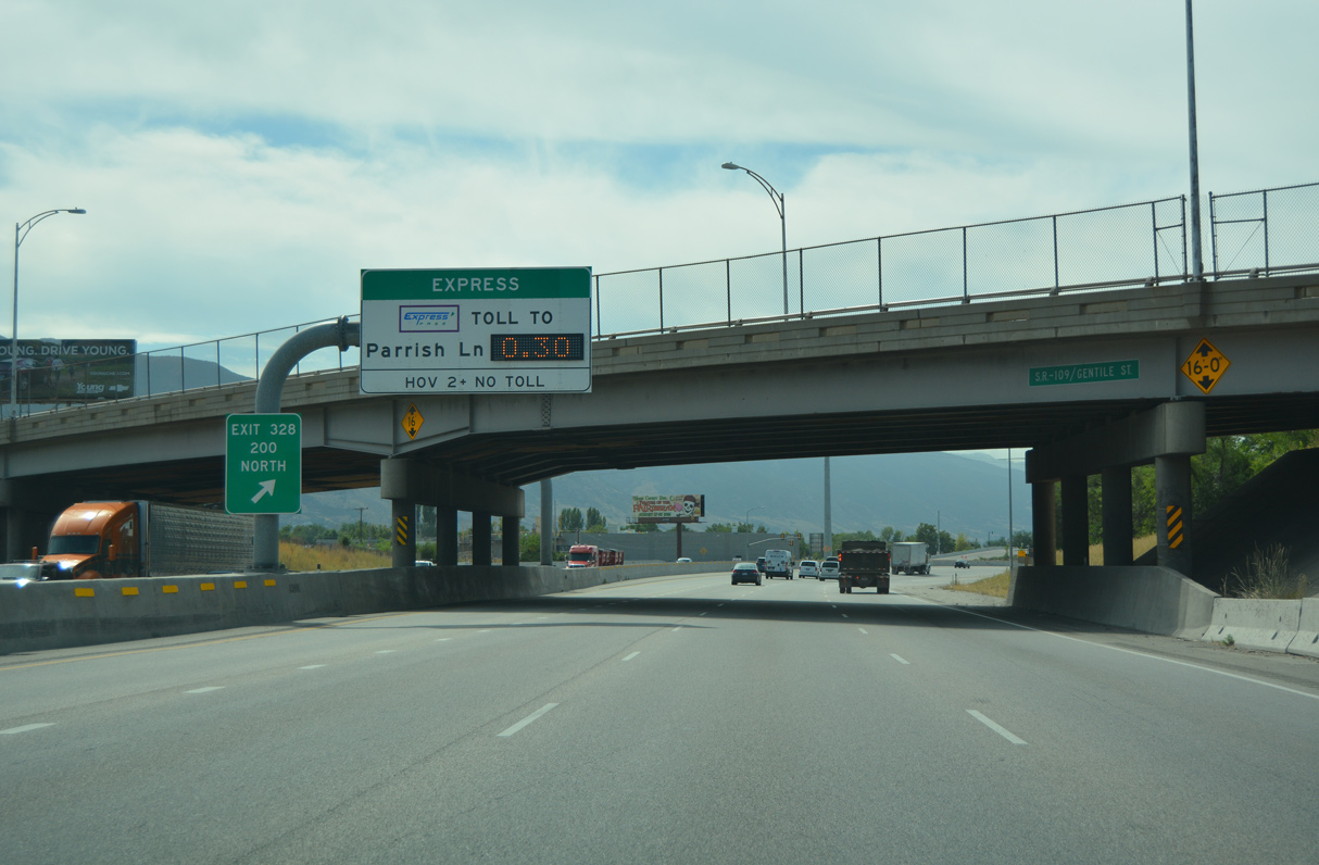
SR 109 (Gentile Street) spans Interstate 15 just north of Exit 330 without direct access. The 2.97 mile long route stems east from SR 126 (Main Street) to U.S. 89 across south Layton.
08/10/16
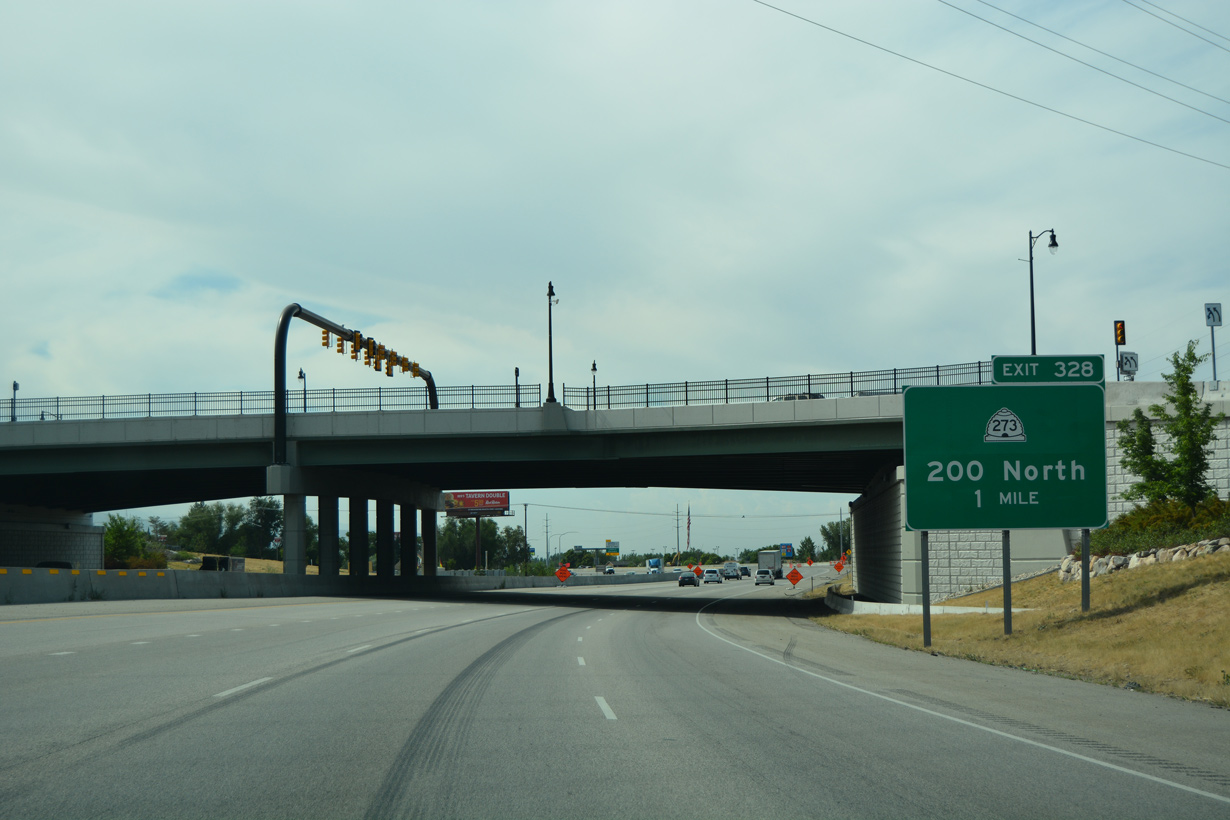
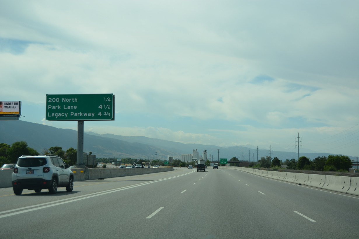
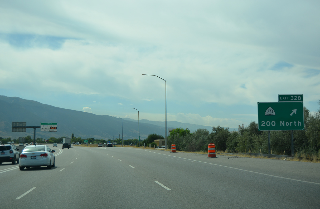
Exit 328 connects Interstate 15 with the north end of SR 273 along 200 North in Kaysville.
08/10/16
07/08/16
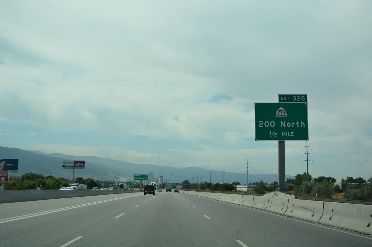
Following old U.S. 91 southeast along Main Street, SR 273 is a 3.06 mile long route from Exit 328 to the freeway along U.S. 89 on the Fruit Heights and Farmington city line.
08/10/16
08/10/16
SR 273 replaced SR 106 along Main Street (old U.S. 91) southeast from 200 North to U.S. 89. Main Street becomes part of SR 106 south of Shepard Lane in Farmington.
08/10/16
07/08/16
07/08/16
07/08/16
07/08/16
07/08/16
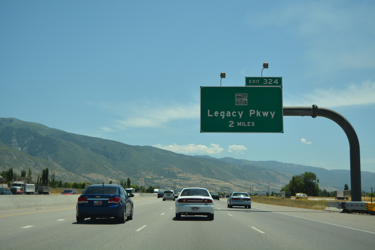
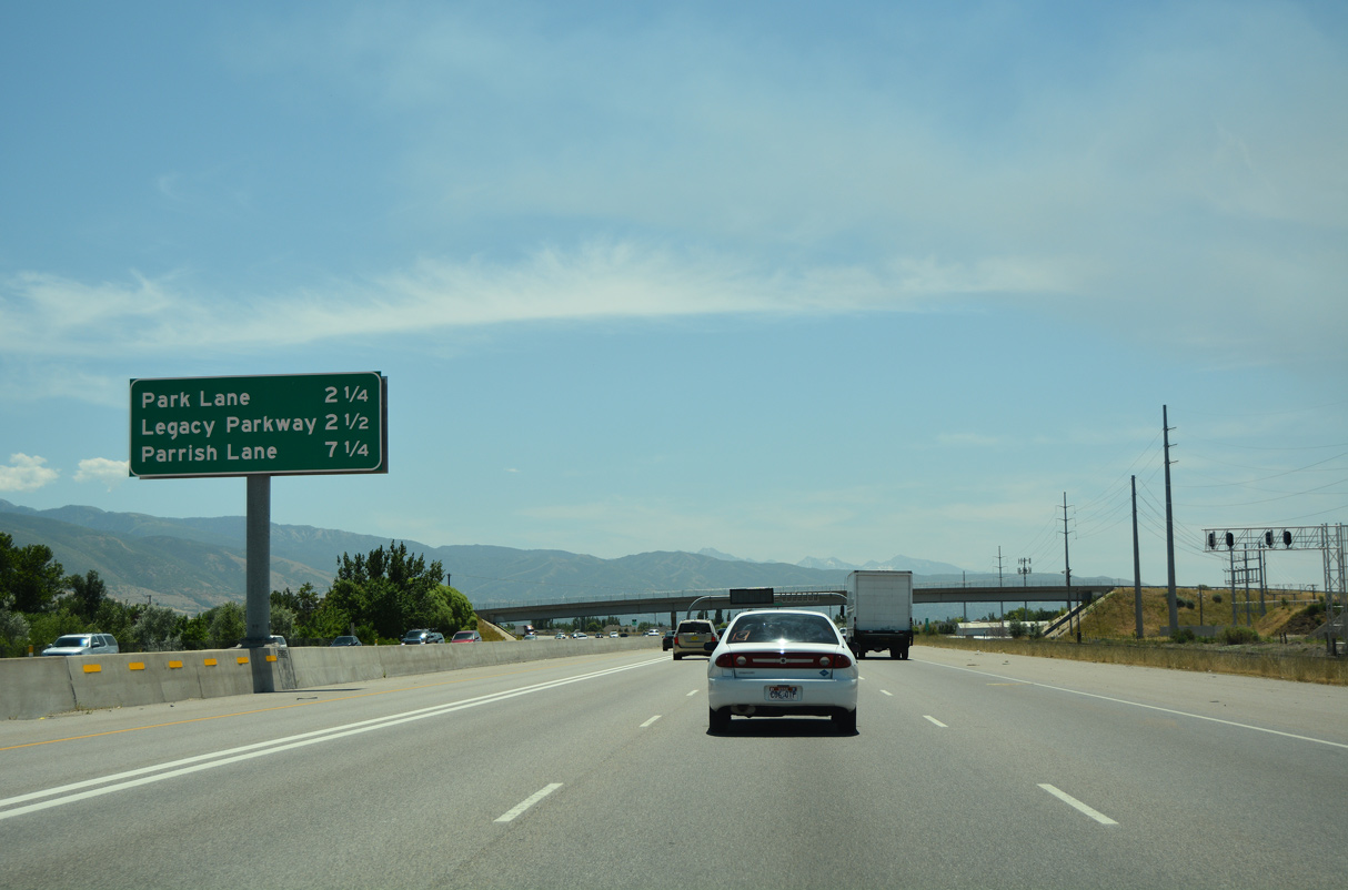
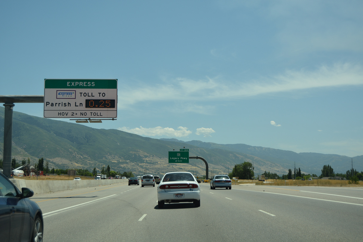
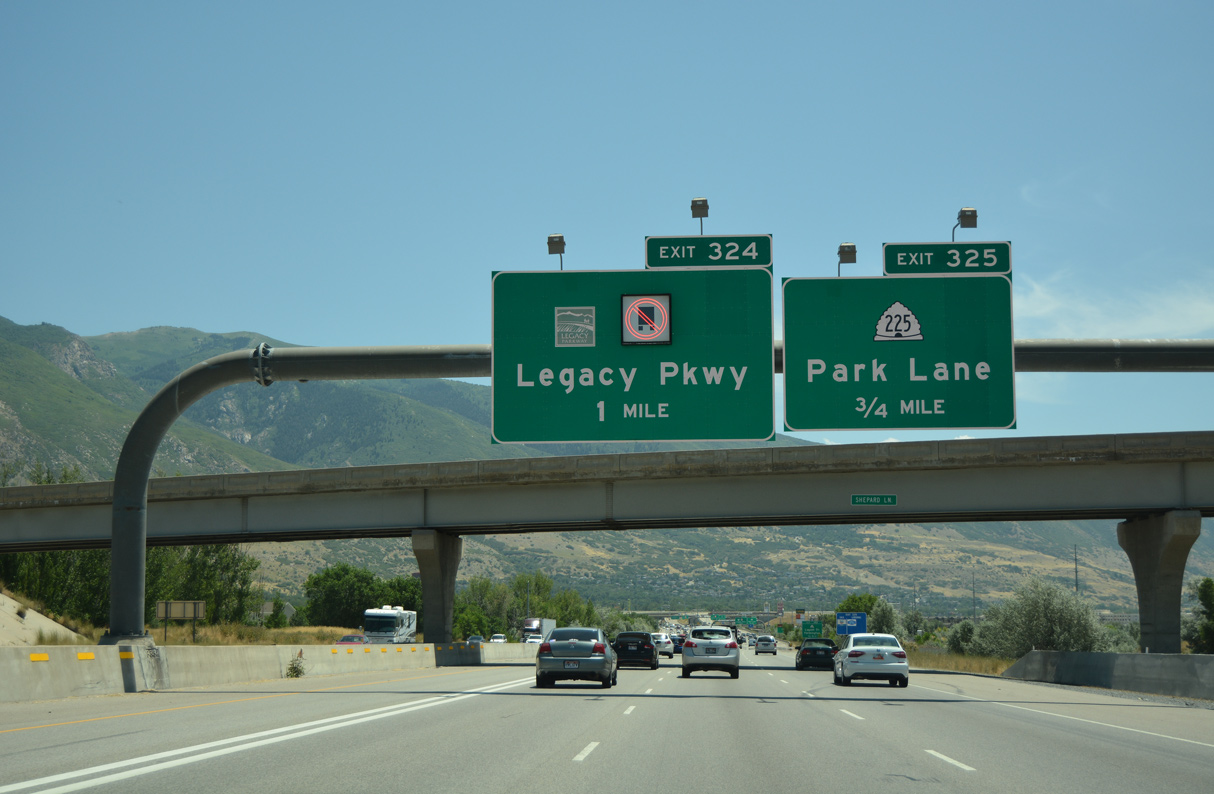
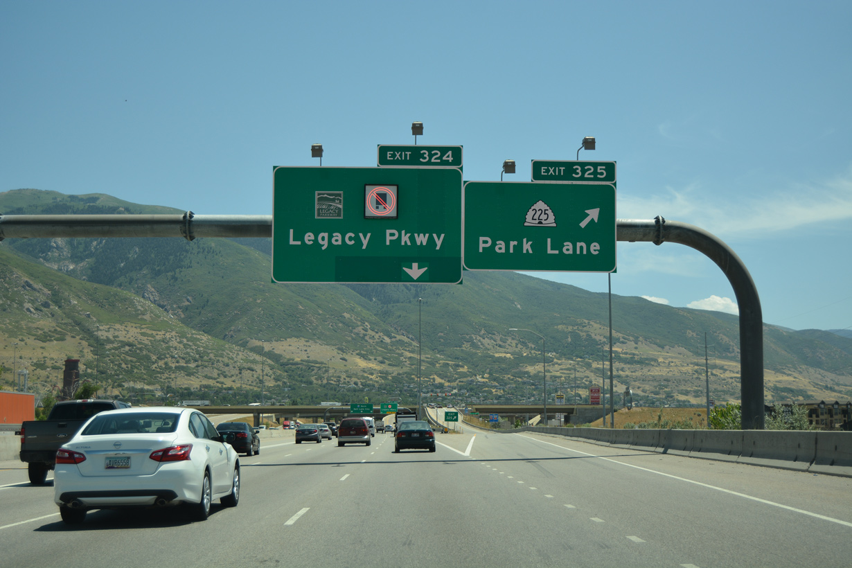
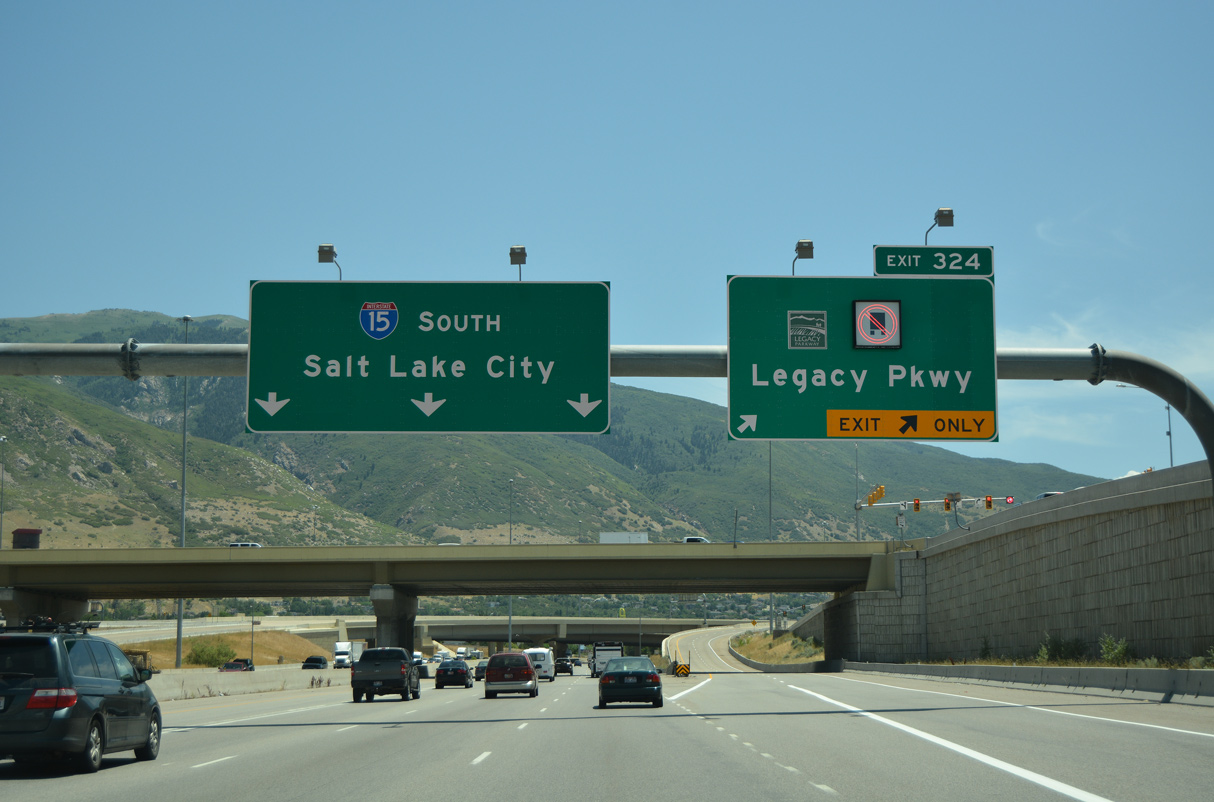
SR 67 (Legacy Parkway) constitutes an 11.55 mile long limited access highway south from Exit 324 to Interstate 215 at North Salt Lake.
07/08/16
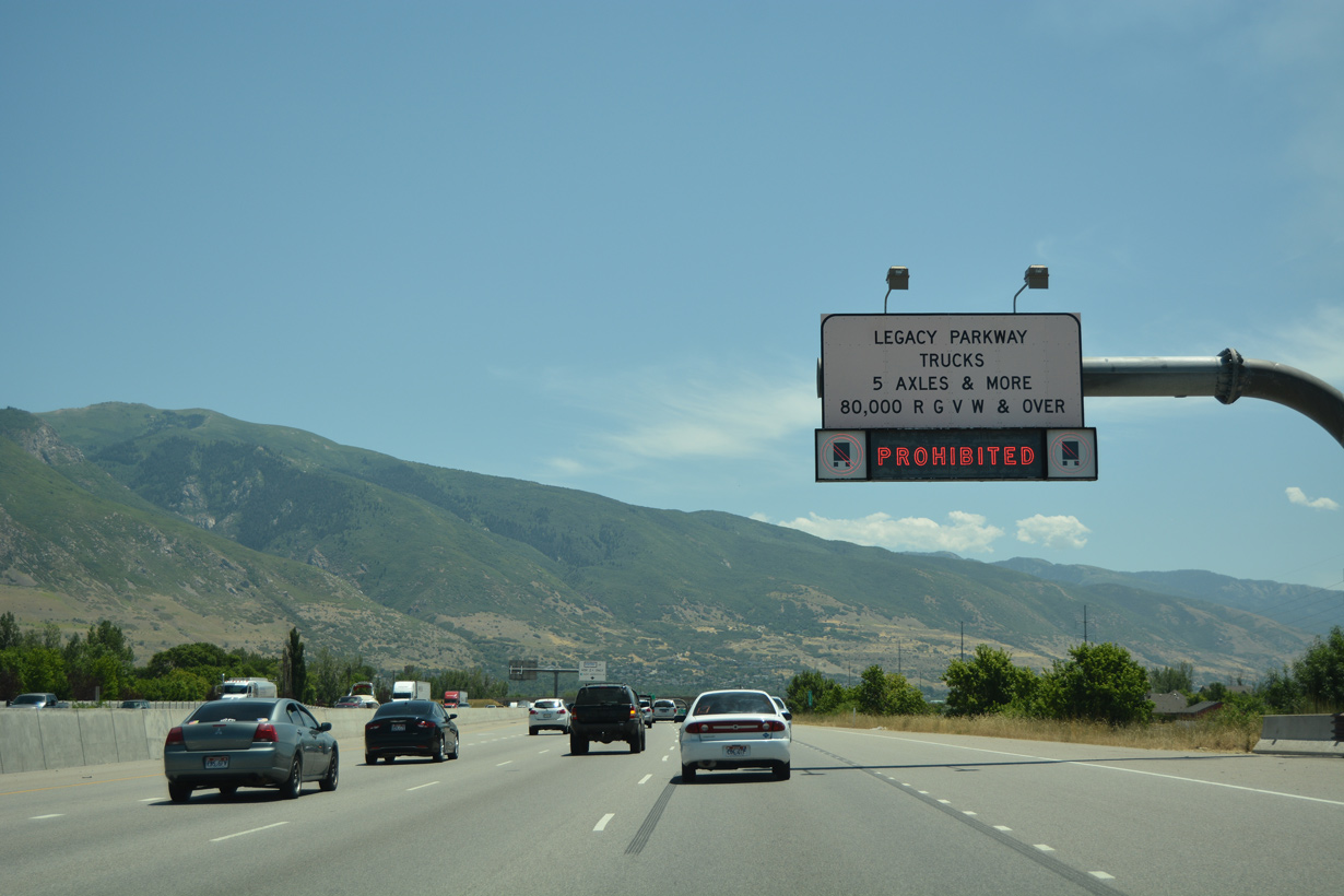
The truck restriction along Legacy Parkway ended in 2020. Prior to that time, SR 67 was only open to truck traffic selectively as a detour for parallel Interstate 15.
07/08/16
07/08/16
Opened to traffic on September 13, 2008, Legacy Parkway is a freeway grade route that offers an alternate for Interstate 15 south to I-215 and Salt Lake City.
07/08/16
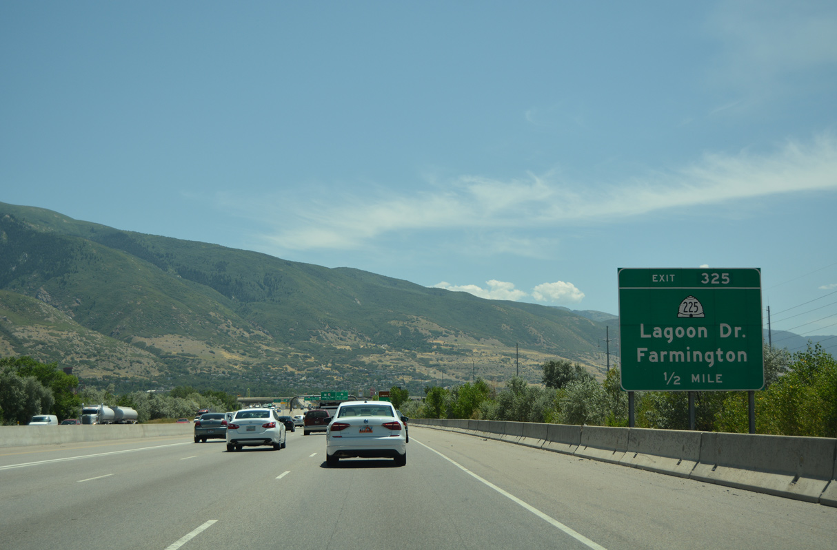
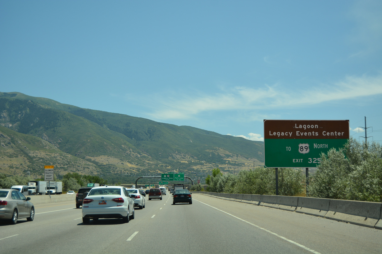
SR 225 (Park Lane) east connects with Lagoon Drive south to Lagoon theme park.
07/08/16
SR 225 (Park Lane) links I-15 south with the freeway along U.S. 89 north to Fruit Heights.
07/08/16
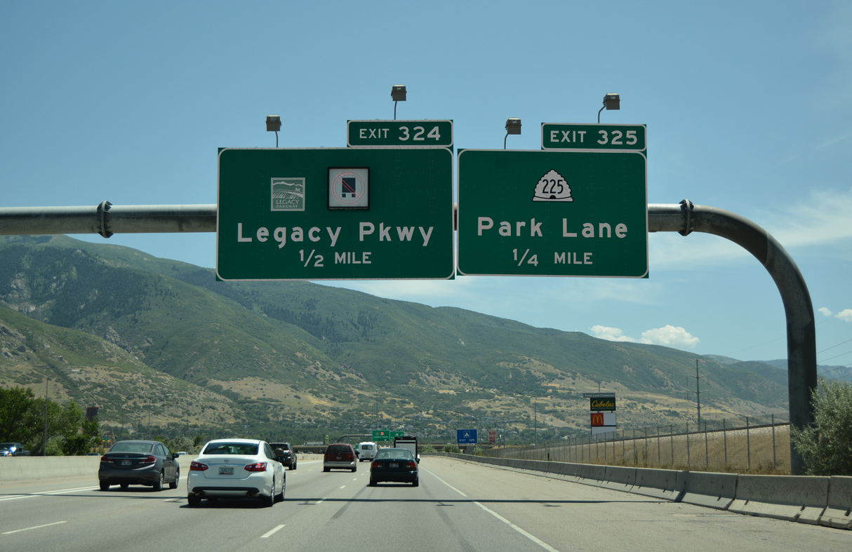
The half diamond interchange (Exit 325) with SR 225 (Park Lane) falls within the wye interchange (Exit 324) with SR 67 (Legacy Parkway) southbound.
07/08/16
SR 225 lines Park Lane east 0.76 miles from the adjacent Union Pacific Railroad viaduct to SR 106 (Main Street).
07/08/16
SR 67 (Legacy Parkway) runs along the west side of I-15 south into Centerville before diverging westward around West Bountiful and Woods Cross.
07/08/16
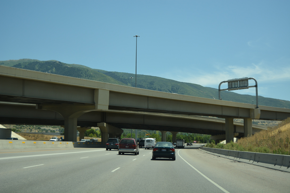
Flyover ramps at the north end of SR 67 (Legacy Parkway).
07/08/16
U.S. 89 combines with I-15 south from a wye interchange adjacent to the ramps with SR 67 (Legacy Parkway).
08/10/16
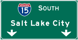

Photo Credits:
07/08/16, 08/10/16 by AARoads
Connect with:
U.S. 89
State Route 68
Page Updated 02-09-2022.