|
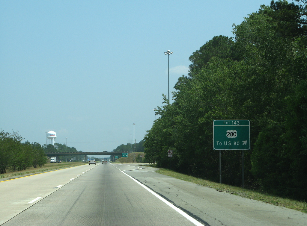
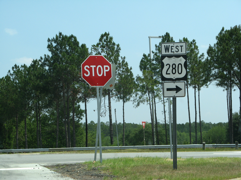
| Exit 143 for U.S. 280/SR 30 represents the lone interchange in Bryan County along Interstate 16. U.S. 280 concludes just 1.6 miles to the east at U.S. 80 and Blitchton. 05/29/05 |
|
| Eastbound Interstate 16 at the diamond interchange (Exit 143) with U.S. 280/SR 30. U.S. 280 travels 392 miles overall, taking a westward course to Pembroke, Claxton, Vidalia, Cordele, Columbus and ultimately Birmingham, Alabama. 05/29/07 |
|
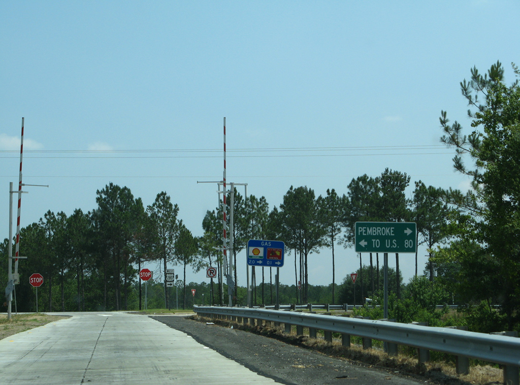
| SR 30 overlaps with U.S. 280 west to Americus and east to U.S. 80. SR 30 zigzags eastward using a combination of U.S. 80 east and SR 17 north to Port Wentworth. 05/29/07 |
|
| Signs posted at Exit 143 reference U.S. 280 west only from I-16 east. Historically U.S. 280 continued east alongside U.S. 80 into Savannah. 05/29/07 |
|
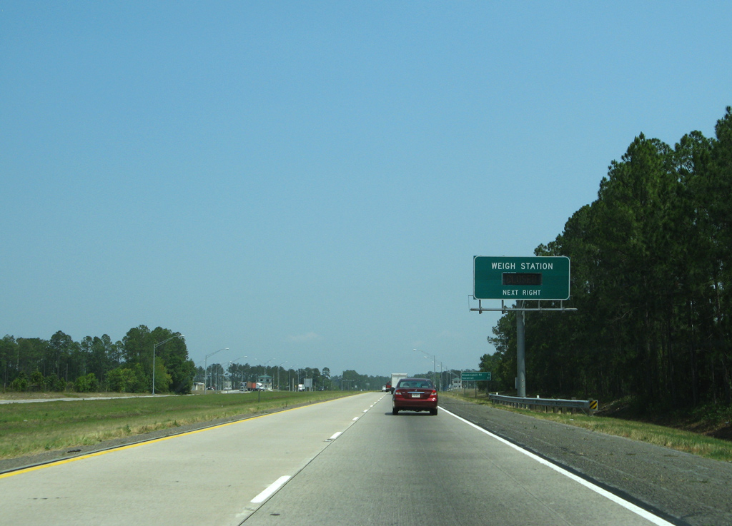
| A pair of weigh stations line Interstate 16 one mile to the southeast of U.S. 280/SR 30. 05/29/05 |
|
| Bryan County Interstate Centre lines the north side of Interstate 16 at U.S. 280. The industrial development was established in the mid-2000s. 05/29/07 |
|
| Truckers reach the lone weigh station of Interstate 16 east. 05/29/07 |
|
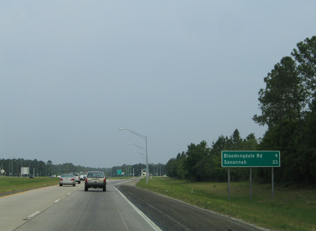
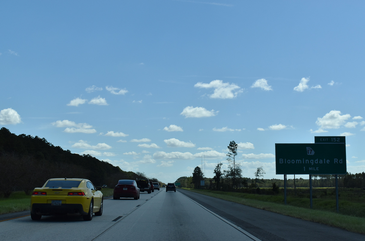
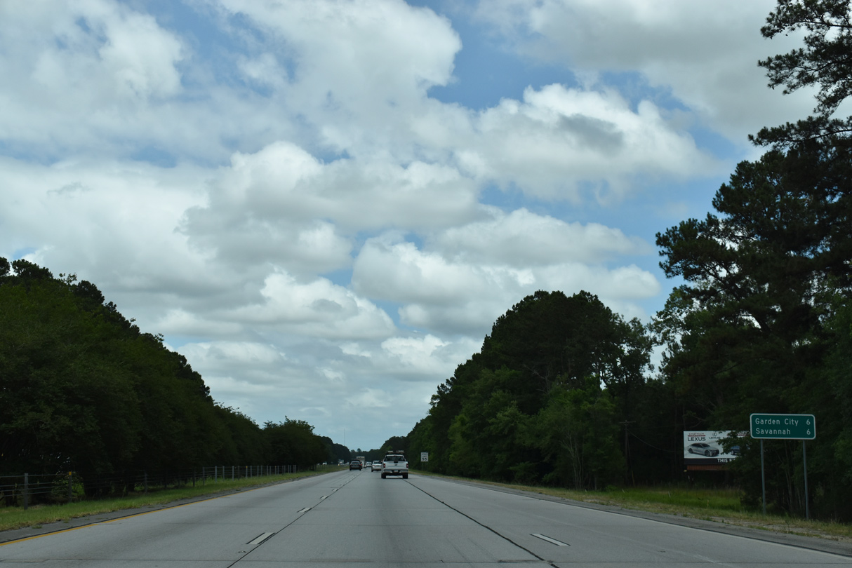
| Savannah is 23 miles away, with Bloomingdale Road referenced as the succeeding exit at nine miles. The design of this guide sign predates the addition of Exit 148. 05/29/05 |
|
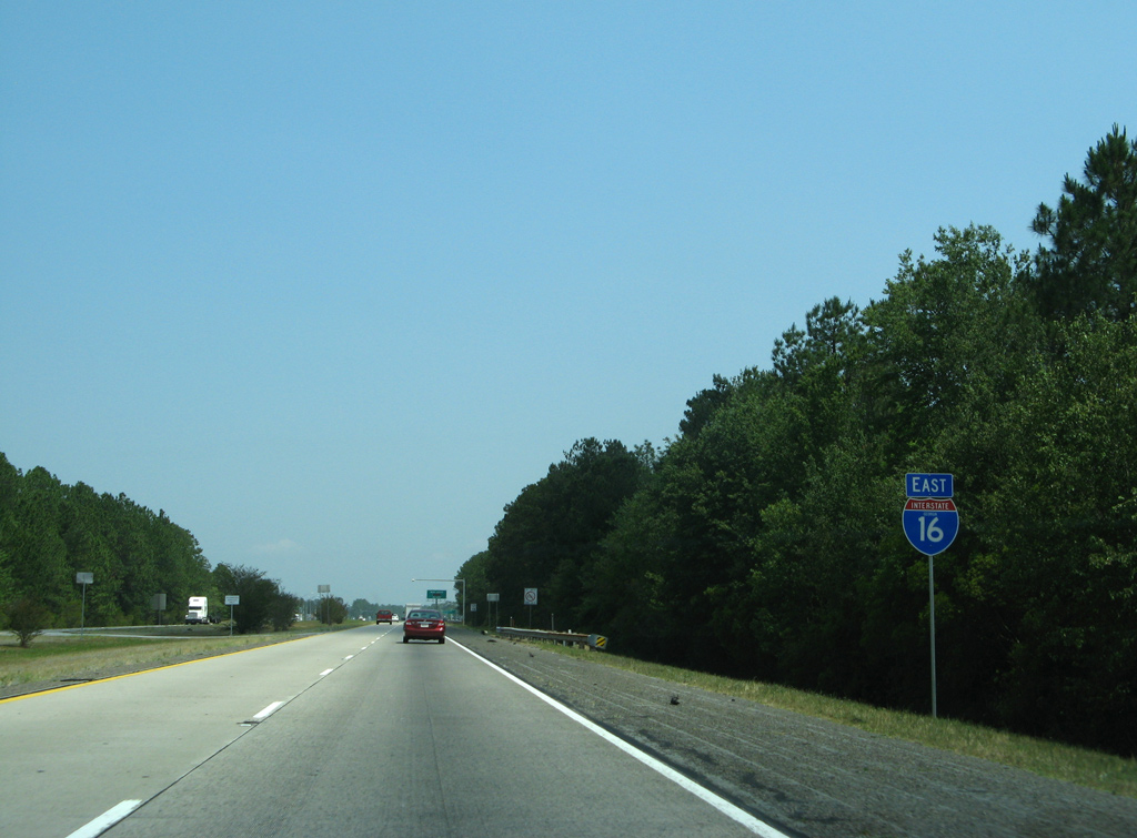
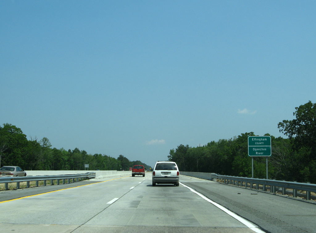
| Interstate 16 crosses the Ogeechee River into the southern wedge of Effingham County. 05/29/07 |
|
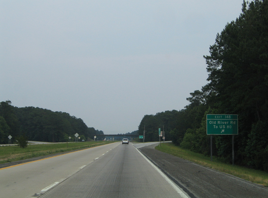
| Old River Road branches southward from U.S. 80/SR 26-30 at Eden to Meldrim and a diamond interchange (Exit 148) with Interstate 16. 05/29/07 |
|
| Exit 148 departs Interstate 16 east for Old River Road. Located in the western outskirts of the Savannah metropolitan area, some suburban development lines Old River Road in both directions from I-16 . Southward the road ties into SR 204. 05/29/05 |
|
| The confirming marker posted eastbound by milepost 149 was removed after 2019. 05/29/07 |
|
| Chatham County was formed in 1777 by the merging of Christ Church Parish and part of St. Phillips Parish. The third oldest county in Georgia derives its name from one of England's most celebrated prime ministers, William Pitt, the Earl of Chatham.1 09/25/22 |
|
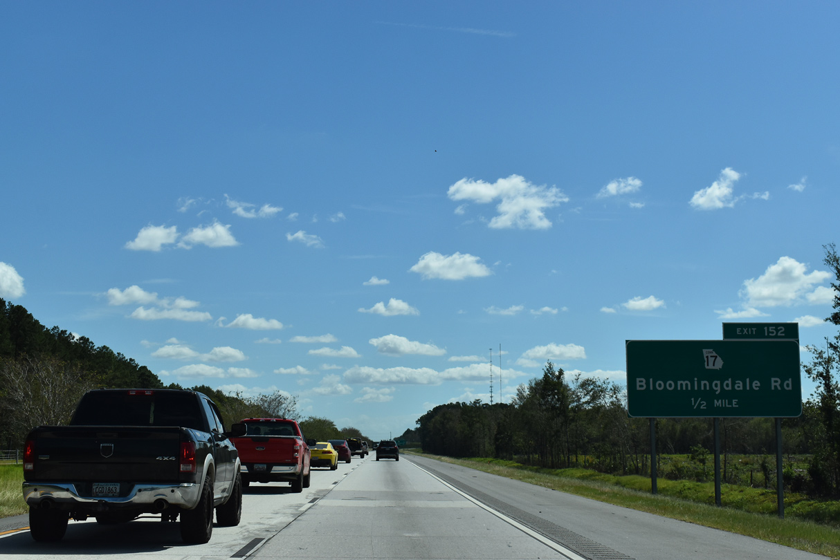
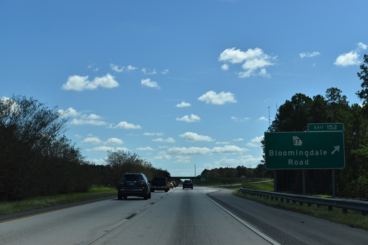
| Interstate 16 advances east to a dumbbell interchange (Exit 152) with SR 17CO (Bloomingdale Road) north and Little Neck Road south. 09/25/22 |
|
| Bloomingdale, a city incorporated in 19742, lies mostly to the north of Interstate 16 along SR 17CO, SR 17 (Jimmy DeLoach Parkway) and U.S. 80/SR 26 (Louisville Road). 09/25/22 |
|
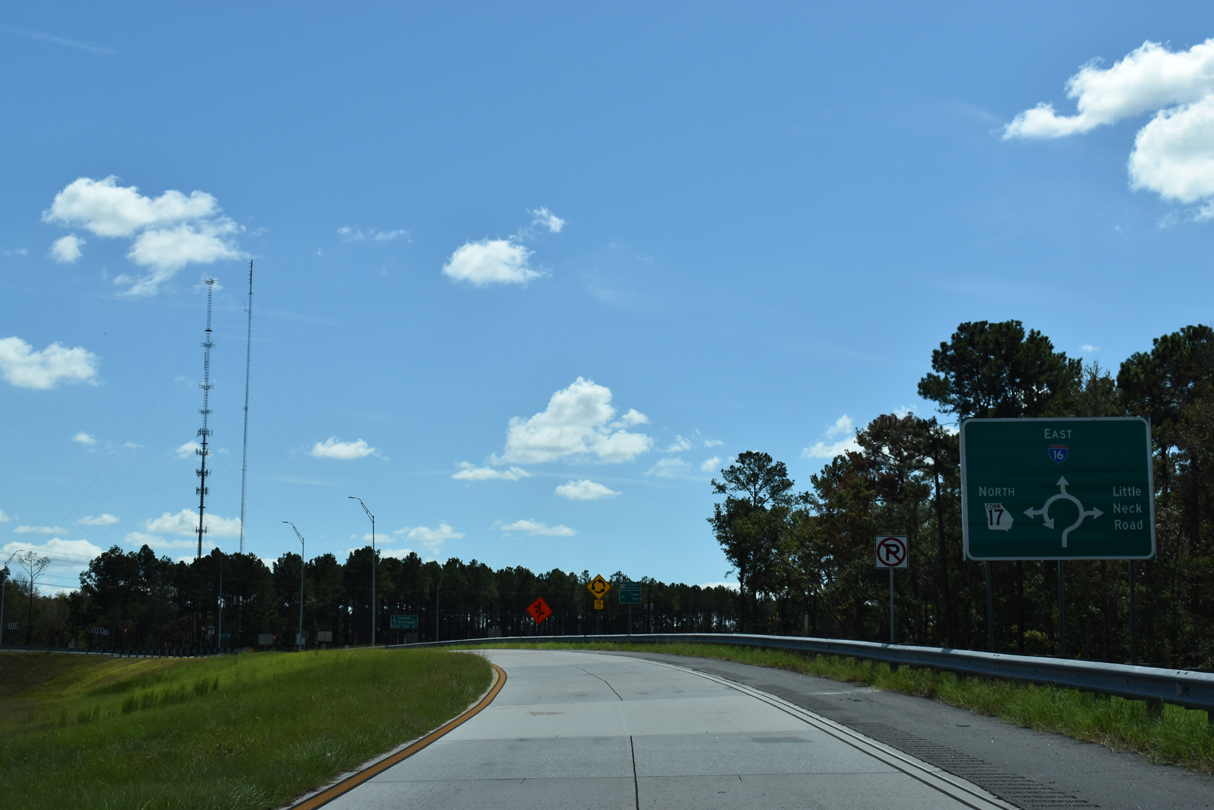
| SR 17CO was designated along Jimmy Deloach Parkway Extension as the link from I-16 to SR 17 at U.S. 80/SR 26. SR 17 mirrors the course of the Ogeechee River northwest from Bloomingdale to Millen and Louisville. 09/25/22 |
|
| Relocated onto Jimmy DeLoach Parkway east to Port Wentworth in 2020, SR 17 formerly commenced a 299.50 mile long route to the North Carolina state line at Exit 152. 09/25/22 |
|
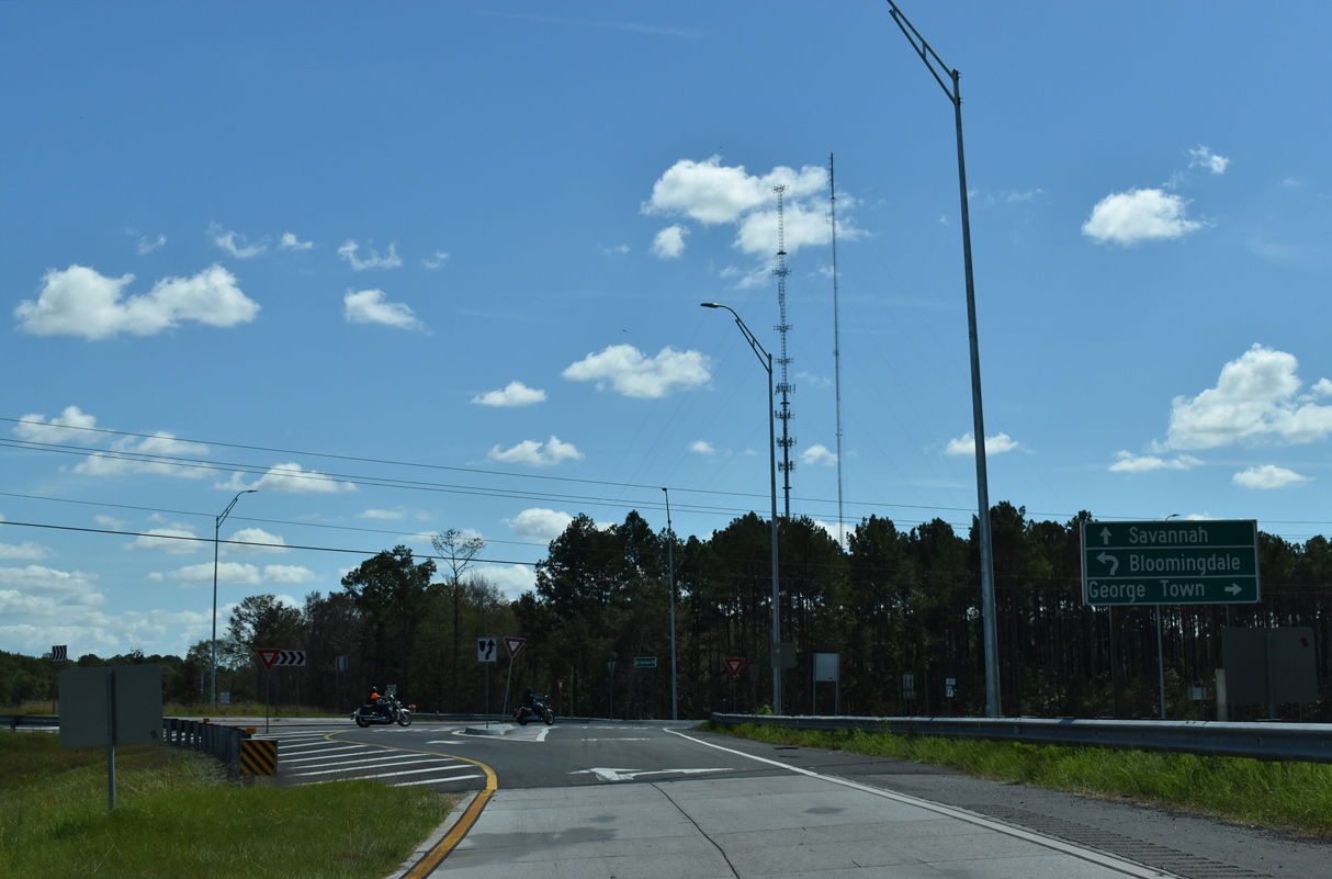
| Little Neck Road extends 8.56 miles southeast from SR 17CO (Jimmy DeLoach Parkway Extension) to U.S. 17/SR 25 (Coastal Highway) at George Town. 09/25/22 |
|
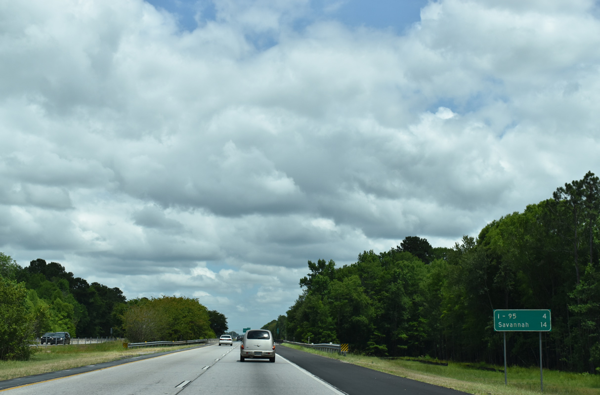
| Spanning the Little Ogeechee River, Interstate 95 leaves Bloomingdale for the city of Pooler as the speed limit reduces to 65 miles per hour. The exchange with Interstate 95 was the next exit in four miles until Pooler Parkway opened in 2004. 06/01/20 |
|
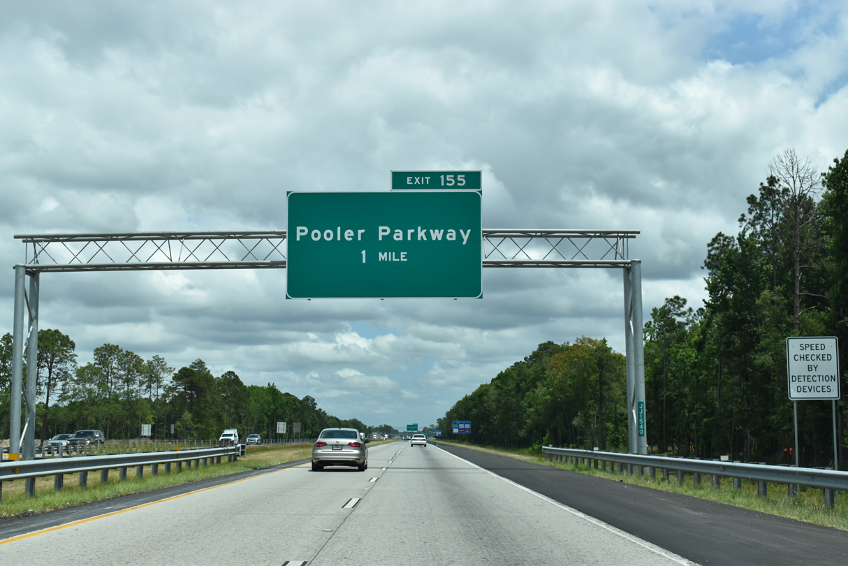
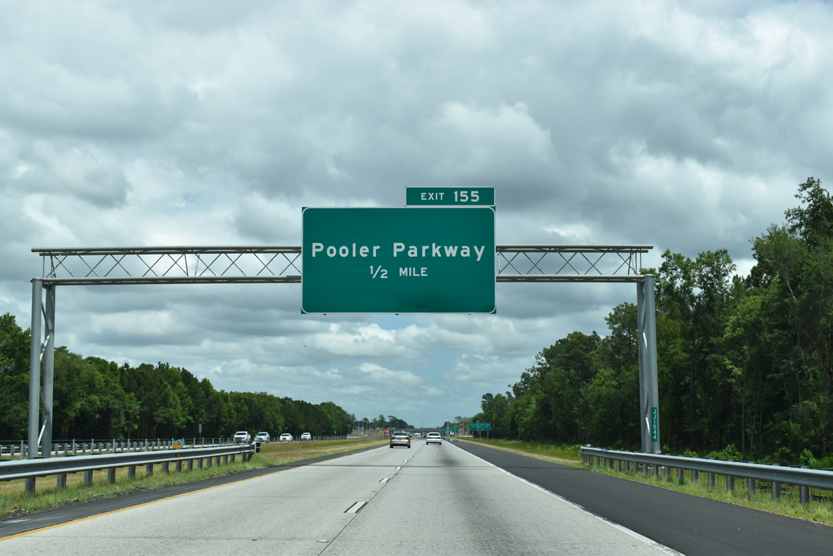
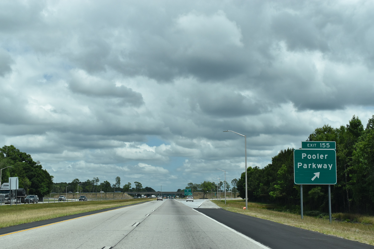
| A diamond interchange (Exit 155) joins Interstate 16 with Pooler Parkway, a county constructed arterial looping 8.29 miles north from Quacco Road to I-95 at Airways Avenue. 06/01/21 |
|
| Pooler Parkway constitutes a controlled access arterial through the city of Pooler with a grade separation at U.S. 80/SR 26 (Louisville Road). 06/01/21 |
|
| Pooler Parkway north transitions into Airways Avenue beyond the exchange with I-95 to the passenger terminal at Savannah / Hilton Head International Airport (SAV). 06/01/21 |
|
| Exit 155 leaves Interstate 16 east for Pooler Parkway north and Quacco Road south. Pooler Parkway accelerated suburban development in the area, becoming a commuter route in conjunction with I-16 into Savannah. 06/01/21 |
|
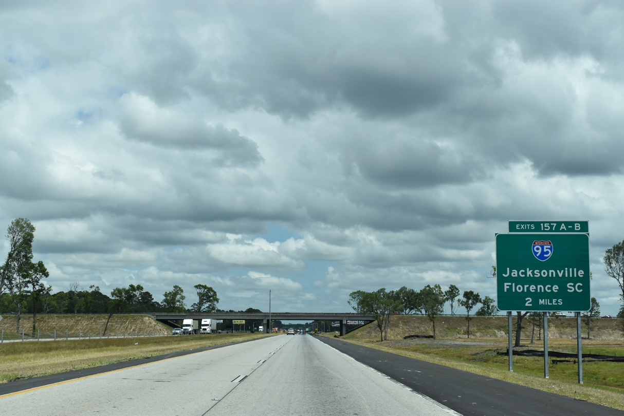
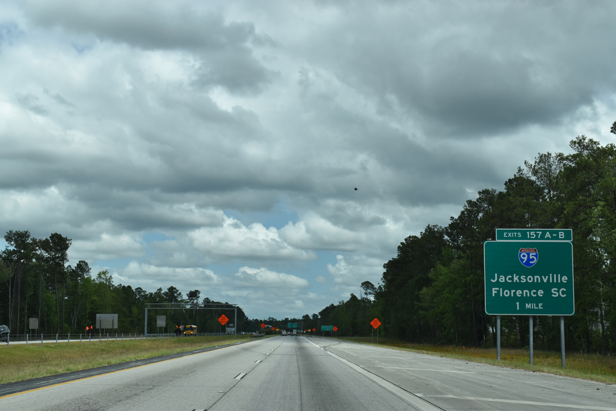
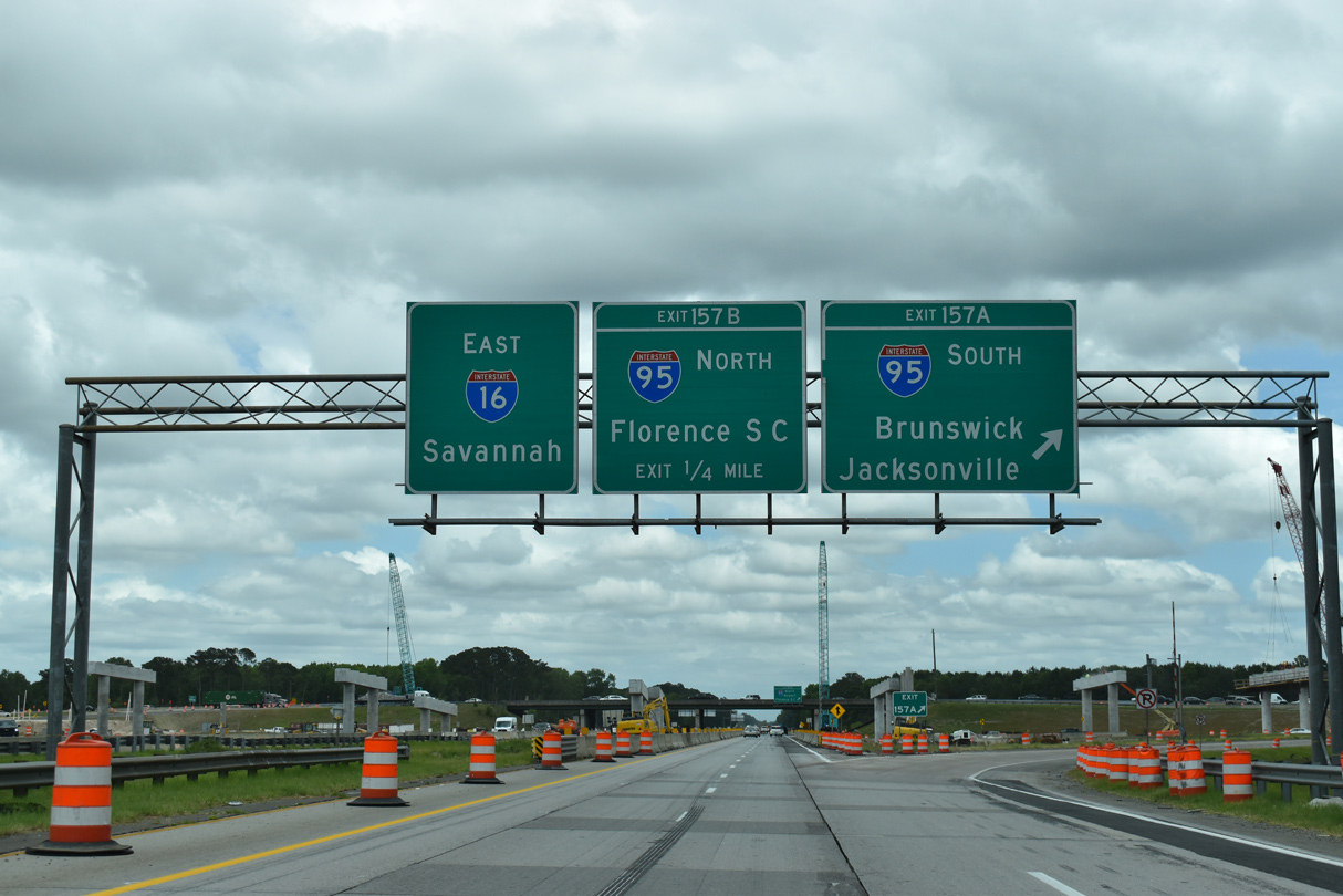
| A cloverleaf interchange (Exits 157A/B) connects Interstate 16 with I-95 two miles beyond Pooler Parkway. 06/01/21 |
|
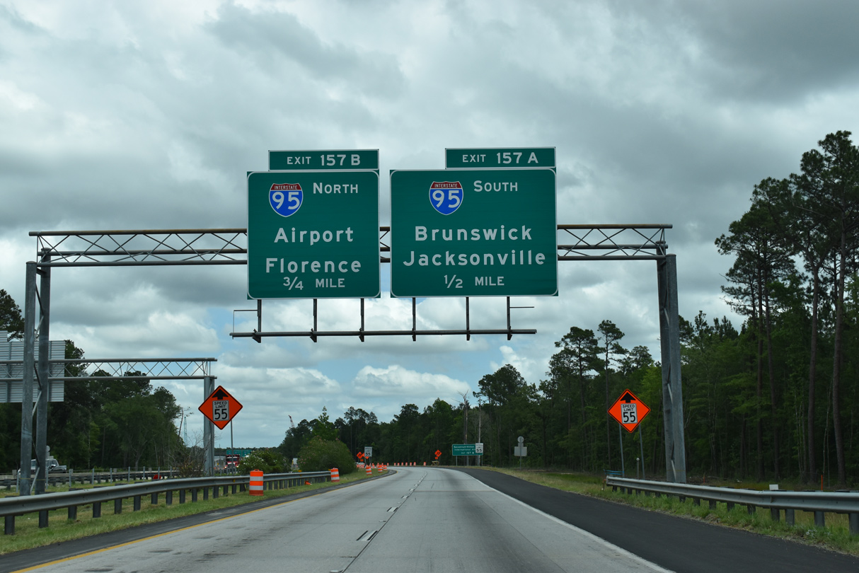
| Exit 157A joins I-95 south to Brunswick and Jacksonville, Florida. Interstate 95 stays west of Savannah, though annexations brought portions within the city limits, passing through Pooler and Port Wentworth as part of a 111.82 mile rural course through the Peach State. 06/01/21 |
|
| Exit 157B provides a second route to Savannah / Hilton Head International Airport (SAV) via Interstate 95 north. I-95 meets Airways Avenue (Exit 104), the gateway to the airport terminal, in 4.8 miles. 06/01/21 |
|
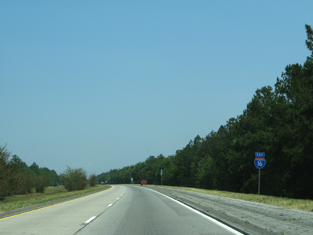
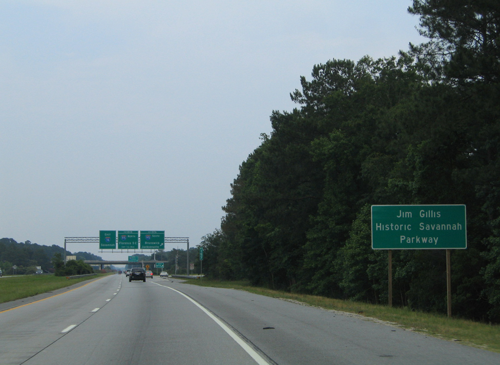
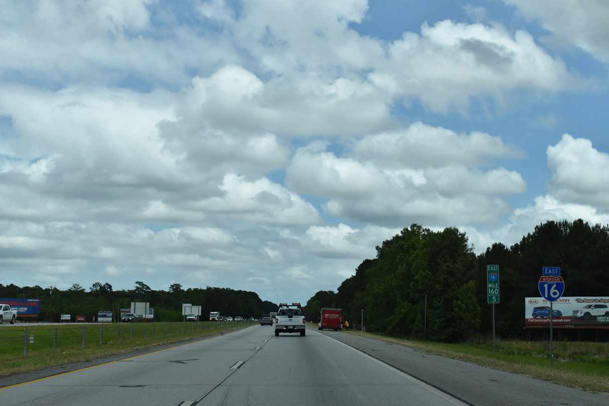
| Interstate 16 transitions into the Jim Gillis Historic Savannah Parkway beyond I-95. The highway west to Macon is the James Gillis, Sr. Memorial Highway, named after the former Georgia Department of Transportation director.3 05/29/05 |
|
| Interstate 95 ventures south 63 miles to Brunswick and 120 miles to Jacksonville, Florida. The freeway parallels U.S. 17 from Beaufort County, South Carolina to Orange Park, Florida. 06/01/21 |
|
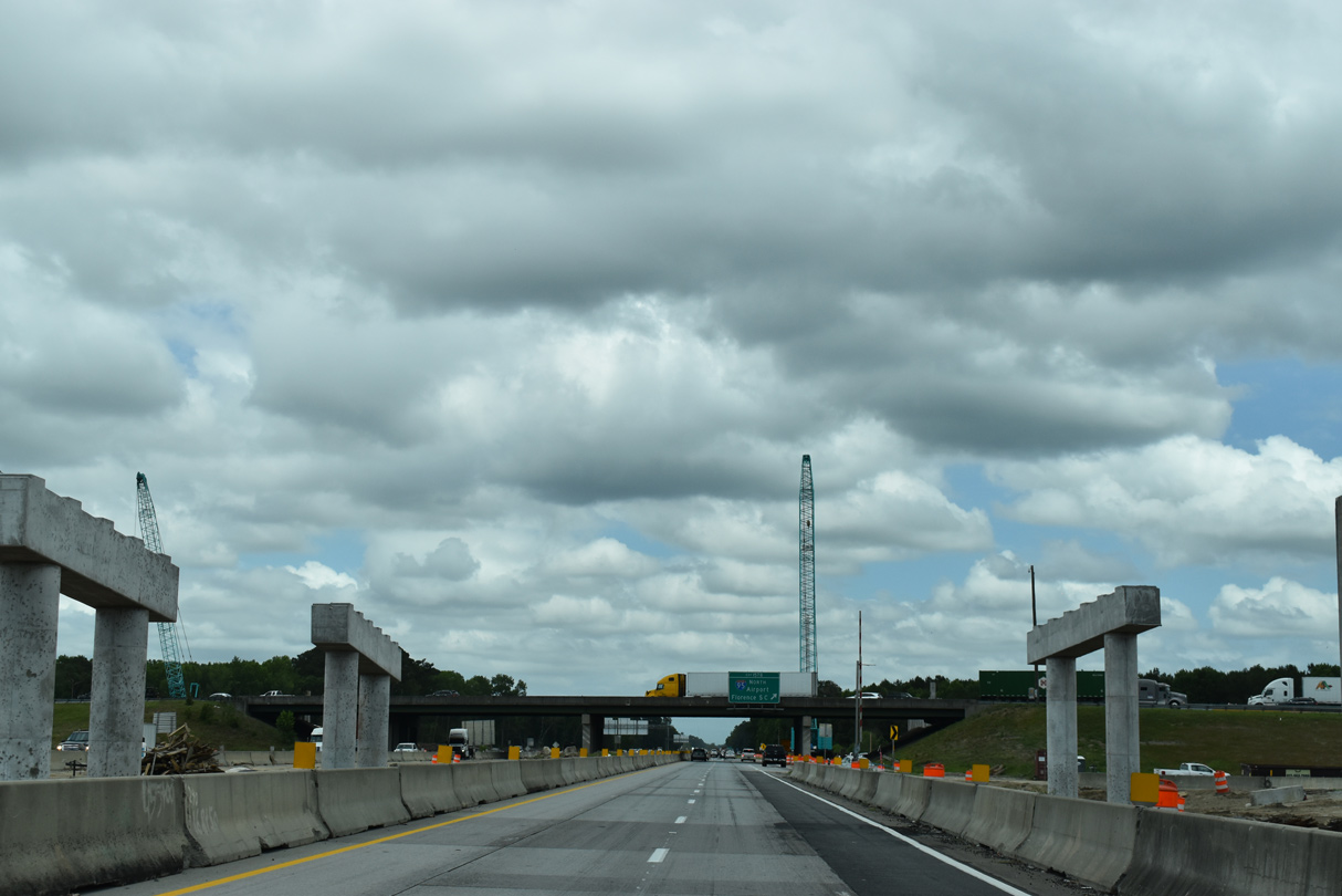
| Construction underway from 2019 to 2022 upgrades the cloverleaf with Interstate 95 to a half turbine systems exchange. 06/01/21 |
|
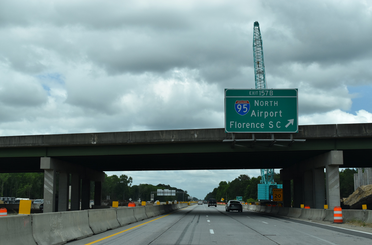
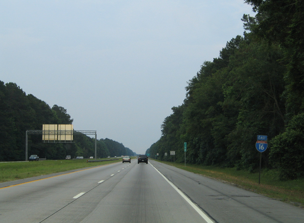
| Exit 157B loops away from I-16 east onto I-95 north. Four additional exits within Chatham County lie between I-16 and the Savannah River into Hardeeville, South Carolina. Florence, SC lies 172 miles to the northeast. 06/01/21 |
|
| Interstate 16 straddles the Pooler city line to forthcoming Exit 160. The reassurance marker posted after I-95 was missing by 2007 and not replaced by 2014. 05/29/05 |
|
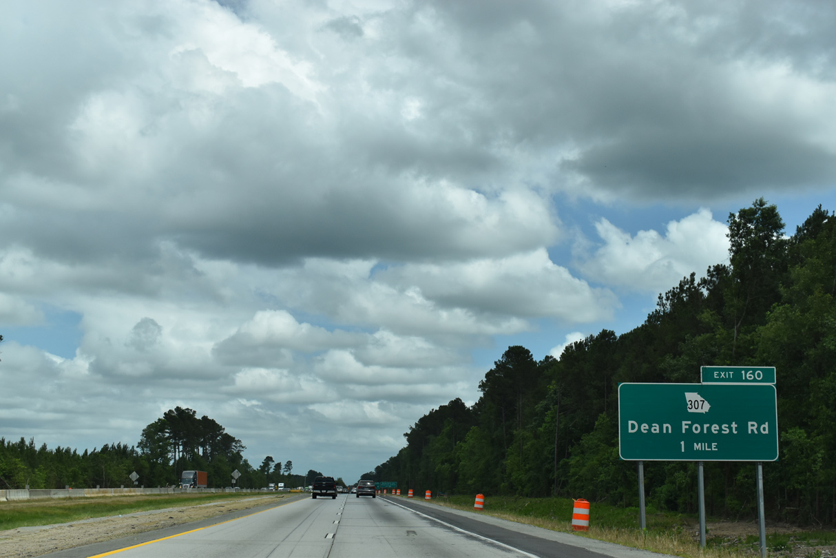
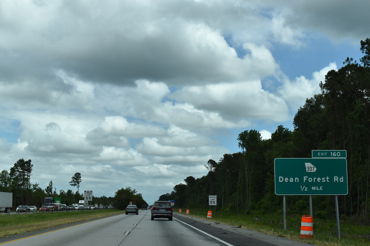
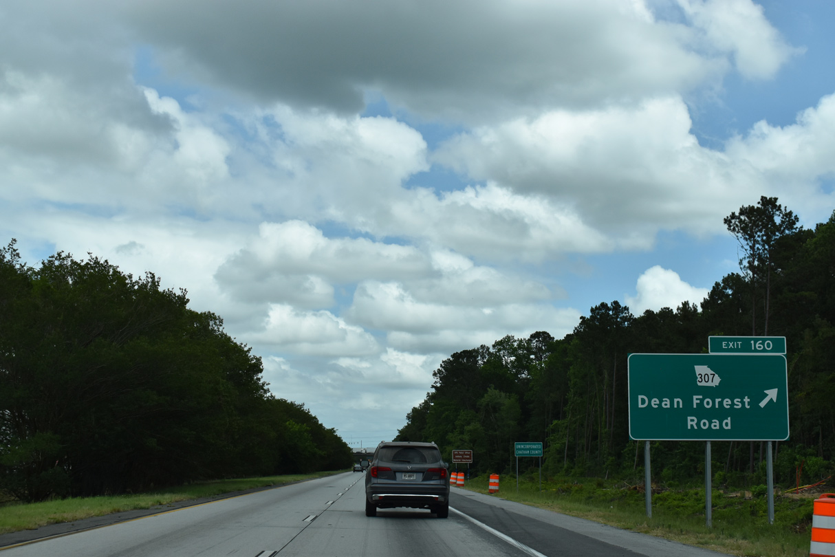
| Continuing east from I-95, Interstate 16 proceeds one mile to a diamond interchange (Exit 160) with SR 307 (Dean Forest Road). 06/01/21 |
|
| SR 307 constitutes an 8.47 mile long route between U.S. 17/SR 25 (Coastal Highway) by Silk Hope and SR 25 (Coastal Road) at Garden City. 06/01/21 |
|
| SR 307 (Dean Forest Road) provides a direct route to the Garden City Terminal of the Georgia Ports Authority from I-16. The former passenger terminal of SAV Airport, replaced with the Airport Business Center, is located off Dean Forest Road north as well. 06/01/21 |
|
| Downtown Savannah lies just beyond the east end of I-16 in six miles. Garden City is also six miles away via I-516 west. 06/01/21 |
|
| Interstate 16 plies across an area of wetlands east into the city limits of Savannah. 06/01/21 |
|
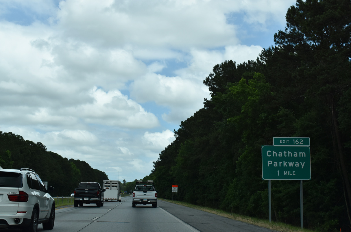
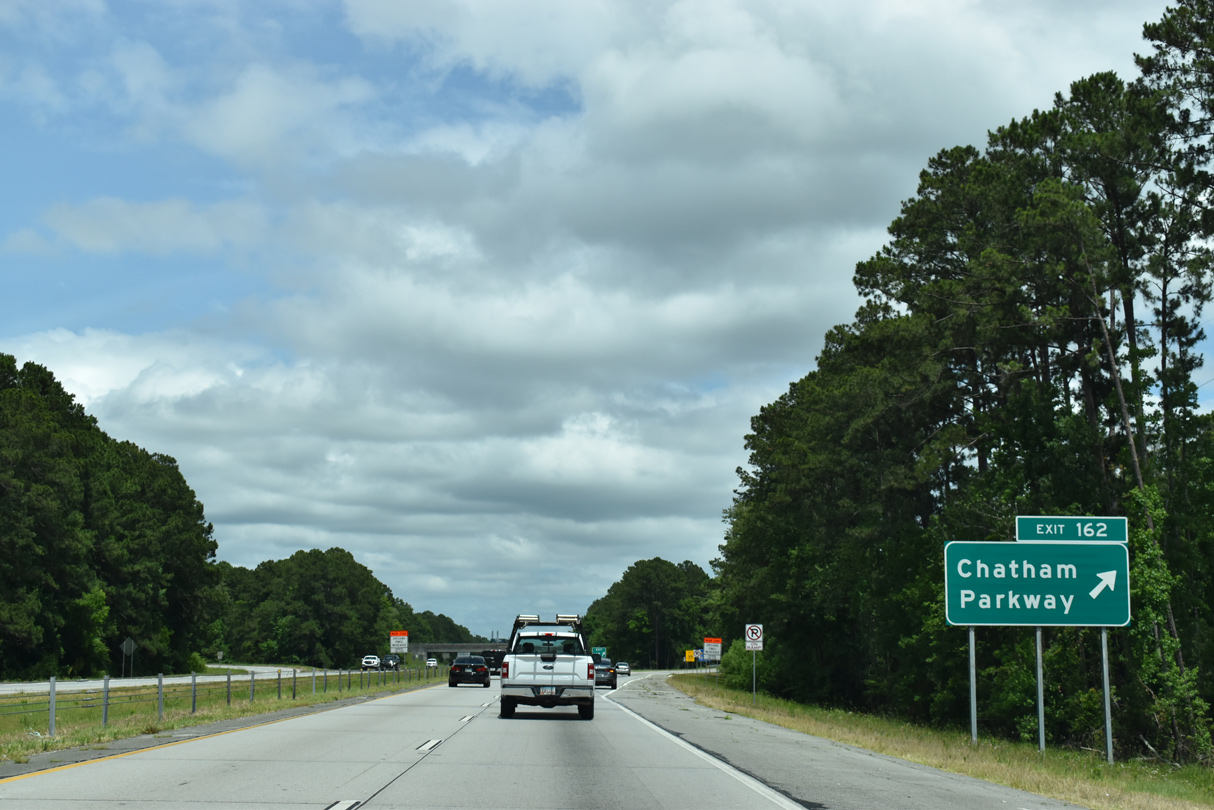
| A parclo interchange (Exit 162) joins I-16 with Chatham Parkway. Chatham Parkway winds northward from Garrard Avenue at Lamarville to U.S. 80/SR 26 (Louisville Road) in Garden City. 06/01/21 |
|
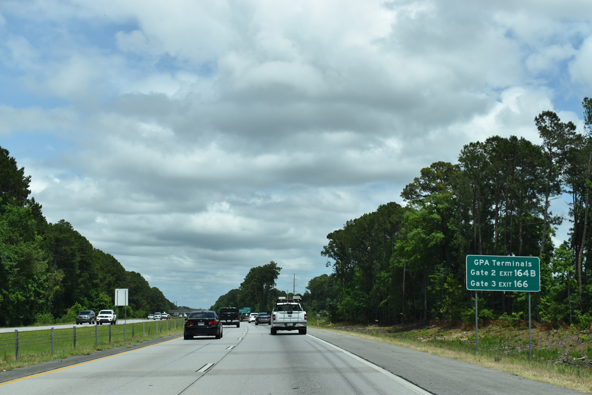
| Trucks headed to the Georgia Port Authority (GPA) Terminals Gates 2 or 3 from I-16 east are partitioned onto I-516 west from Exit 164B and U.S. 17/SR 404SP to Louisville Road from Exit 166. 06/01/21 |
|
| Chatham Parkway serves business and industrial parks on its curved alignment between Veterans Parkway and U.S. 80. The arterial was originally planned as SR 167, which was why previous guide signs for Exit 162 included a space for a route marker. 06/01/21 |
|
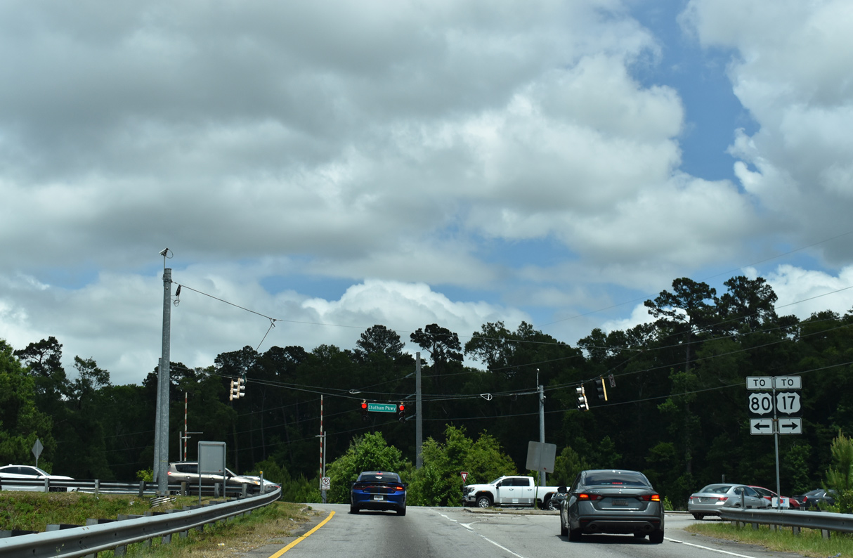
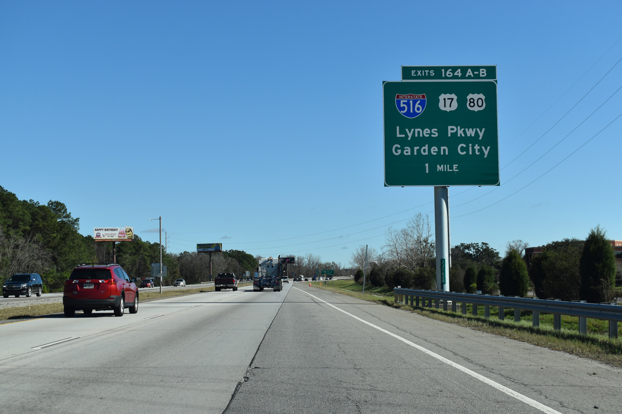
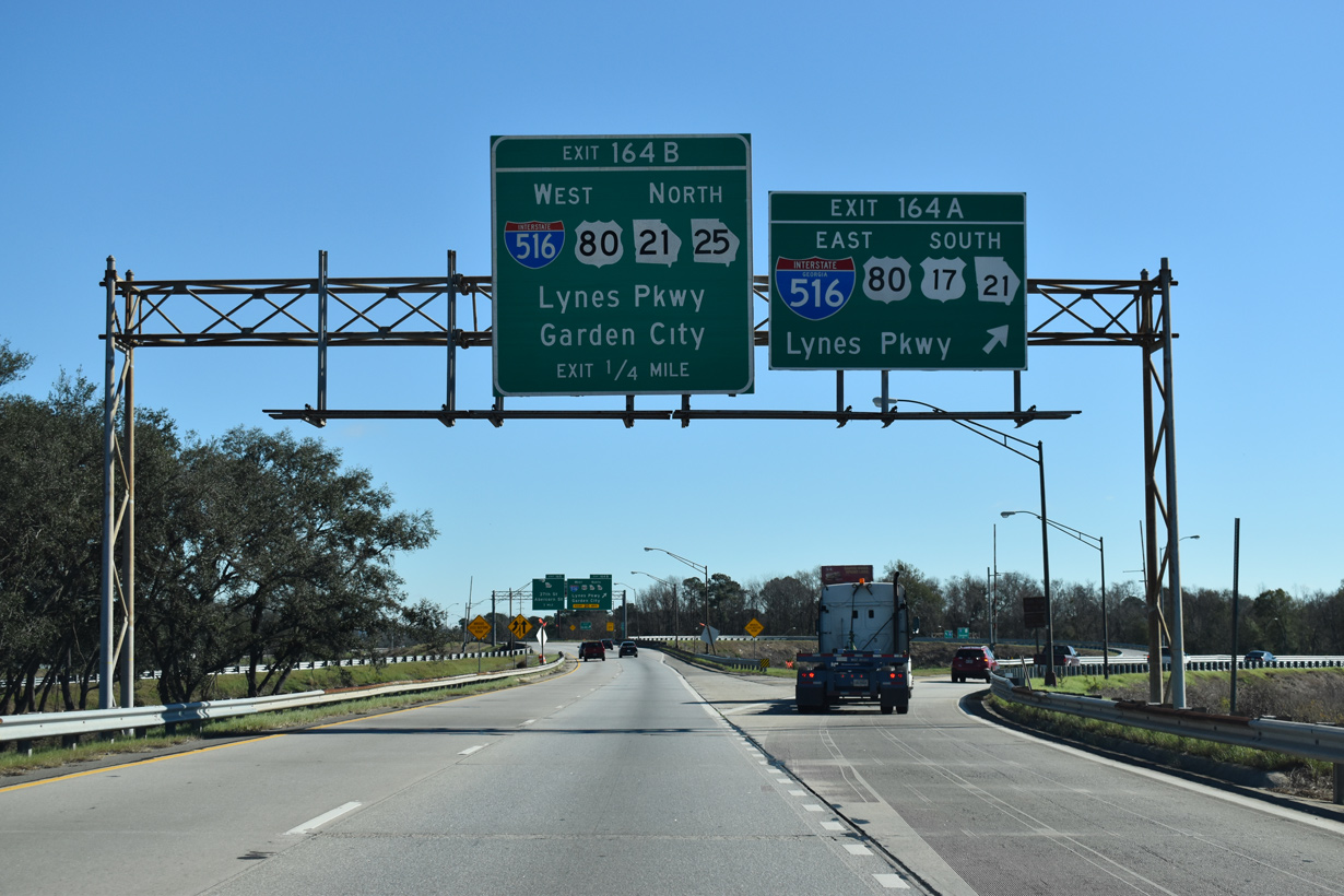
| The ensuing exit from I-16 east is with I-516, U.S. 17-80, and SR 21-25-26. Designated in place or SR 26 Loop in 1985, I-516 (W.F. Lynes Parkway) runs between Hunter Army Airfield and Garden City, doubling as SR 21 from SR 204 (Abercorn Street) in Savannah to Augusta Road. 01/05/19 |
|
| Chatham Center Drive appears along the south side of I-16 between Chatham Parkway and the CSX Savannah Yard. The directional cloverleaf interchange (Exits 162A/B) with Interstate 516 follows. 01/05/19 |
|
| U.S. 17/80 east follow I-516/SR 21 (Lynes Parkway) south to Ogeechee Road. There U.S. 17/SR 25 part ways for Silk Hope and Richmond Hill to the southwest while U.S. 80/SR 26 turn east toward Victory Drive through Midtown Savannah. I-516 curves southeast at Liberty City to DeRenne Avenue (SR 21) at Montgomery Street. 01/05/19 |
|
| Exit 164B loops onto I-516/U.S. 80-SR 26 west and SR 21-25 north toward Garden City from I-16 east. The four routes combine to Exit 7A where U.S. 80/SR 26 depart for Augusta Avenue. SR 21 and SR 25 follow separate alignments from the freeway end to Port Wentworth. 01/05/19 |
|
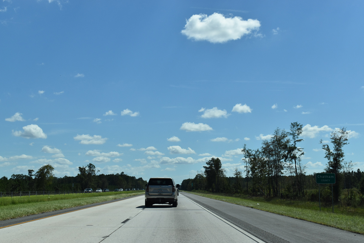
| Home to 289,463 as of the 2020 U.S. Census, Interstate 16 enters Chatham County six miles west of the Bloomingdale city center. 09/25/22 |
|
| U.S. 17 north combines with Interstate 16 east 1.42 miles from I-516 west, though confirming shields omit the overlap. 01/05/19 |
|
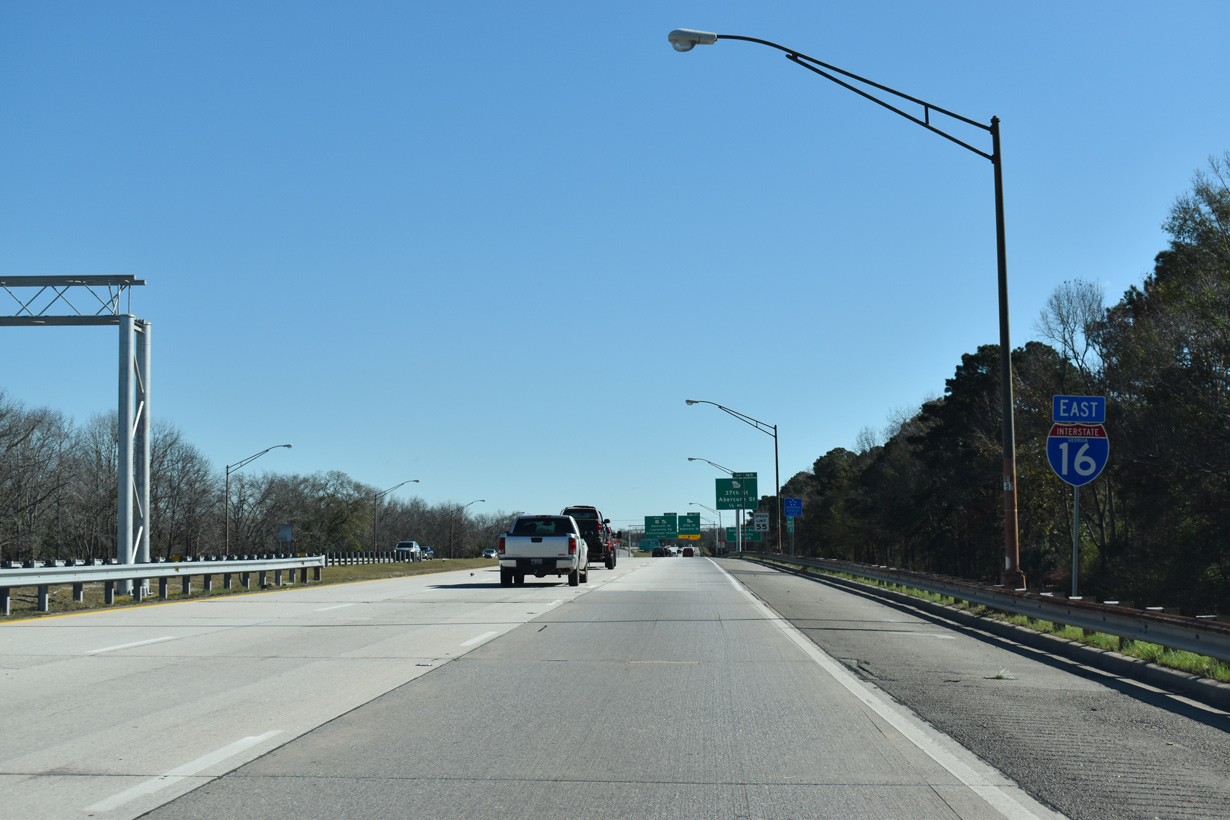
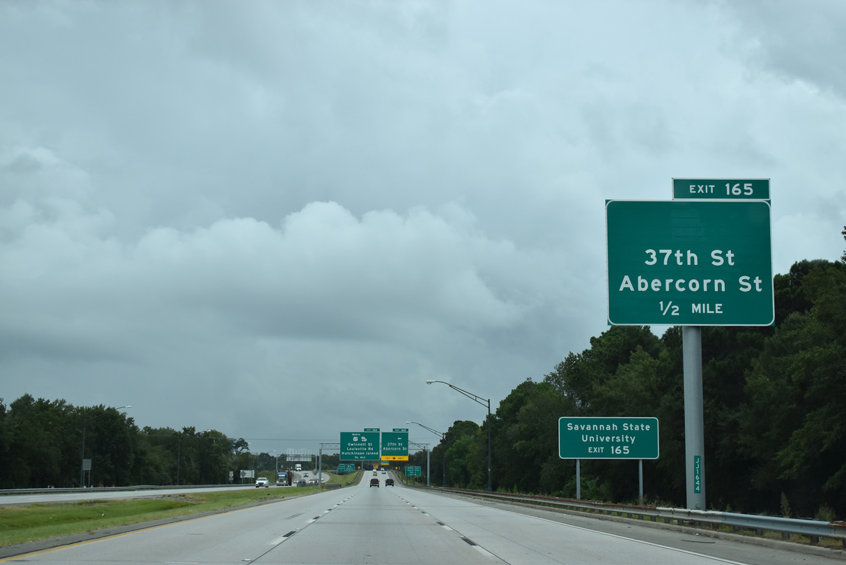
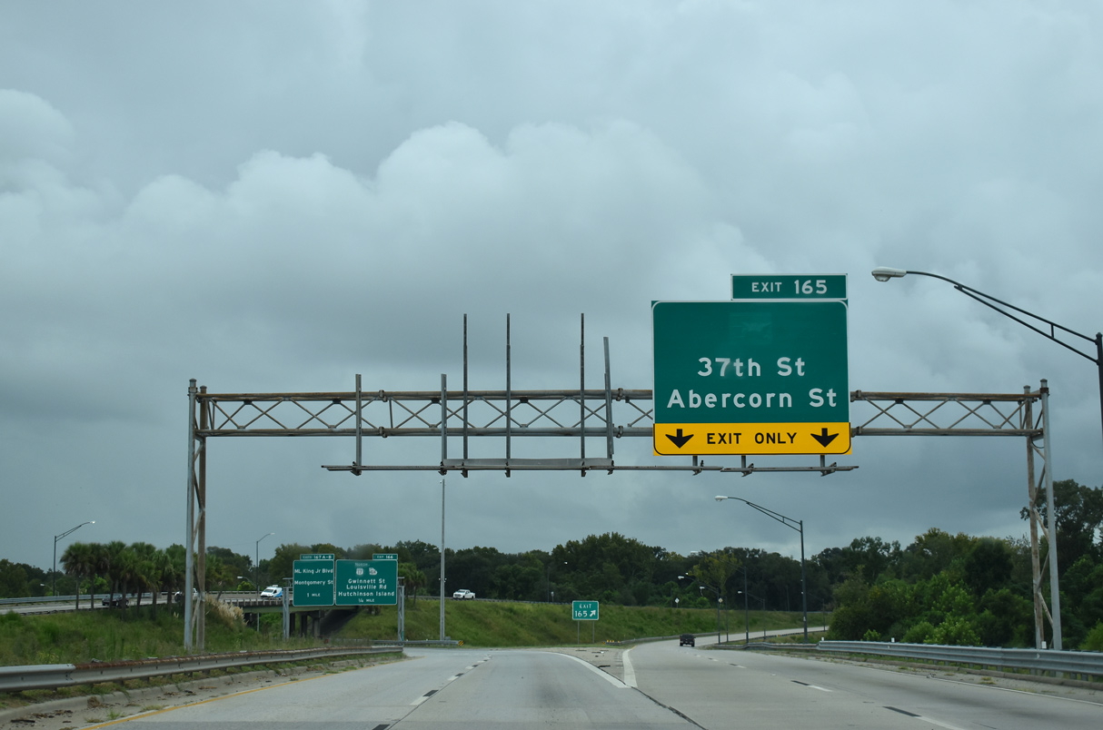
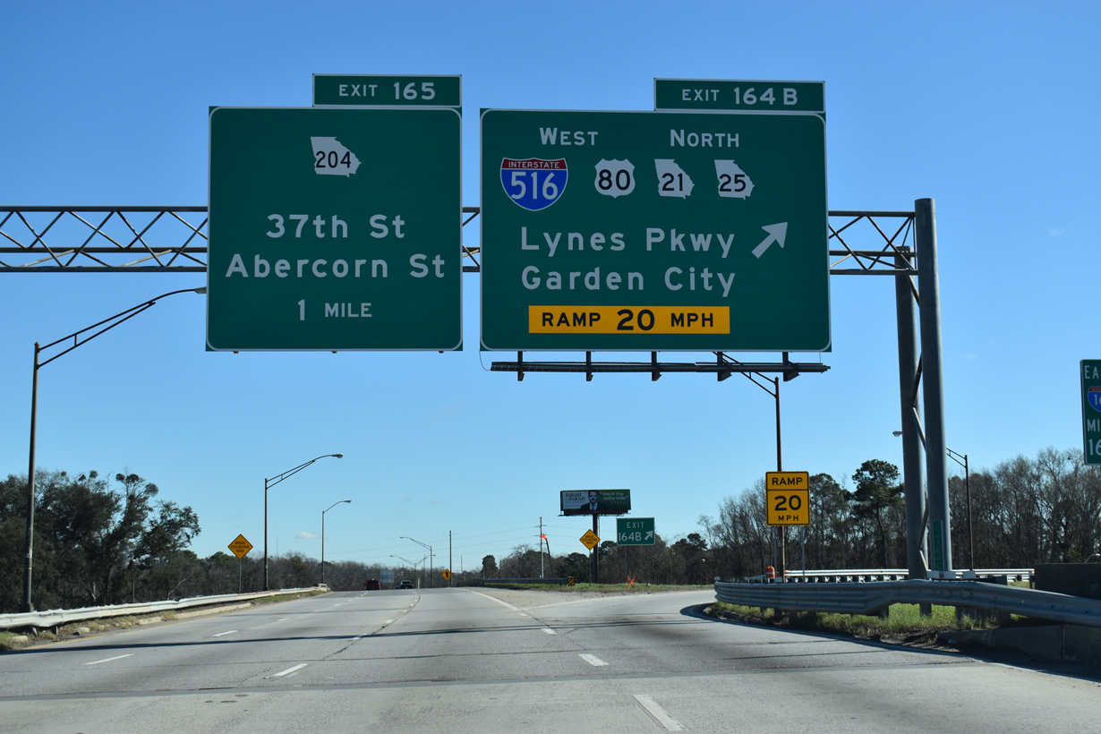
| Continuing east, I-16 advances toward a wye interchange (Exit 165) with the 37th Street Connector (former SR 204). Prior to 2020, Exit 165 represented the east end of SR 204, which formed a 36.1 mile long L-shaped route to South Side Savannah and Pembroke. 09/16/21 |
|
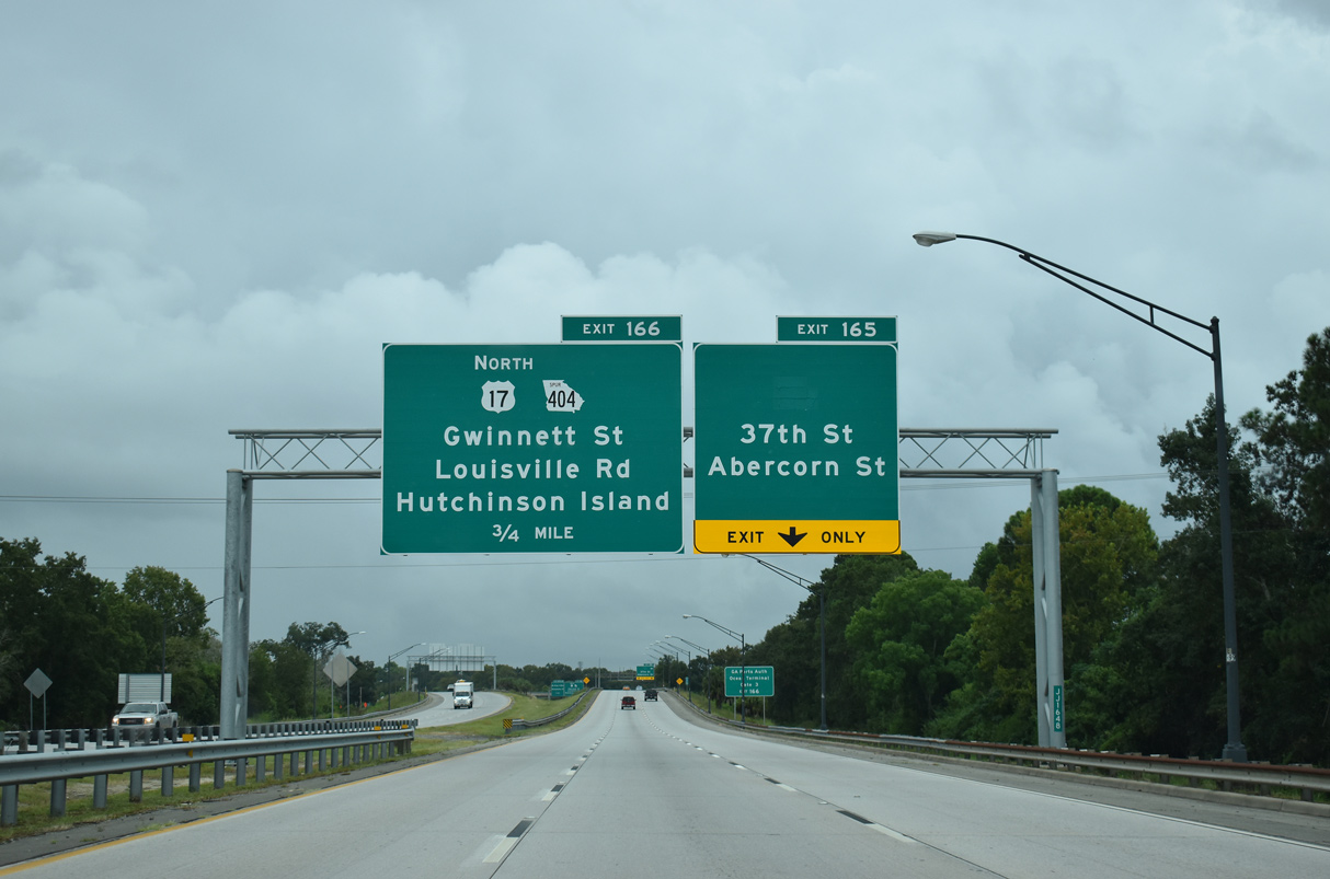
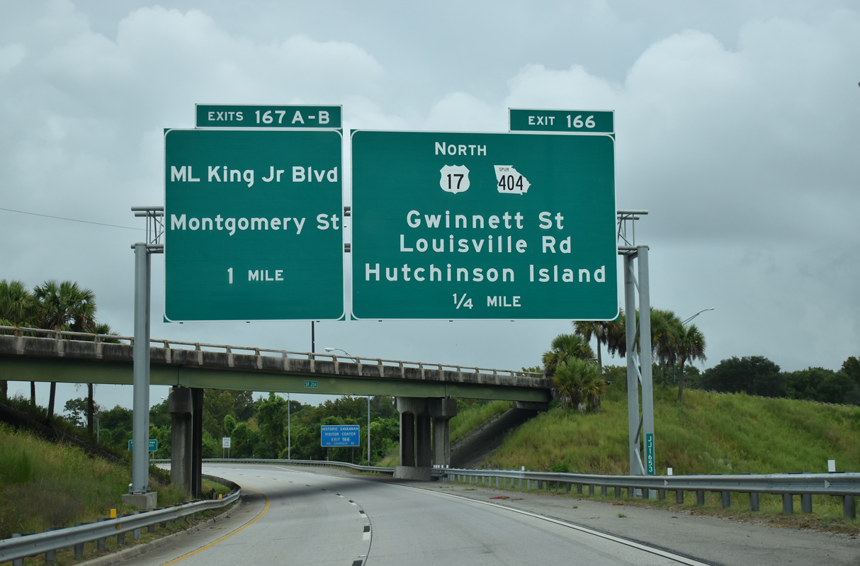
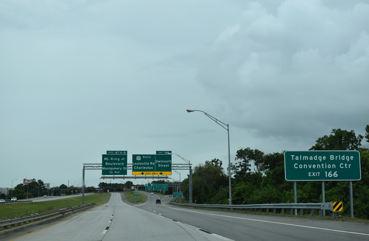
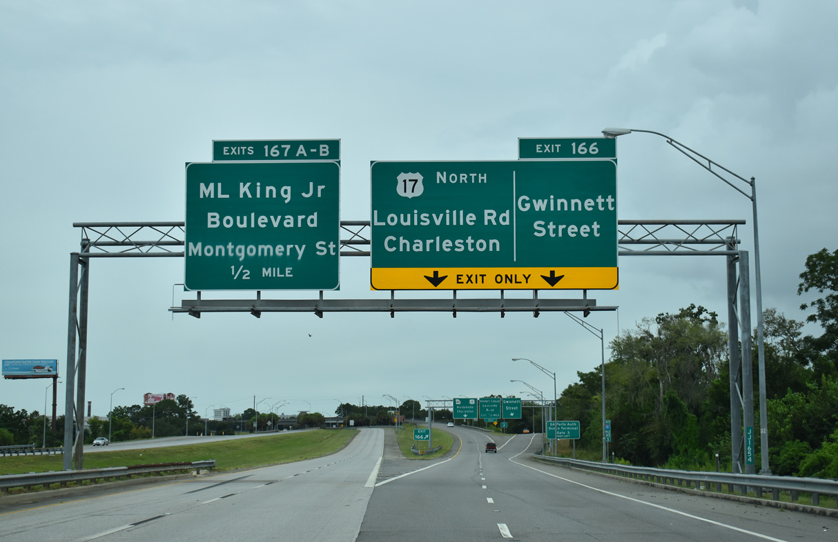
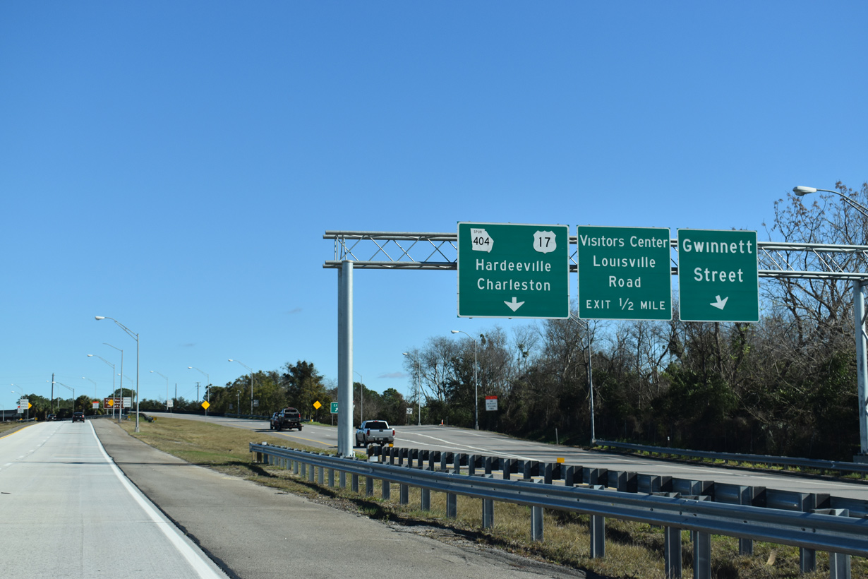
| The 37th Street Connector provides a high speed connection to Ogeechee Road at 37th Street. Exit 166 follows in 0.75 miles for the continuation of U.S. 17 north to the Eugene Talmadge Bridge. SR 404 Spur extends 3.07 miles from I-16/SR 404 at Gwinett Street to Louisville Road and the Savannah River crossing. 09/16/21 |
|
| SR 204 turned south onto Abercorn Street, 1.3 miles to the east on 37th Street. SR 204 was truncated north of SR 21 (DeRenne Avenue) in 2020. Abercorn Street constitutes the main commercial arterial to Southside Savannah. 09/16/21 |
|
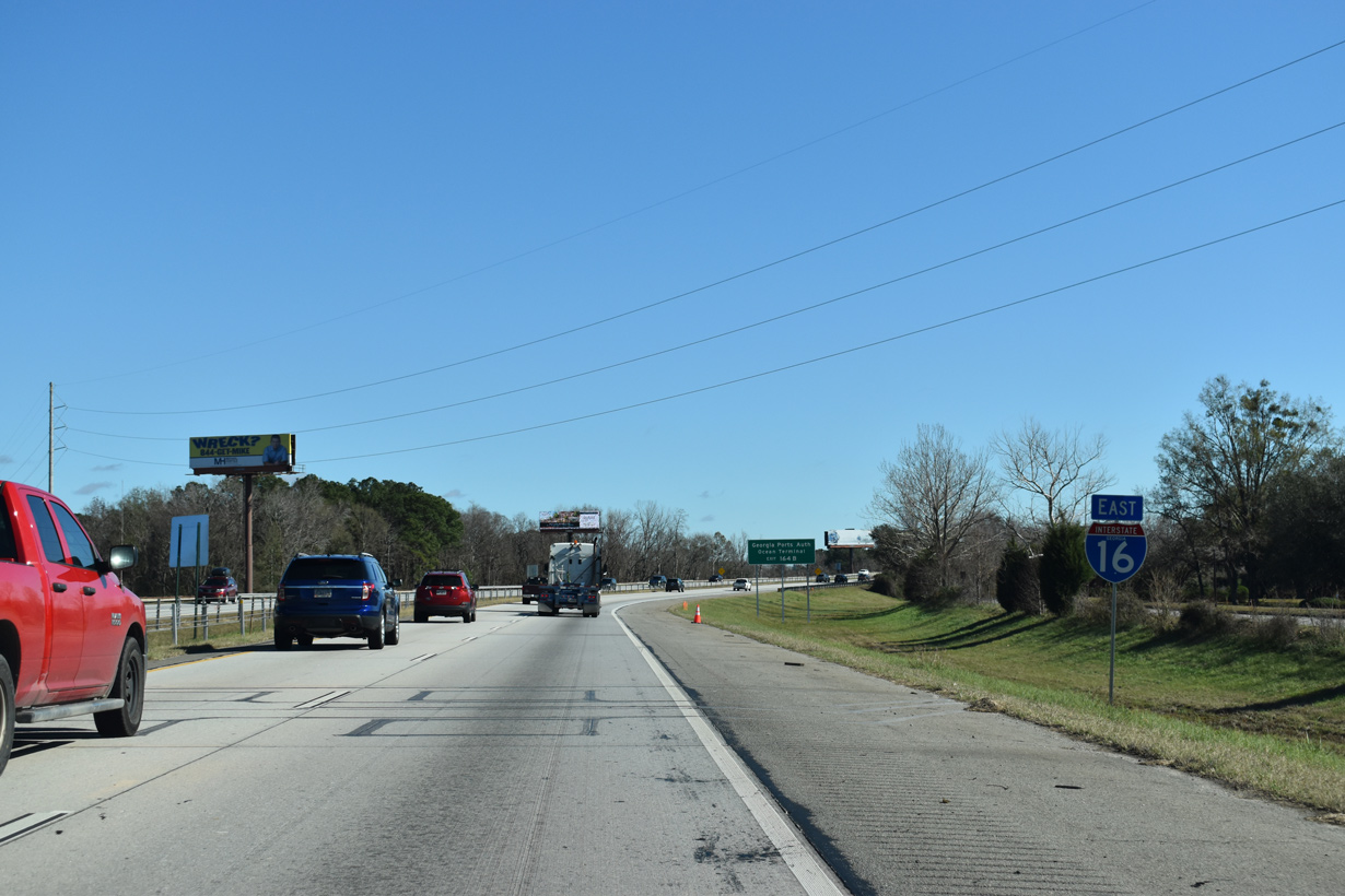
| SR 404 Spur emerges as a branch of SR 404, the hidden state route for all of I-16, at Exit 166. U.S. 17/SR 404 Spur comprise a freeway north to ramps with Louisville Road and on Hutchinson Island. 09/16/21 |
|
| The Talmadge Bridge is a cable-stayed bridge linking the Historic District of Savannah with Hutchinson Island. Replacing a two lane cantilever bridge built in 1953, the span opened in March 1991. Preceding the completion, U.S. 17 was realigned eastward from the Houlihan Bridge at Port Wentworth over the former alignment of U.S. 17 Alternate in 1988. 09/16/21 |
|
| I-16 and U.S. 17 separate at a wye interchange (Exit 166) at Gwinnett Street. U.S. 17/SR 404 Spur curve northward to Hutchinson Island and Hardeeville, South Carolina. Hutchinson Island is home to the Savannah Convention Center. 09/16/21 |
|
| The exit for Gwinnett Street departs U.S. 17/SR 404 Spur northbound just beyond the split with Interstate 16 east. Gwinnett Street heads east to Forsyth Park and west to the industrial area of Telfair Junction. 01/05/19 |
|
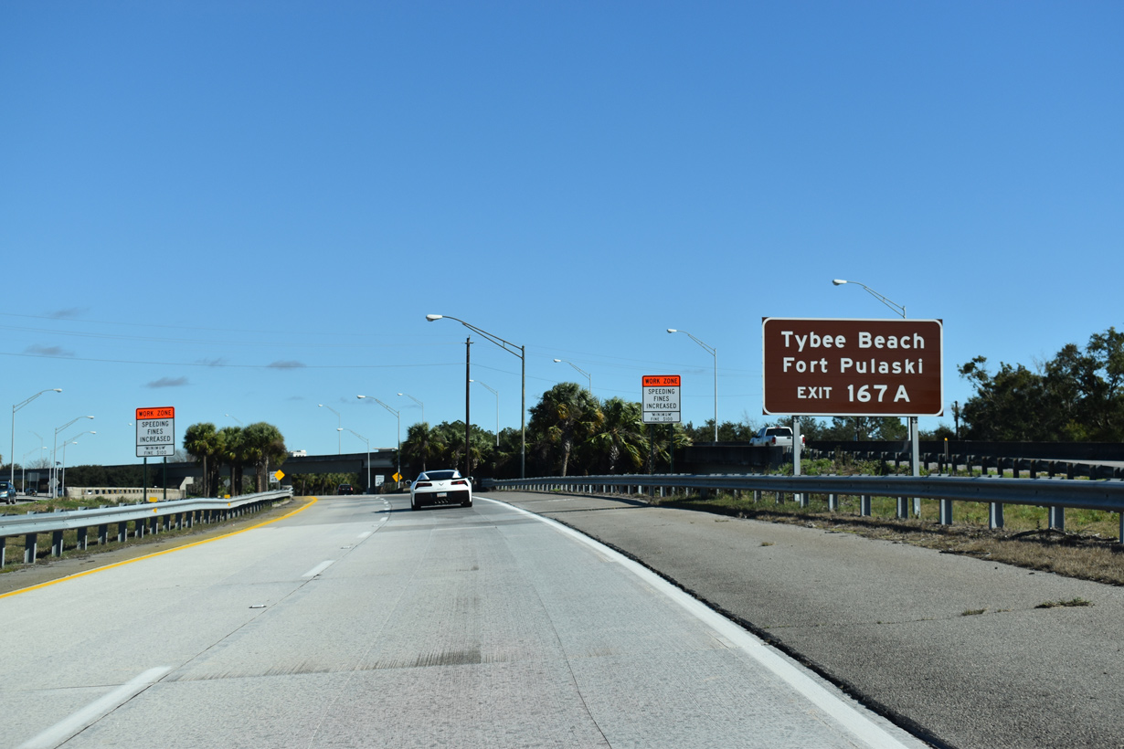
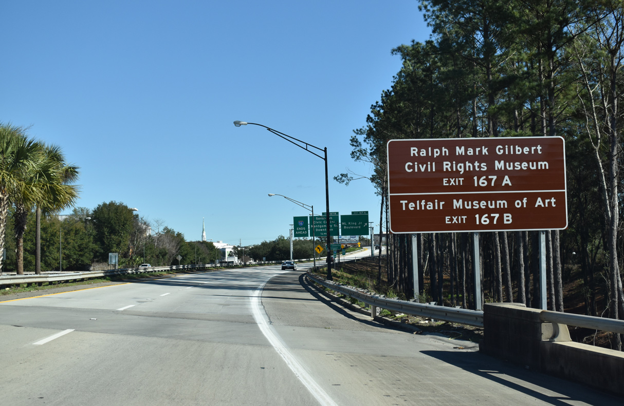
| Exit 167A departs next for Gaston Street east at Martin Luther King, Jr. Boulevard. MLK Boulevard, former U.S. 17-80, leads north to Bay Street, a through route east to U.S. 80 for Fort Pulaski and Tybee Island. 01/05/19 |
|
| The speed limit gradually reduces as I-16 passes between the flyover for U.S. 17/SR 404 Spur northbound and a ramp linking Gwinnett Street with W Boundary Street. 01/05/19 |
|
| Interstate 16 turns eastward to the Savannah Historic District. 01/05/19 |
|
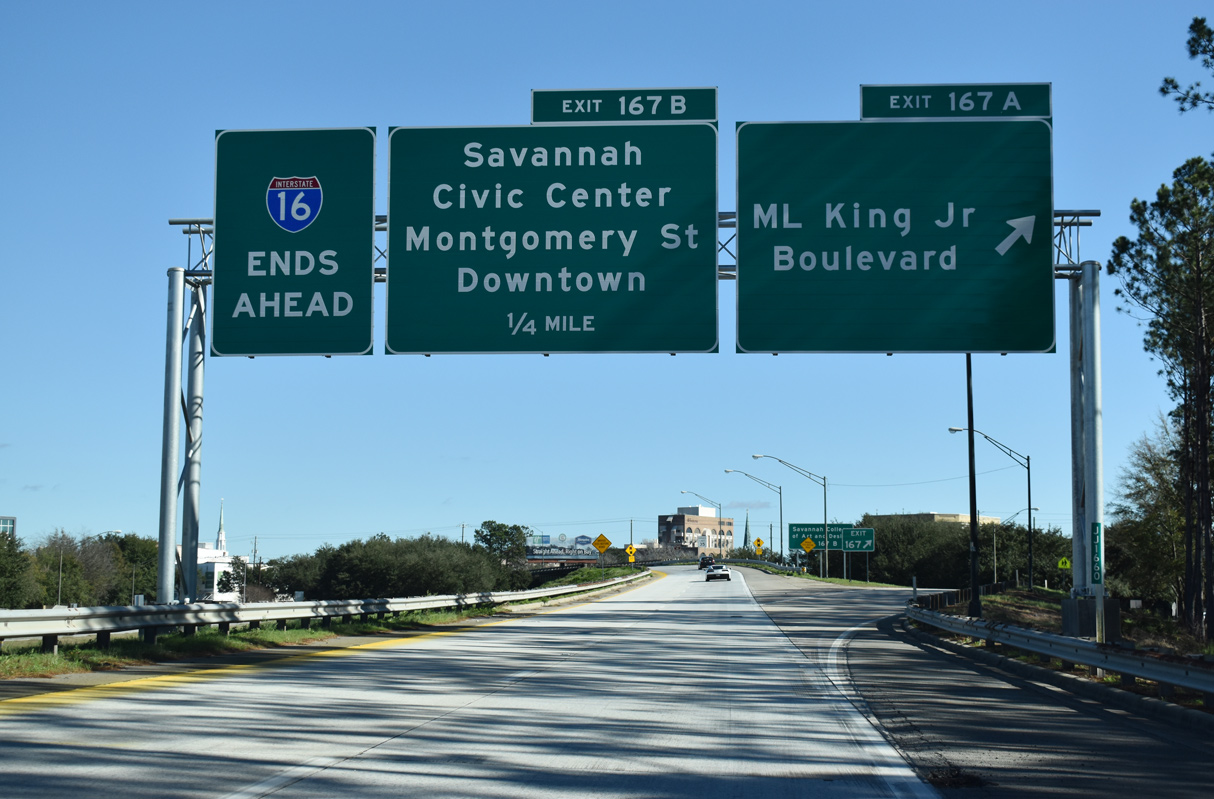
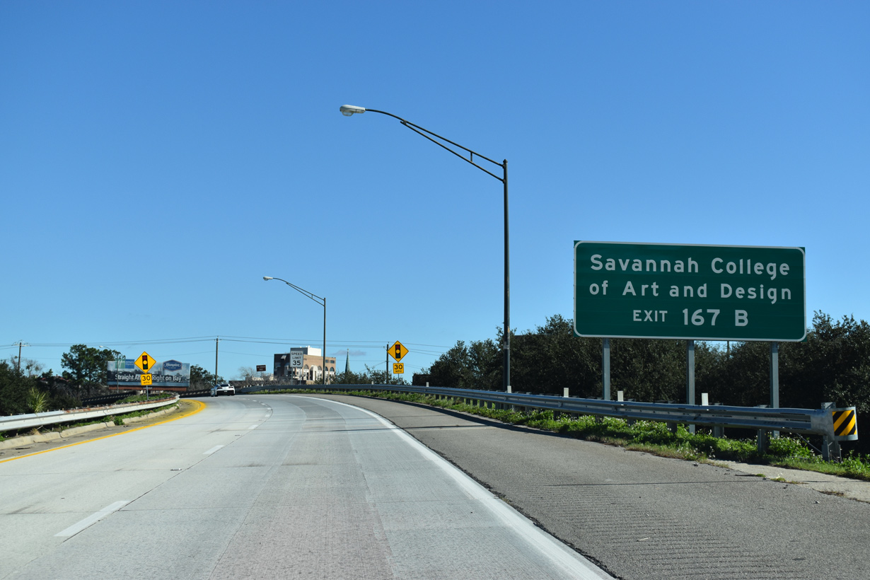
| Exit 167A leaves I-16 east to Martin Luther King, Jr. Boulevard. Exit 167B follows as the flyover (Earl T. Shinhoster Bridge) onto Montgomery Street north two blocks from the Savannah Civic Center. 01/05/19 |
|
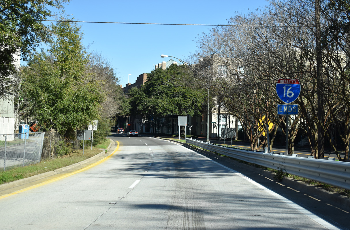
| Interstate 16 ends on the periphery of Downtown Savannah ahead of Liberty Street. Downtown is home to the Savannah College of Art and Design. 01/05/19 |
|
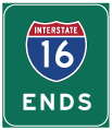
| An end shield precedes the left side merge of I-16 east onto Montgomery Street north. 01/05/19 |
Page Updated 11-28-2022.

 East
East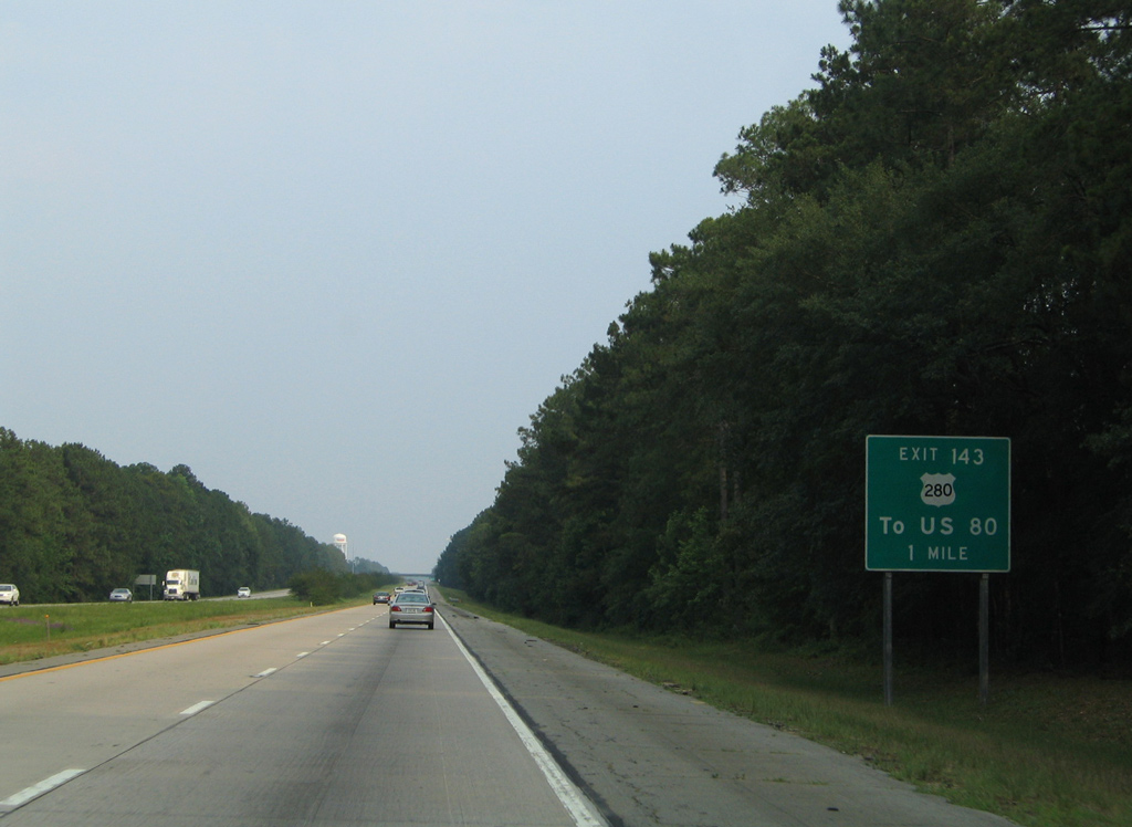


 North
North