|
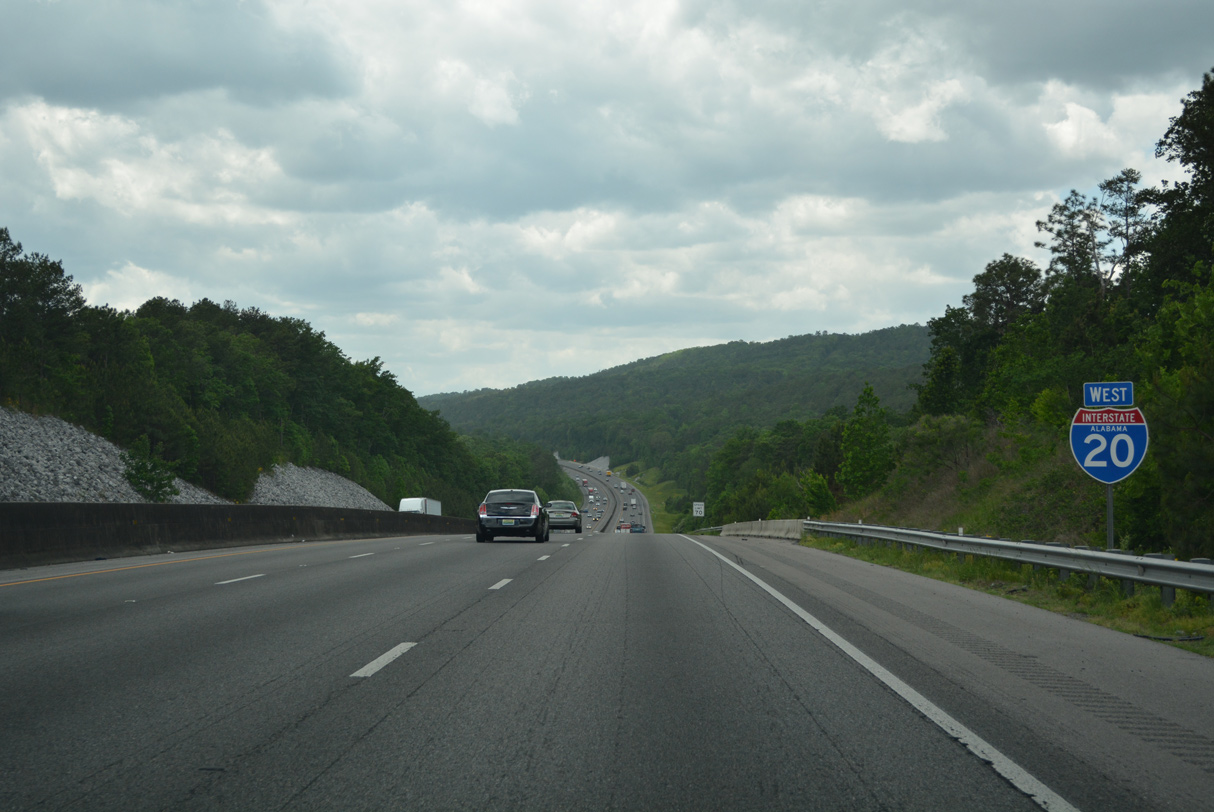
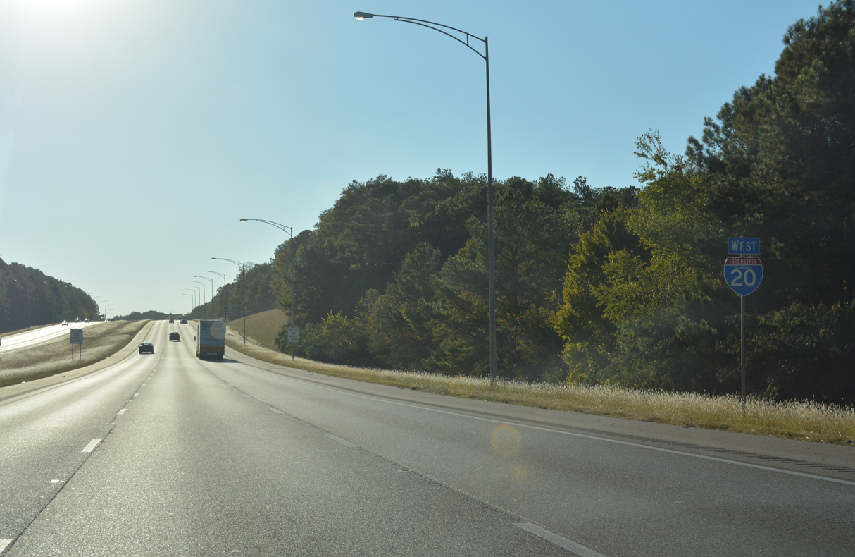
| Westbound Interstate 20 rises onto hills through western reaches of Riverside city limits. 05/06/22 |
|
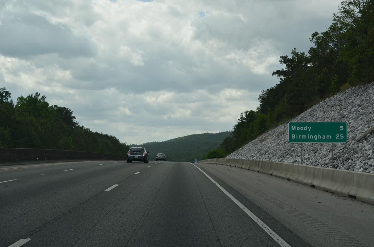
| Downtown Pell City is five miles to the west via the ensuing exit from Interstate 20. Birmingham is a half hour away. 05/06/22 |
|
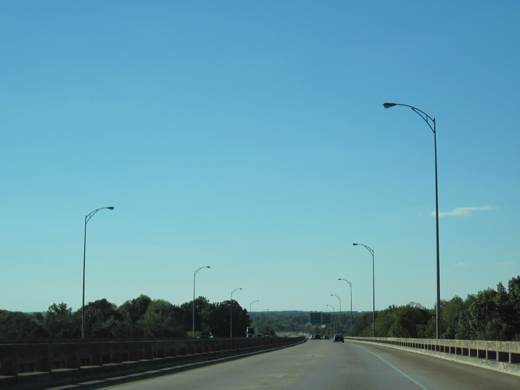
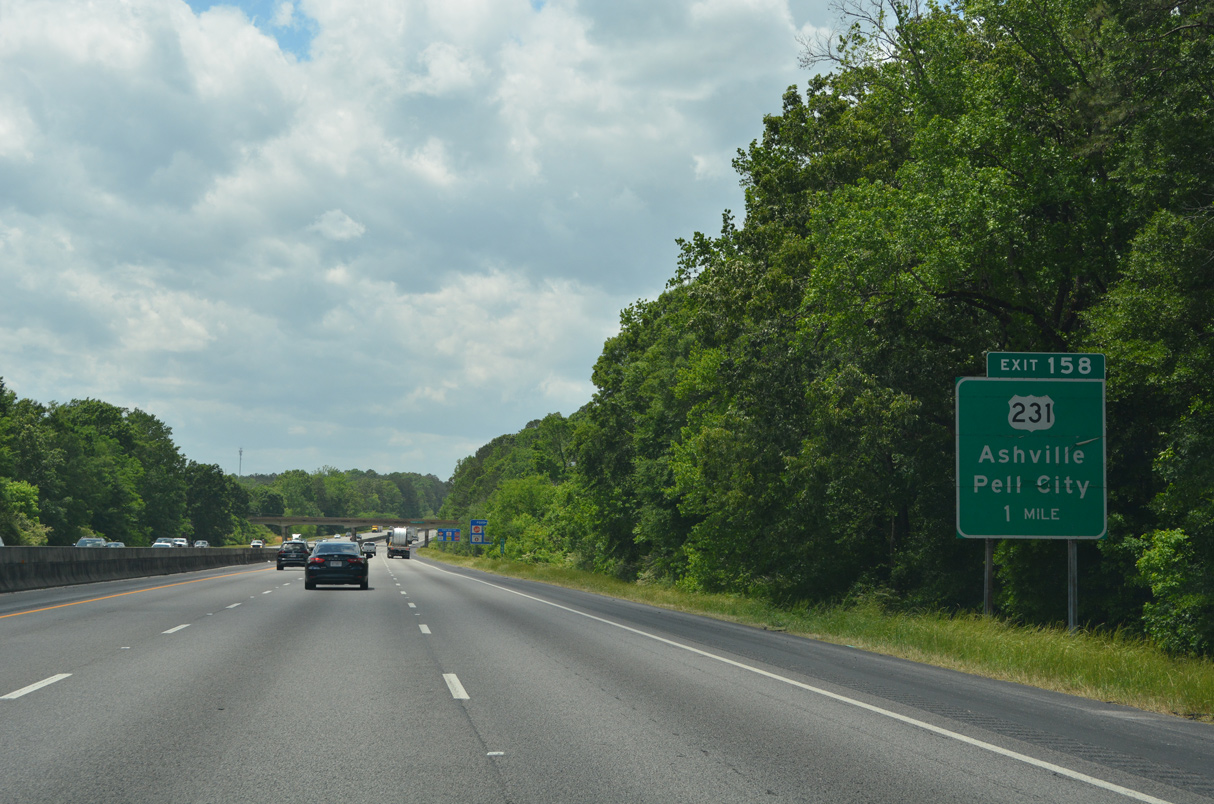
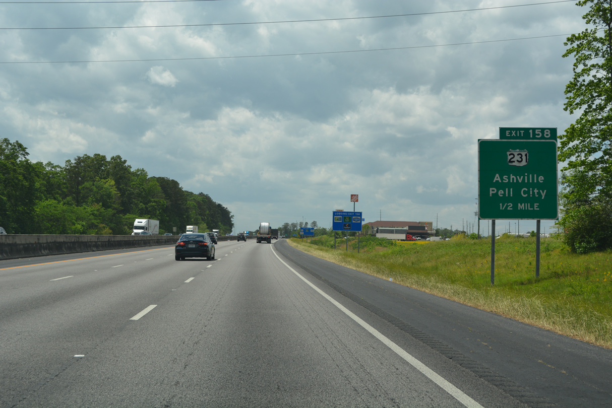
| One mile east of the parclo interchange (Exit 158) with U.S. 231 (Martin Street) on the industrial northeast side of Pell City. U.S. 231 travels 912 miles overall between Panama City, Florida and St. John, Indiana. 05/06/22 |
|
| U.S. 231 follows Martin Street along a commercial arterial south from the Pell City line north of Exit 158 to the city center. U.S. 231 continues north 16.84 miles to SR 23 in Ashville. 05/06/22 |
|
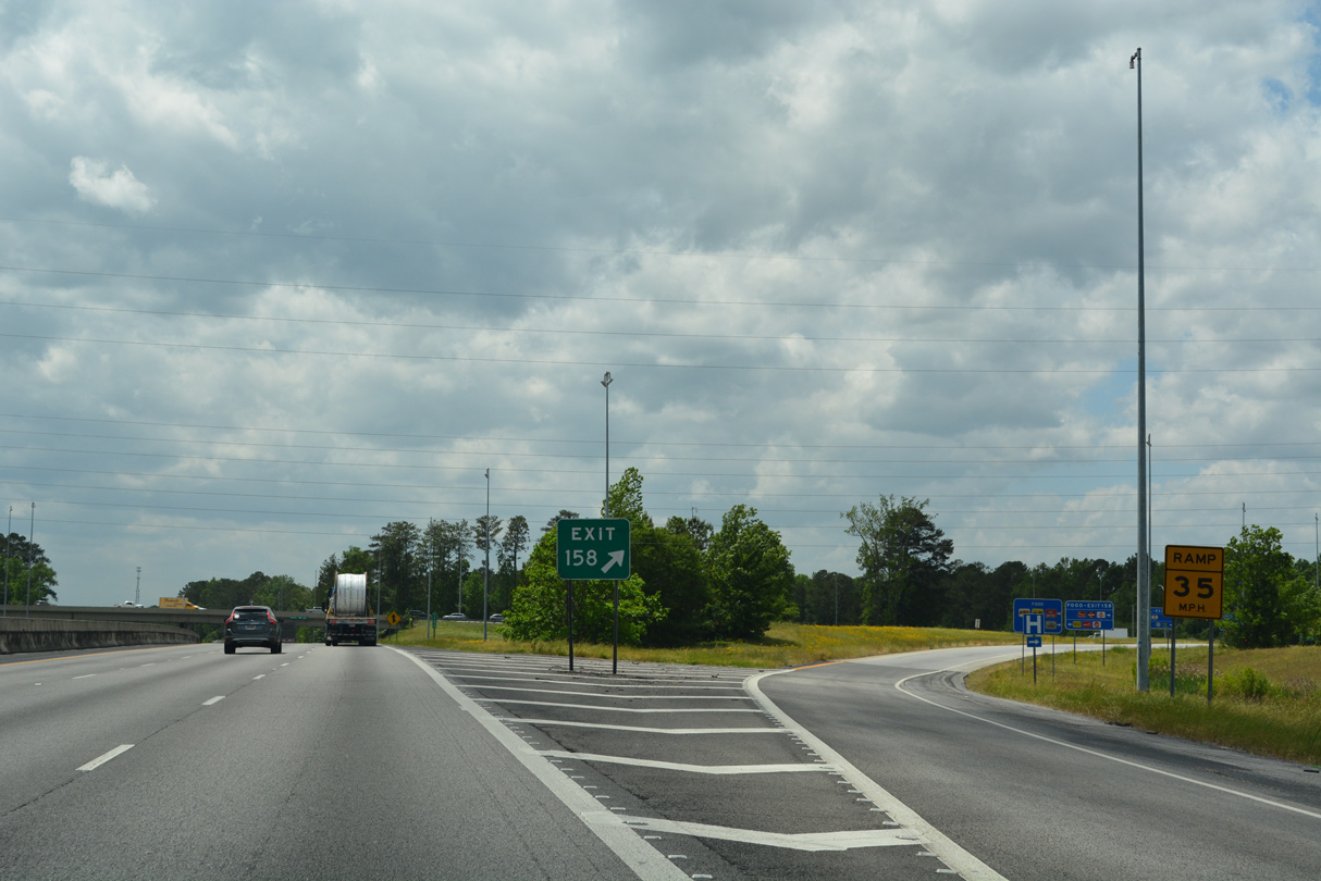
| Construction in 2008 replaced the U.S. 231 overpass above I-20 and removed the loop ramp at Exit 158 B. Southwest from U.S. 78 in Pell City, U.S. 231 combines with U.S. 280 east in 20.6 miles at Harpersville. 05/06/22 |
|
| Suburban development encroaches along the south side of Interstate 20 from Pell City west to the Wolf Creek Road overpass. 05/06/22 |
|
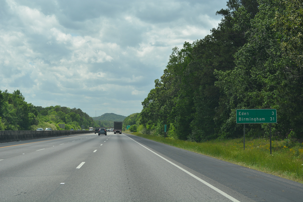
| Eden, a community within the Pell City limits, follows in three miles. 05/06/22 |
|
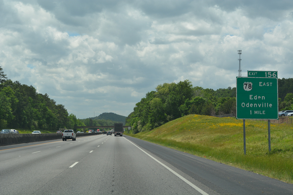
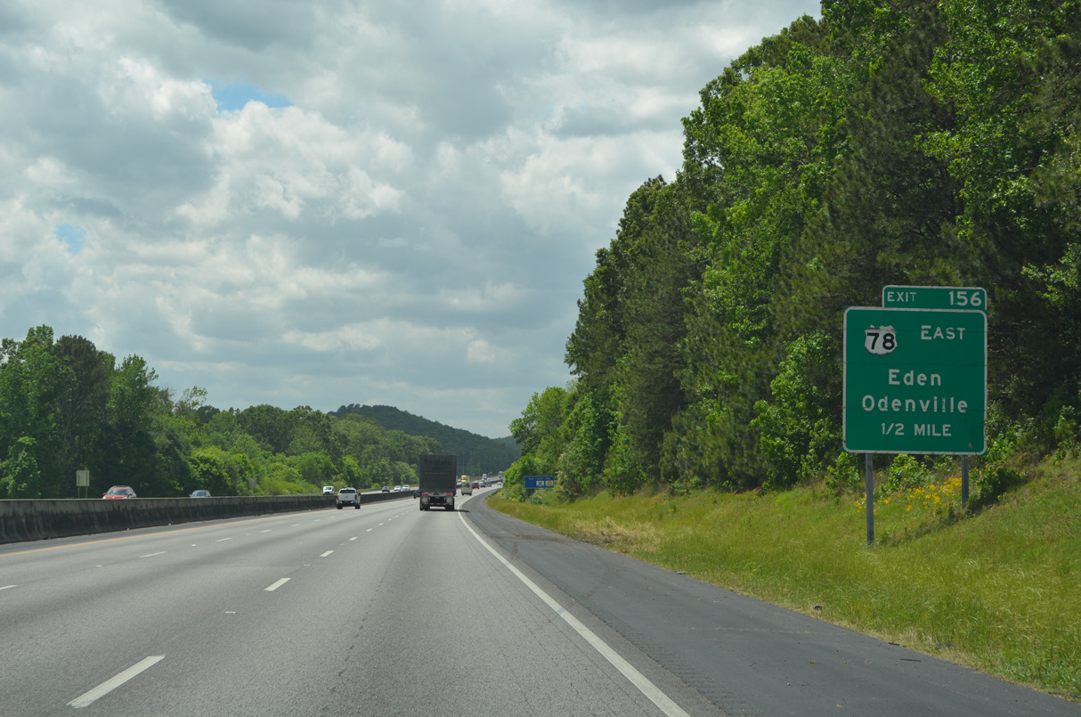
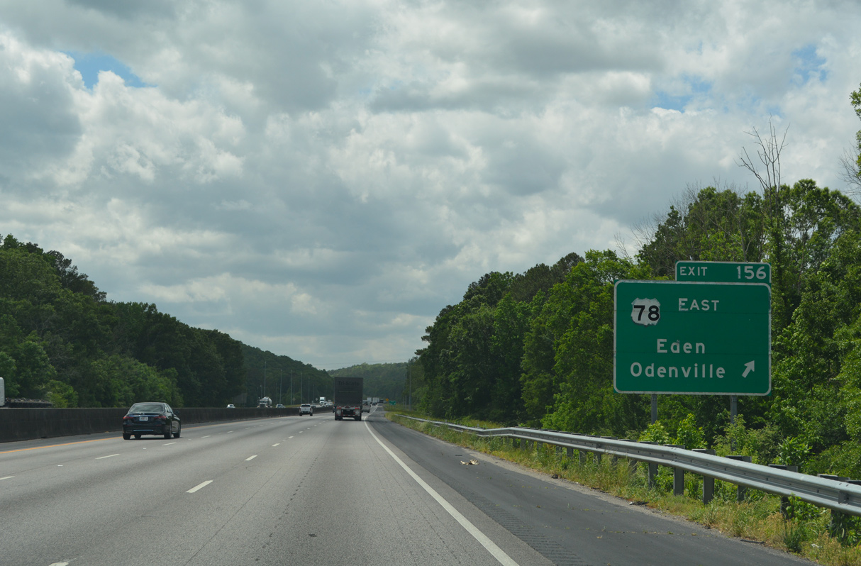
| U.S. 78 weaves northwest from Downtown Pell City through Walkerton and Eden to a diamond interchange (Exit 156) with Interstate 20. 05/06/22 |
|
| CR 29 (Mineral Springs Road) heads 2.60 miles north from I-20/U.S. 78 between Gum Springs and Pond Mountains to SR 174 at Tanyard. SR 174 leads northwest from U.S. 231 near Pell City to U.S. 411 at Odenville. 05/06/22 |
|
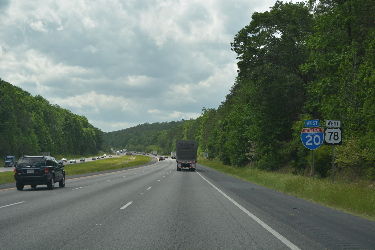
| Interstate 20 passes south of Gum Springs Mountain to Exit 156 for U.S. 78 east to Eden in Pell City and CR 29 north to SR 174 and Odenville. 05/06/22 |
|
| U.S. 78 combines with Interstate 20 west by Pond Mountain, as the former alignment was replaced by the original freeway construction. 05/06/22 |
|
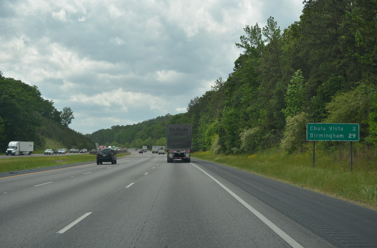
| The community of Chulavista lies west of Pond Mountain and south of Chulavista Mountain at Exit 153. 05/06/22 |
|
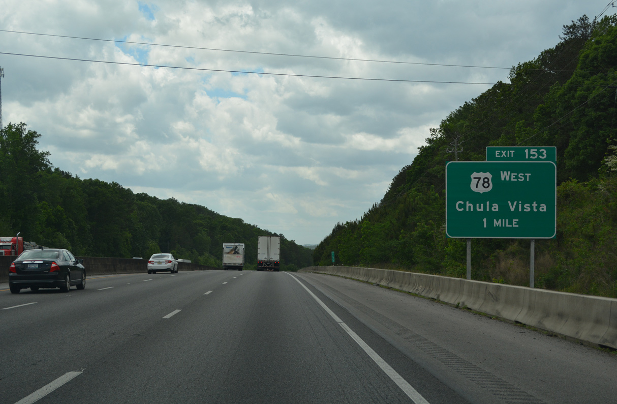
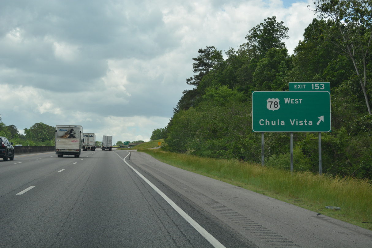
| U.S. 78 separates from Interstate 20 west at the diamond interchange (Exit 153) with Pine Ridge Road). 05/06/22 |
|
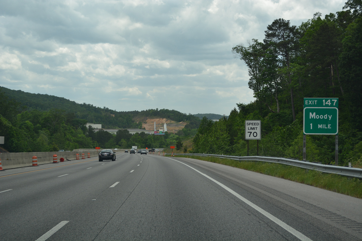
| A barrier median was constructed along I-20 throughout St. Clair County in 2005 to reduce the number of head-on collisions. Progress20 road work between October 2009 and Summer 2013 expanded the freeway to six overall lanes from Chulavista westward to milepost 147.70 at Moody. 05/06/22 |
|
| Pine Ridge Road (former U.S. 78) lines the north side of Interstate 20 east to Mountain Olive Drive at Chulavista and Pond Mountain. U.S. 78 west continues to Cook Springs and Prescott. 05/06/22 |
|
| Bald Rock Mountain and an assortment of radio towers come into view along Interstate 20 west of Chulavista. 05/06/22 |
|
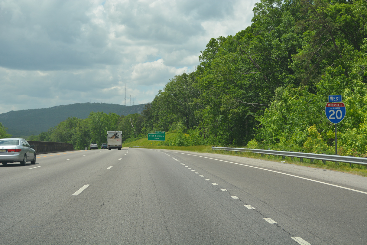
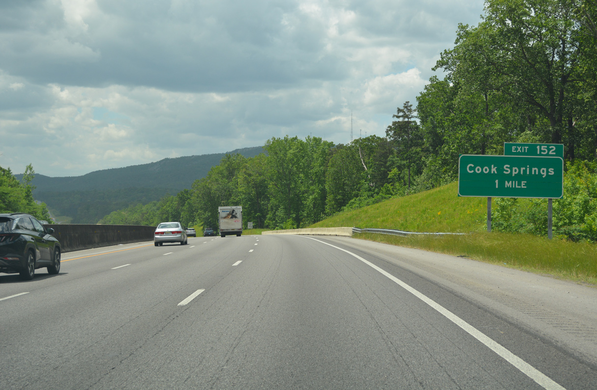
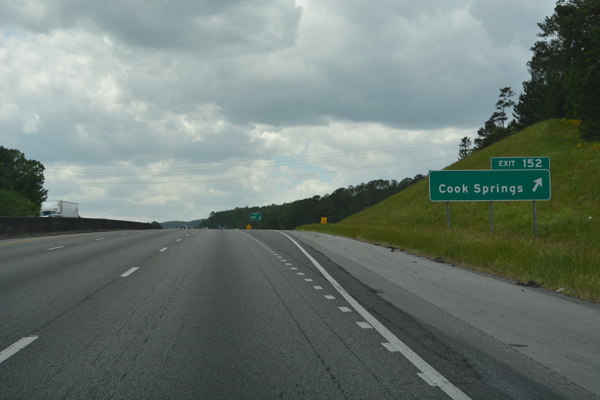
| Cook Springs Road meets Interstate 20 at Exit 152 in one mile. 05/06/22 |
|
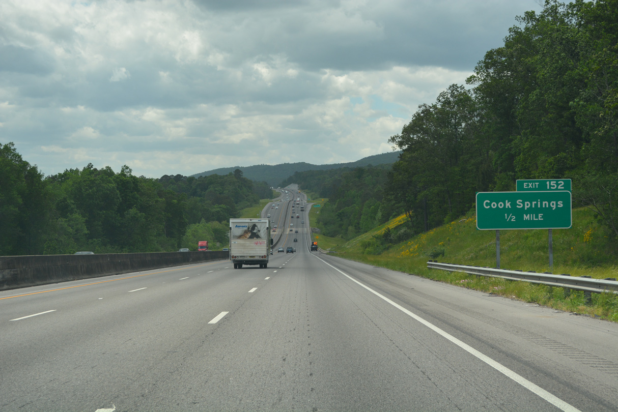
| I-20 lowers ahead of Cane Creek ahead of Exit 152. Cook Springs lies a short distance to the south along U.S. 78. 05/06/22 |
|
| Cook Springs Road continues 4.26 miles north from Interstate 20 to SR 174. 05/06/22 |
|
| Moody City Hall is 6.2 miles away via the succeeding exit from Interstate 20 westbound. Birmingham is 25 miles to the west. 05/06/22 |
|
| Interstate 20 passes between Taylors Mountain and Sand Ridge north of a parallel Norfolk Southern Railroad line. 05/06/22 |
|
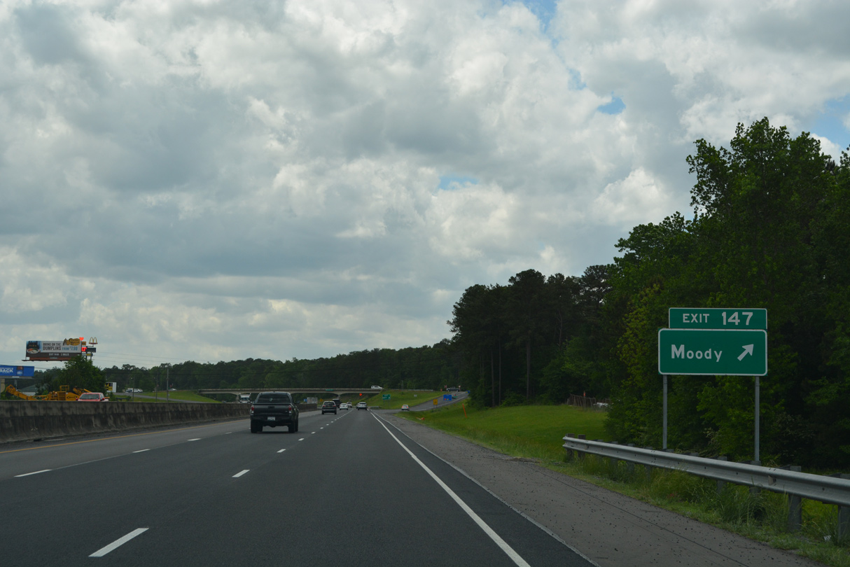
| Interstate 20 runs along eastern reaches of the Moody city limits west through Karr Gap to Exit 147 at Brompton. 05/06/22 |
|
| U.S. 78 enters Karr Gap from Prescott and travels alongside Interstate 20 across Kelly Creek. Kelly Creek Road branches northeast from U.S. 78 to Brompton and SR 174 near Backbone Mountain. 05/06/22 |
|
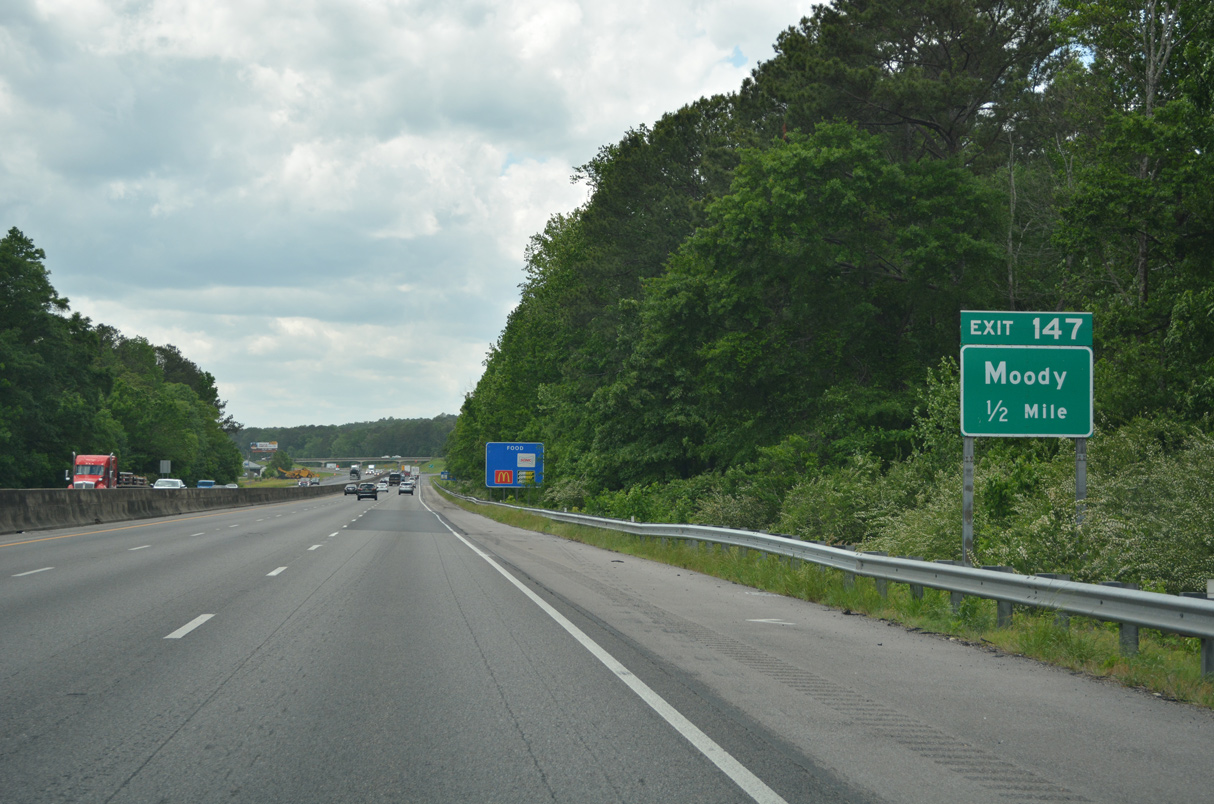
| Entering the diamond interchange (Exit 147) with Kelly Creek Road on Interstate 20 west. Suburban development becomes more apparent as I-20 advances across Moody. 05/06/22 |
|
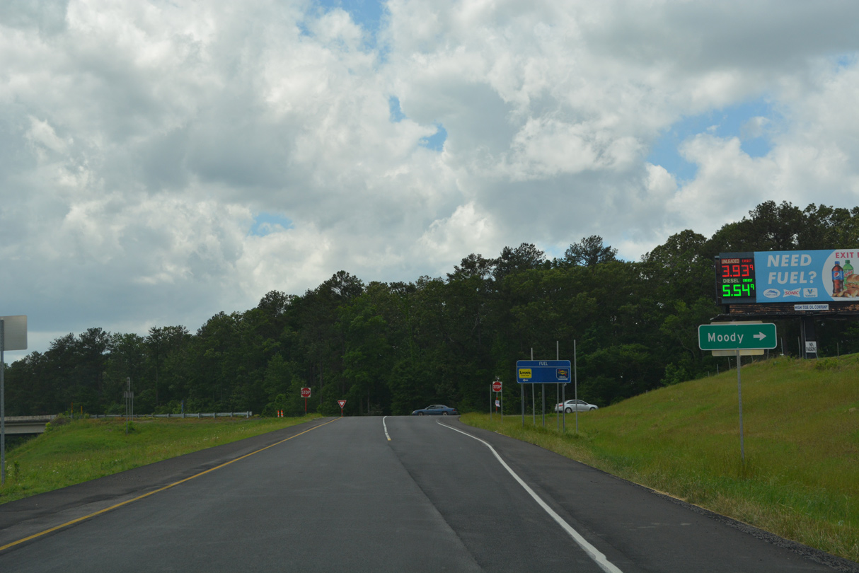
| Kelly Creek Road east to Park Avenue west leads to Moody City Hall and U.S. 411 at CR 10. 05/06/22 |
|
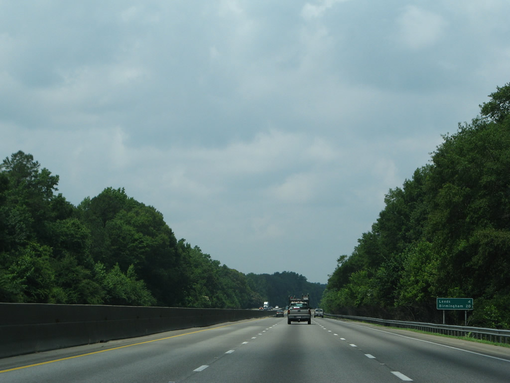
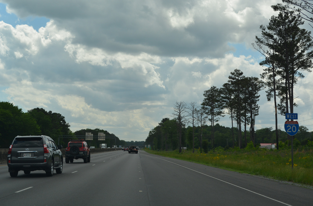
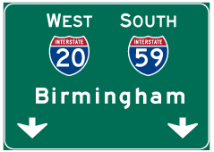
| The city of Leeds is next along Interstate 20 in four miles. Downtown Birmingham is 20 miles to the west along the overlap with I-59 south. 06/12/08 |
|
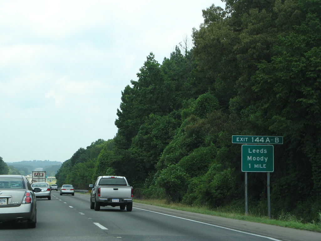
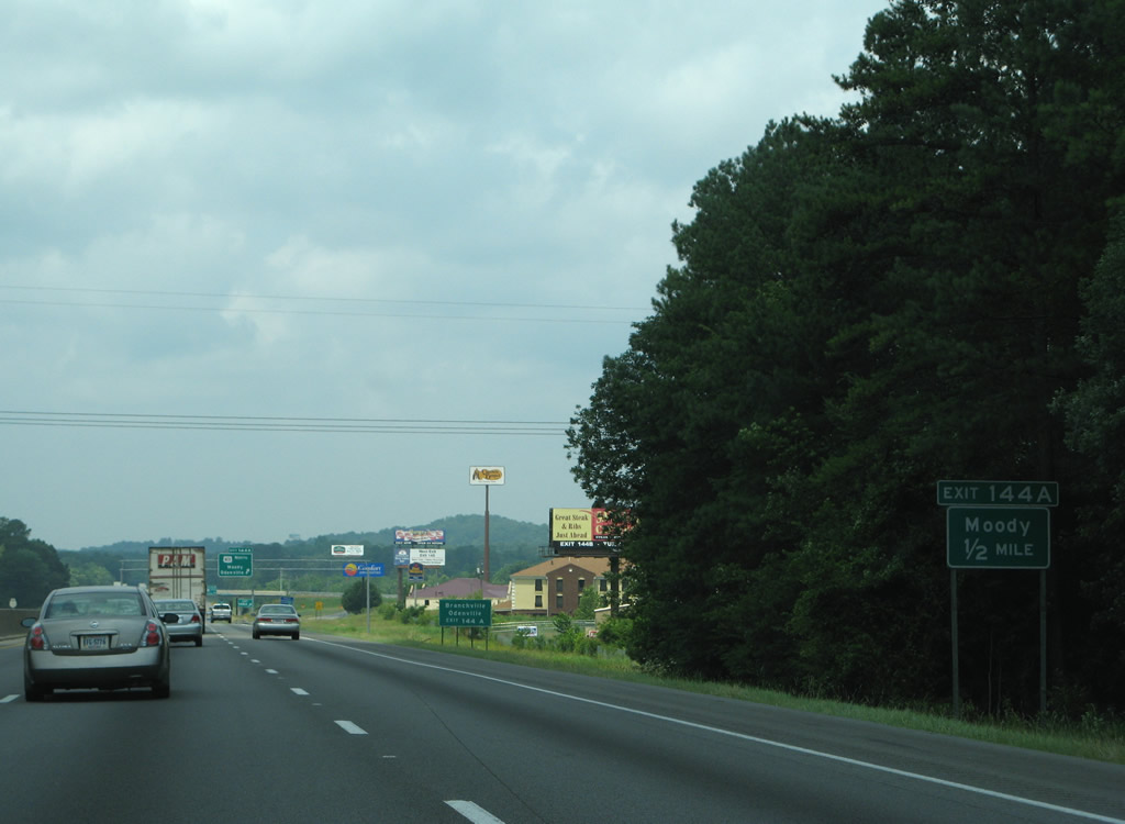
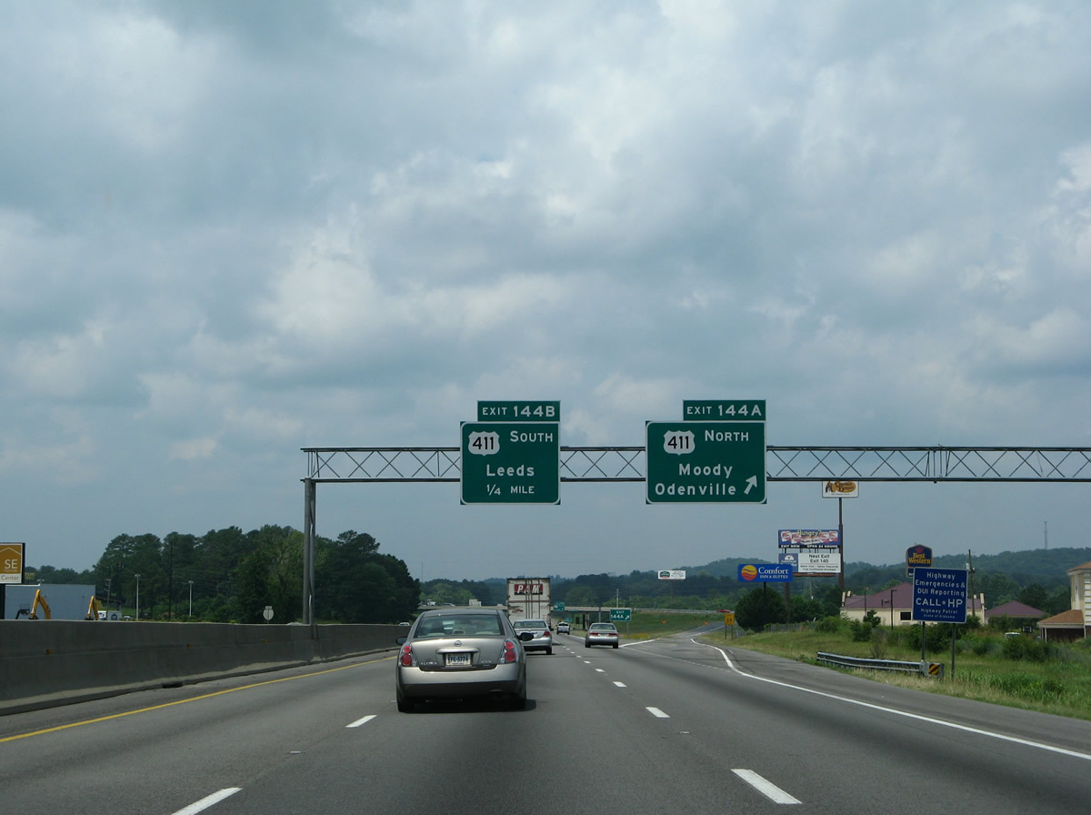
| Interstate 20 traverses Oak Ridge on the mile preceding Exits 144 B/A with U.S. 411 (Ashville Road south / Moody Parkway north). 06/12/08 |
|
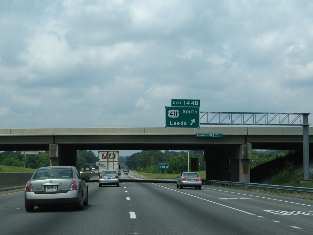
| The six-ramp parclo interchange (Exit 144) with U.S. 411 falls within Cahaba Valley by a variety of retail and travel amenities. 06/12/08 |
|
| Exit 144 A leaves Interstate 20 west for U.S. 411 (Moody Parkway) north through Cahaba Valley to Moody, Branchville and Odenville. 06/12/08 |
|
| U.S. 411 follows Ashville Road southwest from Exit 144 B to Whitmire Street and its end point at 9th Street and U.S. 78 (Parkway Drive) in Downtown Leeds. 06/12/08 |
|
| Interstate 20 proceeds west from Cahaba Valley toward Pine Ridge on the north side of Leeds. 05/06/22 |
|
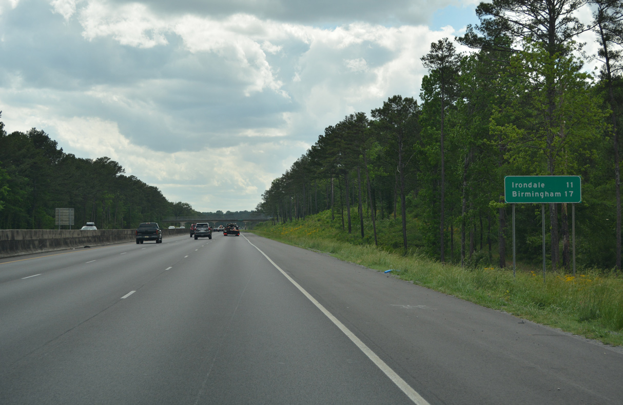
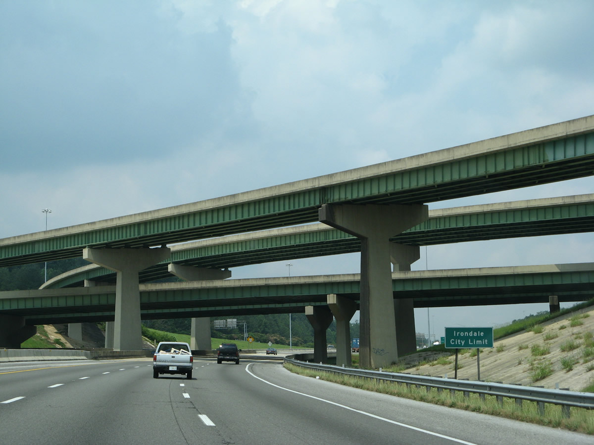
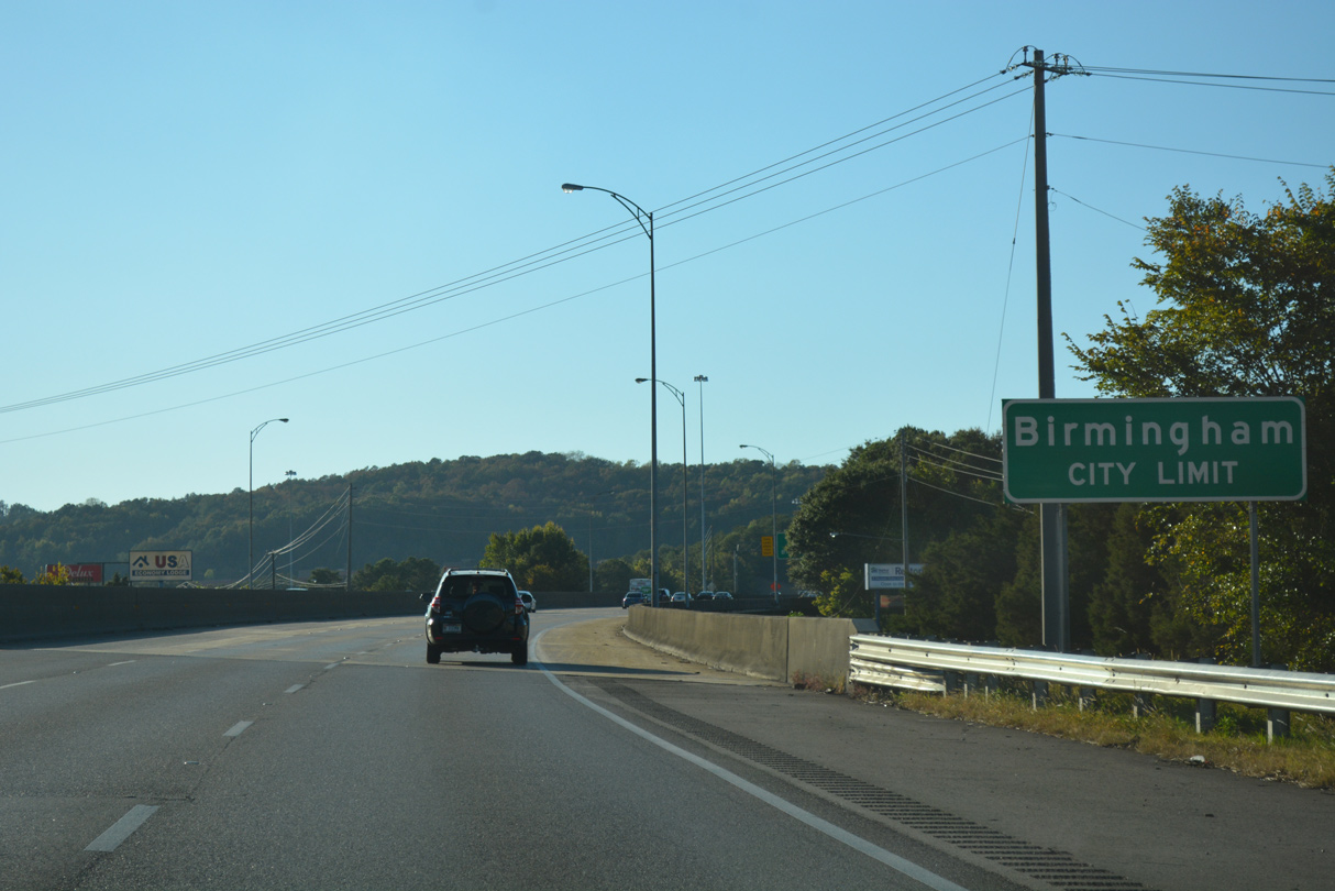
| Irondale, a suburb of Birmingham, is next along Interstate 20 west in 11 miles. 05/06/22 |
|
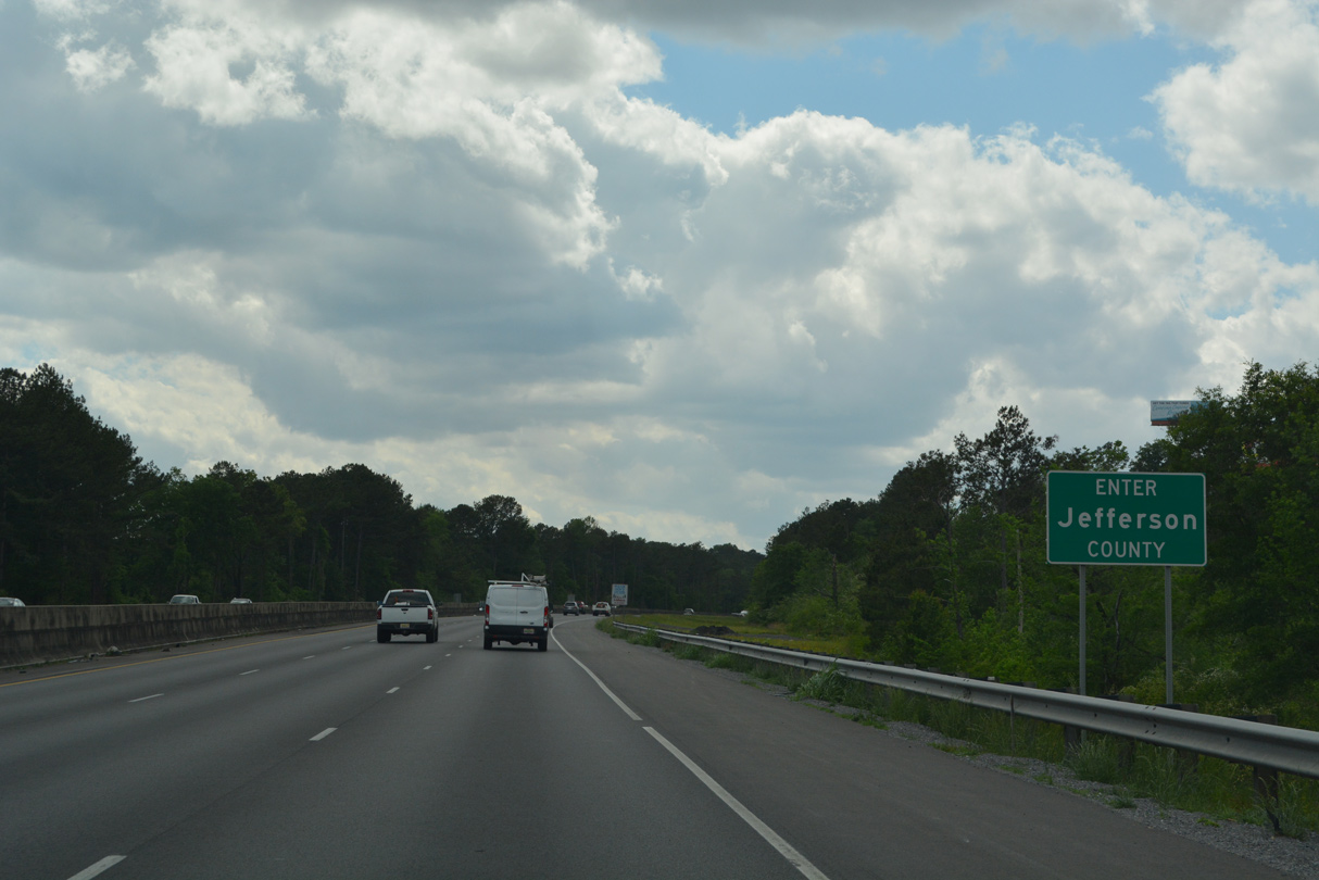
| Westbound Interstate 20 enter Jefferson County at Pine Ridge. 05/06/22 |
|
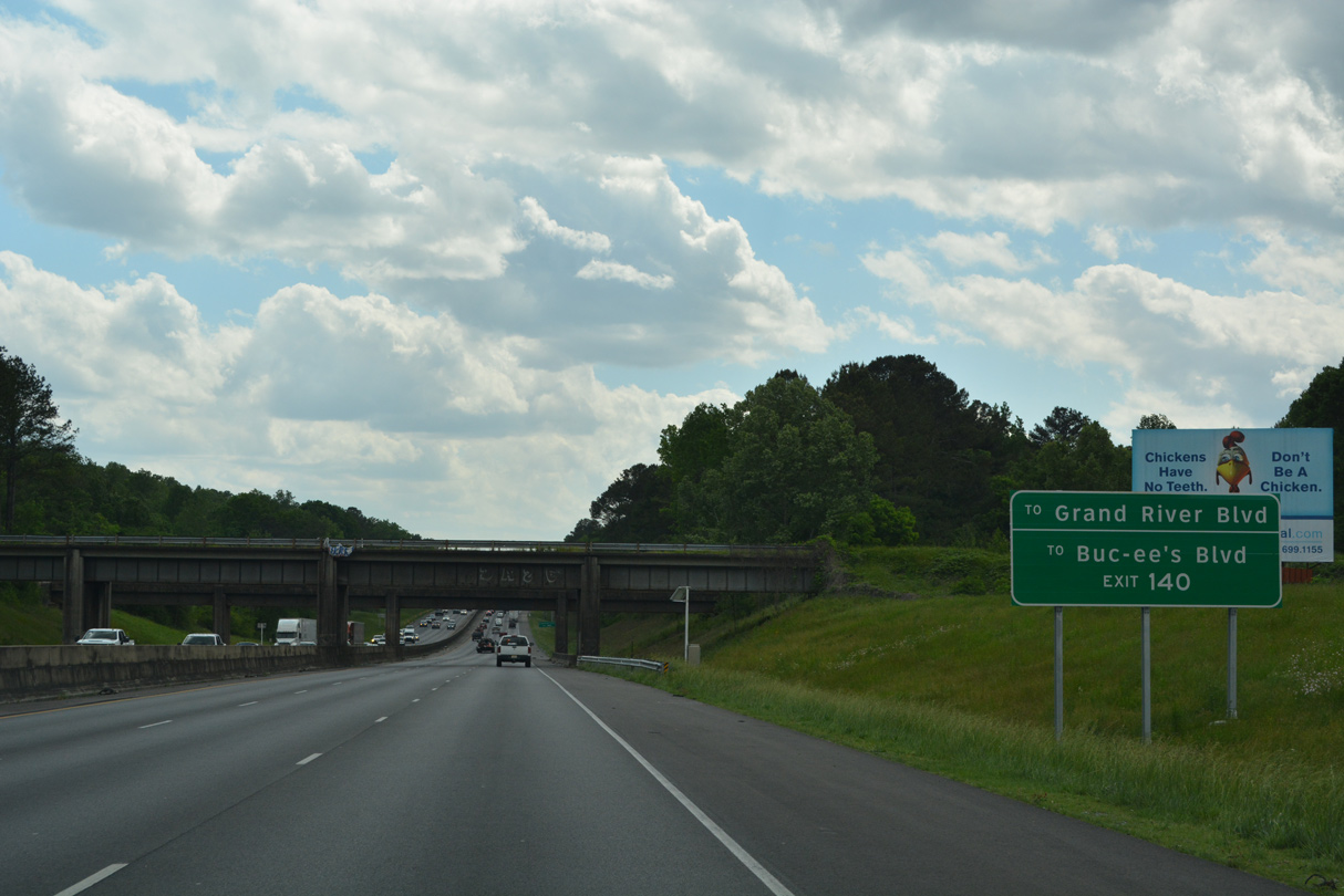
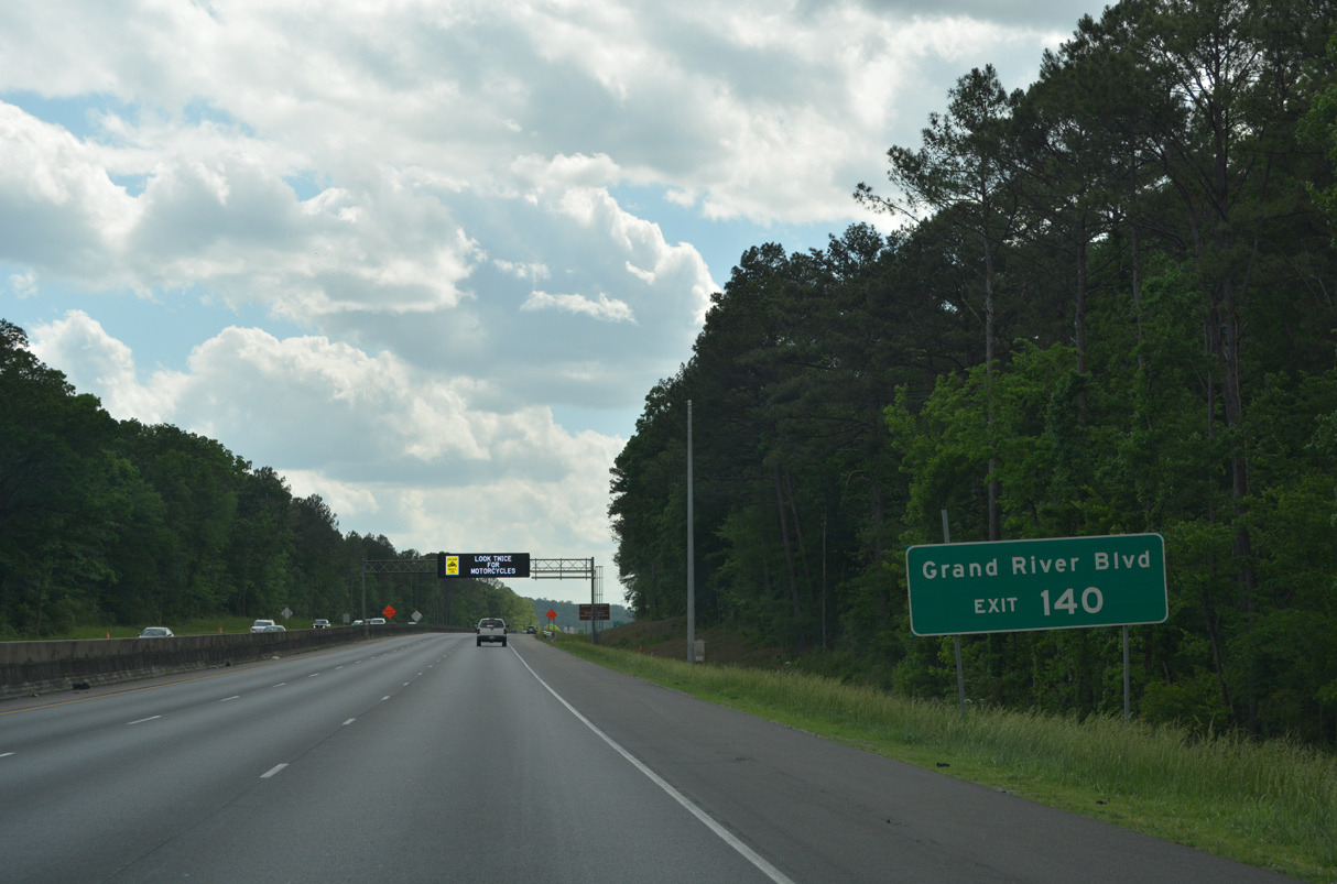
| A Norfolk Southern Railroad line and an abandoned railroad spur span Interstate 20 ahead of Exit 140. Buc-ee&apos's Boulevard and Grand River Boulevard serve adjacent businesses from the forthcoming exchange. 05/06/22 |
|
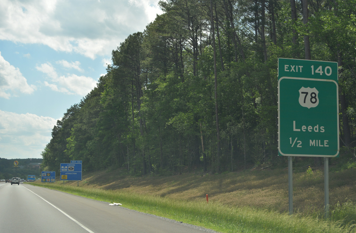
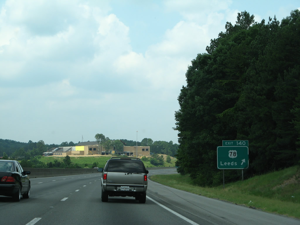
| U.S. 78 follows Parkway Dive across west Leeds to a parclo interchange (Exit 140) with Interstate 20. 06/12/08 |
|
| Retail growth during and after 2008, including a Bass Pro Shops and The Outlet Shops of Grand River along Grand River Boulevard, accompanies the exchange joining Interstate 20 and U.S. 78 in west Leeds. 05/06/22 |
|
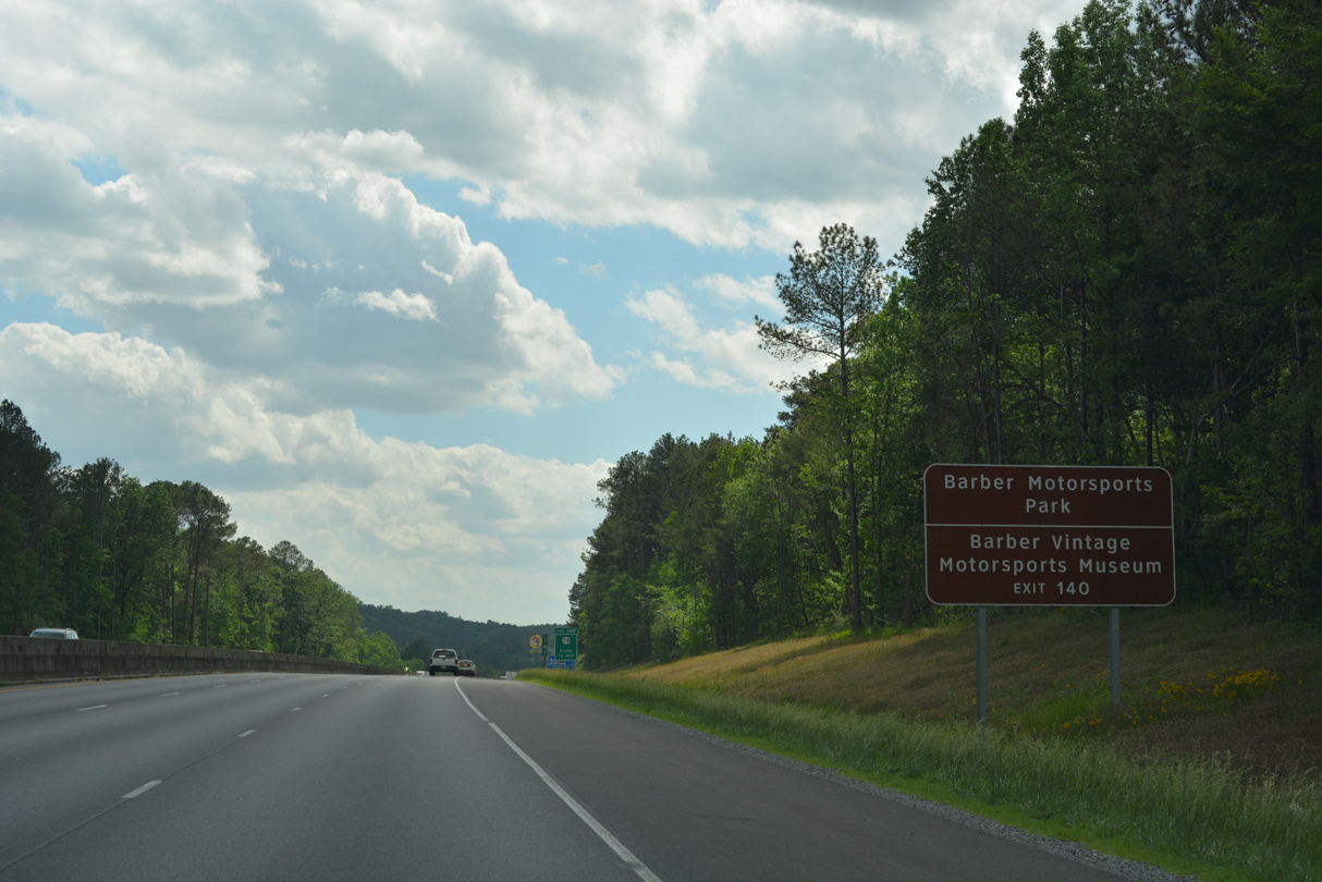
| Rex Lake Road stems southwest from U.S. 78 nearby to Barber Motorsports Park and eastern reaches of the Birmingham city limits. 05/06/22 |
|
| West from Exit 140, U.S. 78 (Bankhead Highway) stays north of Interstate 20 to the Lovick area of Birmingham and the city of Irondale. 05/06/22, 06/12/08 |
|
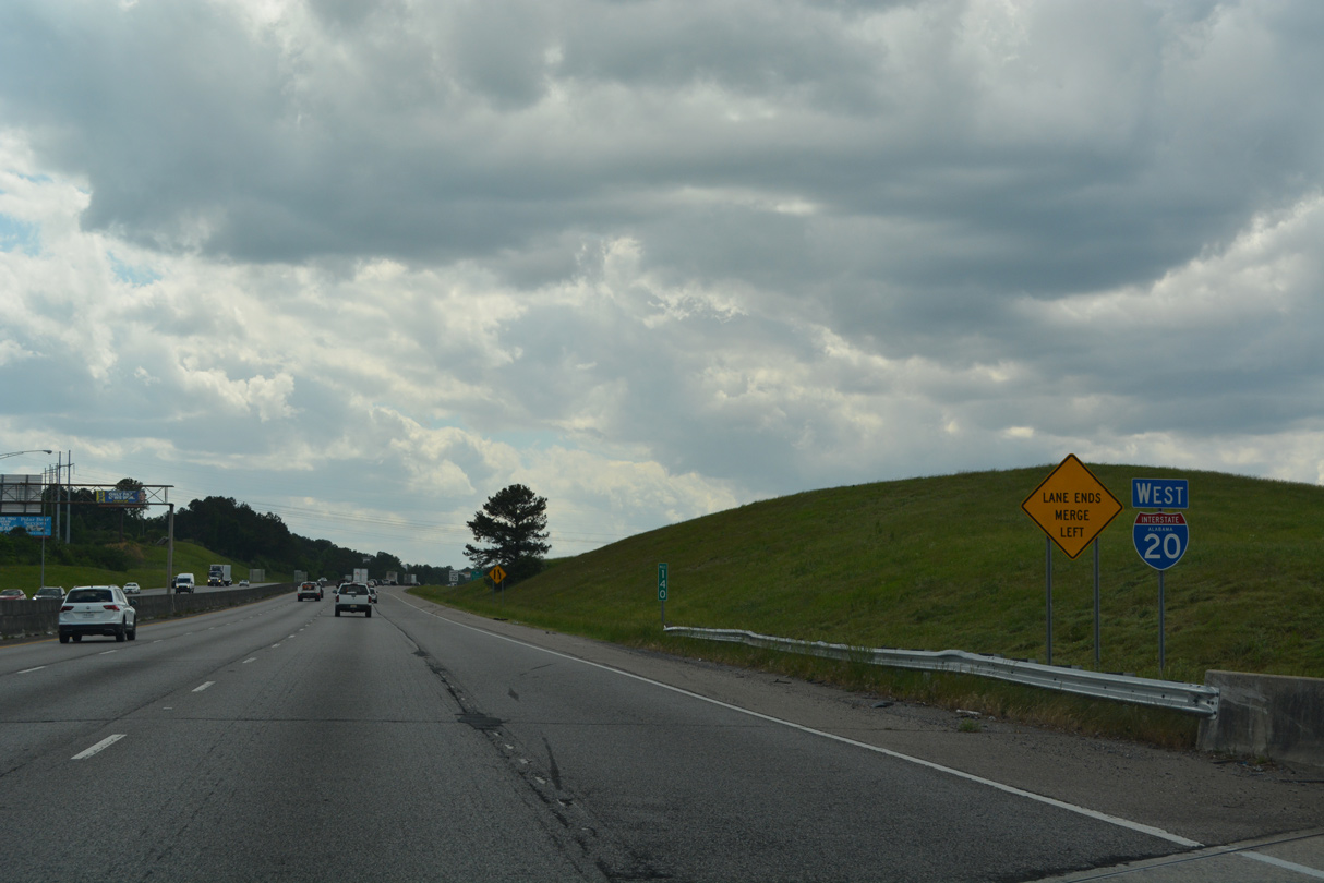
| Reassurance marker posted for Interstate 20 west after the loop ramp from U.S. 78. 05/06/22 |
|
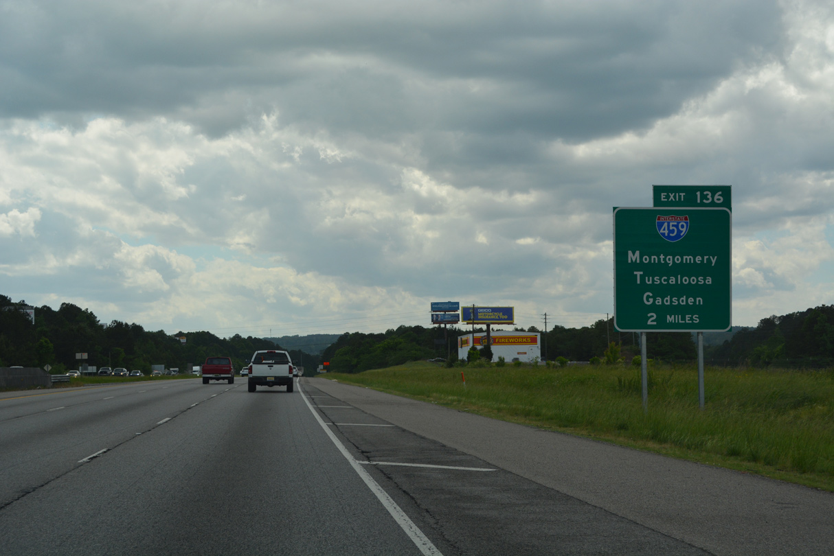
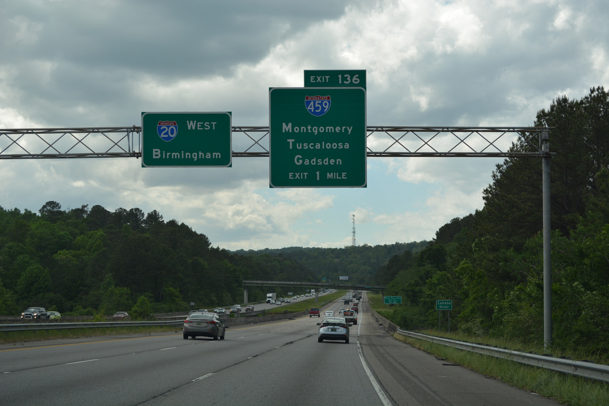
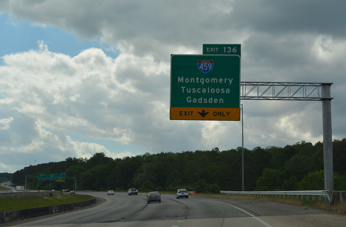
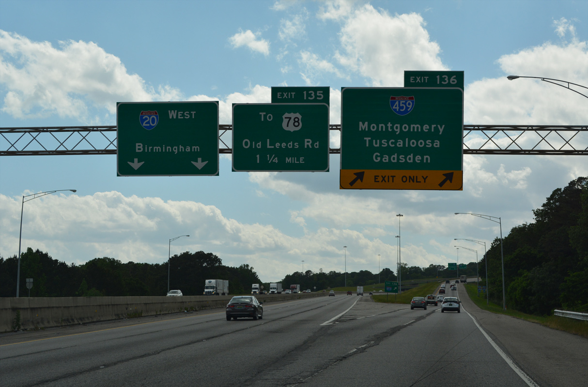
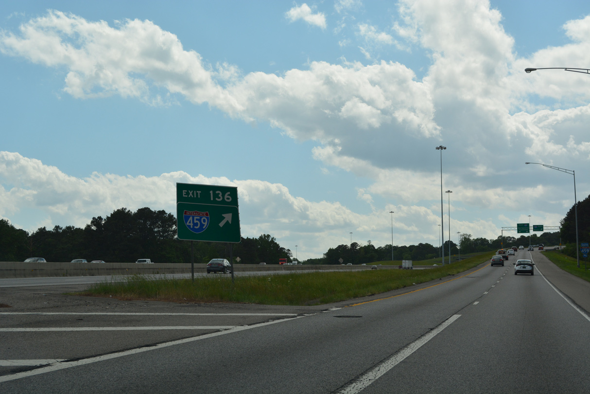
| Interstate 459, the south belt line around Birmingham, converges with I-20 at a four level interchange (Exit 136) in two miles. 05/06/22 |
|
| Spanning the Cahaba River, I-20 progresses one mile west to Interstate 459 at Exit 136. 05/06/22 |
|
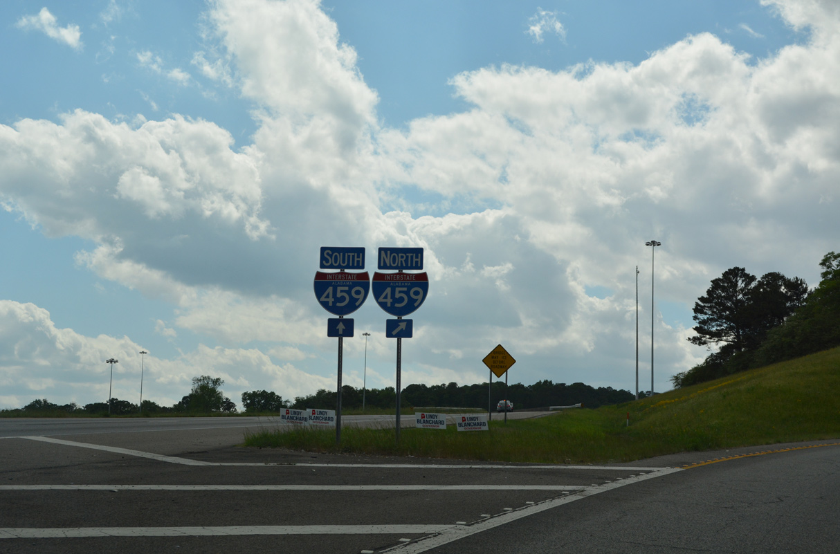
| Interstate 459 constitutes a 33.35 mile loop from I-59 near Trussville to I-20/59 at Bessemer. 05/06/22 |
|
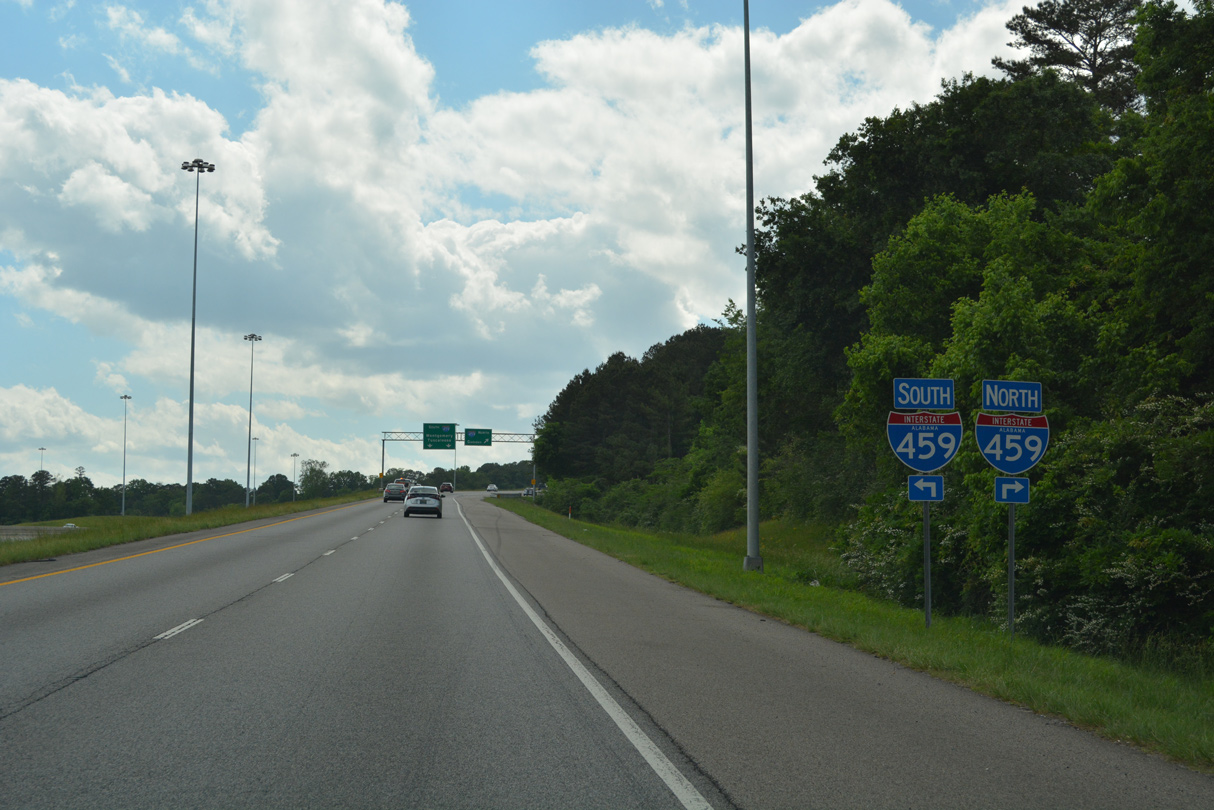
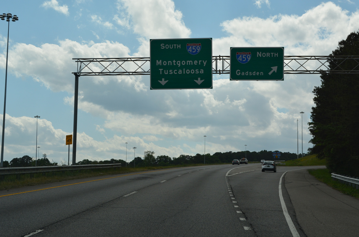
| Interstate 459 north to I-59 leads motorists 48 miles to Gadsden. Through traffic to Tuscaloosa and Meridian, Mississippi is directed onto I-459 south to bypass Downtown Birmingham. 05/06/22 |
|
| An Interstate 459 shield accompanies the gore point sign for Exit 136. This is a typical ALDOT arrangement between freeway to freeway junctions. 05/06/22 |
|
| Interstate 459 opened in stages between 1978 and 1984. 05/06/22 |
|
| Interstate 459 leads 14 miles southwest from Exit 136 to I-65 at the city of Hoover. 05/06/22 |
|
| Flyovers between I-20 and I-459 are two lanes wide while ground level ramps carry just a single lane. 05/06/22 |
|
| The systems interchange at Interstate 459 was completed in 1984. 06/12/08 |
|
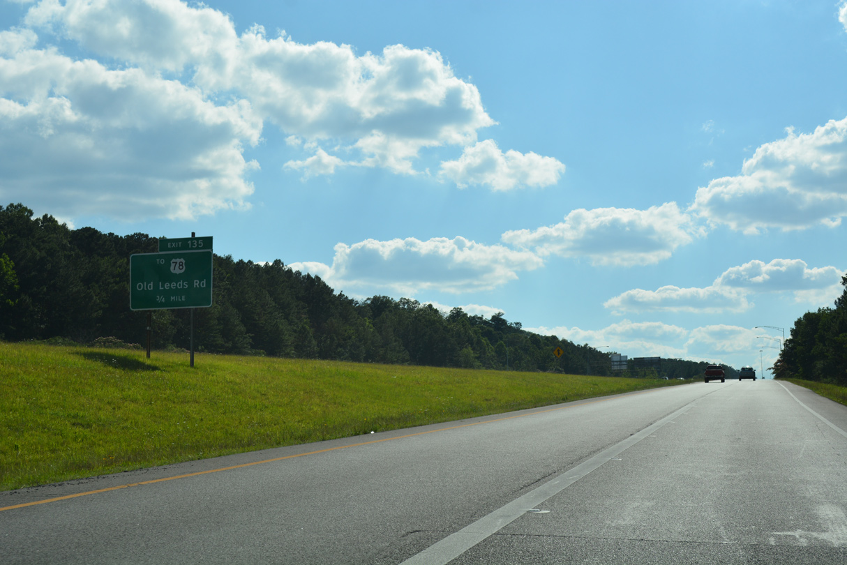
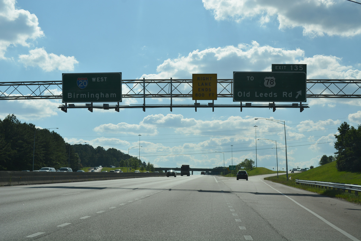
| The ensuing exit from I-20 west is the diamond interchange with Old Leeds Road a half mile from I-459 at Weems Gap. 06/09/17 |
|
| Exit 135 parts ways with Interstate 20 west to Old Leeds Road at Rose Hill. Heading southwest from U.S. 78, Old Leeds Road straddles Flat Ridge to East Irondale and Mountain View. 06/09/17 |
|
| Exit 135 is the first of three in a row linking Interstate 20 west with U.S. 78 in Irondale. 06/09/17 |
|
| Interstate 20 west across Shades Mountain was built in 1981. 10/08/16 |
|
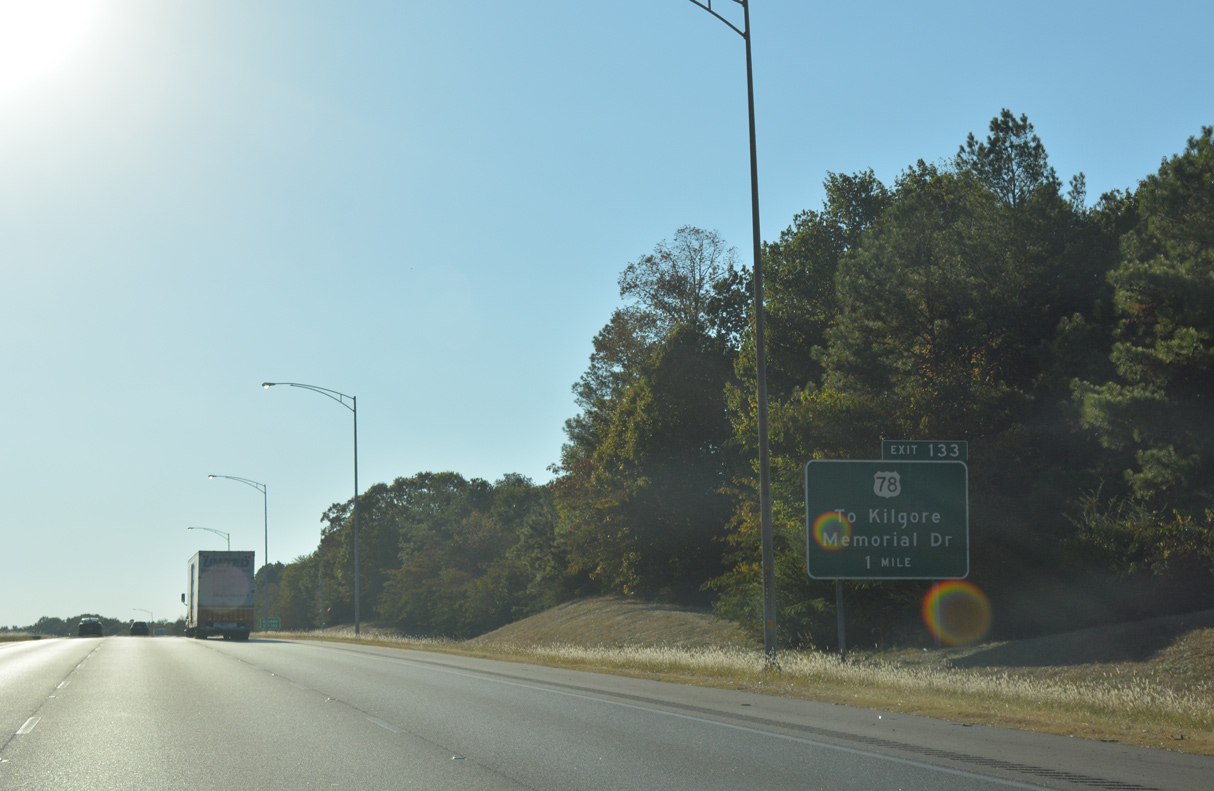
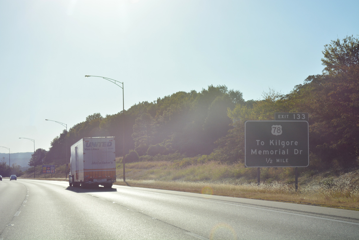
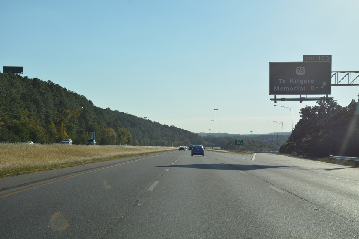
| Interstate 20 next meets U.S. 78 (Crestwood Boulevard) at Kilgore Memorial Drive south of the Irondale city center along 20th Street S. 10/08/16 |
|
| Exit 133 links I-20 westbound directly with parallel U.S. 78 (Crestwood Boulevard) at a parclo interchange. Kilgore Memorial Drive extends southeast from U.S. 78 and 20th Street S to become Grants Mill Road at retail area on Shades Mountain. 10/08/16 |
|
| U.S. 78 continues west from Kilgore Memorial Drive into the city of Birmingham across I-20. Crestwood Boulevard enters a commercial strip by Sandstone Ridge and Red Mountain. 10/08/16 |
|
| Montevallo Road arcs southwest from 16th Street S in Irondale to U.S. 78 (Crestwood Boulevard) and Montclair Road in Birmingham. 10/08/16 |
|
| Entering the city of Birmingham, Interstate 20 curves northwest over a viaduct across Montclair Road and U.S. 78 (Crestwood Boulevard). 10/08/16 |
|
| A diamond interchange joins I-20 with Montevallo Road at Exit 132. The exit also connects to Oporto Madrid Boulevard nearby. 10/08/16 |
|
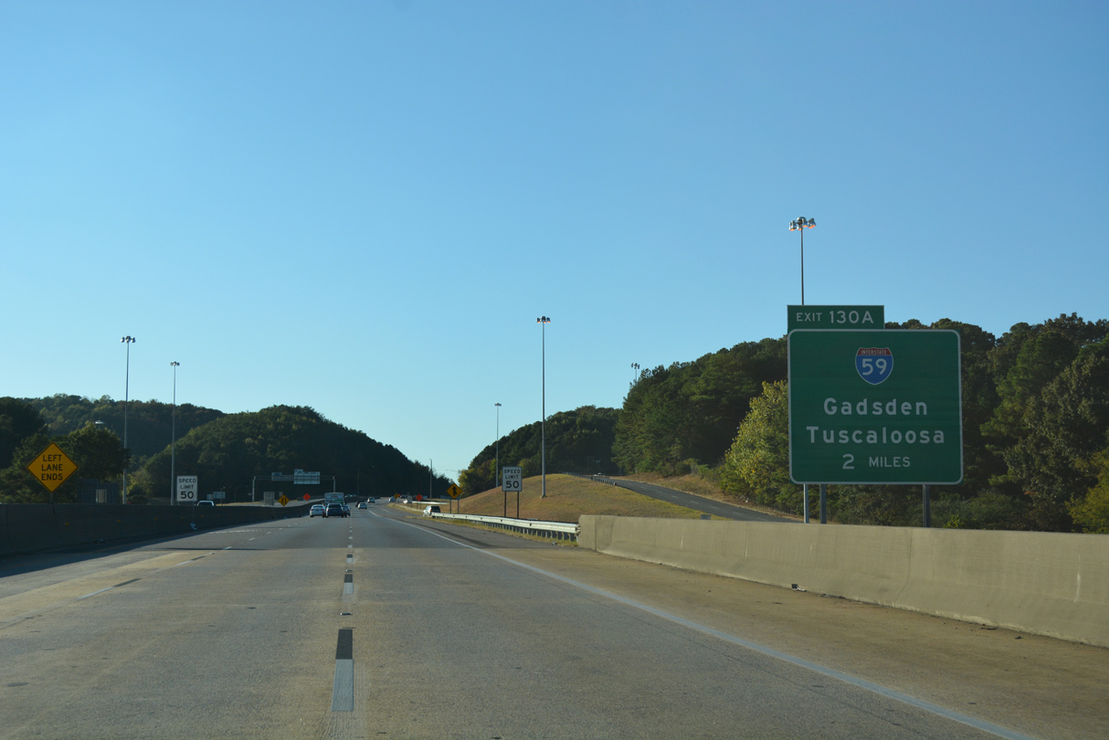
| Meeting I-20 in two miles at Exit 130 A, Interstate 59 enters the Birmingham area from Trussville and Gadsden to the northeast. 10/08/16 |
|
| Westbound confirming marker posted along Interstate 20 on Red Mountain in Birmingham. 10/03/10 |
|
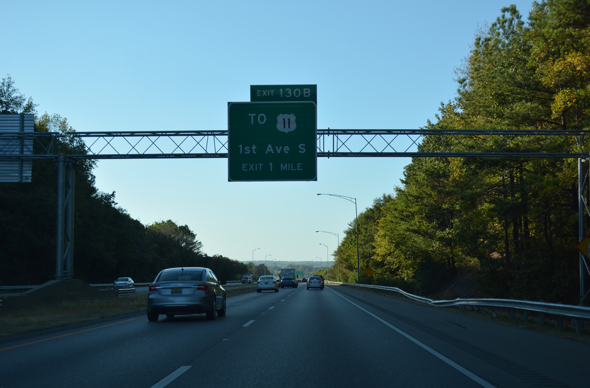
| U.S. 11 (1st Avenue N) crosses Interstate 20 between the Wahouma and Woodlawn neighborhoods. Exit 130 B lowers from I-20 west onto 64th Street just south of the US highway. 10/08/16 |
|
| A lengthy viaduct spans the Alabama and Tennessee River Railway, two Norfolk Southern Railroad lines, Brussels Avenue and Georgia Road between Woodlawn and Gate City. 10/03/10 |
|
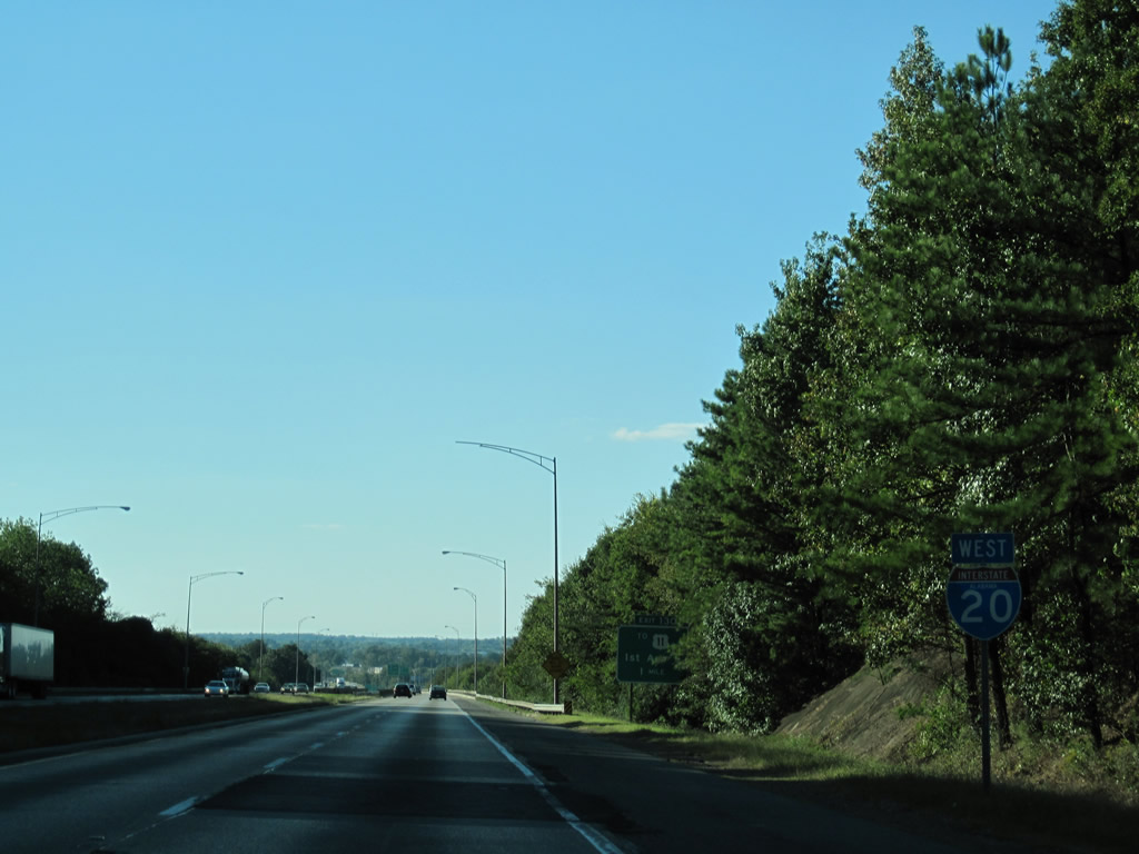
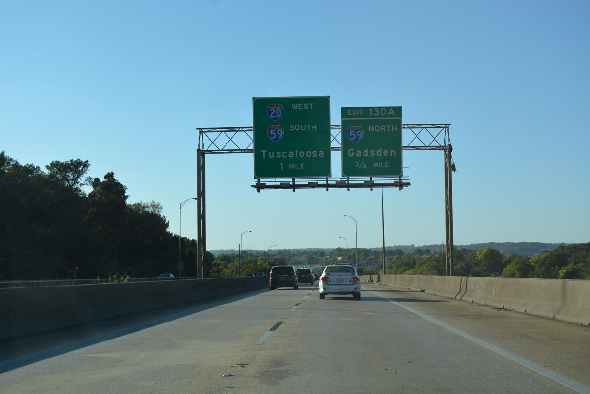
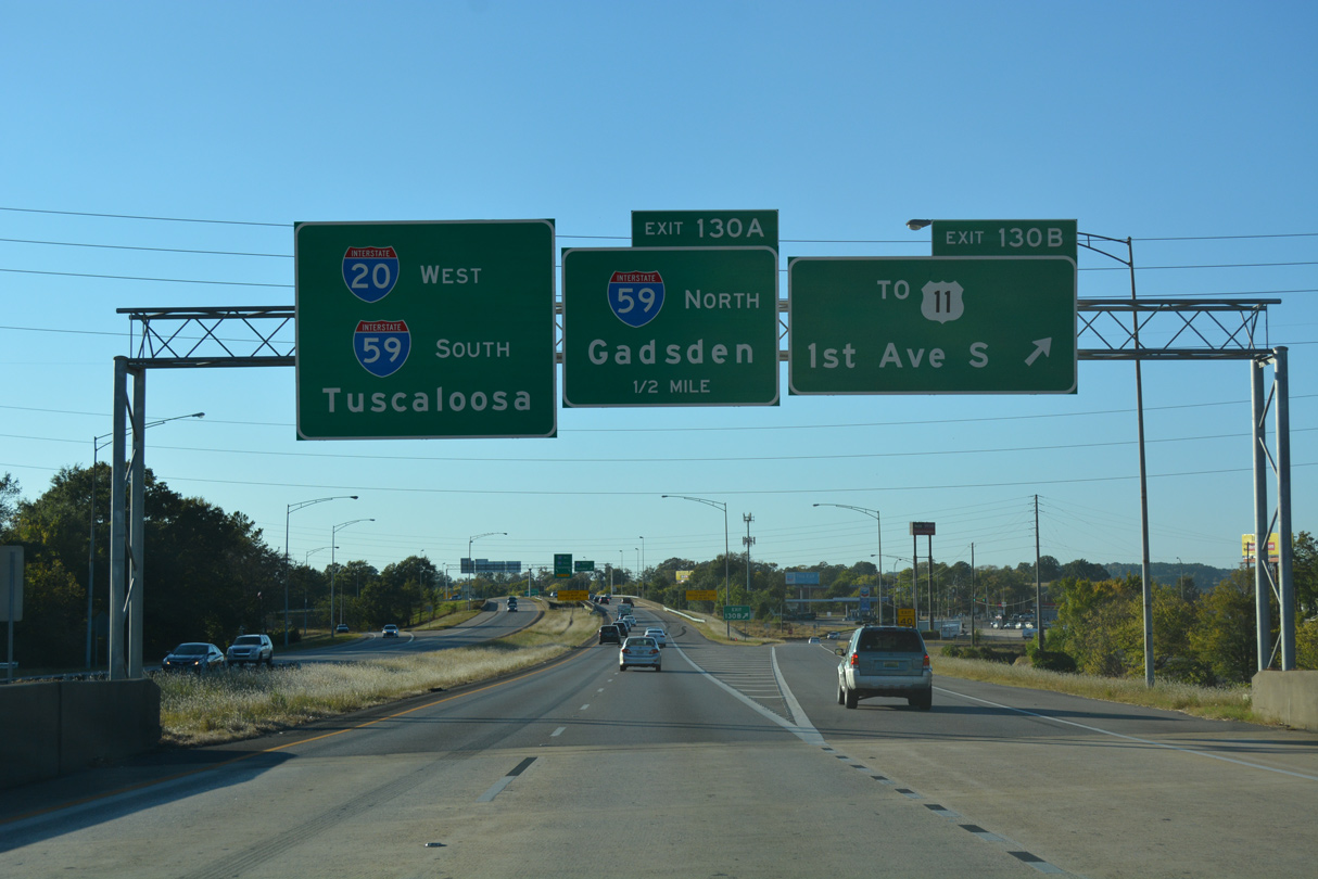
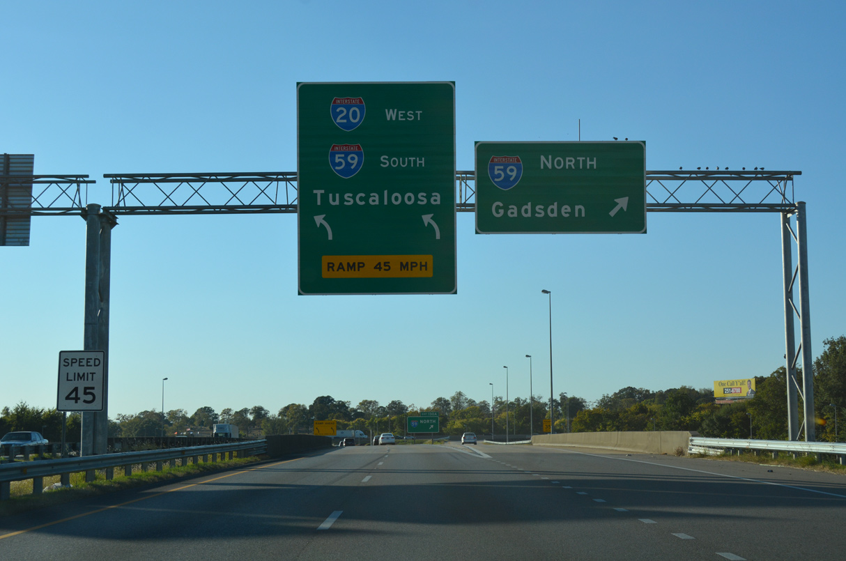
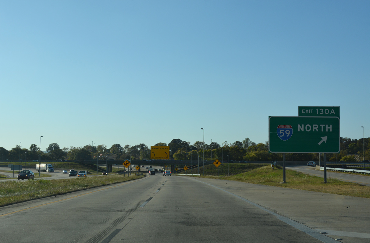
| I-20 west combines with Interstate 59 south in one mile at a trumpet interchange (Exit 130 A). The two routes overlap 154.7 miles southwest into the Magnolia State. 10/08/16 |
|
| Exit 130 B departs I-20 westbound for 1st Avenue S. U.S. 11 follows 1st Avenue N northeast to East Lake and I-59 at Exit 132 and southwest along an industrial boulevard to Downtown. Exit 130 A follows in a half mile to Gadsden and Chattanooga, Tennessee. 10/08/16 |
|
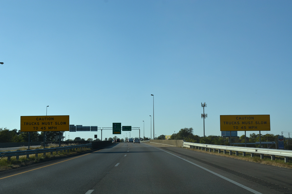
| The speed limit reduces to 45 mph along I-20 leading into the exchange with Interstate 59 south to Downtown Birmingham. 10/08/16 |
|
| Exit 130 A joins Interstate 59 north for East Lake, Roebuck and Huffman in northeast Birmingham. 10/08/16 |
|
| I-59 continues 131 miles northeast from I-20 to I-24 near Wildwood, Georgia. 10/08/16 |
|
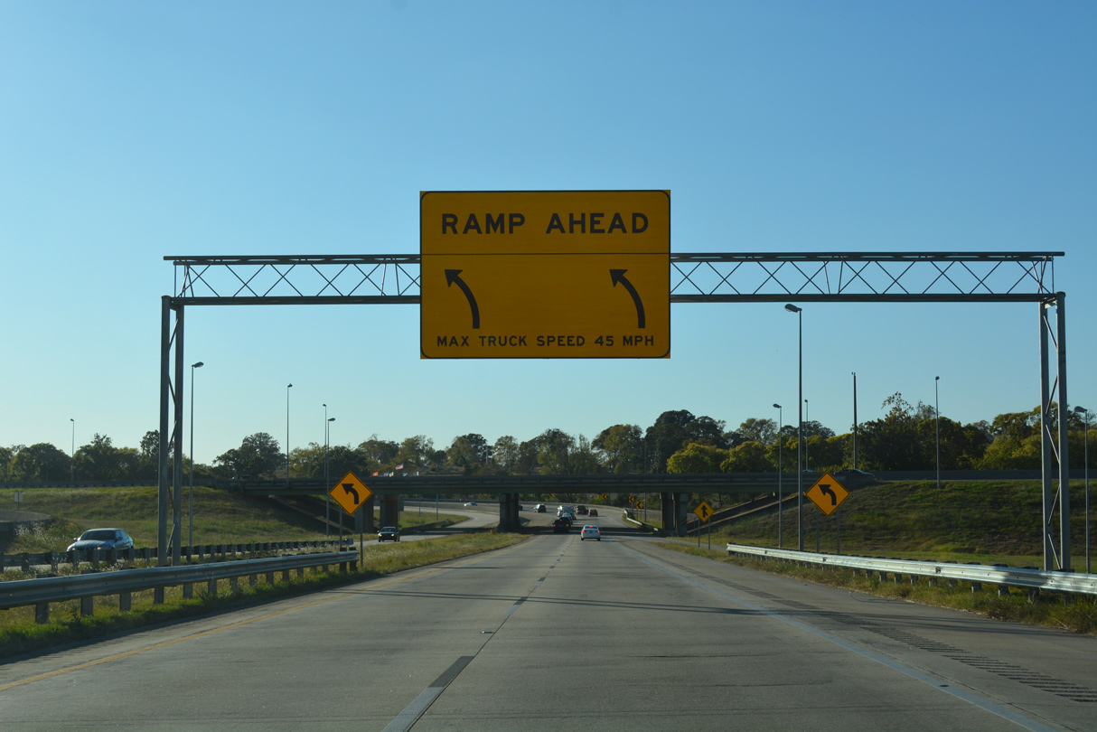
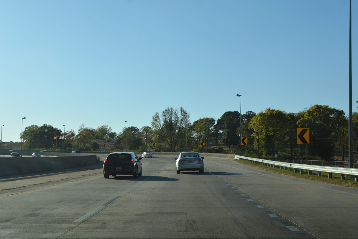
| Interstate 20 navigates along a sharply curved ramp to combine with I-59 south by Forest Hill Cemetery. 10/08/16 |
Page Updated 04-28-2023.

 West
West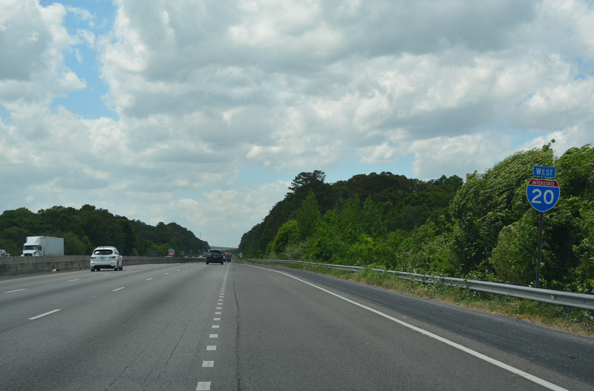

 West
West