|
| Interstate 25 crosses over Candelaria Road one mile ahead of the "Big I" systems interchange (Exits 226B/A) with I-40 (Coronado Freeway). 04/27/17 |
|
| Confirming marker posted beyond the Comanche Road entrance ramp. 04/28/17 |
|
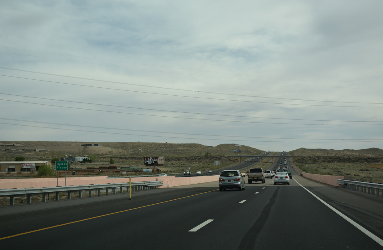
| The succeeding exits south of the Big I interchange with I-40 connect Interstate 25 with Downtown Albuquerque. 04/28/17 |
|
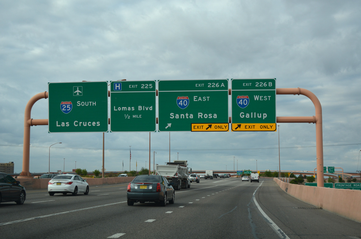
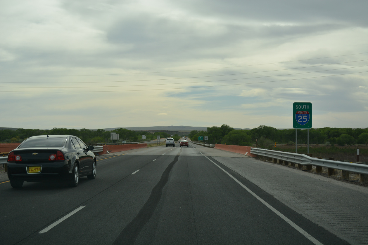
| With five southbound lanes, I-25 (Pan American Freeway) advances south across Candelaria Road to the multi level exchange (Exits 226A/B) with Interstate 40. 04/28/17 |
|
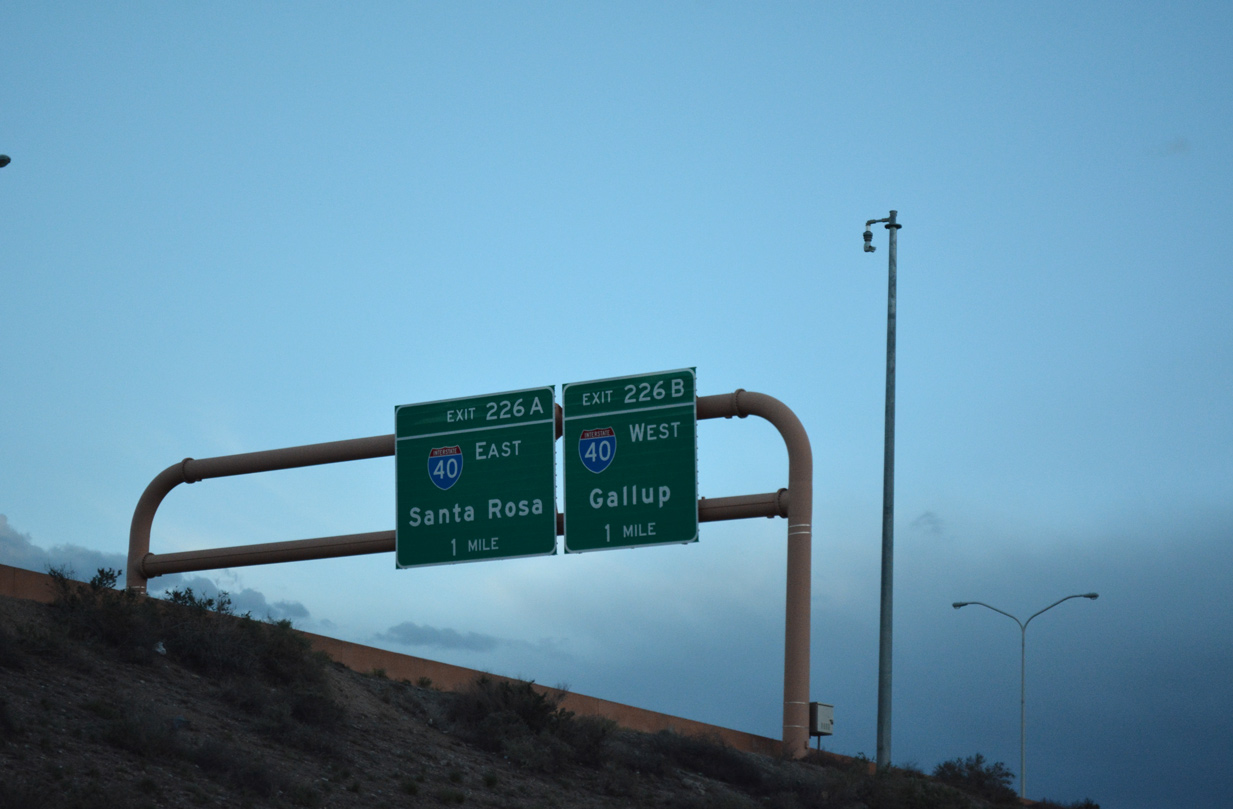
| The Big I interchange at I-25/40 was constructed at a cost of $293 million. The project wrapped up with the opening of the new frontage road system along I-40. A day of festivities formally marked completion of nearly two years of construction on May 25, 2002.1 04/28/17 |
|
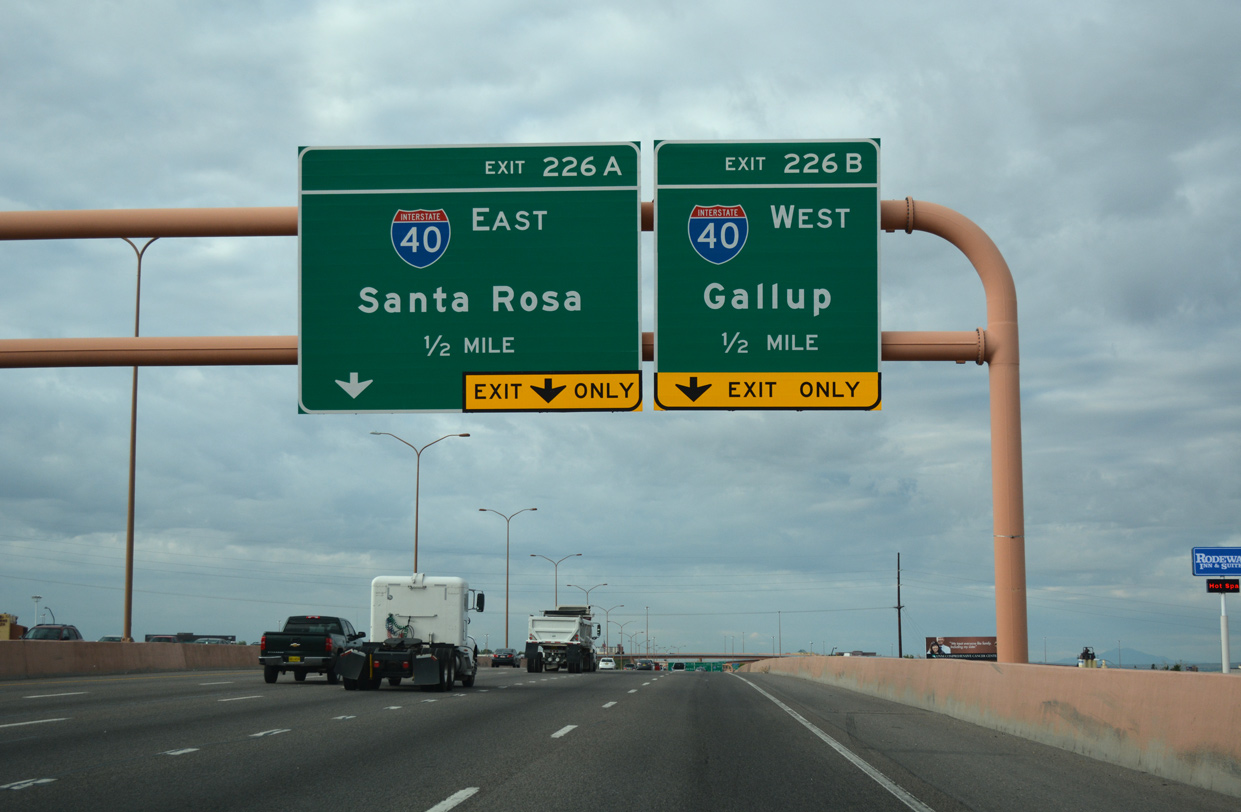
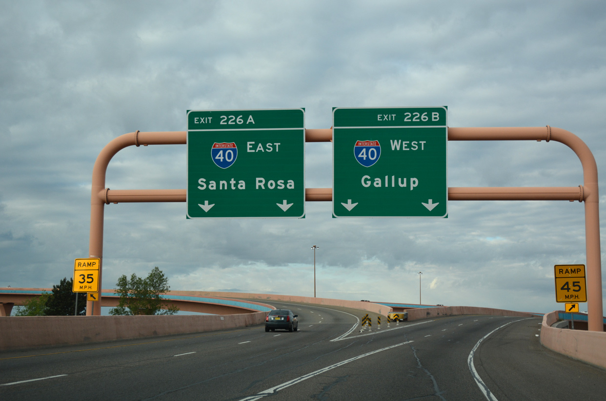
| Two lane flyovers partition for Interstate 40 east to Santa Rosa and Tucumcari and west to Grants and Gallup. 04/28/17 |
|
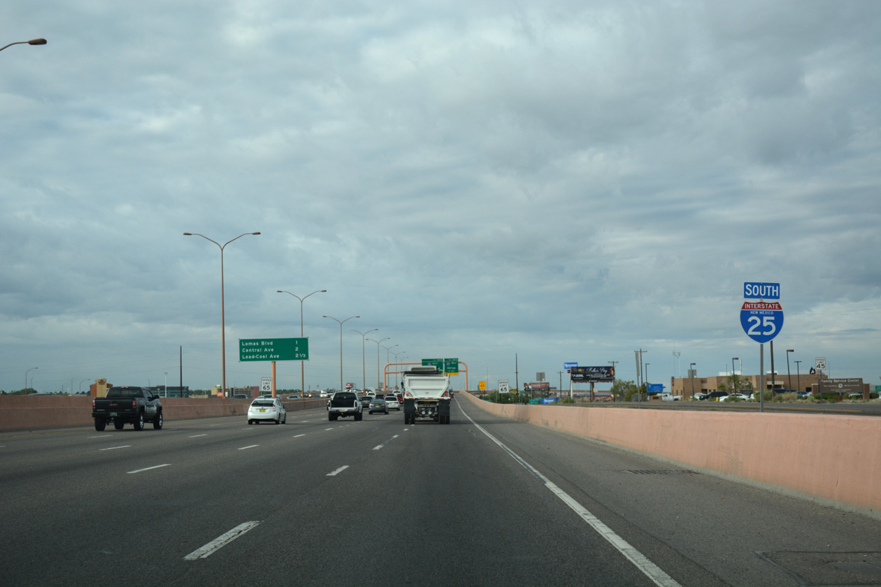
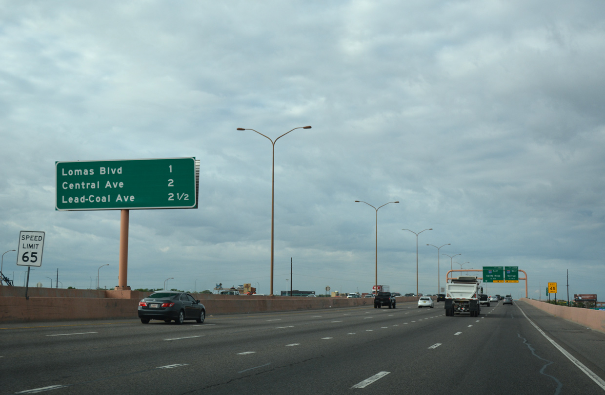
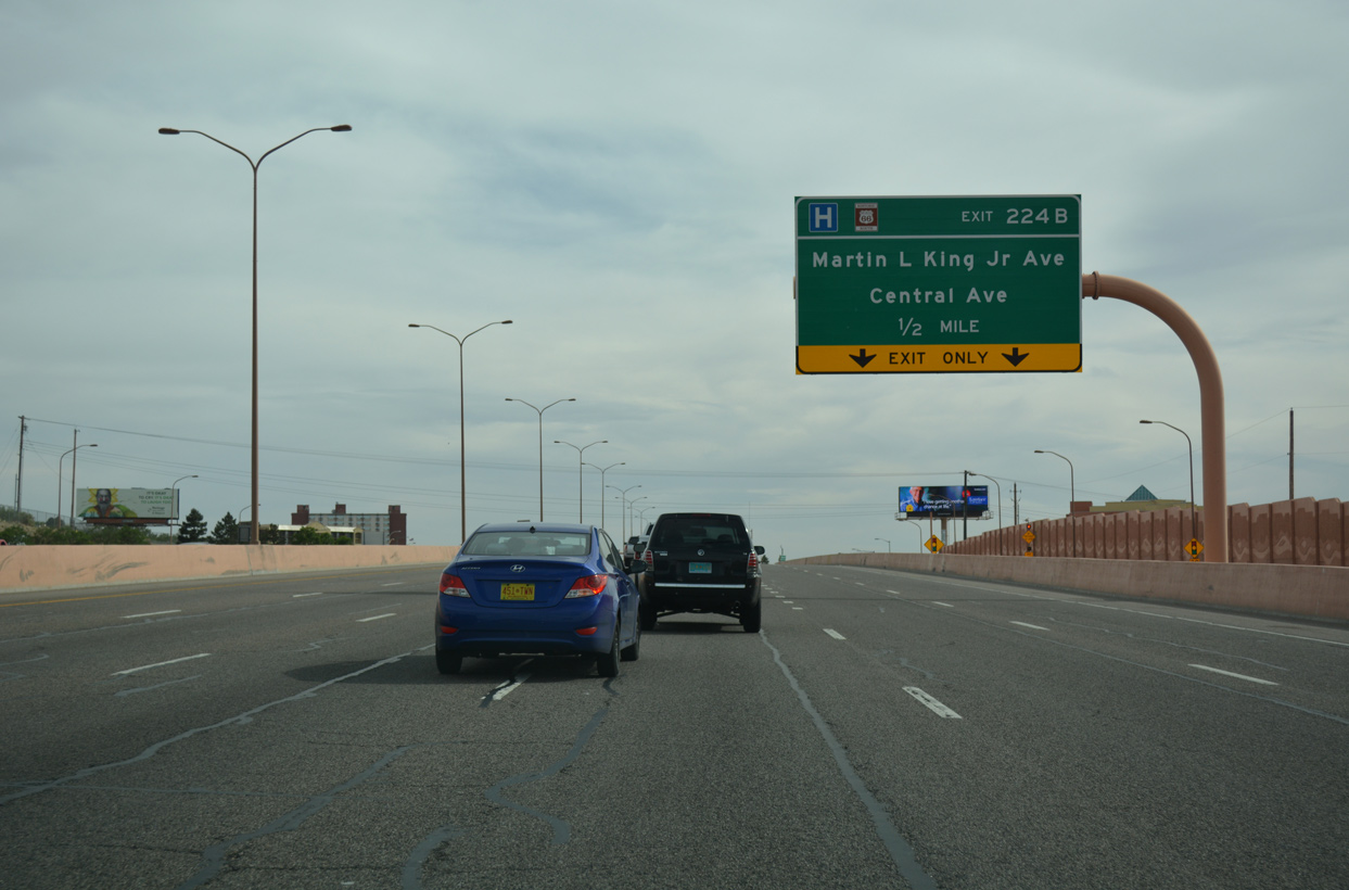
| Interstate 25 passes between Downtown Albuquerque and the University of New Mexico campus with as many as 11 lanes. Decorative sound walls line the freeway along some sections. Forthcoming Exit 224B departs for Dr. Martin Luther King Avenue, Jr to Albuquerque Convention Center. 04/24/17 |
|
| A split diamond interchange (Exit 224B) connects I-25 with Martin L King, Jr. Avenue and Central Avenue (Historic U.S. 66). Both streets link I-25 with Broadway (NM 45) to the west and University Boulevard at UNM to the east. Central Avenue represents the post-1937 alignment of U.S. 66 west to I-40 at Exits 140 and east to Exit 167. 04/24/17 |
|
| Some of the high rise buildings in Downtown Albuquerque skyline to the west of Interstate 25 at Central Avenue. 04/24/17 |
|
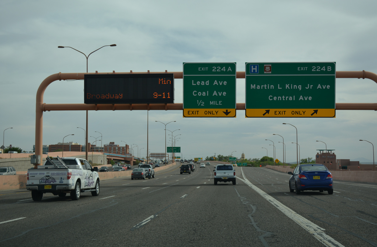
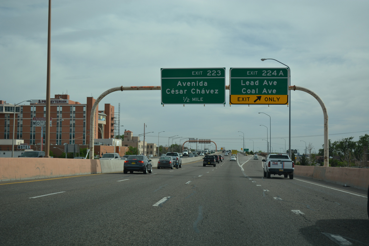
| Exit 224A quickly follows to the one way couplet of Lead Avenue west and Coal Avenue east. 04/24/17 |
|
| The split diamond interchange (Exit 224A) with Lead and Coal Avenues joins Interstate 25 with the Huning Highland Historic District to the west and the University Heights neighborhood to the east. 04/24/17 |
|
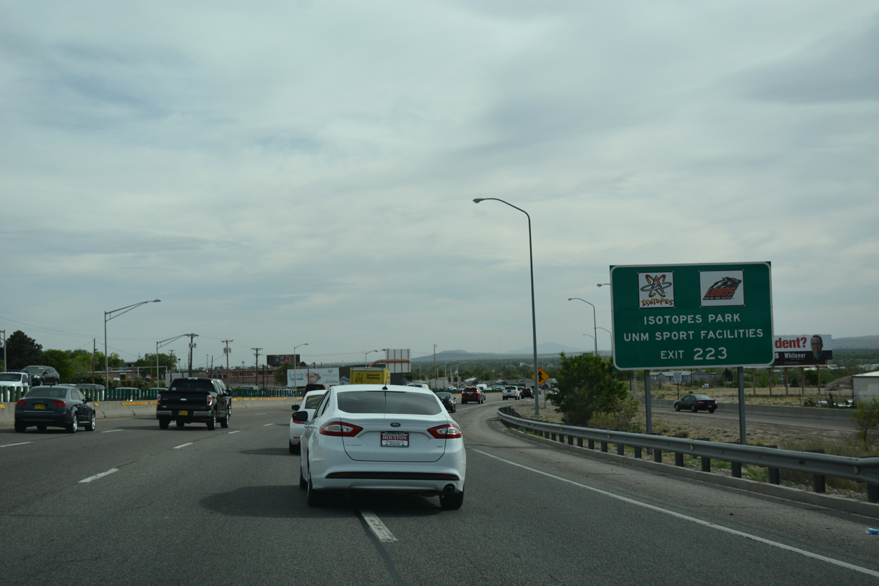
| Shifting west through an S-curve between Coal Avenue and Avenida Cesar Chá, the ensuing exit serves the UNM sports complex including Dreamstyle Stadium, Dreamstyle Arena and Santa Ana Star Field. Isotopes Park, home of the AAA Baseball Albuquerque Isotopes, also lies along Avenida Cesar Chávez to the east. 04/24/17 |
|
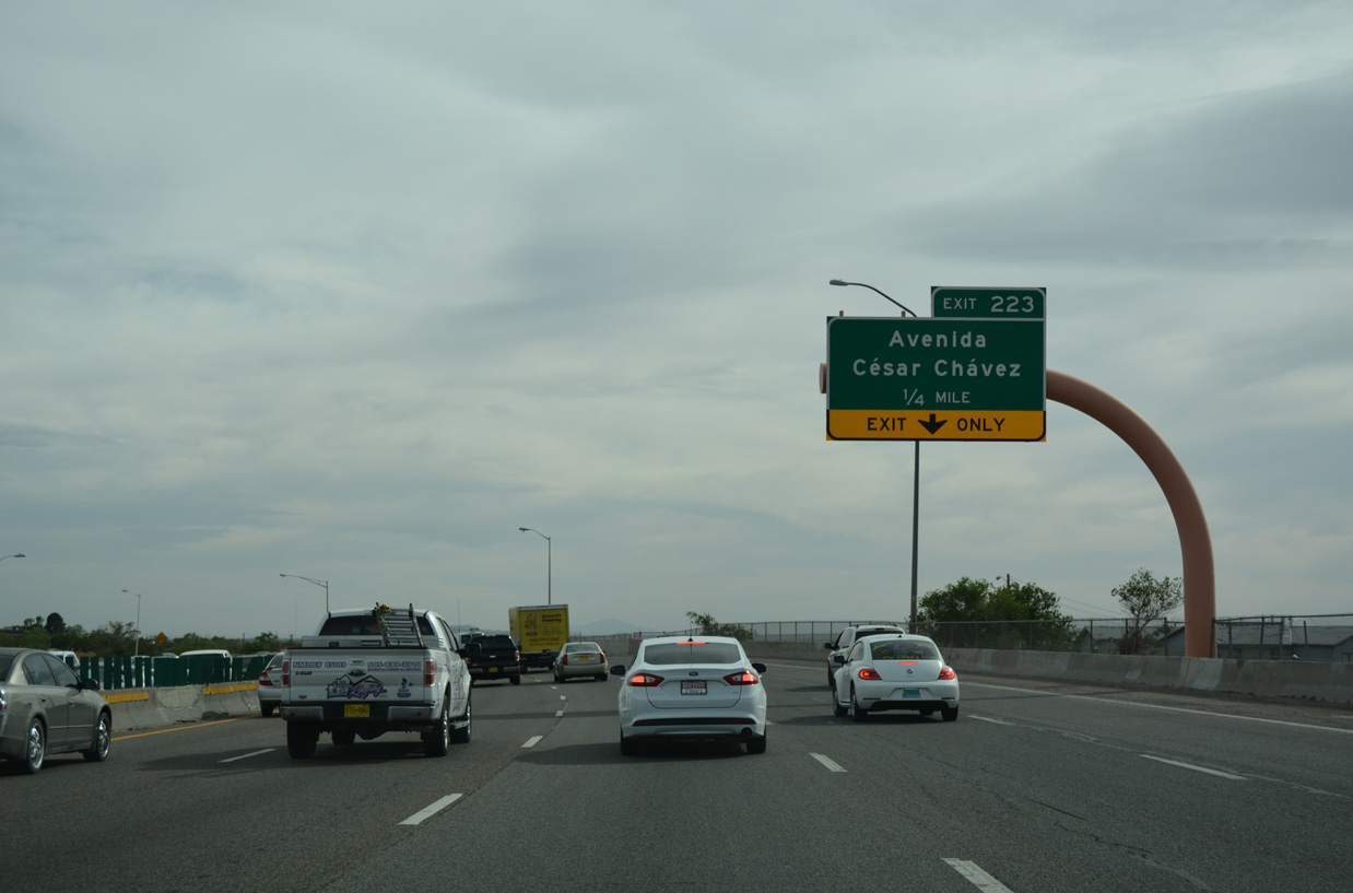
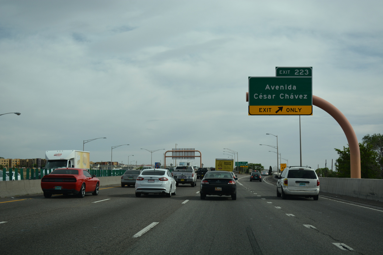
| One quarter mile north of the diamond interchange (Exit 223) with Avenida Cesar Chávez. The four lane boulevard leads west through the South Broadway neighborhood to become Bridge Boulevard, the pre-1937 route of U.S. 66, beyond 4th Street. 04/24/17 |
|
| Exit 223 leaves Interstate 25 south for Avenida Cesar Chávez west to Bridge Boulevard across the Rio Grande and east to Yale Boulevard at Victory Hills. Historic U.S. 66 branches south from Bridge Boulevard along Iseleta Boulevard. 04/24/17 |
|
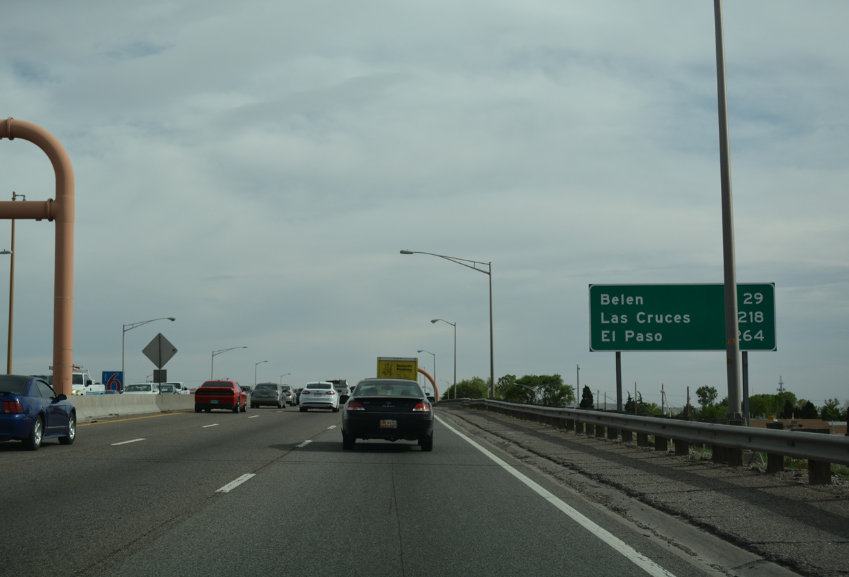
| Distance sign posted at Exit 222, 29 miles north of the Valencia County city of Belen and 218 miles from Las Cruces. 04/24/17 |
|
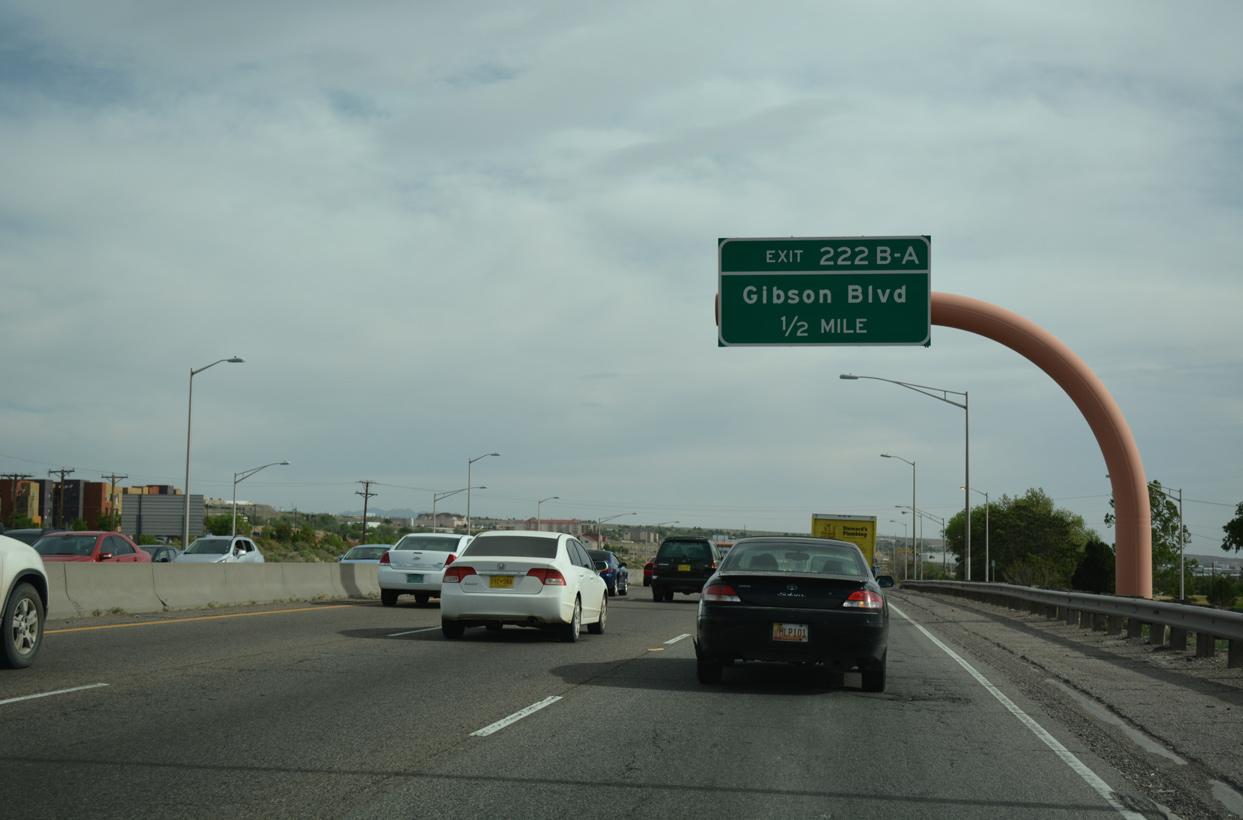
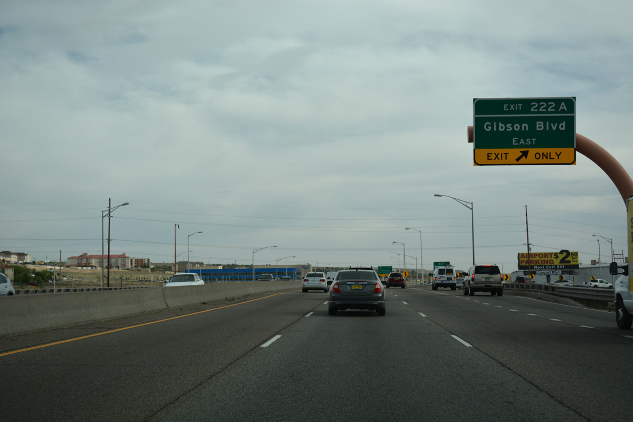
| Advancing south along the South Broadway street grid, the succeeding exit along I-25 is with Gibson Boulevard. 04/24/17 |
|
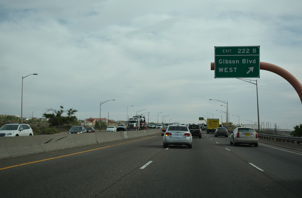
| Entering the six-ramp parclo interchange with Gibson Boulevard, Exit 222B departs for the arterial westbound to NM 47 (Broadway Boulevard) at South Broadway. 04/24/17 |
|
| Exit 222A loops onto Gibson Boulevard east, which extends east from Interstate 25 to the Parkland Hills and South San Pedro communities. 04/24/17 |
|
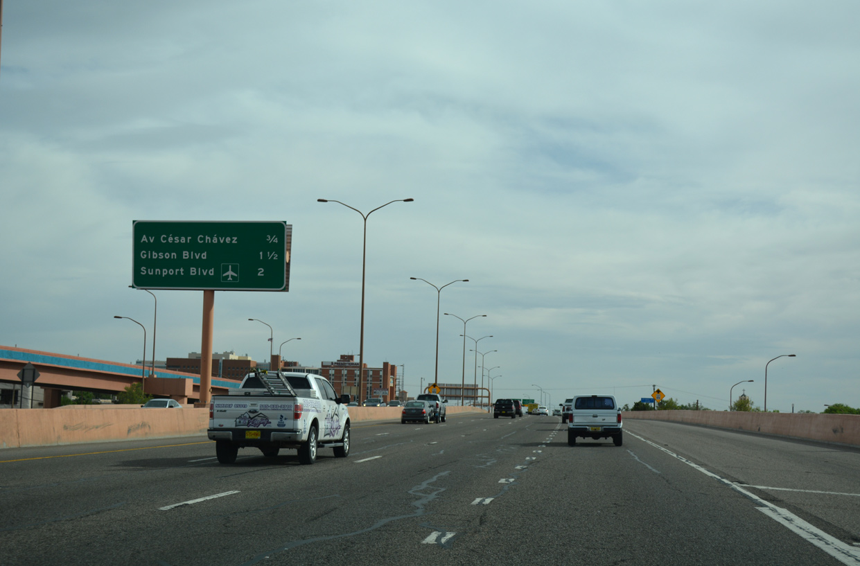
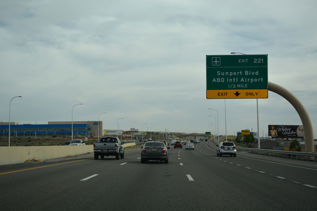
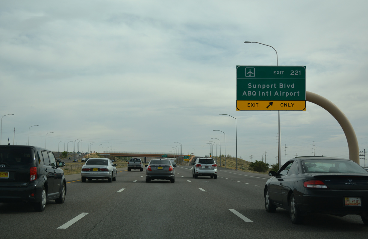
| Sunport Boulevard ties into Interstate 25 to the immediate south of Gibson Boulevard at a diamond interchange (Exit 221). 04/24/17 |
|
| Sunport Boulevard (FL 4070) stems 0.98 miles east from Exit 221 to the passenger terminal at Albuquerque International Sunport (ABQ). The expressway also connects with University Boulevard via nearby ramps. 04/24/17 |
|
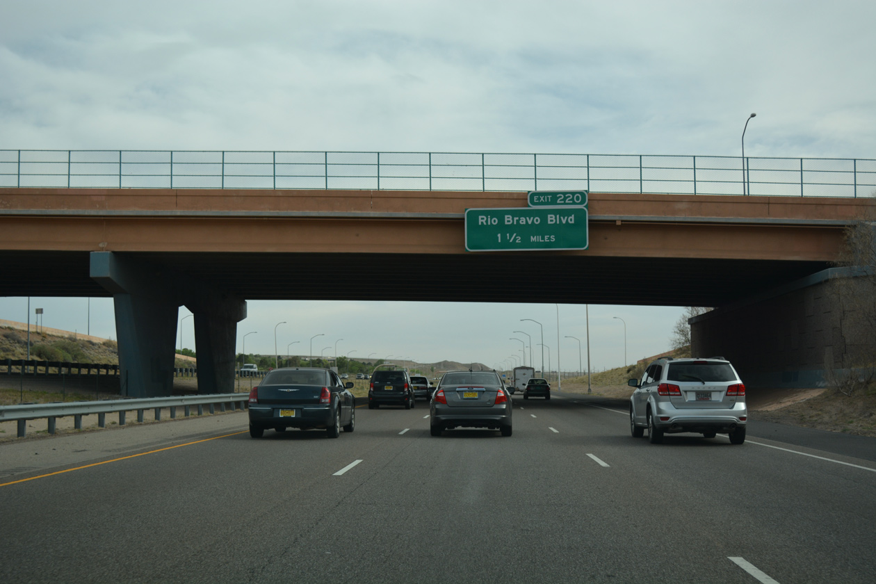
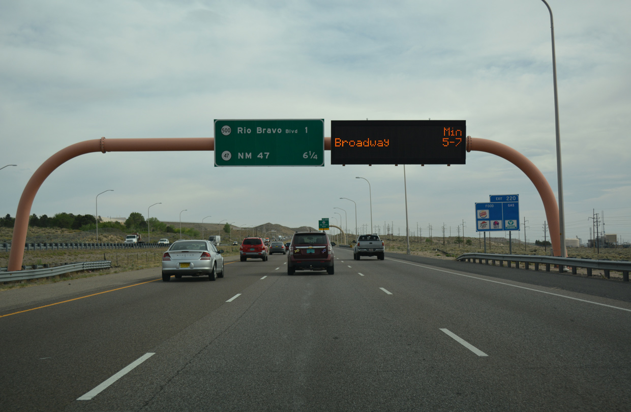
| Continuing south, Interstate 25 travels between the San Jose area and the UNM Golf Course 1.5 miles to Rio Bravo Boulevard (Exit 220). 04/24/17 |
|
| Confirming sign for Interstate 25 south of the Sunport Boulevard entrance ramp. 04/24/17 |
|
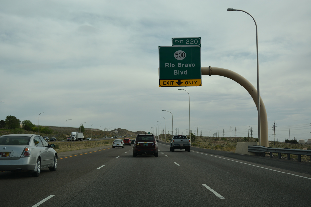
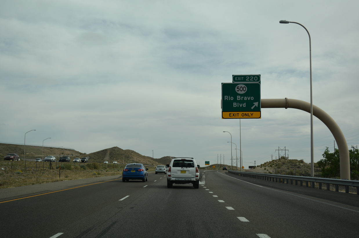
| Exit 220 with NM 500 (Rio Bravo Boulevard) represents the last departure point from I-25 south for the city of Albuquerque. The freeway converges with old U.S. 85 (NM 47) at the subsequent exit. 04/24/17 |
|
| Prior to the I-25/Rio Bravo Interchange project, I-25 reduced from six to four lanes at the 1961-built exchange with NM 500.2 NM 500 constitutes a 12.35 mile long loop around the southwestern suburbs of Albuquerque between I-25 at South Valley and I-40 at Atrisco Vista Boulevard. 04/24/17 |
|
| A $55 million project rebuilds the exchange joining Interstate 25 and NM 500 (Rio Bravo Boulevard) into a hybrid wye / parclo interchange. Started on August 8, 2017 and running through Summer 2019, work expands the freeway to eight lanes above NM 500 and adds new two lane ramps in all four quadrants.2 04/24/17 |
|
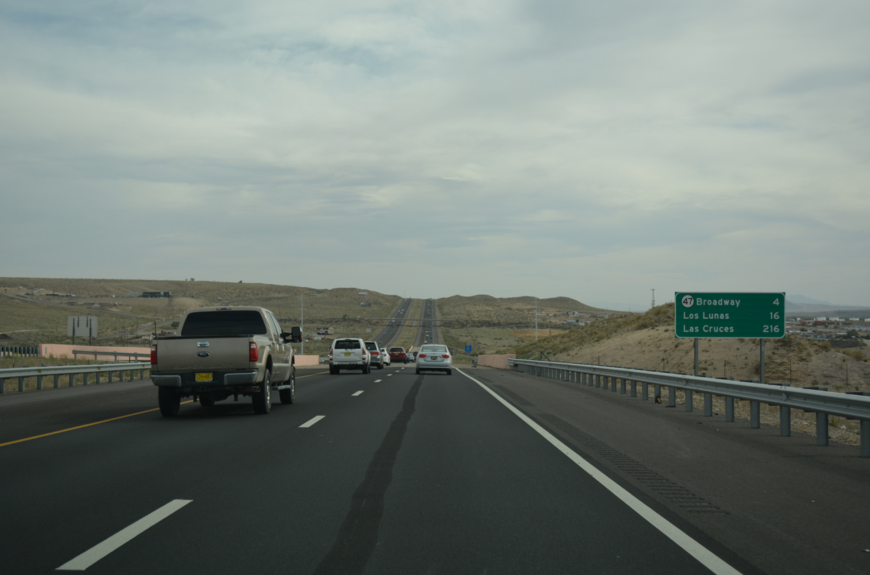
| Spanning Tijeras Arroyo, Interstate 25 advances four miles to NM 47 (Broadway Boulevard) and 16 miles to the Valencia County seat of Los Lunas. 04/24/17 |
|
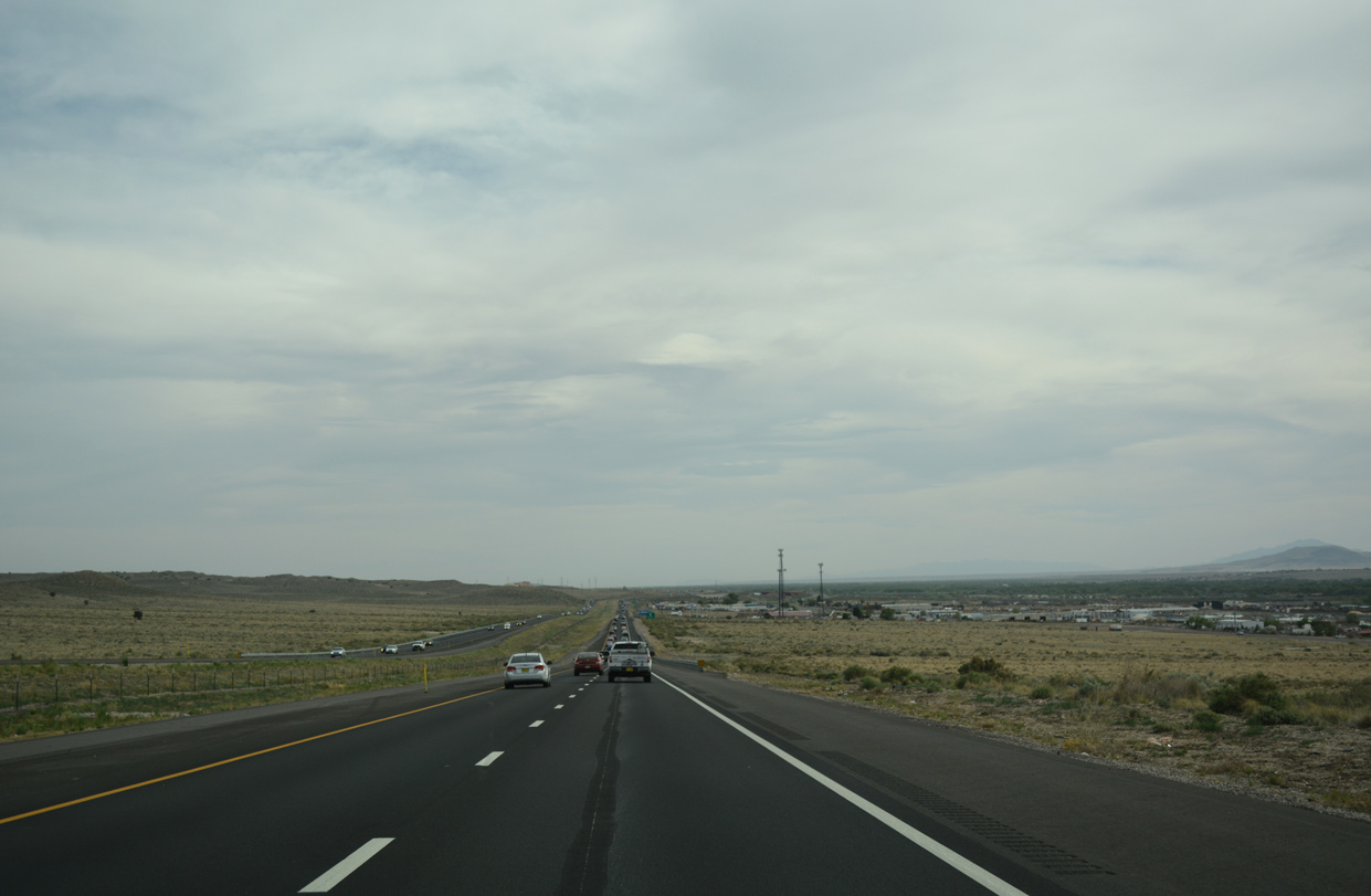
| Interstate 25 rises onto a mesa between South Valley and Mesa Del Sol Innovation Park. 04/24/17 |
|
| Reentering the Albuquerque city limits west of Kirtland Air Force Base, I-25 travels by the Mountainview community. 04/24/17 |
|
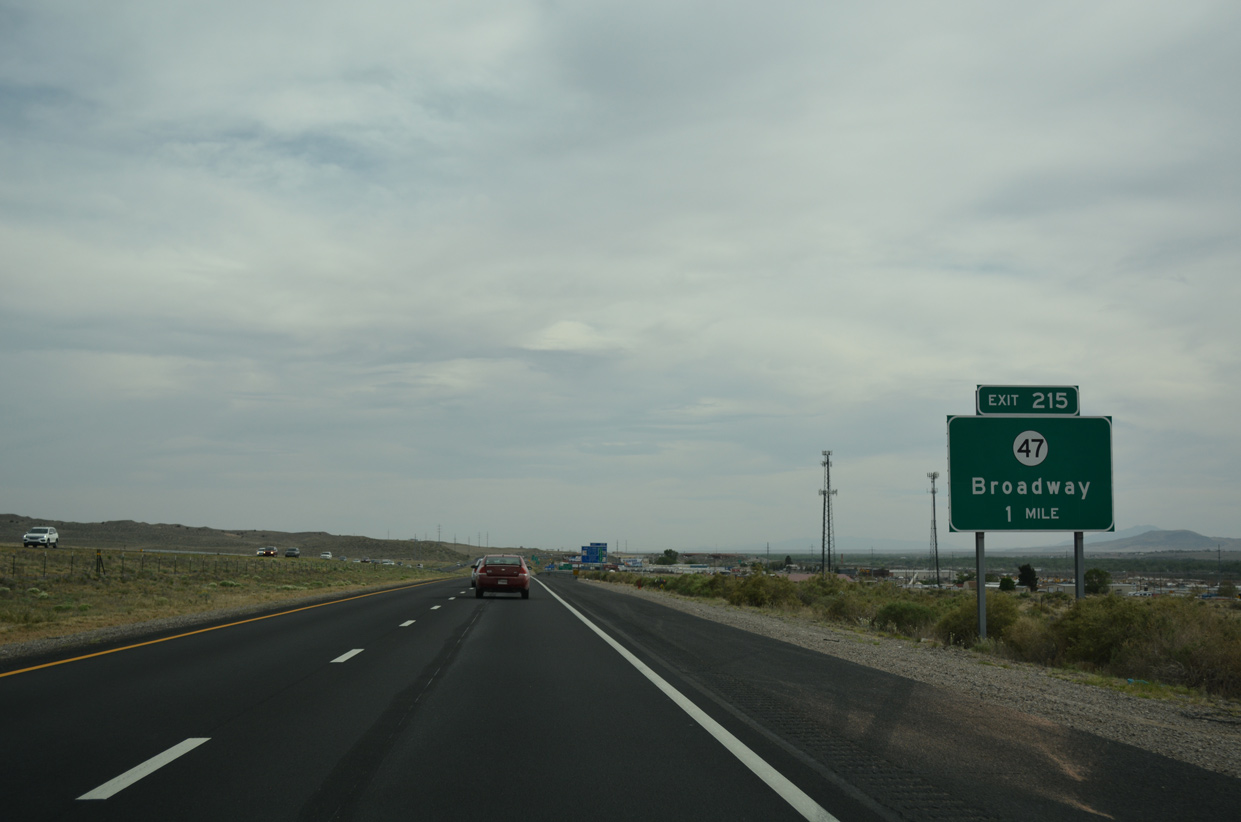
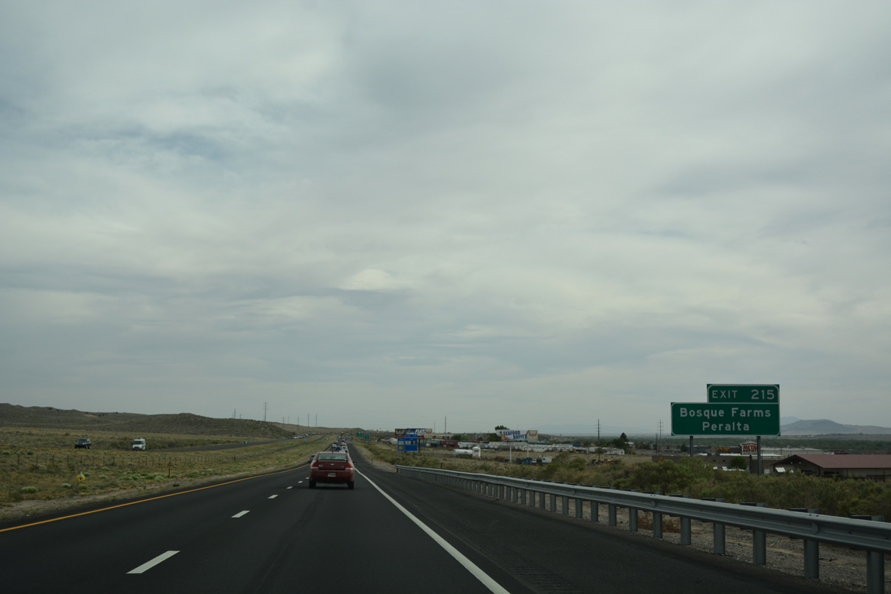
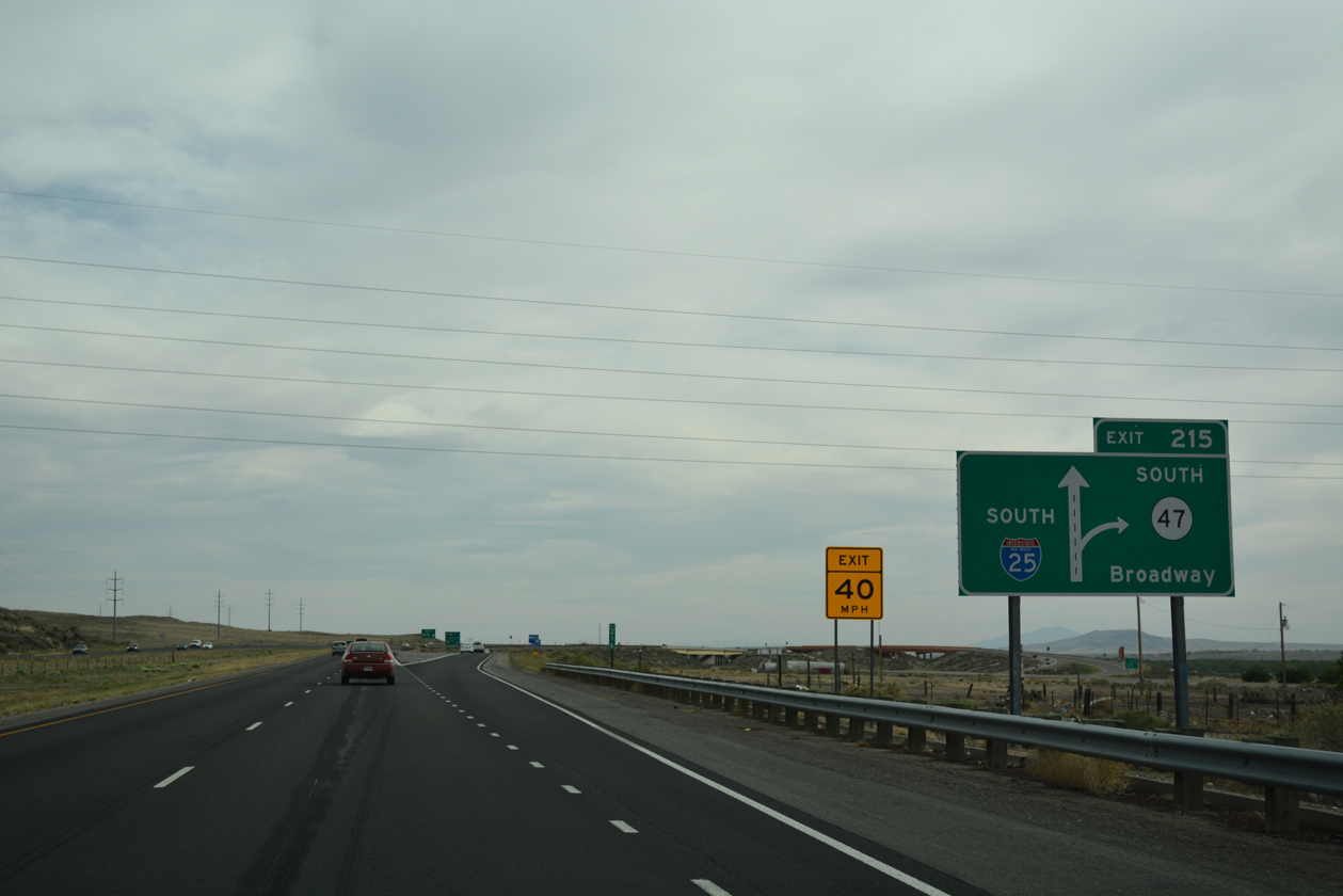
| NM 47 (Broadway Boulevard) crosses paths with Interstate 25 south of Mountainview at Exit 215. 04/24/17 |
|
| Interstate 25 shifts west of the Rio Grande beyond Exit 215. NM 47 stays to the east en route to the village of Bosque Farms and town of Peralta. 04/24/17 |
|
| Exit 215 departs in a quarter mile for both directions of NM 47 (Broadway Boulevard). 04/24/17 |
|
| NM 47 travels 59.64 miles overall between U.S. 60 in eastern Socorro County and NM 556 at the Sandia Reservation. 04/24/17 |
|
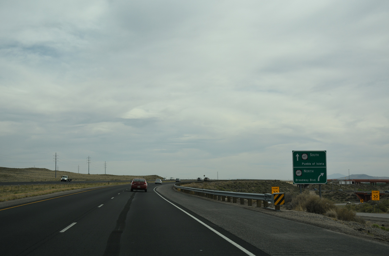
| A directional interchange, Exit 225 partitions into separate ramps for NM 47 (Broadway Boulevard) north to Mountainview and NM 47 south to unincorporated Pueblo of Isleta. 04/24/17 |
|
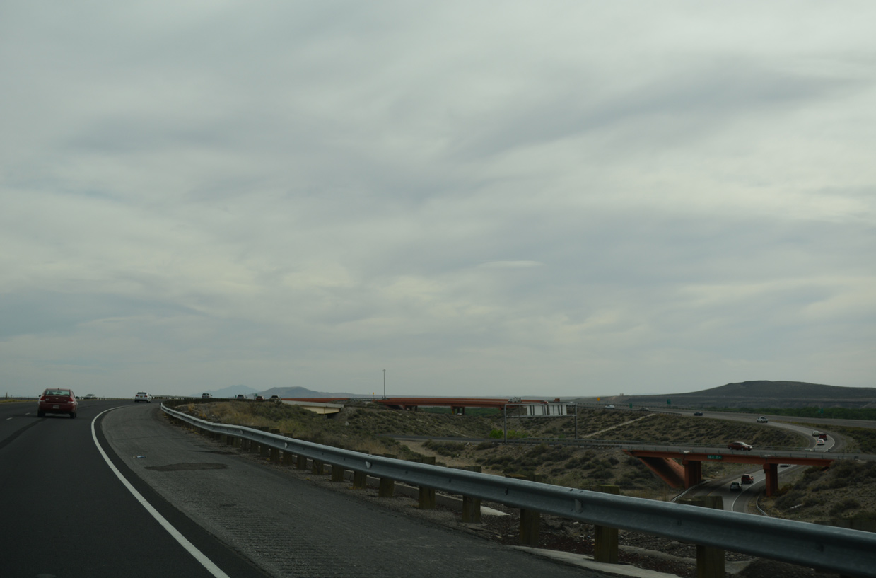
| Turning west, Interstate 25 crosses over a BNSF Railroad at this confirming marker. 04/24/17 |
|
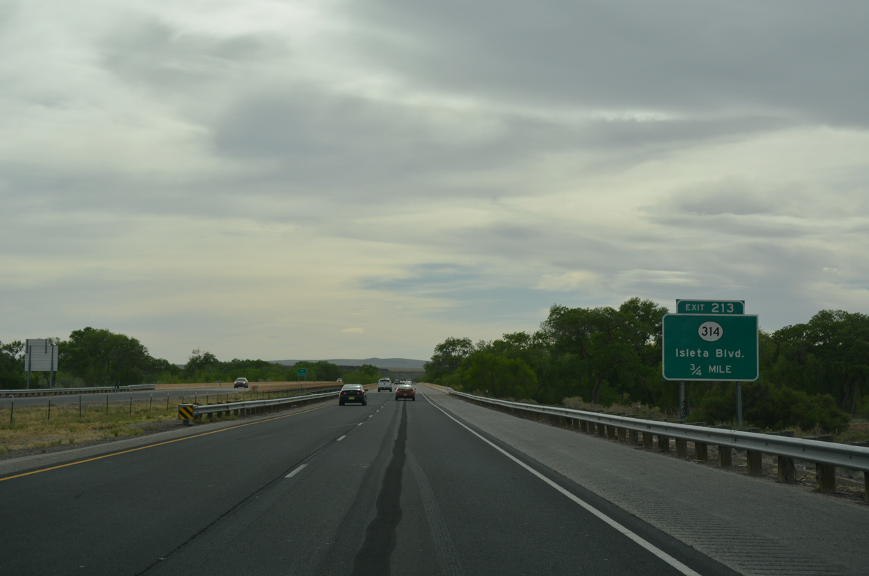
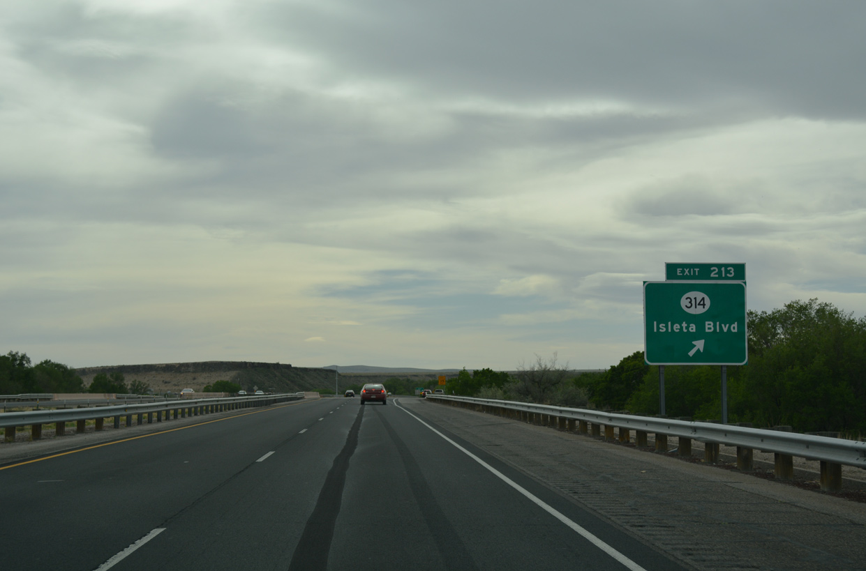
| A diamond interchange (Exit 213) links Interstate 25 with NM 314 (Isleta Boulevard) west of the Rio Grande. 04/24/17 |
|
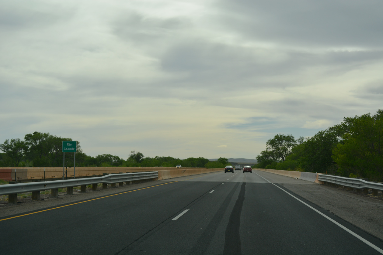
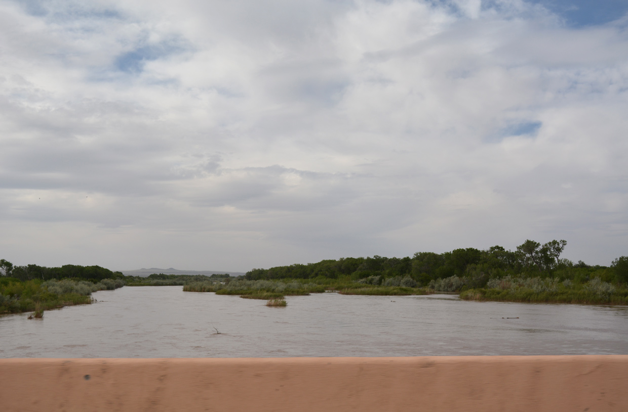
| The 2,301 foot long bridge across the Rio Grande was constructed in 1973 and rebuilt in 1991.3 04/24/17 |
|
| Exit 213 departs I-25 south for Isleta Boulevard north to South Valley and NM 314 south to Pueblo of Isleta. NM 314 parallels the freeway southward to Los Lunas and Belen along a 18.50 mile long course. 04/24/17 |
|
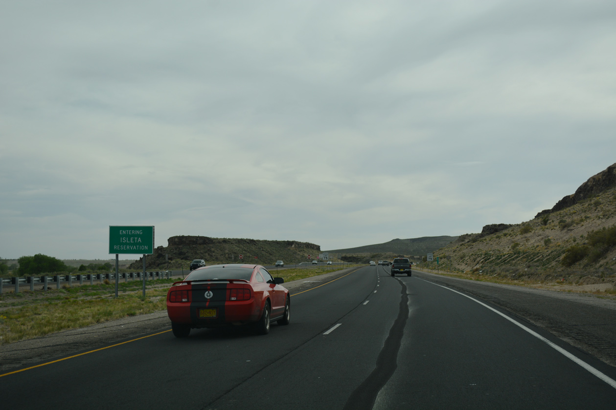
| Entering the Iseleta Reservation, Interstate 25 arcs southward by Black Mesa and Parea Mesa (el. 5,385 ft). 04/24/17 |
|
| Entering the Iseleta Reservation, Interstate 25 arcs southward by Black Mesa and Parea Mesa (el. 5,385 ft) 04/24/17 |
|
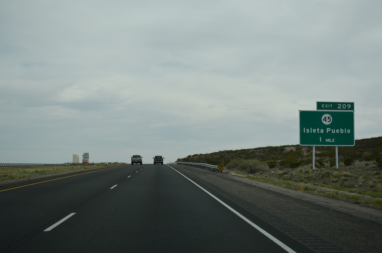
| NM 45 (Coors Road) parallels Interstate 25 south from Black Mesa into Isleta Pueblo. Upcoming Exit 209 links the two routes via NM 317. 04/24/17 |
|
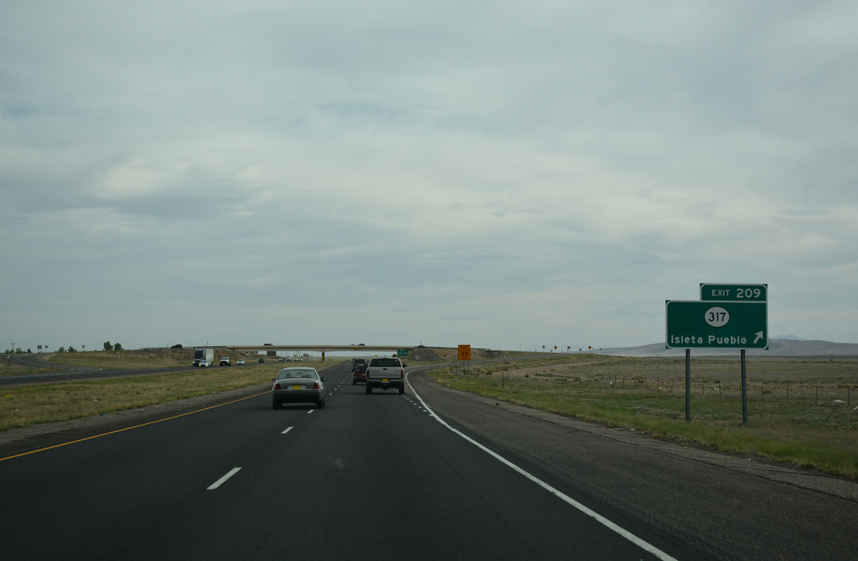
| NM 317 comprises a 1.25 mile long minor arterial east from I-25 to NM 45 (Coors Road). NM 45 concludes just south of NM 317 at NM 314 west of Isleta Village Proper. 04/24/17 |
|
| Tribal Road 61 ties into the diamond interchange (Exit 209) with NM 317 from areas of Isleta Reservation to the west. 04/24/17 |
|
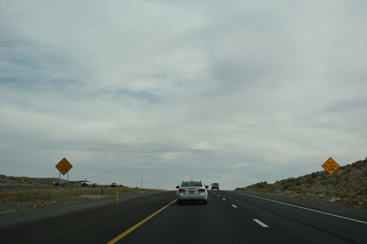
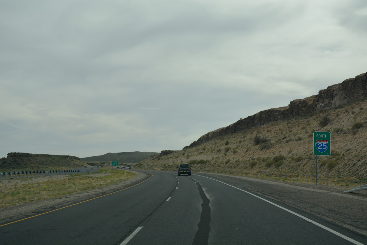
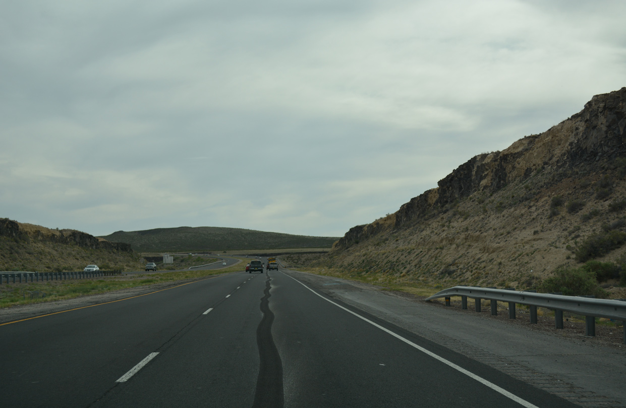
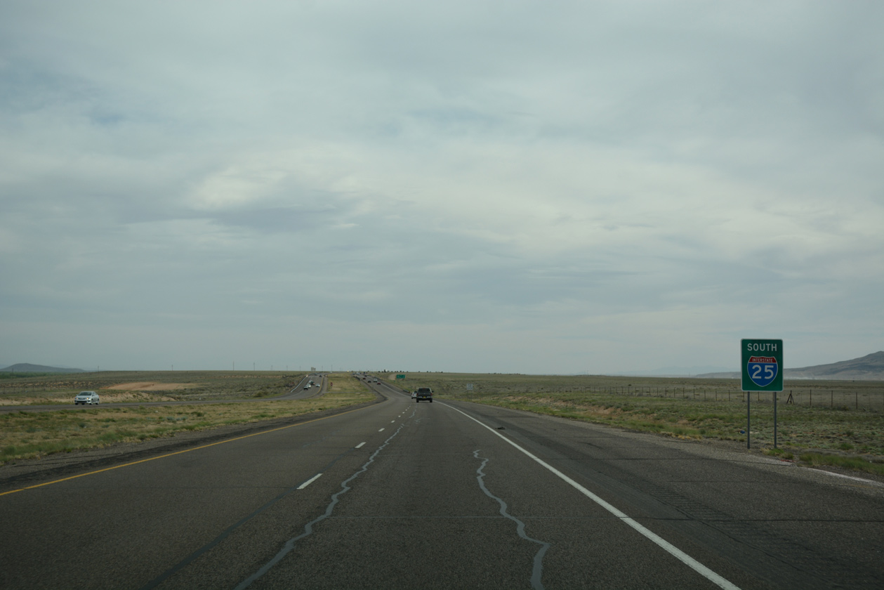
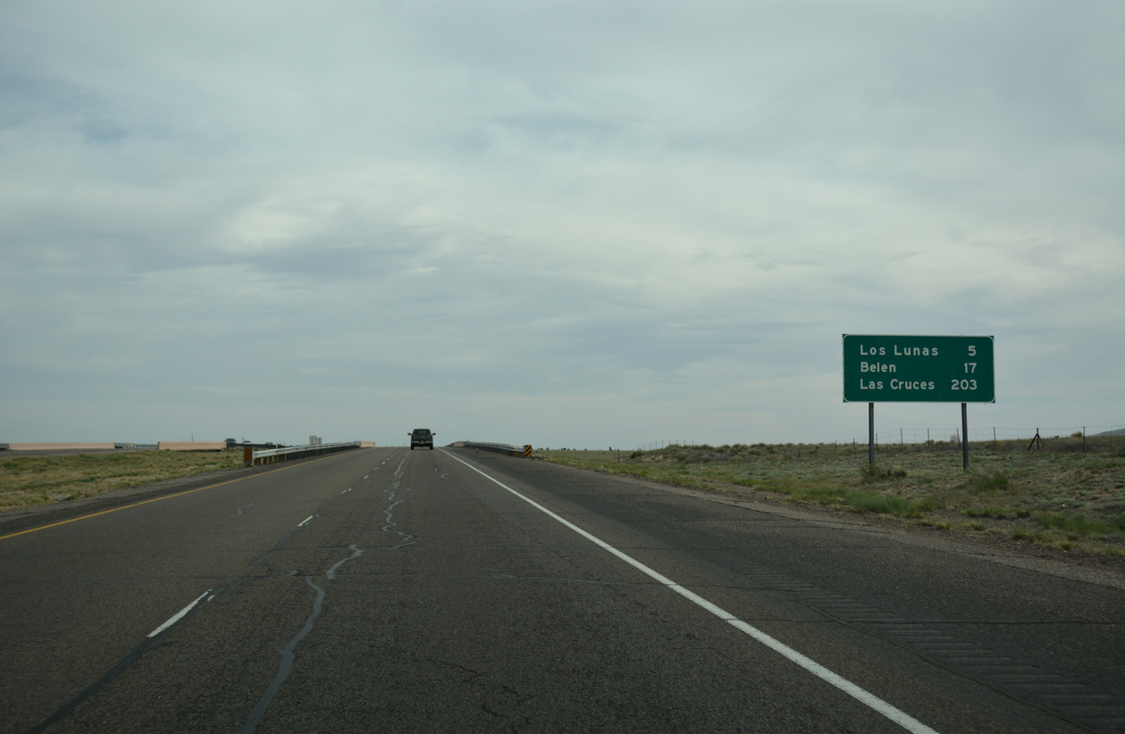
| Staying on the mesa 130 feet above the Rio Grande, Interstate 25 advances south five miles to the village of Los Lunas and 203 miles to Las Cruces. 04/24/17 |
|
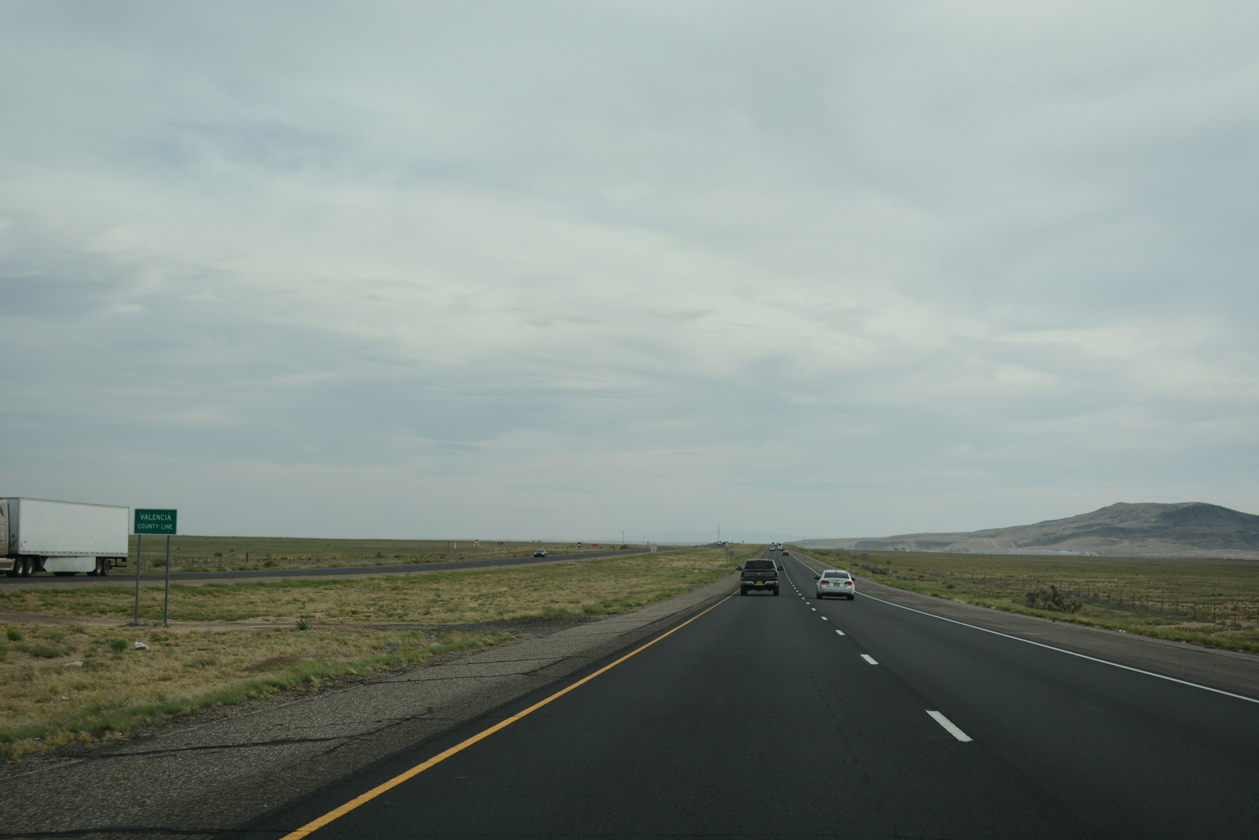
| Crossing the Valencia County line, midway between Exits 209 and 203 on southbound Interstate 25. 04/24/17 |
Page Updated 06-11-2019.

 South
South