|
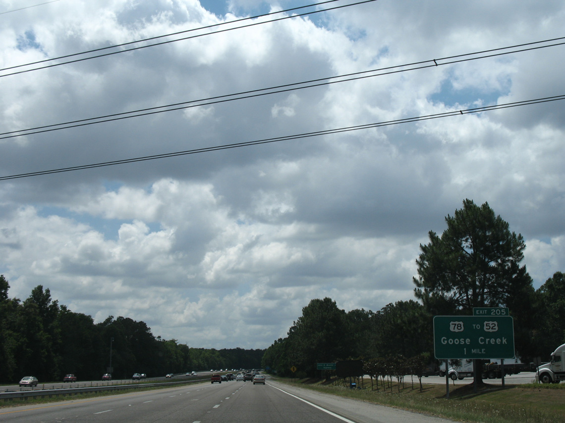
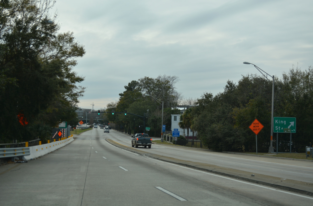
| U.S. 78 (University Boulevard) crosses Interstate 26 east from Ladson at a six-ramp parclo interchange (Exit 205) in one mile. University Boulevard leads U.S. 78 east 1.9 miles to the overlap with U.S. 52 along Rivers Avenue south through North Charleston. 05/27/07 |
|
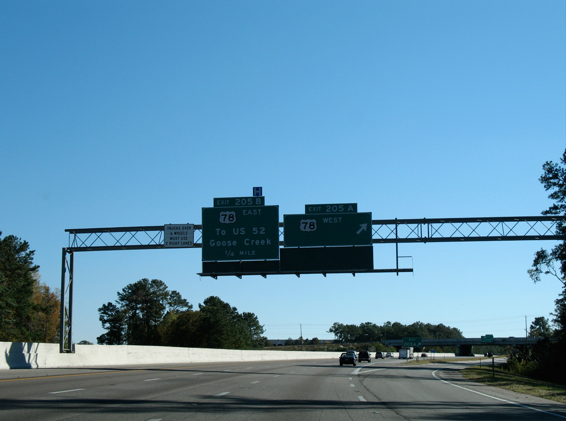
| Exit 205A joins I-26 with U.S. 78 (University Boulevard) west back to Ladson, Linconlville and Summerville. The two routes have paralleled one another for the past 20 miles. 11/12/06 |
|
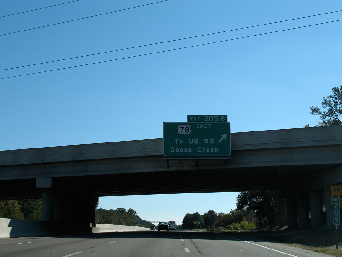
| Exit 205B departs for U.S. 78 (University Boulevard) eastbound to U.S. 52 and Goose Creek. U.S. 52/78 overlap southward along Rivers Avenue to the Charleston Heights community in the city of North Charleston. 11/12/06 |
|
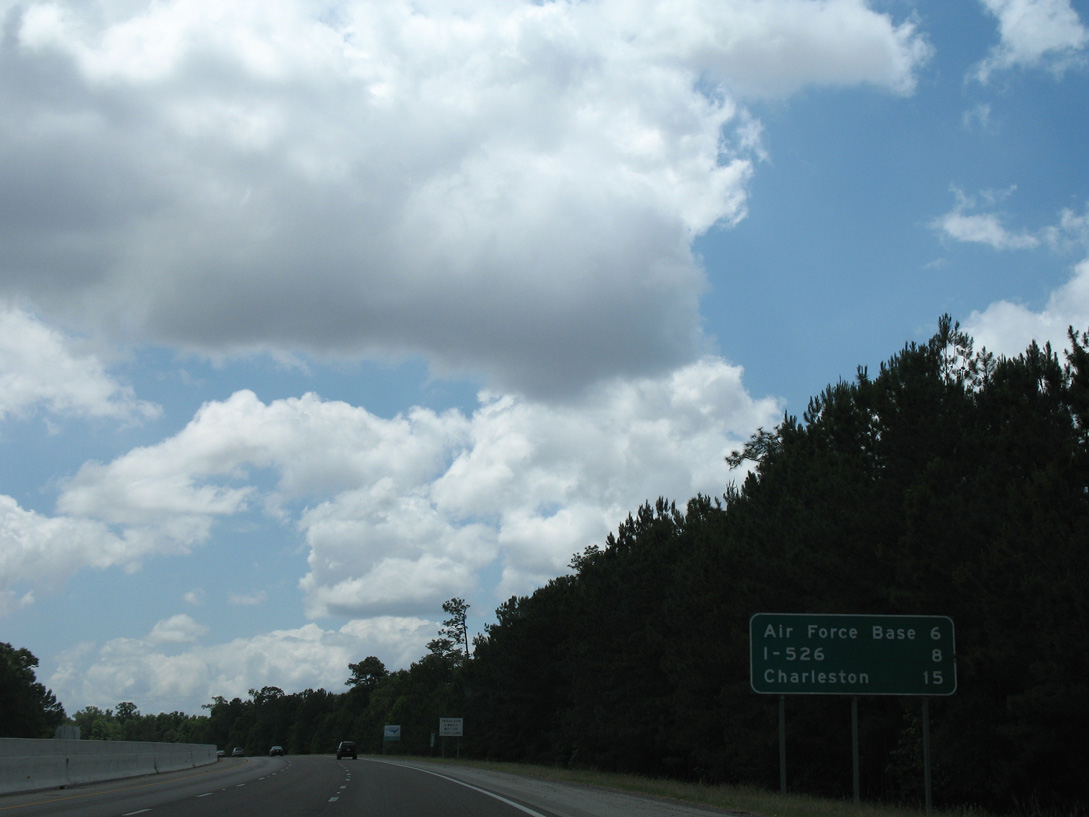
| Continuing south through North Charleston, Interstate 26 travels by Charleston Air Force Base on the eight mile drive to I-526. 05/27/07 |
|
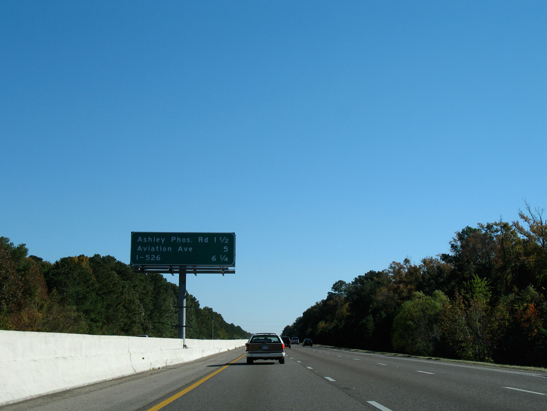
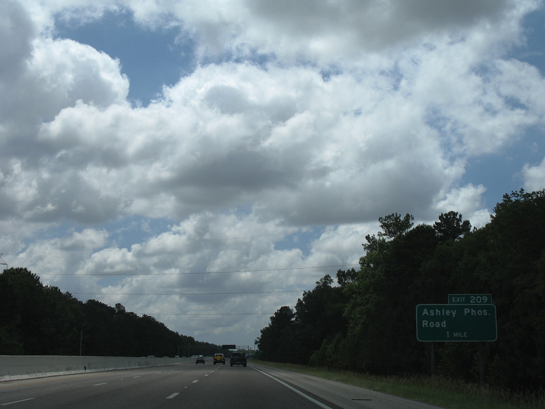
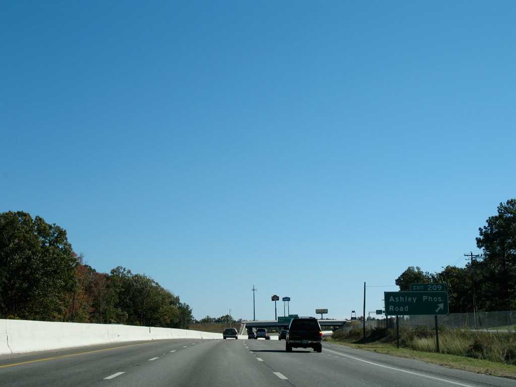
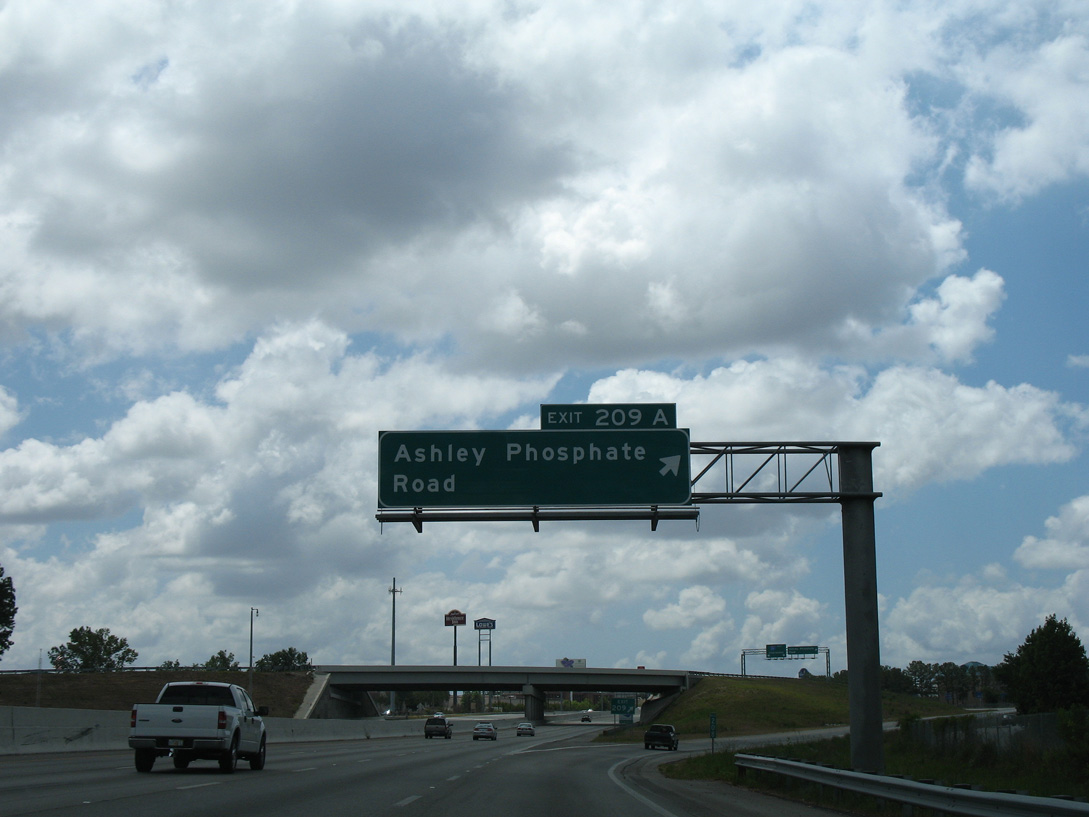
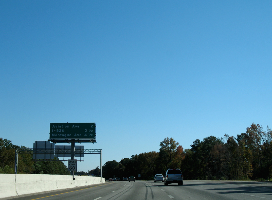
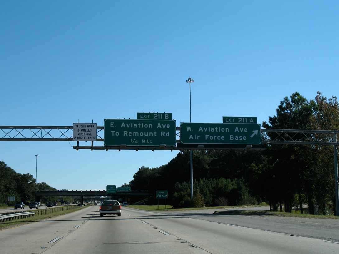
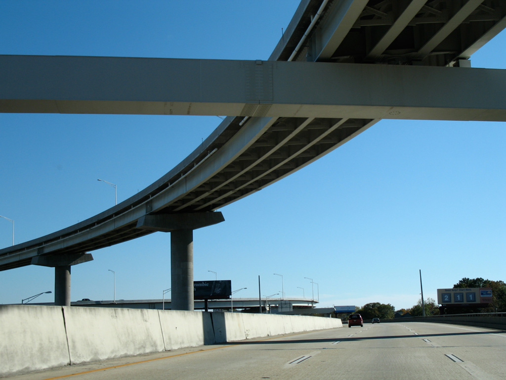
| An interchange sequence outlines the succeeding ramps in North Charleston for Ashley Phosphate Road (Exit 209A), Aviation Avenue (Exits 211A/B) and I-526 (Exits 212B/C). 11/12/06 |
|
| Ashley Phosphate Road constitutes a seven lane wide boulevard 3.71 miles west to S.C. 642 (Dorchester Road) in Dorcester County and 0.51 miles east to U.S. 52/78 (Rivers Avenue). 11/12/06 |
|
| Northside Drive accompanies the west side frontage of I-26 to Ashley Phosphate Road. Exit 209A combines with a ramp from the adjacent wye interchange with U.S. 52 Connector. U.S. 52 Connector is a 0.90 mile limited access link between U.S. 52/78 (Rivers Avenue) and I-26. 11/12/06 |
|
| Exit 209A parts ways with Interstate 26 east ahead of the flyover carrying U.S. 52 Connector south onto the freeway. 05/27/07 |
|
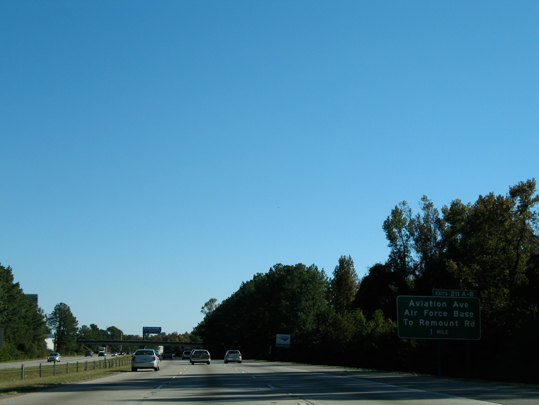
| Ramps for Avaiation Avenue and Remount Road depart in quick succession from Interstate 26 east in two miles. The directional cloverleaf interchange (Exits 212B/C) with I-526 (Mark Clark Expressway) follows in 3.5 miles. 11/12/06 |
|
| Forthcoming Aviation Avenue links U.S. 52/78 (Rivers Avenue) and I-26 with Perimeter Road and cargo areas of Charleston International Airport (CHS). Measuring 0.68 miles, the four lane arterial is Road 1342. 11/12/06 |
|
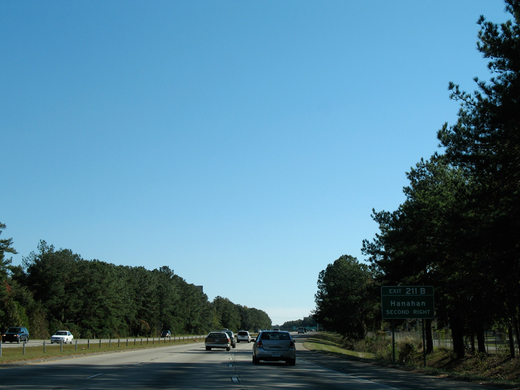
| The city of Hanahan lies just east of U.S. 52/78 (Rivers Avenue) and the adjacent CSX Railroad. 11/12/06 |
|
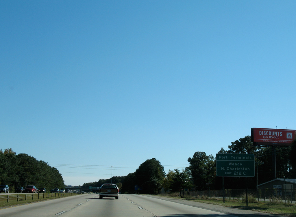
| The South Carolina Port Authority North Charleston terminal lies just south of Hanahan along the Cooper River. Freight traffic to both that terminal and the Wando terminal is directed onto I-526 east from upcoming Exit 212C. 11/12/06 |
|
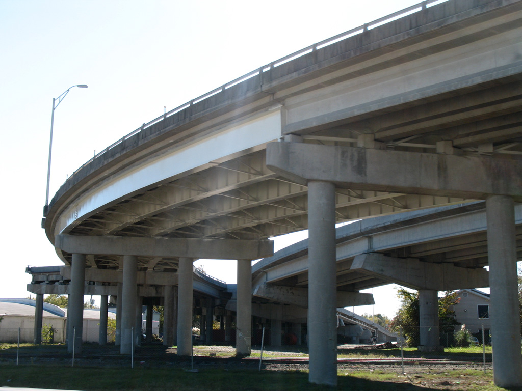
| A $66 million widening project along 2.9 miles of I-26 included rebuilding the cloverleaf interchange with Aviation Avenue and the adjacent Remount Road ramps. Underway from August 2008 to June 2011, the work added a fourth lane in each direction and collector distributor roadways between both exchanges.1 11/12/06 |
|
| A parclo interchange (Exit 211) joins I-26 with Remount Road at Casper Padgett Way to the North Charleston Public Works complex.
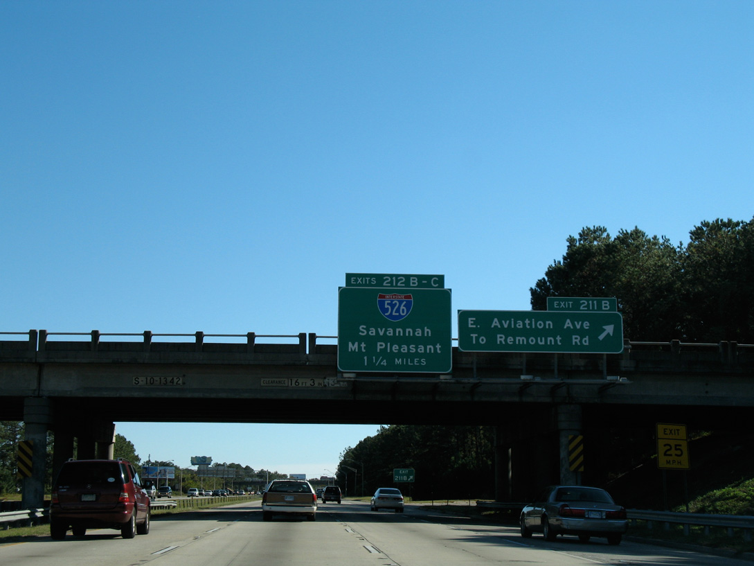
Exits 212B/C separate from the freeway next in 1.25 miles for Interstate 526. 11/12/06 |
|
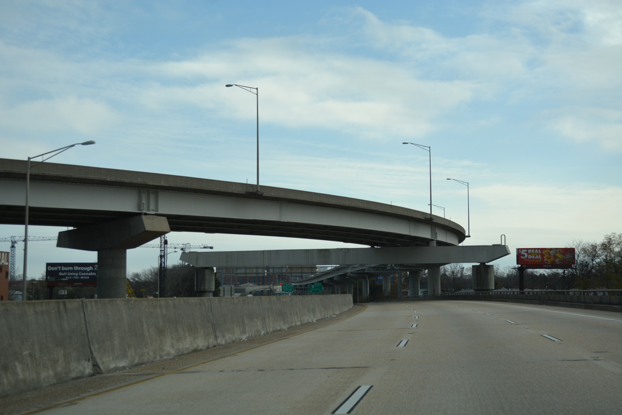
| Auxiliary lanes expand I-26 to ten overall lanes between Remount Road and Interstate 526. I-526 encircles the city of Charleston to the north, connecting with U.S. 17 (Savannah Highway) to the west and U.S. 17 and Business Spur I-526 at the town of Mount Pleasant to the east. 11/12/06 |
|
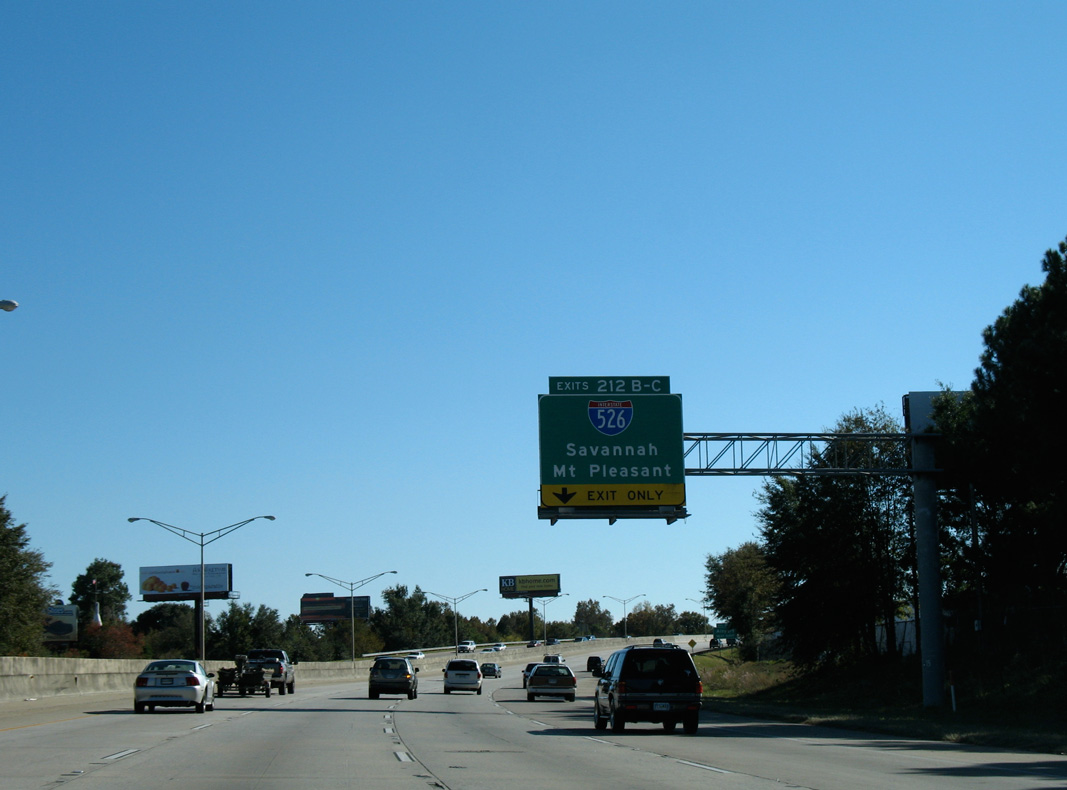
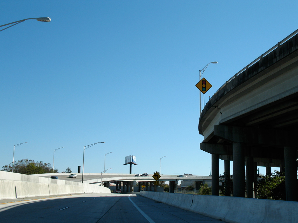
| A c/d roadway partitions traffic for I-526 (Mark Clark Expressway) from the Interstate 26 eastbound mainline. The I-526 Corridor Improvement Project calls for rebuilding this exchange into a systems interchange and expanding Mark Clark Expressway to six overall lanes west to S.C. 461 and east to U.S. 52/78. 11/12/06 |
|
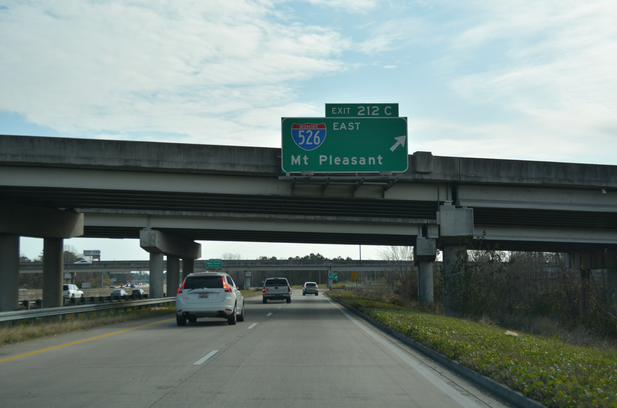
| Exit 212B leads motorists onto I-526 west for Charleston International Airport (CHS), West Ashley and James Island in Charleston. I-526 east continues from North Charleston and Exit 212C across a high level bridge over the Cooper River to Thomas and Daniel Islands. 11/12/06 |
|
| 526 Lowcountry Corridor improvements are separated into East and West segments. The west segment, which includes redesigning the interchange with I-26, is scheduled to begin in late 2022 and runs through 2024.2 11/12/06 |
|
| Exit 212C loops onto Interstate 526 (Mark Clark Expressway) east to Mount Pleasant and U.S. 17 north to Georgetown. 12/31/17 |
|
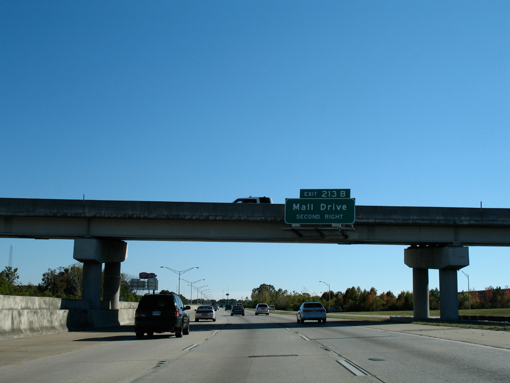
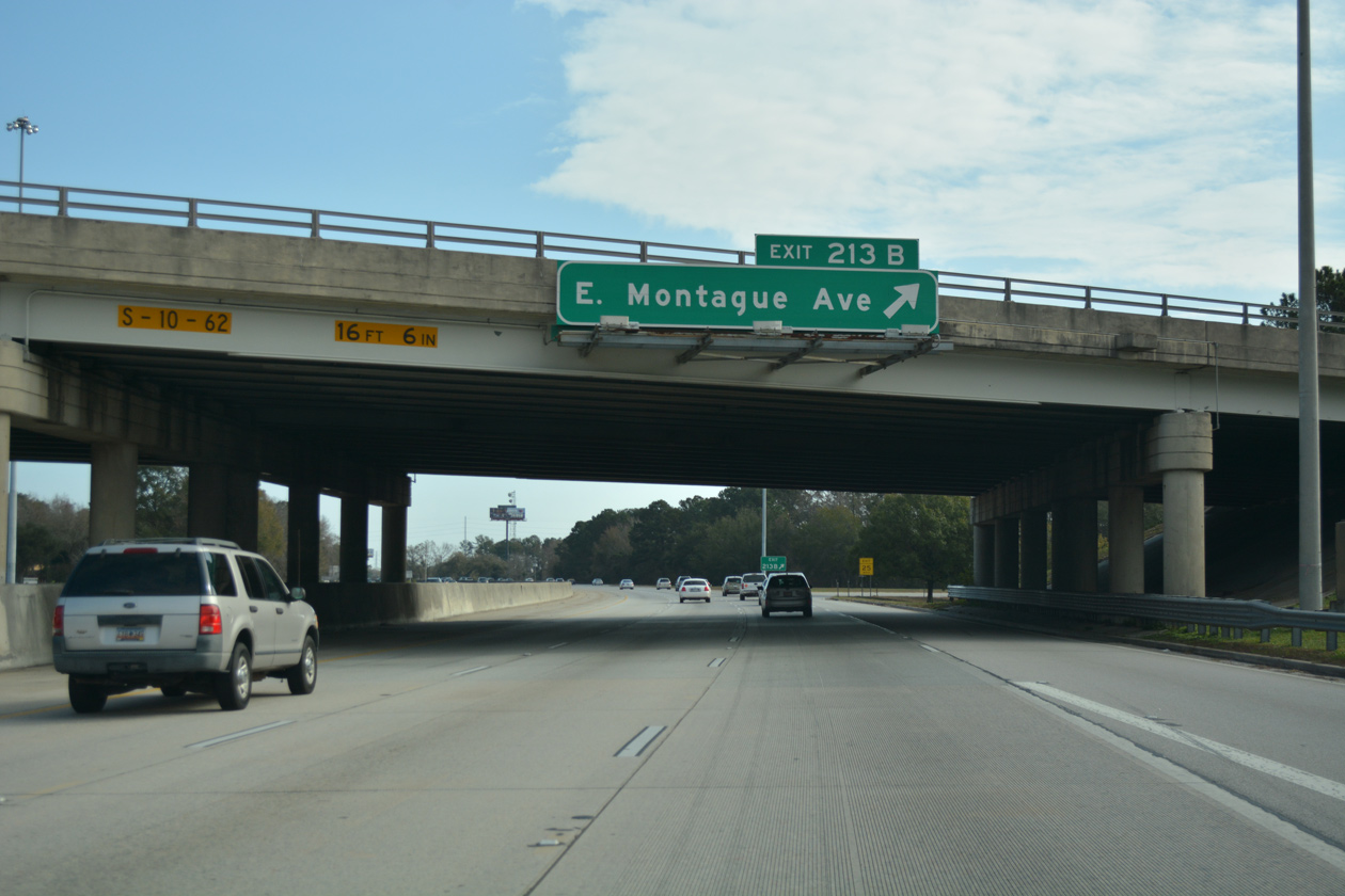
| A parclo interchange (Exit 213) connects Interstate 26 with Montague Avenue adjacent to Mall Drive to North Charleston City Hall in 0.75 miles. 11/12/06 |
|
| Interstate 26 advances south between commercial areas including the Charleston Tanger Outlets and several big box stores to Exit 213A with Montague Avenue west and Tanger Outlet Boulevard north. 12/31/17 |
|
| Montague Avenue navigates along a winding course east from S.C. 642 (Dorcester Road) and I-526 to Park Circle across the city of North Charleston. 12/31/17 |
|
| Angling southeast, Interstate 26 passes by Norfolk Southern and CSX Railroad facilities ahead of the Waylyn neighborhood. Future roadwork will expand the six lane freeway to eight lanes between mile markers 212 and 218. 12/31/17 |
|
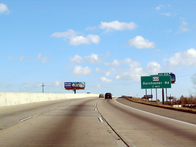
| Missing since at least 2006, the one mile guide sign for Exit 215 stood along I-26 east at the CSX Railroad under crossing. S.C. 642 (Dorchester Road) parallels the Ashley River southeast from the Summerville area into North Charleston. 01/18/04 |
|
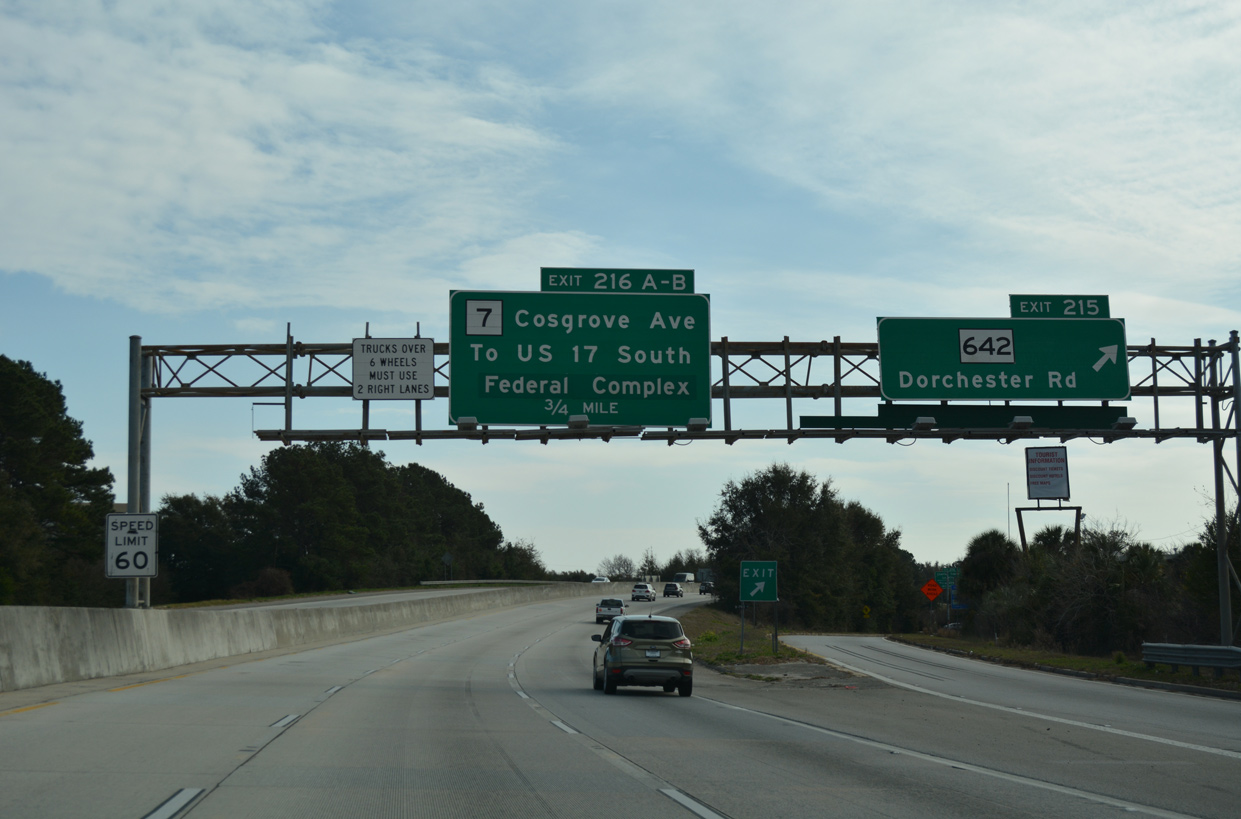
| I-26 enters the diamond interchange (Exit 215) with S.C. 642 (Dorcester Road) along eastbound. S.C. 642 ends 0.64 miles to the east at U.S. 52/78 (Rivers Avenue). S.C. 7 (Cosgrove Avenue) concludes a 5.92 mile course nearby at the Charleston Heights community. 12/31/17 |
|
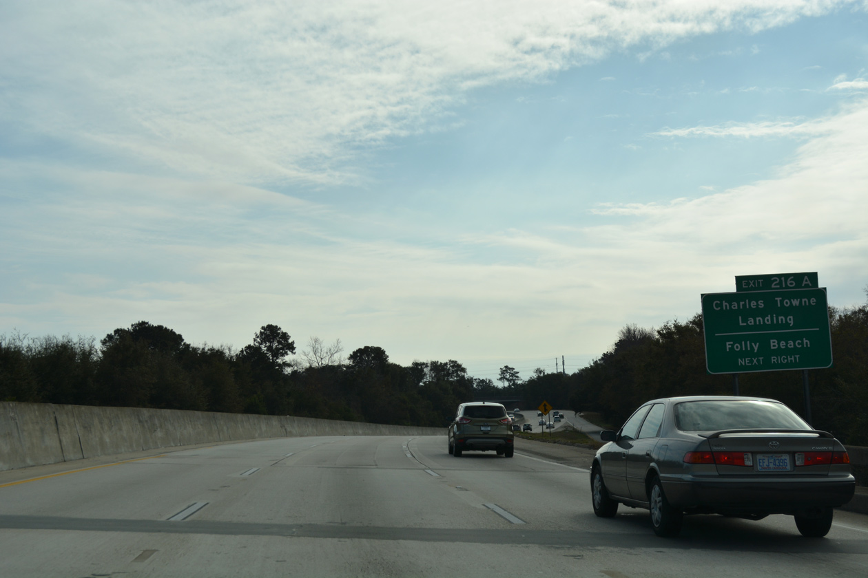
| Spanning the Ashley River south across the Memorial Bridge, S.C. 7 travels 1.82 miles to a wye intersection with S.C. 171 near Charles Towne Landing State Historic Site. S.C. 171 branches southward 12.56 miles to Folly Beach. 12/31/17 |
|
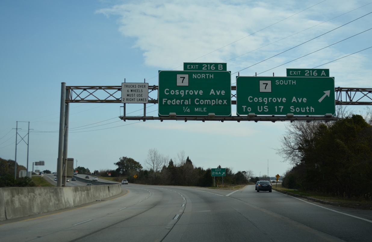
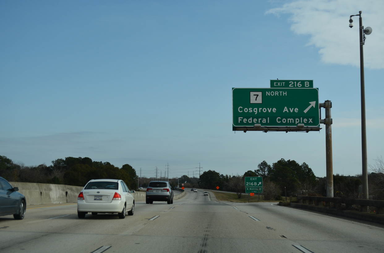
| Interstate 26 makes a sweeping curve eastward along East Marsh Island leading into the cloverleaf interchange (Exits 216A/B) with S.C. 7 (Cosgrove Avenue). S.C. 7 provides an alternate route to U.S. 17, meeting Savannah Highway by I-526 in west Charleston. 12/31/17 |
|
| Exit 216B leaves for S.C. 7 (Cosgrove Avenue) north. Greenouts on overheads for S.C. 7 reflect the 1996 closure of Charleston Navy Base. Serving a number of government agencies, 231 acres of the site were repurposed as a Federal complex.3 Located nearby is the H.L. Hunley Submarine exhibit. The first submarine ever built, the Hunley was a Confederate ship sunk during the Civil War in Charleston Harbor. 12/31/17 |
|
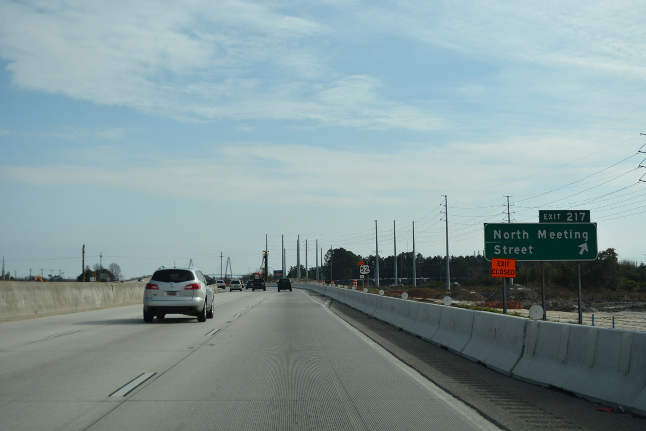
| U.S. 52/78 split 0.47 miles south of S.C. 7 (Cosgrove Avenue), with U.S. 78 shifting west between CSX and NS Railroad lines along King Street Extension and U.S. 52 paralleling to the east along Carner Avenue and Meeting Street Road. Upcoming Exit 217 is a wye interchange linking I-26 east with Meeting Street Road directly. 12/31/17 |
|
| Reassurance marker posted ahead of the Baker Hospital Road underpass. Costing $220 million, the Port Access Road construction project rebuilt the ramps with Meeting Street Road and added a high speed interchange with the new limited access road spurring east to the S.C. Port Authority - Hugh K. Leatherman, Sr. Terminal which commenced operations on April 9, 2021. 12/31/17 |
|
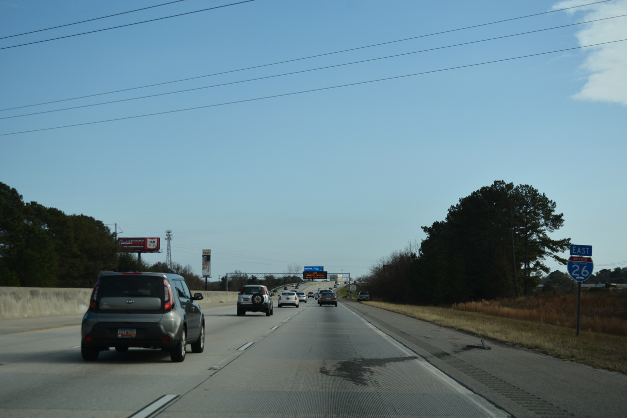
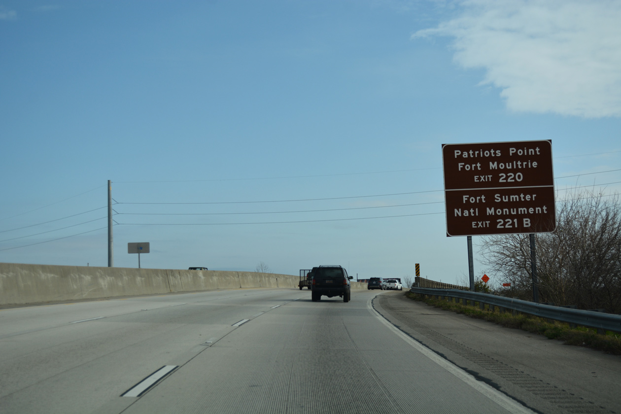
| Interstate 26 enters the Charleston city limits at Exit 217. Points of interest beyond the east end of I-26 include Patriots Point east across the Cooper River in Mt. Pleasant, Fort Moultrie on Sullivan's Island and Fort Sumter National Monument on Charleston Harbor. 12/31/17 |
|
| Exit 217 parts ways with Interstate 26 east to U.S. 52 (Meeting Street Road). U.S. 52 advances south through an industrial area of north Charleston to the residential street grid beyond Morrisor Drive (U.S. 52 Spur).
The Port Access Road project combines Exit 217 with new Exit 218 along an eastbound distributor roadway. 12/31/17 |
|
| Construction on the Port Access Road commenced in November 2016 and runs through 2020 2021. The limited access roadway joins with an extension of Bainbridge Avenue at a half diamond interchange. Associated work removed the connector and wye interchange linking I-26 and Spruil Avenue. 12/31/17 |
|
| The Arthur Ravenel, Jr. Bridge carrying U.S. 17 across the Cooper River comes into view from I-26 on the 1966-built viaduct across Austin Avenue and a NS Railroad spur. 12/31/17 |
|
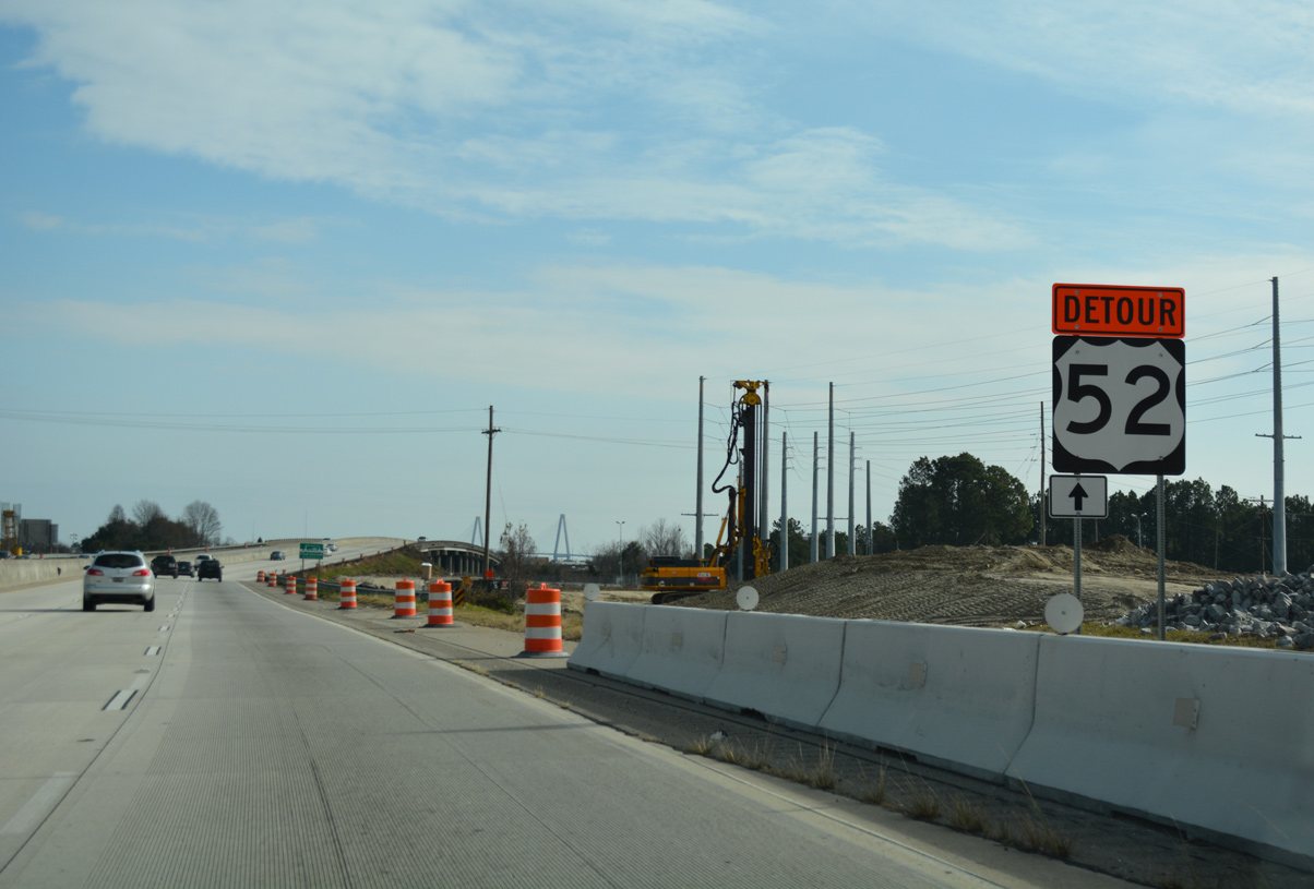
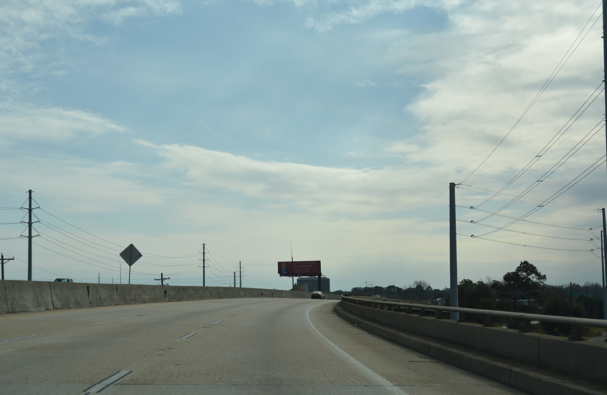
| The on-ramp from Spuill Avenue to I-26 eastbound was located one mile north of the half diamond interchange (Exit 219) with Rutledge Avenue and Heriot Street. 12/31/17 |
|
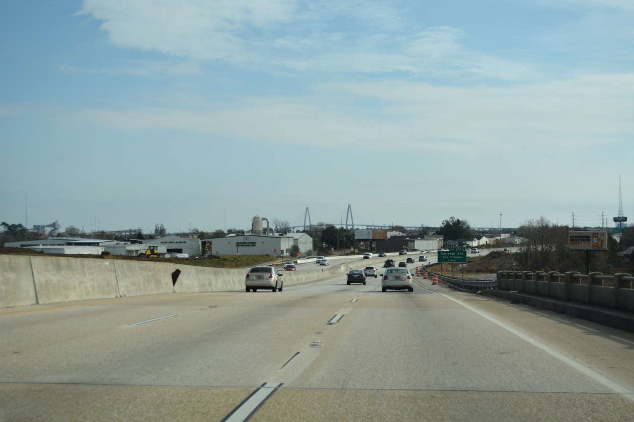
| Continuing south along the Charleston peninsula, Interstate 26 approaches the directional T interchange (Exit 220) with U.S. 17 north across the Ravenel Bridge to Mount Pleasant. 12/31/17 |
|
| Curving south from the Rosemont neighborhood, I-26 elevates onto a 1967-viaduct over Milford Street adjacent to U.S. 78 (King Street Extension), a CSX Railroad line and U.S. 52 (Meeting Street Road). 12/31/17 |
|
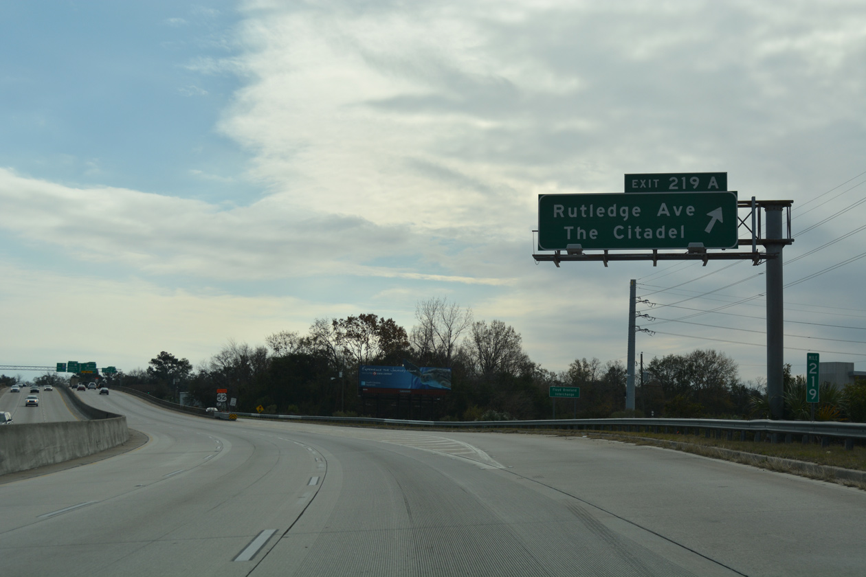
| Exits 219A/B depart I-26 eastbound in quick succession to the Wagner Terrace neighborhood. Morrison Drive (unsigned U.S. 52 Spur) splits from U.S. 52 just east of I-26 and runs along the Cooper River to the S.C. Port Authority - Columbus Street terminal. 12/31/17 |
|
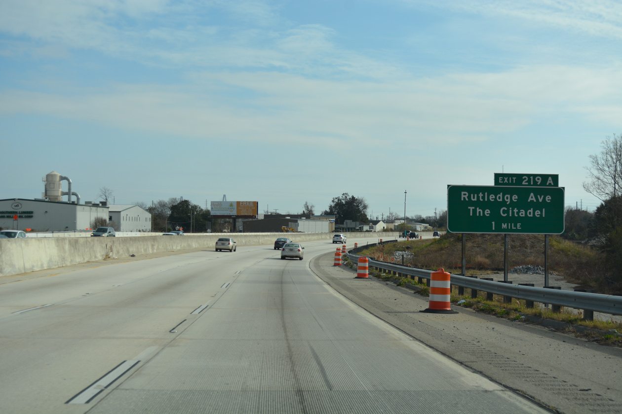
| Rutlegde Avenue branches south from the freeway at Exit 219A to Hampton Park by The Citadel, the Military College of South Carolina, and the Hampton Park Terrace community. 12/31/17 |
|
| Exit 219B lowers onto Mount Pleasant Avenue midway between Rutledge Avenue and U.S. 78 (King Street) and U.S. 52 at Morrison Drive. Spur U.S. 52 extends 2.98 miles south to Broad Street at the French Quarter and historic Charlestowne. 12/31/17 |
|
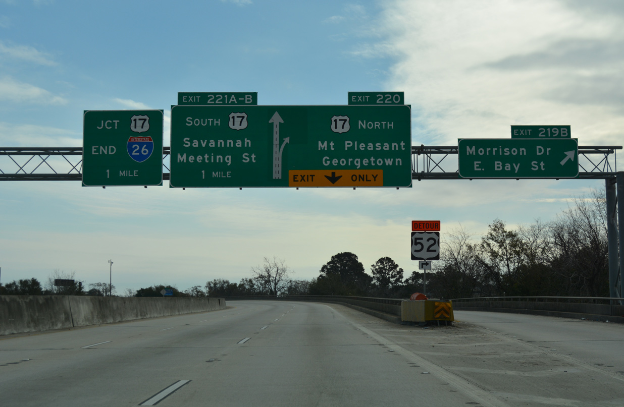
| Formerly a two lane ramp, the flyover (Exit 220) for U.S. 17 north to the Ravenel Bridge, Mt. Pleasant and Georgetown separates from I-26 eastbound. The Ravenel Bridge opened to traffic on July 15, 2005, replacing a pair of aging cantilever spans across the Cooper River further south. 12/31/17 |
|
| The high speed flyovers from I-26 accompany entrance ramps from U.S. 52 (Meeting Street) and U.S. 52 Spur (Bay Street) onto the Ravenel Bridge across Town Creek. The cable-stayed bridge travels 50 feet higher than its predecessors. 12/31/17 |
|
| U.S. 17 south runs alongside I-26 west from the Ravenel Bridge to Septima Clark Parkway ahead of Downtown Charleston. U.S. 17 northbound overlaps with the eastbound lanes on the same stretch. 12/31/17 |
|
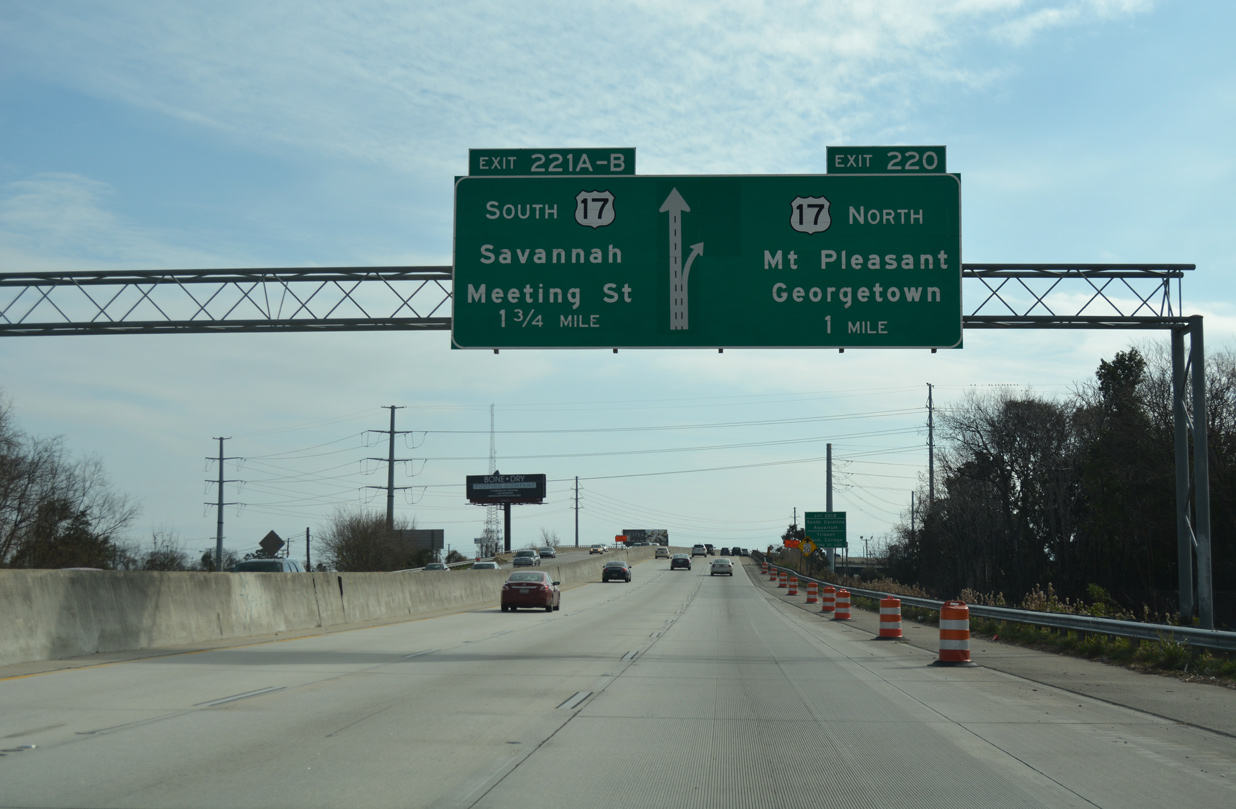
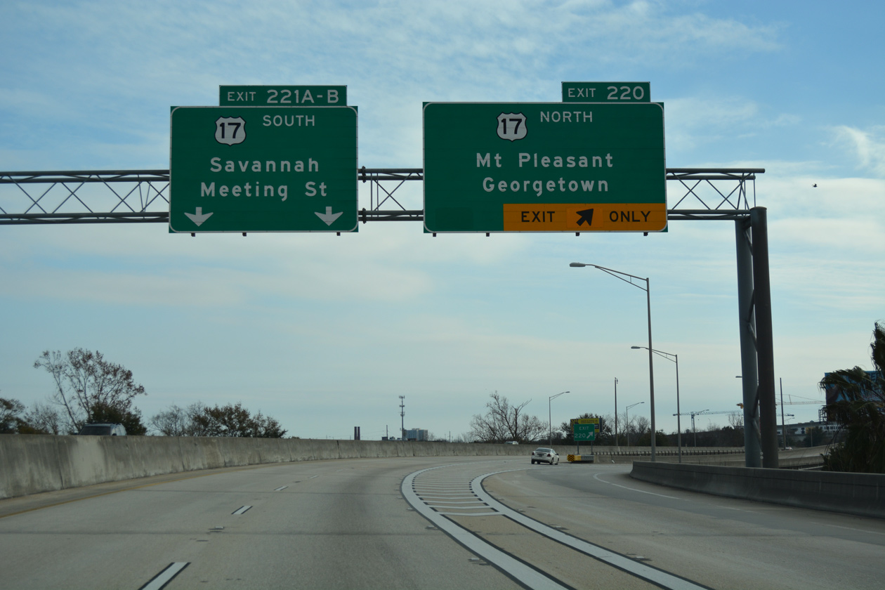
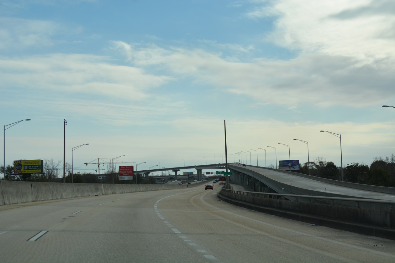
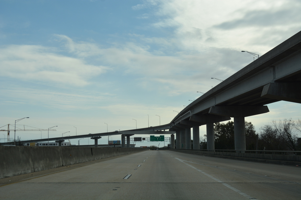
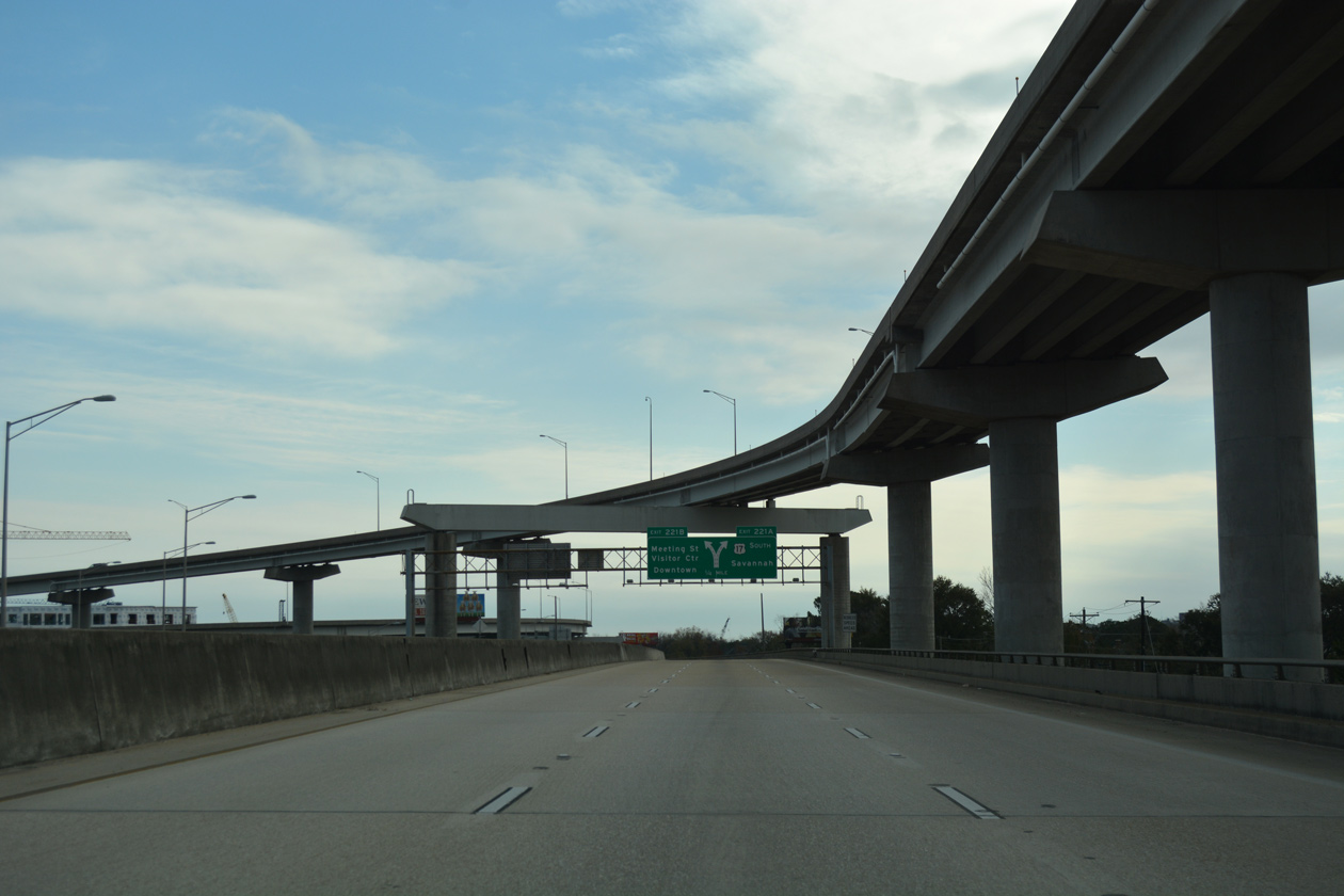
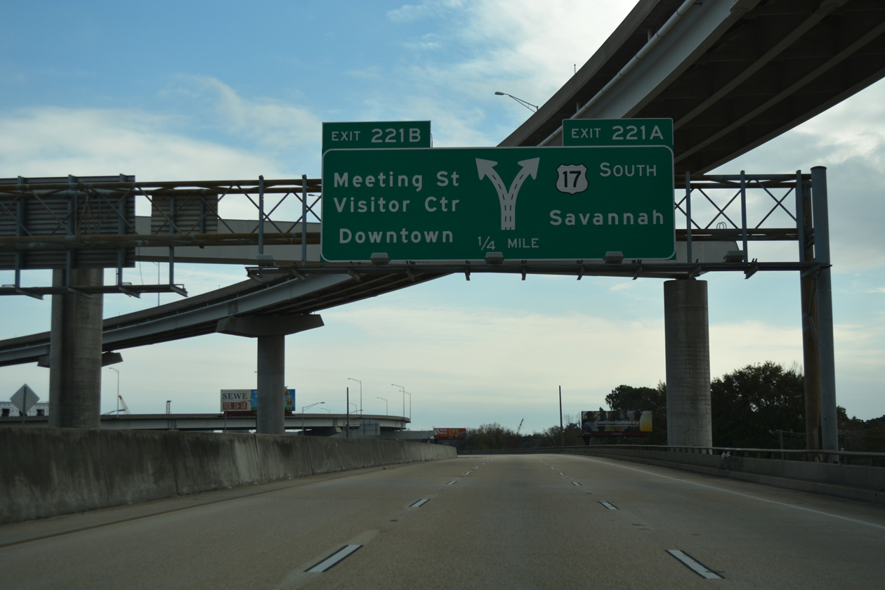
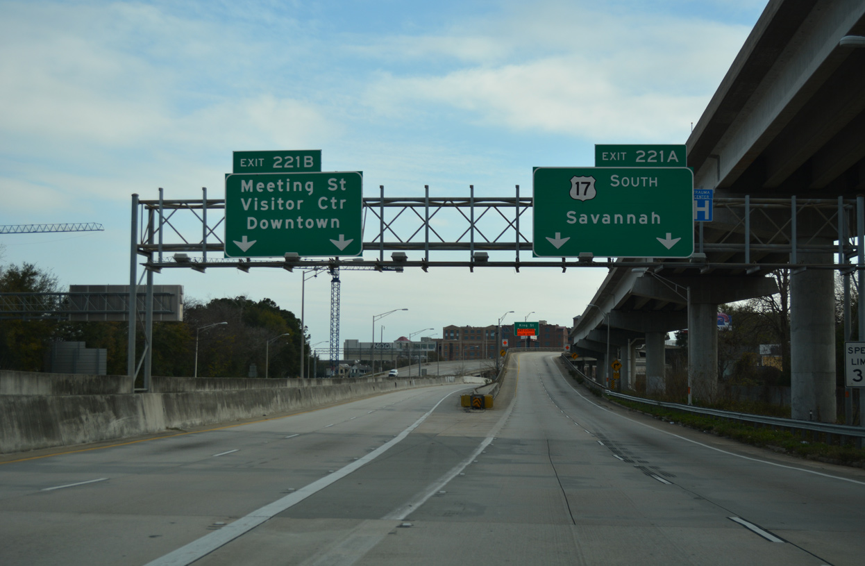
| Traffic along Interstate 26 partitions in one quarter mile for a flyover (Exit 221A) onto U.S. 17 (Septima Clark Parkway) south and a grade level ramp to parallel Meeting Street (U.S. 52). 12/31/17 |
|
| I-26 stays elevated along the Heriot Street Viaduct south across Newmarket Creek through the exchange with U.S. 17 and the Ravenel Bridge. The 6,184 foot long bridge system dates to 1968.4 11/12/06, 12/31/17 |
|
| Two lane ramps split for U.S. 17 (Septima Clark Parkway) southbound to west Charleston and Savannah and Meeting Street south to the Cannonborough Ellioborough areas and the Battery. 12/31/17 |
|
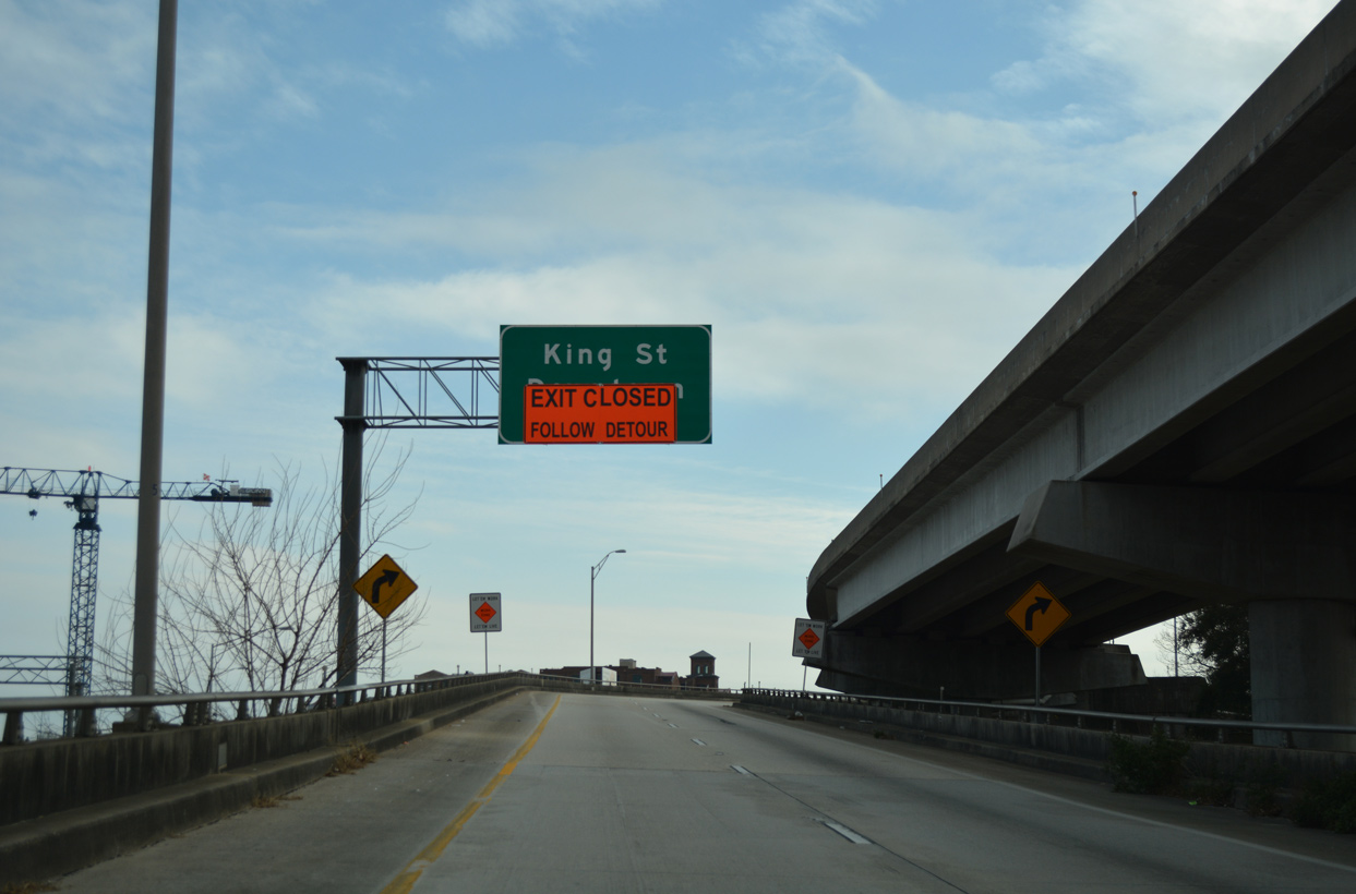
| The last exit from I-26 eastbound connects with King Street (U.S. 78) three blocks north from its end point at Line Street.
The ramp to King Street was closed on January 9, 2017 due to its proximity to one of the shafts built for a drainage tunnel. The tunnel is part of a $146 million citywide drainage improvement project. Work at King Street was expected to last until 2019.6 |
|
| Interstate 26 formally ends beyond the loop ramp to Sheppard Street east to King Street (U.S. 78) at the intersection with Coming Street. A separate loop ramp departs from adjacent U.S. 17 south to U.S. 78. 12/31/17 |
|
| Exit 221B curves east below the flyover taking I-26/U.S. 17 north to intersect Meeting Street. The unmarked east end of U.S. 52 lies 0.9 miles to the south at Line Street. 11/12/06 |
|
| Stubs allude to the former Septima Clark Expressway taking U.S. 17 east to the former John P. Grace and Silas Pearman Bridges across the Cooper River. Opened on August 8, 1929, the Grace Bridge carried southbound traffic along U.S. 17; The three-lane wide Pearman Bridge carried two northbound lanes and one southbound lane. It dated from April 29, 1966.6 11/12/06 |
|
| The grassy area at the northeast corner of Meeting Street and the off-ramp from I-26 was the site of the Septima Clark Expressway viaduct leading east toward Mt. Pleasant. Redevelopment of the area, including part of the old right of way, includes a multi-use development with 221 apartments and ground level retail at 511 Meeting Street, and a five-story apartment complex at 530 Meeting Street with 114 units. Both projects were built in 2019.6,7 11/12/06 |
Page Updated 09-17-2018.

 East
East