Plans in 2004 were underway on a $94 million project to construct a controlled access route from Interstate 26 to the Columbia Metropolitan Airport (CAE). Completed in 2004, a 1.5 mile portion of the roadway opened between S.C. 602 (Platt Springs Road) and S.C. 302 (Airport Boulevard). Named the John N. Hardee Expressway, the controlled access route includes a trumpet interchange for the airport passenger terminal.
The remaining 1.1 mile expressway between S.C. 302 (Airport Boulevard) and a new interchange with Interstate 26 was expected to start construction by mid 2006 and be completed by 2008.1 This portion however remains unconstructed.
|
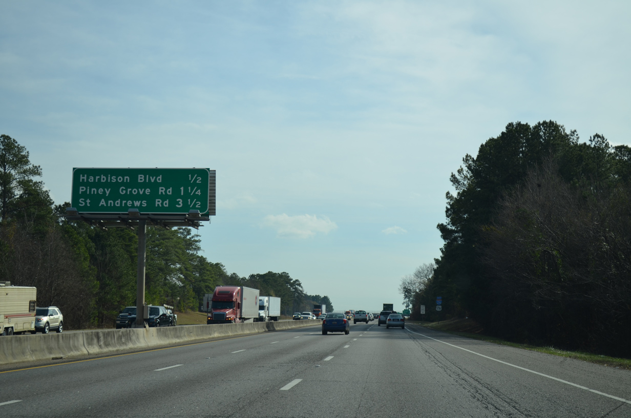
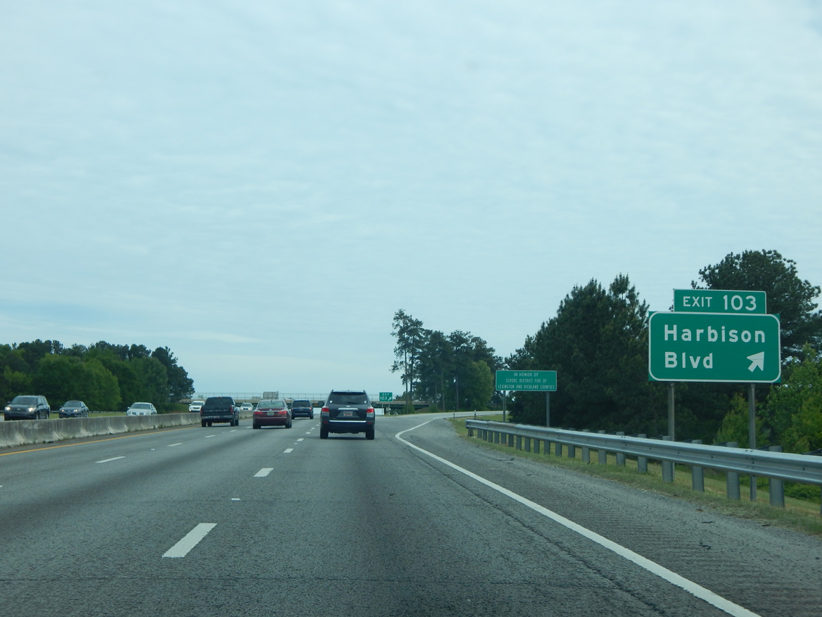
| Forthcoming Exit 103 for Harbison Boulevard (Road 757) serves a sprawling retail area anchored by Columbiana Centre mall. 12/20/13 |
|
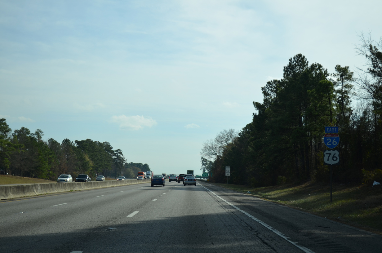
| I-26/U.S. 76 overlap 5.97 miles southeast to Interstate 126. 12/20/13 |
|
| A parclo interchange links I-26/U.S. 76 with Harbison Boulevard at Exit 103. Harbison Boulevard connects the adjacent commercial district with St. Andrews Road (Road 36) to the west and U.S. 176 (Broad River Road) to the north. 04/10/16 |
|
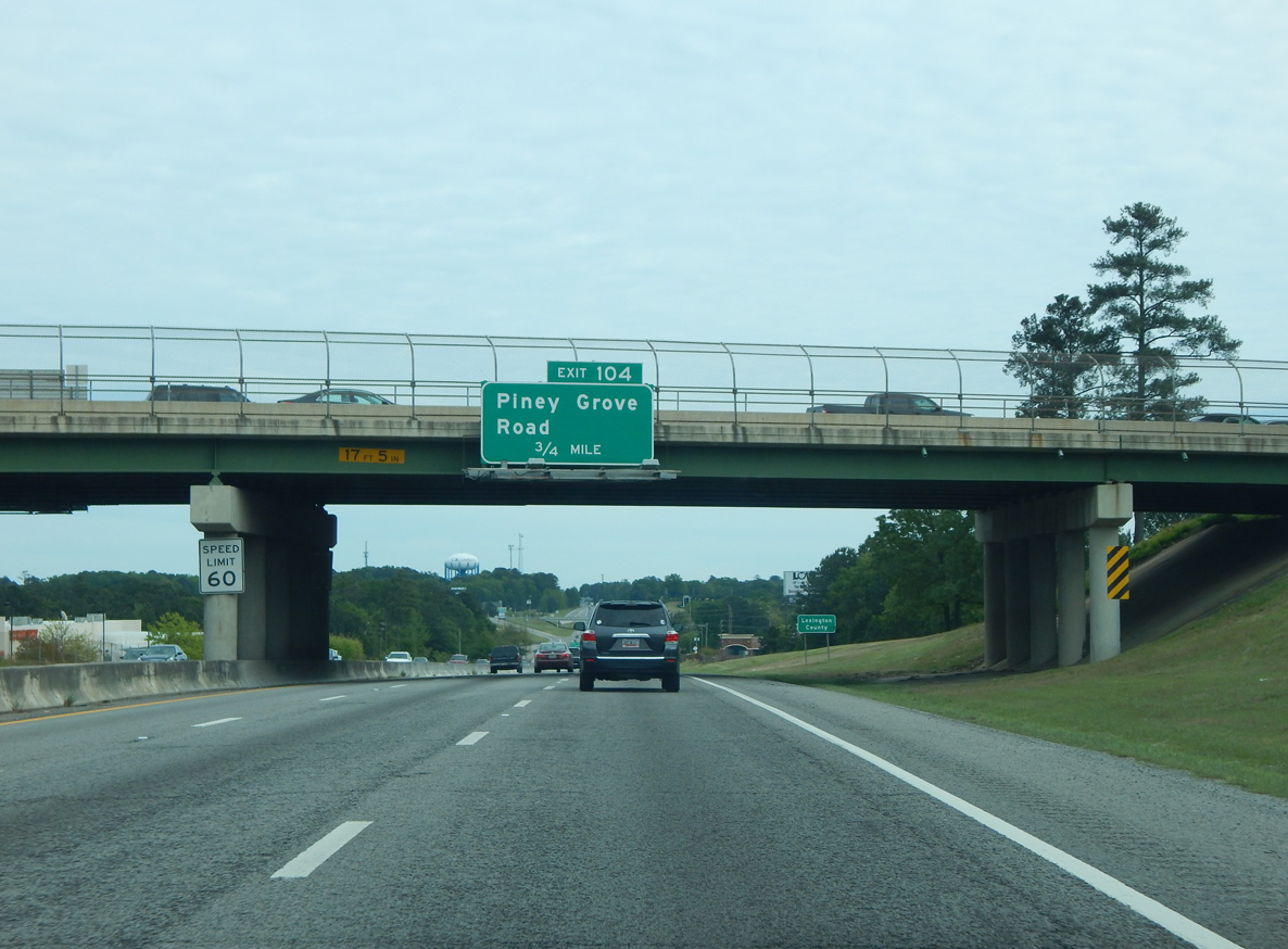
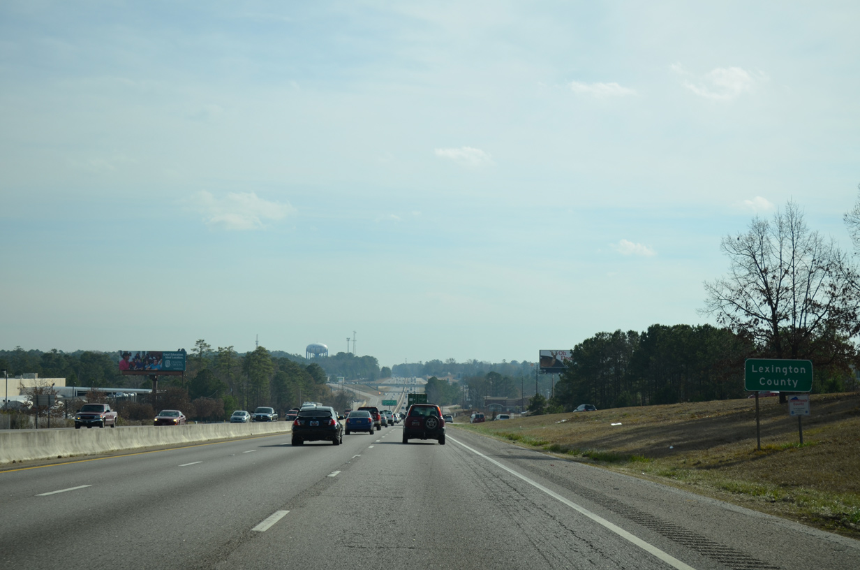
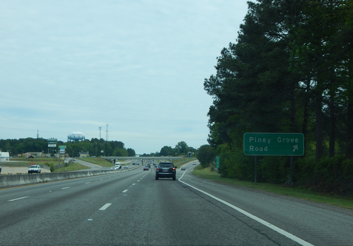
| Passing under Harbison Boulevard, I-26/U.S. 76 reenter Lexington County and next meet Piney Grove Road at Exit 104. 04/10/16, 12/21/13 |
|
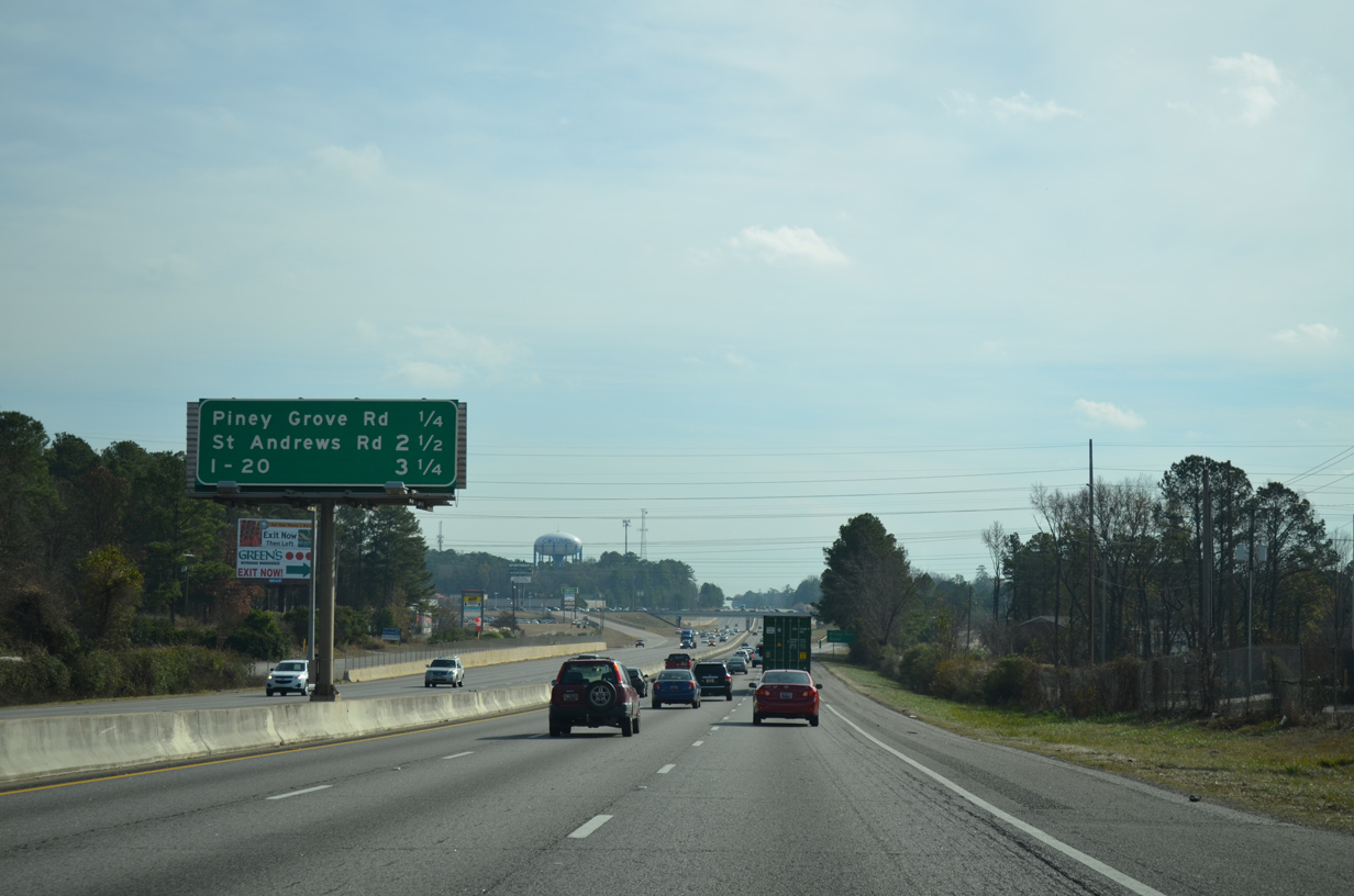
| One quarter mile ahead of the diamond interchange (Exit 104) with Piney
Grove Road (Road 671) on I-26 east. This interchange sequence sign is the first referencing the upcoming exchange with Interstate 20. 12/20/13 |
|
| Piney Grove Road winds 2.93 miles northeast from Saint Andrews Road and Whitehall in south Irmo to Exit 104 and U.S. 176 (Broad River Road). 04/10/16 |
|
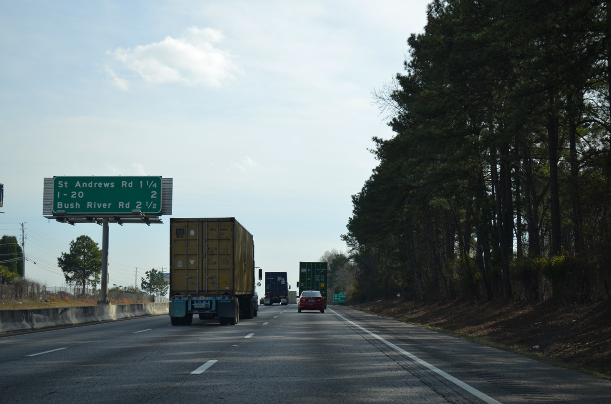
| Continuing southeast, I-26/U.S. 76 pass through the suburb of St. Andrews over the ensuing 2.5 miles. St. Andrews Road and Bush River Road provide access to the unincorporated community between Malfunction Junction, the nickname for the exchange with I-20. 12/20/13 |
|
| St. Andrews Road (Road 36) constitutes a busy arterial route northwest from U.S. 176 (Broad River Road) to the Irmo town center at S.C. 60. 04/10/16 |
|
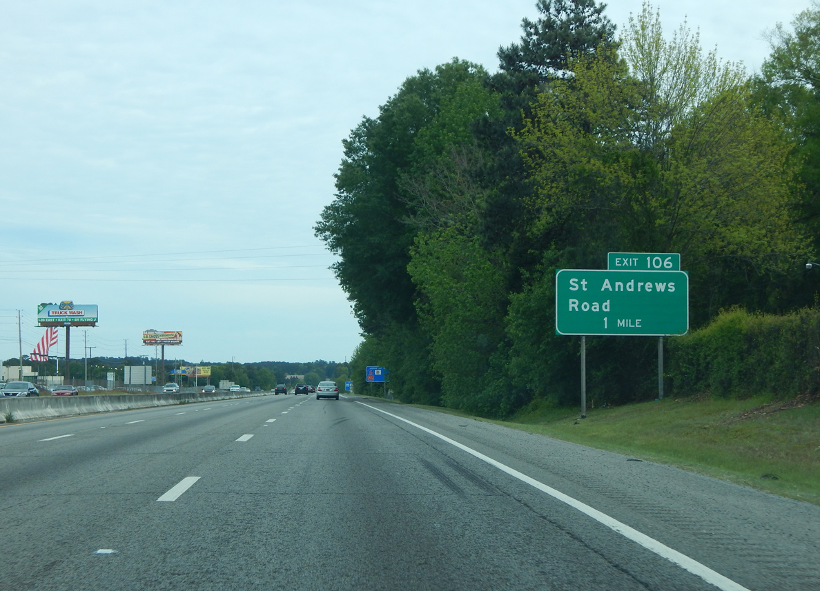
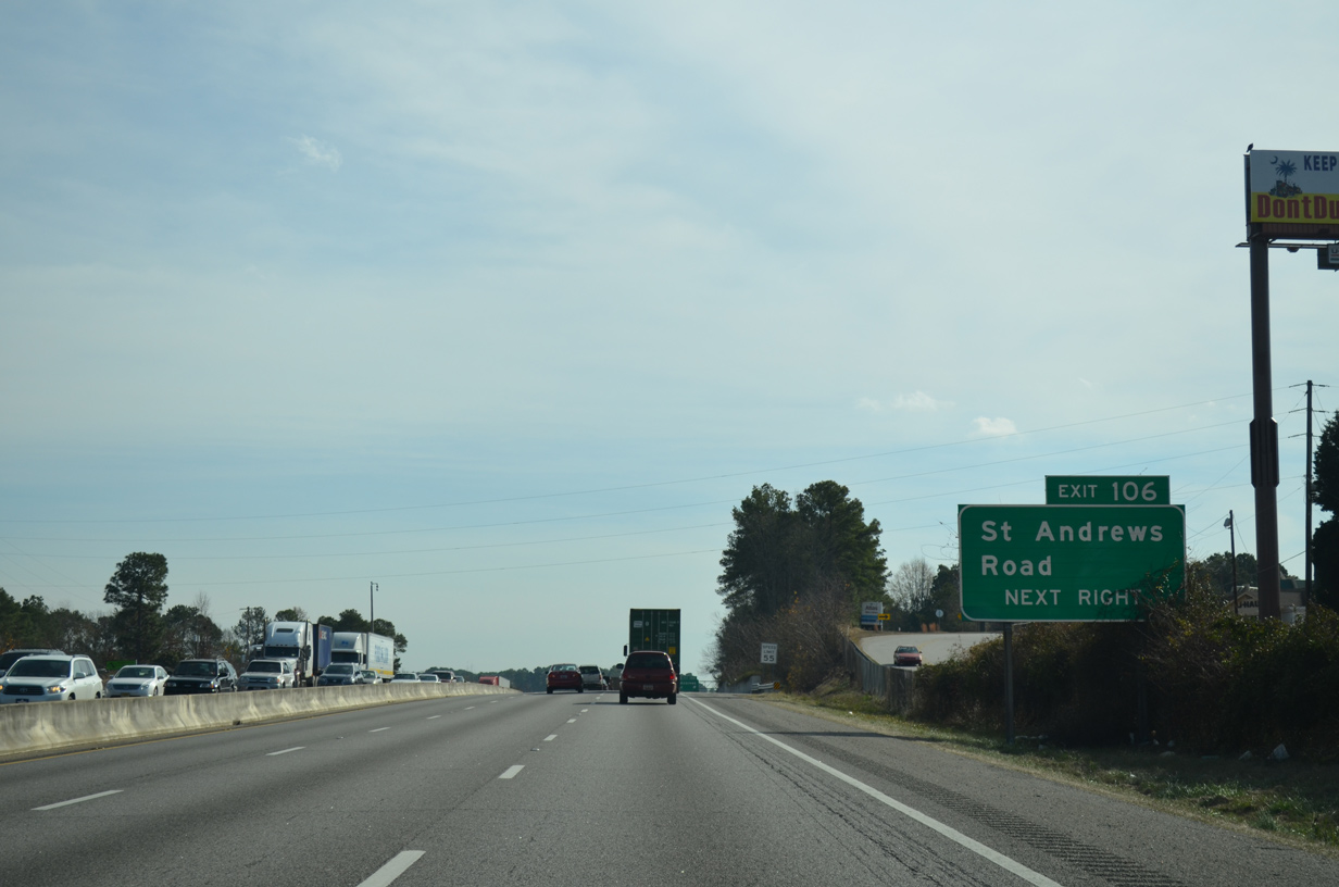
| A six-ramp parclo interchange (Exit 106) joins I-26/U.S. 76 with a commercialized stretch of St. Andrews Road in a quarter mile. 12/20/13 |
|
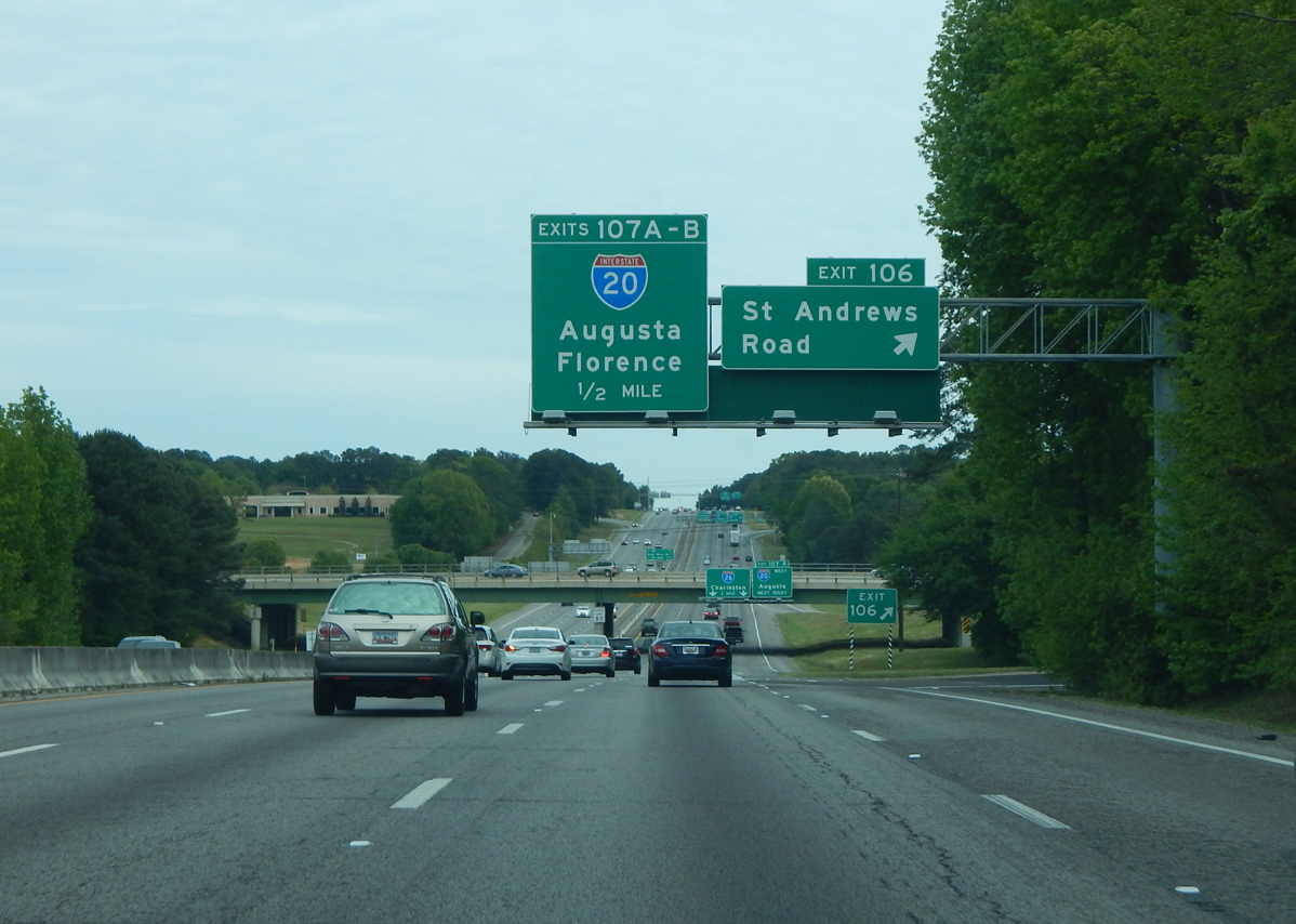
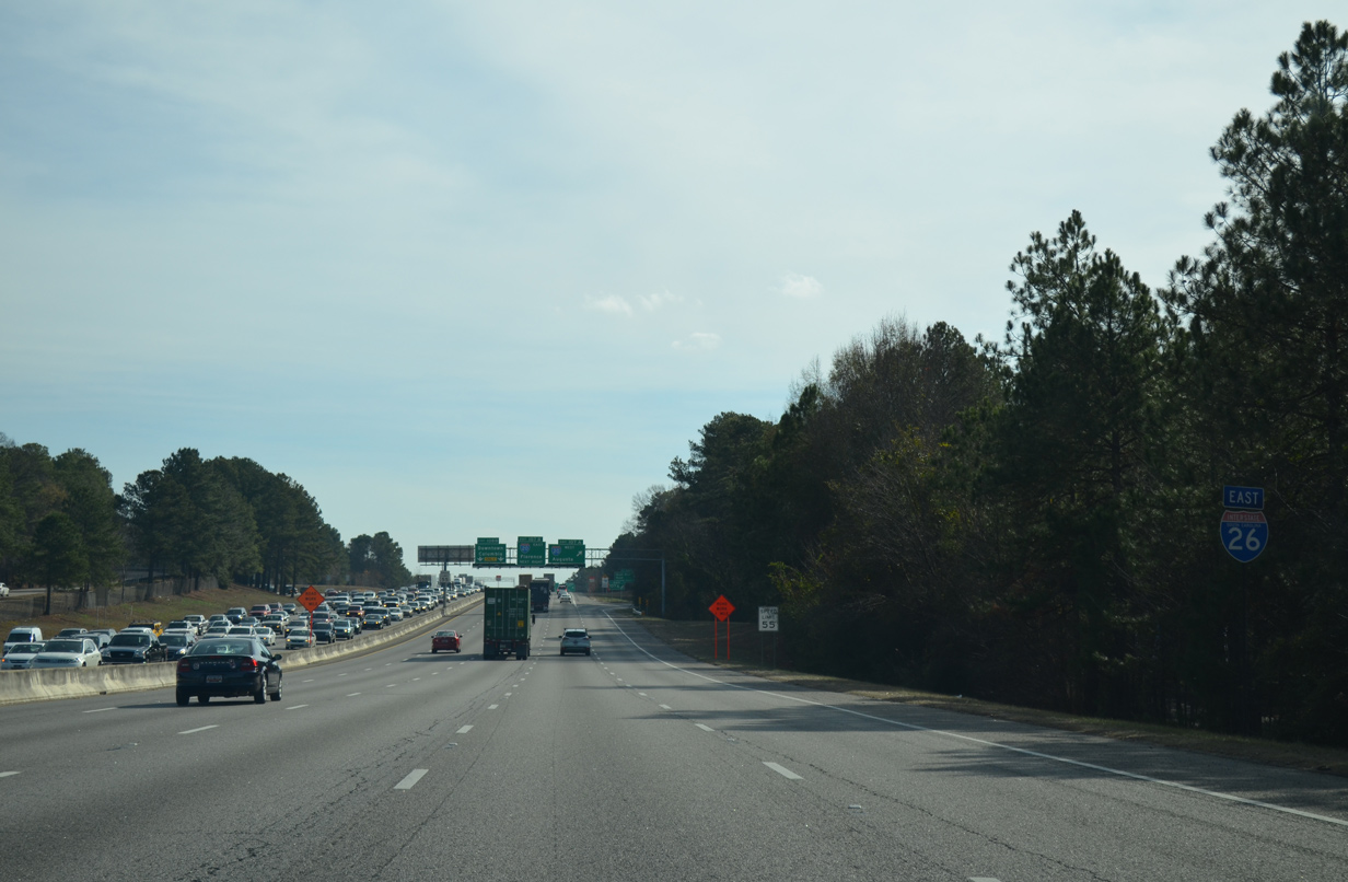
| Interstate 26 expands to eight lanes leading into Malfunction Junction with I-20 as Exit 106 leaves for St. Andrews Road. Phases 4 and 5 of the Carolina Crossroads project, from 2025 to 2029, will further widen I-26 northwest to U.S. 176 (Broad River Road). 04/10/16 |
|
| Passing under St. Andrews Road, overheads direct through traffic into the right lanes as the left lanes eventually default onto I-126/U.S. 76 east into Columbia. Exit 107A for Interstate 20 west to Augusta, Georgia departs next. 10/13/14 |
|
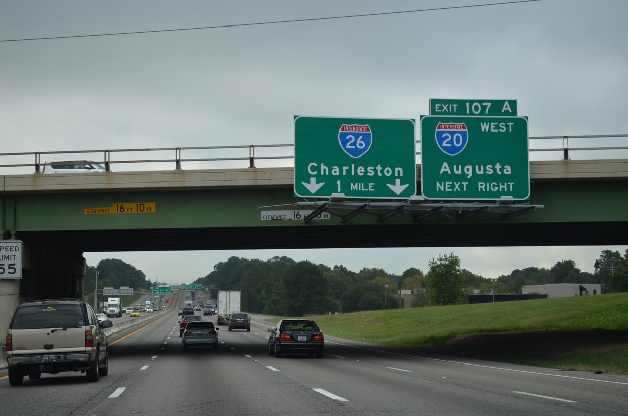
| The weaving traffic pattern at the cloverleaf (Exit 107) with I-20 lead to the Malfunction Junction nickname. Efforts to upgrade the outdated exchange started in 1988. Phase 3 of the Carolina Crossroads project, from late 2023 to Fall 2028, will reconfigure Exit 107 into a turbine interchange. 12/20/13 |
|
| A reassurance marker for I-26 east omits U.S. 76 as five lanes advance to I-20. Phase 3 of Carolina Crossroads will reconstruct the interchange with St. Andrews Road into a SPUI and add a distributor roadway to Exit 107A. 12/21/13 |
|
| I-20 travels west from Exit 107A to Lexington, Aiken and Augusta, Georgia. I-20 leaves the Palmetto State in 63 miles and reaches Atlanta in 203 miles. The first in a series of signs for Exit 108B / I-126/U.S. 76 west precedes the split with I-26 in 0.75 miles. 04/10/16 |
|
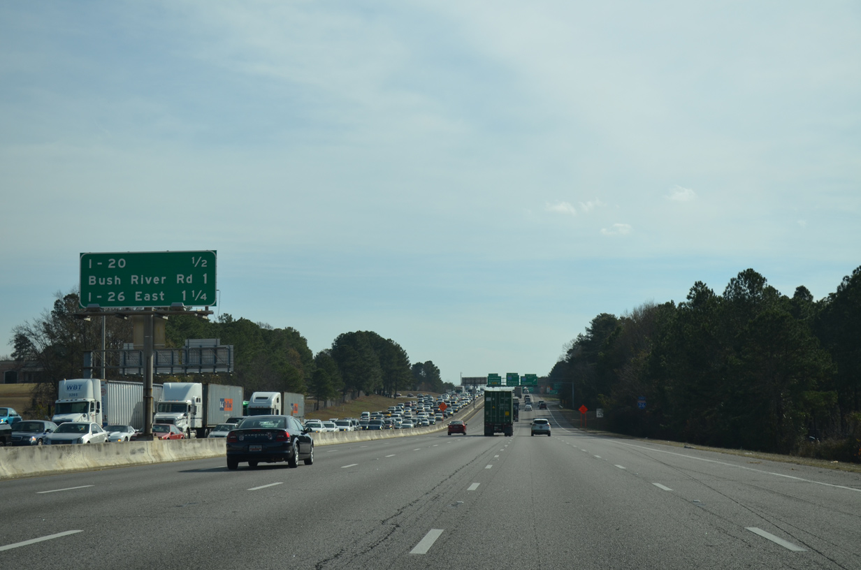
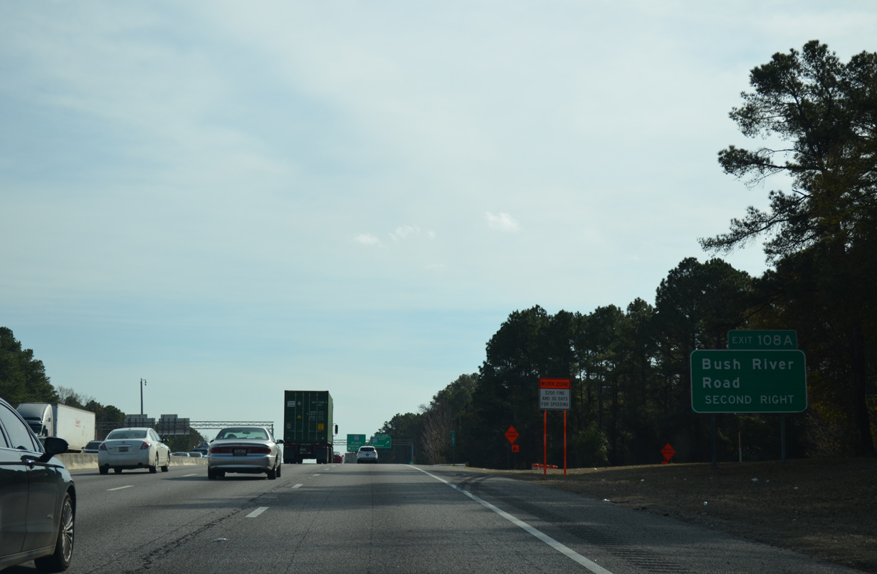
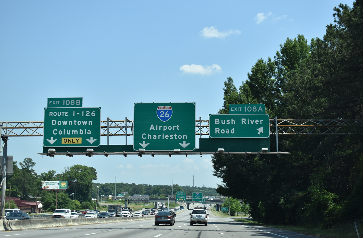
| Sandwiched between ramps for I-20 and I-126 is Exit 108A to Bush River Road. This exchange will be removed during Phase 3 of Carolina Crossroads. Bush River Road constitutes a commercial arterial between I-20 at Exit 63 and U.S. 176 (Broad River Road) by Dutch Square Center mall. 12/20/13 |
|
| I-26 crosses back into Richland County at Exit 107B for I-20 east to I-95 at Florence. I-20 has seven interchanges in the Columbia area between I-26 and I-77 near Fort Jackson. 05/26/19 |
|
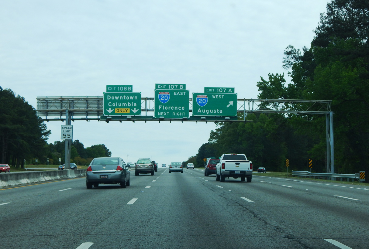
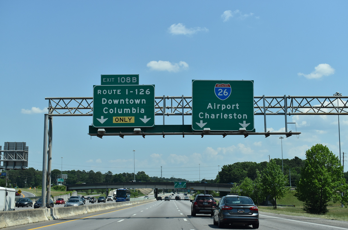
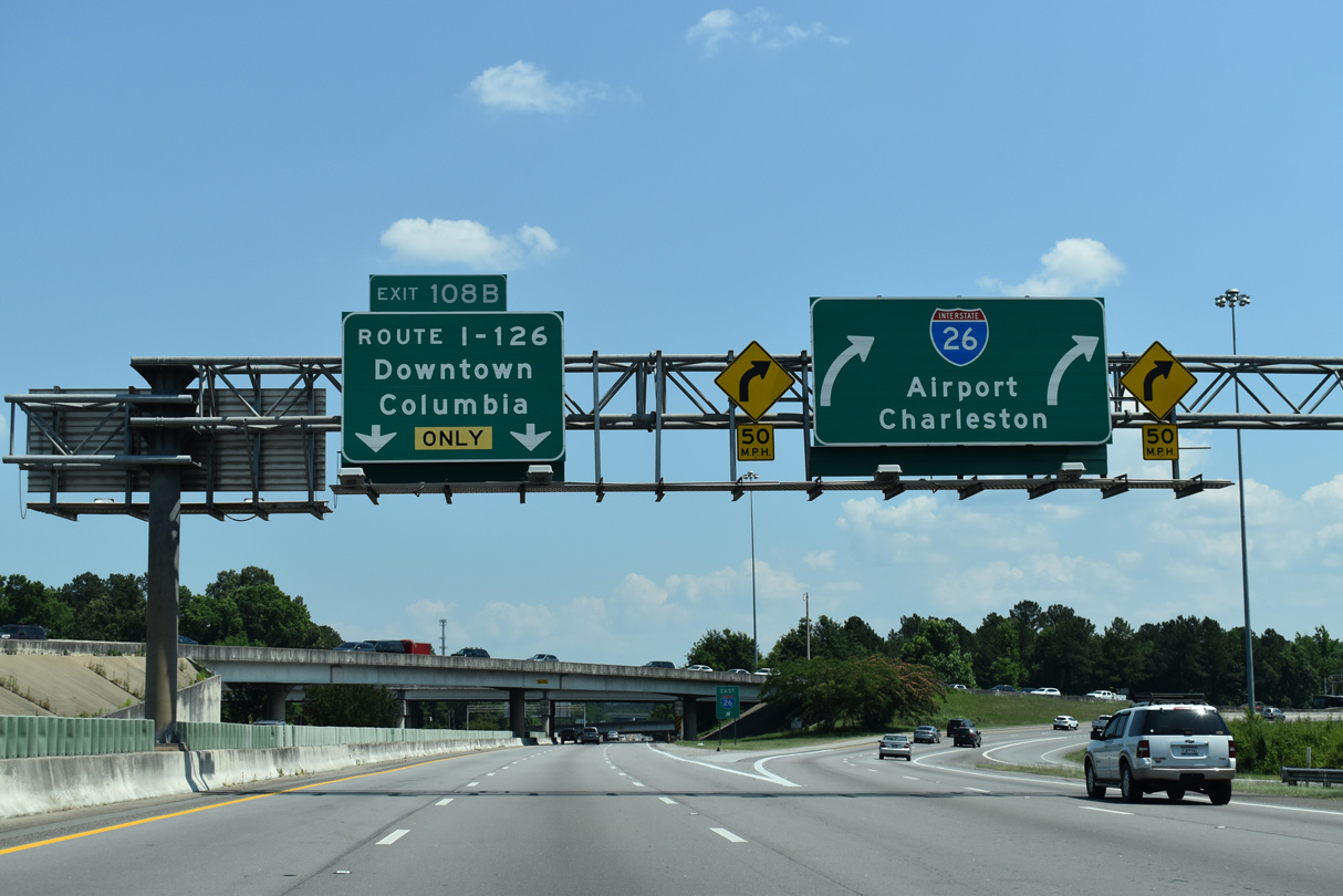
| Signs for Left Exit 108B list Interstate 126 in text and omit U.S. 76. Sometime after 2004, the exit for Bush River Road was renumbered from 108 to 108A and the ramp for I-126 designated Exit 108B. 05/24/19 |
|
| Four lanes of Interstate 26 eastbound partition into separate two lane ramps at Exit 108B for Downtown Columbia and Charleston. Changes to I-126 signs were made in 1994 to address confusion experienced by motorists joining I-26 east from I-20. 05/26/19 |
|
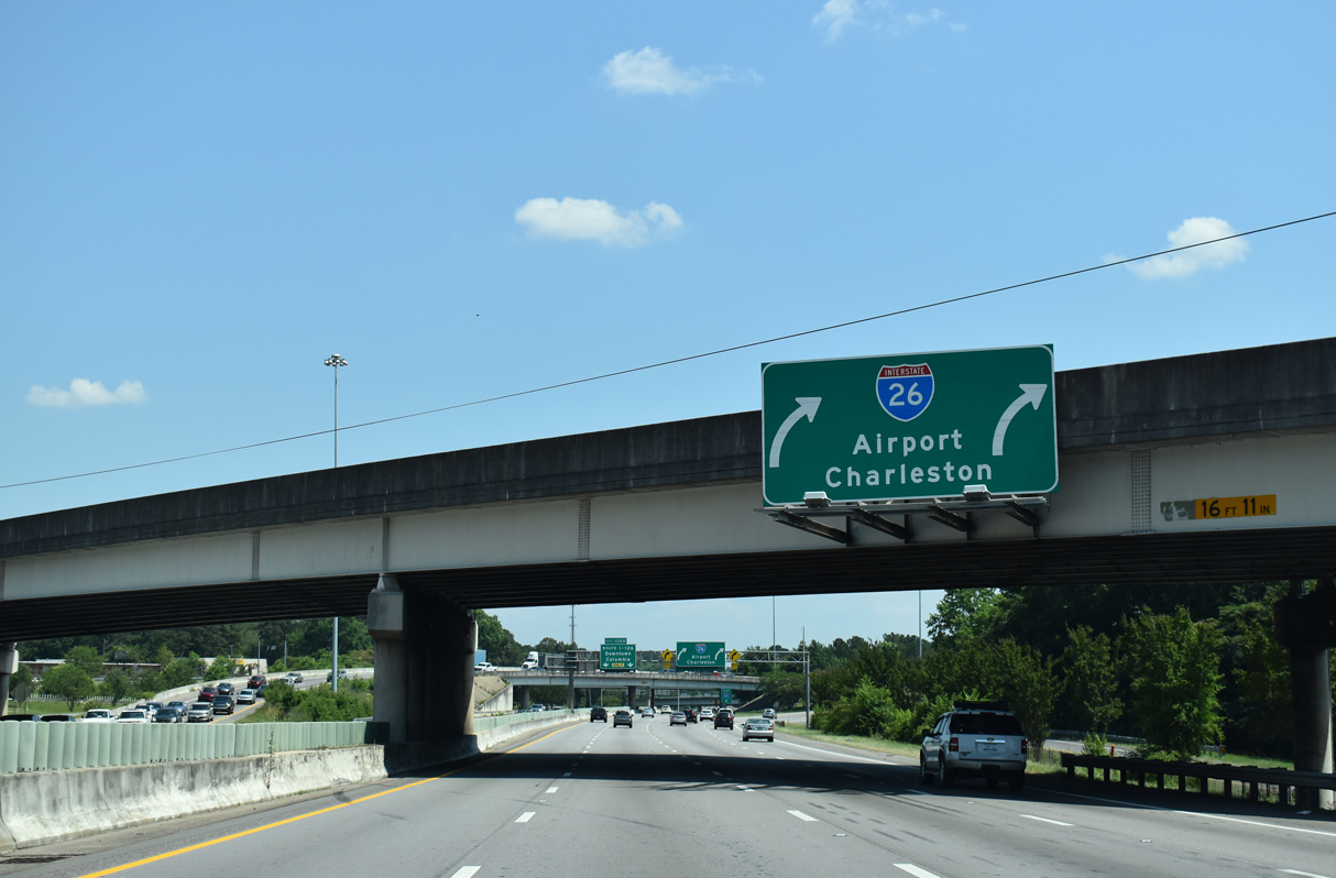
| Interstate 26 travels underneath the Bush River Road overpass before turning westward toward Columbia Metropolitan Airport (CAE). The roadways for I-26 will be realigned to run side by side and the left exit to I-126 shifted to the right during the Carolina Crossroads project. 05/26/19 |
|
| I-126/U.S. 76 overlap east to a three-wye interchange with Huger Street. There U.S. 76 combines with U.S. 121-176-321 north and Business Spur I-126 along Elmwood Avenue. 05/26/19 |
|
| A new directional T interchange will be constructed in place of the original exchange joining I-26 with I-126/U.S. 76 east. Phase 1 road work runs from Spring 2022 to late 2024. 10/13/14 |
|
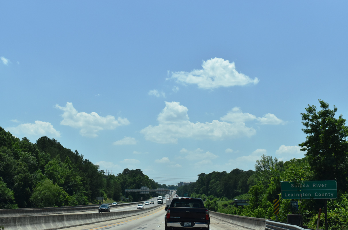
| Interstate 26 angles southwest and reenters Lexington County at the Saluda River. The Saluda and Broad Rivers combine nearby to form the Congaree River between West Columbia and Columbia. 05/26/19 |
|
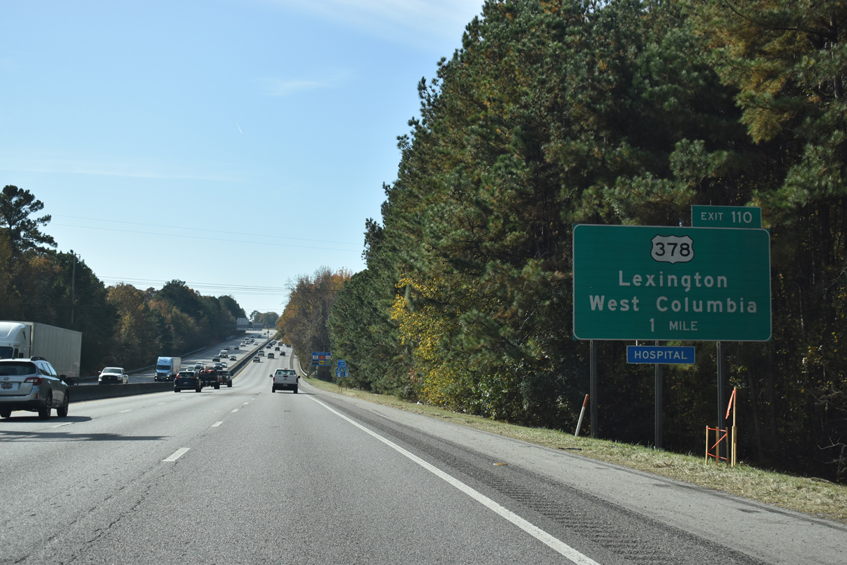
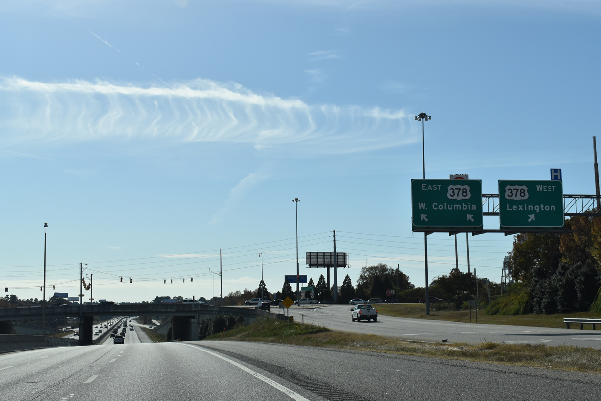
| I-26 advances south to U.S. 378 (Sunset Boulevard) at Exit 110. U.S. 378 travels 234 miles between Washington, Georgia and Conway. 11/21/21 |
|
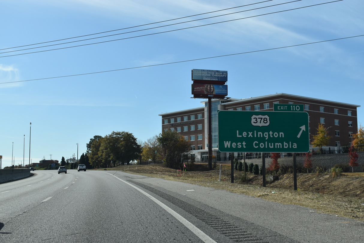
| A single point urban interchange (Exit 110) joins Interstate 26 with U.S. 378. 11/21/21 |
|
| Sunset Boulevard leads U.S. 378 east through West Columbia to Meeting Street (U.S. 1) and west to I-20 at Exit 61 and the city of Lexington. 11/21/21 |
|
| Exit 110 was converted to a SPUI between 2004 and 2005. 11/21/21 |
|
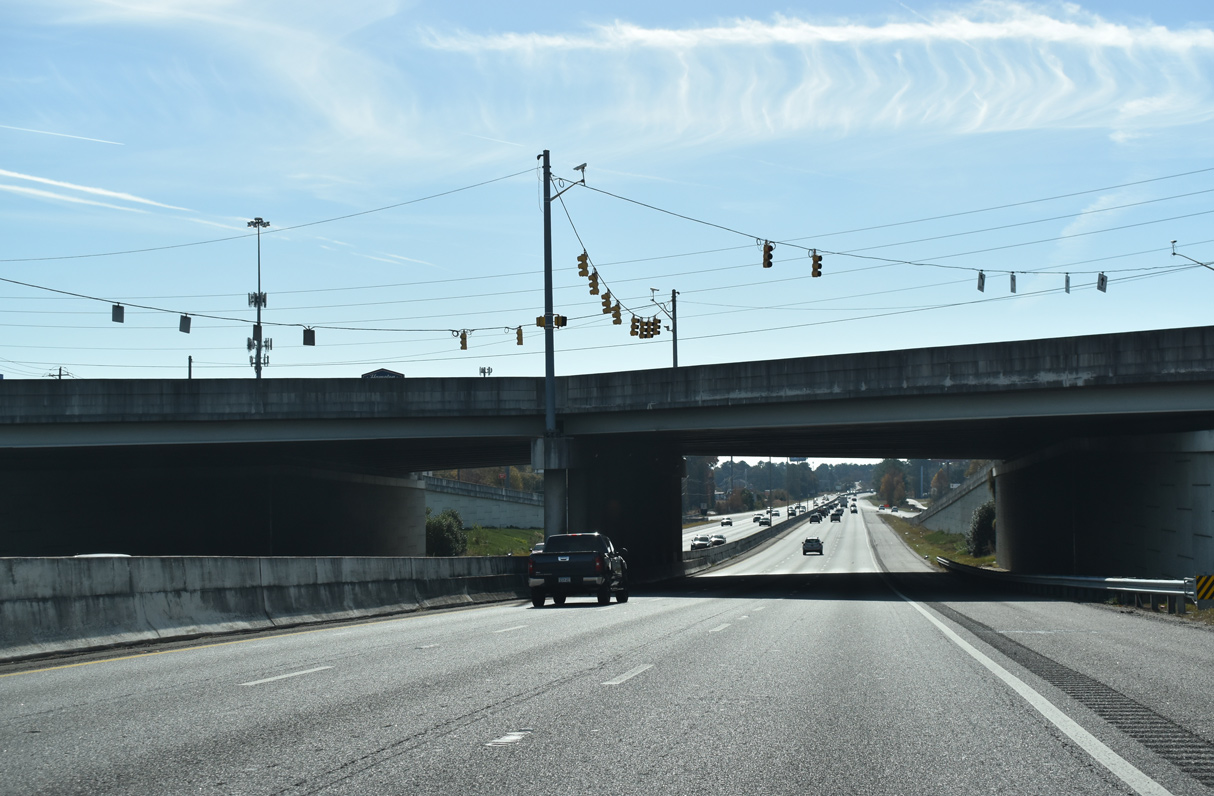
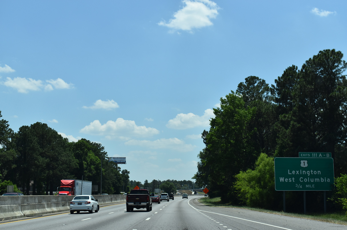
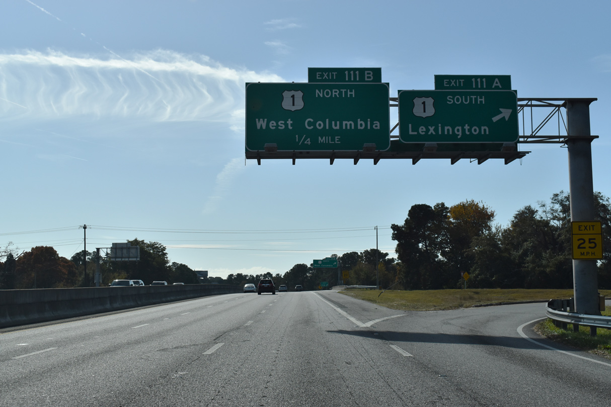
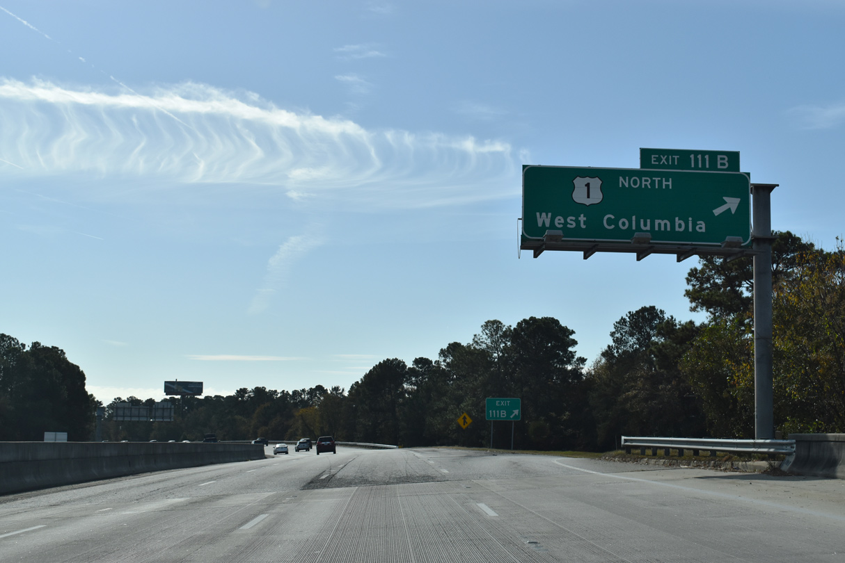
| U.S. 1 leads west from Downtown Columbia across the Gervais Street Bridge over the Congaree River into West Columbia. U.S. 1 follows Augusta Road, a commercialized arterial, to a cloverleaf interchange (Exits 111A/B) with Interstate 26. 05/26/19 |
|
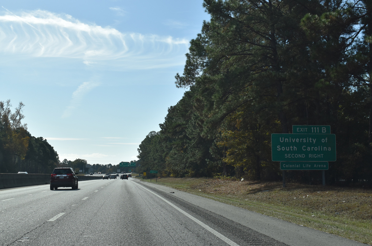
| U.S. 1 north to U.S. 21/176/321 (Huger Street) south leads to the University of South Carolina (USC) campus. Colonial Life Arena (home USC Gamecocks basketball) of lies three blocks south of U.S. 1/378 (Gervais Street) and The Vista along Lincoln Street. 11/21/21 |
|
| U.S. 1 proceeds west from Exit 111A to Lexington, where the route meets U.S. 378 again. 11/21/21 |
|
| Exit 111B loops onto U.S. 1 (Augusta Road) north to Meeting Street and an overlap with U.S. 378 to the State Capitol and Two Notch Road in Columbia. U.S. 1 generally travels from west to east from Wrens, Georgia to Camden. 11/21/21 |
|
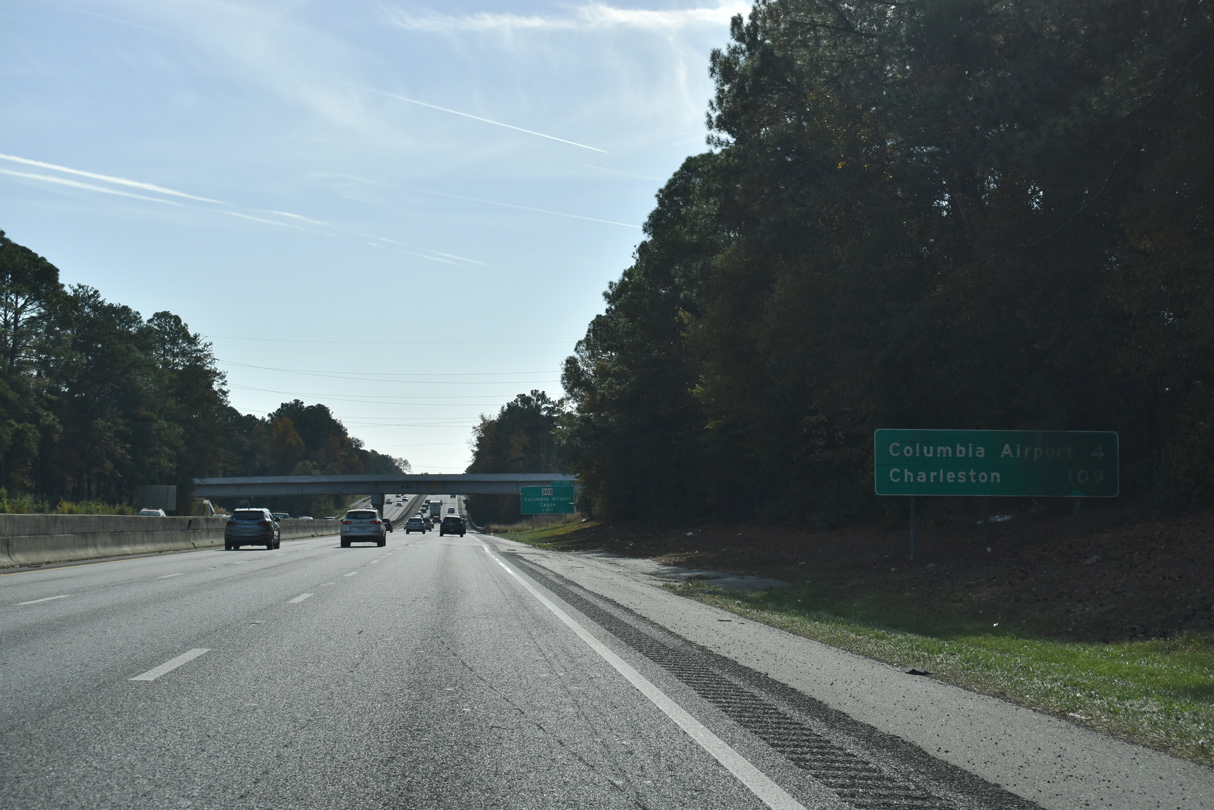
| Charleston appears for the first time along I-26 eastbound distance signage at 109 miles. Columbia Metropolitan Airport (CAE), four miles to the southwest, is the succeeding exit. 11/21/21 |
|
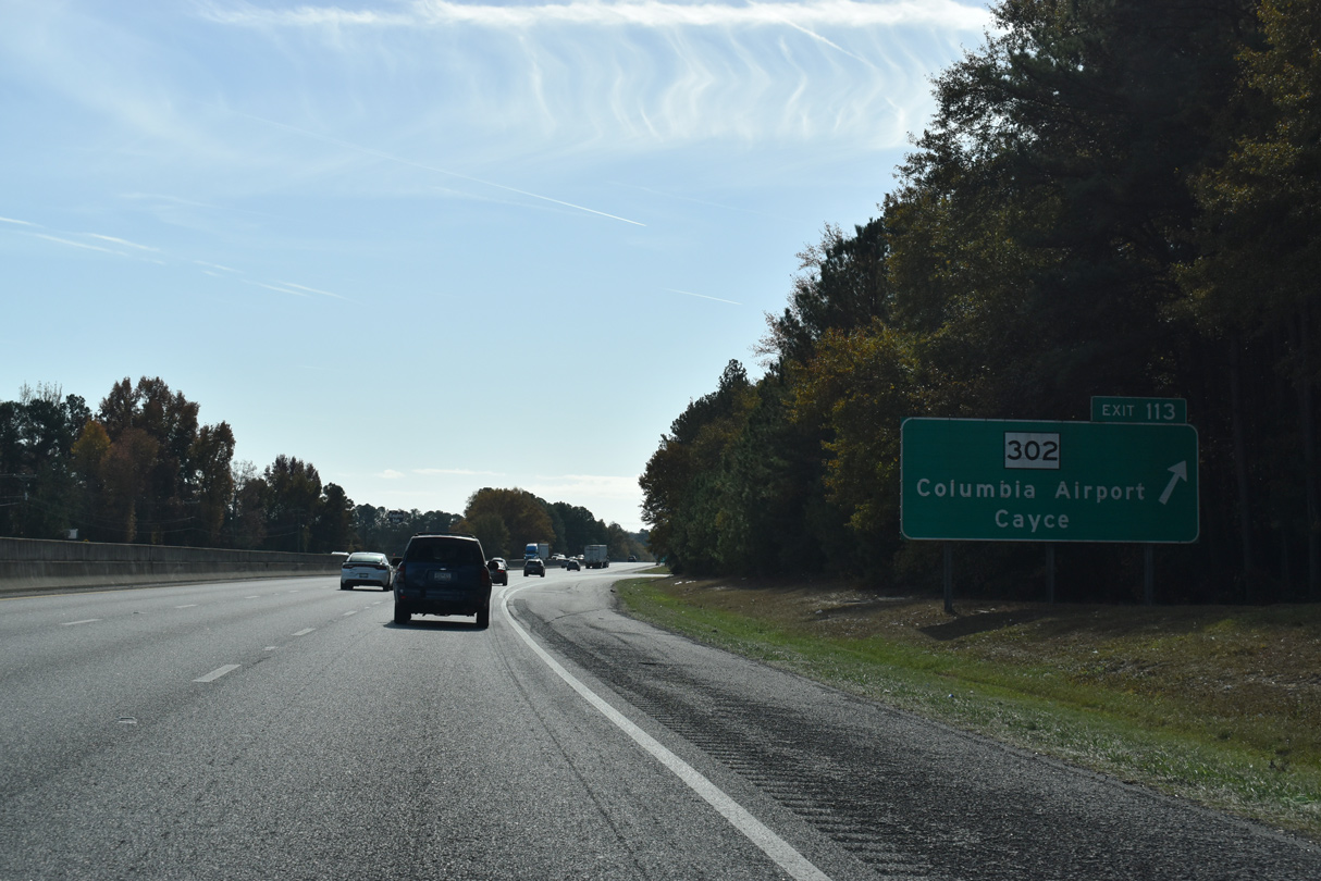
| I-26 maintains six overall lanes through the town of Springdale. Exit 113 follows to S.C. 302 (Airport Boulevard). 11/21/21 |
|
| S.C. 302 leads east from a diamond interchange (Exit 113) with I-26 through Cayce to U.S. 21-176-321 (Charleston Highway) and west to Springdale and Columbia Metropolitan Airport (CAE). 11/21/21 |
|
| Interstate 26 enters the city of Cayce south of Exit 113 and ahead of Sixmile Creek. 11/21/21 |
|
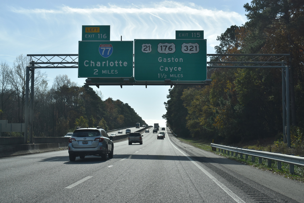
| Back to back interchanges lie 1.5 miles to the south along I-26 with U.S. 21-176-321 (Charleston Highway) and Interstate 77 north. 11/21/21 |
|
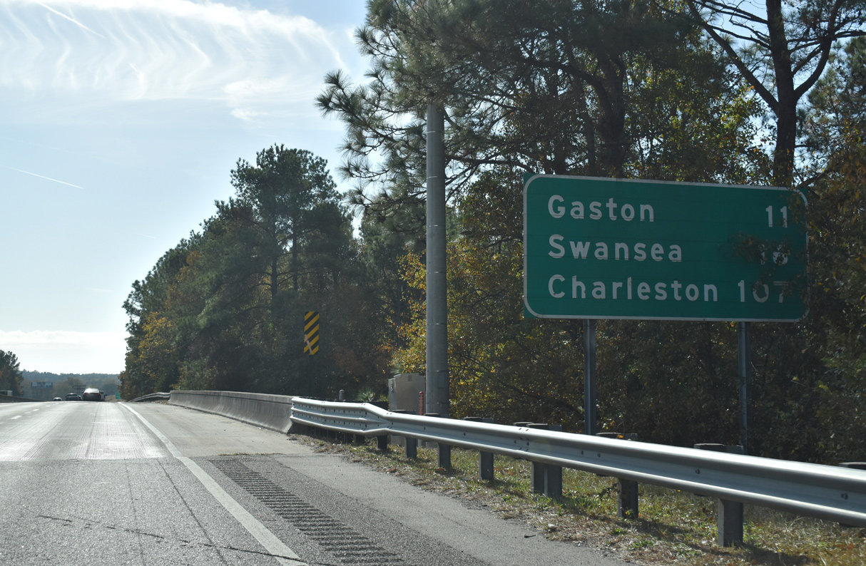
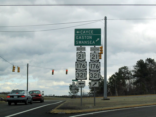
| A distance sign at the Norfolk Southern Railroad underpass references Gaston and Swansea, destinations along U.S. 321 south. Charleston and the east end of I-26 is 107 miles away. 11/21/21 |
|
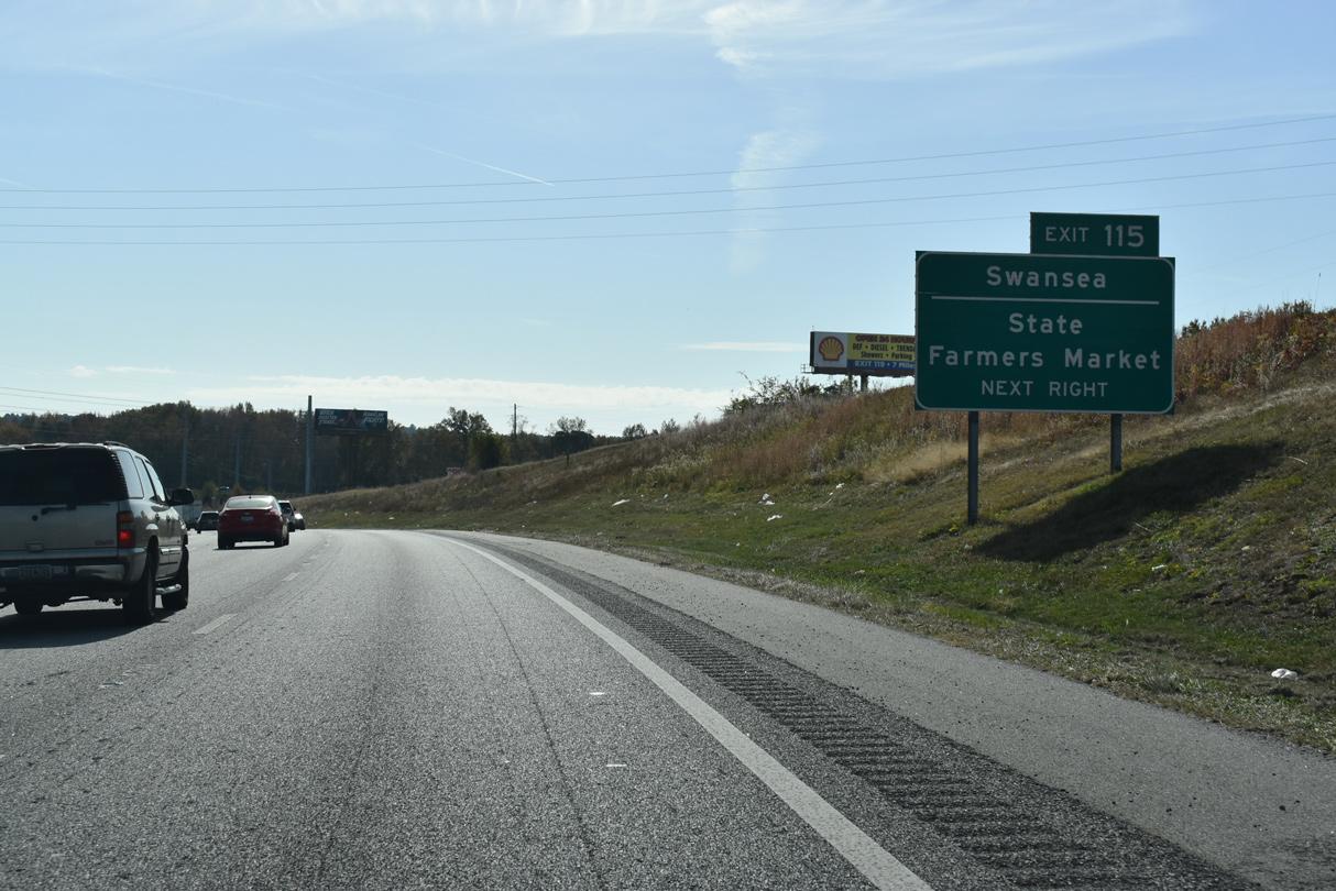
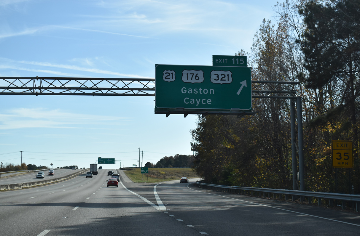
| U.S. 21-176-321 combine in Columbia and head southward from near the University of South Carolina (USC) campus through Cayce to a six-ramp parclo interchange at Exit 115. 11/21/21 |
|
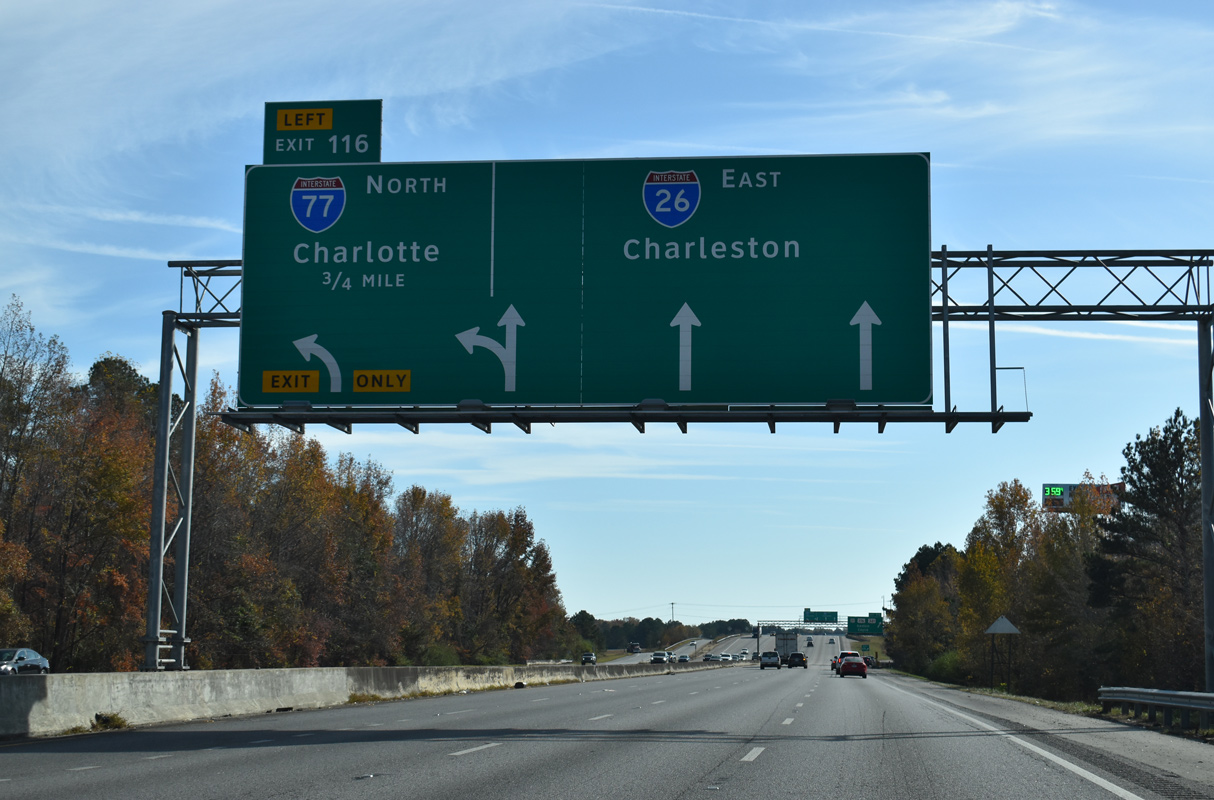
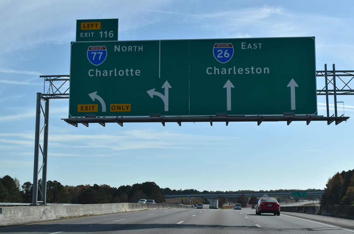
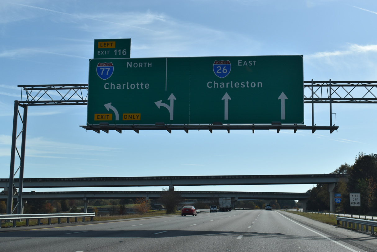
| Eastbound I-26 widens to four lanes near Congaree Creek leading to Left Exit 116 to Interstate 77 north. I-77 (Southeastern Beltway) encircles Columbia from Cayce east to Fort Jackson and Windsor Lake before leaving Cola for Rock Hill and Charlotte, North Carolina. 11/21/21 |
|
| South from Exit 115, U.S. 21/176 proceed another 2.8 miles to part ways with U.S. 321 south. U.S. 321 continues from there through the towns of Gaston and Swansea on a 120 mile course to U.S. 17 at Hardeeville. 11/21/21, 01/18/04 |
|
| Interstate 77 commences a 610 mile route to Cleveland by way of Statesville, North Carolina; Wytheville, Virginia; Beckley and Charleston, West Virginia; and Canton and Akron, Ohio. 11/21/21 |
|
| Left Exit 116 departs I-26 east for I-77 north to Rock Hill and Charlotte. The stretch of I-77 east from Cayce to S.C. 48 (Bluff Road) was initially designated as I-326 and signed as S.C. 478. The Southeastern Beltway opened in stages from August 1986 to June 1995. 11/21/21 |
|
| Ramps from U.S. 21-176-321 merge onto Interstate 26 within the exchange for I-77 north. 11/21/21 |
|
| The systems interchange with the Southeastern Beltway includes two flyovers connecting with U.S. 21-176-321 at Fish Hatchery Road (Road 73). 10/13/14 |
|
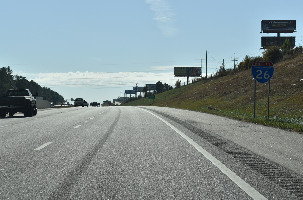
| Interstate 26 east leaves Cayce by a growing industrial park area to the Calhoun County line. 11/21/21 |
|
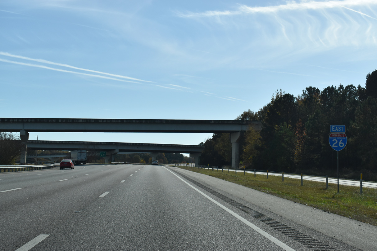
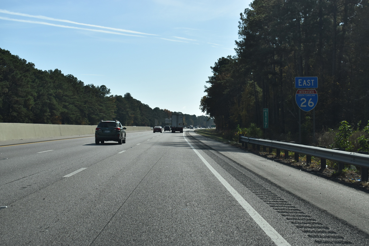
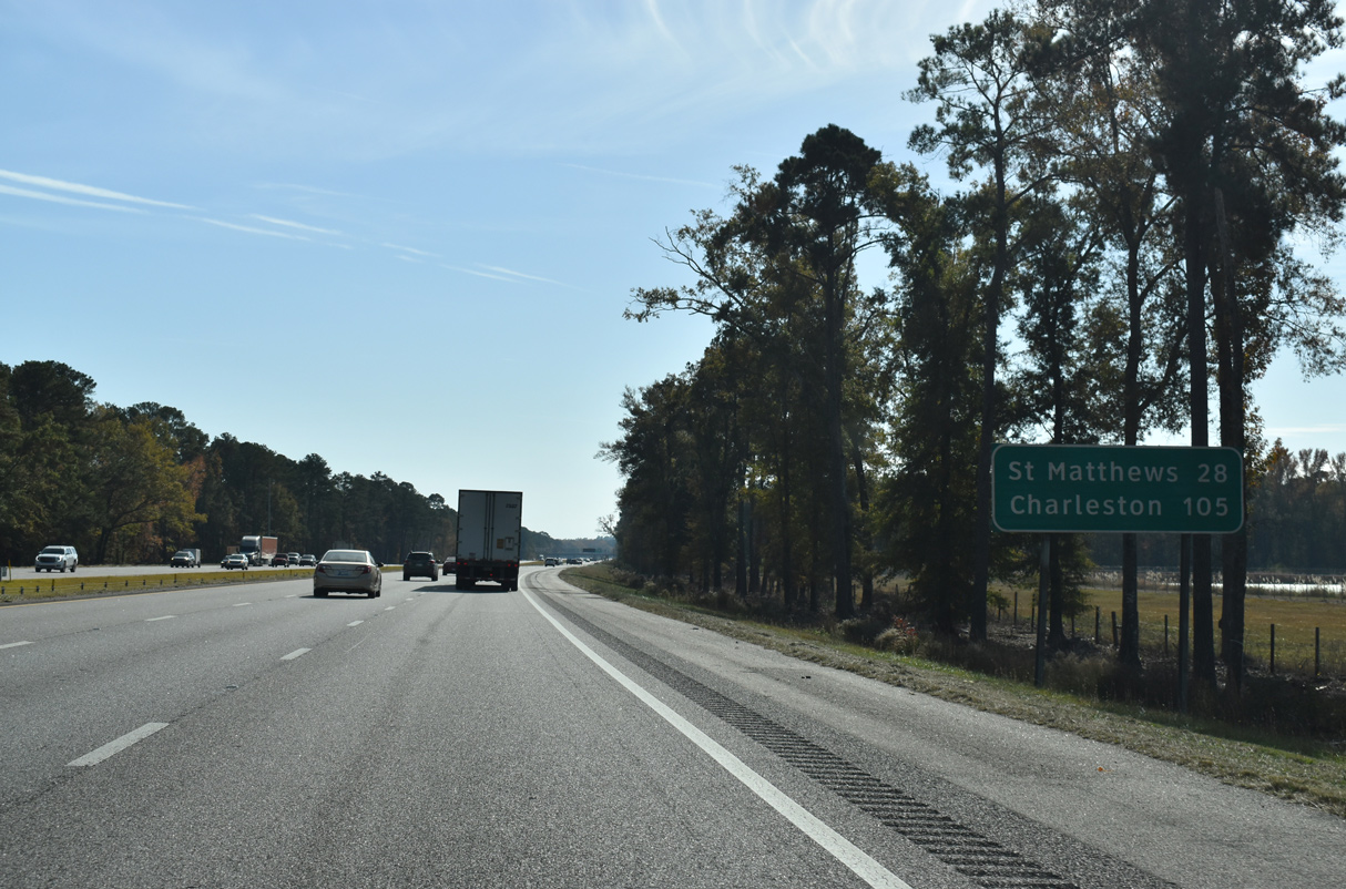
| Leaving the Columbia metropolitan area, Interstate 26 continues 105 miles to Charleston. St. Matthews, the Calhoun County seat, is located 28 miles ahead via Exit 136 and S.C. 6 east. 11/21/21 |
|
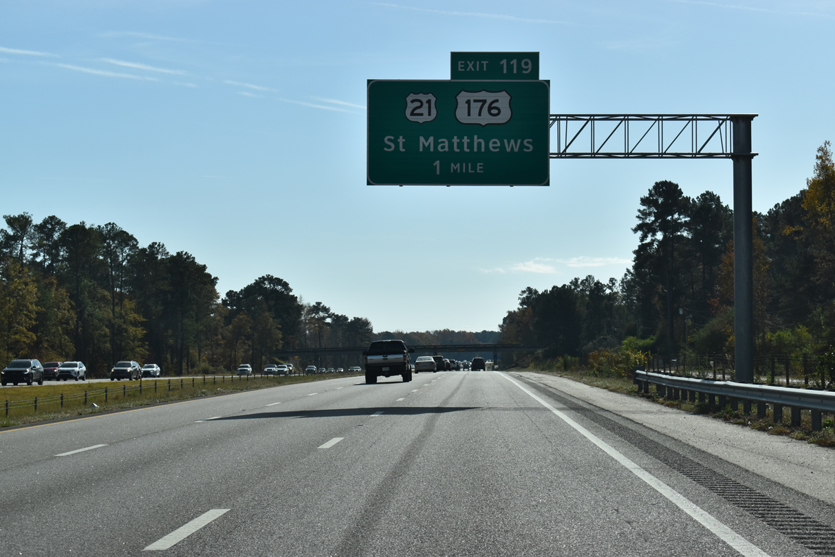
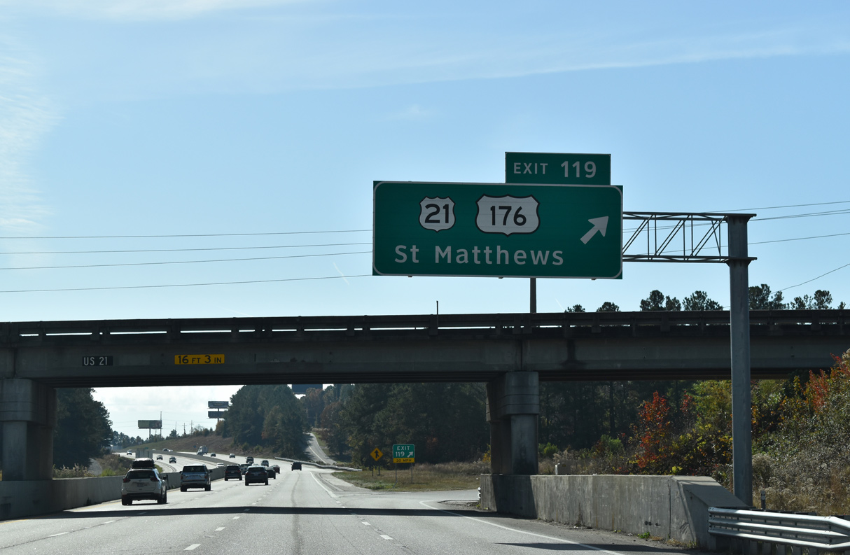
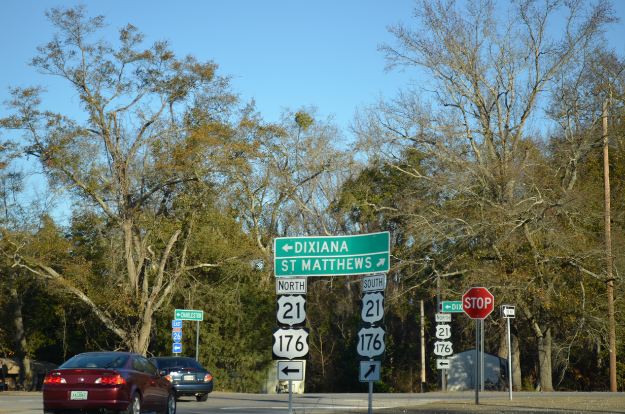
| U.S. 21/176 (Charleston Highway) converge with I-26 again at Exit 119, 1.8 miles south of the split with U.S. 321. U.S. 21/176 continue seven miles south to partition near Sandy Run. 11/21/21 |
|
| U.S. 176 meets Interstate 26 for the final time at Exit 119, 26 miles from Saint Matthews. U.S. 176 parallels I-26 southward to U.S. 52 at Goose Creek. 11/21/21 |
|
| Dixiana lies north of the parclo B2 interchange (Exit 119) with I-26 along U.S. 21/176 (Charleston Highway). 01/03/14 |
|
| U.S. 21/176 line the east side Interstate 26 for a mile before diverging to Savany Hunt Creek Road (Road 86). 11/21/21 |
|
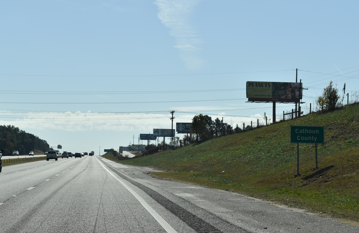
| Interstate 26 leaves Lexington County and enters northwestern Calhoun County east of Sand Mountain. 11/21/21 |
Page Updated 12-31-2021.


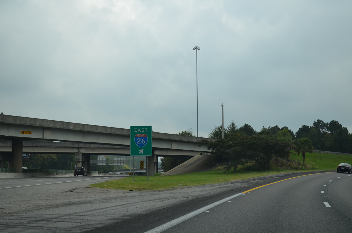
 East
East