|
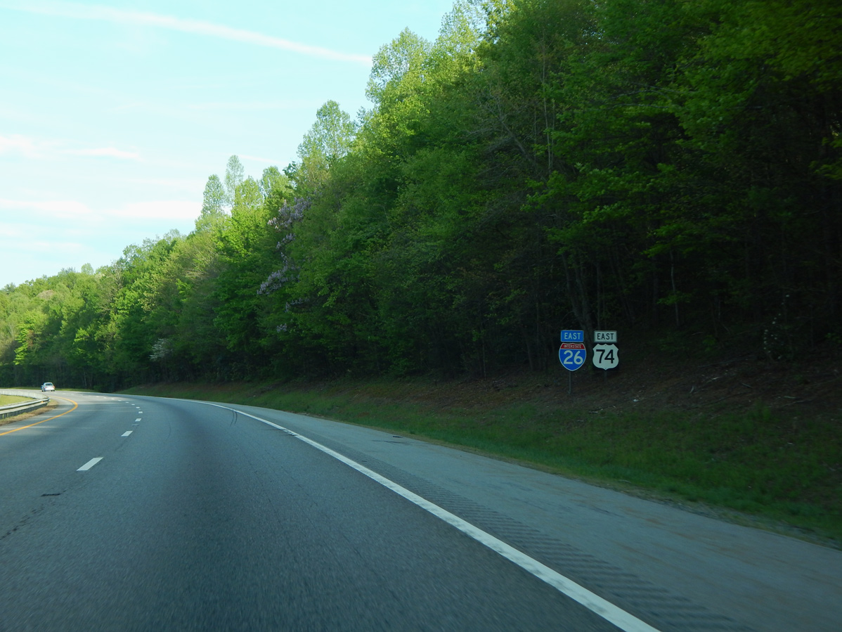
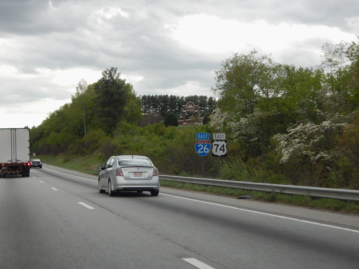
| I-26/U.S. 74 combine one mile ahead of a parclo B2 interchange (Exit 33) with NC 191 (Brevard Road). 04/22/17 |
|
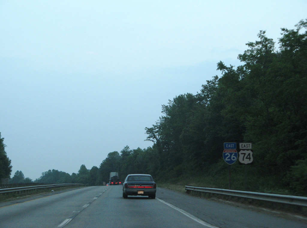
| Interstate 26 and U.S. 74 overlap for 36 miles from Asheville southeast to Columbus. 12/31/13 |
|
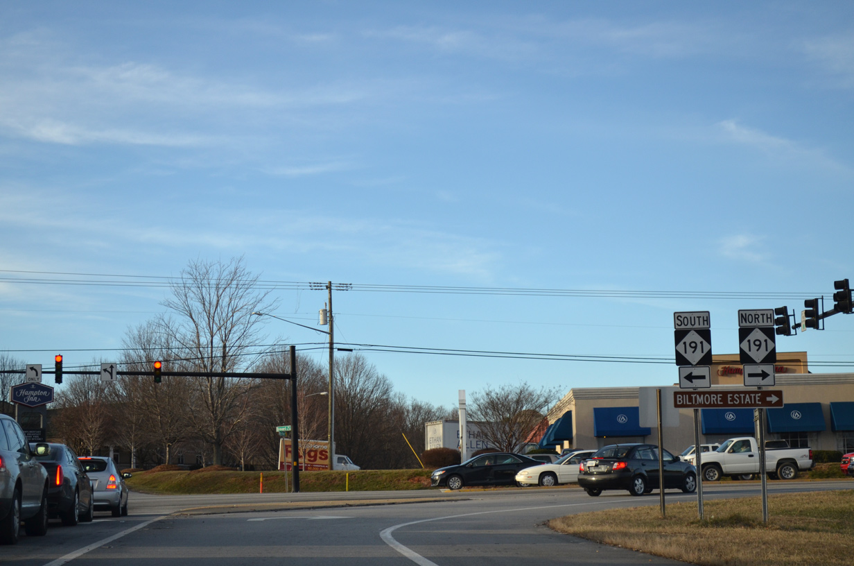
| NC 191 (Brevard Road) parallels I-26 southward from West Asheville to Hendersonville through Avery Creek and Mills River. 04/22/17 |
|
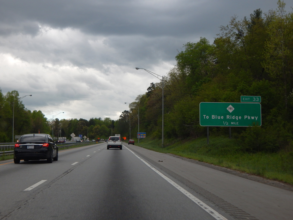
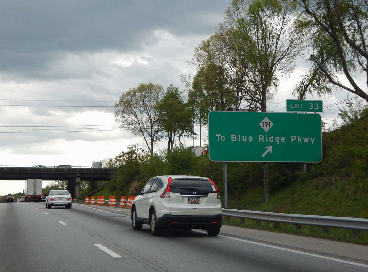
| NC 191 (Brevard Road) connects I-26/U.S. 74 with Blue Ridge Parkway in 2.4 miles. The exchange at Exit 33 was upgraded from Spring 2016 to Fall 2020. 04/22/17 |
|
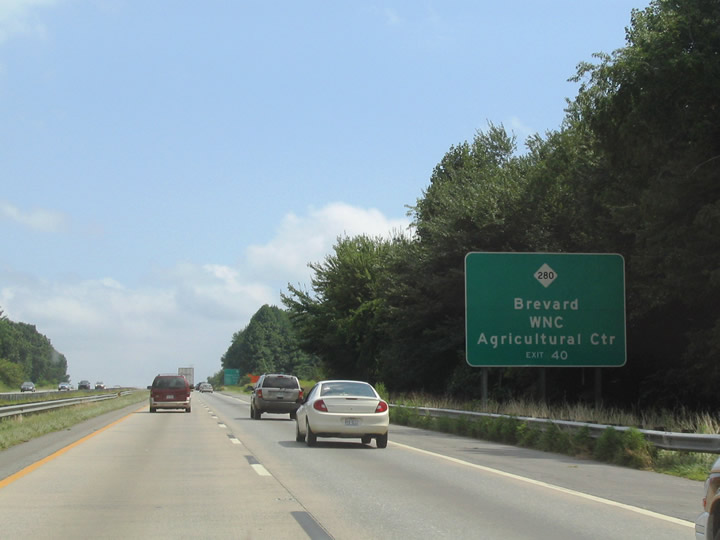
| NC 191 (Brevard Road) leads north to a number of industrial parks and the WNC Farmers Market at I-40. South from I-26, NC 191 passes through a retail area anchored by the Asheville Outlet to Bent Creek. 12/31/13 |
|
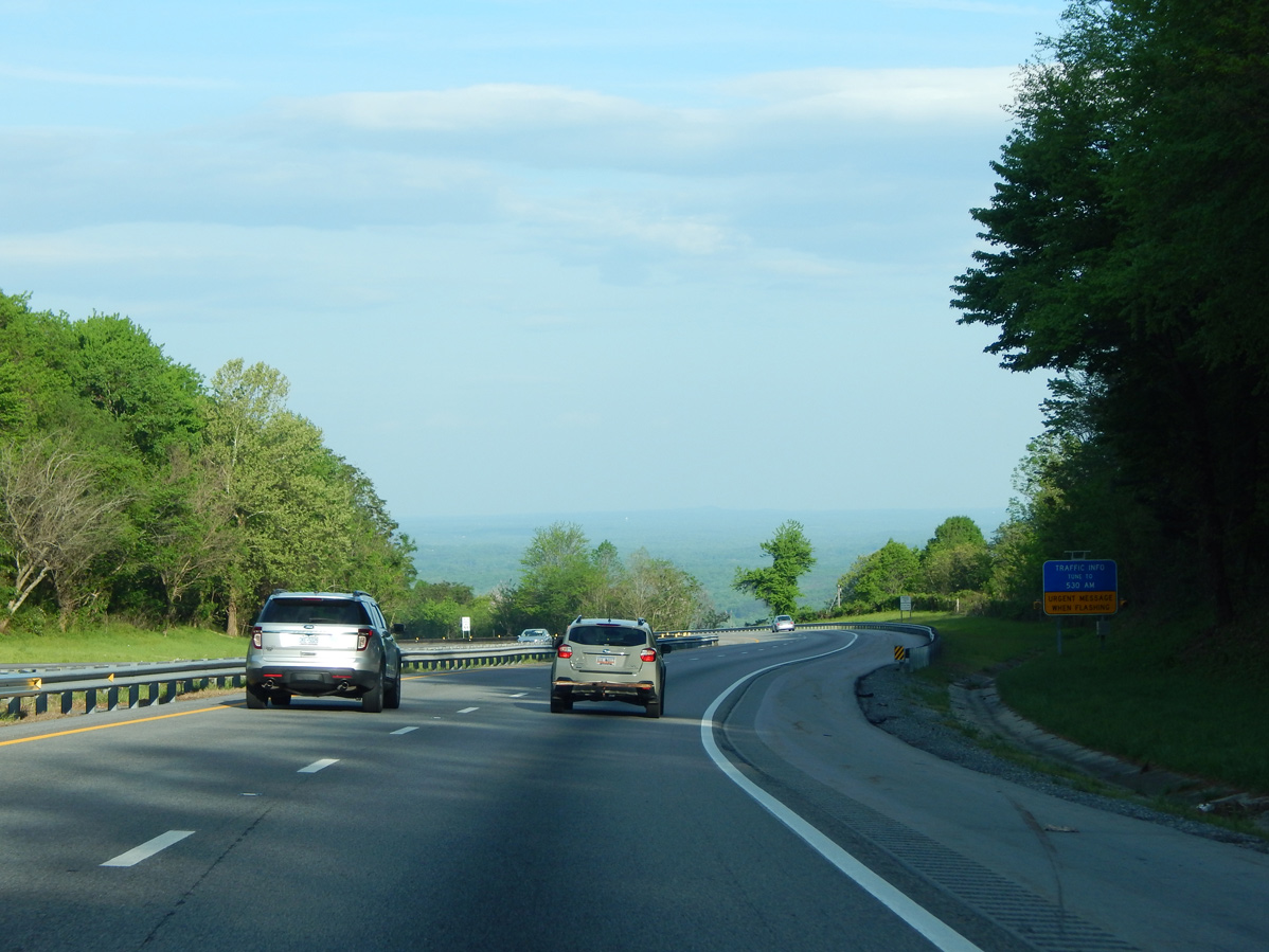
| Passing by Westerly Lake and Dellwood Lake, Interstate 26 lowers 200 feet in elevation to cross the French Broad River. 04/22/17 |
|
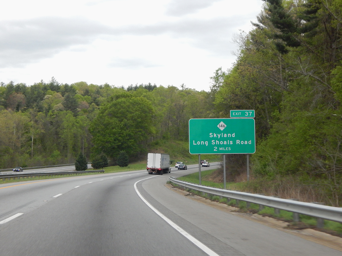
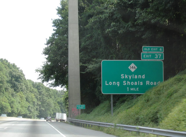
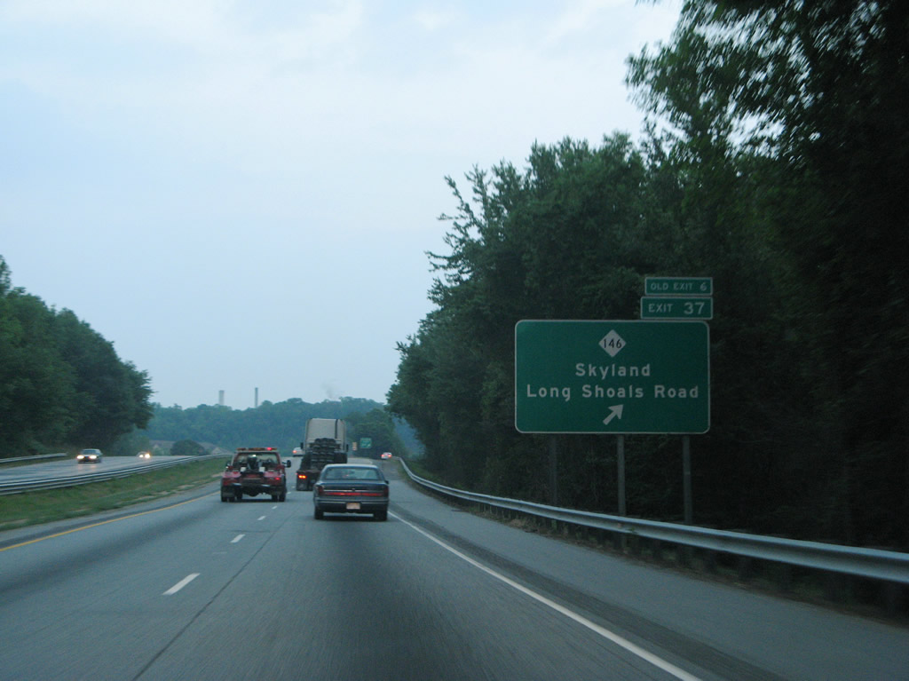
| The roadways of I-26/U.S. 74 diverge midway between the French Broad River and SPUI (Exit 37) with NC 146 (Long Shoals Road). 04/22/17 |
|
| I-26/U.S. 74 pass below the high overpass for the Blue Ridge Parkway one mile from NC 146 (Long Shoals Road). 2019-24 widening of I-26 from four to eight lanes includes replacing the Blue Ridge Parkway bridge. 08/15/04 |
|
| NC 146 (Long Shoals Road) is a 3.48 mile long route joining I-26/U.S. 74 with NC 191 (Brevard Road) at Avery Creek to the west and U.S. 25 (Hendersonville Road) at Arden to the east. 05/31/07 |
|
| I-26/U.S. 74 runs alongside the French Broad Rive from Long Shoals south to Glen Bridge Road (SR 3495). 05/31/07 |
|
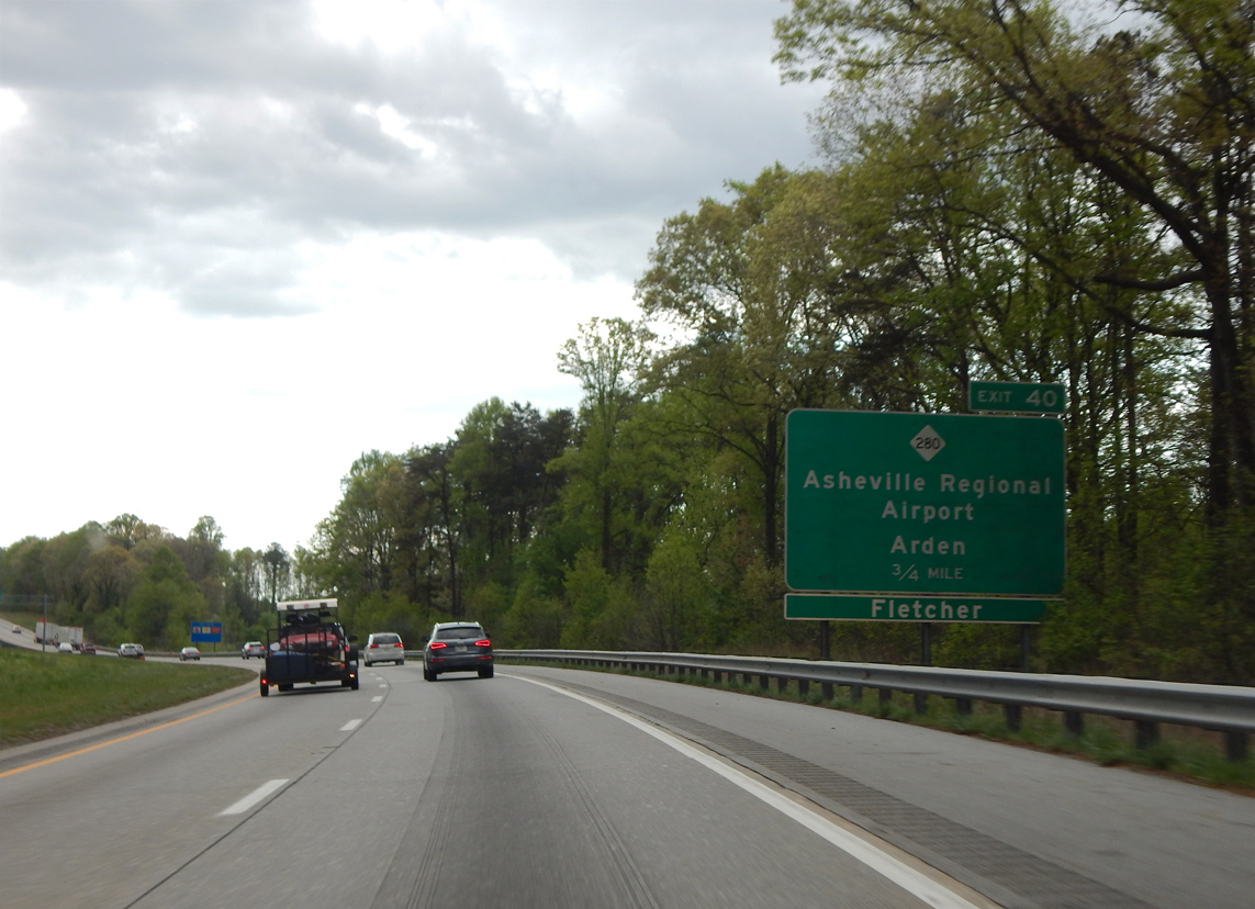
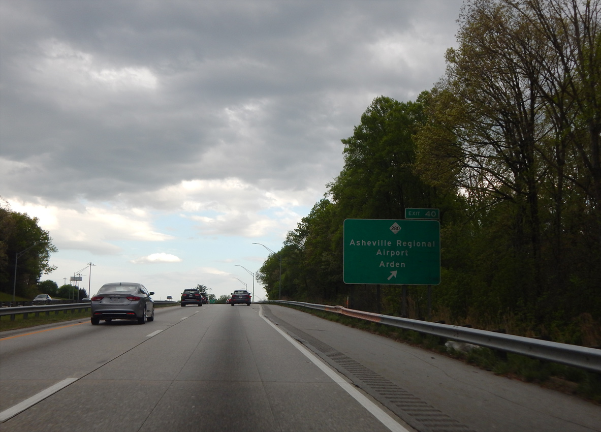
| I-26/U.S. 74 east meet NC 280 (New Airport Road) in 1.50 miles by Southridge Shopping Center and Asheville Regional Airport (AVL). 08/15/04 |
|
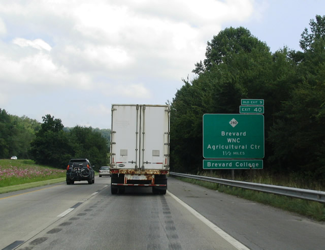
| Construction from May 2014 to November 2016 reconfigured the diamond interchange (Exit 40) with NC 280 into a DDI. 04/22/17 |
|
| NC 280 travels southwest from Exit 40 to the town of Mill River and U.S. 64/276 at the Transylvania County seat of Brevard. 08/15/04 |
|
| Exit 40 leaves I-26/U.S. 74 east for NC 280 (New Airport Road) south to adjacent Asheville Regional Airport (AVL) and the WNC Agricultural Center. NC 280 concludes 3.75 miles to the northeast at U.S. 25 and U.S. 25A (Sweeten Creek Road) in Arden. 04/22/17 |
|
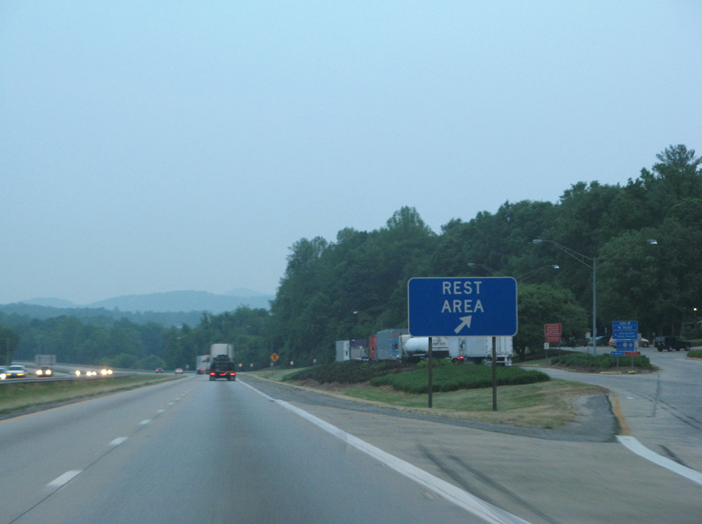
| I-26/U.S. 74 straddle the Buncombe and Henderson County line south to a set of rest areas. 05/31/07 |
|
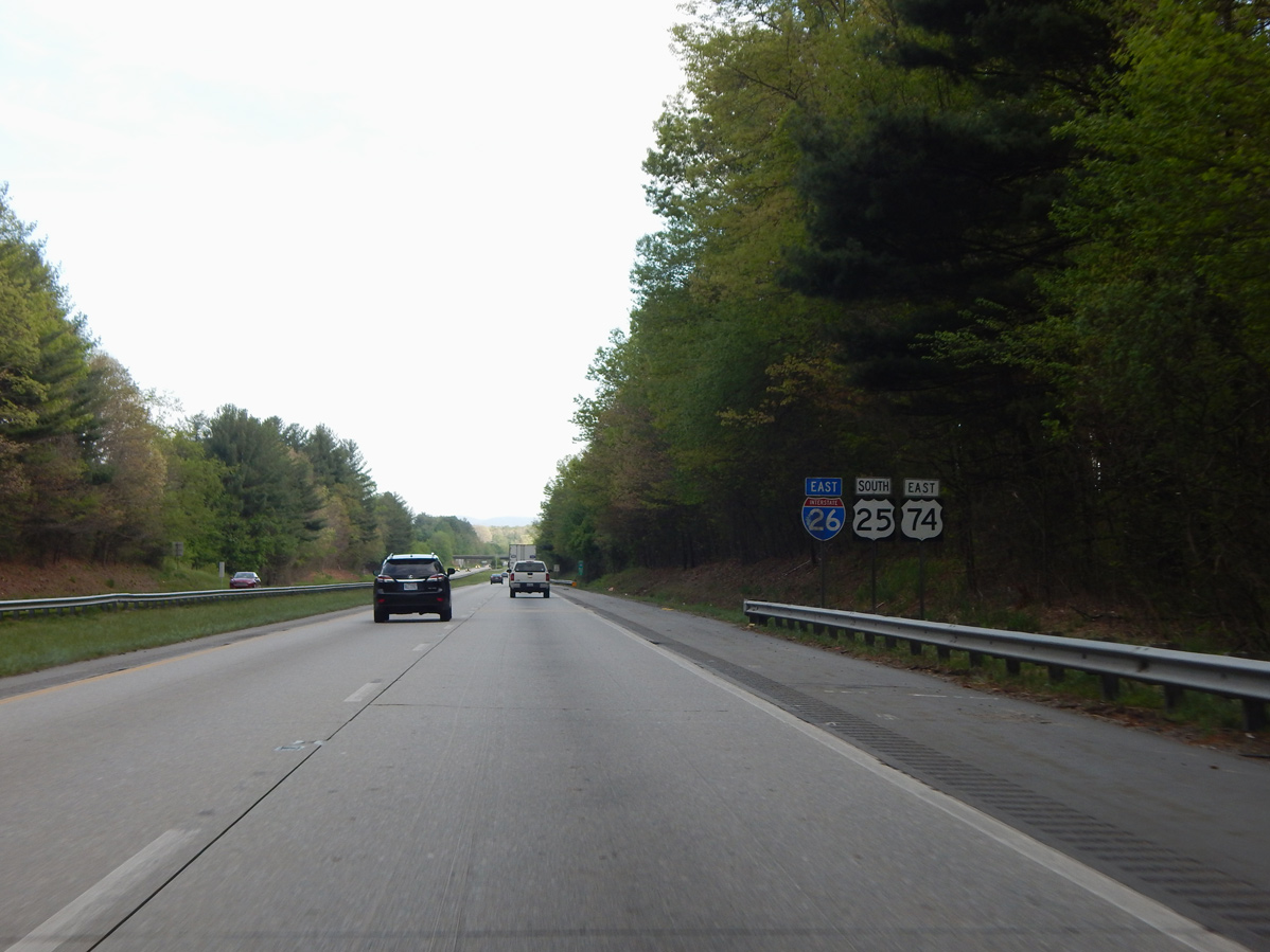
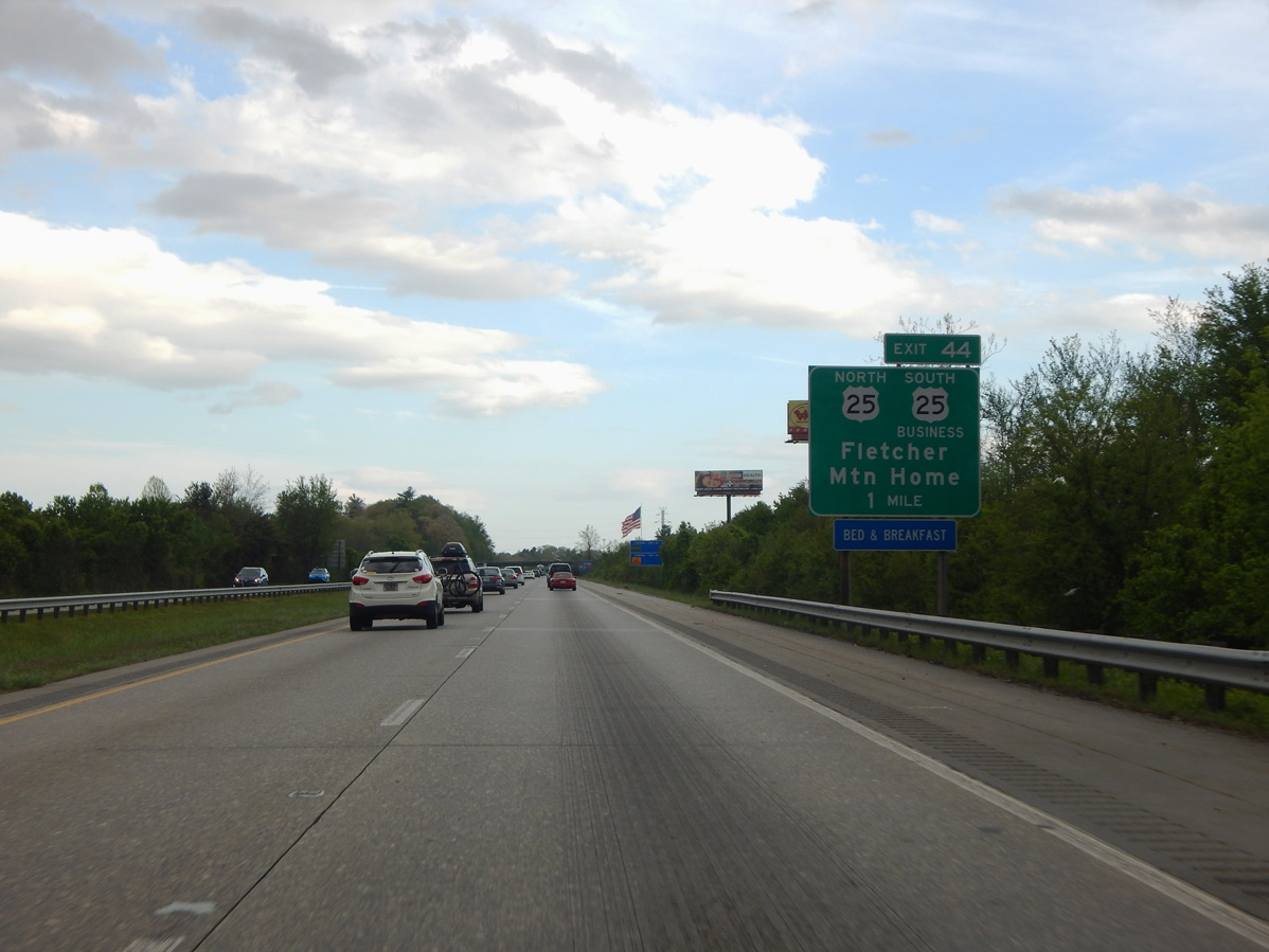
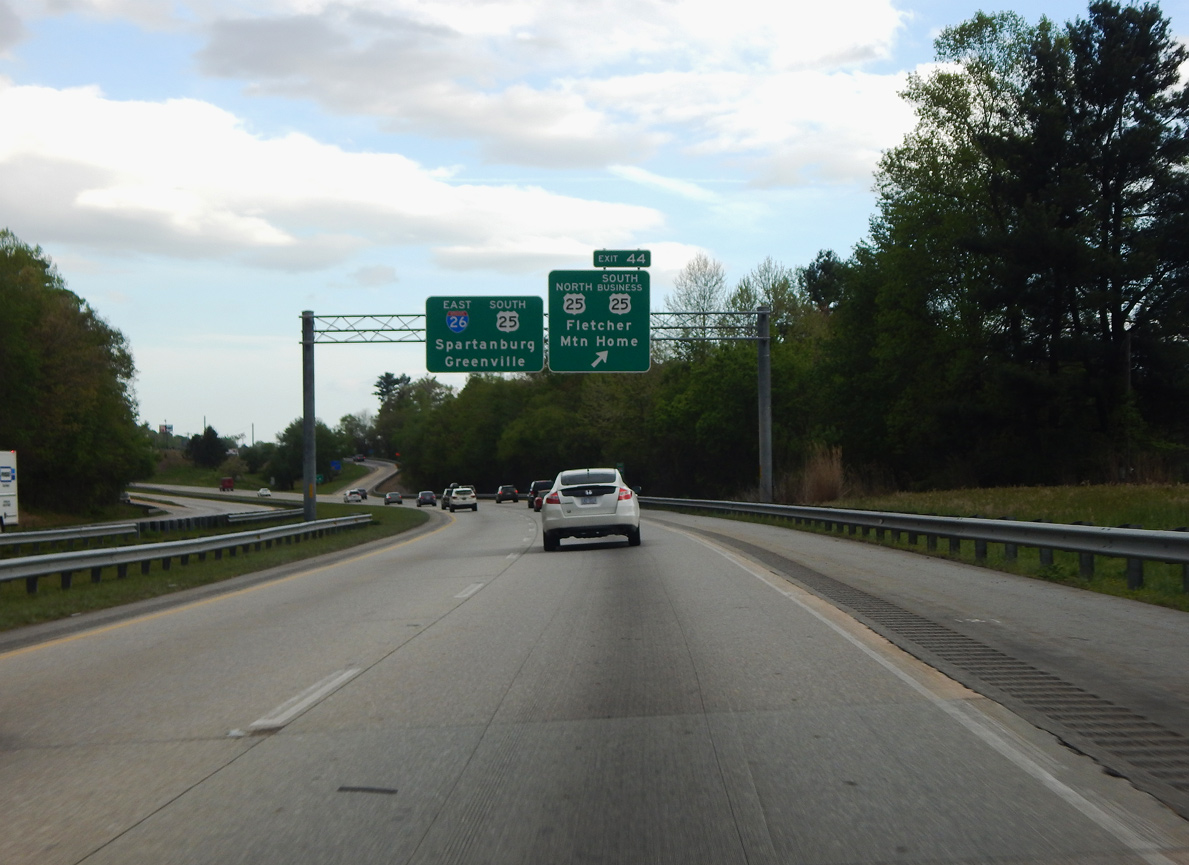
| U.S. 25 (Asheville Highway) south converges with I-26/U.S. 74 from the town of Fletcher at Exit 44. 2019-24 widening of I-26 reconfigures the diamond interchange with U.S. 25/25 Business into a DDI. 04/22/17 |
|
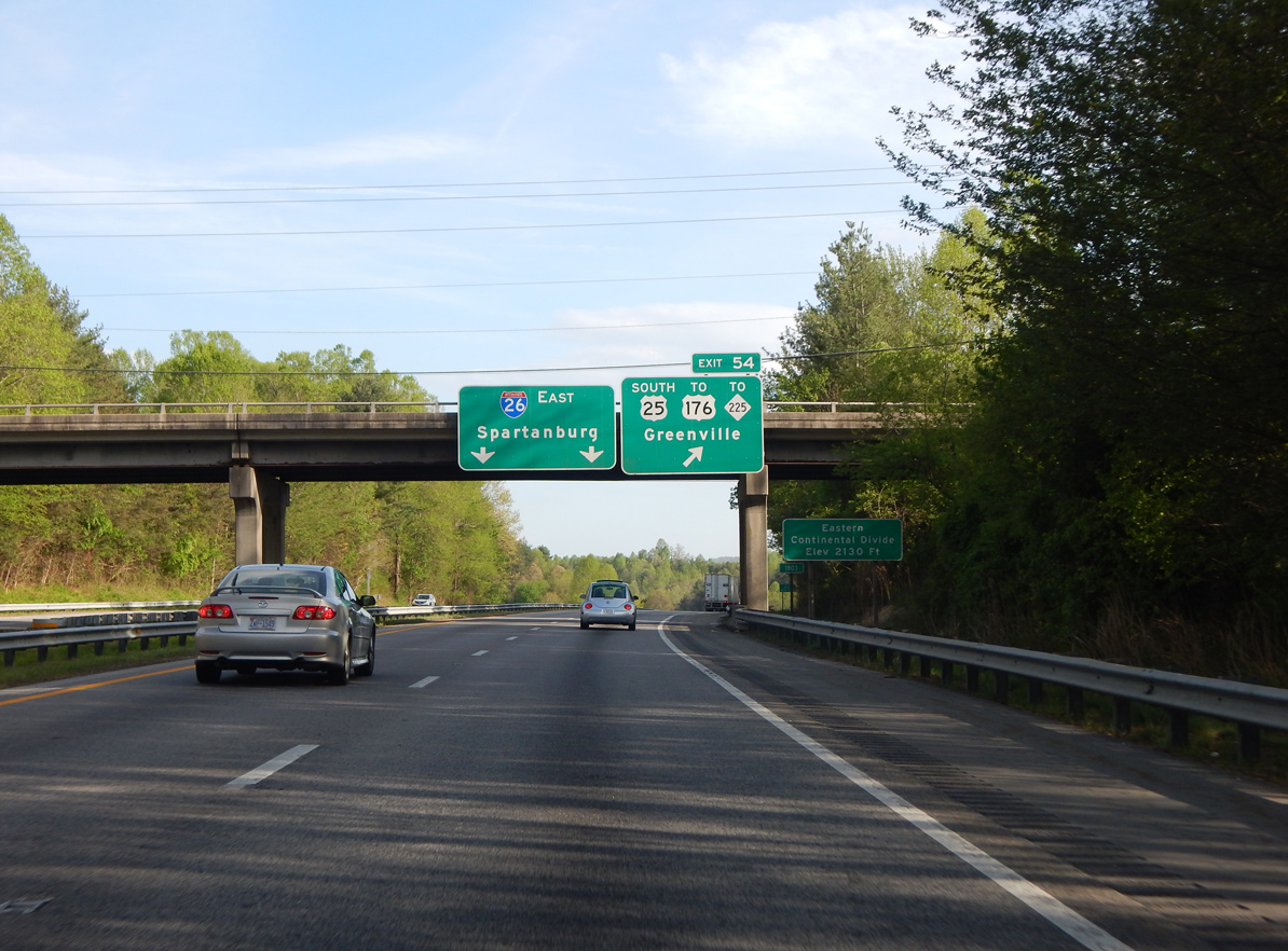
| U.S. 25 combines with I-26 to bypass Hendersonville to Exit 54 while U.S. 25 Business follows the pre-2004 route along Asheville Highway south to Mountain Home. 04/22/17 |
|
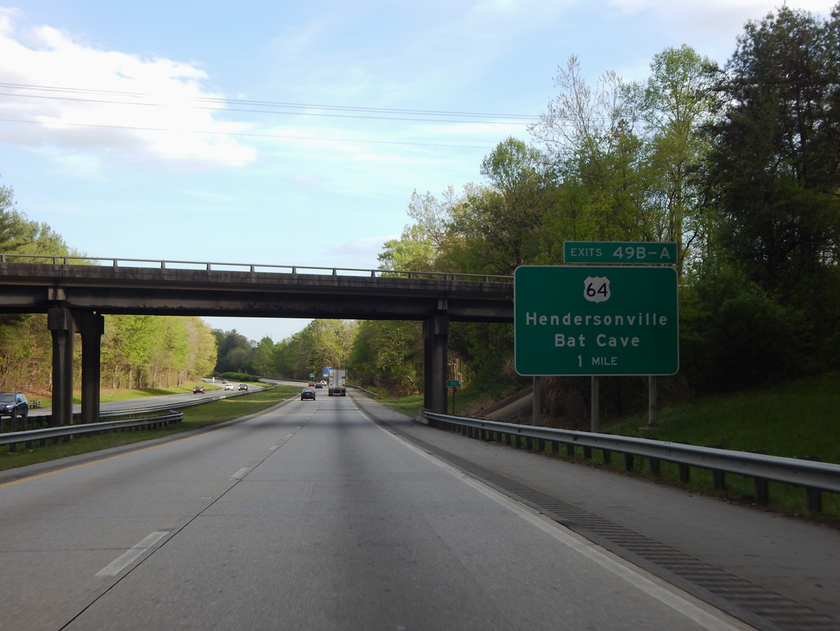
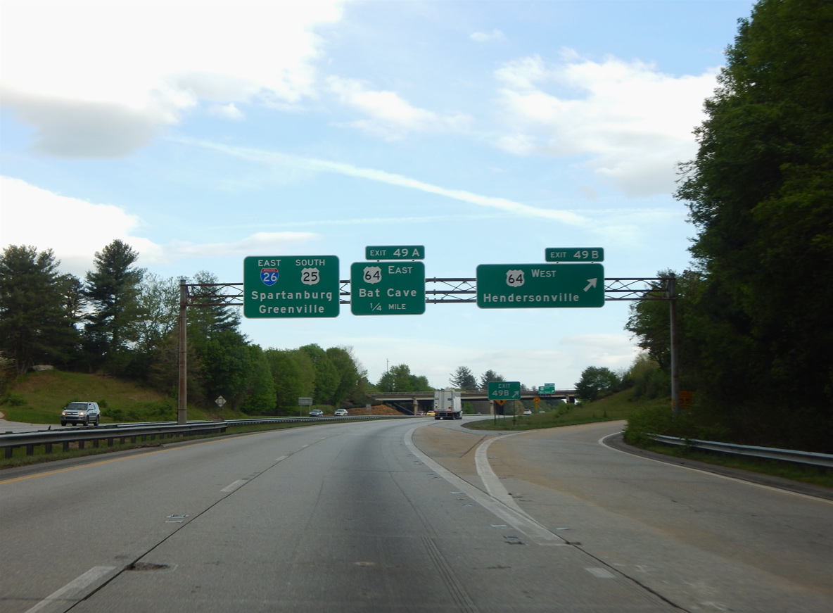
| Continuing south into the city of Hendersonville, I-26/U.S. 25-74 meet U.S. 64 at Exit 49. Six lane expansion of I-26 rebuilds the cloverleaf at Exit 49 into a six-ramp parclo interchange. 04/22/17 |
|
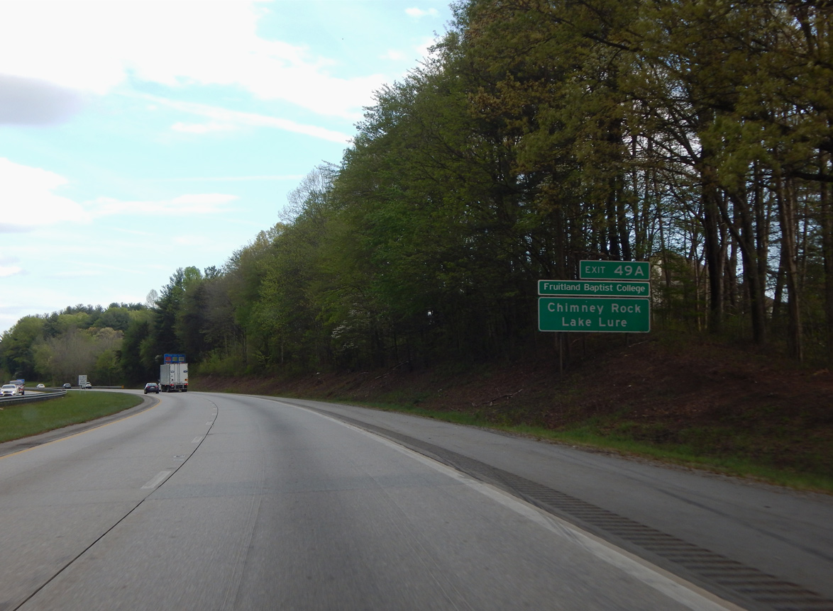
| U.S. 64/74A-NC 9 combine east 2.7 miles from Bat Cave to Chimney Rock and 5.8 miles to Lake Lure. 04/22/17 |
|
| U.S. 64 (Four Seasons Boulevard) runs southwest from Exit 49 B to Downtown Hendersonville and 21 miles to U.S. 276/NC 280 at Brevard. 04/22/17 |
|
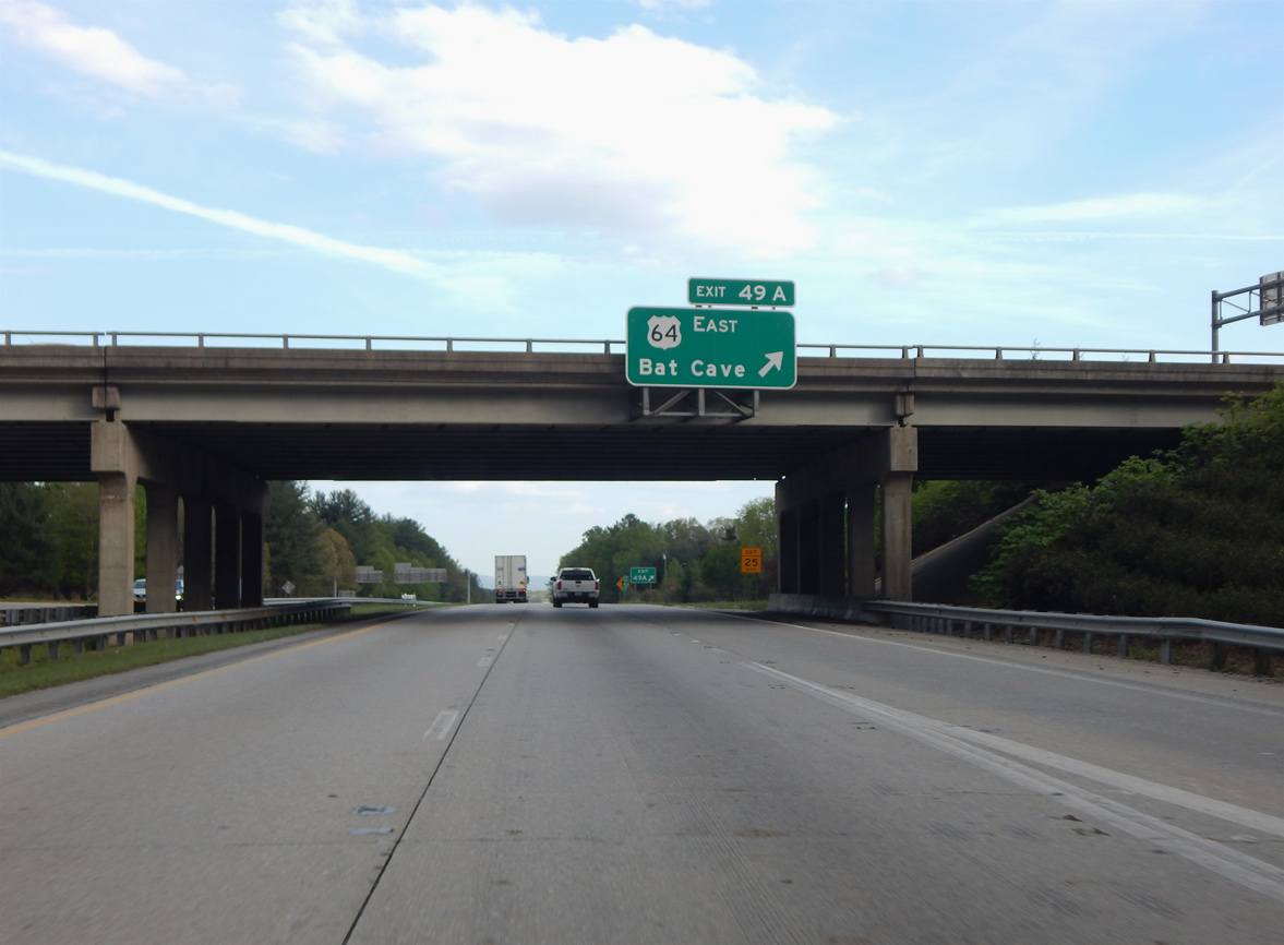
| U.S. 64 (Chimney Rock Road) travels 12.5 miles northeast from Exit 49 A to U.S. 74A/NC 9 at Bat Cave. 04/22/17 |
|
| U.S. 25 south continues with I-26/U.S. 74 east another 4.3 miles from U.S. 64. 04/22/17 |
|
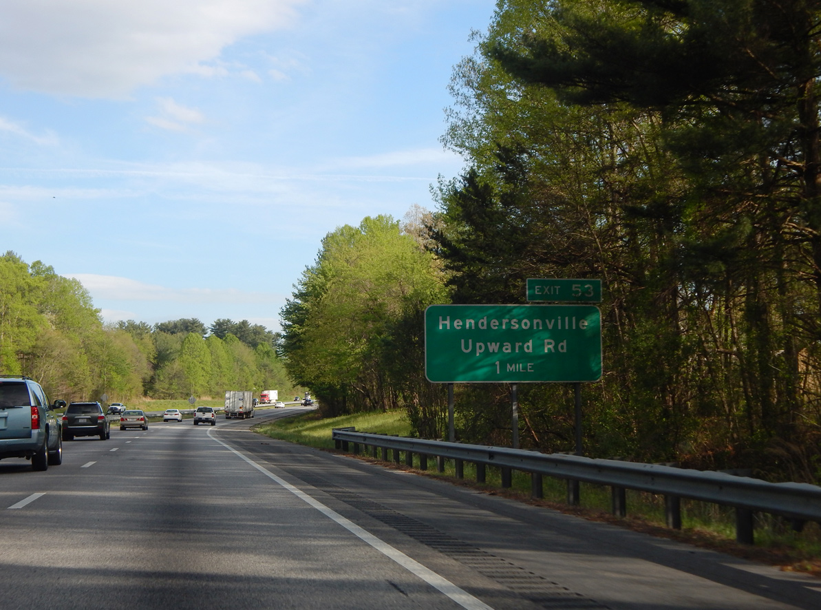
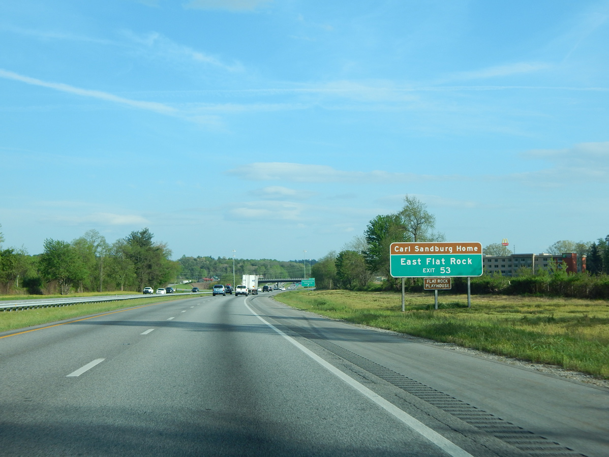
| A diamond interchange (Exit 53) joins I-26/U.S. 25-74 with Upward Road (SR 1783) in one mile. 04/22/17 |
|
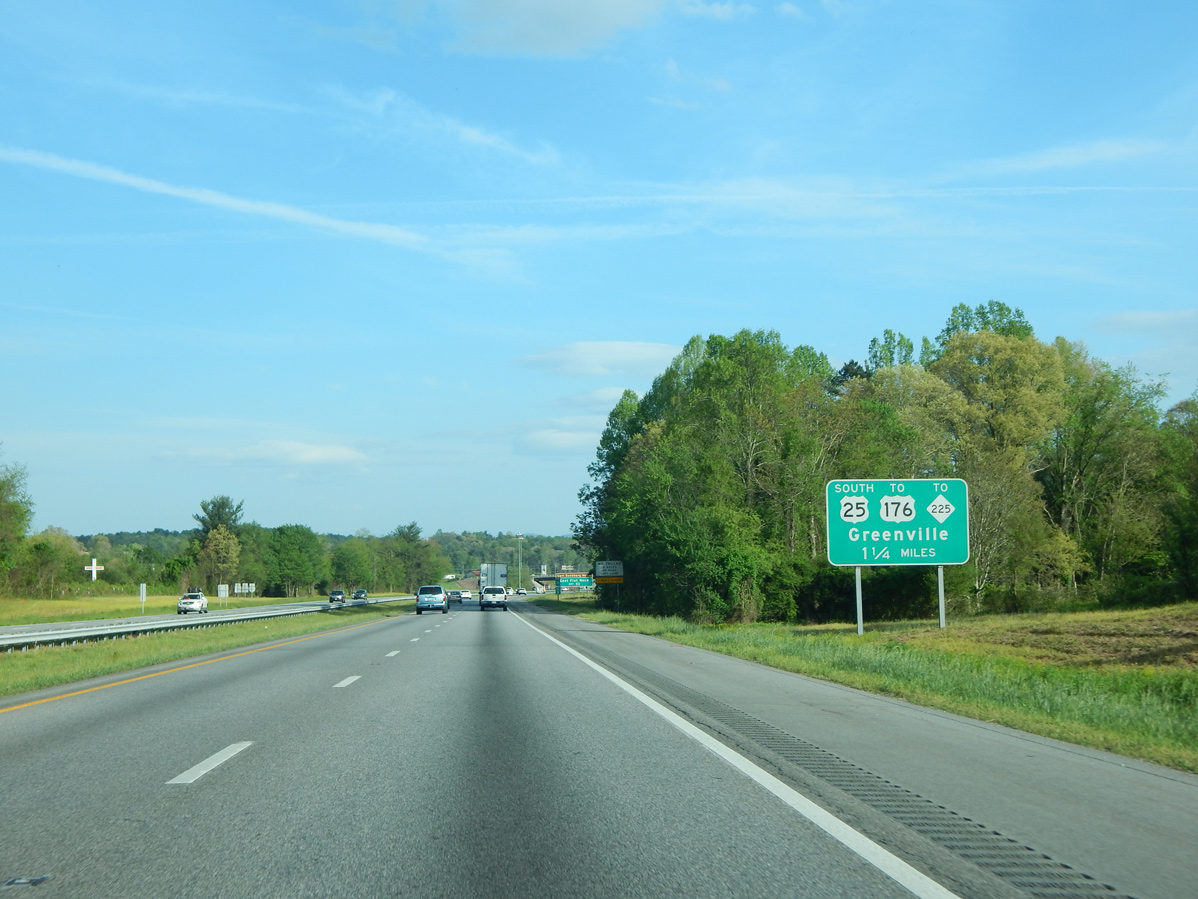
| U.S. 25 separates with I-26/U.S. 74 east at the succeeding exit beyond Upward Road. Prior to 2004, the freeway bypass of East Flat Rock was part of NC 225. 04/22/17 |
|
| Upward Road (SR 1783) heads 1.31 miles west from I-26/U.S. 25-74 to U.S. 176/25 Business (Spartanburg Highway) at N Highland Lake Road in East Flat Rock. 04/22/17 |
|
| Exit 53 departs I-26/U.S. 25-74 east for Upward Road (SR 1783). Upward Road arcs northeast into rural areas ahead of Dana. 04/22/17 |
|
| I-26/U.S. 74 reach the trumpet interchange (Exit 54) for U.S. 25 south at the Crest Road (SR 1803) and Eastern Continental Divide. U.S. 176 parallels I-26/U.S. 74 southeast to Saluda and Tryon. U.S. 25 connects with U.S. 176 at the south end of U.S. 25 Business nearby. 04/22/17 |
|
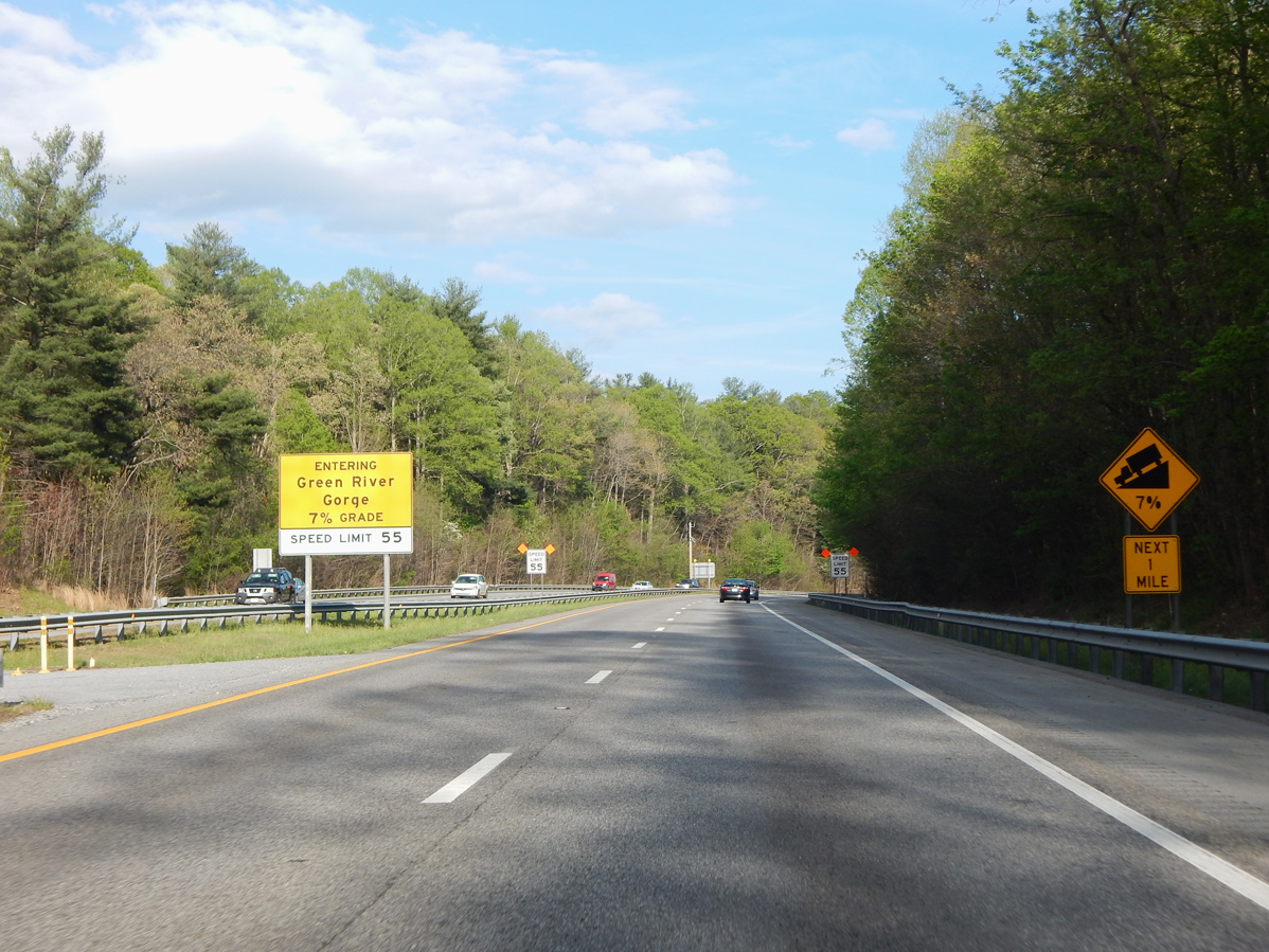
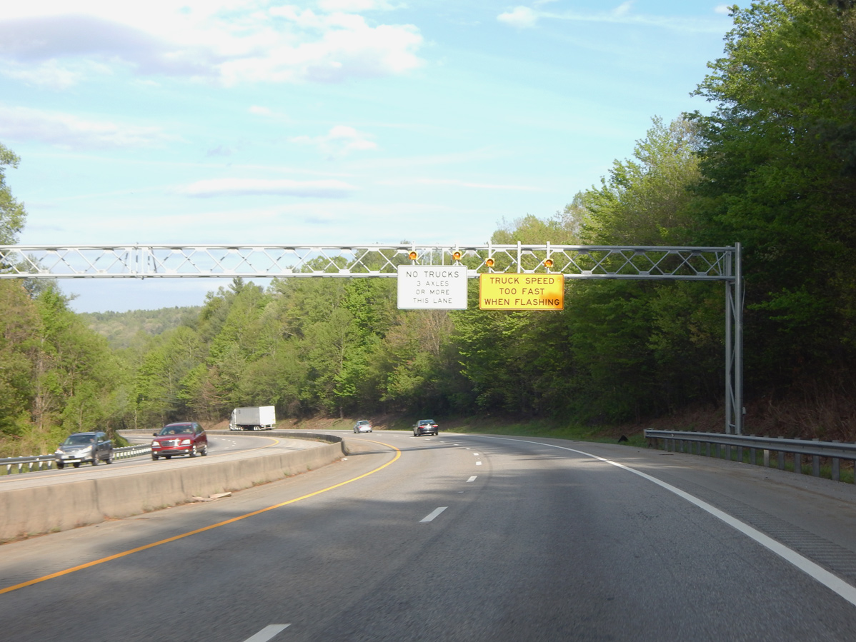
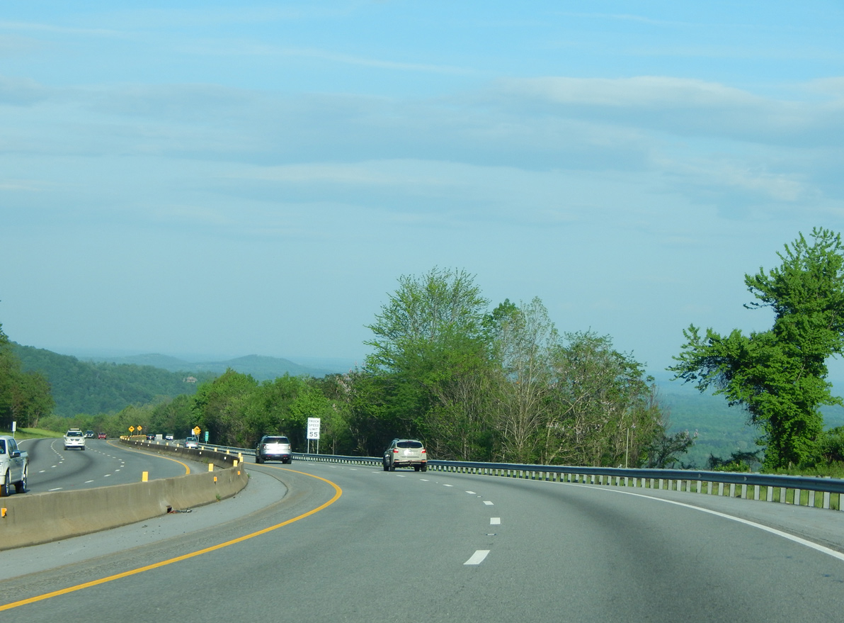
| I-26/U.S. 74 turn eastward by Dodging Hill into the Green River Gorge, where the freeway drops over 500 feet in elevation at a 7% grade. 04/22/17 |
|
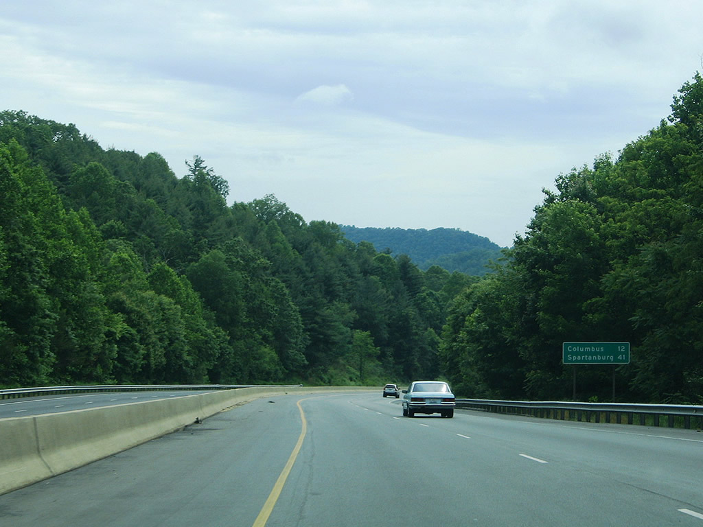
| The town of Columbus, where U.S. 74 splits with I-26, is 12 miles to the southeast. Spartanburg follows in 41 miles. 05/30/05 |
|
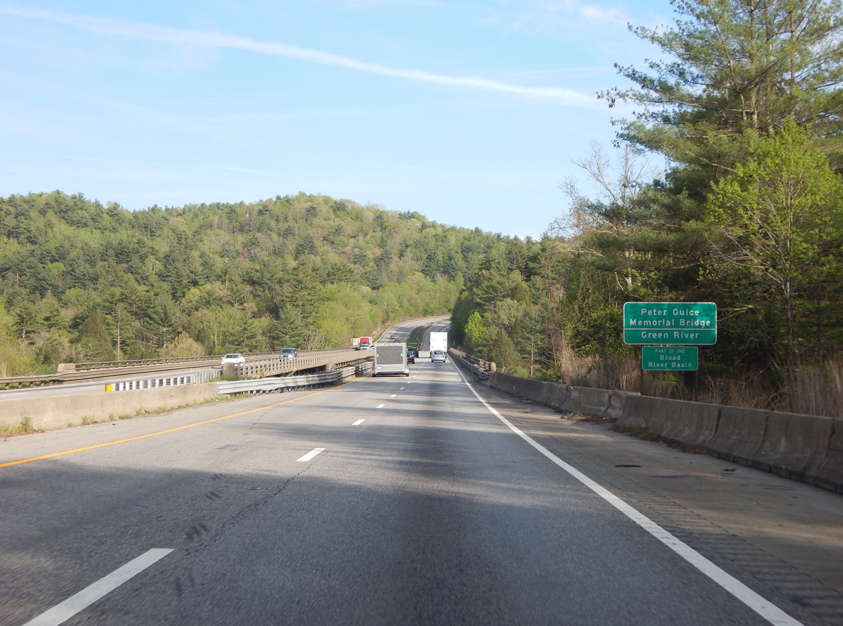
| Lowering to cross the Peter Guice Memorial Bridge across the Green River. These bridges opened to traffic in 1968. 04/22/17 |
|
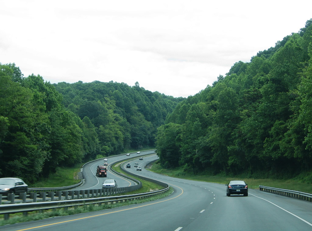
| Continuing the ascent from Green River Gorge along I-26/U.S. 74 east. 05/30/05 |
|
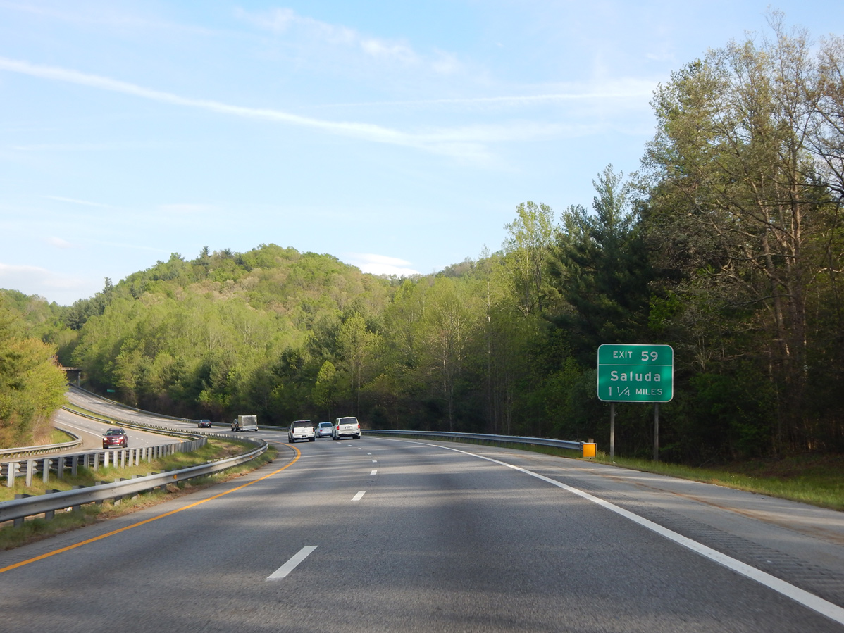
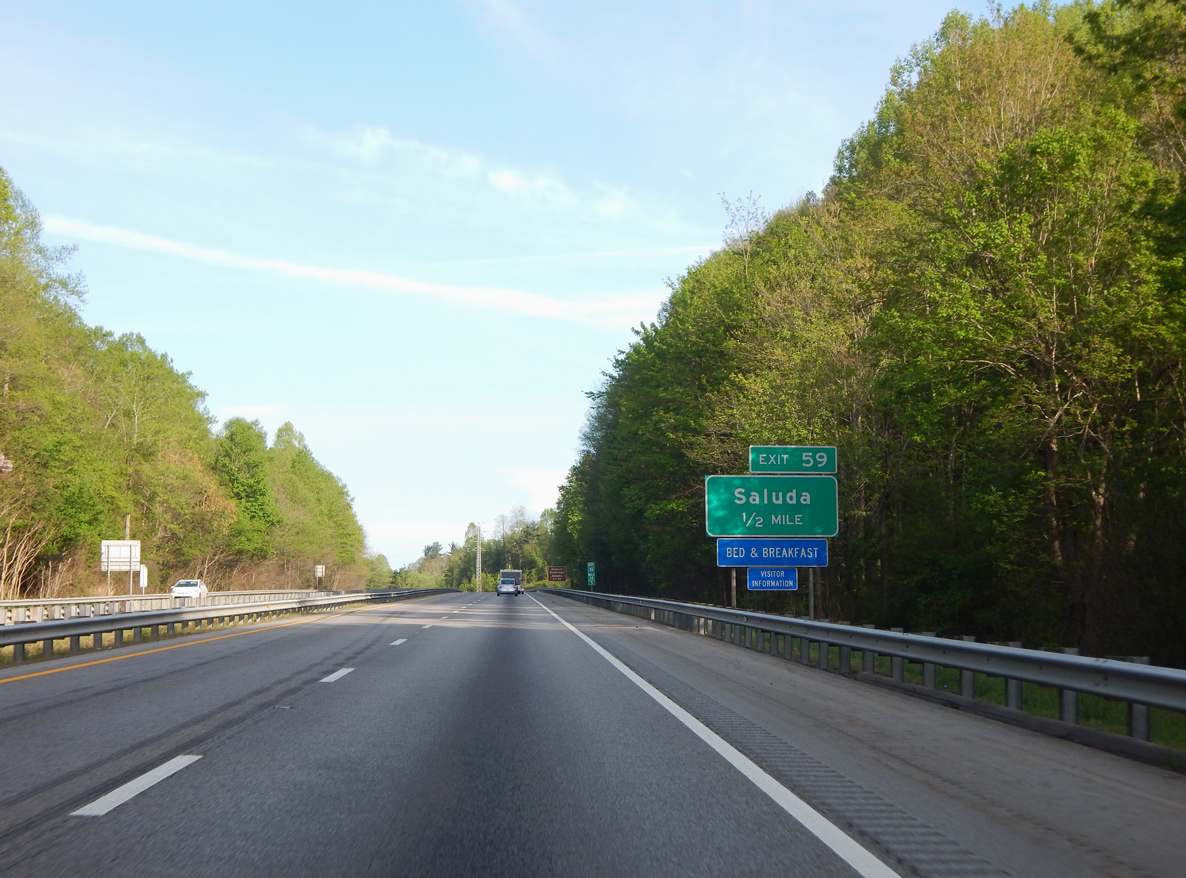
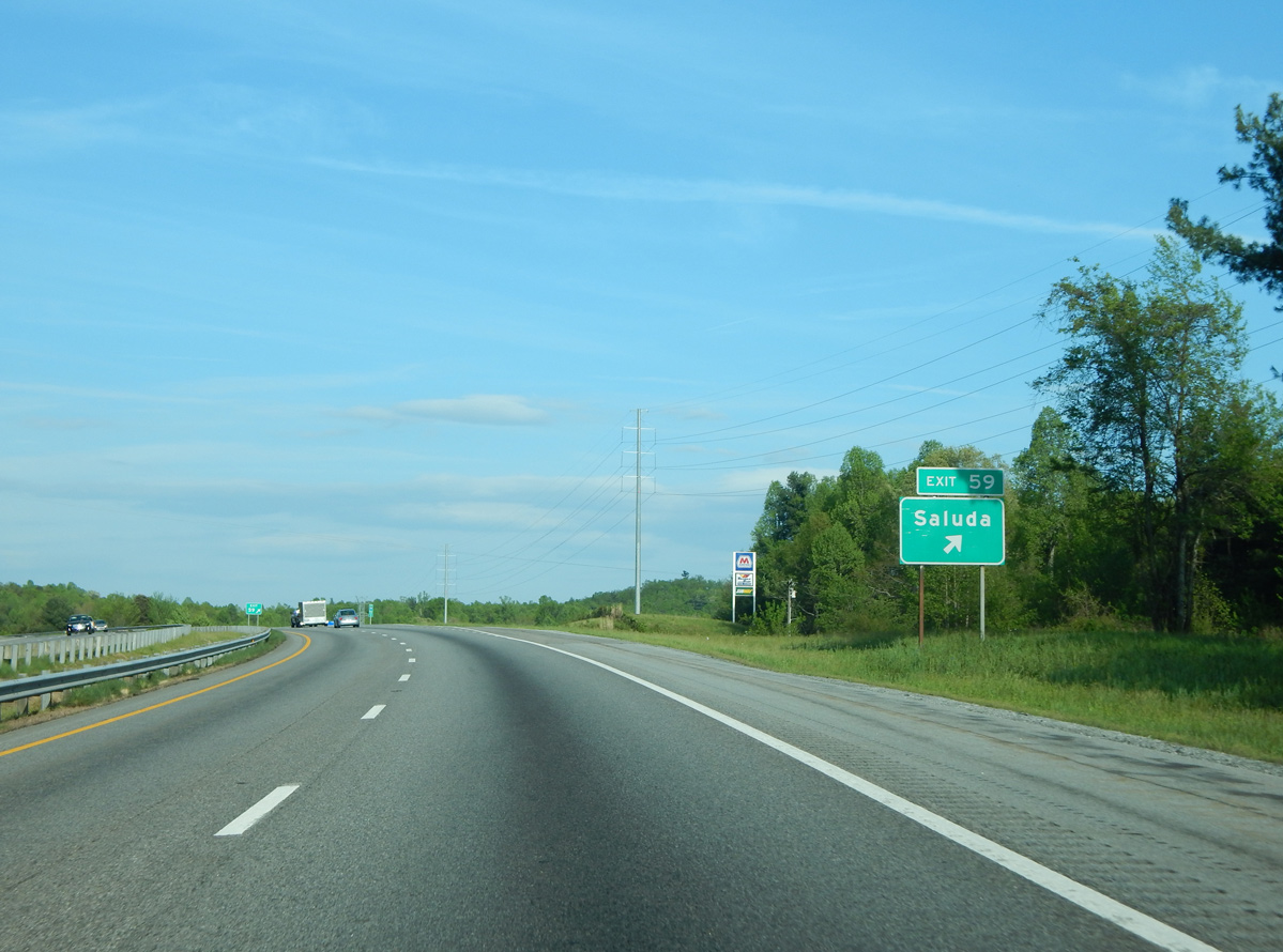
| Meeting the freeway at Exit 59 is Ozone Drive (SR 1142) 1.16 miles north of U.S. 176 (Main Street) in Saluda. 04/22/17 |
|
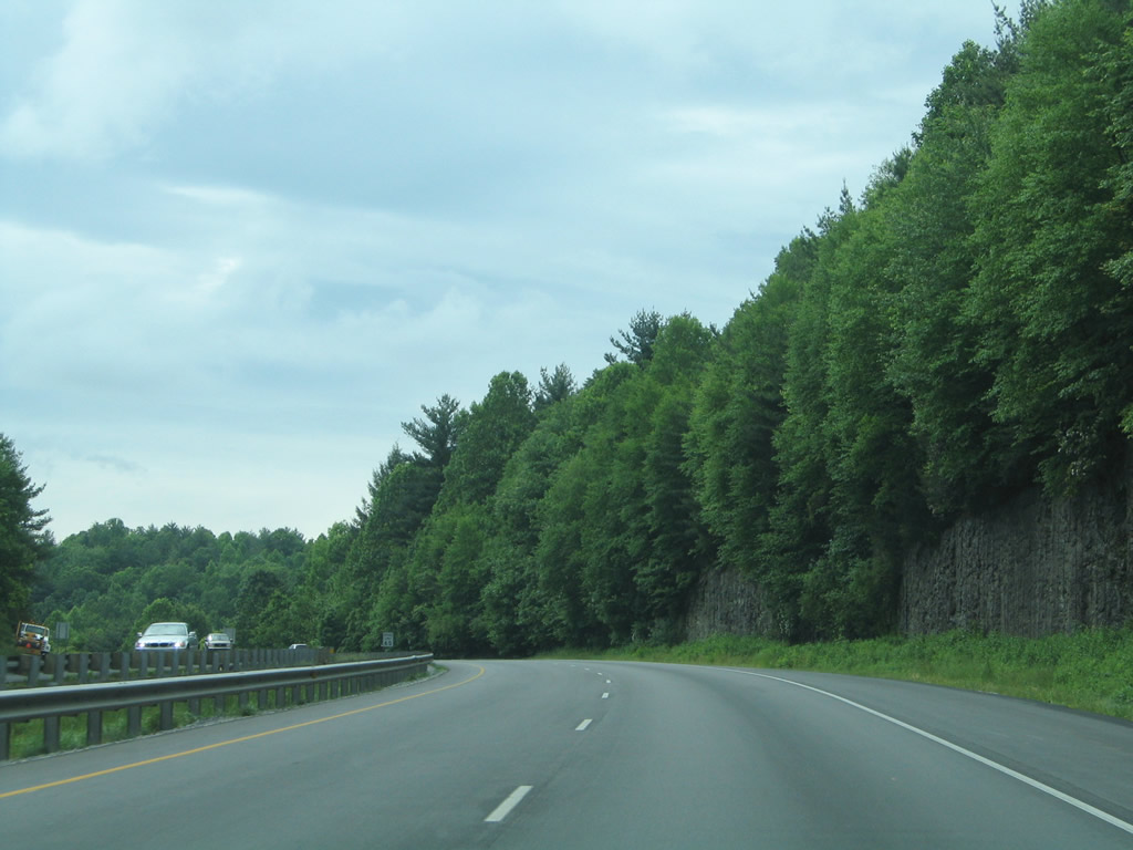
| I-26/U.S. 74 enter Polk County ahead of the Puzzle Gulley Road (SR 1183) overpass and town of Saluda. 05/30/05 |
|
| Holbert Cove Road continues SR 1142 northeast from Exit 59 to Brushy and Piney Mountains. 04/22/17 |
|
| Eastbound I-26/U.S. 74 at the diamond interchange (Exit 59) with Ozone Drive (SR 1142) to Historic Downtown Saluda. 04/22/17 |
|
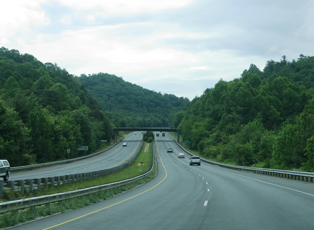
| Interstate 26 and U.S. 74 proceed east from the Ozone Drive entrance ramp 6.17 miles to their split. 04/22/17 |
|
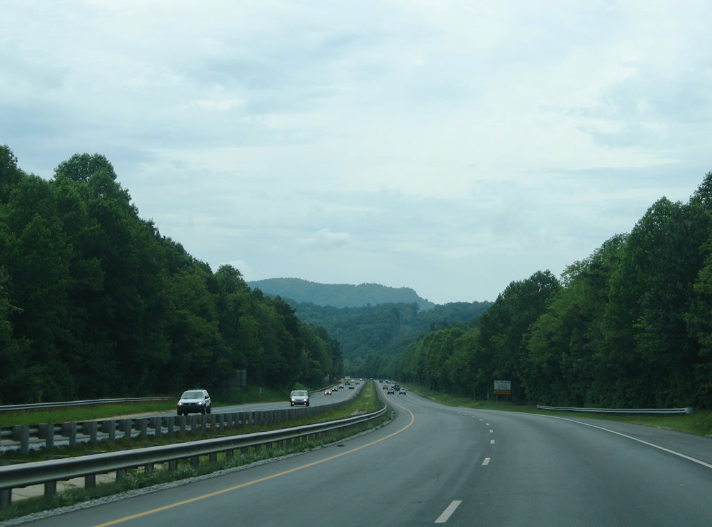
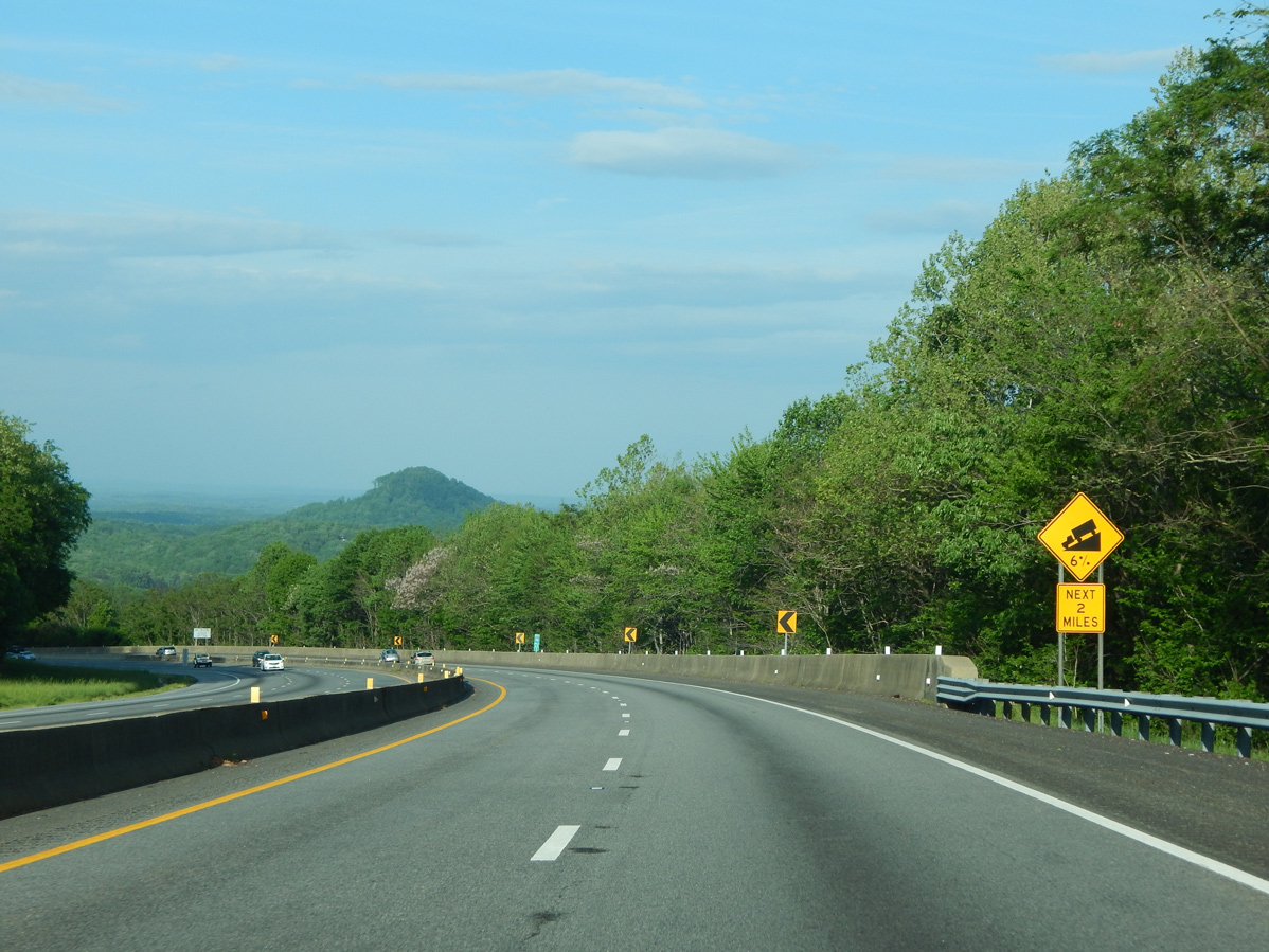
| Miller Mountain rises along the horizon as the I-26/U.S. 74 advance toward by Chestnut Mountain and Howard Gap. 05/30/05 |
|
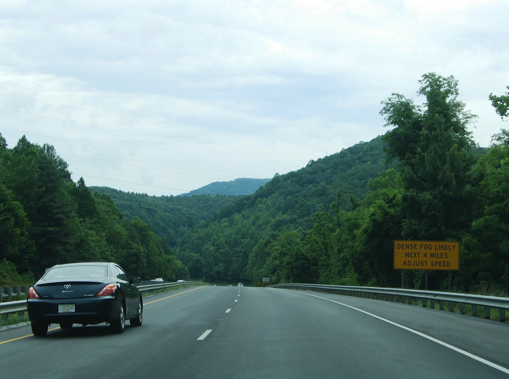
| The four mile stretch of I-26 between Miller and Round Mountains via Howard Gap is subject to frequent dense fog. 05/30/05 |
|
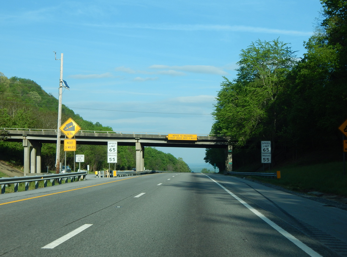
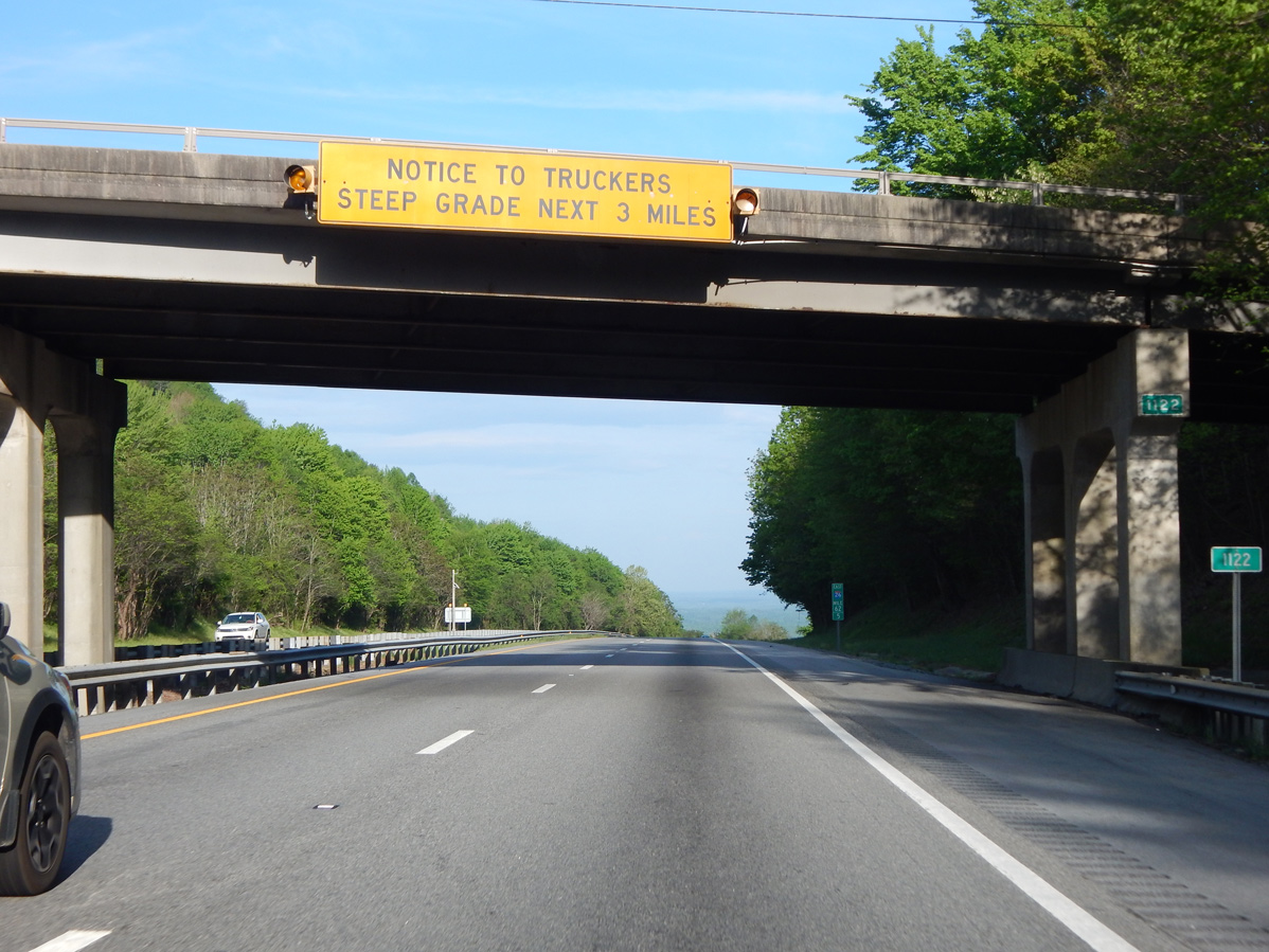
| Truckers along Interstate 26 encounter a 6% grade over the ensuing three miles east of the Indian Mountain Road (SR 1188) overpass at Howard Gap. 04/22/17 |
|
| I-26/U.S. 74 emerge from Howard Gap south of Miller Mountain. The North Pacolet River valley opens to the east as the freeway drops 600 feet from Howard Gap to Columbus. 04/22/17 |
|
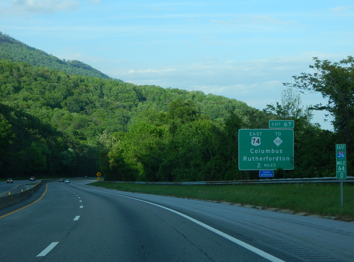
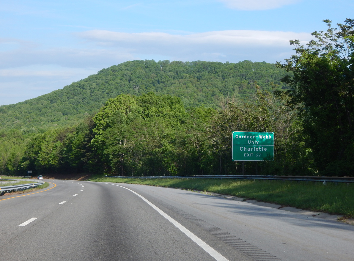
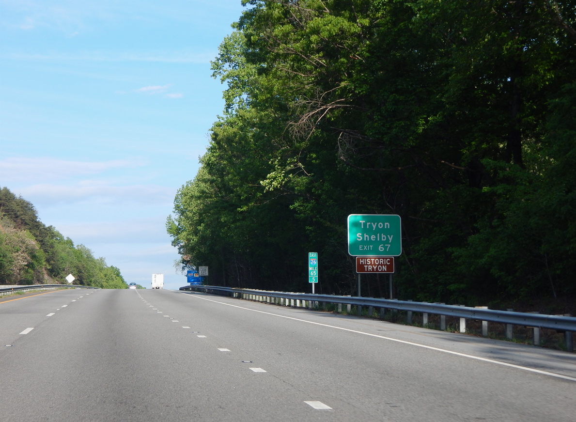
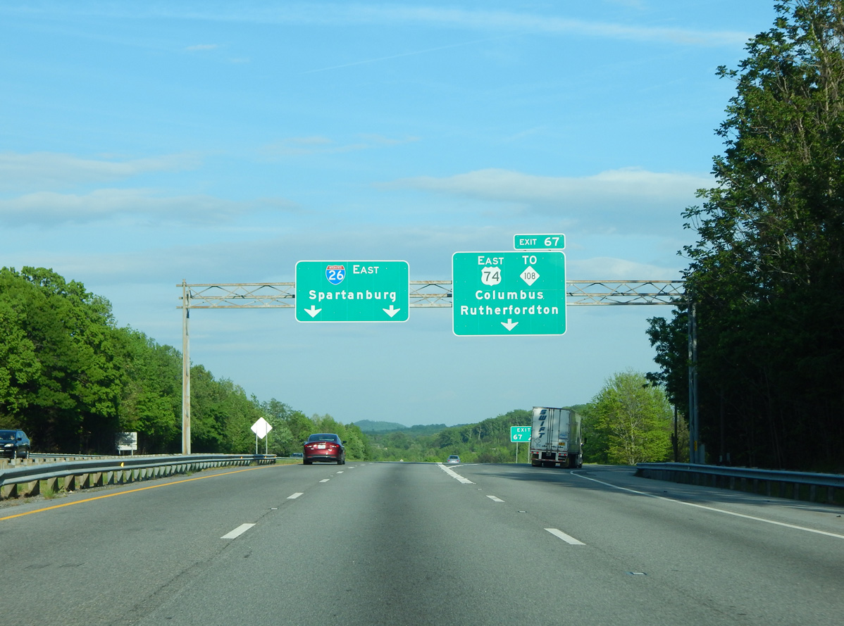
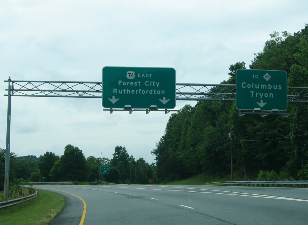
| U.S. 74 branches east from I-26 along a freeway from Exit 67 to Forest City, Mooresboro and Shelby. 04/22/17 |
|
| U.S. 74 provides a direct route to the Charlotte metropolitan area via Interstate 85 north. Construction continues along the Shelby Bypass, which will complete the limited access connection to I-85, in 2027. 04/22/17 |
|
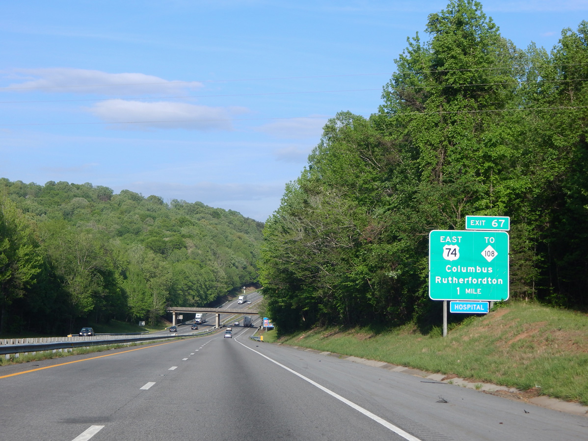
| U.S. 74 travels 17 miles east from Exit 67 to Forest City and U.S. 221 Alternate. NC 108 parallels the freeway to the south along Mill Street across the town of Columbus. 04/22/17 |
|
| NC 108 west to U.S. 176 in the town of Tryon and east to Rutherfordton represents the original alignment of U.S. 74. 04/22/17 |
|
| The directional T interchange (Exit 67) with the departing U.S. 74 includes ramps with NC 108 (Mill Street). 04/22/17 |
|
| U.S. 74 runs along the north side of Columbus, meeting NC 108 directly in two miles. Rutherfordton, seat of Rutherford County, is 23 miles via U.S. 74 east and U.S. 221 north. 05/30/05 |
|
| Interstate 26 continues south from the town of Columbus through undeveloped areas east of Horse Creek. 05/26/21 |
|
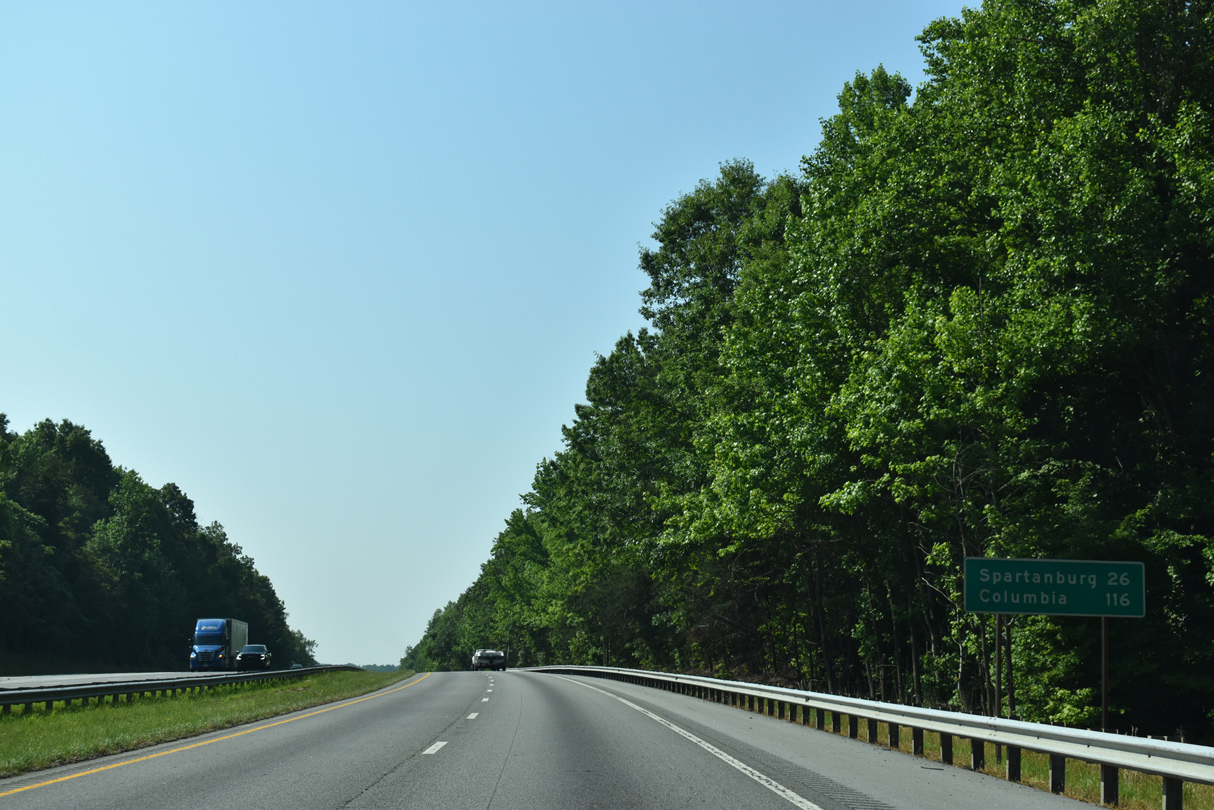
| Spartaburg in the Upstate of South Carolina is 26 miles to the southeast. Columbia lies 80 miles further. 05/26/21 |
|
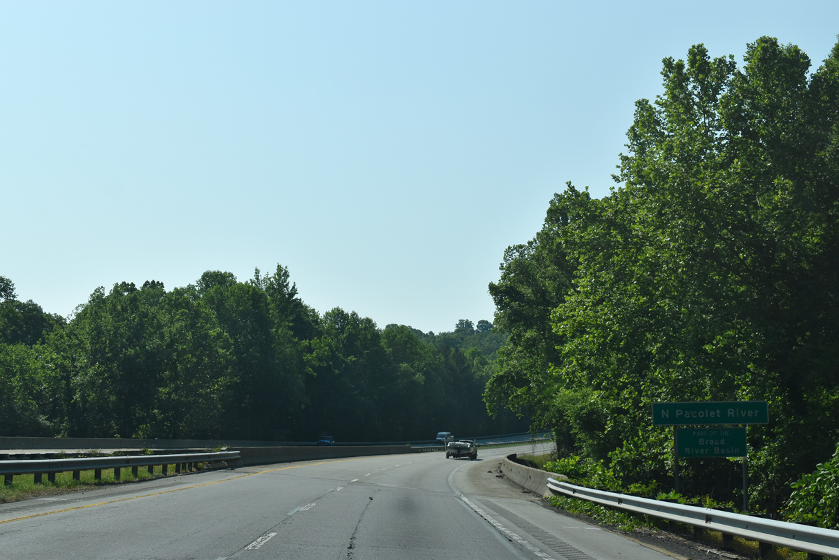
| I-26 spans the North Pacolet River east of Tryon and Burnt Chimney Corner. 05/26/21 |
|
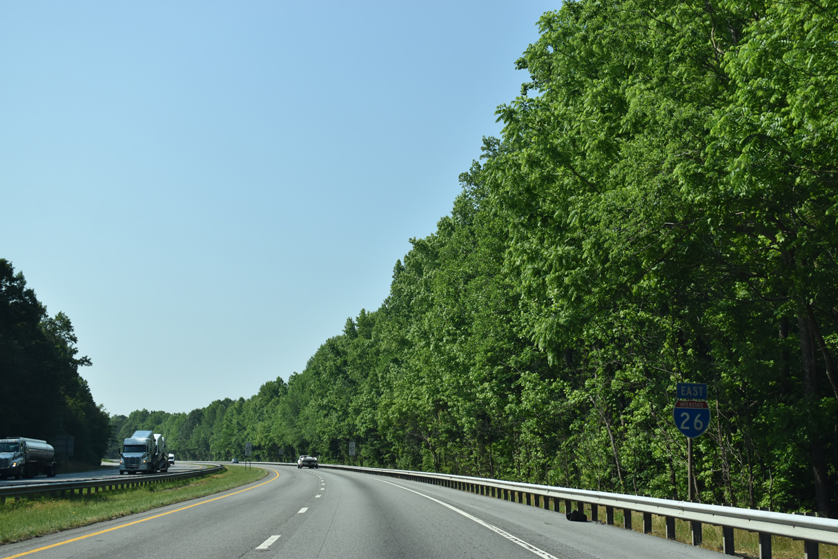
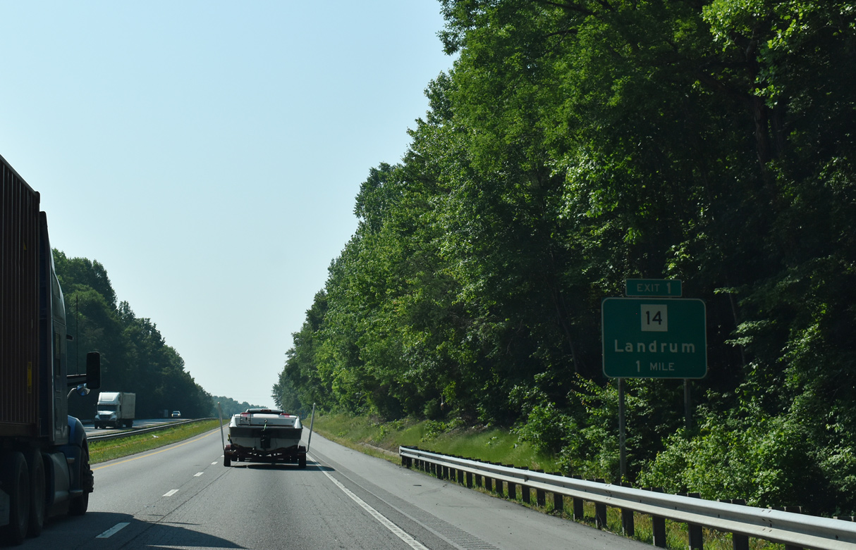
| S.C. 14 ties into Interstate 26 one half mile south of the state line at Exit 1. S.C. 14 leads west into the adjacent city of Landrum. 05/26/21 |
Page Updated 01-27-2023.


 East
East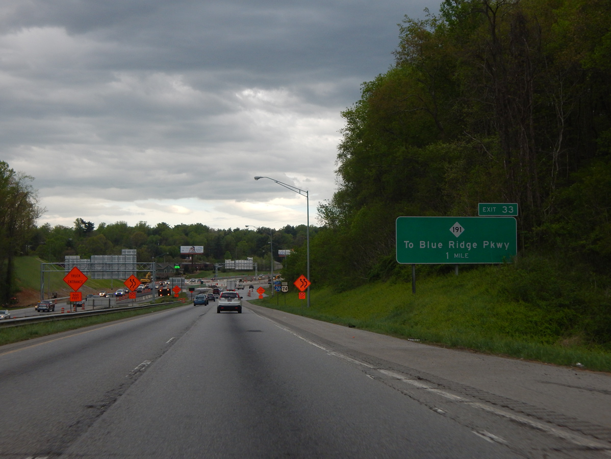
 South
South