|
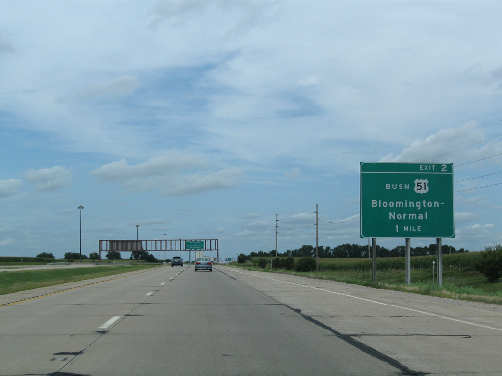
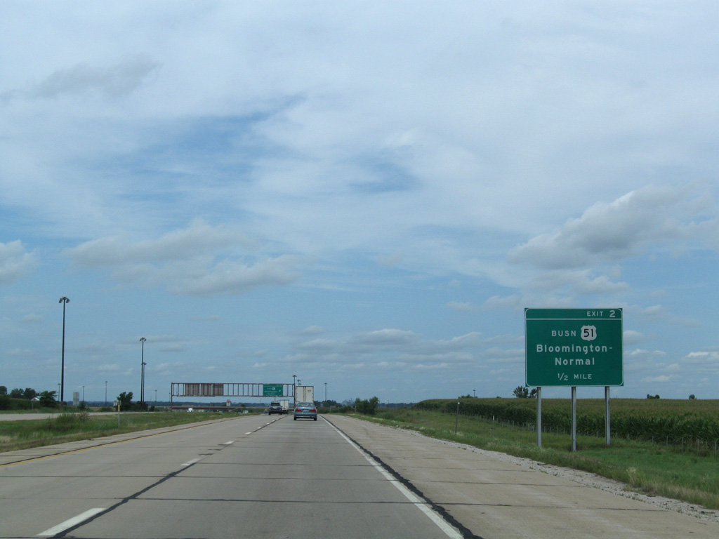
| I-39/U.S. 51 converge with the north end of U.S. 51 Business (Main Street) 1.5 miles north of I-55 at Exit 2. 08/10/09 |
|
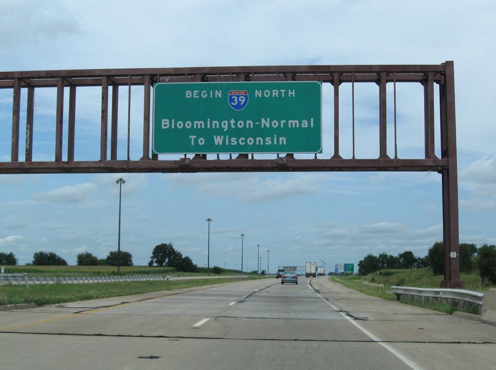
| The sign bridge referencing the beginning of Interstate 39 at the Northtown Road underpass was removed by 2016. Wisconsin was referenced in place of La Salle or Rockford, the largest cities along the 123 mile route of I-39 in Illinois. 08/10/09 |
|
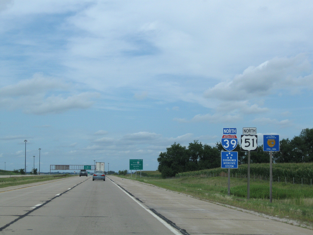
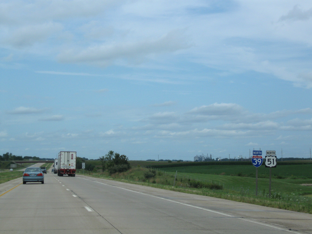
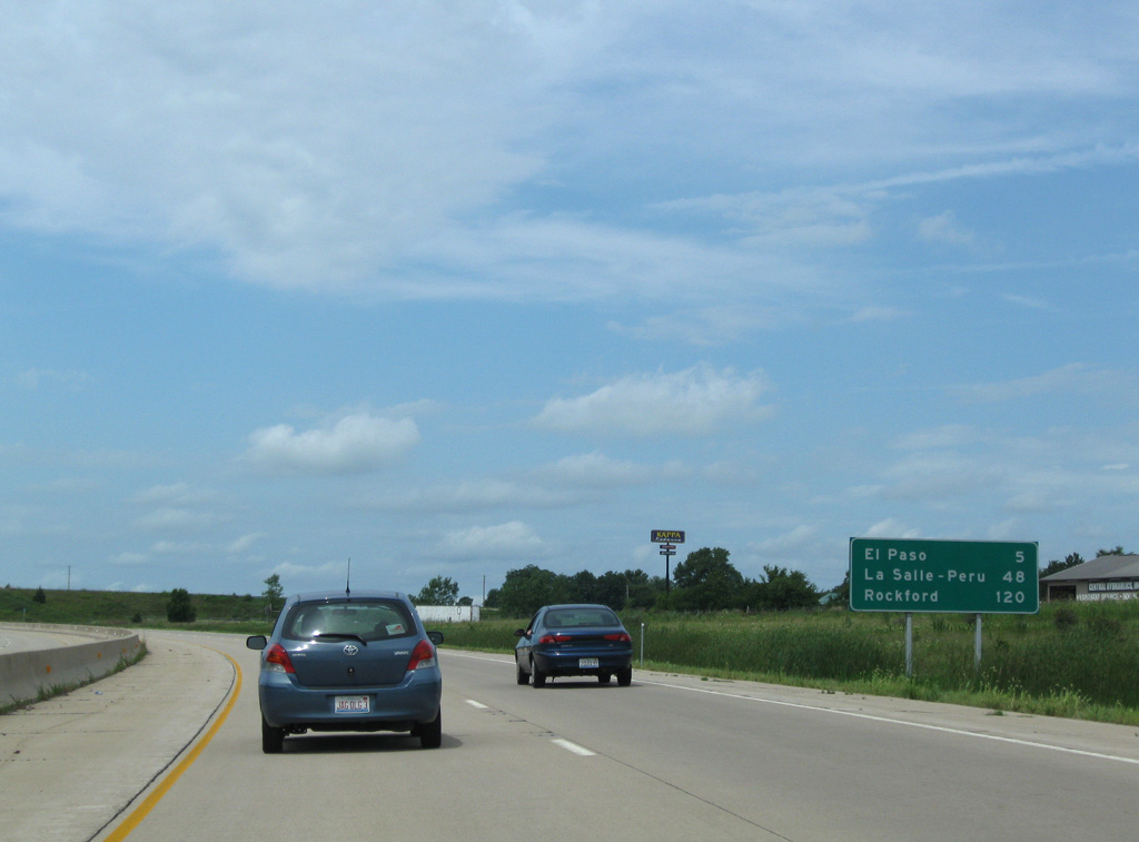
| The first set of shields for I-39/U.S. 51 stand north of the Normal city line in unincorporated McLean County. 08/10/09 |
|
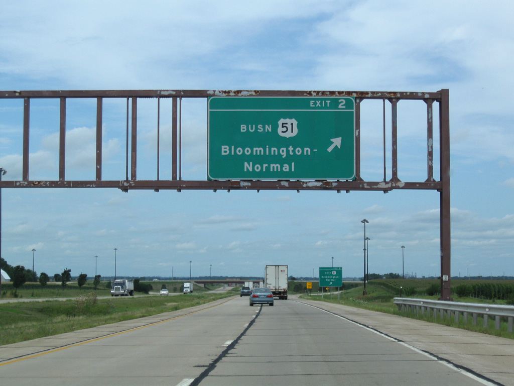
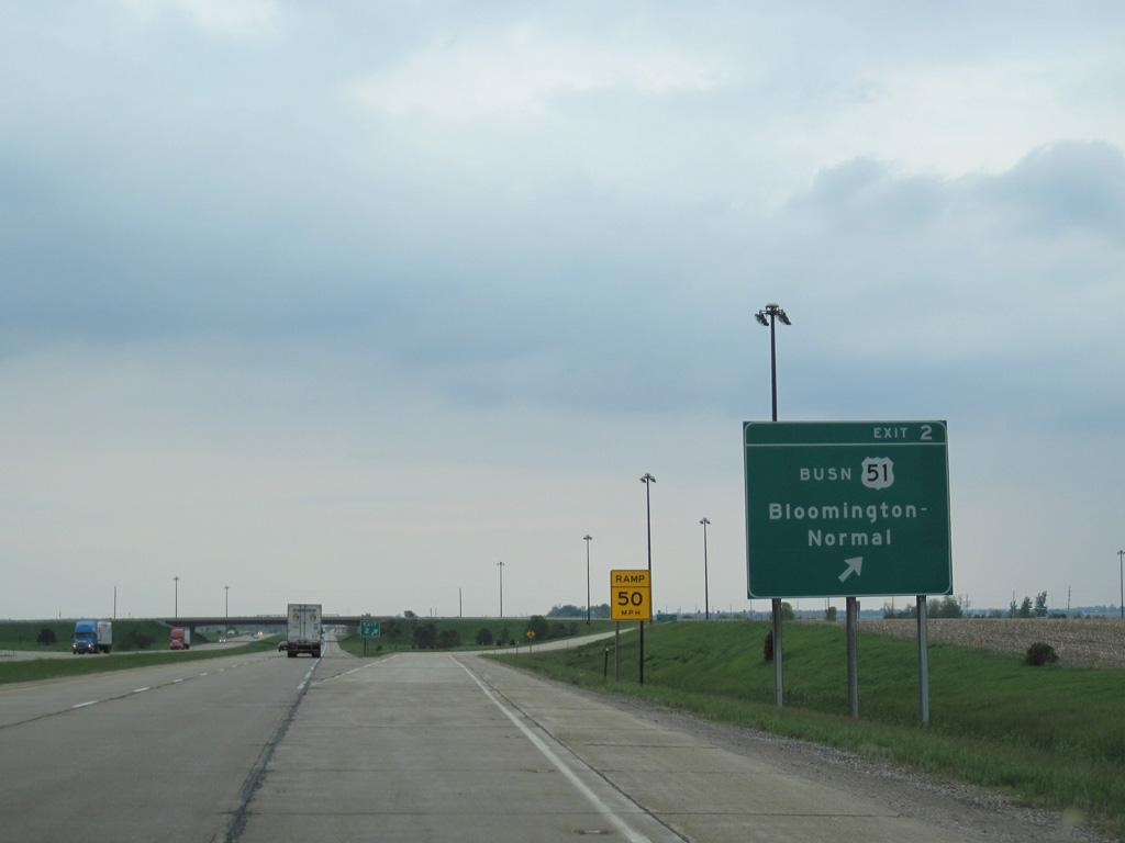
| One half mile ahead of the diamond interchange with U.S. 51 Business (Main Street) south and Ziebarth Road west on I-39 north. 08/10/09 |
|
| Exit 2 leaves I-39/U.S. 51 north for Main Street south back into Normal. Old U.S. 51 extends north another 1.1 miles along North 1425 East Road. 08/10/09, 05/07/10 |
|
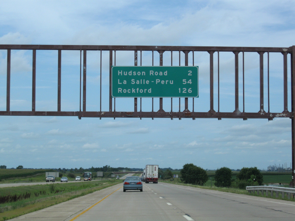
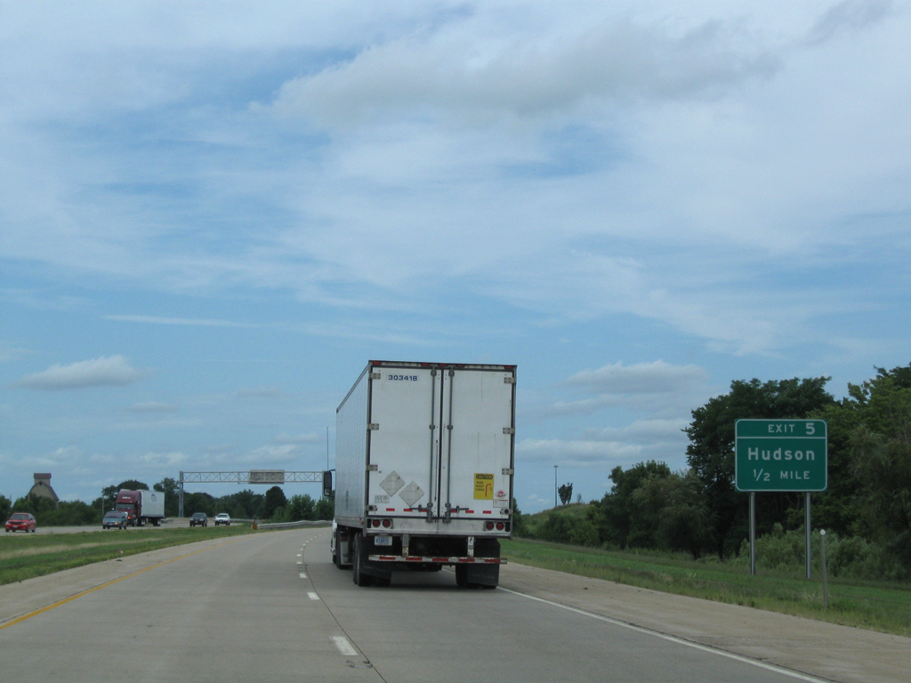
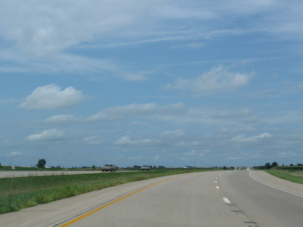
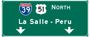
| Continuing north from U.S. 51 Business, I-39/U.S. 51 next reach the village of Hudson. The La Salle-Peru area lies 54 miles ahead. 08/10/09 |
|
| Interstate 39 directly overlaid the historic alignment of U.S. 51 leading toward Hudson. The freeway bends eastward across Sixmile Creek ahead of Exit 5 with Franklin Street. 08/10/09 |
|
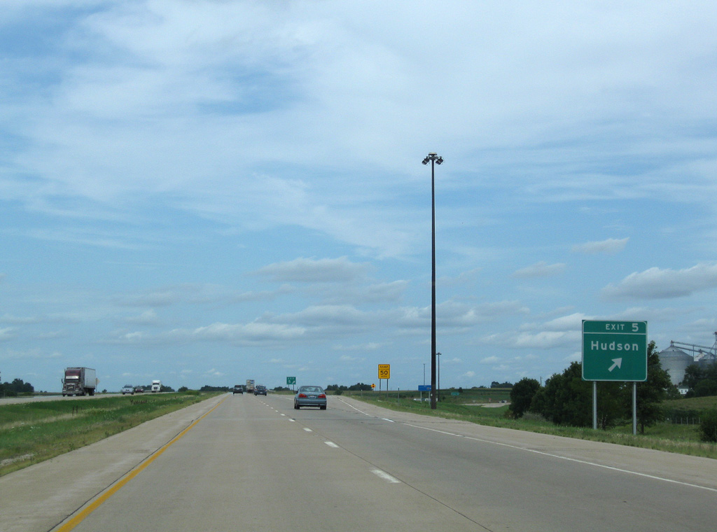
| Hudson lies just east of the diamond interchange (Exit 5) with County Road 12 (Franklin Street). 08/10/09 |
|
| Northbound at Exit 5 for County Road 12 west to U.S. 150 and Franklin Street east into central Hudson. 08/10/09 |
|
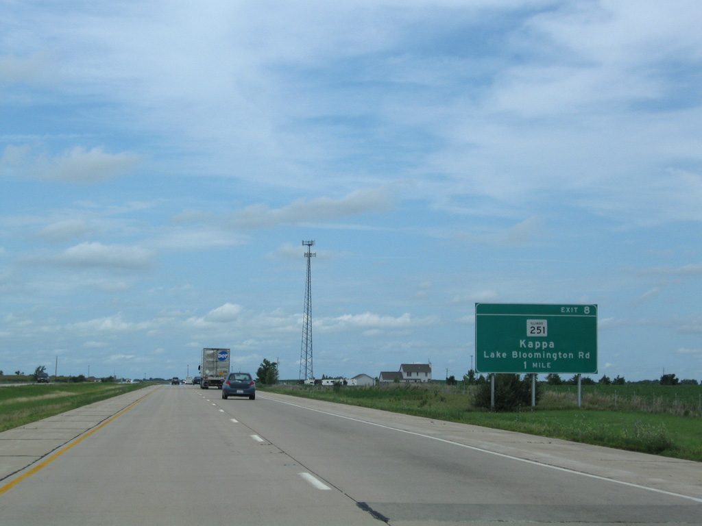
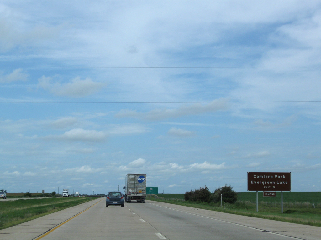
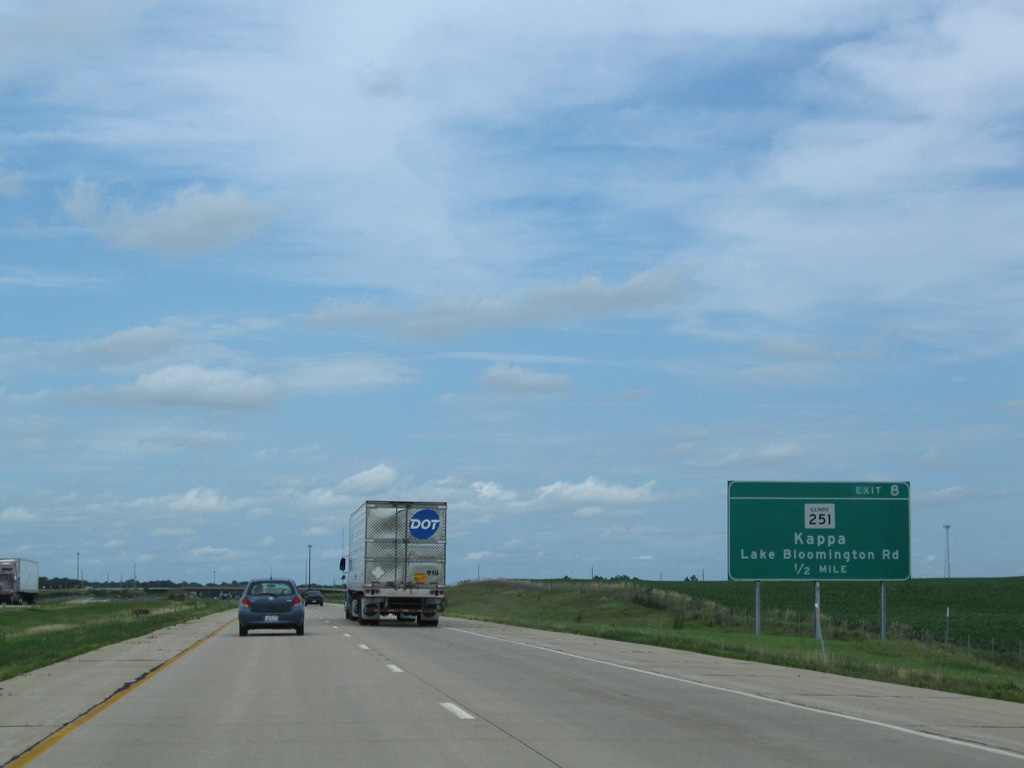
| I-39/U.S. 51 shift westward again and pass by Evergreen Lake on the approach to Exit 8 with Lake Bloomington Road (CR 8) and the northbound beginning of IL 251. 08/10/09 |
|
| County Road 8 leads west from Exit 8 to Comlara Park and around the north side of Evergreen Lake into neighboring Woodford County. Lake Bloomington is a 3.5 mile drive to the east via Lake Bloomington Road. 08/10/09 |
|
| IL 251 follows the pre-freeway alignment of U.S. 51 north from Exit 8 to the village of Kappa and overall to Rockford and South Beloit. 08/10/09 |
|
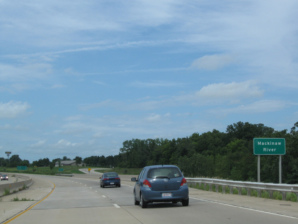
| I-39/U.S. 51 run alongside IL 251 north to the Mackinaw River. 08/10/09 |
|
| Crossing into Woodford County, IL 251 diverges from the I-39/U.S. 51 right of way to loop northwest through the village of Kappa. 08/10/09 |
|
| Interstate 39 bypasses Kappa to the west, heading next to the city of El Paso in five miles. 08/10/09 |
|
| Turning northwest, I-39/U.S. 51 leave the original fooprint of the U.S. 51 Kappa bypass. Advancing north from the County Road 600 North overpass, the freeway parallels old U.S. 51 (IL 251) one half mile to the west. 08/10/09 |
|
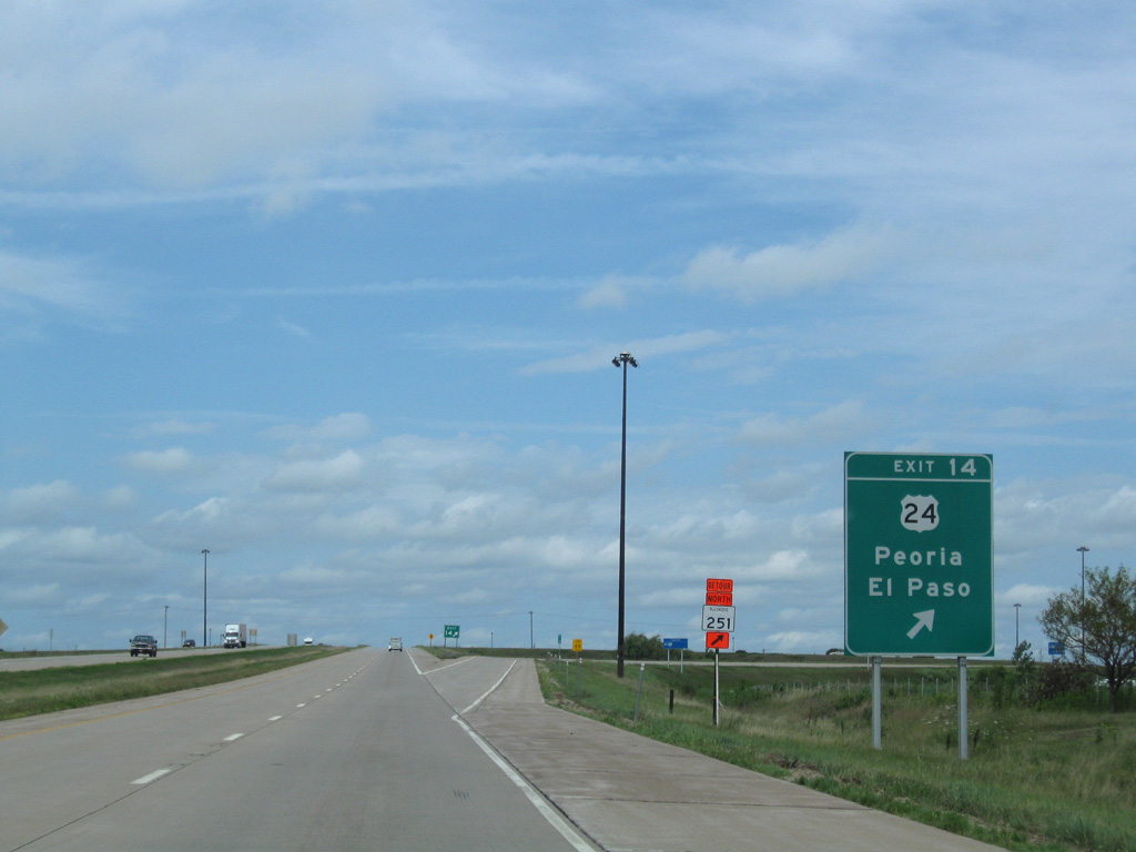
| Navigating along an S-curve, I-39 shifts a quarter mile west to bypass El Paso. Meeting the freeway next is U.S. 24. 08/10/09 |
|
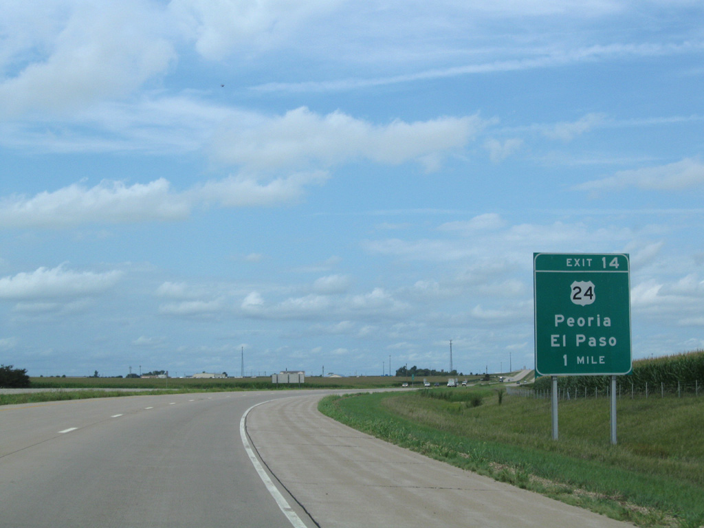
| U.S. 24 (Main Street) travels through Downtown El Paso east of Exit 14. The US highway follows a linear course adjacent to the Toledo, Peoria & Western (TPW) Railway to Chenoa, Forest, Gilman and Watseka to the Indiana state line alongside U.S. 52. 08/10/09 |
|
| Entering the folded diamond interchange (Exit 14) with U.S. 24 (Main Street) on I-39/U.S. 51 north. U.S. 24 west reaches the city of Eureka in 13 miles and Peoria via the McClugage Bridge in 31 miles. 08/10/09 |
|
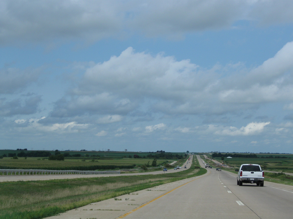
| Progressing north from the El Paso city limits along I-39/U.S. 51. 08/10/09 |
|
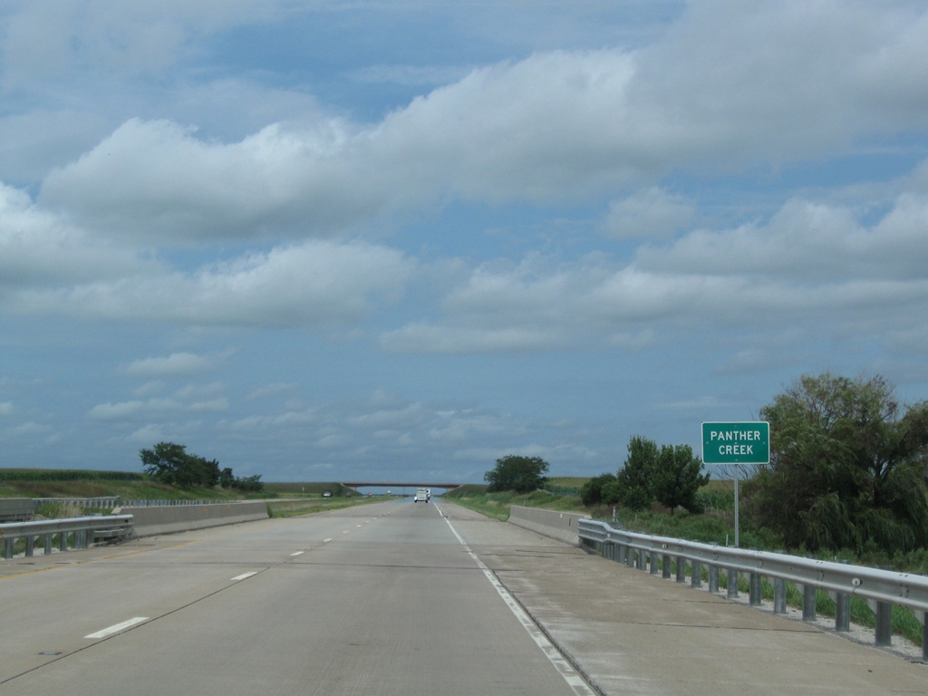
| I-39/U.S. 51 cross the East Branch of Panther Creek beyond milepost 16. 08/10/09 |
|
| Panther Creek flows 2.5 miles north of its East Branch. I-39 spans the creek northwest of Panola. 08/10/09 |
|
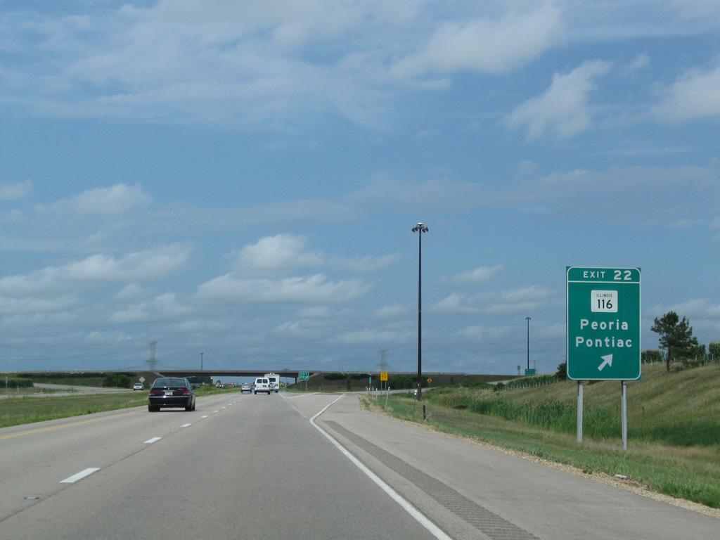
| IL 116 ventures northeast from Peoria through Metamora and Roanoke to cross paths with I-39/U.S. 51 at Exit 22. The state route combines with parallel IL 251 north nearby before continuing east to Flanagan and Pontiac. 08/10/09 |
|
| I-39/U.S. 51 advance north four miles to the city of Minonk and 34 miles to La Salle - Peru. 08/10/09 |
|
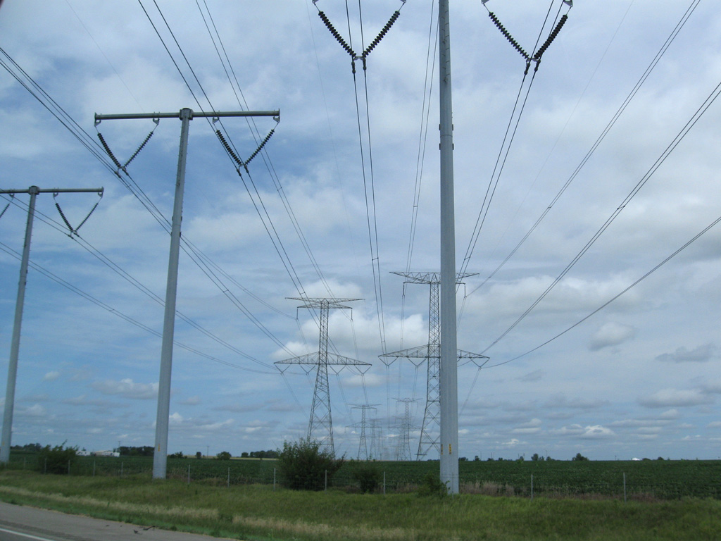
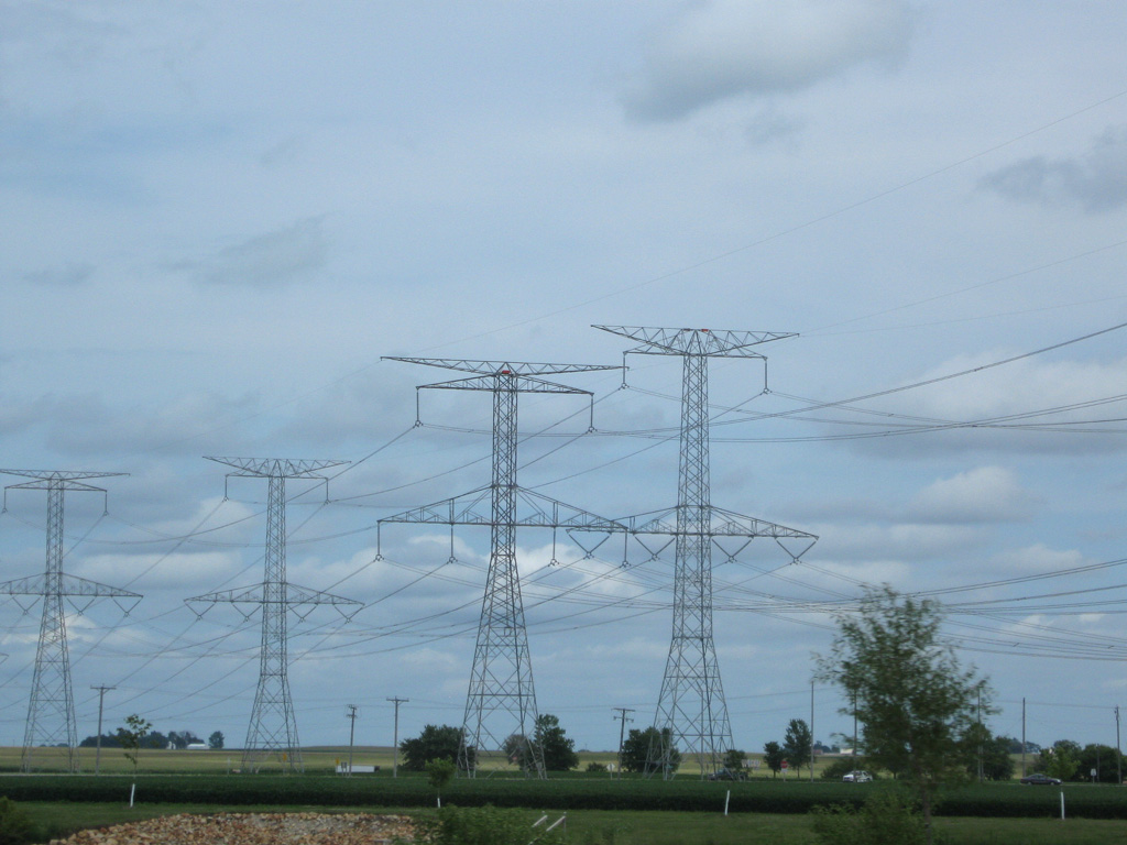
| Steel tower transmission lines pass over Interstate 39 near Minook Junction as they supply electricity to the Chicago area. This power line corridor originates at the NRG Powerton Generation Station at Pekin. 08/10/09 |
|
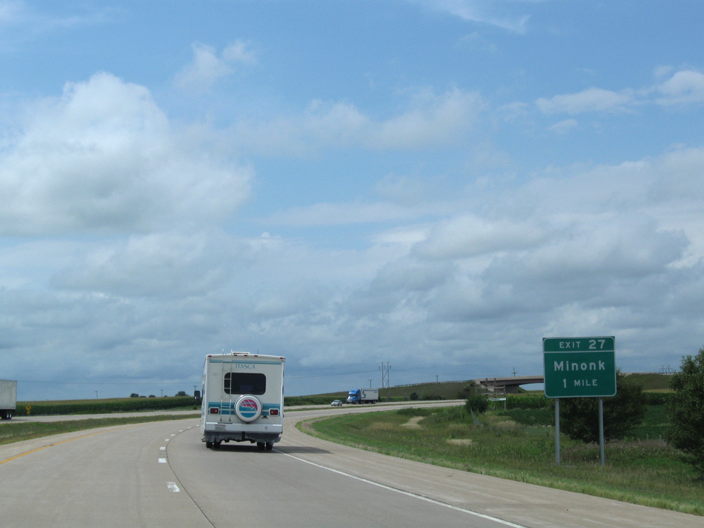
| The course of I-39/U.S. 51 shifts a mile west to circumvent both the city of Minonk and the original U.S. 51 bypass along IL 251. 08/10/09 |
|
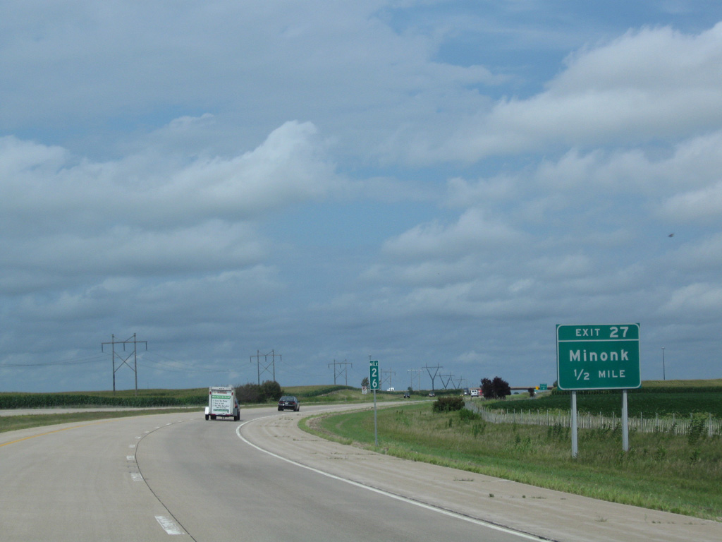
| A diamond interchange (Exit 27) joins Interstate 39 with County Road 2 on the west side of Minook in a half mile. 08/10/09 |
|
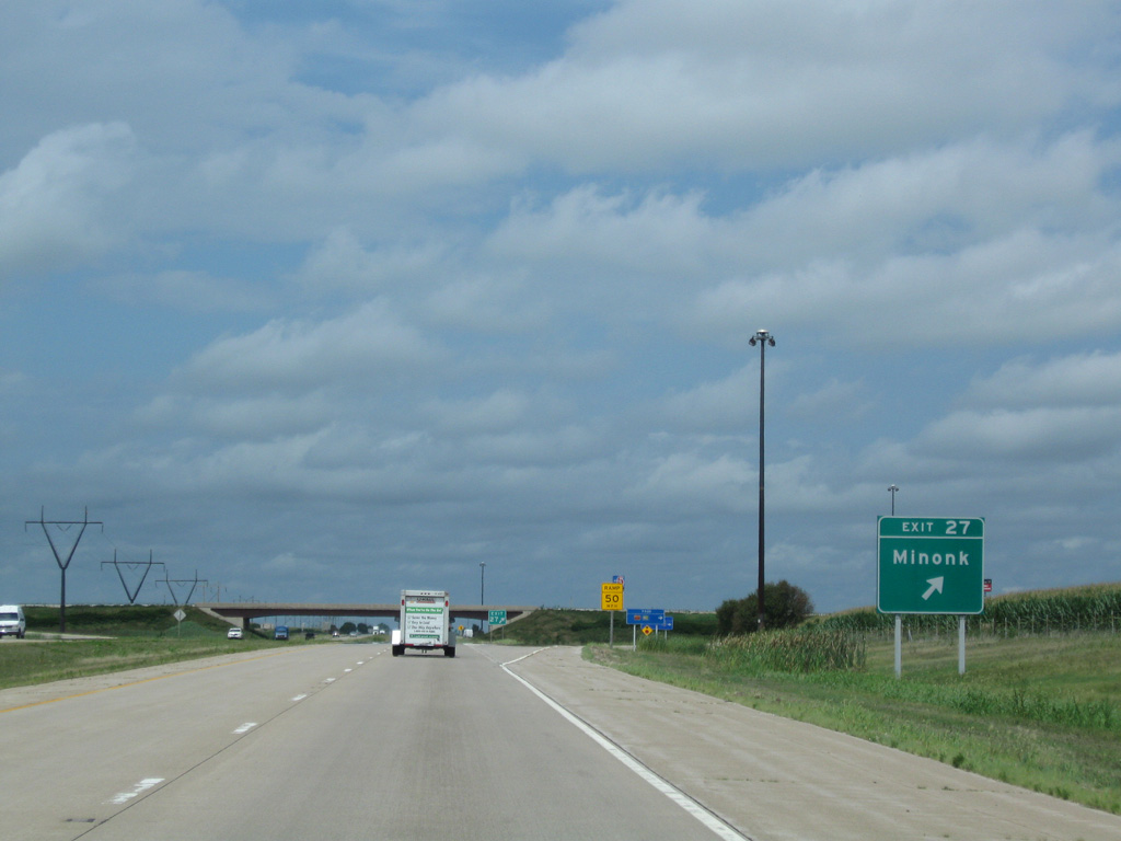
| Exit 27 departs I-39/U.S. 51 north for CR 2 (County Road 2200 North) east to Chestnut Street (old U.S. 251) south to Downtown Minonk and west to the village of Washburn. 08/10/09 |
|
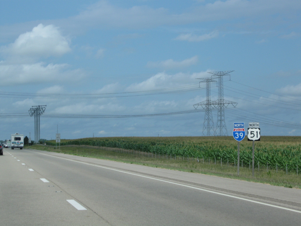
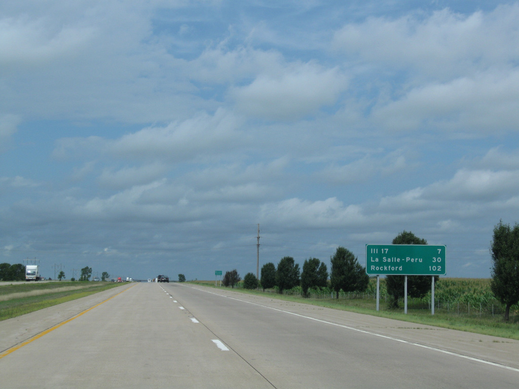
| IL 17 crosses paths with Interstate 39 seven miles ahead at Wenona. Rockford is just over 100 miles away at this point. 08/10/09 |
|
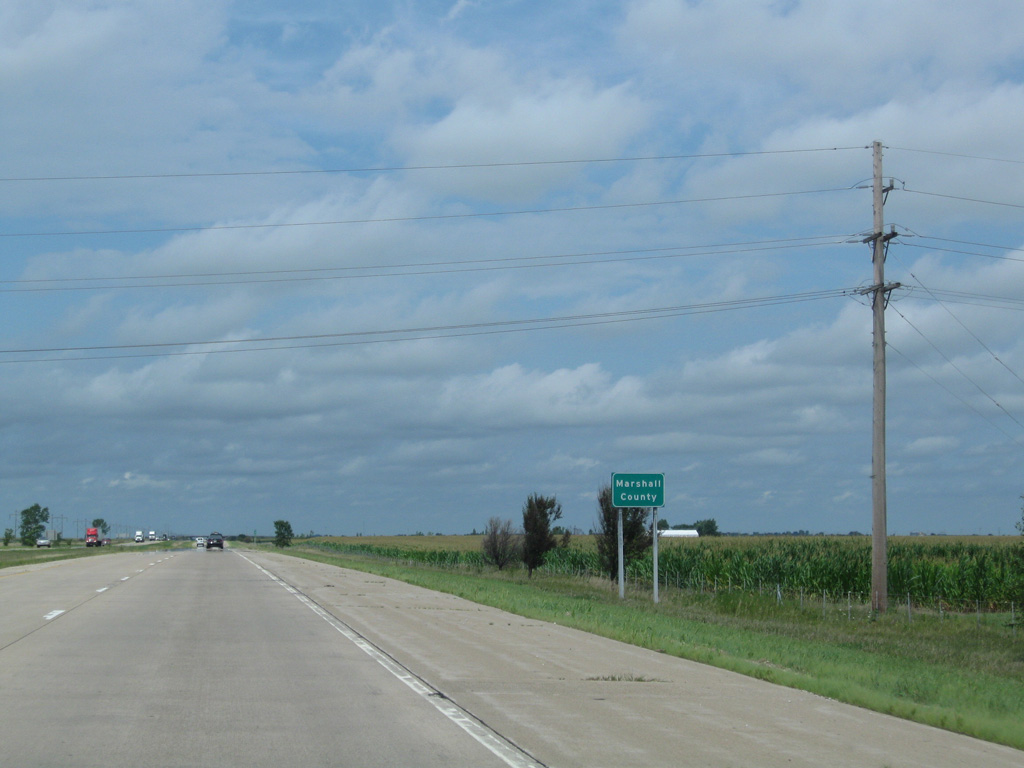
| A nearly nine mile long straight away ensues along I-39 north from Exit 27 across eastern Marshall County. 08/10/09 |
|
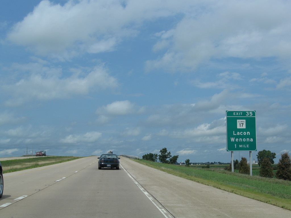
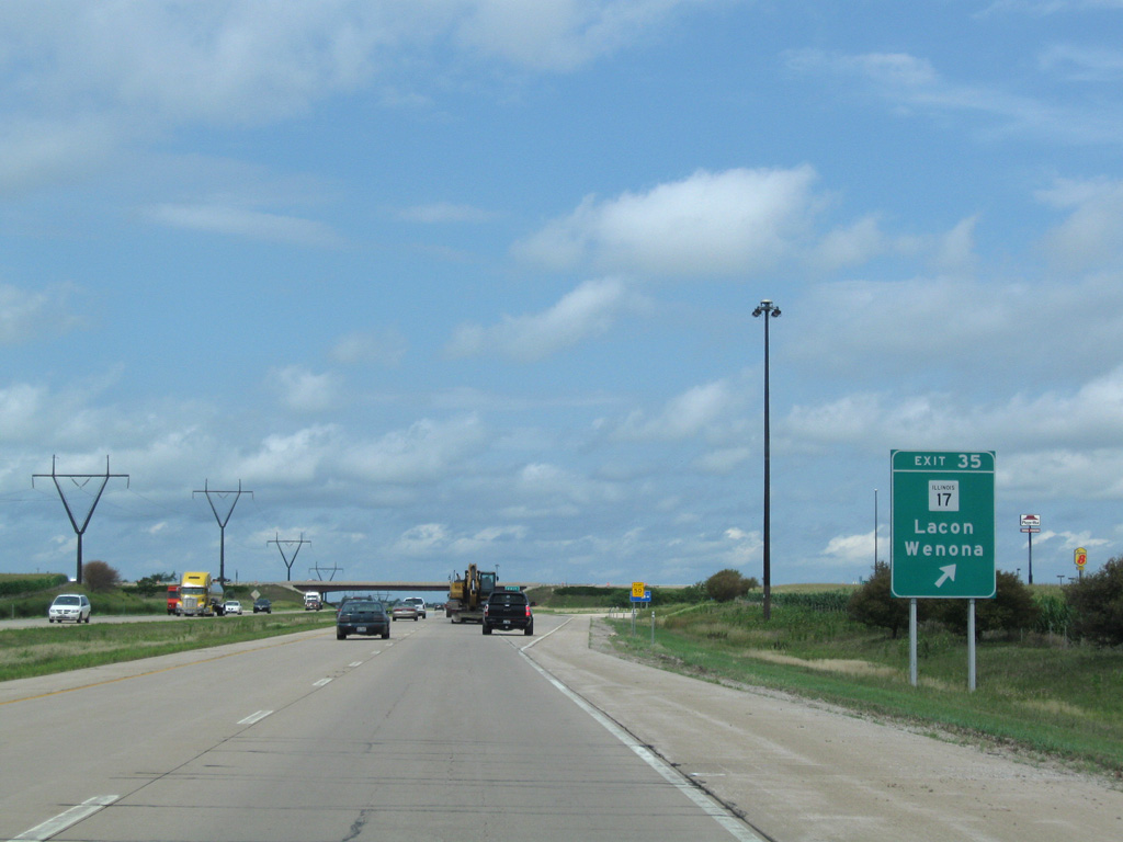
| Crossing over a BNSF Railroad line, I-39/U.S. 51 proceeds one mile north to Exit 35 with IL 17. 08/10/09 |
|
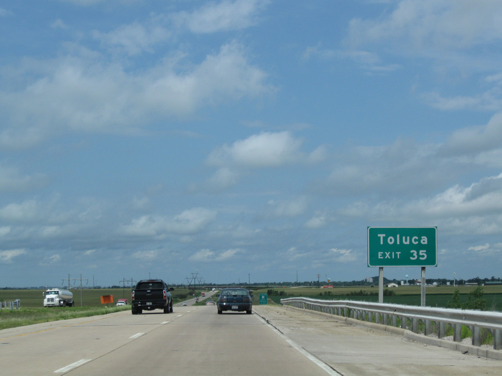
| West from Exit 35, IL 17 travels four miles to intersect IL 117. IL 117 begins there and heads south into the city of Toluca. 08/10/09 |
|
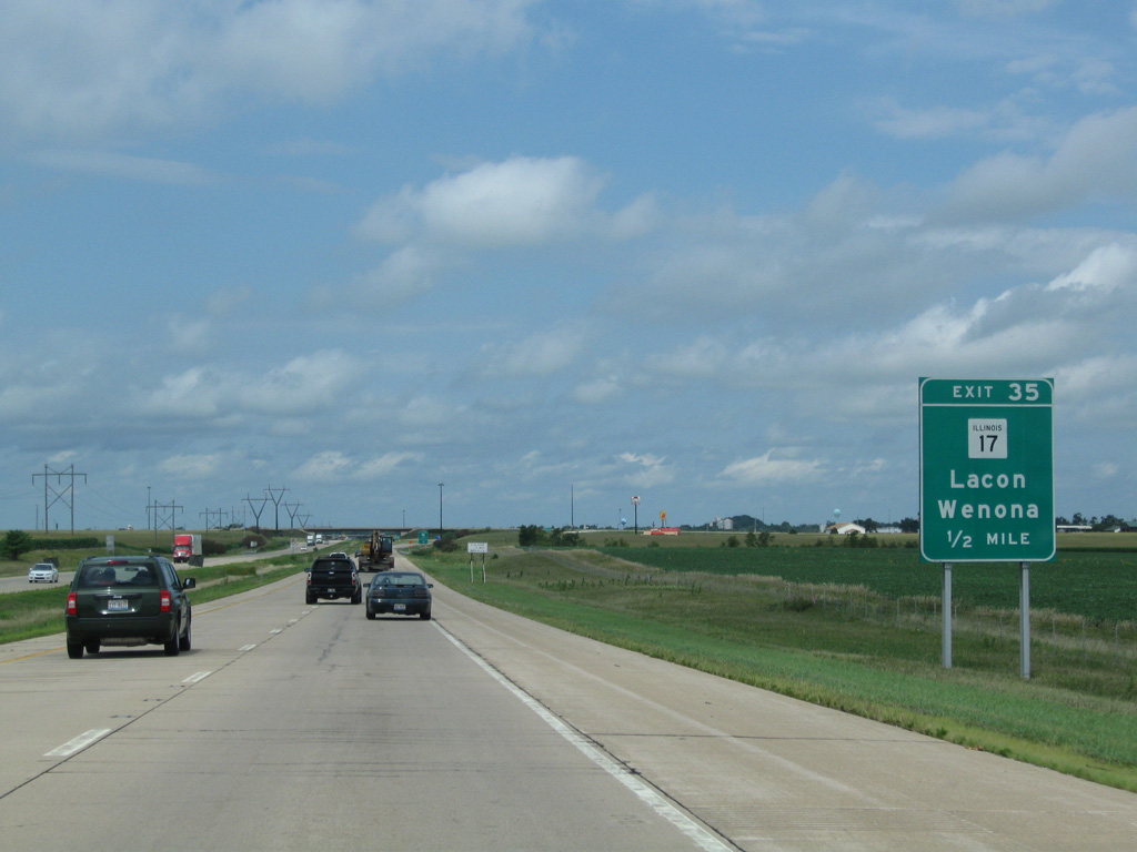
| A half mile out from the diamond interchange (Exit 35) with IL 17 on I-39/U.S. 51 north. IL 17 combines with parallel IL 251 north two miles through Downtown Wenona. 08/10/09 |
|
| The city of Lacon lies 18 miles to the west along IL 17. The state route crosses the Illinois River there on the Lacon Bridge to IL 29 at Sparland. 08/10/09 |
|
| Curving west again, Interstate 39 overtakes the previous U.S. 51 bypass of Wenona. La Salle-Peru is now just 21 miles away. 08/10/09 |
|
| IL 251 runs to the immediate east of I-39/U.S. 51 north across Sandy Creek. 08/10/09 |
|
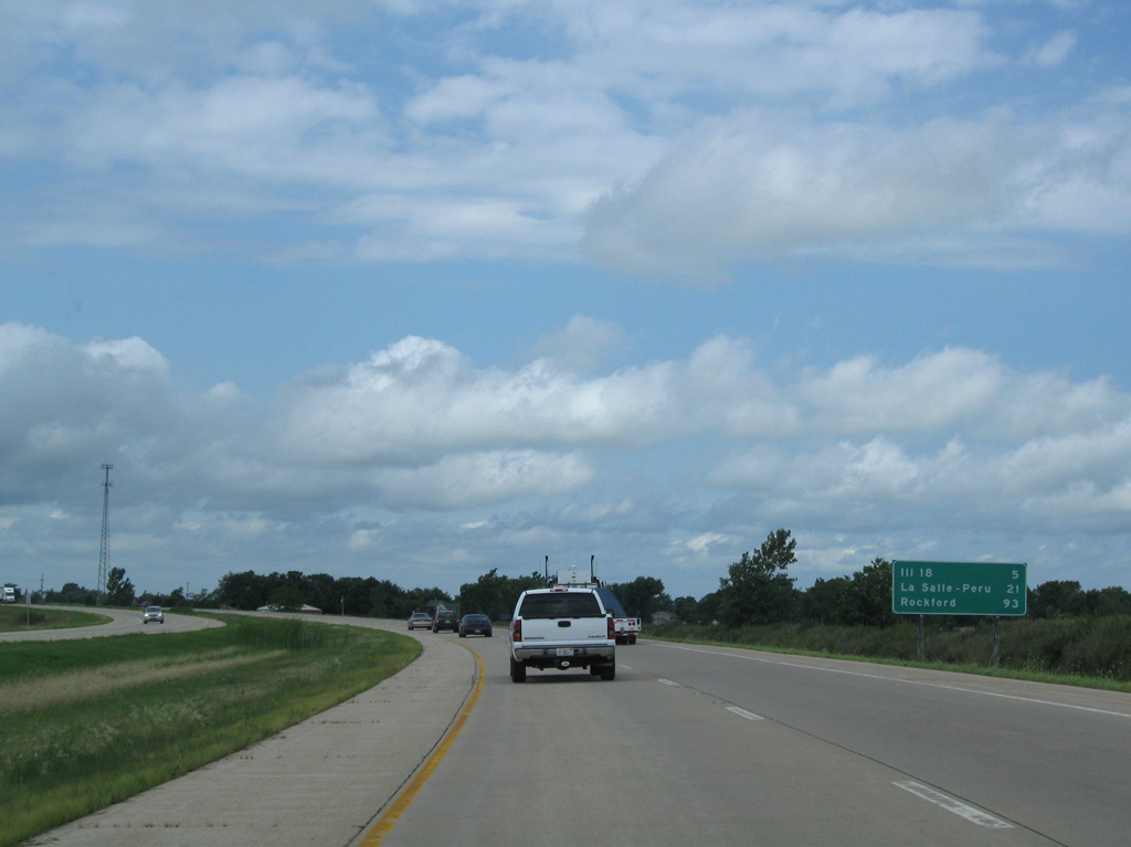
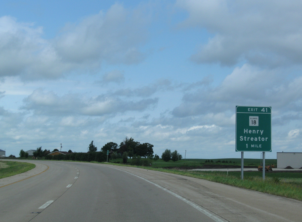
| The succeeding northbound exit connects I-39/U.S. 51 with IL 18 in one mile. 08/10/09 |
|
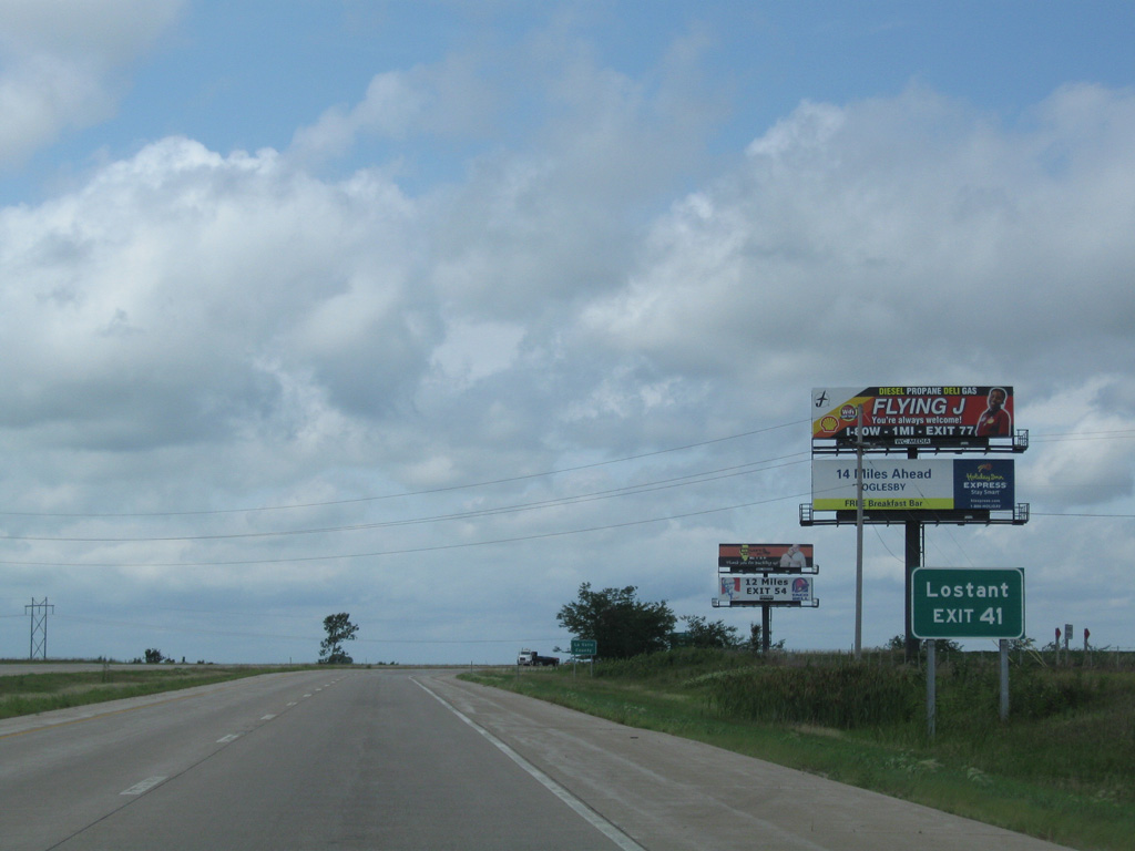
| IL 251 separates from the Interstate 39 frontage as both enter the village of Lostant. 08/10/09 |
|
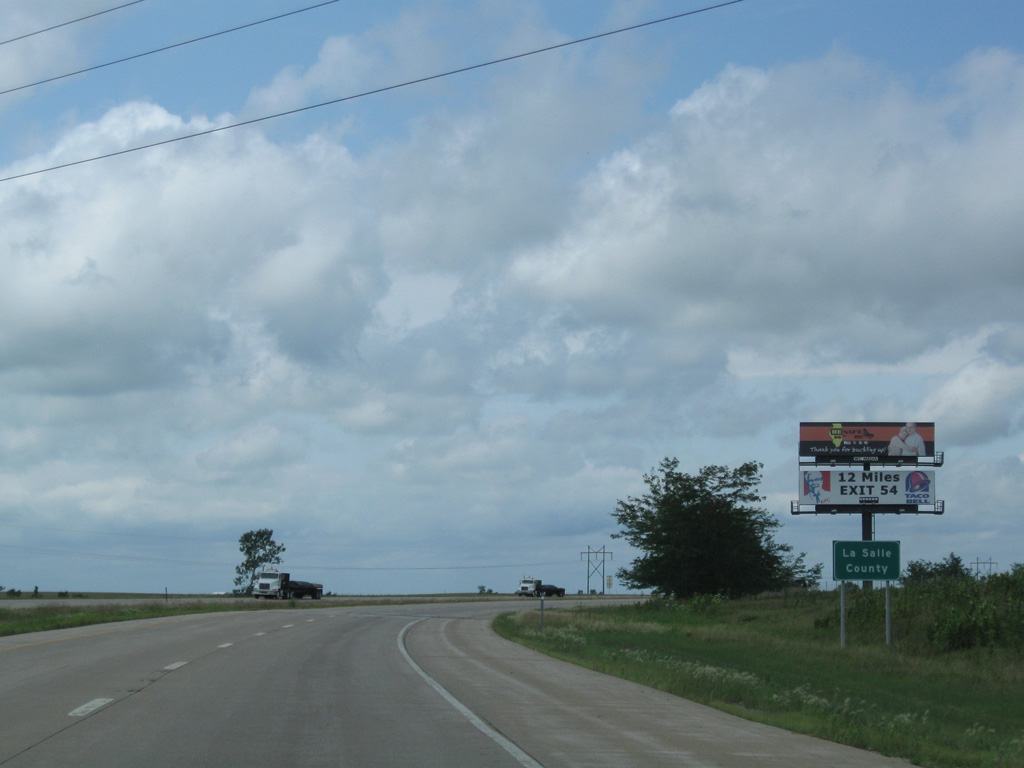
| Navigating a half mile west through an S-curve, I-39 enters La Salle County as it bypasses Lostant. 08/10/09 |
Page Updated 05-01-2018.


 North
North