|
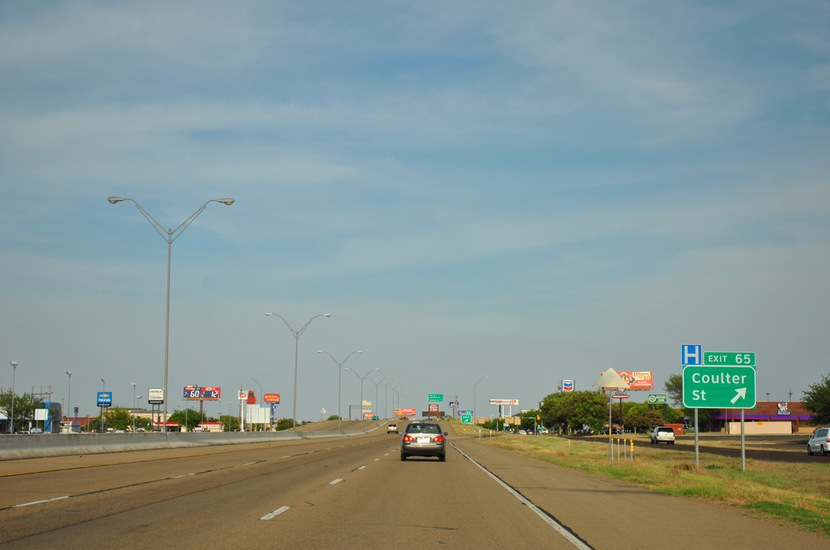
| Passing by Westgate Mall, Interstate 40 east enters the diamond interchange (Exit 65) with Coulter Street. Coulter Street leads south through residential areas including the Belmar and Puckett Place neighborhoods. 05/05/12 |
|
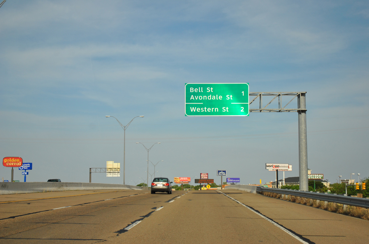
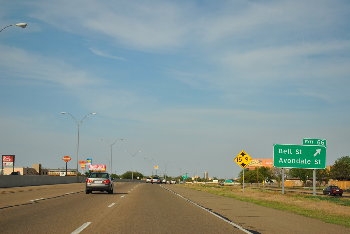
| Interstate 40 shifts northward between lodging establishments, apartment complexes and office buildings to Exit 66 for Bell and Avondale Streets. 05/05/12 |
|
| Bell Street comprises an arterial north from Interstate 27 to Business Loop I-40 (Amarillo Boulevard) at SW 9th Street (Loop 279). Avondale Street parallels through Avonbell, Country Club Terrace and other neighborhoods to the east. 05/05/12 |
|
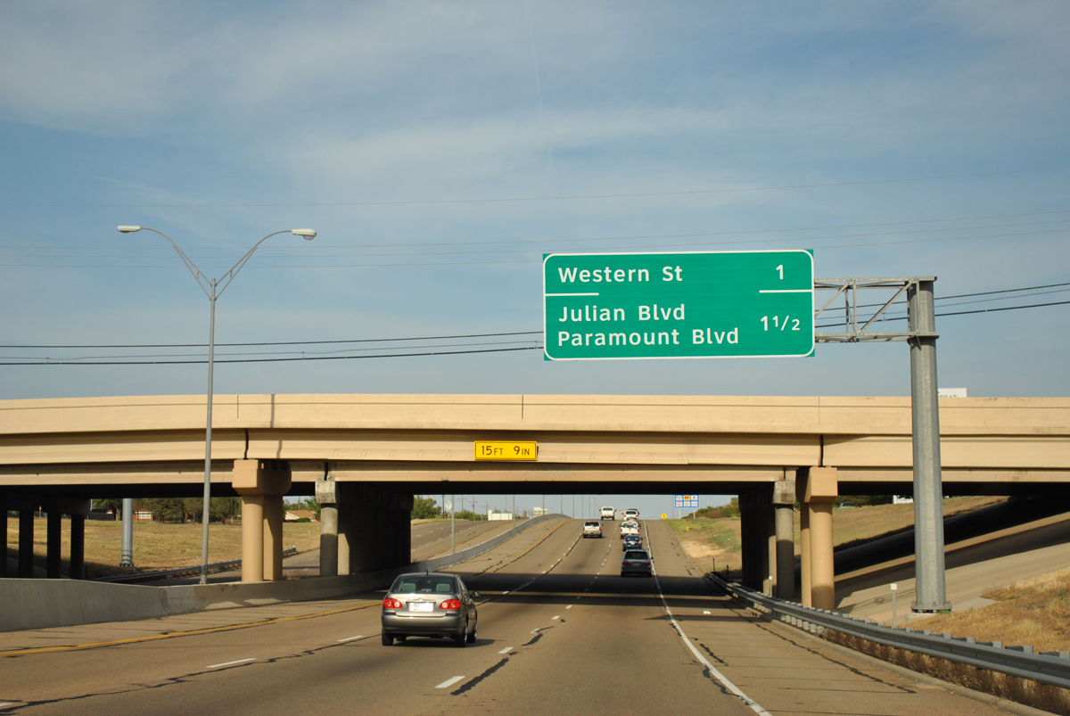
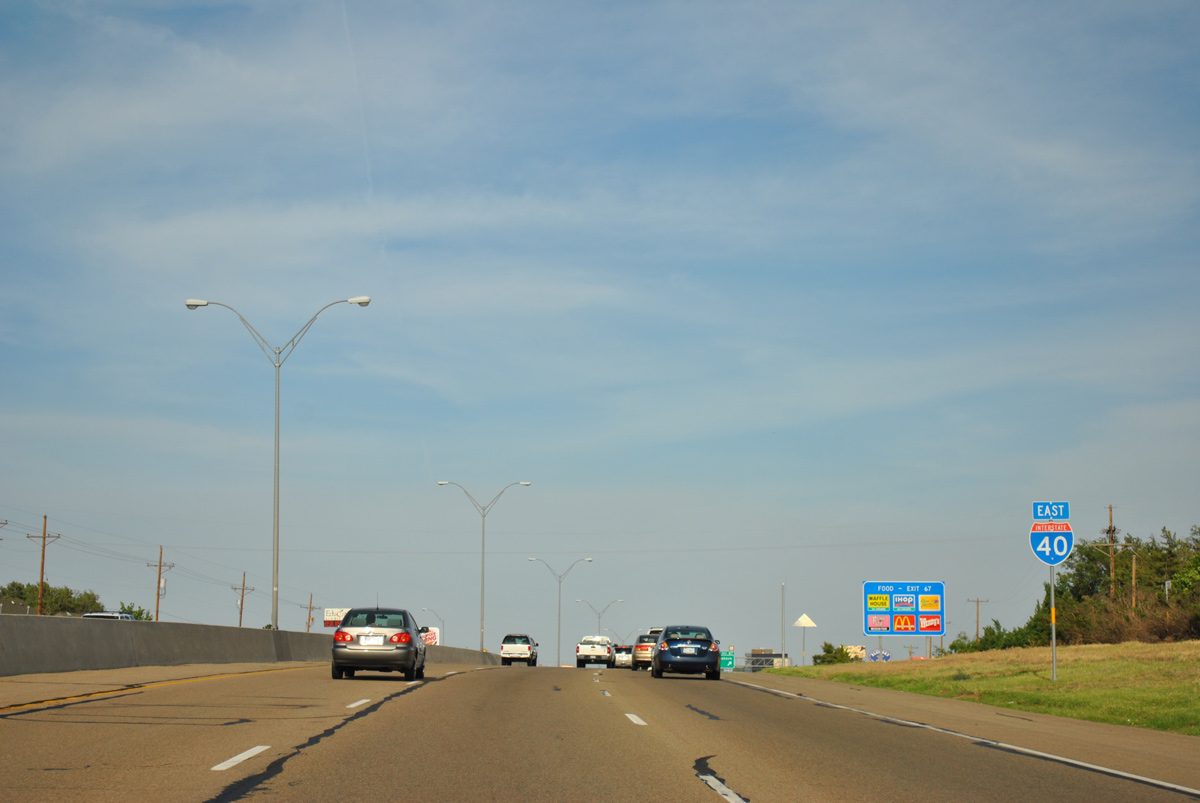
| Western Street meets IH 40 next at Exit 67. A split diamond interchange (Exit 68A) follows for Julian Boulevard north and Paramount Boulevard south. 05/05/12 |
|
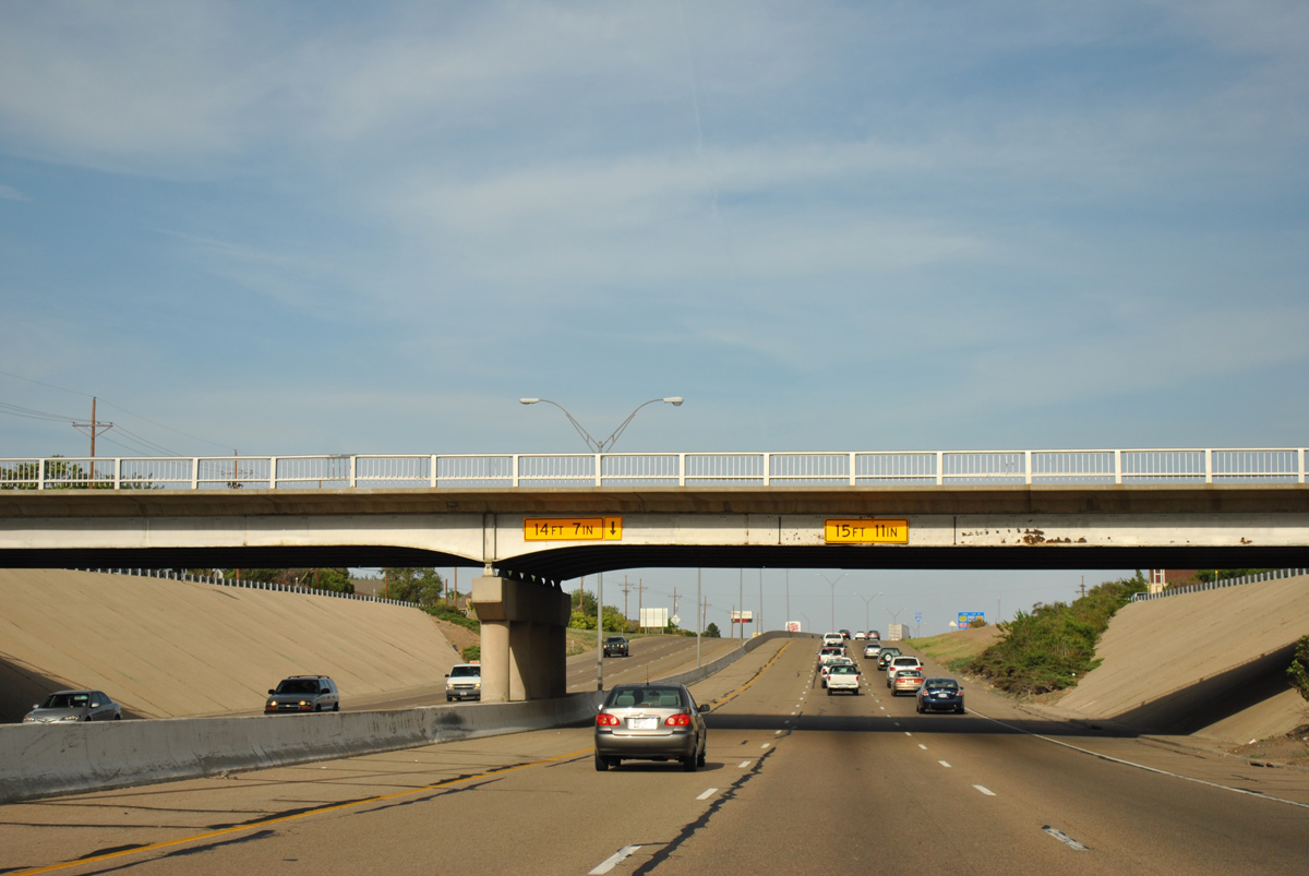
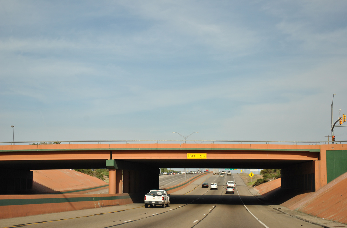
| IH 40 drops below grade at the 1966-built overpass for Avondale Street. 05/05/12 |
|
| Reassurance marker posted at the Bell Street on-ramp. TxDOT recorded 94,951 vehicles per day (vpd) here in 2015. 05/05/12 |
|
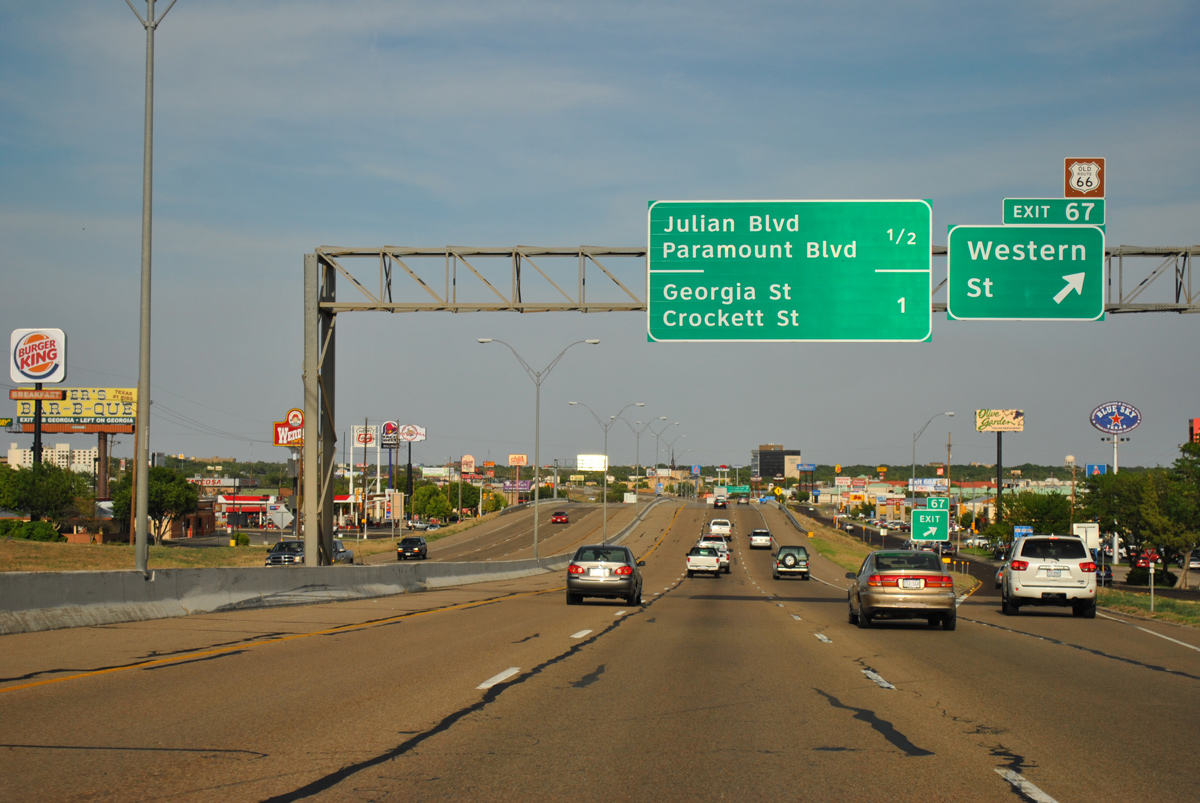
| Western Street leads north from Exit 67 and the Western Crossing retail area to the Country Club District and Loop 279 (Bushland Boulevard). Loop 279 overlays the 1953 alignment of U.S. 66 east from Business Loop I-40 to U.S. 60-87-287 in Downtown. 05/05/12 |
|
| Exit 68A quickly departs from Interstate 40 east for the south side frontage ahead of Lakeview Drive and Paramount Boulevard south. Paramount Boulevard comprises a five lane boulevard south through the Lawrence Park business area. Julian Boulevard extends the road north through the Westview community to become a tree lined boulevard east to Sunset Park. 05/05/12 |
|
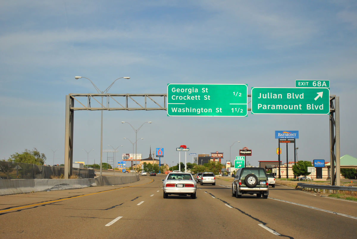
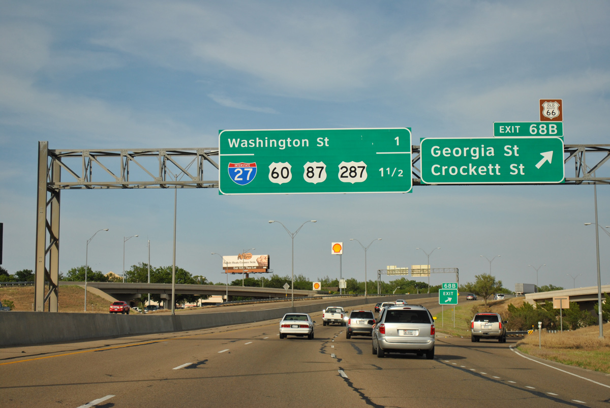
| Ramps for Paramount Boulevard pass over the ramps at Exit 68B for Georgia and Crockett Streets. Georgia Street constitutes a five to seven lane commercial boulevard south to IH 27. Crockett Street parallels to the east at the Wolflin Park, Sunnyside and Bivins neighborhoods. 05/05/12 |
|
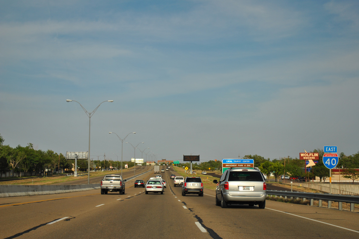
| Interstate 40 spans Georgia Street and a pair of U-turn ramps ahead of this confirming marker by Wolflin Square. 05/05/12 |
|
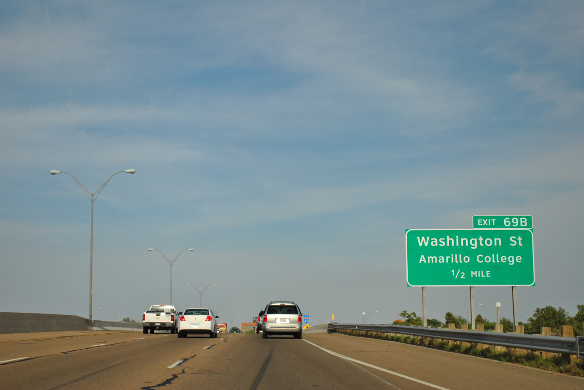
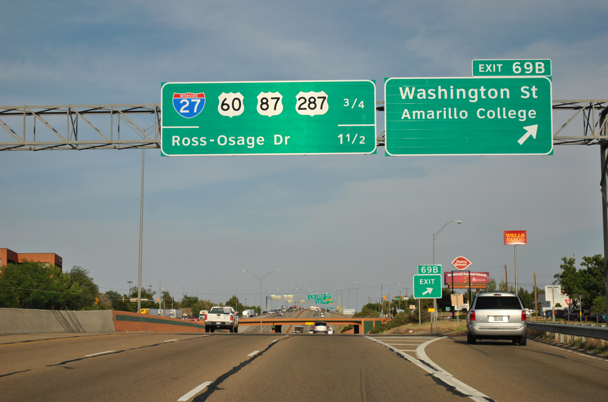
| Washington Street heads south from upcoming Exit 69 to Amarillo College and north to Adams Street at Ellwood Park. 05/05/12 |
|
| A half diamond interchange (Exit 69A) adds traffic to IH 40 east from Crockett Street. 05/05/12 |
|
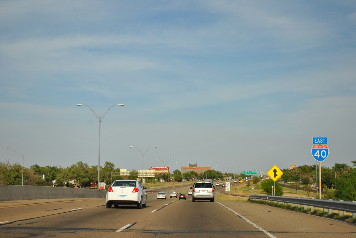
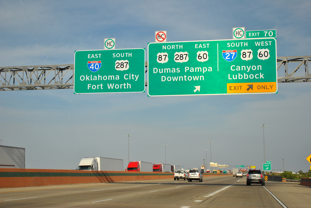
| Exit 69B leaves IH 40 east, 0.75 miles ahead of the turbine interchange (Exit 70) with IH 27 south, U.S. 60-87 and U.S. 287 north. 05/05/12 |
|
| The Washington Street overpass was replaced during a $2.8 million project in 2003. The previous bridge dated from 1963.1 05/05/12 |
|
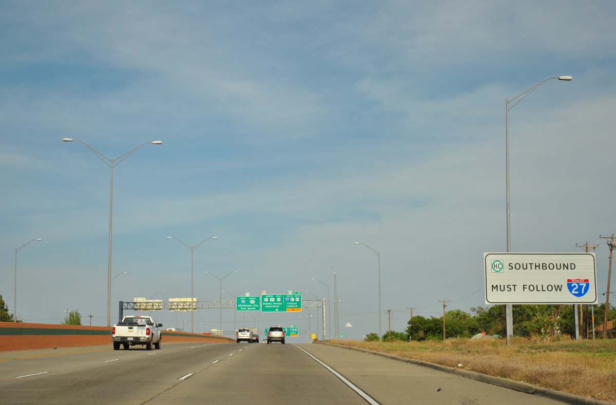
| Hazmat based cargo headed south to Lubbock must use IH 27 in lieu of surface streets or the southwest quadrant of Loop 335. This will change once Loop 335 is upgraded to a full freeway. 05/05/12 |
|
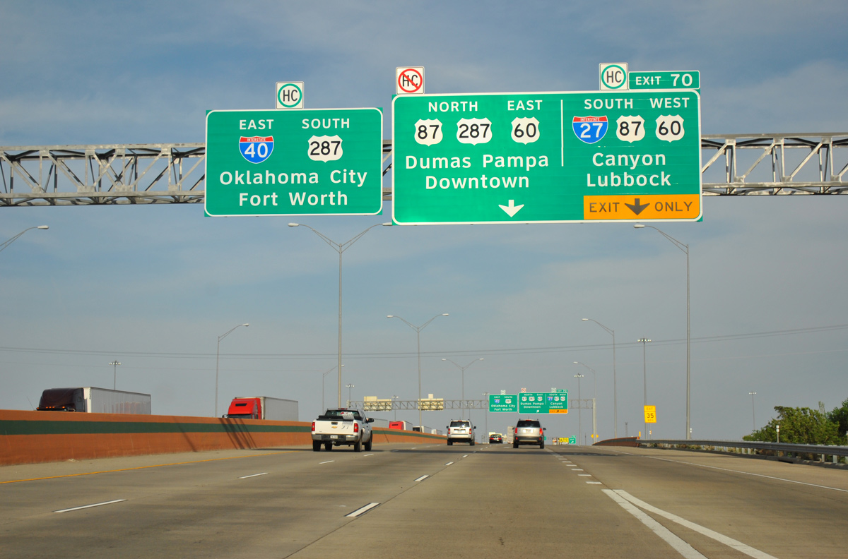
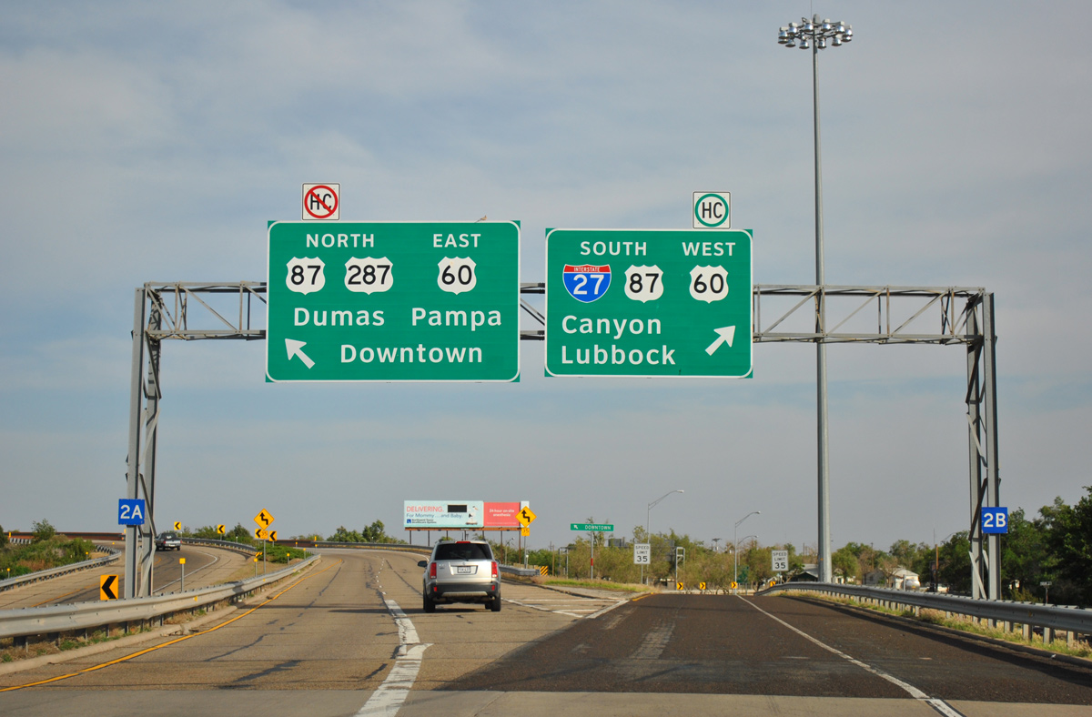
| Exit 70 serves IH 27/U.S. 60-87 south to Canyon, Plainview and Lubbock beyond the Harrison and Tyler Street viaduct. IH 27 replaced Fillmore Street, 36th Avenue and Canyon Drive as the through route of U.S. 60/87 south. 05/05/12 |
|
| A three-year project reconfigured the exchange with IH 27 so that IH 40 elevates above IH 27, among other improvements. IH 27 travels 124 miles south from Amarillo to Loop 289 and U.S. 87 on the south side of Lubbock. 05/05/12 |
|
| Exit 70 partitions with a flyover built in 2017/18 for IH 27/U.S. 60-87 south and a circuitous two lane ramp onto U.S. 60/87/287 north to their separation through Downtown Amarillo. U.S. 60 joins Amarillo with Pampa to the northeast, while U.S. 87/287 overlap northward to Dumas. 05/05/12 |
Page Updated 04-05-2017.

 East
East