|
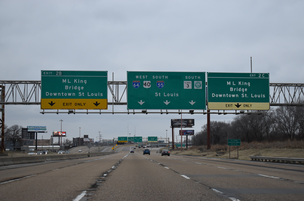
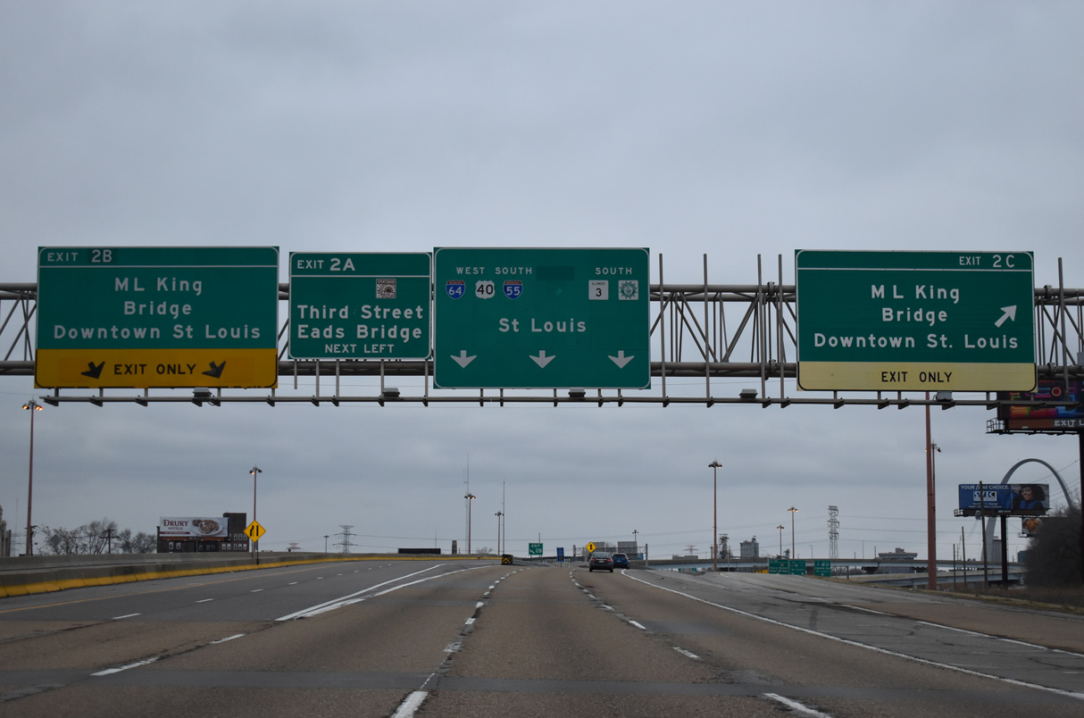
| Two separate ramps join the westbound freeway with Dr. Martin Luther King, Jr. Memorial Bridge. Left Exit 2 B serves traffic entering from I-64 West / IL 3 south while Exit 2 C serves all other traffic on the right. 12/31/23 |
|
| Exits 2 C/2 B depart I-55/64 westbound simultaneously for Dr. Martin Luther King, Jr. Memorial Bridge west to 3rd Street in Downtown St. Louis. Once part of U.S. 40/66 and originally named the Veterans Memorial Bridge, the cantilever truss bridge opened in 1951 as a toll facility. Tolls were removed in 1987 and the bridge renamed to honor MLK.1 12/31/23 |
|
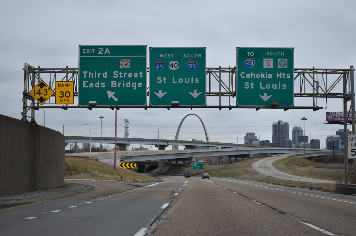
| Left Exit 2 A quickly follows from I-55/64 onto 3rd Street west ahead of Missouri Avenue in East St. Louis. Connections with River Park Drive lead to the Eads Bridge (former U.S. 40-50-66) and the Casino Queen. River Park Drive east to Broadway forms the beginning of IL 15, a 148 mile long highway between East St. Louis and the Indiana state line at Mt. Carmel. 12/31/23 |
|
| Ramps at the two-wye interchange joining I-55/64-U.S. 40 and the Dr. Martin Luther King, Jr. Memorial Bridge were reconstructed in 2018/19. All four ramps span an adjacent Illinois Central Railroad line. 12/31/23 |
|
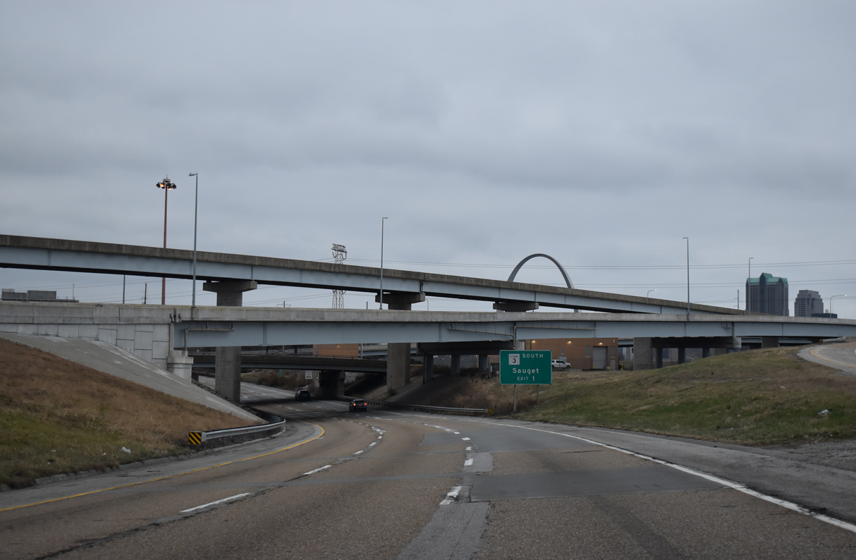
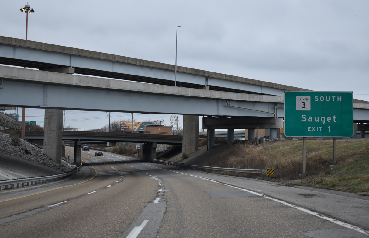
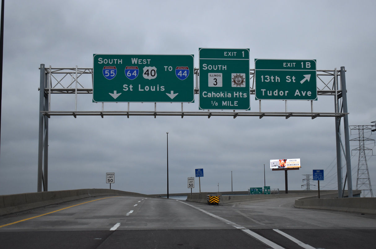
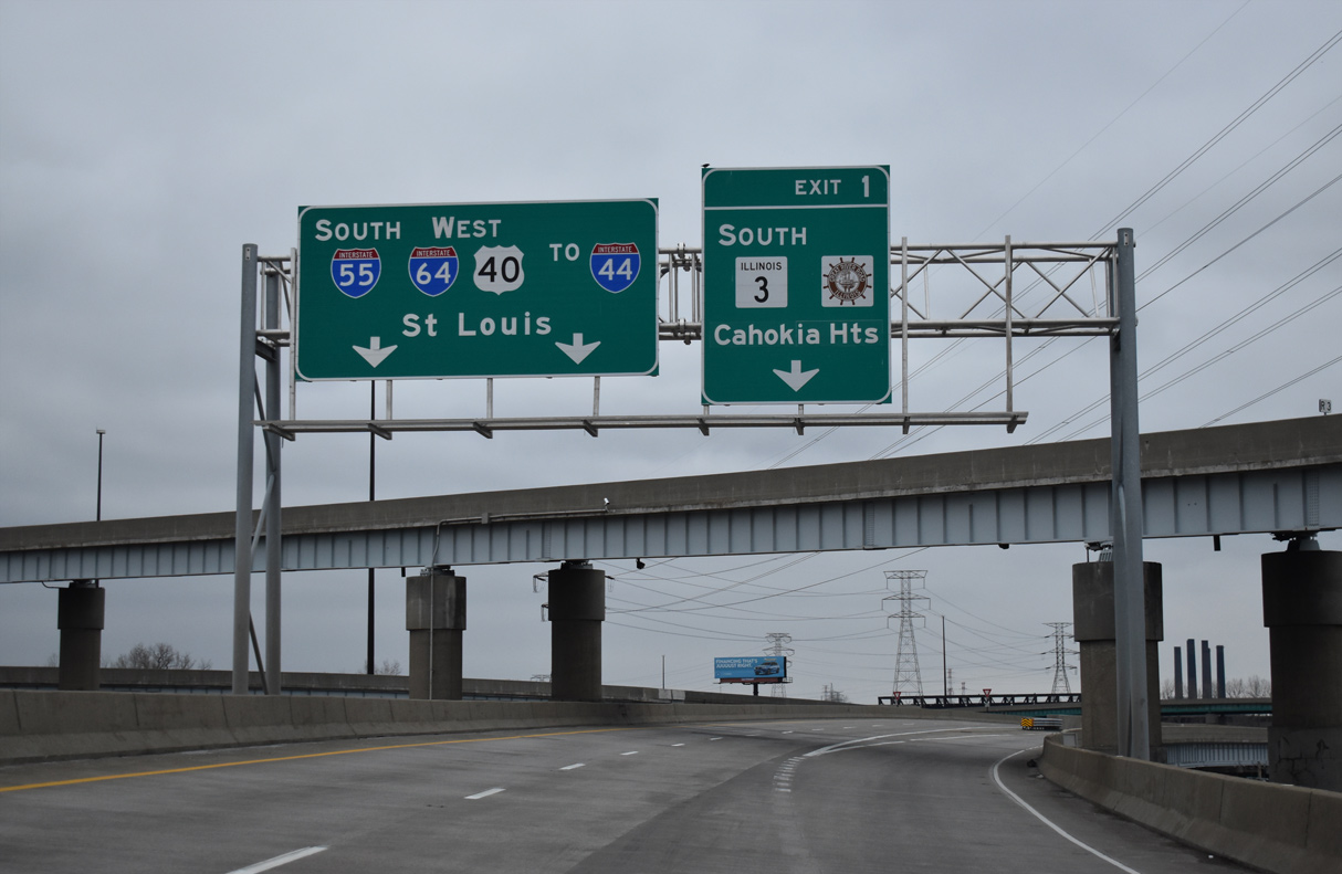
| IL 3 parts ways with I-55-64/U.S. 40 at the final Illinois exit for Sauget, Cahokia Heights and Dupo. 12/31/23 |
|
| Three-wye interchanges with IL 3 (Mississippi Avenue) south and a freeway stub to Tudor Avenue and 13th Street follow the elevated stretch over a Metrolink line and Main Street in East St. Louis. Exit 1 forms a c/d roadway to both. 12/31/23 |
|
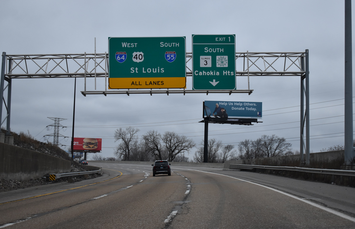
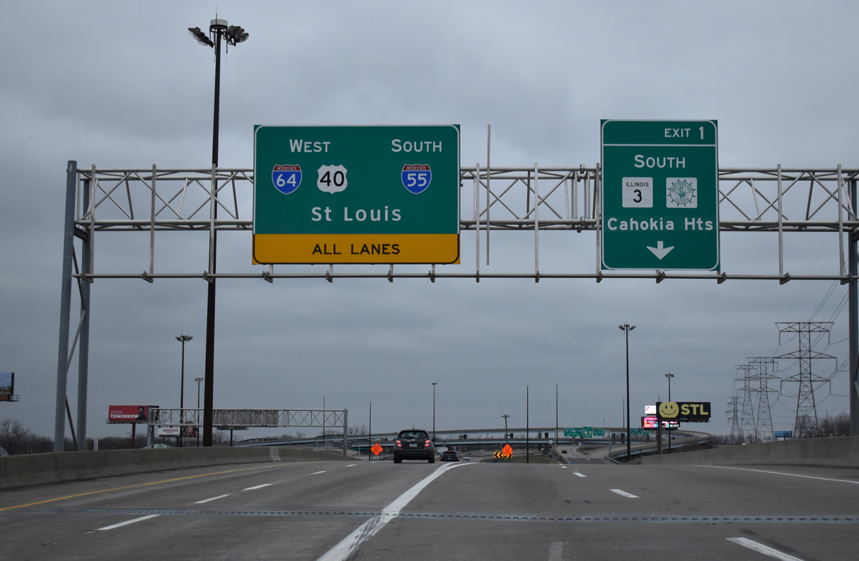
| Greenouts added to Exit 1 for IL 3 south replaced Cahokia with Cahokia Heights. The city was formed on May 6, 2021 when the city of Centreville merged with the villages of Cahokia and Alorton.1 12/31/23 |
|
| I-55/64 split into separate two lane roadways at Exit 1. All lanes continue through, but the outer roadway is required for IL 3 (Mississippi Avenue) / Great River Road south to Cahokia Heights. 12/31/23 |
|
| Previously an unnumbered ramp, Exit 1 B leaves the c/d roadway for the freeway stub to Tuder Avenue south at 13th Street in East St. Louis. 12/31/23 |
|
| The tri-level interchange with I-55/64 was built in anticipation of a planned freeway linking the Poplar Street Bridge with IL 15 (Missouri Avenue) and IL 163 at Alorton. 05/24/18 |
|
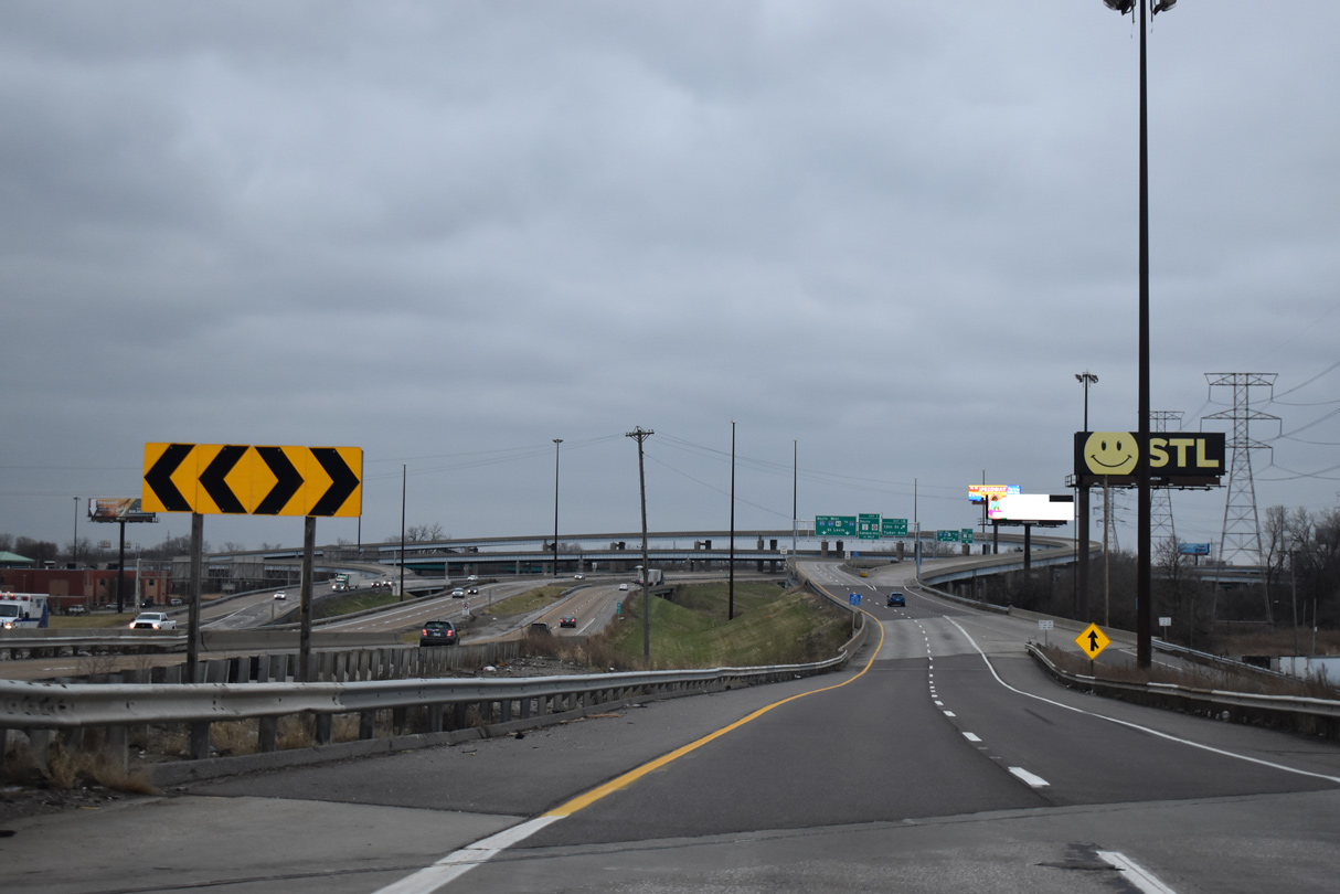
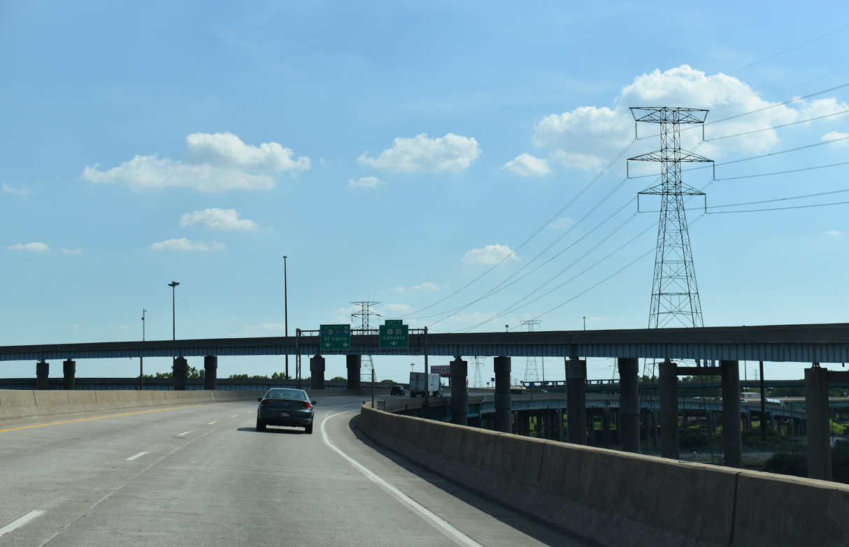
| A second flyover leaves the c/d roadway at Exit 1 for IL 3 southbound. IL 3 comprises a 189 mile long highway from Grafton southeast to Cairo. 12/31/23 |
|
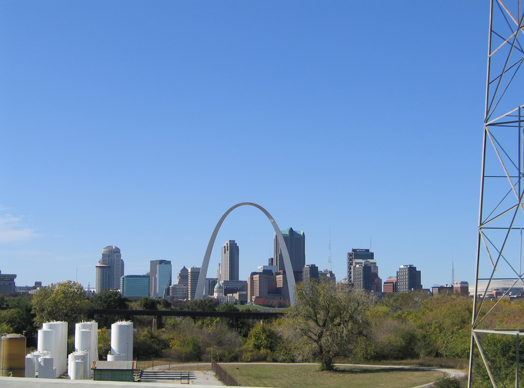
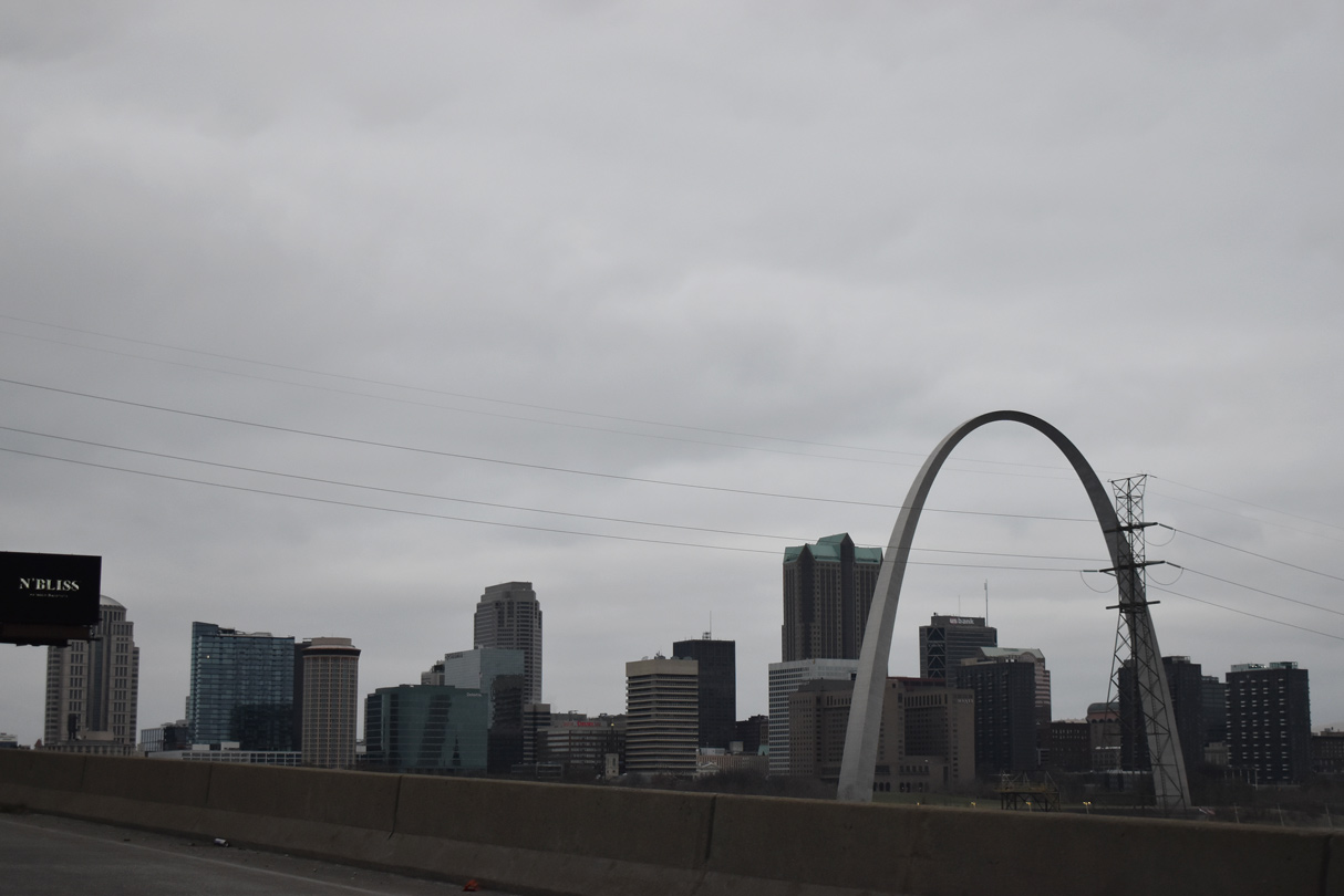
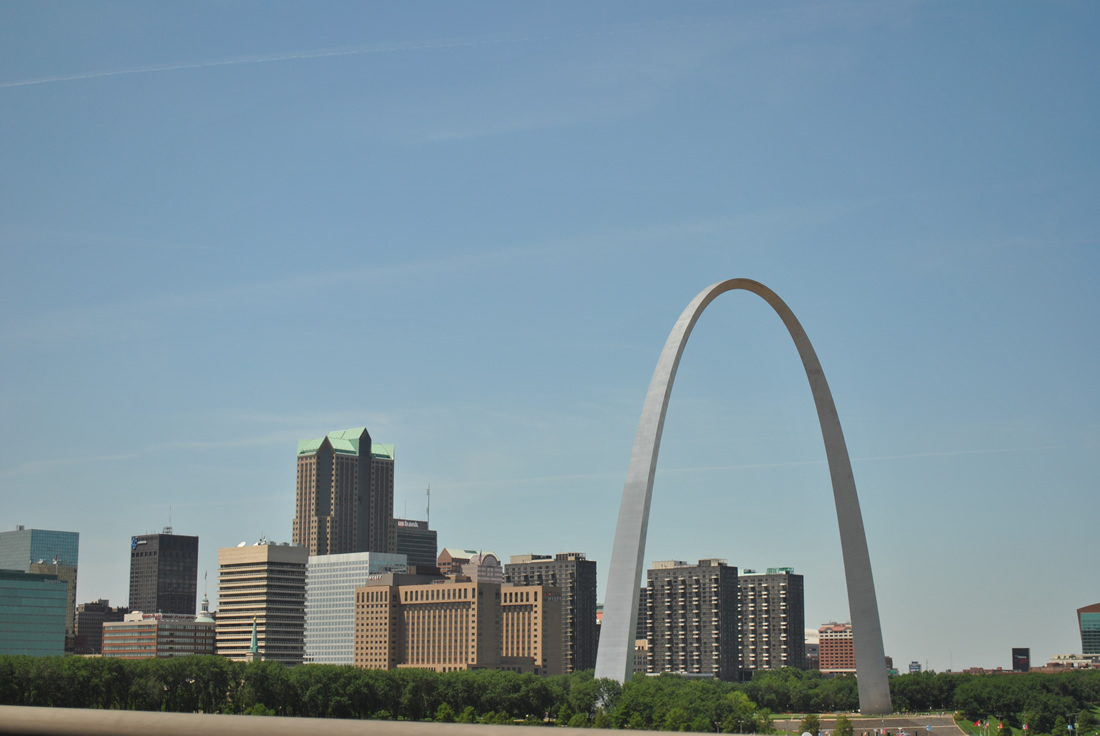
| The Gateway Arch rises to the west from I-55/64-U.S. 40 at the exchange with IL 3. 10/16/04 |
|
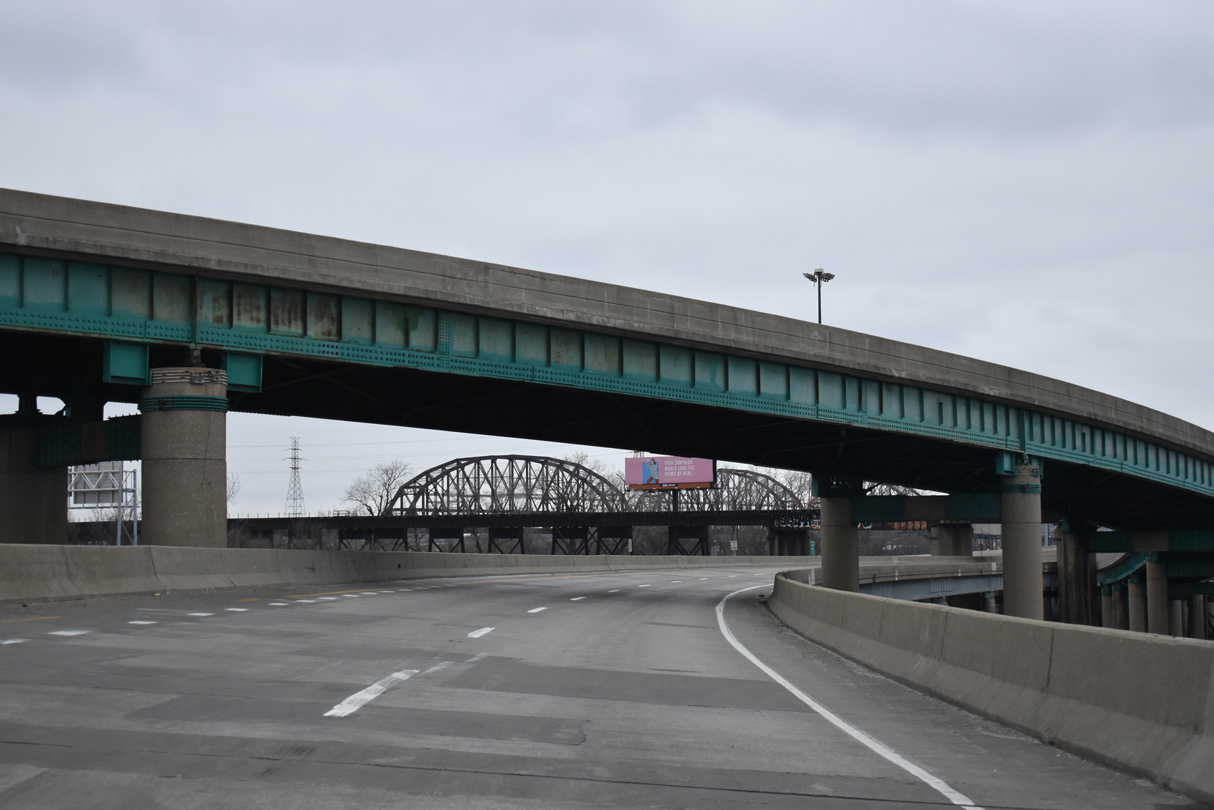
| The railroad trestle in the foreground leads onto the MacArthur Bridge (former U.S. 67 Alternate/U.S. 460). 06/01/11 |
|
| The northbound flyover from IL 3 combines with the c/d roadway at Exit 1 ahead of the Poplar Street Bridge west. 12/31/23 |
|
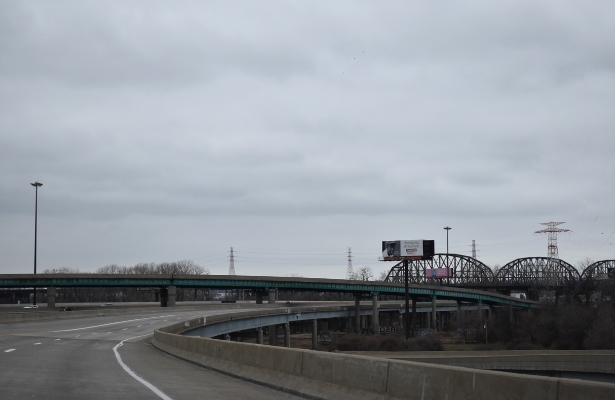
| The aforementioned railroad bridge linking the Illinois Central Railroad with the MacArthur Bridge passes above the Poplar Street Bridge east end. 12/31/23 |
|
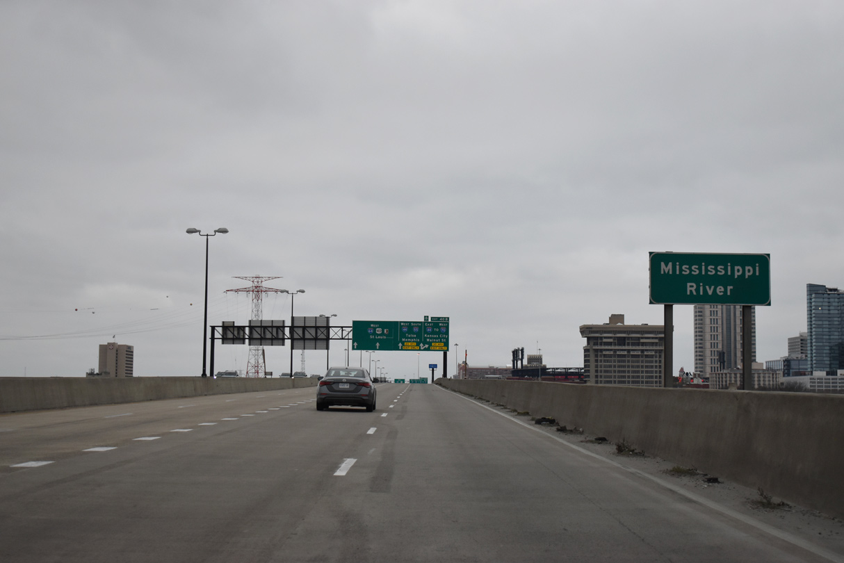
| Carrying eight overall lanes and completed in 1967, the Poplar Street Bridge spans the Mississippi River between East St. Louis and Exit 40 B where I-55 turns south alongside I-44 from I-64/U.S. 40 west by Downtown St. Louis. 12/31/23 |
|
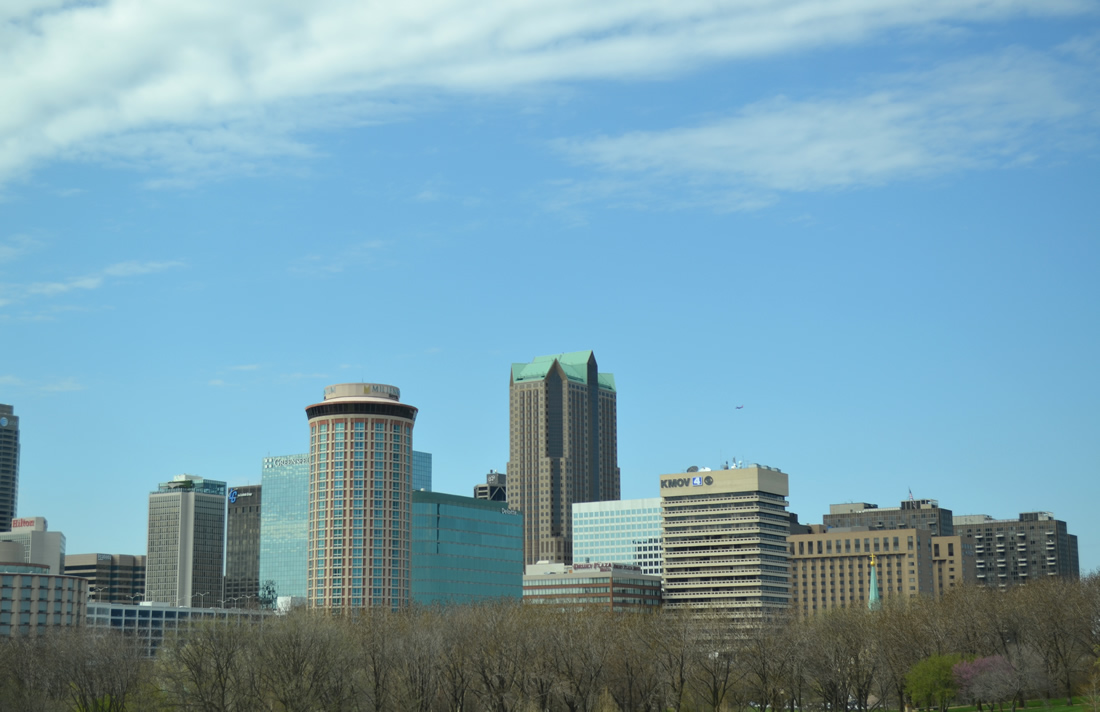
| The Gateway Arch and Jefferson National Expansion Memorial come into view beyond the west banks of the Mississippi River by Downtown St. Louis. Completed in 1965, the arch stands 630 feet high and represents the Gateway to the West, a symbolism of American westward expansion.2 12/31/23 |
|
| Poplar Street Bridge is a deck girder bridge stretching 2,164 feet in length at a height of 92 feet above the Mississippi River.3 12/31/23 |
|
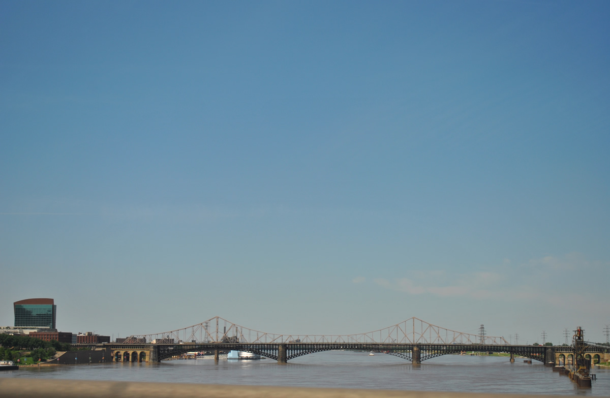
| The Eads and Dr. Martin Luther King, Jr. Memorial Bridges parallel I-55/64 to the north. The Mississippi River ran above normal in 2011 due to heavy rainfall in the Spring. 06/01/11 |
|
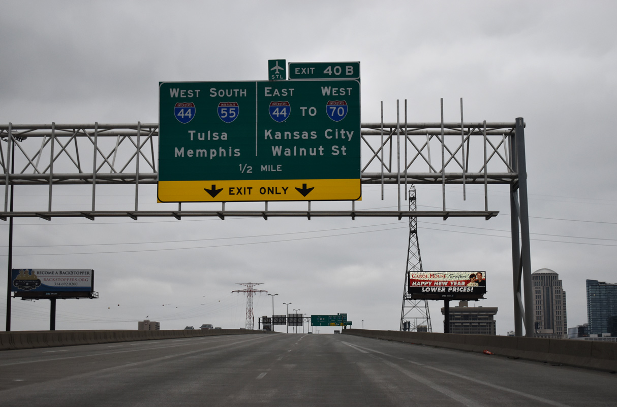
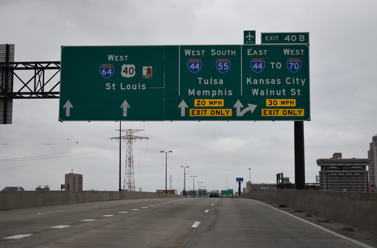
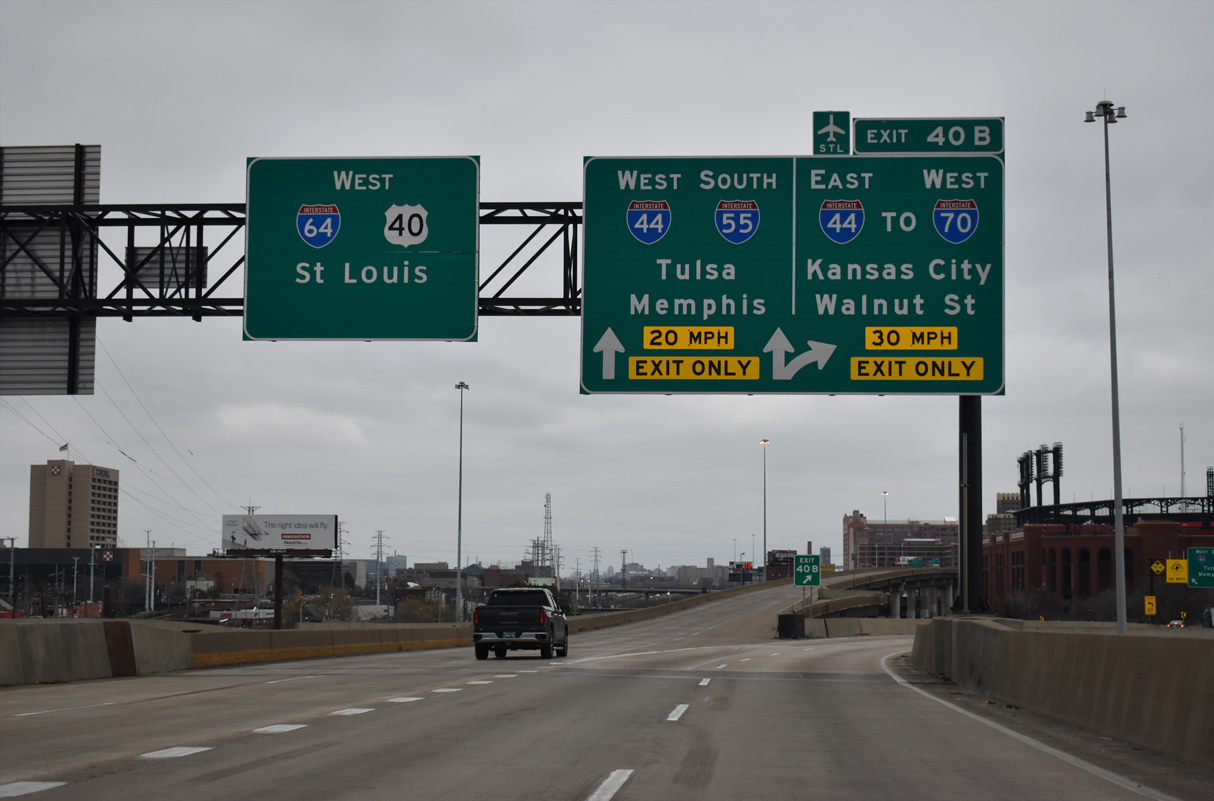
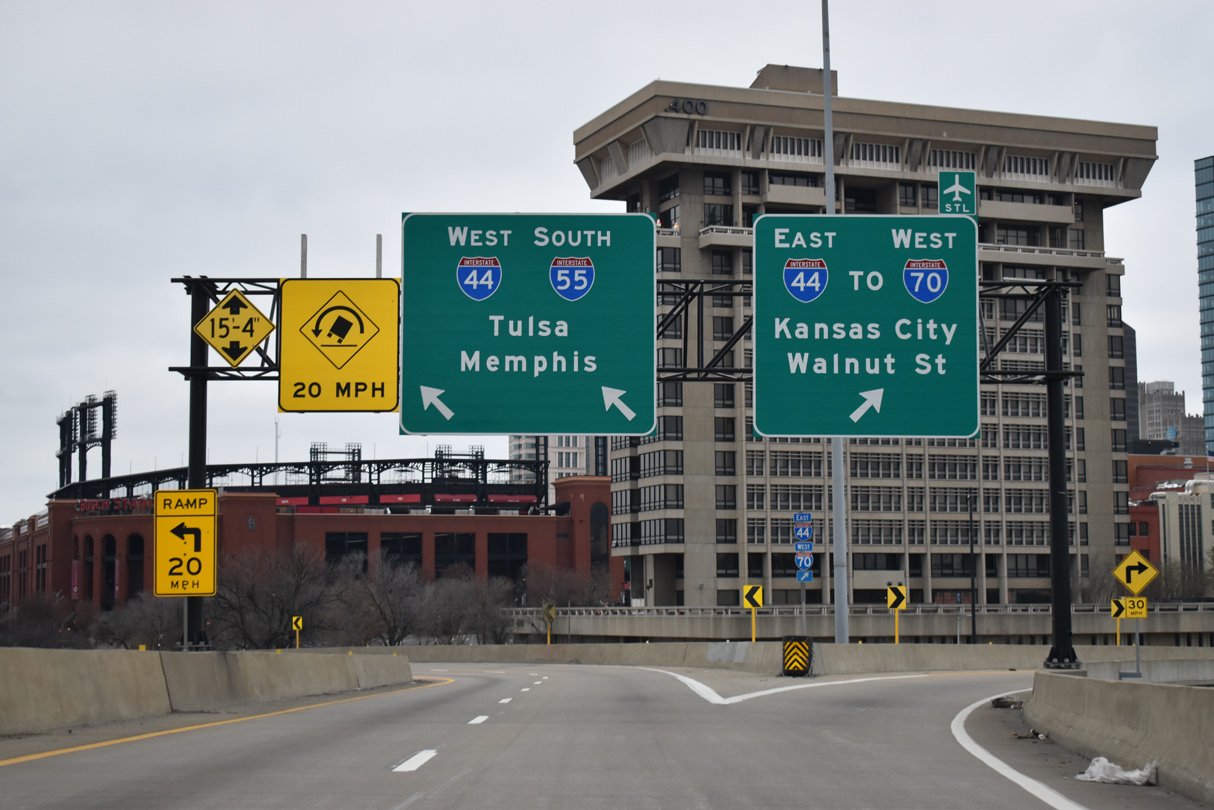
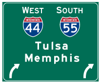
| I-55 separates with I-64/U.S. 40 at a wye interchange (Exit 40 B) with an additional ramp to I-44 eastbound and Walnut Street. I-44/55 overlap south to La Salle in St. Louis. I-55 continues from there to to Cape Girardeau and Memphis, Tennessee. 12/31/23 |
|
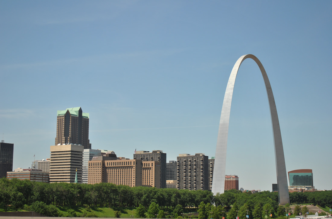
| The skyline of St. Louis, anchored by the Gateway Arch. The eastbound entrance ramp for I-44 partitions with a connection to Memorial Drive to the adjacent National Park. 06/01/11 |
|
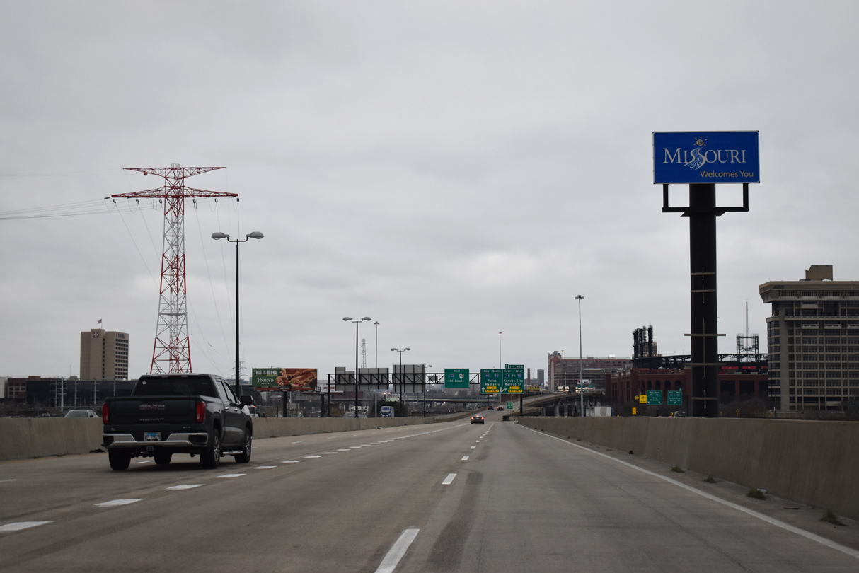
| Entering Missouri and the city of St. Louis along I-55-64/U.S. 40 west. 12/23/23 |
|
| Additional views of the St. Louis skyline afforded to westbound traffic across the Poplar Street Bridge. 06/01/11, 12/23/23 |
|
| I-64/U.S. 40 shift into a double-deck freeway from west the split with I-55 by Busch Stadium and Downtown West while I-55 turns south through the Soulard and Dutchtown neighborhoods in St. Louis to vacate the city ahead of Mehlville. 12/23/23 |
|
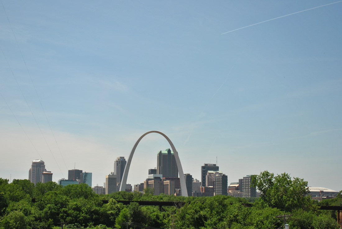
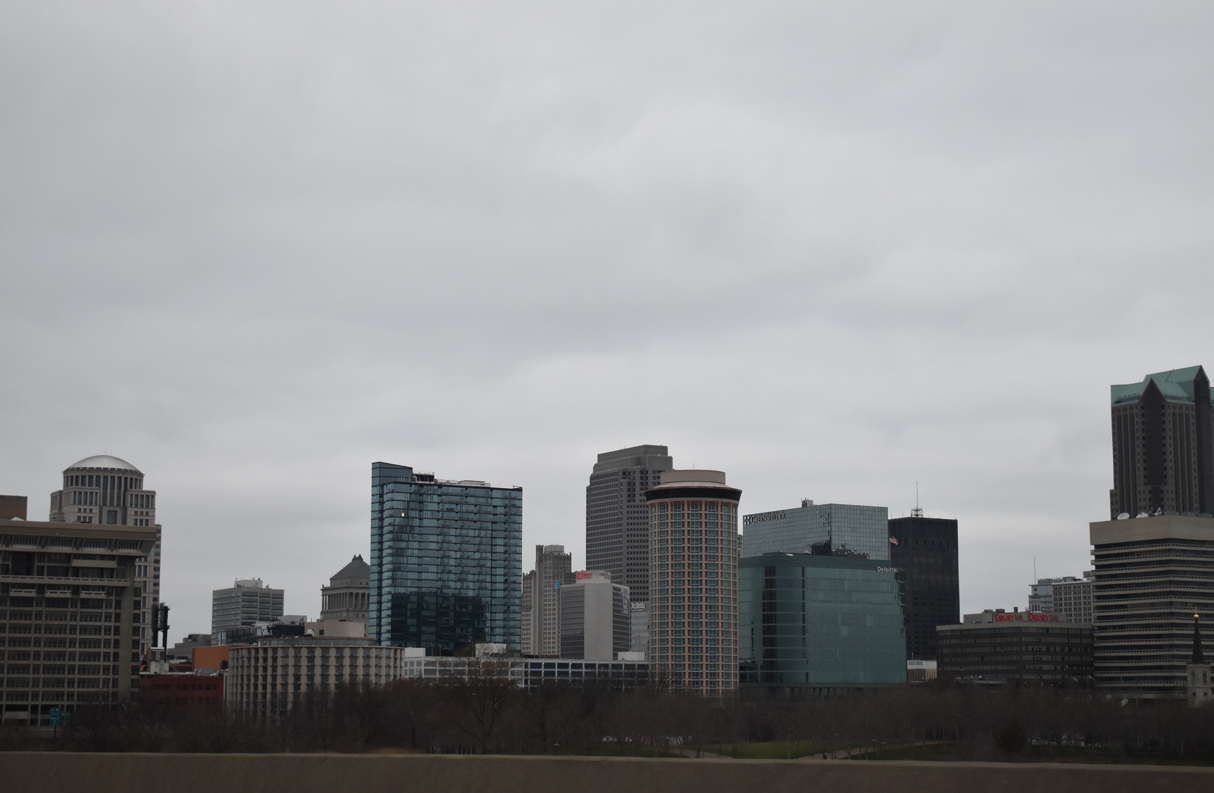
| The Downtown skyline of St. Louis unfolds beyond the tree tops of Jefferson National Expansion Memorial. 04/13/13 |
|
| Exit 40 B partitions for Interstate 44 east to I-70 west from the Stan Musial Veterans Memorial Bridge to Kansas City and nearby Walnut Street to Gateway Arch National Park. I-44 branches west from I-55 south in 1.1 miles for Kirkwood, Eureka, Springfield, Joplin and ultimately Tulsa, Oklahoma. 12/23/23 |
Page Updated 01-12-2024.


 West
West