|
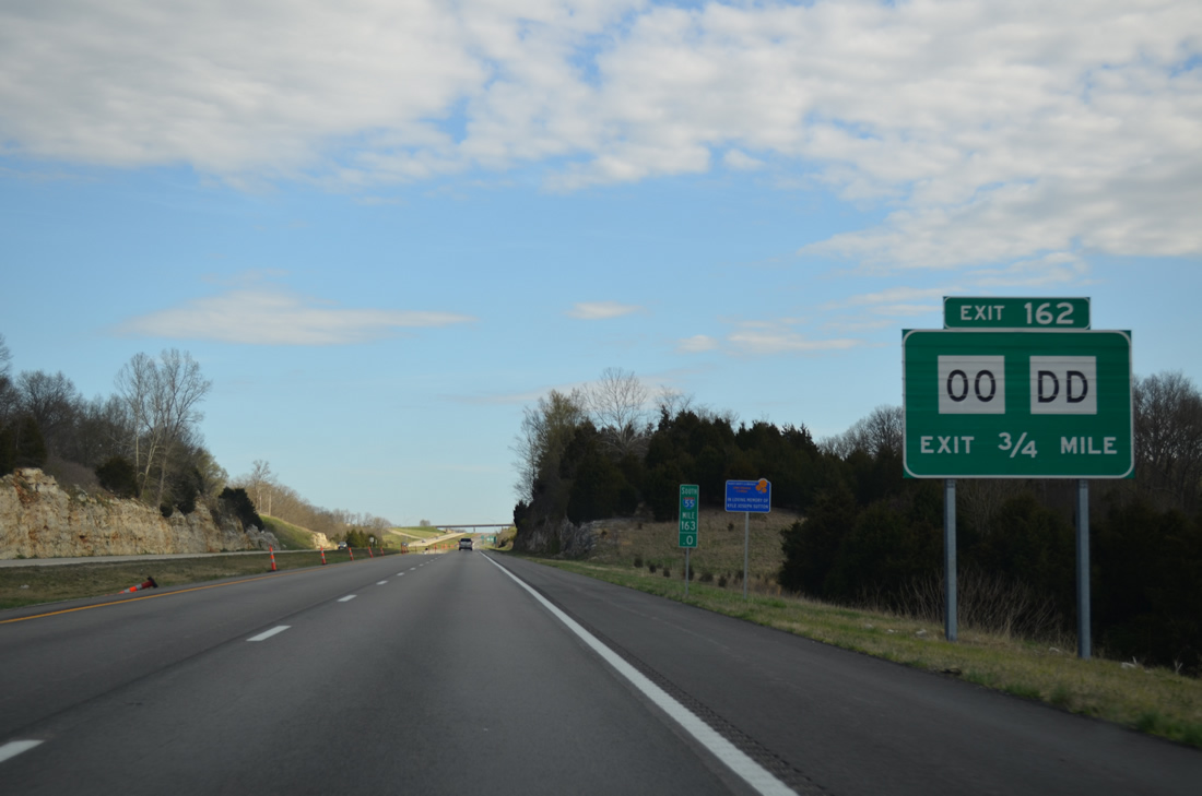
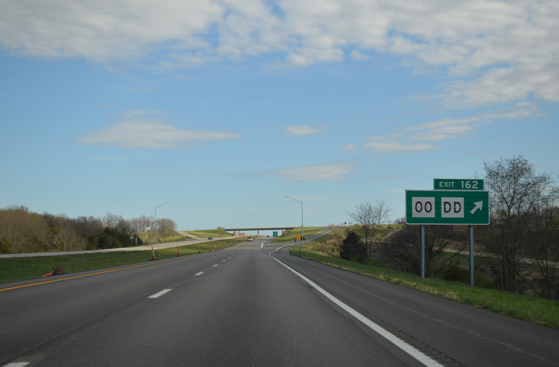
| The first of six interchanges in Sainte Genevieve County joins Interstate 55 south with Highway DD west and Highway OO east at Valley View. 04/13/13 |
|
| Highway DD runs west 9.78 miles from Exit 162 to Highway T in Jefferson County. Highway OO extends the route 0.78 miles east to parallel U.S. 61. 04/13/13 |
|
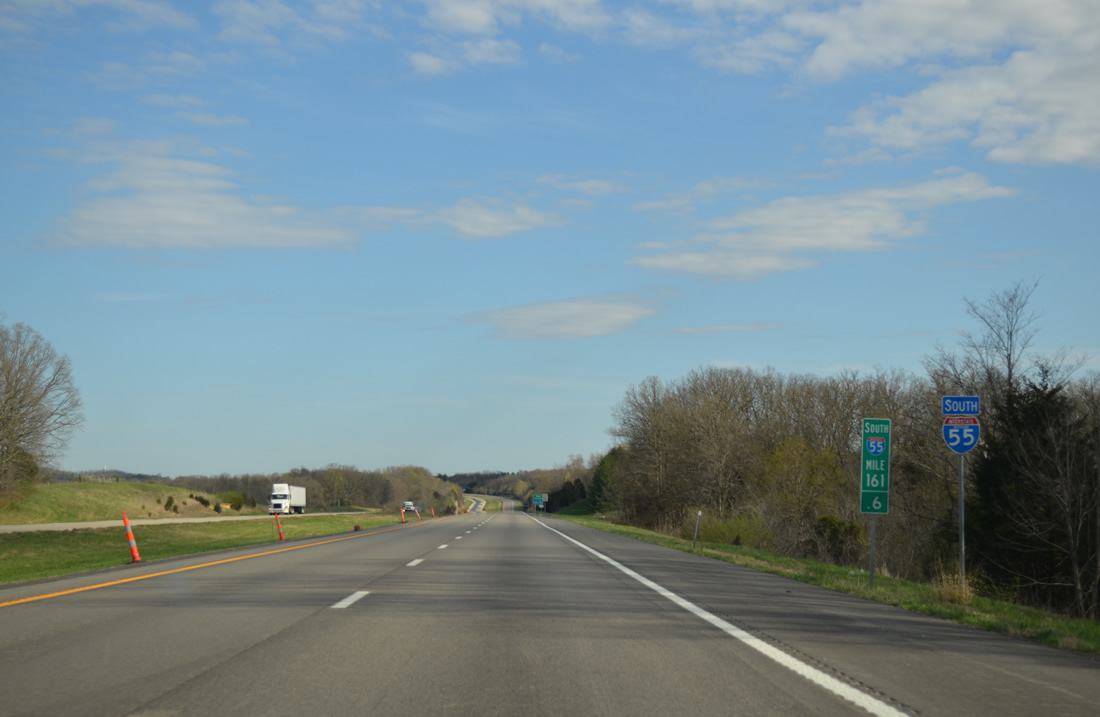
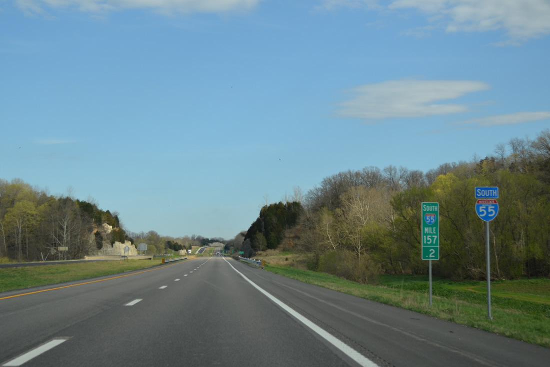
| Interstate 55 passes by Sunset Lake beyond this reassurance marker. 04/13/13 |
|
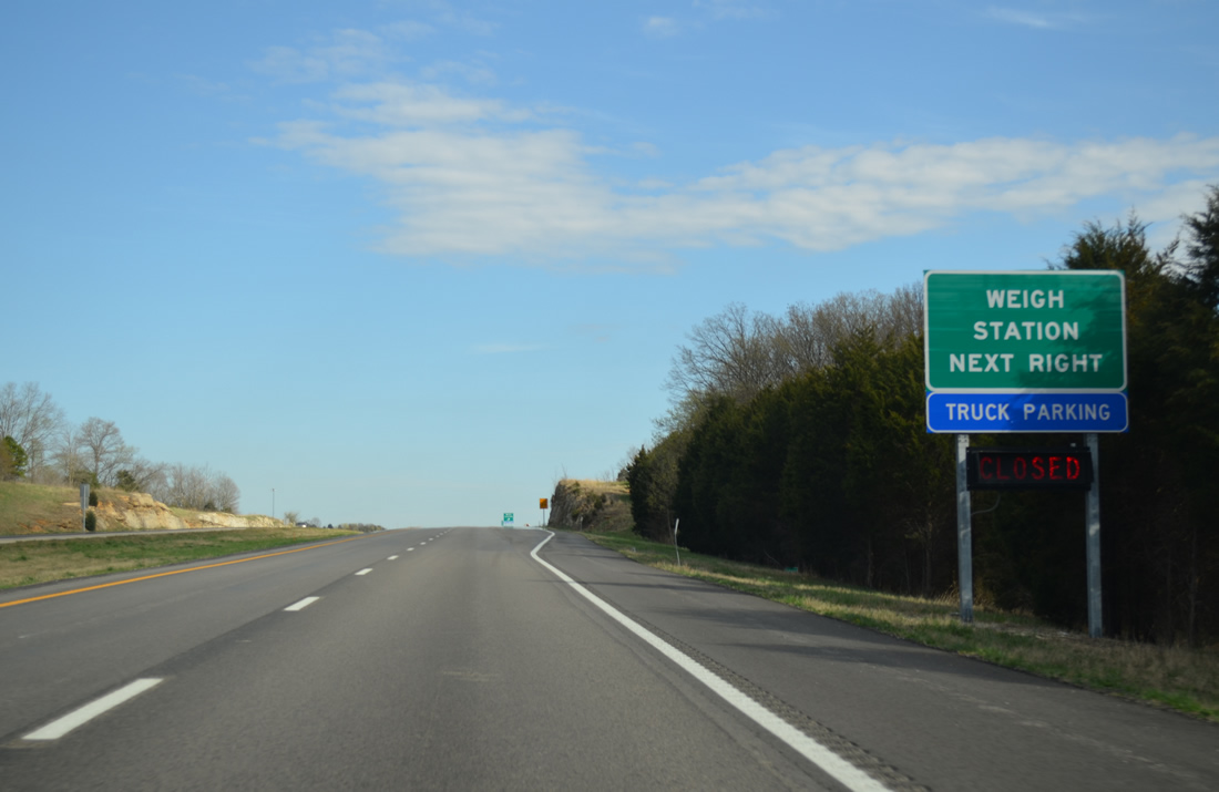
| The former southbound rest area near Bloomsdale was converted to a high-tech weigh station during construction in 2011 and 2012. It replaced the older facility at Barnhart.1 04/13/13 |
|
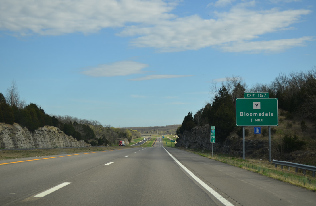
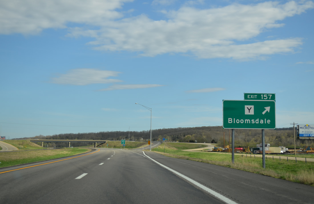
| Highway Y, an 18.53 mile route between U.S. 61 at Bloomsdale and U.S. 67 at Halifax, meets Interstate 55 in one mile at Exit 157. 04/13/13 |
|
| A diamond interchange links Interstate 55 and Highway Y at Exit 157. Highway Y ends at U.S. 61 a half mile to the east. French Village in St. Francois County is 9.6 miles to the west. 04/13/13 |
|
| Leaving Bloomsdale, Interstate 55 crosses Fourche a Du Clos and Establishment Creeks on a stretch of freeway completed in 1970. 04/13/13 |
|
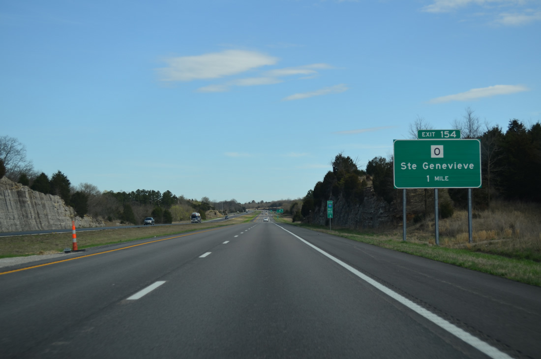
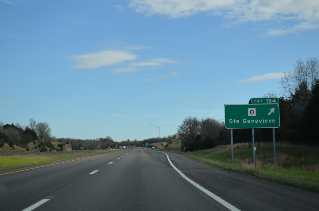
| Interstate 55 next meets Highway O at a diamond interchange (Exit 154) in one mile. 04/13/13 |
|
| Highway O provides a cutoff via Rocky Ridge to Route 32 south to Weingarten and Farmington along a 6.22 mile route. East from Exit 154, U.S. 61 arcs away from I-55 to the county seat of Sainte Genevieve. 04/13/13 |
|
| Kimmel Lake Road accompanies the west side of Interstate 55 ahead of an agricultural area at Zell. 04/13/13 |
|
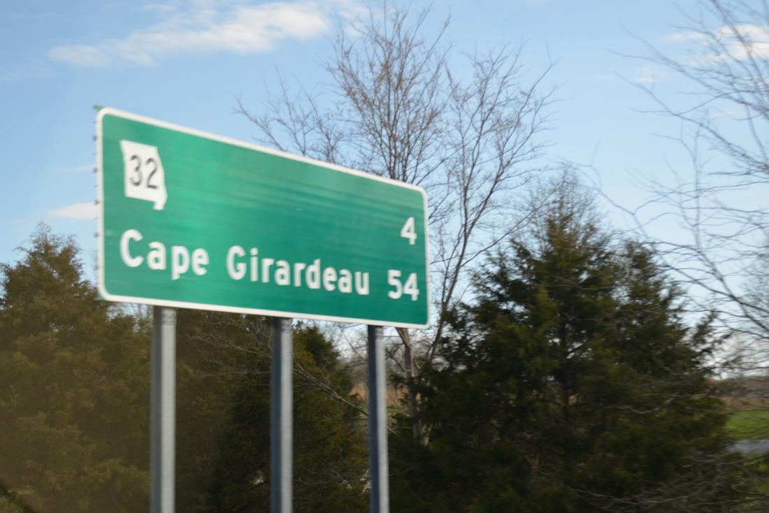
| Route 32 crosses paths with Interstate 55 in four miles, 50 miles north of the control city of Cape Girardeau. 04/13/13 |
|
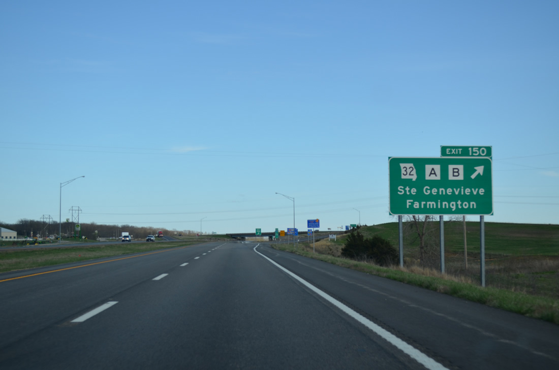
| A diamond interchange connects Interstate 55 south with the confluence of Route 32 east to Ste. Genevieve and west to Farmington, Highway A north to Zell and Highway B south to River aux Vases. 04/13/13 |
|
| The Ste. Genevieve-Modoc Ferry provides the first automobile crossing of the Mississippi River south of the Jefferson Barracks Bridge (I-255/U.S. 50). The service links Little Rock Road north of Ste. Genevieve with Modoc Ferry Road from Kellogg, Illinois. 04/13/13 |
|
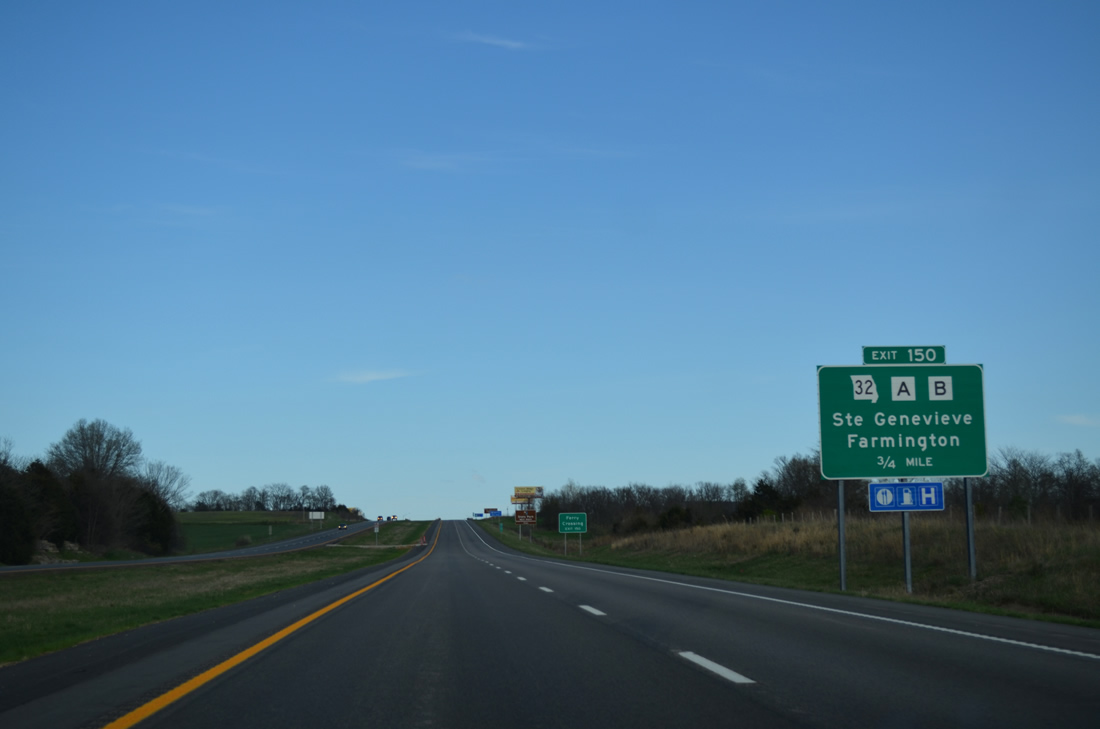
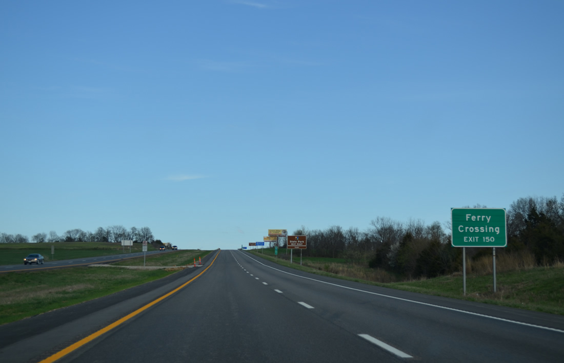
| Exit 150 leaves Interstate 55 south for Missouri Route 32, a 285 mile cross state highway between El Dorado Springs and U.S. 61 in Ste. Genevieve. Highway B leads southwest 13.75 miles to Cullman while Route 32 travels 11.2 miles west to Route 144, the entrance road to Hawn State Park. 04/13/13 |
|
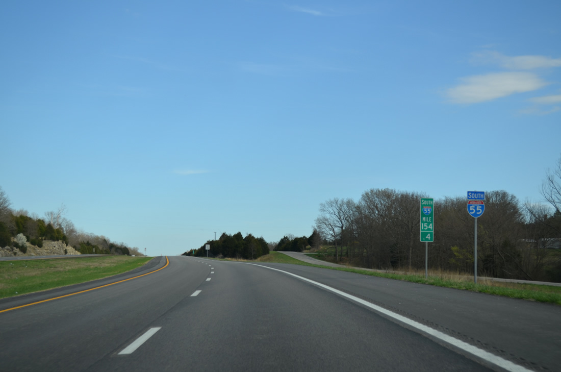
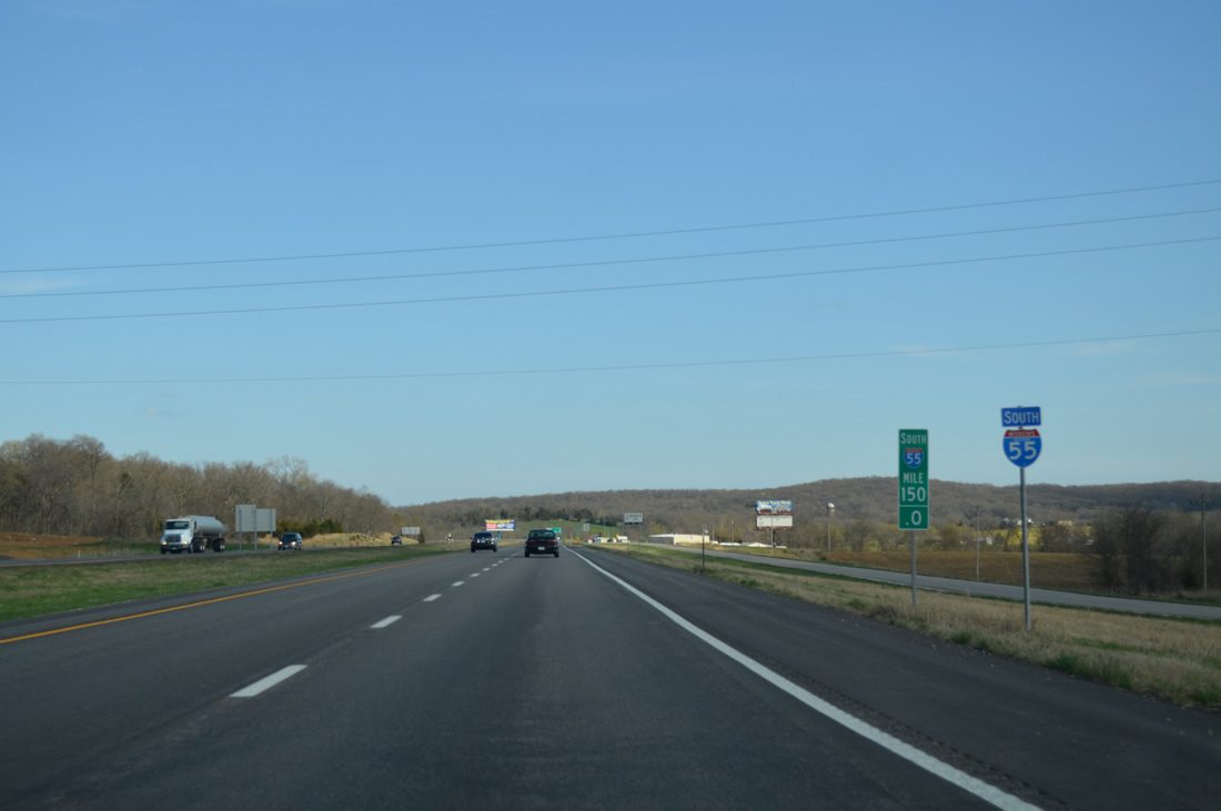
| Highway B appears to the right of this reassurance marker posted at milepost 150. 04/13/13 |
|
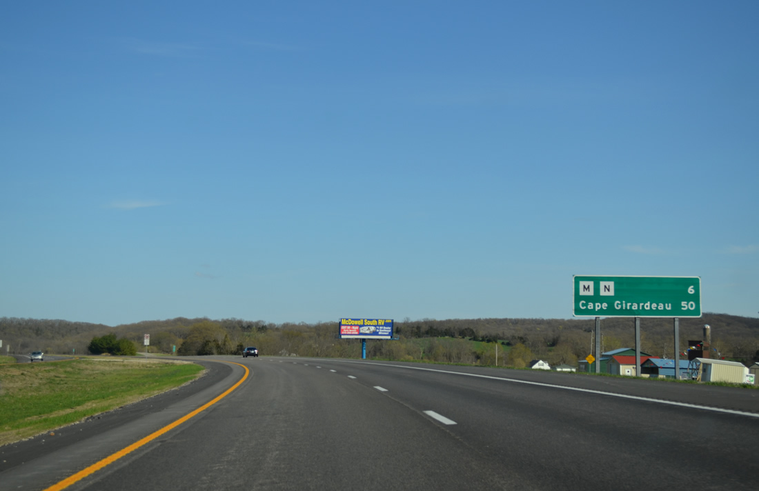
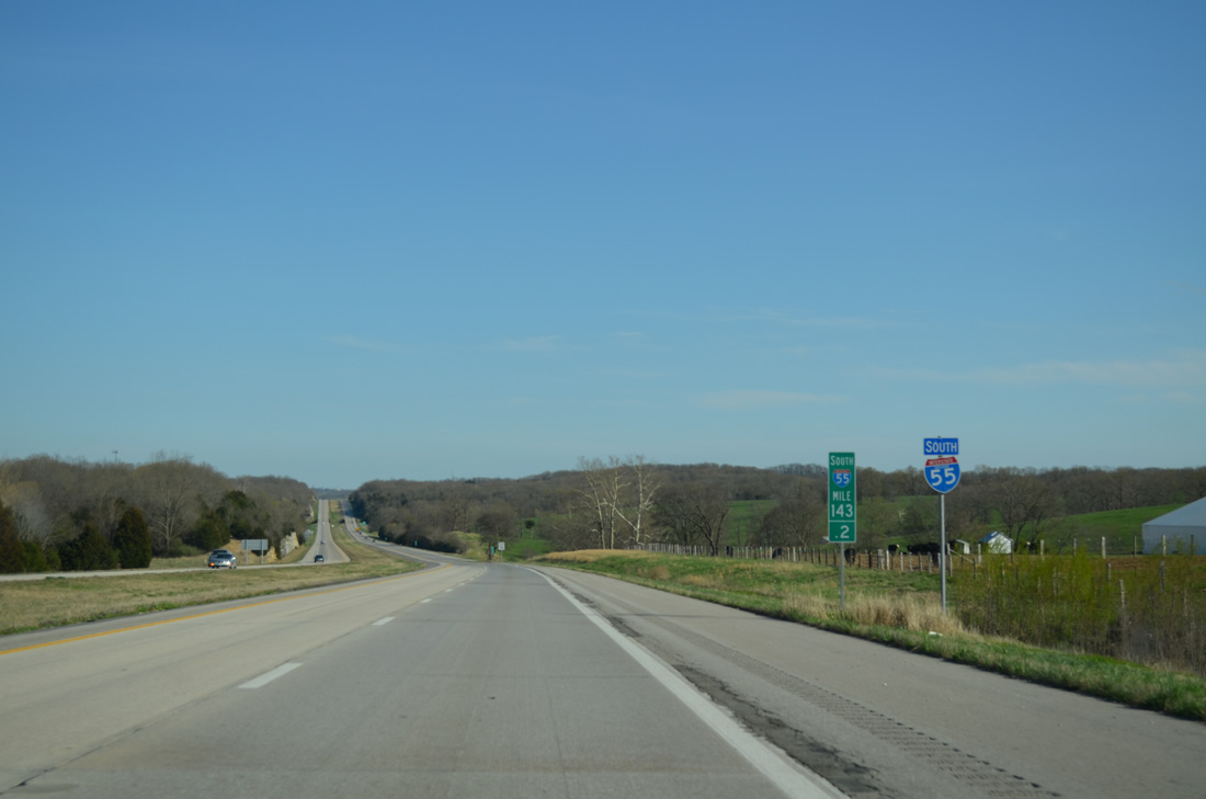
| Similar to Exit 154, forthcoming Exit 143 represents the ends of two Missouri secondary highways. Cape Girardeau is 50 miles away. 04/13/13 |
|
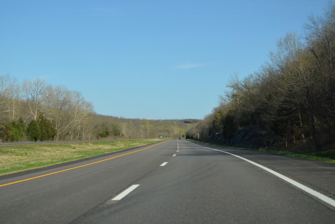
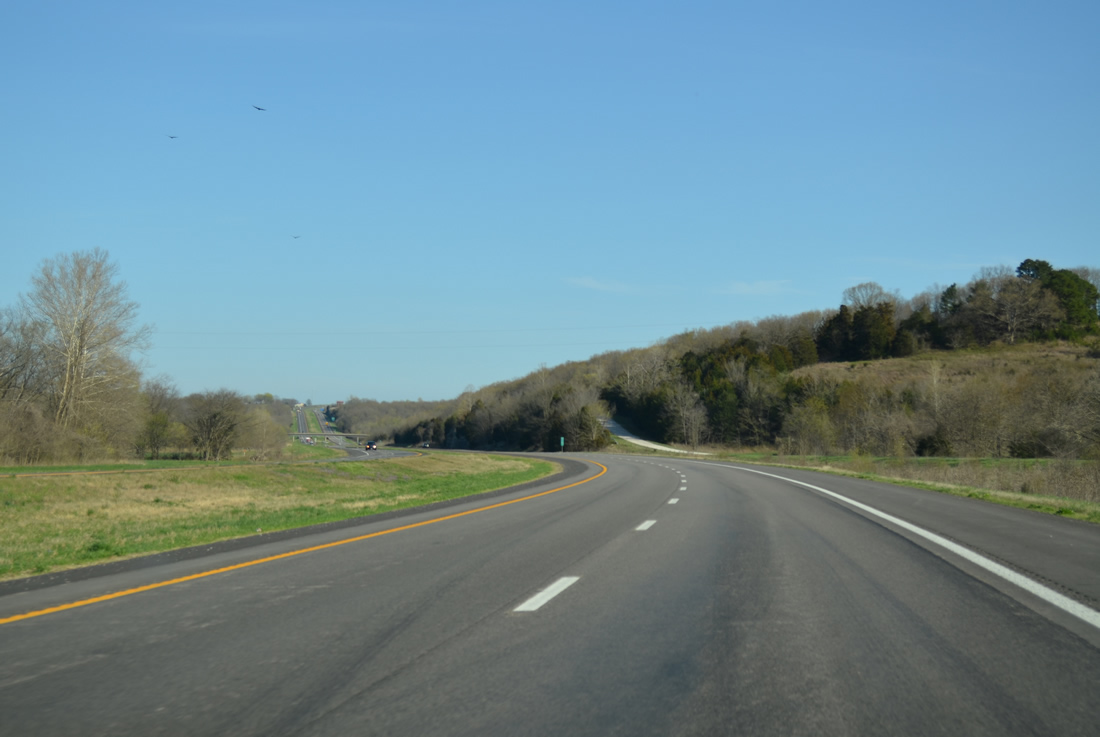
| Interstate 55 traverses the forested Beckett Hills over the next several miles. 04/13/13 |
|
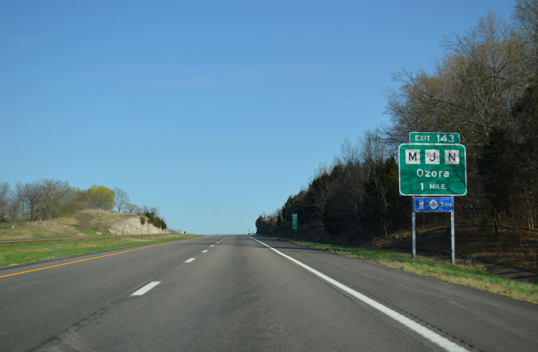
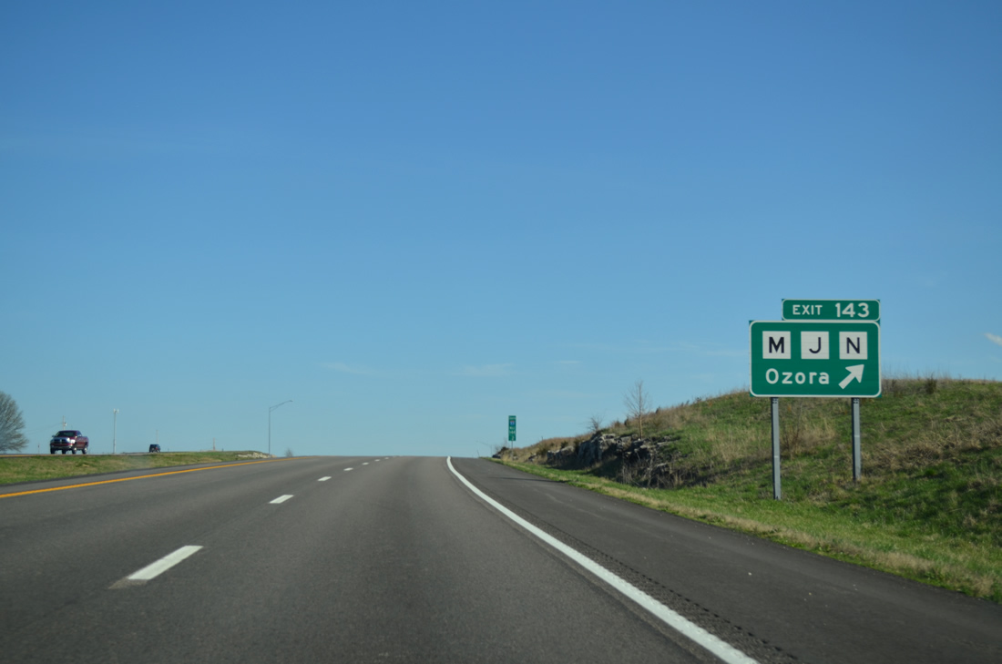
| Rising from the River Aux Vases, Interstate 55 is within one mile of the diamond interchange (Exit 143) with Highway N south to nearby Ozora, Highway M north to Ste. Genevieve and Highway J east across Lick Hill. 04/13/13 |
|
| Highway N spurs south 10.68 miles from Exit 143 to Minnith and Holmes Road. Highway J stems east from Highway M 4.39 miles to U.S. 61, north of St. Mary. 04/13/13 |
|
| Beyond Exit 143, Interstate 55 straightens to cross Little Saline Creek. This portion of freeway was completed in 1970. 04/13/13 |
|
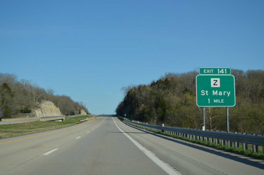
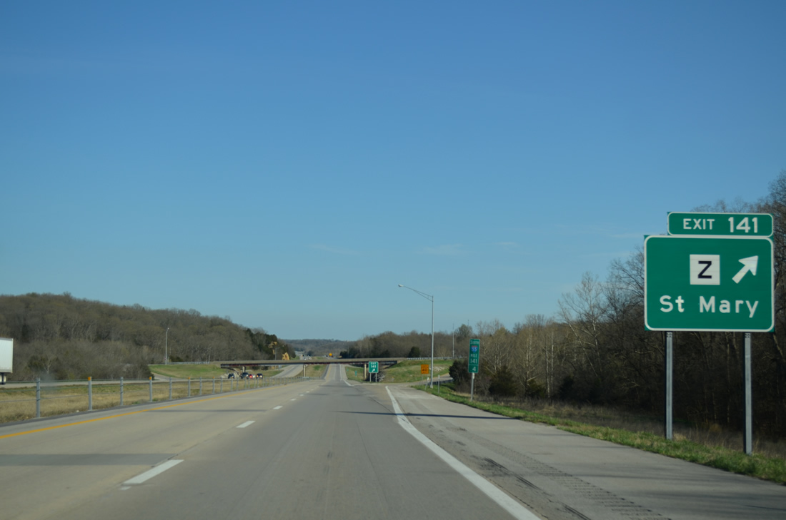
| Exit 141 is a diamond interchange with Highway Z west of St. Mary. 04/13/13 |
|
| A 4.32 mile route, Highway Z meanders east from Highway N to Exit 141 and U.S. 61 just outside the St. Mary city limits. 04/13/13 |
|
| Continuing beyond Exit 141, Interstate 55 advances to Saline Creek. 04/13/13 |
|
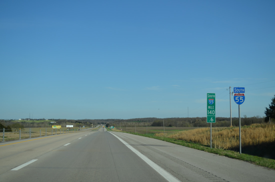
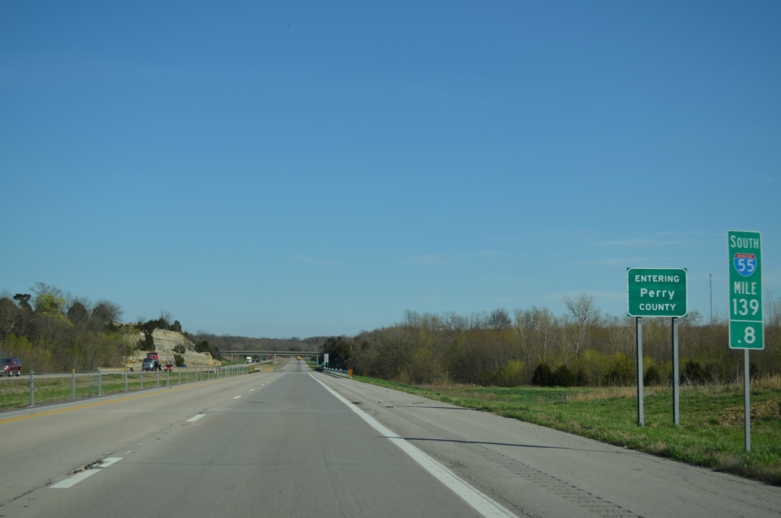
| Southbound I-55 enters Perry County just ahead of Saline Creek, completing a 25.11 mile stretch in Ste. Genevieve County. 04/13/13 |
|
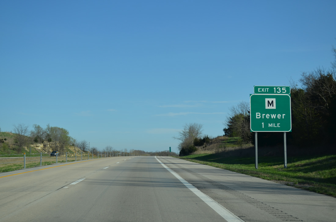
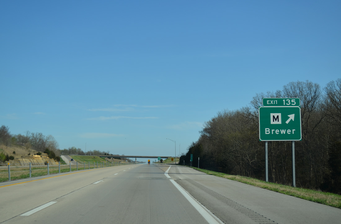
| Exit 135 with Highway M is the first of three interchanges along Interstate 55 south in Perry County. Highway M connects the freeway with U.S. 61 at Brewer. 04/13/13 |
|
| Highway M begins a 7.75 mile route at the diamond interchange (Exit 135) with I-55. The route overlaps with U.S. 61 briefly before turning north to Lithium and Highway H near Perryville Municipal Airport. 04/13/13 |
|
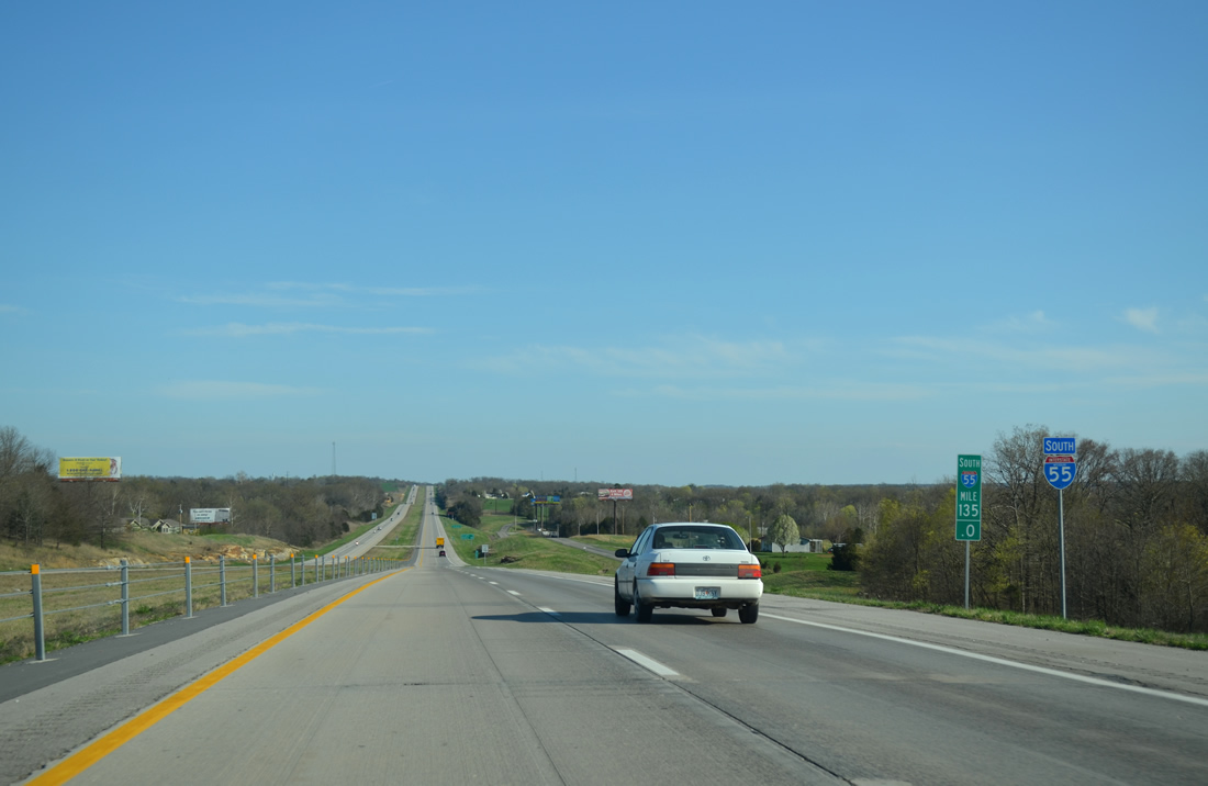
| A long straight away lies beyond Exit 135 with Interstate 55 paralleling County Road 806 through mostly agricultural areas to the Perryville area. 04/13/13 |
|
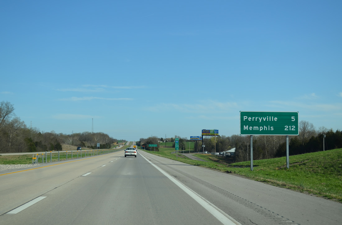
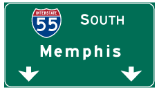
| Memphis debuts on southbound distance signs at 212 miles away. Memphis originates as a control point as far north as I-57 at Chicago, Illinois 04/13/13 |
|
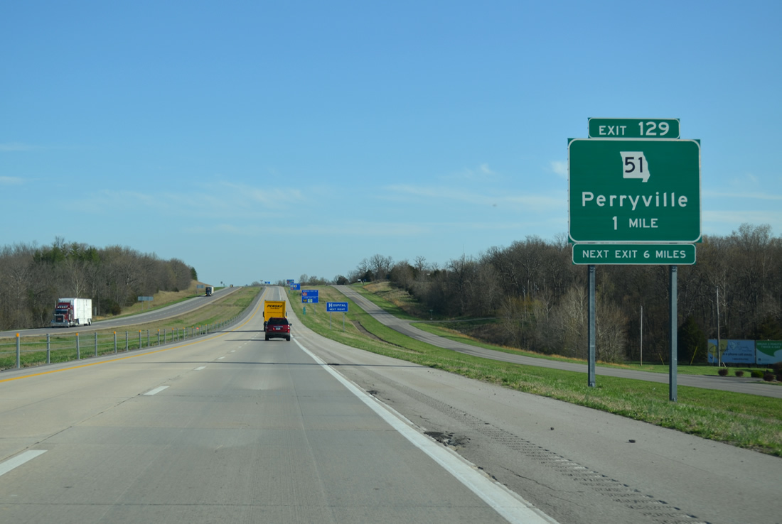
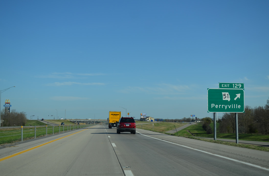
| Route 51 (Perryville Boulevard) follows an at-grade bypass around the west and north sides of Perryville to meet Interstate 55 at a diamond interchange (Exit 129) in one mile. 04/13/13 |
|
| Traveling 121.12 miles, Route 51 leads south from the Chester Bridge and the Mississippi River to the Arkansas state line south of Fagus. The state highway travels a rural route south from Perryville to Patton and the Bollinger County seat of Marble Hill. Northward, Route 51 followed St. Joseph Street east from Perryville Boulevard to Downtown and Main Street before shifting to a new alignment to the west. 04/13/13 |
|
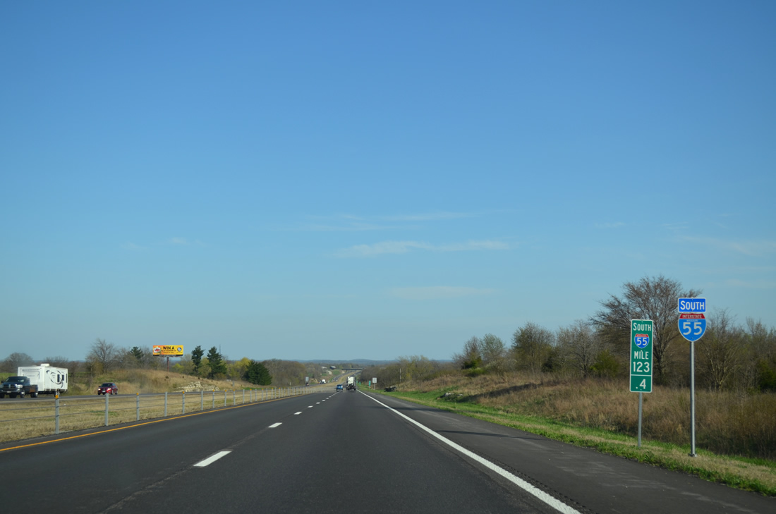
| Heading south from Perryville, Interstate 55 spans Cinque Hommes Creek five miles from Exit 123 to Highway B. Cape Girardeau is 33 miles to the south. 04/13/13 |
|
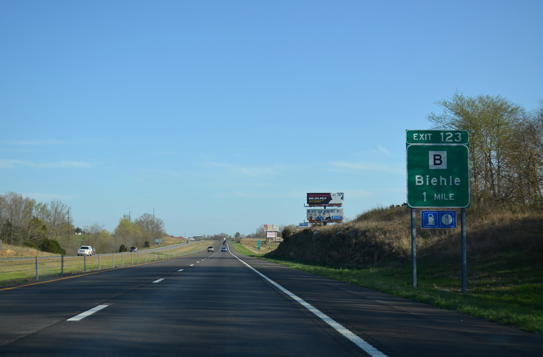
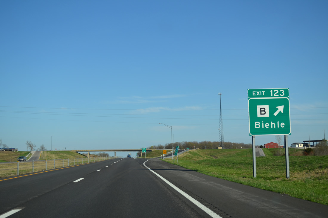
| Highway B originates from U.S. 61 (Kingshighway Street) and Main Street (old Route 51) in Perryville. The secondary route meanders south ten miles to Biehle. 04/13/13 |
|
| I-55 south at the diamond interchange (Exit 123) with Highway B. 25.10 miles in length, Highway B continues from nearby Biehle to Daisey and Route 72 near Millersville. 04/13/13 |
|
| Reassurance shield posted ahead of a straight stretch preceding the Highway F overpass. Rocky Branch flows along the west side of the freeway over the ensuing stretch. 04/13/13 |
|
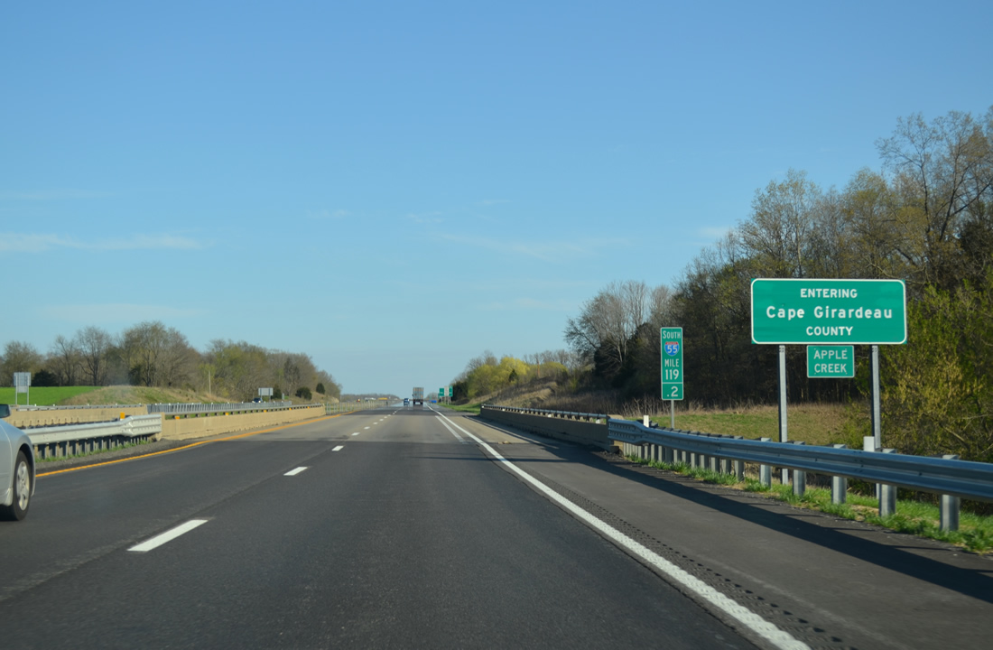
| Crossing Apple Creek, southbound motorists of Interstate 55 reach Cape Girardeau County. The freeway totaled 20.64 miles through Perry County. 04/13/13 |
Page Updated 11-18-2013.

 South
South