|
| Reassurance marker posted at the Norfolk Southern Railroad underpass from Hesler-Noble Field Airport (LUL) in south Laurel. 06/02/10 |
|
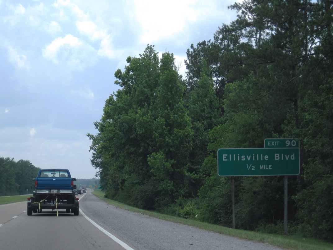
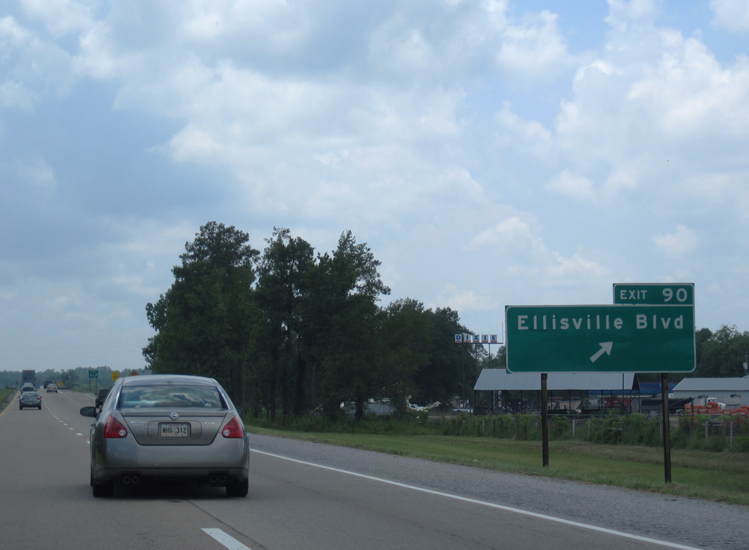
| Previous guide signs for the diamond interchange (Exit 90) joining Interstate 59 with Ellisville Boulevard omitted U.S. 11. 06/02/10 |
|
| U.S. 11 (Ellisville Boulevard) switches sides with Interstate 59 as both lead south to the city of Ellisville. 06/02/10 |
|
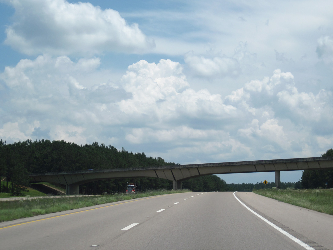
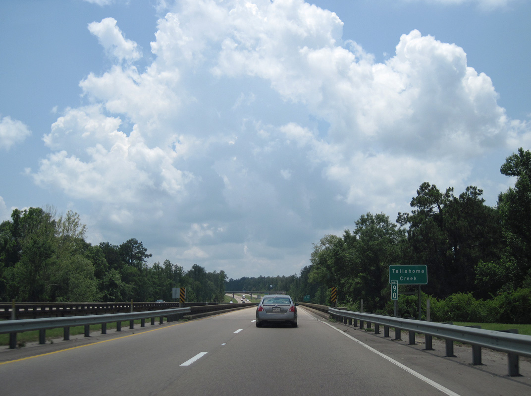
| Interstate 59 crosses Tallahoma Creek on bridges constructed in 1960. 06/02/10 |
|
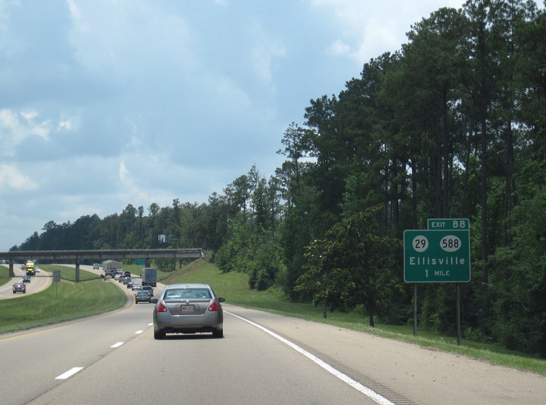
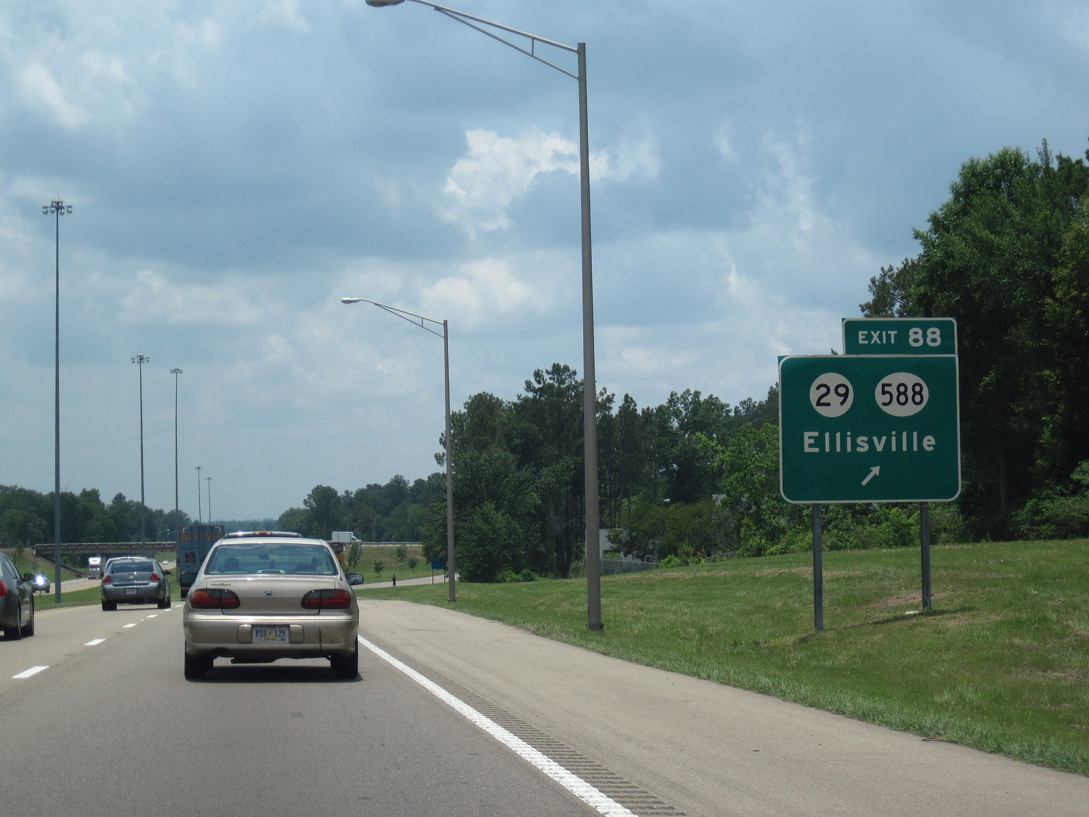
| Entering the Ellisville city limits, I-59 approaches the diamond interchange (Exit 88) with MS 29 (Hill Street). 06/02/10 |
|
| MS 588 stems west from MS 29 at Hal Crocker Road adjacent to Interstate 59 at Exit 88. Measuring 24.2 miles between U.S. 84 and MS 29, MS 588 is a rural highway connecting Ellisville with Collins. 06/02/10 |
|
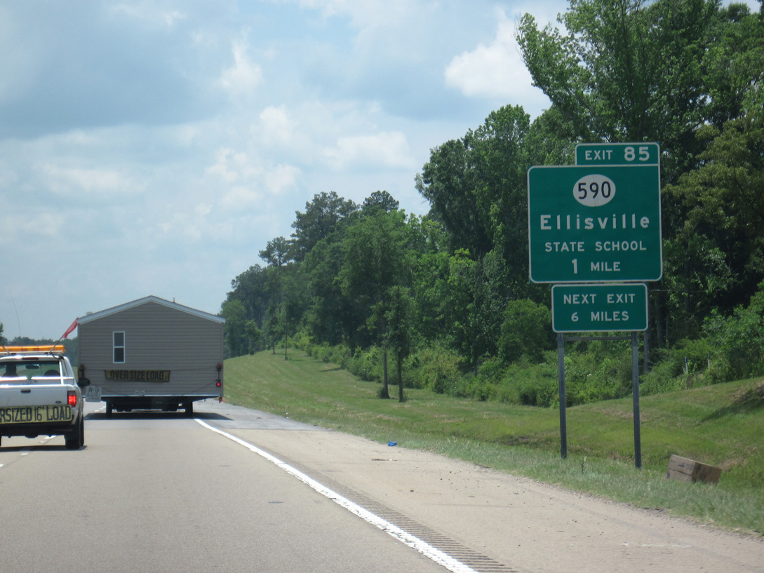
| Exit 85 joins I-59 with MS 590 at Howard Technology Park in one mile. Beginning at MS 29 east of Jones College, MS 590 bypasses the south side of Ellisville along a roadway built from June 2011 to August 2013. 06/02/10 |
|
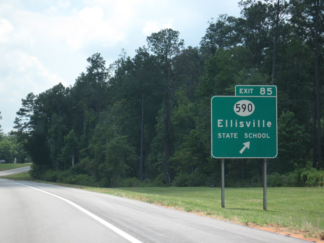
| Exit 85 departs Interstate 59 south for MS 590 east to the Ellisville State School and west to Seminary. 06/02/10 |
|
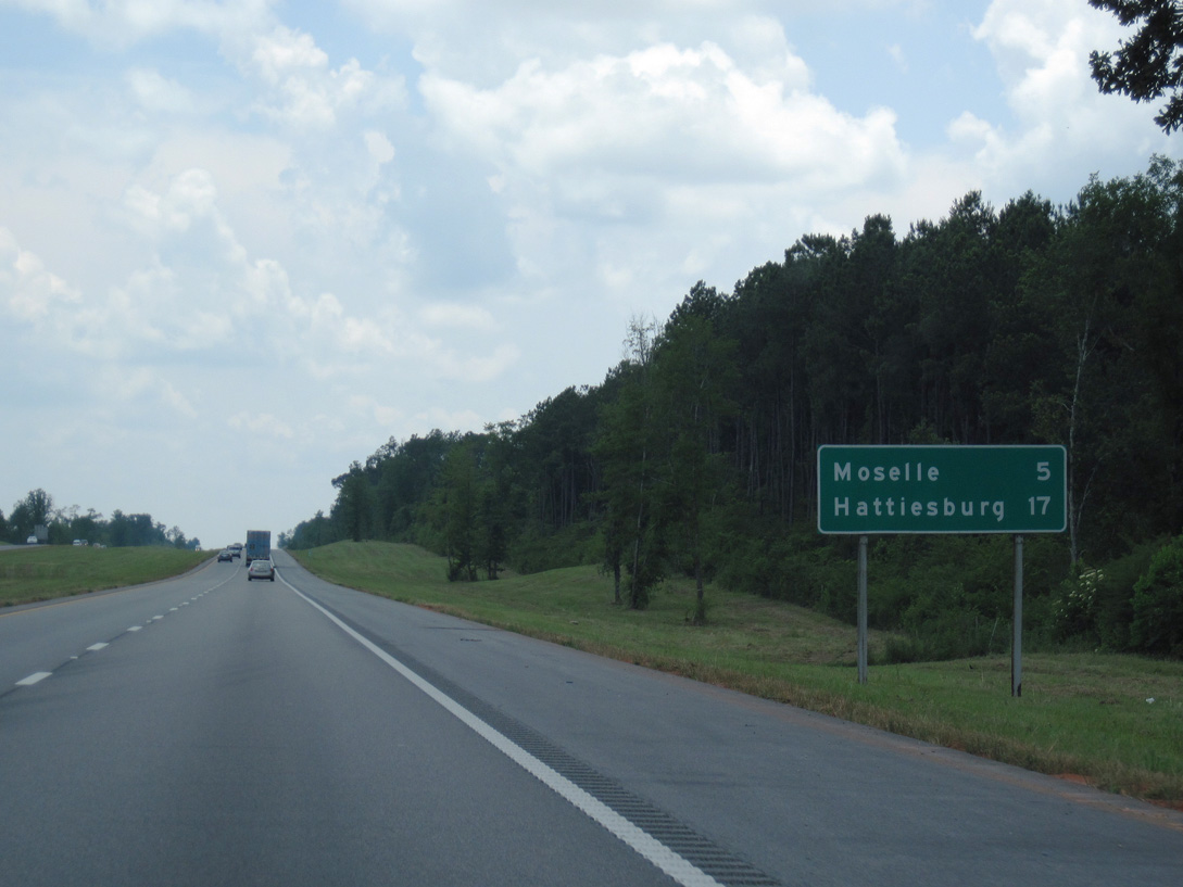
| Interstate 59 and parallel U.S. 11 advance five miles southwest toward the unincorporated community of Moselle. Located between the two highways is the Highlands Subdivision. 06/02/10 |
|
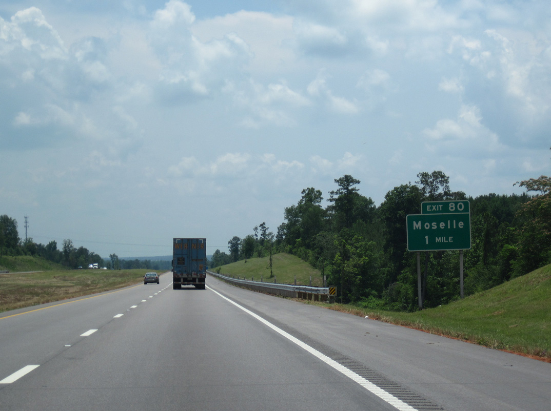
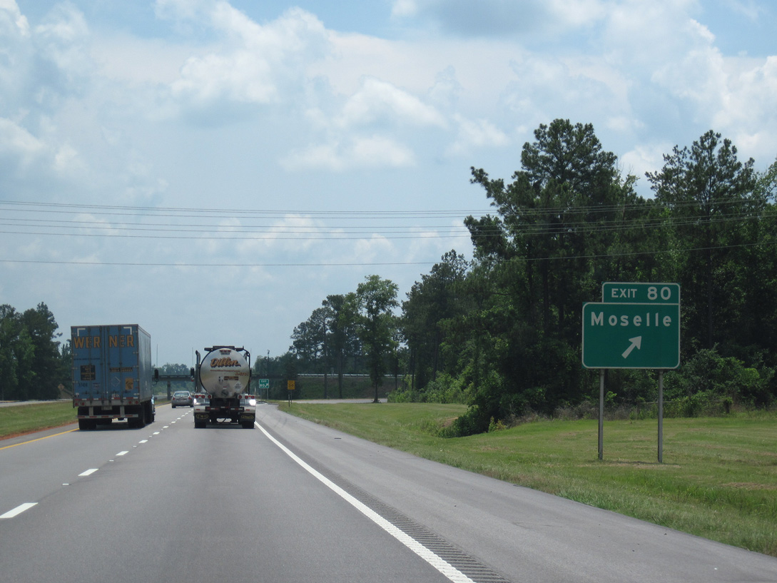
| A diamond interchange (Exit 80) links Interstate 59 with Moselle Seminary Road in one mile. 06/02/10 |
|
| Moselle Seminary Road merges with U.S. 11 ahead of Mill Creek and Moselle just east of Exit 80. 06/02/10 |
|
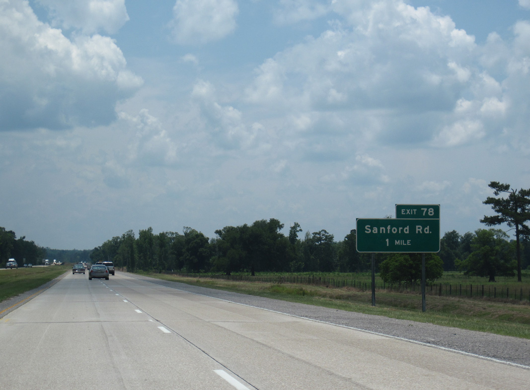
| Interstate 59 turns more to the west from Mill Creek and Moselle to Exit 78 with Sanford Road. 06/02/10 |
|
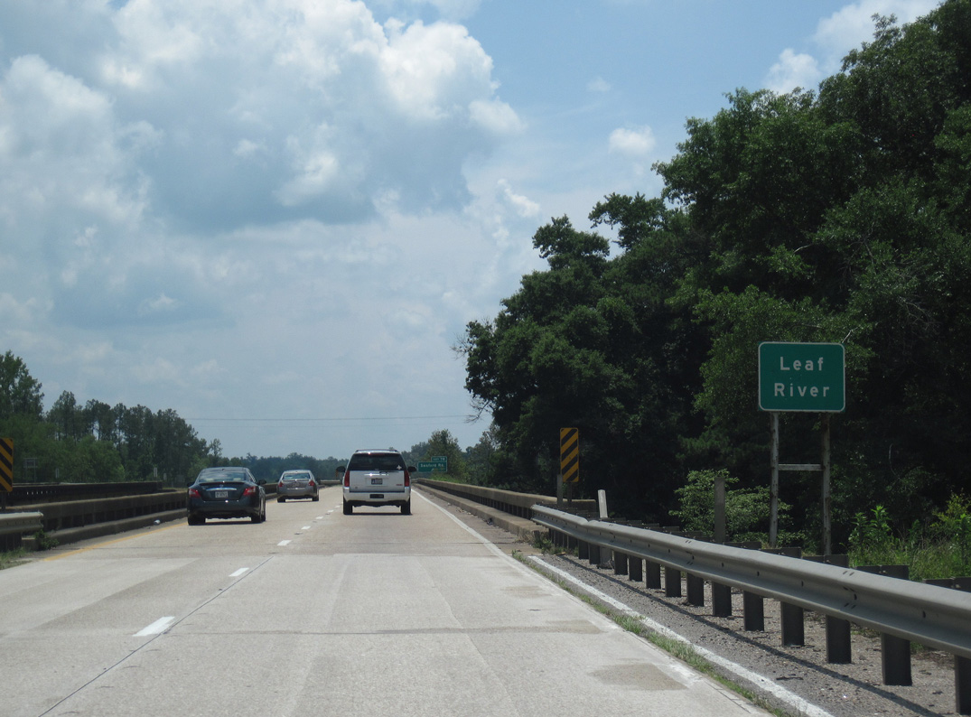
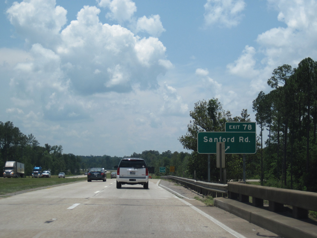
| Crossing the 1960-built bridge over the Leaf River, Interstate 59 enters the folded diamond interchange (Exit 78) with Sanford Road. 06/02/10 |
|
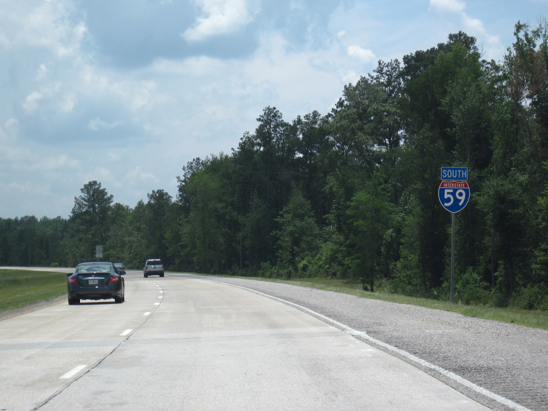
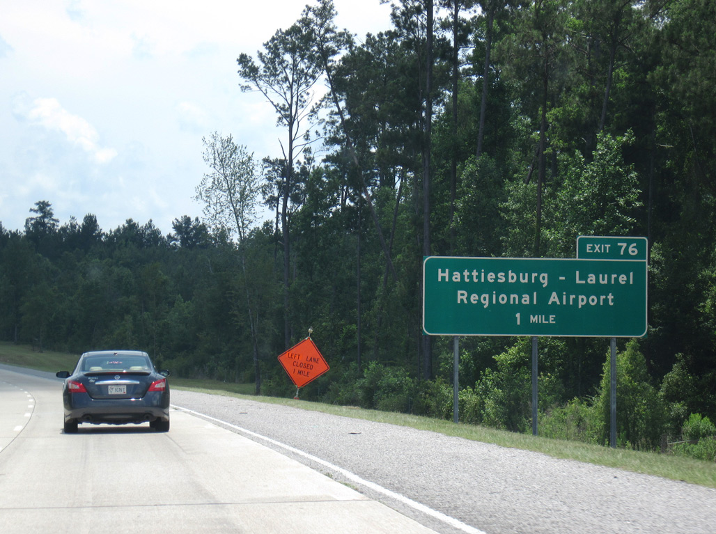
| Curving southward again, Interstate 59 travels between Hattiesburg-Laurel Regional Airport (PIB) and the timberland spreading west from the Leaf River. 06/02/10 |
|
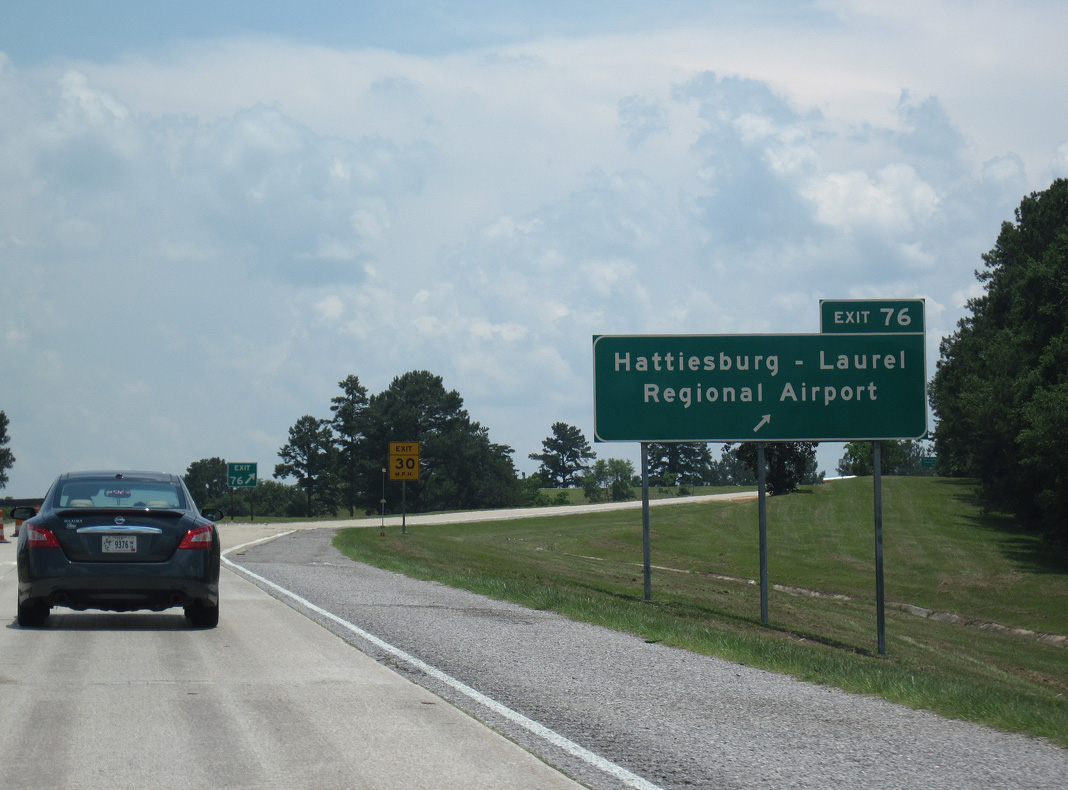
| Southbound I-59 at the diamond interchange (Exit 76) with Terminal Drive west to Hattiesburg-Laurel Regional Airport (PIB). 06/02/10 |
|
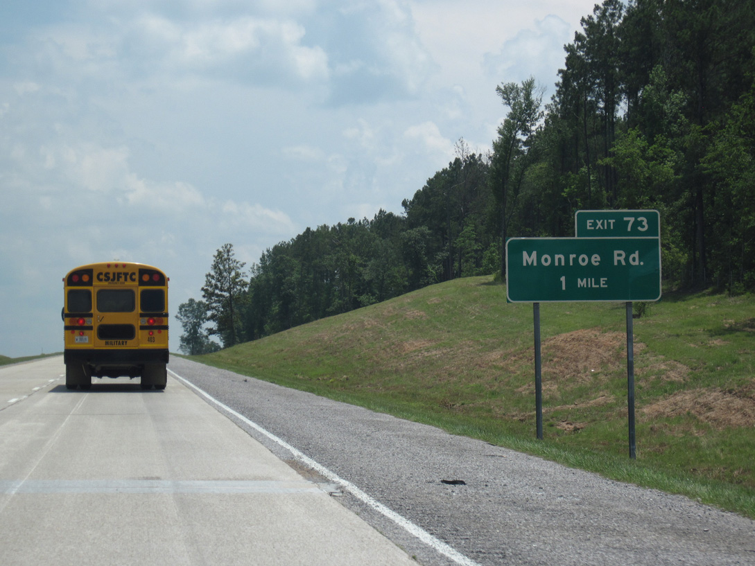
| Interstate 59 bee lines 2.1 miles south from Terminal Drive to Exit 73 with Monroe Road. 06/02/10 |
|
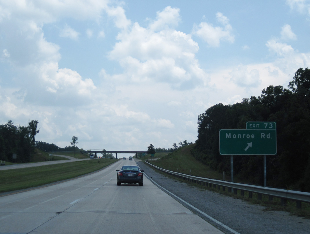
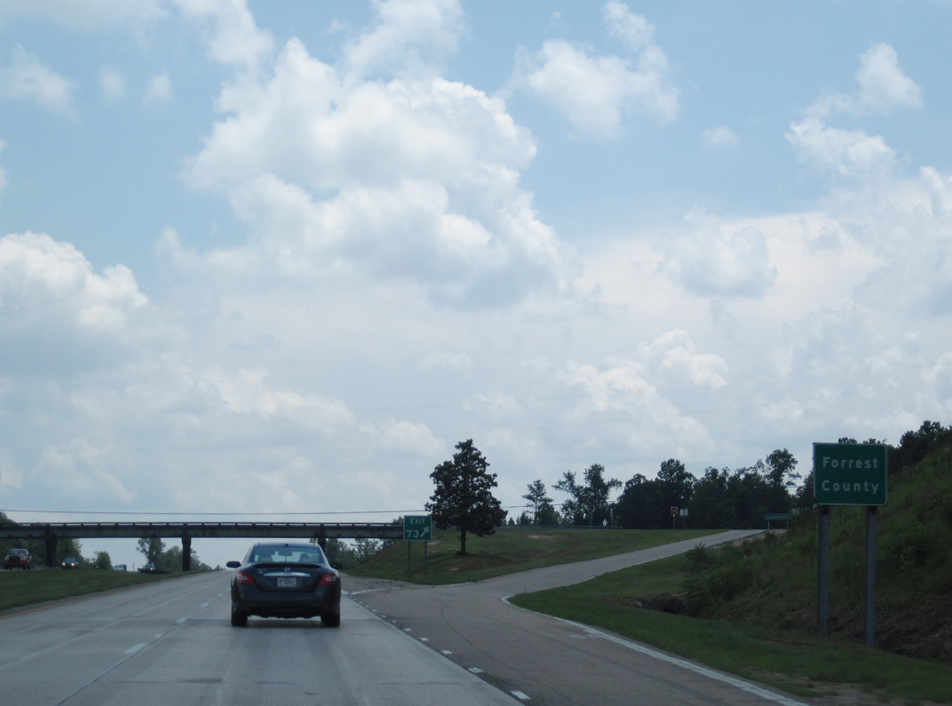
| Exit 73 parts ways with I-59 south for Monroe Road, Eatonville and Eastabuchie. 06/02/10 |
|
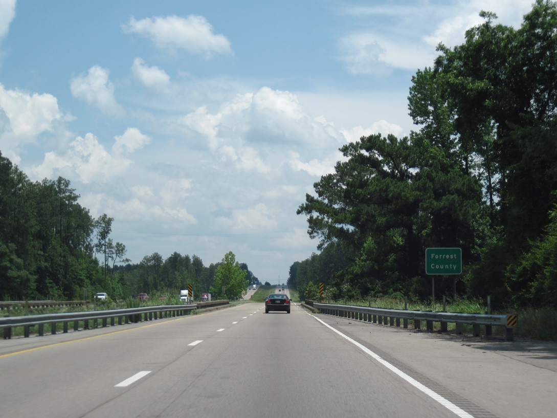
| The diamond interchange (Exit 73) with Monroe Road lies just across the Forrest County line. 06/02/10 |
|
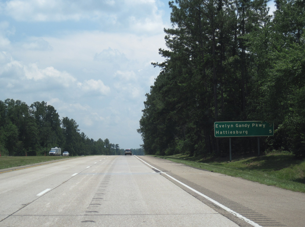
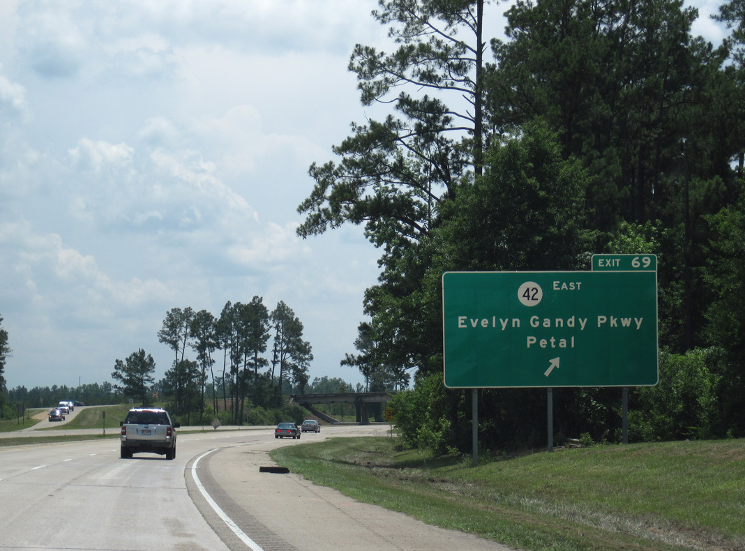
| Continuing south, Interstate 59 reaches Exit 69 with Evelyn Gandy Parkway (MS 42) east in three miles and the first of four Hattiesburg exits in five miles. 06/02/10 |
|
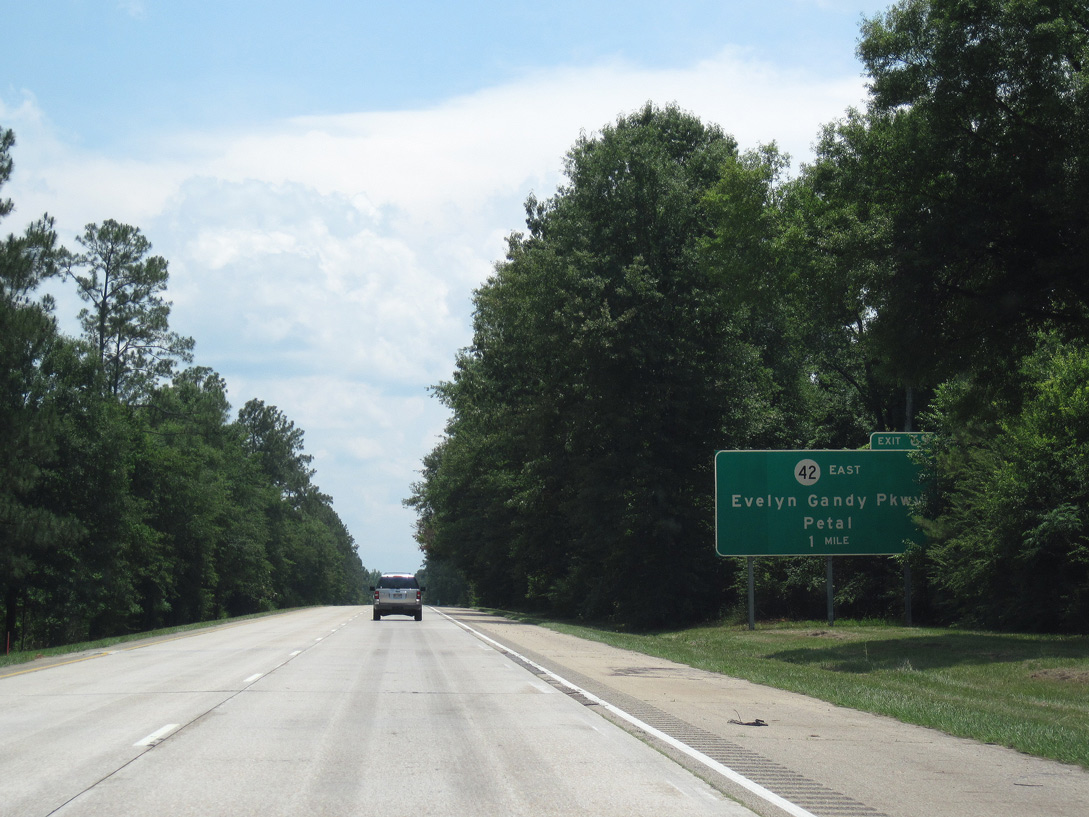
| Opened east from Interstate 59 to U.S. 11 on November 14, 2016, Evelyn Gandy Parkway forms an arterial bypass running across the north side of Petal. The highway replaced Eatonville Road through the diamond interchange at Exit 69. 06/02/10 |
|
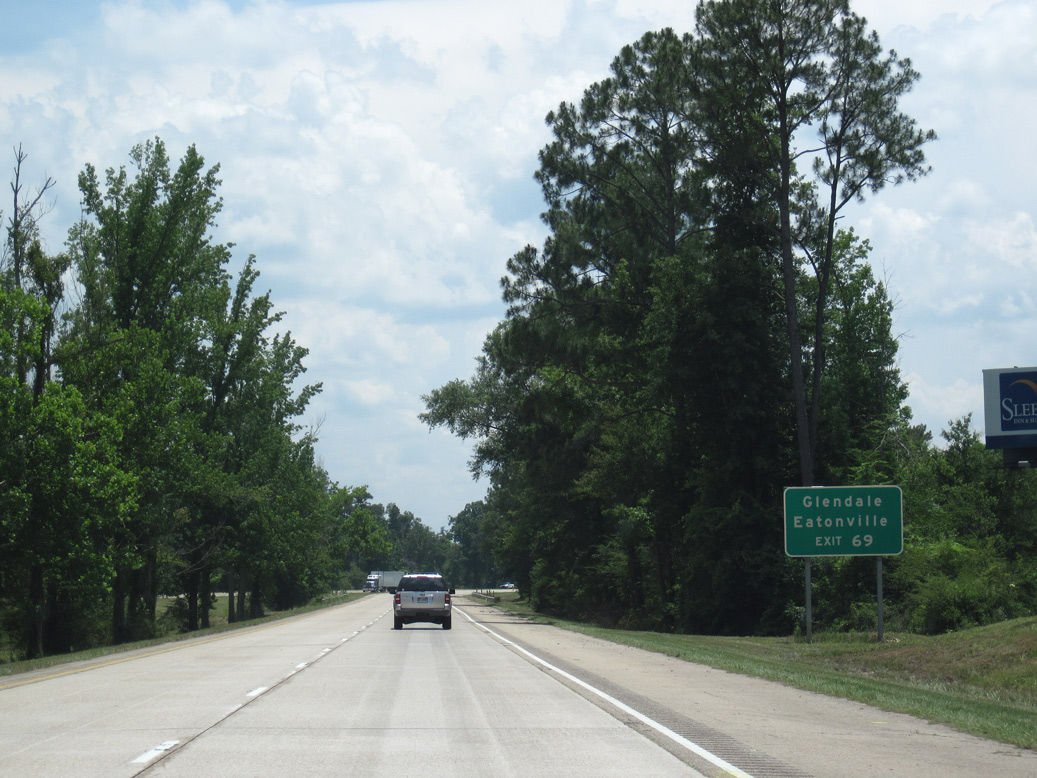
| Eatonville Road ties into the exchange with Evelyn Gandy Parkway from Eatonville to the north. MS 42 travels east through unincorporated Glendale between I-59 and the Leaf River. 06/02/10 |
|
| MS 42 runs east from the city of Petal to Richton and State Line. Two years of construction starting in April 2019 rebuilds the exchange at Exit 69 into a parclo interchange with a significantly wider footprint. 06/02/10 |
|
| Prior to 2006, Mississippi 42 combined with U.S. 11 southwest across the Leaf River into Hattiesburg before turning west to U.S. 49. With the completion of Evelyn Gandy Parkway west from Petal, the state highway was realigned to overlap with I-59 south to Exit 67B. 06/02/10 |
|
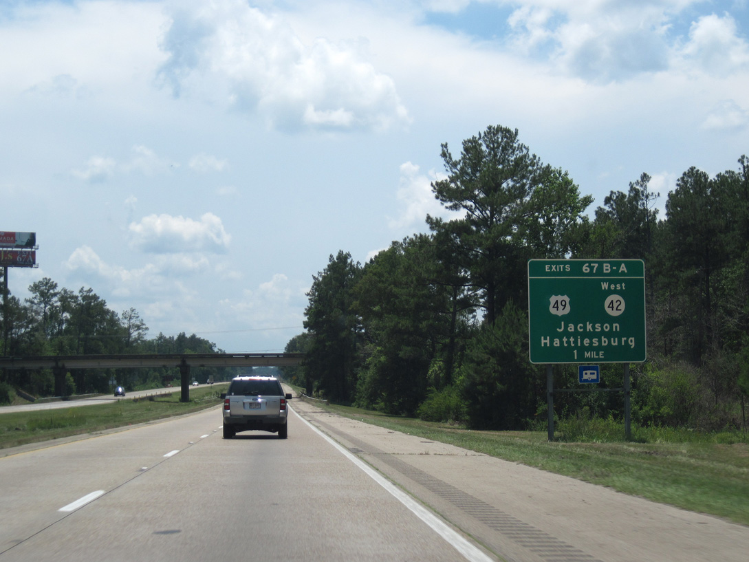
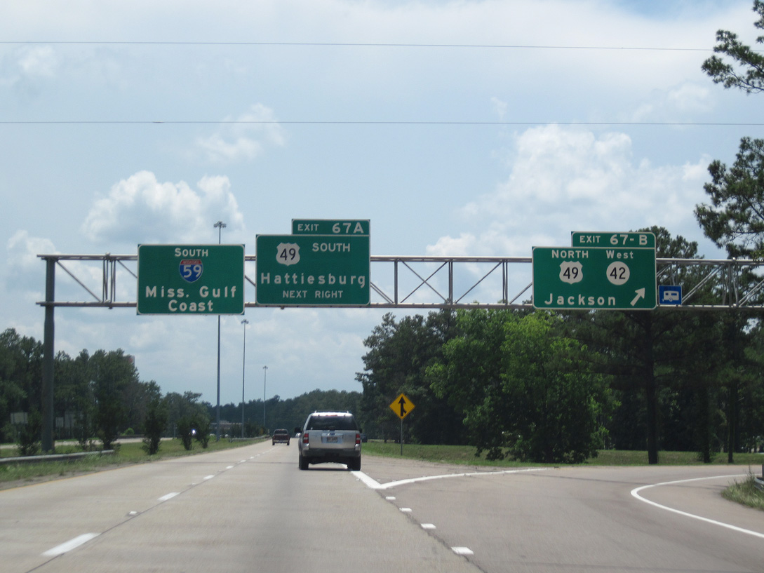
| U.S. 49 is a regional highway joining Hattiesburg and the Mississippi Gulf Coast at Gulfport with Jackson. A cloverleaf interchange connects the US highway with I-59 and MS 42 at Exit 67. 06/02/10 |
|
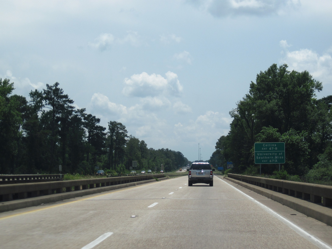
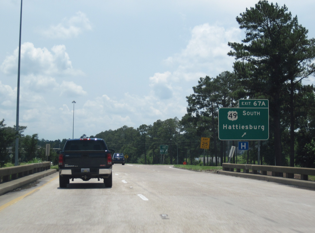
| Crossing the Bouie River, 0.9 miles north of Exit 67B for U.S. 49 north to Collins. Exit 67A loops onto U.S. 49 south toward The University of Southern Mississippi. The campus lines the west side of U.S. 49 between 4th and Hardy Streets. 06/02/10 |
|
| MS 42 overlaps with U.S. 49 north 5.6 miles before turning west to the town of Lamar. U.S. 49 travels 82 miles northwest to Interstate 20 outside Jackson. 06/02/10 |
|
| U.S. 49 constitutes a commercial arterial across the city of Hattiesburg. Highway 42 (old MS 42) and Hardy Street lead east from the US route toward the city center. 06/02/10 |
|
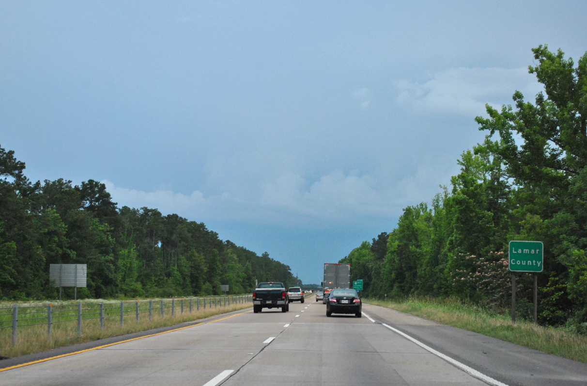
| Interstate 59 straightens out south of the Lamar County line through the community of West Hattiesburg. 05/07/12 |
|
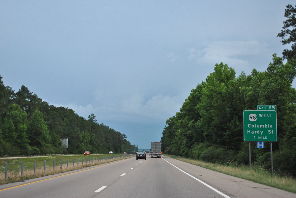
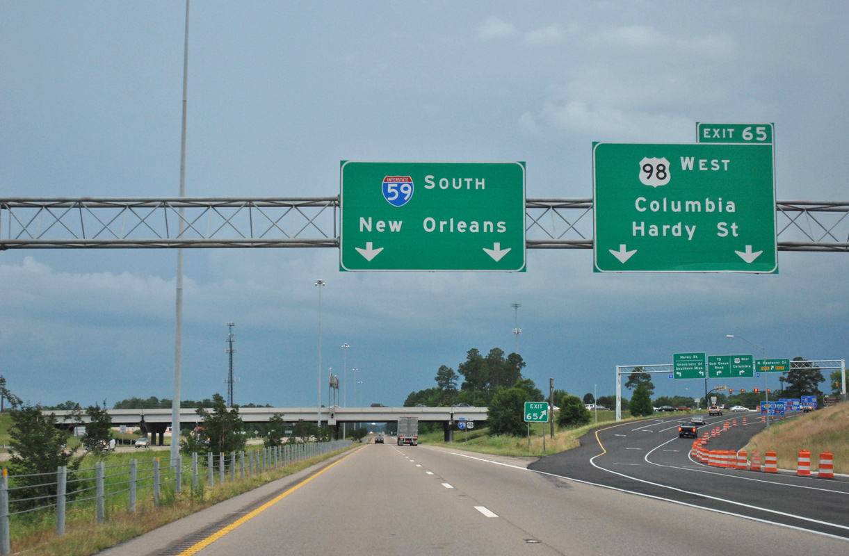
| The succeeding exit along southbound I-59 is the six-ramp parclo interchange (Exit 65) with U.S. 98 west and Hardy Street (MS 198) east. Hardy Street constitutes a busy urban arterial west from the central business district to commercial areas of west Hattiesburg including Turtle Creek Mall. 05/07/12 |
|
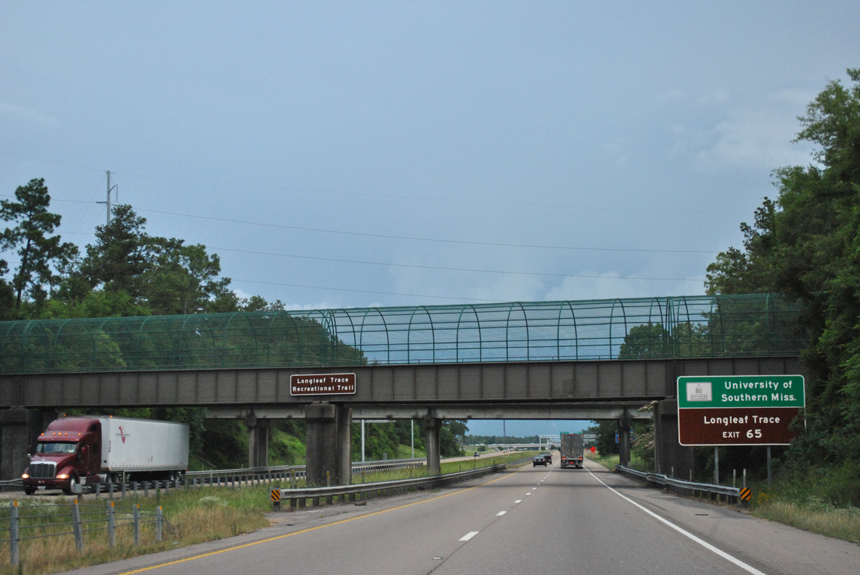
| Longleaf Trace Recreational Trail and West 4th Street span Interstate 59 west of the University of Southern Mississippi. Longleaf Trace Trail follows the former Illinois Central Gulf Coast Railroad 41 miles west from Hattiesburg to Prentiss. 05/07/12 |
|
| Eastbound U.S. 98 joins Interstate 59 south from Hardy Street (Exit 65) in west Hattiesburg. 05/07/12 |
|
| Columbia, seat of Marion County, lies 29 miles to the west along U.S. 98. US. 98 continues from there to Tylertown, McComb and ultimately Natchez. 05/07/12 |
|
| Construction in 2002 extended the second lane for Exit 65 and expanded the southbound off-ramp to four lanes. 05/07/12 |
|
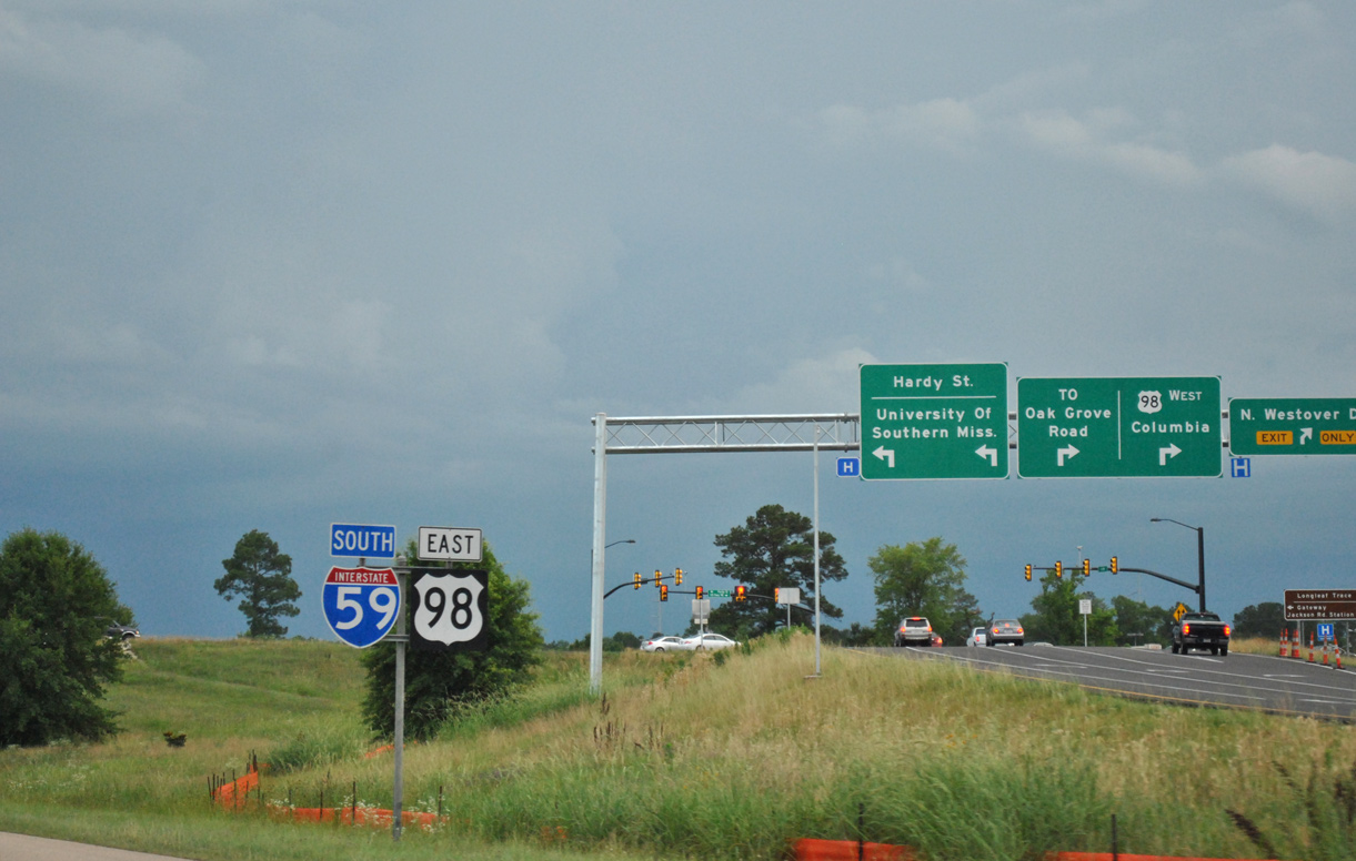
| Hardy Street east from the merge of U.S. 98 with I-59 south doubles as Mississippi Highway 198. Although not acknowledged on guide signs at Exit 65, the state route overlays the arterial 1.4 miles east to the University of Southern Mississippi and U.S. 49. 05/07/12 |
|
| Interstate 59 south & U.S. 98 east overlap for 5.5 miles. 05/07/12 |
|
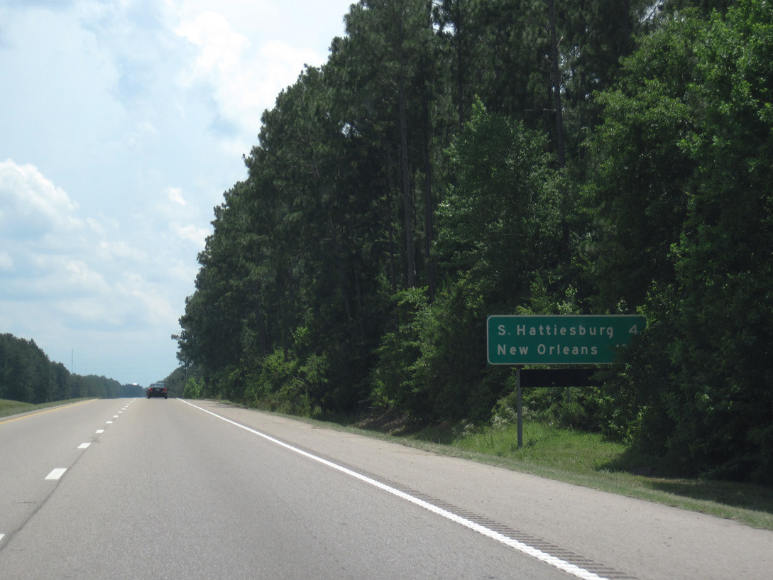
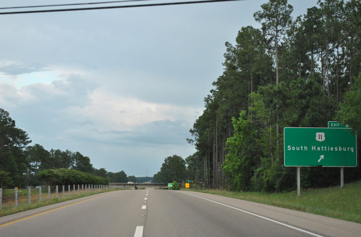
| U.S. 11 crosses paths with Interstate 59 again in four miles at south Hattiesburg. New Orleans, Louisiana debuts on distance signs at 105 miles out. 06/02/10 |
|
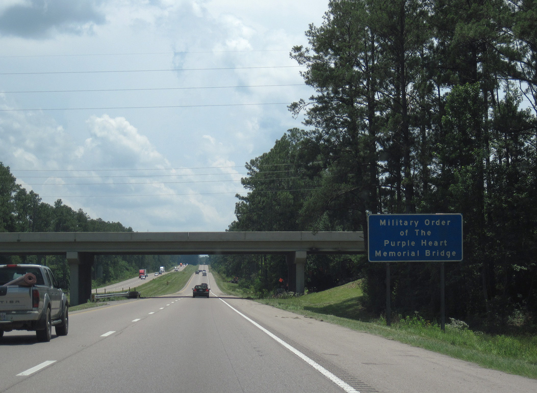
| The Lincoln Road overpass is the Military Order of The Purple Heart Memorial Bridge. 06/02/10 |
|
| Making a gradual southeastern turn, Interstate 59 & U.S. 98 enter Forest County ahead of the diamond interchange (Exit 60) with U.S. 11 (Veterans Memorial Drive). 05/07/12, 06/02/10 |
|
| U.S. 11 winds 3.5 miles southwest from a cloverleaf interchange with U.S. 49 along an arterial route to I-59 & U.S. 98. Continuing southwest from Exit 60, U.S. 11 transitions to a rural two lane highway en route to the city of Purvis. 05/07/12 |
|
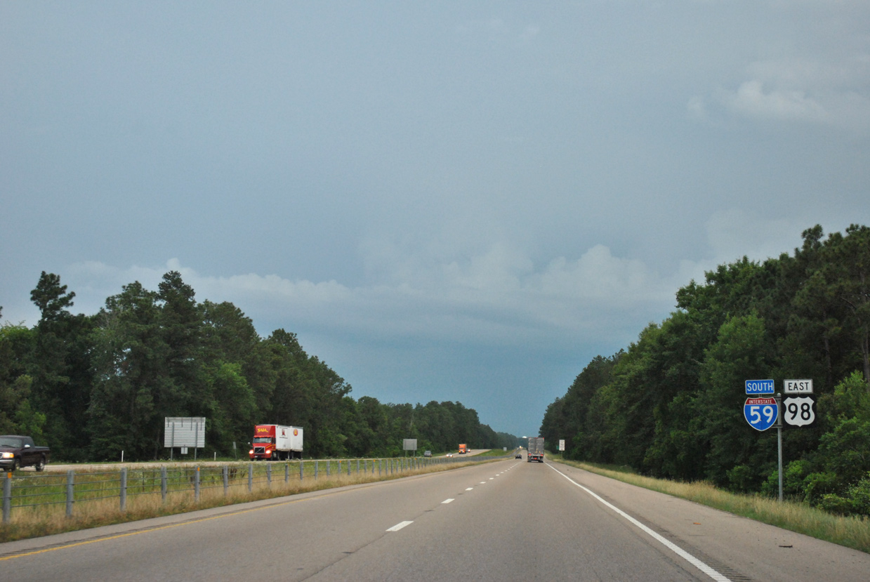
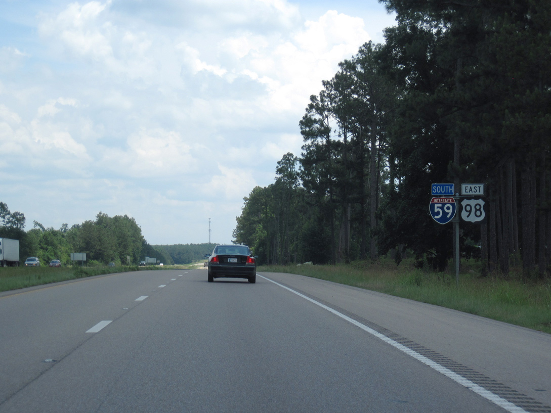
| U.S. 98 east parts ways with Interstate 59 at the ensuing interchange (Exit 59) south of U.S. 11. 05/07/12, 06/02/10 |
|
| U.S. 98 stems three miles east from Interstate 59 along a freeway to U.S. 49. U.S. 49. U.S. 49 runs south from there along the west side of Camp Shelby toward Wiggins and Gulfport. U.S. 98 travels north of Camp Shelby east to New Augusta. 05/07/12 |
|
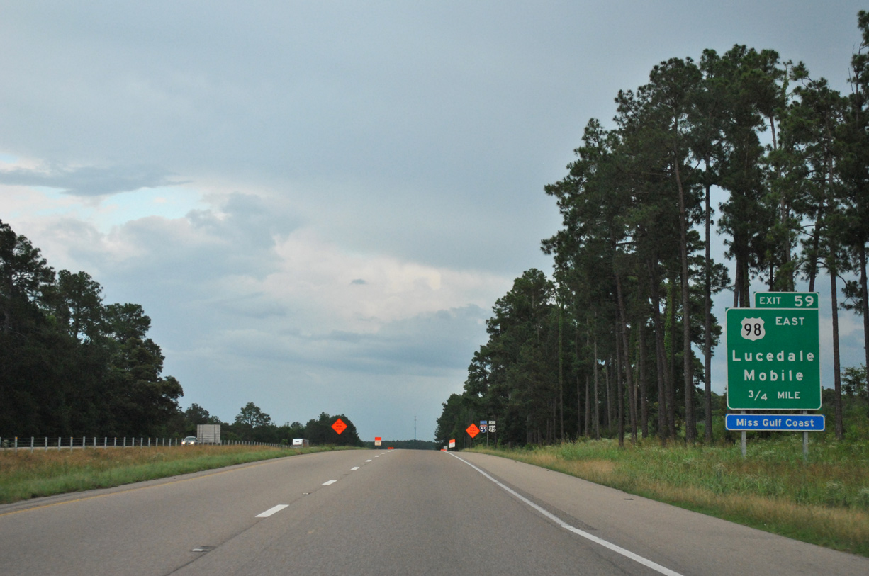
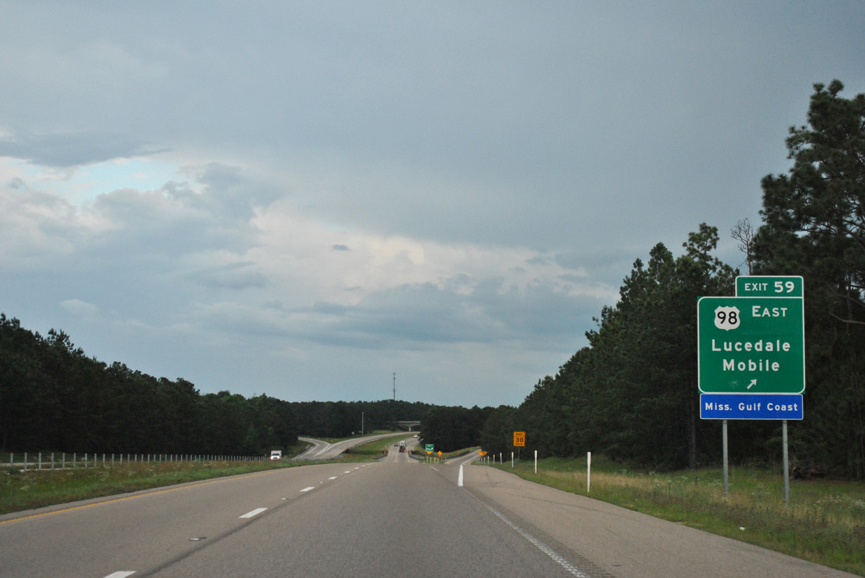
| Southbound travelers along I-59 reach the trumpet interchange (Exit 59) with the departing U.S. 98 east to Lucedale and Mobile, Alabama. 05/07/12 |
|
| The exchange with U.S. 98 at Exit 59 and the freeway east to U.S. 49 opened in 1980. Grading remains from the original construction for an unbuilt extension west. 06/02/10 |
Page Updated 03-28-2019.

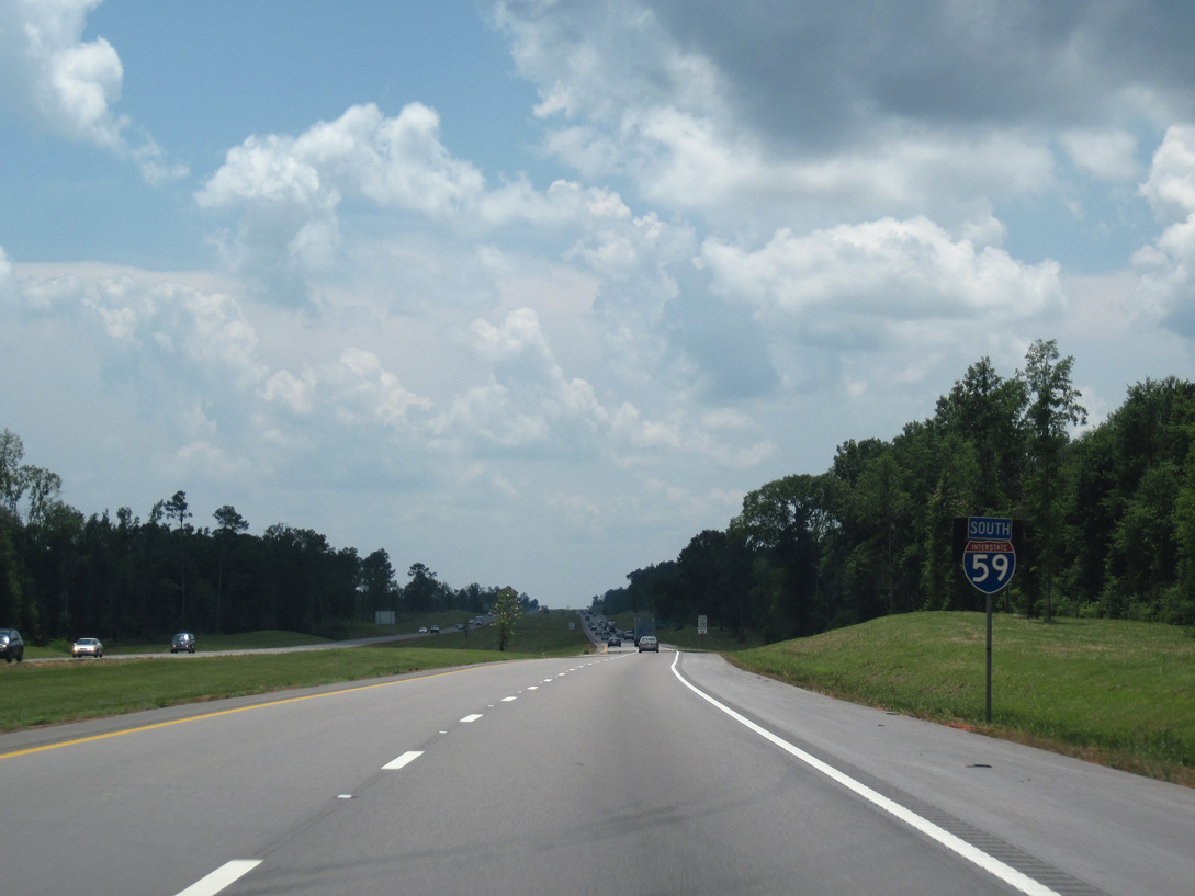
 South
South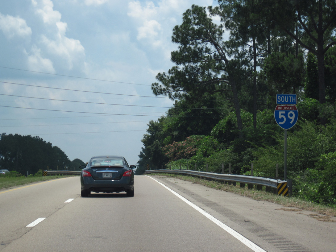
 West
West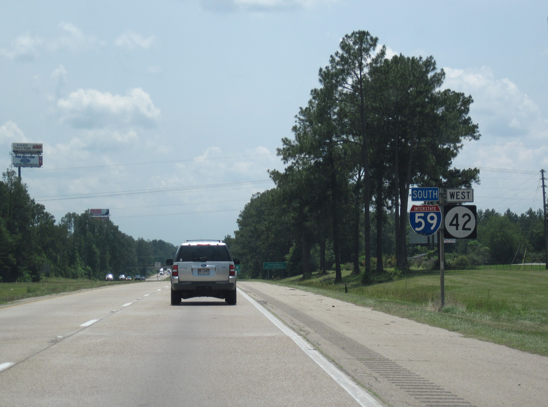


 West
West