|
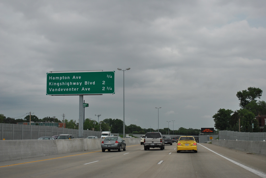
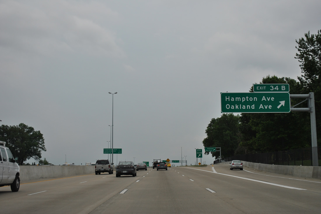
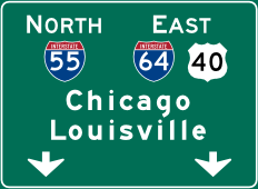
| A SPUI (Exit 34B) joins I-64/U.S. 40 with Hampton Avenue at Forest Park in 0.75 miles. A second SPUI (Exit 36A) follows with Kingshighway Boulevard in two miles. 05/04/12 |
|
| The stretch of U.S. 40 freeway along Forest Park was first built in the 1930s and 40s and named the Red Feather Highway and before that the Oakland Express Highway. "The New I-64" project brought the freeway up to modern standards, including the replacement of a compact cloverleaf interchange with Hampton Avenue. 05/04/12 |
|
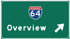
| Shield assembly posted for I-64/U.S. 40 east ahead of the wye interchange with Clayton Road (Exit 34A on westbound). 05/04/12 |
|
| Exit 34B includes access to both Hampton Avenue and Oakland Avenue, a parallel boulevard east through the Cheltenham and Kings Oak neighborhoods. 05/04/12 |
|
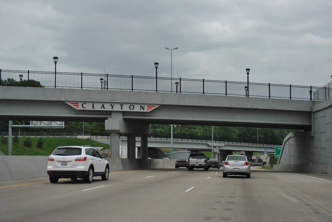
| Eastbound beyond the Clayton Road on-ramp and ahead of the Tamm Drive overpass that links Oakland Avenue and Wells Drive. 05/04/12 |
|
| Hampton Avenue leads south from a roundabout with Wells Drive at Forest Park to Missouri 30 (Gravois Avenue) at Princeton and Boulevard Heights. Exit 34B splits with one ramp intersecting Hampton Avenue directly and another passing under Hampton to Oakland Avenue at Oakview Place. 05/04/12 |
|
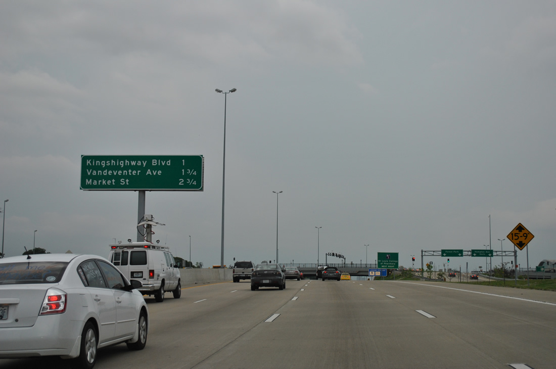
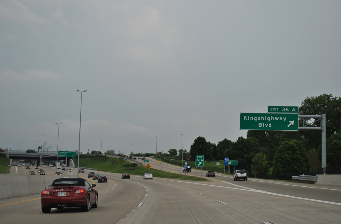
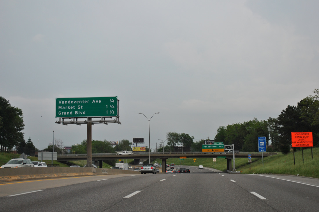
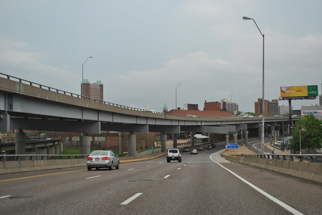
| One mile west of Exit 36A to Kingshighway Boulevard on I-64/U.S. 40 east. Exit 36B to Vandeventer Avenue follows in 1.75 miles. 05/04/12 |
|
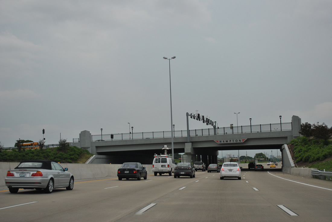
| Passing through the Hampton Avenue SPUI on I-64/U.S. 40 east. 05/04/12 |
|
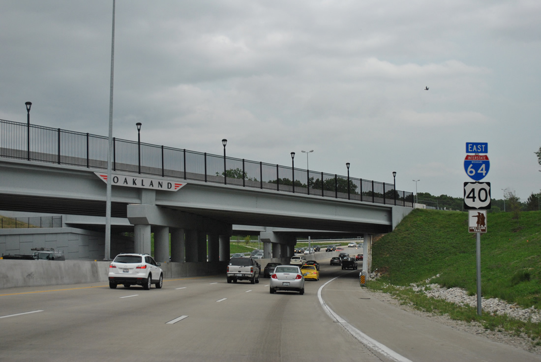
| Oakland Avenue lines the south side of I-64/U.S. 40 to Kingshighway Boulevard at Forest Park South East. 05/04/12 |
|
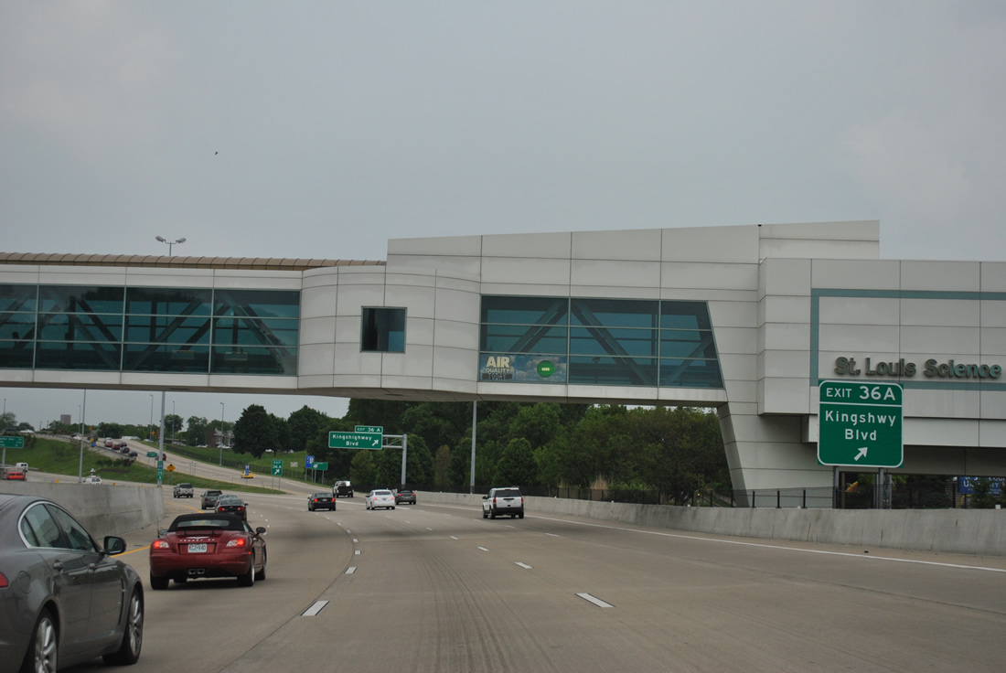
| An enclosed pedestrian walkway links the St. Louis Science Center on Oakland Avenue with the James S. McDonnell Planetarium in Forest Park above I-64/U.S. 40 as Exit 36A departs for Kingshighway Boulevard. Kingshighway Boulevard was a part of U.S. 67 between Gravois Avenue at Bevo Mill and Bircher Boulevard at Penrose Park. 05/04/12 |
|
| Kingshighway Boulevard comprises an arterial northward from Exit 36A along the eastern periphery of Forest Park to Central West End and Mark Twain. Southward, Kingshighway Boulevard heads to the neighborhoods of The Hill, North Hampton and Tower Grove South among others. 05/04/12 |
|
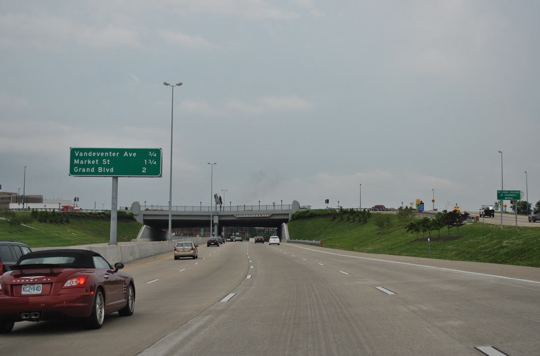
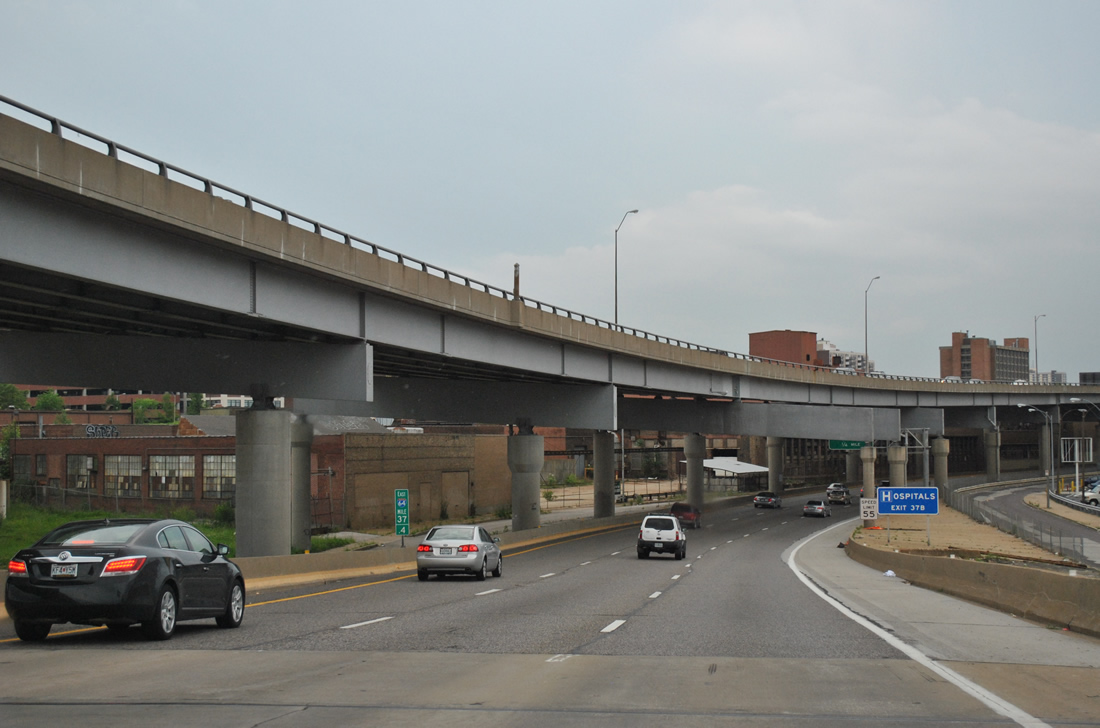
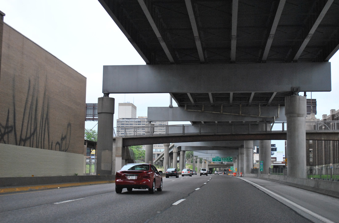
| I-64/U.S. 40 traverses the Forest Park South East section of St. Louis from Kingshighway Boulevard to Vandeventer Avenue. Exits for Market Street and Grand Boulevard follow at Midtown within two miles. 05/04/12 |
|
| Exit 36A was a cloverleaf interchange until "The New I-64" project. 05/04/12 |
|
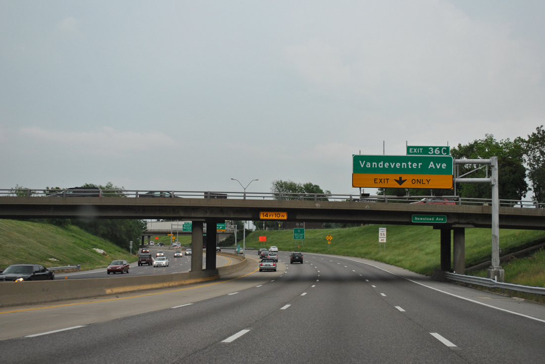
| The right lane defaults onto the Vandeventer Avenue connector in one quarter mile. The original Oakland Express Highway linked directly with the Chouteau Avenue (U.S. 40 Truck/Route 100) viaduct ahead of Grand Boulevard. 05/04/12 |
|
| A wye interchange sees Exit 36C peel away from I-64/U.S. 40 as an access road passing under Sarah Street to an at-grade intersection with Vandeventer Avenue. A mid-2000s project removed the elevated connector from Vandeventer Avenue to Chouteau Avenue, when the Chouteau Avenue viaduct over the Missouri Pacific and Burlington Northern Railroads was replaced. 05/04/12 |
|
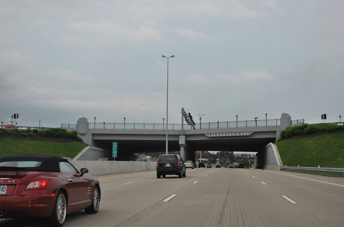
| Vandeventer Avenue branches northeast from Kingshighway Boulevard at Southwest Avenue in the Southwest Garden neighborhood to cross I-64/U.S. 40 en route to the Covenant Blu-Grand Center section of the city. 05/04/12 |
|
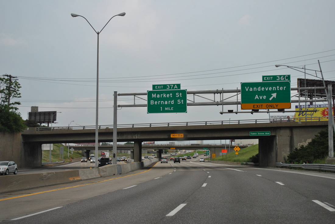
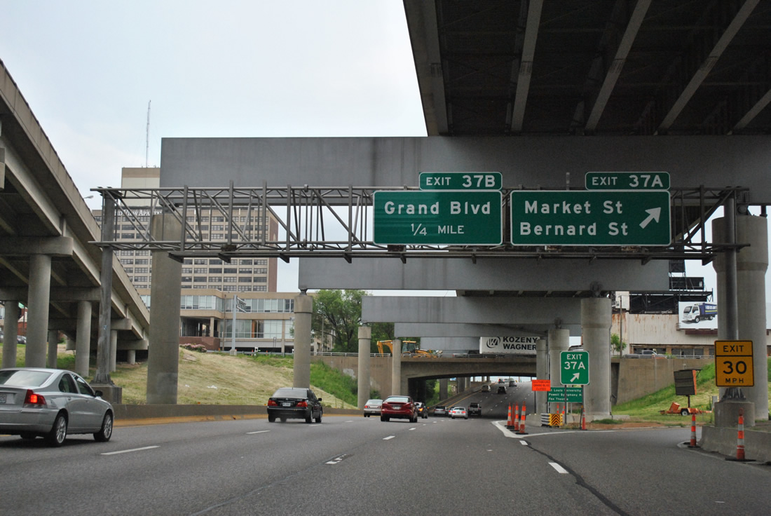
| Exits 37A/B consist of a parclo interchange with Grand Boulevard and Bernard Street east in one half mile to serve Midtown, Tiffany and The Gate District. 05/04/12 |
|
| A pair of viaducts carry I-64/U.S. 40 over Clayton Avenue, a Metrolink line and Vandeventer Avenue ahead of a double deck freeway where eastbound stays at grade level and westbound utilizes an elevated roadway directly above. 05/04/12 |
|
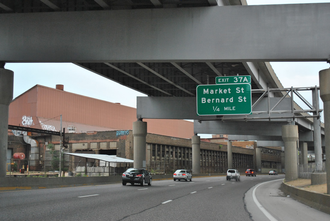
| Exit 37A parts ways with I-64/U.S. 40 east for Bernard Street in an industrial section of Midtown. Bernard Street passes below Grand Boulevard to link the eastbound freeway with a wye interchange connecting with Market Street at Compton Avenue and the end of Forest Park Avenue. 05/04/12 |
|
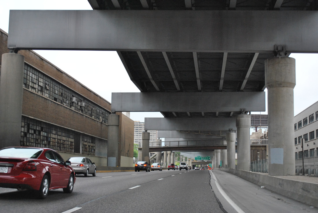
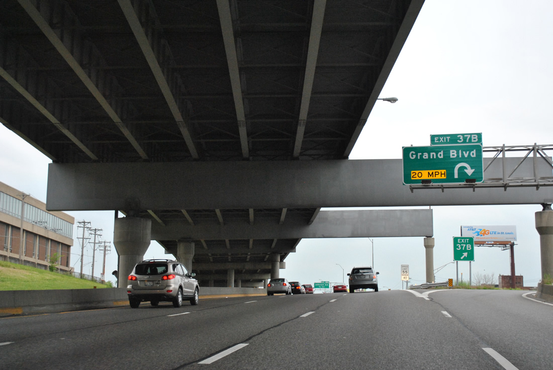
| Industrial buildings line both sides of the double decked I-64/U.S. 40. A pedestrian bridge links disjointed sections of Spring Avenue ahead of a westbound on-ramp from Grand Boulevard. 05/04/12 |
|
| The old Oakland Express Highway carried U.S. 40 directly onto Market Street, with Market Street carrying U.S. 40 shields through Downtown West and Downtown.
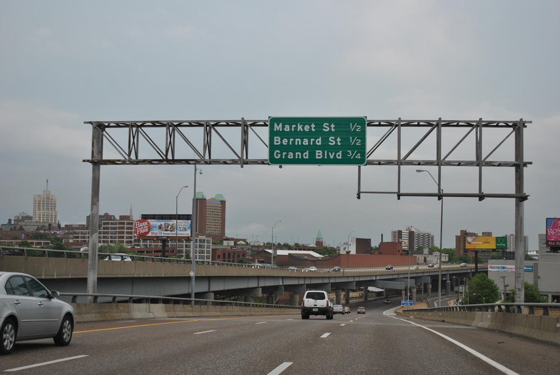
Exit 37B loops onto Grand Boulevard in one quarter mile for St. Louis University and Grand Center. 05/04/12 |
|
| Grand Boulevard leads south to The Gate District and Dutchtown and north to Jeff Vanderlou and College Hill. The 50-year old Grand Boulevard viaduct south across Metrolink and Missouri Pacific and Burlington Northern Railroads was replaced as part of a $22 million project between March 14, 2011 and July 13, 2012.1 05/04/12 |
|
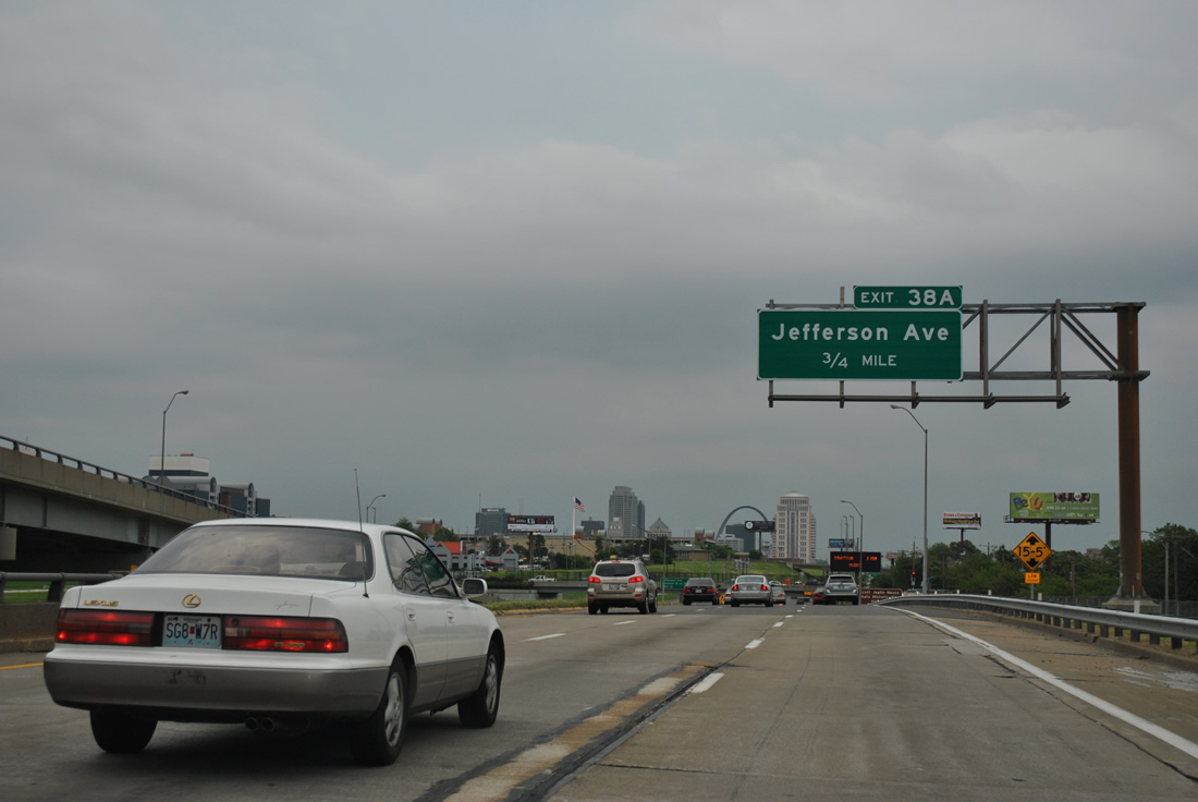
| The eastbound lanes emerge from below I-64/U.S. 40 westbound, 0.75 miles ahead of the half diamond interchange (Exit 38A) with Jefferson Avenue. 05/04/12 |
|
| Traffic from Forest Park Avenue merges onto the left side of I-64/U.S. 40 at a single wye interchange (Exit 38A from west) to bring the freeway up to eight overall lanes. 05/04/12 |
|
| A loop ramp joins I-64/U.S. 40 east from Ewing Avenue to add an auxiliary lane to Jefferson Avenue. Jefferson Avenue comprises a multi-lane boulevard northward from Midtown to St. Louis Place and Carr Square. The avenue passes the west side of the former Pruitt–Igoe urban housing project ahead of Cass Avenue. 05/04/12 |
|
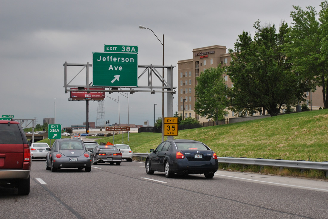
| Jefferson Avenue heads south from Exit 38A across the parallel railroad corridor to The Gate District and Lafayette Square and an interchange with Interstate 44. Jefferson Avenue north leads visitors to the Scott Joplin House State Historic Site. 05/04/12 |
|
| I-64/U.S. 40 east next meet a portion of the North South Distributor Freeway, a planned freeway (Missouri 755) that was to loop north from Interstates 44 and 55 at LaSalle Park to Interstate 70 at Old North St. Louis. Two segments of the freeway were built: interchanges here and at the merge of Interstates 44 and 55. 05/04/12 |
|
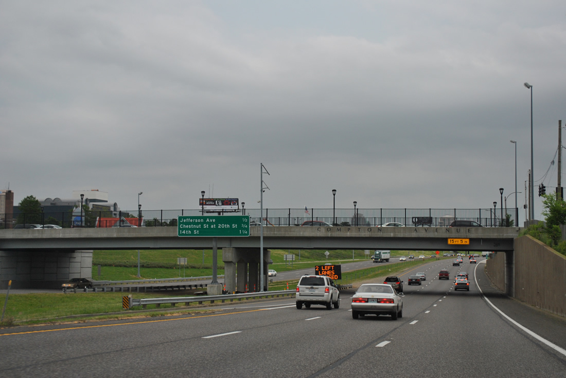
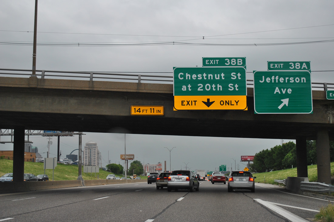
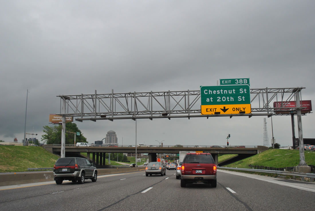
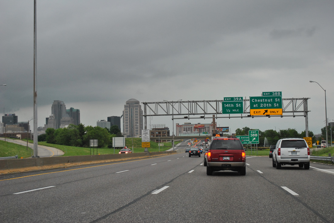
| A directional interchange was partially built for the North South Distributor Freeway leading north to Chestnut Street at 20th Street and south from Pine Street. Roadway stubs from the unconstructed freeway mainline exist along the access roads between I-64/U.S. 40 and the Market Street overpass. 05/04/12 |
|
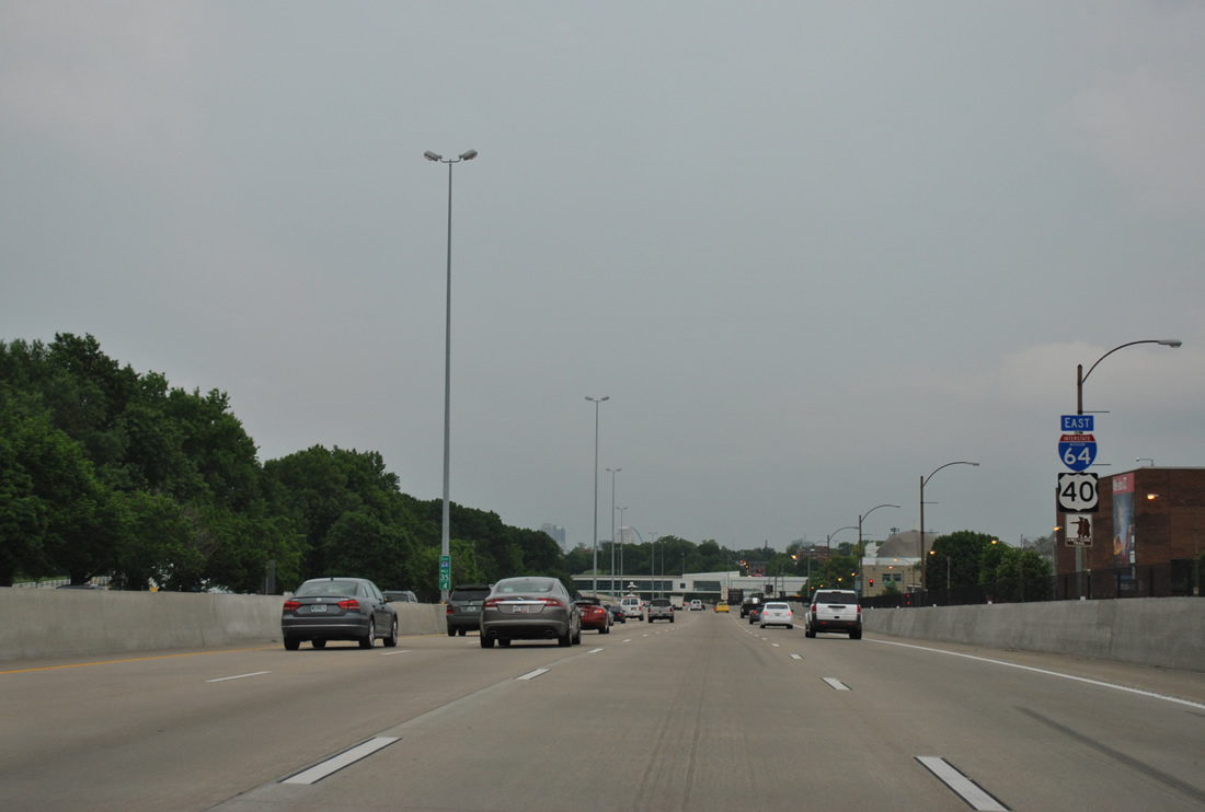
| I-64/U.S. 40 elevated onto a viaduct from Exit 38B near St. Louis Union Station to the Poplar Street Bridge. This interchange sequence sign lists the distances to the final Missouri exits. 05/04/12 |
|
| The last set of shields posted for I-64/U.S. 40 in Missouri precede a stretch of double decker freeway carrying the freeway through the south side of both Downtown West and Downtown St. Louis. 05/04/12 |
|
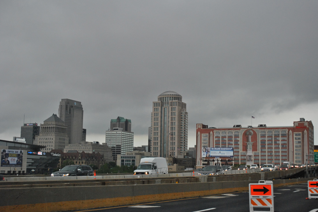
| The Scottrade Center comes into view to the north of Interstate 64. The home of the NHL St. Louis Blues resides at Clark Avenue and 14th Street, two blocks north of Exit 39A. 05/04/12 |
|
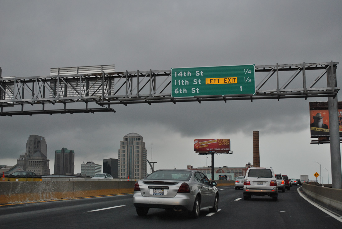
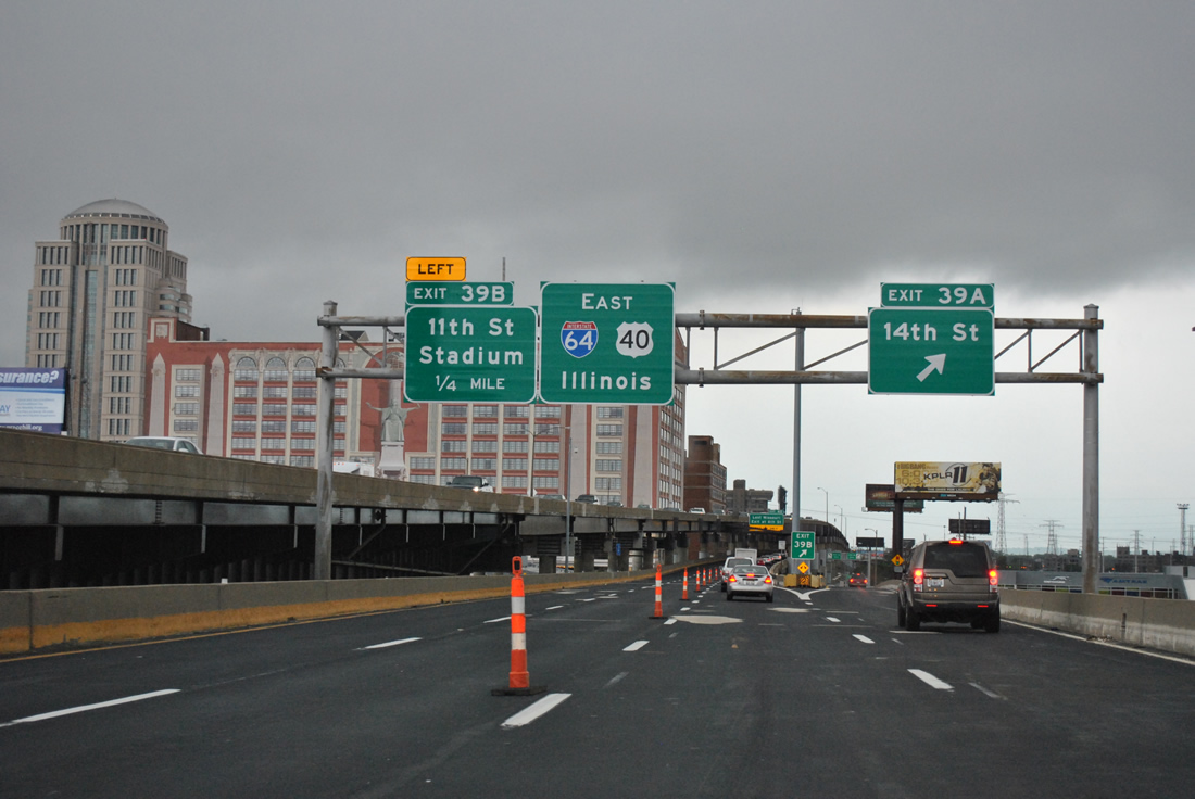
| Exit 39A departs I-64/U.S. 40 east for 14th Street south to the Peabody Darst Webbe community and north to Scottrade Center and World War Memorial Park.
Exit 39B leaves in one quarter mile for 11th Street north to St. Louis City Hall and Busch Stadium (home of the MLB St. Louis Cardinals). 05/04/12 |
|
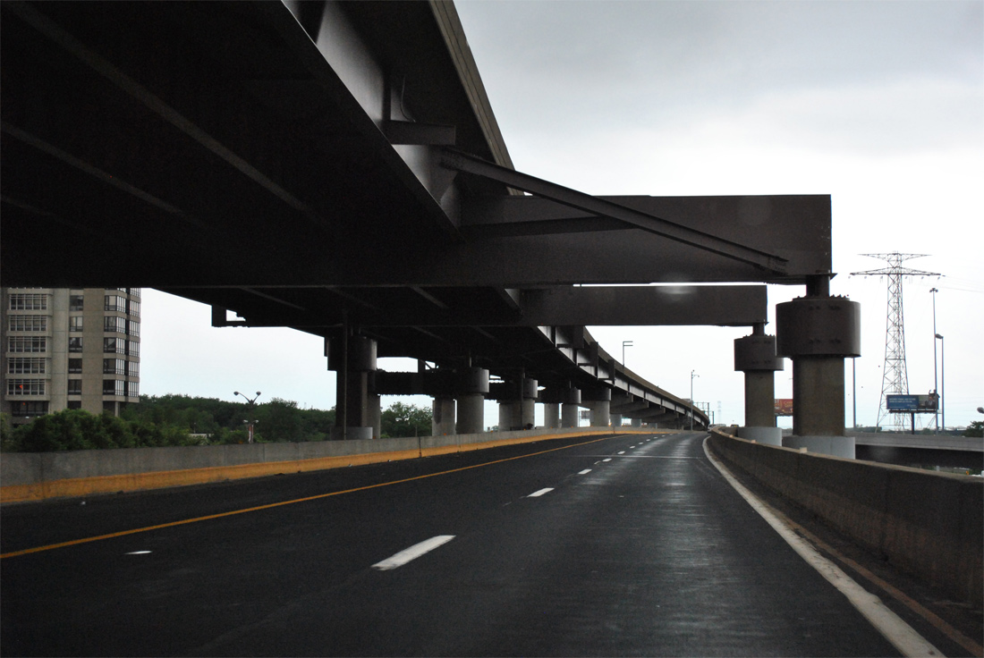
| Again I-64/U.S. 40 east lie below the westbound lanes as the freeway passes over 14th Street, Tucker Boulevard and Broadway ahead of the Poplar Street Bridge. This stretch of freeway opened in November 1967, and work between early 2012 and summer 2013 replaced 37 expansion joints and repaired the driving surface to extend the life span of the viaduct by up to 25 years.2 05/04/12 |
|
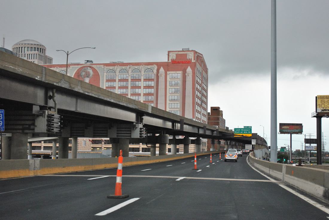
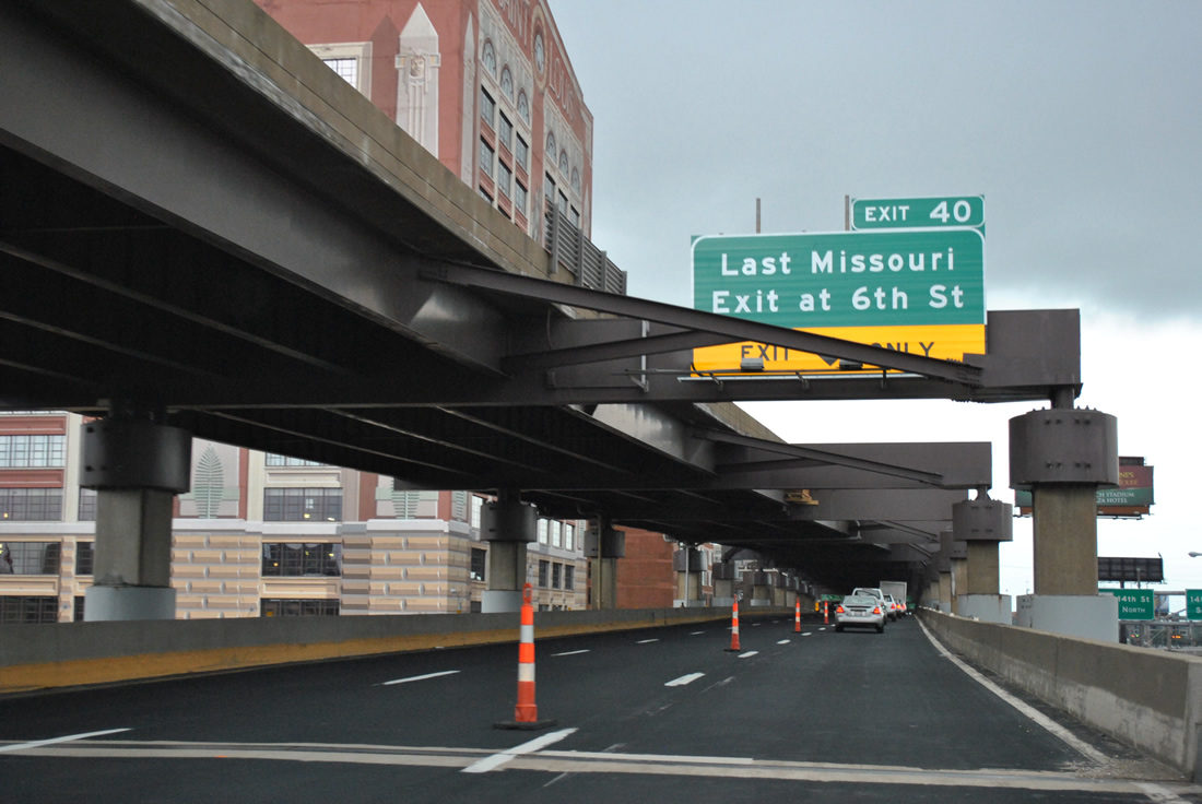
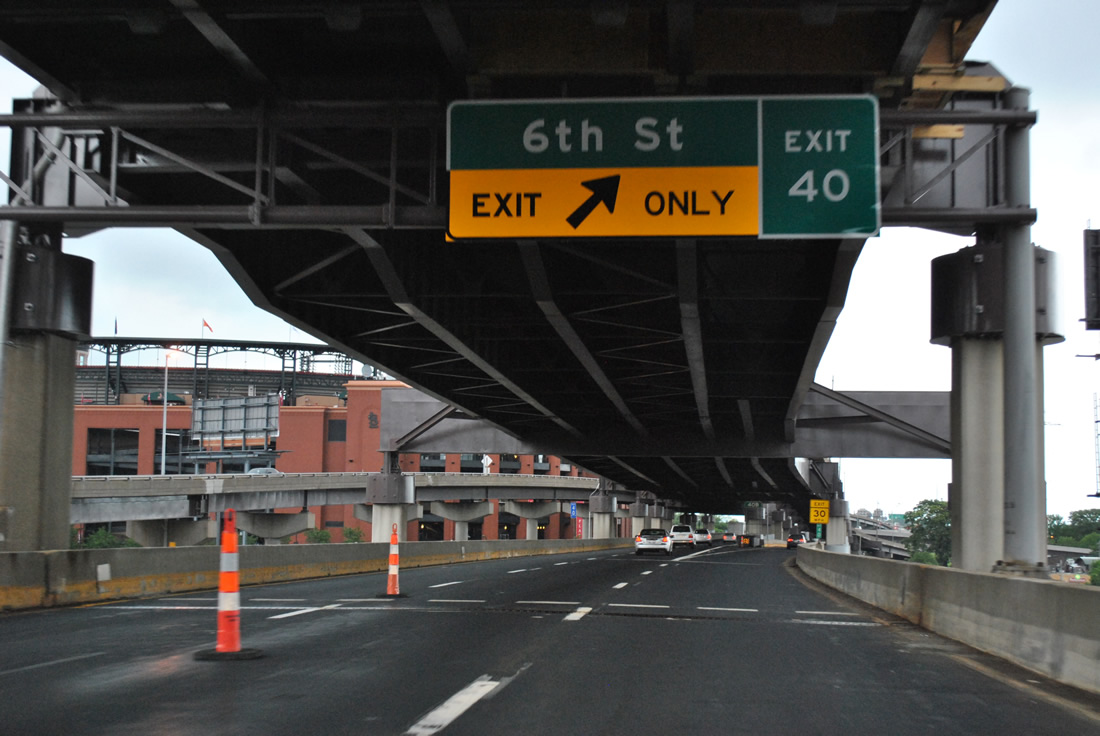
| Two through lanes continue onto the Poplar Street Bridge into East St. Louis, Illinois as the right lane defaults onto Exit 40 for 6th Street south at Gratiot Street. 05/04/12 |
|
| Exit 39B drops down from the I-64/U.S. 40 viaduct onto 11th Street north at Spruce Street, just three blocks west of Busch Stadium. Exit 40 follows for 6th Street south to LaSalle Park. 05/04/12 |
|
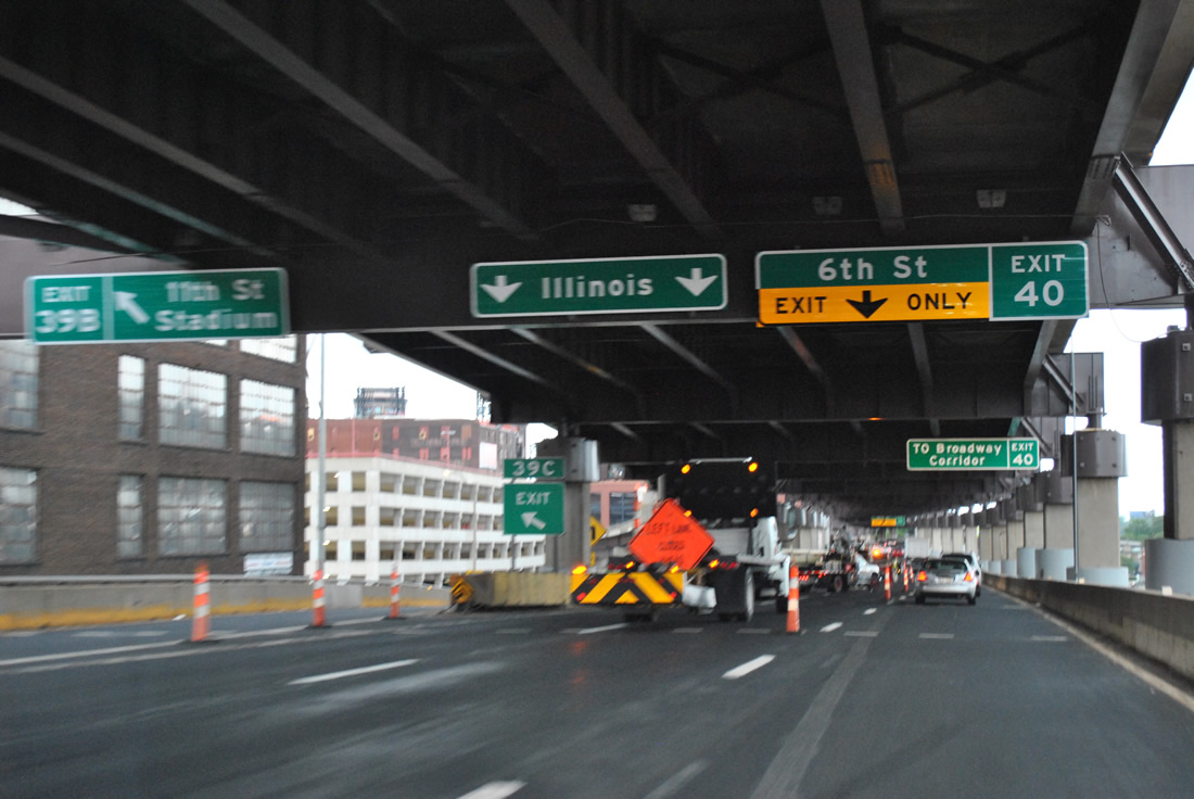
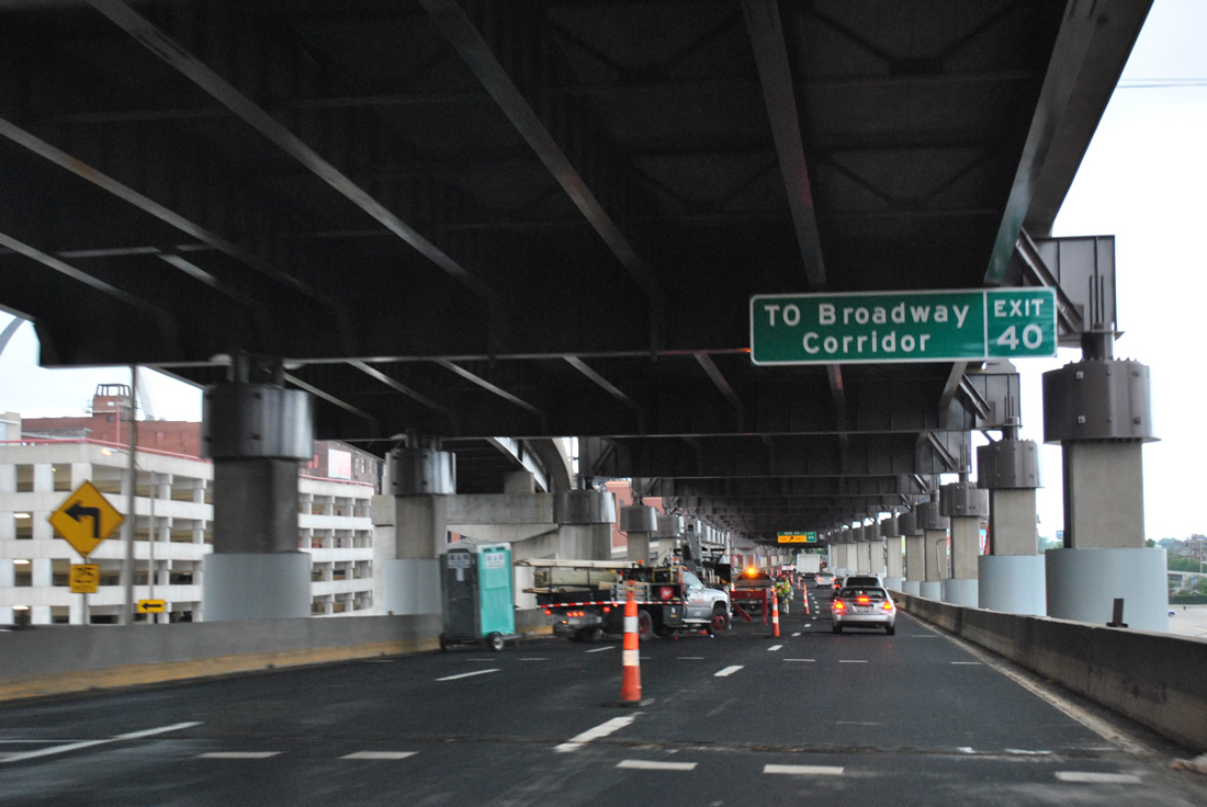
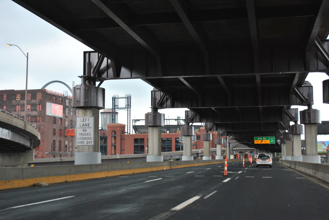
| Exit 40 serves the Broadway Corridor, which is the stretch of Broadway between Soulard and Downtown. Points of intersect include the Gateway Arch and the Anheuser-Busch Tour Center. 05/04/12 |
|
| Ramps join the upper deck of I-64/U.S. 40 with 10th and 9th Streets at Clark Avenue as Busch Stadium comes into view. 05/04/12 |
|
| The ramp from Exit 40 was extended south from Cerre Street one block to Gratiot Street in 2006 when a new flyover ramp was added from 6th Street north onto I-64 east. Broadway parallels 6th Street one block to the east and is the former alignment of U.S. 67 Alternate south from Kosciusko to Davis Street at the Patch section of the city. 05/04/12 |
|
| I-64/U.S. 40 east emerge from the double decker freeway to combine with Interstate 55 north across the Poplar Street Bridge. 05/04/12 |
|
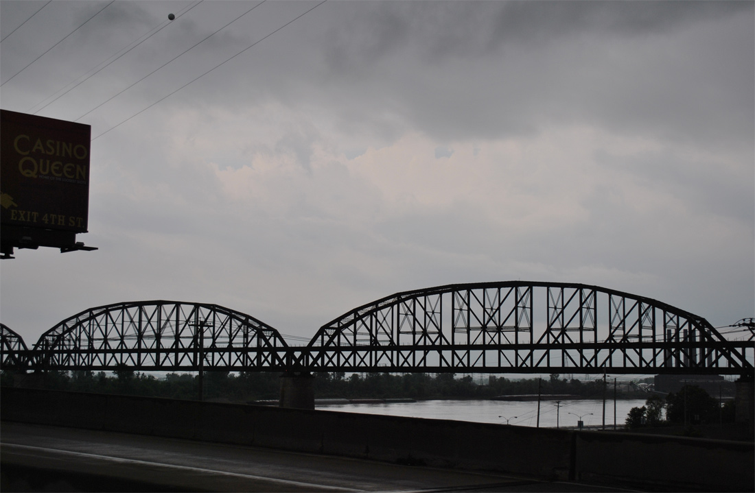
| The MacArthur Bridge appears next to the Poplar Street Bridge as the former routing of U.S. 460 and U.S. 67 Alternate. Originally a double deck bridge, the upper deck supported automobile traffic until deterioration of the pavement resulted in a closure of the bridge to cars in 1981.3 05/04/12 |
Page Updated 11-13-2013.


 East
East