|
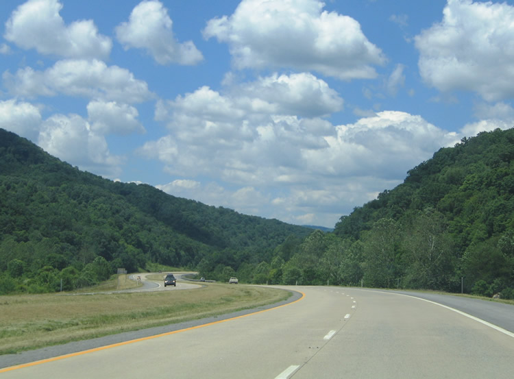
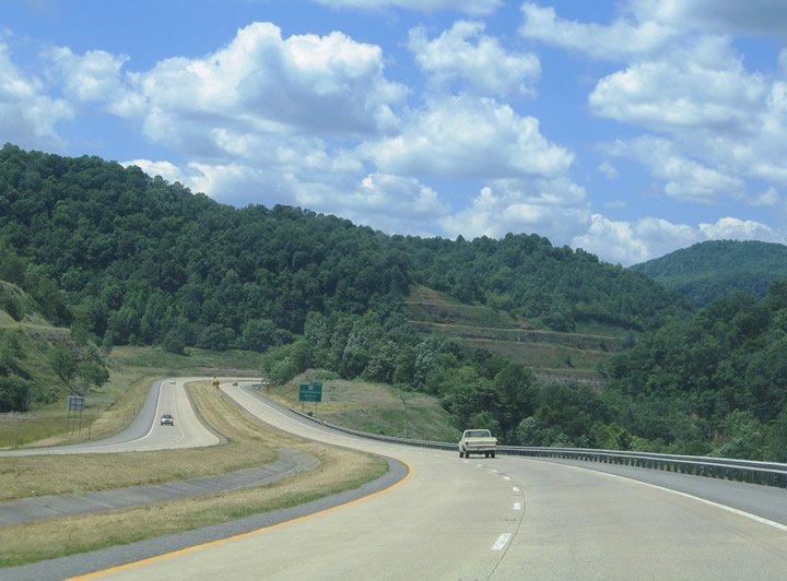
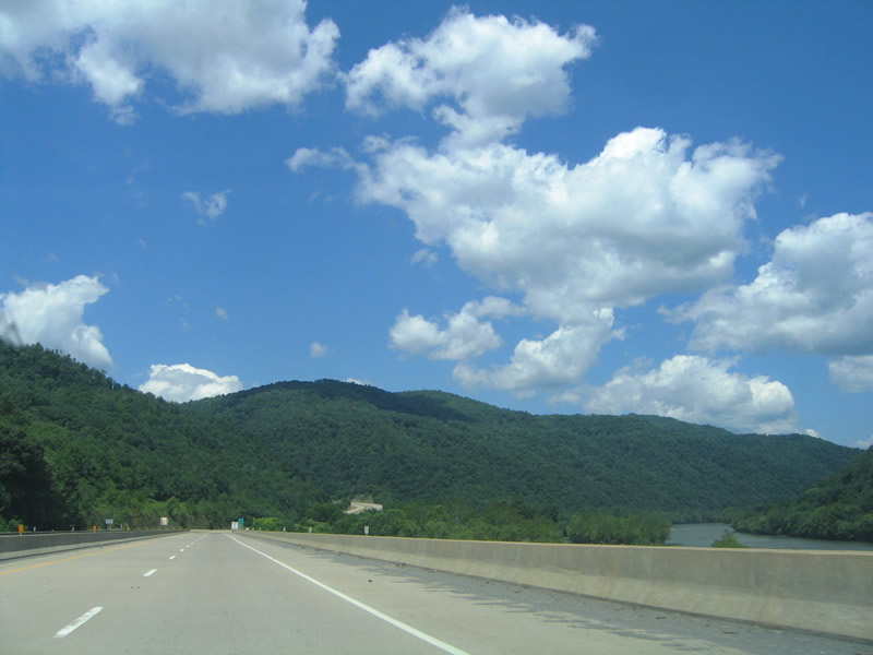
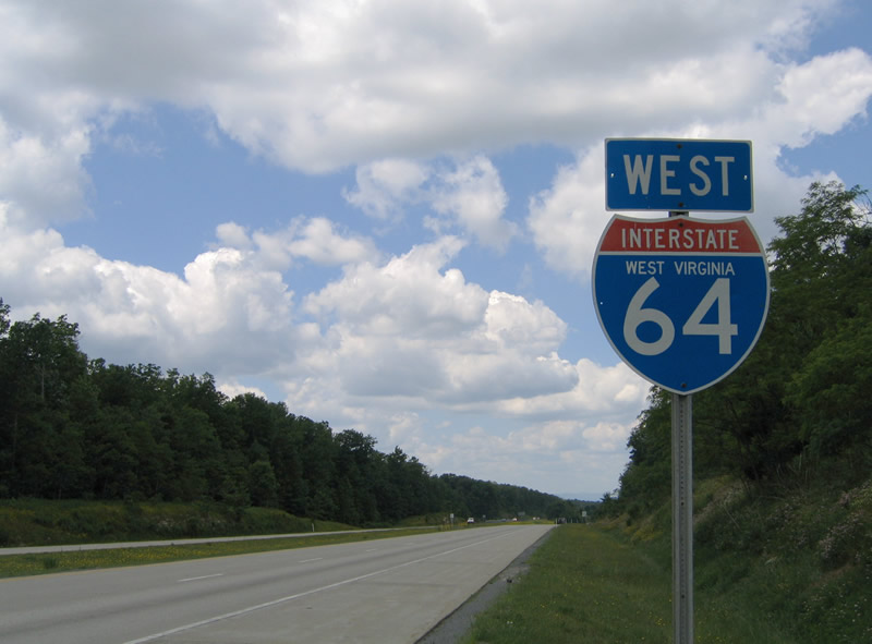
| Interstate 64 travels west four miles from Green Sulphur Springs to New River Gorge and the settlement of Sandstone. The freeway parallels both WV 20 and Lick Creek along the drive south of Gwinn and Hump Mountains 06/17/05 |
|
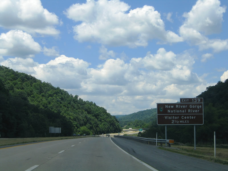
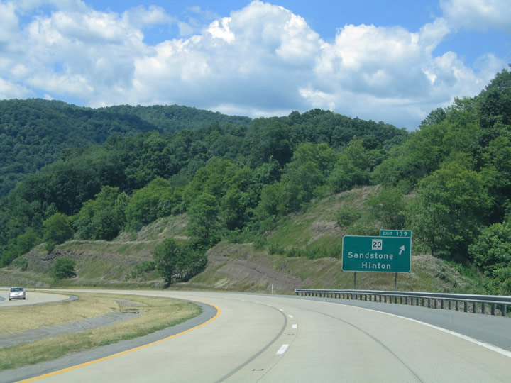
| Use Exit 139 for the New River Gorge National River visitor center along County Route 7 (Meadow Creek Road) north. The park area covers the New River southward from Fayetteville to Hinton. 06/17/05 |
|
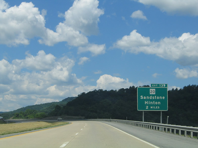
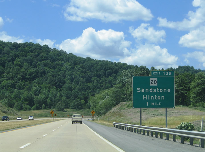
| WV 20 passes underneath Interstate 64 just east of the folded diamond interchange (Exit 139) with County Route 7. The state route turns sound along New River Gorge through Sandstone ten miles to the Summers County seat of Hinton. 06/17/05 |
|
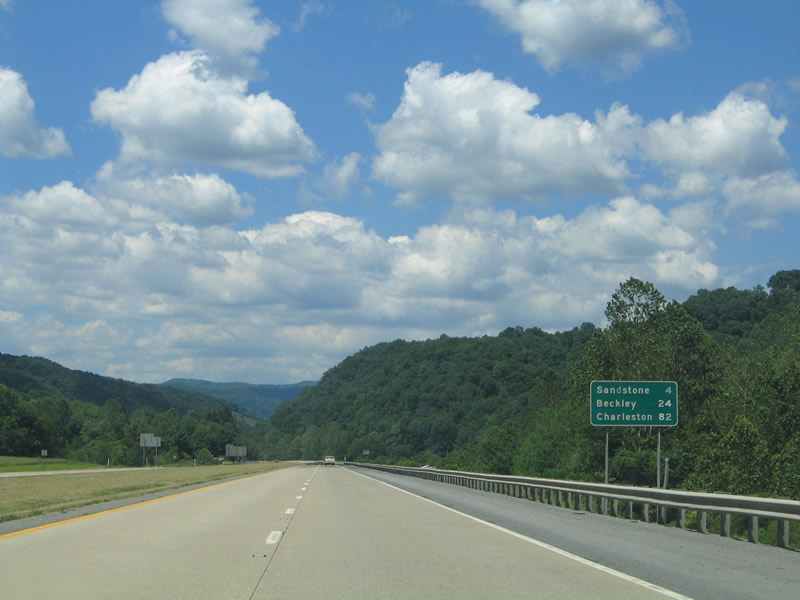
| Terraced hillsides come into view along Interstate 64 ahead of Exit 139 to WV 20 (Main Street) at Sandstone. Sandstone represents a small settlement along the New River south of I-64. 06/17/05 |
|
| Interstate 64 lowers to the off-ramp (Exit 139) for CR 7 at WV 20 and Sandstone. WV 20 and the parallel CSX Railroad line head south to Brooks and Hinton (WV 3). Beyond Hinton, WV 20 continues to the Bluestone National Scenic River, Athens and Princeton. 06/17/05 |
|
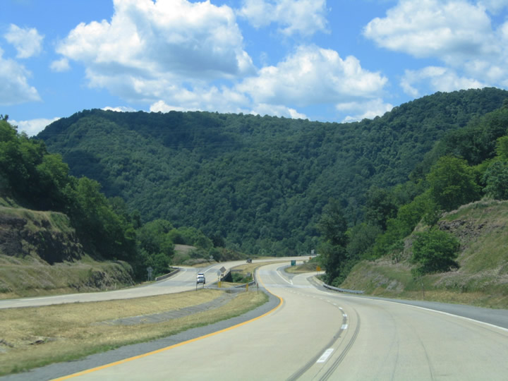
| Sullivan Knob (el, 2,582 ft) rises just west of the new River as Interstate 64 winds across CR 7. 06/17/05 |
|
| Interstate 64 spans the New River via the Mary Draper Ingles Bridge west of Sandstone. The span carries the freeway across the Raleigh County line. 06/17/05 |
|
| The New River flows northward 320 miles within the Appalachian Mountains from near Boone, North Carolina into the Kanawha River at Gauley Bridge. 06/17/05 |
|
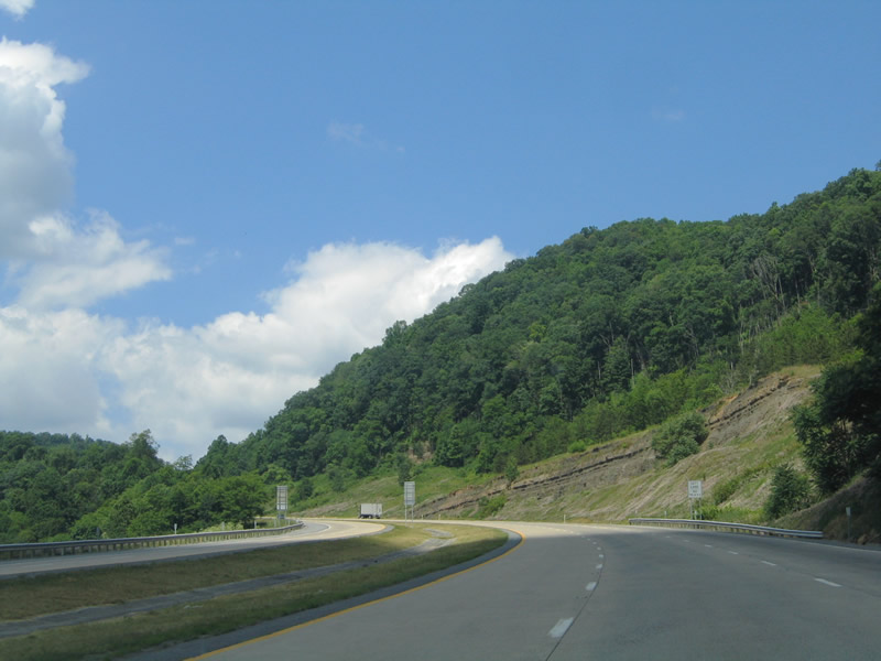
| Westbound drivers ascend from New River Gorge through a valley between Smith and Irish Mountains. 06/17/05 |
|
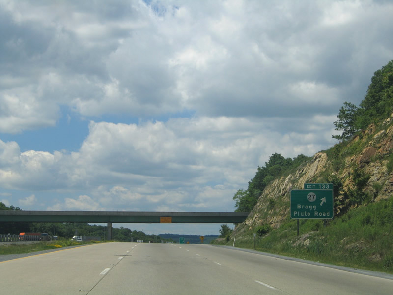
| Meeting the freeway in two miles is CR 27 (Pluto Road) south of Bragg. 06/17/05 |
|
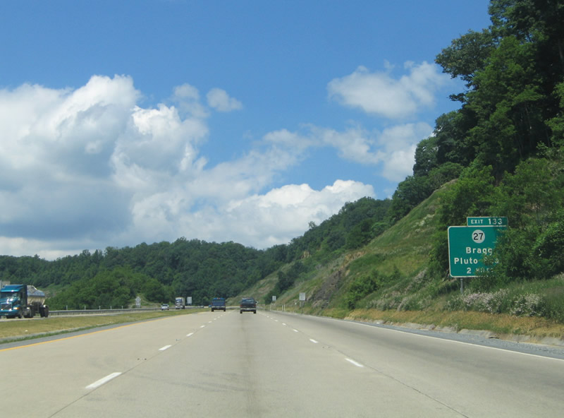
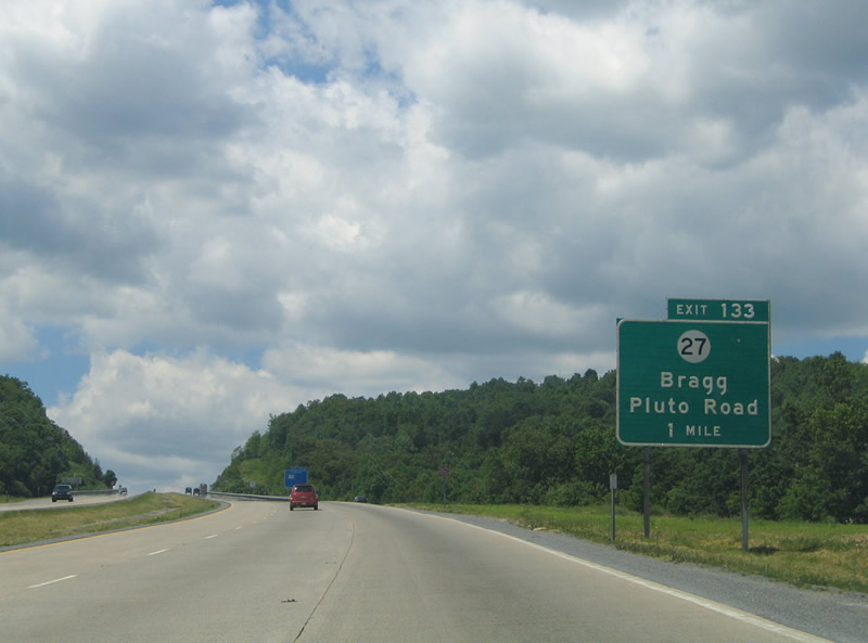
| A folded diamond interchange facilitates movement between Interstate 64 and County Route 27 (Pluto Road) at Exit 133. Bragg lies 0.9 miles north. CR 27 extends from there east across Plumley Mountain to Abraham. 06/17/05 |
|
| Westbound Interstate 64 at the loop ramp (Exit 133) to CR 27 (Pluto Road). Pluto Road snakes its way southwestward from the freeway eight miles to Pluto and ten miles to WV 3 (Hinton Road) near Shady Spring. 06/17/05 |
|
| Reassurance marker posted at the CR 27/10 (Cloverdale Road) overpass. Cloverdale Road parallels Interstate 64 west 2.8 miles to a dead end on Plumley Mountain. 06/17/05 |
|
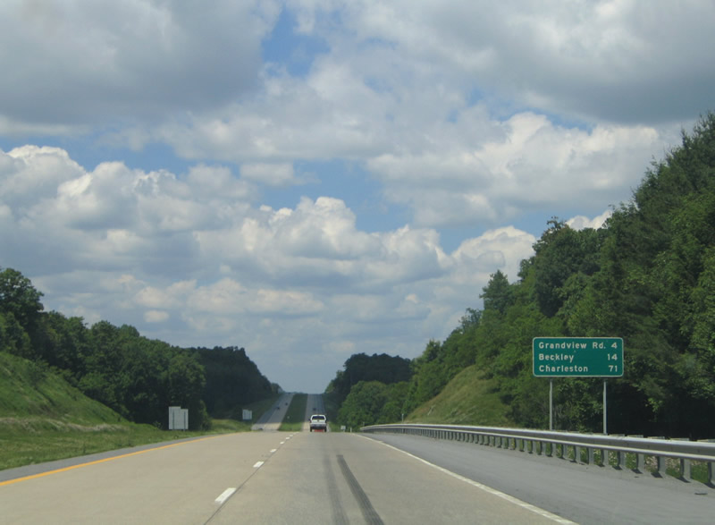
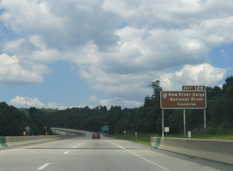
| Now 14 miles out from Beckley, Interstate 64 nears Grandview Road at the settlement of Beaver. 06/17/05 |
|
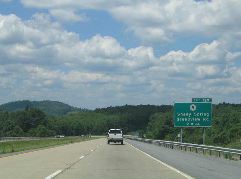
| County Route 9 (Grandview Road) travels north from upcoming Exit 129 to Grandview and south to Crow. 06/17/05 |
|
| Interests to the Grandview area of the New River Gorge National River should use CR 9 (Grandview Road) northbound five miles to its end. 06/17/05 |
|
| 0.75 miles east of the parclo interchange (Exit 129) with CR 9 (Grandview Road) on I-64 west. Grandview Road becomes part of WV 307 nearby. WV 307 constitutes a 8.4 mile loop east from U.S. 19/WV 3 at Beaver to Little Beaver State Park. 06/17/05 |
|
| Exit 129 departs Interstate 64 west for CR 9 (Grandview Road). WV 307 south from CR 9 leads motorists to Shady Spring, a census designated place along U.S. 19/WV 3 south. 06/17/05 |
|
| A closer look at the reassurance marker for I-64 west posted after Exit 129 and ahead of Scott Ridge. 06/17/05 |
|
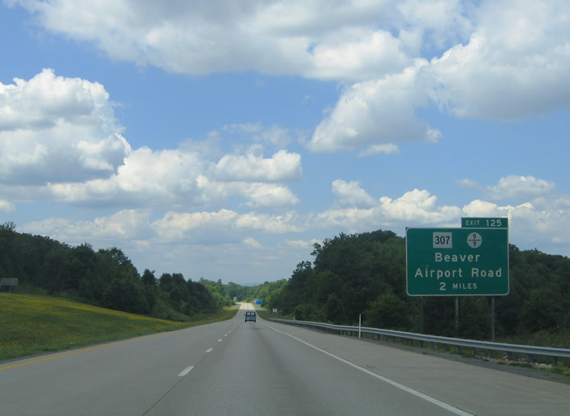
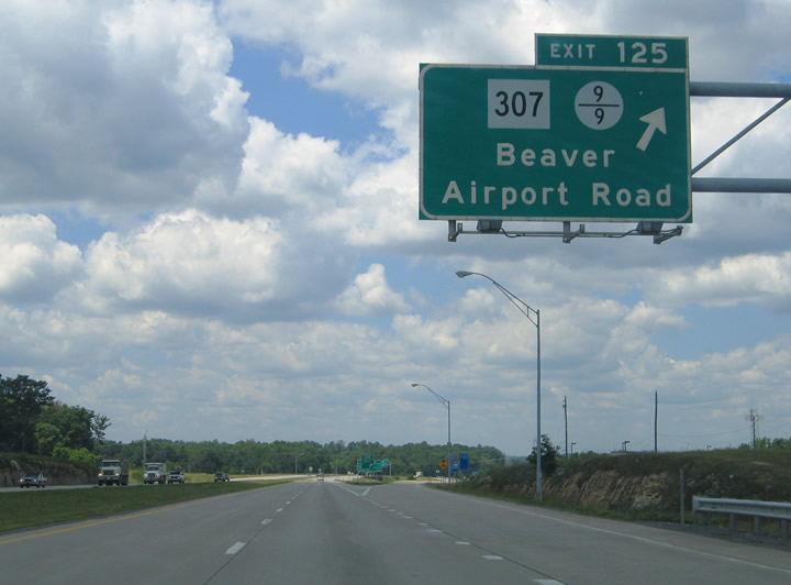
| Next in line for westbound motorists is the six-ramp parclo interchange (Exit 125) with County Route 9/9 near Cliffop. 06/17/05 |
|
| One mile out from the Exit 125 to CR 9/9 (Airport Road) on Interstate 64 west. Airport Road joins WV 307 and the freeway with Raleigh County Memorial Airport (BKW) and its associated industrial park. 06/17/05 |
|
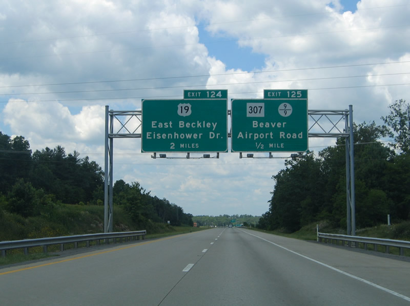
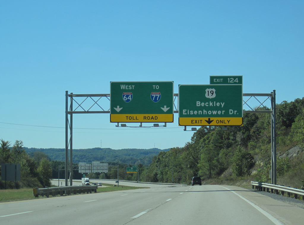
| Interstate 64 enters the Beckley area and sees this sign bridge for Exits 125 and 124 (East Beckley Bypass). There is no direct access to U.S. 19 from the freeway, but the East Beckley Bypass provides a high-speed route to the US highway near East Beckley. 06/17/05 |
|
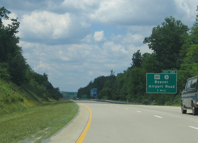
| Exit 125 leaves Interstate 64 west for County Route 9/9 (Airport Road). WV 307 ties into Airport Road nearby, midway between Grandview Road and Beaver (U.S. 19/WV 3). 06/17/05 |
|
| This community interchanges identification sign for Beckley references Exit 124 for the East Beckley Bypass and the first two exits along the I-64/77 overlap. 06/17/05 |
|
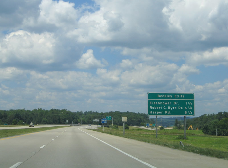
| U.S. 19 splits with WV 3 (Fayette Street) north of Beaver for Eisenhower Drive through eastern reaches of the city. Fayette Street carries WV 3 through East Beckley to 2nd Street outside Downtown while U.S. 19 stays to the east to WV 16 at Skelton. 10/02/10 |
|
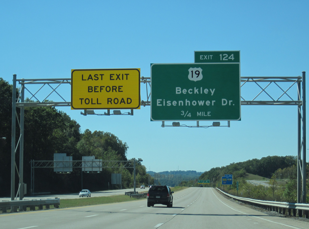
| Interstate 64 bypasses Beckley well south of the city between Exits 124 and the West Virginia Turnpike (I-77). A last exit before toll overhead advises motorists one half mile east of the trumpet interchange (Exit 124) with the East Beckley Bypass. I-64/77 (West Virginia Turnpike) leading north to Exit 42 (WV 16) however is toll free. 10/02/10 |
|
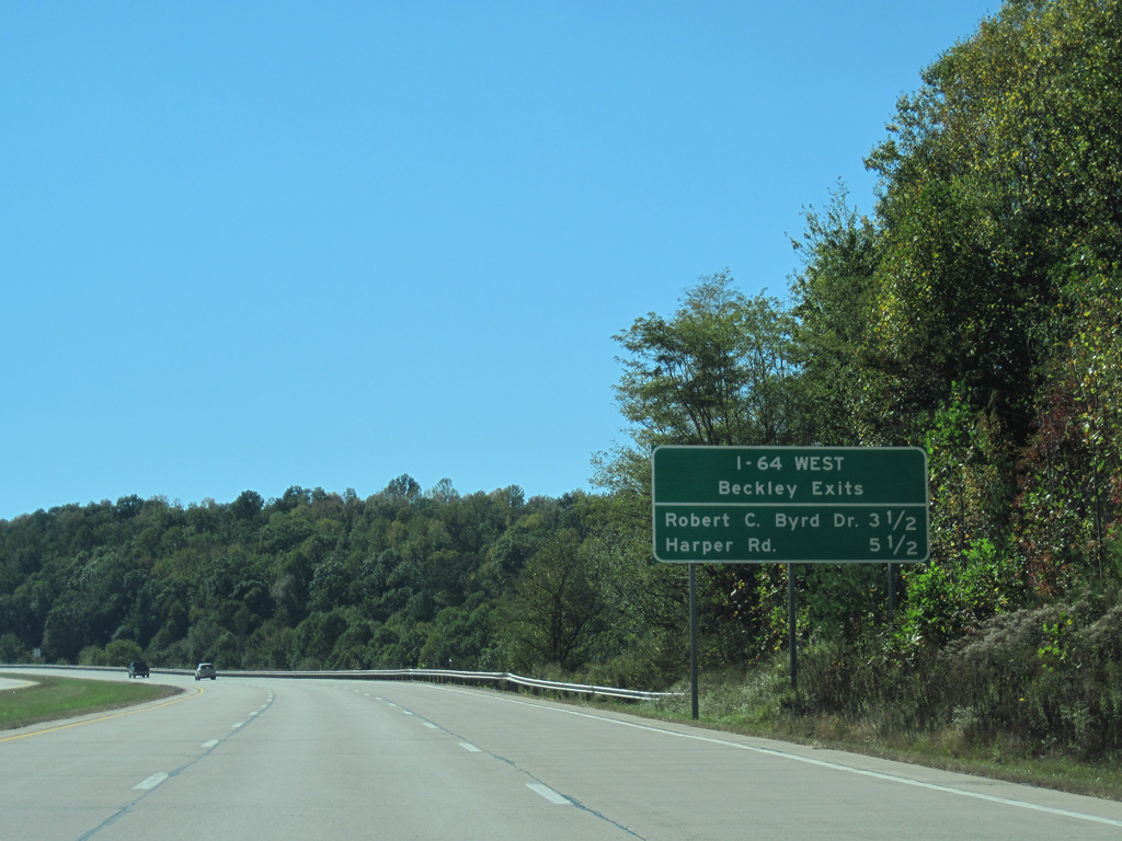
| An auxiliary lane runs from Airport Road to Exit 124. The East Beckley Bypass provides an alternate route of U.S. 19 (Eisenhower Drive) through the city of Beckley. Varying between four and five lanes with controlled access, the corridor begins at I-64 and ends at WV 41 (Stanaford Road). Construction started on October 8, 2014 extends the expressway 1.33 miles north to Industrial Drive and U.S. 19/WV 16 (Robert C. Byrd Drive).1 10/02/10 |
|
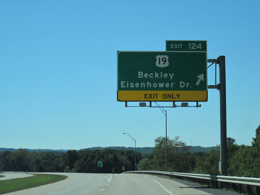
| Drivers bound for Beckley and U.S. 19 (Eisenhower Drive) part ways with Interstate 64 west at Exit 124. U.S. 19 follows Eisenhower Drive northward to Prosperity and the expressway alignment (Mountaineer Expressway) leading north to Mt. Hope. U.S. 19 northward from Beckley is part of Appalachian Regional Development Corridor L. 10/02/10 |
|
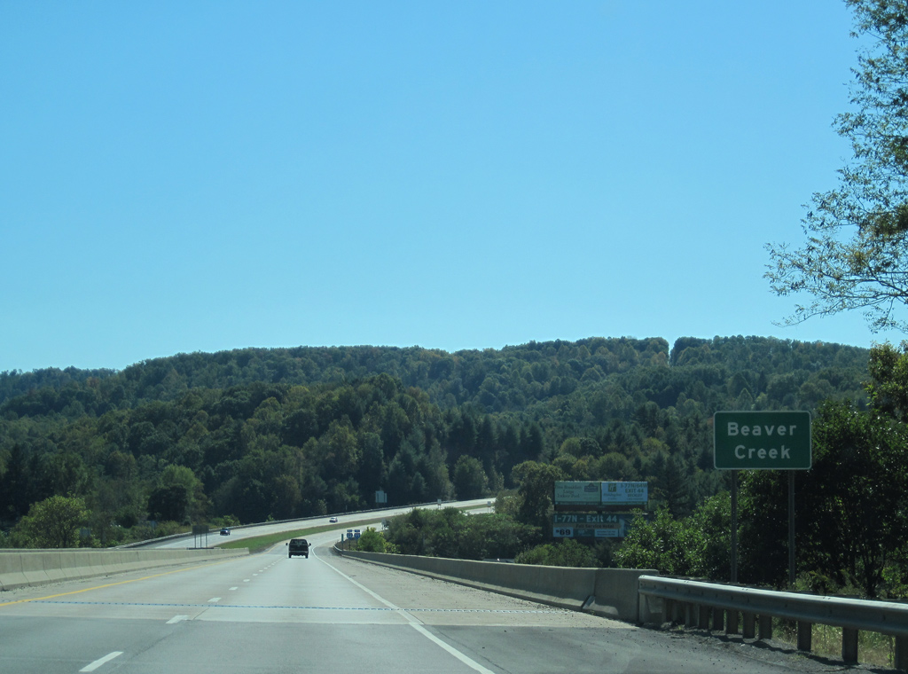
| Interstate 64 west sinks toward the crossing of Beaver Creek and U.S. 19/WV 3 near Glen Morgan and Beaver. 06/17/05, 10/02/10 |
|
| Westbound reassurance shield and Interstate 77 trailblazer posted at the Tank Branch Road under crossing. Interstate 64 south of Beckley opened in 1987. 06/17/05 |
|
| Interstate 64 west combines with Interstate 77 along the west side of Beckley. Two interchanges join the West Virginia turnpike with the city at WV 16 (Robert C. Byrd Drive) and WV 3 (Harper Road). 10/02/10 |
|
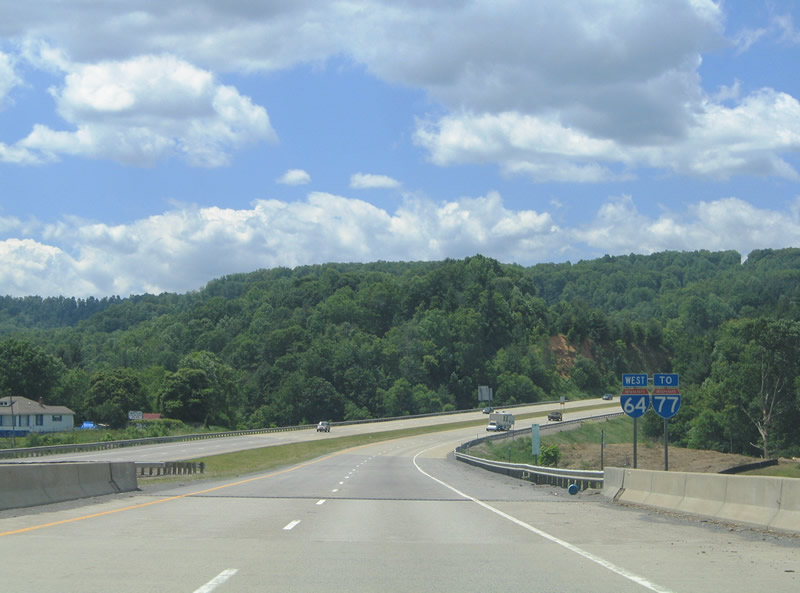
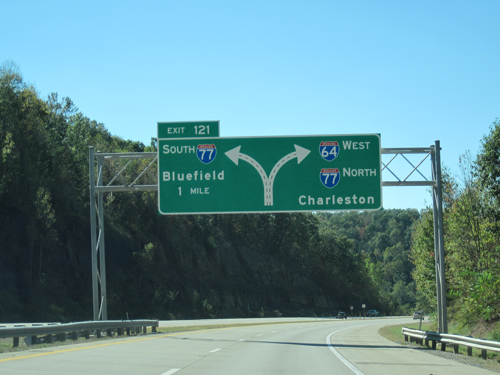
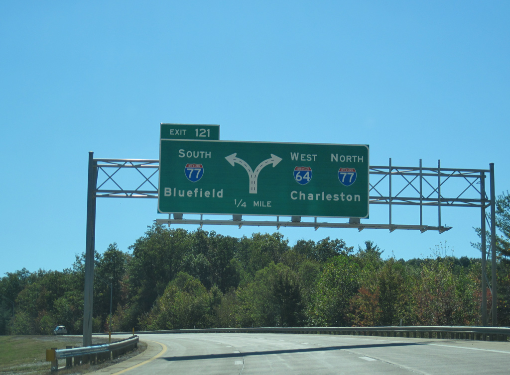
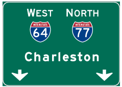
| Two miles east of the directional T interchange (Exit 121) with Interstate 77 (West Virginia Turnpike) on I-64 west. Interstate 77 straddles western reaches of the Beckley area by MacArthur, Mabscott and Tamarack. 10/02/10 |
|
| A second diagrammatic overhead outlines the lane distribution for the West Virginia turnpike along I-64 west near Tilden. Including the remainder of the West Virginia Turnpike northbound, I-64/77 overlap for 61.5 miles between the Beckley area and Charleston. 10/02/10 |
|
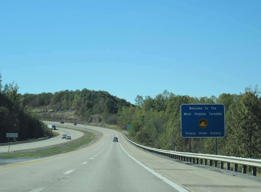
| Welcome to the West Virginia Turnpike sign posted on the final curve before Interstate 64 joins Interstate 77. Interstate 77 follows the West Virginia Turnpike southward from Exits 40 to 9 (U.S. 460). 10/02/10 |
|
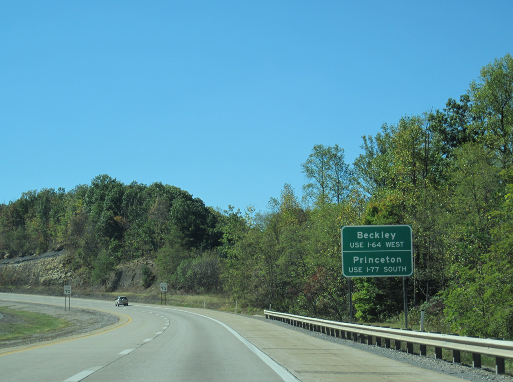
| Interests to Beckley are provided with three additional interchanges along I-64/77 north; Princeton lies 32 miles southward via U.S. 460 west from Exit 9. 10/02/10 |
|
| Tolls are collected in both directions of the West Virginia Turnpike, however I-64/77 north to WV 16 is toll free. 10/02/10 |
|
| County Route 19/41 (Fitzpatrick Road) passes over Interstate 64 at the partition of ramps to Interstate 77. I-77 south continues 12 miles to Ghent and 42 miles to Bluefield (via U.S. 52). I-64/77 north part ways with the U.S. 19 corridor at Exit 48 and converge with the U.S. 60 corridor at Exit 96, the turnpike north end. 10/02/10 |
|
| Interchange sequence sign listing the distances to WV 16 (Exit 42), WV 3 (Exit 44), and the U.S. 19 connector (Exit 48). The sign does not reference Tamarack (Exit 45) because it predates its construction. 06/17/05 |
|
| A left side ramp takes drivers onto Interstate 77 south from Interstate 64 west. 10/02/10 |
Page Updated 03-16-2015.

 West
West