|
| I-64/U.S. 60 crosses the James River on the Hampton Roads Bridge Tunnel between the Willoughby Spit area in Norfolk and Phoebus in Hampton. Opened in 1957, the bridge system was expanded from two to four lanes in 1976. 03/25/01 |
|
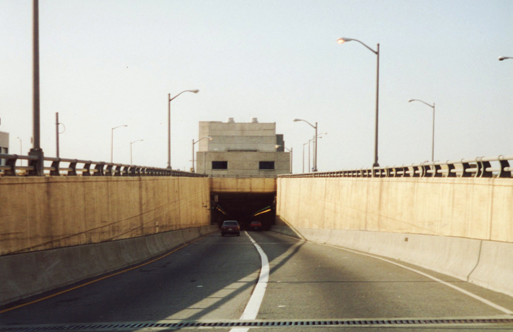
| Tunnels along I-64/U.S. 60, I-664 and U.S. 13 were built to accommodate the largest of ships to the Hampton Roads navy bases and port facilities. 03/25/01 |
|
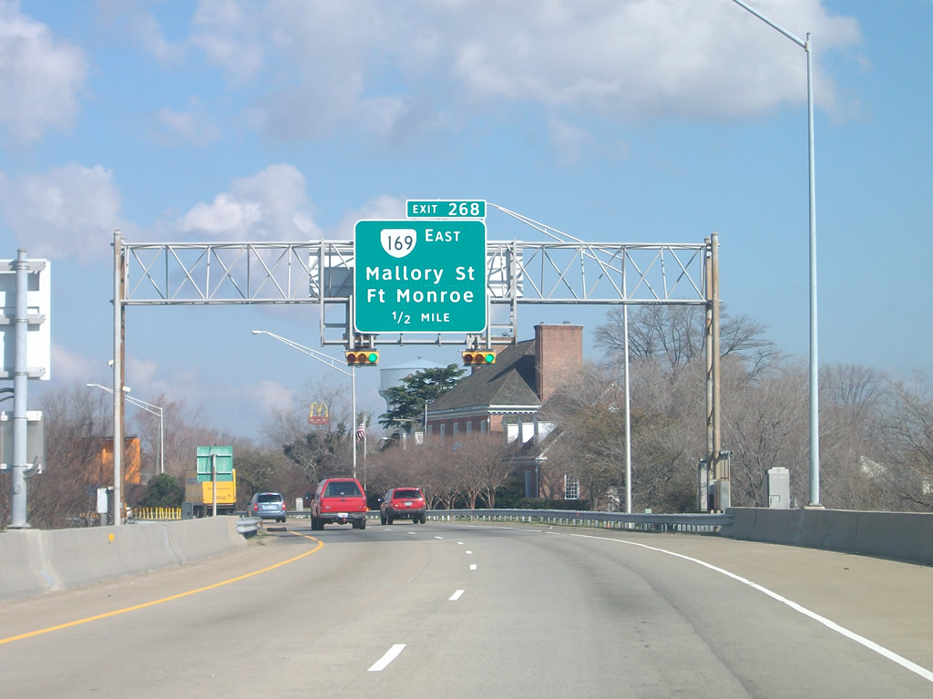
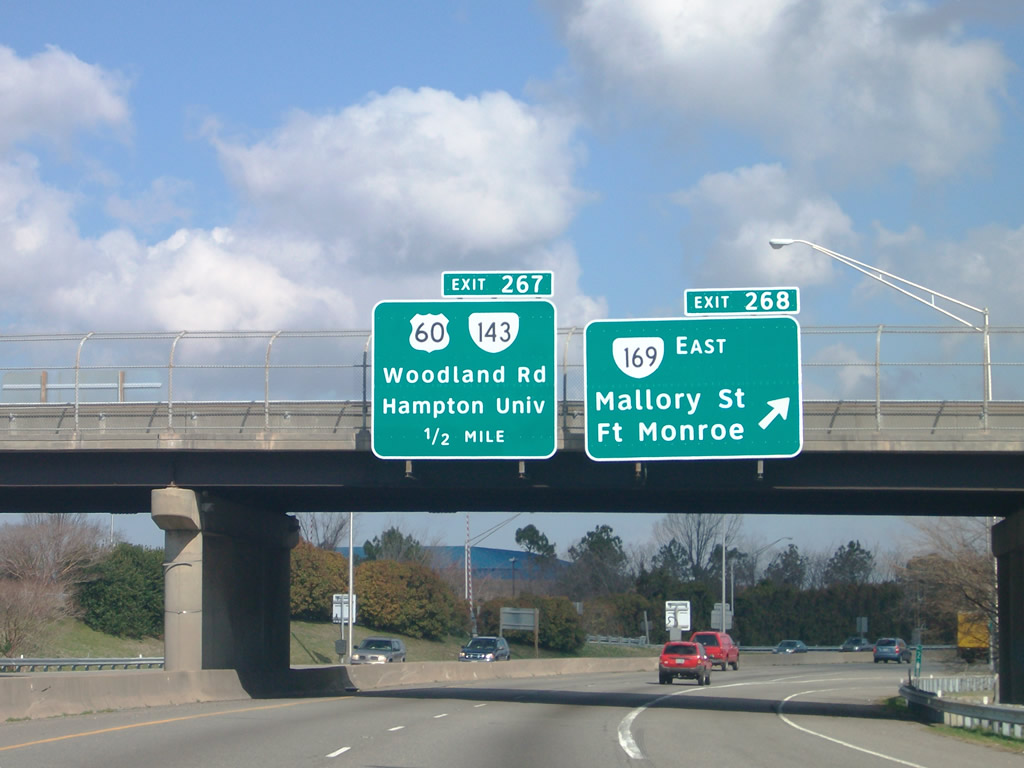
| A parclo interchange (Exit 268) lies just beyond the north end of the Hampton Roads Bridge Tunnel (HRBT) with Mallory Street east to SR 169 and SR 143 (County Street). 03/21/09 |
|
| SR 169 (Mallory Street) connects I-64/U.S. 60 with U.S. 258 (Mercury Boulevard) at Phoebus before extending northeast to Chesapeake Heights and Buckroe Beach. U.S. 60 parts ways with I-64 west at the succeeding exit for Settlers Landing Road. 03/21/09 |
|
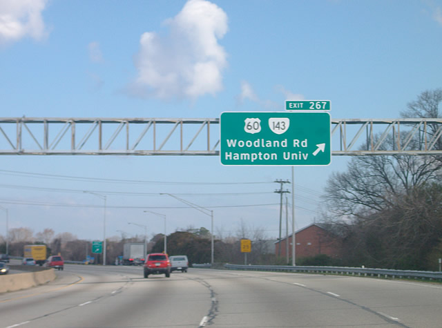
| I-64 expands to six lanes ahead of Exit 267 with U.S. 60/SR 143 west to Hampton University and Downtown Hampton. SR 143 Truck follows Woodland Road east to U.S. 258 while SR 143 spurs south to Fort Monroe. 03/21/09 |
|
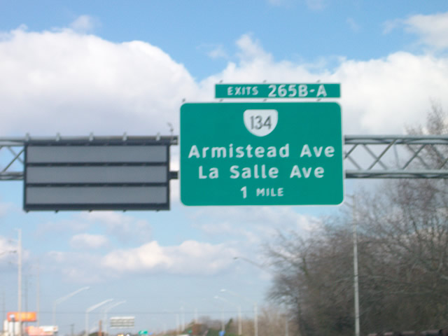
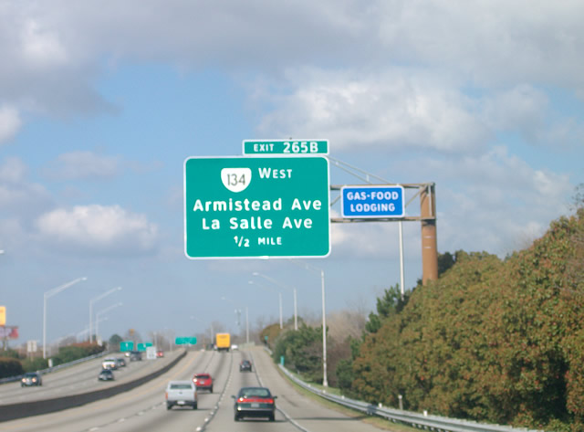
| Interstate 64 arcs northwest across the Hampton River to a six-ramp parclo interchange (Exit 265) with SR 134 (Armistead Avenue) and SR 167 (La Salle Avenue). 03/21/09 |
|
| La Salle Ave (former VA 167) extends 2.05 miles north from SR 143 (Armistead Avenue just beyond Exit 265B to Langley Air Force Base. 03/21/09 |
|
| SR 134 combines with U.S. 258 (Mercury Boulevard) west from Armistead Avenue near Windsor Terrace and Hampton Coliseum to I-64 at Exit 283. 03/21/09 |
|
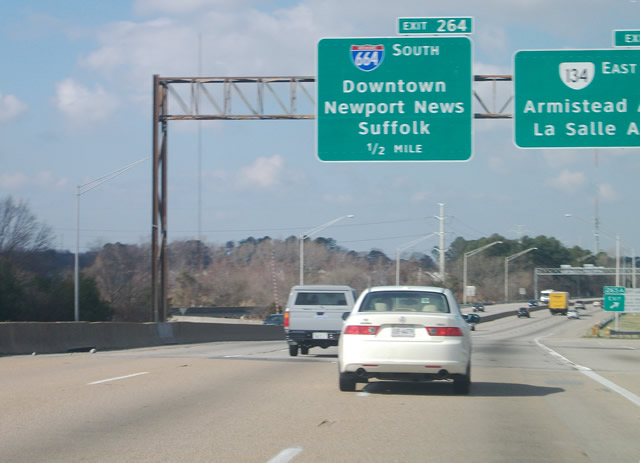
| SR 134 (Armistead Avenue) arcs 1.10 miles south from I-64 to U.S. 60/SR 143 (Settlers Landing Road) at Downtown Hampton. I-64 west leaves the Hampton Roads Beltway at forthcoming Interstate 664. 03/21/09 |
|
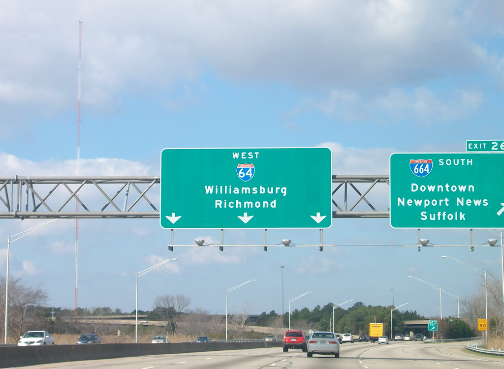
| Interstate 664 (Hampton Roads Beltway) angles southwest from a directional T interchange (Exit 264) with I-64 to southern Newport News and the Monitor Merrimac Memorial Bridge Tunnel spanning the James River to Suffolk. 03/21/09 |
|
| An HOV lane opens along I-64 ahead of the exchange with U.S. 258/SR 134. Following the completion of the Coliseum Central Highway Project in 2006, I-64 expands to as many as 12 lanes between I-664 and Exit 262B with SR 134 north. 03/21/09 |
|
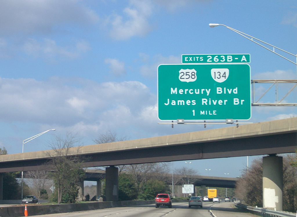
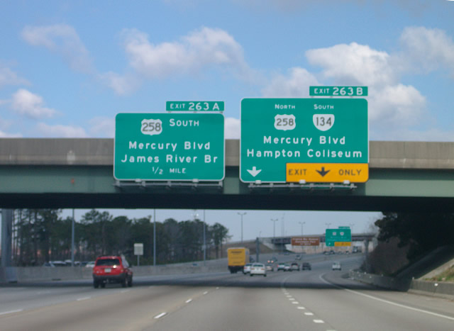
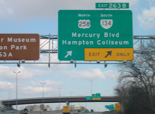
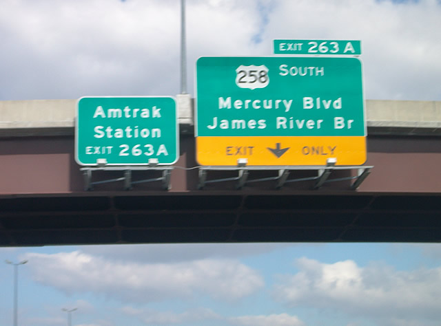
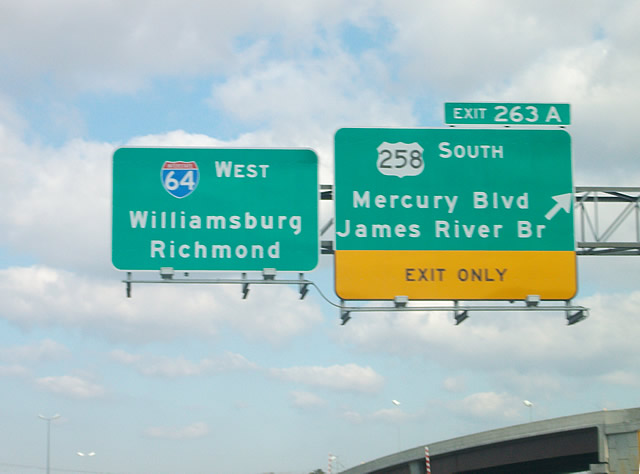
| Passing by the Hampton Coliseum, I-64 makes a gradual turn northwest to a cloverstack interchange (Exit 263) with U.S. 258/SR 134 (Mercury Boulevard). 03/21/09 |
|
| U.S. 258/SR 134 (Mercury Boulevard) combine east to Armistead Avenue. U.S. 258 continues from there in an arc southeast to Fort Monroe. 03/21/09 |
|
| U.S. 258 (Mercury Boulevard) travels southwest from Exit 263A to Newport News, where it combines with U.S. 17 across the James River Bridge. U.S. 17/258 overlap to Carrollton in Isle of Wight County. 03/21/09 |
|
| Two of the four loop ramps at the original cloverleaf interchange (Exit 263) joining I-64 with U.S. 258/SR 134 (Mercury Boulevard) were replaced with flyovers. 03/21/09 |
|
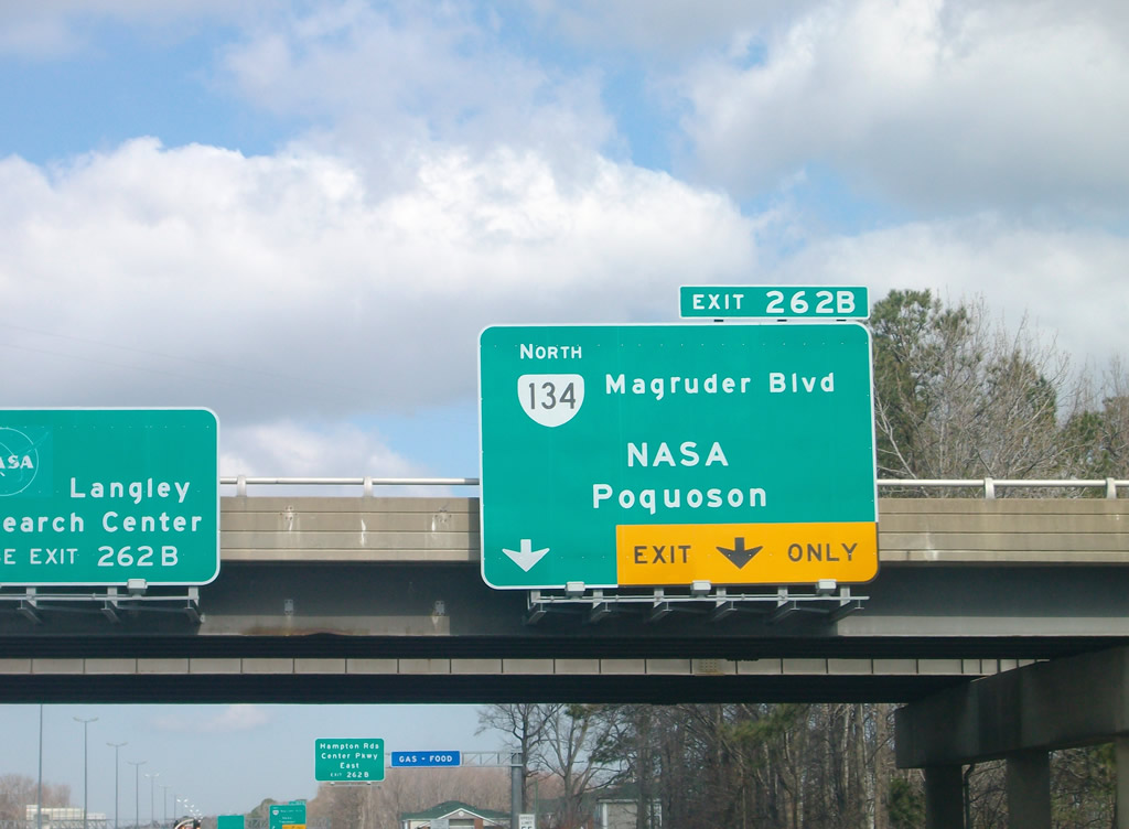
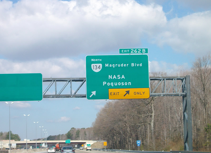
| SR 134 north combines with I-64 west from U.S. 258 (Mercury Boulevard) to a wye interchange (Exit 262B) with Magruder Boulevard. 03/21/09 |
|
| Following Magruder Boulevard in Newport News, SR 134 travels north to a SPUI with nearby Hampton Roads Center Parkway and SR 172 for Langley AFB, NASA and Poquoson. Hampton Highway leads SR 134 northwest to U.S. 17 in York County. 03/21/09 |
|
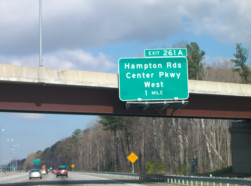
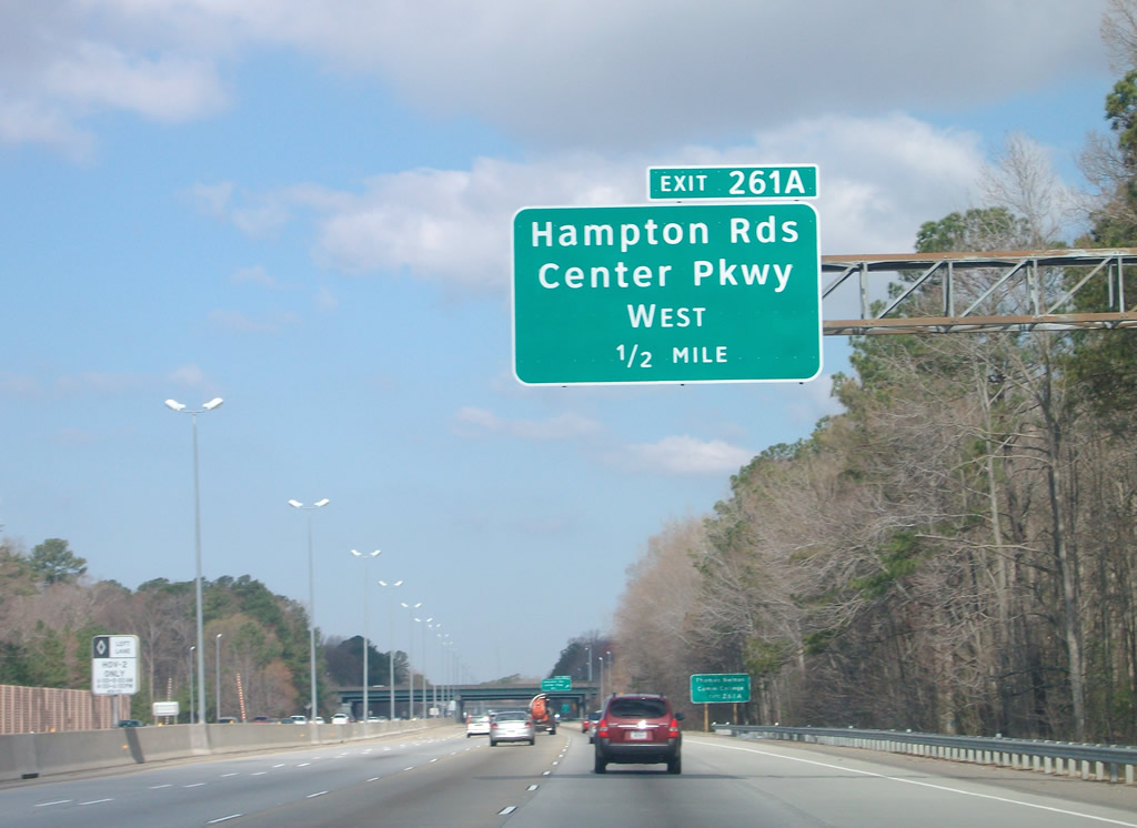
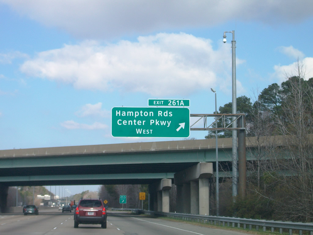
| Completed in the early 2000s, Hampton Roads Center Pkwy heads west from the SPUI with SR 143 to a cloverleaf interchange (Exit 261A) with Interstate 64. 03/21/09 |
|
| Located mainly in the city of Hampton but also a small portion of Newport News, Hampton Roads Center Parkway is a 4.16 mile long expressway running west from Armistead Avenue. 03/21/09 |
|
| Exit 261A connects with Hampton Roads Center Parkway westbound to U.S. 17/SR 143 (Jefferson Avenue) at SR 306 (Harpersville Road) between Beaconsdale and Morrison in Newport News. 03/21/09 |
|
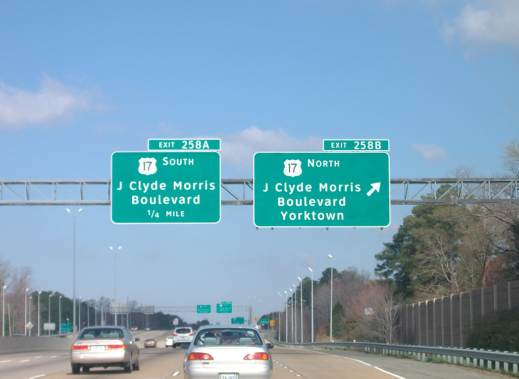
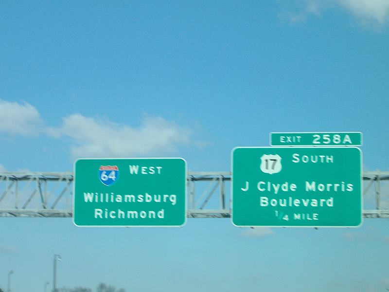
| Interstate 64 enters the city of Newport News northwest northwest of Newmarket Creek. The ensuing exit is with U.S. 17 (J. Clyde Morris Boulevard)l. 03/21/09 |
|
| U.S. 17 (J. Clyde Morris Blvd) travels towards Yorktown, becoming George Washington Memorial Highway in York County north to the tolled George P. Coleman Memorial Bridge into Gloucester County. 03/21/09 |
|
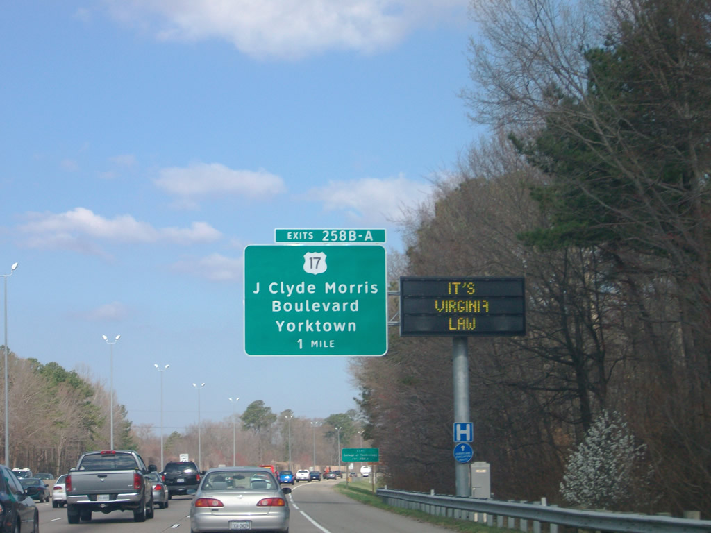
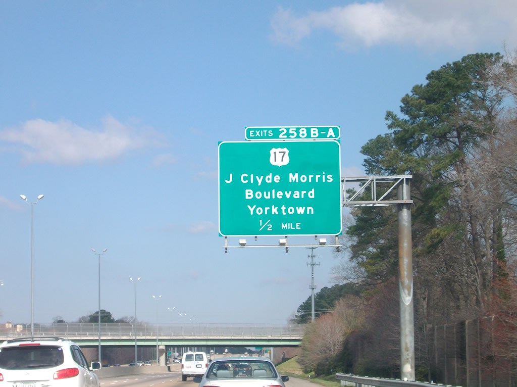
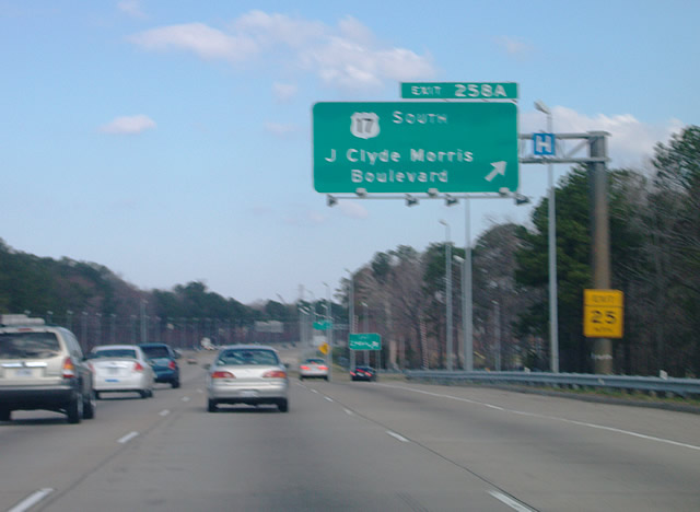
| Exit 258B departs I-64 west for U.S. 17 (J. Clyde Morris Boulevard) north at Harpersville in Newport News. U.S. 17 connects with Colonial Parkway in Yorktown, which is where the US won the American Revolution in 1781. 03/21/09 |
|
| U.S. 17 continues west along J. Clyde Morris Boulevard 1.58 miles from Exit 258A to SR 143 (Jefferson Avenue) and SR 312. 03/21/09 |
|
| SR 312 extends J. Clyde Morris Blvd 1.11 miles west from U.S. 17/SR 143 (Jefferson Avenue) to U.S. 60 (Warwick Boulevard). U.S. 17/SR 143 overlap south 4.12 miles to U.S. 258 (Mercury Boulevard) in Newport News. 03/21/09 |
|
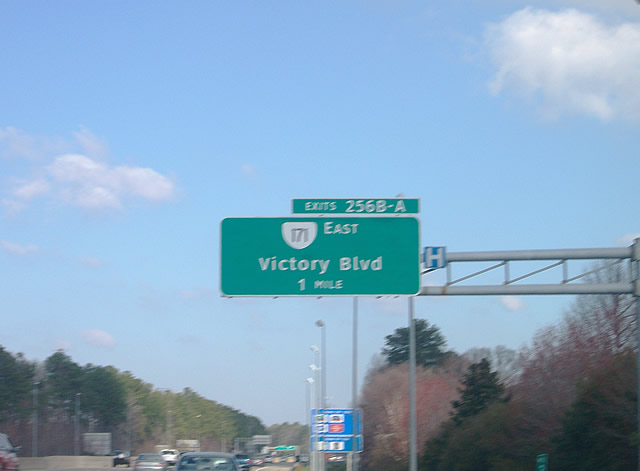
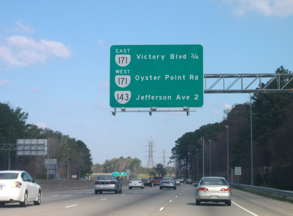
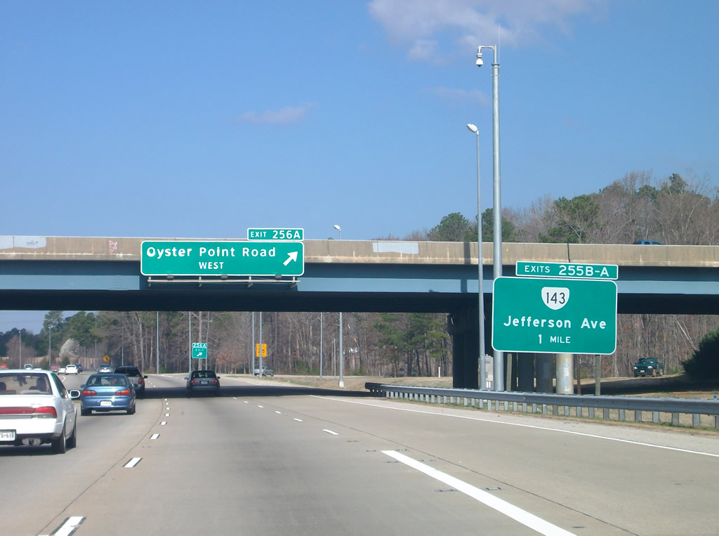
| Oyster Point Road (SR 1015) stems 1.04 miles east from U.S. 60 (Warwick Boulevard) and Boxley Boulevard to become Victory Boulevard at SR 143 (Jefferson Avenue). Victory Boulevard continues east 0.87 miles to a cloverleaf interchange (Exit 256) with I-64, where SR 171 begins. 03/21/09 |
|
| SR 171 heads 11.19 miles east from Interstate 64 to Messick Point along the Back River in the city of Poquoson. 03/21/09 |
|
| SR 171 (Victory Boulevard) is a controlled access arterial east from Exit 256B to SR 172 (Wythe Creek Road) in Poquoson. SR 171 is two lanes with a wide right of way between SR 134 (Hampton Highway) and SR 172. 03/21/09 |
|
| Exit 256A loops onto Victory Boulevard west to a heavily developed retail area at Oyster Point Road and SR 143 (Jefferson Avenue). 03/21/09 |
|
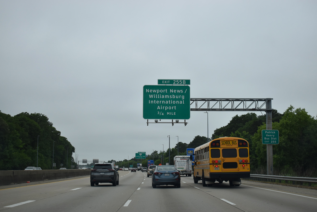
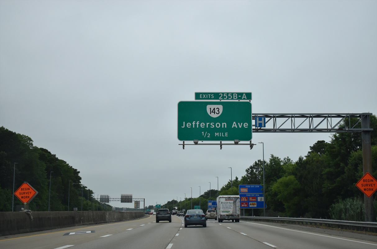
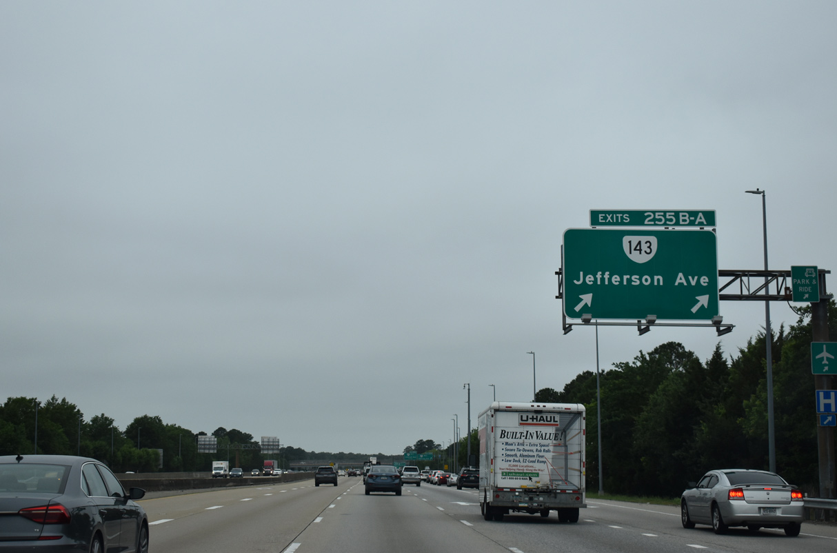
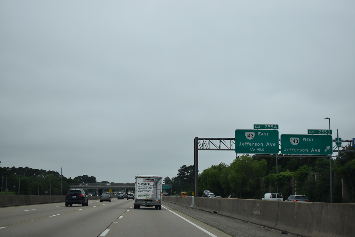
| SR 143 (Jefferson Avenue) converges with I-64 again at a cloverleaf interchange (Exit 255) south of Newport News/Williamsburg International Airport (PHF). 05/26/22 |
|
| SR 143 (Jefferson Avenue) constitutes a heavily developed commercial arterial. Patrick Henry Mall and several big box stores line the route through northern Newport News. 05/26/22 |
|
| C/d roadways separate from I-64 west at Exit 255 in both directions. The freeway previously reduced to four lanes beyond this exchange. 05/26/22 |
|
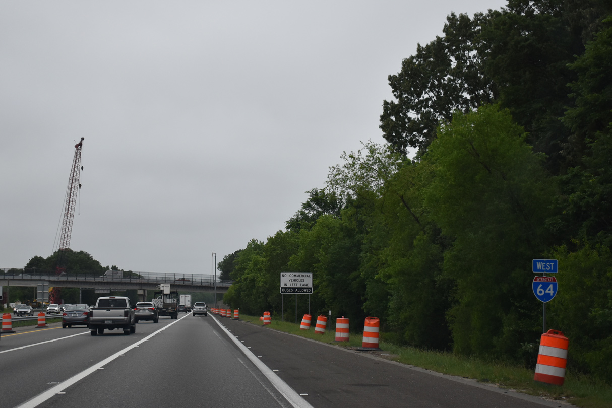
| SR 143 continues paralleling Interstate 64 northwest to Exit 238 outside Williamsburg. 05/26/22 |
|
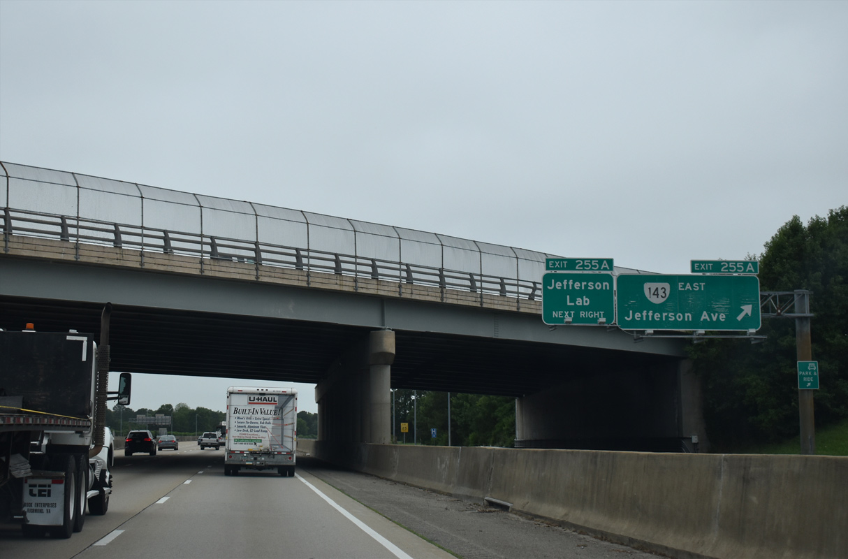
| SR 143 (Jefferson Avenue) leads south from Exit 255 A to Patrick Henry Mall and the Jefferson Lab. 05/26/22 |
|
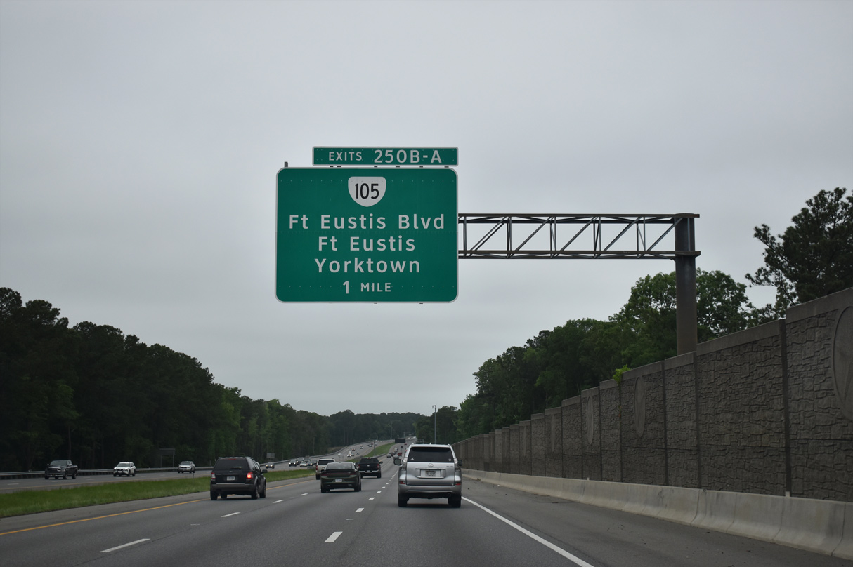
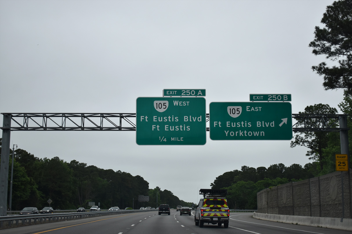
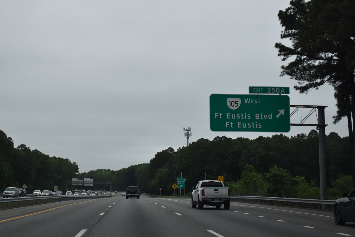
| Advancing north, Interstate 64 meets SR 143 (Jefferson Avenue) and SR 105 (Fort Eutis Road) at a cloverleaf interchange (Exit 250). 05/26/22 |
|
| Exit 205 B links I-64 west with SR 143 (Jefferson Avenue) south of SR 105 (Fort Eustis Boulevard). SR 105 is a controlled access arterial running east through Newport News Park to U.S. 17 and SR 1050 near Battle Park. 05/26/22 |
|
| The 4.90 mile long route of SR 105 (Fort Eustis Boulevard) concludes west of an interchange with U.S. 60 (Warwick Boulevard) at Fort Eustis Gate 1. 05/26/22 |
|
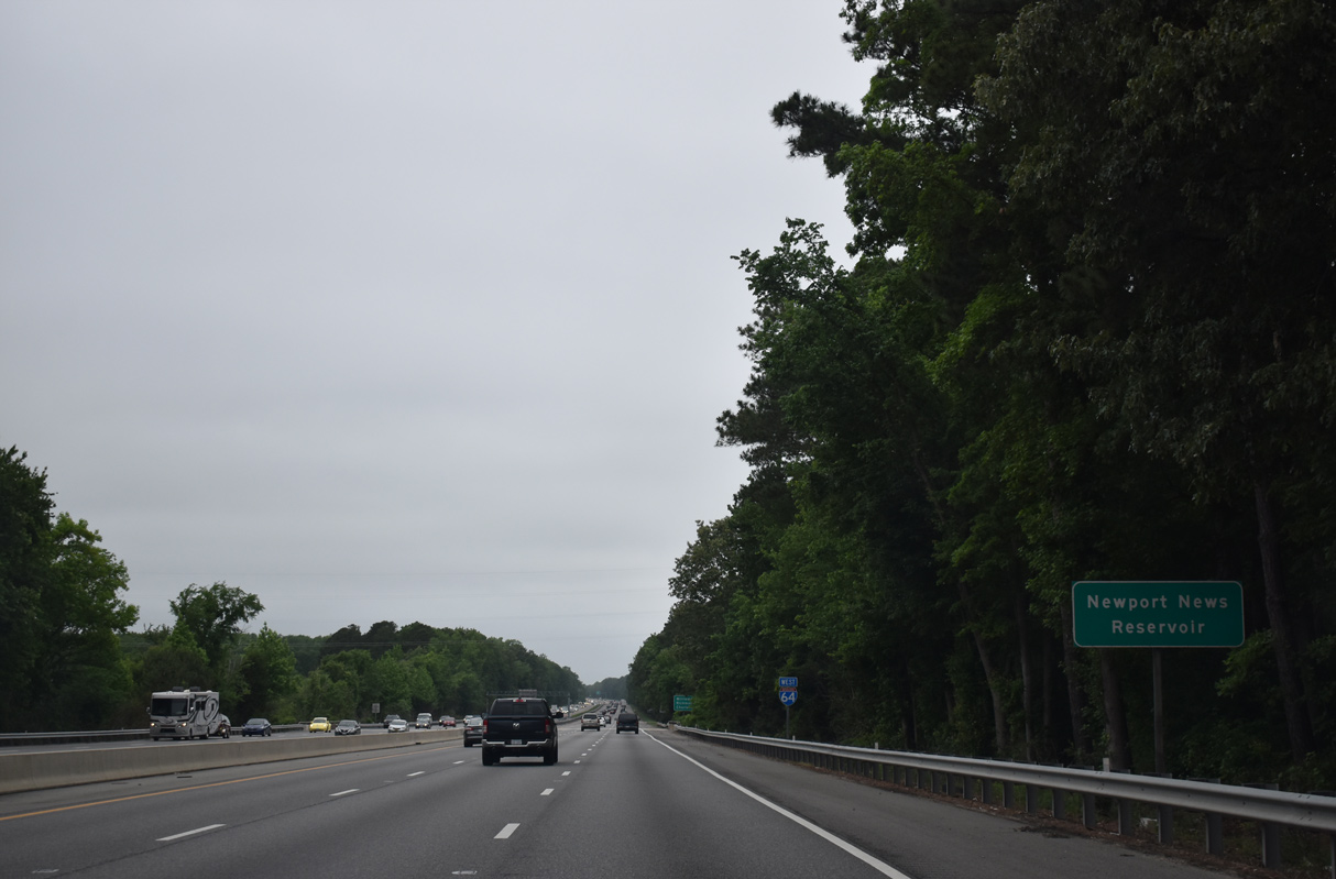
| Interstate 64 crosses Lee Hall Reservoir just north of the exchange with SR 105/143. 05/26/22 |
|
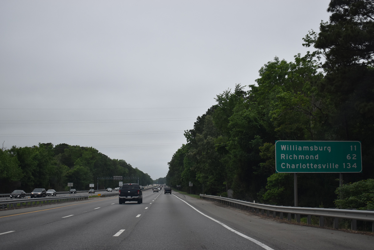
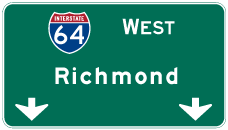
| Downtown Richmond lies 59 miles west of Newport News Reservoir via Interstate 64. 05/26/22 |
|
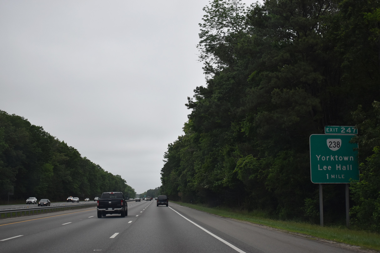
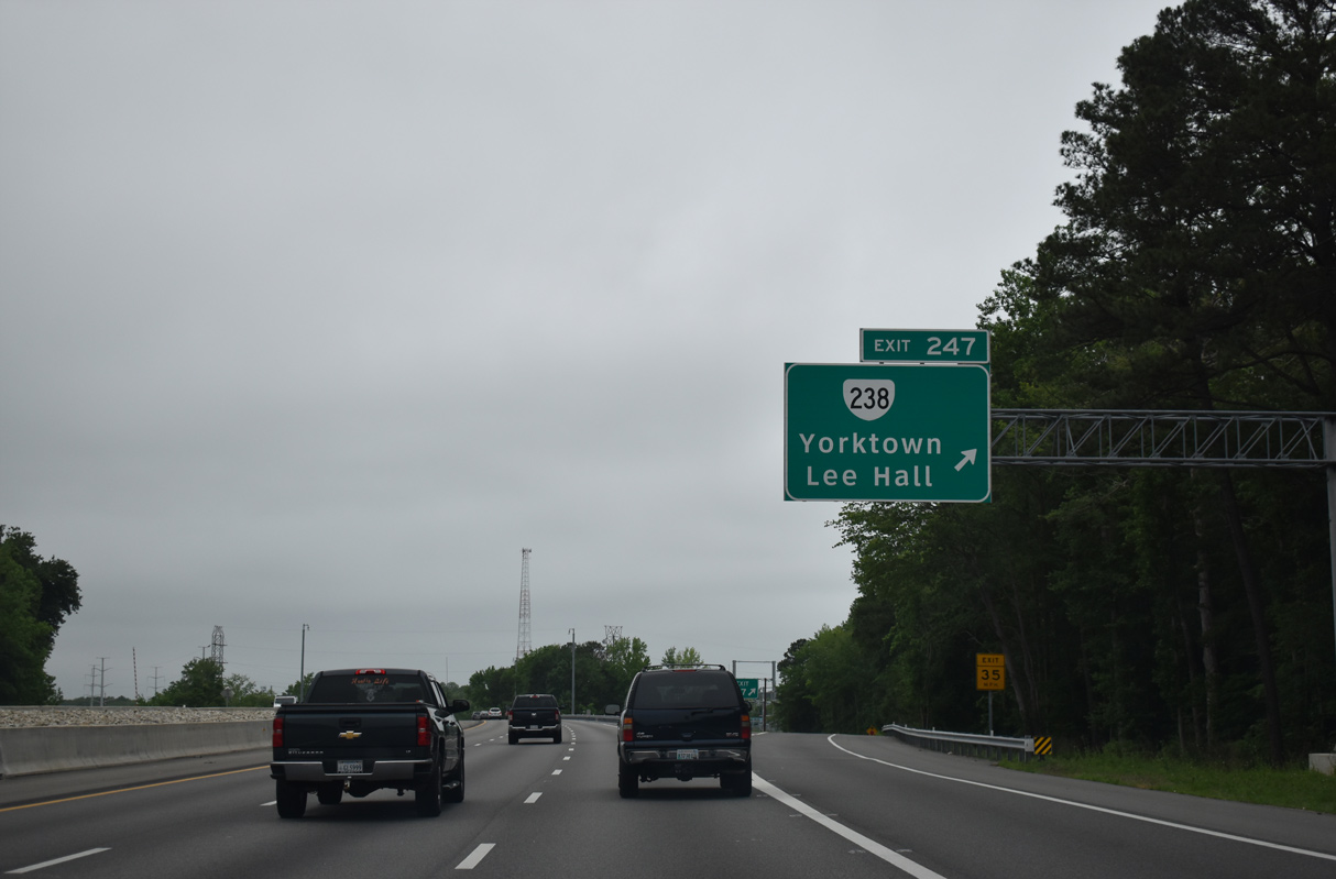
| SR 238 (Yorktown Road) branches north from U.S. 60 (Warwick Boulevard) in the Lee Hall section of Newport News to a half diamond interchange (Exit 247) with I-64 west. 05/26/22 |
|
| SR 238 is a 7.75 mile long route traveling east to Yorktown Naval Weapons Station, Colonial National Historical Park and USCG Training Center Yorktown. 05/26/22 |
|
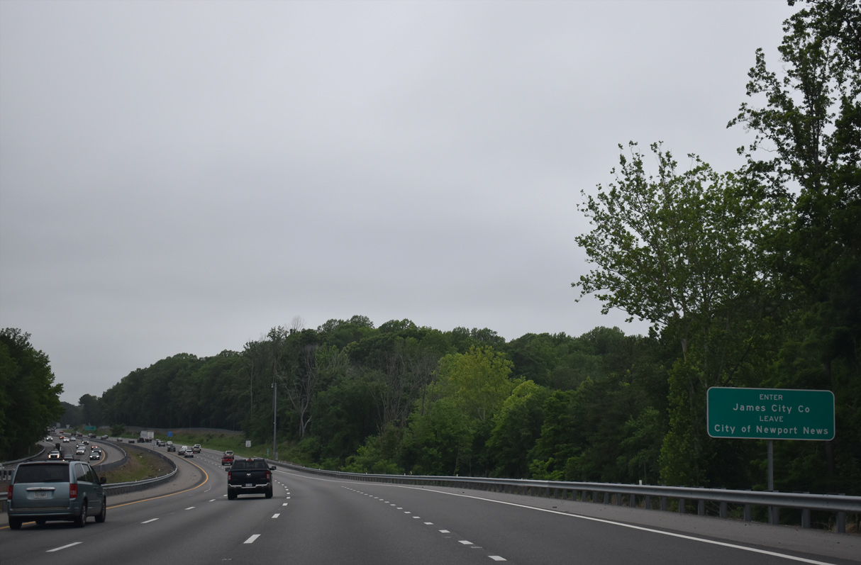
| Interstate 64 west enters James City County across Blows Mill Run at the southern tip of York County. 05/26/22 |
Page Updated 12-12-2022.


 West
West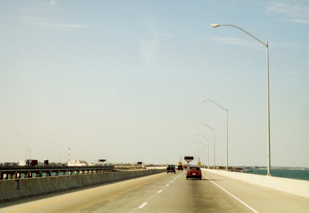

 North
North