|
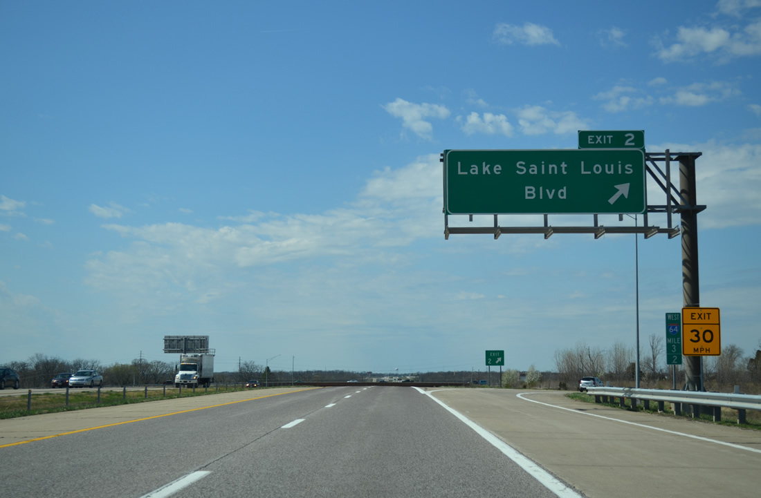
| Leaving the cloverleaf interchange at the west end of Route 364, I-64/U.S. 40-61 next meet Lake St. Louis Boulevard in 0.75 miles. 04/13/13 |
|
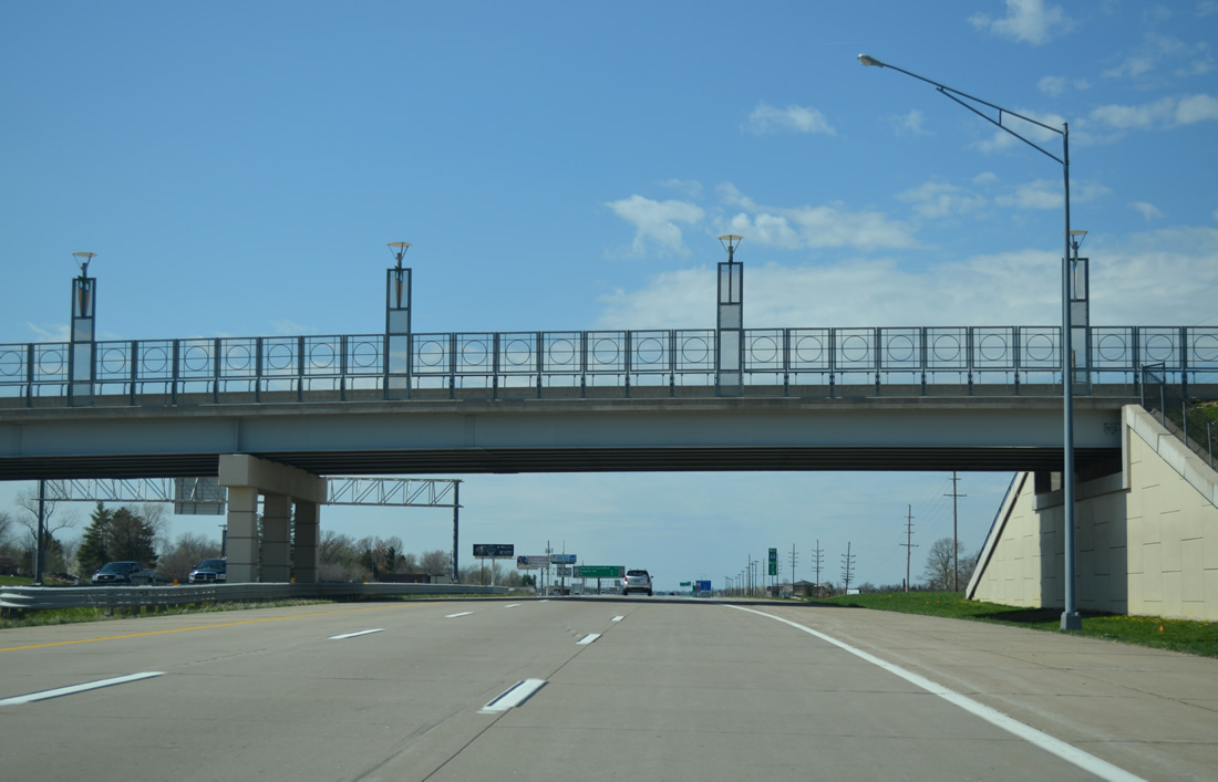
| A decorative overpass carries Ronald Reagan Driver across I-64/U.S. 40-61 just beyond the on-ramp from Highway N. The north-south road joins the Shoppes at Hawk Ridge retail area with a number of subdivisions in south Lake St. Louis. 04/13/13 |
|
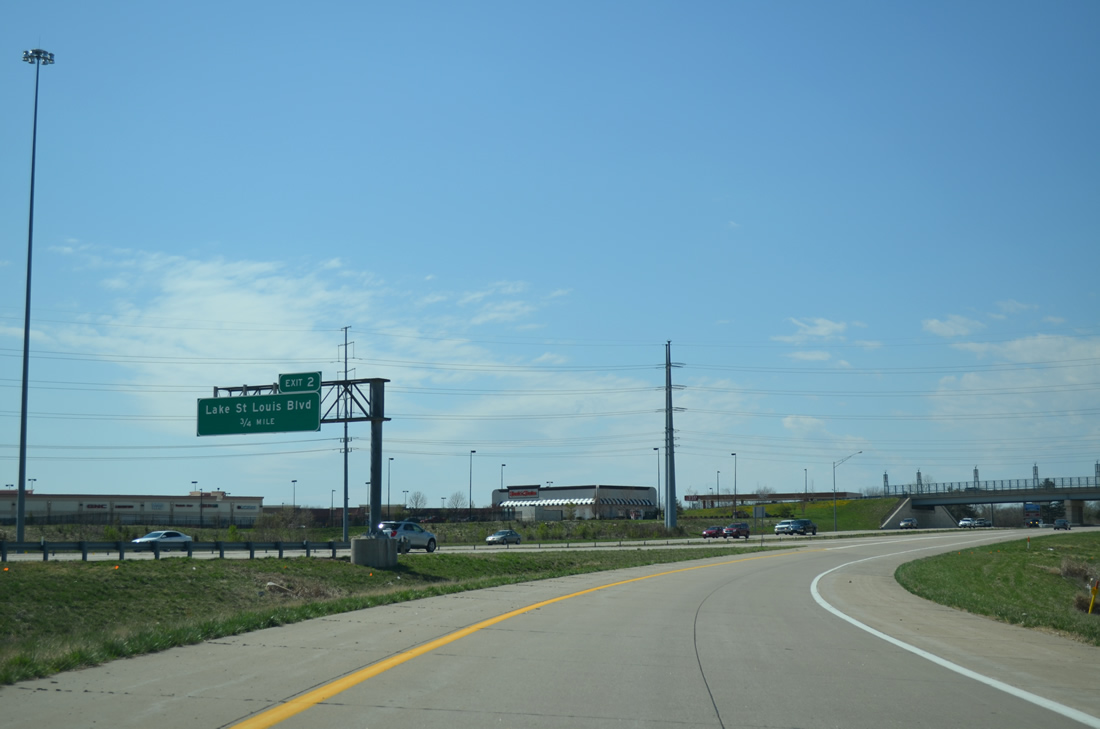
| Interstate 64 west reaches its final three miles. The following two exits serve the city of Lake St. Louis ahead of the conclusion in Wentzville. 04/13/13 |
|
| Technology Drive lines the north side of I-64/U.S. 40-61 from Ronald Reagan Drive to Lake St. Louis Boulevard. The frontage road serves the adjacent Meadows at Lake Saint Louis retail complex. 04/13/13 |
|
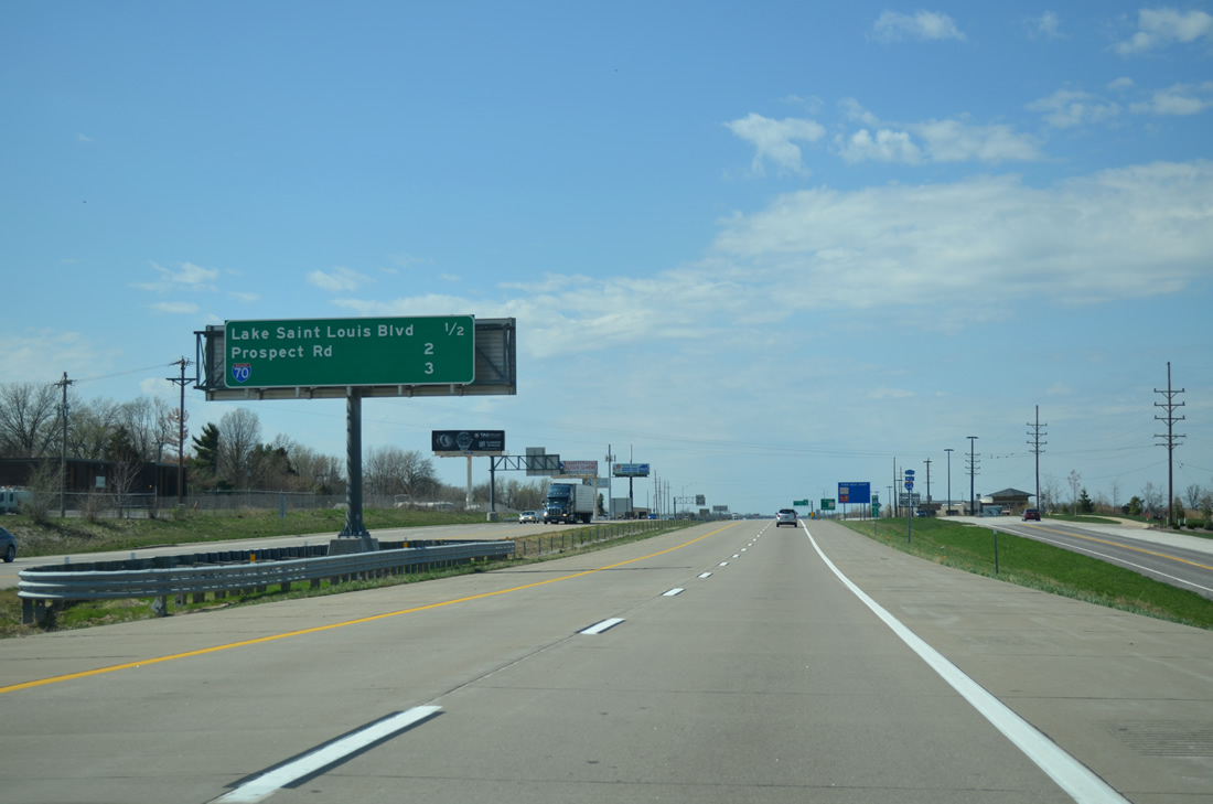
| A folded diamond interchange joins Interstate 64 and U.S. 40-61 with Lake Saint Louis Boulevard. Heading north from Highway N as Freymuth Road, Lake Saint Louis Boulevard meanders east from Exit 2 to encircle Lake Saint Louis by a number of residential subdivisions to Interstate 70 at Exit 214. 04/13/13 |
|
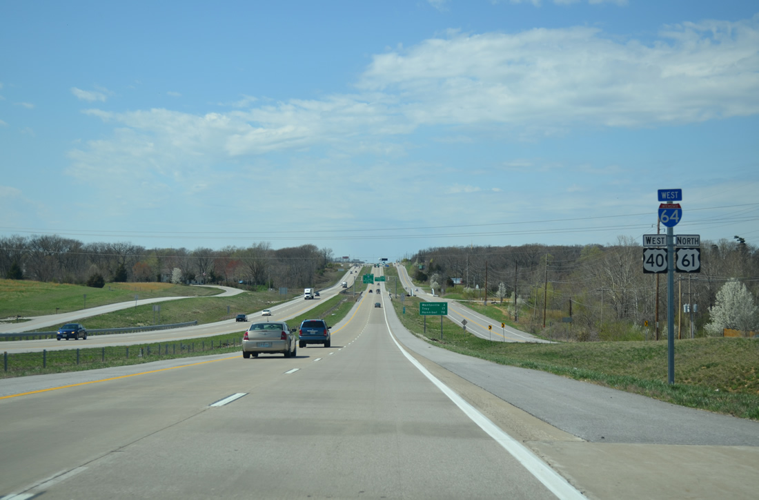
| Reassurance shields for I-64-U.S. 40/61 north lie ahead of the climb toward Wentzville. North Outer Road, the former alignment of U.S. 40/61, parallels the westbound lanes to Exit 1C. 04/13/13 |
|
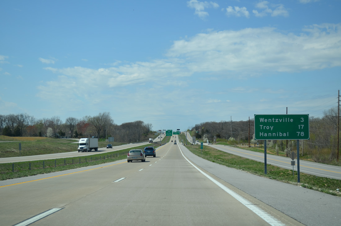
| This westbound distance sign features the distances to the U.S. 61 (Avenue of the Saints) destinations of Troy (17 miles) and Hannibal (78 miles). 04/13/13 |
|
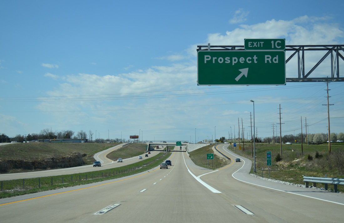
| A pony truss bridge comes into view along North Outer Road (old U.S. 40-61) as Interstate 64 nears the Prospect Road diamond interchange (Exit 1C). Two miles of I-64 remain. 04/13/13 |
|
| Prospect Road leads west from Freymuth Road to become Duello Road south outside Lake St. Louis. Roundabouts reside at the Exit 1C ramp ends, joining Prospect Road with Corporate Parkway north and South Service Road. 04/13/13 |
|
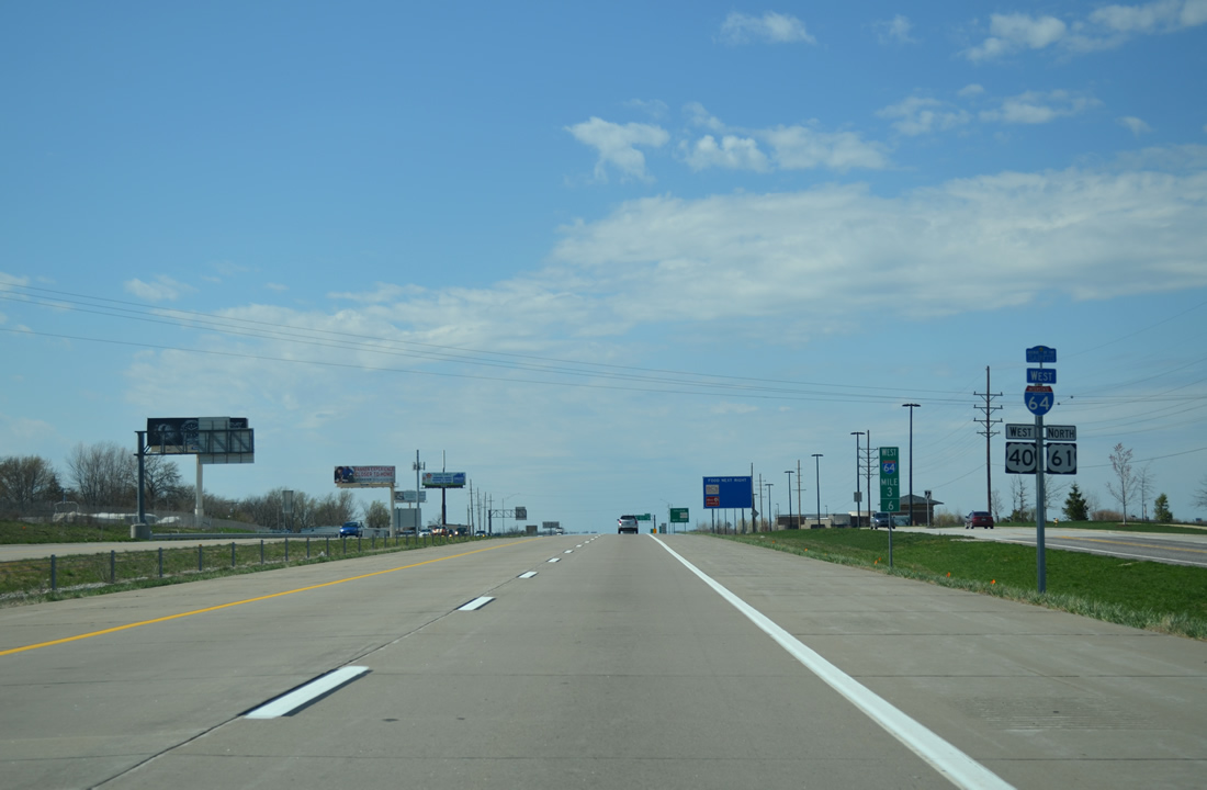
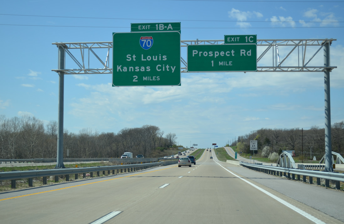
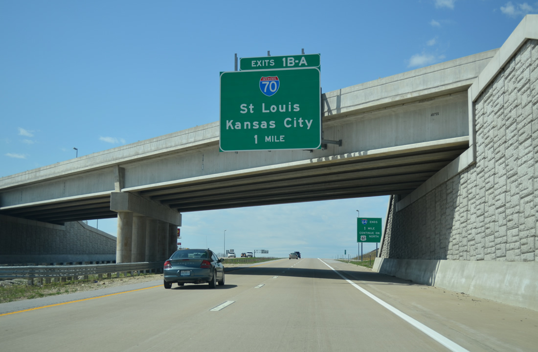
| Interstate 70, a 2,153 mile route between Cove Fort, Utah and Baltimore, Maryland, crosses paths with the Avenue of the Saints corridor at the western terminus of Interstate 64. I-70 in Missouri links St. Louis with Kansas City, including one of the first stretches of Interstate highway constructed, with work commencing on August 13, 1956 on the Mark Twain Expressway in St. Charles County.1 04/13/13 |
|
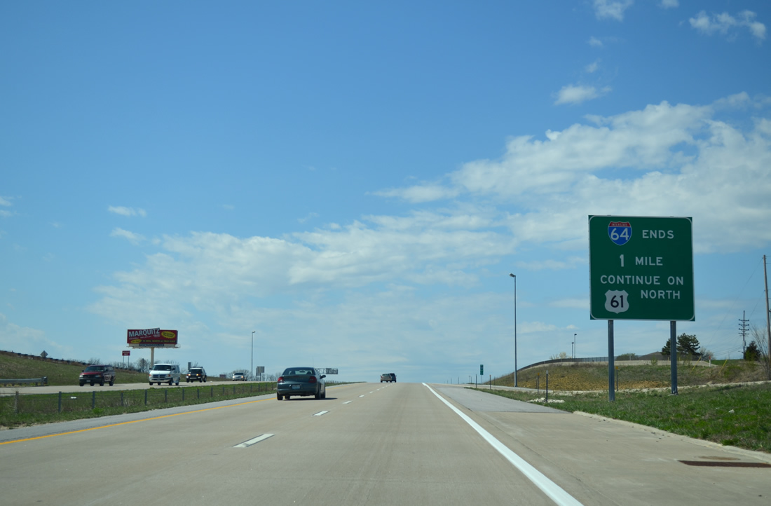
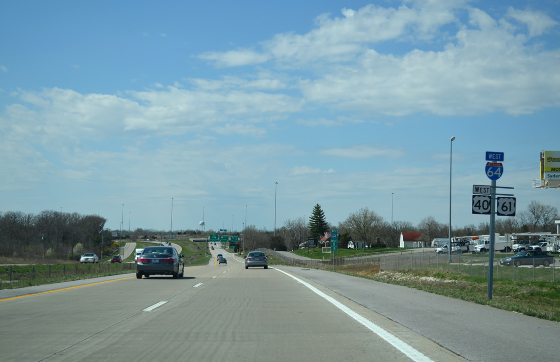
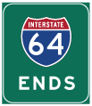
| MODOT typically signs the conclusion of a freeway when one route transitions into another with end signage. U.S. 61 extends the I-64 freeway northwest another 1.9 miles through Wentzville. The Avenue of the Saints Corridor maintains at least four lanes to Minneapolis and Saint Paul, Minnesota. 04/13/13 |
|
| A directional cloverleaf interchange with left exits joins Interstate 64 with I-70 in a half mile. 04/13/13 |
|
| The last Interstate 64 westbound shield assembly precedes milepost 0.8. 04/13/13 |
|
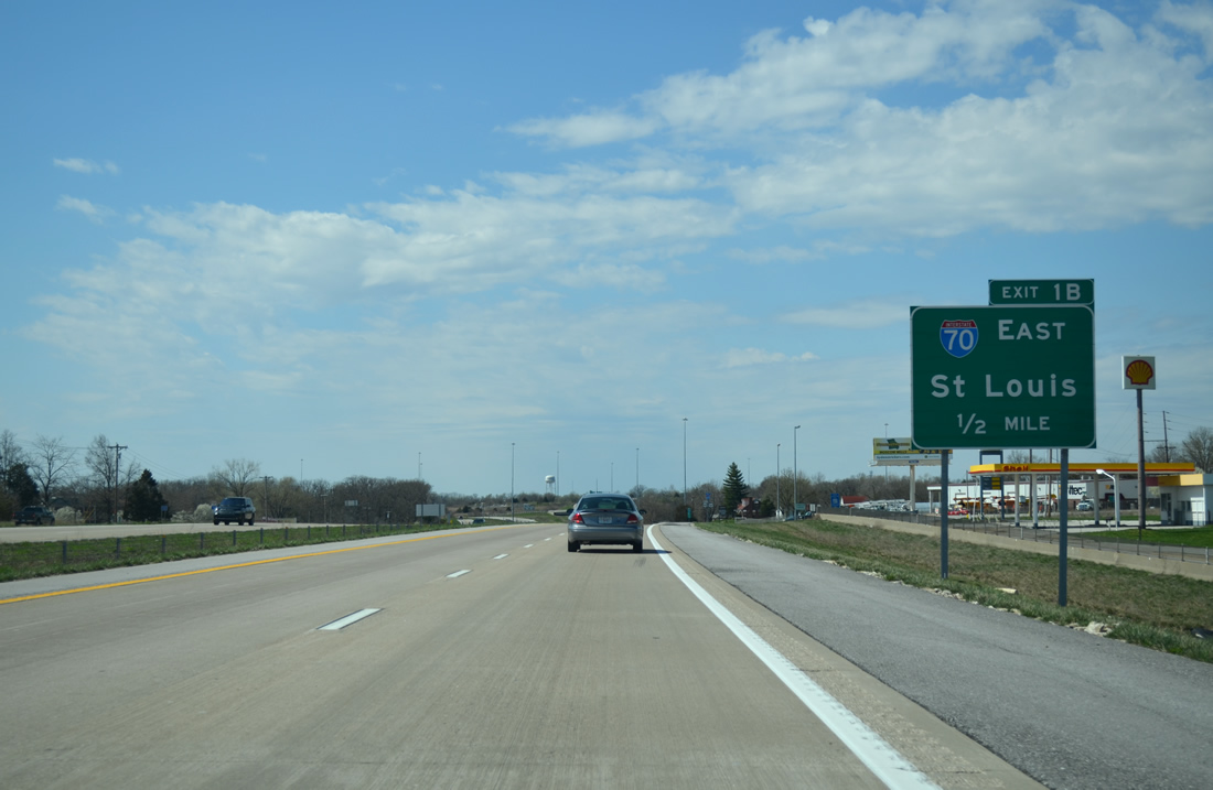
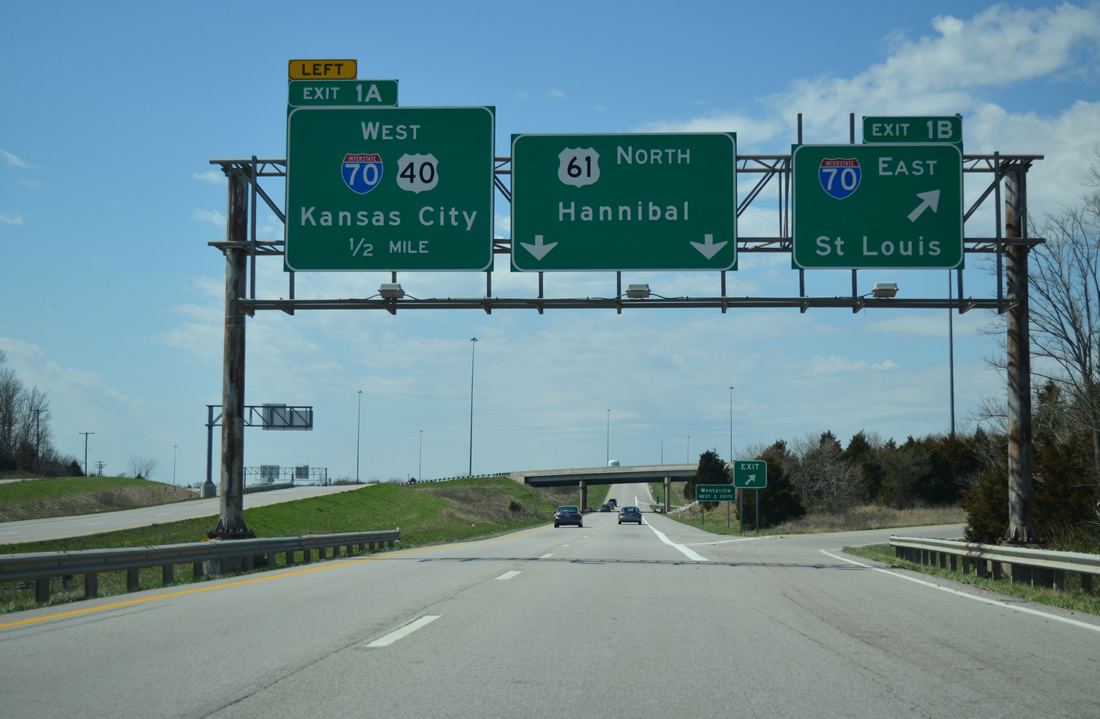
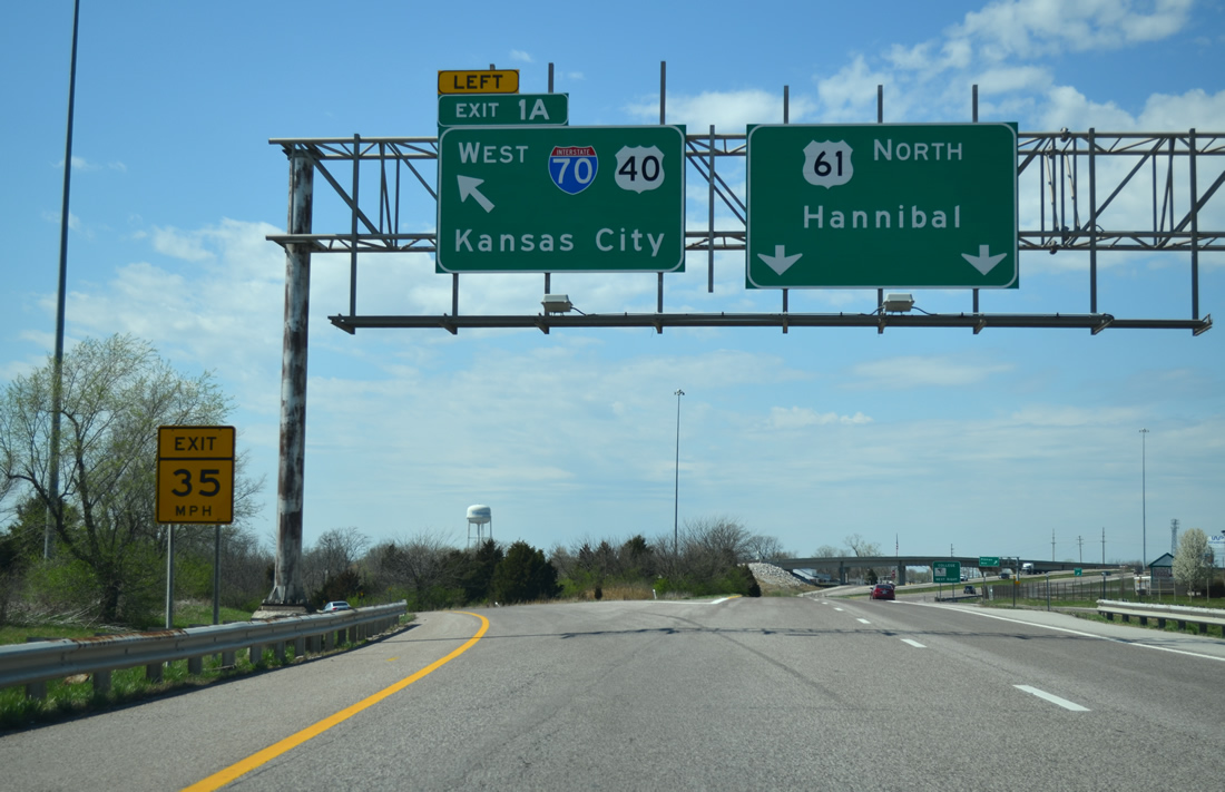
| Exit 1 B departs I-64/U.S. 40-61 north for Interstate 70 east back toward St. Louis. Left Exit 1 A follows for the continuation of U.S. 40 onto I-70 west toward Columbia and Midway. 04/13/13 |
|
| I-70/U.S. 40 west provide one of two exits for the city of Wentzville via U.S. 61 north. The pair leave the St. Charles County suburb ahead of Foristell along the increasingly rural route to Columbia. U.S. 61 (Avenue of the Saints) continues 78 miles north to the Mississippi River city of Hannibal. 04/13/13 |
Page Updated 11-13-2013.


 West
West  North
North