|
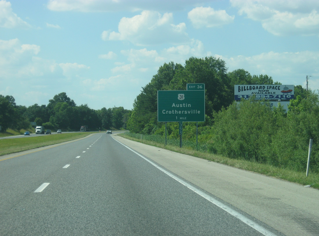
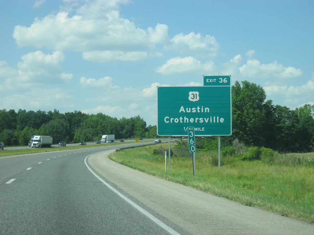
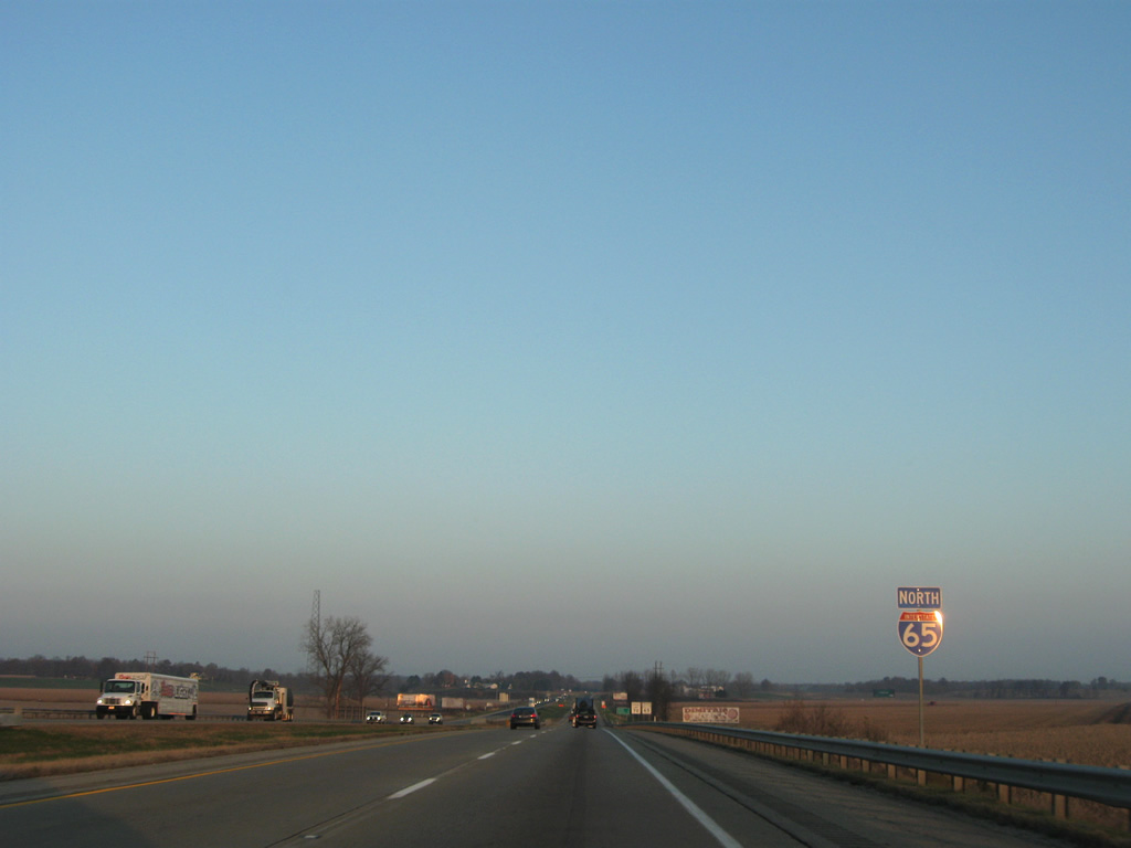
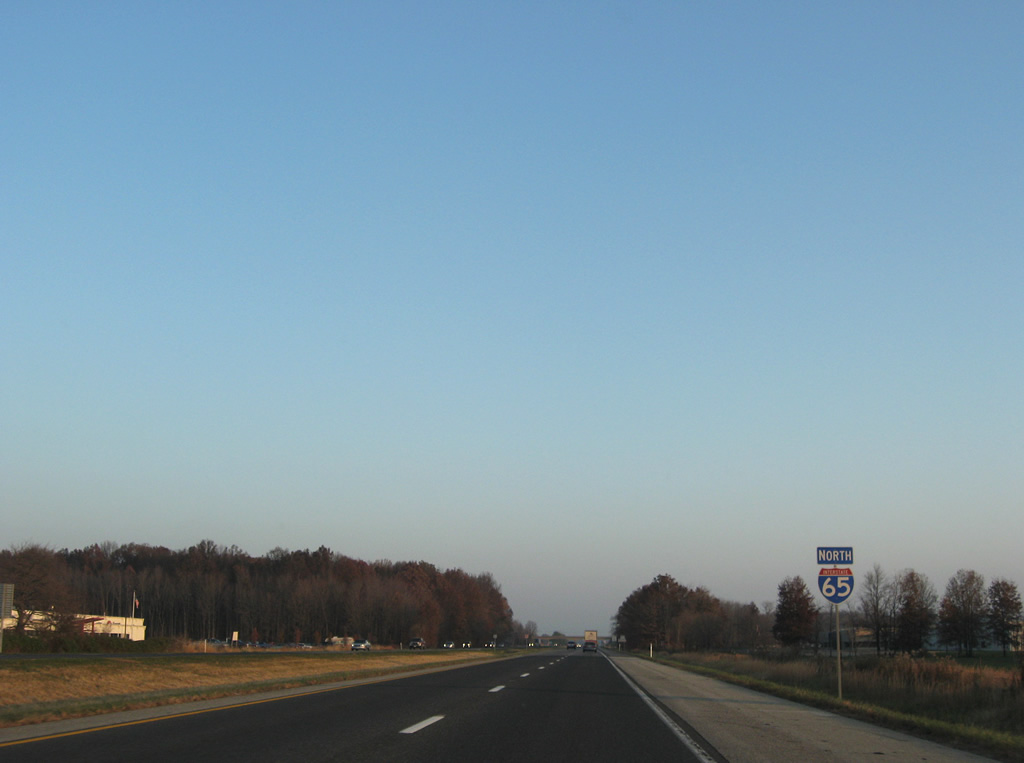
| Interstate 65 nears its first crossing with U.S. 31 since Clarksville in one mile via Exit 36. 06/07/12 |
|
| U.S. 31 serves the nearby communities of Crothersville, one mile to the north, and Austin, two miles to the south back in Scott County. 06/07/12 |
|
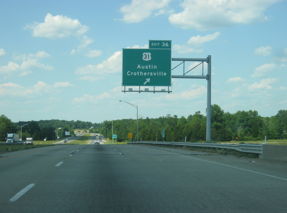
| A folded diamond interchange, created by the Louisville & Indiana Railroad to the west of U.S. 31, leaves Interstate 65 north at Exit 36. 06/07/12 |
|
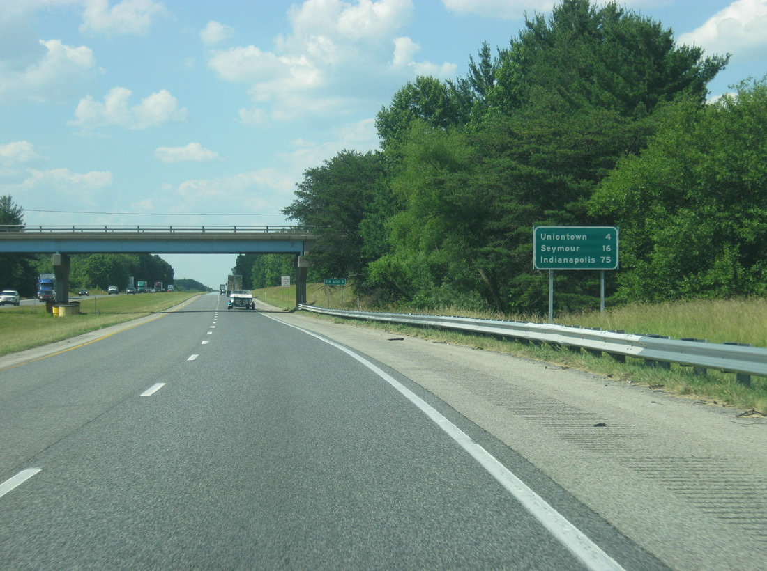
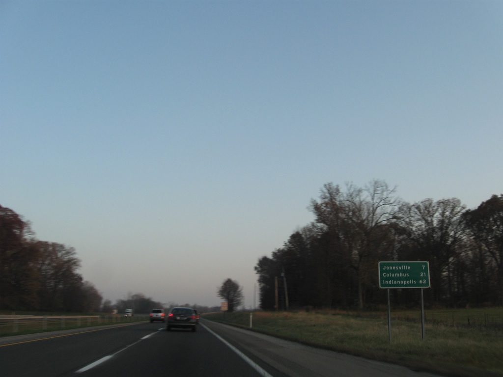
| Uniontown is four miles away along Interstate 65 north of Exit 36. Seymour and Indianapolis are respectively 16 and 75 miles away. 06/07/12 |
|
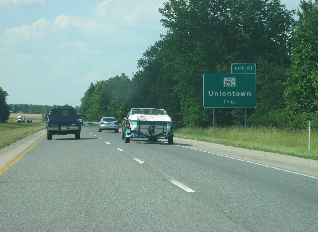
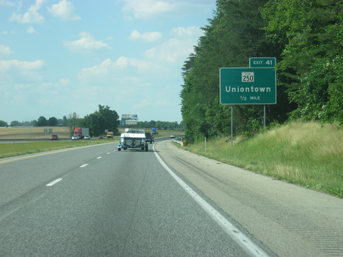
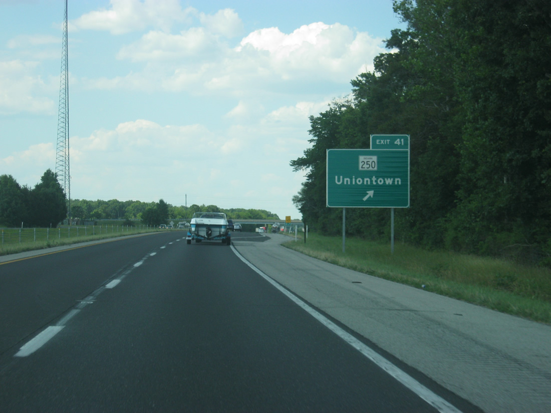
| Interstate 65 north nears the interchange with SR 250 in eastern Jackson County. 06/07/12 |
|
| SR 250 exists in two segments along a path that travels from Brownstown to the west to Patriot on the Ohio River in Switzerland that is separated by the Big Oaks National Wildlife Refuge, formerly the Jefferson Proving Grounds. 06/07/12 |
|
| Exit 41 leaves Interstate 65 via a diamond interchange onto SR 250, with the small town of Uniontown to the immediate west at the junction with U.S. 31. The western segment of SR 250 travels from U.S. 50 in Brownstown and goes east for 33.5 miles to SR 7 northwest of Madison. The other 34.8 mile segment continues a few miles to the east at U.S. 421 and continues east toward Patriot. 06/07/12 |
|
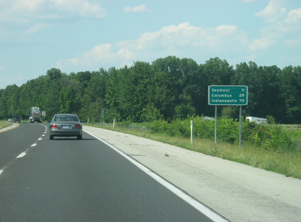
| Seymour follows at the next interchange with a distance of 11 miles. The Bartholomew County seat of Columbus becomes the secondary control city with a distance of 29 miles. Indianapolis is now 70 miles, about an hour away. 06/07/12 |
|
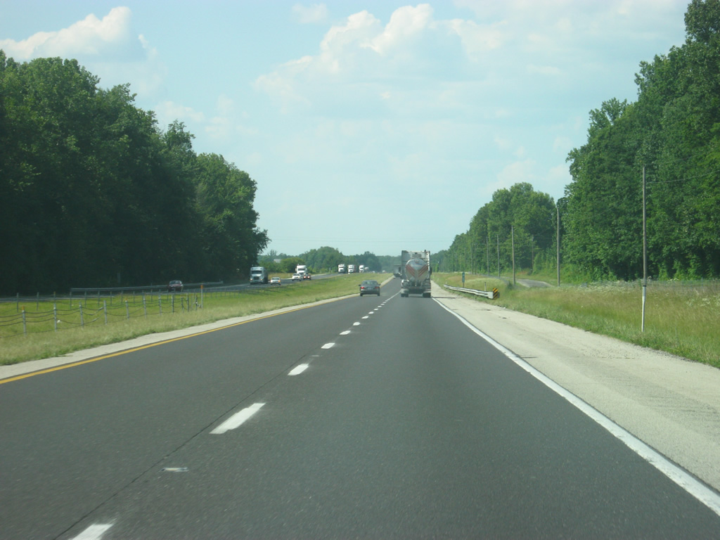
| Interstate 65 travels across the far eastern tier of Jackson County in between Exits 41 and 50, crossing under U.S. 31 and over the Vernon Fork of the Muscatatuck River. 06/07/12 |
|
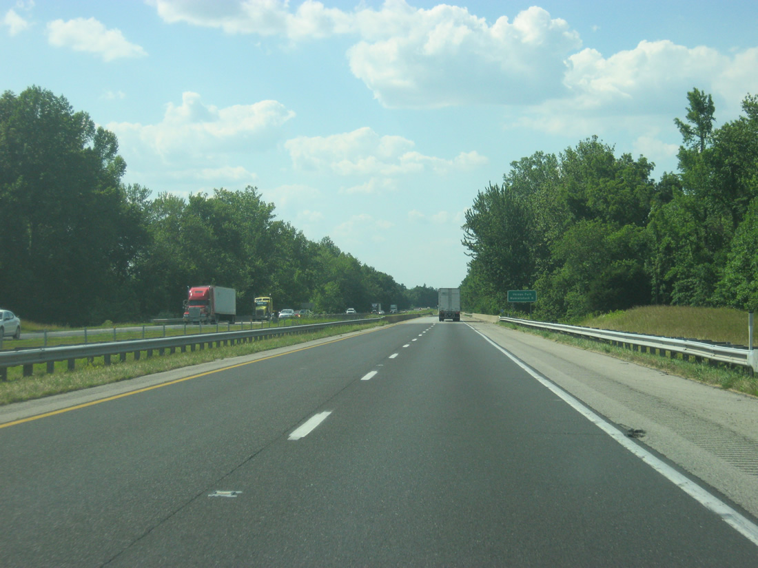
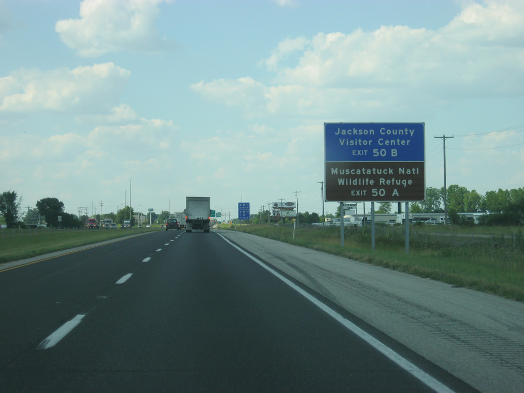
| Interstate 65 north now nears the halfway point in between Louisville and Indianapolis at Exit 50 A-B with U.S. 50. 06/07/12 |
|
| U.S. 50 travels for 3,008 miles from Sacramento, California to Ocean City, Maryland. In Indiana, the highway goes for 171.5 miles as a major two lane highway across south-central Indiana from Vincennes eastward through Washington, Shoals, Bedford, Brownstown, Seymour, North Vernon, Versailles and Lawrenceburg before continuing east toward Cincinnati, Ohio. 06/07/12 |
|
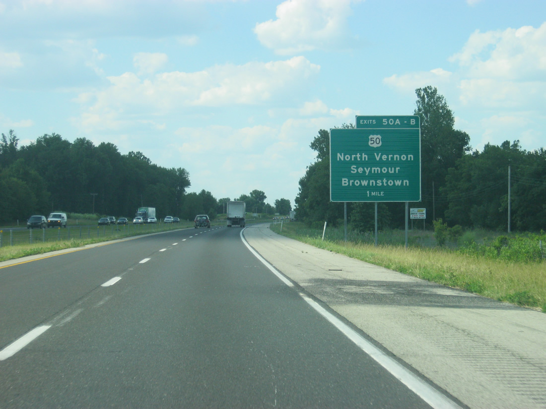
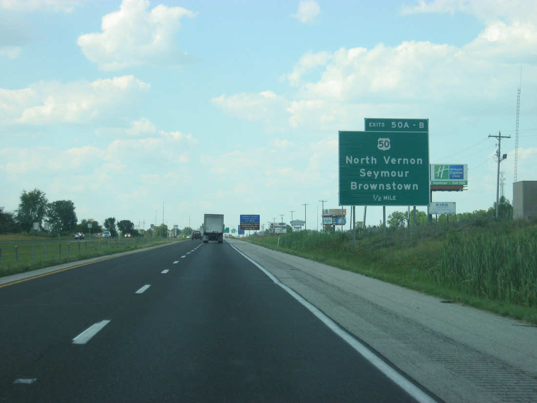
| The Jackson County Visitors Center and Muscatatuck National Wildlife Refuge Center can be reached via U.S. 50 east off of Exit 50 A. 06/07/12 |
|
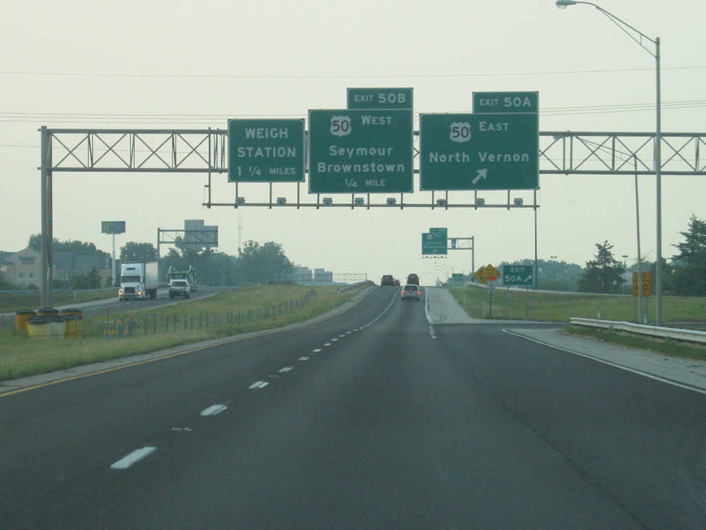
| U.S. 50 (Tipton Street) meets Interstate 65 at the Exit 50 A-B cloverleaf interchange. Exit 50 A turns off toward U.S. 50 east with an immediate intersection with U.S. 31 before continuing into Jennings County and the town of North Vernon, 12 miles to the east. From there, it heads east toward Versailles and Cincinnati, Ohio. 06/16/12 |
|
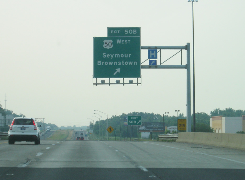
| Exit 50 B turns off Interstate 65 north for a loop ramp onto U.S. 50 west. U.S. 50 (Tipton Street) goes through the city of Seymour, which contains a large assortment of motorist's services and businesses, serving the city of 17,500. West of Seymour, U.S. 50 continues for ten miles to the Jackson County seat of Brownstown before it heads west toward Bedford and Vincennes. 06/16/12 |
|
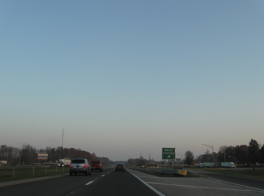
| Northbound Interstate 65 travelers pass over a CSX Railroad line and approach a set of weigh stations (one per direction). 11/05/09 |
|
| Beyond the Redding Road overpass is this distance sign posted 62 miles south of Indianapolis. Jonesville and Columbus lies next along Interstate 65 in adjacent Bartholomew County. 11/05/09 |
|
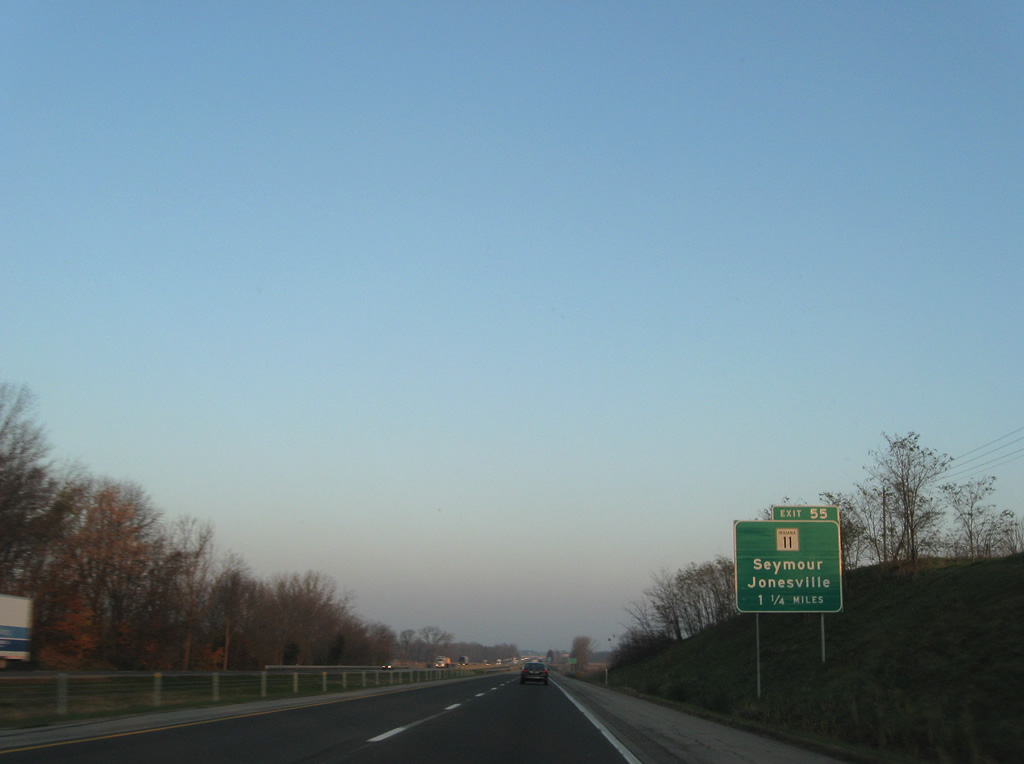
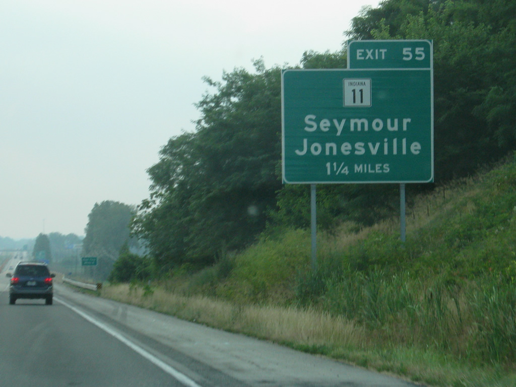
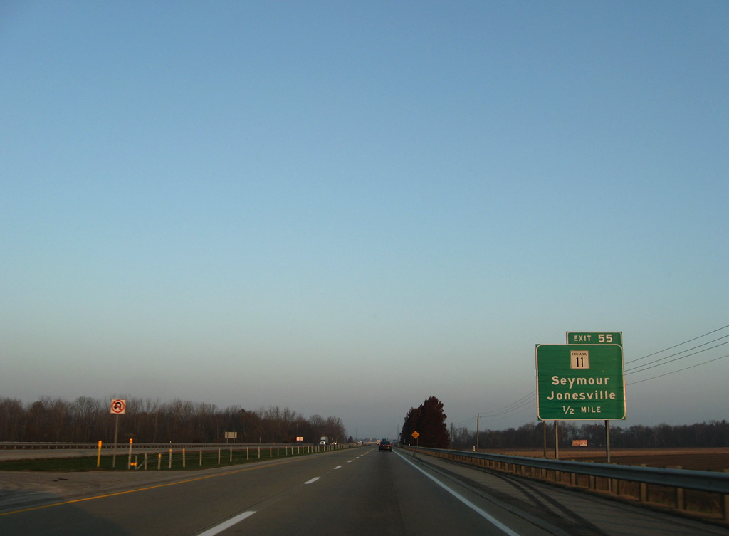
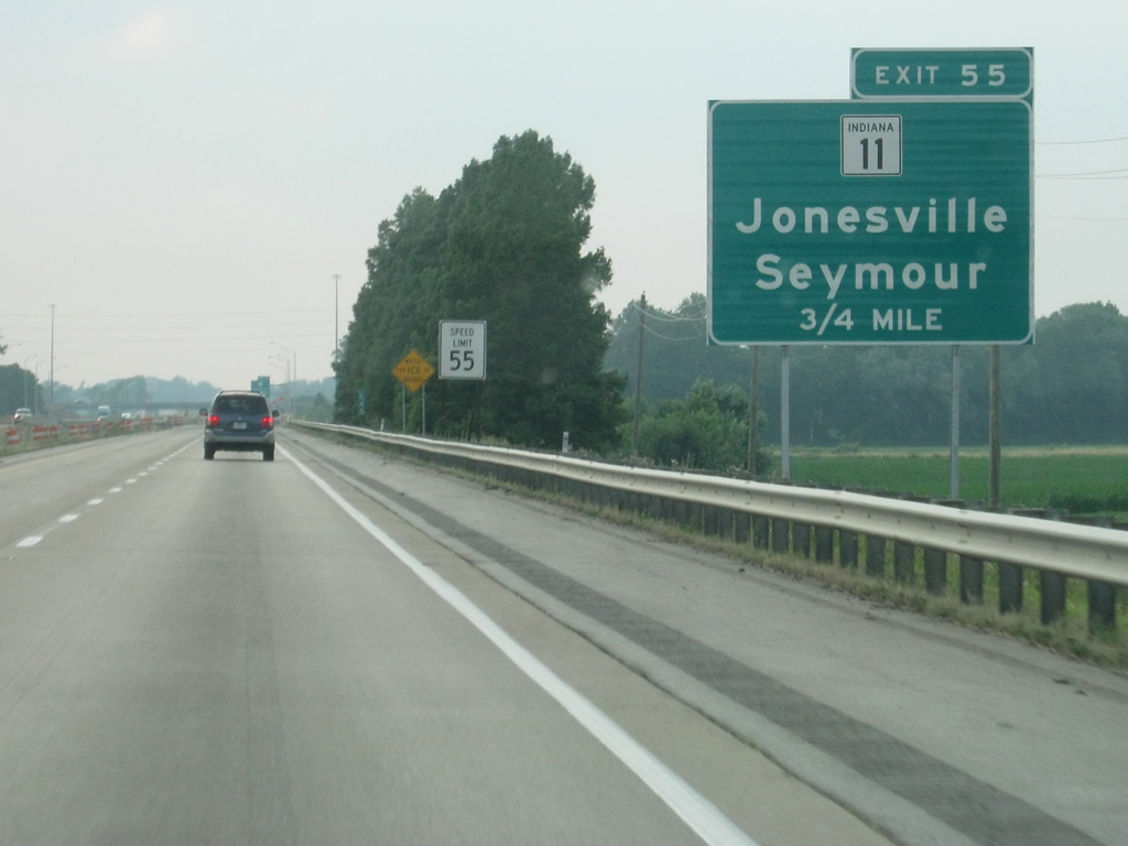
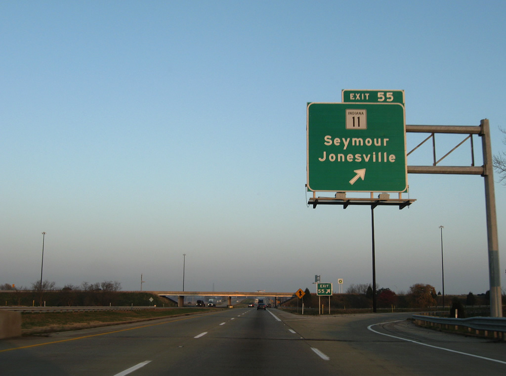
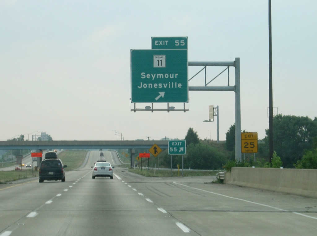
| SR 11 crosses paths with Interstate 65 at the Exit 55 six-ramp partial interchange near Little Acre. 11/05/09, 06/16/12 |
|
| A pair of 1960-constructed bridges span the East Fork White River along Interstate 65. 11/05/09 |
|
| One half mile south of the Exit 55 ramp departure to SR 11. SR 11 travels south 2.8 miles to Rockford and 4.9 miles into Seymour. Northward the state road parallels Interstate 65 to Jonesville, Waynesville, Walesboro and Garden City. 11/05/09, 06/16/12 |
|
| An overhead sign directs drivers onto Exit 55 for State Road 11. SR 11 exists in two segments: the southern branch arcs between SR 135 at Mauckport and SR 62 near Lanesville for 30 miles. The northern portion stretches 26 miles from Dudleytown (SR 250) to SR 46 at Columbus. 11/05/09, 06/16/12 |
|
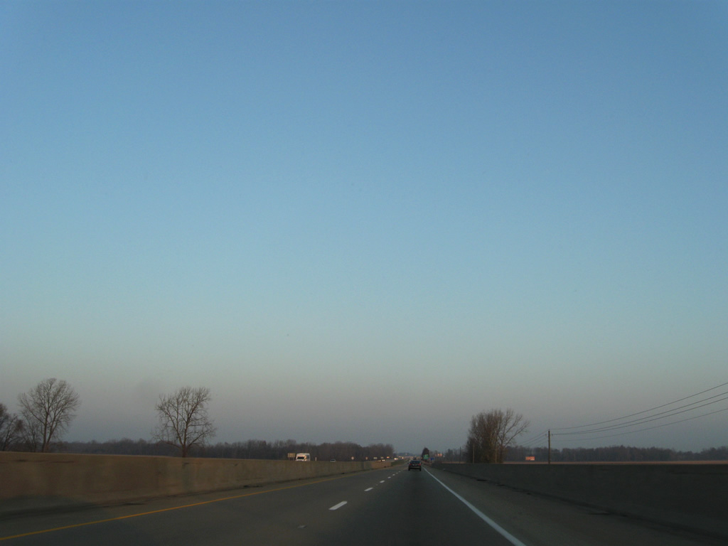
| Continuing north from SR 11, Interstate 65 passes over a Louisville & Indiana Railroad line ahead of this reassurance marker. 11/05/09 |
|
| The Jackson County seat of Columbus follows in 15 miles. Indianapolis is less than an hour's drive. 06/07/12 |
|
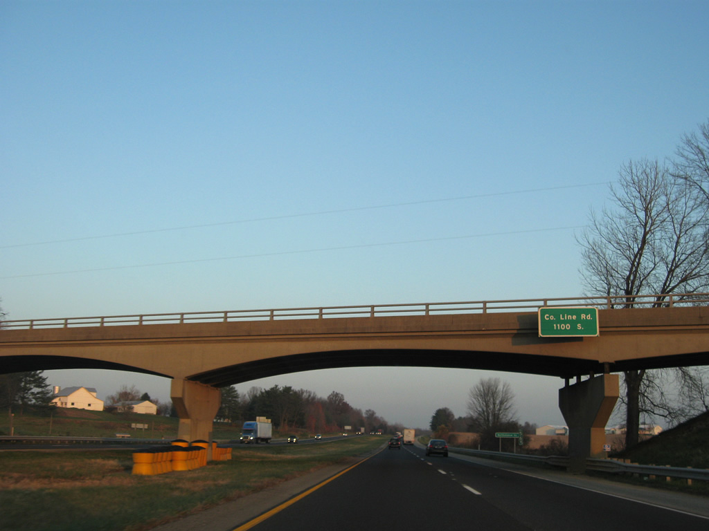
| County Line Road passes over Interstate 65 just south of the Bartholomew County line. Also known as County Road 1100 South, the rural highway kinks to cross over the freeway at an angle that places it off the actual Jackson County boundary. 11/05/09 |
|
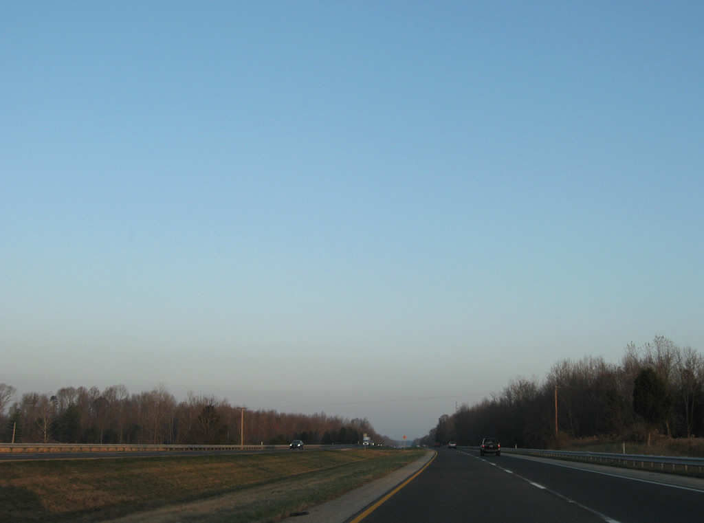
| A mixture of forest and farm land sets the tone for southern Bartholomew County as Interstate 65 parallels the East Fork White Creek. 11/05/09, 06/07/12 |
|
| Interstate 65 spans a tributary of the East Fork White Creek ahead of the County Road 625 South over crossing. The outskirts of Columbus are nearby. 11/05/09 |
|
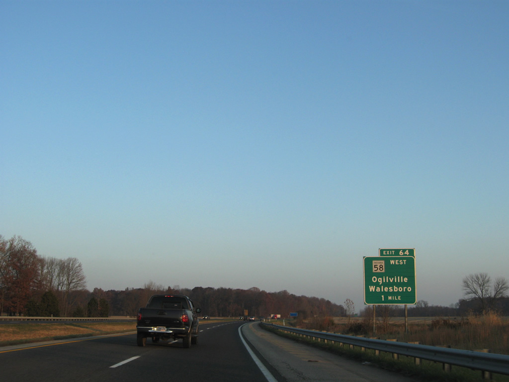
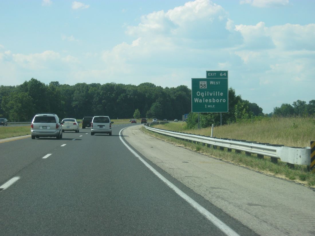
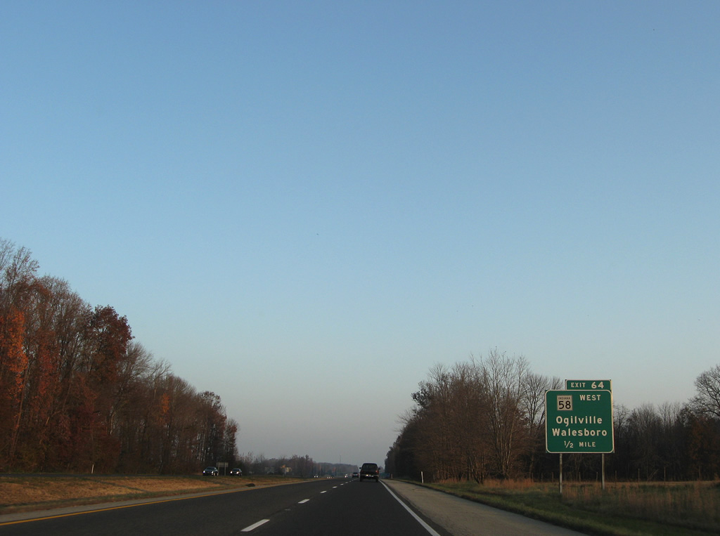
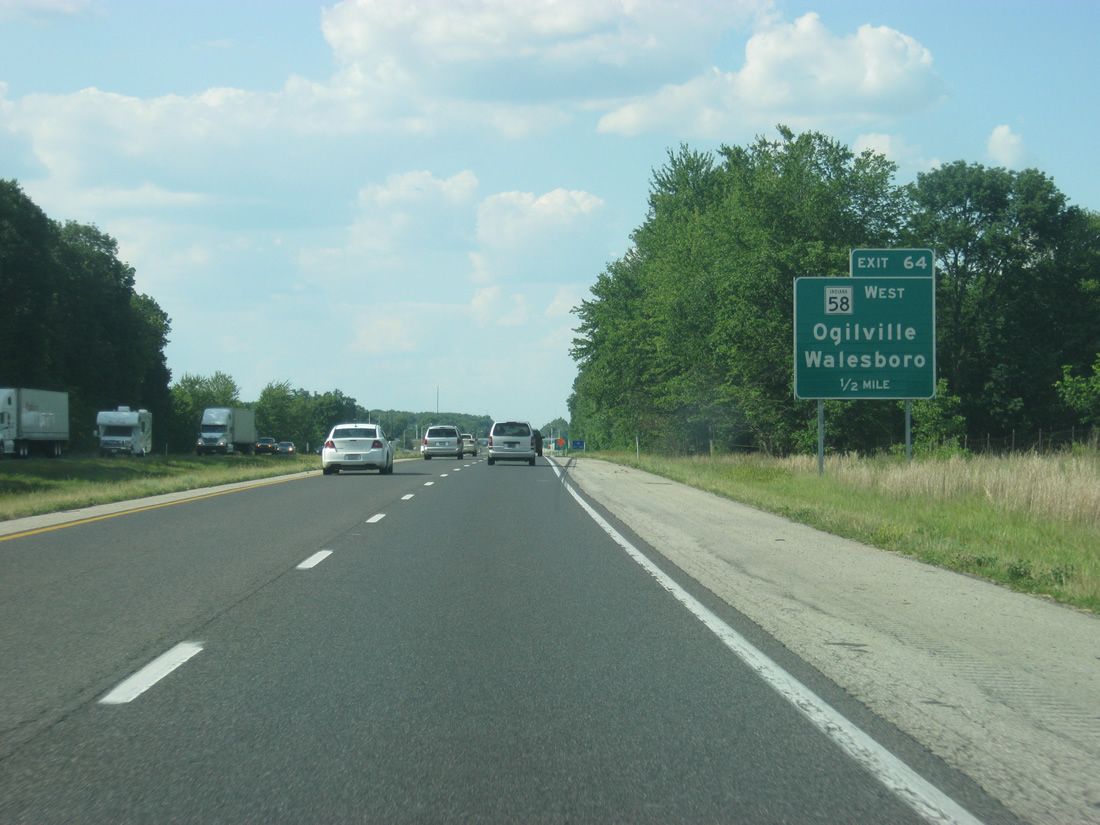
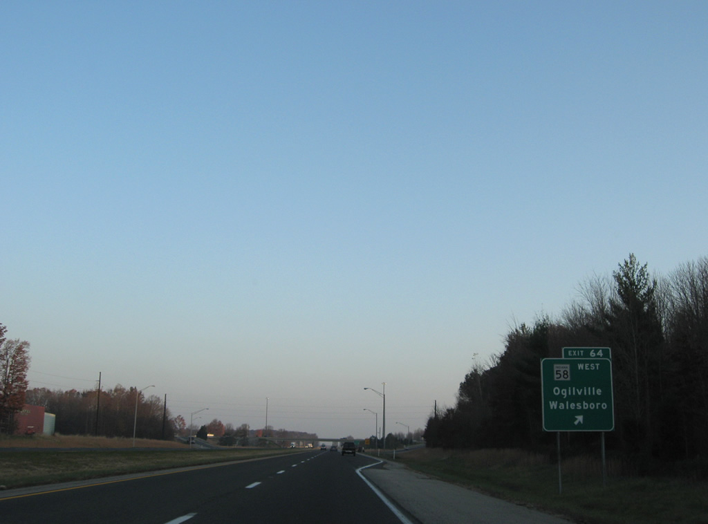
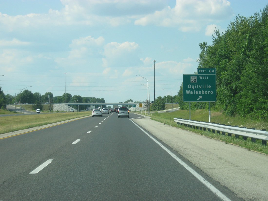
| Meeting Interstate 65 next is SR 58 east and County Road 450 South at the Exit 64 diamond interchange. 11/05/09, 06/07/12 |
|
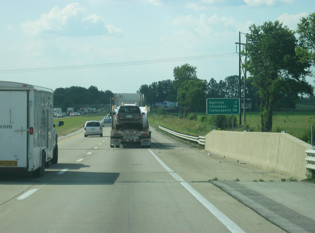
| SR 58 begins at Exit 64 and ventures west 2.6 miles to Ogilville and 14.6 miles southwest to Freetown. Overall the state road totals 122 miles between south Columbus and Merom (SR 63) near the Wabash River / Illinois state line. 11/05/09, 06/07/12 |
|
| Interstate 65 formally enters the city limits of Columbus on the approach to Exit 64. Annexations have pushed the city outward to encompass a Toyota plant nearby and Exit 68. Walesboro, an unincorporated community to the east, lies along SR 11. The diamond interchange was rebuilt in 2011 to better handle the industrial traffic around it. 11/05/09, 06/07/12 |
|
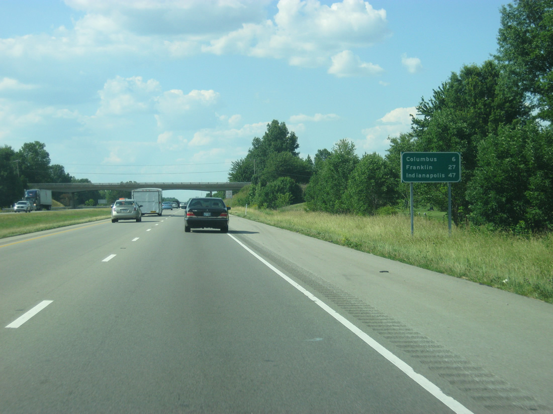
| Reassurance shield and distance signs follow on the 47 mile drive to Indianapolis from south Columbus. 11/05/09, 06/07/12 |
|
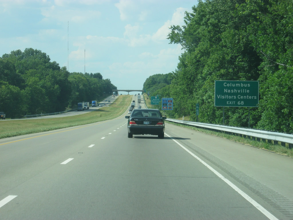
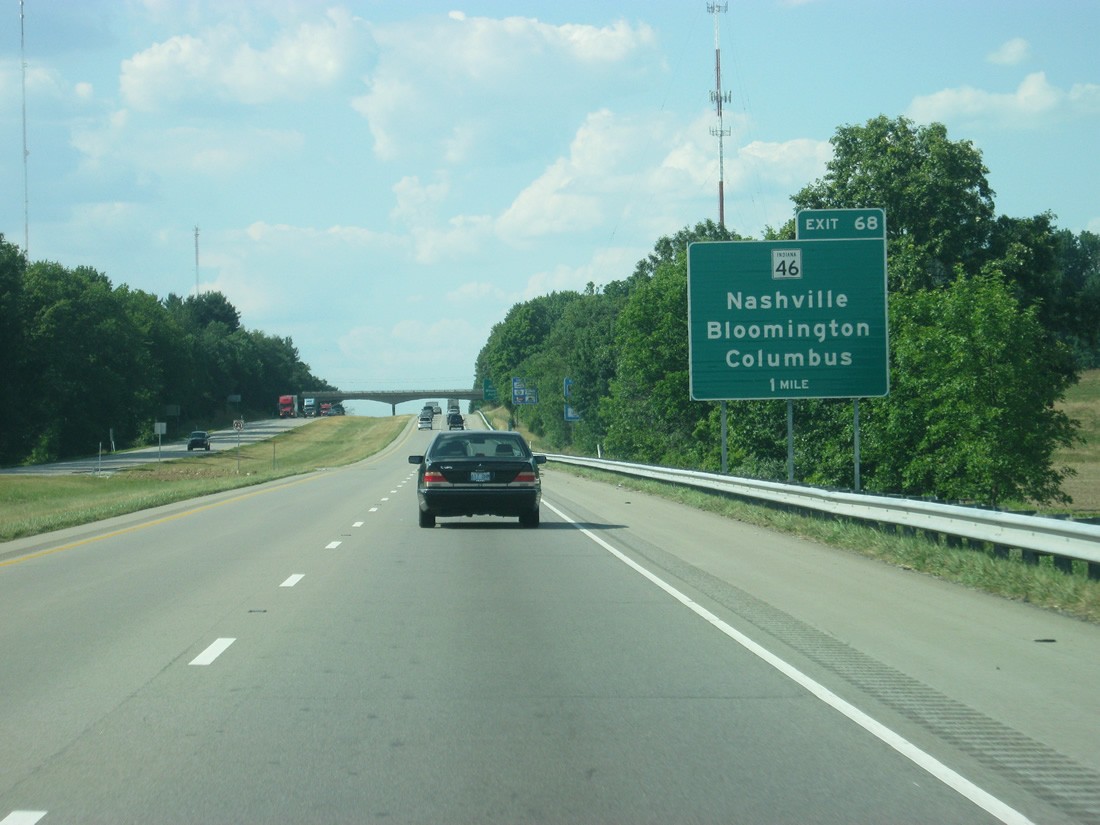
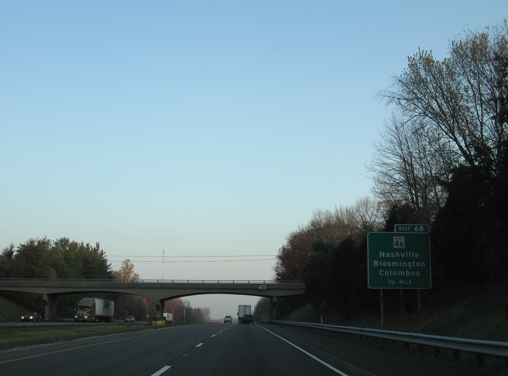
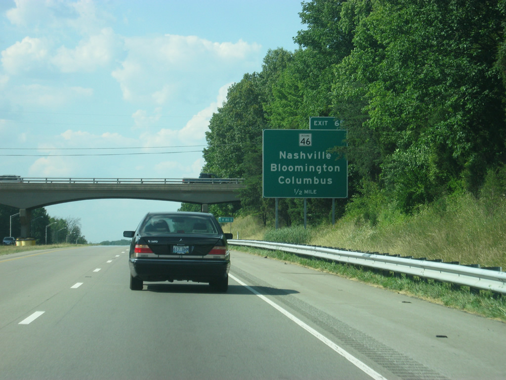
| Visitors Centers serving the city of Columbus and the town of Nashville in Brown County are reached via SR 46 to the east and west respectively. 06/07/12 |
|
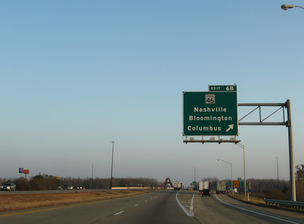
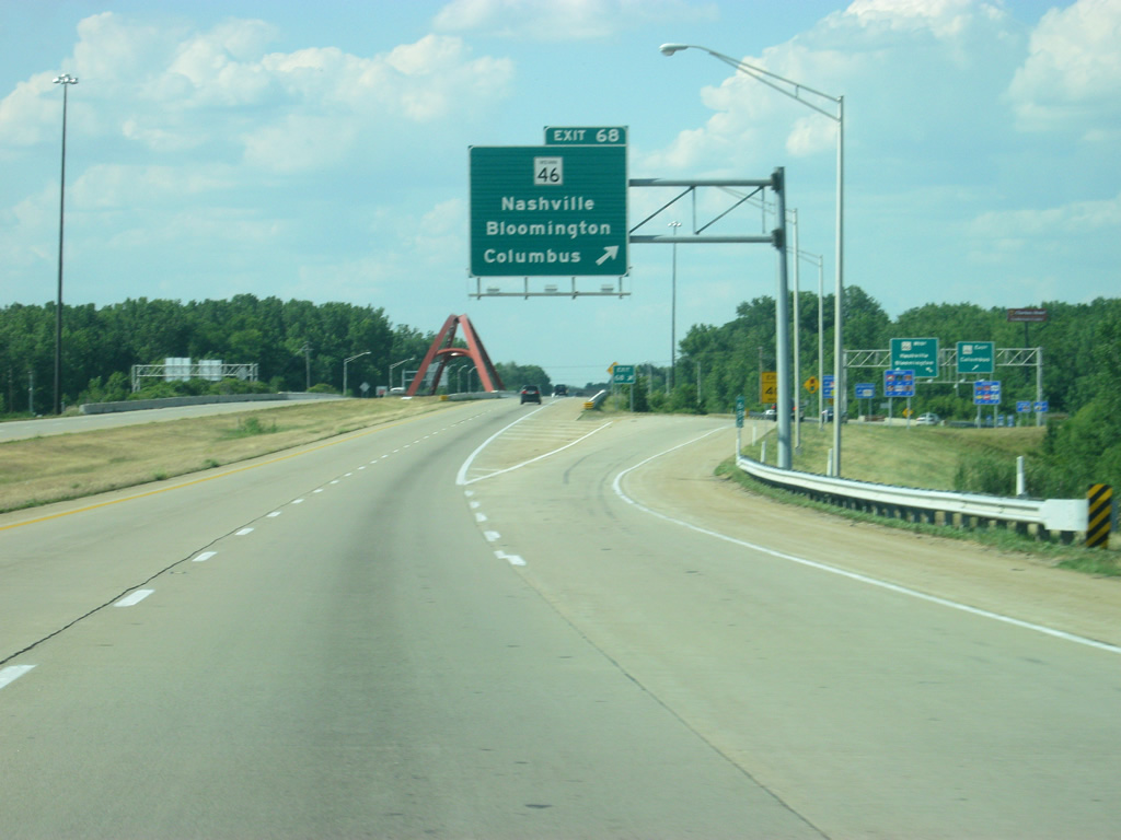
| Land adjacent to Interstate 65 consists of a mixture of farm land and suburban development as the freeway enters a second parcel of Columbus outside of the city core. State Road 46 (Jonathon Moore Pike) comes together with I-65 at Exit 68 in one mile as a commercialized arterial. 11/05/09, 06/07/12 |
|
| Car Hill Road passes over Interstate 65 one half mile south of Exit 68 to SR 46. SR 46 is a 153.7 mile route traveling across nearly the width of the state between Terre Haute and U.S. 52 a short distance from West Harrison and the Ohio State line. 11/05/09 |
|
| Car Hill Road passes over Interstate 65 one half mile south of the off-ramp (Exit 68) to SR 46. SR 46 is a 153.7 mile route traveling across nearly the width of the state between Terre Haute and U.S. 52 a short distance from West Harrison and the Ohio State line. 06/07/12 |
|
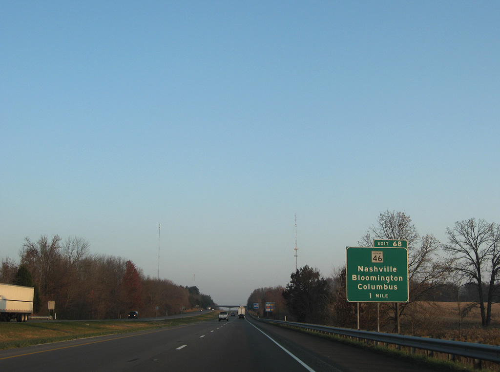
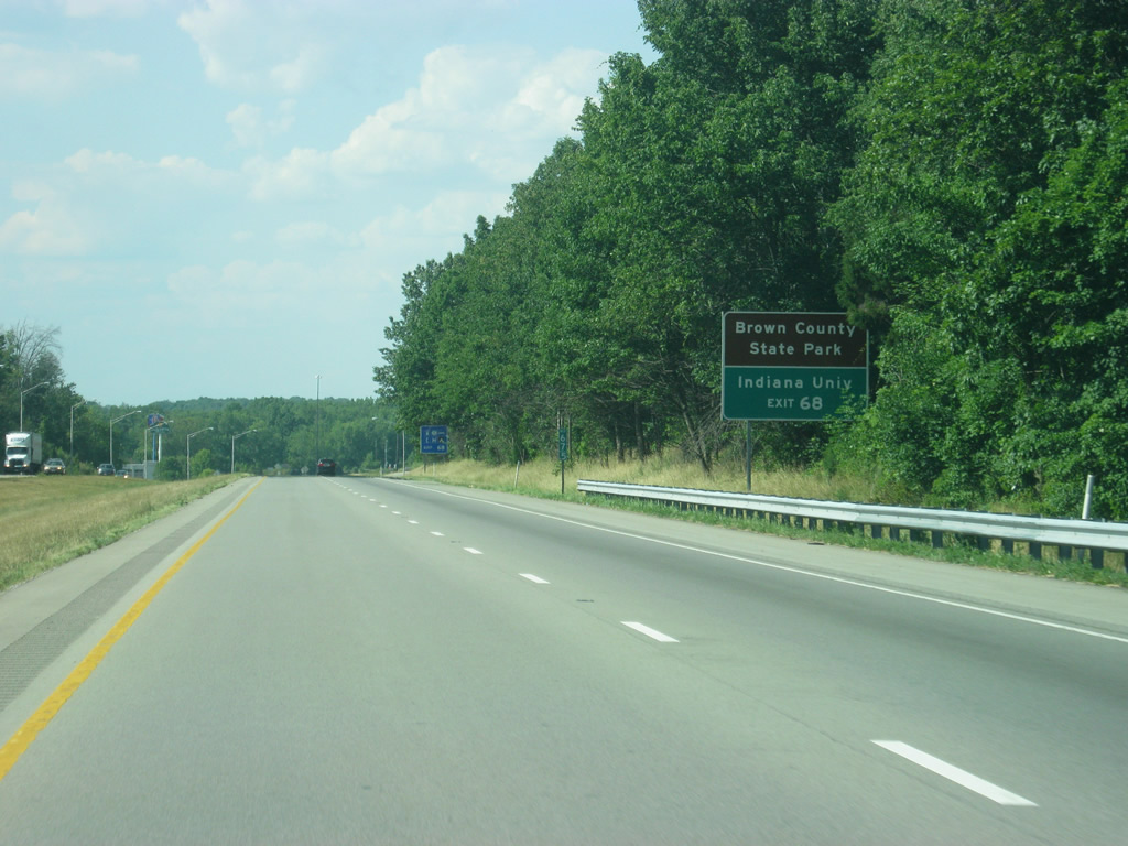
| Points of interest served by SR 46 include Brown County State Park south of Nashville and Indiana University in Bloomington. The state road also provides a route to the Columbus and Nashville Visitors Centers. 06/07/12 |
|
| Exit 68 parts ways with Interstate 65 north for SR 46. Jonathon Moore Pike carries the state road east to the north end of SR 11 near Garden City and a roadway split of 2nd (east) and 3rd (west) Streets into the city core. SR 46 otherwise joins Columbus with Greensburg and the Interstate 74 corridor to the east. 11/05/09, 06/07/12 |
|
| Exit 68 partitions into two left turn lanes onto SR 46 west for the 16.7 mile drive to Nashville and 29 mile trek to Bloomington. 11/05/09 |
|
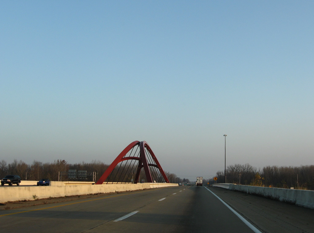
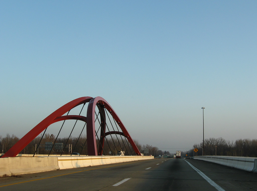
| A decorative arch bridge supports the roadways of Interstate 65 above SR 46 within the single point urban interchange (SPUI). Originally built as a wide diamond interchange (the footprint still visible on aerials), Exit 68 was configured by 1996 into the SPUI. 11/05/09 |
|
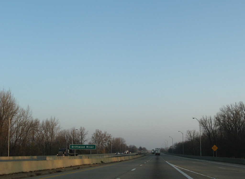
| Interstate 65 immediately spans the Driftwood River beyond the Exit 68 SPUI. These spans were built in 1961. 11/05/09 |
|
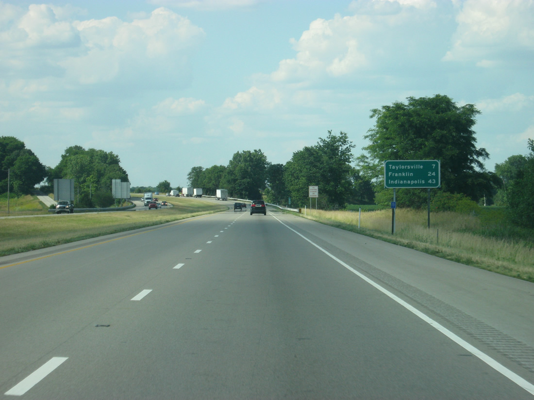
| The final Bartholomew County interchange lies seven miles to the north with U.S. 31 (Exit 76). 24 miles to the north is Franklin and SR 44 (Exit 90). 11/05/09, 06/07/12 |
|
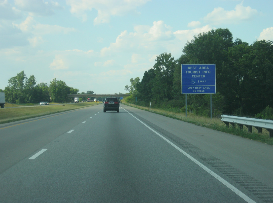
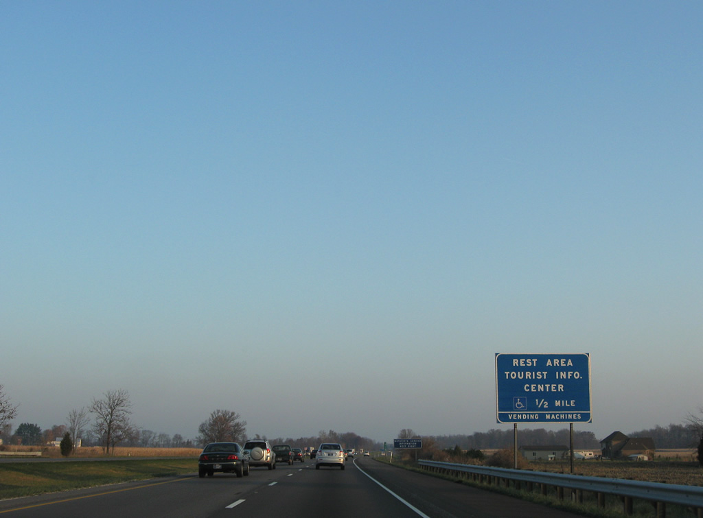
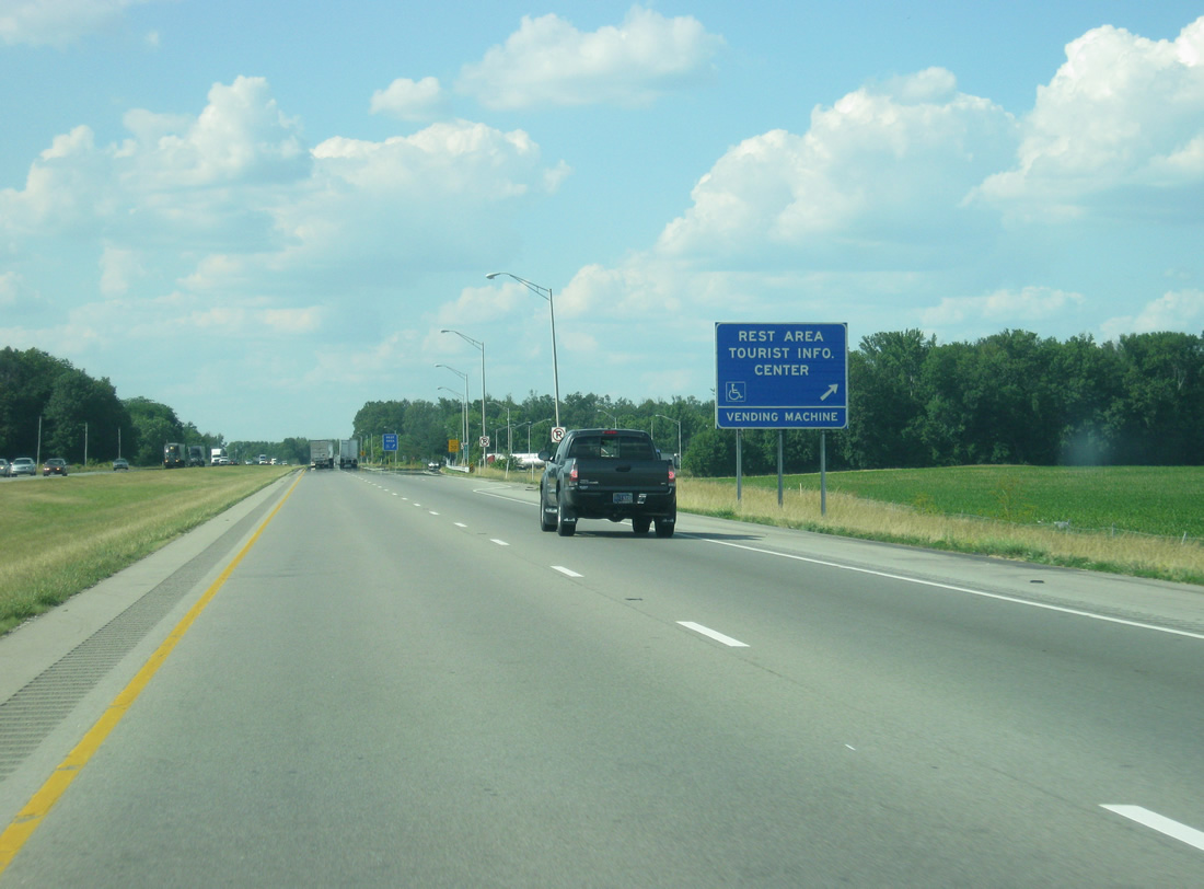
| A northbound side rest area and tourist information center lines Interstate 65 by the community of Taylorsville. The next facility is not until north of the Indianapolis metropolitan area in northern Boone County. 06/07/12, 11/05/09 |
|
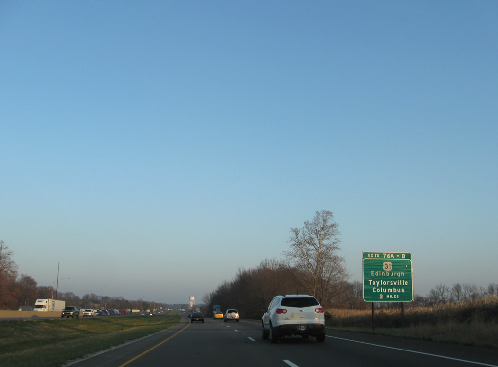
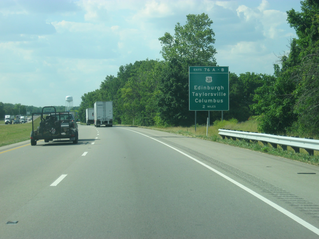
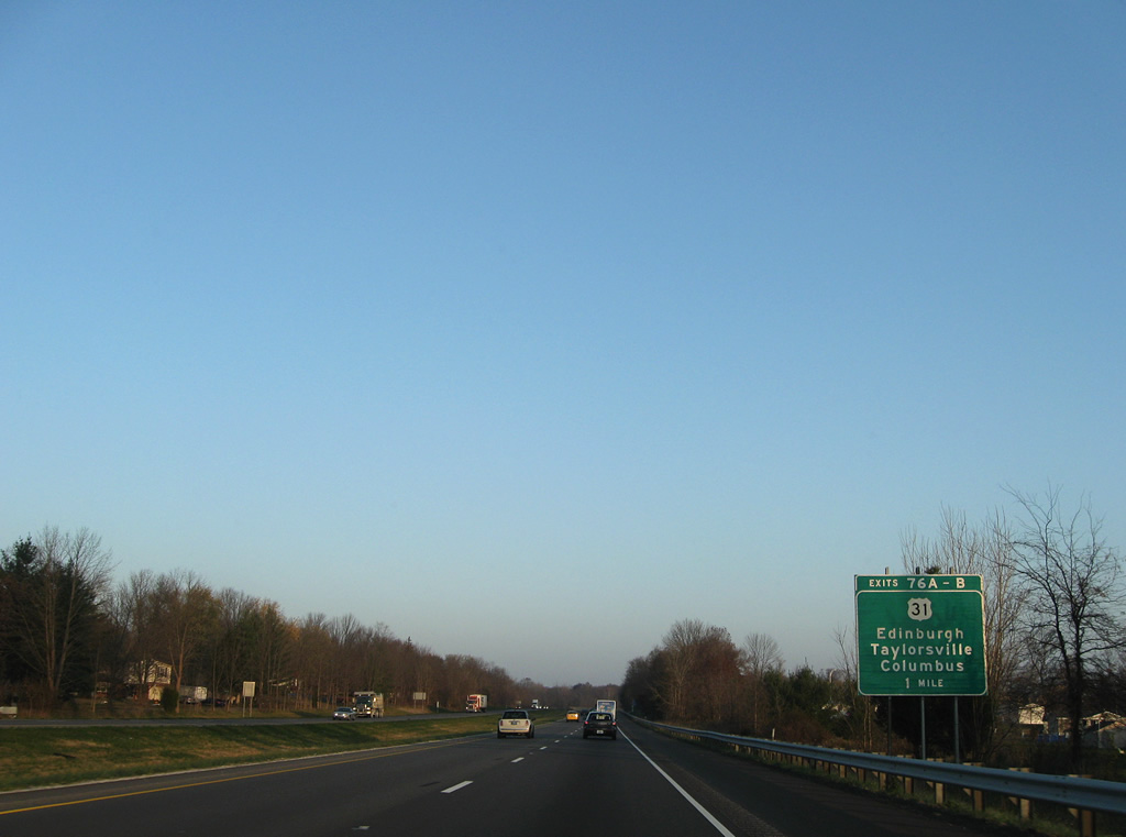
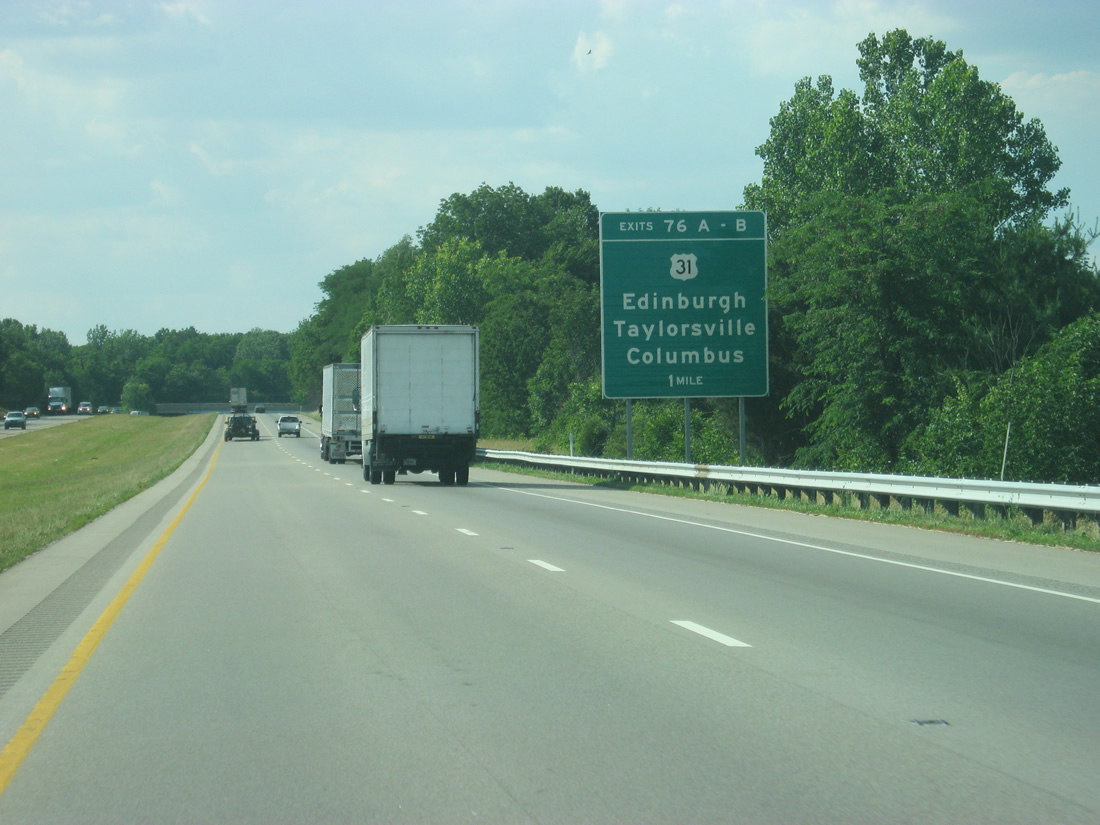
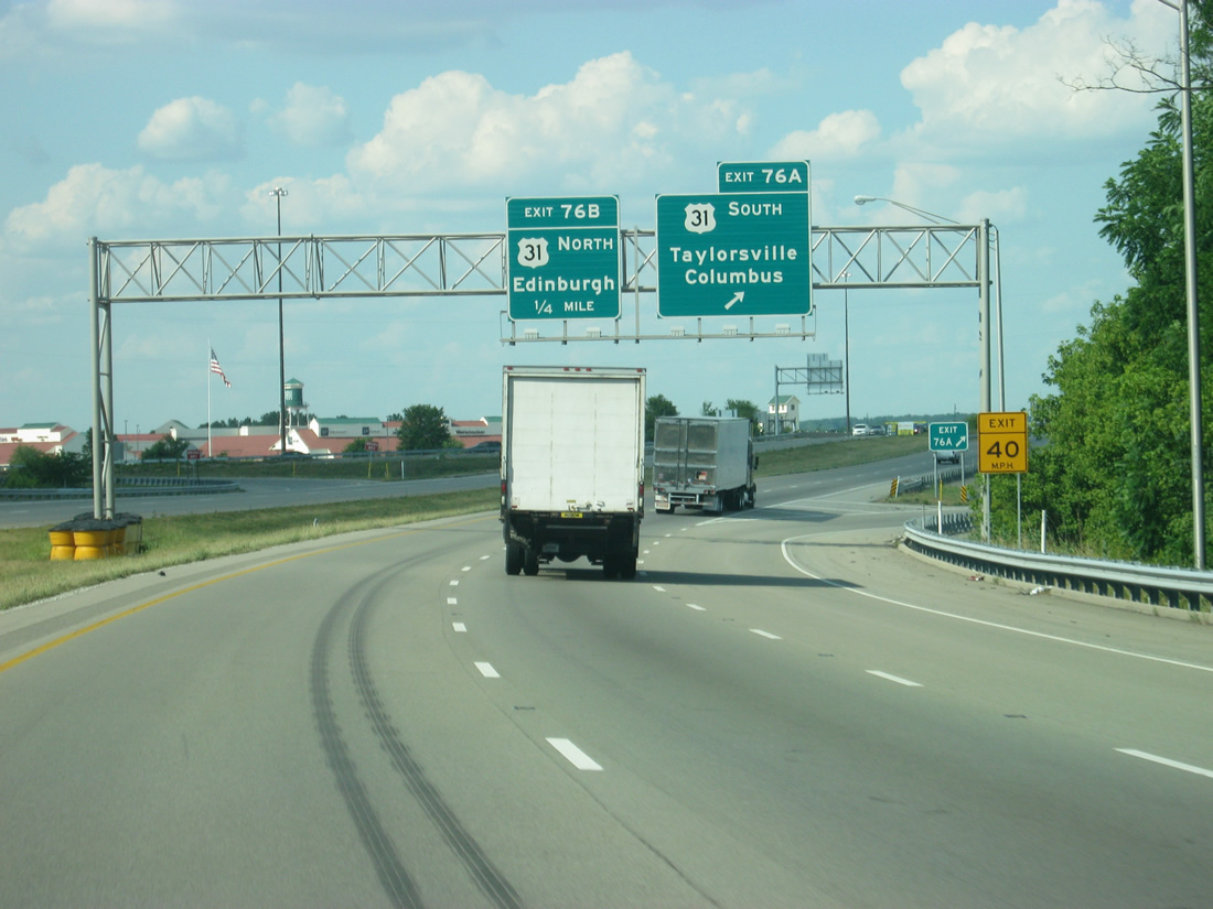
| U.S. 31 crosses Interstate 65 from Taylorsville to Edinburgh at Exits 76A/B. The US Route last met I-65 directly at Exit 36 and will do so again, and for the final time, with the Indianapolis Beltway at Exit 106. 11/05/09, 06/07/12 |
|
| Exits 76A/B consists of a six-ramp parclo interchange with U.S. 31 adjacent to North Park and Taylorsville. U.S. 31 comprises a four lane divided highway north from Columbus to Franklin. 11/05/09, 06/07/12 |
|
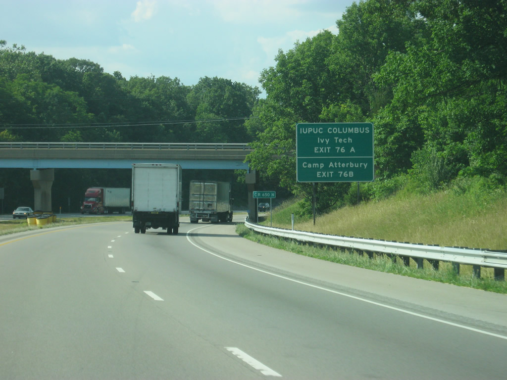
| Camp Atterbury is located north of Exit 76 A-B via U.S. 31 north and Hospital Road west of Edinburgh. Indiana University-Purdue University-Columbus and Ivy Tech are located to the south near the Columbus area. 06/07/12 |
|
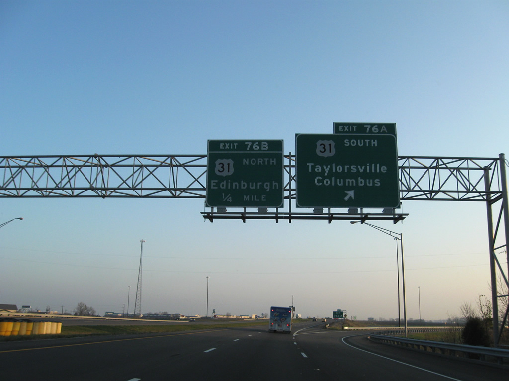
| Northbound Interstate 65 at the Exit 76A off-ramp to U.S. 31 south. U.S. 31 continues from Taylorsville to Columbus, serving interests to IUPU Columbus and Ivy Tech. 11/05/09, 06/07/12 |
|
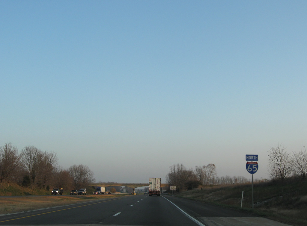
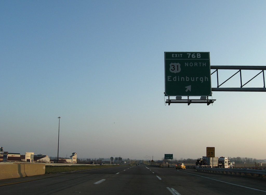
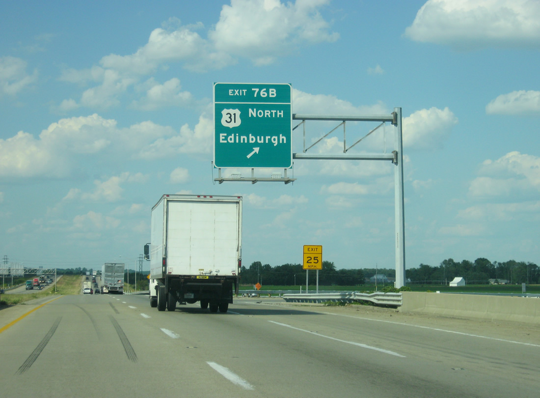
| A loop ramp (Exit 76B) drops down to U.S. 31 north to Camp Atterbury and Edinburgh. U.S. 31, which has run in tandem with Interstate 65 since Bay Minette, Alabama, leaves the corridor at Indianapolis for Kokomo, Plymouth, South Bend, and St. Joseph, Michigan. 11/05/09, 06/07/12 |
|
| Interstate 65 curves northeast and passes over the Louisville & Indiana Railroad again. 11/05/09 |
|
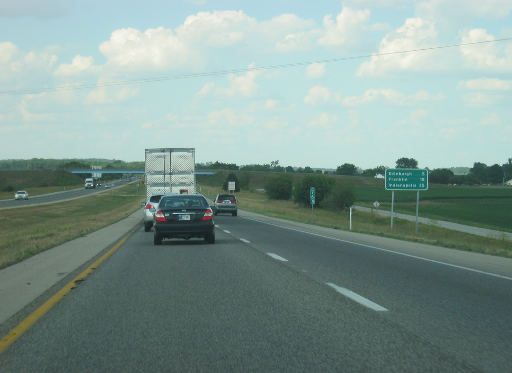
| Multiples of fives in this distance sign for Edinburgh, Franklin and Indianapolis. County Road 200 West briefly parallels Interstate 65 northbound in this scene. 06/07/12 |
|
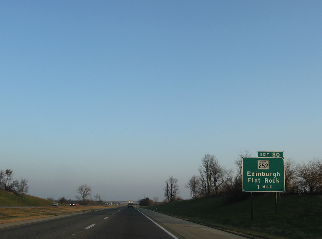
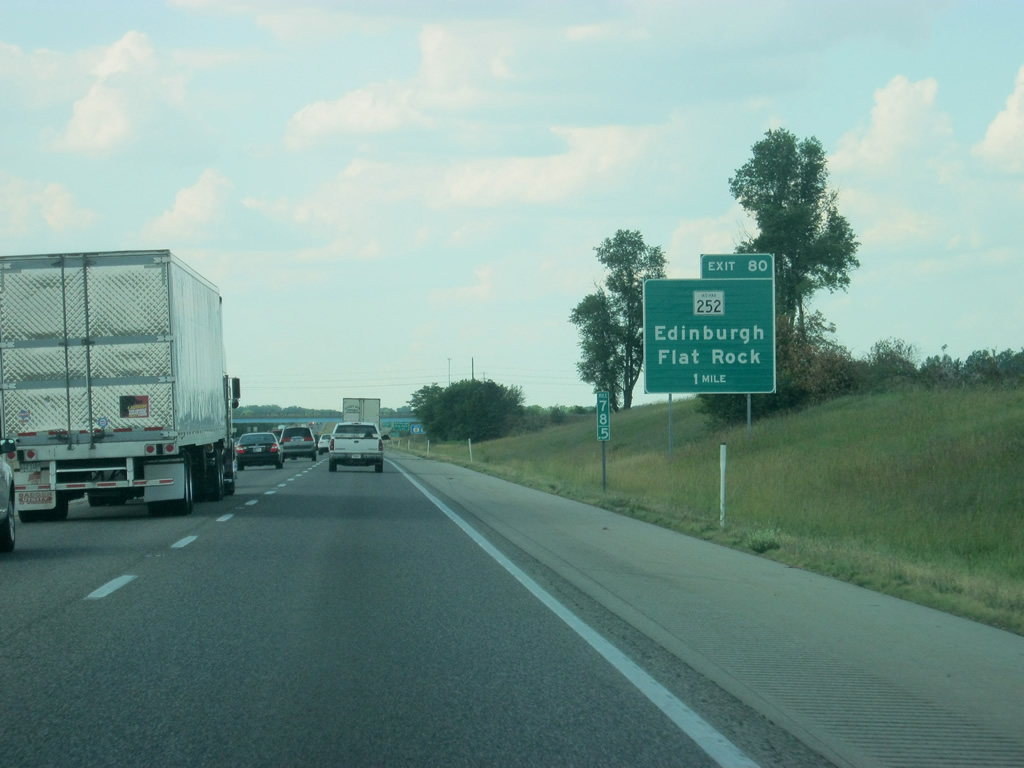
| SR 252 joins Interstate 65 with Edinburgh and Flat Rock via Exit 80 in one mile. 11/05/09, 06/07/12 |
|
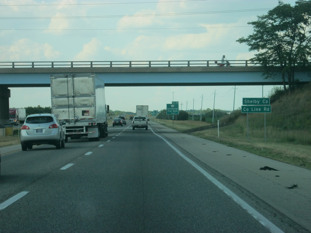
| Interstate 65 nips the southwest corner of Shelby County as it slides by the east side of Edinburgh. 06/07/12 |
Page Updated 02-25-2013.

 North
North