|
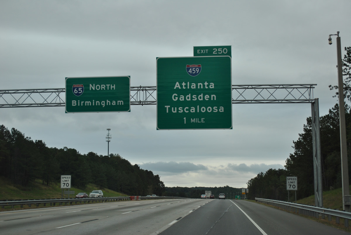
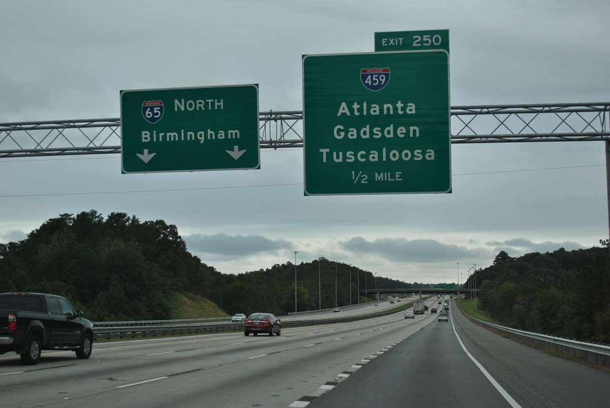
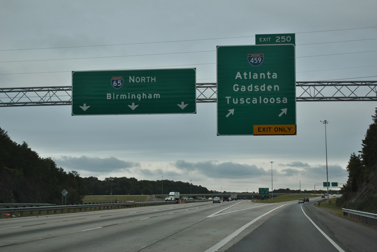
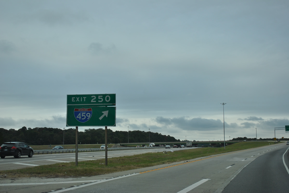
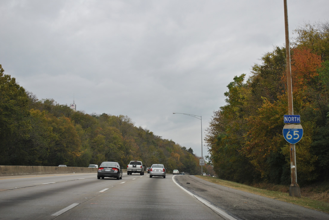
| Exit 250 leaves I-65 one mile north of the Shelby County line. Interstate 459 serves regional traffic while doubling as a commuter route for communities such as Hoover, Vestavia Hills, Mountain Brook and Trussville. 10/07/12 |
|
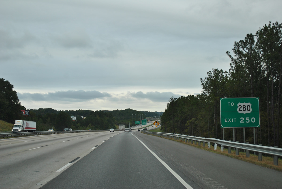
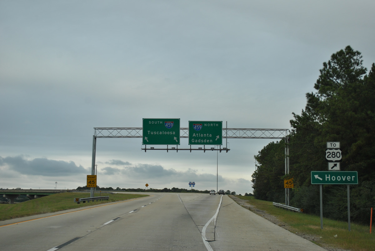
| Interstate 459 north connects with U.S. 280 at Exit 19. The well traveled commuter leads north to Homewood and Mountain Brook and south to the Shelby County suburbs and Sylacauga. 10/07/12 |
|
| Two lanes depart at the four level interchange (Exit 250) for Interstate 459 while I-65 maintains six overall lanes through the exchange. 10/07/12 |
|
| Exit 250 leaves I-65 north for Interstate 459. The Birmingham bypass stretches 32.80 miles from I-20/59 at Bessemer to Interstate 59 at Trussville. 10/07/12 |
|
| Adjacent exits along the south belt line serve the Riverchase Galleria and Alabama's sixth largest city, Hoover (2020 population 92,687). 10/07/12 |
|
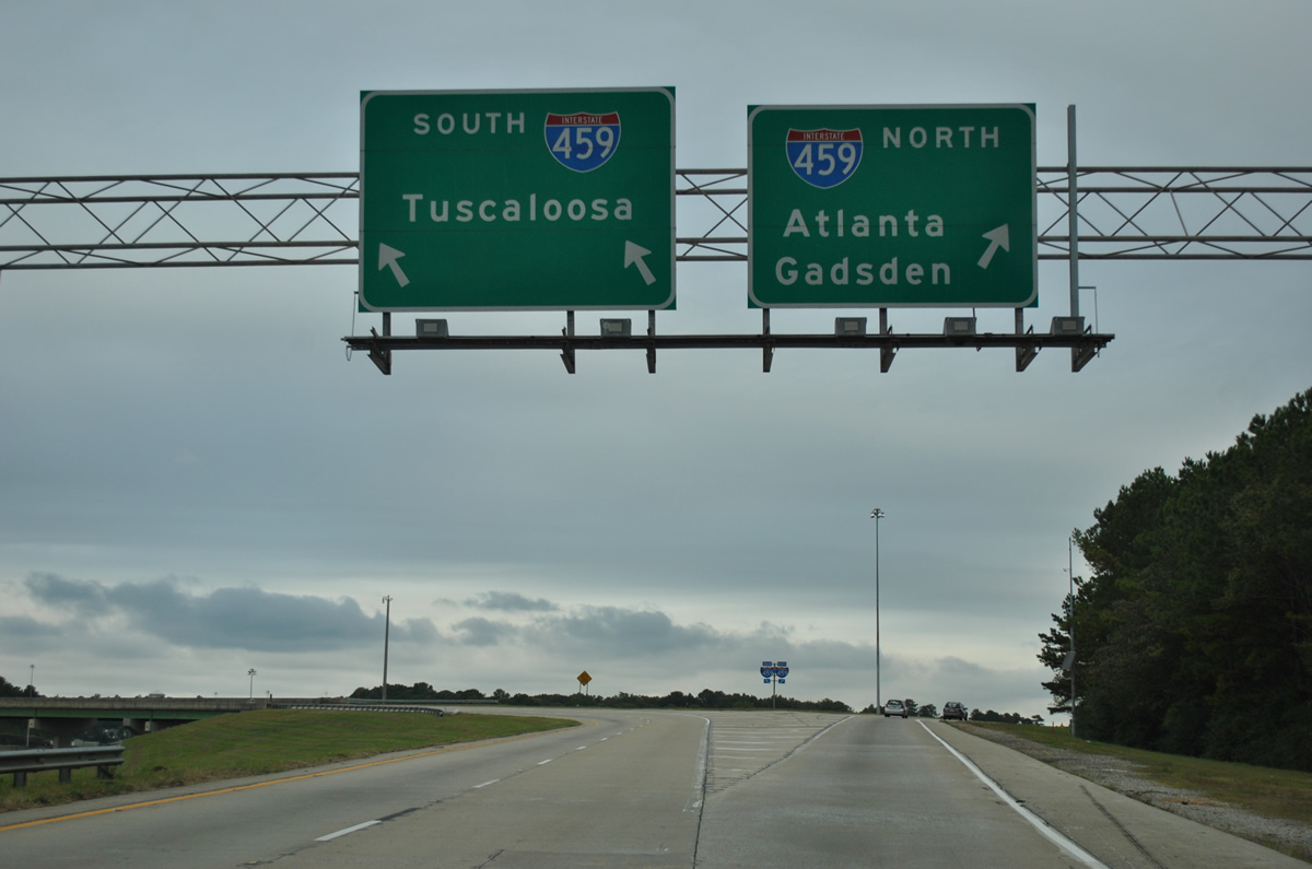
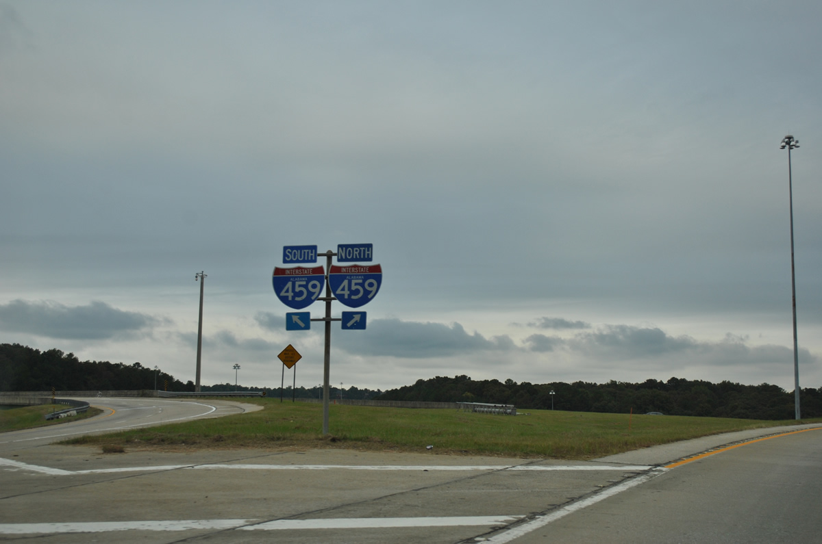
| I-459 north links I-65 with I-20 east to Anniston and Atlanta and I-59 north toward Gadsden and Chattanooga. 10/07/12 |
|
| West from I-65 to Bessemer City, I-459 connects with I-59/20 south toward Tuscaloosa and Meridian, Mississippi. 10/07/12 |
|
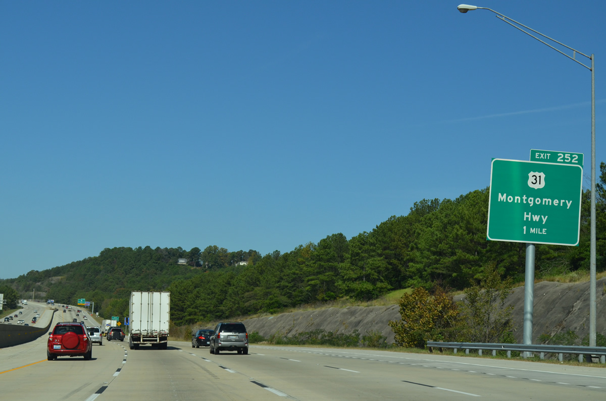
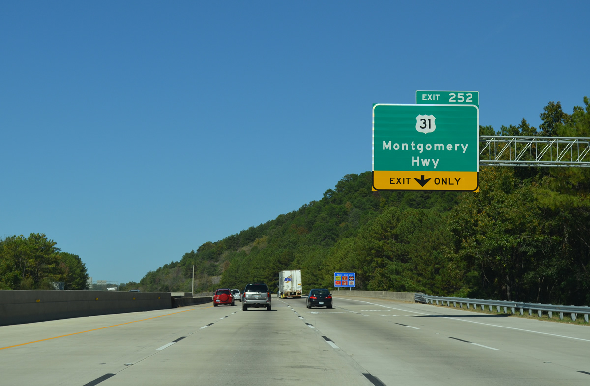
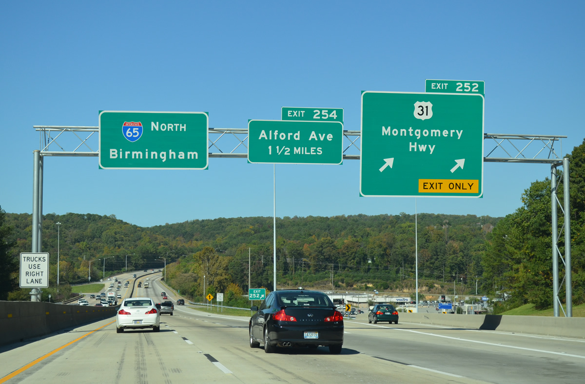
| I-65 continues north from the belt line to Exit 252 for U.S. 31 (Montgomery Highway) beyond Patton Chapel. This is the sixth meeting of the two routes north from Lower Alabama. 10/20/12 |
|
| Exit 252 was expanded to a two lane off-ramp between 2010-12. The central area of Hoover is buffeted by heavy suburban type development and many travel amenities. 10/20/12 |
|
| U.S. 31 continues northeast from I-65 to Vestavia Hills, Homewood and the Elton B. Stephens Expressway. This exit also serves Old Columbiana Road, CR 99 between Hoover and SR 149 (Green Springs Highway) at Homewood. 10/20/12 |
|
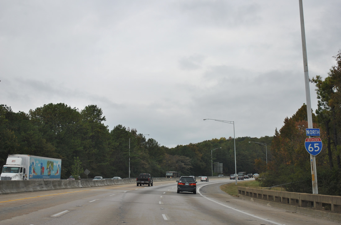
| Reassurance marker for Interstate 65 north posted at the Tyler Road underpass. The six lane freeway winds northwest toward Shades Cliff between Hoover and Vestavia Hills. 11/03/11 |
|
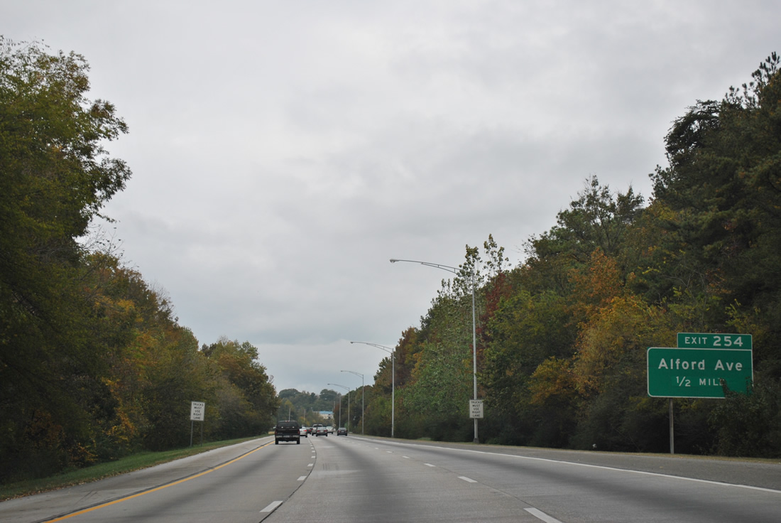
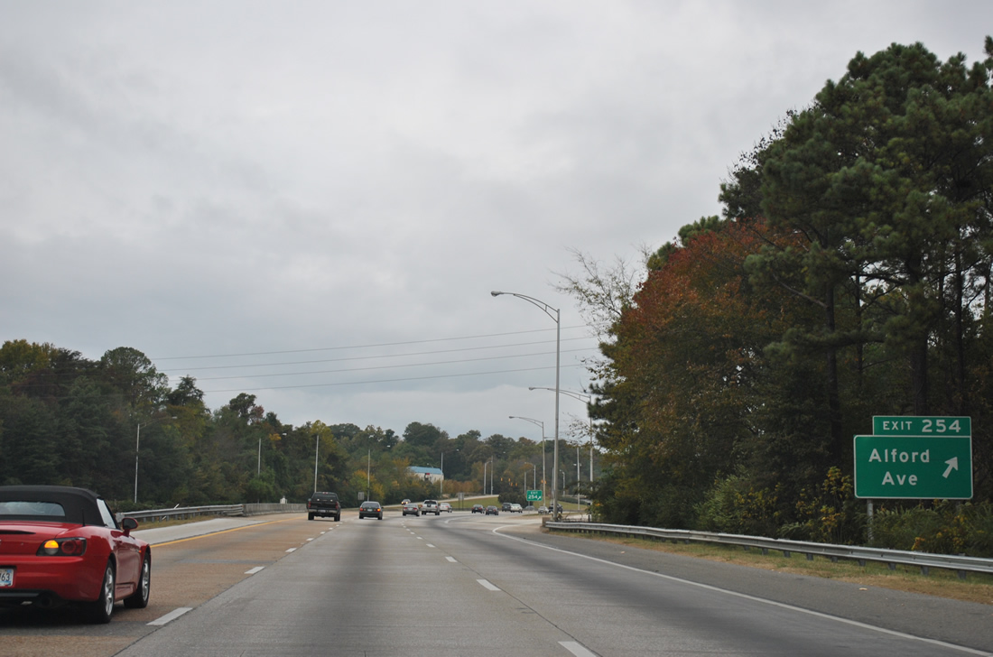
| Alford Avenue meets Interstate 65 at a diamond interchange (Exit 254) on Shades Mountain in one half mile. 11/03/11 |
|
| Alford Avenue (CR 97) follows Shades Crest southwest from Exit 254 to Fancher Drive where CR 97 dog legs at W Oxmoor Road to Shades Crest Road south to Bluff Park. CR 97 continues east from Interstate 65 to Shades Crest Road and Columbiana Road (CR 99). 09/24/03 |
|
| Intrrstate 65 advances north through the city limits of Homewood. 10/20/12 |
|
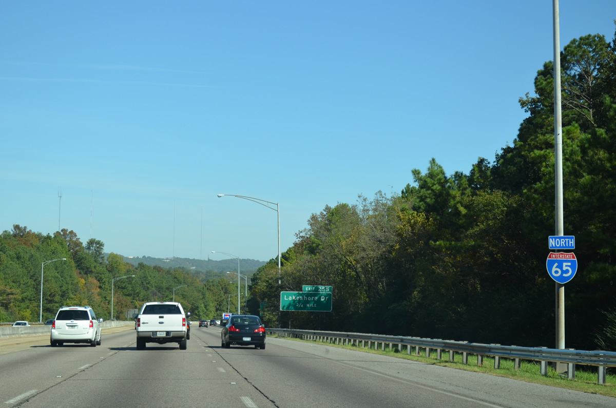
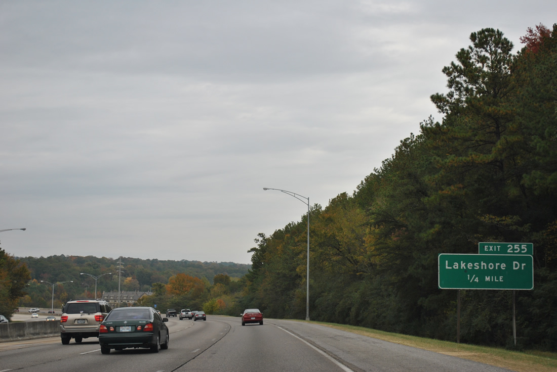
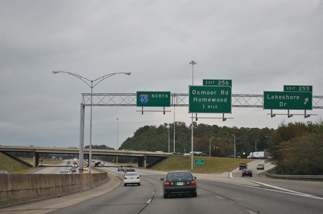
| Interstate 65 lowers from Shades Mountain and passes over Forest Brook Drive and Shades Creek to the parclo interchange (Exit 255) with Lakewood Drive at Lakeview Park. 10/20/12 |
|
| Lakeshore Drive constitutes a divided arterial east to Samford University and U.S. 31 at Homewood. SR 149 follows the route east from Green Springs Highway. 11/03/11 |
|
| During the mid 1990s, Lakeshore Drive was extended west to a newly built interchange with Interstate 65. The roadway continues southwest as Lakeshore Parkway to SR 150 at the city of Bessemer. 11/03/11 |
|
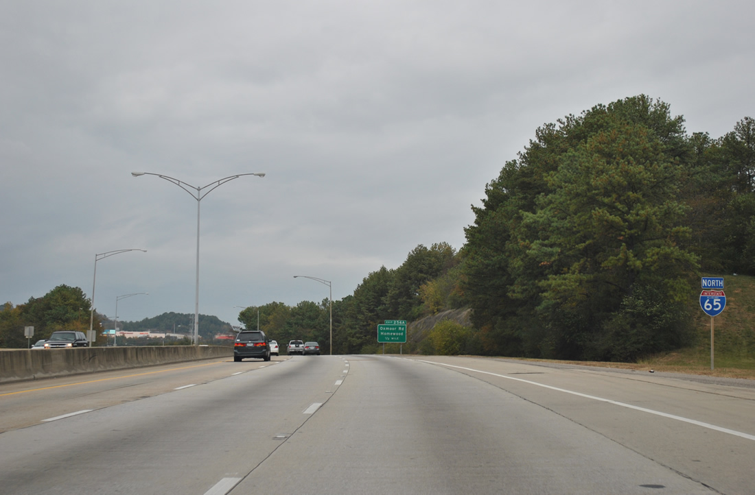
| Continuing north along Interstate 65 toward the second interchange (Exit 256A) within the city of Homewood. There is no Exit 256B in the northbound direction. 11/03/11 |
|
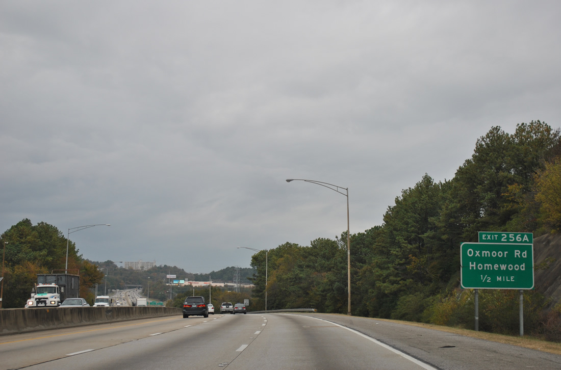
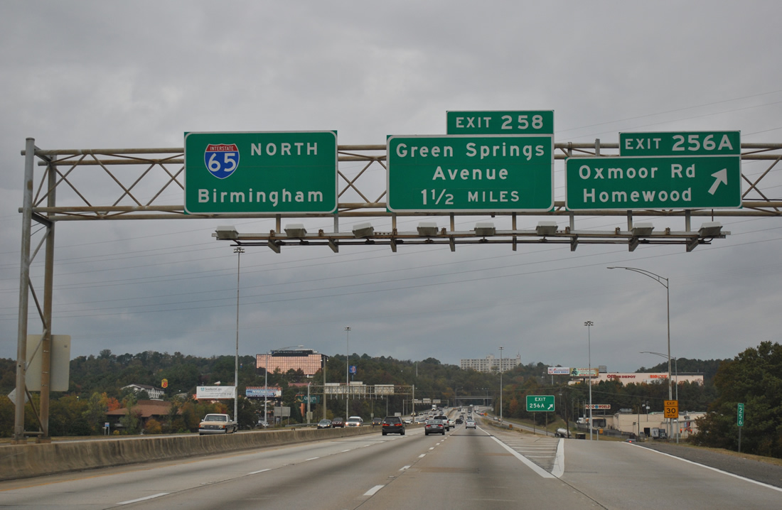
| A parclo interchange joins Interstate 65 with Oxmoor Road at the Edgemont and Oak Grove Estates neighborhoods in Shades Valley. Oxmoor Road transitions into Palisades Boulevard amid a retail area bounding the intersection with SR 149 (Green Springs Highway) to the east. 11/03/11 |
|
| Oxmoor Road west from Homewood turns southerly to Lakeshore Parkway by Little Shades Mountain in west Birmingham. Exit 258 follows on Interstate 65 north as the first Birmingham city interchange in one and a half miles. 11/03/11 |
|
| Ascending over Red Mountain along Interstate 65 north. 11/03/11 |
|
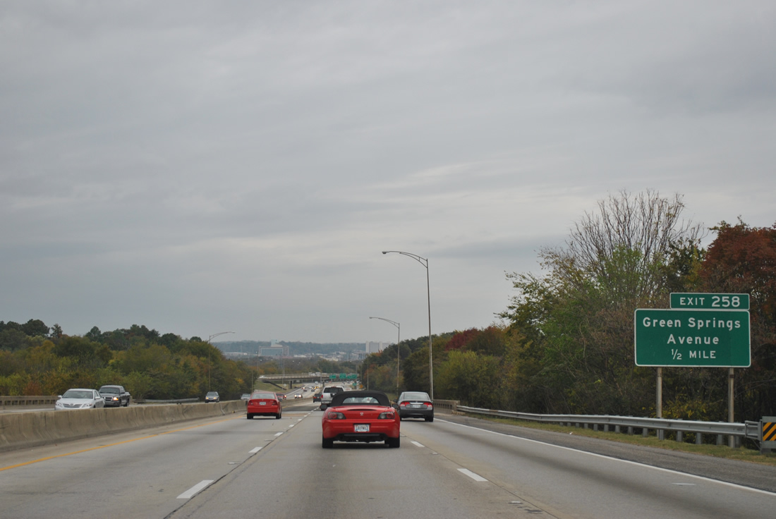
| Exit 258 joins Green Springs Avenue with Interstate 65 at a diamond interchange one half mile north of 24th Avenue South. The surface street serves George Ward Park and the Spaulding, West End, and Powderly neighborhoods of west Birmingham. 11/03/11 |
|
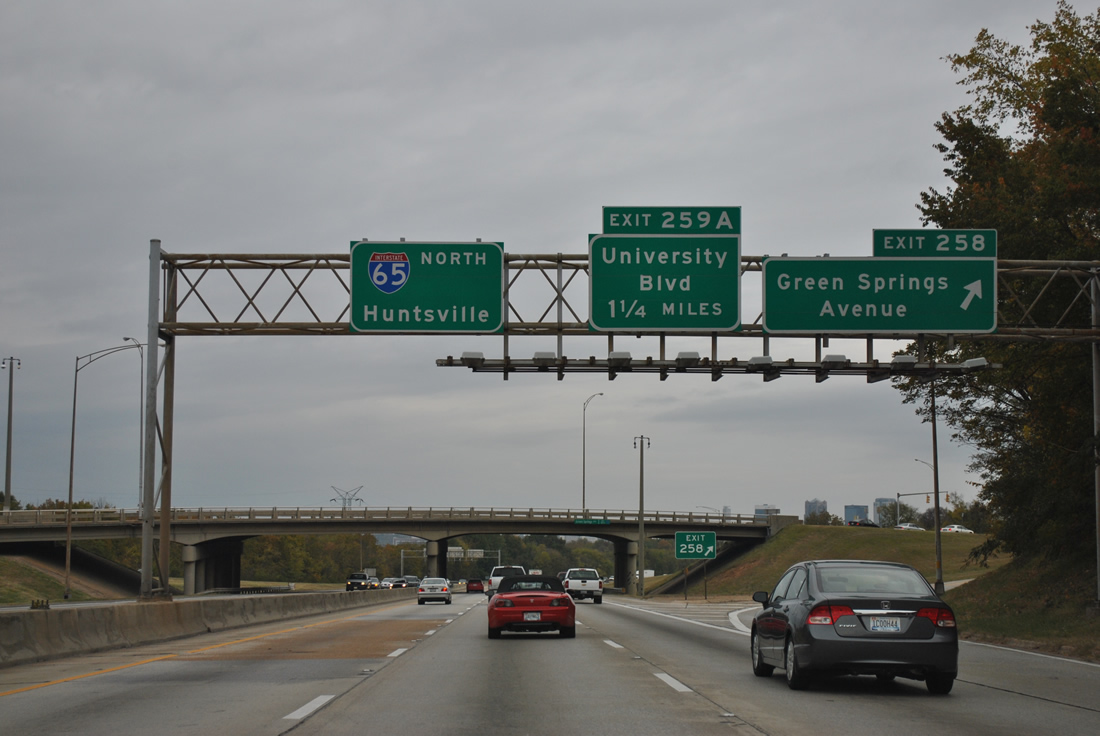
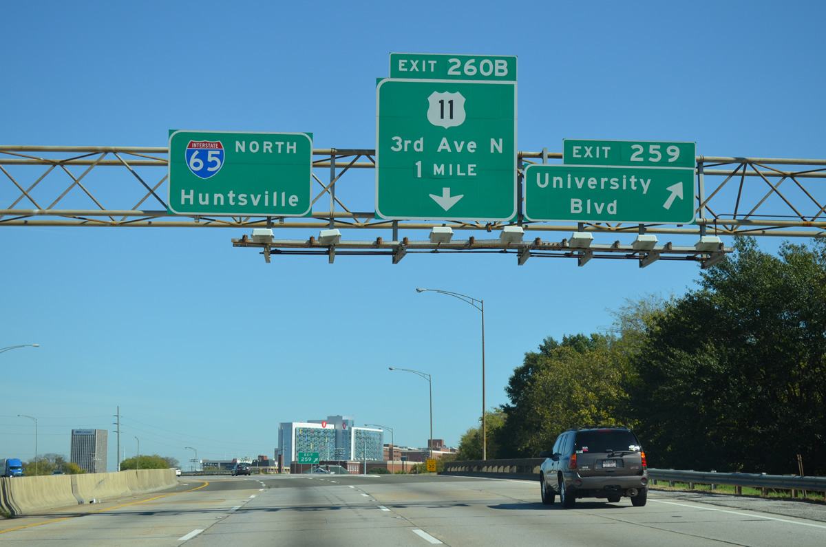
| High rises from the central business district appear at Exit 258 to Green Springs Avenue. Green Springs Avenue intersects SR 149 (Green Springs Highway) just east of the freeway. The state route continues northward alongside I-65 to Exit 259 A. 11/03/11 |
|
| Interstate 65 northbound crosses over SR 149 (Green Springs Highway), 0.75 miles to the south of Exit 259 for University Boulevard. SR 149 becomes University Boulevard at 16th Avenue but is omitted from Interstate 65 related guide signs. 10/20/12 |
|
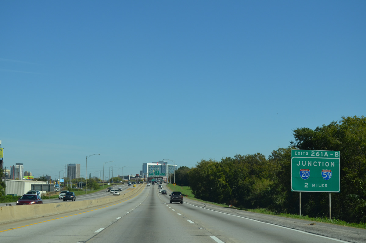
| Two miles south of the I-20/59 (Exits 261A/B) along I-65 north near Exit 259 (University Boulevard). The forthcoming interchange is one of the most heavily traveled locations in the metropolitan area, and is arguably one of the busiest in the state. 10/20/12 |
|
| Exit 259 for SR 149 (University Boulevard) departs Interstate 65 northbound. This interchange serves the Southside and Five Points neighborhoods of Birmingham and the University of Alabama at Birmingham academic and medical campuses. The college is home to the largest medical facility in the state and region and represents the city's largest employer. 10/20/12 |
|
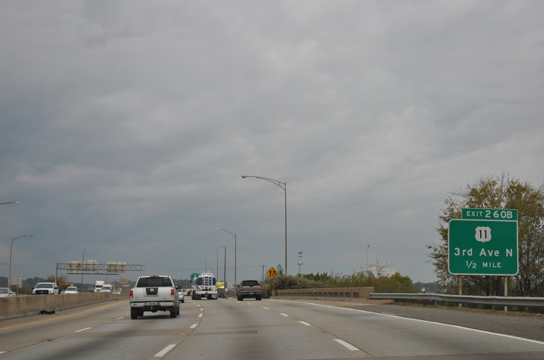
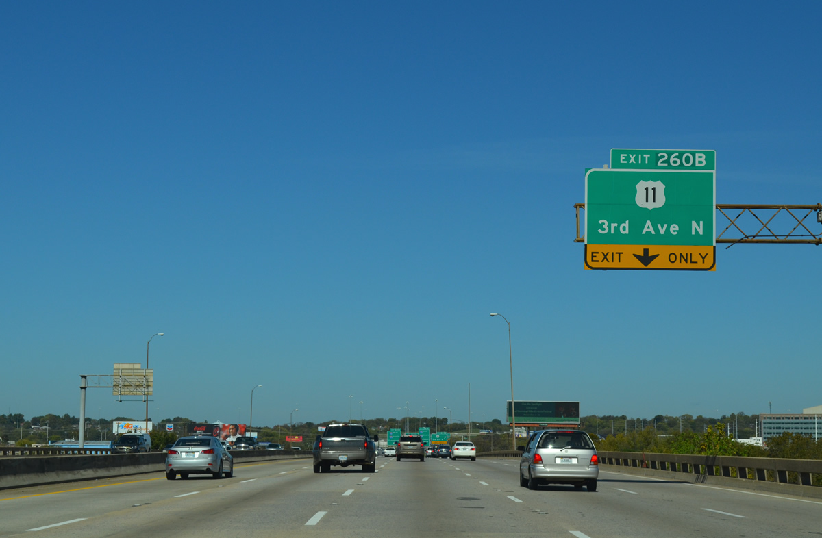
| A split diamond interchange (Exit 260 B) follows with U.S. 11/78 (1st & 3rd Avenues N). While U.S. 78 is omitted from Exit 260 B overheads, the route overlaps with U.S. 11 from Arkadelphia Road and the Smithfield neighborhood eastward through Downtown to 24th Street. 11/03/11 |
|
| Interstate 65 travels a viaduct from the wye interchange with 3rd/4th Avenues over 2nd Avenue South, the Louisville and Nashville Railroad, the Norfolk Southern Railroad and 1st Avenue North. 10/20/12 |
|
| North of Exit 259 is this view of the downtown Birmingham skyline as seen from Interstate 65 northbound. As of the 2010 census, Birmingham boasts 212,237 citizens within its city limits and 1,212,848 residents in the overall metropolitan area. Those numbers represent a 400,000 increase in metro population from 2000, but a 30,000 decrease within the city. 11/03/11 |
|
| Interstate 65 northbound at Exit 260B off-ramp onto 11th Street North. There is no Exit 260A, so why is this signed as Exit 260B? U.S. 11 north & 78 east follow 3rd Avenue north to 13th Street North. U.S. 11 south & 78 west use 1st Avenue North to 9th Street North. 11th Street North travels four blocks north otherwise to the northbound on-ramp.
The street grid of Birmingham is partitioned by the Norfolk-Southern Railroad tracks that bisect the central business district. In other words, Third Avenue North is three blocks north of the railroad division. 10/20/12 |
|
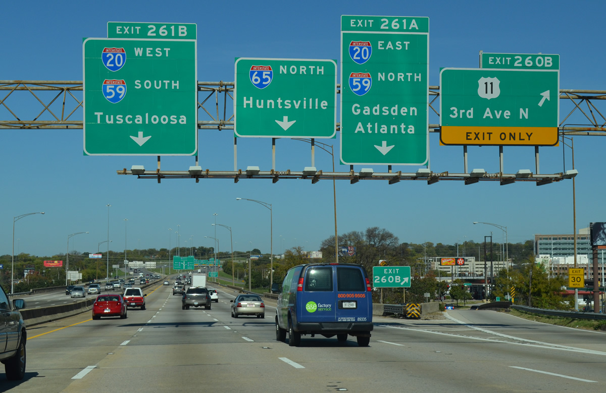
| Interstate 65 immediately meets I-20/59 north of the 11th Street North entrance ramp. This interchange uses several left side ramps and sees roadways on both freeways switch to accommodate shorter connections. The exchange is better known by locals as "Malfunction Junction". 11/03/11 |
|
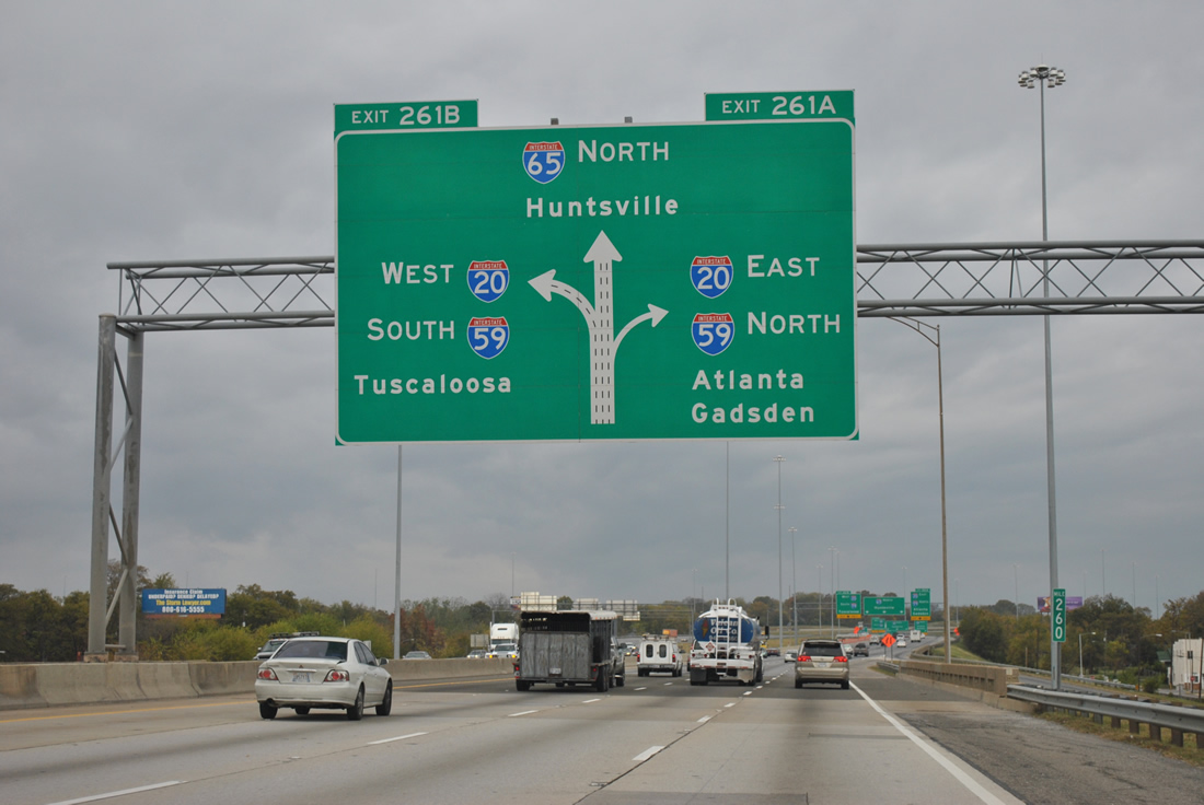
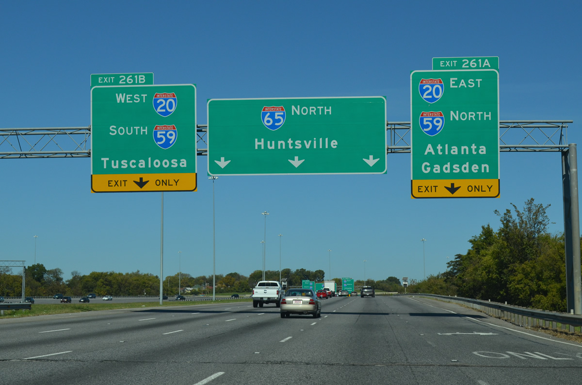
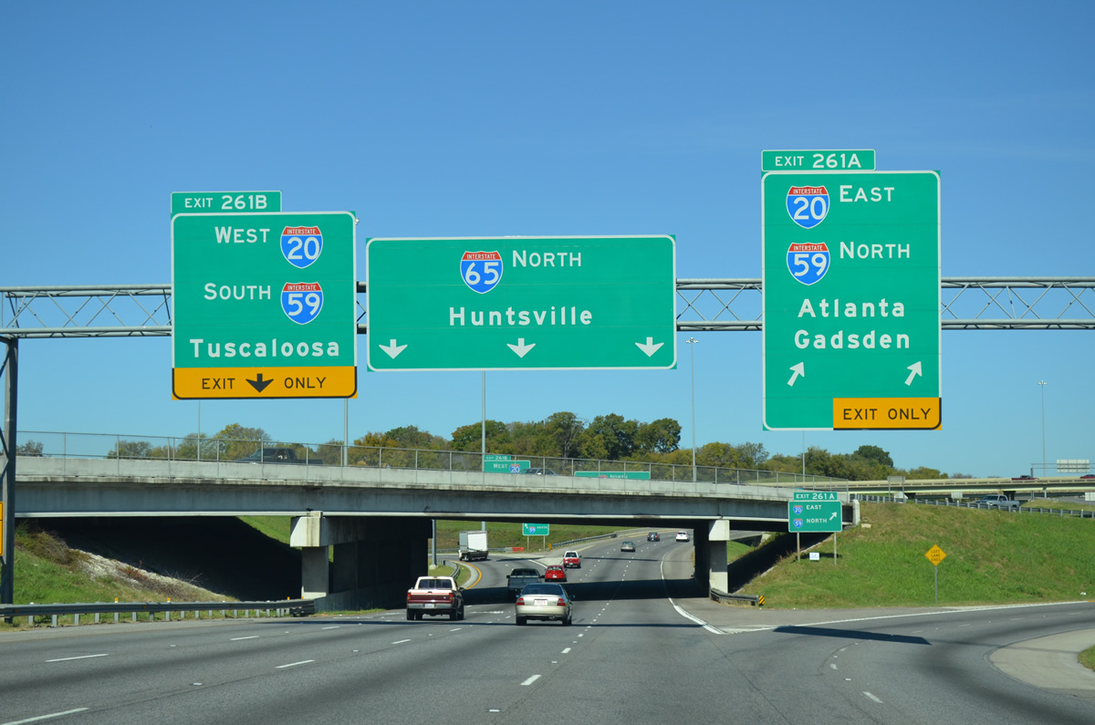
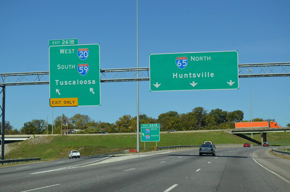
| Interstate 65 north expands to five overall lanes on the approach to "Malfunction Junction". A two lane ramp connects with Interstate 20 east & 59 north to downtown. A left side ramp (Exit 261B) follows onto the southbound tandem to Bessemer. 10/20/12 |
|
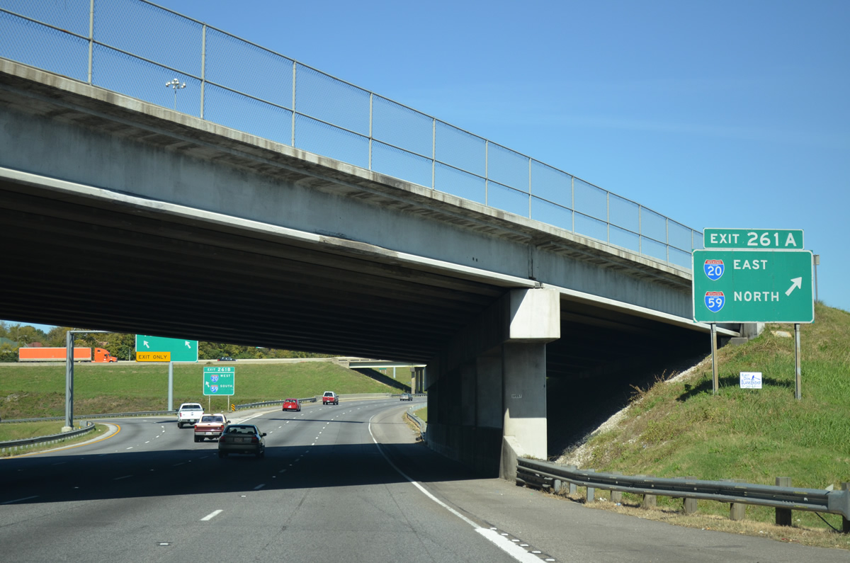
| Exit 261A departs Interstate 65 north. I-20/59 travel eastward along a twin viaduct through the northern reaches of the central business district. Three exits serve downtown from the freeway. 10/20/12 |
|
| Traffic leaving Interstate 65 north at the southbound mainline overpass for Exit 261A sees one last ground level sign for I-20/59. Interests to Birmingham-Shuttlesworth International Airport should follow I-20/59 northeast to Exit 129. 10/20/12 |
|
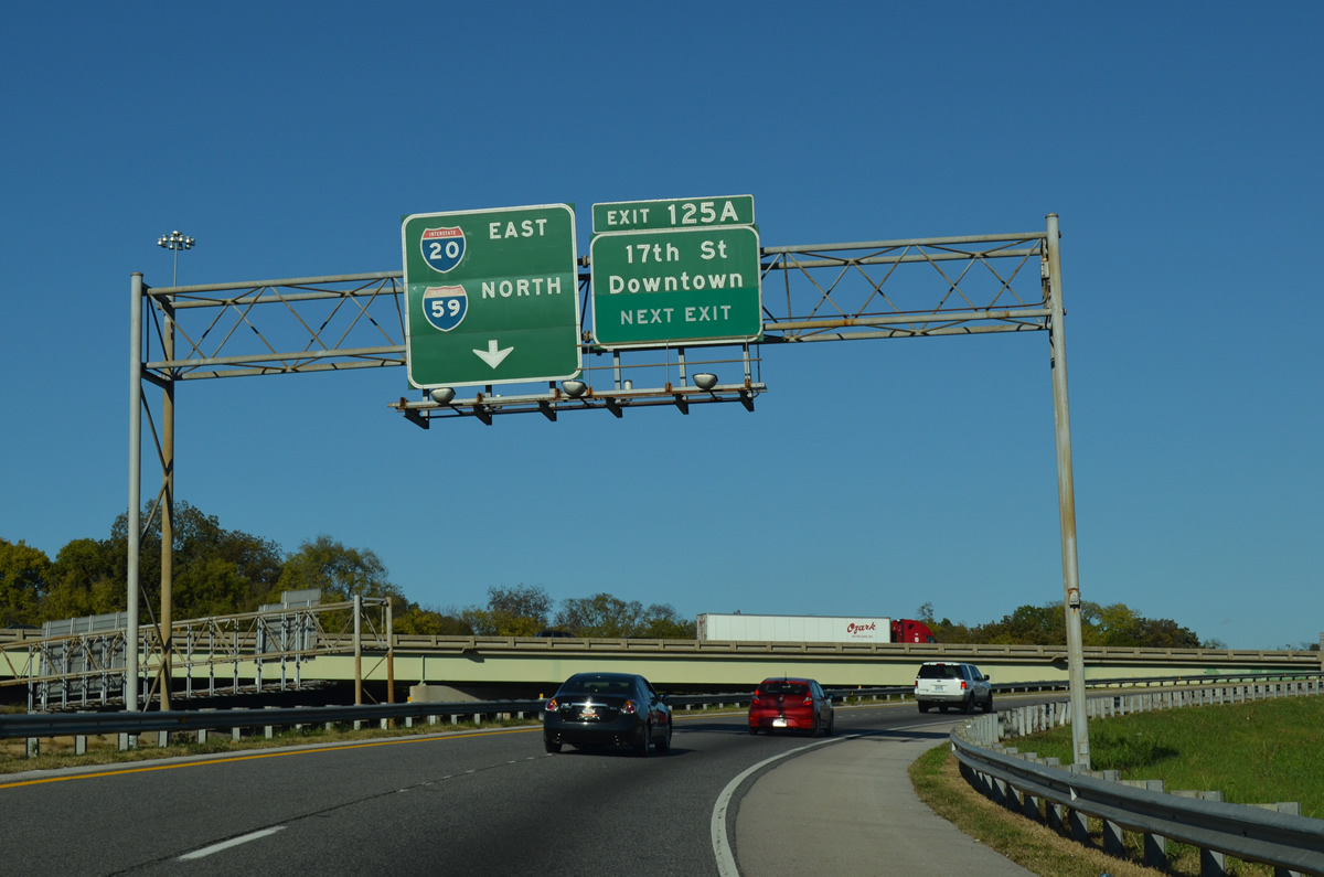
| Taking Exit 261A, motorists are advised of the forthcoming 17th Street North (Exit 125A) ramp departure into downtown with original button copy overheads. 10/20/12 |
|
| Exit 261B departs from under the southbound lanes of Interstate 65 onto I-20 west / I-59 south to Fairfield and Bessemer. The paired Interstates overlap from Birmingham to Tuscaloosa, Cuba, and Meridian, Mississippi. 10/20/12 |
|
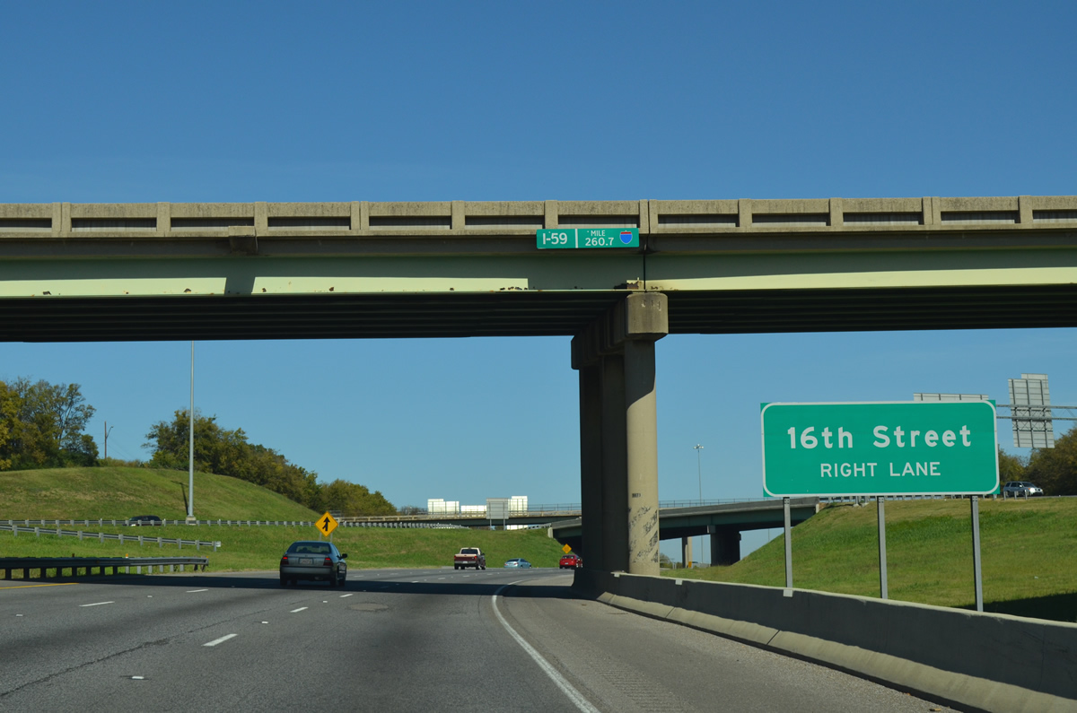
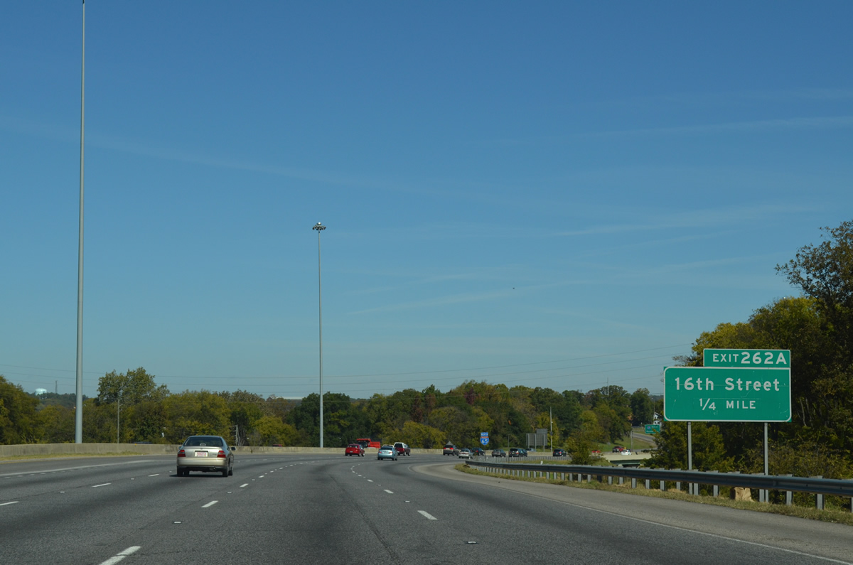
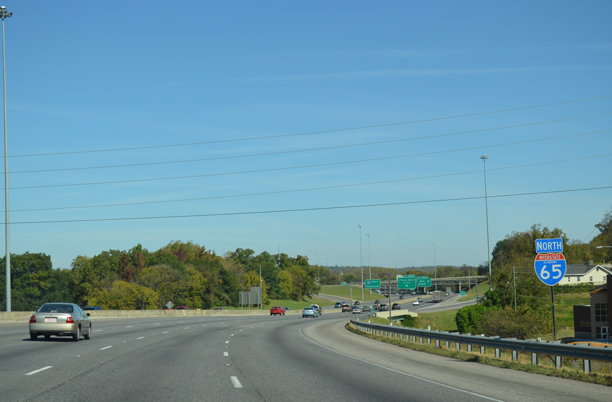
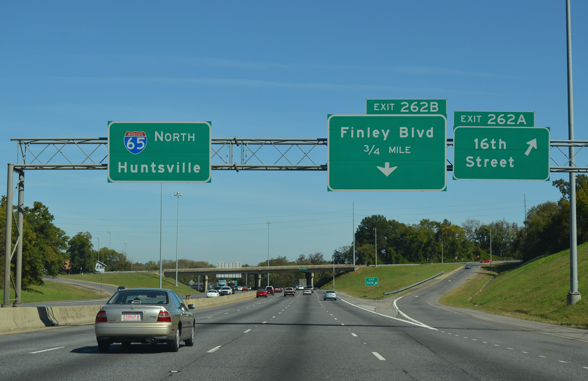
| Interstate 65 winds northeast through Fountain Heights to a half diamond interchange with 16th Street North (Exit 262A). 10/20/12 |
|
| Reassurance marker posted for Interstate 65 north by Fountain Heights Park ahead of the 15th Avenue North underpass. 10/20/12 |
|
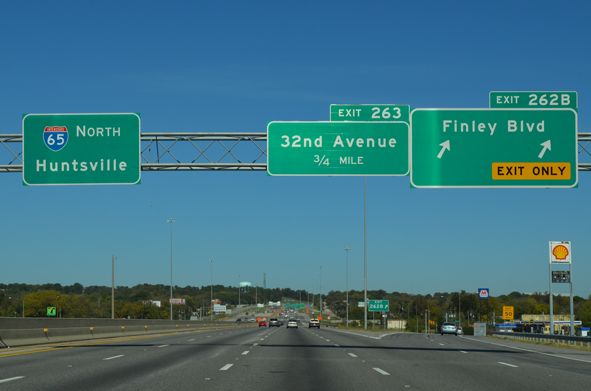
| 16th Street N shifts northwest from 18th Street N at Fountain Heights to Finley Boulevard (SR 378) and North Birmingham. Finley Boulevard constitutes an industrial arterial between U.S. 78 (Bankhead Highway) and U.S. 31 (Carraway Boulevard). The four lane arterial meets I-65 next at Exit 262 B. 10/20/12 |
|
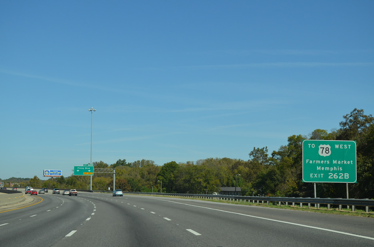
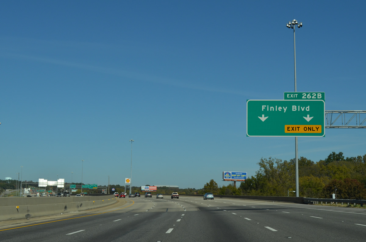
| Interstate 65 passes over 18th Street North and Village Creek on the 0.25 mile approach to Finley Boulevard (Exit 262B). Freeway expansion between 2009-10 from Village Creek northward to 41st Avenue North (Exit 264) expanded the freeway to as many as 11 overall lanes.
Use Finley Boulevard for the State Farmers Market. 10/20/12 |
|
| Entering the diamond interchange (Exit 262B) with Finley Boulevard on I-65 north. Finley Boulevard represented the preferred truck route to U.S. 78 (Bankhead Highway) from Interstate 65 to the completion of Interstate 22. 10/20/12 |
|
| Interstate 65 travels a series of bridges west of North Birmingham including a longer one over 27th and 29th Avenues North and CSX and NS Railroad lines at this northbound shield. 10/20/12 |
|
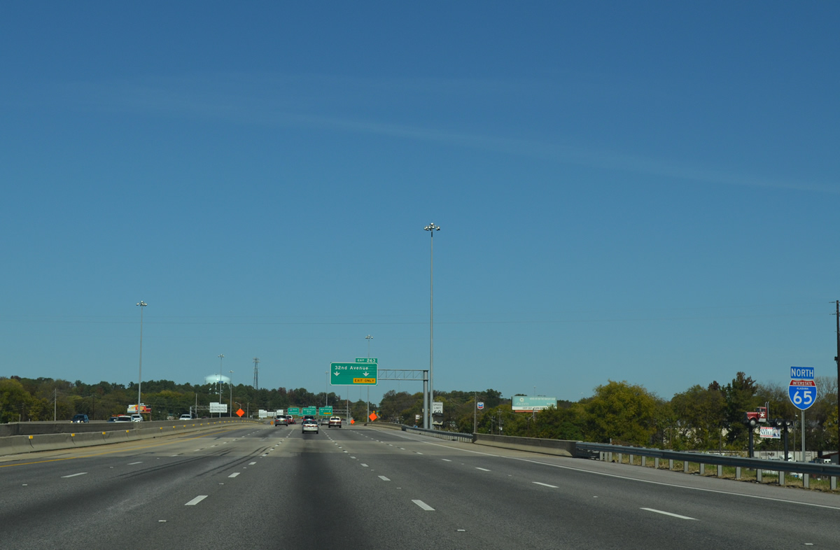
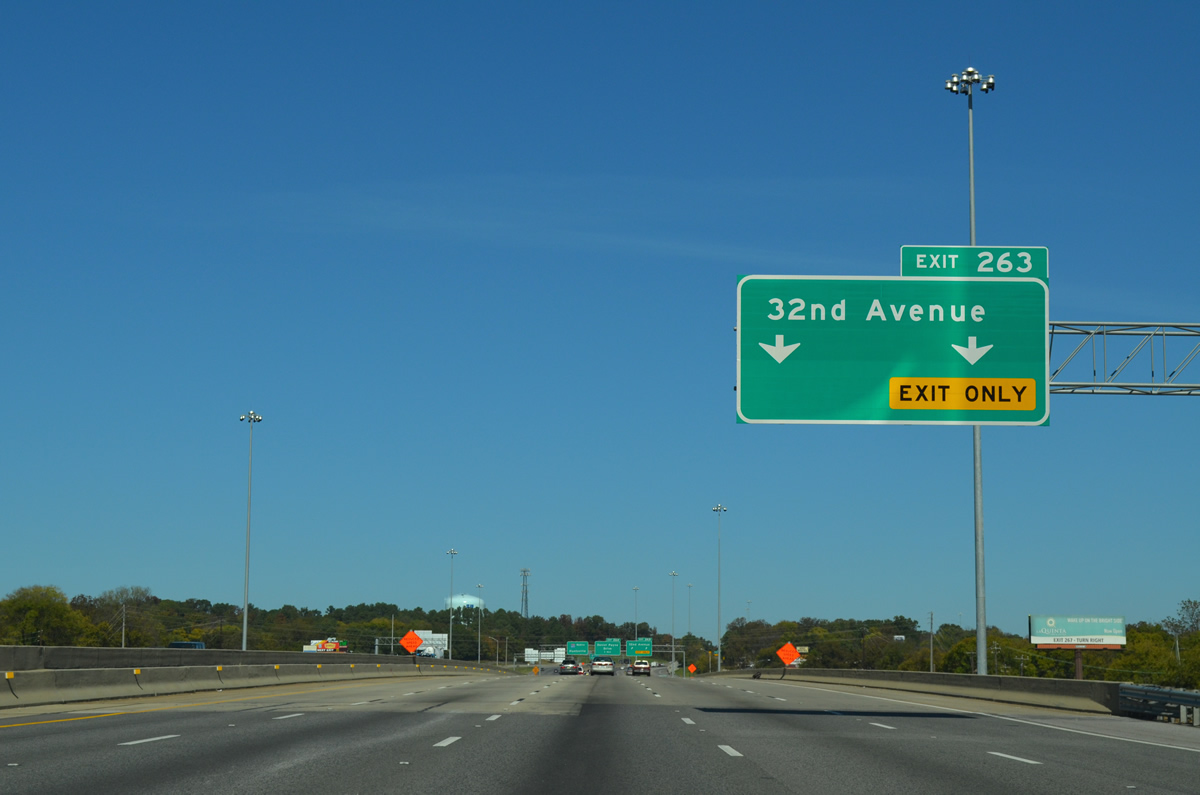
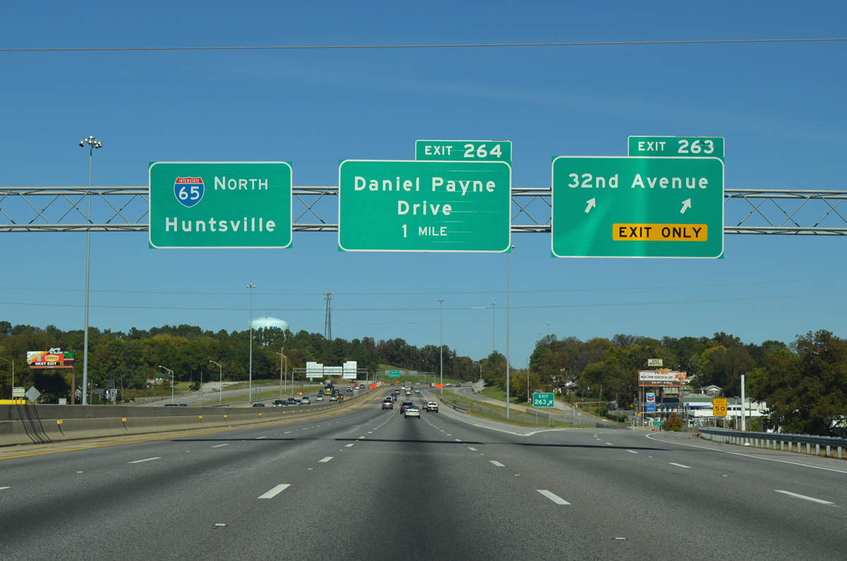
| Exit 263 with 32nd and 33rd Avenues serves the North Birmingham neighborhood of the city next. 10/20/12 |
|
| A split diamond interchange (Exit 263) joins the freeway with the east-west avenues via 18th & 19th Streets N. 10/20/12 |
|
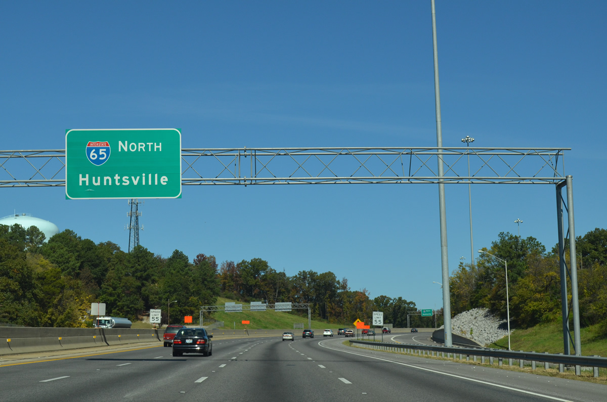
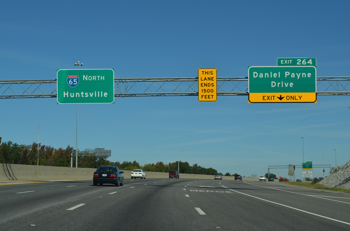
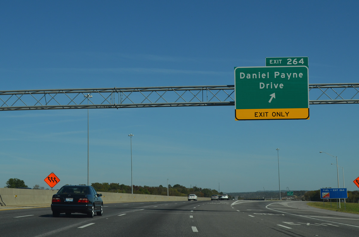
| Interstate 65 climbs from the North Birmingham street grid toward the diamond interchange (Exit 264) with Daniel Payne Drive / 41st Avenue North. This sign bridge was installed in 2011 for the eventual Interstate 22. 10/20/12 |
|
| The final northbound interchange within the city limits of Birmingham joins Intestate 65 with 41st Avenue North east and Daniel Payne Drive west at Exit 264. This east-west roadway serves the Sayreton neighborhood of the city and a busy truck stop to the west. 10/20/12 |
|
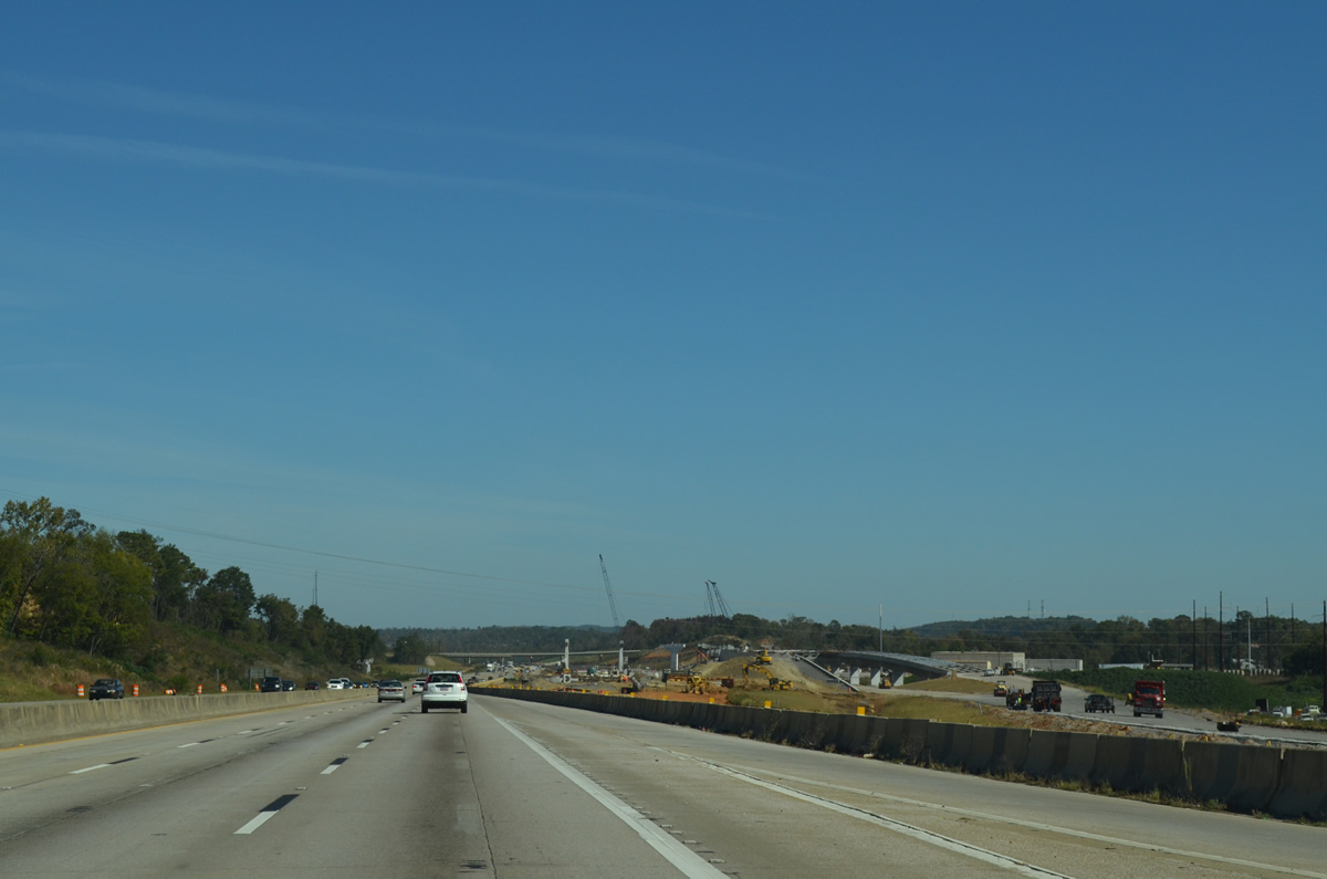
| Exit 266 branches away from Interstate 65 north to Daniel Payne Drive / 41st Avenue North. Daniel Payne Drive ventures west from an industrial park area at Coalburg Road (County Road 77) to U.S. 78 at Pratt City. 10/20/12 |
|
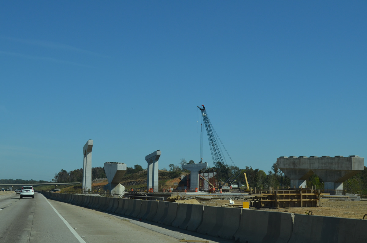
| Looking at construction of the stack interchange for Interstate 22 (Corridor X) by the community of Lewisburg. This exchange was originally planned for an October 2014 completion. Delays however pushed work to spring 2016. 10/20/12 |
|
| Interstate 22 ends at Coalburg Road (Exit 93) presently and will extend east to I-65 and adjacent U.S.31 when the interchange opens. 10/20/12 |
|
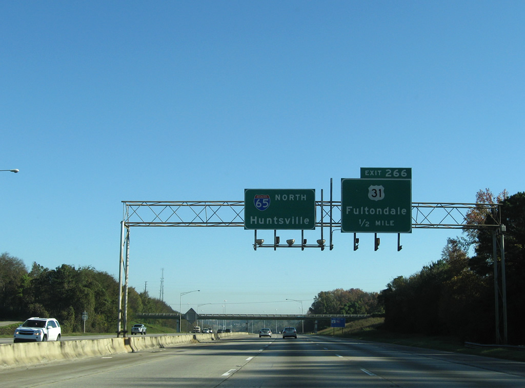
| One half mile south of U.S. 31 (Decatur Highway) near the original 47th Avenue North overpass (replaced by 2011). This junction is one of two to serve the northern suburb of Fultondale. The northbound ramp to U.S. 31 sweeps to the northeast and merges onto U.S. 31 (Decatur Highway) from the right. This configuration is a remnant from when Interstate 65 north defaulted onto Decatur Highway.
Construction related to I-22 expanded I-65 to four overall roadways with c/d lanes leading to and from Exit 266. 11/04/09 |
|
| Interstate 65 ended at U.S. 31 until December 19, 1985 when the 14 mile stretch between Exits 266 and 281 opened to traffic. Traffic was diverted onto U.S. 31 (Decatur Highway) at Fultondale and Gardendale to Warrior until the final section of I-65 in Alabama opened.
This scene changed dramatically through 2016 with a c/d roadway merging onto I-65 at Exit 266. 11/04/09 |
|
| Road work underway between 2011-16 expanded Interstate 65 with two collector distributor roadways to serve Interstate 22 between Daniel Payne Drive and U.S. 31 (Decatur Highway) at Exit 266. 10/20/12 |
|
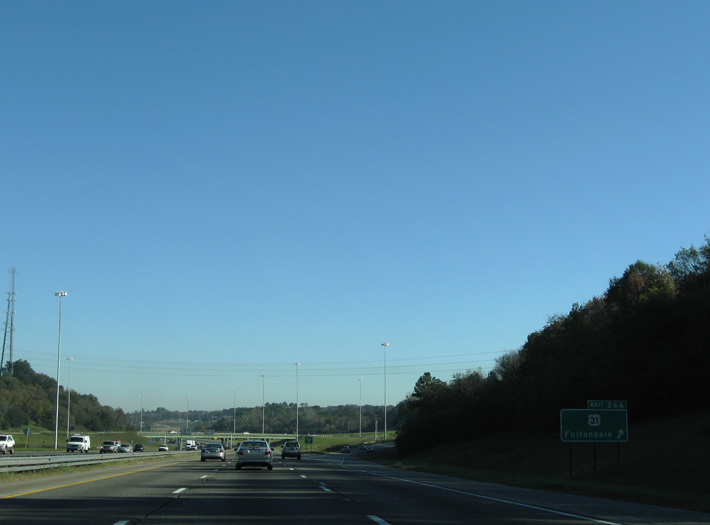
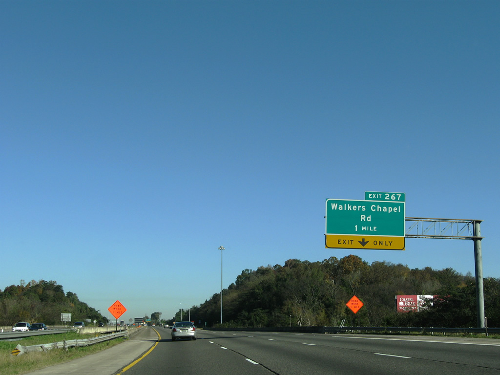
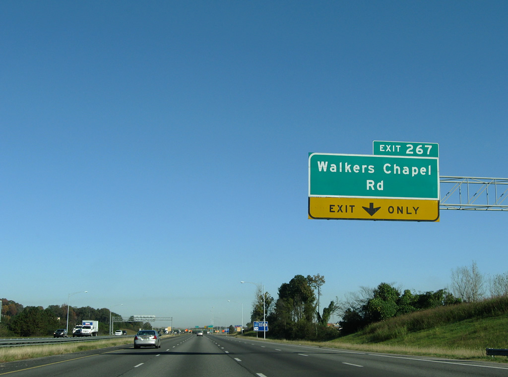
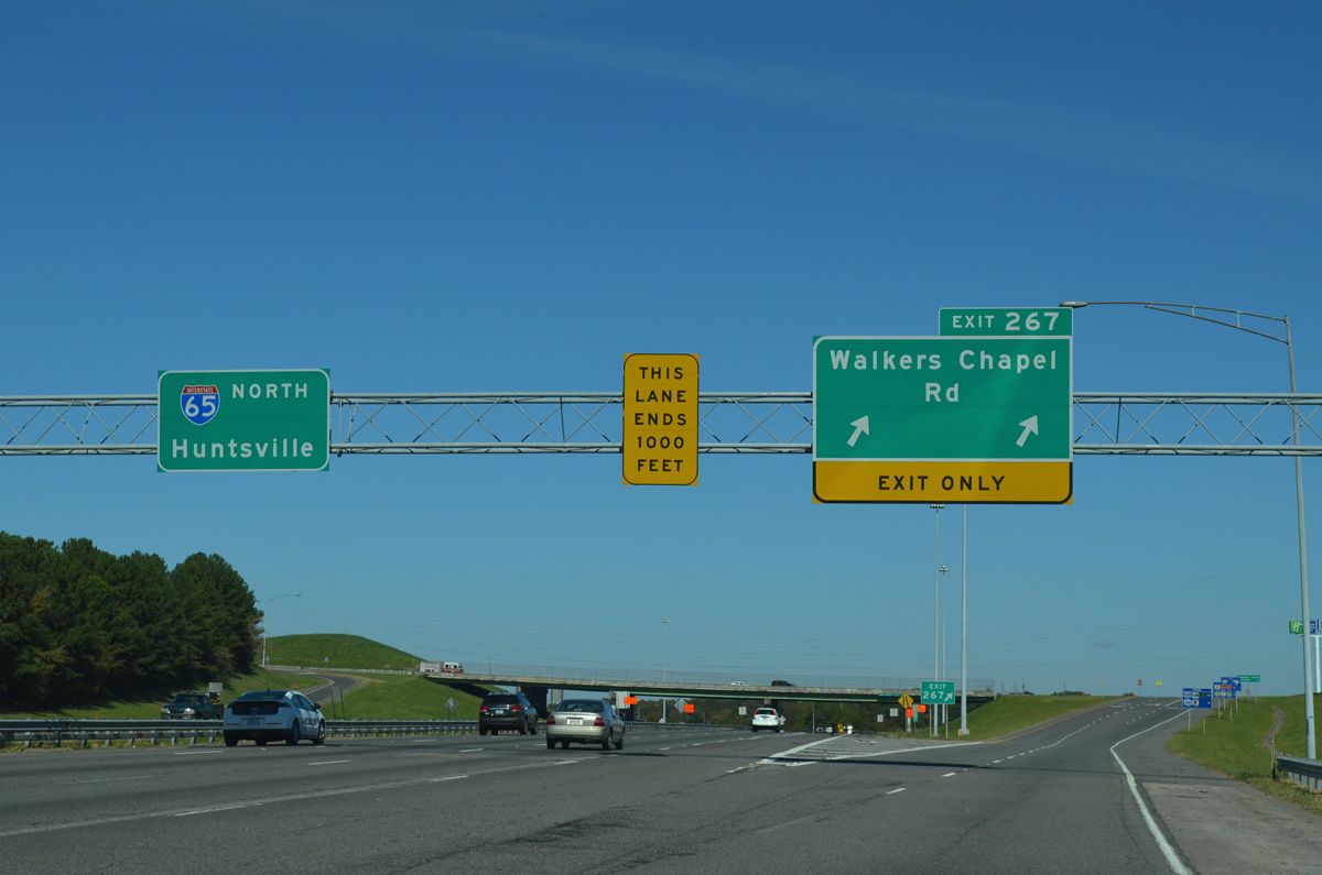
| Traffic from Exit 266 merged onto Interstate 65 northbound adding a fourth auxiliary lane to the freeway. Walkers Chapel Road represents the next interchange (Exit 267) at Glendale, one mile to the north.
Expansion of I-65 through 2016 included new overpasses above Fivemile Creek here and additional lanes. 11/04/09 |
|
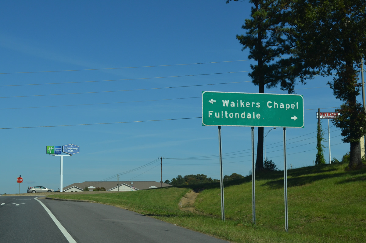
| Walker Chapel Road travels between Upper Coalsburg in north Birmingham to U.S. 31 (Decatur Highway) and Jefferson County 121 (Carson Road) at Fultondale. A parclo interchange with tall grassy berms in the northwest quadrant connects I-65 and the east-west road. 11/04/09 |
|
| Exit 267 carries two lanes to Walkers Chapel Road and Fultondale from Interstate 65 north. Jefferson County 121 angles northeast from U.S. 31 nearby to New Castle as U.S. 31 continues north to Fulton Springs. 10/20/12 |
|
| The next two interchanges of Interstate 65 north serve the city of Gardendale.
This interchange sequence sign was removed by 2015. 11/04/09 |
|
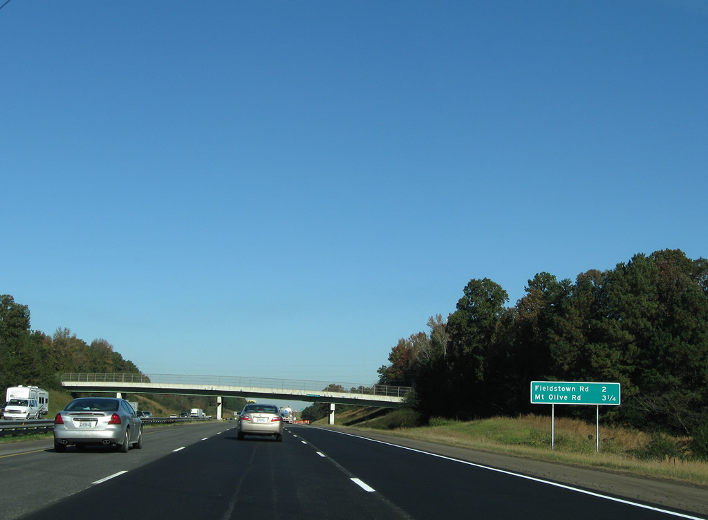
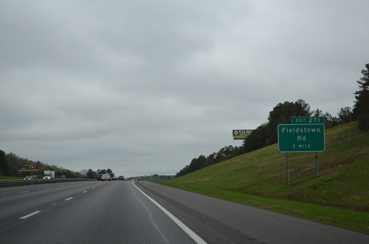
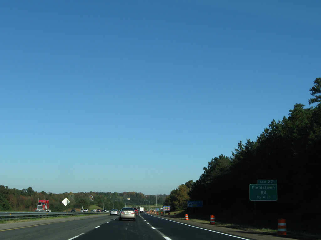
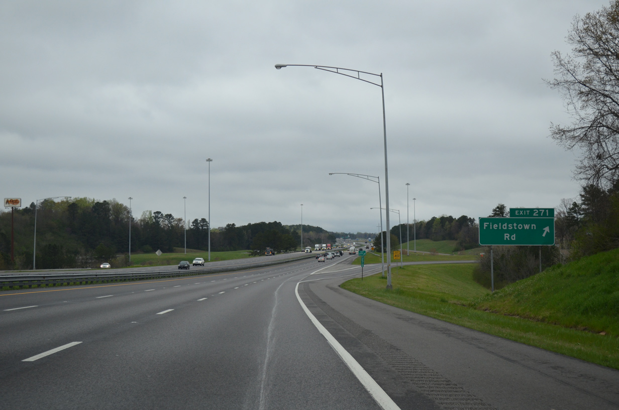
| Jefferson County 118 (Fieldstown Road) meets Interstate 65 at a parclo interchange (Exit 271) in one mile. 04/04/13 |
|
| Entering Gardendale, Interstate 65 approaches the off-ramp (Exit 271) to Fieldstown Road. Fieldstown Road stems west from U.S. 31 (Decatur Highway) to Jefferson County 77 (Coalburg Road) east of Mineral Springs. 11/04/09 |
|
| Northbound at Exit 271 to Jefferson County 118 (Fieldstown Road). County Road 118 serves a bevy of suburban develoment centered around Fieldstown and Easterwood Mountain to the west. The Gardendale city center lies to the east. 04/04/13 |
|
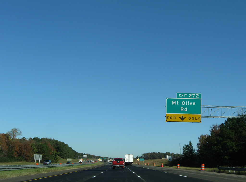
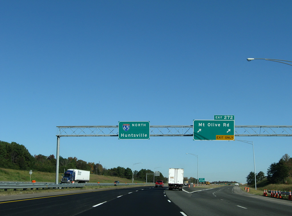
| Interstate 65 continues just one mile to the next exit (Jefferson County 112 / Mt. Olive Road). 11/04/09 |
|
| A fourth northbound lane joins Interstate 65 between Fieldstown Road and the parclo interchange at Exit 272. 11/04/09 |
|
| A two lane off-ramp leaves Interstate 65 north for Jefferson County 112 (Mt. Olive Road) in north Gardendale. County Road 112 meanders west from U.S. 31 (Decatur Highway) to Mt. Olive, Crocker Junction and Brookside. 11/04/09 |
|
| Interstate 65 turns northwest than northeast on the two mile drive to Morris through northern reaches of Gardendale. The future Birmingham Northern Beltline (Interstate 422) will cross paths with the freeway along this stretch. 04/04/13 |
|
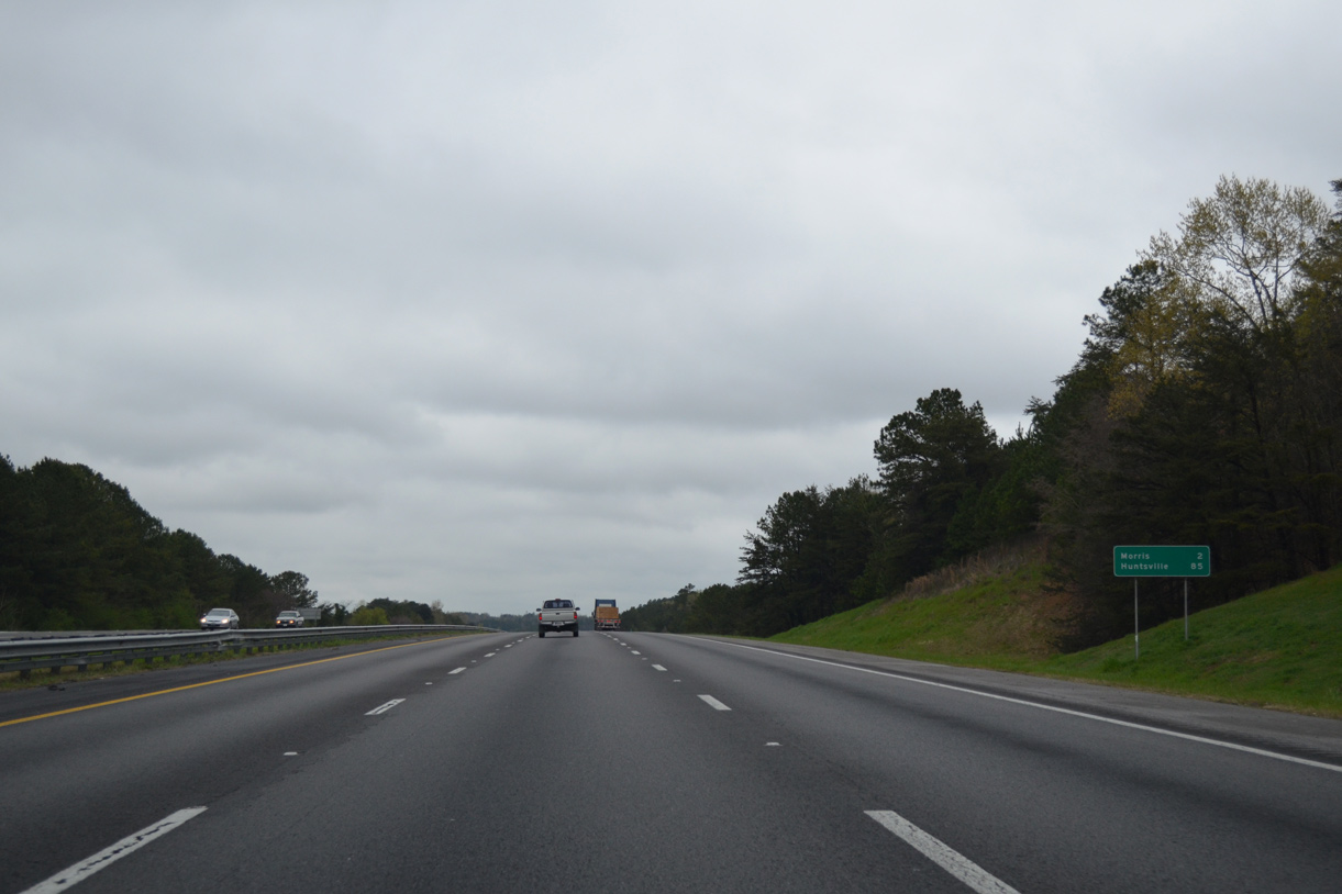
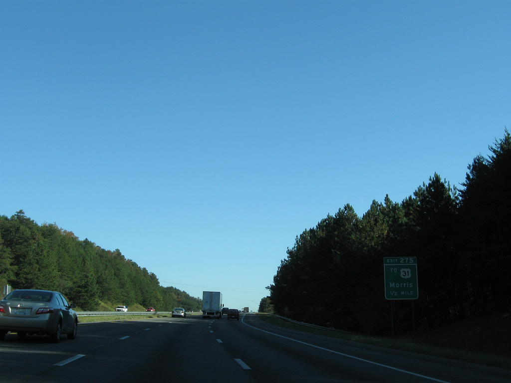
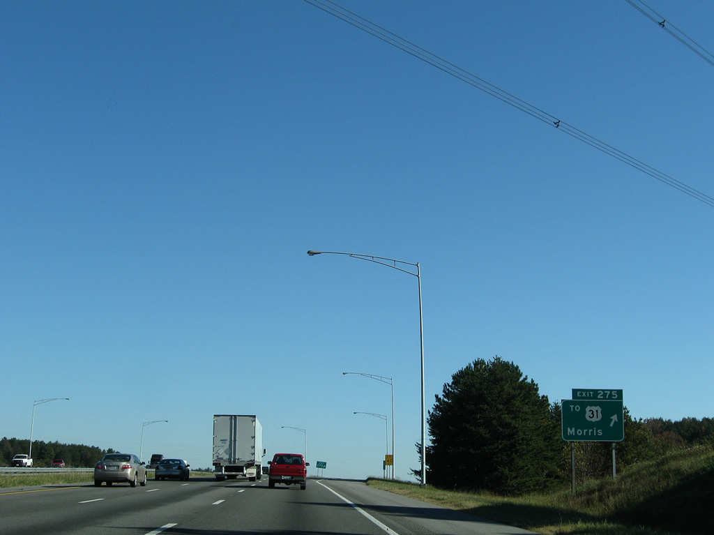
| Mary Buckelew Parkway connects Exit 275 of Interstate 65 north with adjacent U.S. 31 south of Morris. 11/04/09 |
|
| Interstate 65 north at the diamond interchange (Exit 275) with Mary Buckelew Parkway. The parkway sinks southwest to Jefferson County 77 (Mt. Olive Road), north of Mt. Olive. U.S. 31 curves northeast from the parkway to Morris and Kimberly. 11/04/09 |
|
| Mountains in Blount County come into view at this vista along Interstate 65 northbound near Jefferson County 144 (Sardis Road). 11/04/09 |
|
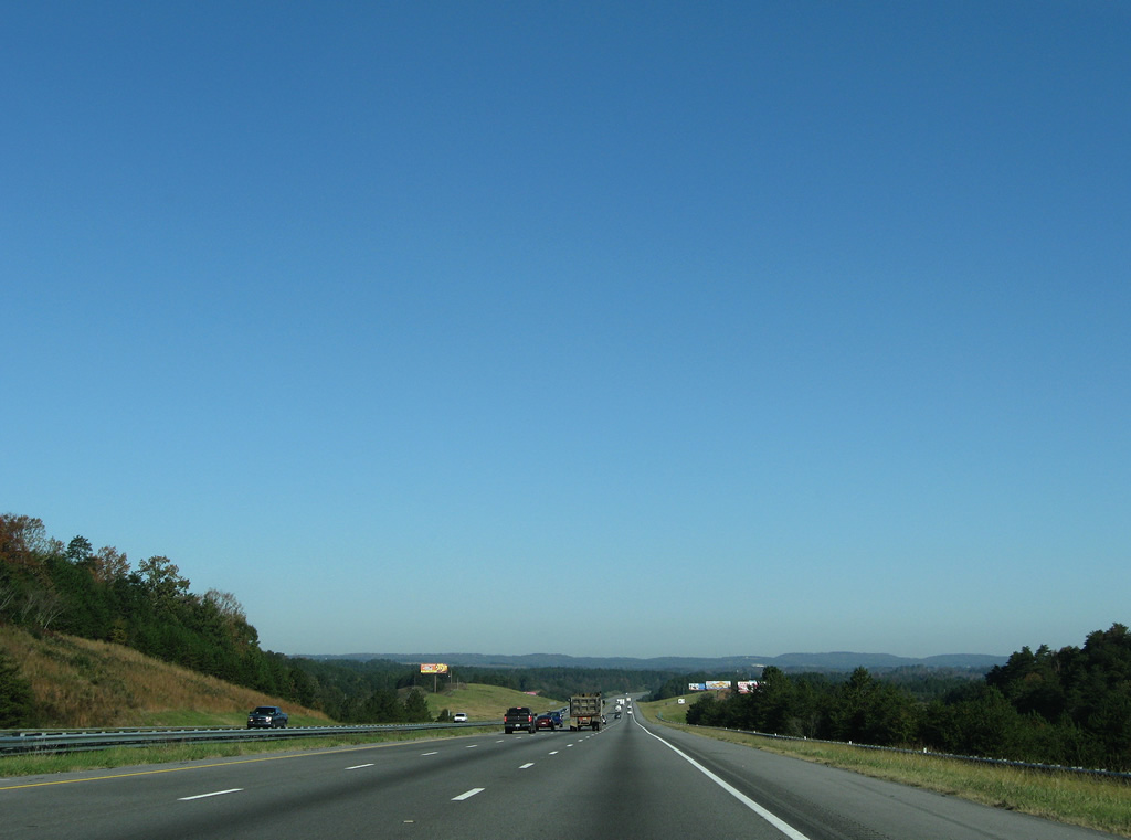
| Six lanes of Interstate 65 cross the Locust Fork of the Warrior River, one mile south of the diamond interchange (Exit 280) with the U.S. 31 connector north of Kimberly. 11/04/09 |
|
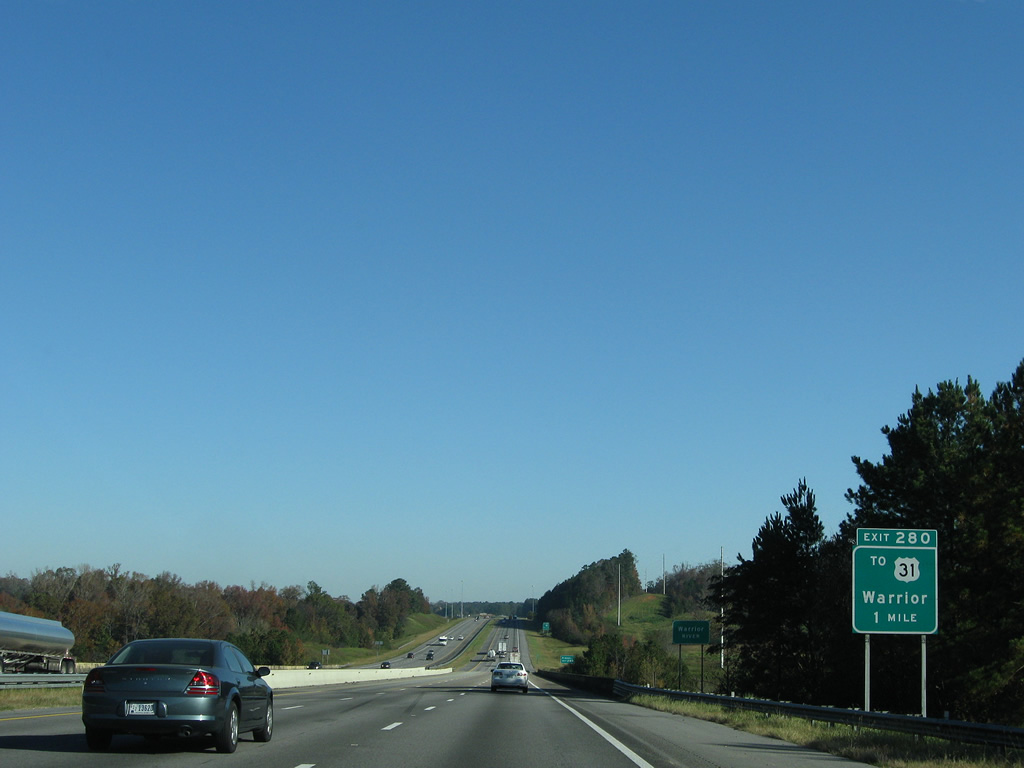
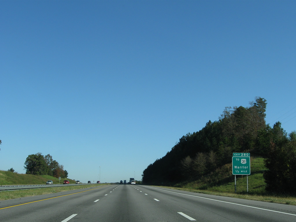
| Interstate 65 shifts from the 1985-completed freeway to the first section of freeway completed in Alabama at Exit 280. A wye interchange originally represented the split of U.S. 31 north to Warrior from the 1959-opened bypass to the west. 11/04/09 |
|
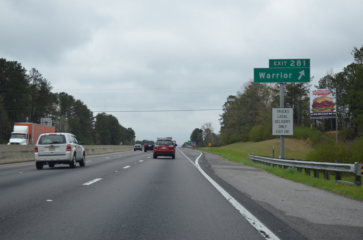
| Exit 281 quickly follows as a folded-cloverleaf interchange between Dana Road and Interstate 65 at Seloca. Dana Road spurs west from U.S. 31 to a pair of subdivisions on the west side of the freeway. 04/04/13 |
|
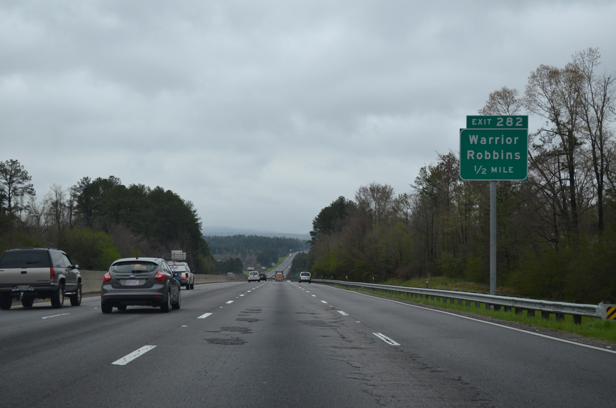
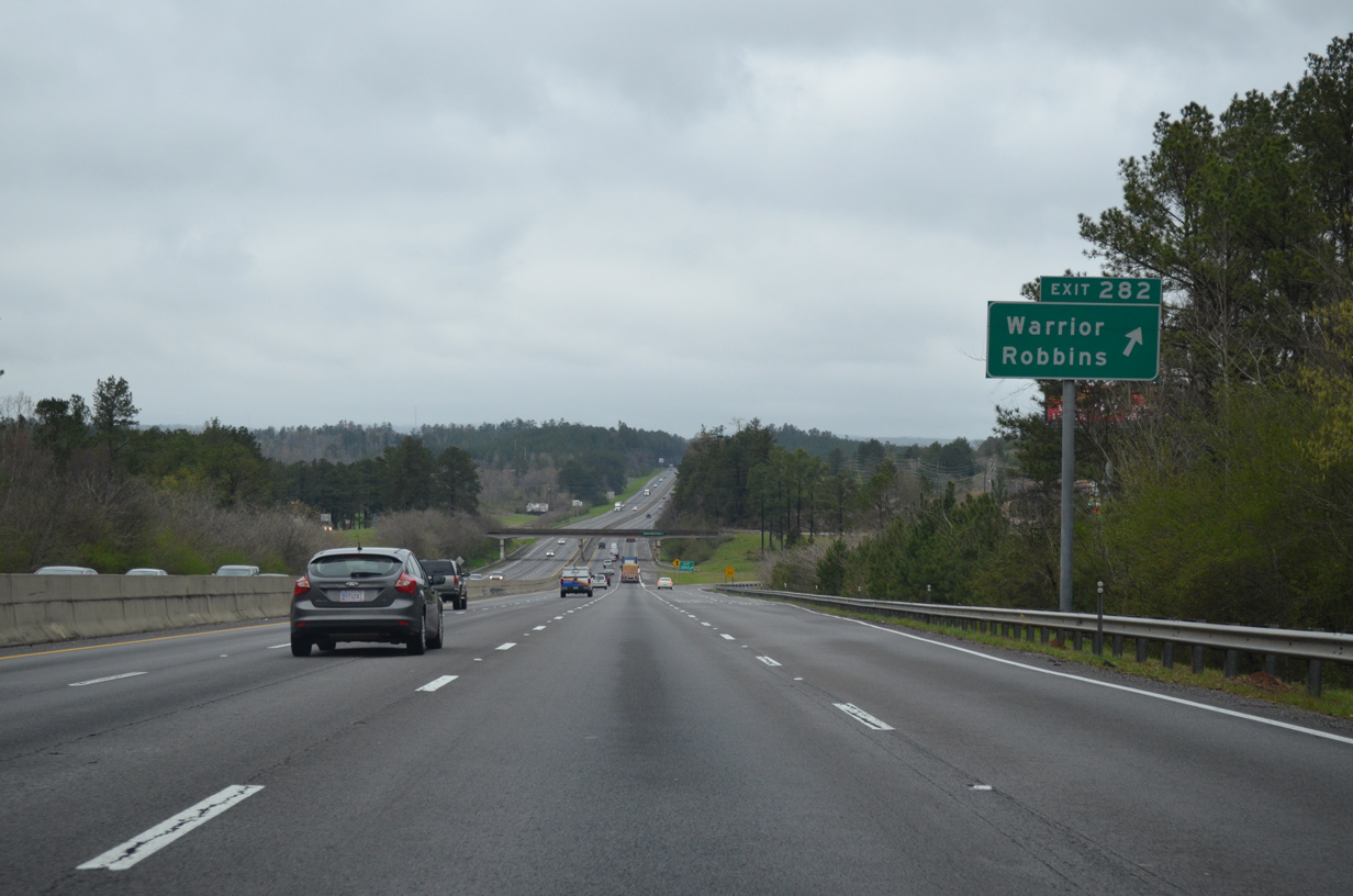
| Interstate 65 again expands to four lanes from Dana Road north to the parclo interchange (Exit 282) with Jefferson County 140. 04/04/13 |
|
| Cane Creek Road leads east from Exit 282 to U.S. 31 (Louisa Street) at Warrior. Jefferson County 140 (Warrior Jasper Road) leads southwest all the way to U.S. 78 near Sumiton. 04/04/13 |
|
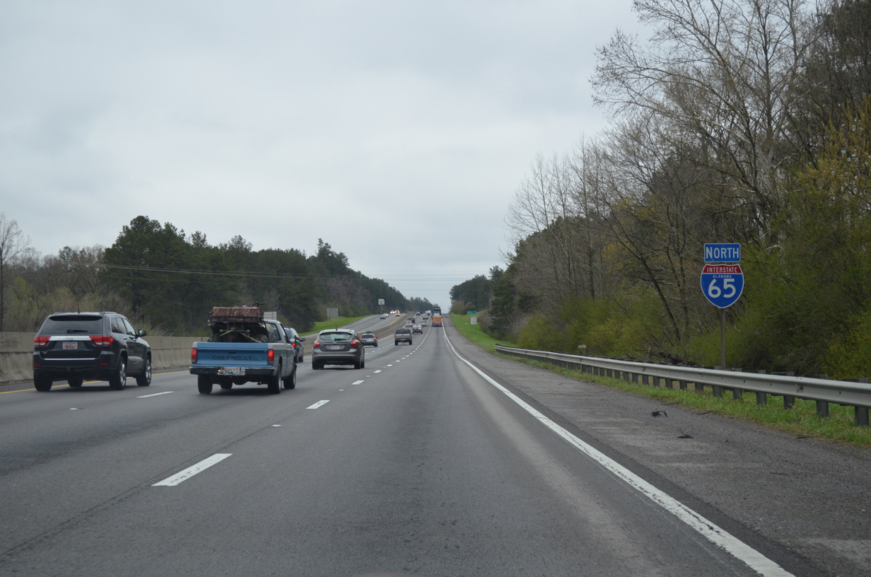
| Leaving the Warrior area, Interstate 65 progresses north across hills to the east of Cane Creek. 04/04/13 |
|
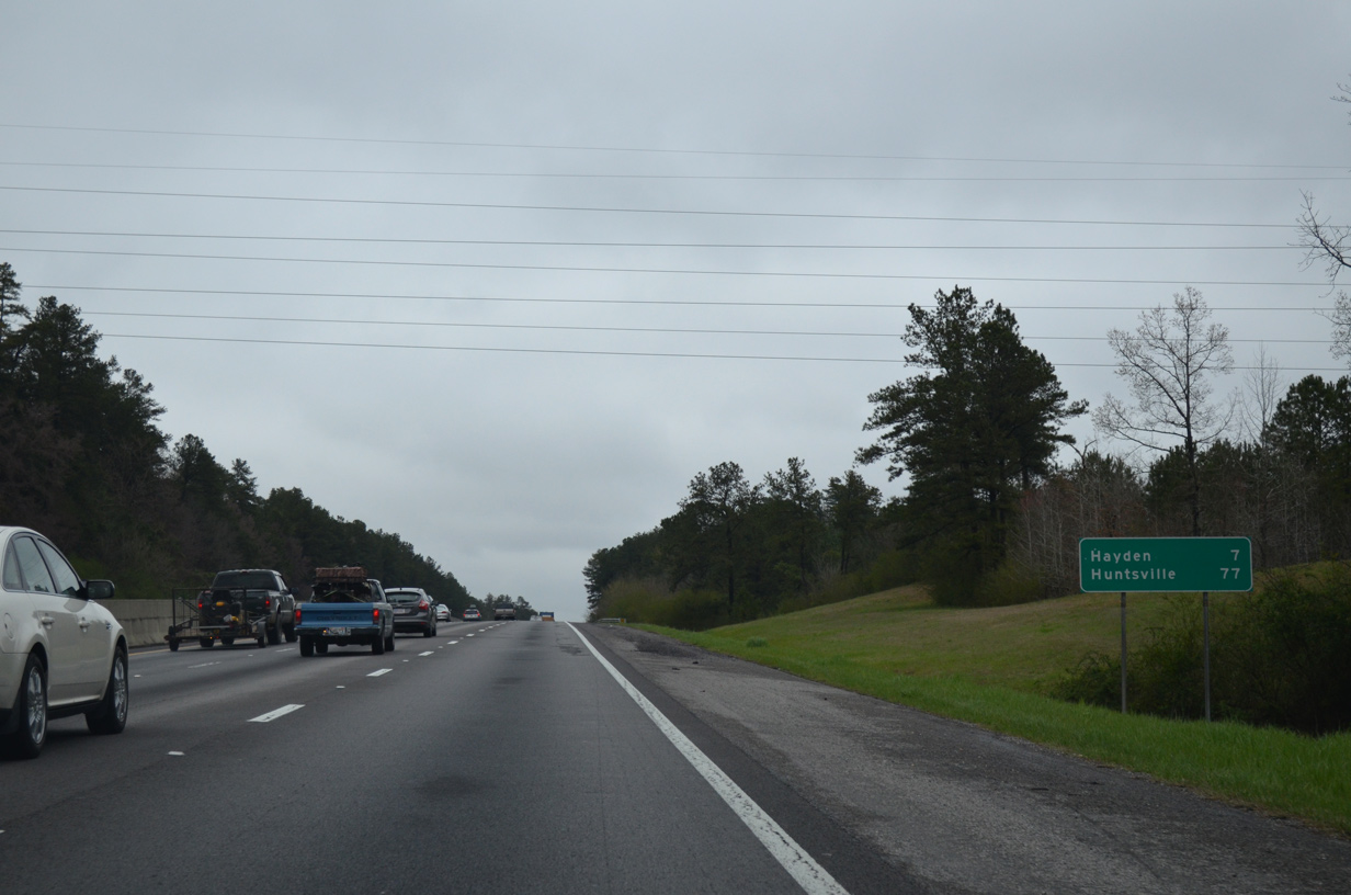
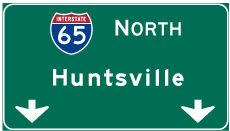
| Huntsville is now 77 miles to the north via I-65 and I-565 east. 04/04/13 |
|
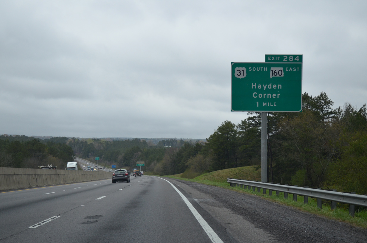
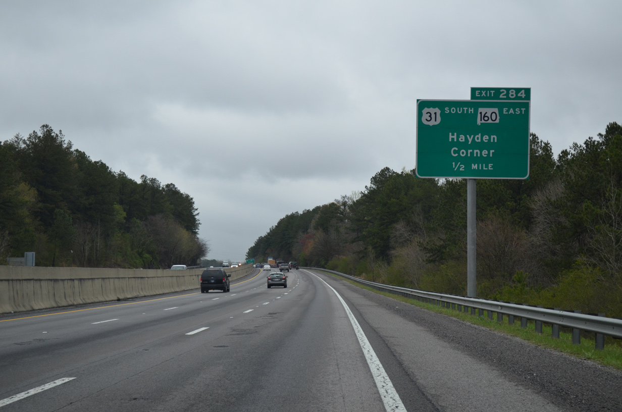
| U.S. 31 leaves Warrior and returns to Interstate 65 at a folded diamond interchange (Exit 284) with SR 160. 04/04/13 |
|
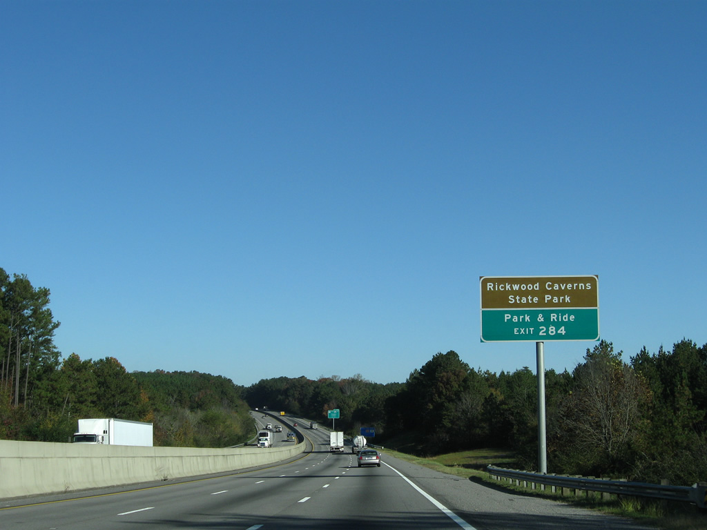
| Blount County Route 8 (Skyline Drive) ties into the west side of Exit 284 at an industrial park. CR 8 arcs northwest to Rickwood Caverns Road for interests to the state park. 11/04/09 |
|
| U.S. 31 combines with SR 160 adjacent to a park & ride facility before turning west to merge onto Interstate 65 at Exit 284. SR 160 travels northeast five miles to Hayden and 22 miles overall to U.S. 231 at Cleveland. 04/04/13 |
|
| Interstate 65 crosses the Blount County line just ahead of the off-ramp (Exit 284) to U.S. 31 south & SR 160 east. 04/04/13 |
Page Updated 02-22-2016.

 North
North