|
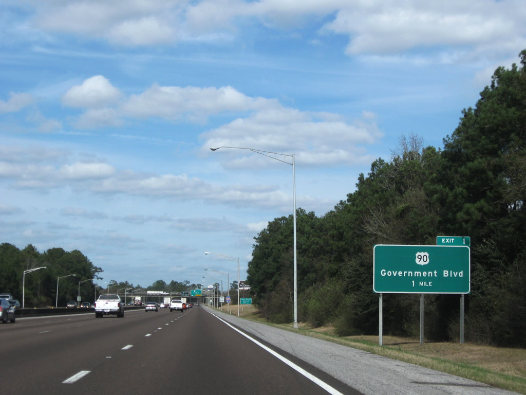
| Traveling north from the three wye interchange with I-10, Interstate 65 advances one mile to U.S. 90 (Government Boulevard). Exit 1 serves the Cottage Hill and Midtown sections of Mobile in addition to Henry Aaron Stadium, the previous home of the Mobile Baybears AA Baseball franchise. 01/23/09 |
|
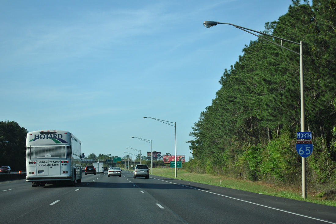
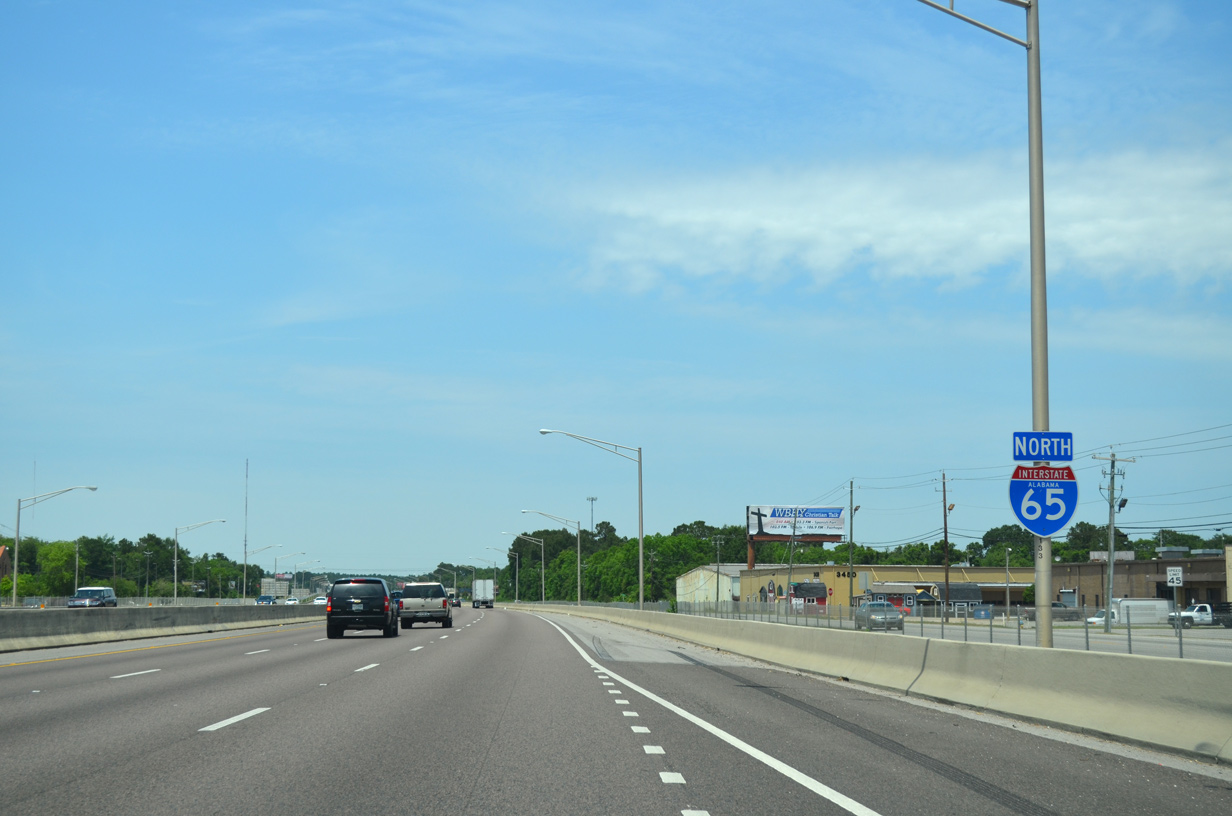
| The first I-65 confirming marker for the 887 mile long route north to Gary, Indiana stands midway between I-10 and the Halls Mill Road overpass in Mobile. Locally known as the Belt Line Highway, I-65 throughout Alabama is also the Heroes' Highway and a part of the Purple Heart Trail. 03/18/12 |
|
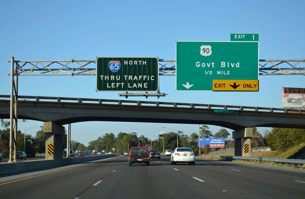
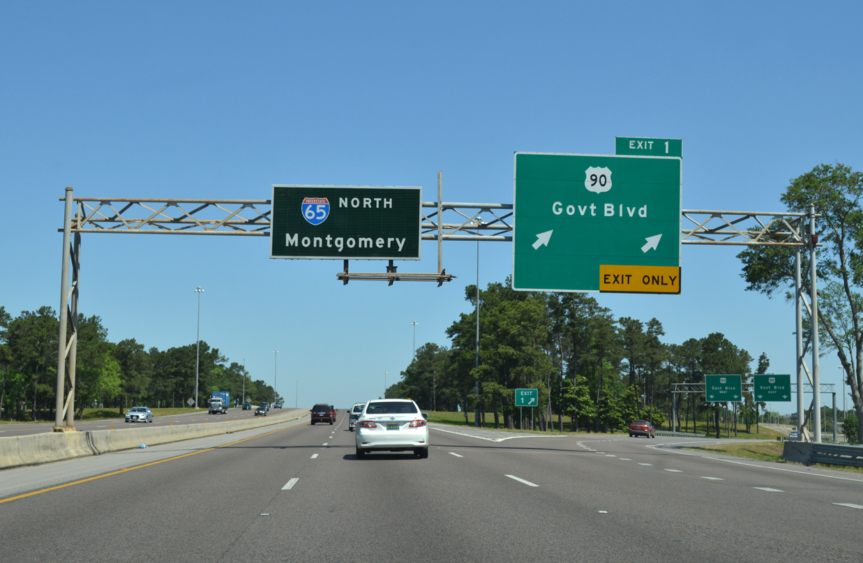
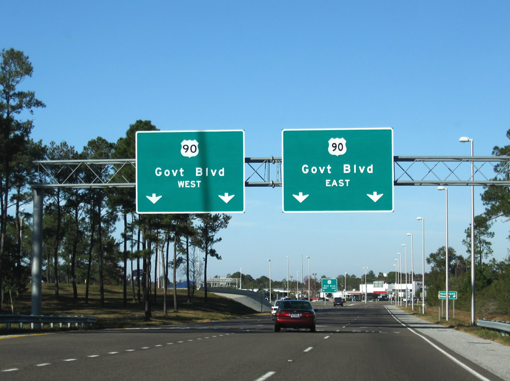
| A lane drop occurs along I-65 north at the six-ramp parclo interchange (Exit 1) with U.S. 90 (Government Boulevard). U.S. 90 constitutes a commercial arterial west to Tillman's Corner and Theodore and east to SR 163 (Dauphin Island Parkway) and Airport Boulevard at the Carlen and Rickarby neighborhoods. 11/21/14 |
|
| Construction in 2003-04 redesigned the cloverleaf interchange joining I-65 with U.S. 90 to eliminate weaving traffic. Exit 1B for U.S. 90 west closed on February 8, 2004 as Exit 1A was redesigned to link with both directions of Government Boulevard. 05/06/16 |
|
| Two lanes separate from I-65 north for U.S. 90 at Exit 1. The off-ramp expands to four lanes ahead of Government Boulevard at the west end of the "Mobile Motor Mile", a commercialized strip lined with car dealerships. 11/21/08 |
|
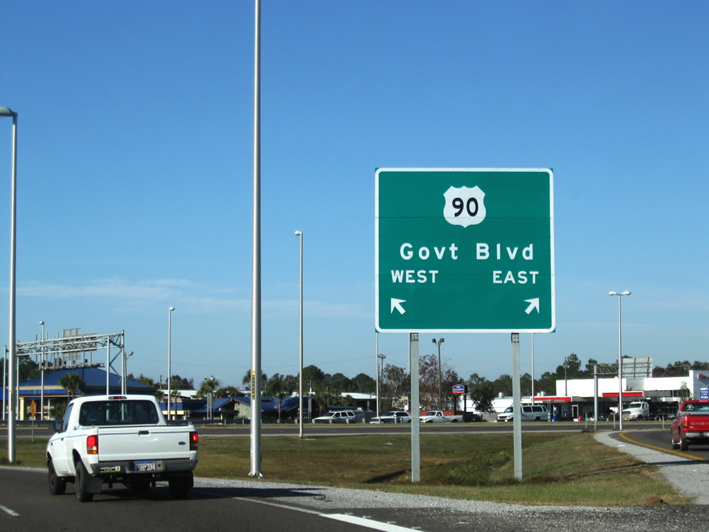
| U.S. 90 constitutes a commuter route linking Midtown Mobile with Skyland Park, Crestview and other neighborhoods west of I-65. Connections with Lakeside Drive and the I-65 Service Roads link with Cottage Hill Road, a major arterial to West Mobile. 11/21/08 |
|
| Interstate 65 generally travels above the adjacent Service Roads from U.S. 90 north to U.S. 98 (Spring Hill Avenue). The elevated roadway crosses over Cottage Hill Road beyond the second reassurance marker northbound. 11/21/14 |
|
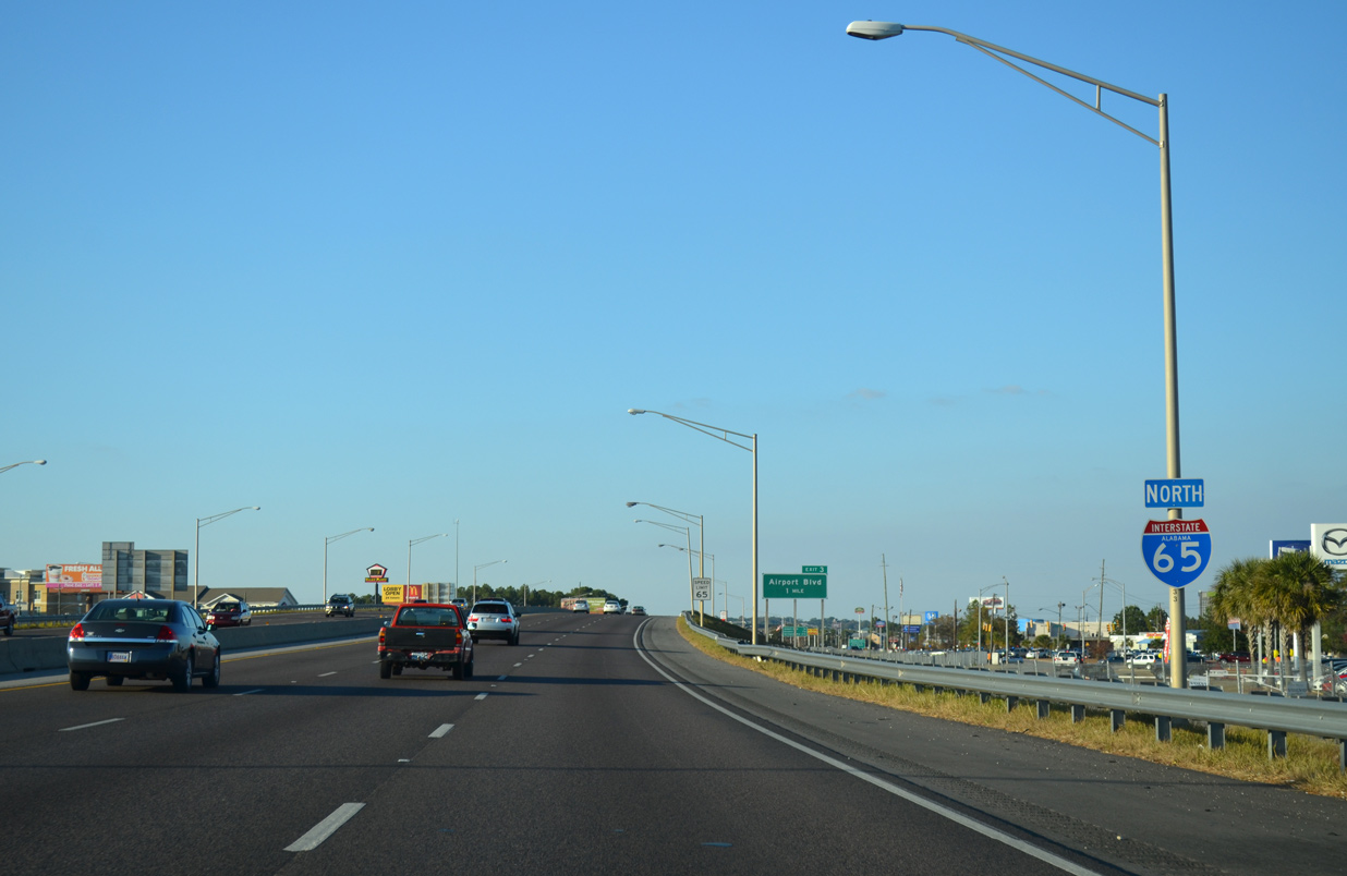
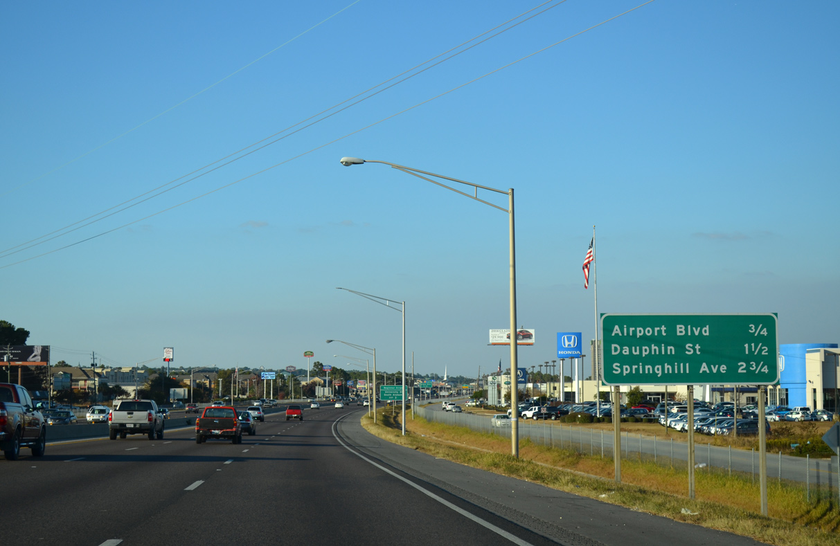
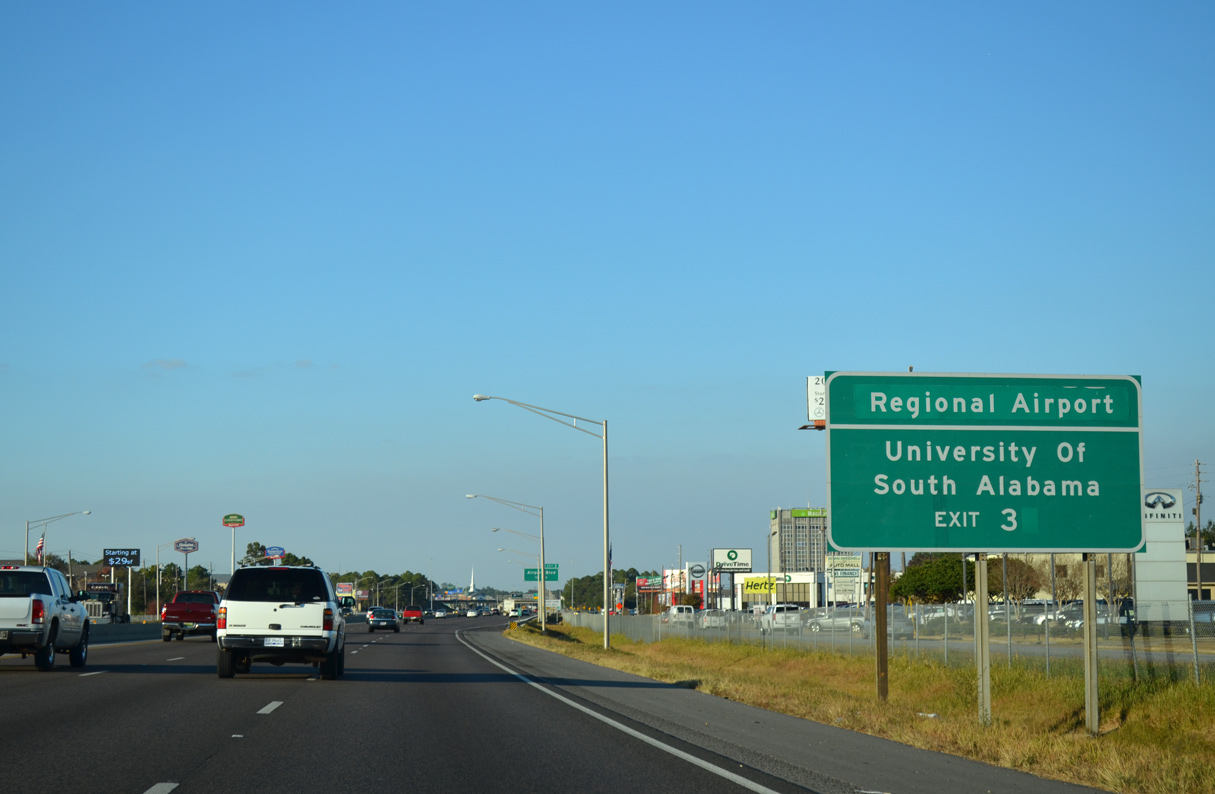
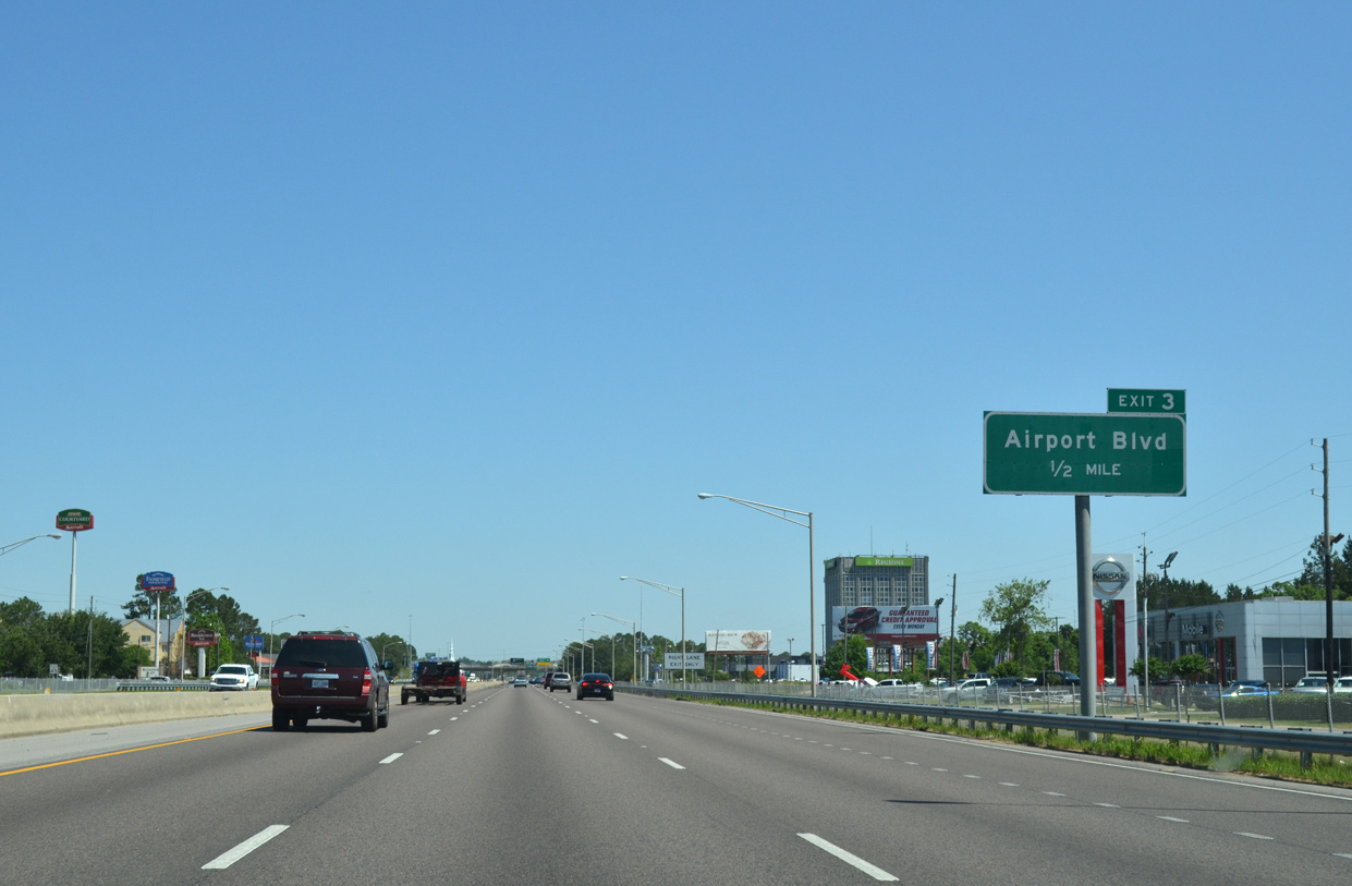
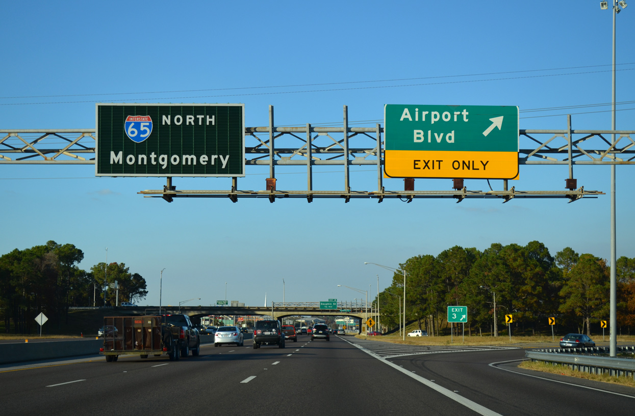
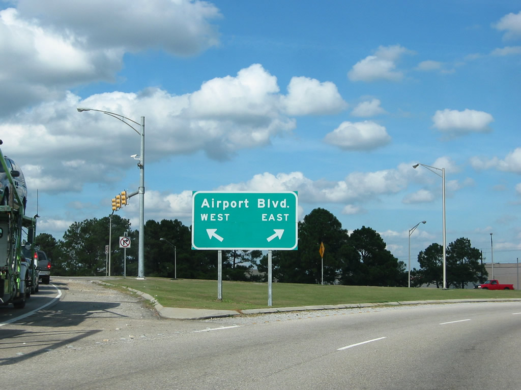
| The ensuing exit is the six-ramp parclo interchange (Exit 3) with Airport Boulevard by the Shoppes at Bel Air Mall. 11/21/14 |
|
| Airport Boulevard is the first of three arterials connecting with Interstate 65 with the Spring Hill, Tacon, Crichton and Forest Hill communities in Mobile. 11/21/14 |
|
| Airport Boulevard travels west 2.5 miles to University Boulevard, which heads north to the University of South Alabama (USA) campus, and 7.2 miles to Air Terminal Drive at Mobile Regional Airport (MOB). 11/21/14 |
|
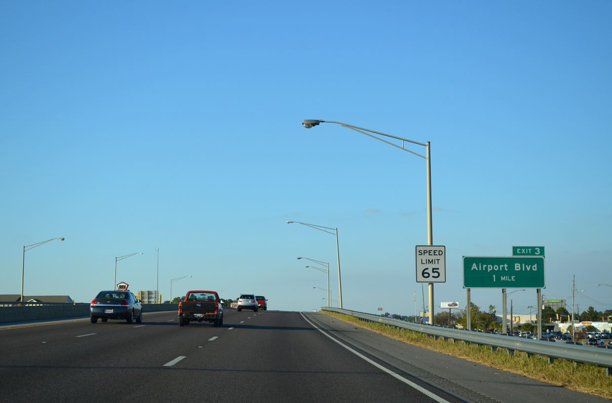
| A second lane for Airport Boulevard at Exit 3 from I-65 northbound was removed in 2009. 05/06/16 |
|
| Airport Boulevard constitutes a heavily traveled commercial arterial west from Midtown Mobile and Interstate 65 to Schillinger Road and Mobile Regional Airport (MOB) in West Mobile. 11/21/14 |
|
| The ramp at Exit 3 expands to four lanes ahead of the commercial strip along Airport Boulevard. Airport Boulevard (CR 56) extends from West Mobile and the Seven Hills Area to MS 614 ahead of Hurley. 10/30/03 |
|
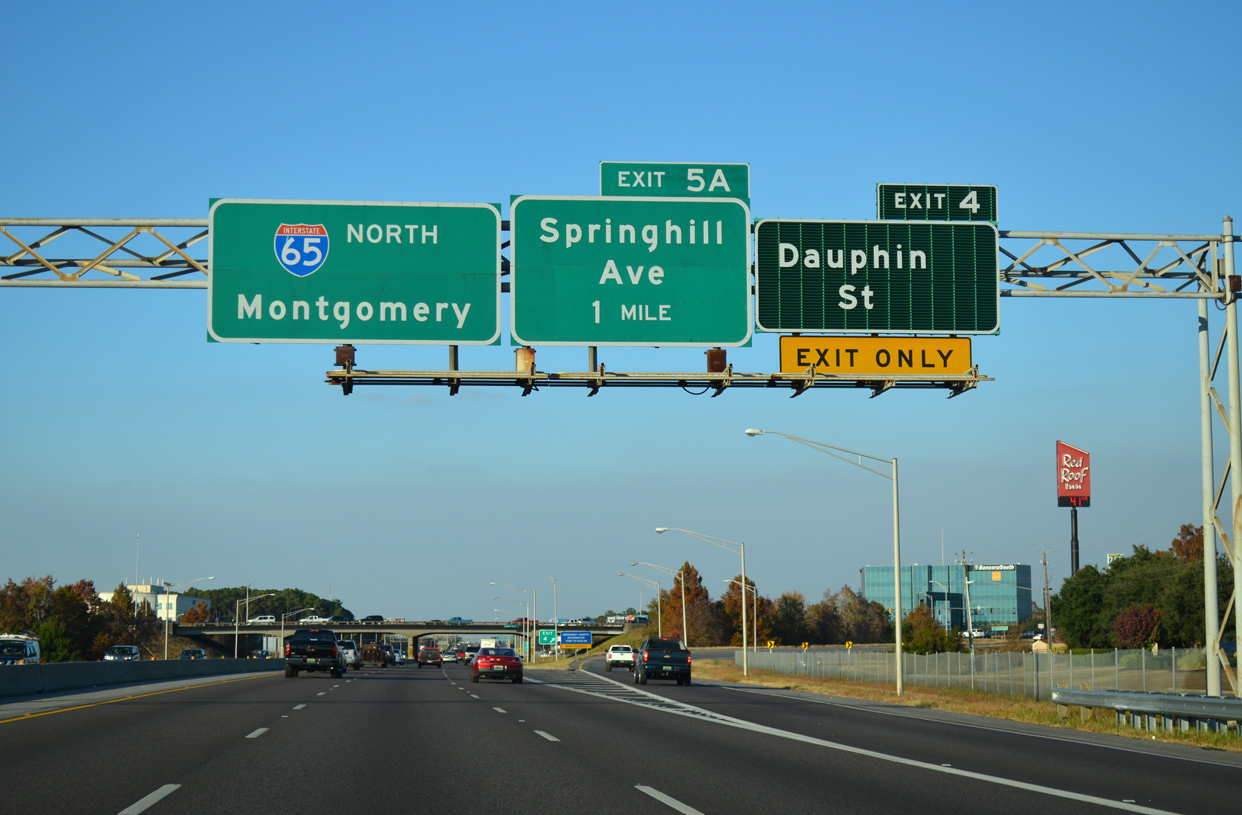
| A loop ramp formerly departed from I-65 north for Airport Boulevard west, 0.75 miles ahead of the exchange with Dauphin Street (Exit 4). 11/21/14 |
|
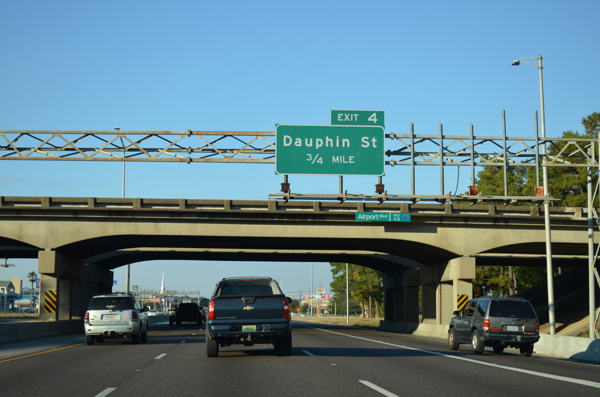
| Commercialized frontage lines both sides of I-65 along the Belt Line Highway northward to Dauphin Street (Exit 4). 05/06/16 |
|
| Dauphin Street constitutes a multi lane arterial west to Spring Hill College and McGregor Avenue at Country Club Estates and east to Florida Street at the Carlen community. 05/06/16 |
|
| Exit 4 leaves northbound I-65 to Dauphin Street. Dauphin Street was extended west from the Belt Line Highway to McGregor Avenue in the 1970s. 11/21/14 |
|
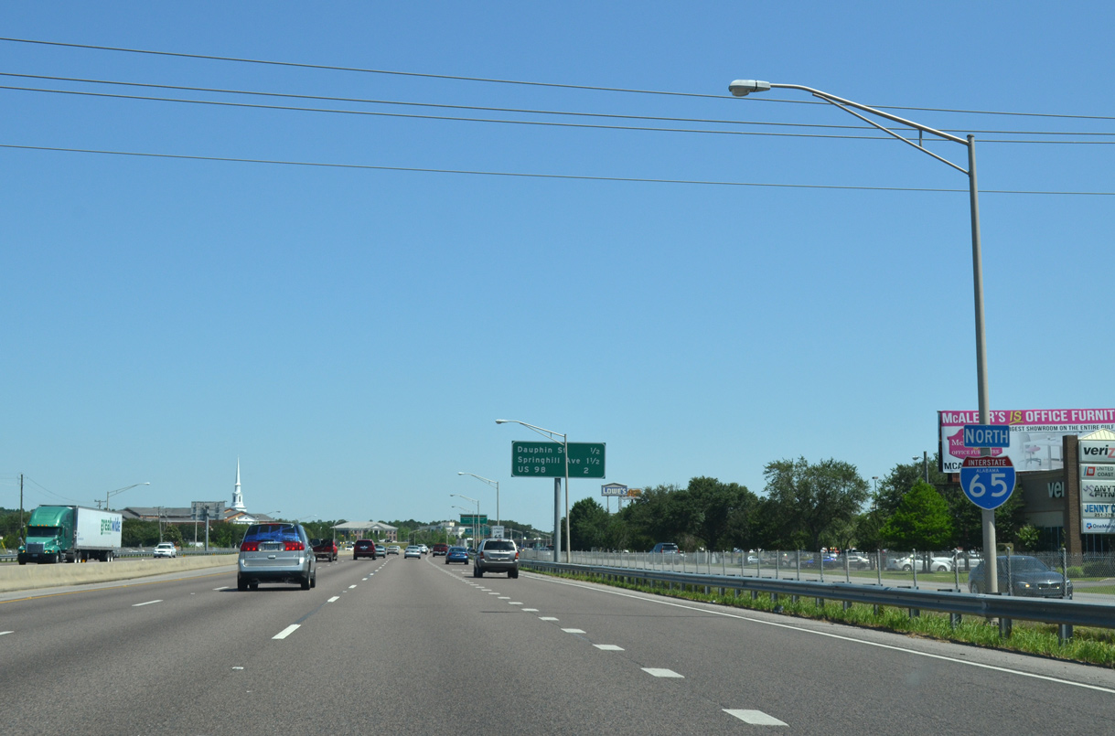
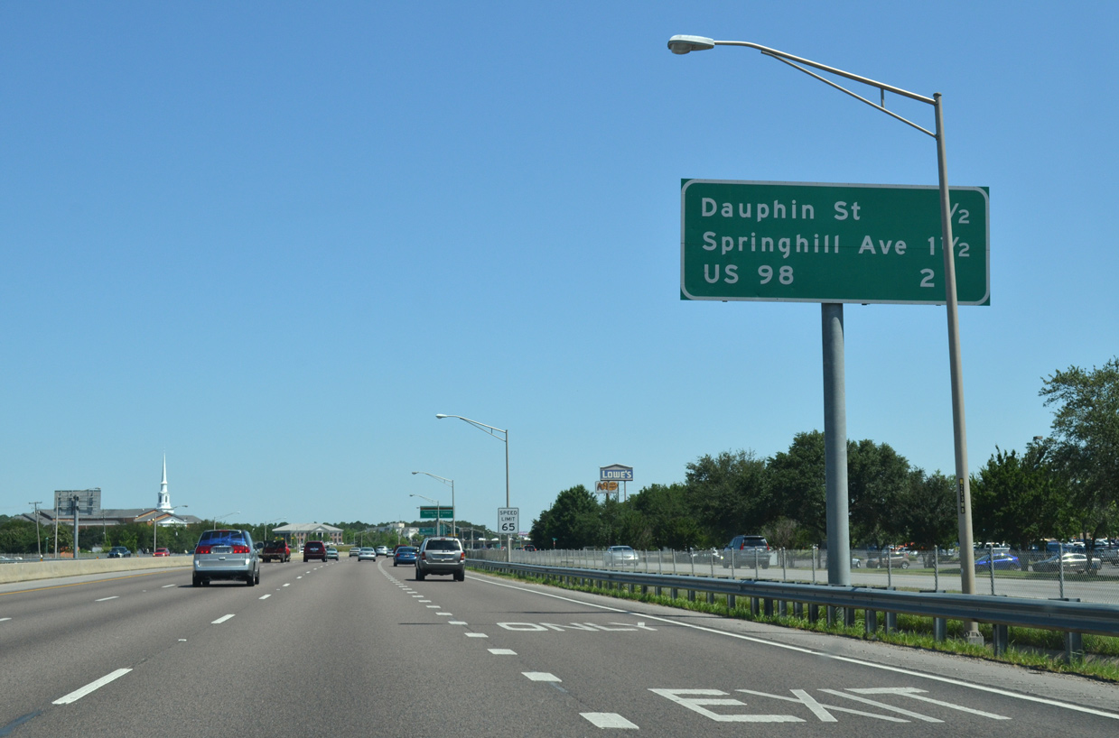
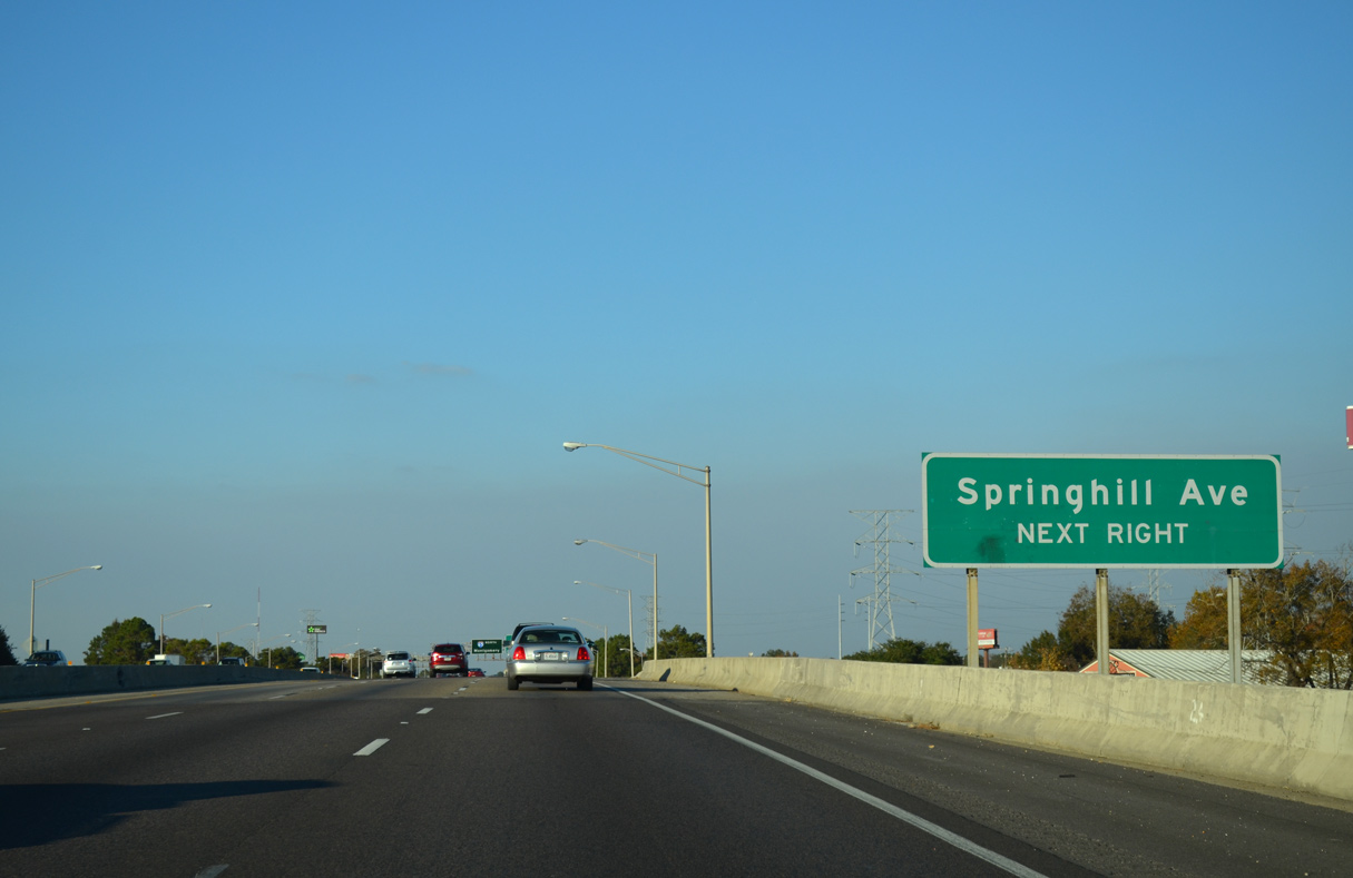
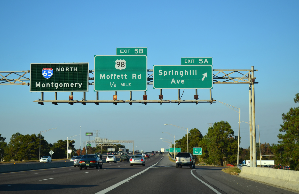
| Interstate 65 continues a half mile north to a parclo interchange (Exit 5A) with Spring Hill Avenue at the College Park neighborhood. 11/21/14 |
|
| Interstate 65 spans Old Shell Road beyond this shield assembly. The I-65 Service Roads link forthcoming Spring Hill Avenue (Exit 5A) with Old Shell Road, an arterial heading west to Spring Hill College and the University of South Alabama (USA). 11/21/14 |
|
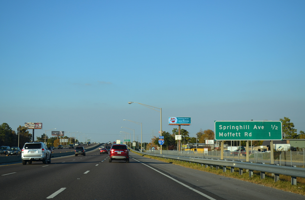
| Spring Hill Avenue branches west from U.S. 98 (Moffett Road) to the Parkhill neighborhood and Langan Park by the Mobile Museum of Art. Zeigler Boulevard extends the road to Tanner Williams Road (CR 70) in West Mobile. 11/21/14 |
|
| Exit 5A lowers from I-65 to Spring Hill Avenue. Spring Hill Avenue east merges with U.S. 98 (Moffett Road) through the Crichton area. U.S. 98 follows Spring Hill Avenue east to U.S. 90 (Broad Street) outside Downtown Mobile. 11/21/14 |
|
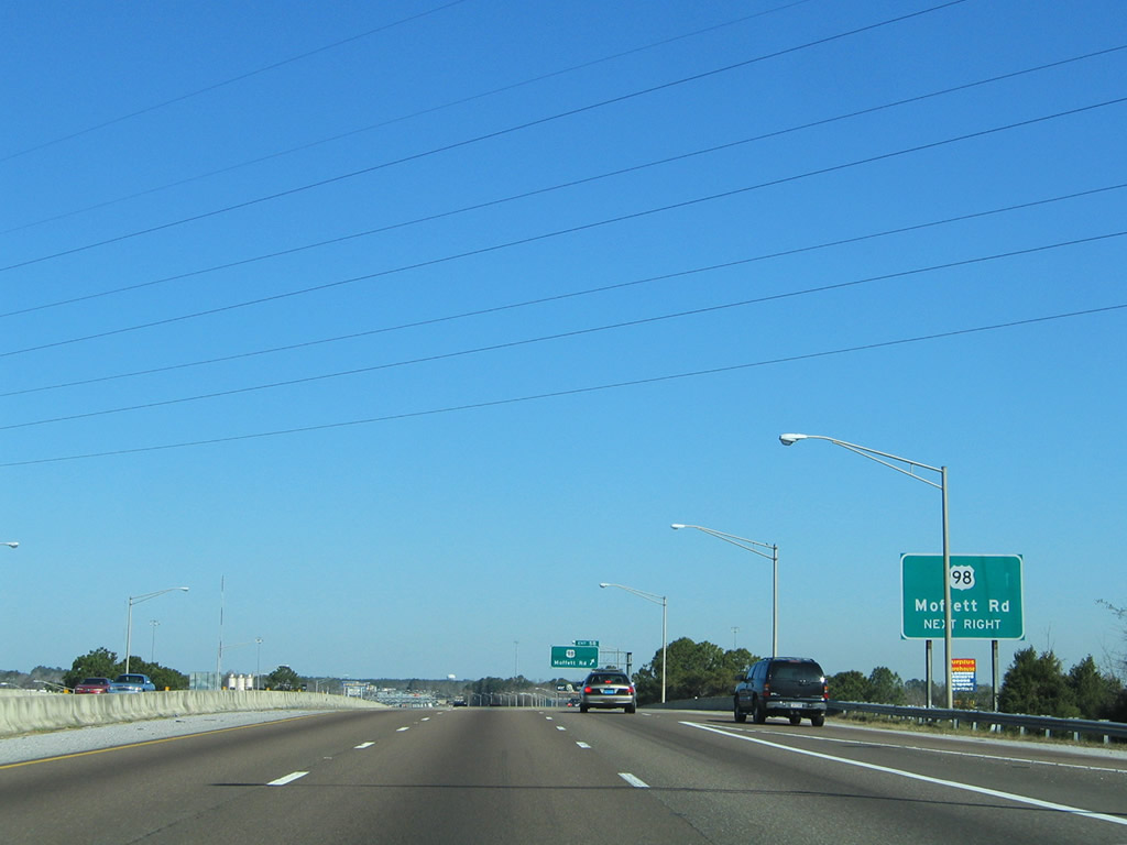
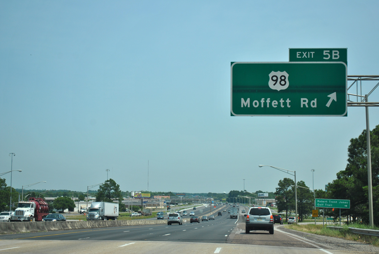
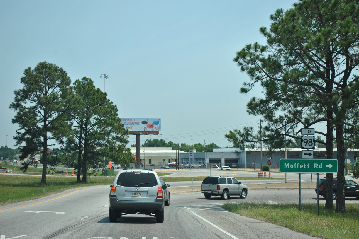
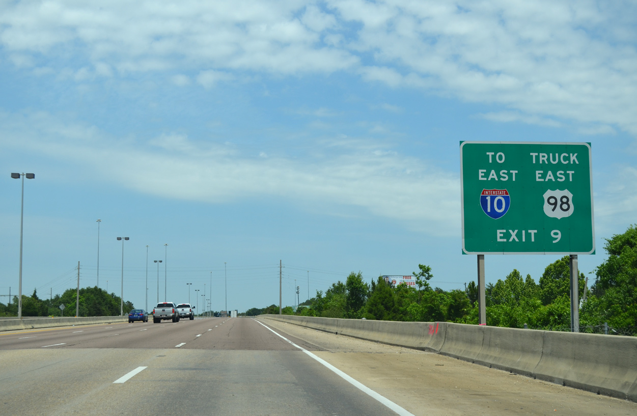
| U.S. 98 (Moffett Road) crosses paths with Interstate 65 adjacent to a CN Railroad and Threemile Creek at Exit 5B. U.S. 98 travels northwest from Mobile to Semmes and Wilmer, connecting Mobile with Lucedale and Hattiesburg, Mississippi. 02/08/06 |
|
| A folded diamond interchange (Exit 5B) joins I-65 with U.S. 98 via the adjacent service roads. 05/05/12 |
|
| U.S. 98 will eventually shift northward from Moffett Road onto a new four lane highway from I-65 at Exit 13 and SR 158 west to George County, Mississippi. Delayed due to funding issues for over a decade, construction on the new alignment runs through 2023. 05/05/12 |
|
| Confirming marker posted northbound ahead of the Greenmound neighborhood in Mobile. 05/15/16 |
|
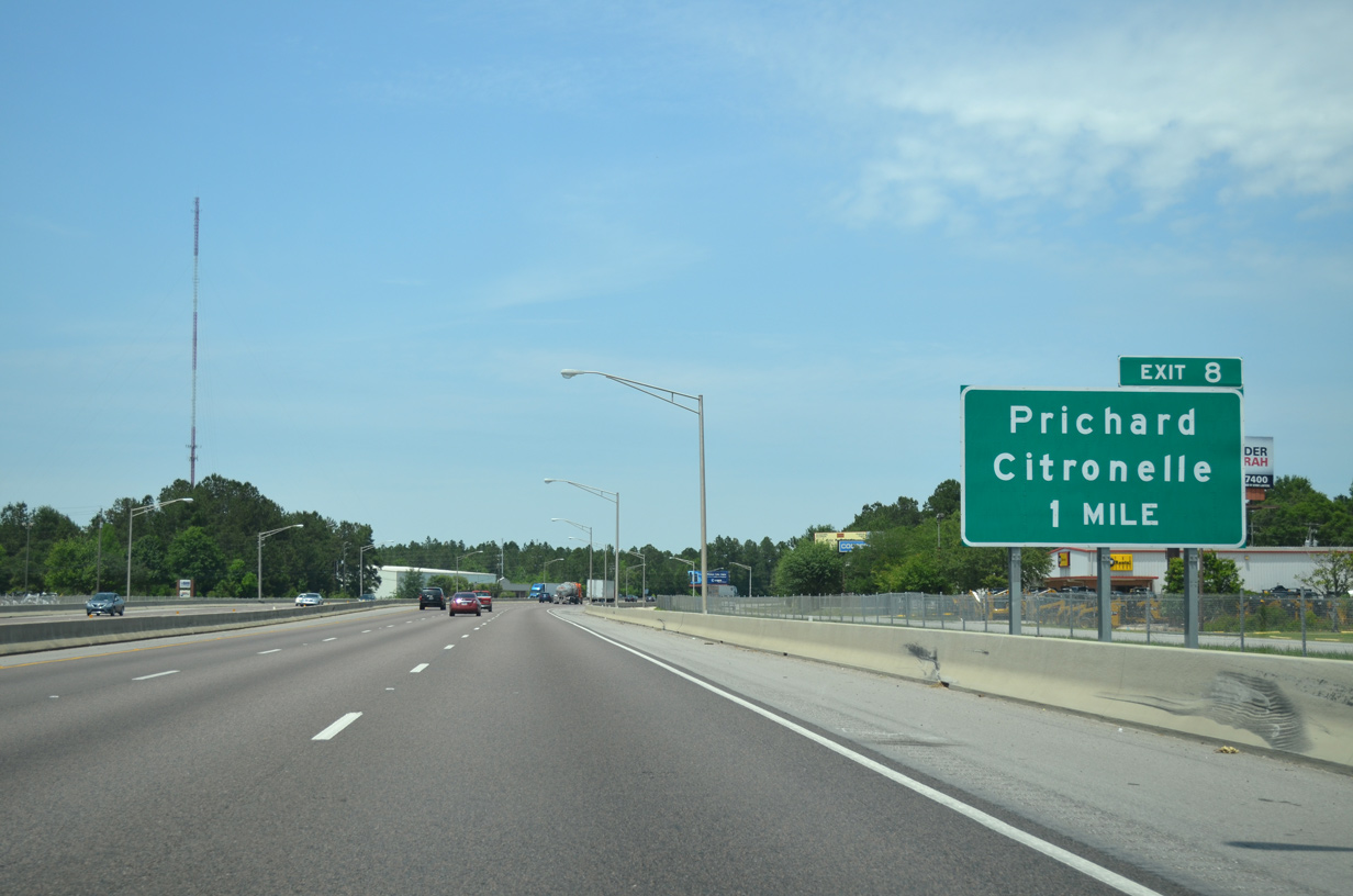
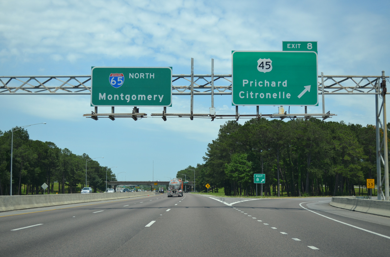
| Posted in 2007, the initial sign for Exit 8 omits U.S. 45 (St. Stephens Road) along I-65 northbound. Road work completed in 2005 reconfigured Exit 8 from a cloverleaf into a six-ramp parclo interchange. 05/15/16 |
|
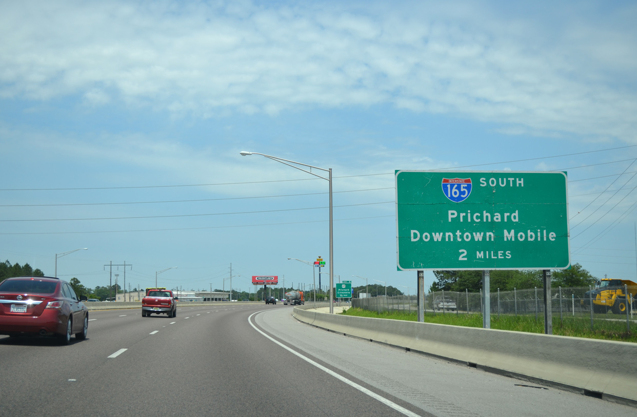
| Interstate 165, a 5.07 mile route southeast from Prichard to Downtown Mobile, ties into I-65 at the succeeding exit beyond U.S. 45. The freeway spur cost $240 million to construct and opened to traffic on October 28, 1994. 05/15/16 |
|
| U.S. 45 (St. Stephens Road) originates in Mobile from U.S. 98 (Spring Hill Avenue) at the Lyons Park community. Traveling northwest, U.S. 45 meets I-65 in Prichard en route to Eight Mile and SR 158 at Kushla. 05/15/16 |
|
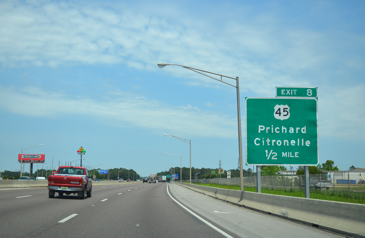
| With the removal of Exit 8B in 2005, Exit 8A was renumbered as Exit 8 for both U.S. 45 north to Citronelle and south through Prichard. U.S. 45 joins Lower Alabama with Waynesville, Quitman and Meridian, Mississippi. 05/15/16 |
|
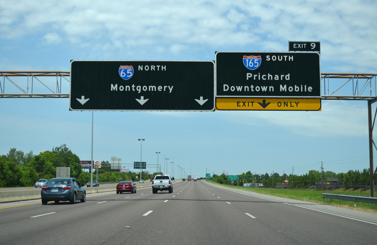
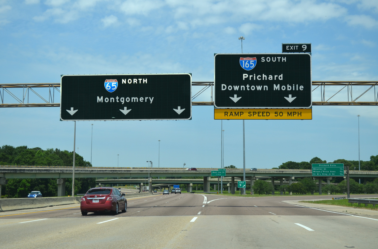
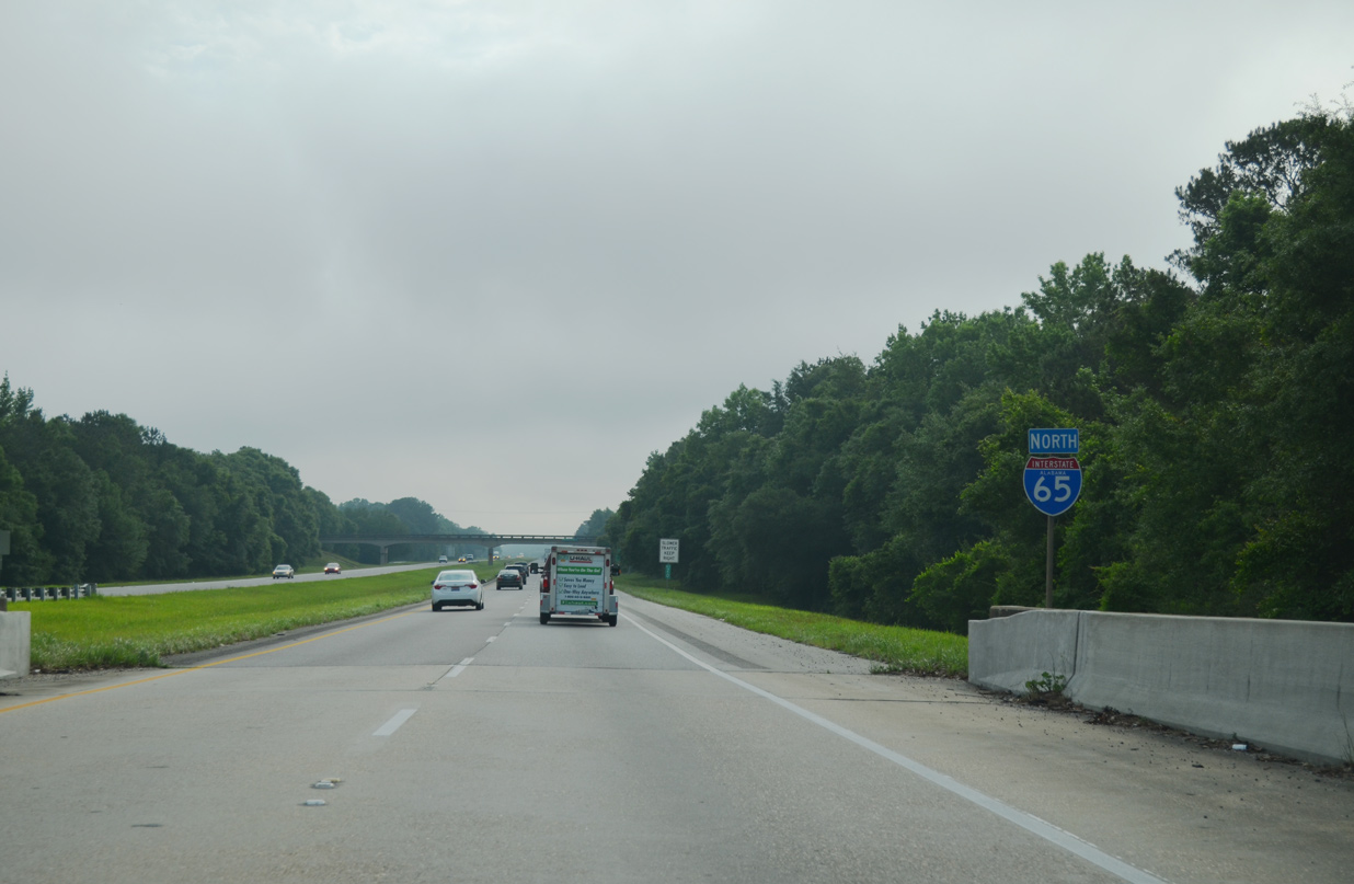
| I-65 expands to eight lanes overall with auxiliary lanes between U.S. 45 (St. Stephens Road) and I-165 (Exit 9). Interstate 165 winds southward through Prichard to the Alabama State Docks and Water / Beauregard Streets north of Downtown Mobile. 05/15/16 |
|
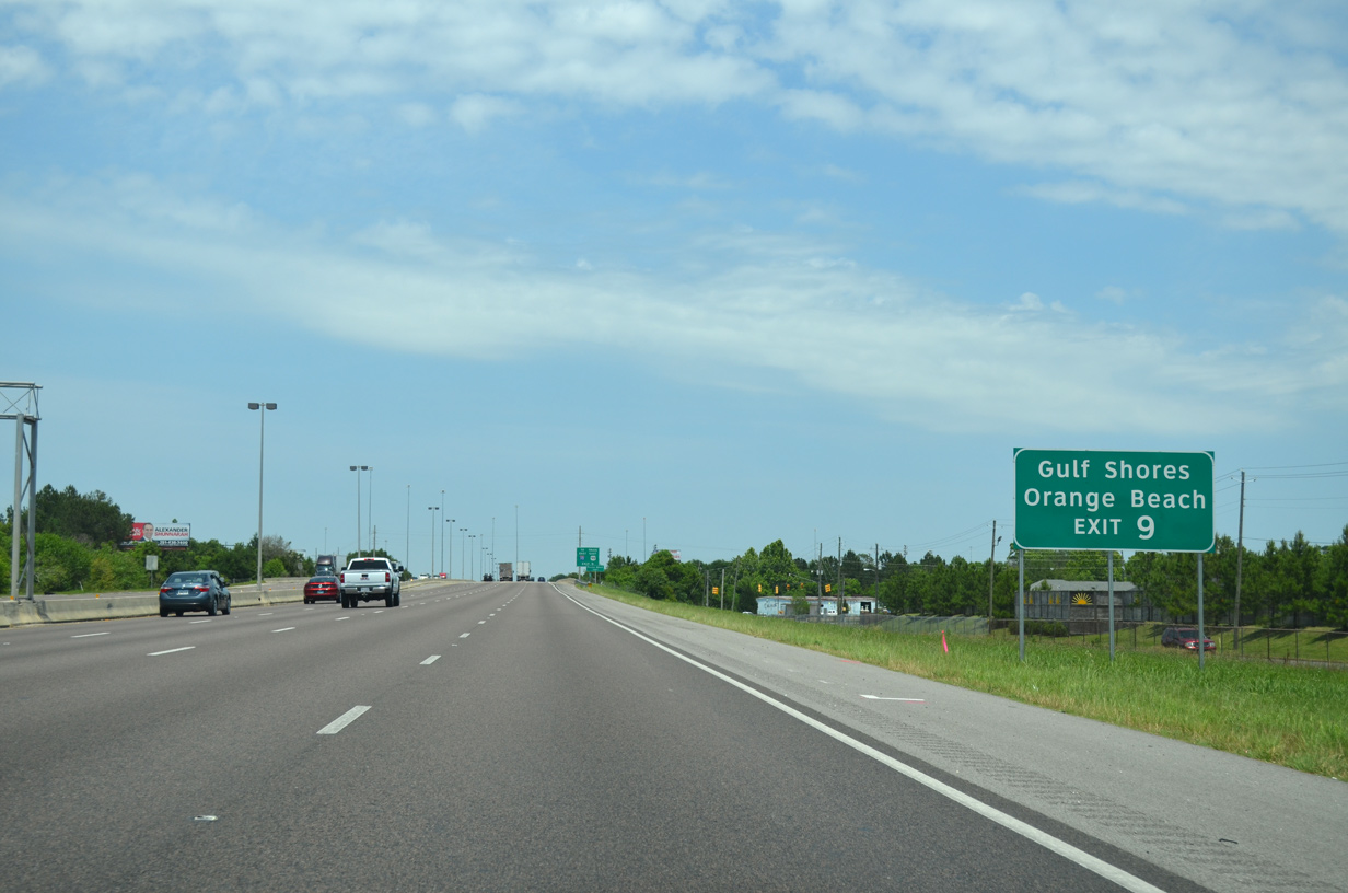
| A series of guide signs posted along Moffett Road, I-65 and I-165 advise beach traffic from U.S. 98 and points west of Mobile to bypass I-10 and the Wallace Tunnel at Downtown Mobile. 05/15/16 |
|
| S Bessemer Avenue parallels the east side of I-65 between U.S. 45 and Main Street at the Whistler community of Prichard. 10/10/11 |
|
| Guide signs for the U.S. 98 Truck route were posted within the Mobile area during the Summer and Fall 2001. U.S. 98 Truck overlaps with I-165 south from Exit 9 to Bay Bridge Road, and with U.S. 90 across the Africatown-Cochrane Bridge to U.S. 98 east of the Bankhead Tunnel. 05/15/16 |
|
| Spanning Whistler Street and Turner Road, I-65 northbound enters the two-wye interchange (Exit 9) with Interstate 165 south. 05/15/16 |
|
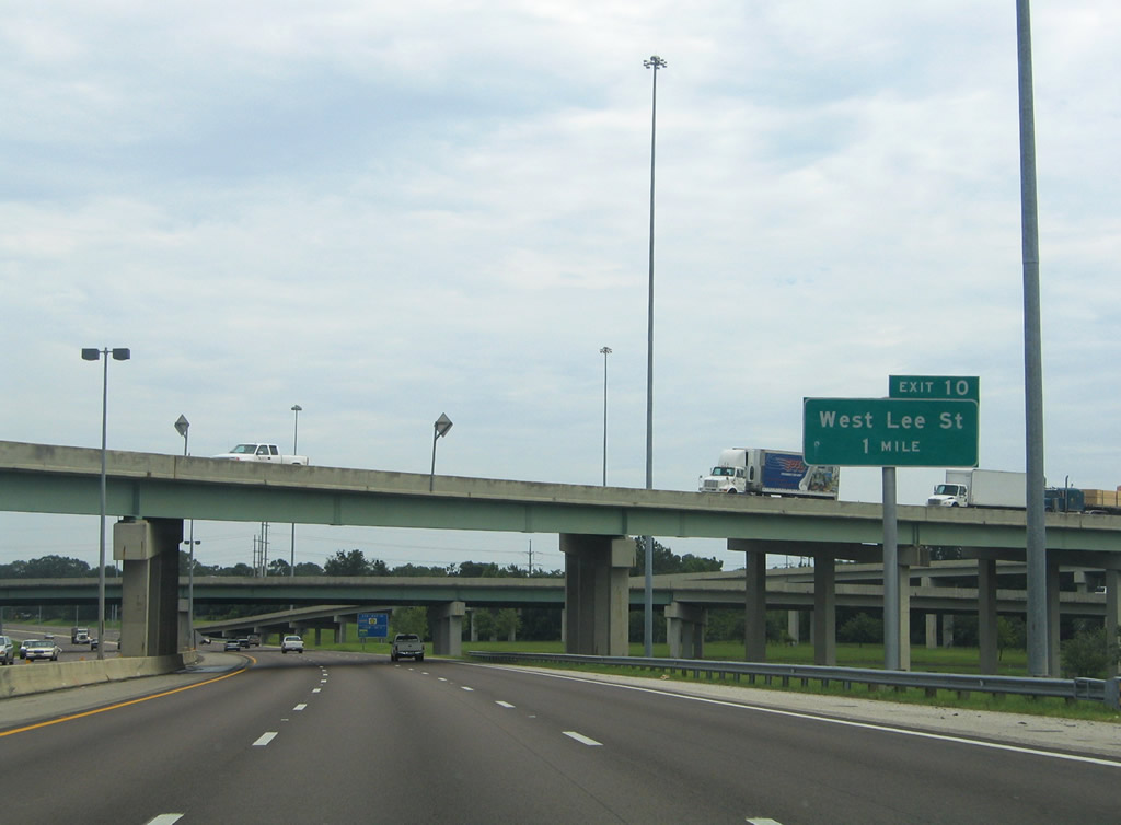
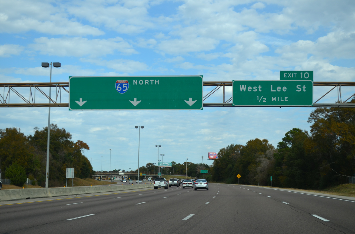
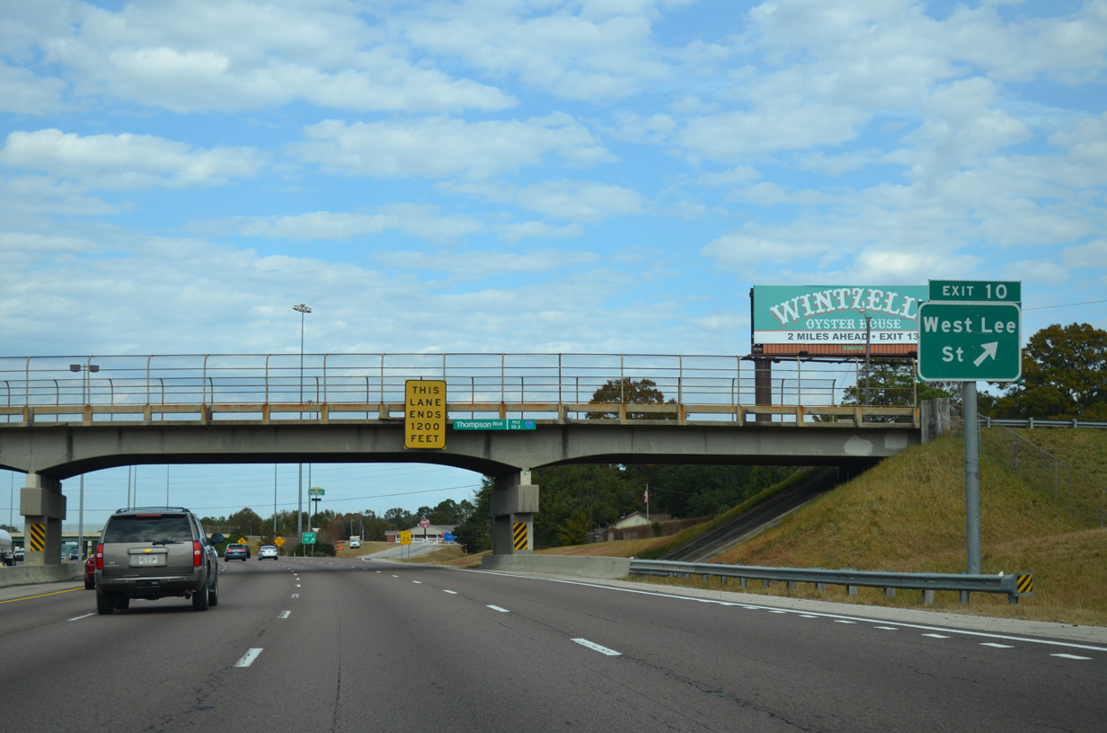
| Progressing northward from I-165, Interstate 65 continues one mile to a diamond interchange (Exit 10) with W Lee Street. 07/15/05 |
|
| The entrance ramp from I-165 adds a northbound lane ahead of W Lee Street in the city of Chickasaw. 11/25/14 |
|
| Exit 10 generally serves local traffic in Chickasaw. W Lee Street connects with Commanche Street south toward Prichard and with neighborhood streets east to U.S. 43 (Craft Highway). 11/25/14 |
|
| Interstate 65 straddles the Prichard and Chickasaw city line from Eight Mile Creek northward to Chickasaw Creek. 11/25/14 |
|
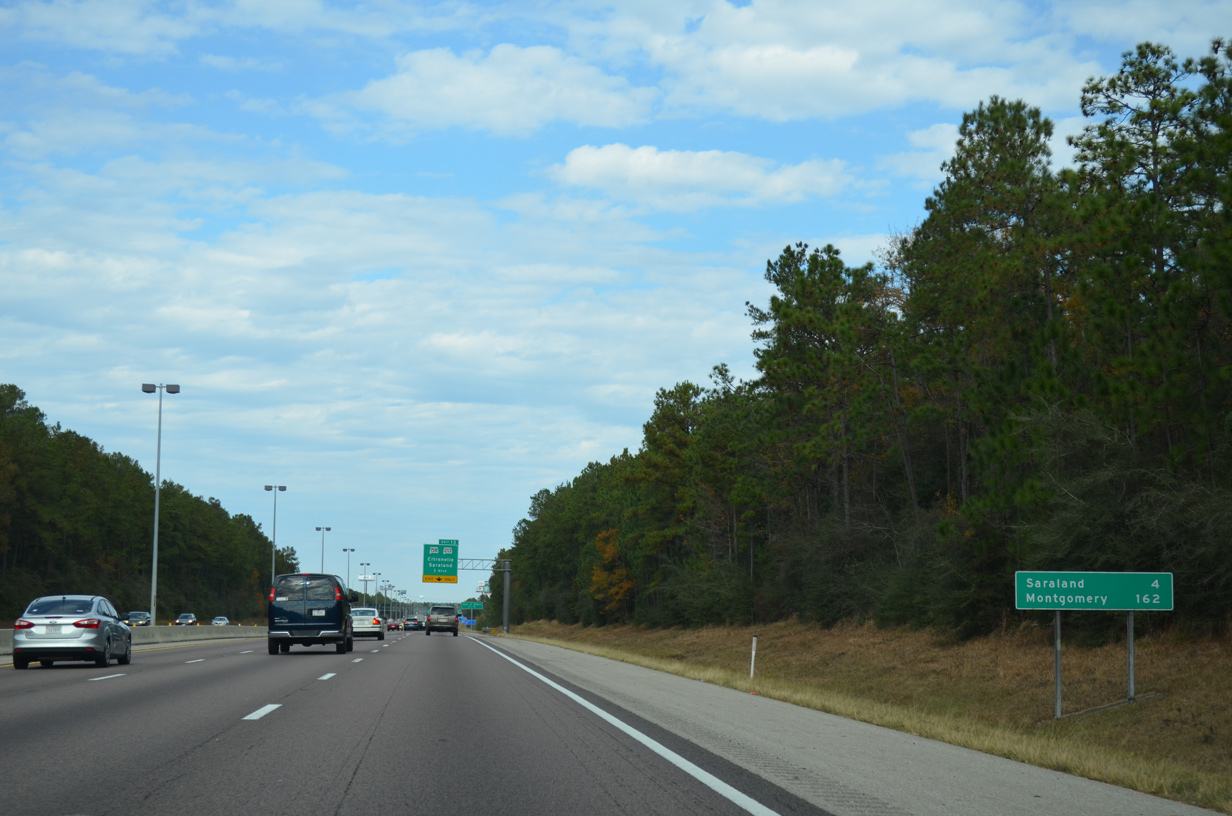
| Interstate 65 next enters the city of Saraland. The Saraland city center lies 2.6 miles east of the freeway along U.S. 43 (Saraland Boulevard) at 2nd Avenue. 11/25/14 |
|
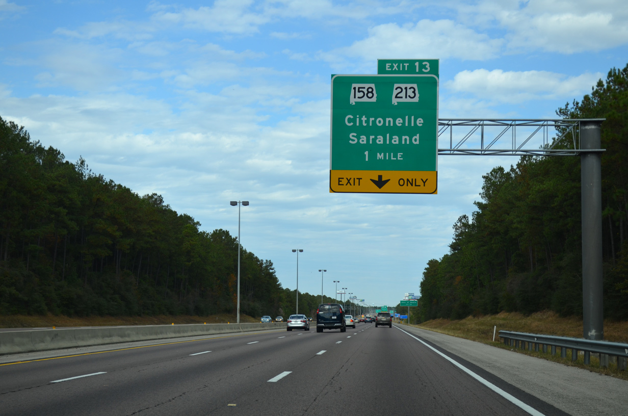
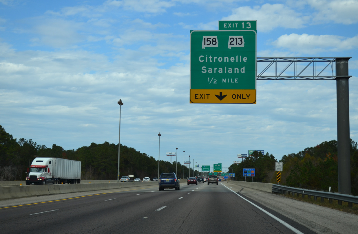
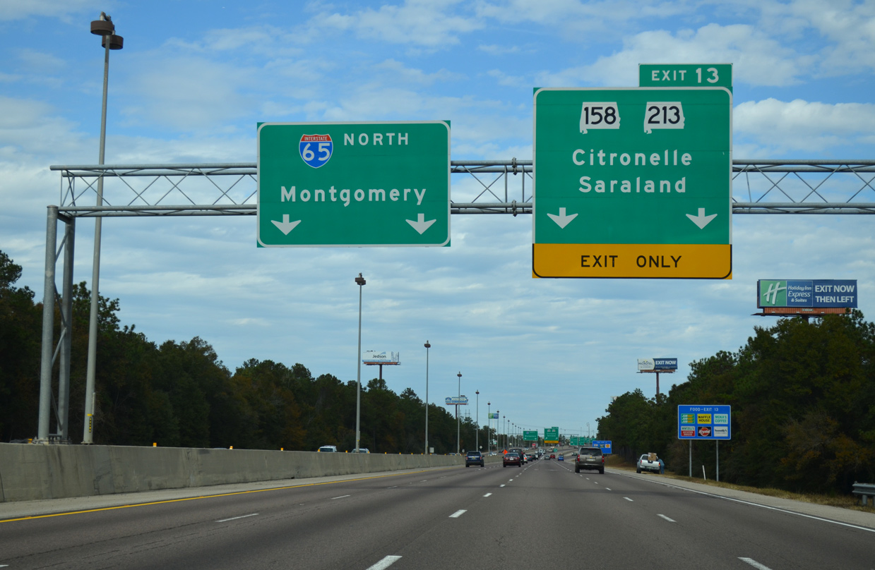
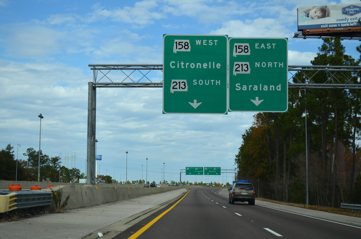
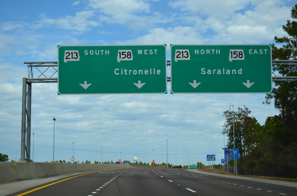
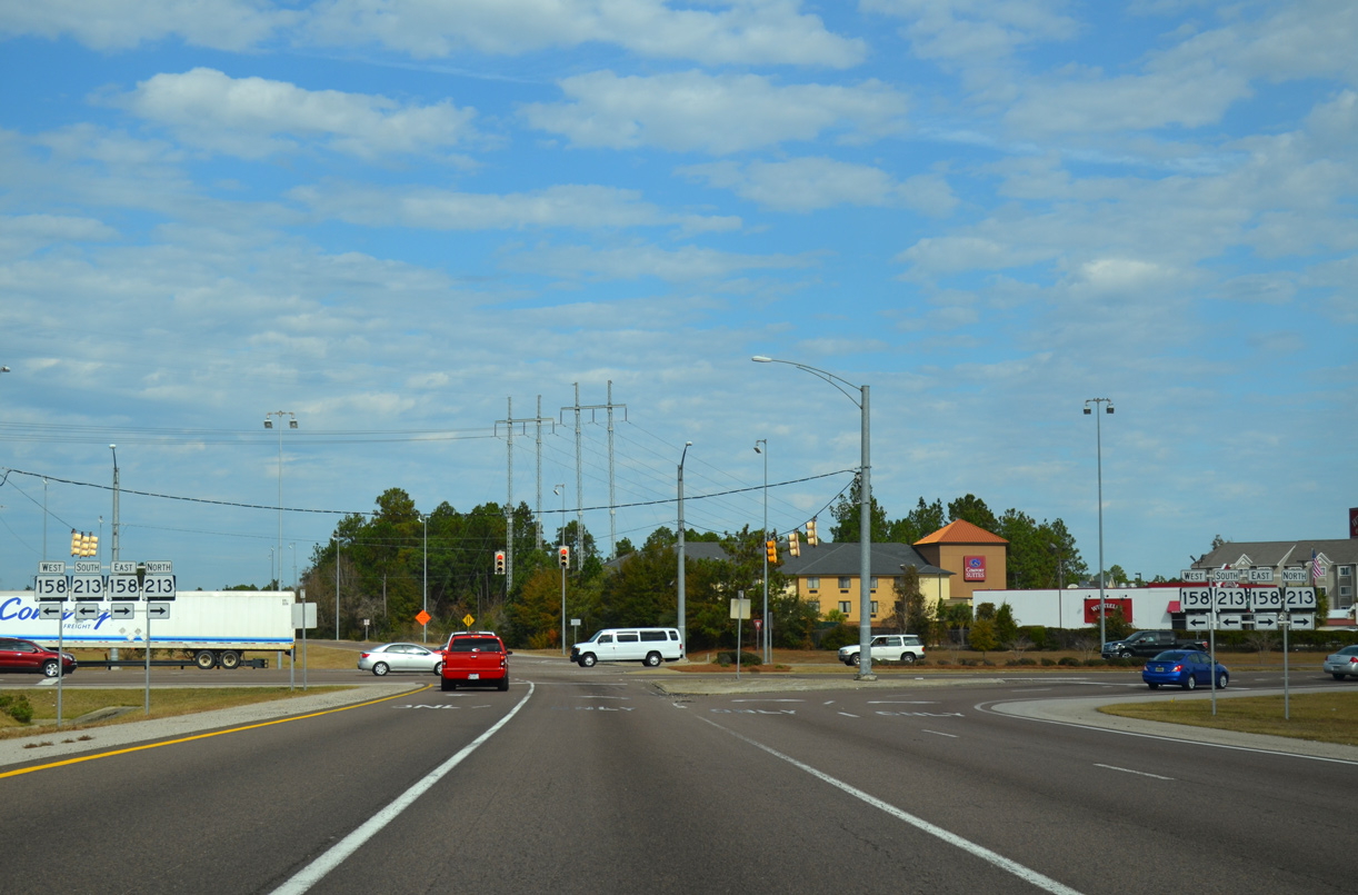
| SR 158/213 converge with Interstate 65 at a parclo interchange (Exit 13) in Saraland. 1999-03 road work rebuilt this exchange, adding a loop ramp from SR 158 west to I-65 south. The six lane portion of I-65 was also extended north to Exit 13. 11/25/14 |
|
| I-65 travels through Chickasabogue Park on the half mile approach to SR 158/213. SR 213 angles southwest from U.S. 43 (Saraland Boulevard) in Saraland to the University of Mobile, Shelton Beach, and Eight Mile in the city of Prichard. 11/25/14 |
|
| A fourth lane opens along I-65 north leading to Exit 13. SR 158 (Industrial Parkway) stems west from U.S. 43 and Industrial Parkway Extension in Saraland to U.S. 45 at Kushla. SR 158 was extended westward to Schillinger Road (CR 31) in January 2008 as part of the planned realignment of U.S. 98 north away from Wilmer and Semmes. 11/25/14 |
|
| Two lanes partition from I-65 north for SR 158/213 along Industrial Parkway. SR 213 travels 5.8 miles from U.S. 45 at Eight Mile and the five point intersection with U.S. 43 (Saraland Boulevard), CR 41 (Celeste Road) and Ferry Avenue east. 11/25/14 |
|
| Exit 13 expands to four lanes ahead of the short overlap for SR 158/213 (Industrial Parkway). Industrial Parkway opened in 1967 as a two lane route for SR 158 between U.S. 43 (Saraland Boulevard) and U.S. 45 west of CR 55 (Kali-Oka Road). 11/25/14 |
|
| An array of retail, hotels and industrial businesses line Industrial Parkway within the vicinity of Interstate 65. A one time proposal outlined extending Bay Bridge Road northward from the Cochrane Bridge in Mobile to SR 158 at U.S. 43 in Saraland. 11/25/14 |
|
| Confirming marker posted north of Exit 13. A frontage road (I-65 Service Road) parallels the freeway to the west, opening up timberland for development. 10/25/03 |
|
| Celeste Road (CR 41) stems west from U.S. 43 (Saraland Boulevard) and SR 213 (Shelton Beach Road) to a diamond interchange with Interstate 65 in one mile. 06/07/17 |
|
| Celeste Road winds through northwest Saraland, serving a number of new residential subdivisions sandwiched between CR 41 and CR 55 (Kali-Oka Road). 06/07/17 |
|
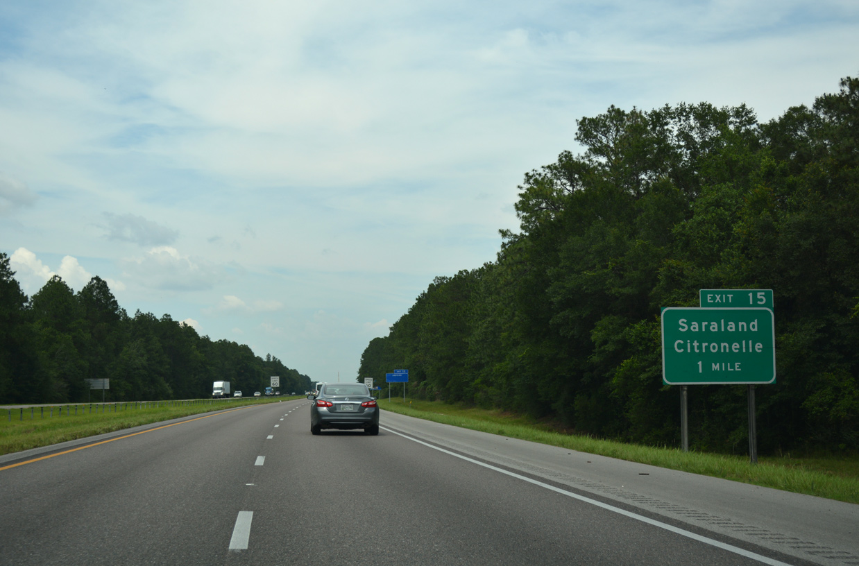
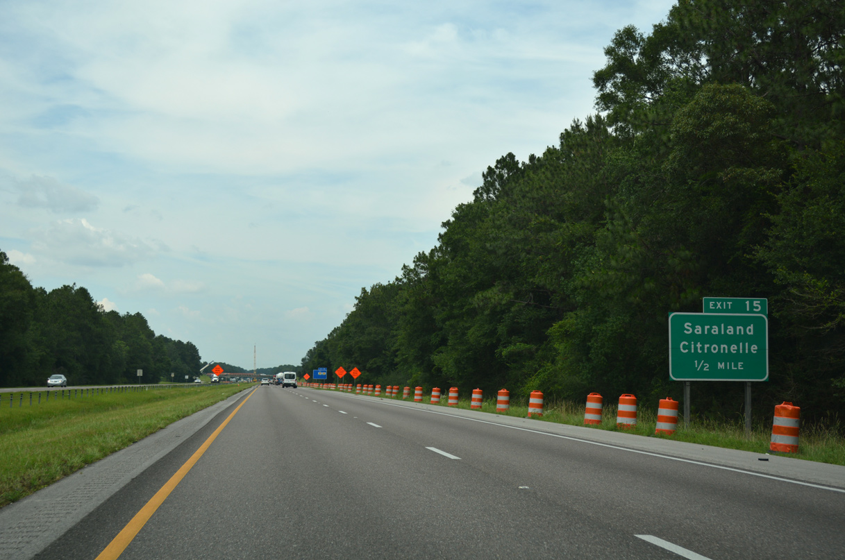
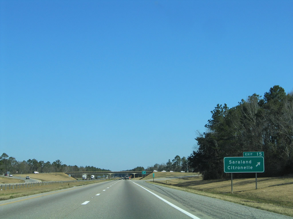
| Mobile County Road 41 comprises part of a long distance route between Saraland and Citronelle in northern Mobile County. Eastward from Exit 15, Celeste Road connects with U.S. 43 near Mackies and the Satsuma city line. 02/07/06 |
|
| The section of Interstate 65 north from Exit 15 to Satsuma opened to traffic in 1967. 06/07/17 |
|
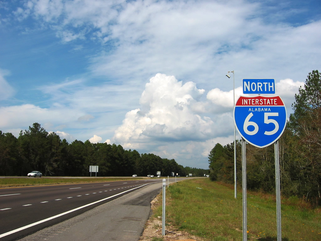
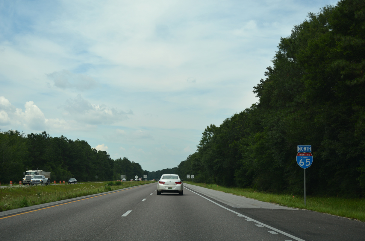
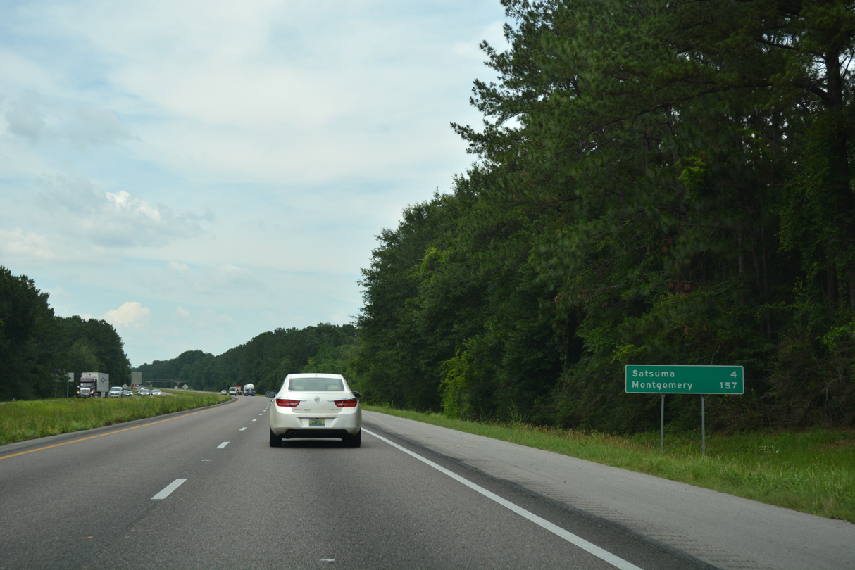
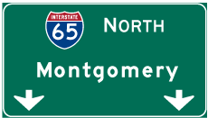
| Interstate 65 proceeds north through the city of Satsuma 157 miles to Montgomery. 06/07/17 |
|
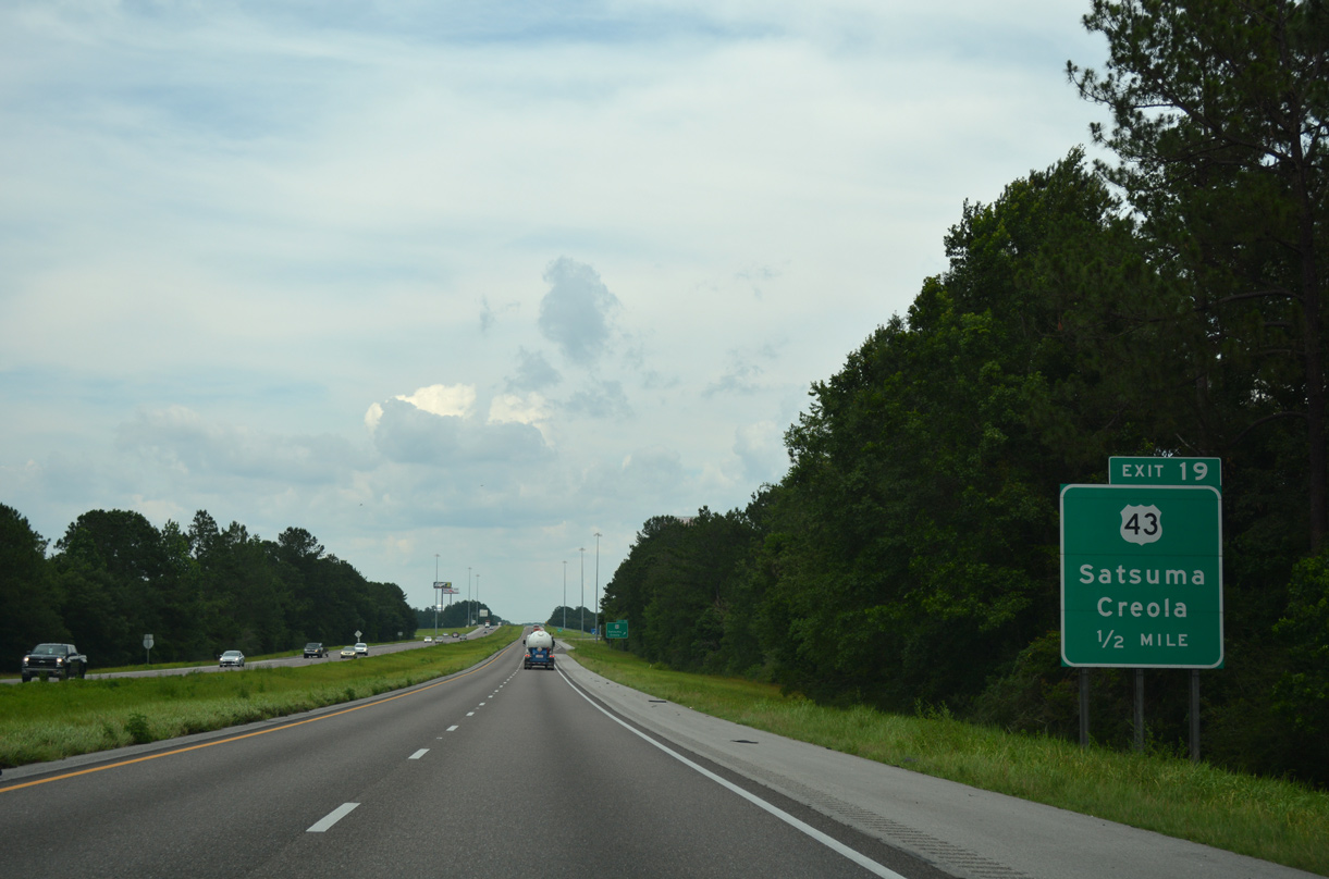
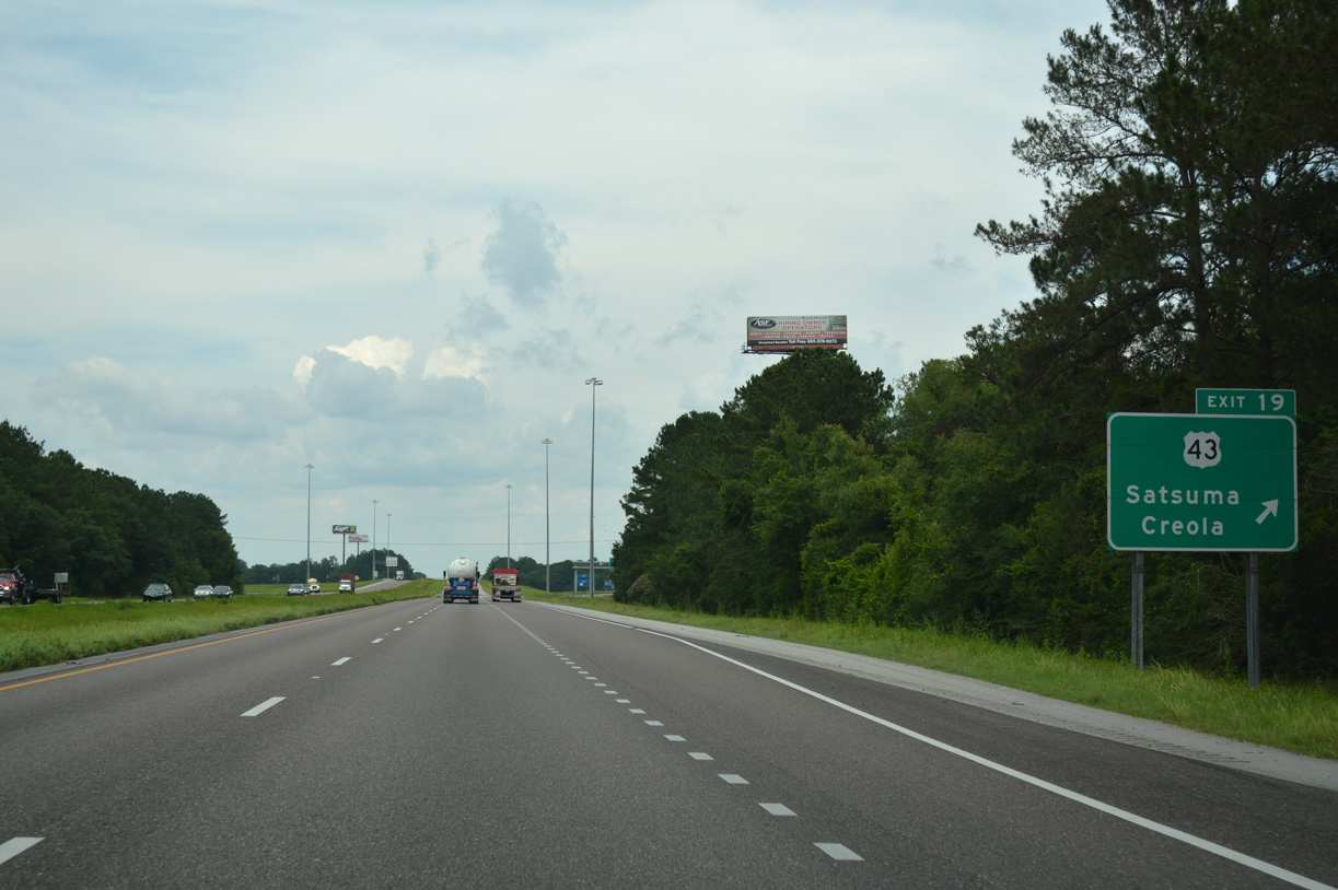
| Shifting northeastward, I-65 runs along the Satsuma city limits, spanning a BNSF Railroad line on the one mile approach to U.S. 43 (Exit 19). U.S. 43 converges with the freeway by the rural city of Creola. 06/07/17 |
|
| Having paralleled Interstate 65 northward from Prichard, U.S. 43 diverges with the freeway beyond Creola en route to Mt. Vernon, Grove Hill, Demopolis and Tuscaloosa. Overall U.S. 43 travels 410 miles between Mobile and Columbia, Tennessee. 06/07/17 |
|
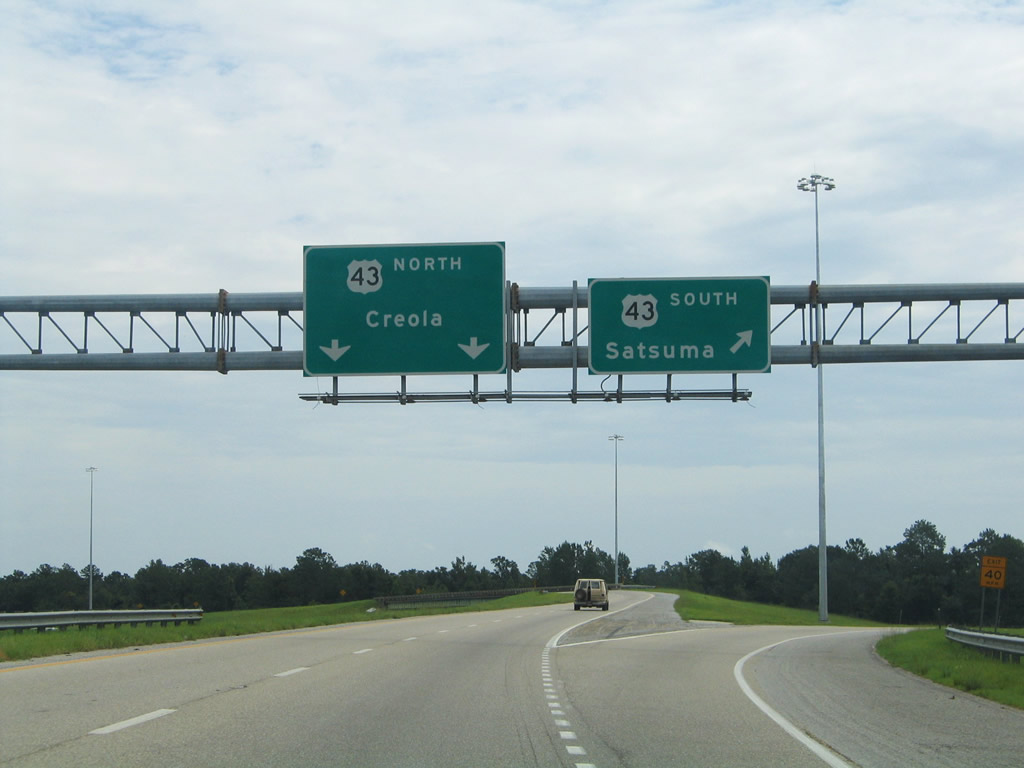
| Exit 19 departs Interstate 65 north for U.S. 43. U.S. 43 constitutes a four lane highway from Mobile County to Thomasville and Alabama's Black Belt region, an agricultural area defined by it's dark soil. 06/07/17 |
|
| Exit 19 splits with two lanes joining the northbound lanes of U.S. 43. With initial discussion originating in the 1970s, the Black Belt Freeway was once considered along U.S. 43 between Mobile and the Shoals Region in Northwest Alabama. Meant to stimulate economic growth, the corridor never advanced due to lack of funding. 10/25/03 |
|
| Interstate 65 spans Gunnison Creek between U.S. 43 and the Lister Dairy Road overpass. This stretch of freeway opened in 1970. 05/12/16 |
|
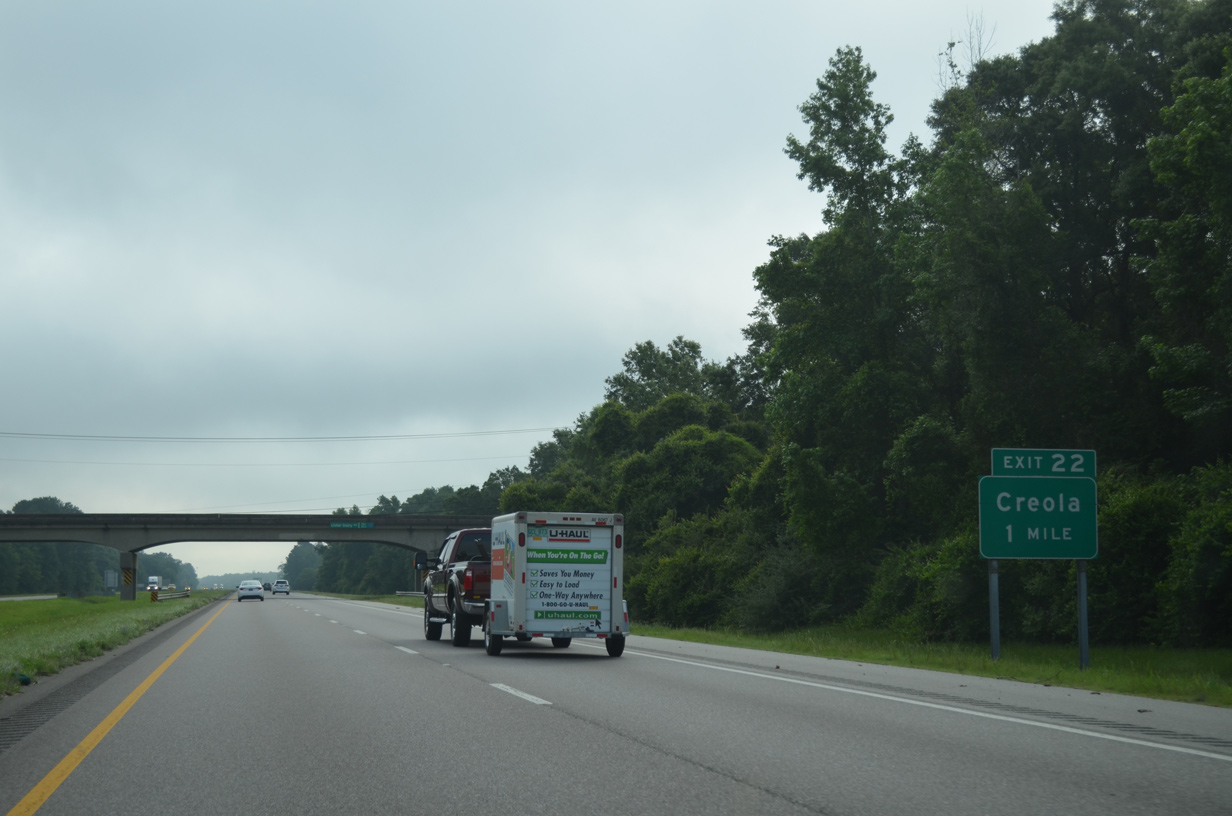
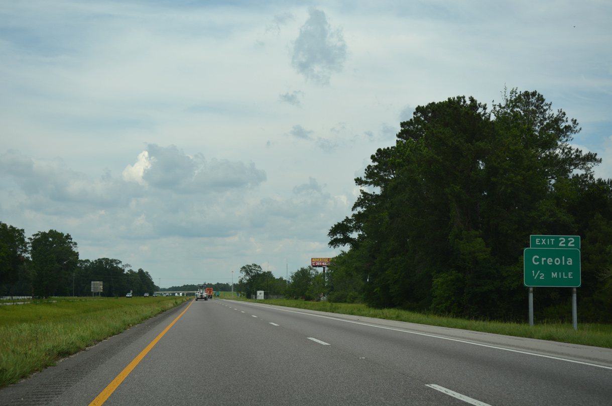
| Interstate 65 curves northeast through Creola toward the Mobile River Delta. Meeting the freeway next is Sailor Road at Exit 22. 05/12/16 |
|
| Exit 22 from northbound utilizes the adjacent I-65 Service Road to connect with Sailor Road. Sailor Road spans the freeway northwest to Dead Lake Road. 06/07/17 |
|
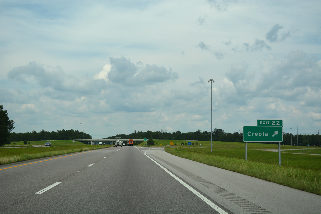
| Entering the folded diamond interchange (Exit 22) with I-65 Service Road, Sailor Road and Dead Lake Road on I-65 north. 06/07/17 |
|
| Dead Lake Road leads west to U.S. 43 in Creola and north to Creola Axis Loop Road East and Dead Lake Marina to Mark Reynolds/North Mobile County Airport. 06/07/17 |
|
| Angling northeast from Creola, I-65 runs between Dead Lake Road and I-65 Service Road to Jim Bell Branch and wetlands associated with Dead Lake. 06/07/17 |
|
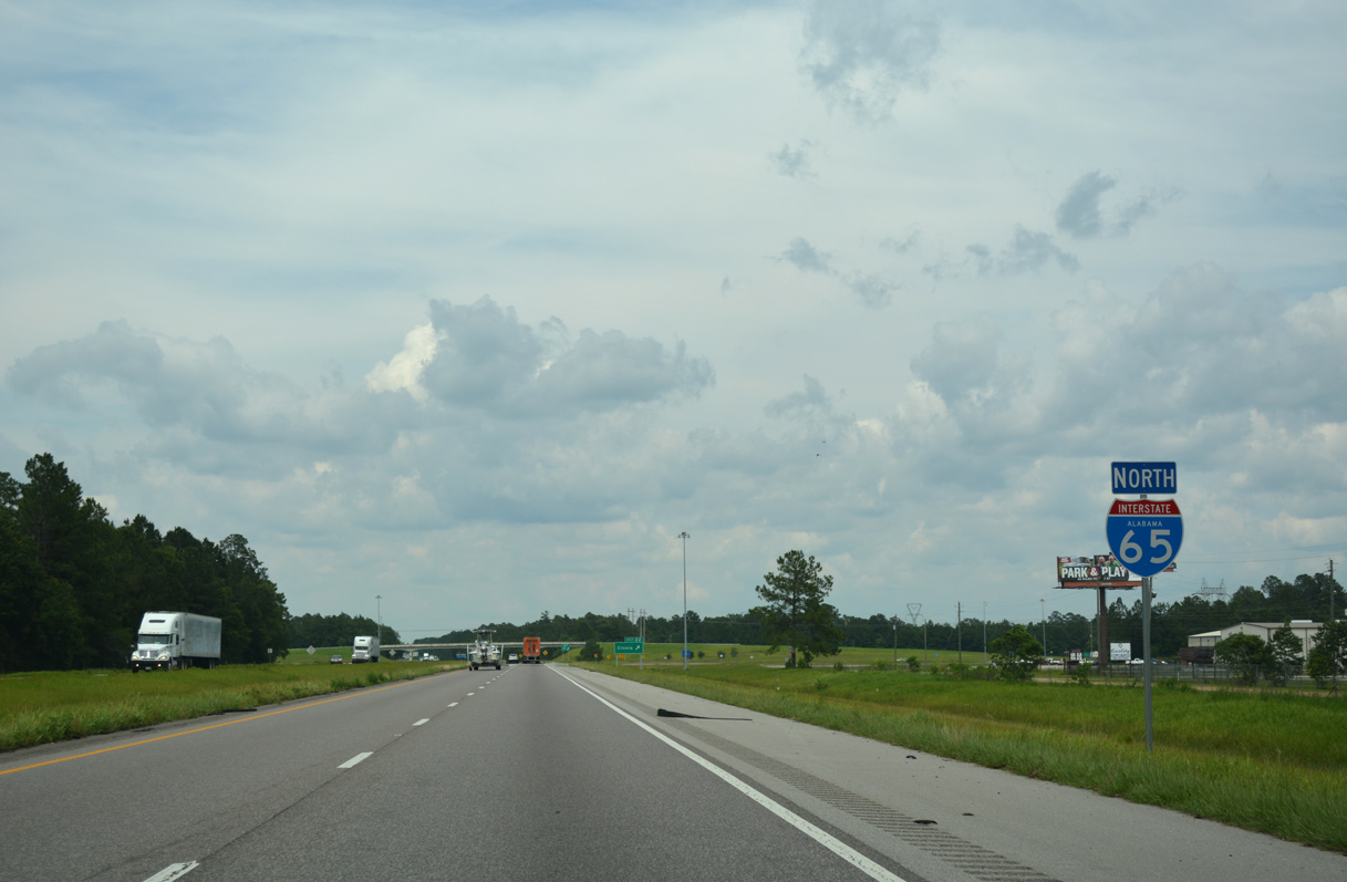
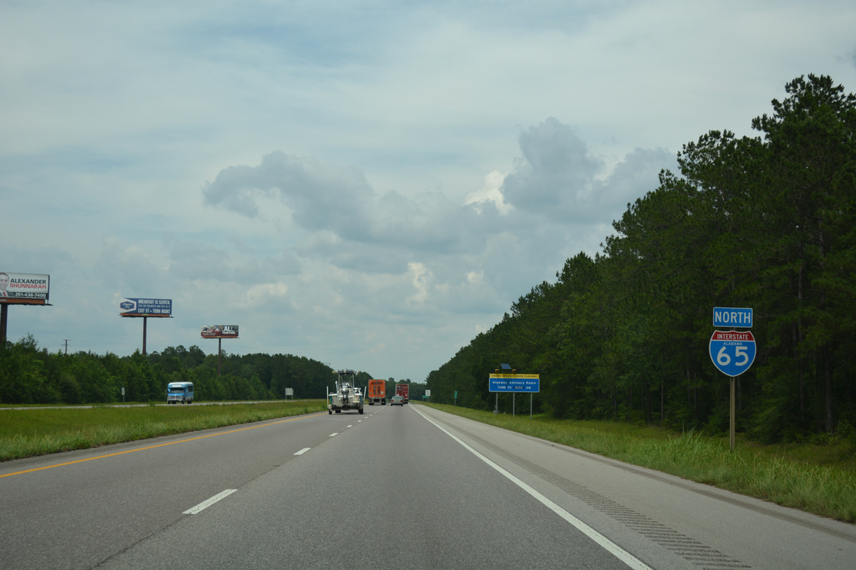
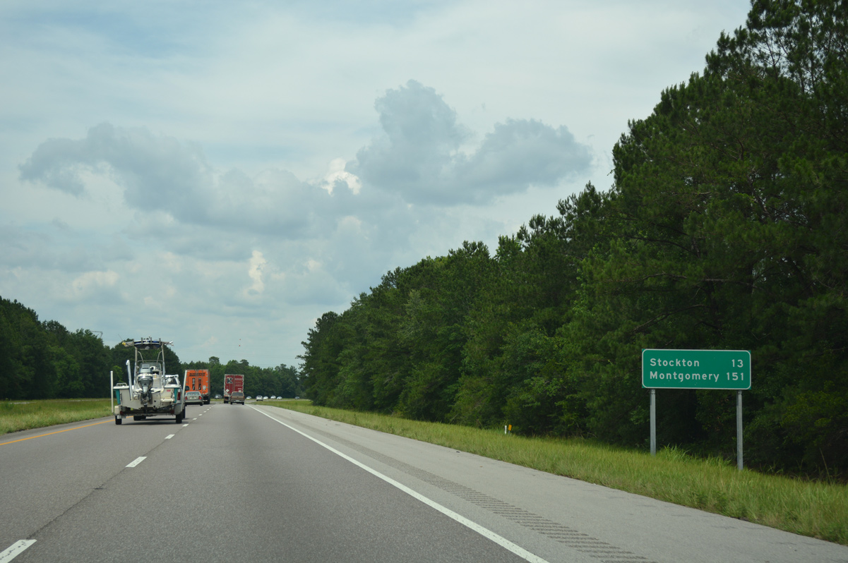
| Interstate 65 travels nine miles between Creola and SR 225 south of Stockton. Montgomery is 142 miles further north. 06/07/17 |
|
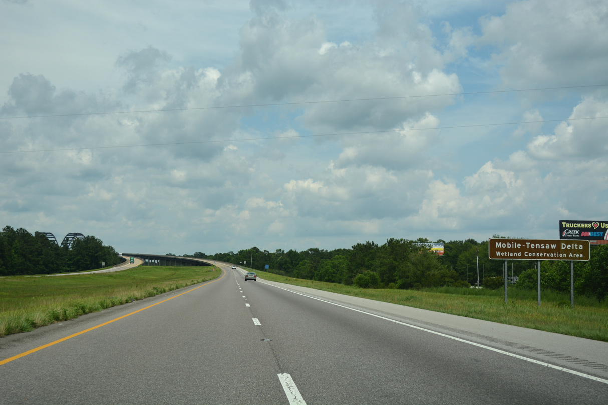
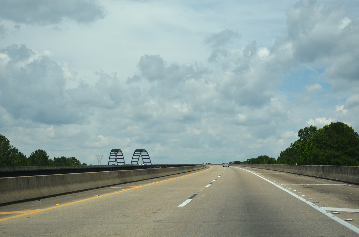
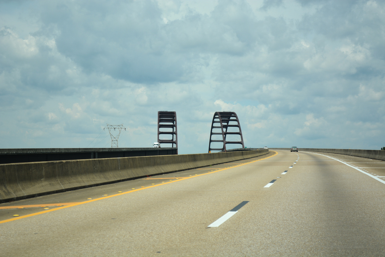
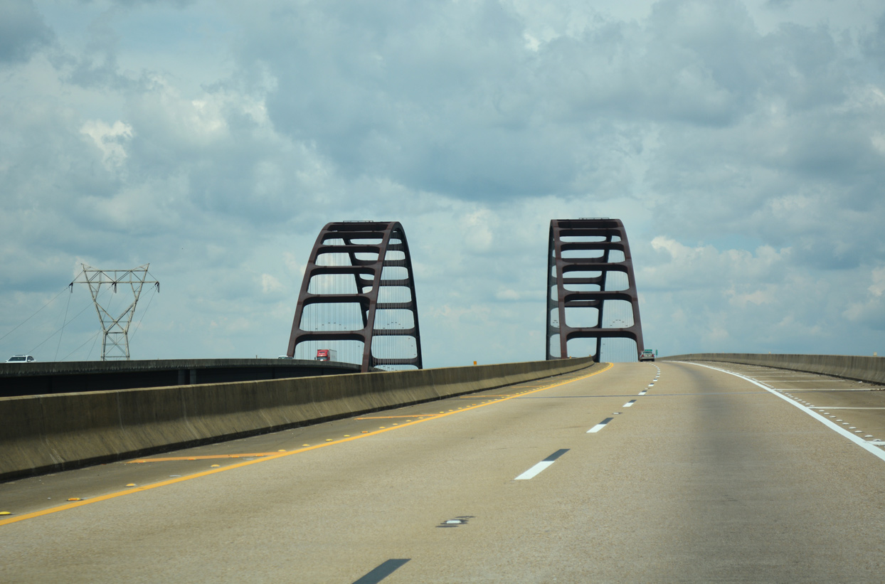
| The steel arches of the Mobile Tensaw River Delta bridges rise above the tree line along Interstate 65 east of Creola. 02/07/06 |
|
| Areas surrounding the Mobile and Tensaw Rivers along Interstate 65 fall within the Mobile-Tensaw Delta Wetland Conservation Area. This includes the W.L. Holland Wildlife Management Area (WMA) and the Mobile-Tensaw Delta WMA. 06/07/17 |
|
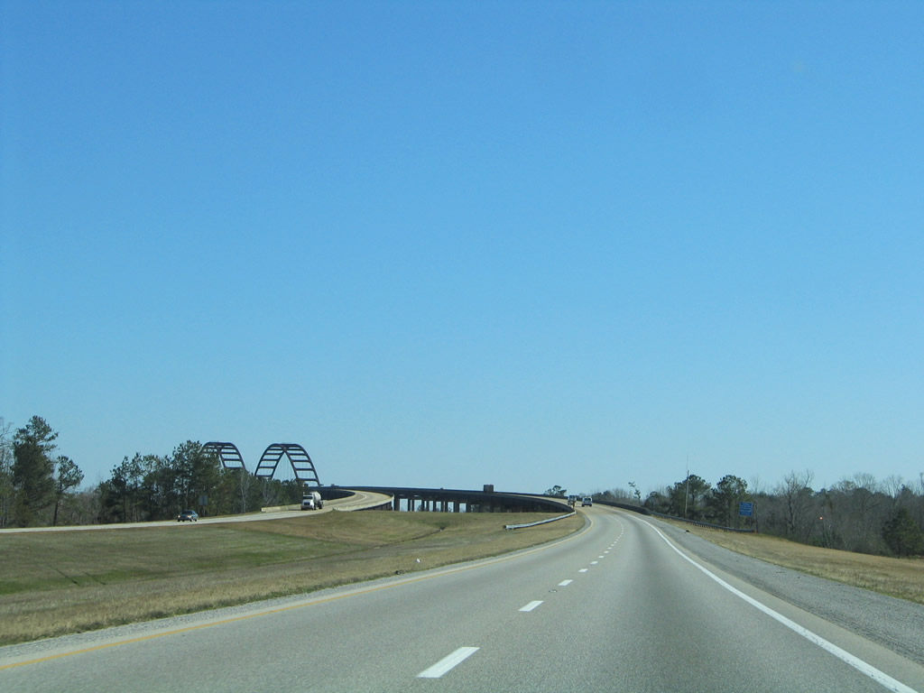
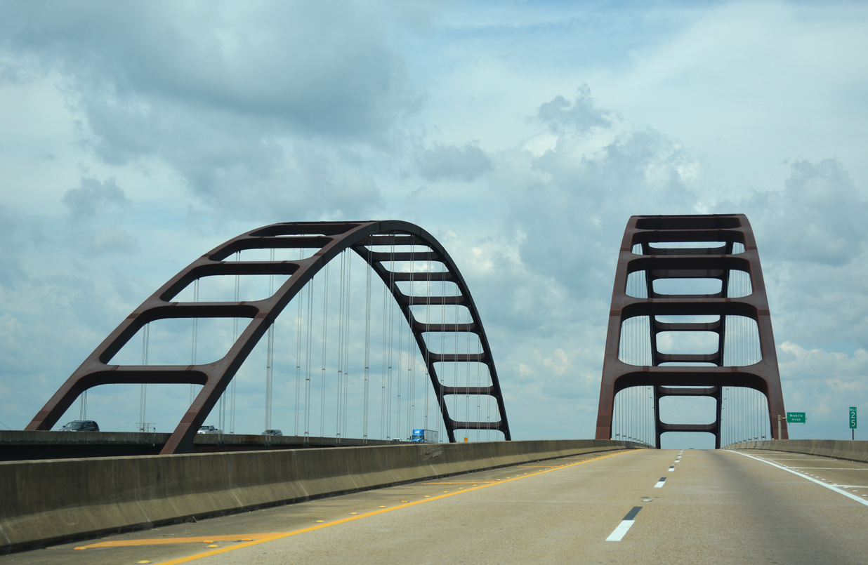
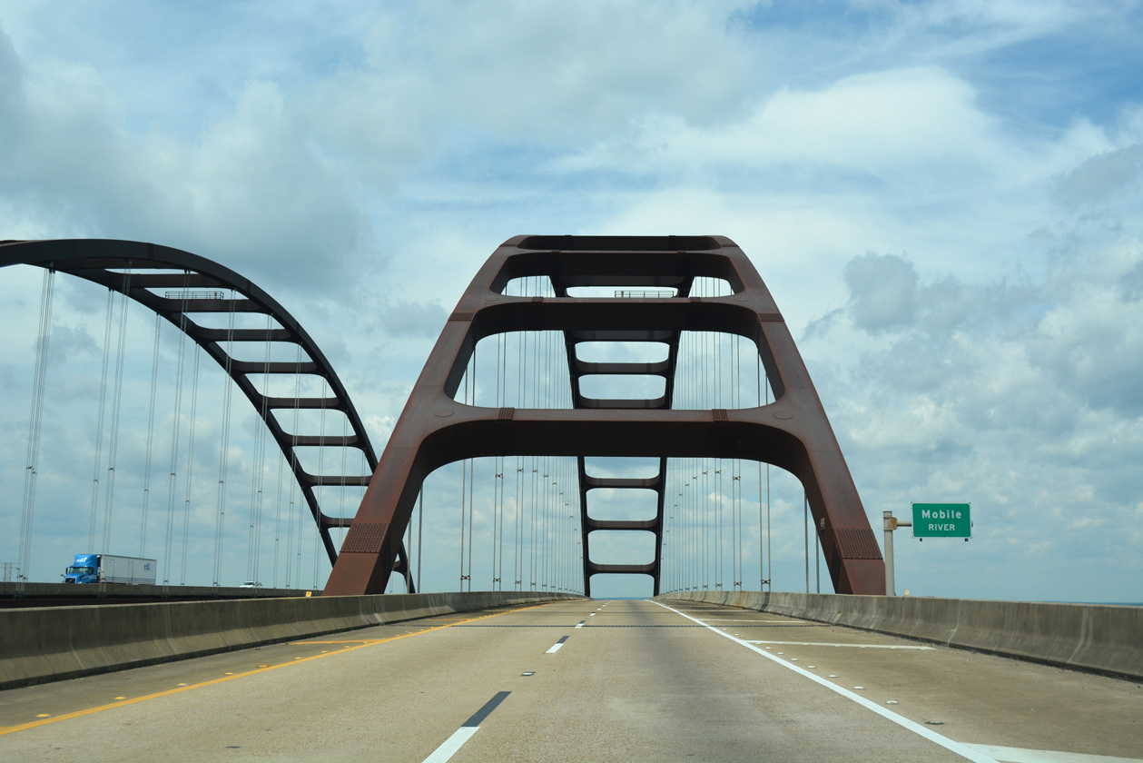
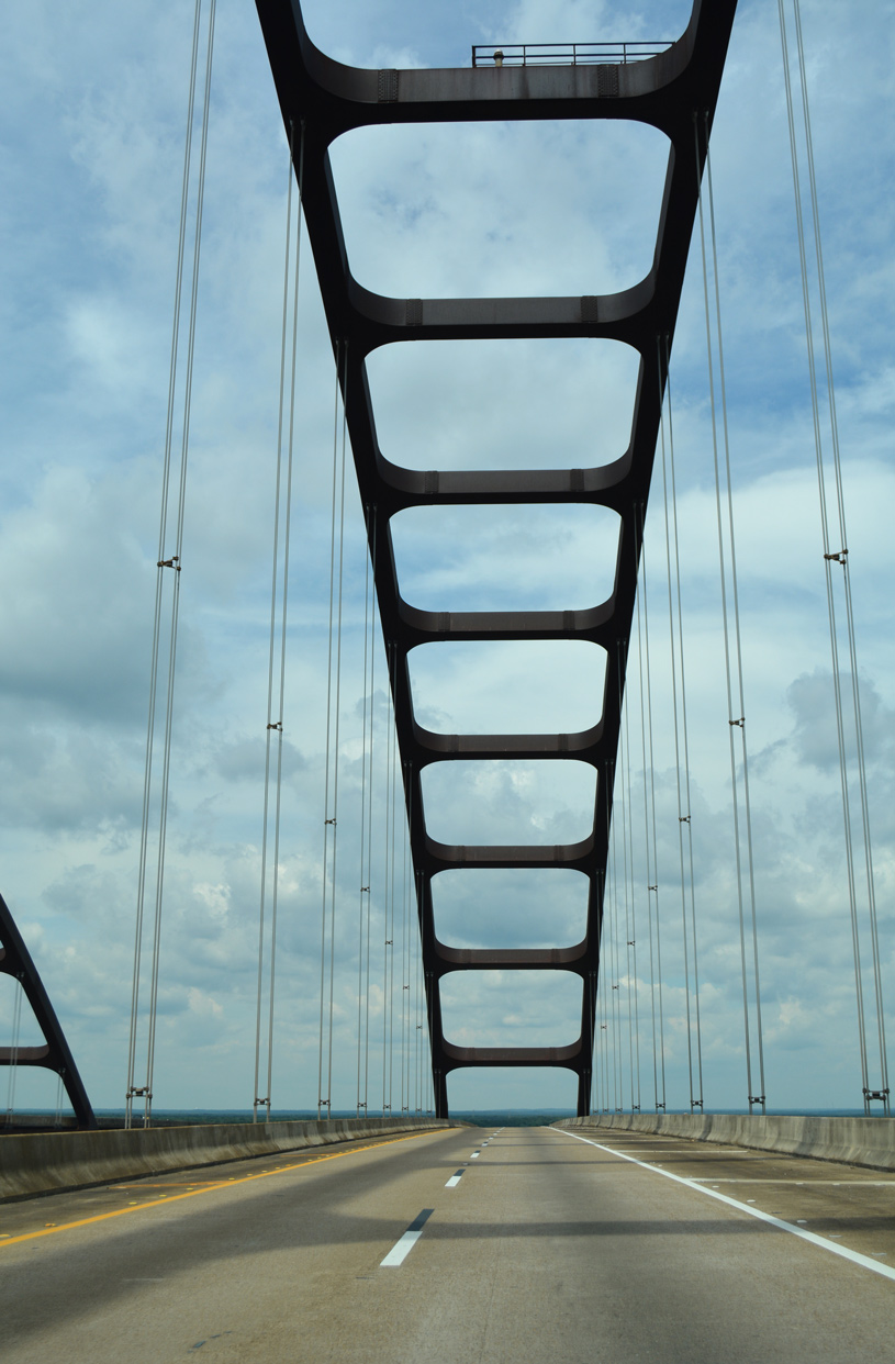
| The General W.K. Wilson, Jr. Bridge taking Interstate 65 across the Mobile River is the first in a series of three high rise bridges over the Mobile-Tensaw River Delta. 02/07/06, 06/07/17 |
|
| Cresting to a height of 125 feet above the Mobile River, the tied arch bridge along I-65 opened along with the 12 mile stretch of roadway between Creola and SR 225 on October 2, 1981. This was the last stretch of Interstate 65 to open south of Birmingham. 06/07/17 |
|
| Flowing south from the confluence of the Tombigbee and Alabama Rivers, the Mobile River is part of the Tennessee-Tombigbee Waterway system, man made waterways accommodating commercial navigation between the Deep South region and the Gulf of Mexico. 06/07/17 |
|
| The General W.K. Wilson, Jr. Bridge honors a Mobile native who served as Chief of the U.S. Army Corps of Engineers during the President Kennedy administration. The span is more commonly known in Lower Alabama as the Dolly Parton Bridge.1 06/07/17 |
|
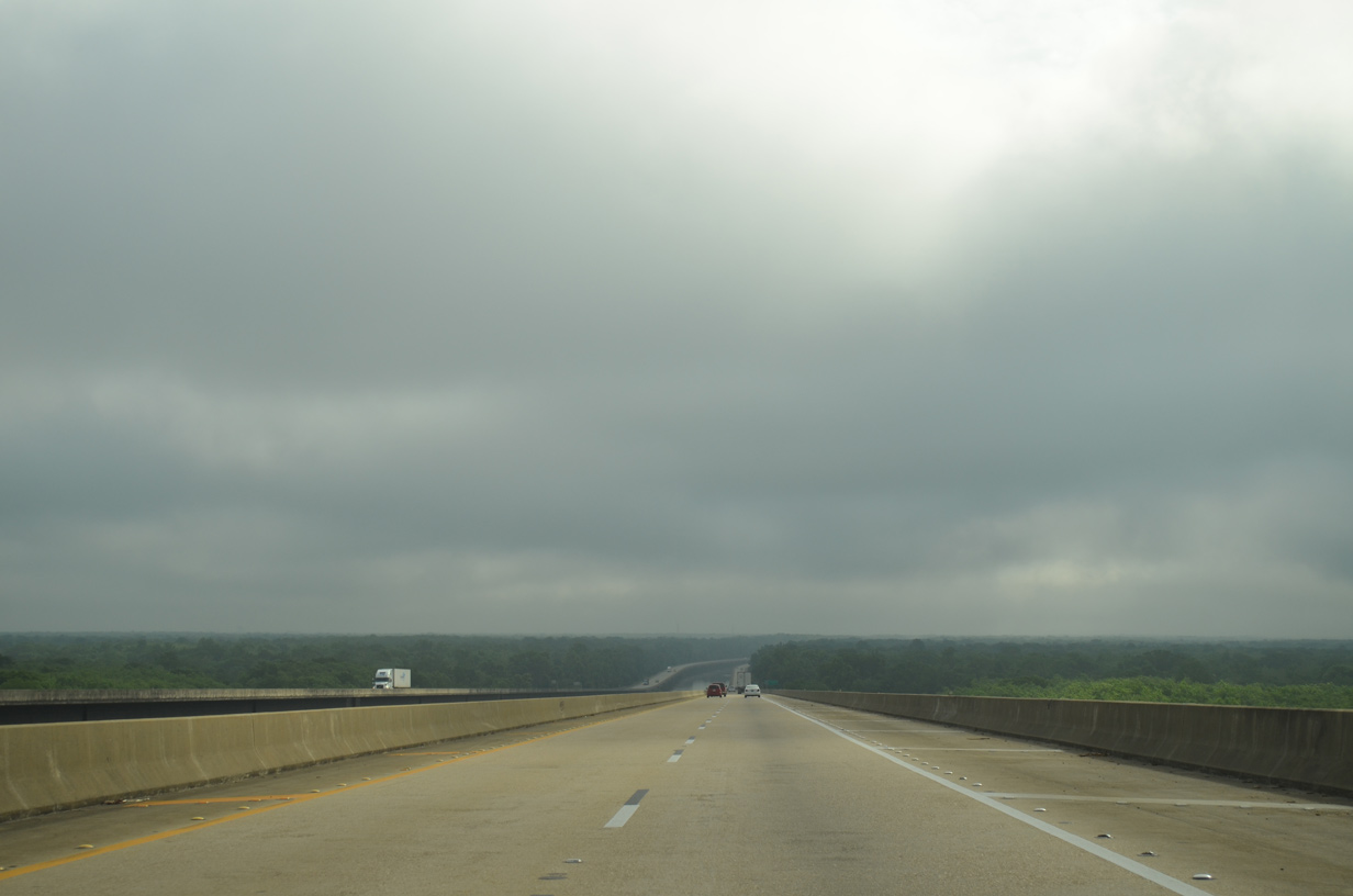
| Descending toward Baldwin County, industrial plants appear to the northwest along the Mobile River banks. The Mobile skyline can be seen on clear days over the southern horizon as well. 05/12/16 |
|
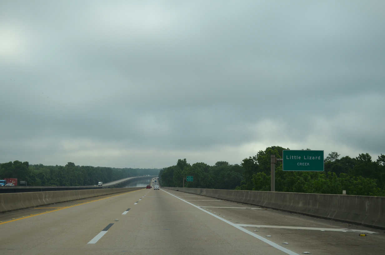
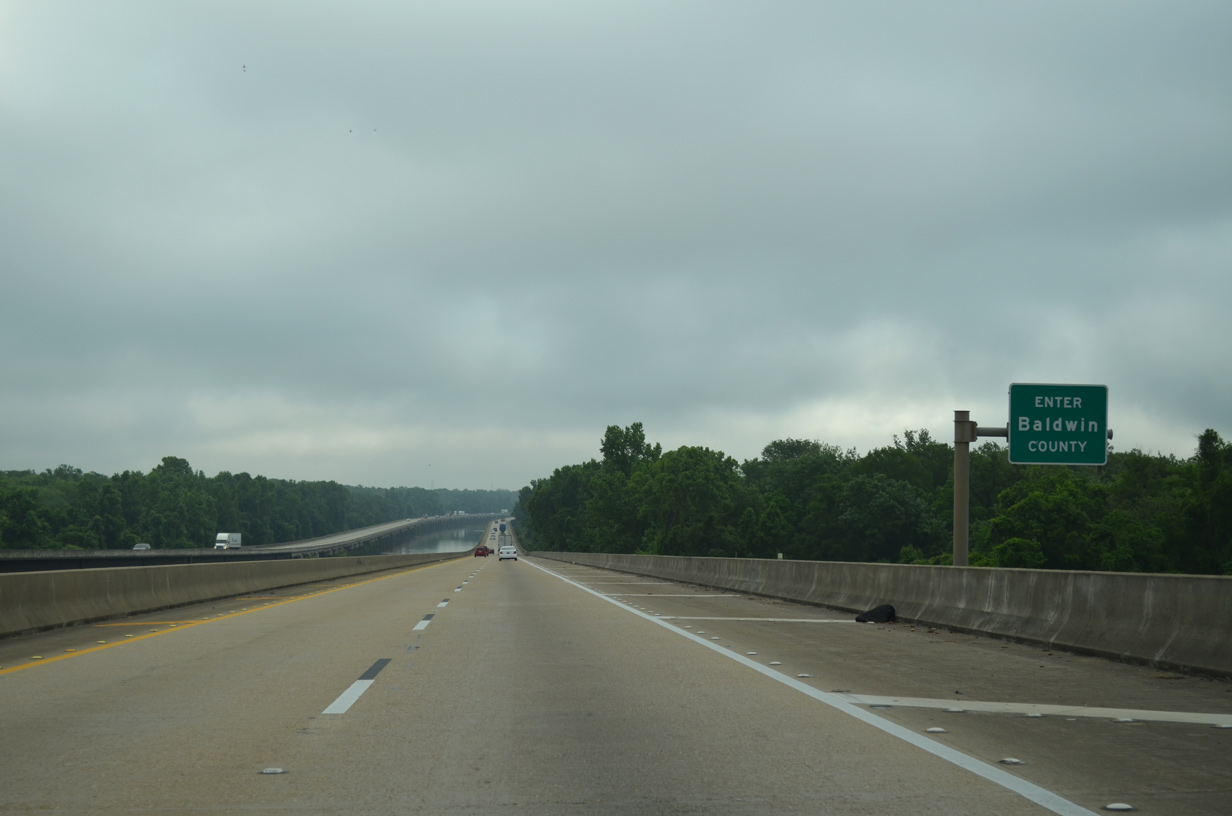
| Little Lizard Creek meanders between the Mobile and Middle Rivers. The Baldwin County line straddles the creek north of The Basin and south of Bayou East. 05/06/16 |
10/25/03, 10/30/03, 07/15/05, 02/07/06, 02/08/06, 11/21/08, 01/23/09, 10/10/11, 03/18/12, 05/05/12, 11/21/14, 11/25/14, 05/06/16, 05/12/16, 05/15/16, 06/07/17 by AARoads
Page Updated 11-21-2020.

 North
North