|
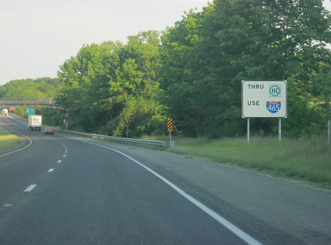
| Truckers carrying hazardous cargo must use the Indianapolis beltway to bypass downtown in lieu of Interstate 65. 05/14/12 |
|
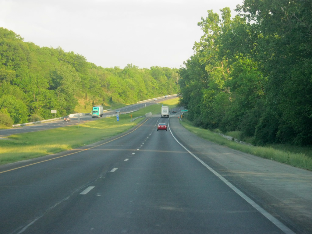
| Interstate 65 winds its way through Pike Township in Marion County in between Exits 129 and 124, giving for a rural scene in what is the 12th largest city in the country. Eagle Creek Park, among the largest municipal parks in the country borders the highway to the west. 05/14/12 |
|
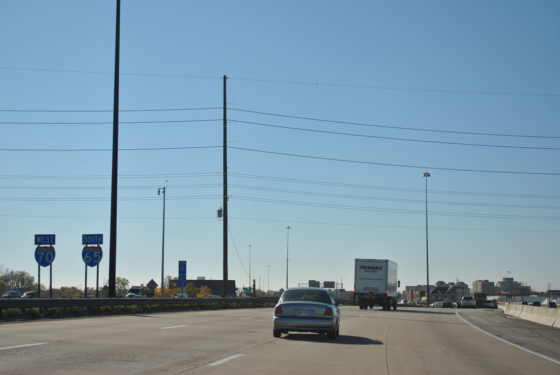
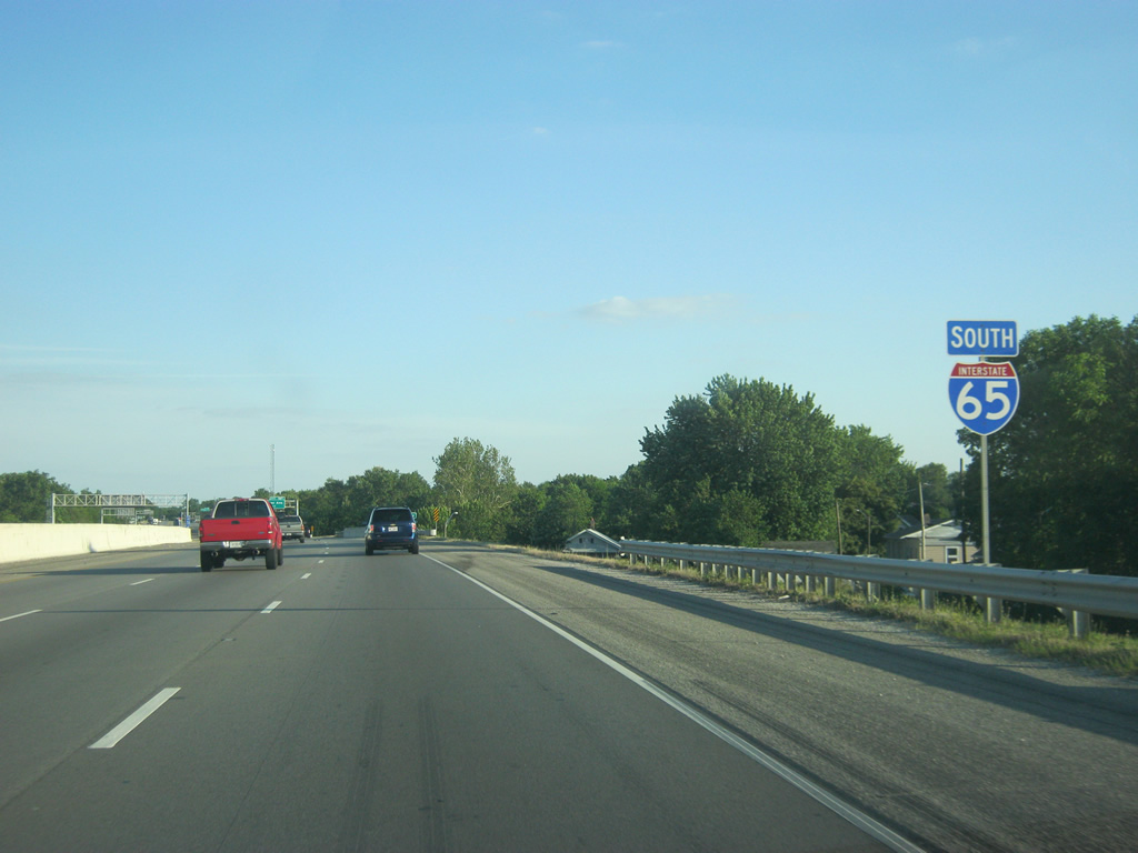
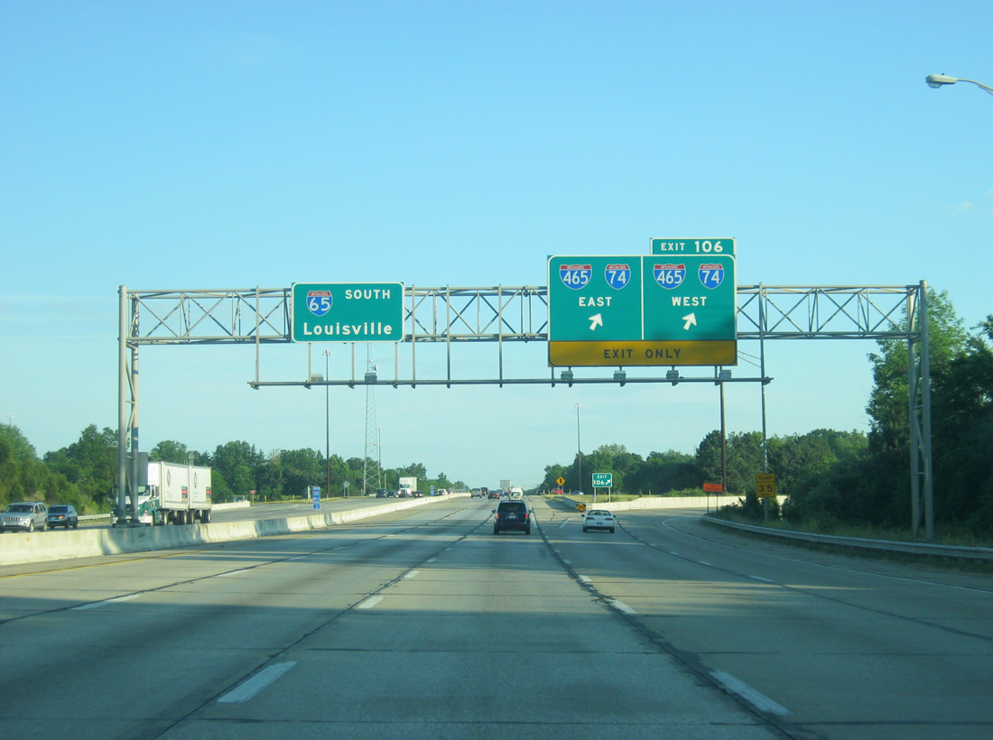
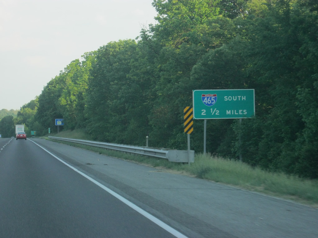
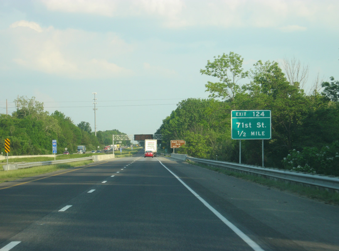
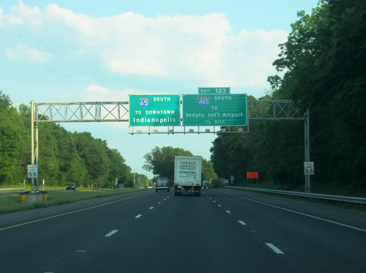
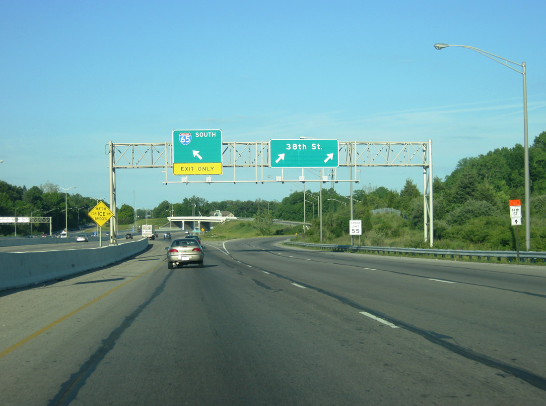
| Interstate 65 south meets the Interstate 465 beltway in 2 1/2 miles. 05/14/12 |
|
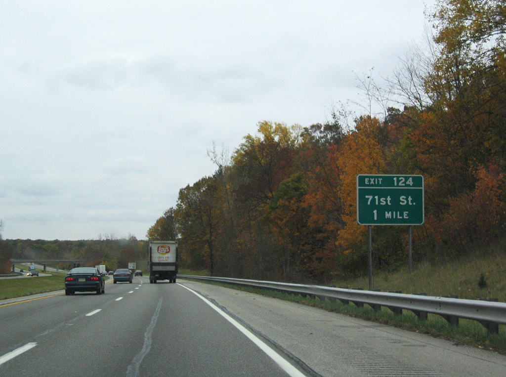
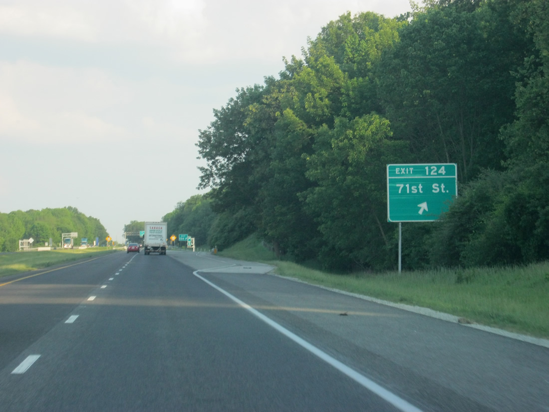
| First in line for southbound travelers in Indianapolis is the Exit 124 diamond interchange at West 71st Street near Traders Point. 10/16/04 |
|
| Another sign reminding those with hazardous cargo to use Interstate 465 around the city instead of Interstate 65 south. 05/14/12 |
|
| Spanning Eagle Creek, Interstate 65 advances to within one half mile of West 71st Street. 71st Street travels east from the Eagle Creek Reservoir area to Exit 21 of Interstate 465 and the New Augusta community. 05/14/12 |
|
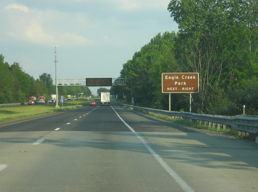
| Eagle Creek Park, the largest park in Indianapolis, along Eagle Creek Reservoir can be reached from 71st Street to the immediate west of Exit 124. 05/14/12 |
|
| Southbound I-65 at Exit 124 to West 71st Street. 71st Street transitions to Westlane Road at Augusta and 73rd Street to its end at Meridian Street (former U.S. 31). The alignment between Michigan Road (old U.S. 421) to old U.S. 31 represents the former route of SR 434. 05/14/12 |
|
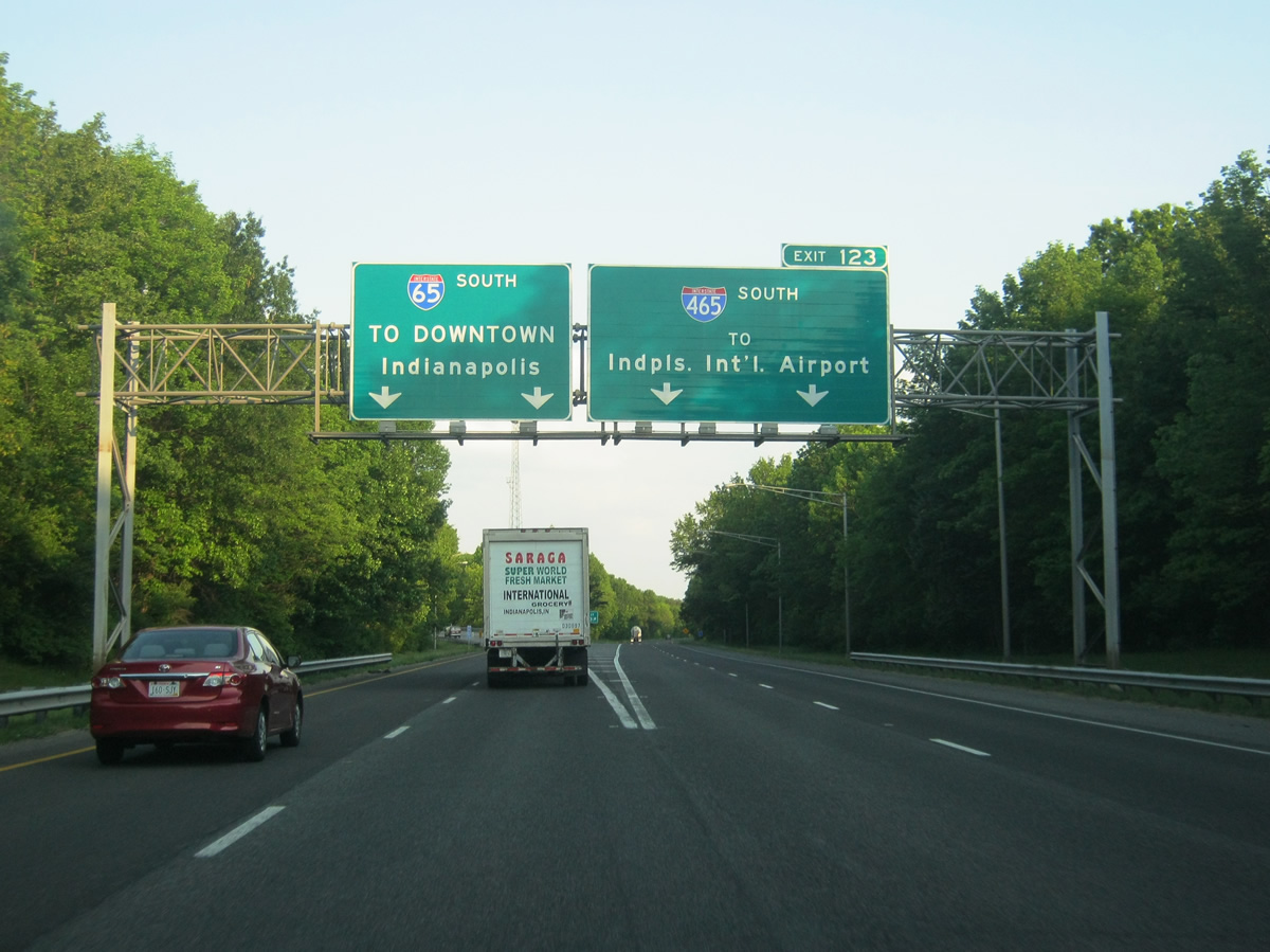
| Interstate 65 crosses paths with Interstate 465 at Exit 123 near Eagle Creek Park. Access is only provided to the beltway south. 05/14/12 |
|
| A wye interchange facilitates movements southward onto Interstate 465 to Speedway, Ben Davis, and Indianapolis International Airport (via Interstate 70 west). Interstate 65 sees two additional ramps with Interstate 465 directly near Lafayette Road (old U.S. 52). 05/14/12 |
|
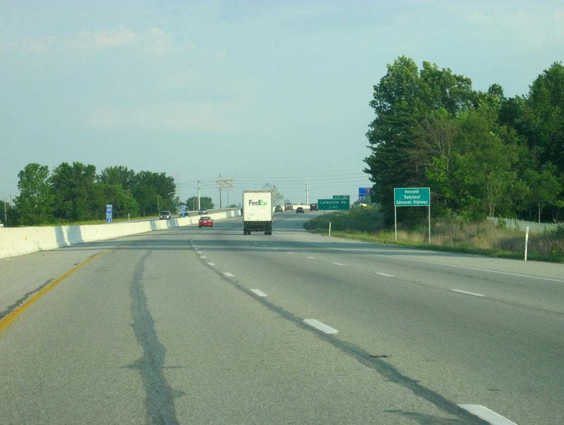
| Interstate 65 within the Interstate 465 beltway was named the Kenneth "Babyface" Edmonds Highway in 1999 after the famous R&B musician who was from Indianapolis. Like most highways that are named for people in Indiana the name is not used by locals, who merely call the highway 65. 05/14/12 |
|
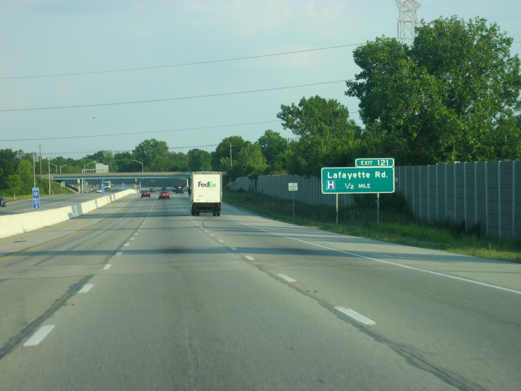
| Continuing south from Interstate 465, Interstate 65 kinks eastward through a diamond interchange at Lafayette Road. Lafayette Road represents old U.S. 52 southeast from Royalton to West 16th Street (old U.S. 136). 05/14/12 |
|
| Since the Lebanon area, Lafayette Road (in Boone County known as Indianapolis Road) has followed Interstate 65 and is a four lane facility from the Zionsville area south through Indianapolis through its terminus at West 16th Street. As with several roads in Indianapolis, bicycle lanes were added along Lafayette Road for its entire length in the city. 05/14/12 |
|
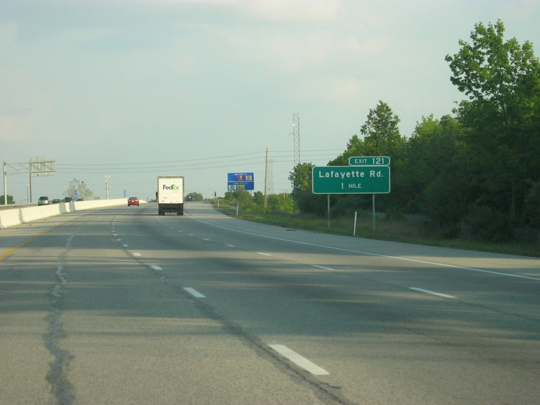
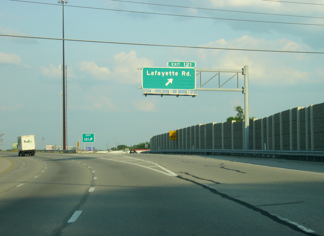
| Facing eastward, Interstate 65 splits with the Exit 121 off-ramp to Lafayette Road. Lafayette Road serves a retail center bound by Interstate 65 and West 38th Street nearby. 05/14/12 |
|
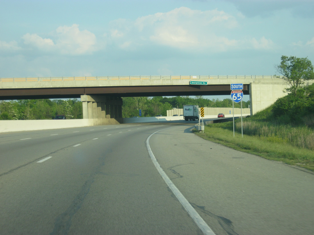
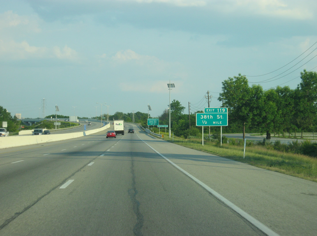
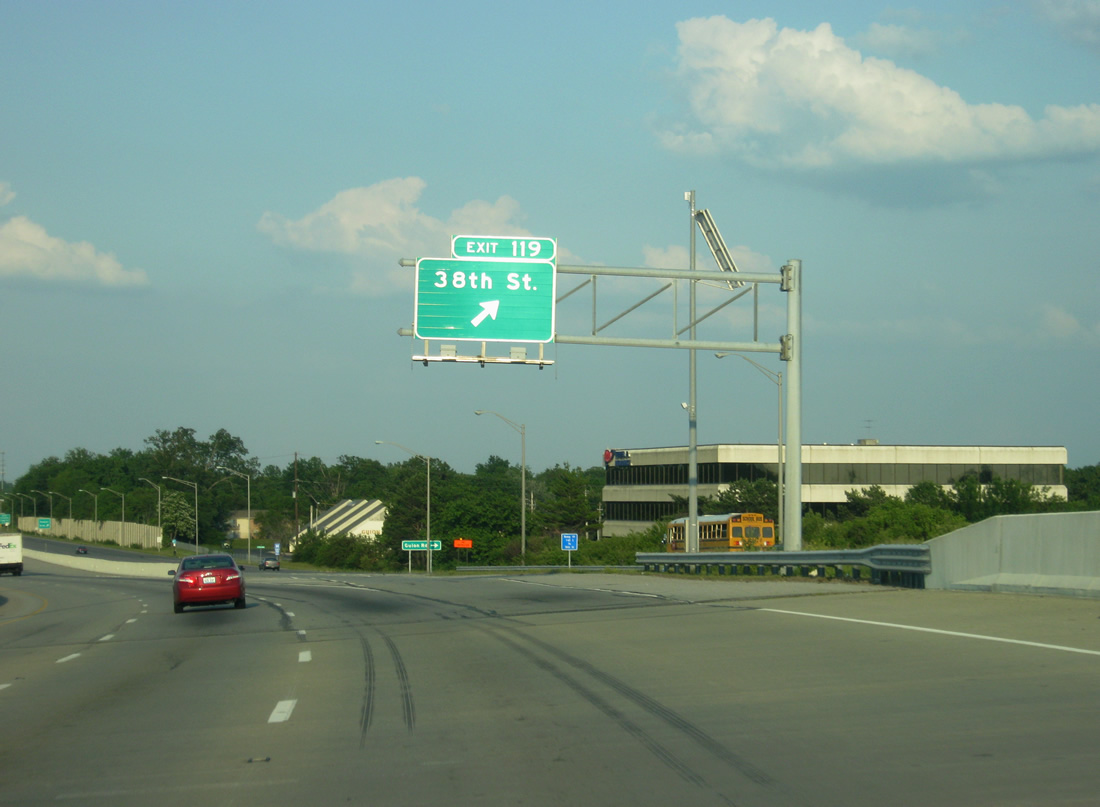
| An Interstate 65 reassurance shield greets motorists after the on-ramp from Lafayette Road onto Interstate 65 south, which was rebuilt in the late 1990s from Exit 123 south through Exit 119 and 38th Street. Up ahead, the Georgetown Road overpass was among the new bridges built over the widened highway. 05/14/12 |
|
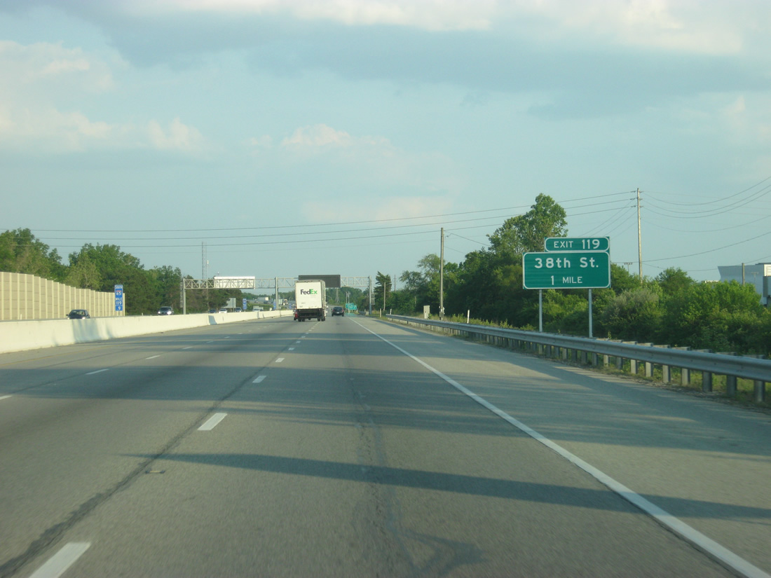
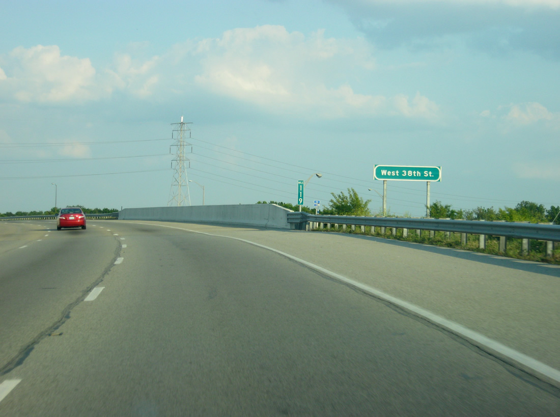
| Angling southeast, Interstate 65 next splits with a collector distributor roadway (West 38th Street). 05/14/12 |
|
| West 38th Street constitutes a commercial arterial east from Exit 17 of Interstate 465 to the split diamond interchange of Exit 119. The arterial comprises the c/d roadway system of Interstate 65 through its folded diamond interchange with Kessler Boulevard. 05/14/12 |
|
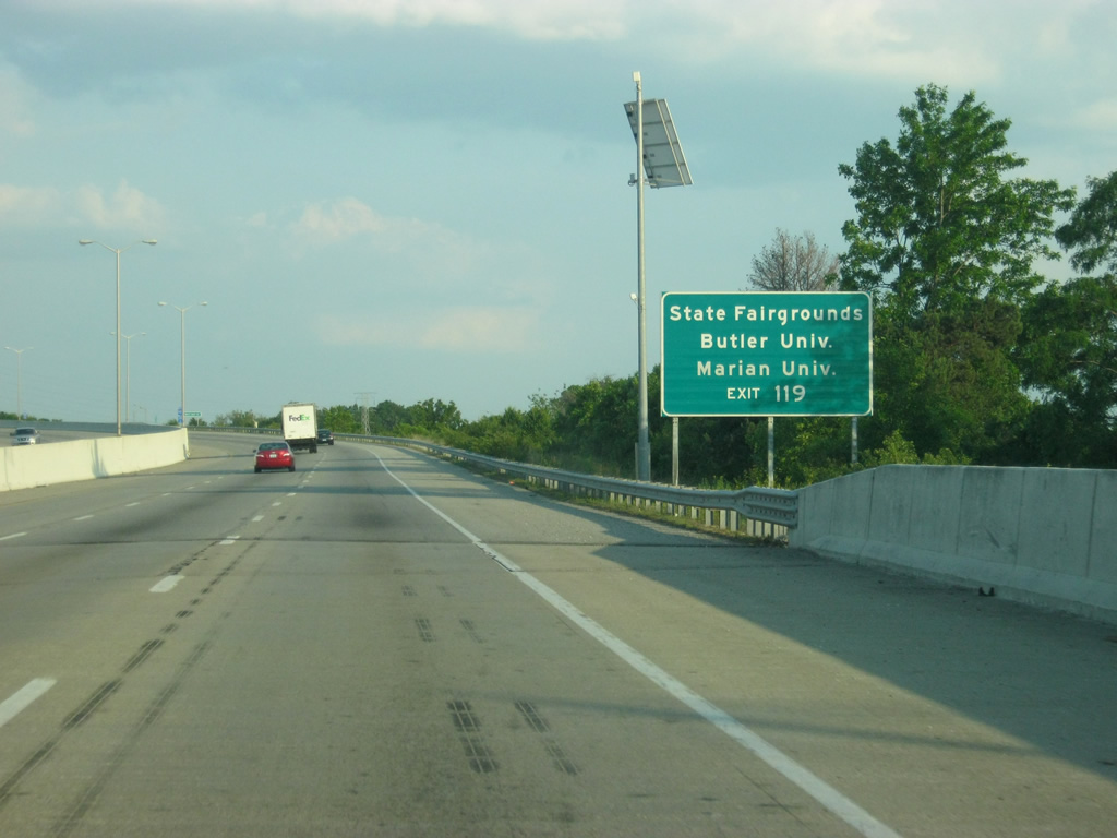
| Exit 119 leads to several cultural destinations on the north side of Indianapolis. The Indiana State Fairgrounds is located at East 38th Street and Binford Boulevard (former SR 37). Butler University, home of the Bulldogs, is located a mile north of 38th Street off of Meridian Street (former U.S. 31) and Marian University, a private Catholic University, is located along Cold Spring Road just south of 38th Street nearby. 05/14/12 |
|
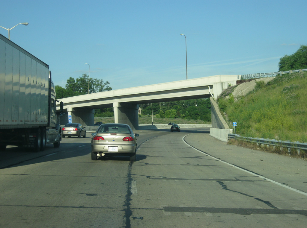
| Just before the ramp for Exit 119, Interstate 65 crosses the westbound lanes of 38th Street, as Exit 119 will lead to the eastbound lanes. 05/14/12 |
|
| Exit 119 departs as a slip ramp onto the West 38th Street c/d roadway. 38th Street travels alongside the freeway to Riverside Park at the Wynnedale community, continuing from there across the White River to Mapleton and the State Fairgrounds. 05/14/12 |
|
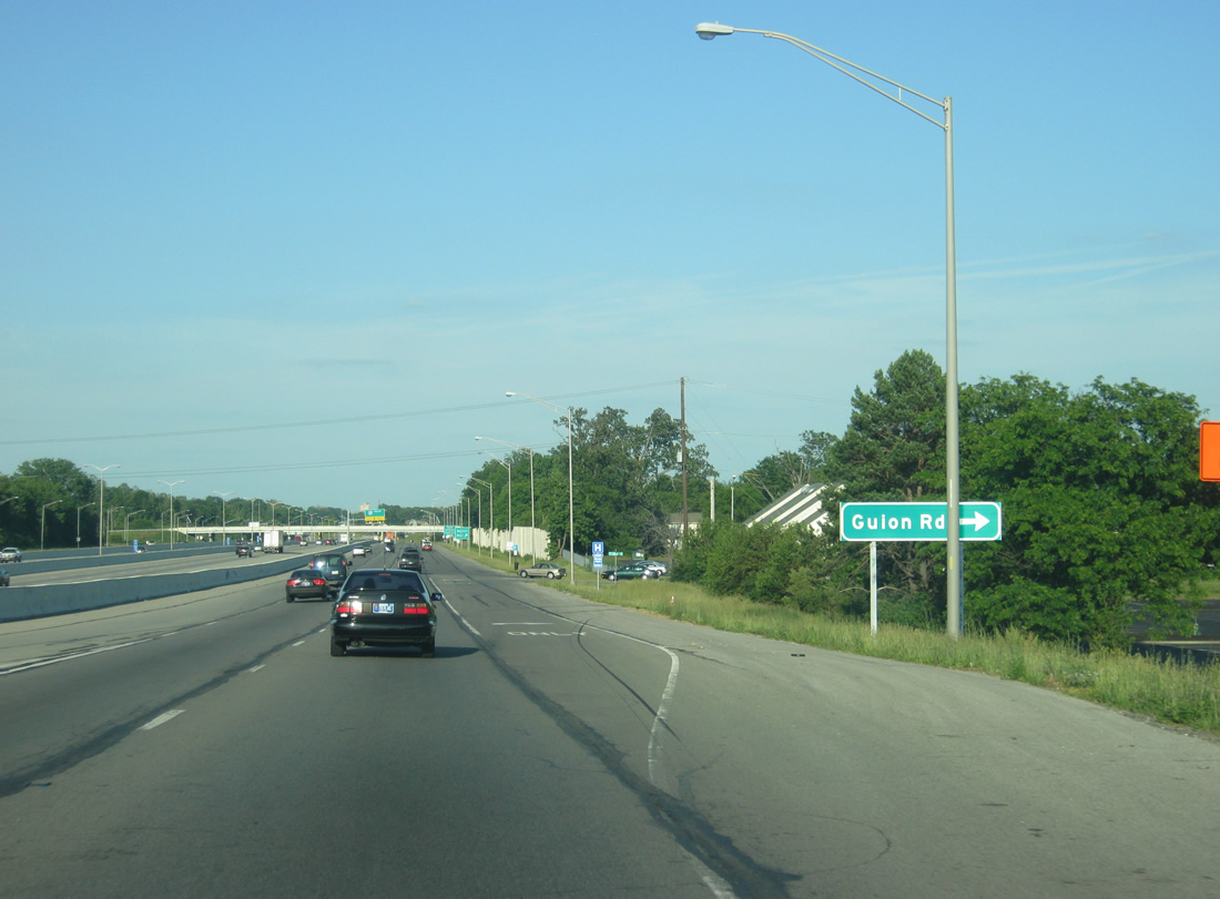
| On the collector distributor road that shares the eastbound lanes for 38th Street, a connector road heads south from East 38th Street to Guion Road, a local road that connects 30th Street to the south with 71st Street to the north in New Augusta. Westview Hospital is just south of this location. 05/14/12 |
|
| A view of Interstate 65 as it straddles the median of 38th Street, which serves as the collector distributor roadway for the elongated Exit 119 complex. Before the interstate was widened to six lanes in the late 1990s, along with a reconstruction of all bridges and roadways, Interstate 65 was four lanes with a grassy median. 05/14/12 |
|
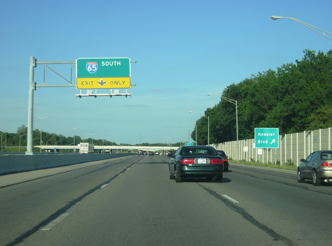
| Eastbound along the collector distributor roadway off of the Interstate 65 freeway at the Kessler Boulevard off-ramp. Kessler Boulevard travels south to Westside Indianapolis and West 16th Street (former U.S. 136) and north to the Wolfington and Broadmoor neighborhoods. 05/14/12 |
|
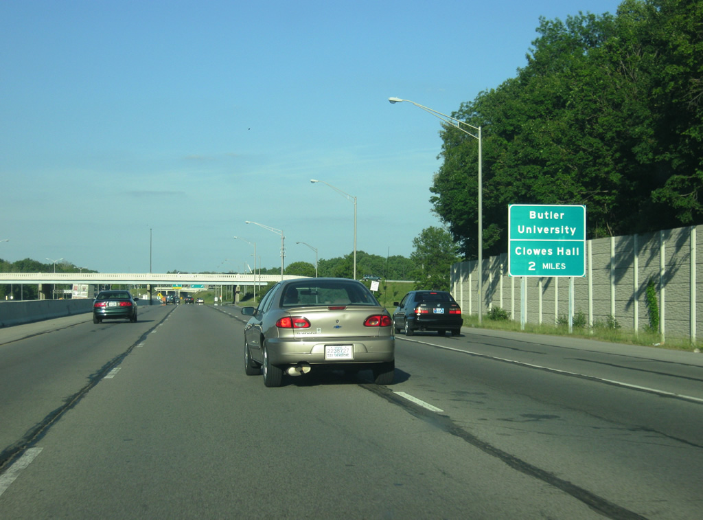
| Interests for Butler University and Clowes Memorial Hall should continue on East 38th Street toward the Butler-Tarkington neighborhood. Both institutions are two miles away via 38th Street, Meridian Street and 46th Street. 05/14/12 |
|
| 38th Street concludes the Exit 119 c/d roadway system via a wye interchange east to Riverside Park. The arterial represents historical alignments for U.S. 36 and SR 67 between Dr. Martin Luther King Jr. Street (old U.S. 421) and Pendleton Pike (old SR 367). 05/14/12 |
|
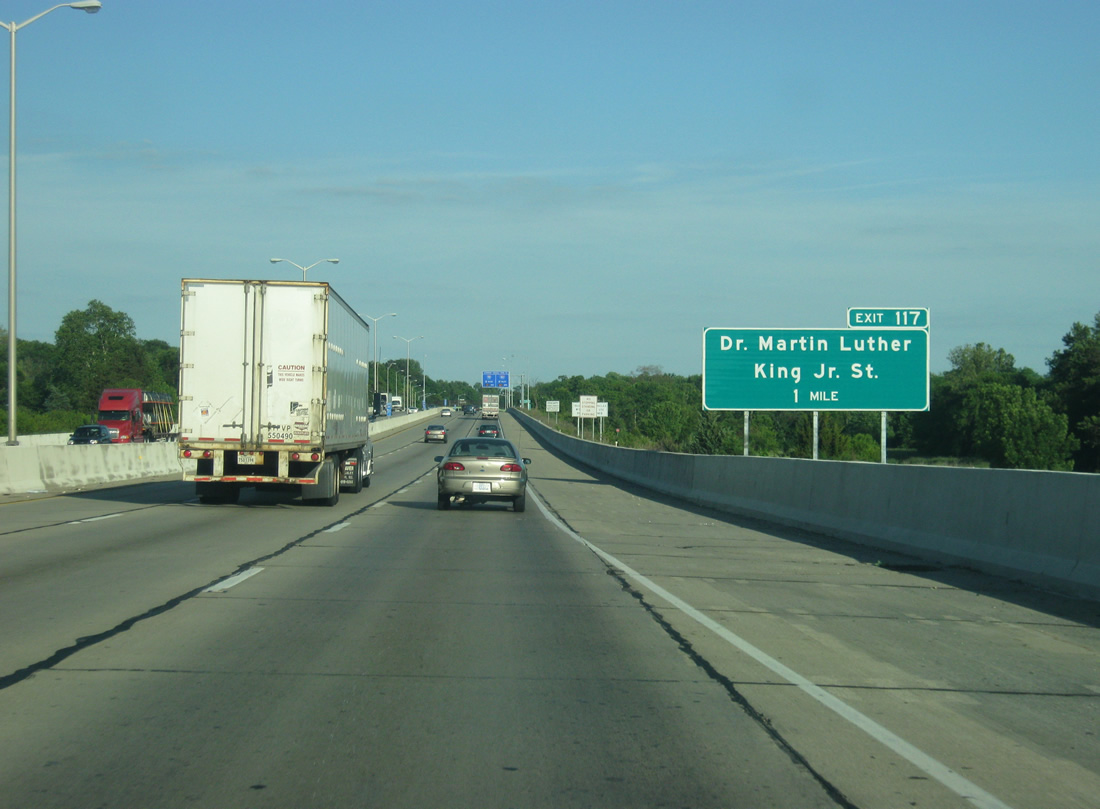
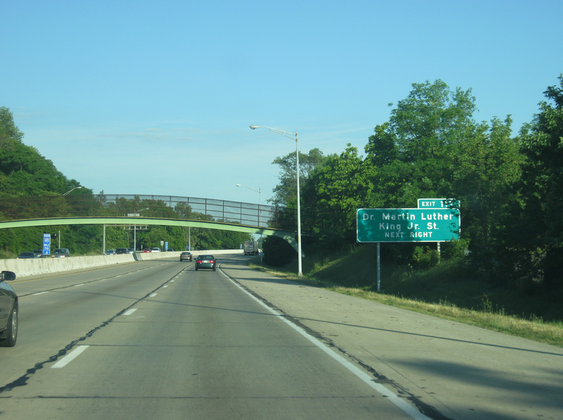
| Interstate 65 bends southeast again, crossing the White River on the one mile approach to Dr. Martin Luther King Jr. Street. MLK Street continues old U.S. 421 south from Michigan Road into downtown Indianapolis. 05/14/12 |
|
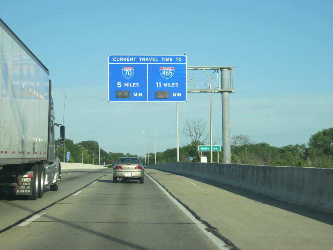
| Approaching Exit 117 (Dr. Martin Luther King, Jr. Street) a new Travel Time Sign alerts motorists of the distance and estimated time to reach Interstates 70 (5 miles) and 465 (11 miles). 05/14/12 |
|
| Bisecting the street grid west of old U.S. 421, I-65 continues another half mile to a parclo interchange (Exit 117) with Dr. Martin Luther King, Jr. Street. 05/14/12 |
|
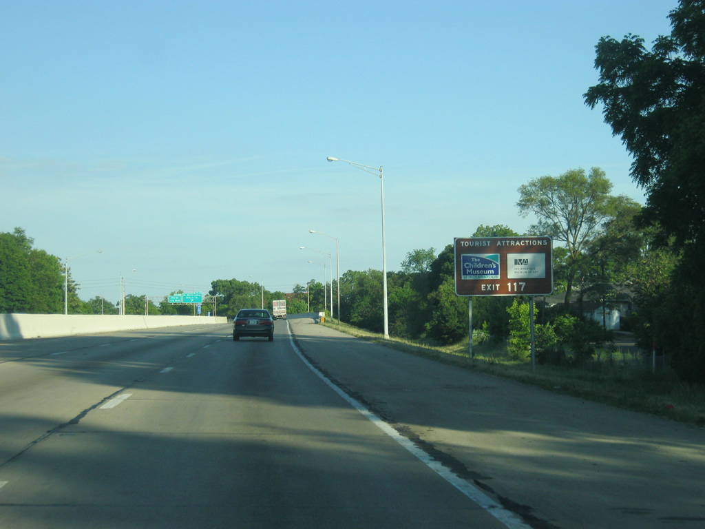
| The Children's Museum of Indianapolis, the largest children's museum in the world, and the Indianapolis Museum of Art can both be reached from Exit 117. The Children's Museum can be accessed via Dr. Martin Luther King, Jr. Street south to 29th Street and east to Illinois Street. The Indianapolis Museum of Art can be accessed by going north on Dr. Martin Luther King, Jr. Street to 38th Street. 05/14/12 |
|
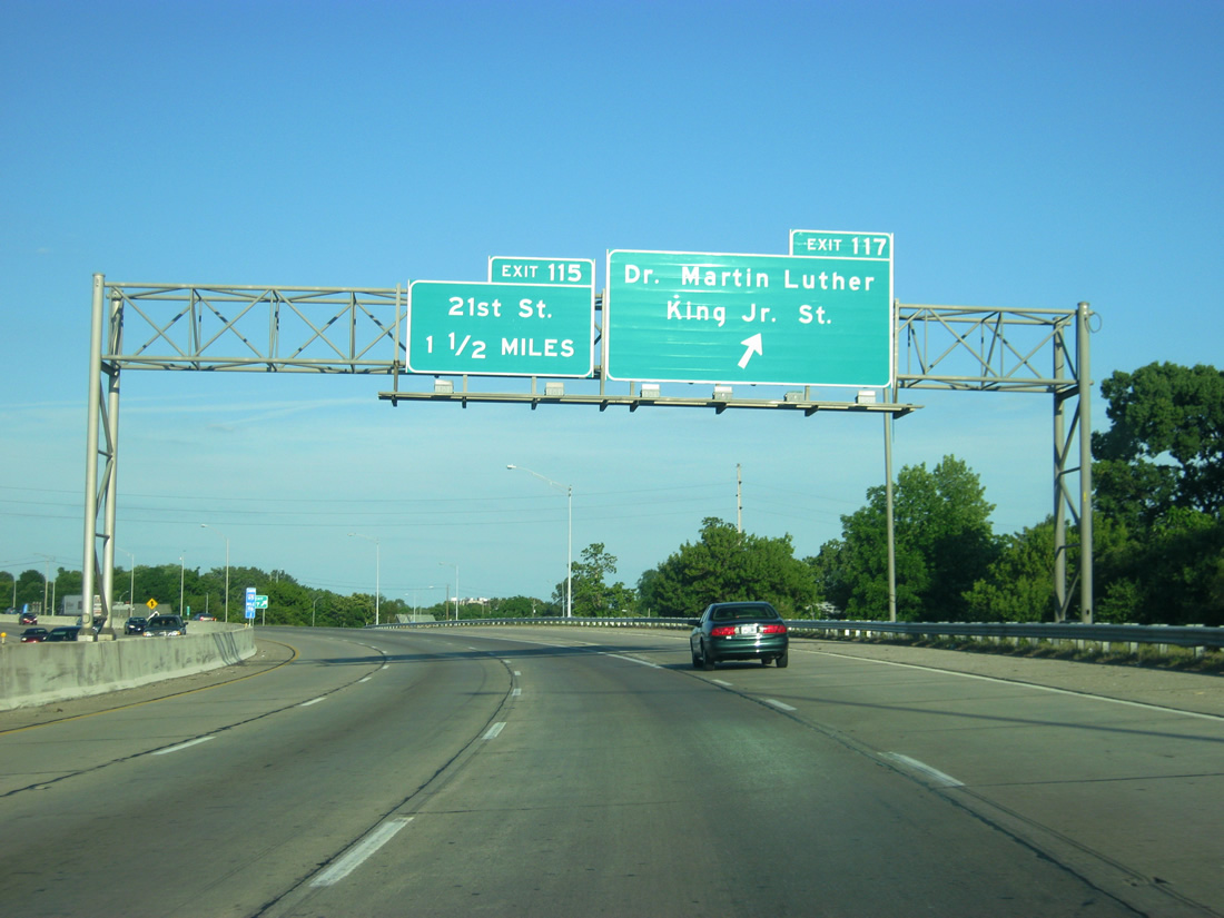
| Exit 117 leaves Interstate 65 south for Dr. Martin Luther King Jr. Street. Old U.S. 421 parallels the freeway southward to Exit 114 outside downtown and leads north to Shooters Hill and Highwoods. 05/14/12 |
|
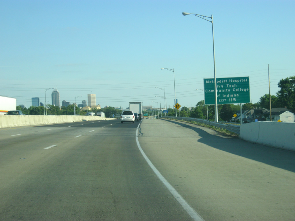
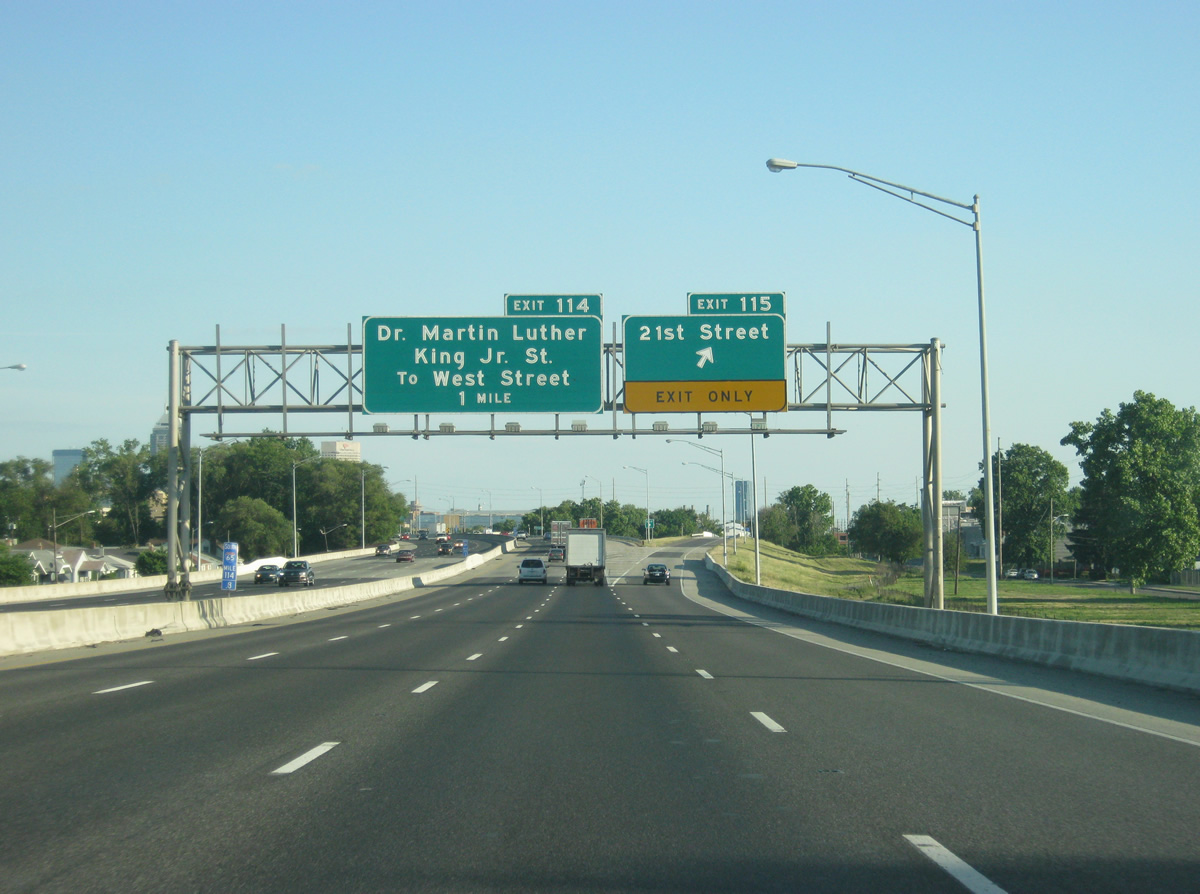
| A parclo interchange joins Interstate 65 north with the 29th and 30th Street one way couplet at Exit 116. Southbound drivers next meet West 21st Street (Exit 115). 21st Street east to Meridian Street (old U.S. 31/SR 37) leads drivers north to Ivy Tech Community College of Indiana. New signage in place by 2012 omits mention of 21st Street and includes the sprawling Methodist Hospital complex at Senate Boulevard and 16th Street. 05/14/12 |
|
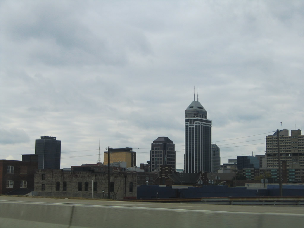
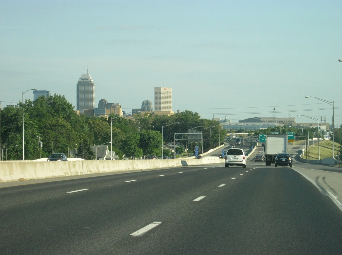
| Indianapolis' skyline comes into view on the southbound approach to the Interstate 65 crossing of Fall Creek. 05/14/12 |
|
| Exit 115 departs Interstate 65 south, passing over Fall Creek Parkway North, before ending at West 21st Street. 21st Street constitutes an east-west arterial between Dr. Martin Luther King, Jr. Street (old U.S. 421) and Meridian Street (old U.S. 31/SR 37). 05/14/12 |
|
| Crossing over 21st Street, the Methodist Hospital complex, a part of the IU Health network dominates the foreground view of the Downtown Indianapolis skyline. 05/14/12 |
|
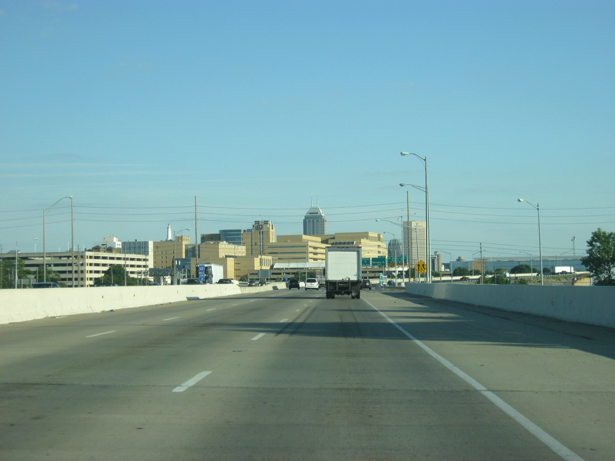
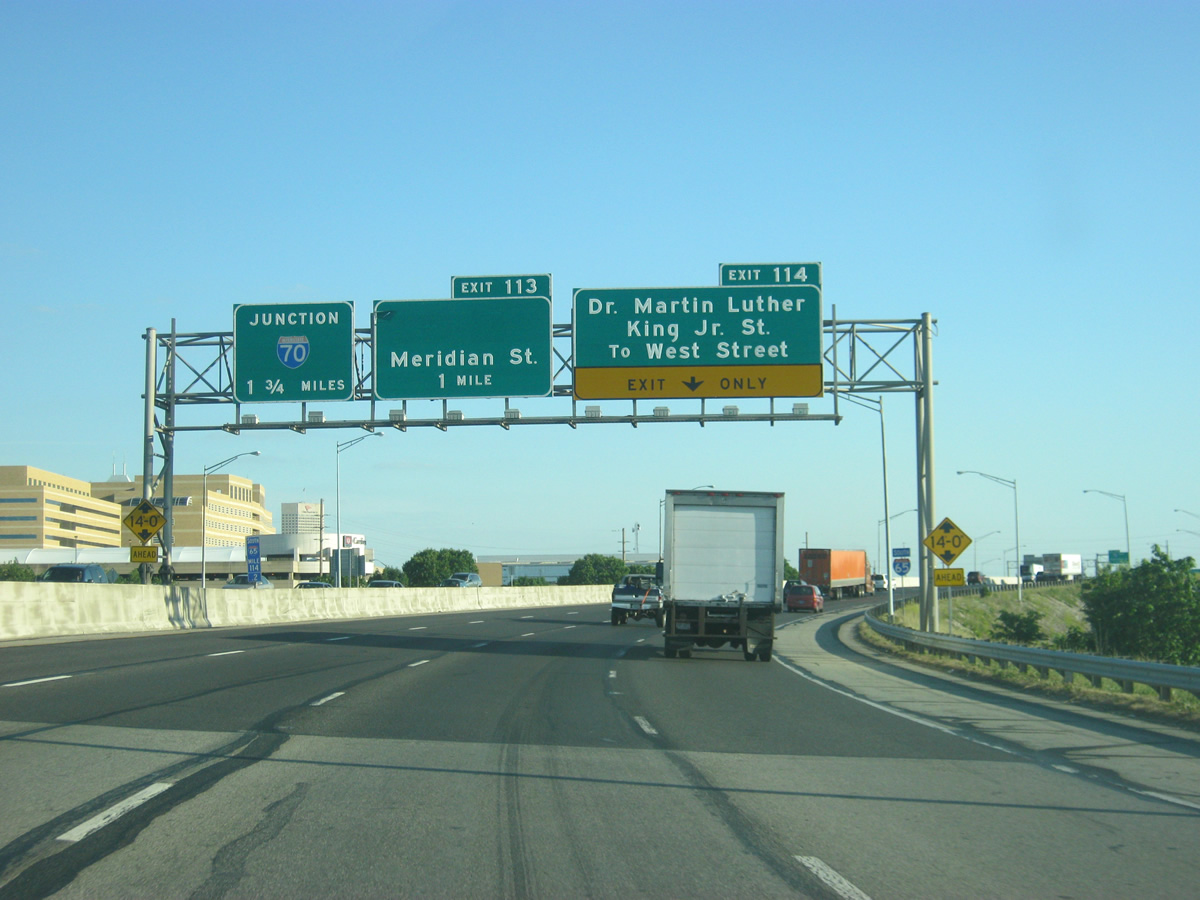
| Nearing downtown, Interstate 65 splits with a freeway spur at Exit 114 to Dr. Martin Luther King Jr. Street (old U.S. 421) south to West Street. The spur and associated interchange were constructed in anticipation of the planned North Leg Extension Freeway leading west to the unbuilt Harding Freeway. 05/14/12 |
|
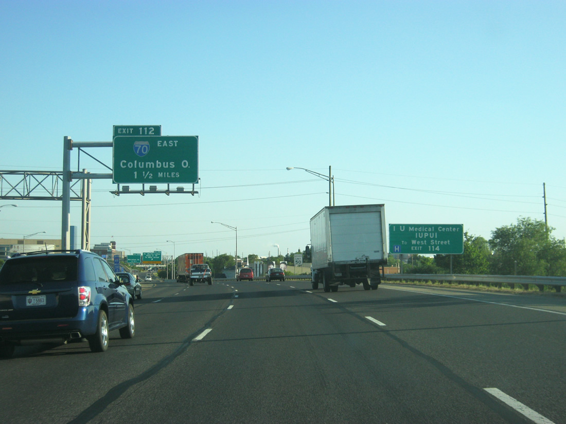
| Interstate 65 travels east-west along the northern fringes of central Indianapolis, merging with Interstate 70 west at Exit 112. Interstate 70 enters Indianapolis from Columbus, Ohio and Richmond. Travelers heading for Indiana University-Purdue University Indianapolis (IUPUI) and the IU Medical Center should use Exit 114 to West Street. 05/14/12 |
|
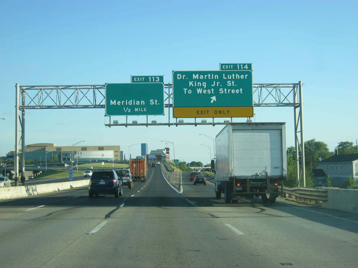
| Exit 114 consists of a tri-level stack interchange with the Martin Luther King, Jr. Street freeway spur. The spur overtakes old U.S. 421 as a divided boulevard, becoming West Street outside downtown to Victory Field and the Indianapolis Convention Center. 05/14/12 |
|
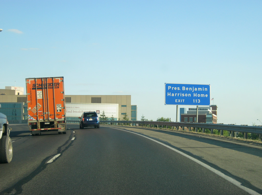
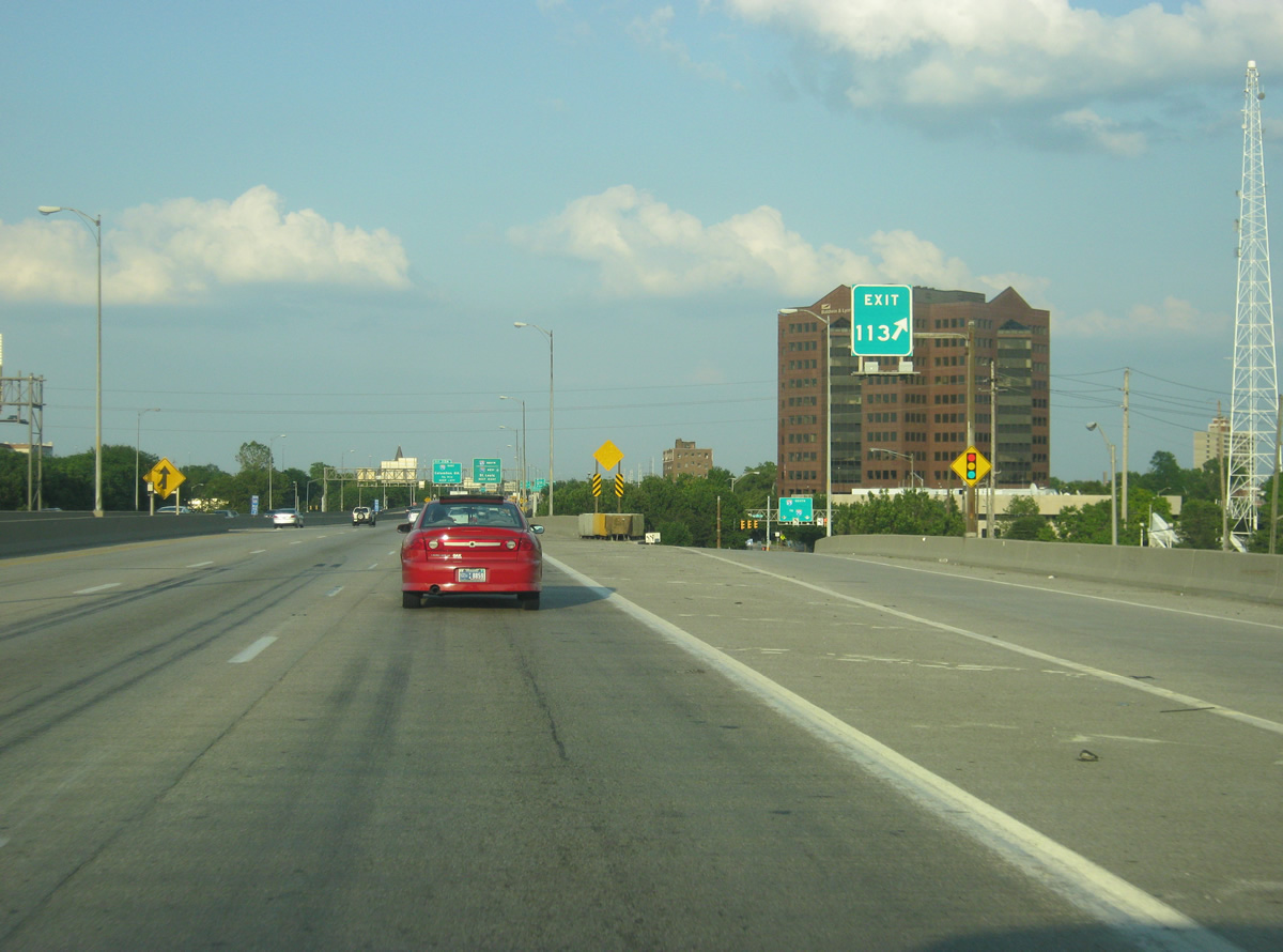
| Interstate 65 makes a sweeping turn to the east as it passes by part of the IU School of Medicine just south of the highway. Interests bound for the President Benjamin Harrison Home should use Exit 113 and head east along 11th Street to Delaware Street and north for a couple of blocks. 05/14/12 |
|
| Interstate 65 follows an elevated viaduct through the Exit 114/113 split diamond interchange with Illinois Street north, Meridian Street (former U.S. 31-36 & SR 37), and Pennsylvania Street south. Exit 114 signage used to display shields for U.S. 31/SR 37. 05/14/12 |
|
| An unusual overhead gore point sign directs motorists onto East 11th Street (frontage road) for Illinois, Meridian, and Pennsylvania Streets. West 12th Street facilitates movements between the north-south streets and Interstate 65 north on the opposite side of the viaduct. 05/14/12 |
|
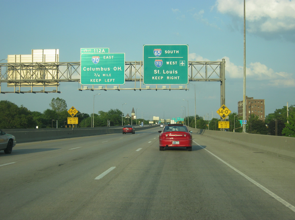
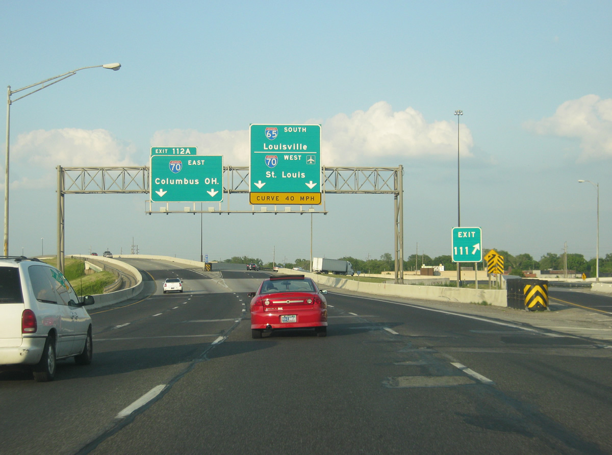
| Exit 112A leaves the left side of Interstate 65 south for Interstate 70 east to Richmond, Dayton, and Columbus, Ohio. Exit 112B was reserved for the unconstructed Northeast Freeway leading northeast to Binford Boulevard and Interstate 465. 05/14/12 |
|
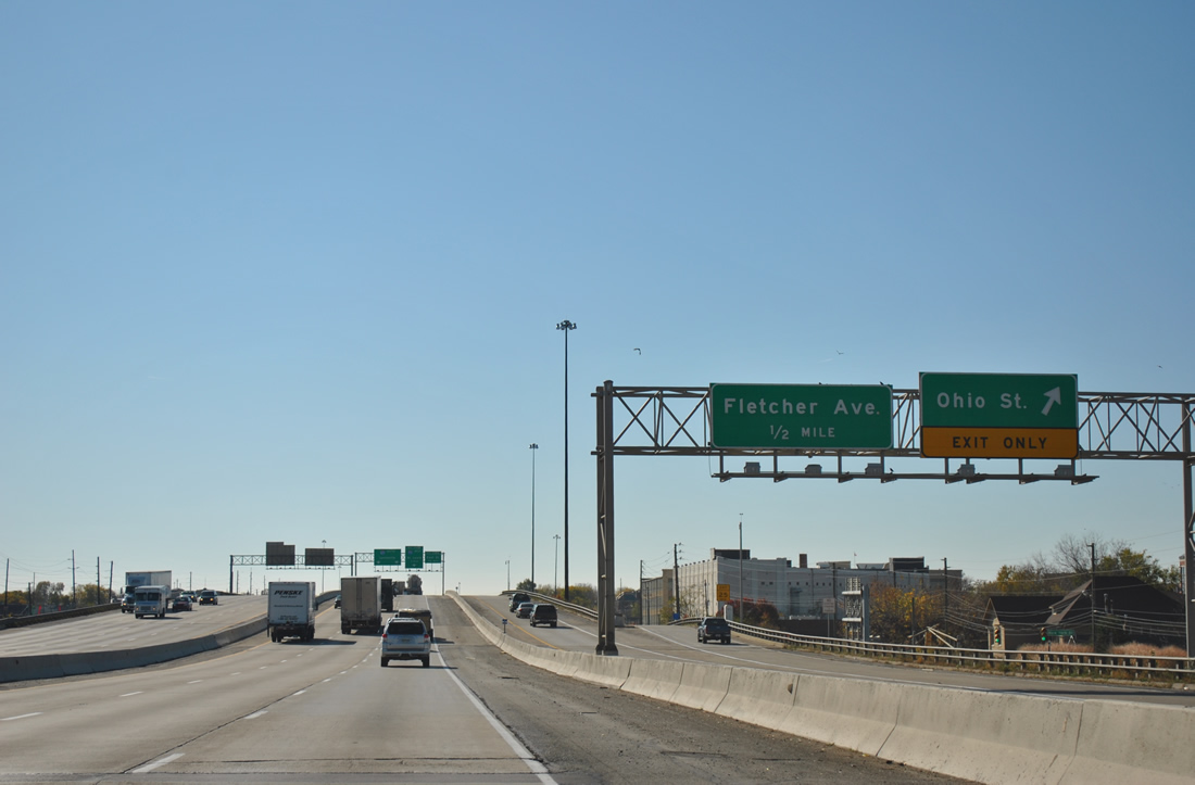
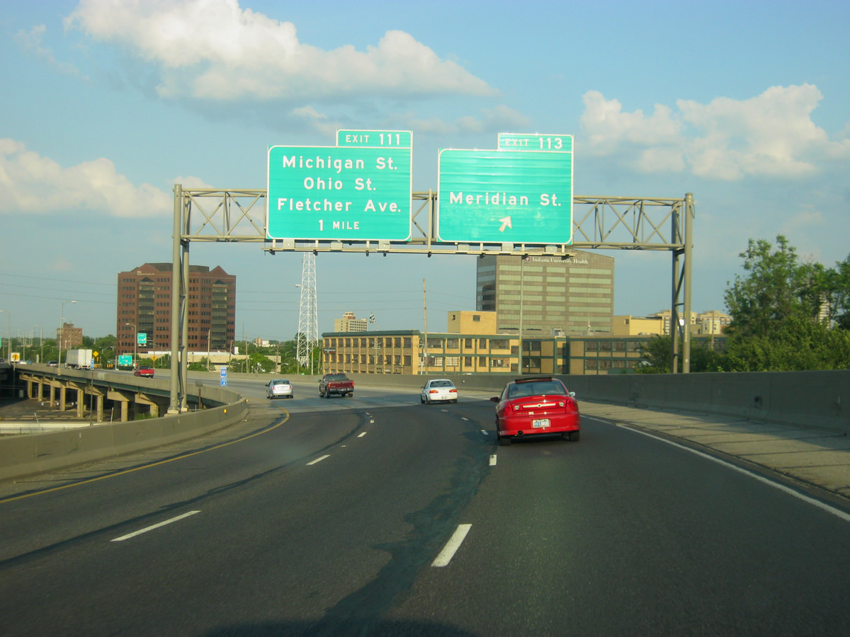
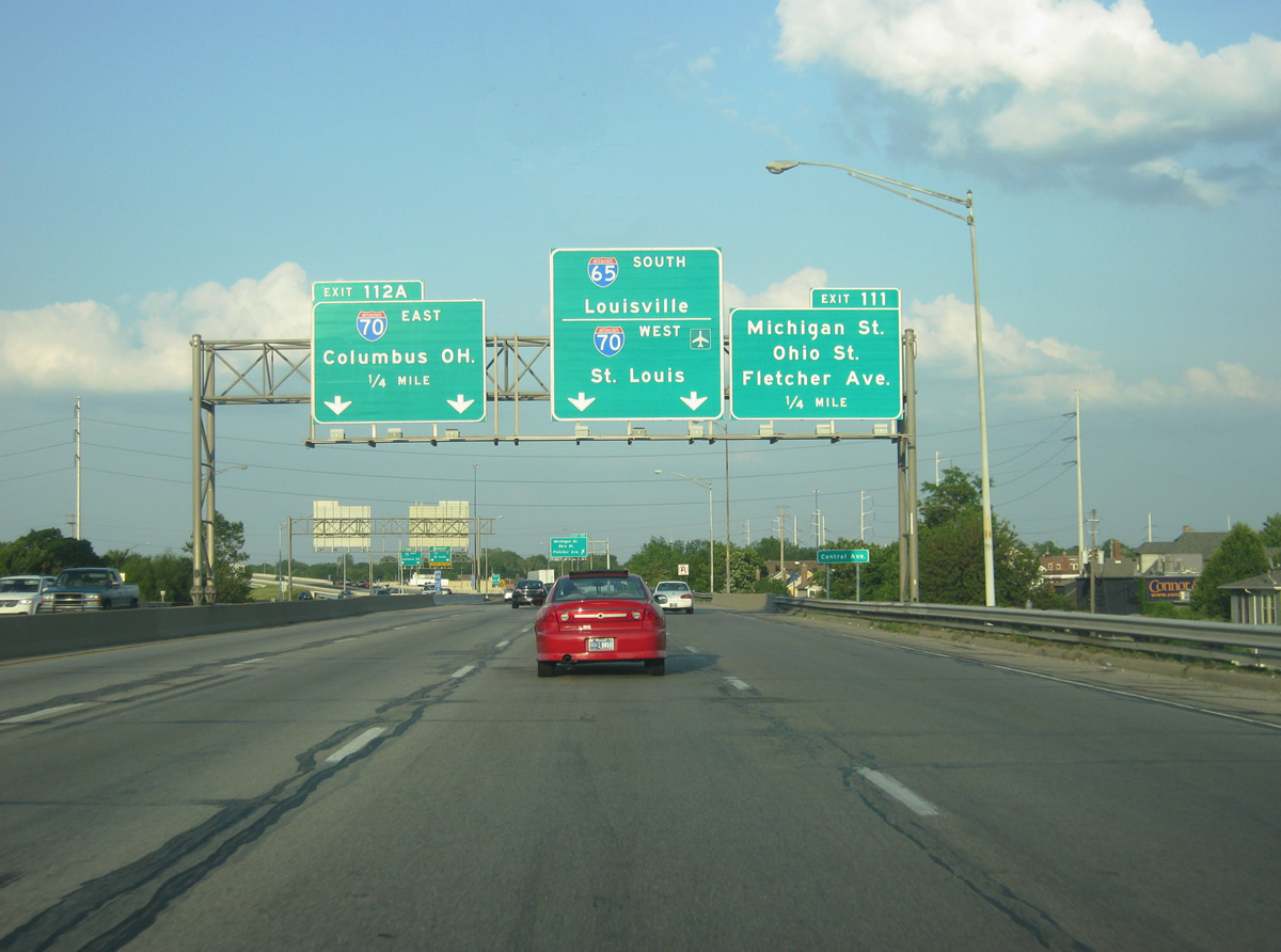
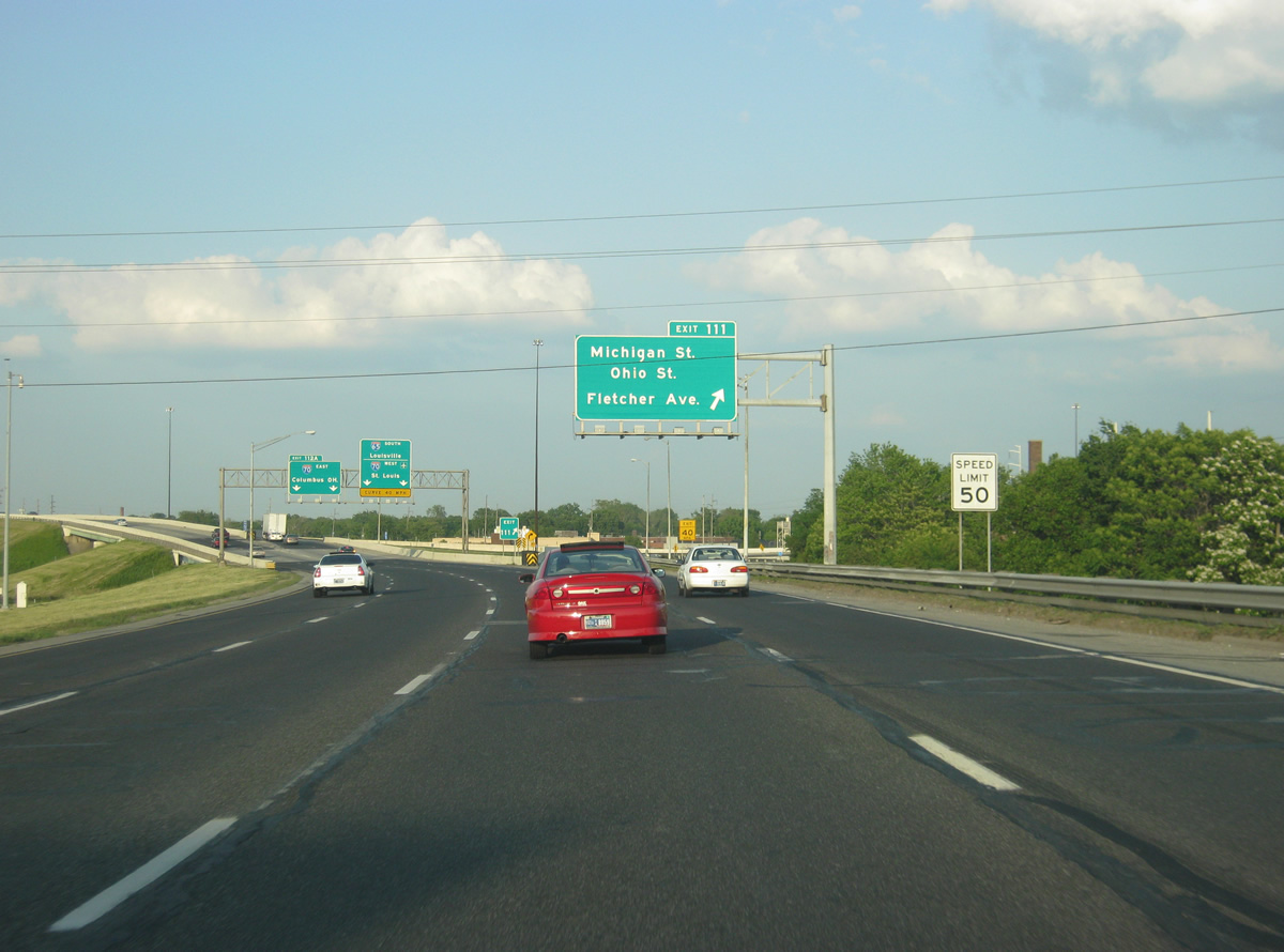
| A high-speed directional interchange lies northeast of College Avenue and East 10th Street between Interstates 65 and 70 (Exit 112A). Ramp stubs are present for the unconstructed southern terminus of Interstate 69. Exit 111 meanwhile prepares to partition from the Interstate 65 southbound mainline as a local roadway to Michigan Street, Ohio Street, and Fletcher Avenue east of downtown. 05/14/12 |
|
| Exit 111 handles all movements between the feeder streets into downtown from I-65/70. The next local off-ramp joins the freeway with East Street at the I-65 & 70 split. 05/14/12 |
|
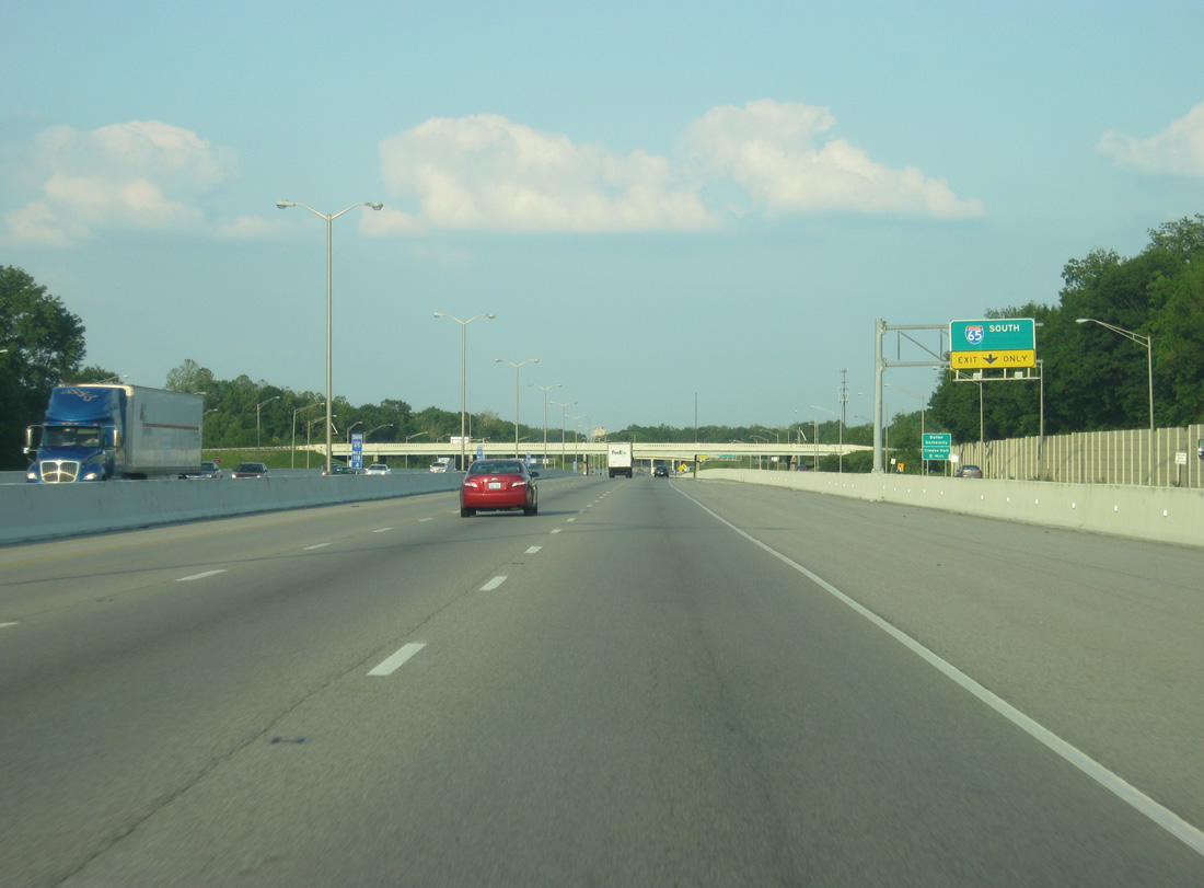
| Four lanes of Interstate 65 south split into separate two lane ramps for Interstate 70 east to Warren Park and I-65/70 to Beech Grove and Indianapolis International Airport respectively. 05/14/12 |
|
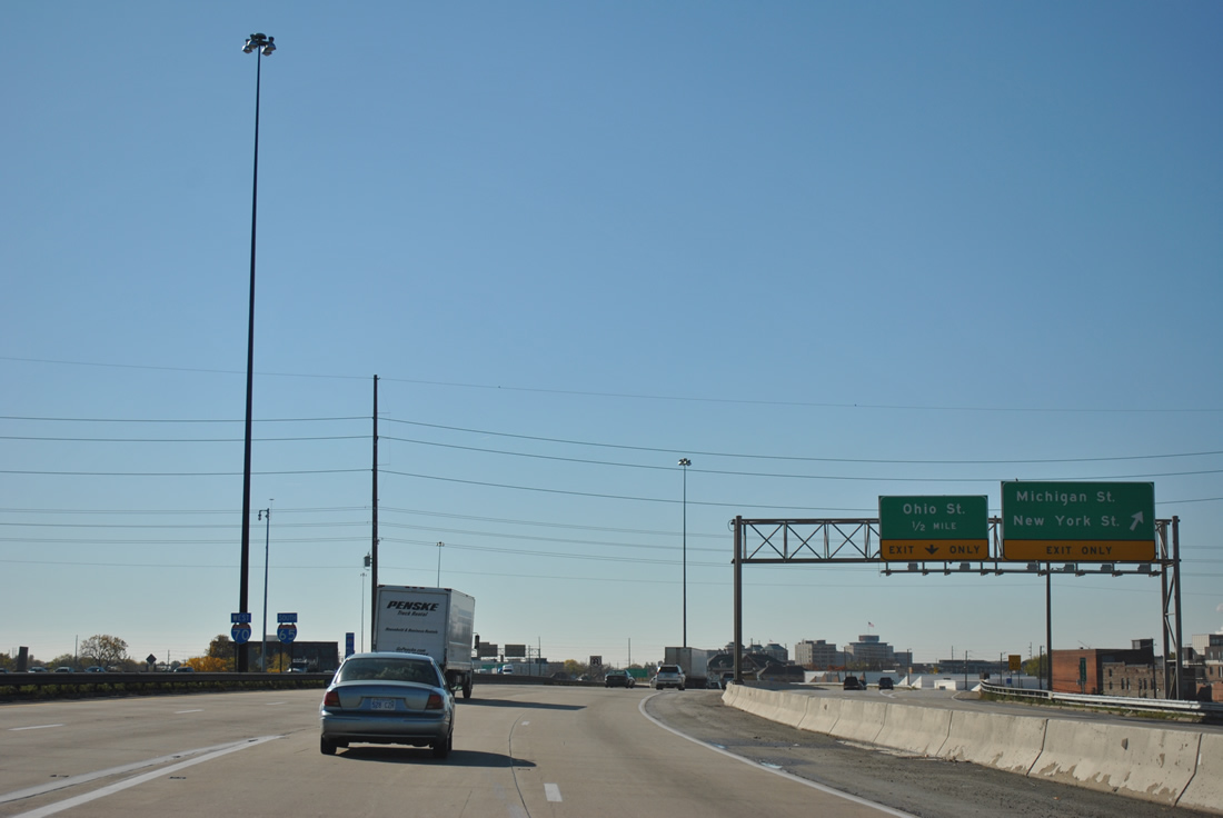
| Exit 83A comprises a local roadway with three separate ramps into downtown. Departing first is the Davison Street (southbound side frontage road) off-ramp to Michigan Street west and New York Street east. 11/04/11 |
|
| Shields posted for Interstates 65 south and 70 west at the merge of the two ramps by the Near Eastside neighborhood. These are the only reassurance markers posted along the 2.13 mile overlap of I-65/70. 11/04/11 |
|
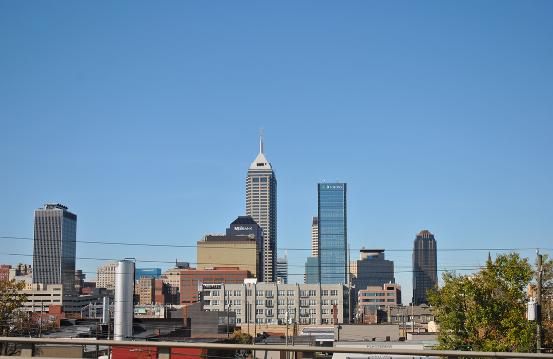
| Looking west at the Indianapolis skyline from I-65/70. 10/16/04, 11/04/11 |
|
| Drivers bound for Ohio Street west into downtown leave the Exit 83A local roadway. Ohio Street provides access to the Indiana state capitol complex and the Soldiers and Sailors Monument. 11/04/11 |
|
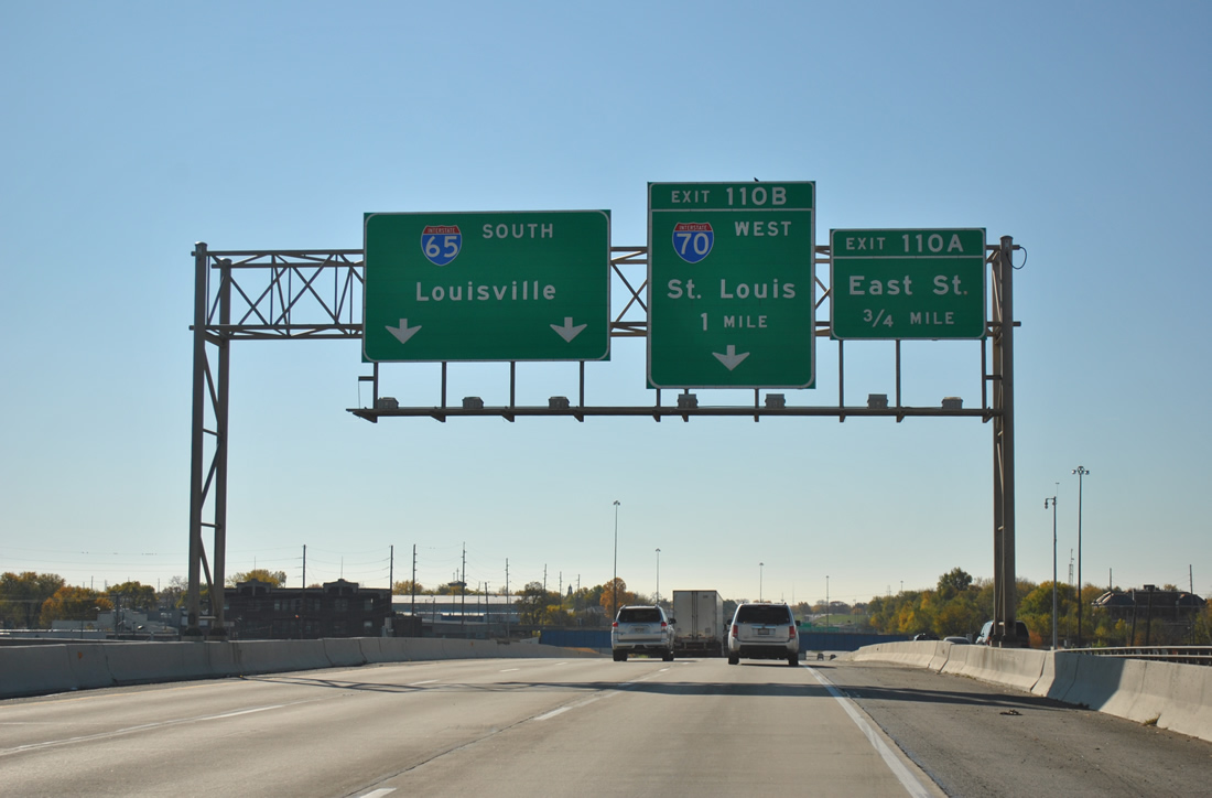
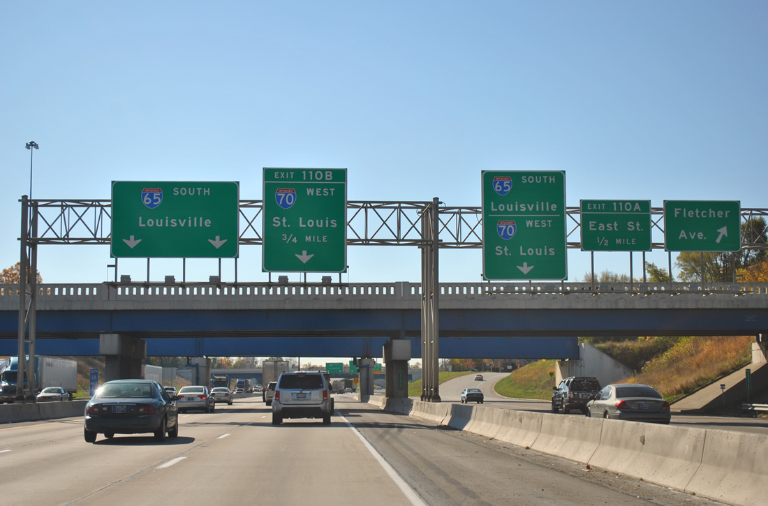
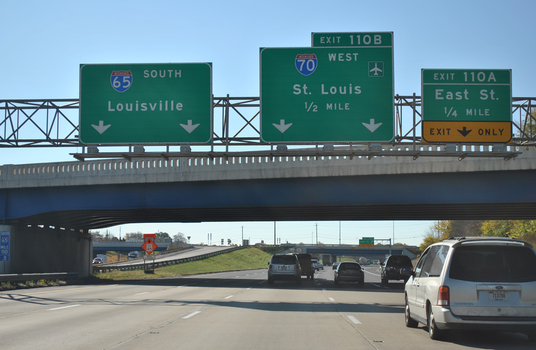
| On-ramps join the local roadway from Market Street east and Ohio Street west ahead of the Fletcher Avenue off-ramp. Fletcher Avenue links Shelby Street east of I-65/70 with the six-way intersection of East Street, South Street, and Virginia Avenue. South Street west leads to the Bankers Life Fieldhouse (home of the Indiana Pacers NBA franchise) and Lucas Oil Stadium (home of the Indianapolis Colts NFL franchise).
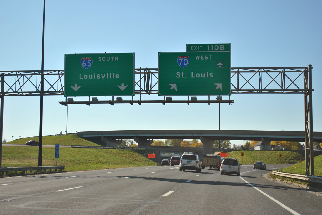
I-65/70 meanwhile prepare to split at a tri-level stack interchange (Exit 110B). 11/04/11 |
|
| Interstate 65 continues southeast toward Beech Grove and Louisville, Kentucky. Interstate 70 resumes its westward course to Indianapolis International Airport and Terre Haute. 11/04/11 |
|
| Exit 110A leaves before the split, carrying motorists west to East Street at Bicking Street west. 11/04/11 |
|
| Southbound Interstate 65 at the Exit 110B departure of Interstate 70 west. Interstate 70 continues west from Indianapolis to St. Louis, Kansas City, and Denver on its 2,153.13 mile route across the country. The freeway was completed in Indiana by 1976.2 Interstate 65 travels 887.30 miles overall and 261.27 miles within the Hoosier State. Completion of the north-south freeway within the state occurred in 1976 as well.3 11/04/11 |
|
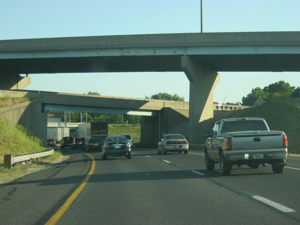
| Interstate 65 continues under the tri-level stack with Interstate 70. 05/14/12 |
|
| Exiting downtown, Interstate 65 passes over Shelby Street and Pleasant Run on the half mile approach to Exit 169 (East Raymond Street). Raymond Street constitutes a divided arterial east to Southeastern Avenue (former U.S. 421) and west to Sam Jones Expressway. 05/14/12 |
|
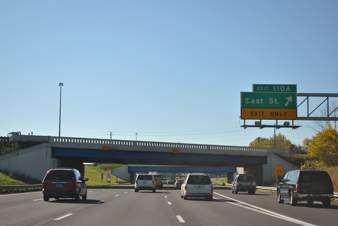
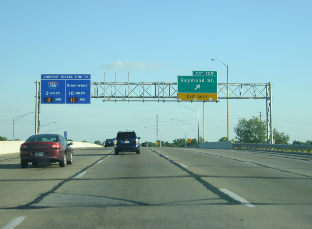
| A six-ramp parclo interchange joins Interstate 65 with Raymond Street (Exit 109) three miles north of I-74/465 (Exit 106). Raymond Street serves the Near Southeast and Garfield Park neighborhoods nearby. A travel time giving the distance and time to Exit 106 and to the Greenwood interchange (Exit 99) replaced the older Exit 106 guide sign. 10/16/04, 05/14/12 |
|
| An Interstate 65 shield past the on-ramp from Raymond Street to Interstate 65 south. The stretch of Interstate 65 from the South Split (Exit 110) to Keystone Street (Exit 107) cut a wide swath through the south side neighborhoods of Fountain Square, Garfield Park and Bean Creek and was among the last stretches of interstate to be built through Indianapolis. 05/14/12 |
|
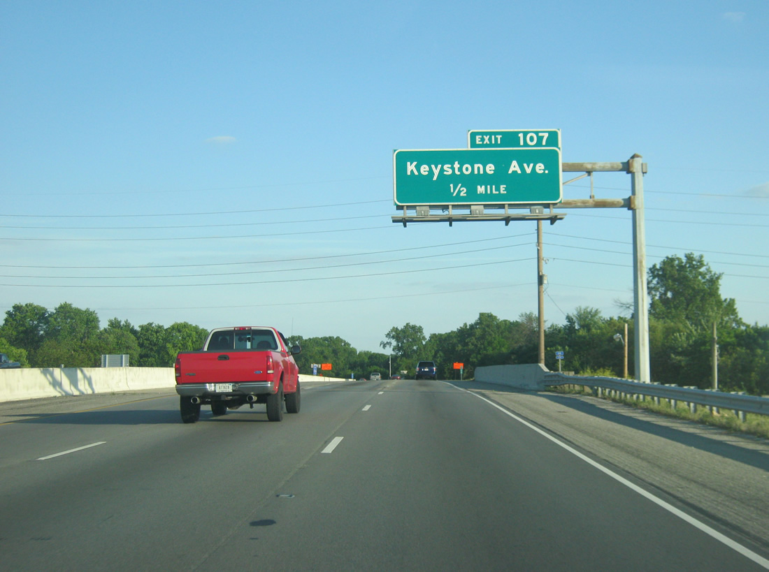
| Keystone Avenue crosses paths with Interstate 65 at a diamond interchange (Exit 107) in south Concord. 05/14/12 |
|
| One half mile north of Keystone Avenue at the Troy Avenue underpass of Interstate 65 south. Keystone Avenue travels south from Southeastern Avenue (old U.S. 52 & 421) to Edgewood. 05/14/12 |
|
| The University of Indianapolis can be reached from Exit 107 by going south on Keystone Avenue and west on Hanna Avenue. 12/04/11 |
|
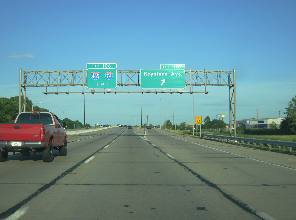
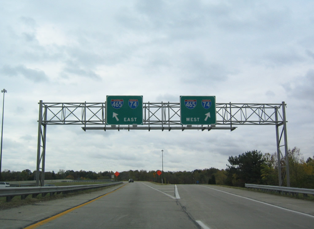
| Exit 107 departs Interstate 65 south for Keystone Avenue as travelers near the symmetrical directional cloverleaf interchange with I-74/465 (Exit 106). Interstate 74 follows the Indianapolis beltway for 20.60 miles between Speedway and Five Points. 05/14/12 |
|
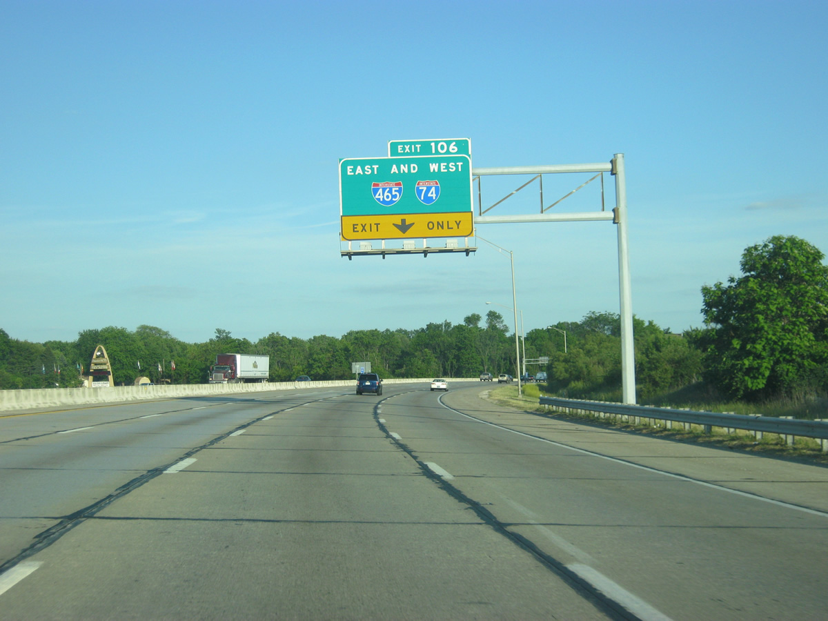
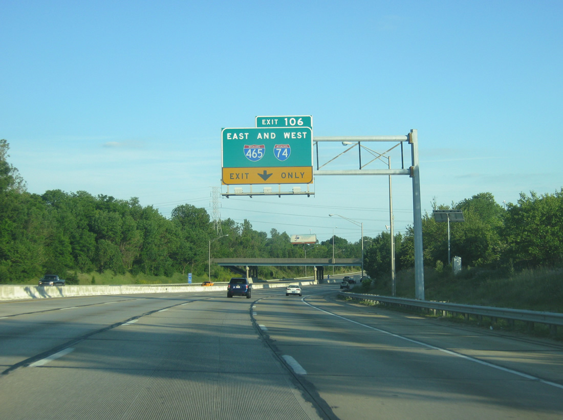
| Exit 106 carries motorists to I-74/465 east and west in unison from Interstate 65 south. 05/14/12 |
|
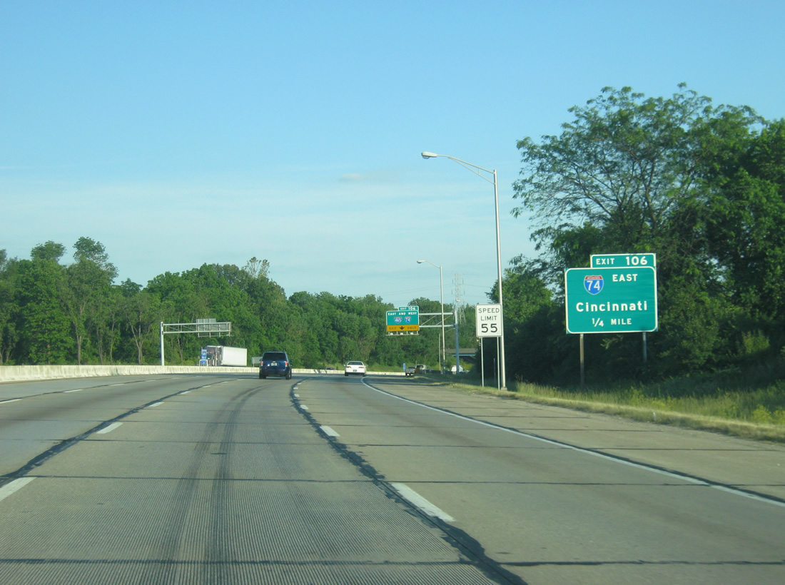
| Interstate 74 leaves Interstate 465 north in four miles for its own path eastward to Cincinnati, Ohio. The freeway also serves Shelbyville and Greensburg, doubling as U.S. 421 to Exit 132. 05/14/12 |
|
| Hanna Avenue crosses over Interstate 65 ahead of Exit 106 to the Indianapolis beltway. I-465 enters Beech Grove just east of Exit 106 and travels west four miles to SR 37 (Harding Street), the planned route of I-69 south. 05/14/12 |
|
| Exit 106 expands to two lanes as it parts ways with I-65 south. I-65 continues to the Southport area of south Indianapolis on the 108 miles to Louisville. I-74 travels 171.54 miles through Indiana and was fully completed by 1967.1 I-465 replaced SR 100 as the belt route for the capital city and was completed by 1970.2
The interchange complex was modified in 2013 with a new flyover ramp from I-465/74 west to southbound I-65 that replaced a loop ramp. A widened ramp leads from northbound I-65 to I-465/74 east as well. Both were a part of the Operation Indy Commute.3 |
|
| Drivers partition into separate ramps for the beltway. Interstate 74 meets the beltway with a freeway spur leading into the city at the eastern merge point and formerly with one leading into Speedway at the west merge point. The western stub was removed in 2011 with an upgrade of Exit 16B. 10/16/04 |
|
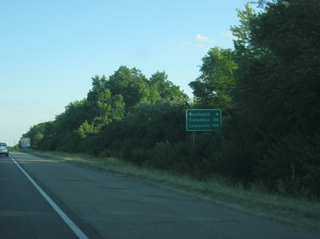
| Shield and distance sign combo south of Exit 106 with I-465/74. Among the planned works with the Indy Commute project will be a continuous lane from the combined on ramps from west and east I-465/74 onto Interstate 65 south to the Southport Road interchange (Exit 103). South of the Indianapolis beltway, the next community is Southport, only four miles away via Interstate 65 and Southport Road. Columbus, the largest city along the interstate between Indianapolis and Louisville, is 38 miles away and the main control city of Louisville, Kentucky is 108 miles away. 05/14/12 |
|
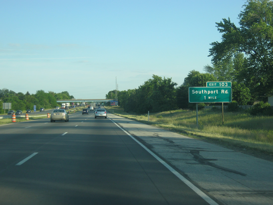
| Exit 103, for Southport Road, is one mile away. Through southern Marion County, Interstate 65 remains a busy highway, necessitating the six lanes throughout. 05/14/12 |
|
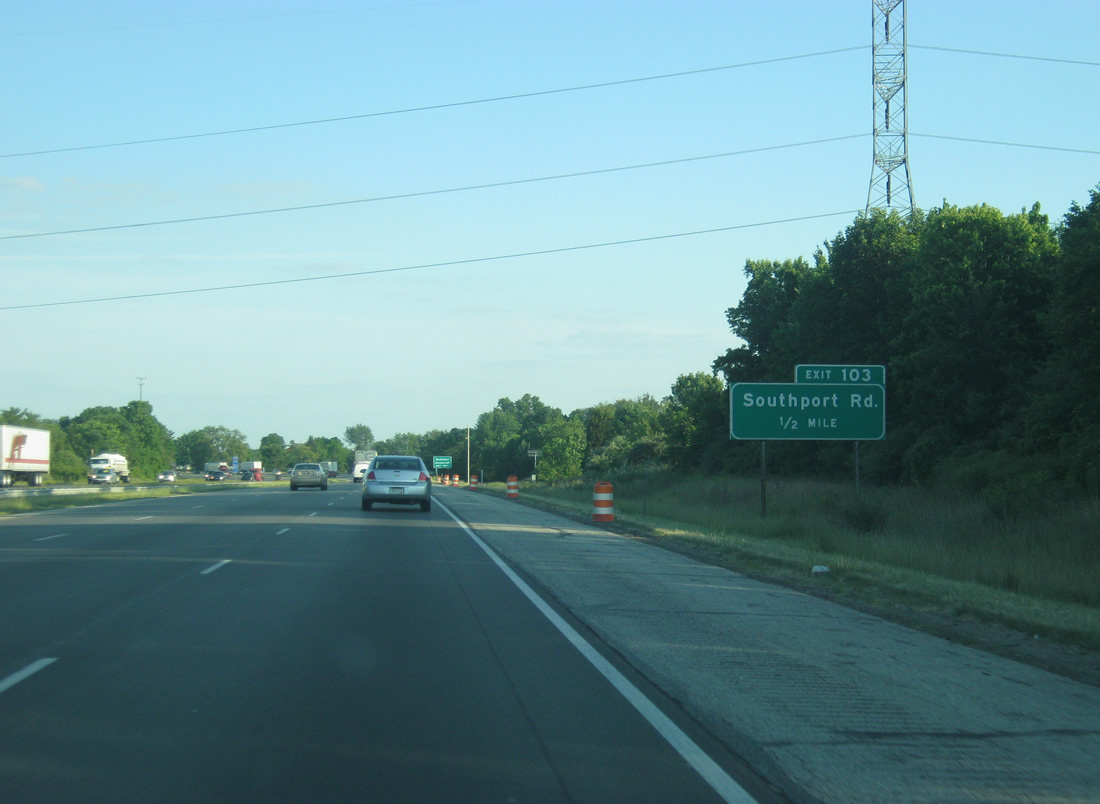
| A half mile now from Exit 103 (Southport Road). Southport Road is a major west-east road across the southern tier of Marion County, stretching from West Newton on the far southwest part of the county to Acton in the far southeast. 05/14/12 |
|
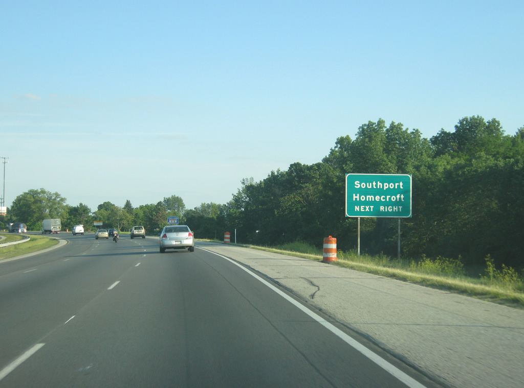
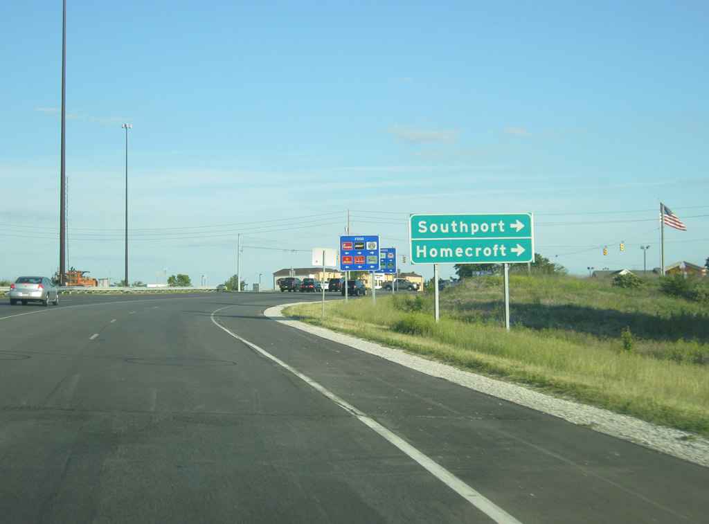
| The communities of Southport and Homecroft can be reached via Exit 103 (Southport Road). Southport, located a couple of miles west of the interchange along Southport Road, is one of the four excluded cities that were kept after Indianapolis merged with Marion County in the early 1970s. Homecroft, just north of Southport, is one of the "included towns" of Marion County, which have some levels of autonomy, whereas Southport has full autonomy. 05/14/12 |
|
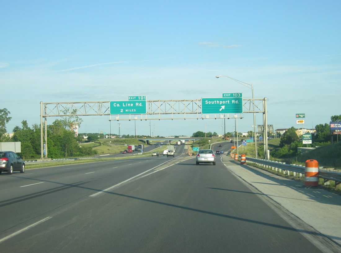
| Now at the exit ramp at Exit 103 for Southport Road. The area around Southport Road is filled with big-box shopping centers, restaurants, and hotels. Exit 103 serves the suburban areas of Southport, eastern Perry Township and western Franklin Township. County Line Road, at the boundary of Marion and Johnson Counties, is two miles away. 12/16/11 |
|
| On the off ramp from Interstate 65 south to Southport Road, both Southport and Homecroft are about a couple of miles to the west. Numerous restaurants, stores and hotels serve travelers around Exit 103, leading east to the busy intersection with Emerson Avenue and Southport Road and west toward the McFarland Farms area. 05/14/12 |
|
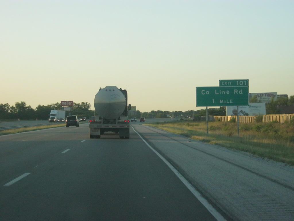
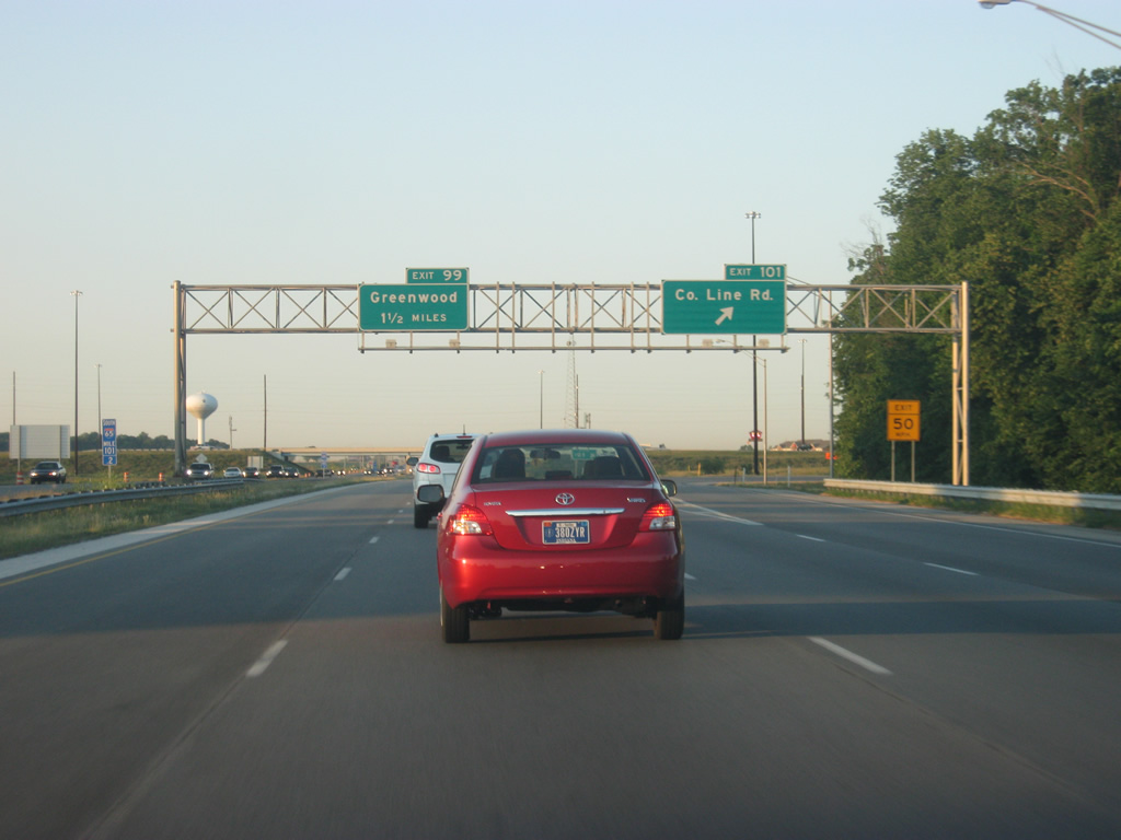
| South of Exit 103, Exit 101 (County Line Road) is one mile away. Exit 101 is a rather new interchange, opening in 1999 to provide another interchange for the growing Southside suburbs and lessen the traffic congestion at Exits 103 (Southport Road) and 99 (Main Street, Greenwood). 06/06/12 |
|
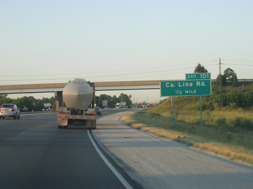
| A half mile away from Exit 101 (County Line Road). County Line Road is a four lane arterial that stretches from Interstate 65 west to SR 135 (Meridian Street). The road continues as a two lane road west to SR 37 where it will have a new interchange with the new Interstate 69 when completed. 06/06/12 |
|
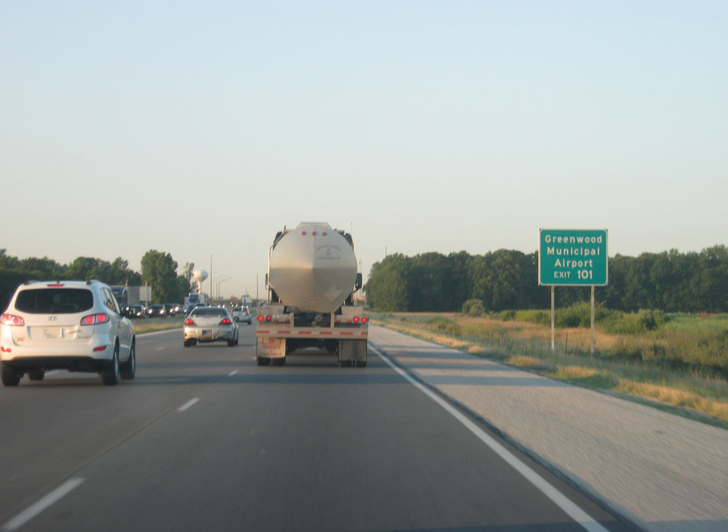
| The Greenwood Municipal Airport, a general aviation airport serving the Southside, is a half mile to the west along County Line Road from Interstate 65. 06/06/12 |
|
| Exit 101 is a parclo interchange between Interstate 65 and County Line Road. County Line Road provides a direct connection with the Greenwood Park Mall; about three miles to the west at U.S. 31 and traffic can be busy along it at peak hours. The original Greenwood interchange at Main Street is now 1 1/2 miles to the south. 06/06/12 |
|
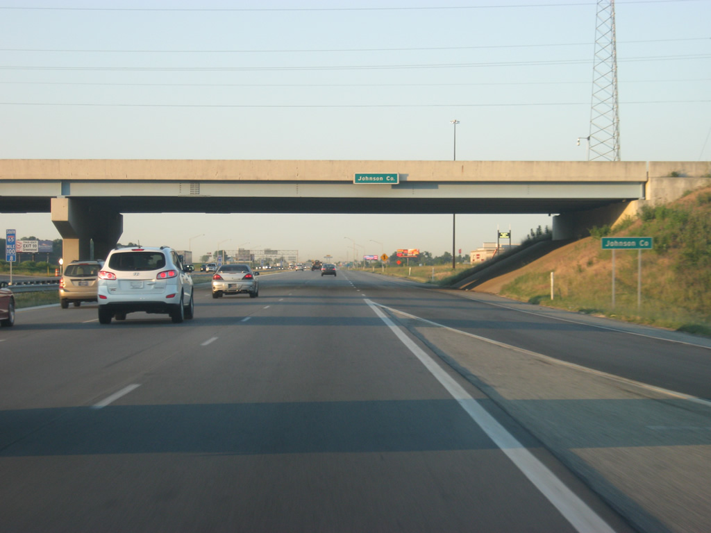
| Passing under County Line Road, Interstate 65 enters Johnson County (population 139,654) and Greenwood (population 49,791). Greenwood is the largest community in Johnson County and has taken in much of the overflow population from southern Marion County. 06/06/12 |
Page Updated 02-26-2013.

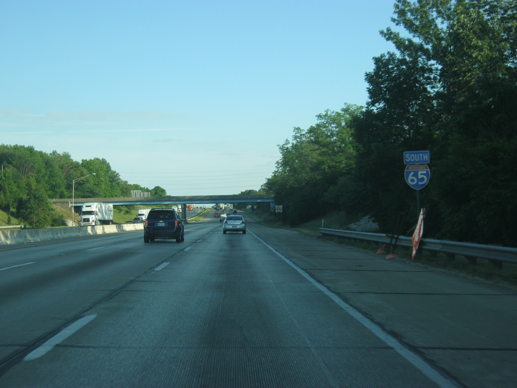
 South
South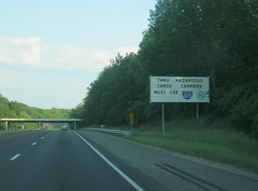
 West
West