|
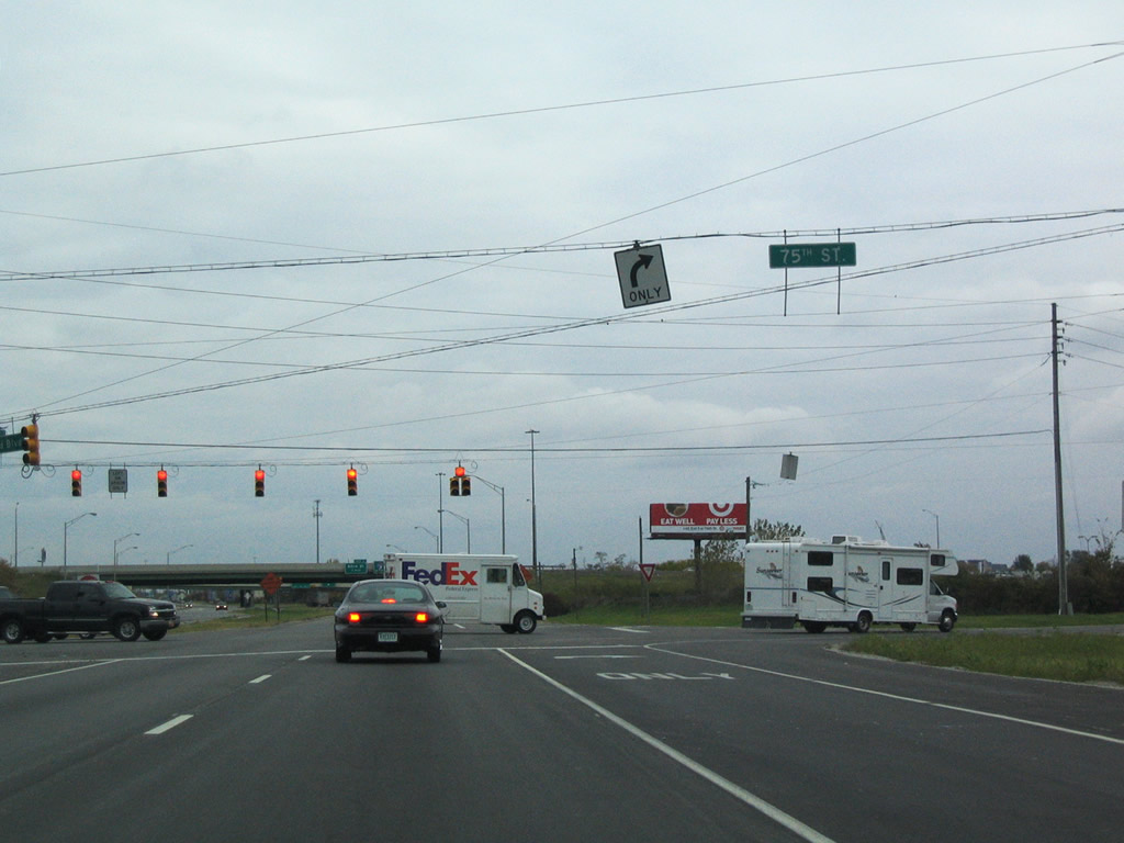
| Binford Boulevard was constructed in the late 1950s as a new alignment for SR 37, replacing the routing along Allisonville Road (later SR 37A). The divided highway travels northeast from Keystone Avenue and Fall Creek Parkway to East 75th Street and the beginning of Interstate 69. 10/16/04 |
|
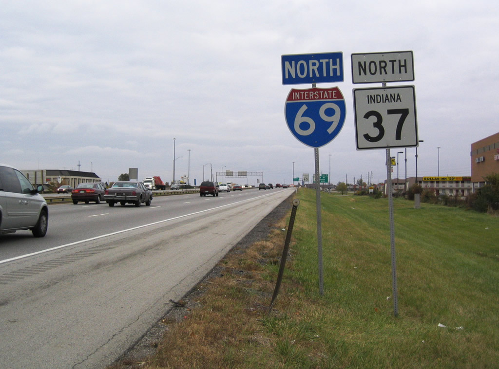
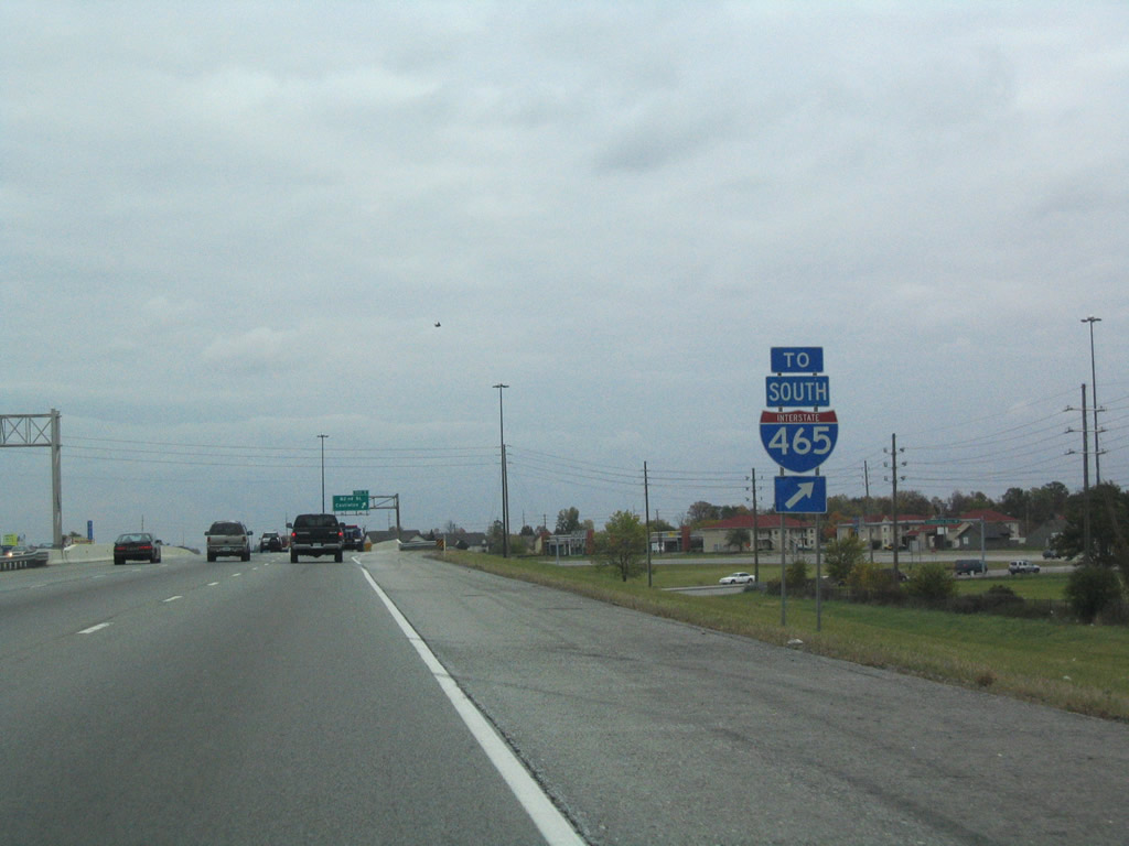
| Interstate 69 north sees a loop ramp onto Interstate 465 west to Allisonville and Carmel. The ramps to the beltway are signed as Exit 200 on southbound but unnumbered on northbound. 10/16/04 |
|
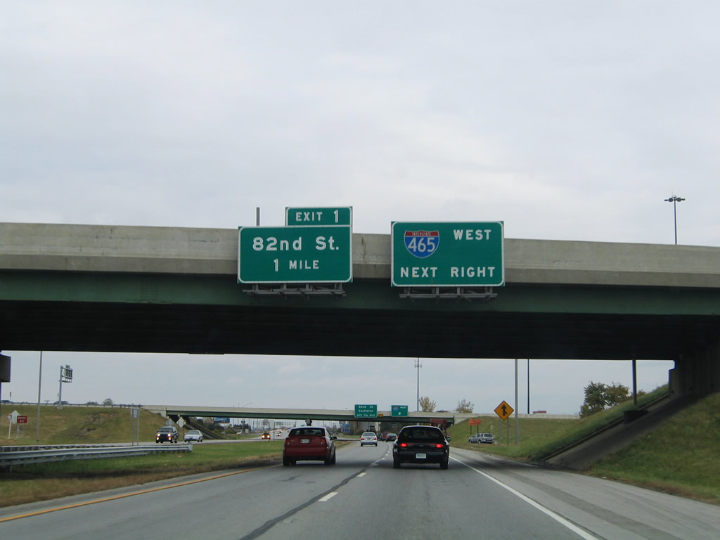
| Attached to the directional ramp from I-69/SR 37 south to Interstate 465 south is the one mile overhead for Exit 201 (82nd Street). Access is only available to the westbound direction of the Indianapolis beltway here. SR 37 joins Interstate 69 north from Interstate 465 north. 10/16/04 |
|
| Interstate 69 north at Interstate 465 west. Interstate 465 carries U.S. 52 to Interstate 865 west amid a bevy of other routes including U.S. 31, U.S. 421 and SR 37, all of which are unsigned along their combined routing on the beltway. The loop freeway opened by 1970 and replaced SR 100.1 10/16/04 |
|
| Travelers needing access to Interstate 465 south from Interstate 69 / Binford Boulevard north need only continue to Exit 201 to u-turn for the southbound on-ramp to the beltway. This state-named shield was posted after the loop ramp onto Interstate 465 north. 10/16/04 |
|
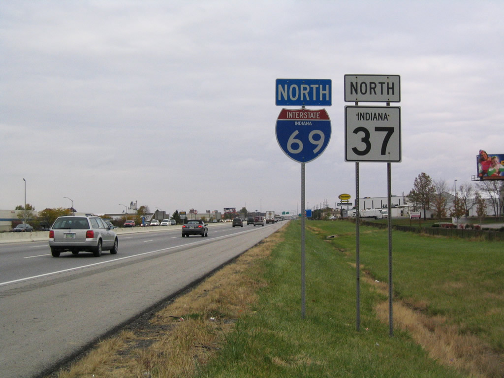
| The first reassurance marker of Interstate 69 coincides with SR 37 after the directional cloverleaf interchange with Interstate 465. SR 37 follows the freeway northward to Exit 205 at Fishers. 10/16/04, 02/06/12 |
|
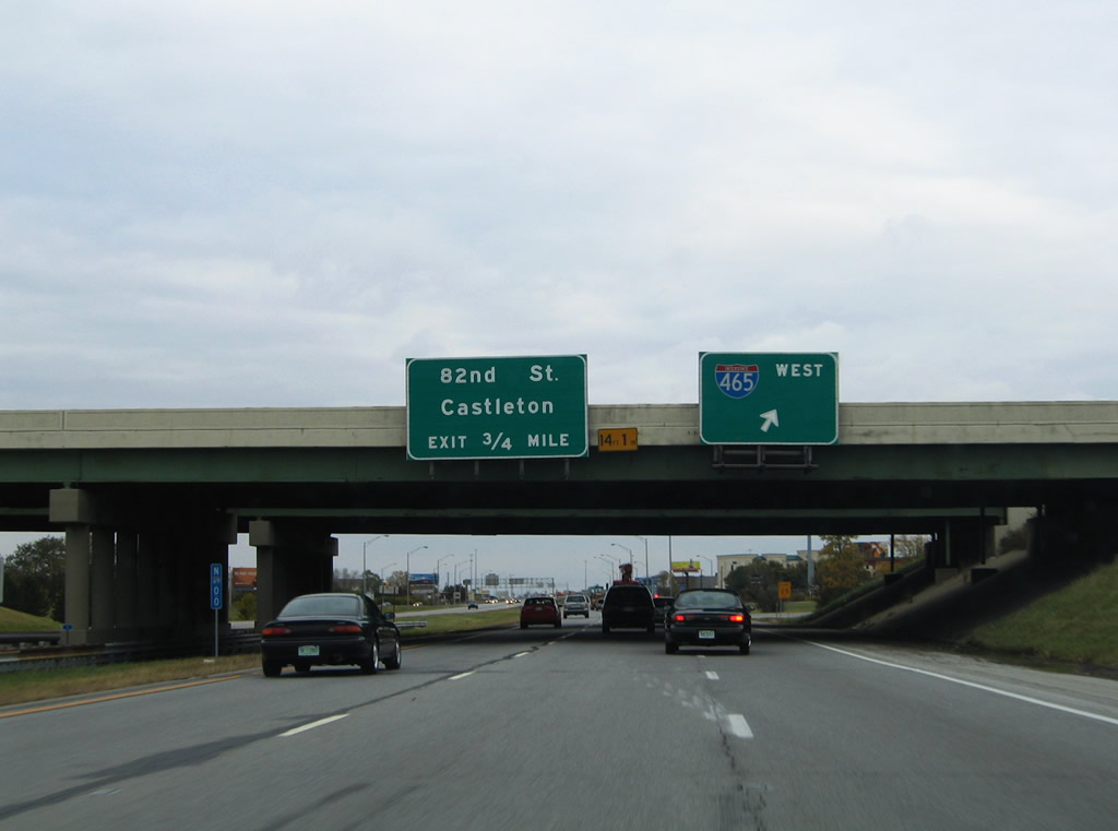
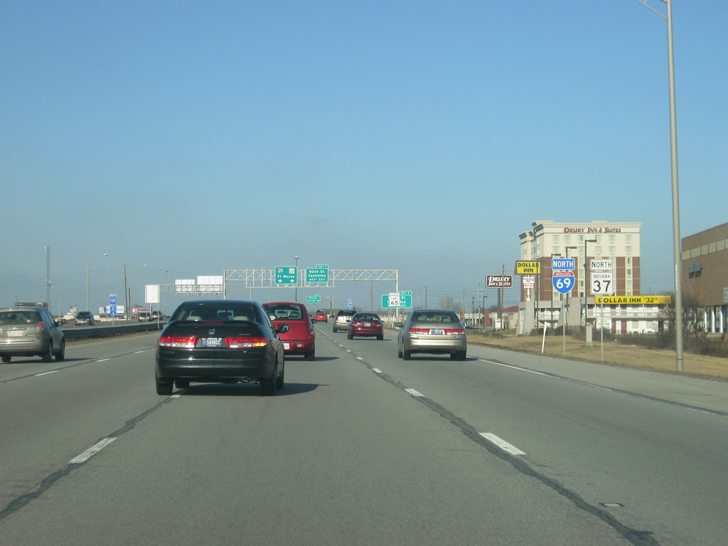
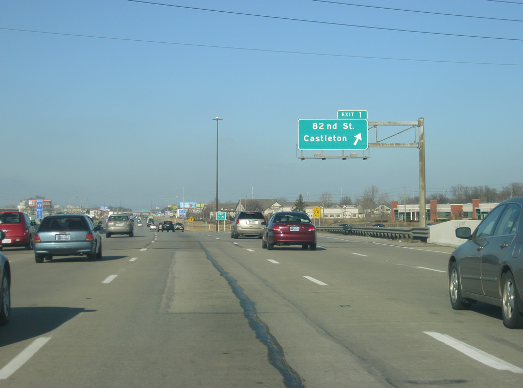
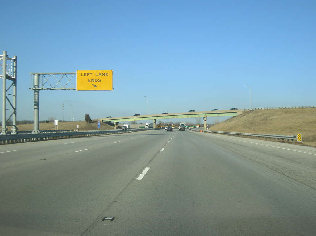
| A folded diamond interchange joins East 82nd Street with I-69/SR 37 near Community Hospital-North in Castleton. 82nd Street heads west to Castleton Square mall and Allisonville and east to Fall Creek Road. The northbound lanes were widened to four in 2008 from Exit 200 to Exit 205; a similar project will do the same to the southbound lanes in 2013. Auxiliary lanes will be placed to the right in between exits. 10/16/04, 02/06/12 |
|
| Northbound travelers may use the Exit 201 loop ramp onto 82nd Street west for the return ramp onto I-69/SR 37 south for Interstate 465 south. 10/16/04 |
|
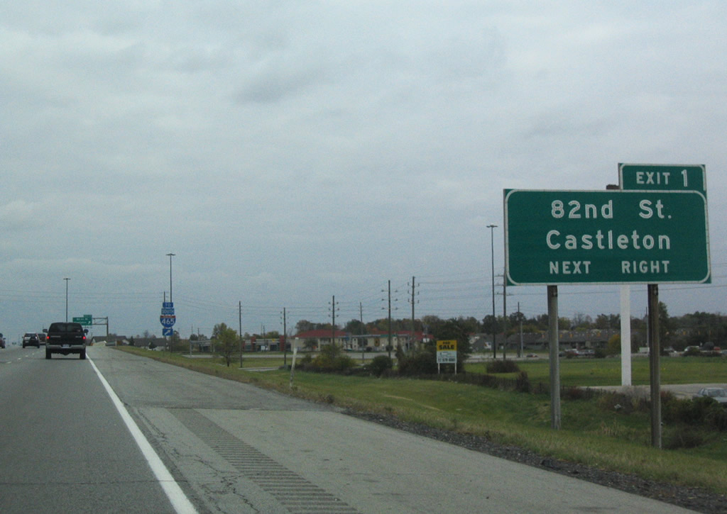
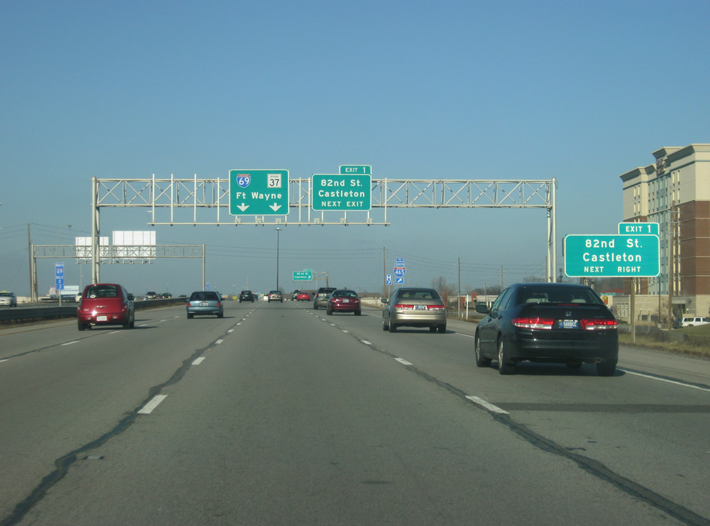
| I-69/SR 37 north at the off-ramp (Exit 201) to 82nd Street at Castleton. 82nd Street west from parallel Shadeland Avenue represents a historic alignment of SR 100, the predecessor to the Indianapolis beltway. 02/06/12 |
|
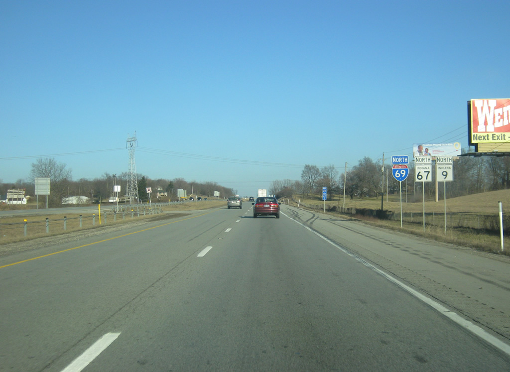
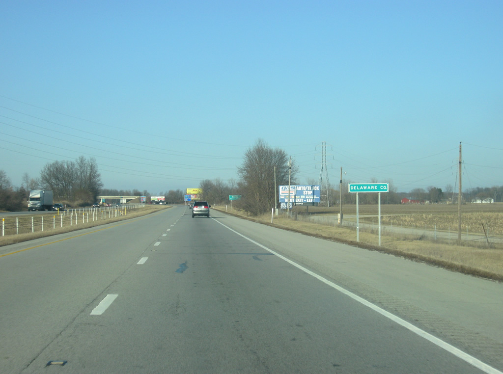
| A rare state-named shield for Interstate 69, since replaced, was posted alongside SR 37 north of Exit 201. A number of business and industrial parks line the frontage of the freeway between Castleton and the Hamilton County line. 10/16/04 |
|
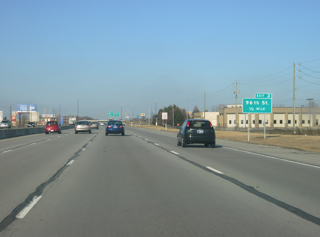
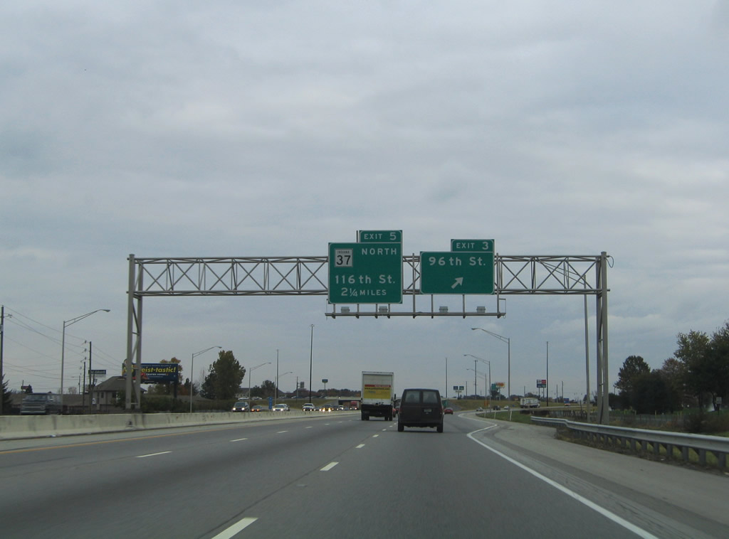
| 96th Street straddles the Marion County line and meets I-69/SR 37 at the Exit 203 diamond interchange. 02/06/12 |
|
| Exit 203 leaves I-69/SR 37 north, 2.25 miles south of their split. 96th Street heads west to Indianapolis Metropolitan Airport and east to Fall Creek Road at Geist Reservoir. Strip malls, big box retail and hotels, and fast food franchises line the arterial in both directions. 10/16/04, 02/06/12 |
|
| I-69/SR 37 north go underneath 96th Street and cross into Hamilton County. 02/06/12 |
|
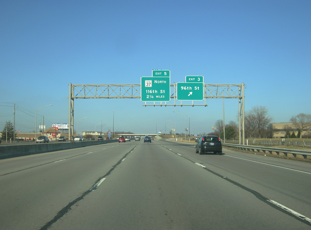
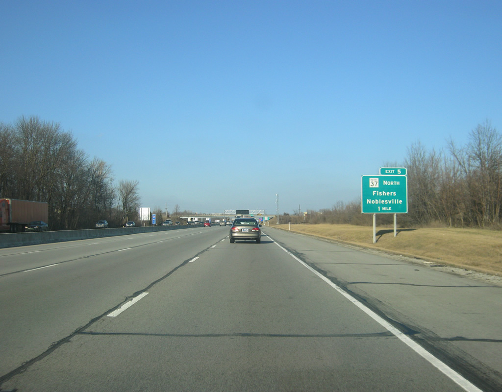
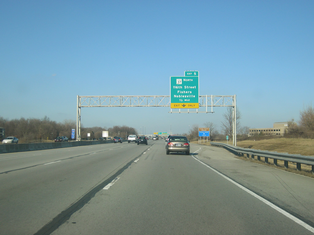
| SR 37 splits off from Interstate 69 one mile to the north at Exit 205. 02/06/12 |
|
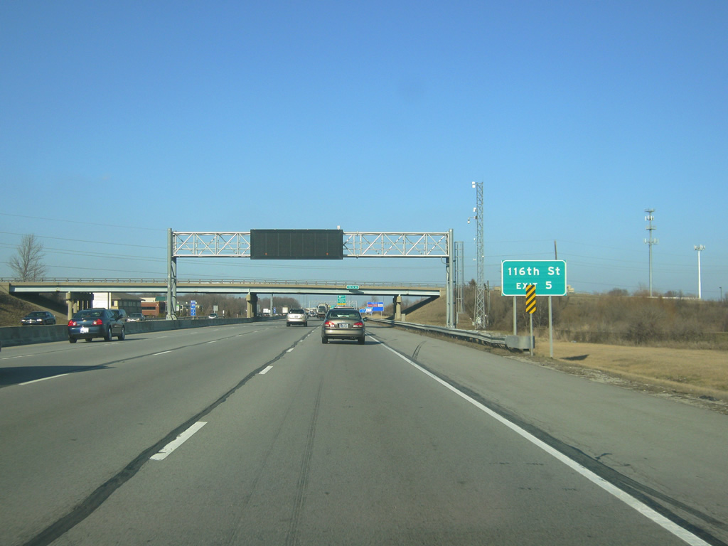
| 116th Street is a major east-west road across the communities of Carmel and Fishers. The highway begins as an extension of Oak Street in Zionsville and crosses Carmel and over the White River into Fishers. In Fishers, 116th Street is a four lane boulevard east across I-69/SR 37 north and east to Olio Road. 02/06/12 |
|
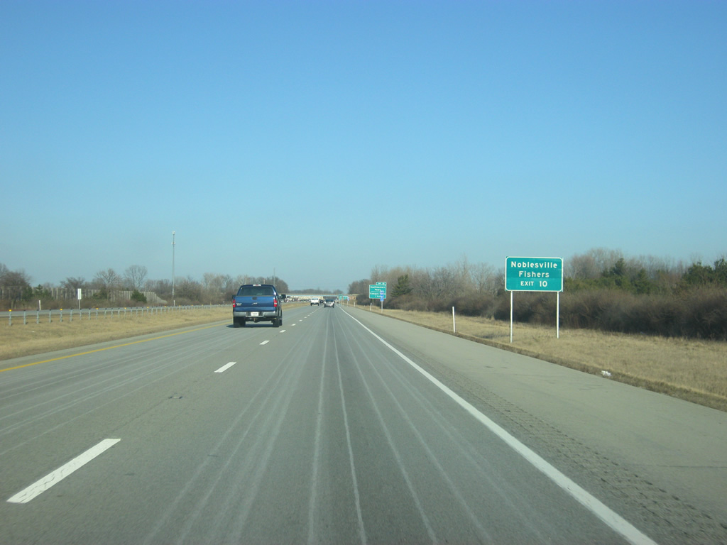
| Interstate 69 expands to five lanes to prepare for Exit 205 with SR 37 north and 116th Street. SR 37 continues north from Interstate 69 as a four lane expressway to the Hamilton County seat of Noblesville. Both Fishers and Noblesville are among the fastest growing communities in Indiana, resulting in daily traffic backups on the approach to this exit. North of Noblesville, SR 37 becomes a two lane highway north toward Elwood and Marion. 02/06/12 |
|
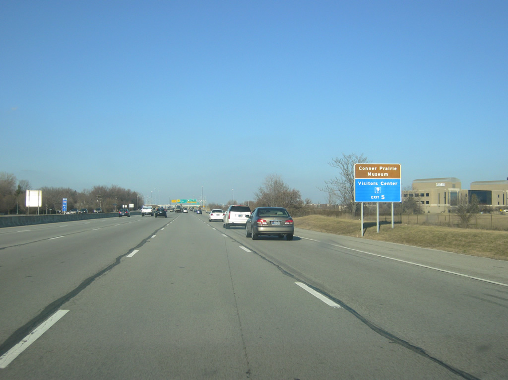
| The Conner Prairie Living History Museum and the Hamilton County Visitors Center can be reached by taking 116th Street to the west into Fishers from Exit 205. 02/06/12 |
|
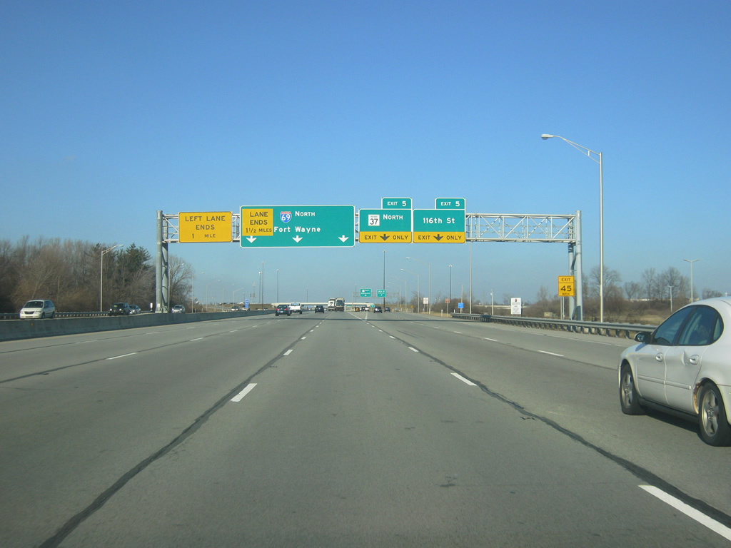
| Interstate 69 expands to six lanes at Exit 205, which sees the right two lanes exit off toward SR 37 north and 116th Street via a collector distributor ramp. Currently, traffic bound for SR 37 north must change lanes with the off ramp from 116th Street to Interstate 69 north. The left four lanes continue north toward Fort Wayne, but only the right two lanes continue a mile up the road. Future work in 2012 will redesign the exit to eliminate weaving for the two exits. The planned road work, part of INDOT's Operation Indy Commute, will see the left three lanes diverted onto Interstate 69 north with the right three lanes exiting off toward Exit 205. For more information see, http://www.in.gov/indot/2381.htm. 02/06/12 |
|
| North of Exit 205, the left two lanes of Interstate 69 end as the four northbound lanes becomes two past the Cumberland Road overpass. Once the Exit 205 redesign is finished, it will only be three lanes heading north with the left lane ending. Either way, the interstate is reduced to four lanes beyond the Cumberland Road overpass. 02/06/12 |
|
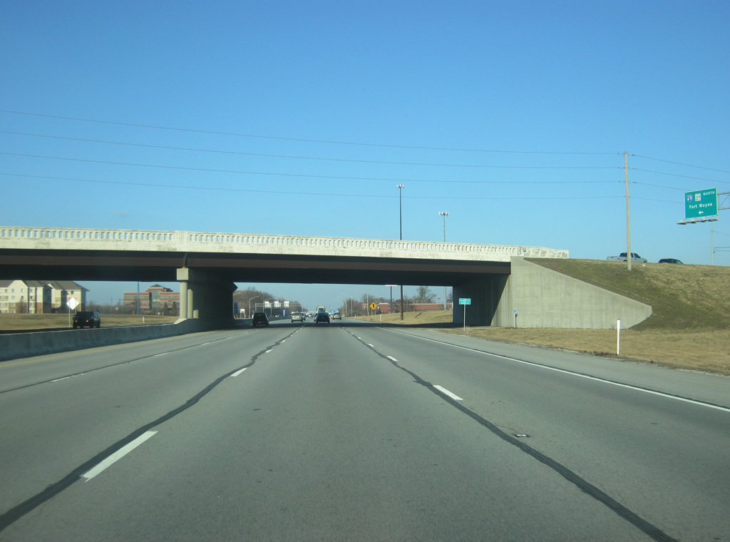
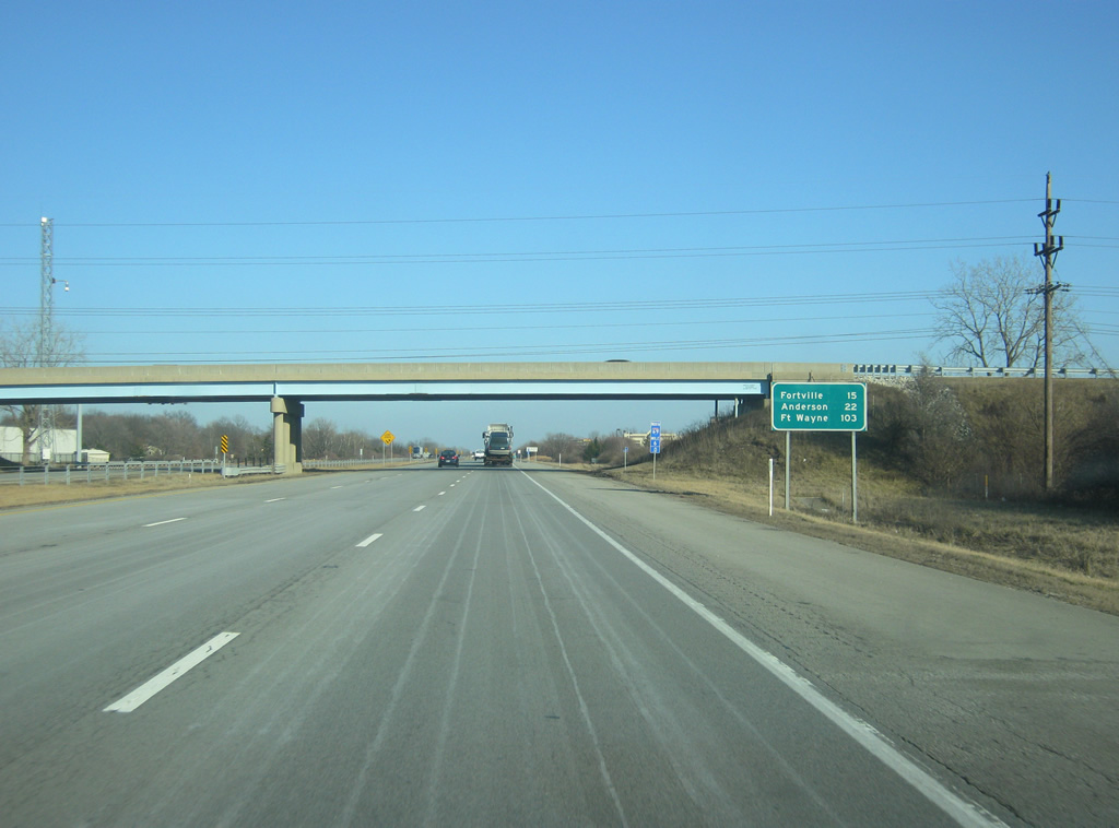
| Heading underneath Cumberland Road, Interstate 69 is 15 miles from Fortville, 22 miles from Anderson and 103 miles from the control city of Fort Wayne. 02/06/12 |
|
| Traffic remains steady as Interstate 69 passes through the suburban community of Fishers. The original 157 mile section of I-69 in Indiana is the Korean War Veterans Highway. From Exit 205 to just before Exit 219, I-69 follows an easterly course toward Pendleton. 02/06/12 |
|
| Interstate 69 passes underneath the newly widened overpass for 126th Street, which was itself widened between SR 37 and Olio Road across Fishers. 02/06/12 |
|
| An auxiliary guide sign directs travelers to the eastern parts of Fishers and Noblesville via Exit 210 up ahead. 02/06/12 |
|
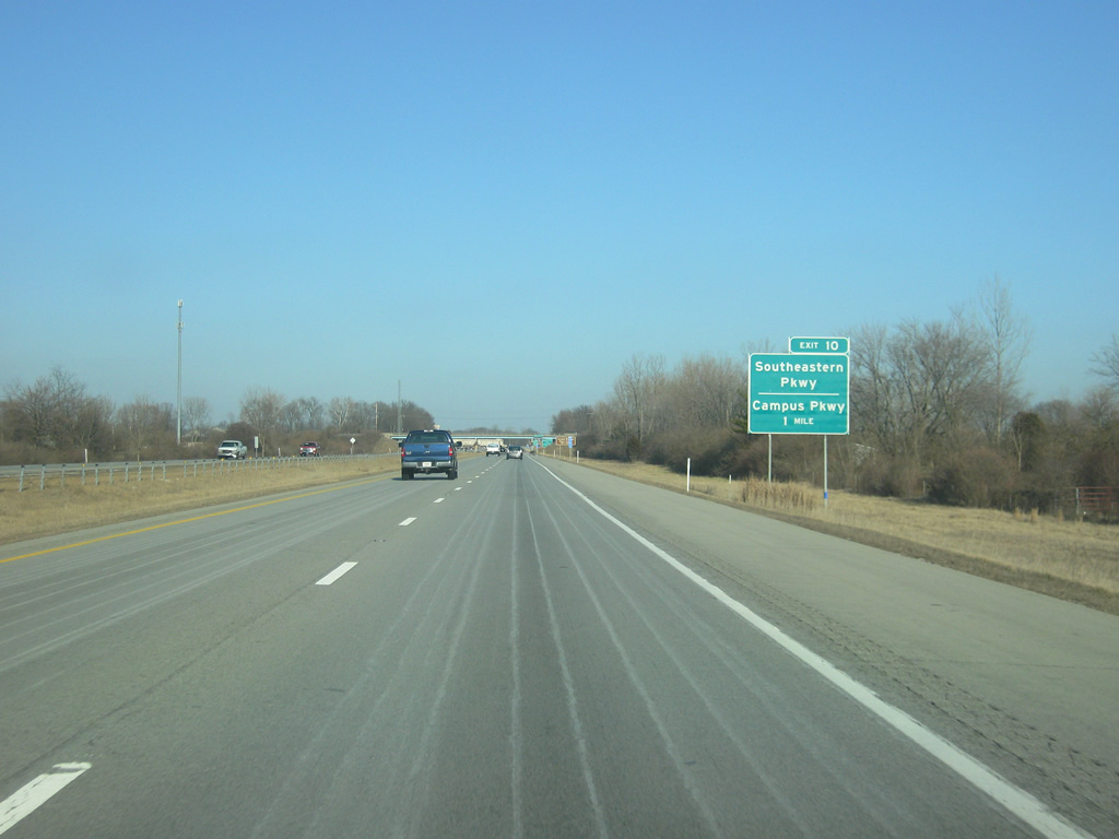
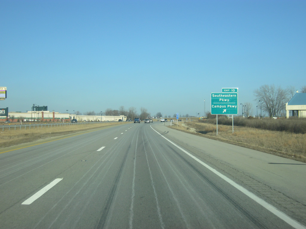
| Interstate 69 is now a mile away from Exit 210, a diamond interchange that serves Campus Parkway and Southeastern Parkway. Until 2011, the exit served SR 238, which traveled southeast from Interstate 69 for six miles to SR 13 in Fortville. The highway has since been decommissioned and returned to local authorities. At one time, the highway stretched from SR 37 in Noblesville to the southeast to Greenfield. 02/06/12 |
|
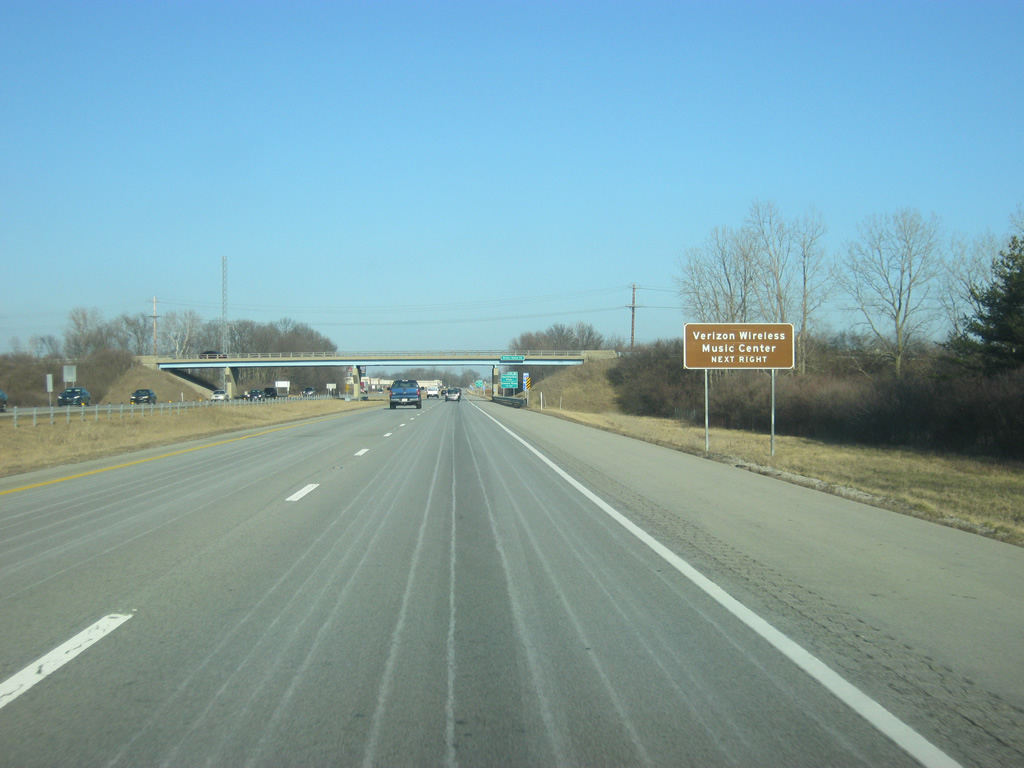
| The Verizon Wireless Music Center can be reached by taking Campus Parkway west from Exit 210 to Bergen Boulevard and north to 146th Street. 02/06/12 |
|
| Campus Parkway goes across the Saxony Campus past the Hamilton Town Center lifestyle center to the northwest to connect with 146th Street, a four lane arterial that heads west across northern Fishers, southern Noblesville and the cities of Westfield and Carmel. The name Campus Parkway continues northwest to Marilyn Road, where it becomes 146th Street. Southeastern Parkway continues to the southeast and follows the old routing of SR 238 to Fortville, connecting with Olio Road, a major north-south road across eastern Hamilton County that continues to the south as Mount Comfort Road (County Road 600 West), connecting with Interstate 70 in western Hancock County. 02/06/12 |
|
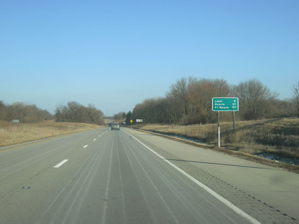
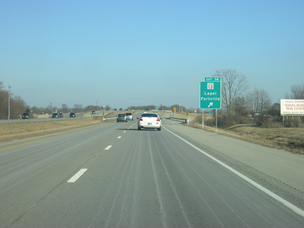
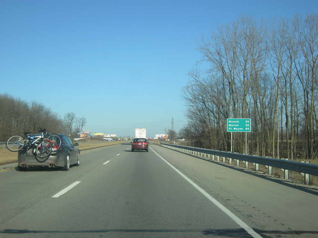
| East of Exit 210, Lapel is the next community reached by Interstate 69 at nine miles. Muncie is next at 37 miles with Fort Wayne at 97 miles. 02/06/12 |
|
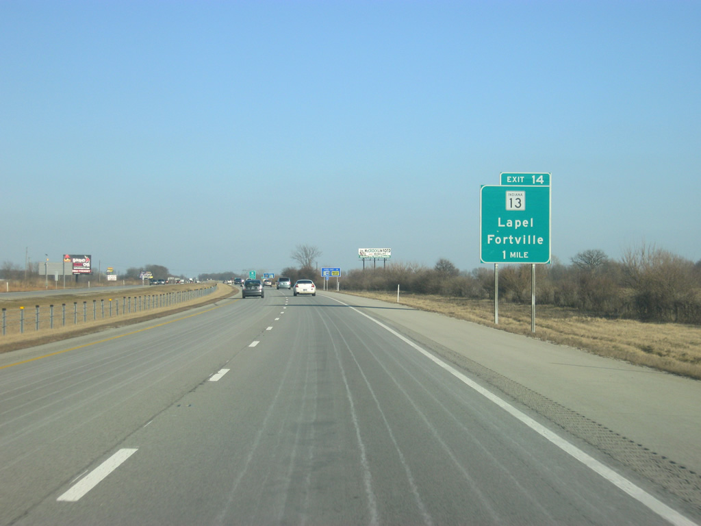
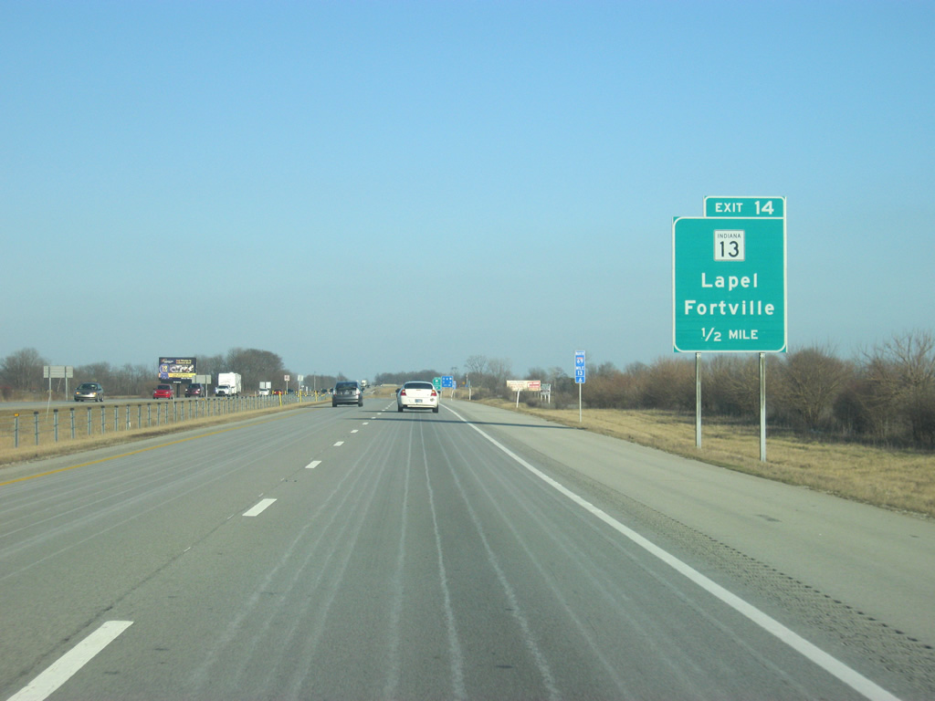
| Up ahead is Exit 214 with SR 13, which goes for 138 miles from U.S. 36/SR 67 in Fortville north through Elwood, Wabash and Syracuse before ending at the Indiana Toll Road (I-80/90) north of Middlebury. 02/06/12 |
|
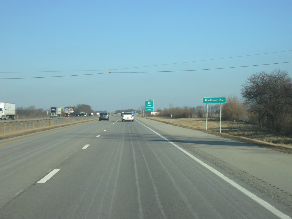
| Less than a mile from Exit 214, Interstate 69 enters Madison County. 02/06/12 |
|
| At the half mile approach to Exit 214 with SR 13, Lapel is located four miles to the north at the junction of SR 13 with SR 32. In the background, a blue 2/10ths mile marker sign designates the 13.6 mile marker along Interstate 69. These mile markers were installed along Interstate 69 in early 2012 from Exit 205 north to Exit 226 past Anderson. 02/06/12 |
|
| Exit 214 departs Interstate 69 onto SR 13. Fortville is six miles to the south at the southern end of SR 13 at U.S. 36/SR 67. 02/06/12 |
|
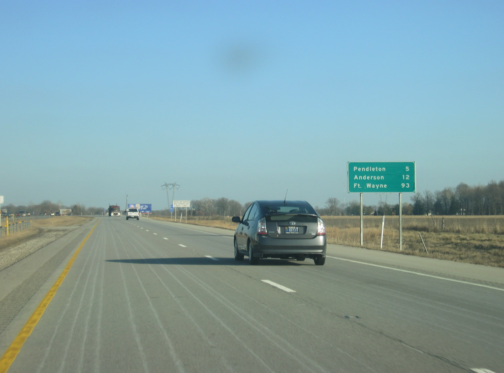
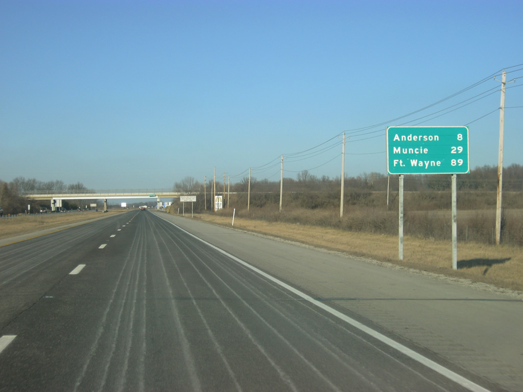
| East of Exit 214, Interstate 69 is five miles from Pendleton and 12 miles from the Madison County seat of Anderson. Fort Wayne is 93 miles away. 02/06/12 |
|
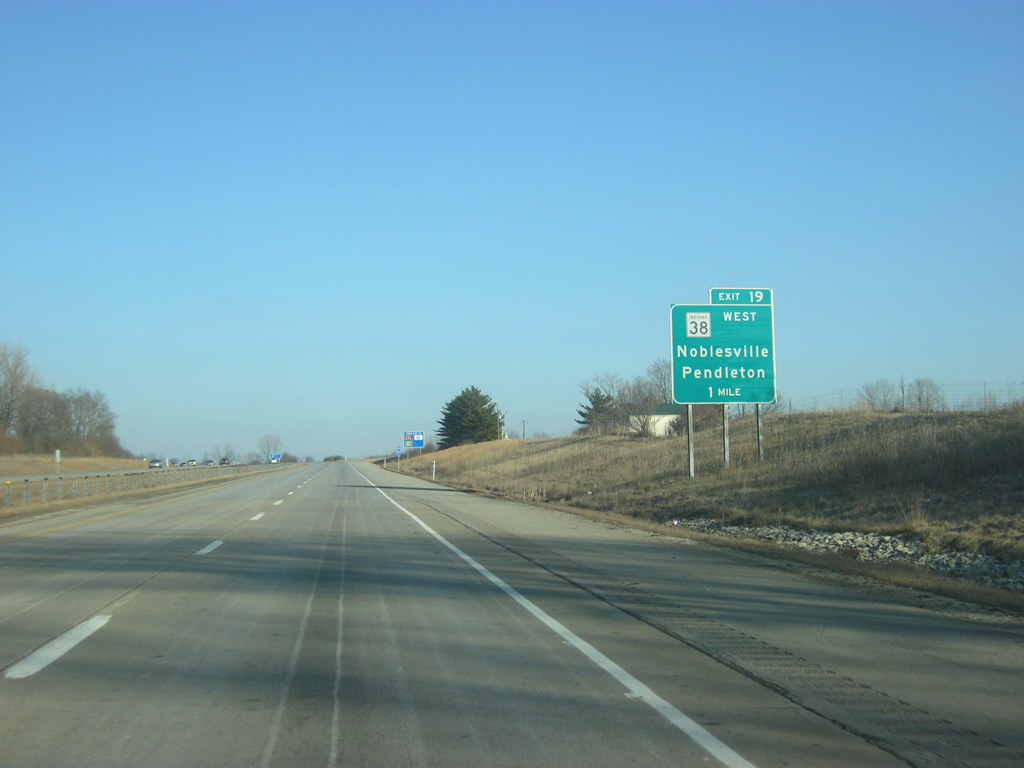
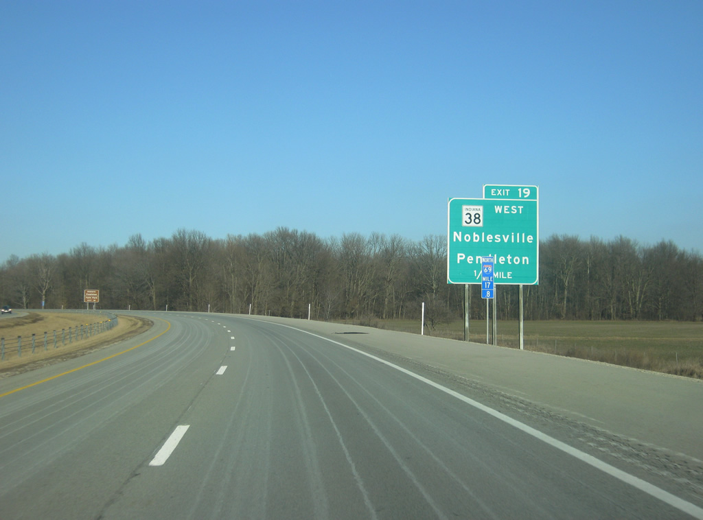
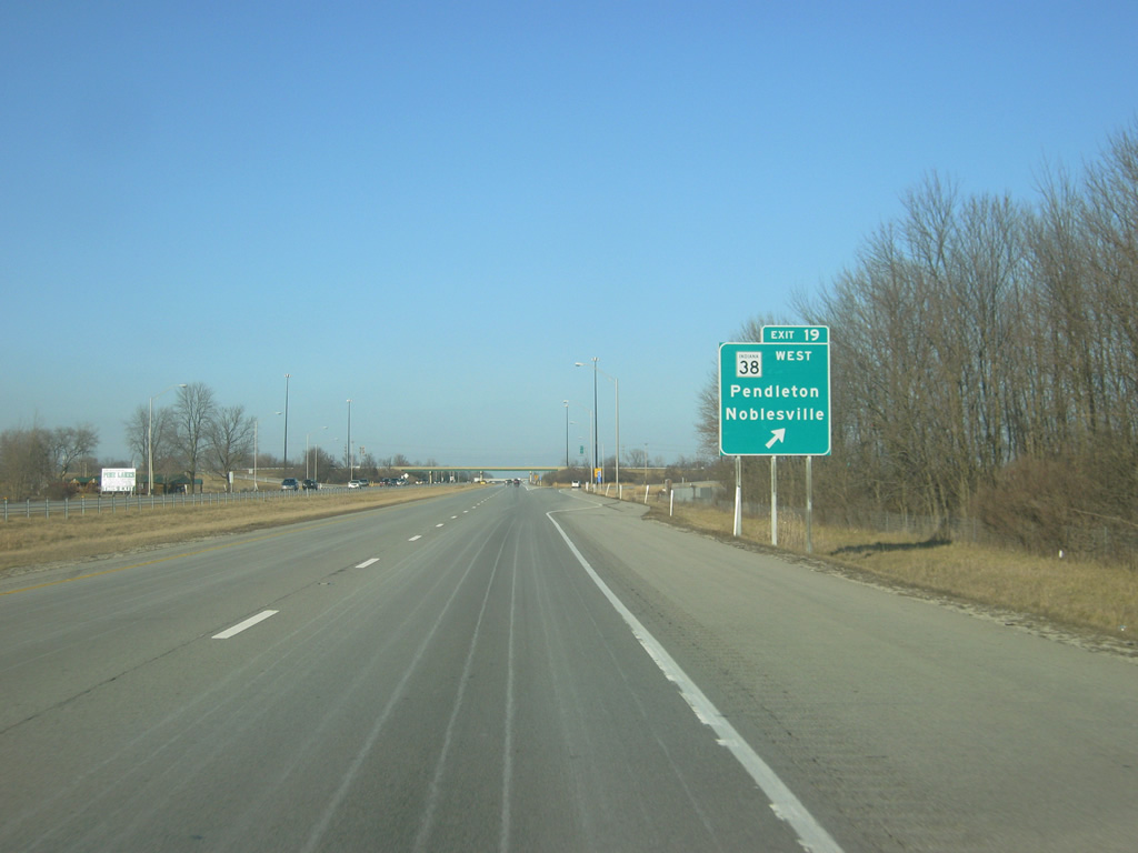
| Now a mile away from Exit 219, a diamond interchange serving SR 38 and State Street for Noblesville and Pendleton. SR 38 goes for 116.4 miles from U.S. 52 in Lafayette and east through Frankfort, Noblesville, Pendleton and New Castle before ending at U.S. 35 near Richmond. 02/06/12 |
|
| SR 38 goes to the west for 15 miles to the west back to Noblesville via the community of Clarksville. SR 38 used to continue east through the town of Pendleton via State Street, but that stretch was decommissioned from Interstate 69 to U.S. 36, SR 9 & SR 67 east of town. This decommissioning, done in 2004, severed the highway for a year until it was rerouted along Interstate 69 and U.S. 36, SR 9 & SR 67 to bypass Pendleton. 02/06/12 |
|
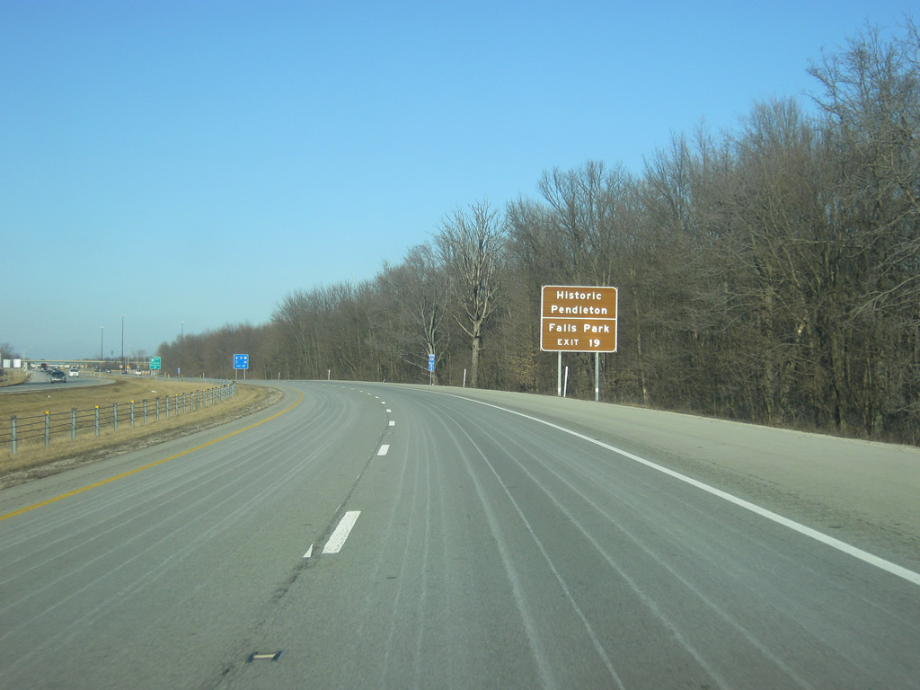
| Both Historic Pendleton and Falls Park can be reached by taking State Street to the east of Exit 219. 02/06/12 |
|
| Exit 219 leaves Interstate 69 for SR 38 west and State Street. The town of Pendleton is less than a mile to the east from Exit 219. SR 38 will follow Interstate 69 to the north to the next exit. 02/06/12 |
|
| North of Exit 219, Interstate 69 & SR 38 east is eight miles from Anderson and 29 miles from the Delaware County seat of Muncie. Fort Wayne is 89 miles away. 02/06/12 |
|
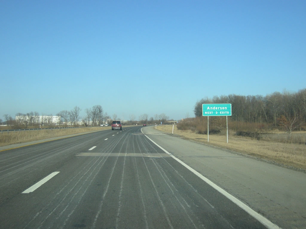
| Interstate 69 now approaches the city of Anderson, which is accessed by the next three interchanges. 02/06/12 |
|
| Interstate 69 & SR 38 east is now one mile away from Exit 222, serving SR 9 south & SR 67 south. SR 9 constitutes a 196 mile route between the Michigan state line and SR 46 east of Columbus, going through the communities of LaGrange, Columbia City, Huntington, Marion, Anderson, Pendleton, Greenfield and Shelbyville. 02/06/12 |
|
| SR 67 travels for 199 miles from Vincennes to the southwest, north through Indianapolis and Muncie before ending at the Ohio border near Bryant. Both SR 9 and SR 67 used to be routed through Anderson, with SR 67 following Dr. Martin Luther King, Jr. Boulevard (formerly Pendleton Avenue) north to 53rd Street and east to Rangeline Road and Old State Road 67. 02/06/12 |
|
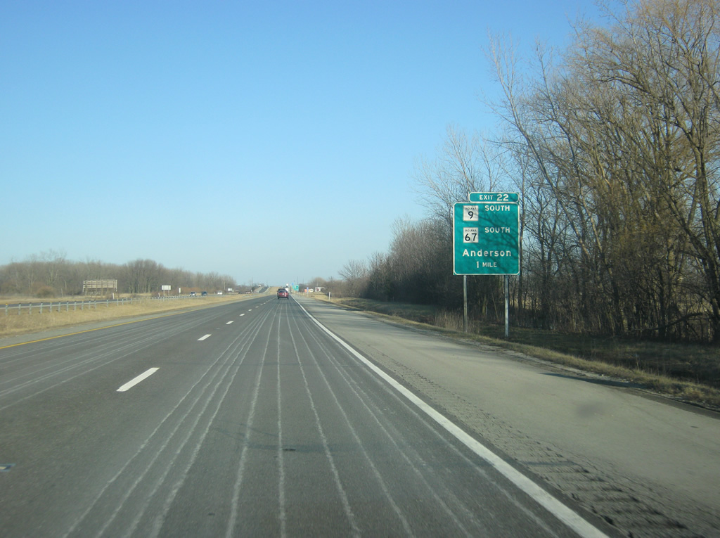
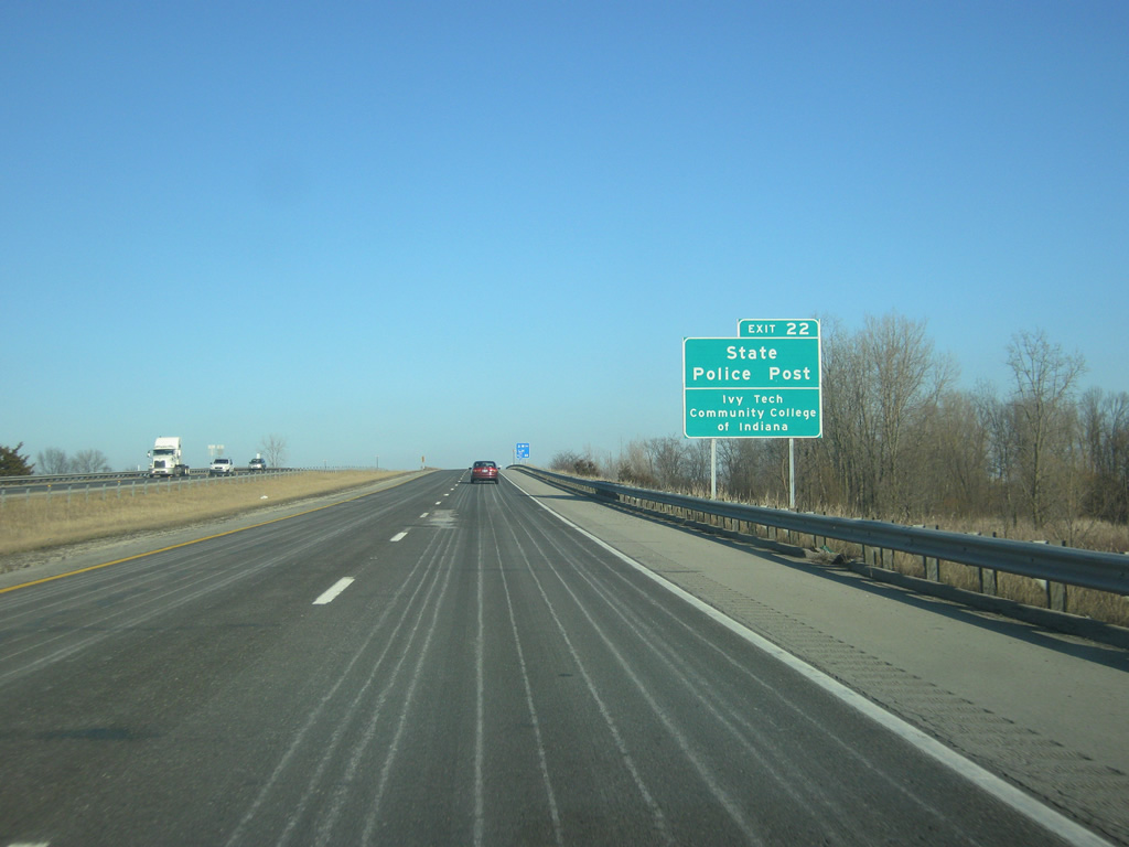
| An Indiana State Police Post is located several miles to the south along SR 67 in Pendleton while the Ivy Tech Community College is located to the north in Anderson. A large industrial park is also anchored around Exit 222. 02/06/12 |
|
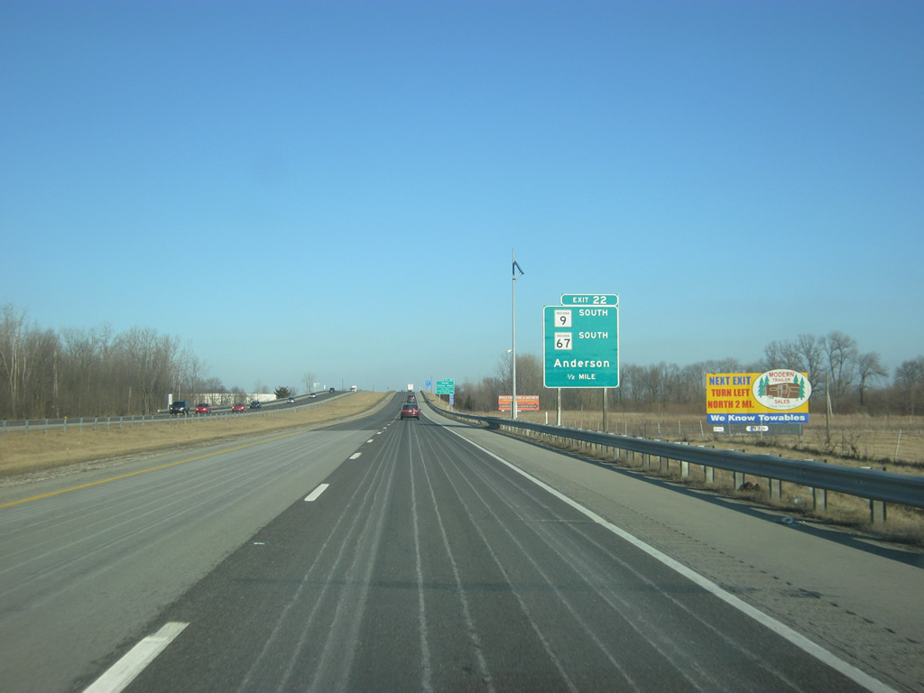
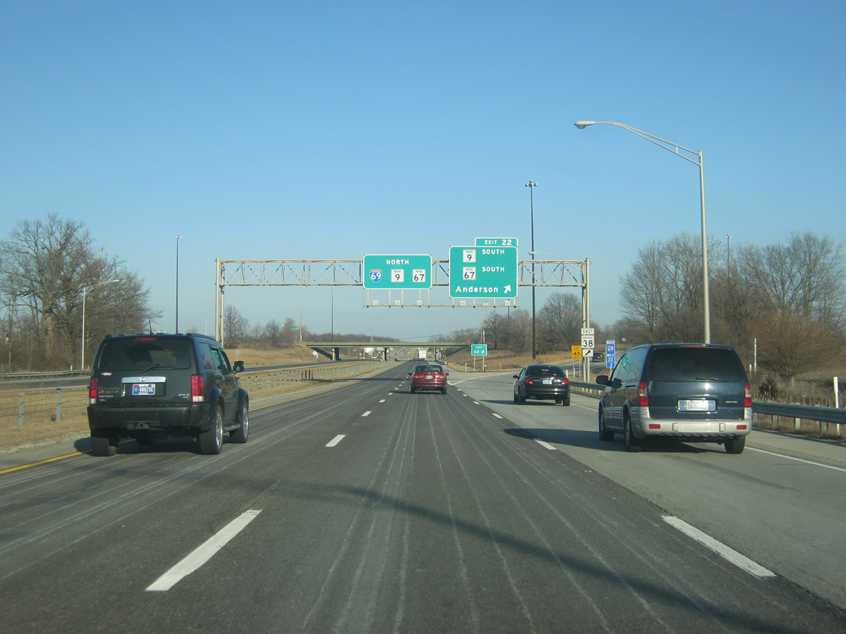
| Now at Exit 222, a diamond interchange with SR 9 south & SR 67 south. SR 9 used to be routed through Anderson via Dr. Martin Luther King, Jr. Boulevard (formerly Pendleton Avenue) to Brown Street and Broadway Street. SR 38 heads off toward the south to follow SR 9 & SR 67 for the two mile drive to Pendleton. 02/06/12 |
|
| East of Exit 222, SR 9 & SR 67 are now multiplexed along Interstate 69 as the three highways move past the south side of Anderson. 02/06/12 |
|
| Muncie is now 25 miles away via SR 67, with Marion at 50 miles along Interstate 69. Fort Wayne is 85 miles away. 02/06/12 |
|
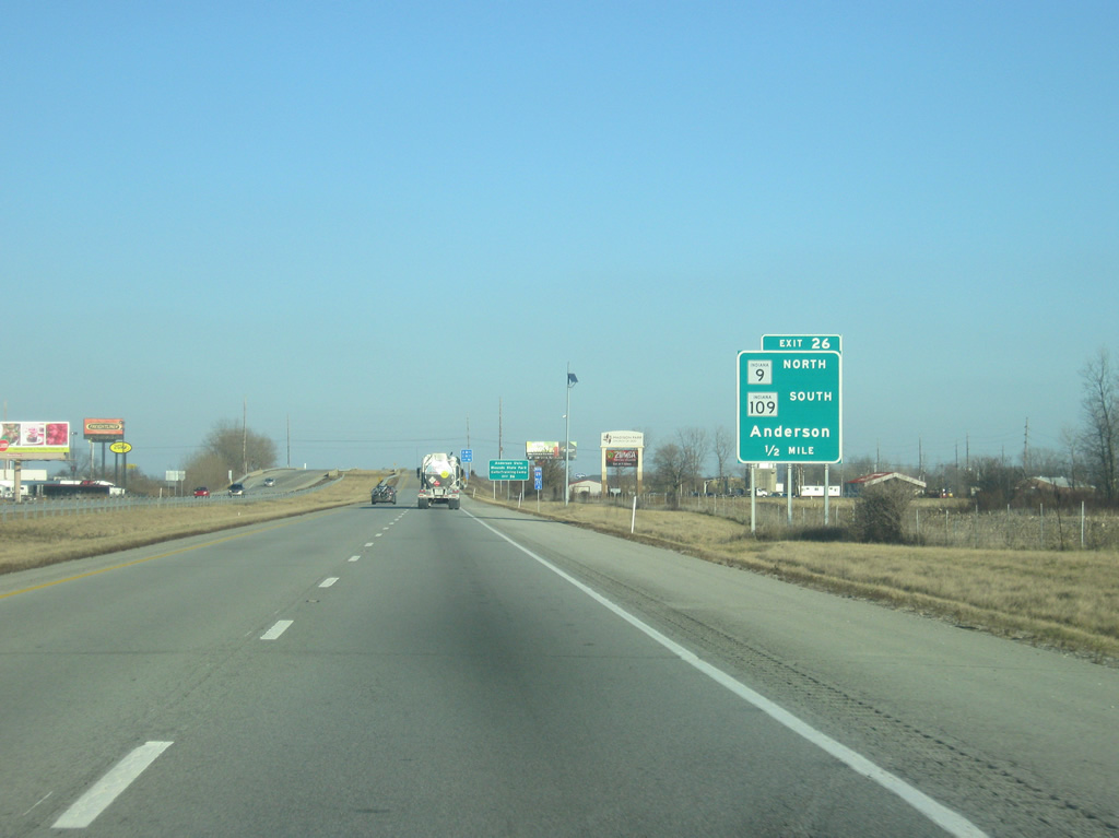
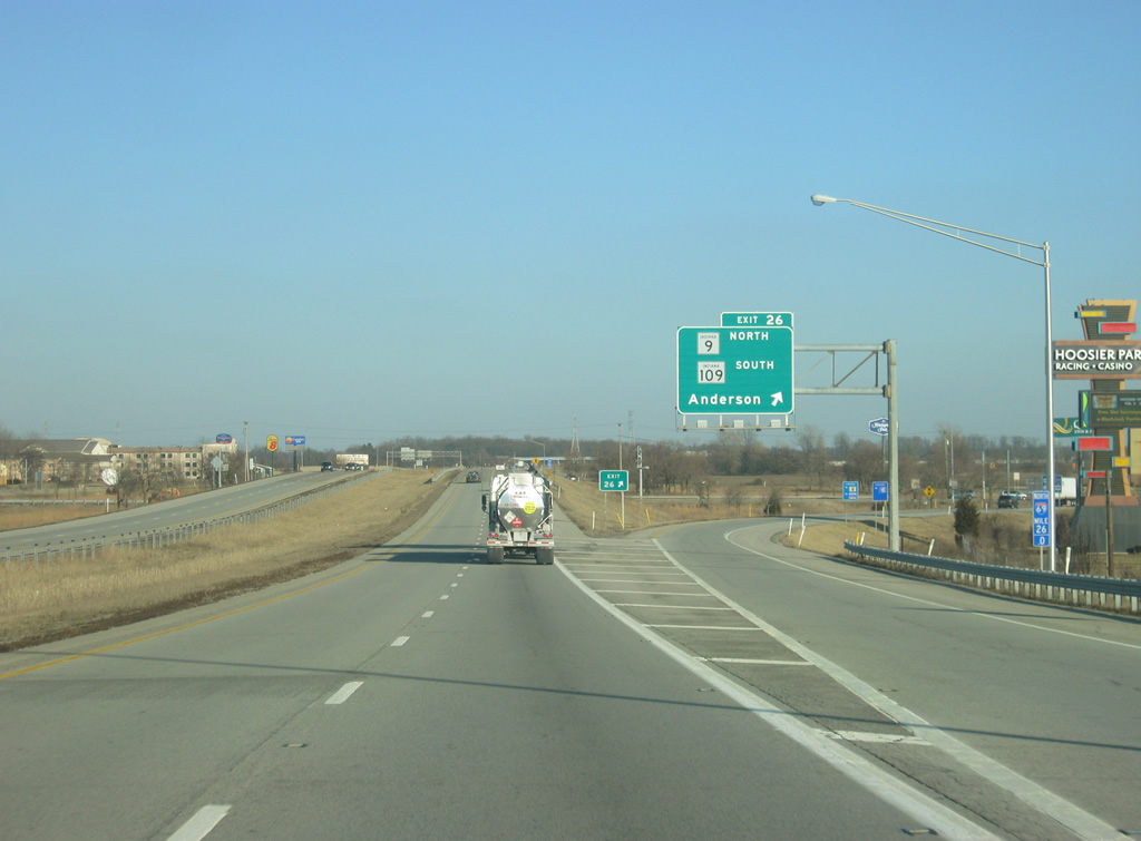
| Now a half mile away from Exit 226, serving SR 9 north (Scatterfield Road) and SR 109 south. SR 109 goes for 20 miles from Interstate 69 south to U.S. 40 in Knightstown. A second segment exists in Northern Indiana from U.S. 30 to U.S. 33 in Whitley and Noble Counties. 02/06/12 |
|
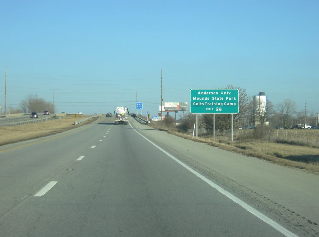
| Mounds State Park can be reached from taking SR 9 (Scatterfield Road) to the north to SR 232 (Mounds Road). Anderson University is further north along SR 9 (Scatterfield Road) to University Boulevard. The Indianapolis Colts Training Camp, held every August, takes place at Anderson University. 02/06/12 |
|
| Exit 226 departs Interstate 69 at SR 9 north (Scatterfield Road) and SR 109 south. SR 9 (Scatterfield Road) goes north through a commercial corridor that stretches into the city of Anderson. Exit 226 has the most motorist services for northbound Interstate 69 travelers until the Fort Wayne area. The Hoosier Park Horse Racing Track and Casino are both reached by taking SR 9 (Scatterfield Road) north to Charles Street. 02/06/12 |
|
| North of Exit 226, SR 67 north remains multiplexed with Interstate 69 as the highways head northeast toward Daleville and Muncie. 07/31/09 |
|
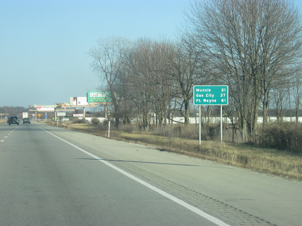
| North of Exit 226, Muncie is now 21 miles away. Gas City, located in Grant County, is 37 miles away with Fort Wayne 81 miles up the highway. 02/06/12 |
|
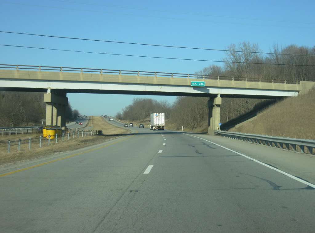
| After heading east for about 20 miles, Interstate 69 starts to turn toward the north as I-69/SR 67 north pass underneath SR 236, a 6.2 mile highway that connects SR 9 in Anderson to the town of Middletown in northwestern Henry County. 02/06/12 |
|
| Interstate 69 now heads in a northerly direction as it crosses over into Delaware County multiplexed with SR 67 north. 02/06/12 |
Page Updated 02-27-2012.

 North
North