|
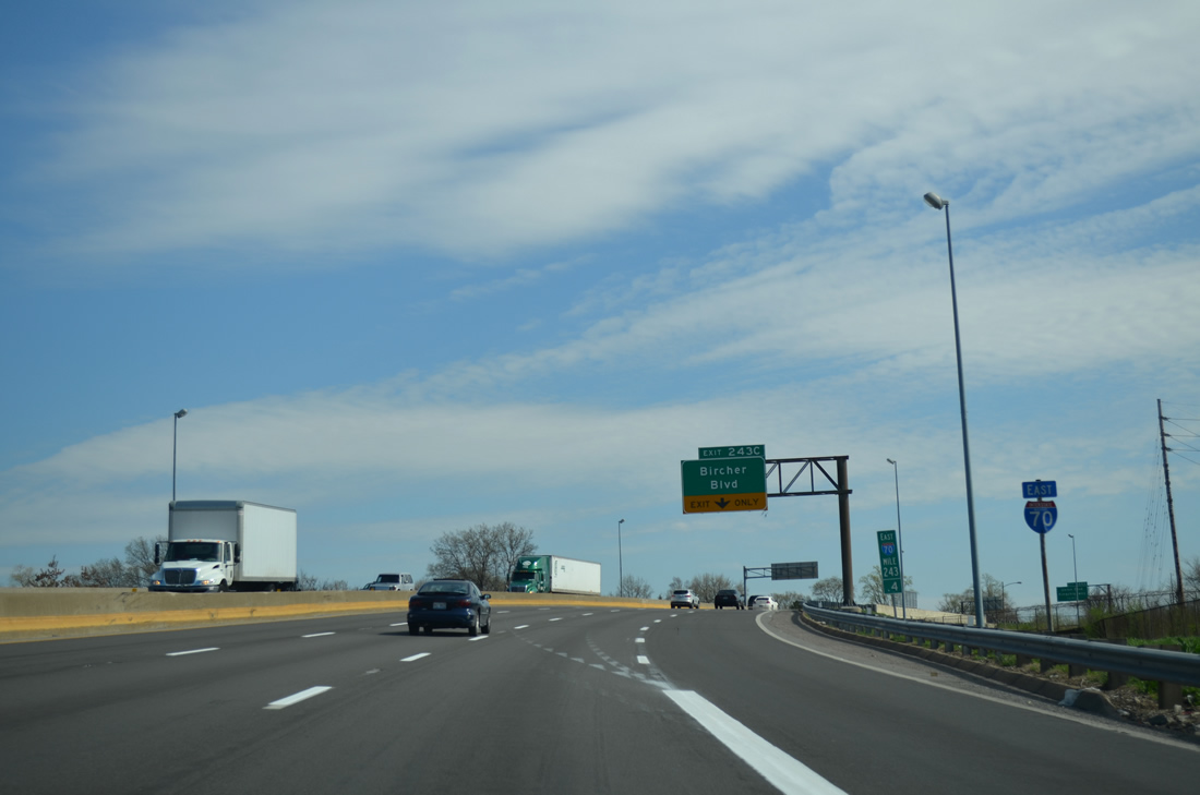
| Turning southward, I-70 spans Riverview Boulevard ahead of its transition to Bircher Boulevard. Riverview Boulevard carries Missouri 367 north from Bircher Boulevard west. The state highway runs 8.96 miles north to U.S. 67 (Lindbergh Boulevard). 04/13/13 |
|
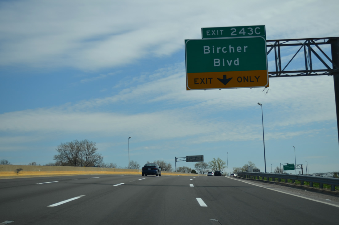
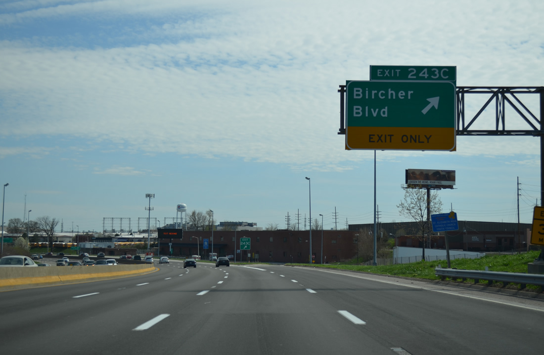
| Exit 243C links I-70 east with adjacent Bircher Boulevard by the former St. Louis Ammunition Plant. Bircher Boulevard lines the freeway to Kingshighway Boulevard and again through the Penrose community. 04/13/13 |
|
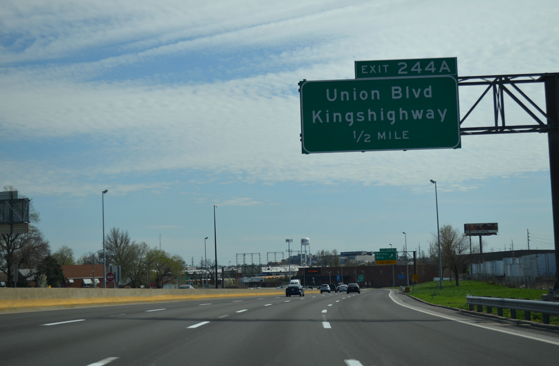
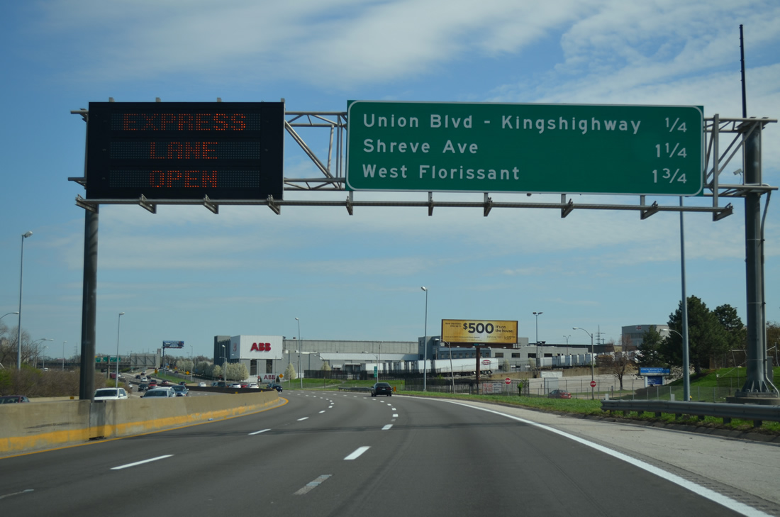
| Adjacent Exit 244A leads also to Bircher Boulevard east ahead of Union Boulevard. Historically U.S. 67 followed Bircher Boulevard between Riverview Boulevard at Walnut Park West and Kingshighway south at Penrose Park. 04/13/13 |
|
| The Mark Twain / I-70 Industrial area encompasses all of the former ammunition plant south of Bircher Boulevard east and north of Missouri 115 (Natural Bridge Avenue). 04/13/13 |
|
| The next three exits of Interstate 70 serve the Mark Twain community to the north. 04/13/13 |
|
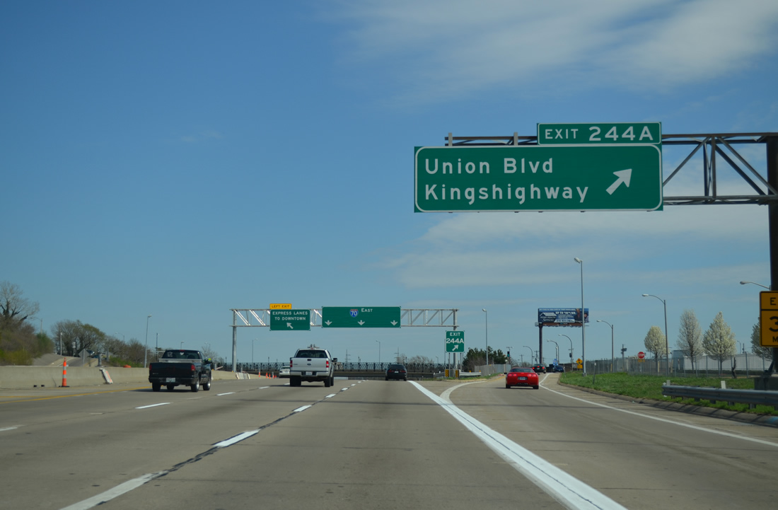
| Exit 244A consists of a split diamond interchange with both Union Boulevard and Kingshighway. U.S. 67 originally turned south along Kingshighway between Kingsway West and East en route to Gravois Avenue (MO 30) at Princeton Heights. U.S. 40 Alternate also traveled the boulevard at one point. 04/13/13 |
|
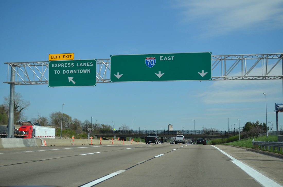
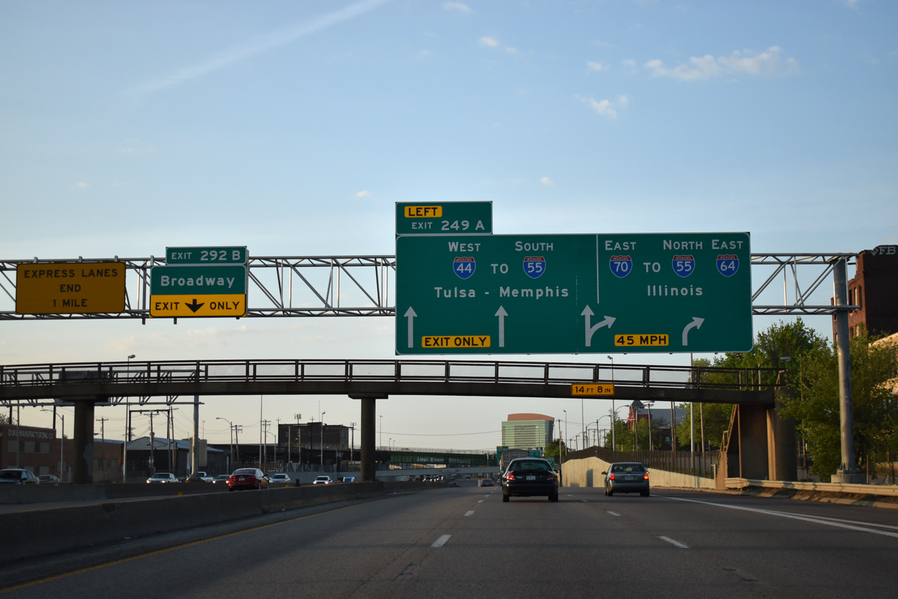
| The Express Lanes split from the Interstate 70 mainline ahead of the Union Boulevard overpass. These lanes travel between the main roadways of I-70 for the next six miles to Broadway near Downtown.
Until December 2011, these lanes were reversible, serving inbound traffic during the morning and outbound traffic during the evening. Based upon traffic flow, MoDOT made the Express Lanes eastbound only. 04/13/13 |
|
| The 1998-2003 reconstruction of Interstate 70 and the reversible lanes included the addition of gate at the Express Lane entrance. The gate was lowered when traffic along the reversible lanes flowed outbound to prevent wrong-way drivers. 04/13/13 |
|
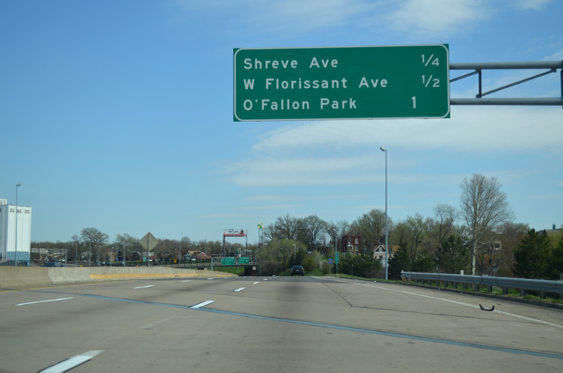
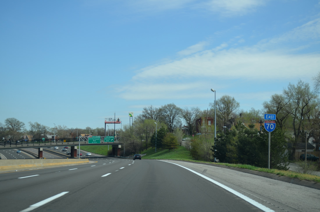
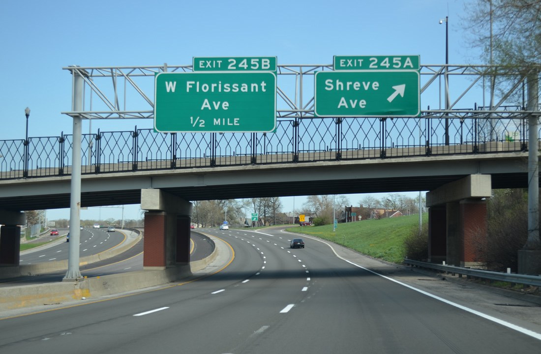
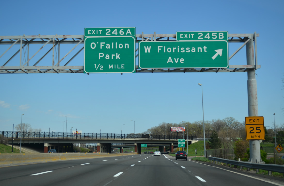
| Interstate 70 passes by Penrose Park and spans a Southern Pacific Railroad line on the quarter mile approach to Exit 245A. Exits 245A and 245B follow in succession to adjacent Bircher Boulevard, as the service road links Shreve Avenue at Penrose with Florissant Avenue at O'Fallon Park. 04/13/13 |
|
| Reassurance marker posted ahead of the Shreve Avenue overpass. 04/13/13 |
|
| Exit 245A departs I-70 east for Bircher Boulevard at Marcus Avenue. Shreve Avenue angles southwest from the freeway to Handy Park at Kingsway East and northeast to Florissant Avenue at Bellefontaine Cemetery. 04/13/13 |
|
| Interstate 70 leaves Penrose and Mark Twain at Florissant Avenue (Exit 245B) to O'Fallon Park (Exit 246A) and College Hill (Exit 246B). 04/13/13 |
|
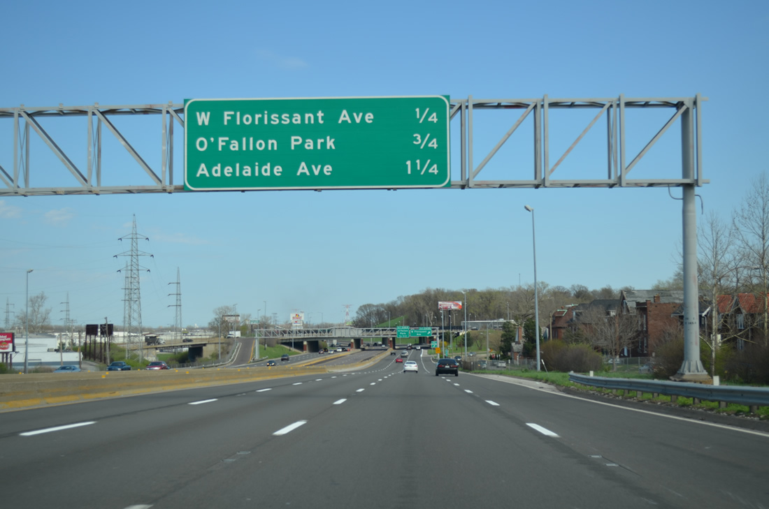
| A parclo interchange (Exit 245B) joins Interstate 70 with Bircher Boulevard, Florissant Avenue and Taylor Avenue. Florissant Avenue leads south from O'Fallon Park to the Fairground Neighborhood and Hyde Park while Taylor Avenue leads east to North Riverfront. 04/13/13 |
|
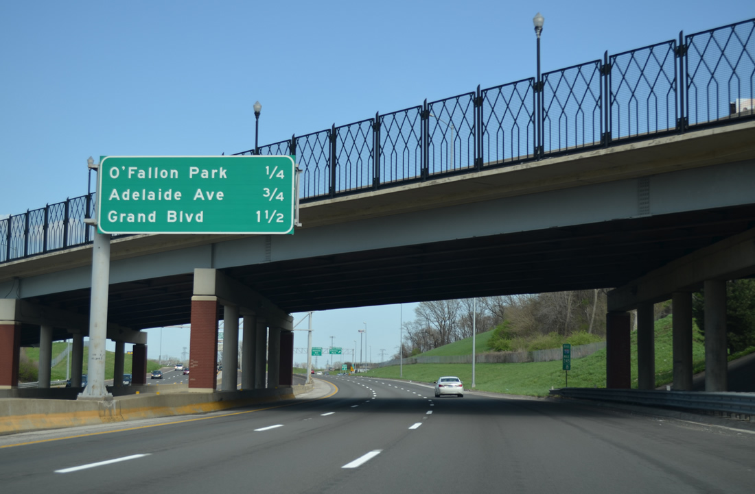
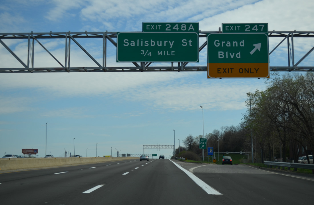
| Curving southward along O'Fallon Park, Interstate 70 lines the Near North Riverfront area to Downtown. Diamond interchanges serve the adjacent industrialized riverfront at both Adelaide Avenue (Exit 246B) and Grand Boulevard (Exit 247). 04/13/13 |
|
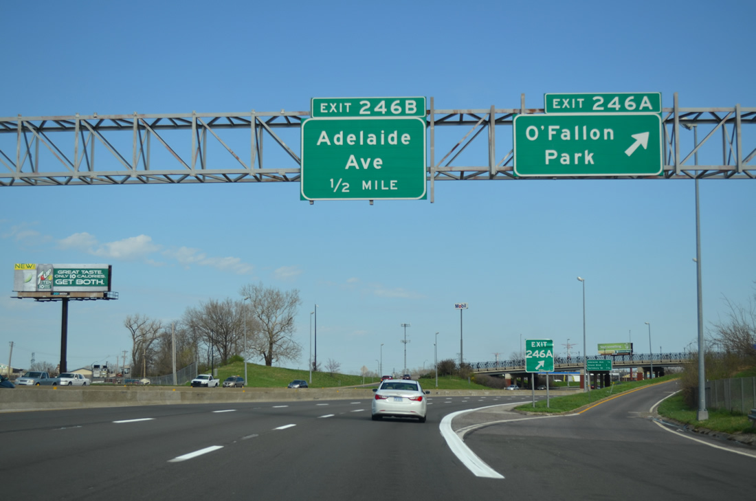
| A split diamond interchange takes drivers from I-70 east to Carrie Avenue at O'Fallon Park. The northbound off-ramp ties into parallel Broadway. 04/13/13 |
|
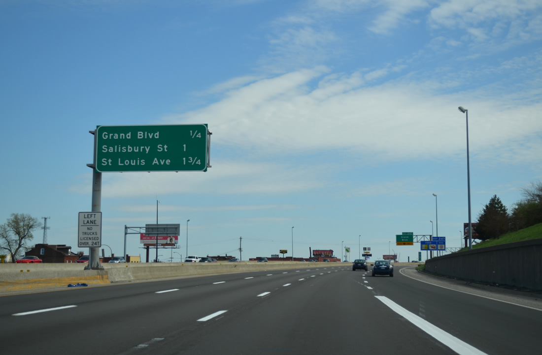
| Adelaide Avenue connects I-70 with the O'Fallon community to the west and North Riverfront to the east in one quarter mile. Salisbury Street (Exit 248A) at Hyde Park appears at 1.75 miles out. 04/13/13 |
|
| Exit 246B departs Interstate 70 east for Adelaide Avenue at Von Phul Street and the southeast corner of O'Fallon Park. 04/13/13 |
|
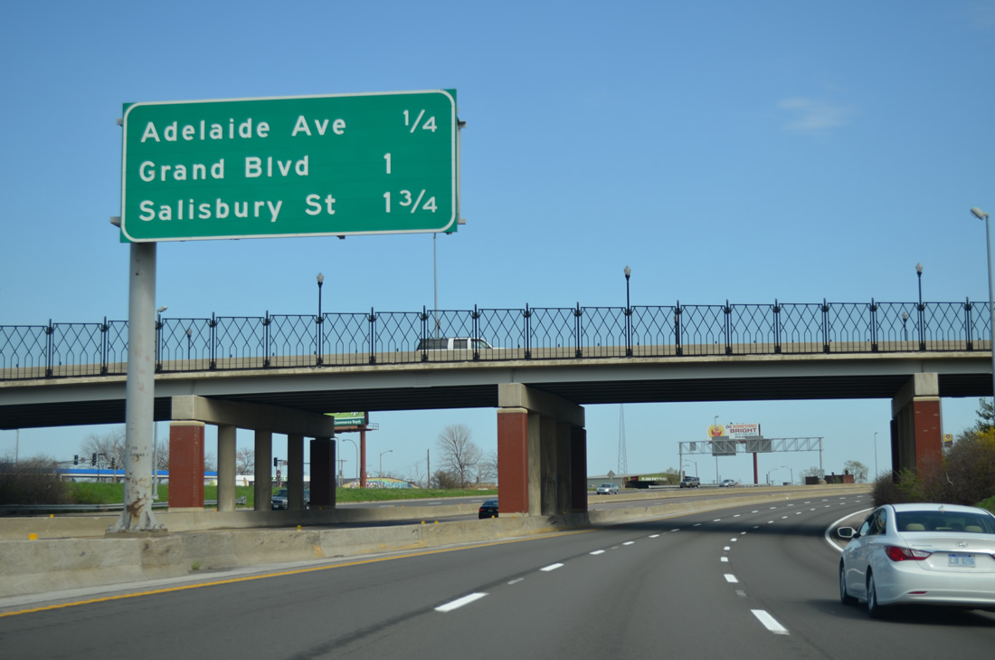
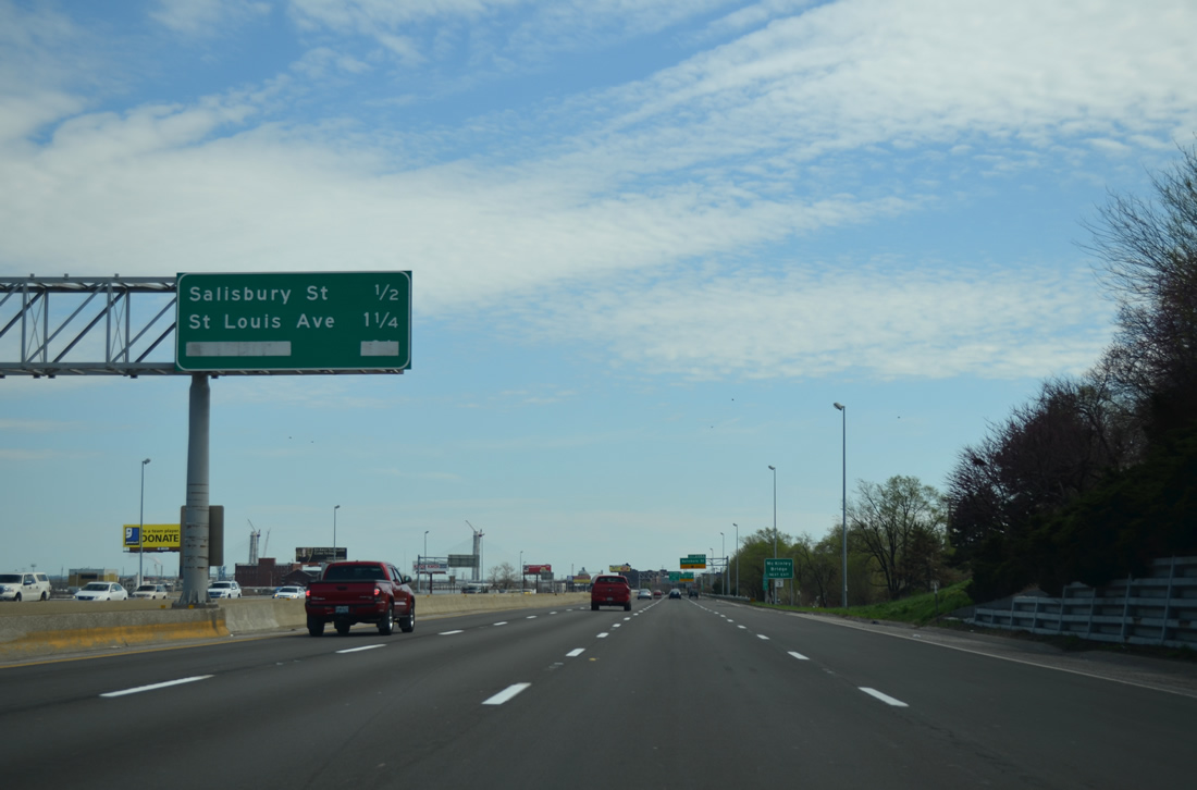
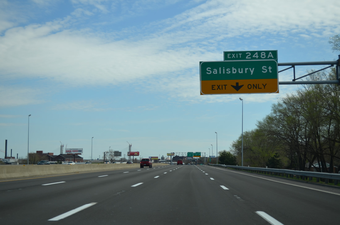
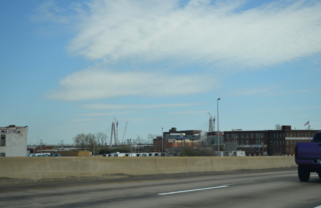
| Interstate 70 elevates to pass over Prairie Avenue, Grand Boulevard and Angelica Street to the split diamond interchange with Salisbury Street (Exit 248A) in one mile. St. Louis Avenue west to Old North St. Louis is 1.75 miles away. 04/13/13 |
|
| The Von Phul Street on-ramp adds a fourth eastbound lane to Grand Boulevard at Fairground Neighborhood. 04/13/13 |
|
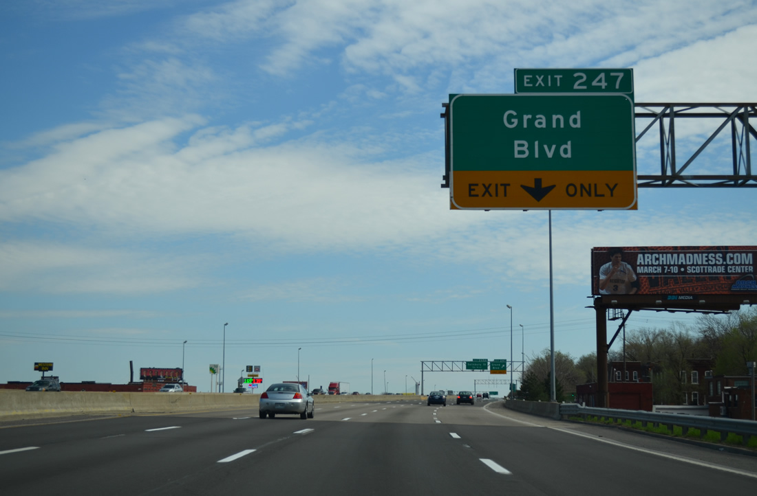
| Eastbound at Exit 247 for Grand Boulevard. Grand Boulevard ventures southward throughout the city to Fairground Park, Jeff Vanderlou and Carondelet in south St. Louis. The street becomes Grand Avenue east of adjacent Broadway to Hall Street. 04/13/13 |
|
| Just beyond Grand Boulevard, eastbound drivers see the two mile sign bridge for the turn of Interstate 70 east across the Stan Musial Veterans Memorial Bridge. Prior to 2014, I-70 continued south through Downtown St. Louis to the Poplar Street Bridge (PSB). The Poplar Street Bridge Ramp project eliminated the former mainline ramp that carried I-70 east onto the PSB in 2016-17. 04/13/13 |
|
| Continuing southward, Interstate 70 travels between 11th and 9th Streets on the half mile approach to Salisbury Street (Missouri 115). Concealed here on this sign was the mileage to the split of Interstate 44 west from I-70 east. 04/13/13 |
|
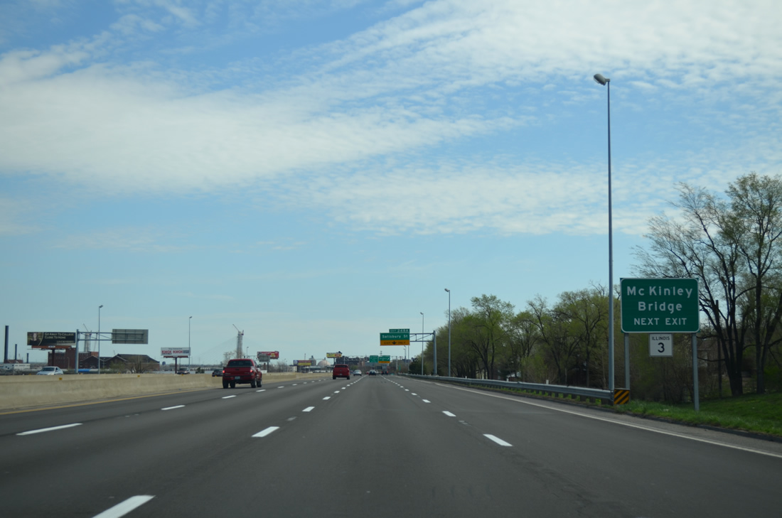
| The Mc Kinley Bridge links Salisbury Street and the east end of Missouri 115 with Illinois 3 at the city of Venice. Dedicated in 1910, the steel truss bridge supported a railroad line until 1977. The span was closed in 2001 and rehabilitated starting in 2005 and running to its reopening in 2007.1 04/13/13 |
|
| Salisbury Street west from 9th Street and the Mc Kinley Bridge carries Missouri 115 to Natural Bridge Avenue at Palm and Parnell Streets. Natural Bridge Avenue takes the state highway northwest to exit the city by the Wells Goodfellow neighborhood. I-70 previously met MO 115 at its eastbound beginning (Exit 237). 04/13/13 |
|
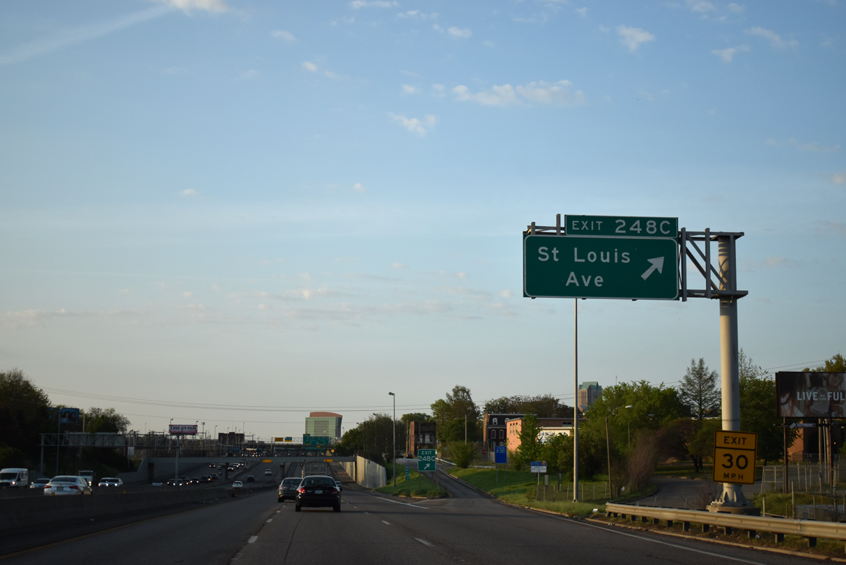
| Exit 248A utilizes 11th Street to make the connection with Salisbury Street (Missouri 115) west to St. Louis Place and east to the Mc Kinley Bridge. 04/13/13 |
|
| Curving toward the Branch Street underpass along Interstate 70 east. The freeway originally passed over Buchanan Street here until 1999, when that underpass was removed. 05/07/18 |
|
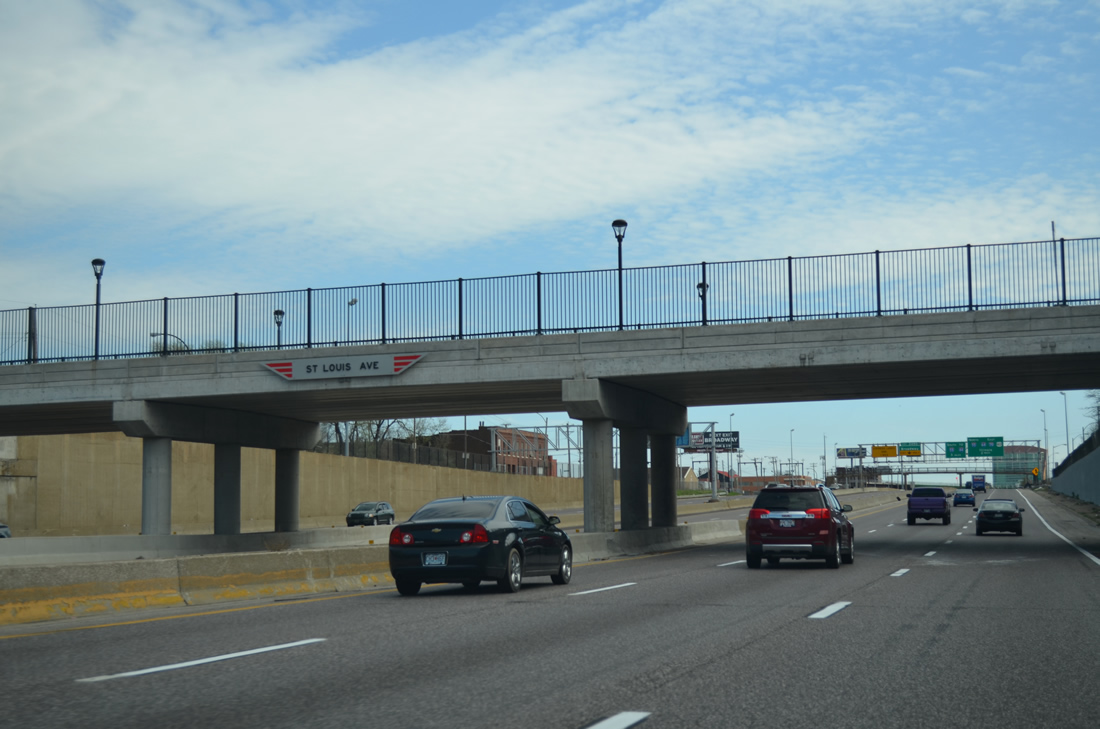
| Interstate 70 navigates southward below grade from the St. Louis Avenue off-ramp (Exit 248C) to the split with Interstate 44 at Exit 249A. 05/07/18 |
|
| Towers of the Stan Musial Veterans Memorial Bridge come into view east of the industrial waterfront of Near North Riverfront. 04/13/13 |
|
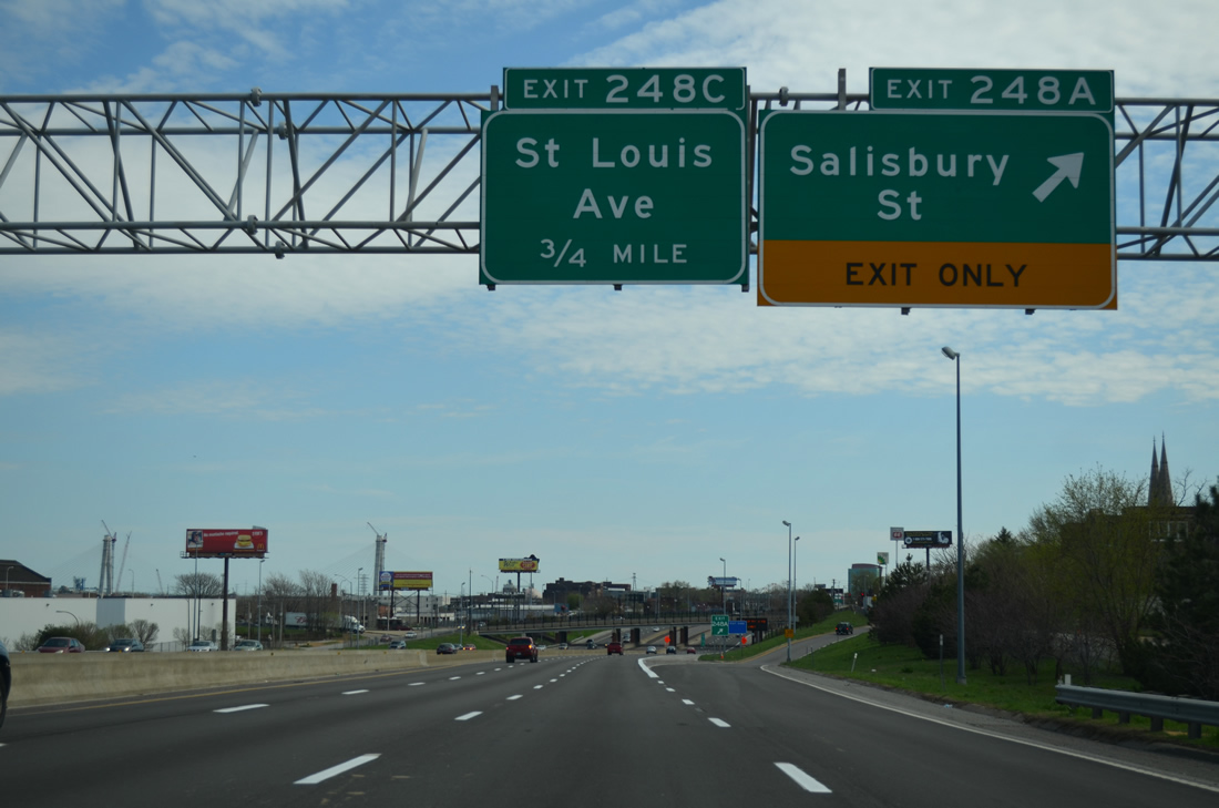
| Exit 248C also joins parallel 11th Street south to make the connection with St. Louis Avenue. St. Louis Avenue stems west from Broadway to cross I-70 en route to Old North St. Louis, St. Louis Place and Jeff Vanderlou. 05/07/18 |
|
| Eight overall lanes for Interstate 70 pass under the St. Louis Avenue overpass. The Express Lanes default traffic to Broadway (Exit 249D) and I-44 west (former I-70 east) just south of the Stan Musial Veterans Memorial Bridge. 04/13/13 |
|
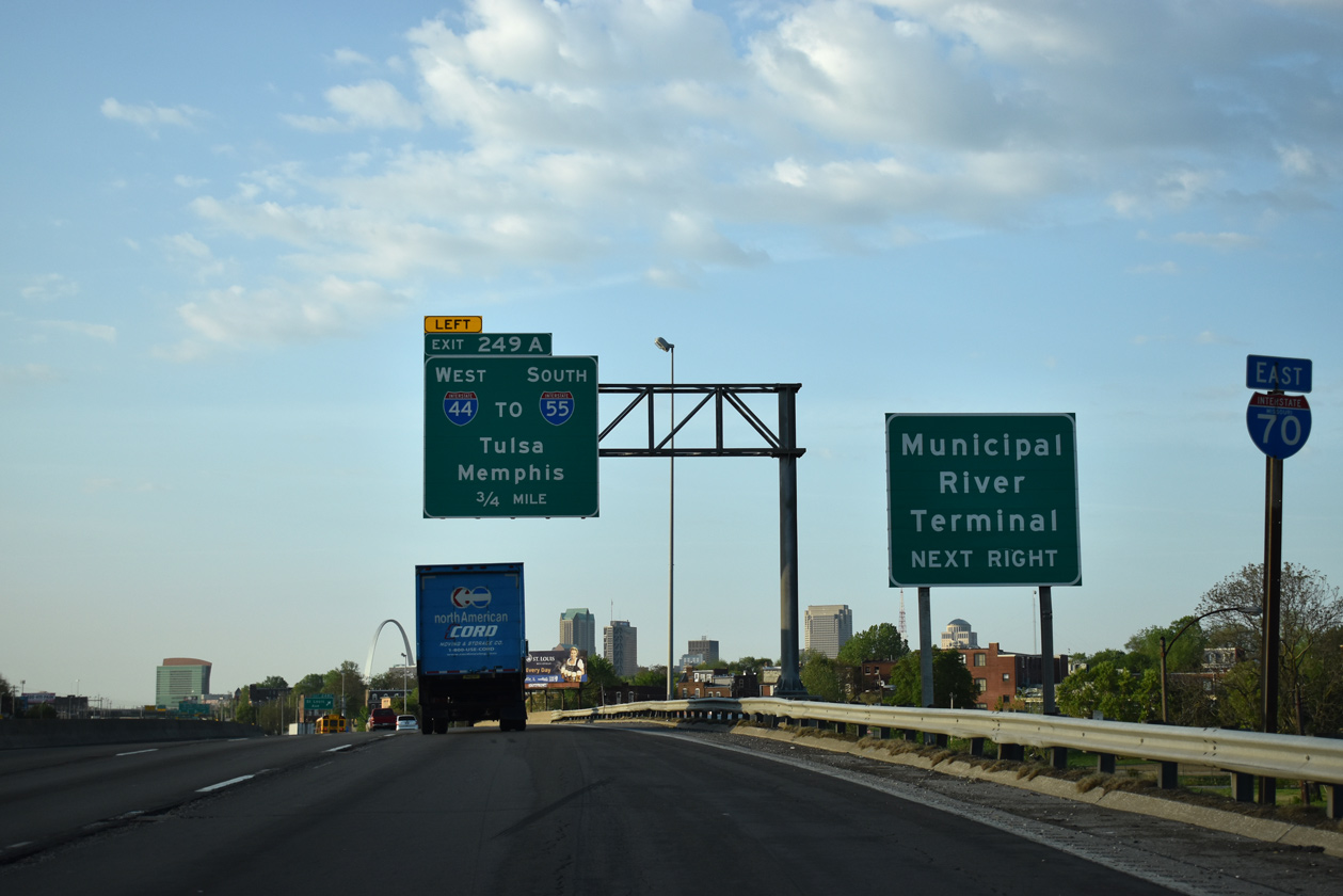
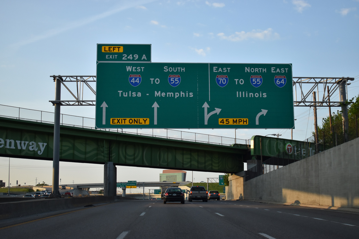
| Interstate 44 west begins in one quarter mile as I-70 turns east along a two lane ramp to the Stan Musial Veterans Bridge. Signs for I-44 in the St. Louis area use Tulsa, Oklahoma as the control city, but not elsewhere until west of Joplin. 05/07/18 |
|
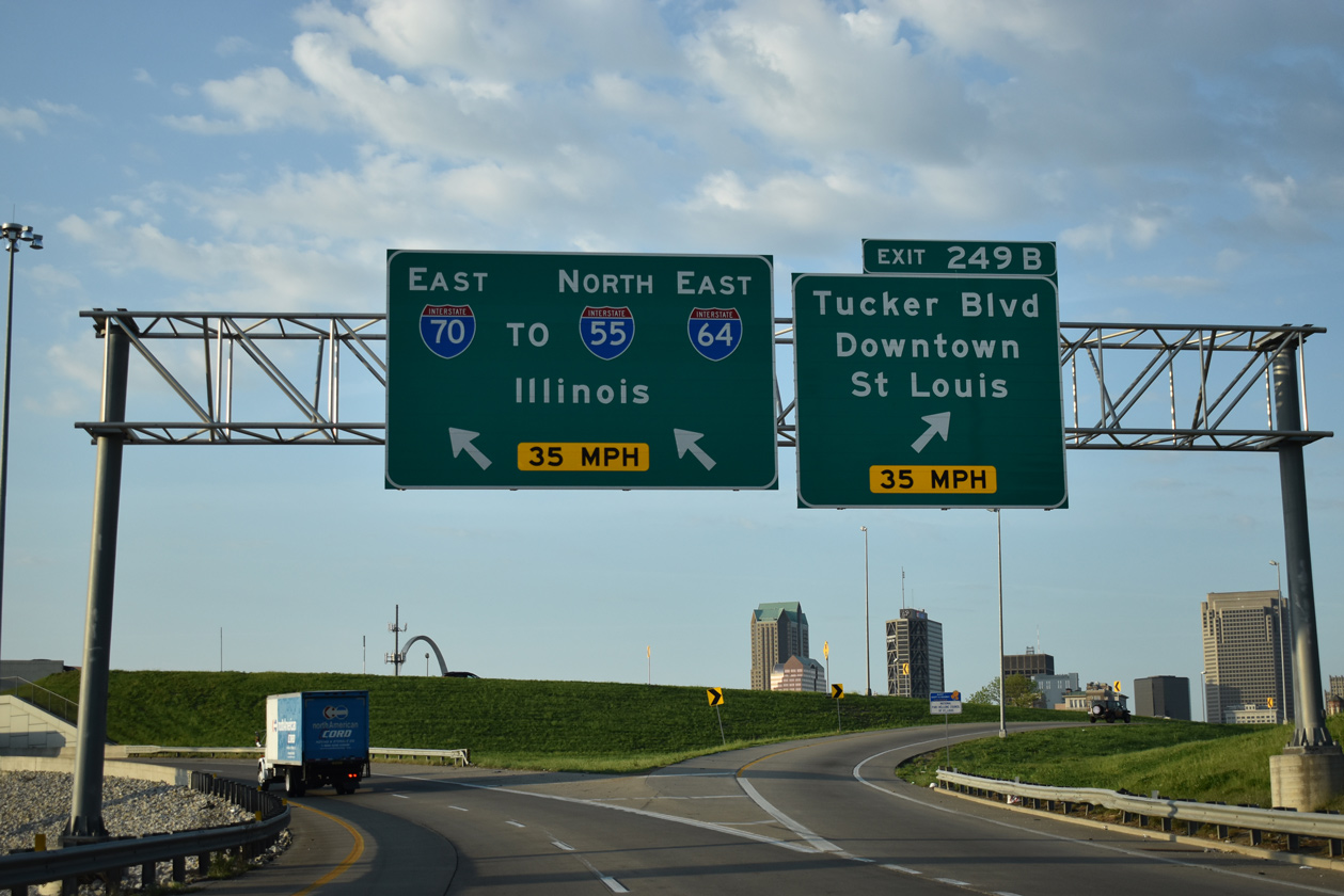
| Departing next is the September 24, 2013-opened exit for Tucker Boulevard south to Columbus Square and the northern gateway to Downtown. 05/07/18 |
|
| The Great Rivers Greenway crosses over Interstate 70 at the split with Interstate 44 west. I-44 leads two miles to merge with I-55 south at the west end of the Poplar Street Bridge. The greenway is a rail trail leading north to the Mc Kinley Bridge. 05/07/18 |
|
| Interstate 70 connects with I-55 north and I-64 east at East St. Louis, Illinois. Tucker Boulevard branches west from I-44 and I-70 to the central business district and St. Louis City Hall. 05/07/18 |
|
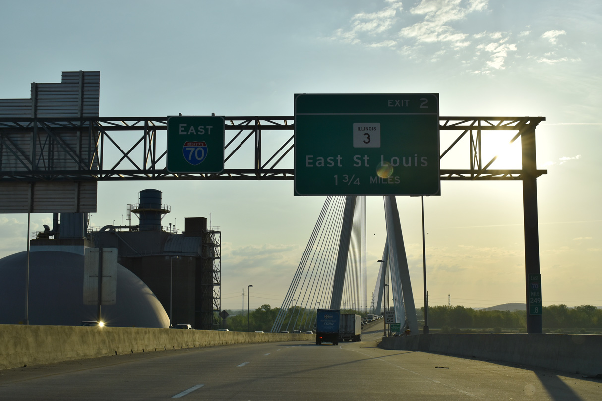
| Interstate 70 combines with traffic from Tucker Boulevard north on the approach to the Stan Musial Veterans Memorial Bridge. The succeeding exit connects the freeway with Packers Avenue to Illinois 3 in 1.75 miles. 05/07/18 |
|
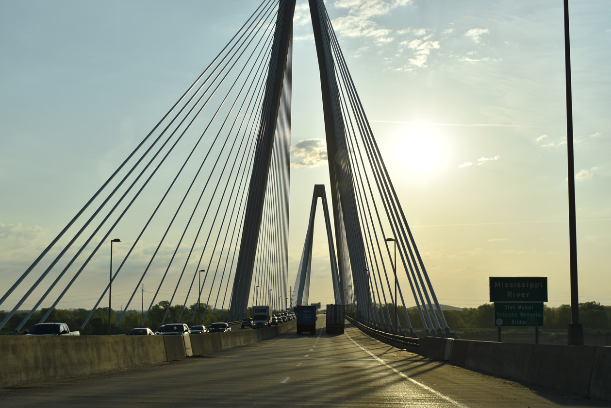
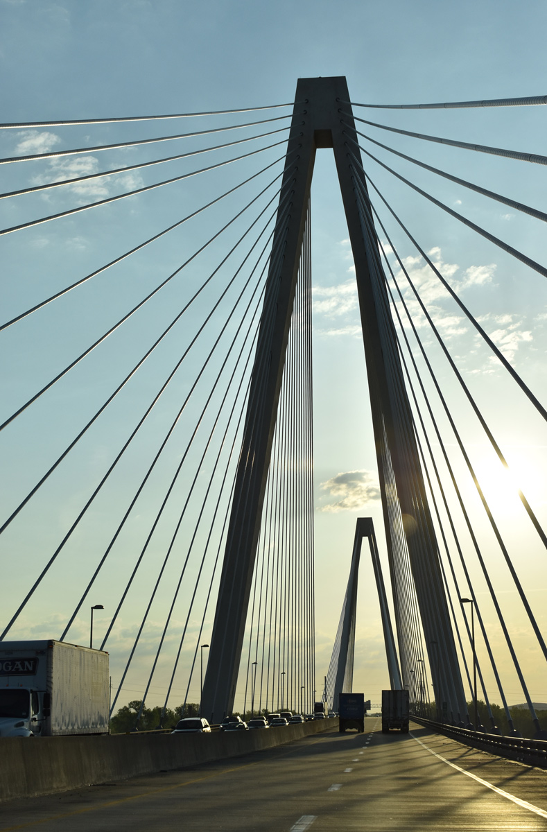
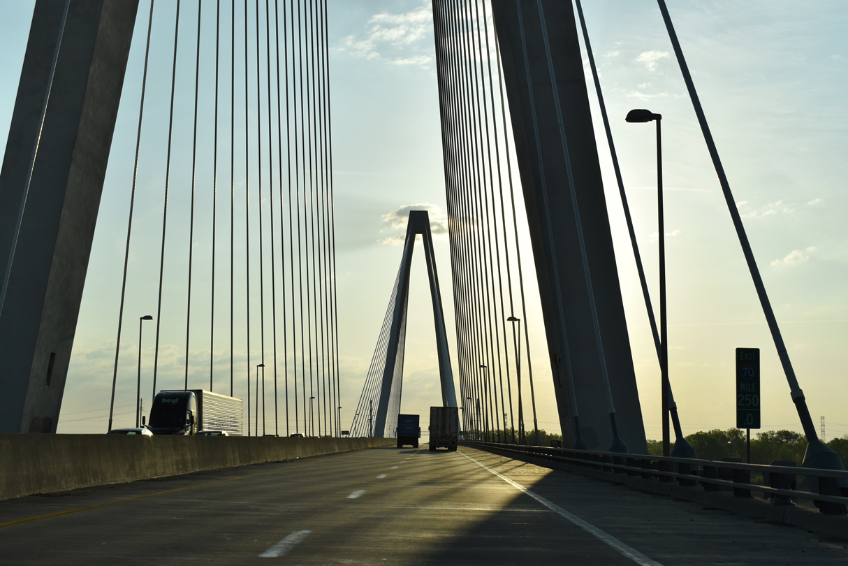
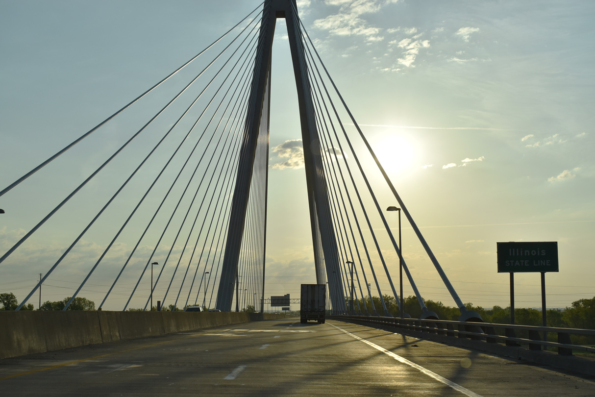
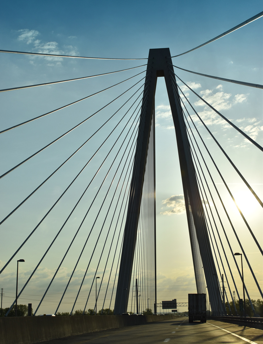
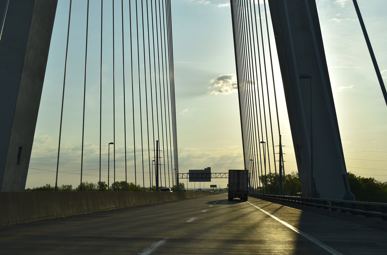
| Dedicated to military veterans and St. Louis Cardinals Hall of Fame slugger Stan Musial (1920-2013), the four lane cabled-stayed bridge carrying Interstate 70 across the Mississippi River opened to traffic on February 9, 2014. 05/07/18 |
|
| The towers supporting the 1,500 foot long main span of the I-70 Mississippi River bridge top out at 400 feet.2 05/07/18 |
|
| Milepost 250 is the last for Interstate 70 east in the Show Me State. 05/07/18 |
|
| Crossing into St. Clair County, Illinois, Interstate 70 peaks at a height of 75 feet above the Mississippi River. 05/07/18 |
|
| Coupled with the new alignment of I-70 southeast to the "Tri-Level Interchange" with I-64, the 2,083-foot long3 Stan Musial Veterans Memorial Bridge was constructed at a cost of $695 million. Illinois and Missouri split the costs, with an agreement on funding reached in February 2008.2 05/07/18 |
|
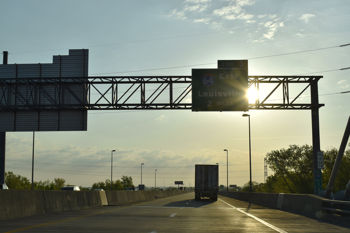
| Curving southeast over a number of railroad lines, Interstate 70 continues two miles to a systems interchange (Exit 3) with Interstate 64 east. 05/07/18 |
|
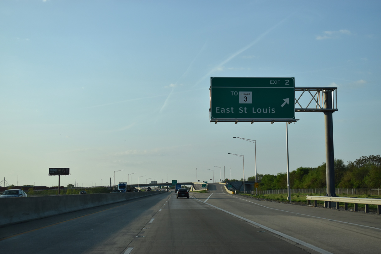
| IL 3 passes under I-70 from the village of Brooklyn to run along the west side of the freeway into East St. Louis. A grade separated intersection links Packers Avenue with IL 3 (St. Clair Avenue) from forthcoming Exit 2. 05/07/18 |
|
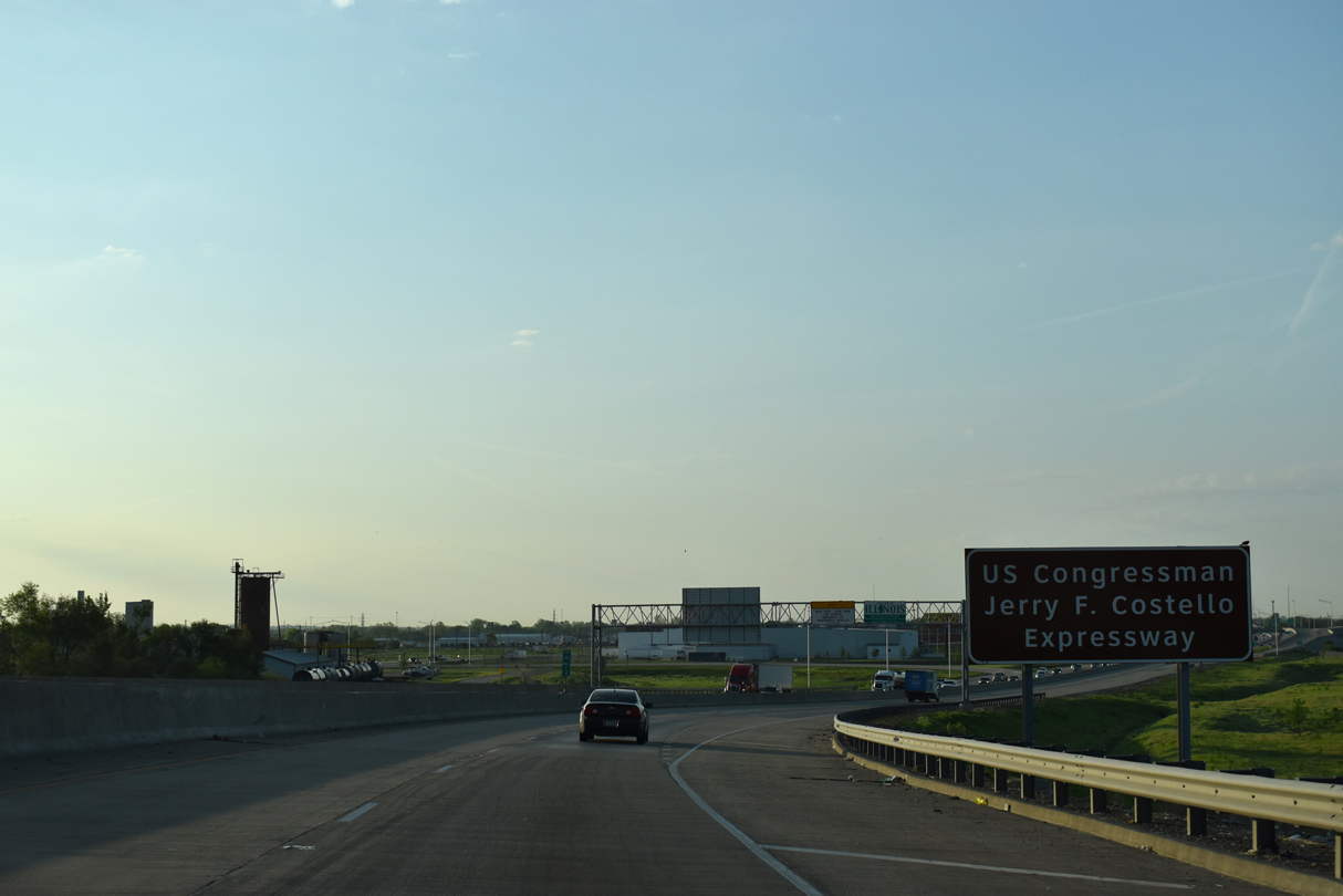
| Interstate 70 south from the Mississippi River is the US Congressman Jerry F. Costello Expressway. 05/07/18 |
|
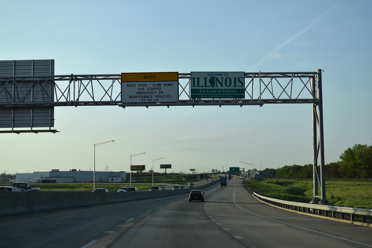
| A welcome sign greets eastbound travelers at the end of the Stan Musial Veterans Memorial Bridge as a third lane opens to Exit 2. The 86 foot wide bridge deck3 on the cable-stayed bridge can be restriped to accommodate an additional lane per direction if traffic counts warrant it. 05/07/18 |
|
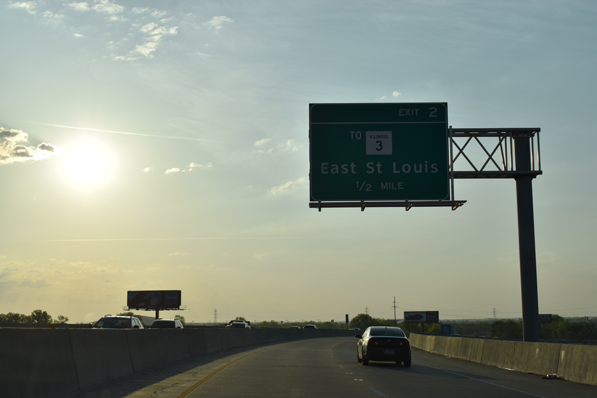
| Entering the parclo interchange (Exit 2) with Packers Avenue on I-70 east. Packers Avenue also connects with Fairmont City Boulevard in an industrial area of East St. Louis to the east. IL 3 parallels I-70 to I-55/64, which the route joins west for its continuation to Cahokia. 05/07/18 |
|
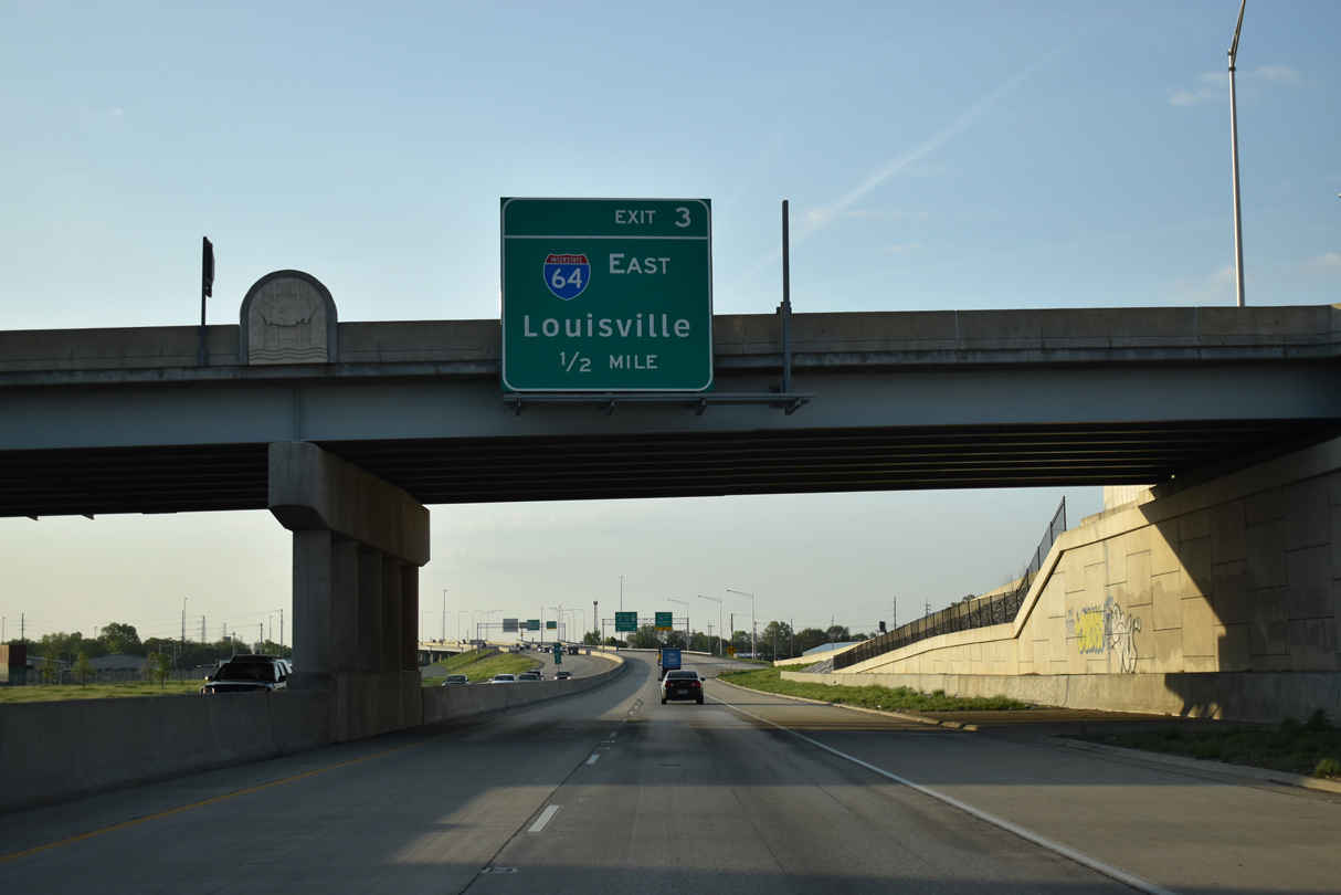
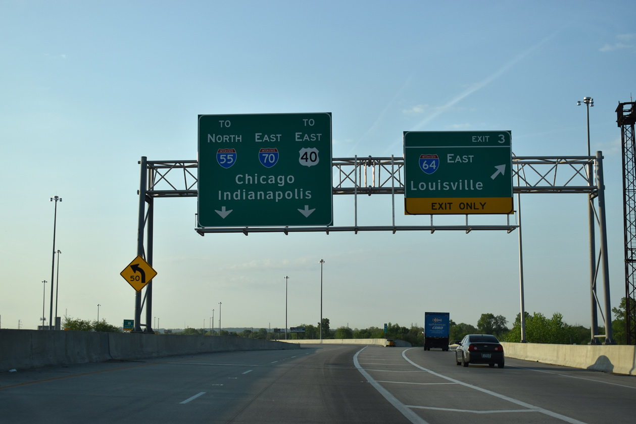
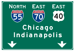
| Advancing a half mile south from the Packers Avenue overpass, traffic on Interstate 70 partitions with Exit 3 for I-64 east to Louisville. 05/07/18 |
|
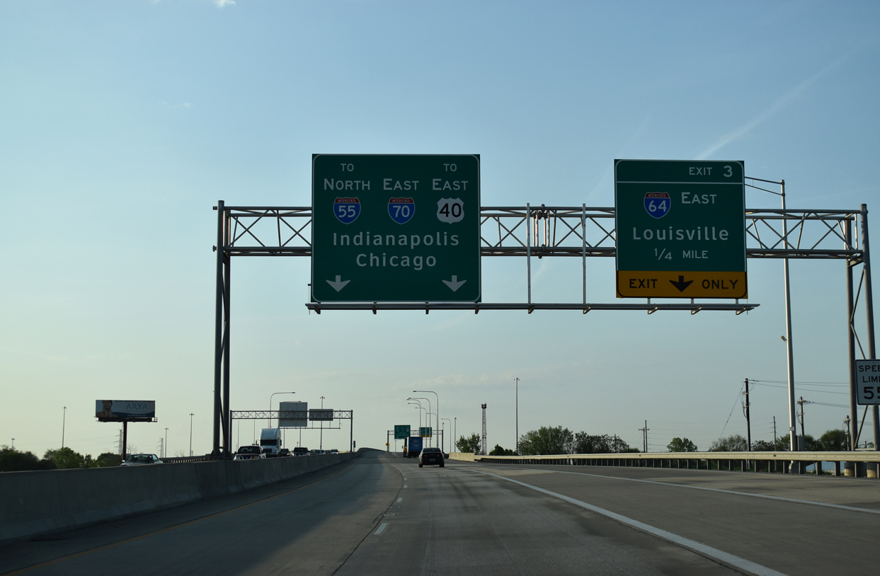
| A two lane flyover links I-70 east with I-55/U.S. 40 north to Fairmont City, Collinsville and Troy. A single lane flyover connects with the departing I-64 east for Washington Park, Fairview Heights and O'Fallon. 05/07/18 |
|
| Exit 3 departs for Interstate 64, which leads from the St. Louis area to Mount Vernon, Evansville, Indiana and Louisville, Kentucky. 05/07/18 |
|
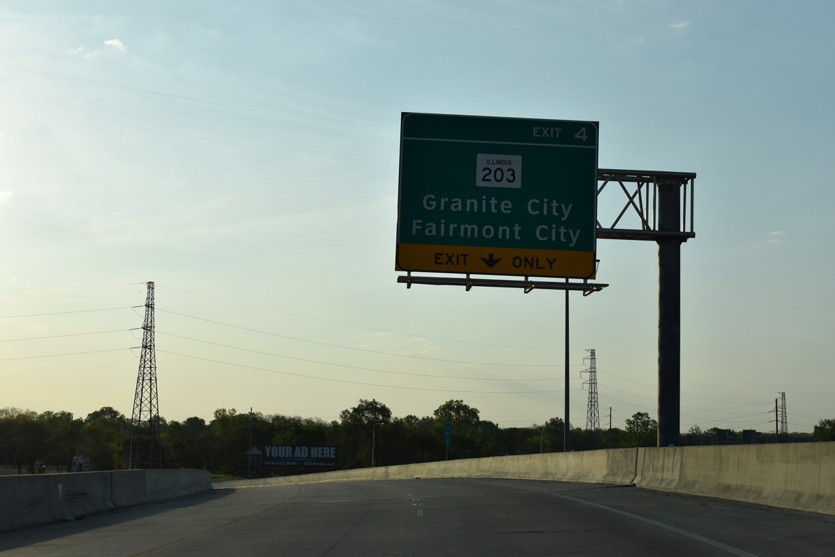
| The I-70 mainline joins I-55/U.S. 40 north ahead of a lane drop for IL 203 at Exit 4. 05/07/18 |
|
| An entrance ramp ties into the exchange joining I-70 east and I-55 north from N 9th Street and Baugh Avenue in East St. Louis. I-55/70 east overlap for 15.8 miles. 05/07/18 |
Page Updated 05-14-2018.

 East
East