|
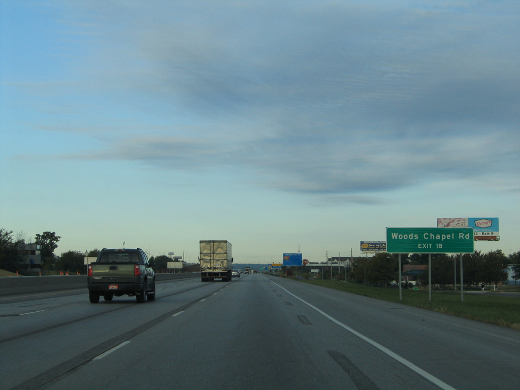
| Former button copy overhead sign assembly posted one mile ahead of the diverging diamond interchange (Exit 18) with Woods Chapel Road south to the city of Lake Tapawingo and Fleming (county) Park. 10/17/04 |
|
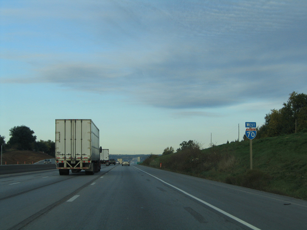
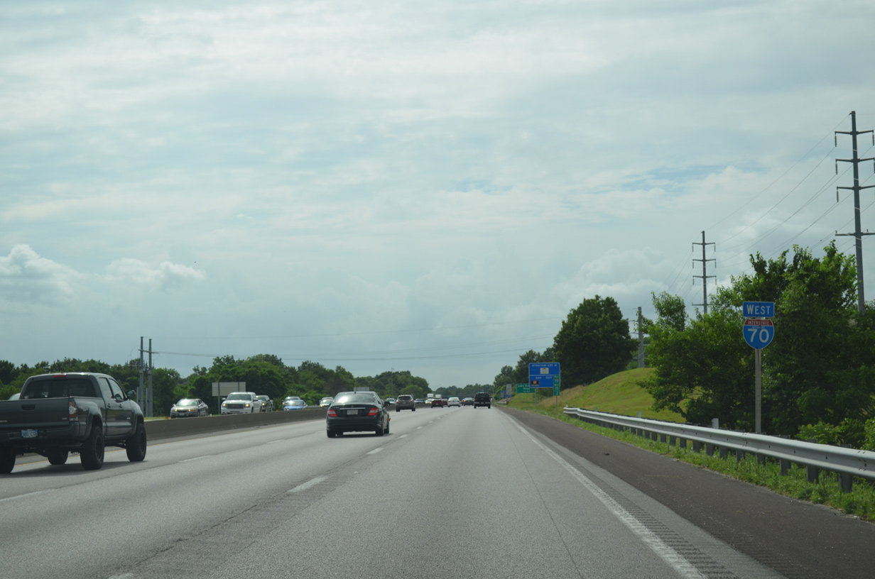
| Interstate 70 constitutes a six lane freeway with commercialized frontage roads (Jefferson Road / South Outer Road) between Route 7 and Woods Chapel Road (Exit 18) through the city of Blue Springs. 10/17/04 |
|
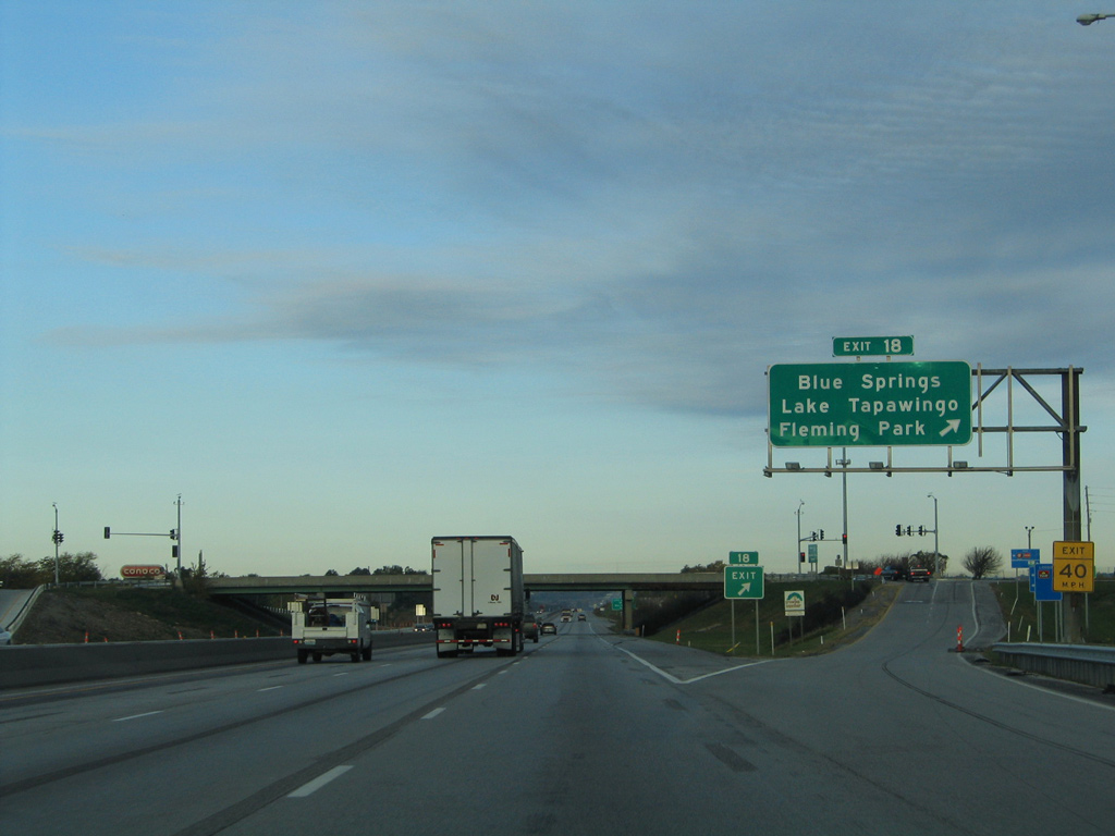
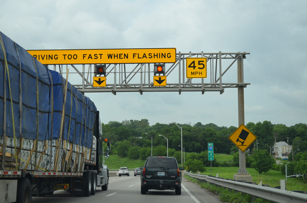
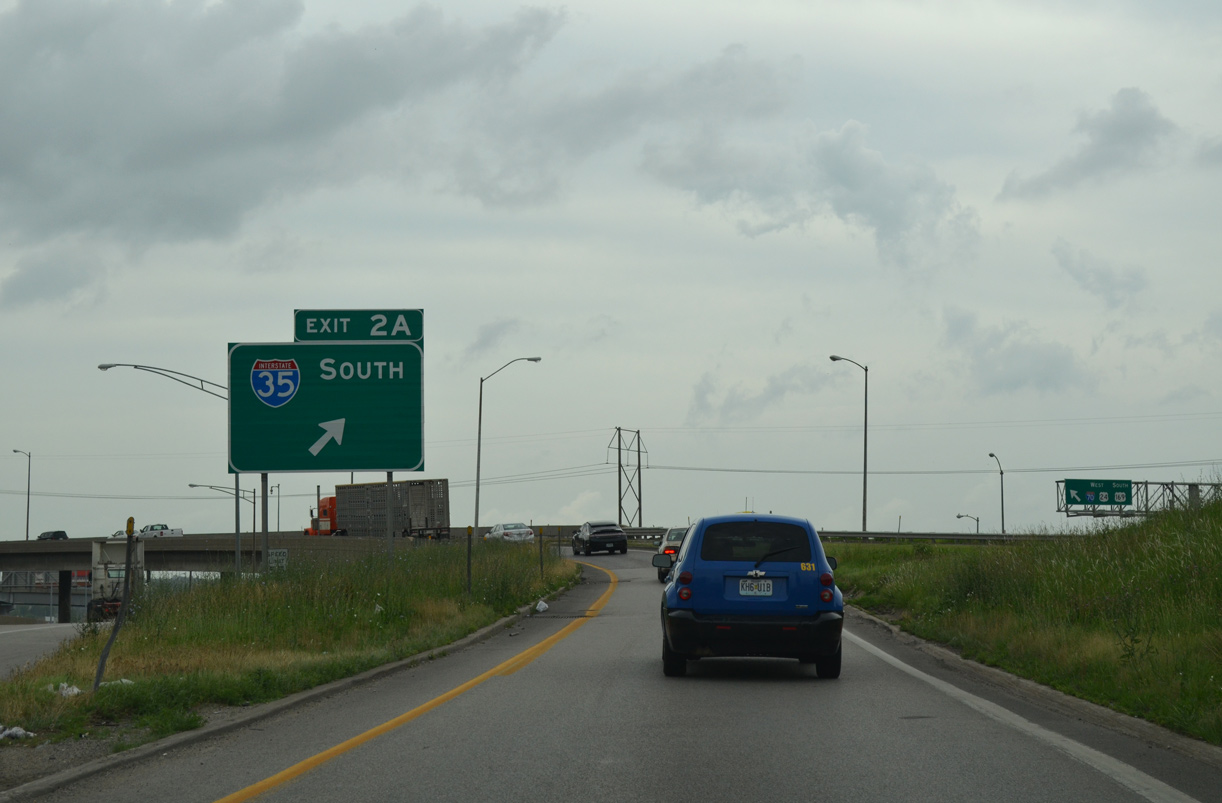
| The close placement of signalized intersections along Woods Chapel Road with the adjacent frontage roads, and weaving traffic patterns between them, led MoDOT and the city of Blue Springs to convert the previous diamond interchange at Exit 21 into a DDI. The $15 million project was completed with a ribbon cutting ceremony held on October 23, 2013.1 10/17/04 |
|
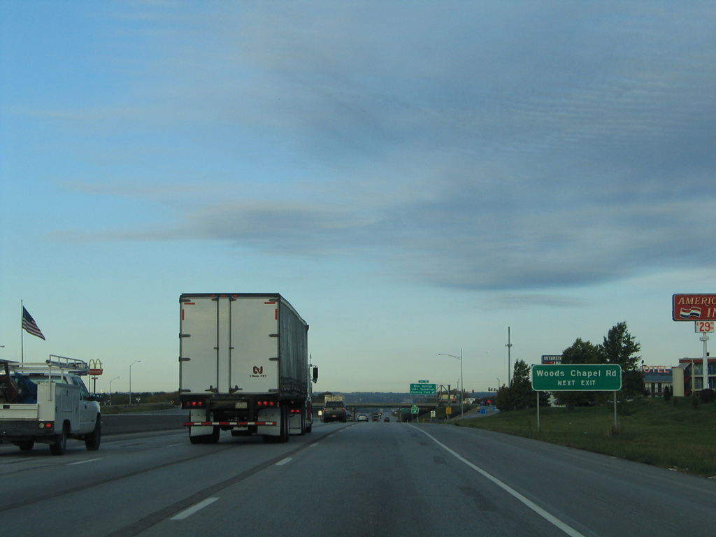
| Woods Chapel Road becomes R.D. Mize Road just north of Exit 21. The road south ends at U.S. 40, with a second segment branching southwest across Blue Springs Lake to Lee's Summit.
This overhead was replaced by 2007. 10/17/04 |
|
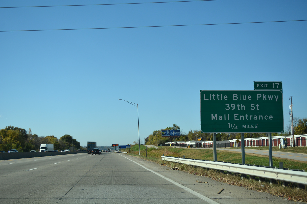
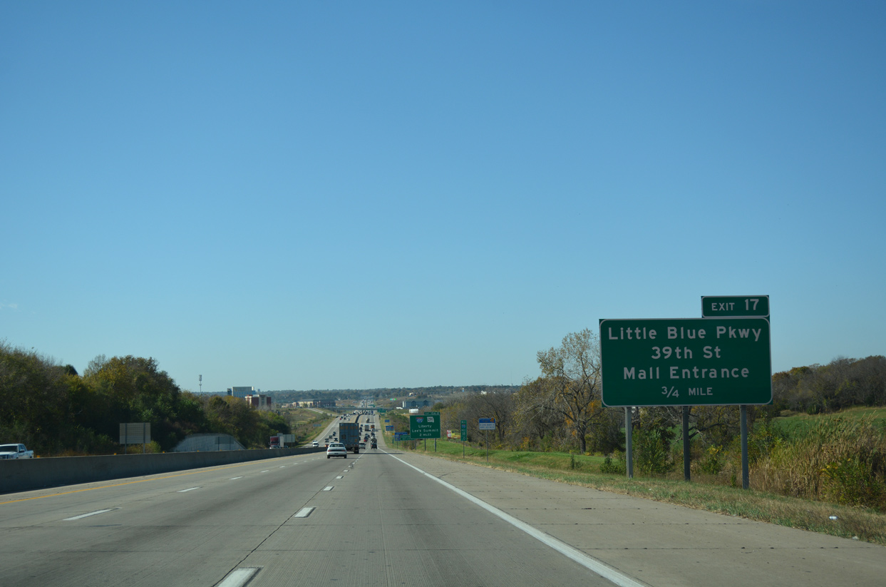
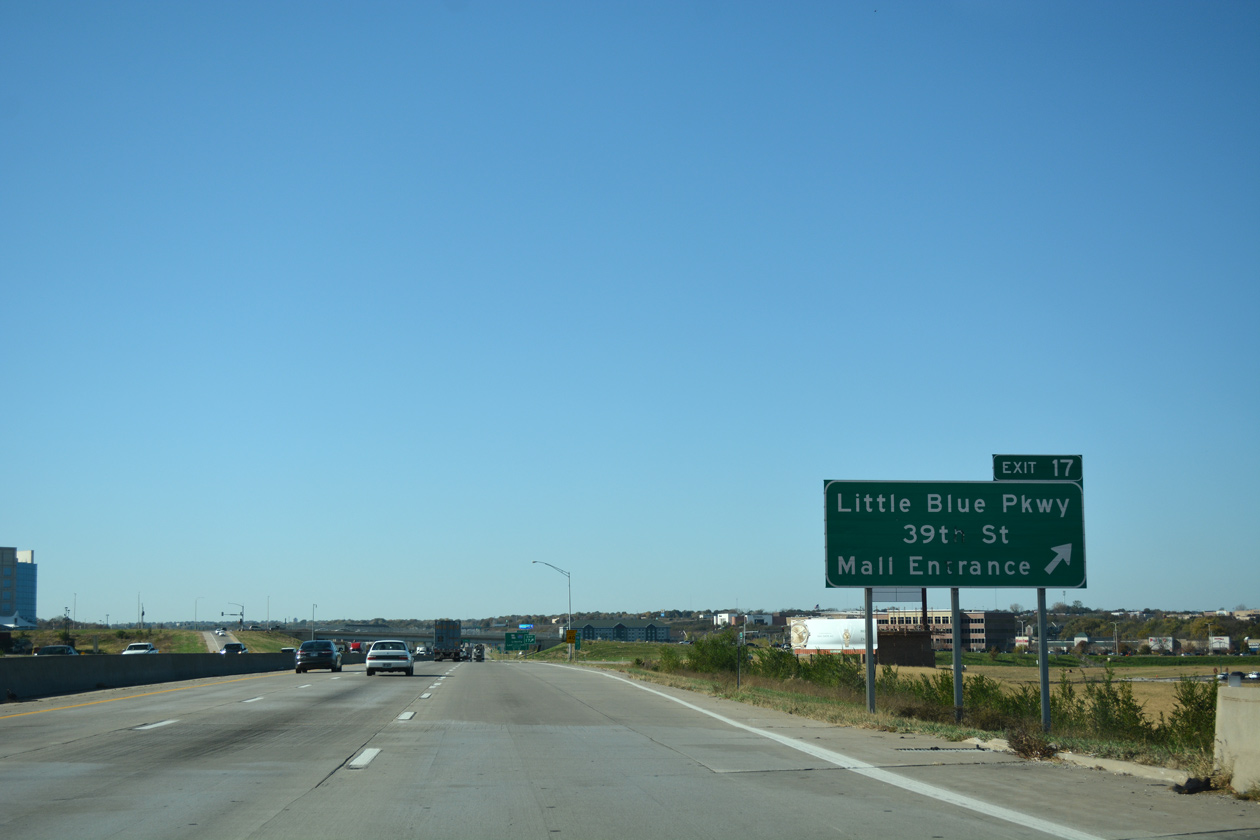
| Advancing west, Interstate 70 leaves Blue Springs for the city of Independence on the 1.25 mile approach to Exit 17 with Little Blue Parkway. 11/03/16 |
|
| The six lane freeway passes between Stone Canyon Golf Club and subdivisions along Valley View Road by this confirming marker. 10/17/04 |
|
| Little Blue Parkway angles southwest from Exit 17 to U.S. 40 to the city of Lee's Summit and north along a winding course 7.7 miles to U.S. 24. 11/03/16 |
|
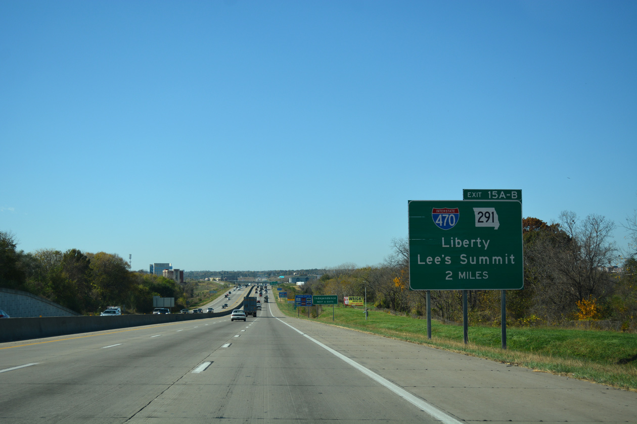
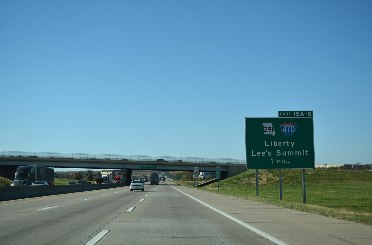
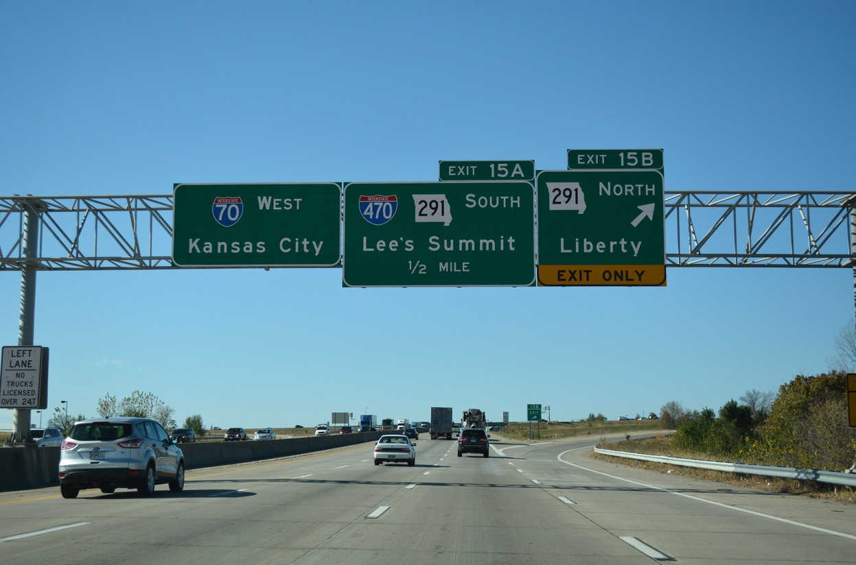
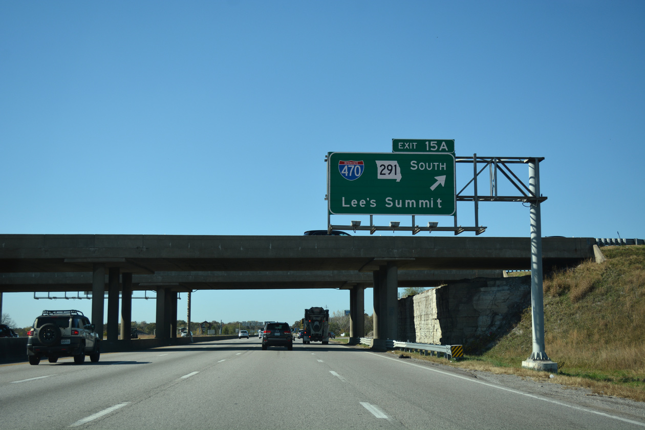
| The cloverleaf interchange (Exits 15A/B) with Interstate 470 and Route 291 lies just west of Little Blue Parkway by Independence Center mall. 11/03/16 |
|
| Exit 17 departs Interstate 70 west beyond the Little Blue River East Fork. Little Blue Parkway serves a number of business parks and area retail to the west. Connections with 39th Street lead motorists west to Centerpoint Medical Center and the aforementioned mall. 11/03/16 |
|
| Interstate 470 is a 17.13 mile suburban loop encircling southeast Kansas City through Lee's Summit. Route 291 overlaps with the freeway between I-70 and Rice Road leading south from Exit 10 to U.S. 50. 11/03/16 |
|
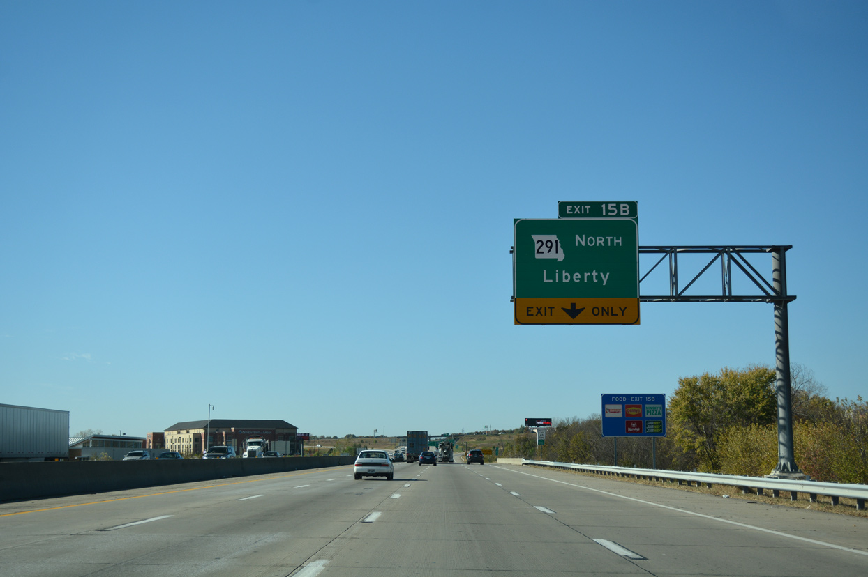
| Route 291 extends north from the end of I-470 to 39th Street as a freeway and Sugar Creek, River Bend and Liberty as a divided highway. 11/03/16 |
|
| Exit 15A loops away from Interstate 70 west onto I-470/Route 291 south to Lee's Summit. I-470 provides a bypass route to I-49 south to Joplin and I-435 west to I-35 at Lenexa, Kansas. The freeway was completed by 1983. 11/03/16 |
|
| Several subdivisions spread to the north and south of Interstate 70 through south Independence. 06/18/15 |
|
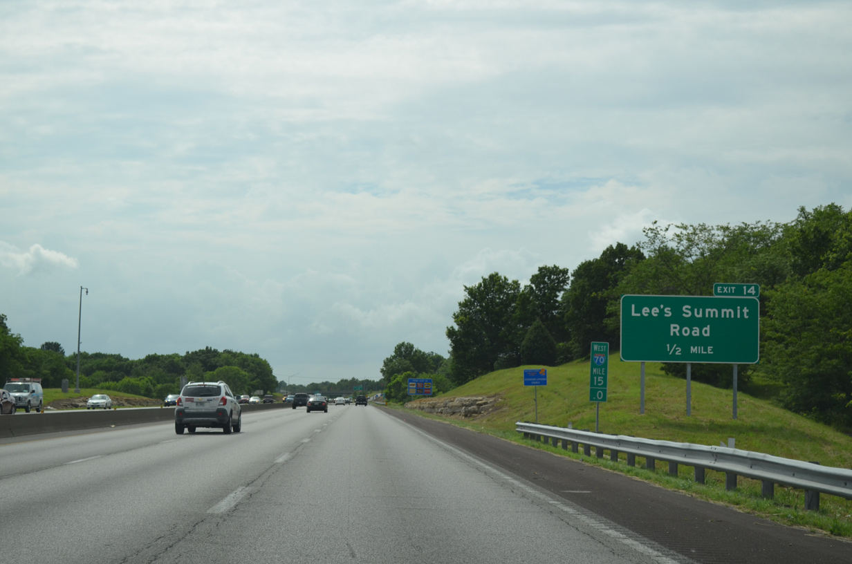
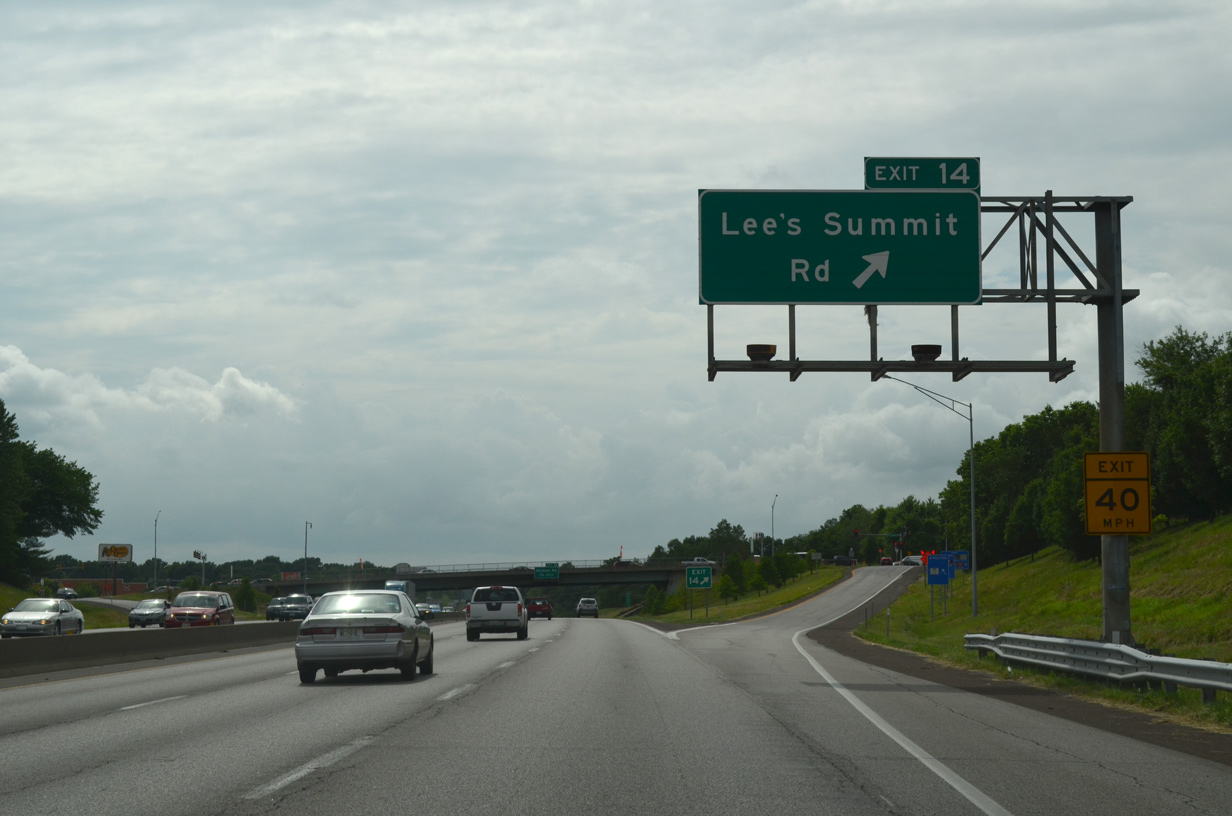
| The next exit along westbound Interstate 70 is the diamond interchange (Exit 14) with Lee's Summit Road. 06/18/15 |
|
| Lee's Summit Road comprises a four to five lane boulevard north from parallel U.S. 40 to Exit 14 and U.S. 24. Heading south, the road becomes more rural with just two lanes to Douglas Road, near I-470. 06/18/15 |
|
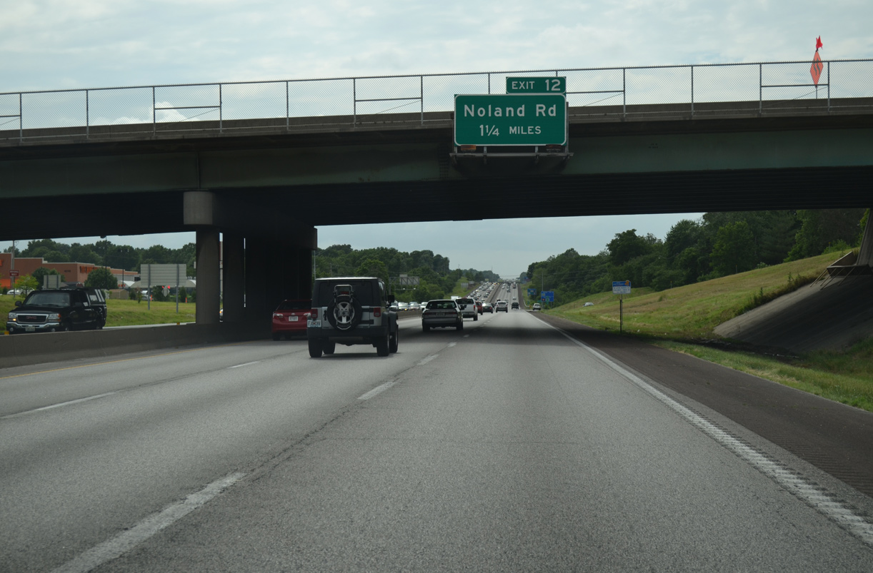
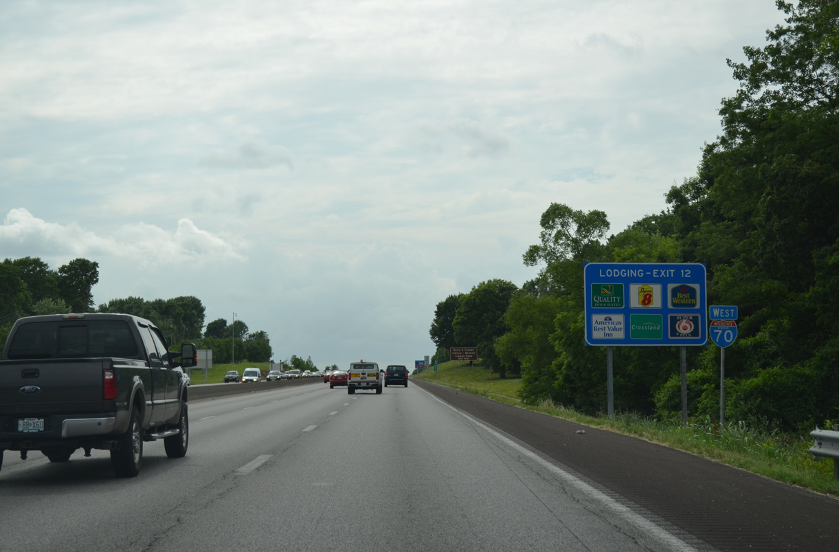
| The subsequent diamond interchange (Exit 12) from I-70 west serves a commercial corridor along Noland Road in 1.25 miles. 06/18/15 |
|
| Confirming marker posted midway between Exits 14 and 12. Noland Road north leads motorists to the Harry S. Truman Home via Truman Road west and the Harry S. Truman Library and Museum via U.S. 24 (Independence Avenue) west. 06/18/15 |
|
| Exit 12 leaves Interstate 70 west for Noland Road north to Downtown Independence and south to the Blue Vue Hills area of Kansas City. U.S. 40 crosses paths with I-70 next in 1.5 miles beside the Kansas City line. 06/18/15 |
|
| A Union Pacific Railroad line spans Interstate 70 just west of Noland Road. The railroad also carries the AMTRAK Missouri River Runner route. 10/17/04 |
|
| A westbound reassurance marker stands beside the UP Railroad overpass. 06/18/15 |
|
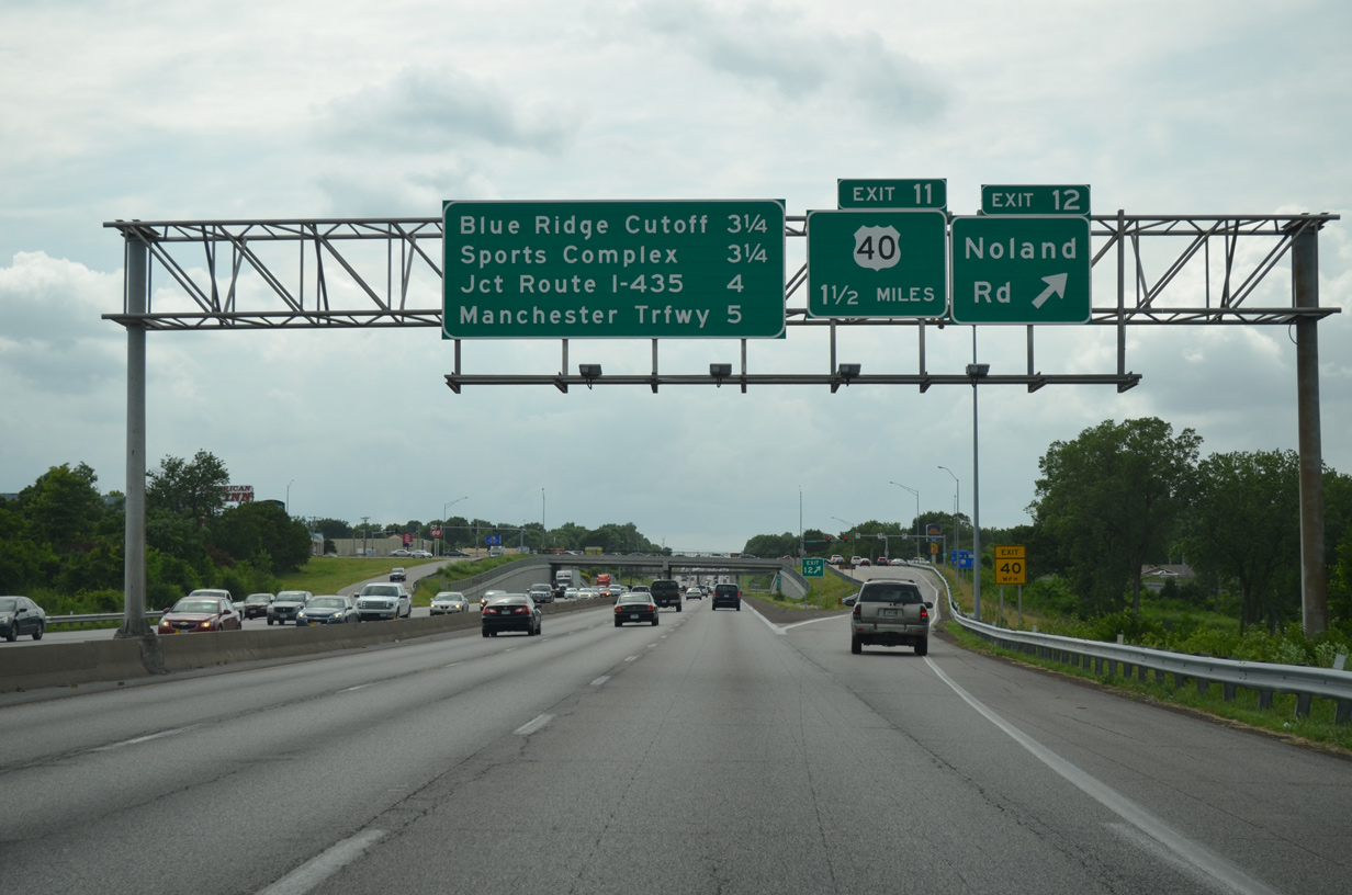
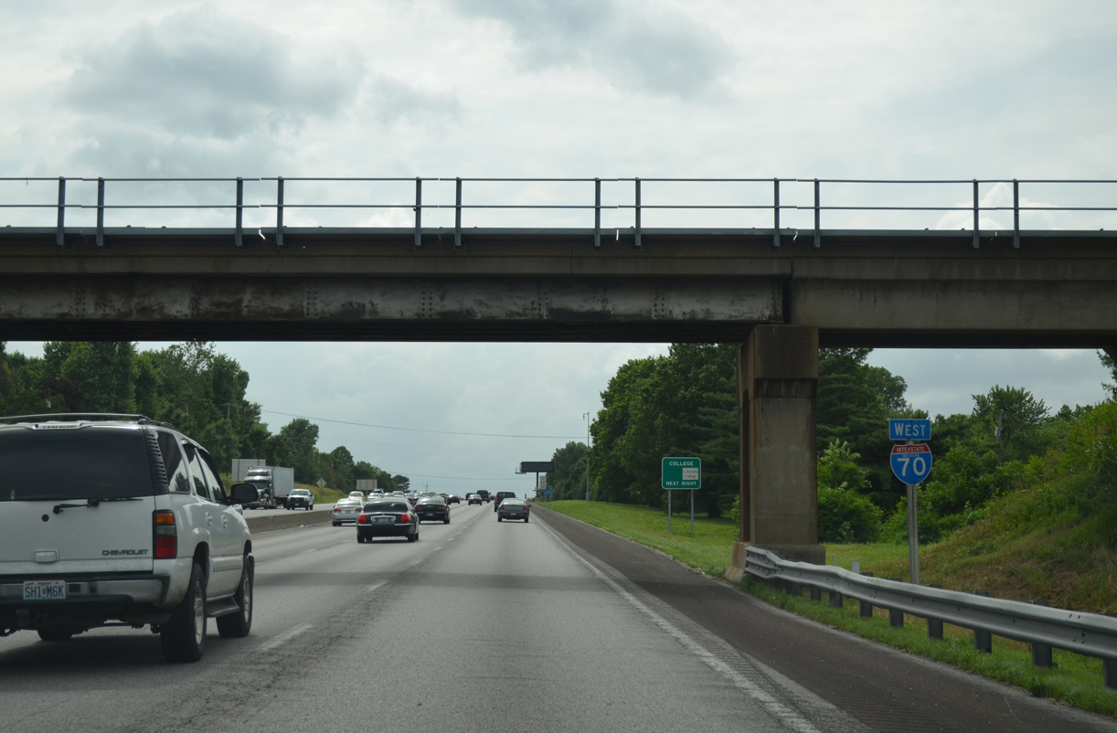
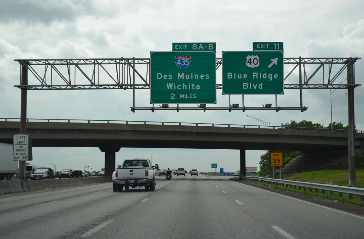
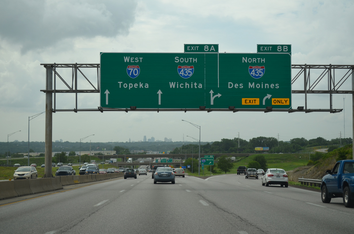
| Blue Ridge Road passes over I-70 as the westbound freeway reaches the diamond interchange (Exit 11) with U.S. 40. U.S. 40 switches sides with the freeway north along a commercial boulevard to I-435. I-435 is the Kansas City Beltway, providing a bypass route north to I-35 for Des Moines and southwest to I-35 for Wichita, Kansas. 06/18/15 |
|
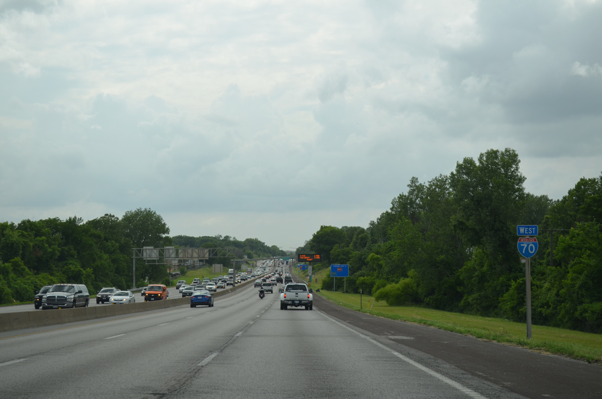
| Interstate 70 crosses the Kansas City limits west between the Ashland Ridge and Riss Lake areas. Motorists catch a glimpse of Arrowhead Stadium, home of the Kansas City Chiefs NFL team, in the distance. 06/18/15 |
|
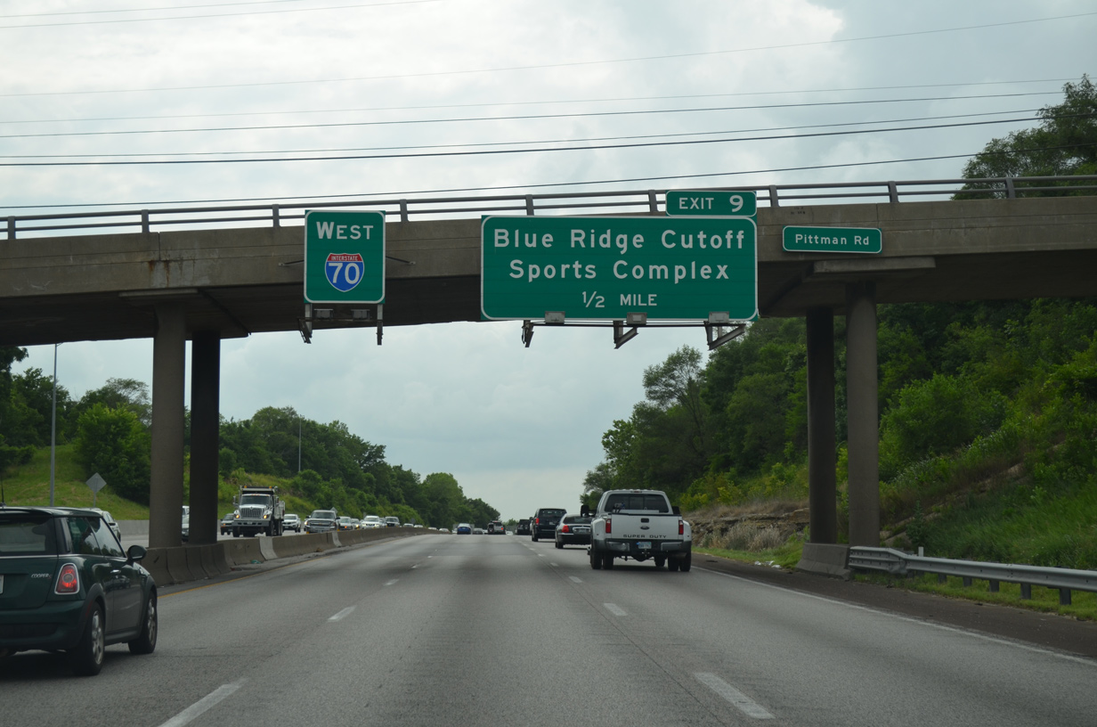
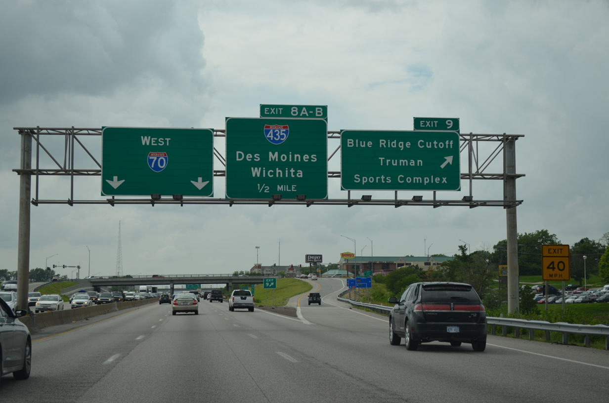
| The freeway bends northwest ahead of the diamond interchange (Exit 9) with Blue Ridge Cutoff. Blue Ridge Cutoff connects Interstate 70 with both Arrowhead and Kauffman Stadiums to the southwest. 06/18/15 |
|
| Exit 9 ascends from Interstate 70 west for the adjacent sports complex and the Ashland Ridge community north to U.S. 40. The freeway mainline continues just a half mile to Exits 8B/A with I-435. 06/18/15 |
|
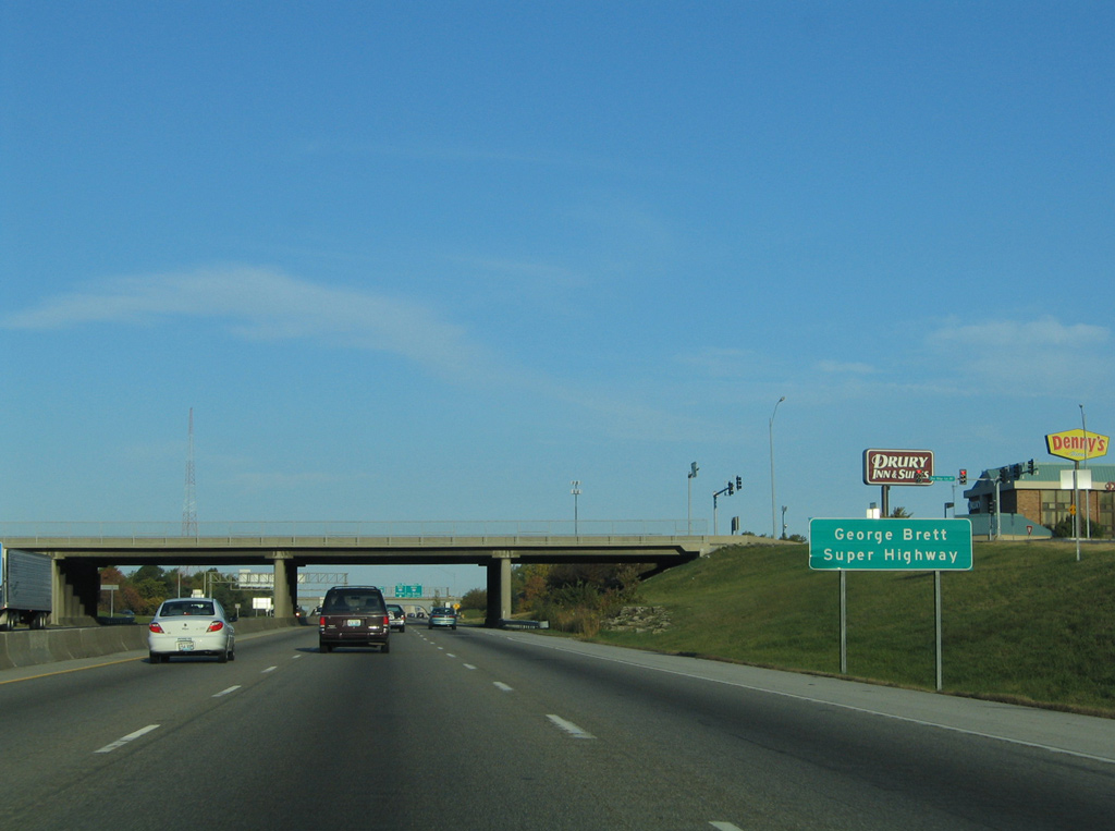
| Interstate 70 west through Kansas City is designated the George Brett Super Highway, after the legendary third baseman of the Royals. Brett spent his entire career with the KC Royals, from 1973 to 1993. 10/17/04 |
|
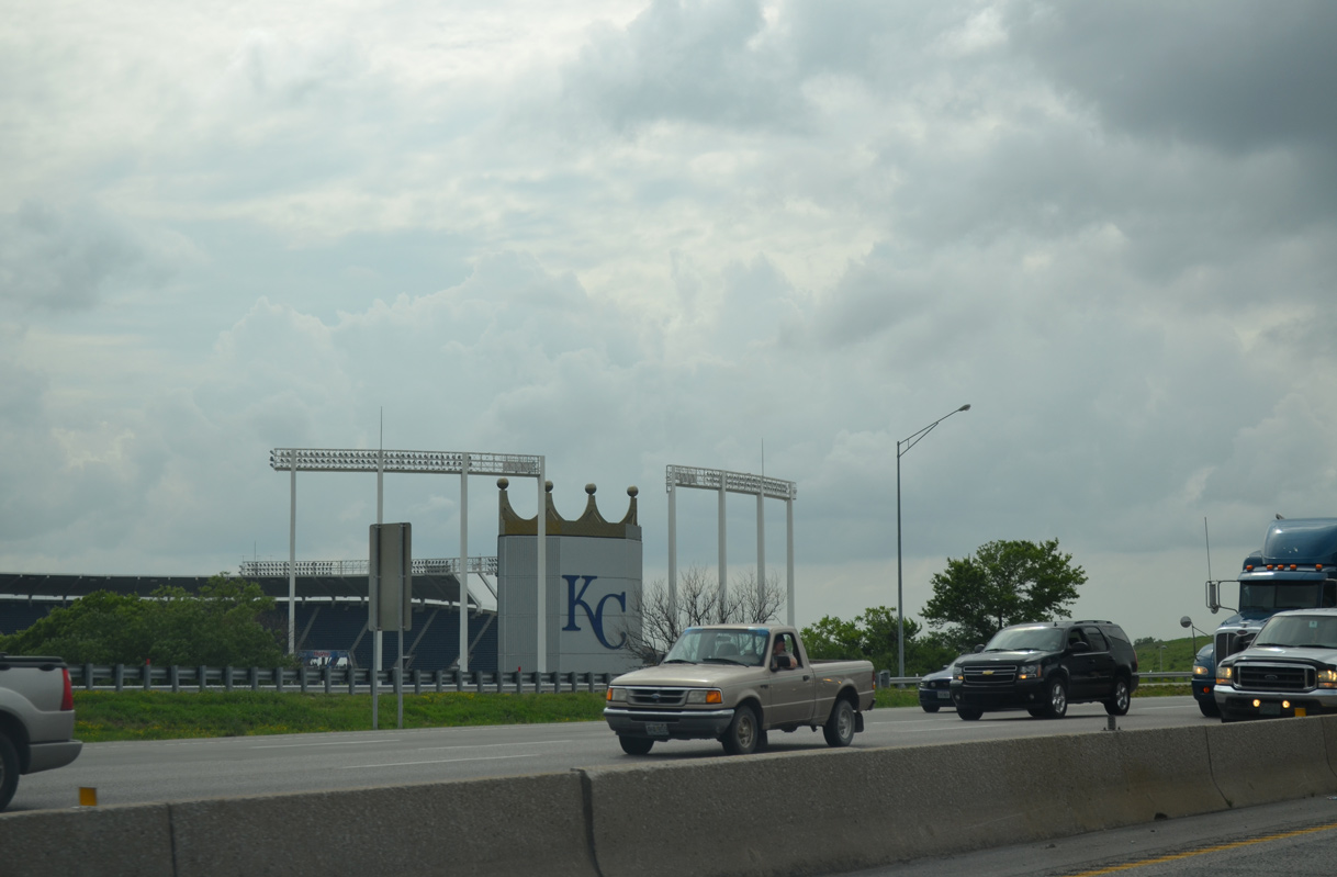
| Kauffman Stadium, named after the Royals founder, is the home of the 2015 World Series champion Kansas City Royals. Constructed between 1968 and 1973, the stadium seats over 37,000. 06/18/15 |
|
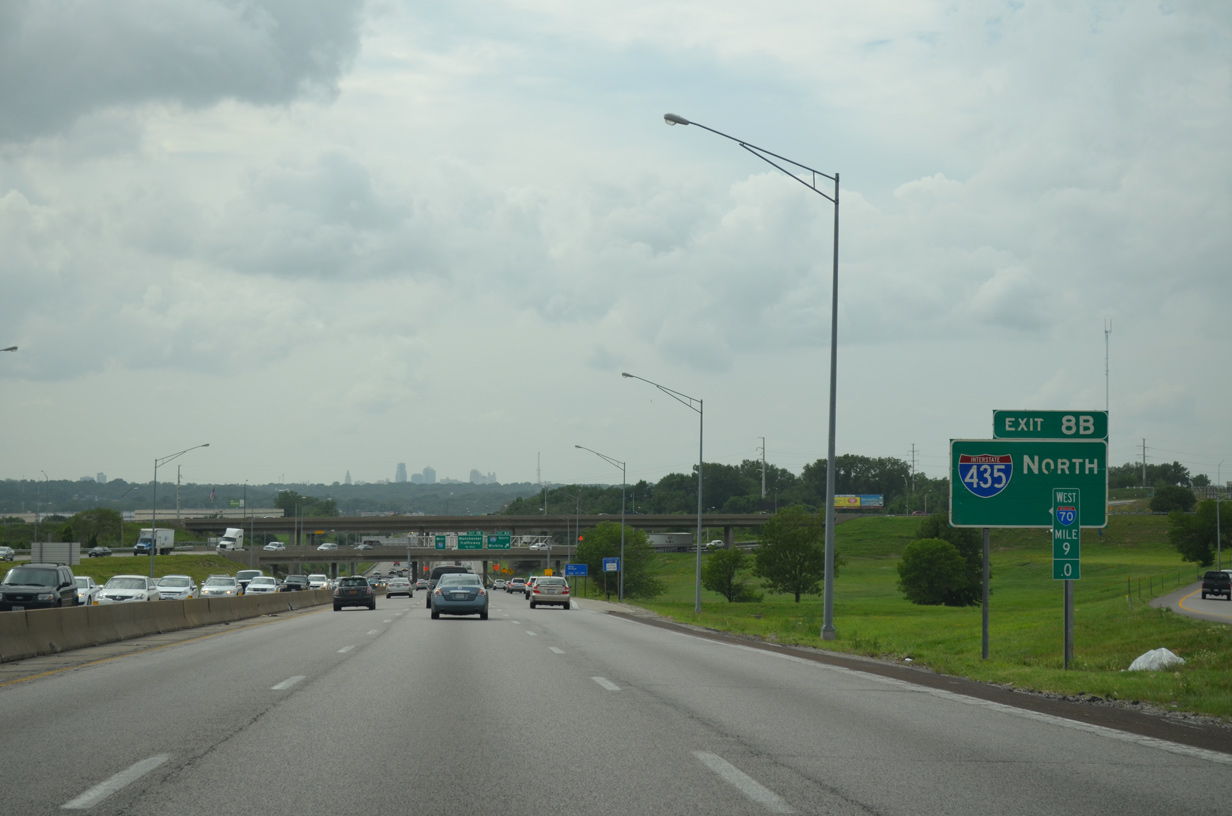
| Arrow Per Lane (APL) signs outline the upcoming two lane off-ramp (Exit 8B) for Interstate 435 north to Claycomo, Liberty and the Kansas City Northland. 06/18/15 |
|
| Stadium Drive spans Interstate 70 as the Kansas City skyline comes into view along the western horizon. 06/18/15 |
|
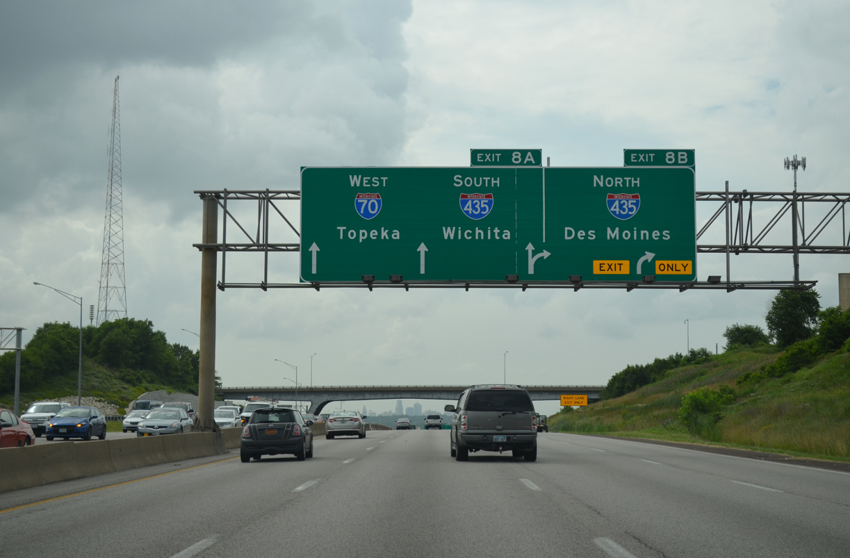
| Travelers bound for Des Moines or St. Joseph depart I-70 west for Interstate 435 north. The Kansas City Beltway turns west near Smithville to Kansas City International Airport (MCI). The loop returns south through Parkville to meet I-70 at Edwardsville. 06/18/15 |
|
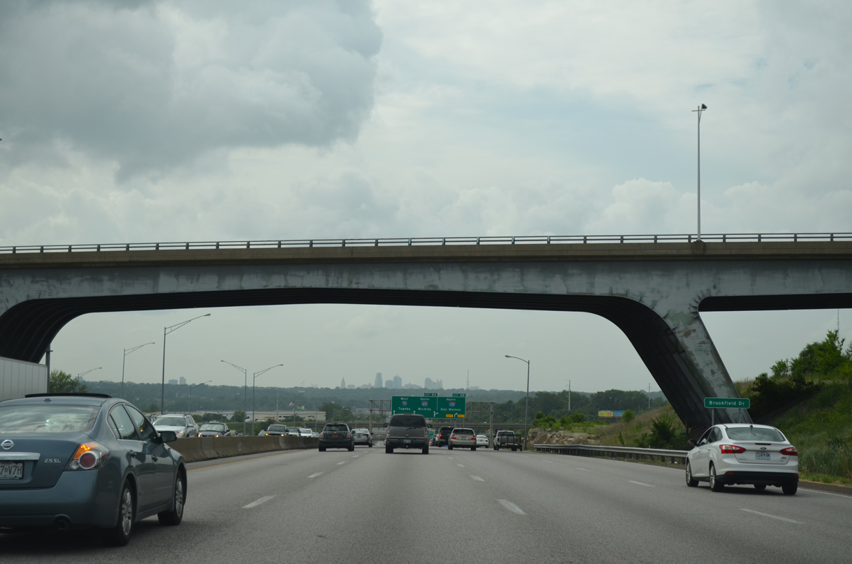
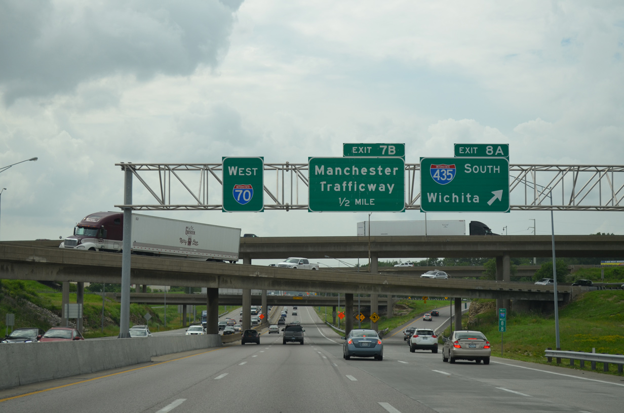
| I-70 lowers through the cloverstack interchange with Interstate 435. A loop ramp (Exit 8A) follows for I-435 south toward Raytown and Grandview. 06/18/15 |
|
| Interstate 435 travels south to the Three Trails Crossing Highway, where U.S. 71, I-49 and I-470 come together. The beltway ventures west from there to Leawood, Overland Park and Lenexa in Wyandotte County, Kansas. 06/18/15 |
|
| Construction during 2010-12 reconfigured the ramp from I-435 south to I-70 east to utilize a new c/d roadway to Blue Ridge Cutoff. A third through lane for Interstate 70 west was added during the project. 06/18/15 |
|
| Passing below the I-435 mainline and ramp from the beltway north to I-70 west. Interstate 435 was open to traffic from I-35 at Lenexa, Kansas to Route 78 at Western Blue Township by 1970. 06/18/15 |
|
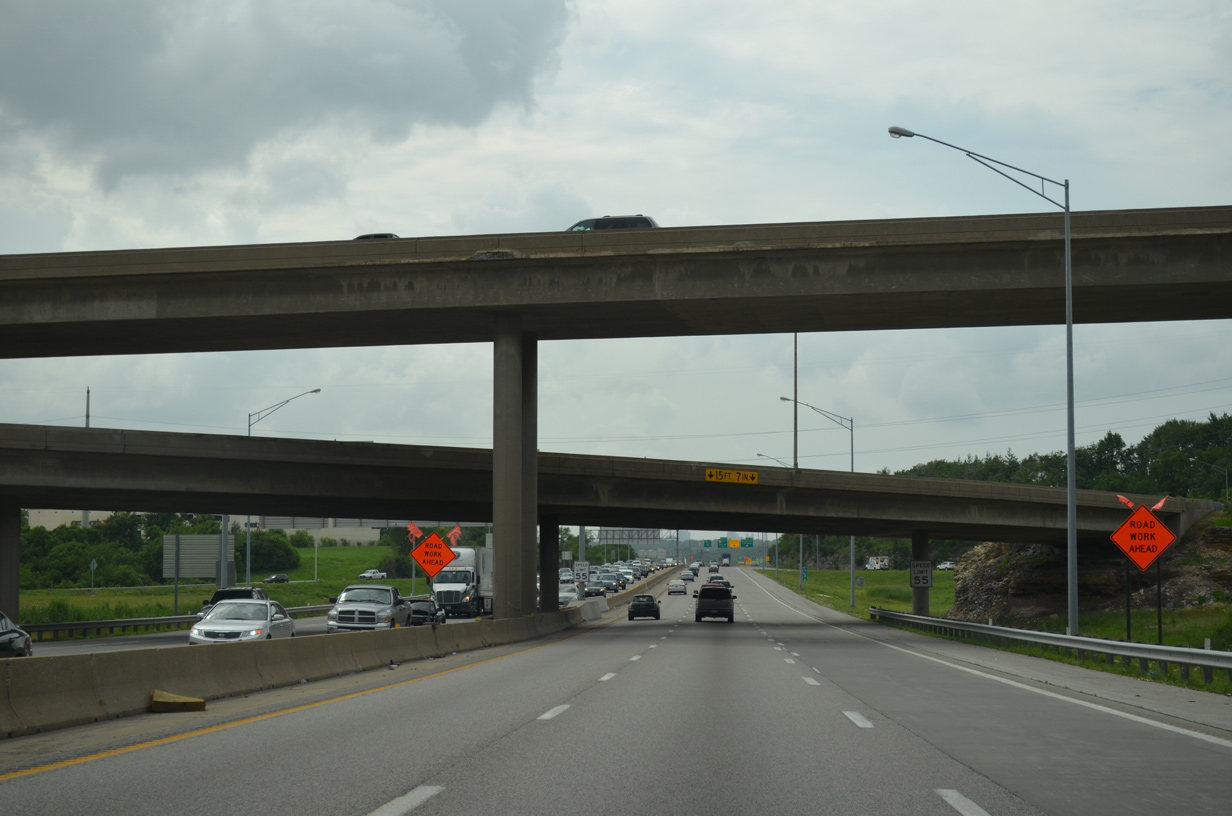
| The $63 million Manchester Bridge Project between February 2014 and December 2015 rebuilt the folded diamond interchange (Exit 7B) with Manchester Trafficway to improve the ramp geometry.2 The local road serves the Leeds industrial area east of the Blue River. 11/03/16 |
|
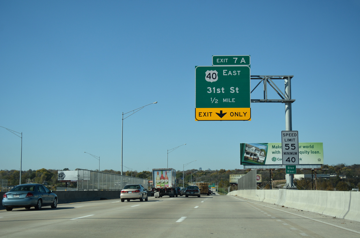
| The entrance ramp from Manchester Trafficway adds a fourth westbound lane to the parclo B2 interchange (Exit 7A) with U.S. 40 east and 31st Street west. 11/03/16 |
|
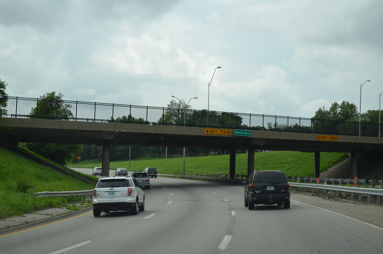
| The viaduct spanning Manchester Trafficway extends west across BNSF and Kansas City Southern Railroads and the Blue River. The bridge system replaced here in 2014/15 dated from the early 1950s. 11/03/16 |
|
| U.S. 40 crosses the Blue River just east of I-70. The adjacent bridge was replaced as part of area improvements during the I-70 and I-435 interchange project in 2010-12. 31st Street ties in from the South Blue Valley area of Kansas City to the west. 11/03/16 |
|
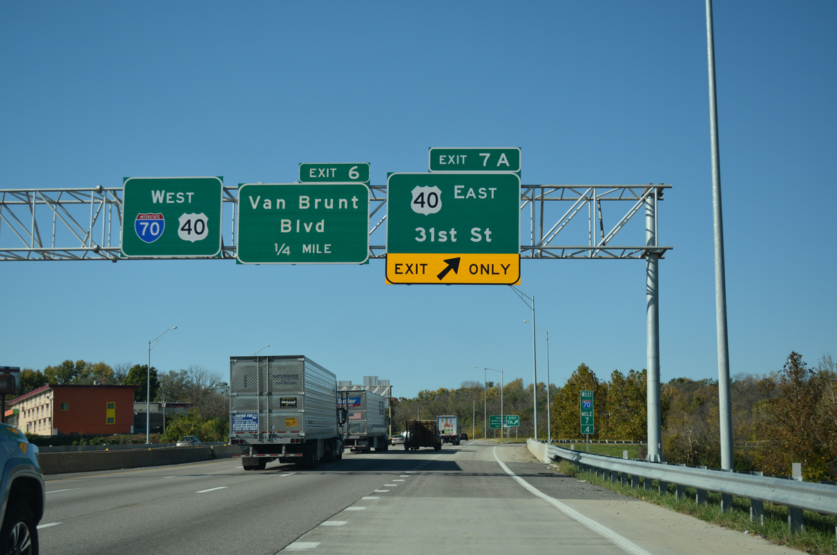
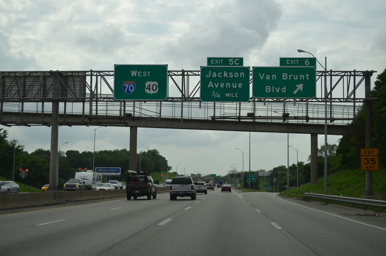
| U.S. 24/40 overlap with Interstate 70 west to U.S. 73 and K-7 at Bonner Springs, Kansas. 06/18/15 |
|
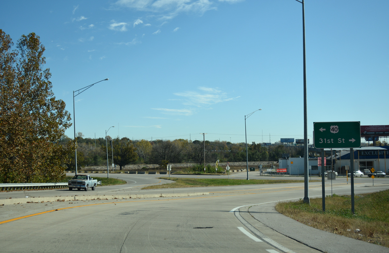
| I-70/U.S. 24-40 enter a diamond interchange with Van Brunt Boulevard at Exit 6. Van Brunt Boulevard constitutes a tree lined boulevard north into the South Blue Valley neighborhood and south to 31st Street. Emanuel Cleaver II Boulevard arcs southwest from 31st Street nearby as a parkway to Vineyard, Oak Park Southeast and U.S. 71 (Midtown South Freeway). 06/18/15 |
|
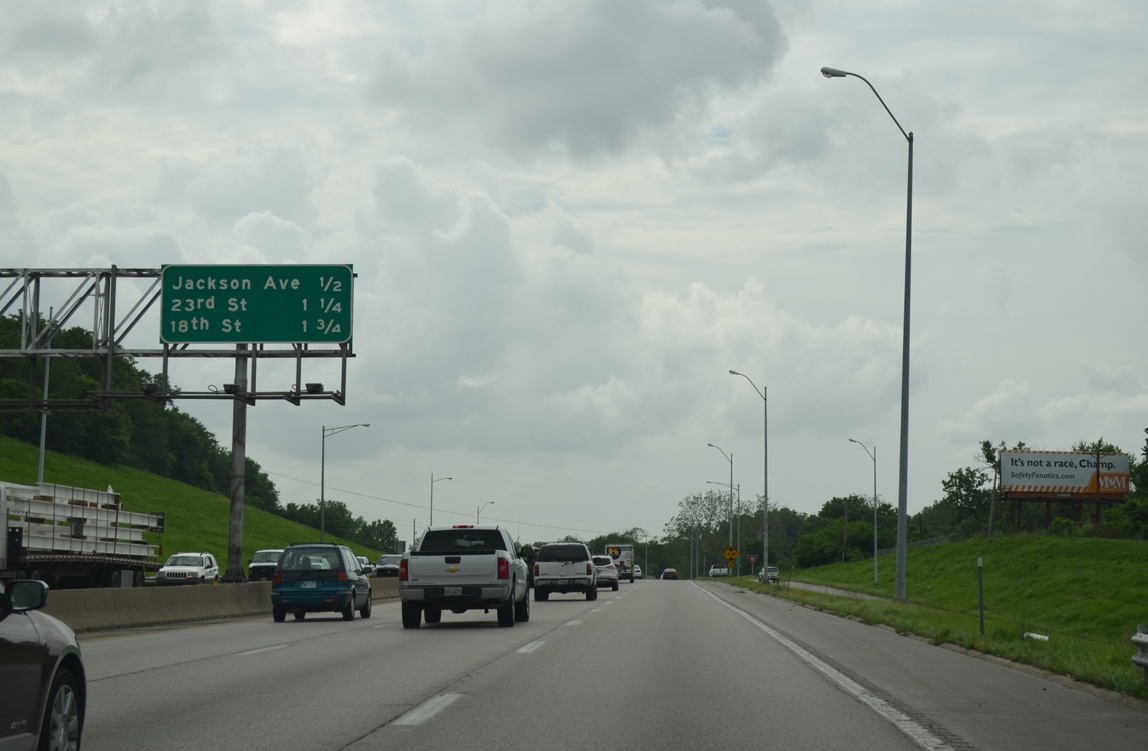
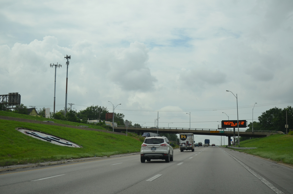
| Interstate 70 turns north at upcoming Jackson Avenue (Exit 5C) to 18th Street (Exit 4B) around the East Community Team neighborhoods over the next 1.75 miles. 06/18/15 |
|
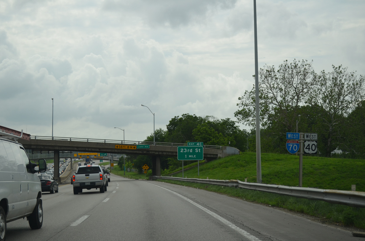
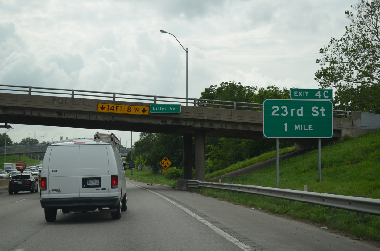
| Passing north of the Knoches Park community, a reassurance shield assembly precedes the Lister Avenue overpass. 06/18/15 |
|
| The subsequent exit beyond the Jackson Curve connects Interstate 70 west with 23rd Street at the Washington Wheatley community. 06/18/15 |
|
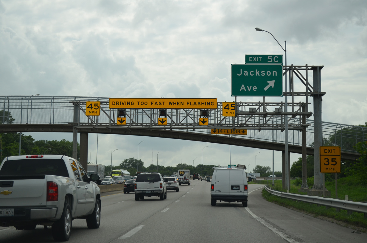
| As Interstate 70 enters the Jackson Curve, named after the 45 mile per hour northward turn at Jackson Avenue, Exit 5C departs. Jackson Avenue connects the freeway with the Ingleside community to the south. 06/18/15 |
|
| The Jackson Curve is a remnant from the 1956 Kansas City Expressway Plan. that included the Southeast Trafficway, an unconstructed expressway linking I-70 with Blue Parkway east of the Blue River. Some of the ramps built for the directional T interchange were reused as local connections with Myrtle and Norton Avenues. 06/18/15 |
|
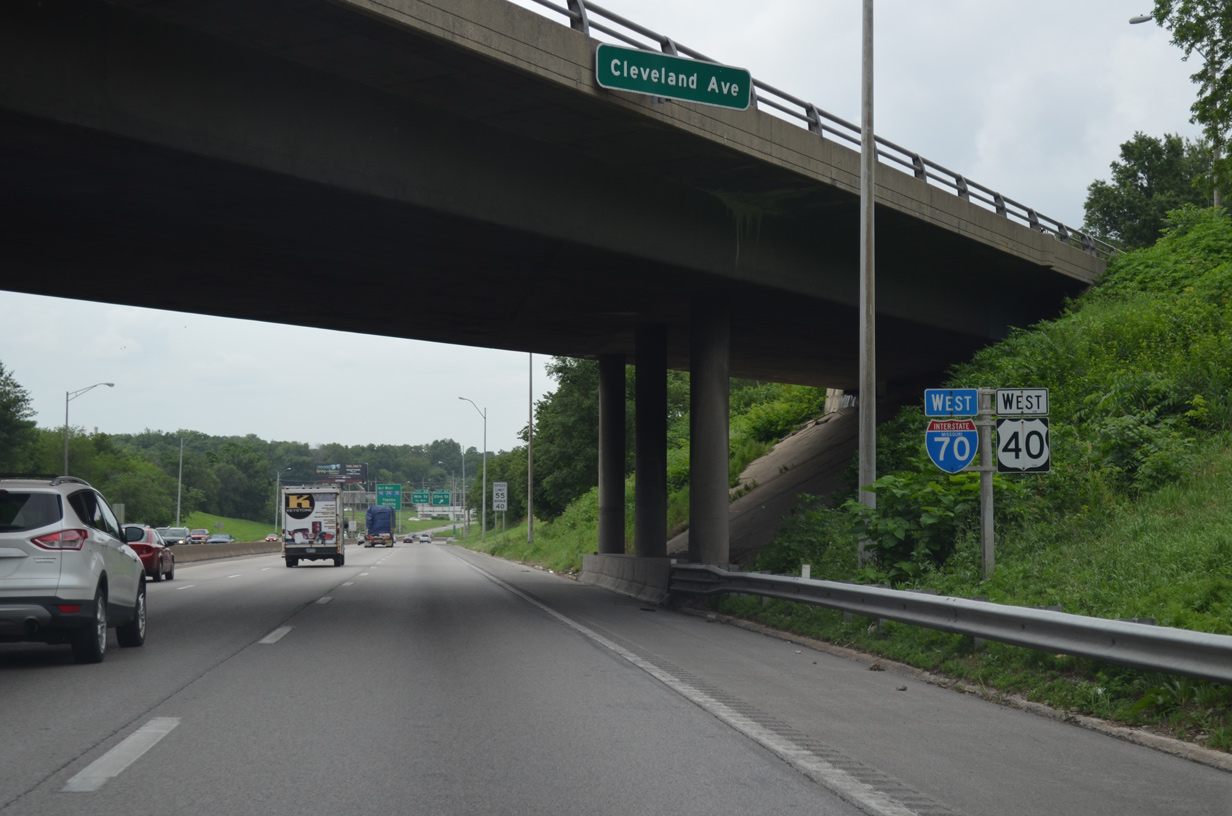
| A half diamond interchange (Exit 5A on eastbound) adds traffic from 27th Street ahead of the shield markers at Cleveland Avenue. 06/18/15 |
|
| Traveling north, I-70/U.S. 24-40 enter the diamond interchange (Exit 4C) with 23rd Street. The exchange (Left Exit 2L) with I-670 at the Alphabet Loop surrounding Downtown lies 2.25 miles to the northwest. 06/18/15 |
|
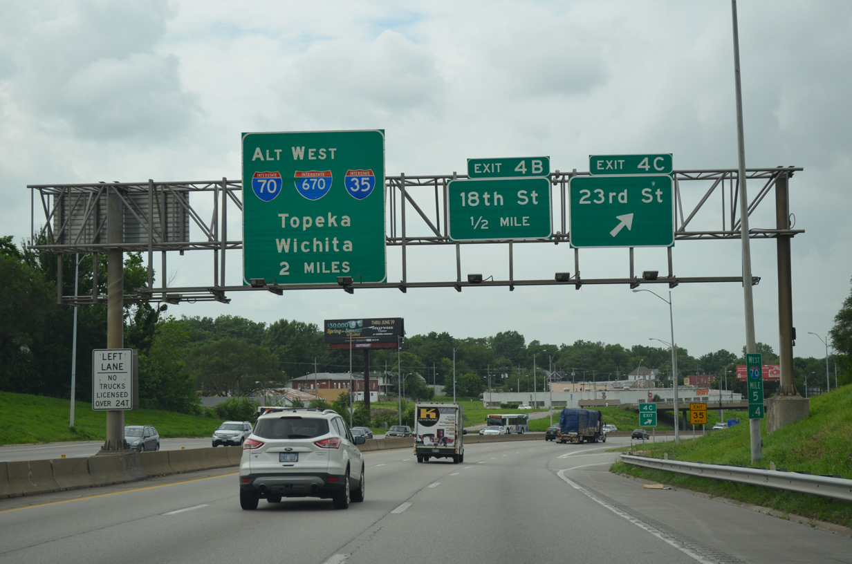
| Exit 4B follows as a parclo interchange with 18th Street west through Washington Wheatley and east to Blue Valley Park. 18th Street west leads to the Negro Leagues Baseball Museum and Hospital Hill south of Downtown. 06/18/15 |
|
| I-70/U.S. 24-40 elevate over a Kansas City Terminal (KCT) Railway line. The continues 1.5 miles to Interstate 670 west and U.S. 71 south at the Alphabet Loop. 06/18/15 |
|
| The Benton Curve, named after Benton Boulevard, redirects the freeway west alongside the Independence Plaza community to Exit 2C for Prospect Avenue. 06/18/15 |
|
| Entrance ramps join I-70/U.S. 24-40 west from Truman Road and Benton Boulevard within the Benton Curve. A high speed interchange was proposed here for an unbuilt expressway spur connecting I-70 with 9th Street to the northeast at the Lykins neighborhood. 06/18/15 |
|
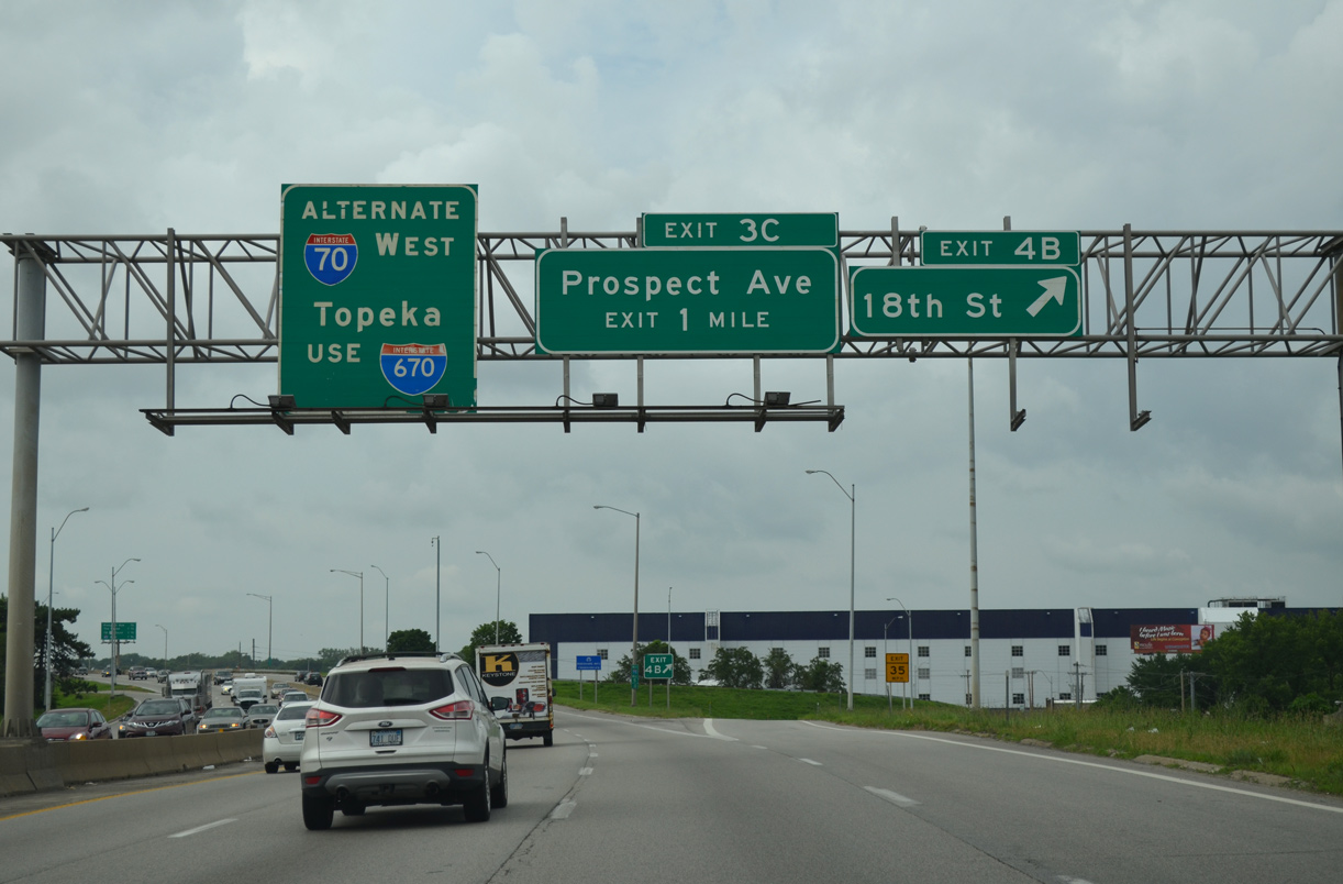
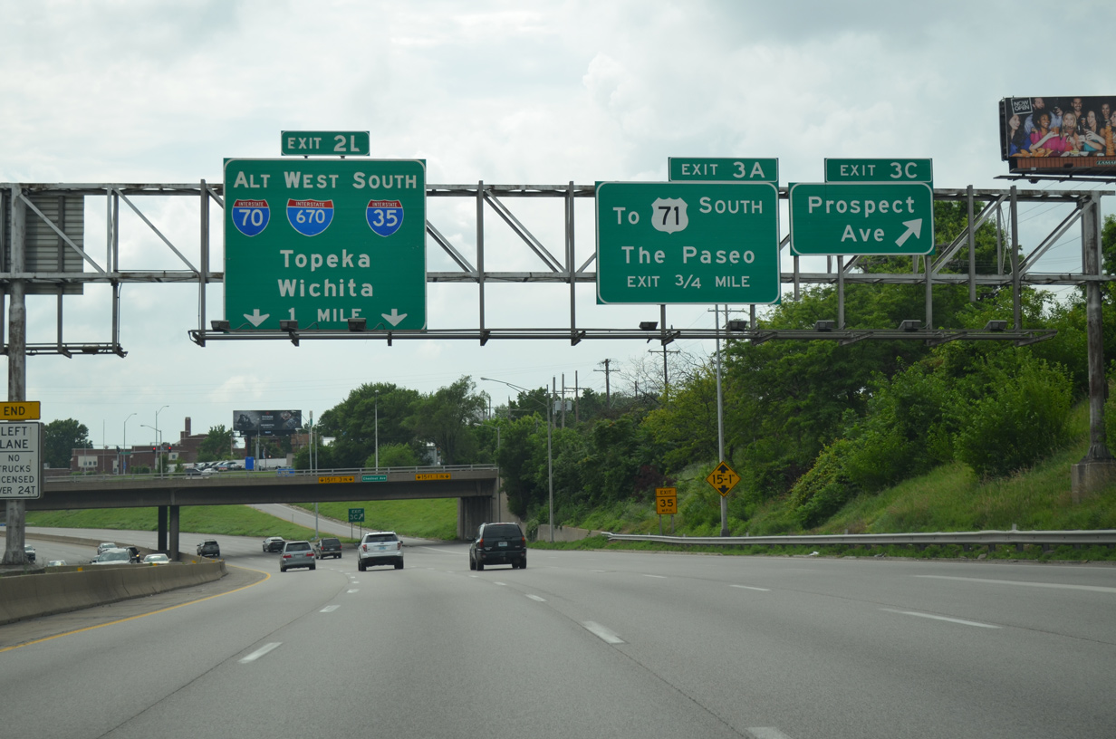
| An S-curve takes westbound I-70 through the diamond interchange (Exit 3C) with Prospect Avenue. The freeway mainline defaults onto Interstate 670 west to I-35 at Left Exit 2L in one mile. 06/18/15 |
|
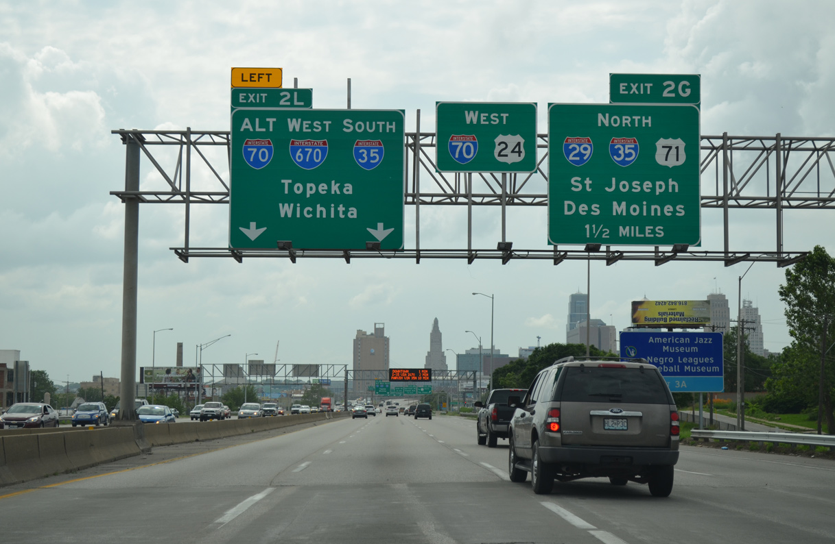
| I-70/U.S. 24-40 enter the Alphabet Loop at a directional interchange (Exit 2L) with I-670 west and U.S. 71 (Bruce R. Watkins Drive). I-70 runs north along the east leg of the Downtown Loop to meet I-29/35 at Exit 2G while I-670 provides a through route west to I-35 south and Kansas City, Kansas. 06/18/15 |
|
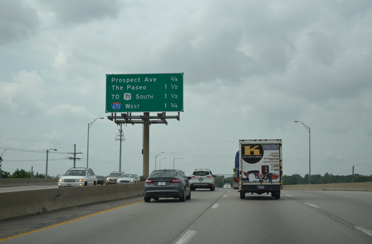
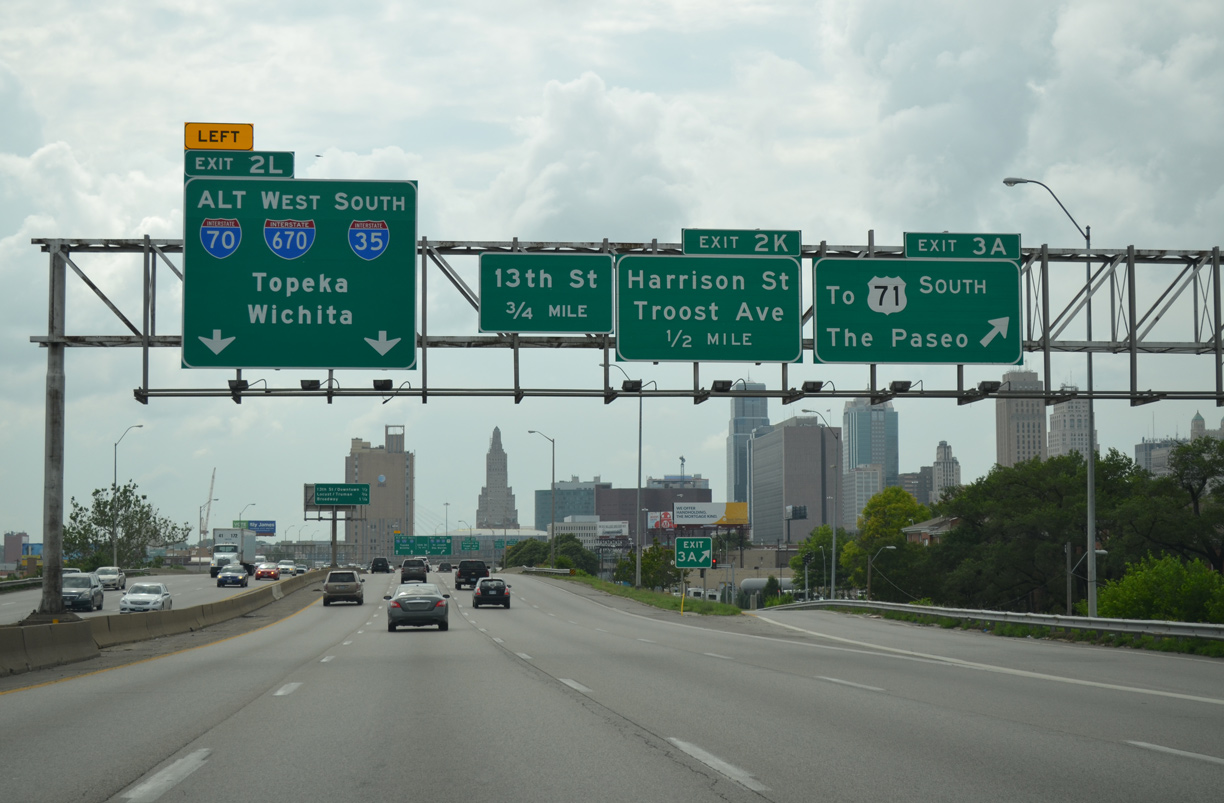
| Advancing west to the Central Business District, I-70/U.S. 24-40 run along the south side of the Forgotten Homes and Parkview neighborhoods to The Paseo at Exit 3A. There is no direct access to U.S. 71 south; instead a Breezewood connection utilizes The Paseo south and Truman Road west for the Midtown South Freeway. 06/18/15 |
|
| Passing over The Paseo, an interchange sequence sign outlines the three mainline exits for Interstate 670 west along the south leg of the Alphabet Loop. 06/18/15 |
|
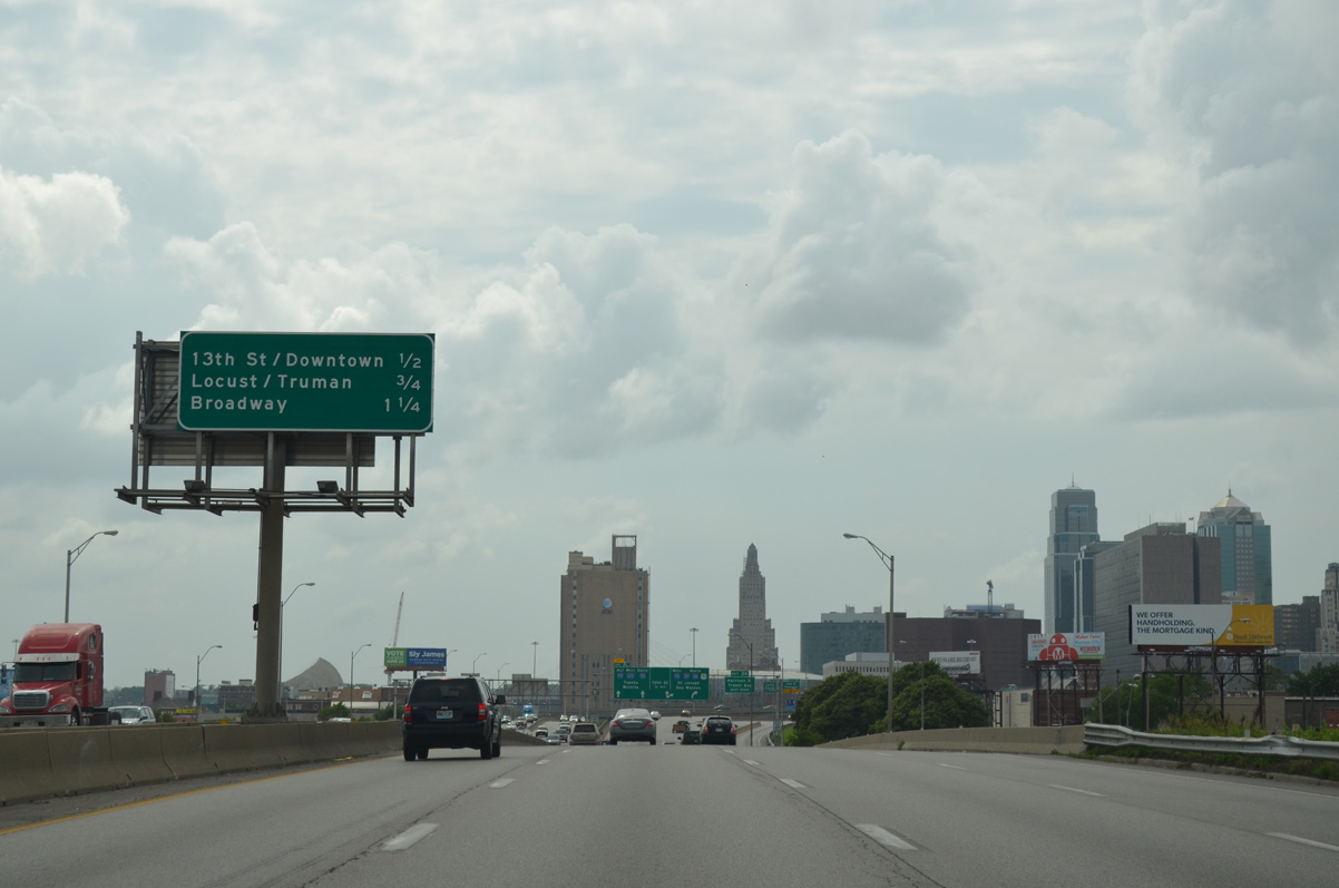
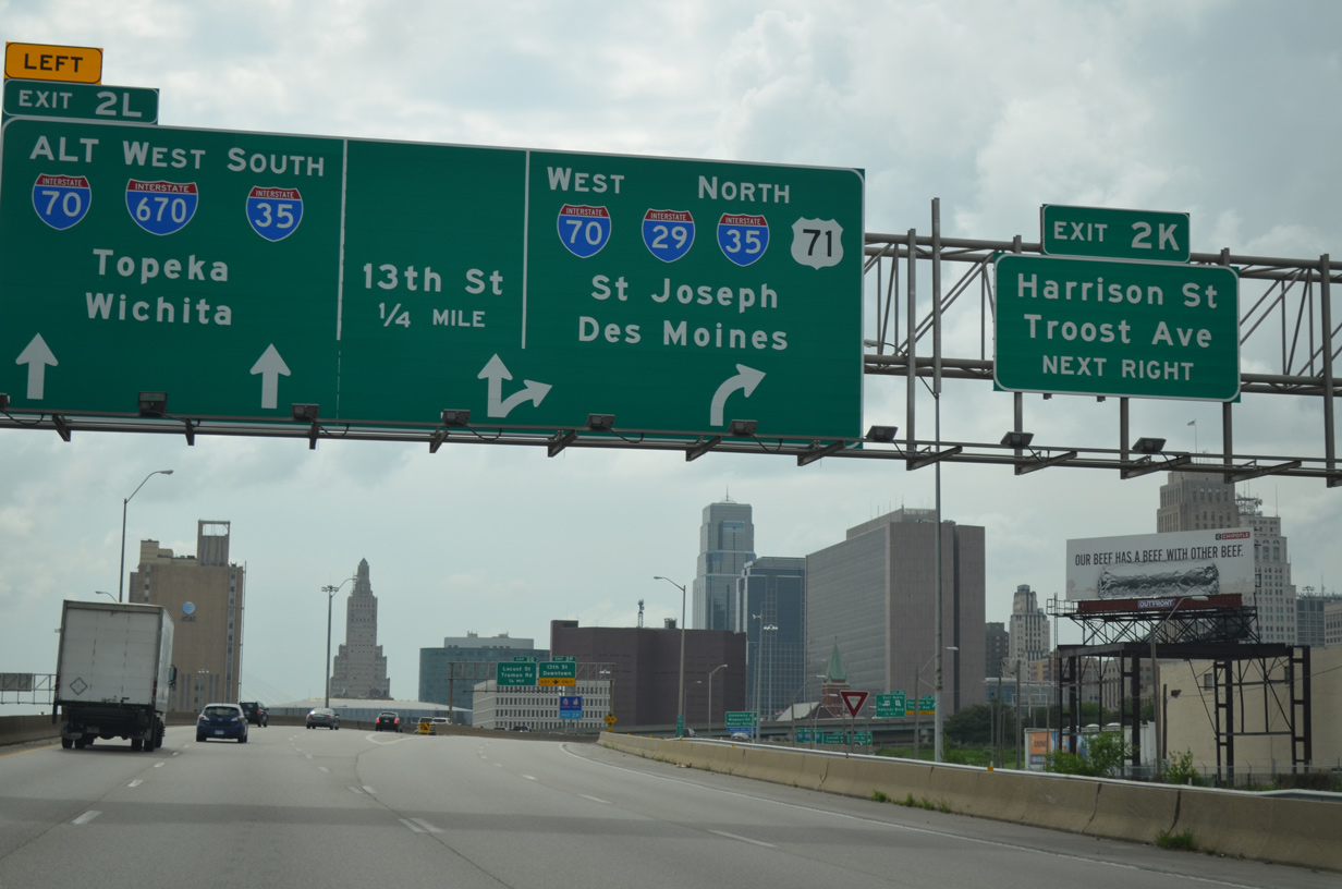
| Traffic initially partitions at Left Exit 2L for I-670 west to Topeka and I-70/U.S. 24-40 west to I-29/35-U.S. 71. Ensuing off-ramps depart from both freeways for Harrison and 13th Streets respectively to Downtown Kansas City. 06/18/15 |
|
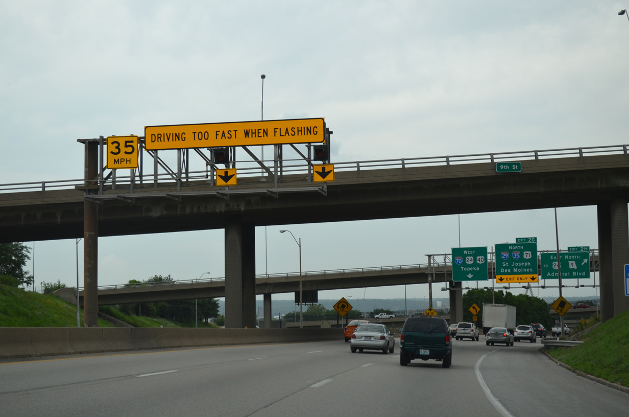
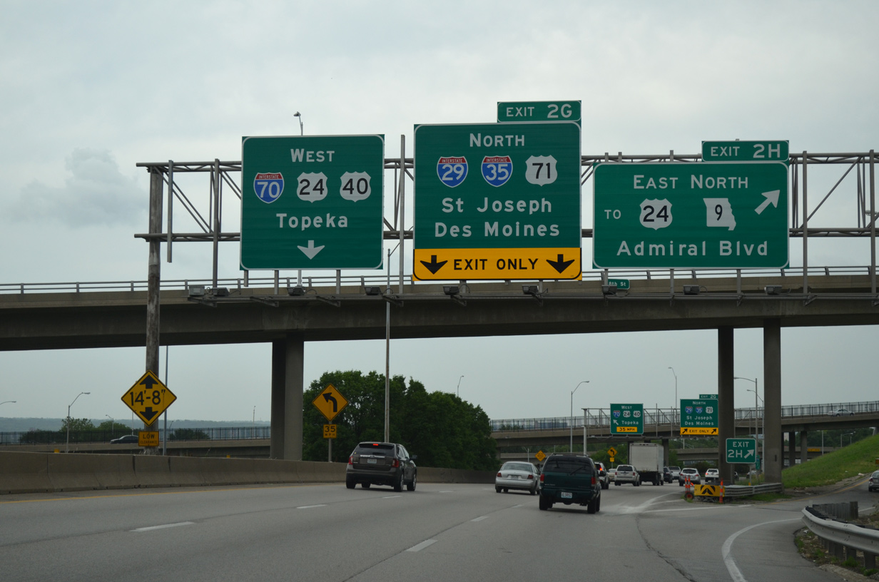
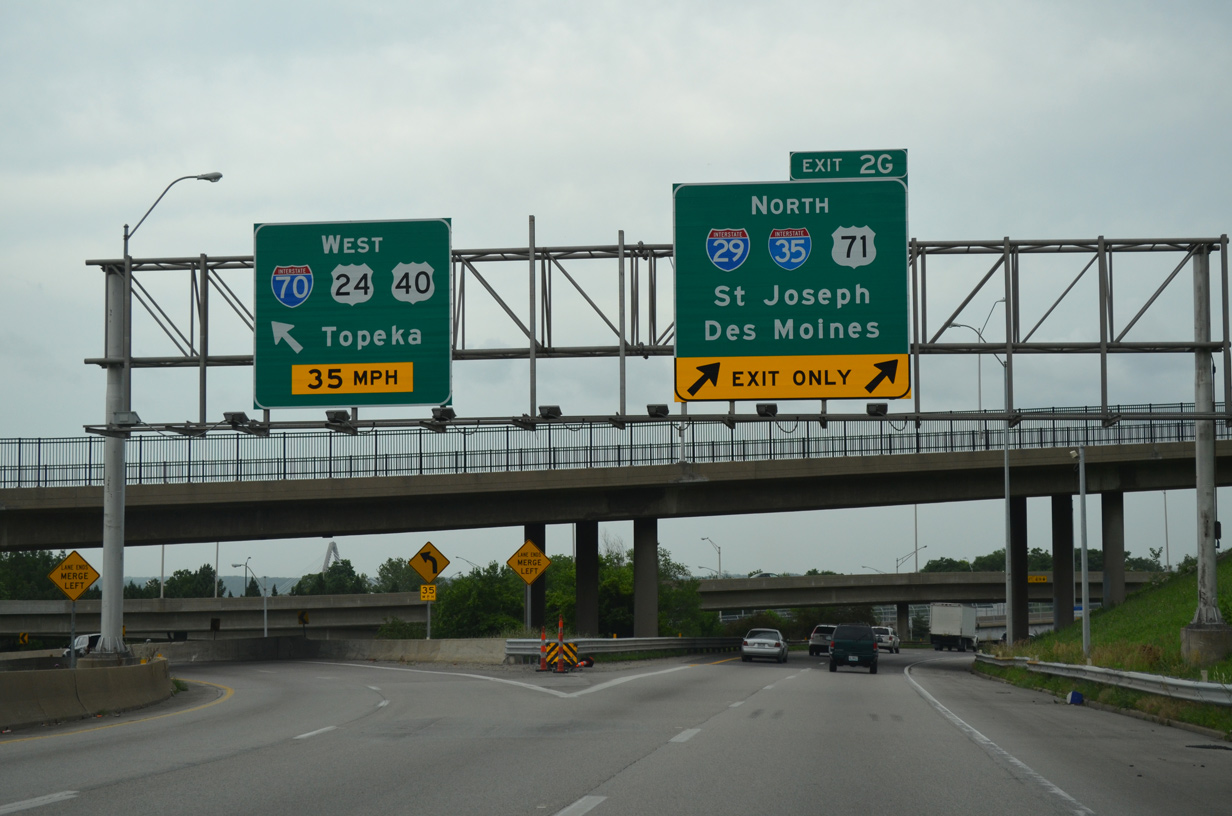
| Ramps from I-670 east and U.S. 71 north come together as I-70/U.S. 24-40 lower onto the east leg of the Alphabet Loop. Succeeding ramps follow at Exit 2H for Admiral Boulevard and Exit 2G for the northbound beginning of Interstate 29. 06/18/15 |
|
| I-70 west and U.S. 71 combine 0.434 miles north to the directional T interchange (Exit 2G) with I-29/35. The Interstate 70 mainline uses a TOTSO connection to the North Loop. The sharp ramp initially departs with two lanes, but quickly reduces to one. 06/18/15 |
|
| Exit 2H rises to intersect Admiral Boulevard and Independence Avenue (former U.S. 24) east to the Pendleton Heights neighborhood. Admiral Boulevard links I-70 with Route 9 (Heart of America Bridge) north and the Paseo West community. The East Loop defaults onto I-29-35/U.S. 71 north as Exit 2G. 06/18/15 |
|
| I-70/U.S. 24-40 west combines with I-35 south between the Central Business District and River Market. I-29/35 overlap 4.62 miles northward through North Kansas City. I-29 leads northwest from Kansas City to MCI Airport, St. Joseph and Council Bluffs, Iowa. I-35 heads northeast to Cameron, Des Moines and the Twin Cities in Minnesota. 06/18/15 |
|
| I-35 south and I-70 west combine with three through lanes into a directional cloverleaf interchange (Exit 2F) with Route 9 (Heart of America Bridge). Route 9 concludes a 14.21 mile route at Oak Street and Admiral Boulevard one block south of I-35/70. 06/19/15 |
|
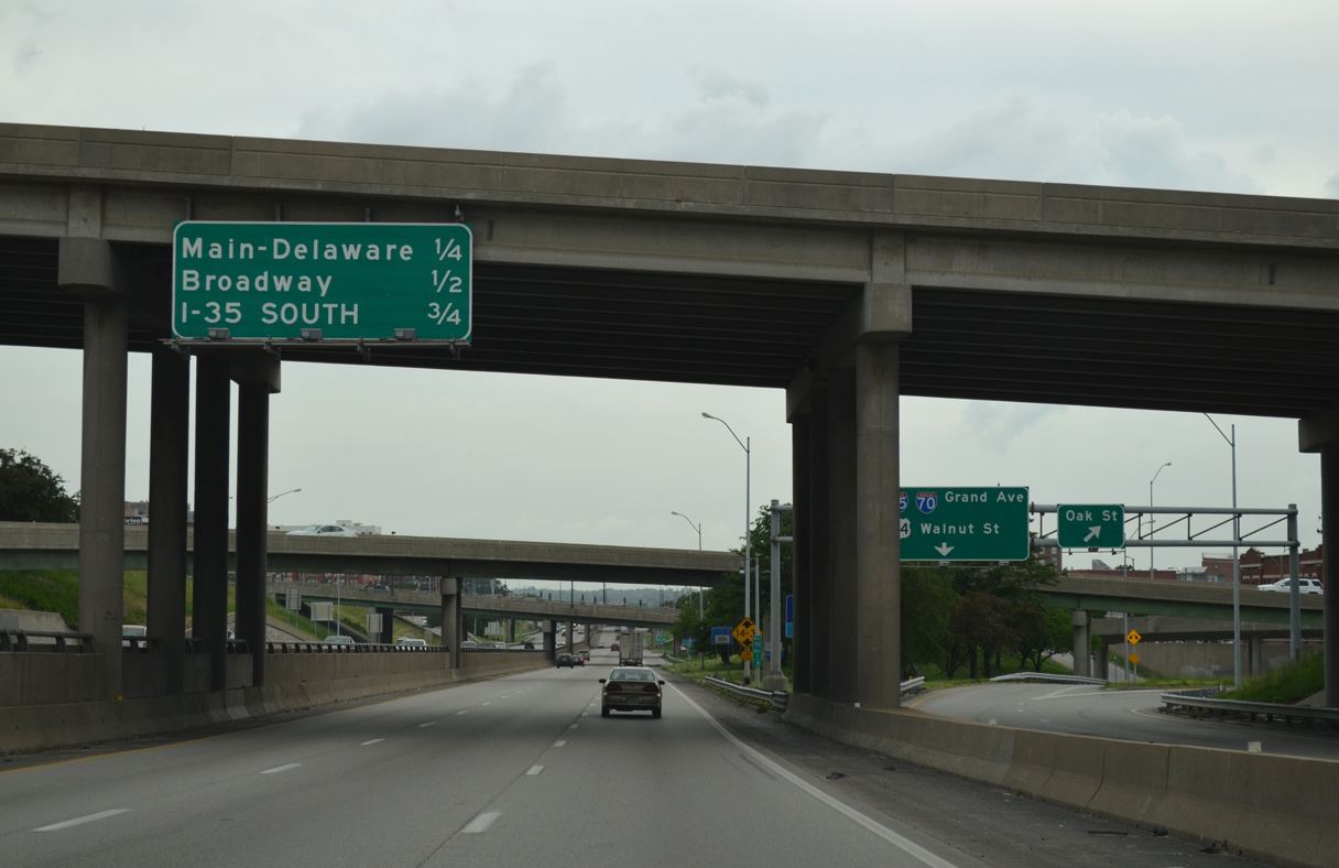
| Succeeding exits join Independence Avenue at Delaware Street and U.S. 169 (Broadway) over the next half mile. I-35/70 overlap for 0.986 miles westbound. 06/19/15 |
|
| Exit 2D quickly follows for Delaware Street north to River Market and south to Main Street and the Central Business District. Wyandotte Street parallels just to the west.
Interstate 35 splits with I-70/U.S. 24-40 west in a half mile at Exit 2A. 06/19/15 |
|
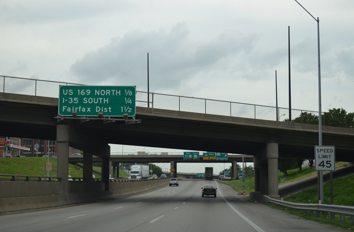
| Exit 2C departs next for U.S. 169 north across the John Jordan "Buck" O'Neil Memorial Bridge to North Kansas City. Construction underway from July 2021 to December 2024 builds a new span for U.S. 169 across the Missouri River. 06/19/15 |
|
| Exit 2C joins Independence Avenue west ahead of with Broadway. U.S. 169 follows Broadway to Charles B. Wheeler Downtown Airport and Arrowhead Trafficway, a freeway leading north to Gladstone. U.S. 169 south combines with I-70/U.S. 24-40 west to S 7th Street in Kansas City, Kansas. 06/19/15 |
|
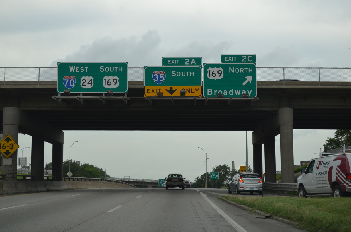
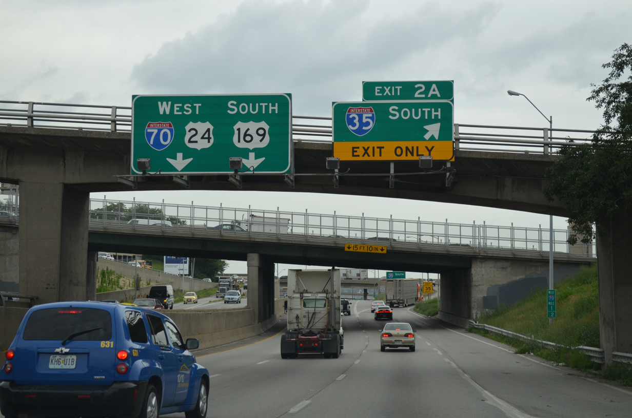
| Interstate 35 turns south onto the west leg of the Alphabet Loop at a three-wye interchange (Exit 2A). I-70 continues west through Kansas City, Kansas to Topeka and Denver, Colorado while I-35 angles southwest to Emporia and Wichita, Kansas. 06/19/15 |
|
| An entrance ramp joins Exit 2A from adjacent Independence Avenue as I-35 heads south along a ridge overlooking the West Bottoms industrial area. The Downtown Loop west leg circles around the Quality Hill area to I-670 at Westside North. 06/19/15 |
|
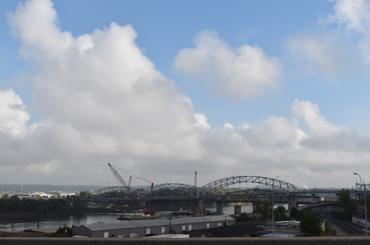
| Originally named the Broadway Bridge, the triple arch bridge carrying U.S. 169 across the Missouri River to the northeast of I-70 at the Quality Hill area, opened to traffic in 1956. 10/07/21 |
|
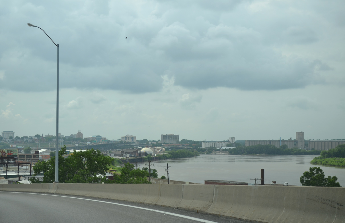
| The confluence of the Kansas and Missouri Rivers appears just north of Interstate 70. 06/18/15 |
|
| The flyover linking I-35 north with Interstate 70 west lowers onto the elevated lanes leading to the Lewis and Clark Viaduct. The interchange between the two freeways was completed in 1967. 10/07/21 |
|
| The Lewis and Clark Viaduct carries three lanes of westbound traffic along I-70/U.S. 24-40-169 above the West Bottoms industrial area. 10/07/21 |
|
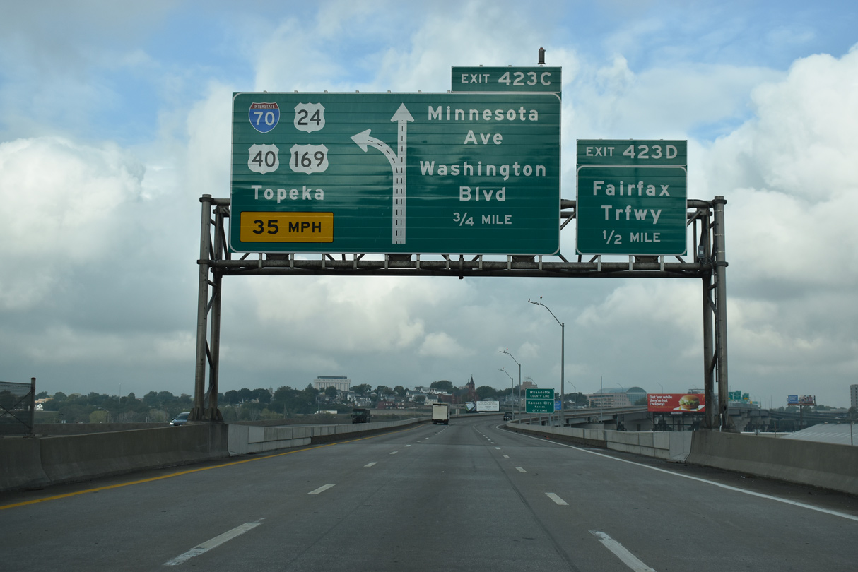
| Interstate 70 crosses the Kansas state line a half mile ahead of the systems interchange (Exit 423 D/C) with Fairfax Trafficway north, Washington Boulevard west and Minnesota Avenue west. The 1956 Kansas City Expressway Plan outlined a route for the Intercity Freeway using the Washington Boulevard corridor west through Kansas City, Kansas. 10/07/21 |
Page Updated 02-21-2020.

 West
West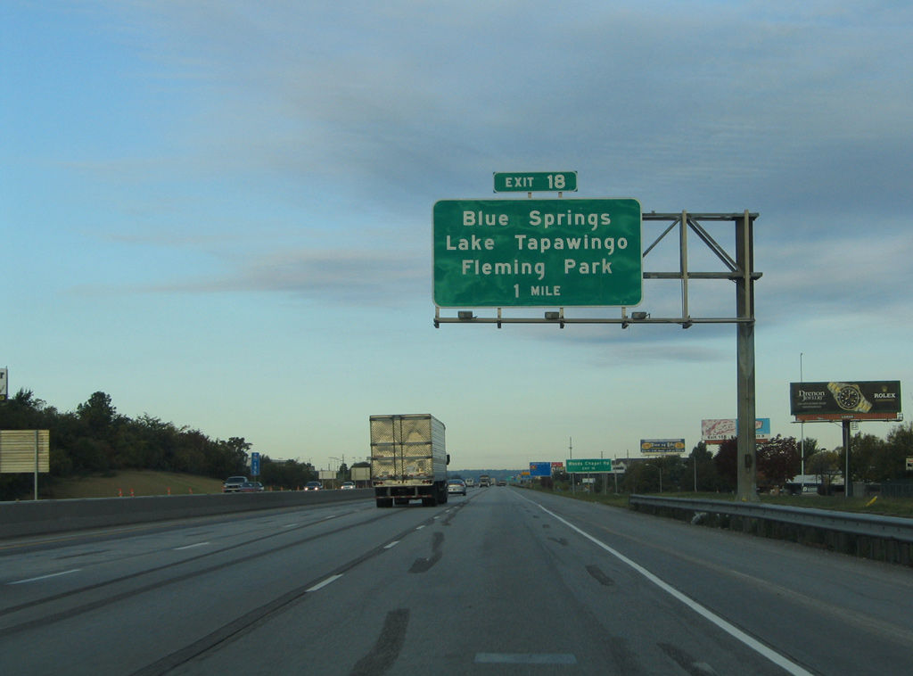

 West
West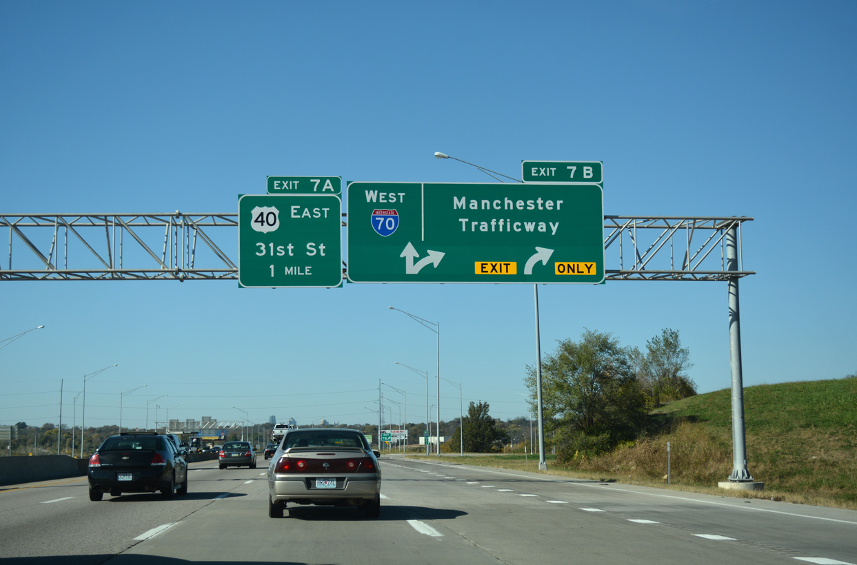
 West
West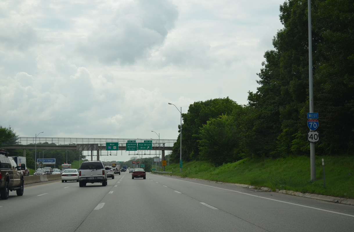
 North
North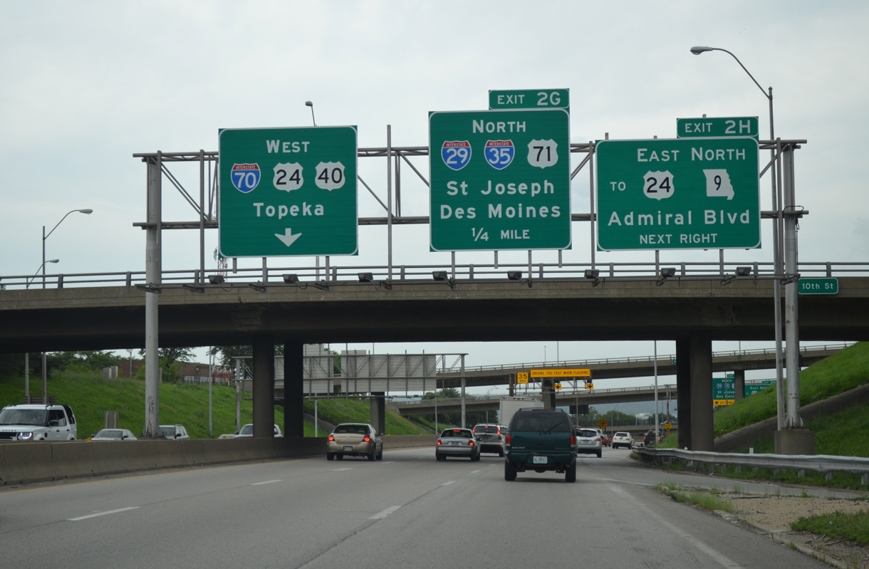
 South
South 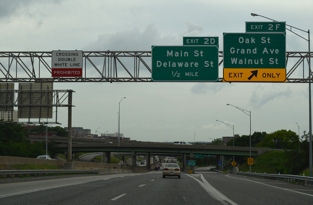

 South
South