|
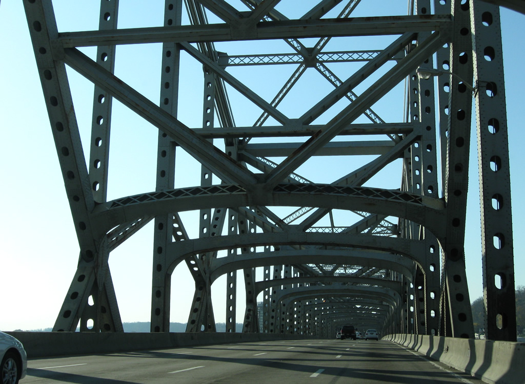
| Continuing south across the Ohio River on the Brent Spence Bridge from Cincinnati. The Federal Highway Administration (FHWA) approved the plan to construct a companion span for I-71/75 in 2012. The anticipated start of work at the time was 2015.1 11/08/09 |
|
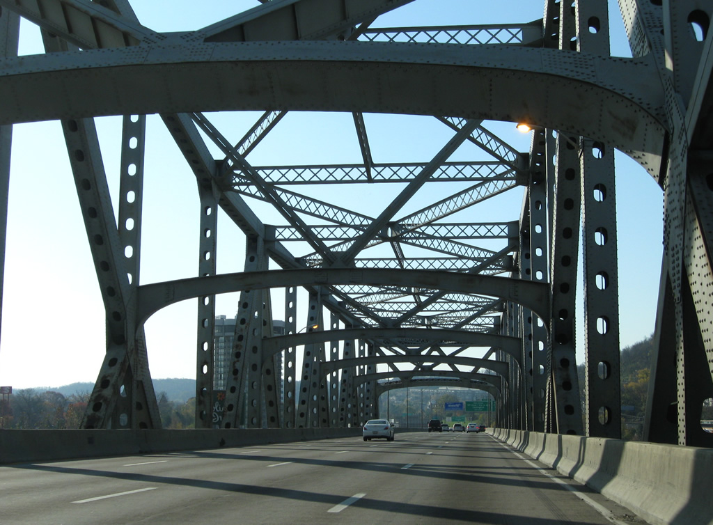
| Lowering into the city of Covington along the Brent Spence Bridge. The cantilever span was named for Kentucky congressman Brent Spence, who retired in 1962. 11/08/09 |
|
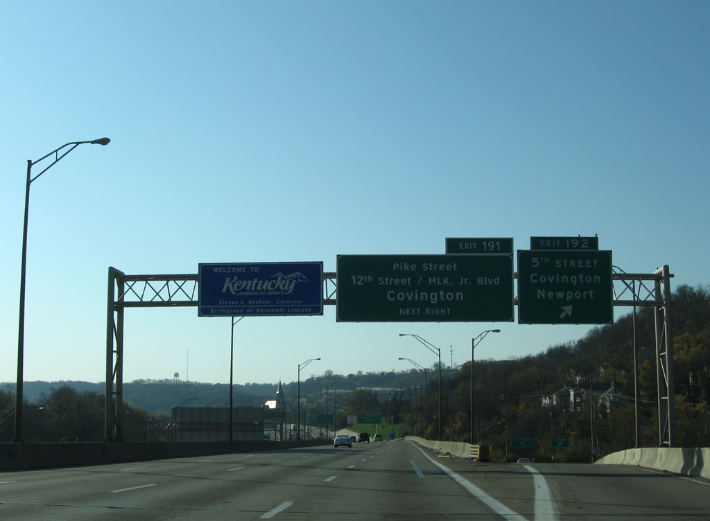
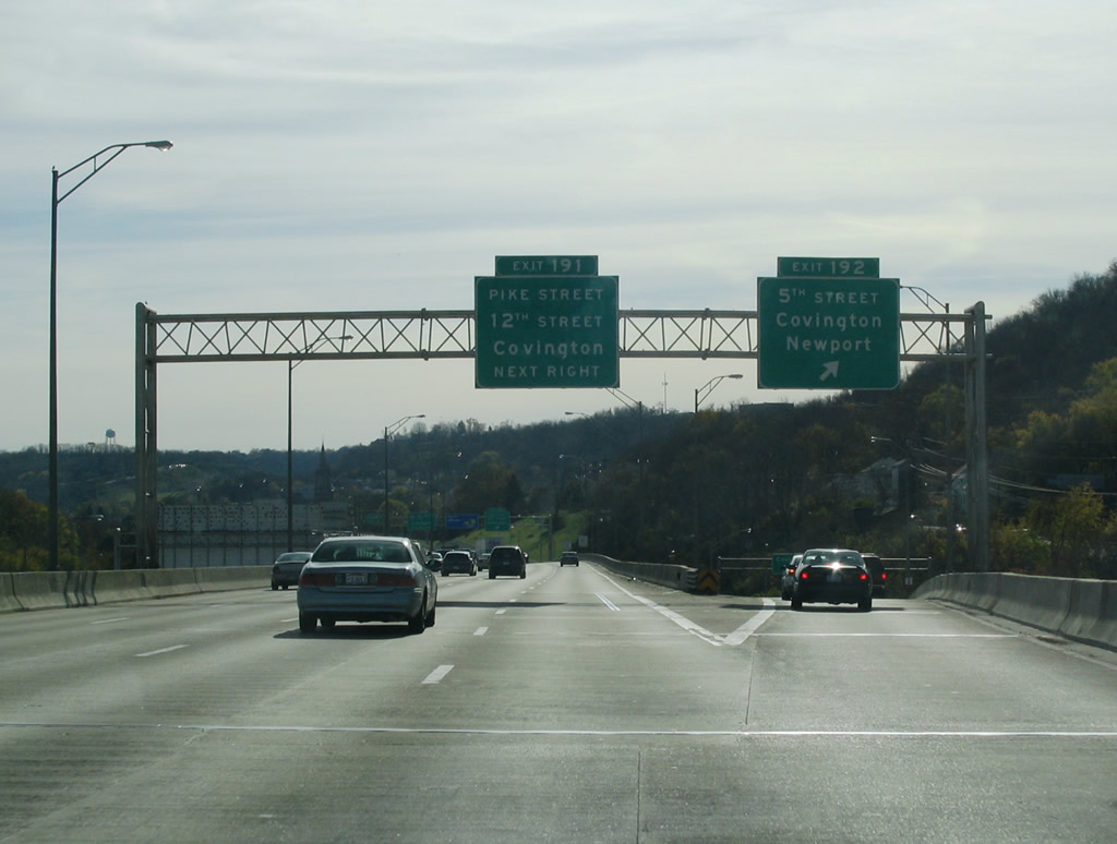
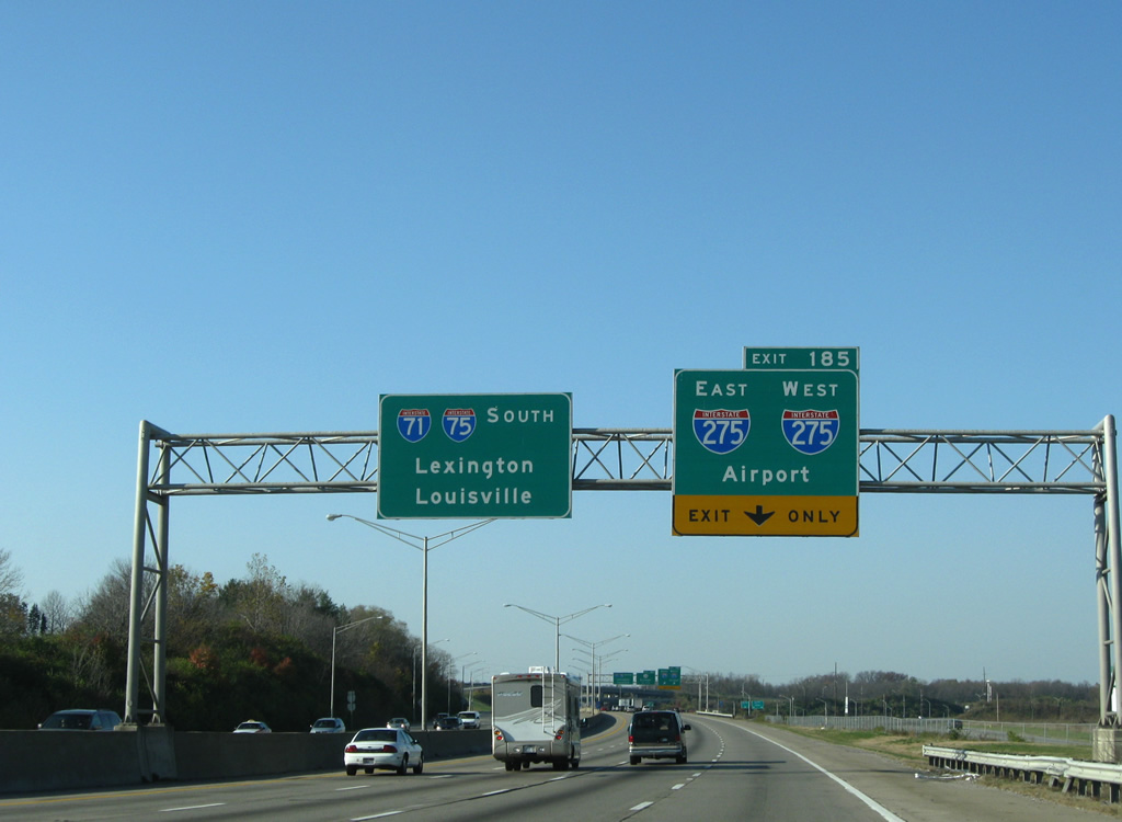
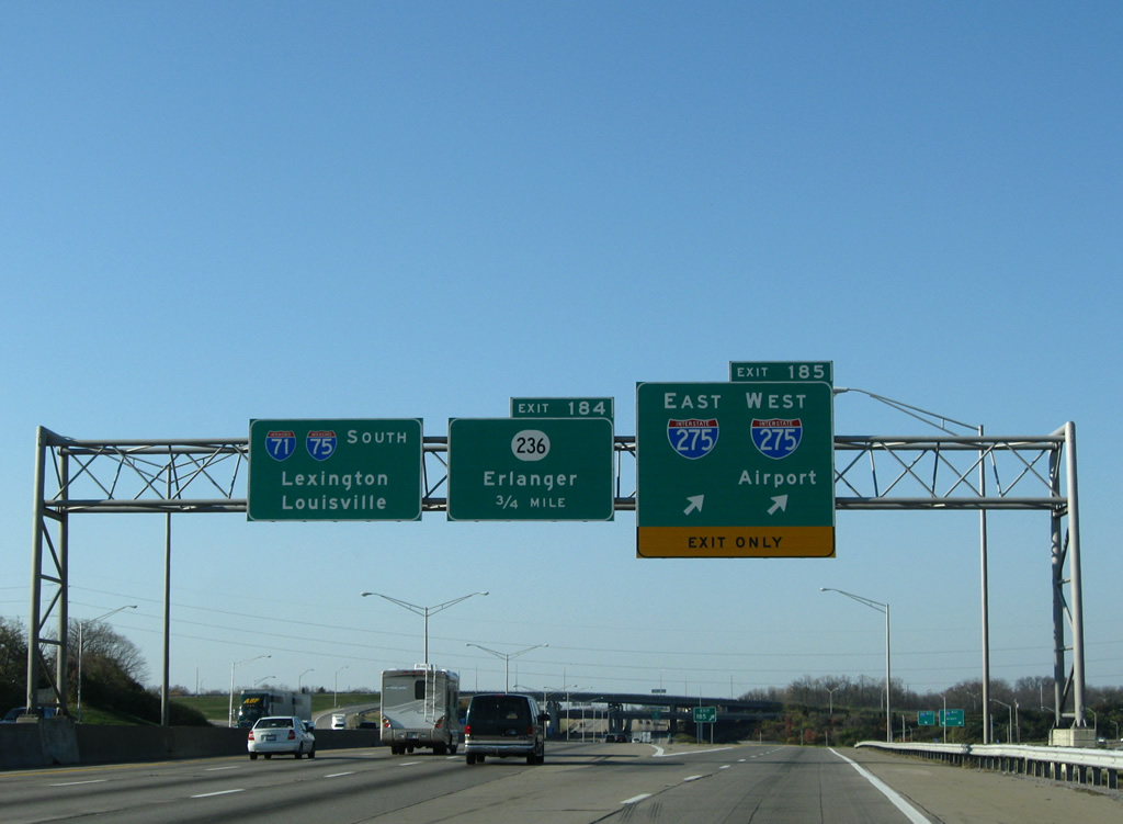
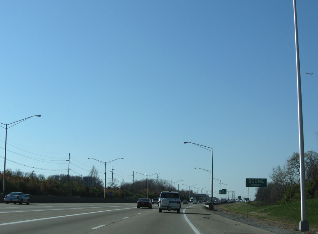
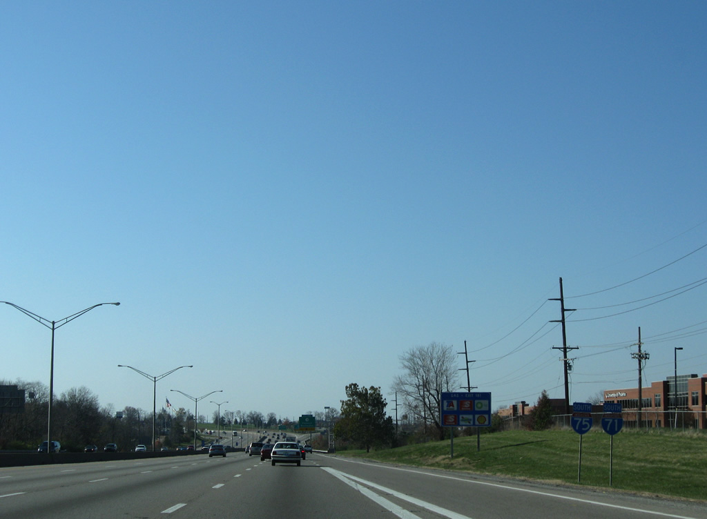
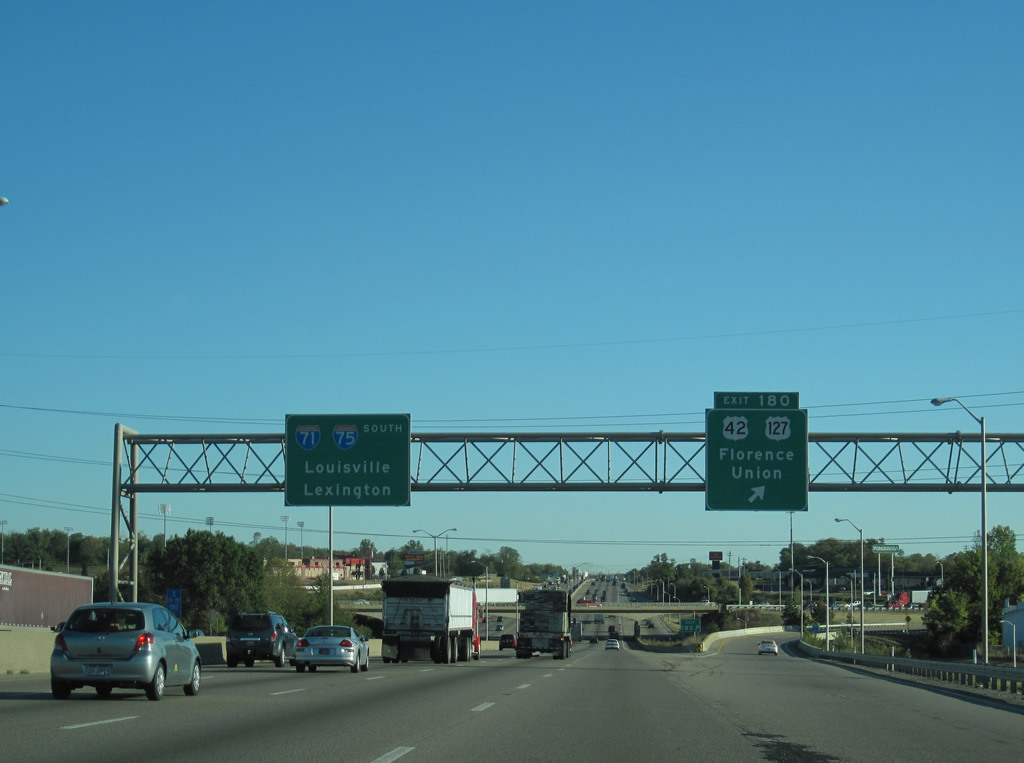
| Exit 192 departs from I-71/75 at the south end of the Brent Spence Bridge for KY 8 (W 5th Street) to Downtown Covington. The state route follows a one way couplet with 4th Street to the Licking River and the city of Newport. 11/08/09 |
|
| Previous overheads at Exit 192 using Highway Gothic font. 11/14/04 |
|
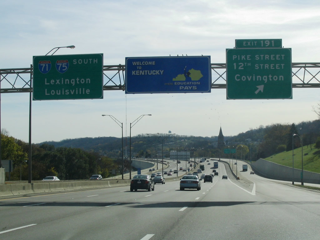
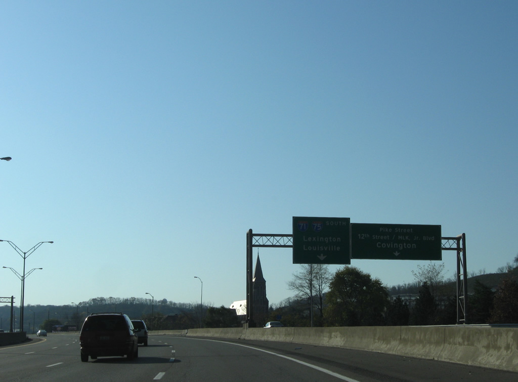
| The slip ramp at Exit 191 connects with the adjacent collector distributor roadway for Pike Street (U.S. 25-52-127) and W 12th Street (KY 1120). U.S. 25-42-127 combine at the nearby intersection of Main and Pike Streets in Covington and cross I-71/75 westward to Park Hills along Dixie Highway. KY 1020 stems east to 11th Street in Newport. 10/01/10 |
|
| Prior to the Unbridled Spirit slogan, Kentucky Welcome Signs displayed Where Education Pays. 11/14/04 |
|
| A three mile stretch along I-71/75 from the Ohio River to Fort Mitchell was completely rebuilt from Spring 1990 to December 1994. 11/08/09 |
|
| I-71/75 next climb southwestward from Covington through the "Cut in the Hill," a 370 foot increase in elevation from the river to Fort Wright. 11/08/09 |
|
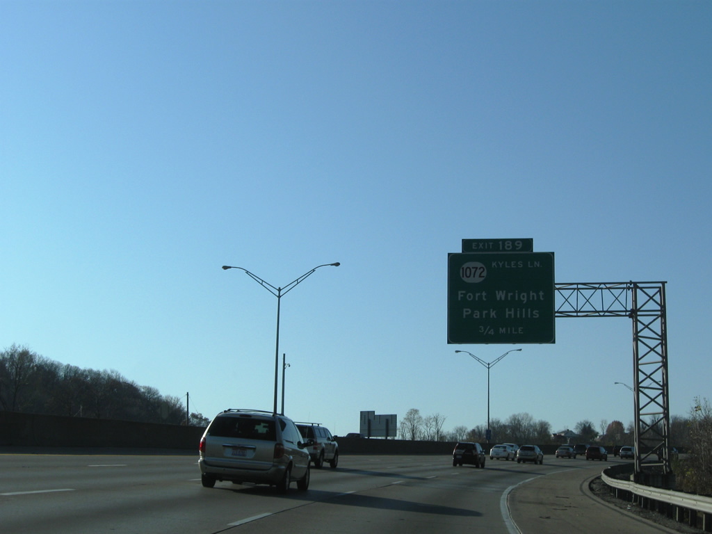
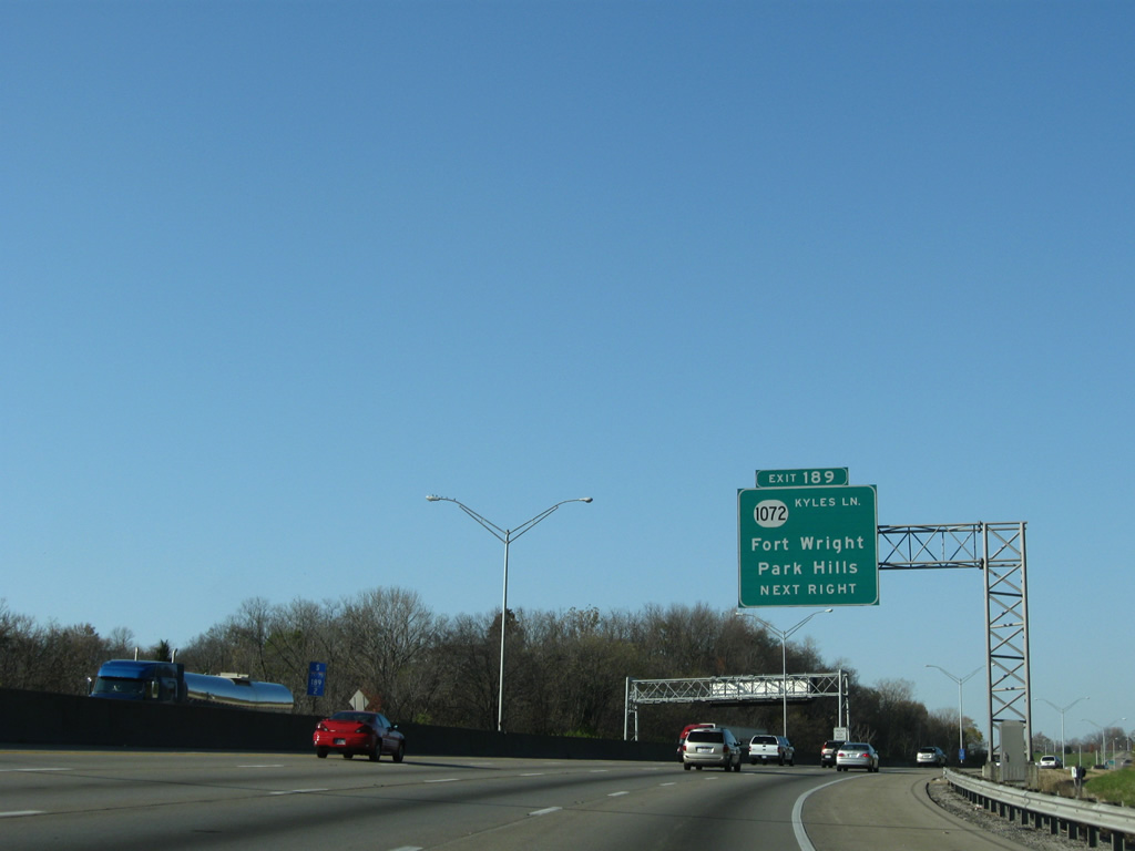
| The freeway levels out west to the diamond interchange (Exit 189) with KY 1072 (Kyles Lane). 11/08/09 |
|
| KY 1072 (Kyles Lane) travels southward from Exit 189 to Madison Pike (KY 17) in Fort Wright. Exit 189 was originally a cloverleaf interchange. 11/08/09 |
|
| Northward from Exit 189, KY 1072 (Kyles Lane) briefly joins U.S. 25-42-127 (Dixie Highway) to Sleepy Hollow Road through west Park Hills to Ludlow on the Ohio River. 11/08/09 |
|
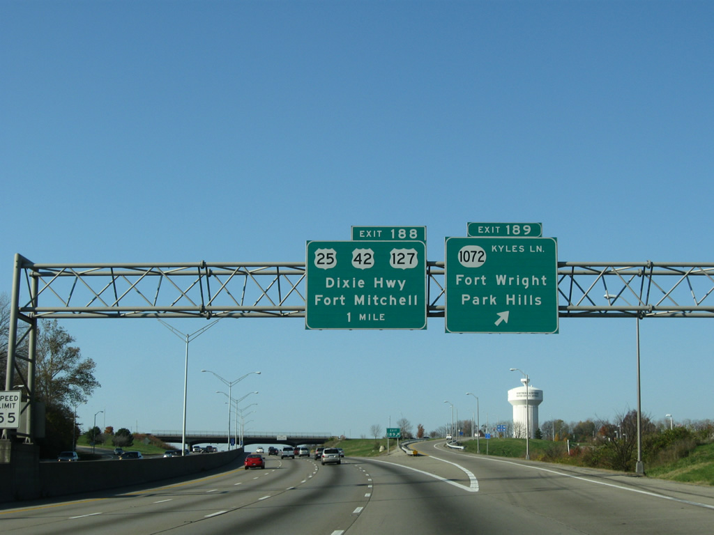
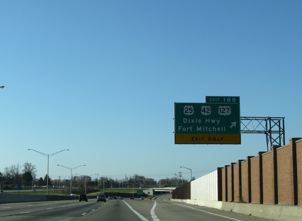
| An auxiliary lane opens south from Exit 189 to the diamond interchange (Exit 188) with U.S. 25/42/127 (Dixie Highway) at Fort Mitchell. 11/08/09 |
|
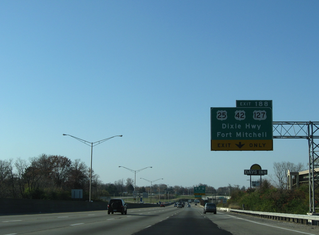
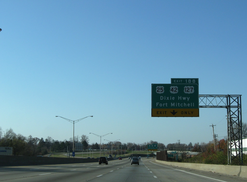
| Entering the city of Fort Mitchell, I-71/75 switch sides with adjacent U.S. 25-42-127 (Dixie Highway) at Exit 188. Exit 188 was previously a cloverleaf interchange. 11/08/09 |
|
| U.S. 25-42-127 (Dixie Highway) continue southward through Fort Mitchell to Lakeside Park, Crestview Hills, Erlanger, Elsmere and Florence. Beginning in Cincinnati, U.S. 25 extends southward to Brunswick, Georgia. U.S. 42 travels between Cleveland and Louisville and U.S. 127 between the Grayling, Michigan area and Chattanooga, Tennessee. 11/08/09 |
|
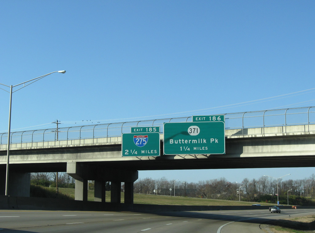
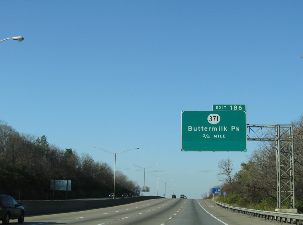
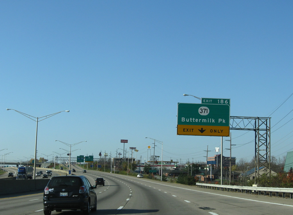
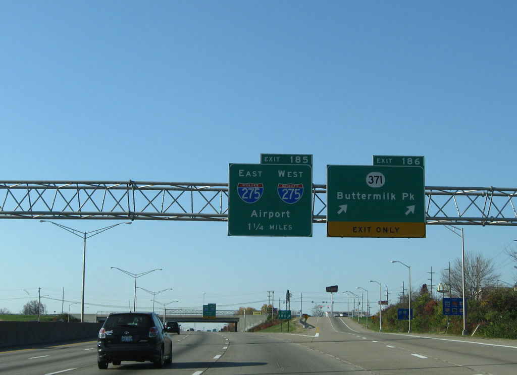
| I-71/75 advance west to a parclo interchange (Exit 186) with KY 371 (Buttermilk Pike). Exit 185 follows at Interstate 275 in 2.25 miles. 11/08/09 |
|
| KY 371 constitutes a 6.95 mile route from KY 8 along the Ohio River to KY 17 (Madison Pike) east of Fort Wright. Buttermilk Pike derives its name from the many dairy farms it passed originally. 11/08/09 |
|
| Confirming markers posted for I-71/75 south at Fort Mitchell. 11/08/09 |
|
| KY 371 (Buttermilk Pike) converges with U.S. 25-42-127 (Dixie Highway) east in Fort Mitchell and leads west from Crescent Springs to Villa Hills. 11/08/09 |
|
| Two lanes separate for KY 371 (Buttermilk Pike) at Exit 186, 1.25 miles ahead of the systems interchange (Exit 185) with Interstate 275. 11/08/09 |
|
| Encircling Cincinnati, Ohio, Interstate 275 is the world's longest Beltway. Planning for the loop began as early as 1953 but work did not commence until April 1968. 10/01/10 |
|
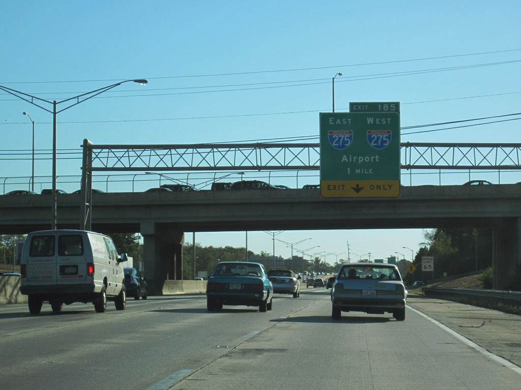
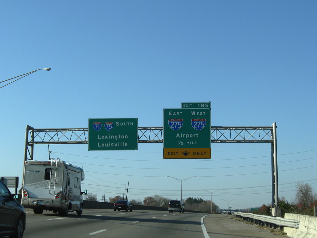
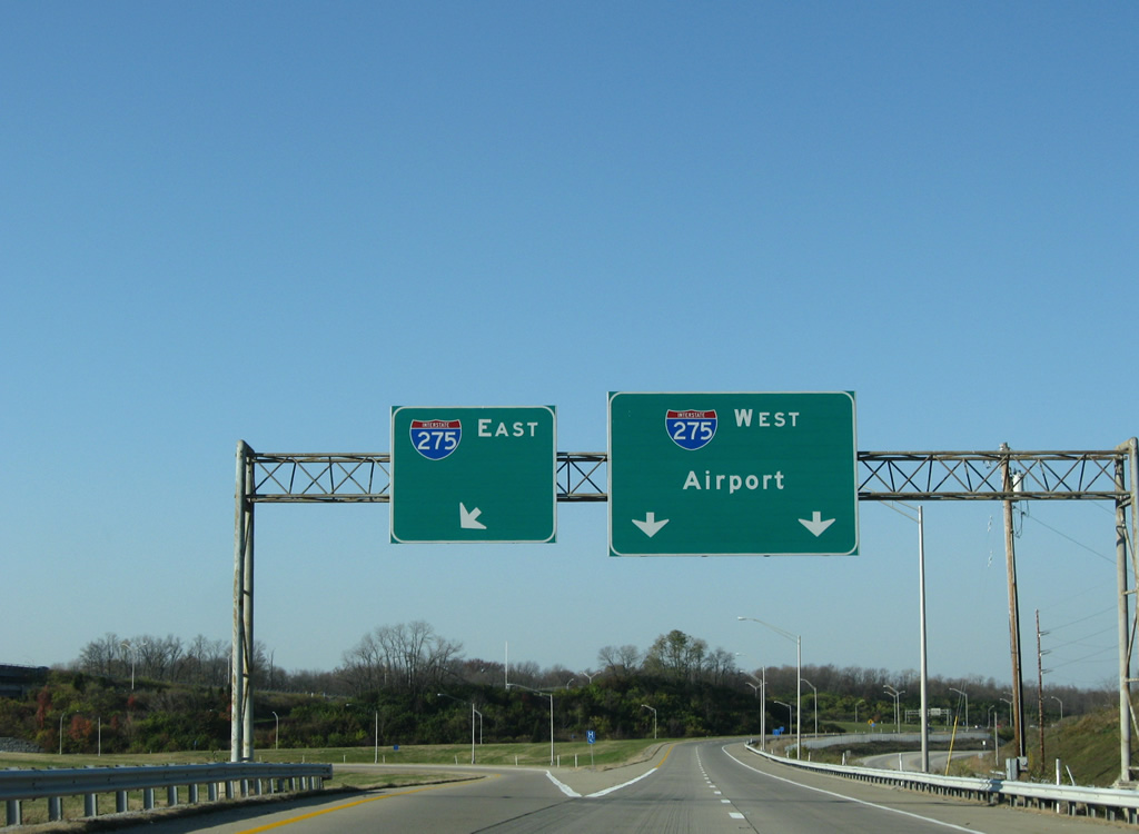
| Interstate 275 is signed only with the Airport as the control point. Cincinnati/Northern Kentucky International Airport (CVG) lies four miles to the west via I-275 and KY 212 south. 11/08/09 |
|
| The majority of the Interstate 275 in Kentucky, including the exchange with I-71/75, opened in December 1977. The beltway was fully completed on December 19, 1979, when the eastern Ohio River bridge opened. 11/08/09 |
|
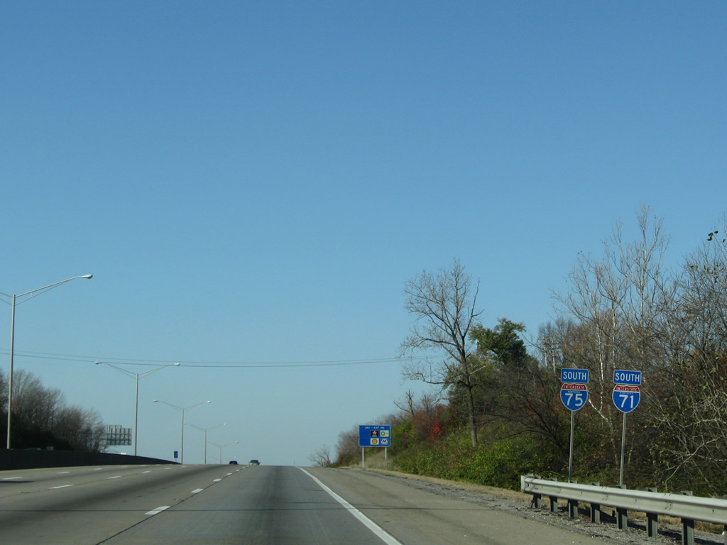
| East from Exit 185, I-275 travels nine miles to Interstate 471 at Highland Heights and west eight miles to Hebron. 11/08/09 |
|
| Exit 185 partitions with two lanes joining Interstate 275 west to Lawrenceburg, Indiana and one lane east to Milford, Ohio. 11/08/09 |
|
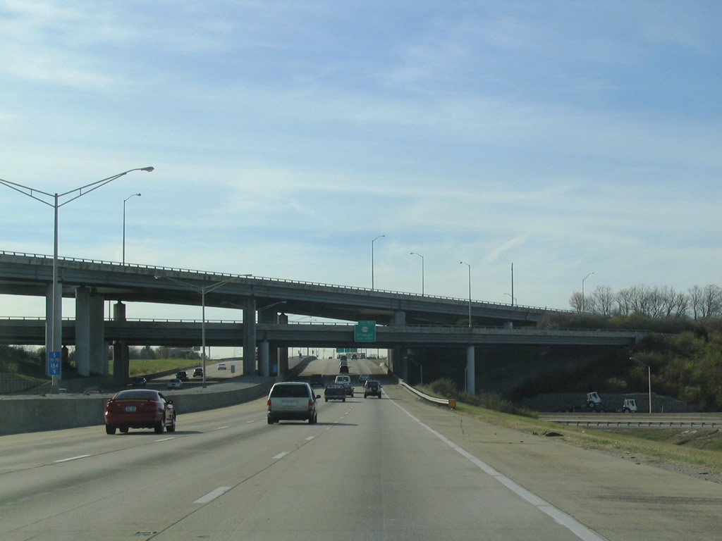
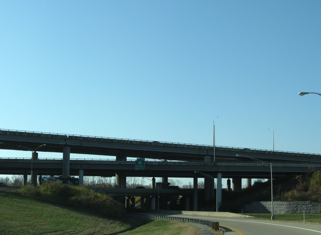
| I-71/75 south at four level exchange with the I-275 beltway. 11/14/04, 11/08/09 |
|
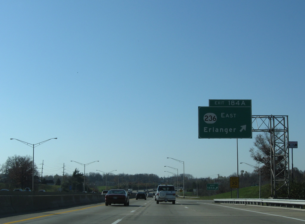
| Exit 184 follows from the I-71/75 southbound mainline to KY 236 (Donaldson Road). 11/14/04 |
|
| I-71/75 at Erlanger was expanded and rebuilt during roadwork from 1999 to Fall 2001. The $30 million project included repaving and adding extra lanes to ramps at Exit 184 as well. This was the last portion of I-71/75 in Northern Kentucky upgraded from 1961 design standards. 11/14/04 |
|
| A lengthy collector distributor roadway extends south from I-275 to KY 236 (Commonwealth Avenue south / Donaldson Highway north) and I-71/75 at Exit 184. Separate ramps partition traffic to the state route at Erlanger. 11/08/09 |
|
| KY 236 (Donaldson Highway) west straddles eastern reaches of Cincinnati / Northern Kentucky International Airport (CVG), serving air cargo areas of the facility. 11/08/09 |
|
| KY 236 east follows Commonwealth Avenue into Erlinger and Stevenson Road from U.S. 25/42 (Dixie Highway) to KY 1303. 11/08/09 |
|
| Leaving Kenton County for Boone County along I-71/75 south. 11/08/09 |
|
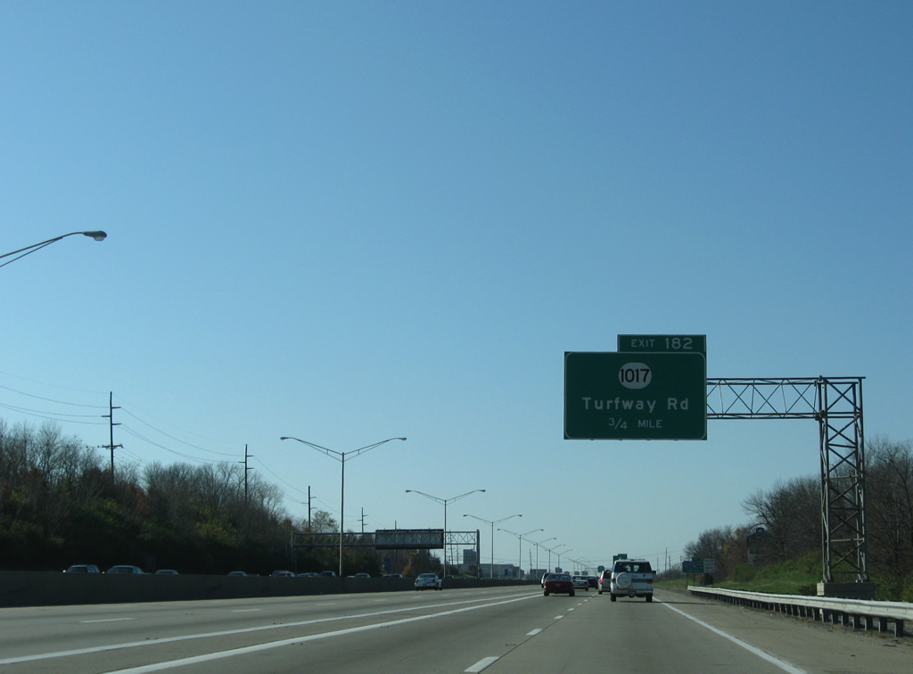
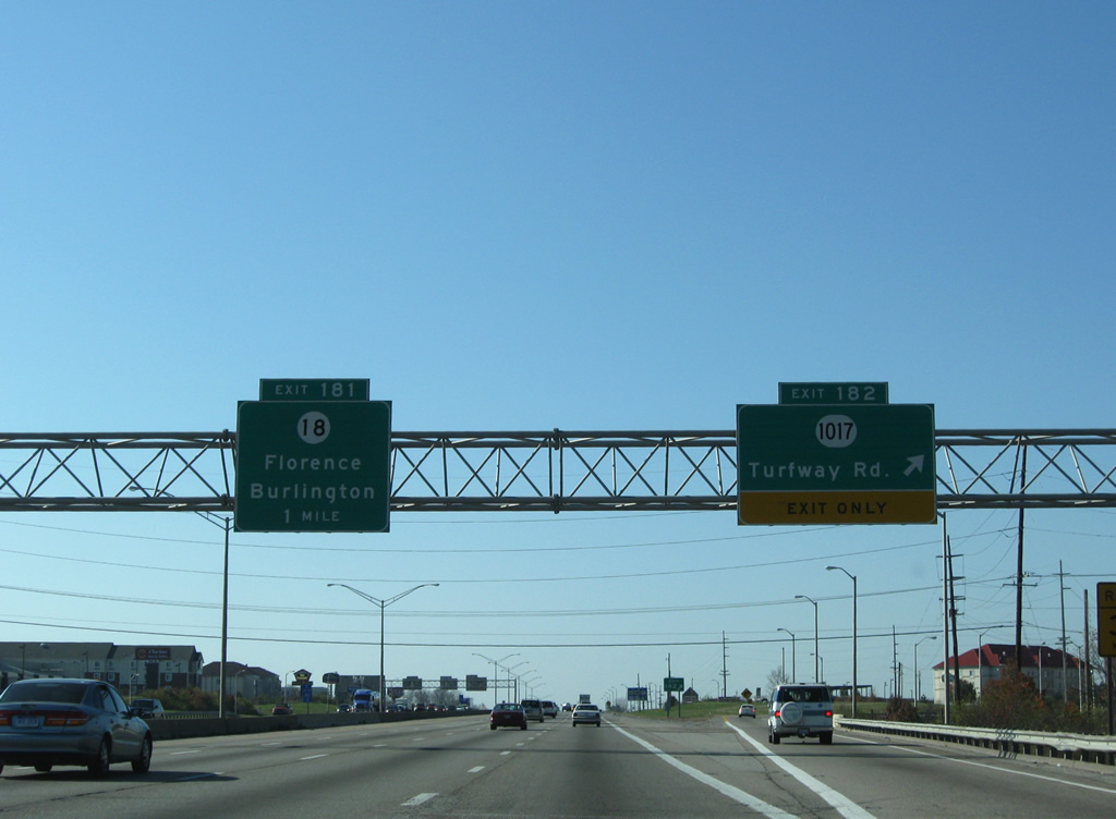
| The c/d roadway from Exit 184 forms an auxiliary lane to KY 1017 (Turfway Road). Exit 182 is a parclo interchange with Thoroughbred Boulevard (KY 717) and parallel Houston Road (KY 842). Turfway Road ties into the southbound ramps via KY 842, but is directly accessible from northbound I-71/75. 11/08/09 |
|
| Turfway Park lies north of the retail and medical complex at KY 842 (Houston Road). 11/08/09 |
|
| KY 1017 follows Turfway Road south to U.S. 25/42 (Dixie Highway) and north to KY 236 (Donaldson Road). 11/08/09 |
|
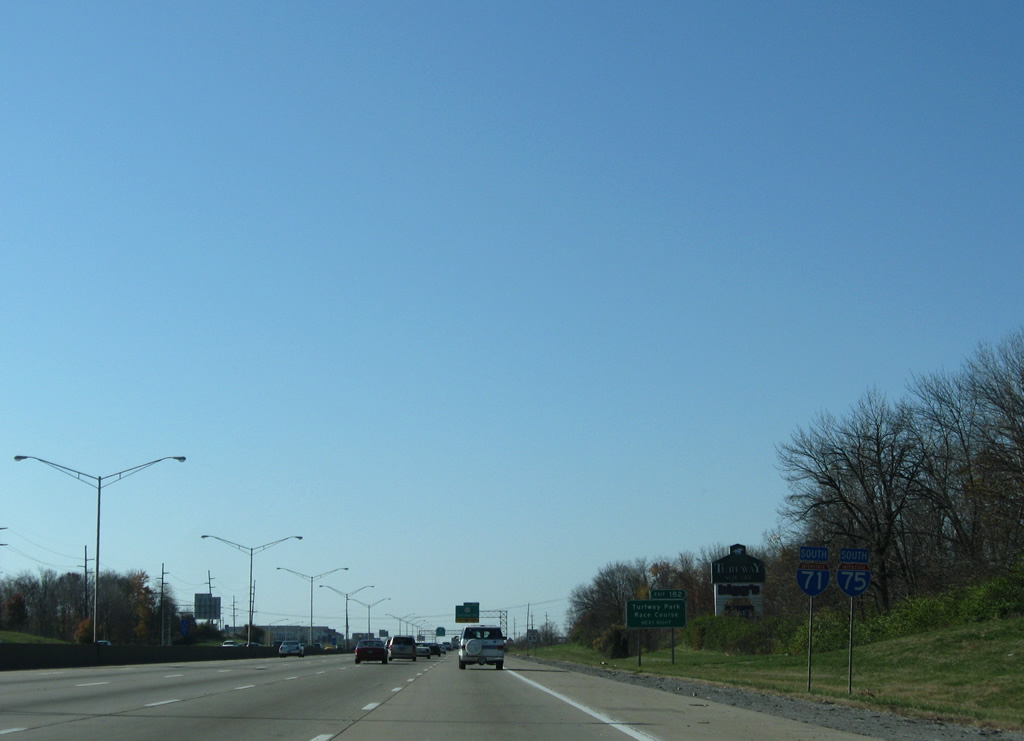
| I-71/75 continue with eight lanes through the exchange at Exit 182 with KY 1017. KY 18 (Burlington Pike) meets the freeway in one mile. 11/08/09 |
|
| A set of reassurance shields stand beyond the entrance from KY 717 (Turfway Park Connector). 11/08/09 |
|
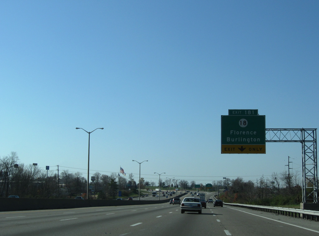
| The diamond interchange at Exit 181 links I-71/75 with KY 18 (Burlington Pike). Heading west, KY 18 runs just south of CVG Airport to the unincorporated community of Burlington. The census designated place topped 18,000 residents by 2020. 11/08/09 |
|
| Areas around the exchange at Exit 181 are buffeted by retail, including Florence Mall. Eastward, KY 18 meanders a short distance to KY 1071 (Turfway Road). 11/08/09 |
|
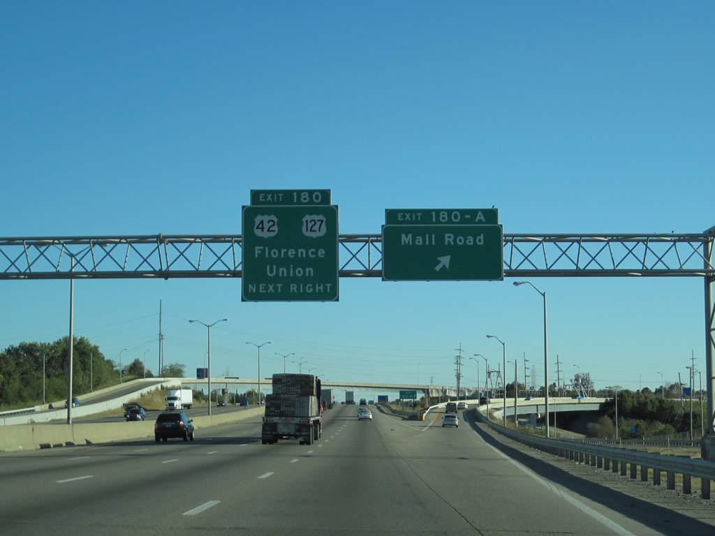
| Exit 180 A follows as a wye interchange with Steinberg Drive, which connects I-71/75 with parallel Mall Road. Providing direct access to Florence Mall, ramps were opened in November 1990, just in time for the holiday shopping season. 10/01/10 |
|
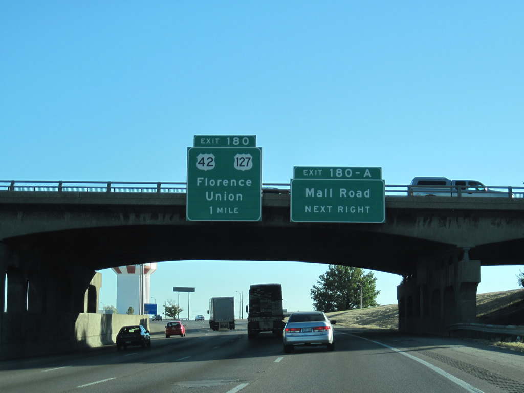
| I-71/75 make a final southward turn ahead of Exit 180 A to Mall Road. Mall Road heads north from U.S. 42/127 (Dixie Highway) to KY 18. The freeway meets the two U.S. highways at a parclo interchange (Exit 180) next. 10/01/10 |
|
| U.S. 42/127 travel southwest from the separation with U.S. 25 to the sprawling area of Union. Florence is generally considered to be the gateway to the "'upland south", which is the part of the southern US north of the "deep south". 10/01/10 |
|
| I-71/75 underwent a $23 million widening project to reduce strains from growing suburban traffic in 2006/2007. 10/01/10 |
|
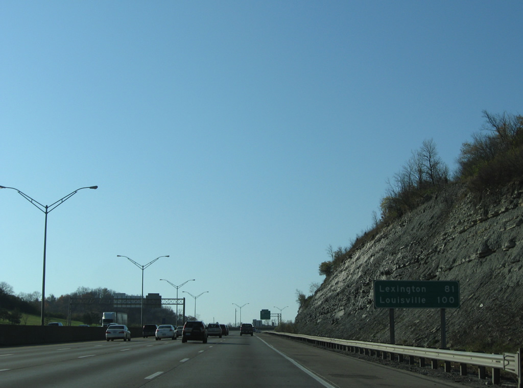
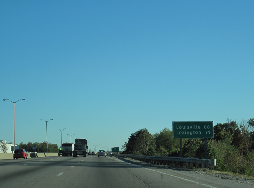
| Distance sign posted 71 miles north of Lexington along I-75 and 88 miles northeast of Louisville at the south end of I-71. 10/01/10 |
|
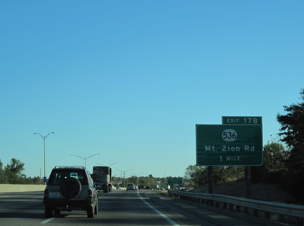
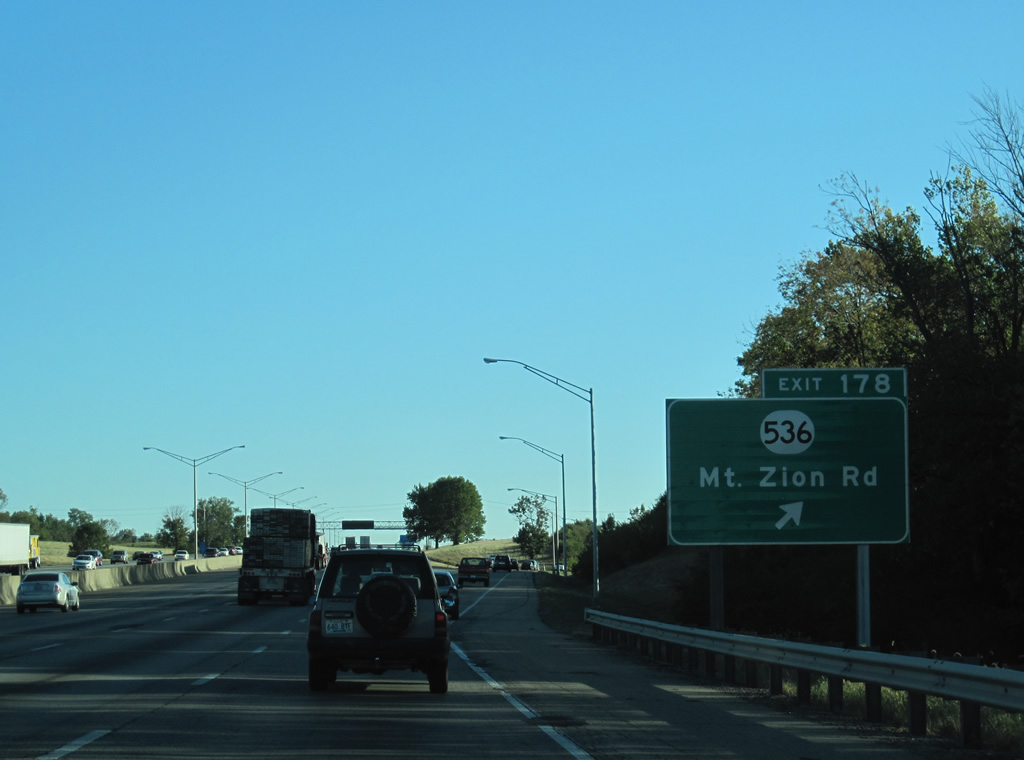
| A diamond interchange joins I-71/75 with KY 536 (Mount Zion Road) at Exit 178. KY 536 travels west to the town of Union, a suburban community mostly consisting of tract housing. 10/01/10 |
|
| KY 536 travels 28.7 miles between KY 338 near Rabbit Hash and U.S. 27 near Alexandria. The route was previously considered when the idea of an east/west arterial or freeway arises. The proposed highway would connect all three Northern Kentucky counties. 10/01/10 |
|
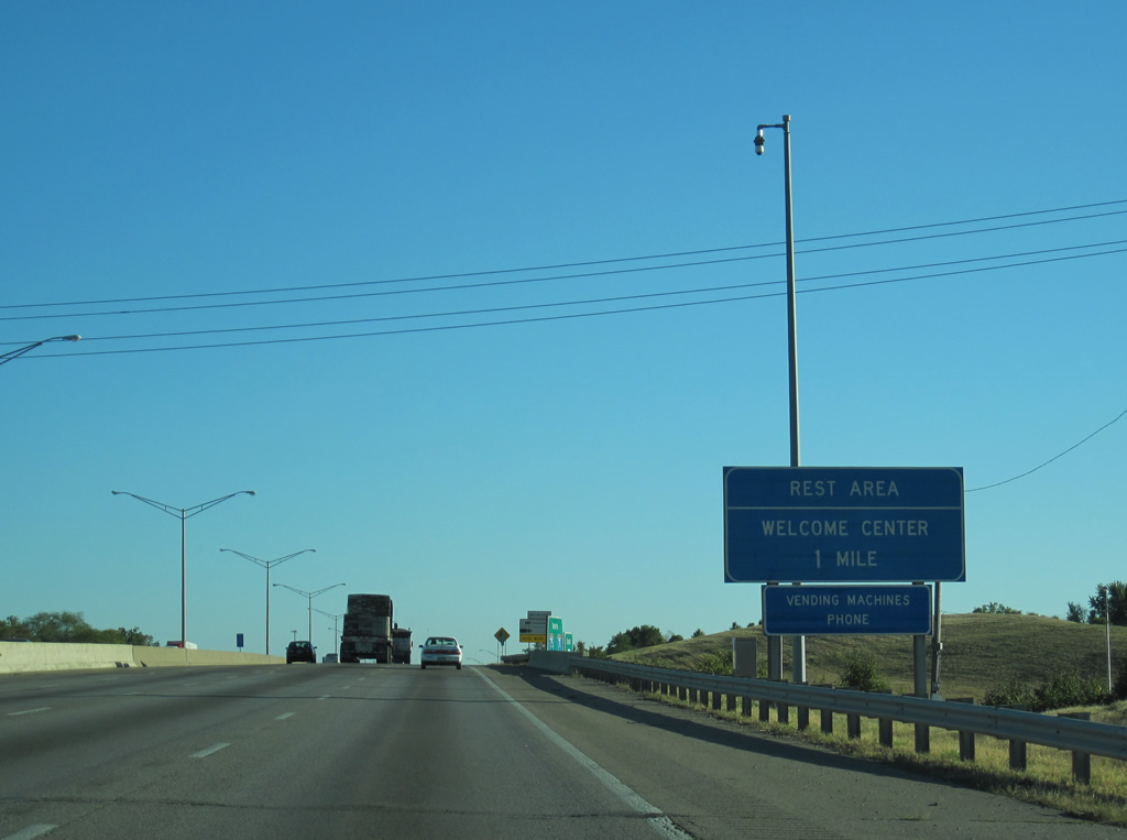
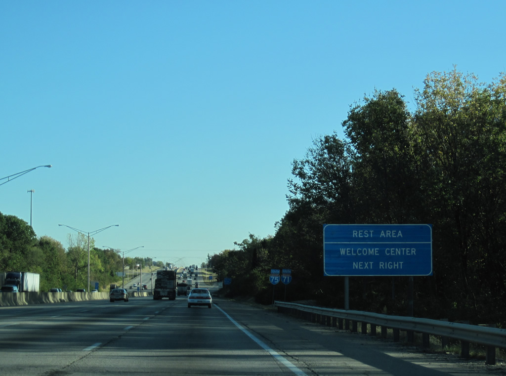
| Rest areas line both directions of I-71/75 between Exits 178 and 175. The southbound facility includes a welcome center for travelers originating in Ohio and points north. 10/01/10 |
|
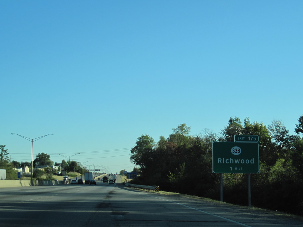
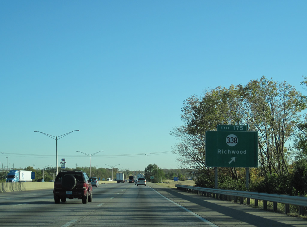
| Exit 178 connects the freeway with the suburban community of Richwood and the sprawling Triple Crown Country Club via KY 338 (Richwood Drive). 10/01/10 |
|
| KY 338 travels west from parallel U.S. 25 (Dixie Highway) to U.S. 42/127 at Beaverlick and beyond to Big Bone Lick State Park. 10/01/10 |
|
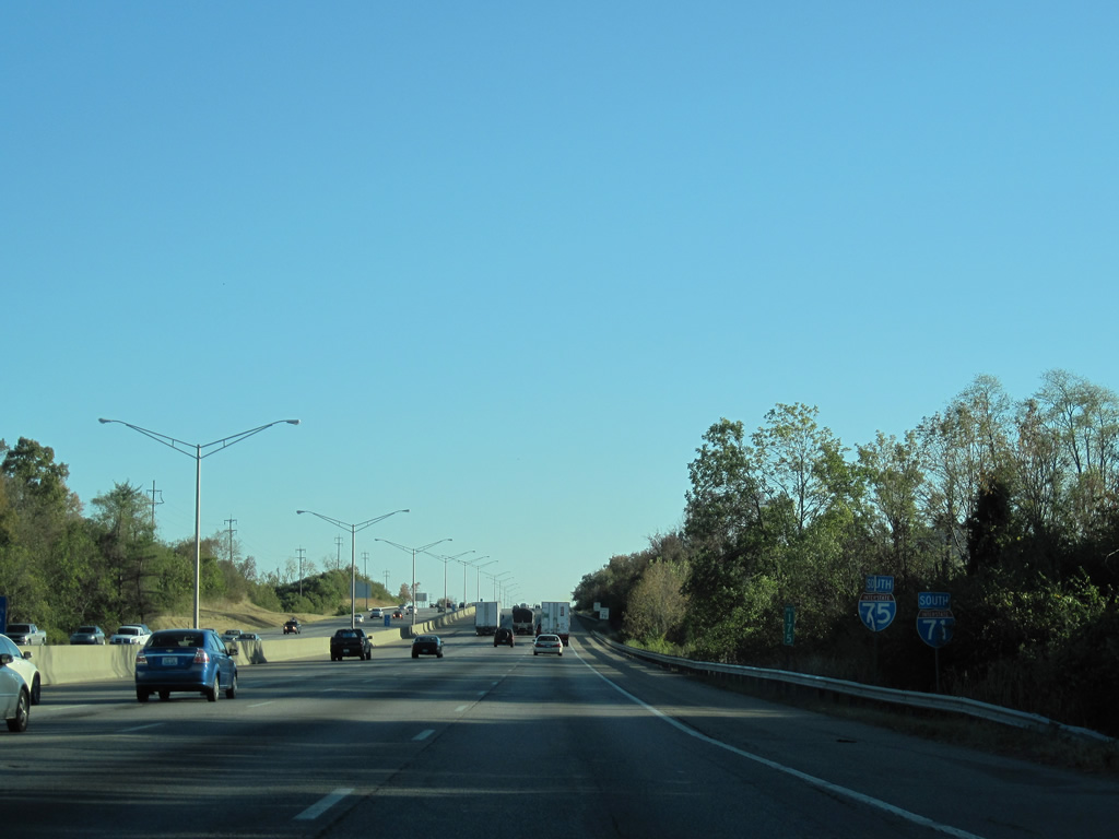
| The final set of shields posted south along the 19.92 mile overlap of I-71/75. 10/01/10 |
|
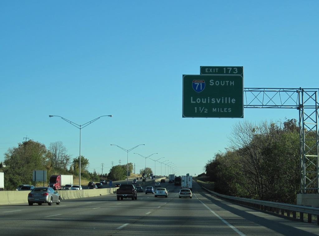
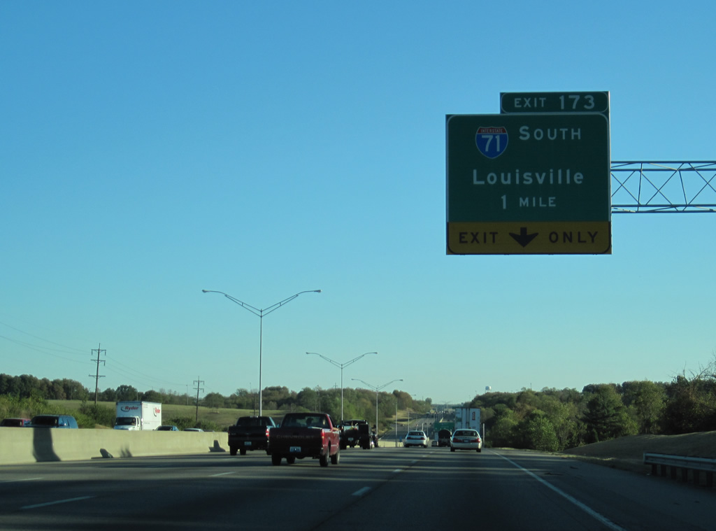
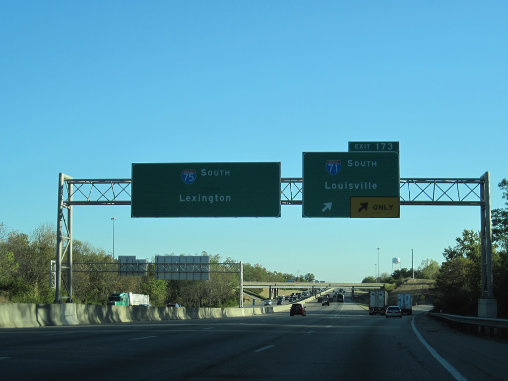
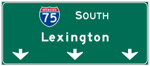
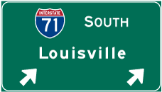
| I-71/75 separate in 1.5 miles at what was a formerly rural trumpet interchange (Exit 173). Development spreads along the east side of the exchange. 10/01/10 |
|
| Interstate 71 departs with two lanes at Exit 173 toward Louisville. I-75 continues with three through lanes to Williamstown and Lexington. 10/01/10 |
|
| Kentucky's Transportation Cabinet set out a goal in the 1990s to widen Interstate 75 to at least six lanes from Lexington to Cincinnati. In May of 2000, a $29 million project was completed that saw the interstate widened from four to eight lanes to this point where Interstate 71 splits. The roadwork started in the summer of 1998. 10/01/10 |
|
| I-71 extends 77 miles southwer to Interstate 64 near Downtown Louisville. I-75 travels southward 55 miles from Exit 173 and Walton to combine with I-64 outside Lexington. 10/01/10 |
Page Updated 03-07-2012.


 South
South