|
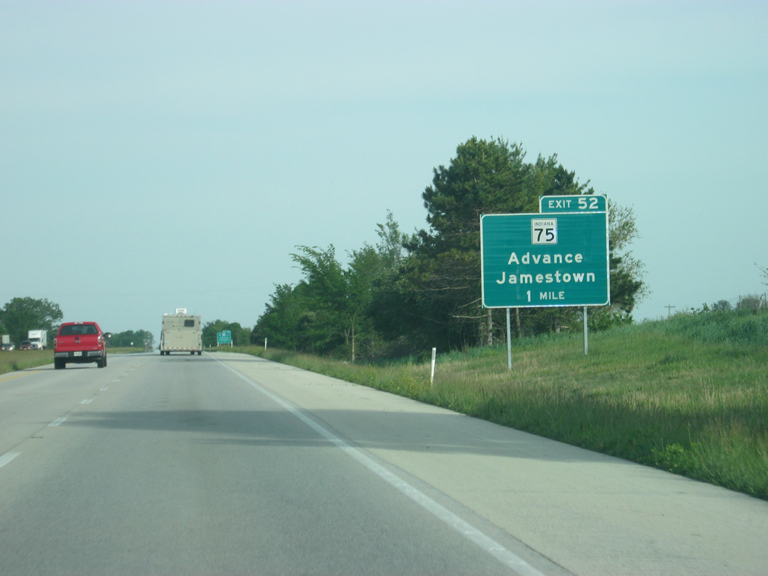
| SR 75 meets Interstate 74 at the lone Boone County exit, a diamond interchange (Exit 52) just north of Jamestown. 05/28/12 |
|
| One half mile out from the Exit 52 off-ramp to SR 75. SR 75 exists in three portions, with the central section traveling 36.8 miles from U.S. 40 near Stilesville to SR 47 at Thorntown. 05/28/12 |
|
| Eastbound Interstate 74 reaches Exit 52. SR 75 follows Lebanon Street through Jamestown, connecting U.S. 136 (Main Street) with SR 234's westbound beginning to Ladoga. Northward, a 3.7 mile drive brings drivers to Advance. 05/28/12 |
|
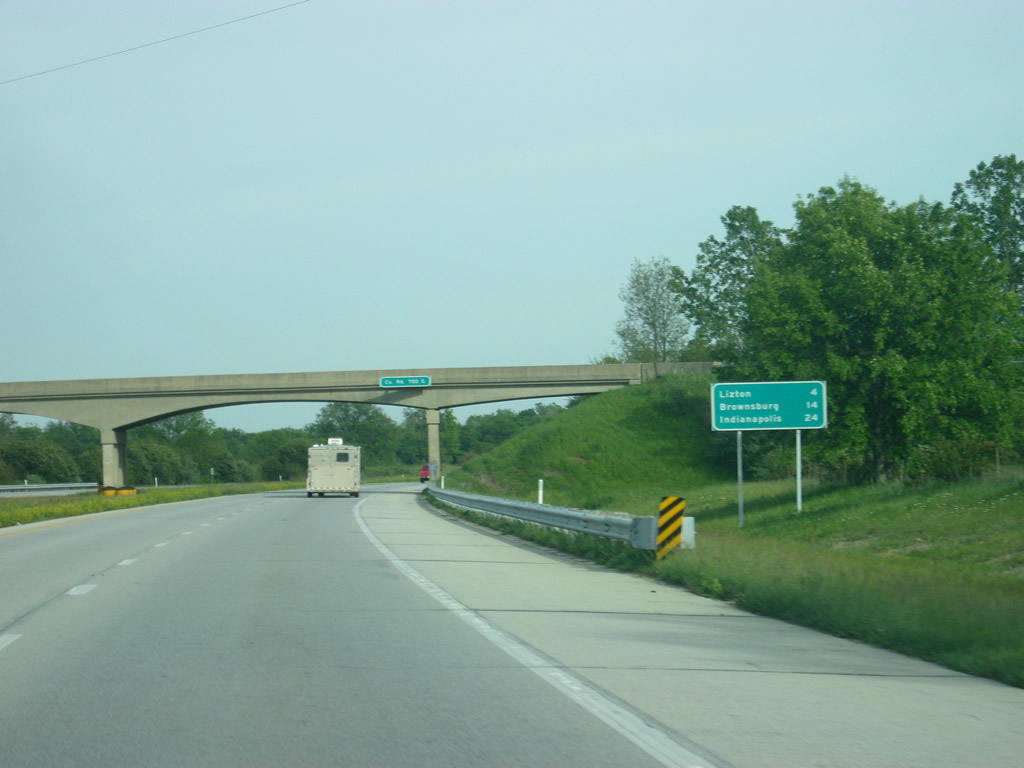
| The Hendricks County community of Lizton is four miles away from Exit 52. Brownsburg and Indianapolis follow respectively at 14 and 24 miles. 05/28/12 |
|
| Eastbound Interstate 74 enters Hendricks County in between Exits 52 and 58. 05/28/12 |
|
| Rest areas line both sides of Interstate 74 approximately one mile west of Lizton and Exit 58. 05/28/12 |
|
| The ramp for the Lizton rest area turns off of Interstate 74 east. The next rest area is 94 miles away east of Batesville in southeast Indiana, though there are several communities with services for motorists along the way. 05/28/12 |
|
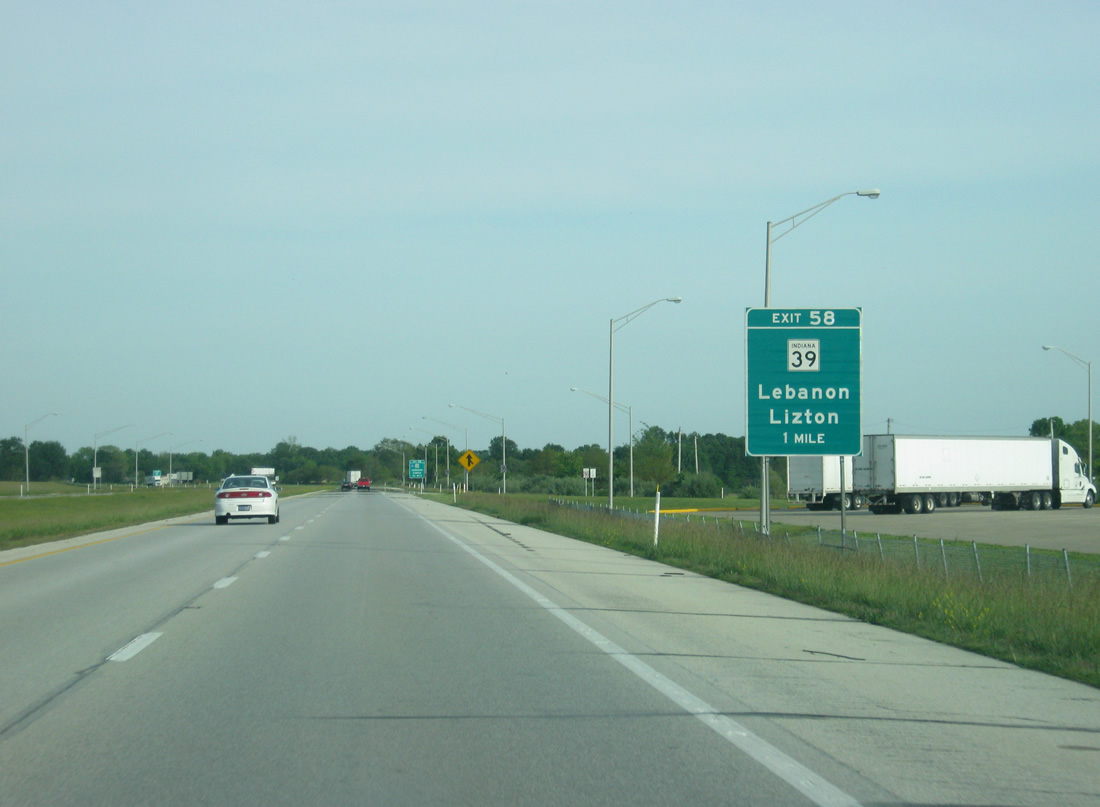
| SR 39 (State Street) connects Interstate 74 with the adjacent community of Lizton south of Exit 58. 05/28/12 |
|
| North from Exit 58, State Road 39 travels 10.1 miles to I-65/U.S. 52 at the Boone County seat of Lebanon. South from Lizton, SR 39 continues nine miles to Danville. 05/28/12 |
|
| Exit 58 departs Interstate 74 east for SR 39. SR 39 totals 179.2 miles from Martinsville north to the Michigan state line, east of Michigan City. A second segment of SR 39 exists for 15.5 miles to the west of Seymour and Scottsburg. 05/28/12 |
|
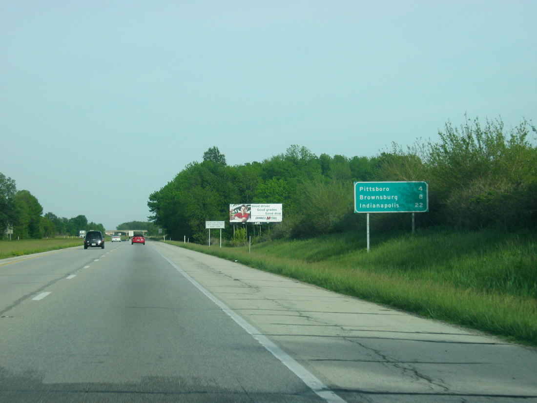
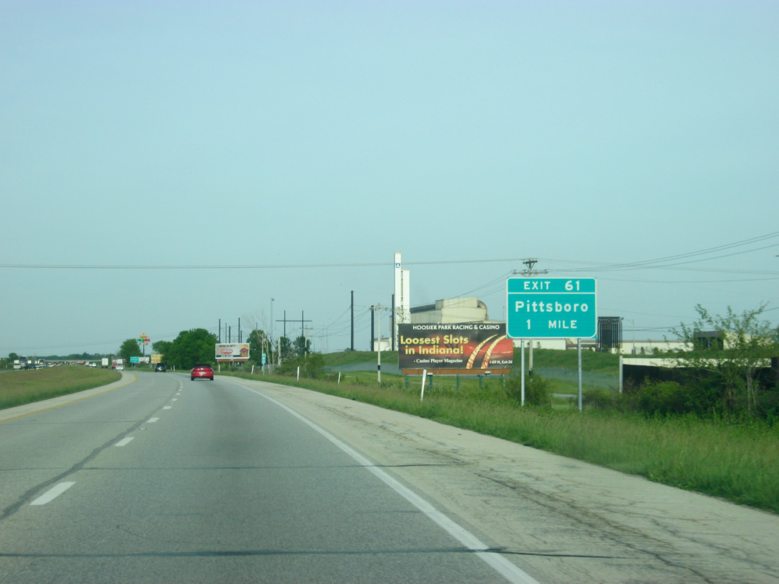
| Pittsboro is the next town along Interstate 74 at a distance of four miles. Brownsburg is eight miles off while Indianapolis follows at 22 miles. 05/28/12 |
|
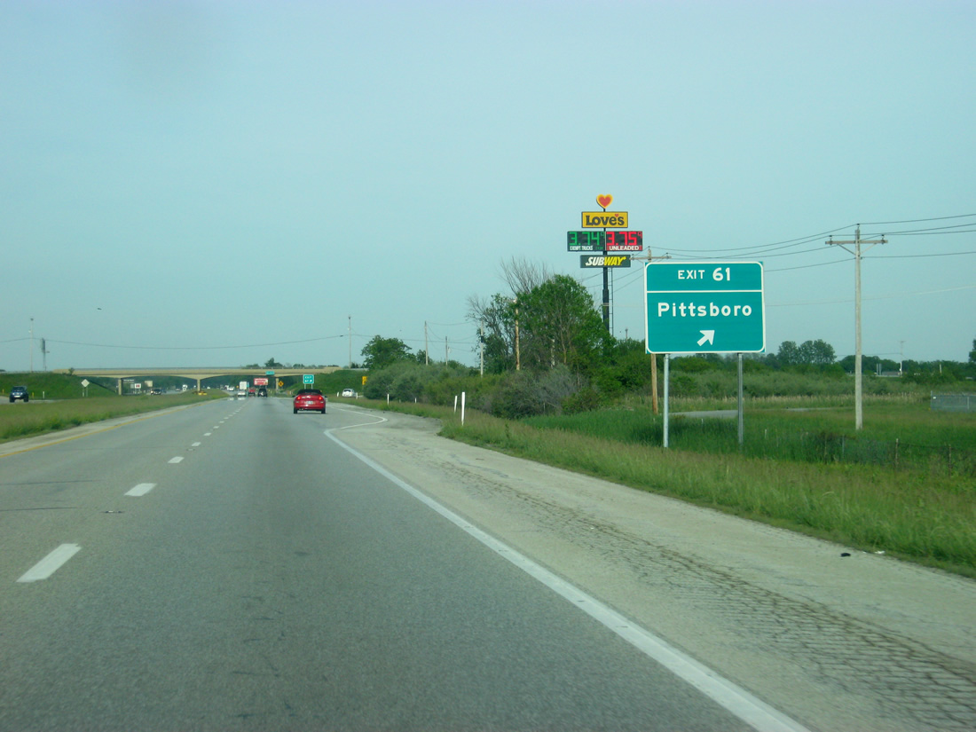
| A diamond interchange (Exit 61) joins Interstate 74 with County Road 275 East in one mile. 05/28/12 |
|
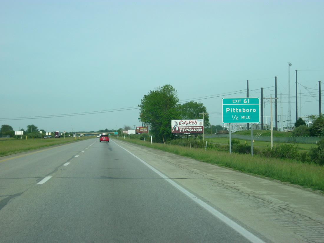
| Pittsboro lies south of Interstate 74 and Exit 61 along U.S. 136 (Main Street) at Meridian Street. 05/28/12 |
|
| County Road 275 East leads north from Exit 61 to rural south Boone County. Wall Street east connects County Road 275 East with Pittsboro via Meridian Street south. 05/28/12 |
|
| A portion of County Road 275 East was renamed to honor Jeff Gordon, the Pittsboro native and three-time NASCAR Winston/Sprint Cup Series champion. 05/28/12 |
|
| One mile west of the Exit 66 parclo interchange with SR 267 on Interstate 74 east. 05/28/12 |
|
| SR 267, a north-south route at 28.7 miles, links Interstate 65 near Whitestown with Mooresville, south of Interstate 70. 05/28/12 |
|
| Interstate 74 east at the Exit 66 ramp departure for SR 267 (Green Street) within the city of Brownsburg. Hotels and retail surround the SR 267 interchange with I-74. Green Street otherwise ventures south into downtown Brownsburg, where it intersects U.S. 136 (Main Street). 05/28/12 |
|
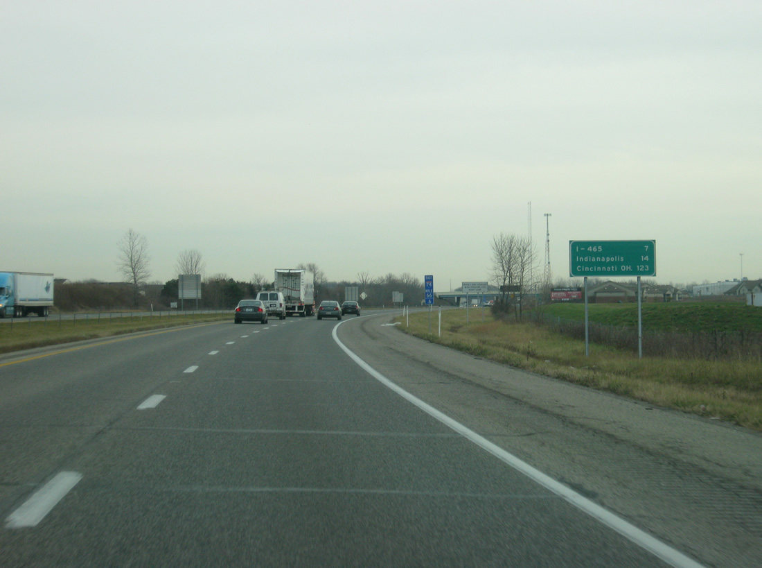
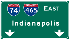
| Interstate 465 is seven miles away, with Downtown Indianapolis following at 14 miles. The Queen City of Cincinnati, Ohio makes its first appearance on distance signs at a distance of 123 miles. 12/06/12 |
|
| A diamond interchange (Exit 68) between Interstate 74 and a newly built segment of Ronald Reagan Parkway opened to traffic on July 15, 2008 at a cost of $17.5 million. Ronald Reagan Parkway is a four lane corridor planned between SR 67 in southwest Indianapolis and Interstate 65 near Whitestown. In between May and December of 2012, signage for the interchange was changed to reflect the control cities of Clermont and Brownsburg instead of the parkway. 05/03/12, 12/06/12 |
|
| Interstate 74 on the half mile approach to Exit 68 and Ronald Reagan Parkway. Presently agricultural lands front the new four lane segment leading north to County Road 600 North and south to Connector Road and U.S. 136. The parkway will open up a significant swath of Hendricks County to new development. 05/03/12, 12/06/12 |
|
| When Exit 68 opened; it cut a seven mile exit less stretch in half for motorists leading west from Interstate 465. Ronald Reagan Parkway provides another connection to Brownsburg for commuters headed to Indianapolis. Another segment of the parkway travels between County Road 300 North south to Clermont and the I-70 interchange with Ameriplex Parkway by IND Airport. 05/03/12, 12/06/12 |
|
| When the control points for Exit 68 were changed, a sign was added identifying the overpass as Ronald Reagan Parkway. 12/06/12 |
|
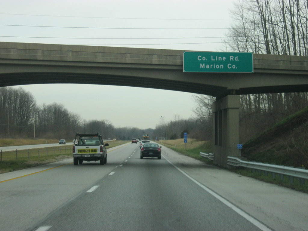
| County Line (Raceway) Road passes over Interstate 74 at the Marion County line. 12/06/12 |
|
| Interstate 74 traverses through some wooded scenery as it approaches the Speedway area and Interstate 465. Here, the interstate passes the dam for Eagle Creek Reservoir. 12/06/12 |
|
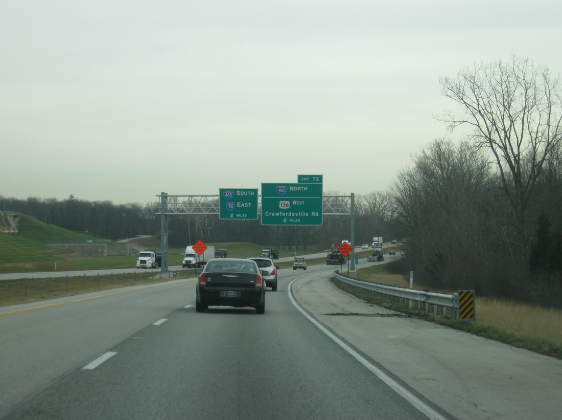
| Two mile overhead posted for the eastbound merge with I-465 around the south side of Indianapolis. The freeway mainline did continue along Crawfordsville Road before the interchange was rebuilt in 2011-2012. The 53 mile beltway encircles Indianapolis and combines with I-74 from Exit 16 to Exit 49. 12/06/12 |
|
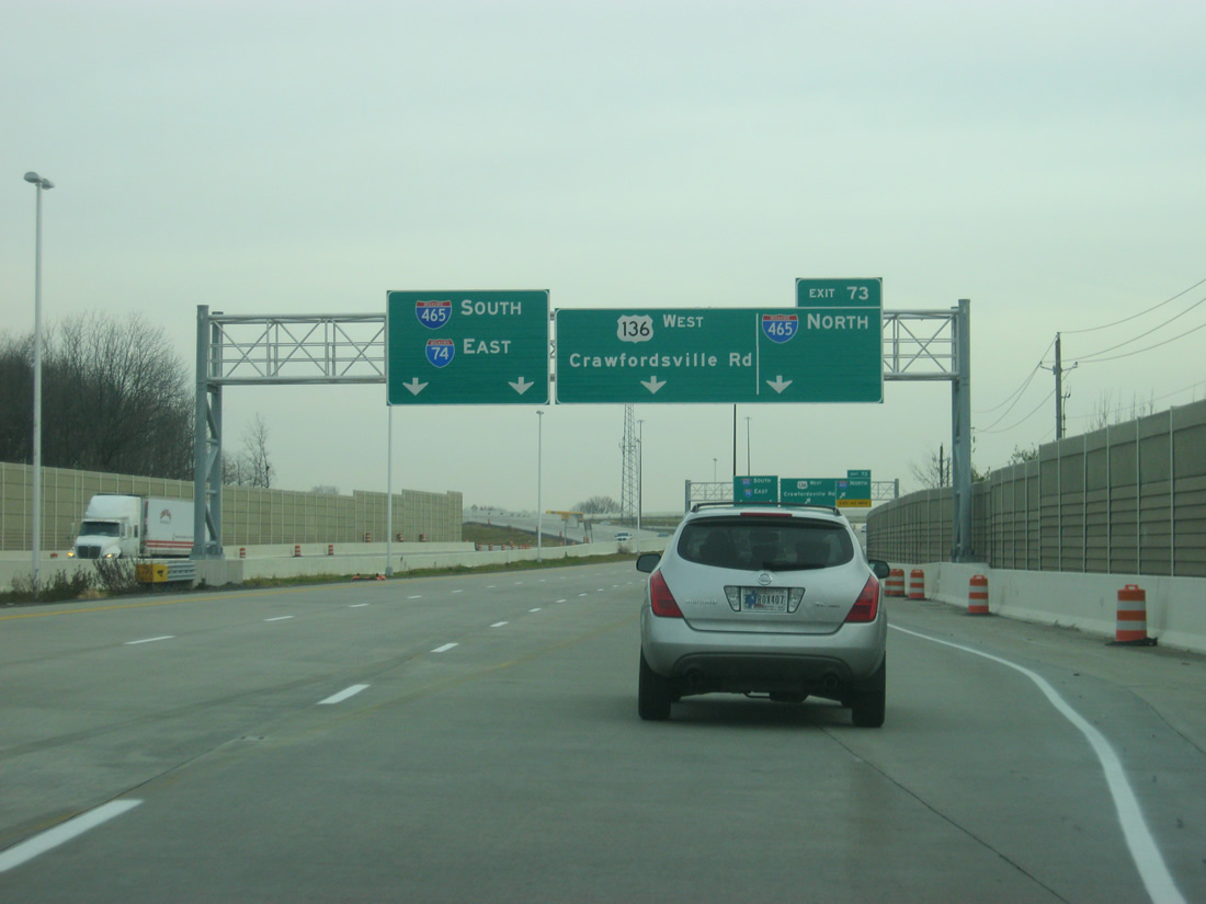
| One mile away from Exit 73 with Interstate 465 and Crawfordsville Road (U.S. 136 west). A new diamond interchange opened in 2012 directly connecting the Beltway and Interstate 74 with U.S. 136 (Crawfordsville Road) west to Clermont. This replaced a connection along the old I-74 freeway stub to Crawfordsville Road.
The Interstate 74 freeway originally defaulted onto Crawfordsville Road (former U.S. 136) east into Speedway. Accelerate 465 construction removed the freeway spur over the Beltway and reconfigured the Crawfordsville Road intersection with High School Road north. 12/06/12 |
|
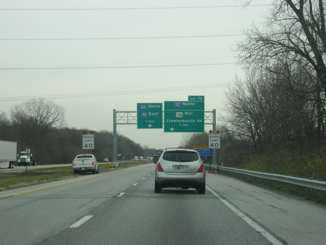
| The right lane along Interstate 74 becomes an exit ramp for Crawfordsville Road (U.S. 136 west) and Interstate 465 north. Crawfordsville Road to the east is known as the Hulman Memorial Way and is the most patrolled traffic route into the Indianapolis Motor Speedway on Race Day. 12/06/12 |
|
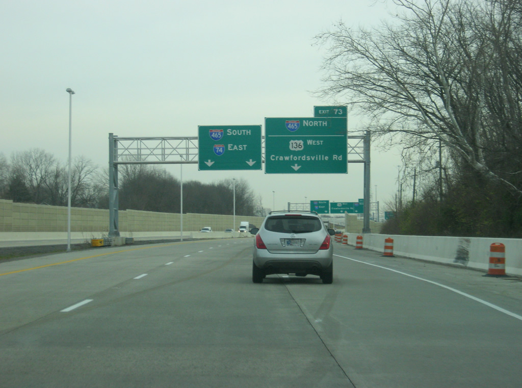
| Approaching the new pavement from Interstate 74 east near Interstate 465 and Crawfordsville Road (U.S. 136 west). U.S. 136 had followed Crawfordsville Road east to the intersection with Georgetown Road and 16th Street outside the famed Indianapolis Motor Speedway. From there, it followed 16th Street east to Martin Luther King, Jr. Street where U.S. 136 had ended. In 1991, U.S. 136 was truncated to the former cloverleaf interchange that used to mark the spot where Interstate 74 went to the west from Speedway. At that point, U.S. 136 began at the cloverleaf interchange and went east to the stoplight intersection with High School Road where it backtracked to the west along Crawfordsville Road. The new interchange removed that situation. 12/06/12 |
|
| The previous interchange had Interstate 74 eastbound traffic follow a ramp to the south toward Interstate 465 south. Traffic bound for Interstate 465 north had to use a loop ramp while traffic bound for Crawfordsville Road and U.S. 136 west continued eastbound to the High School Road intersection. The Accelerate 465 construction project has completely changed all that. 12/06/12 |
|
| The left two lanes of Interstate 74 east continue unobstructed onto Interstate 465 south. The center lane goes ahead to the Crawfordsville Road (U.S. 136 west) diamond interchange toward Speedway and Clermont. The right lane continues onto a flyover ramp that carries eastbound Interstate 74 traffic onto northbound Interstate 465. Interstate 74 will follow Interstate 465 for about 20 miles to the Five Points area on the southeast side of Indianapolis where the highway resumes its trajectory to the southeast toward Cincinnati, Ohio. 12/06/12 |
Page Updated 02-27-2013.

 East
East