|
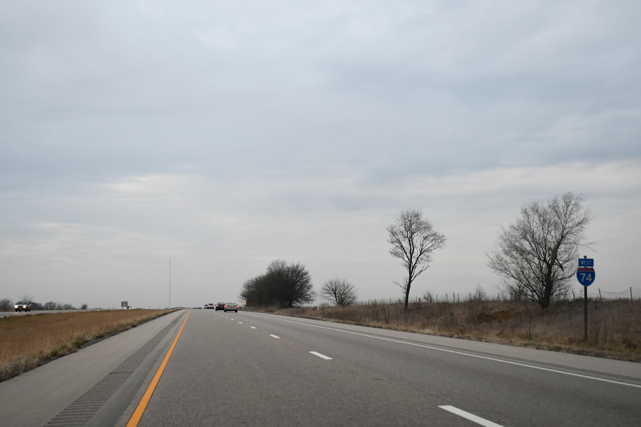
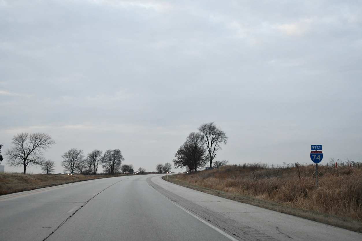
| Leaving Interstate 474 and the Peoria area, I-74 undulates over hills and tributaries to Exit 82 for Kickapoo-Edwards Road. Galesburg follows in 38 miles. Des Moines is signed for connections with Interstate 80 west from Quad Cities. 12/21/23 |
|
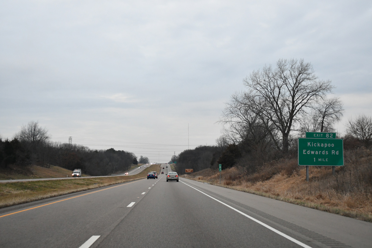
| One mile east of the diamond interchange (Exit 82) with Kickapoo-Edwards Road (Peoria County Road R40) on Interstate 74 west. 12/21/23 |
|
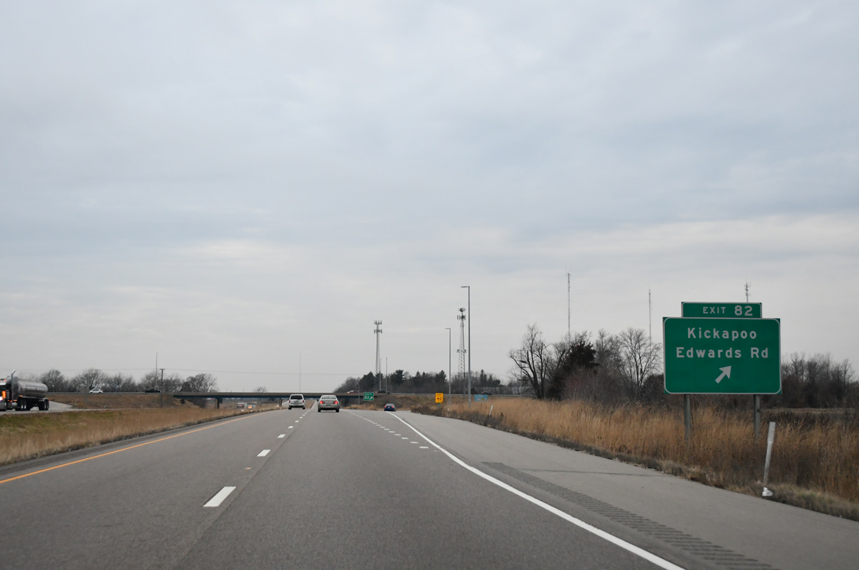
| Peoria County Road R40 connects Interstate 74 with U.S. 150 (Main Street) at Kickapoo, one mile to the north. 12/21/23 |
|
| Heading south, Peoria County Road R40 (Kickapoo-Edwards Road) meanders 2.3 miles from Exit 82 to IL 8 (Southport Road) at Edwards. 12/21/23 |
|
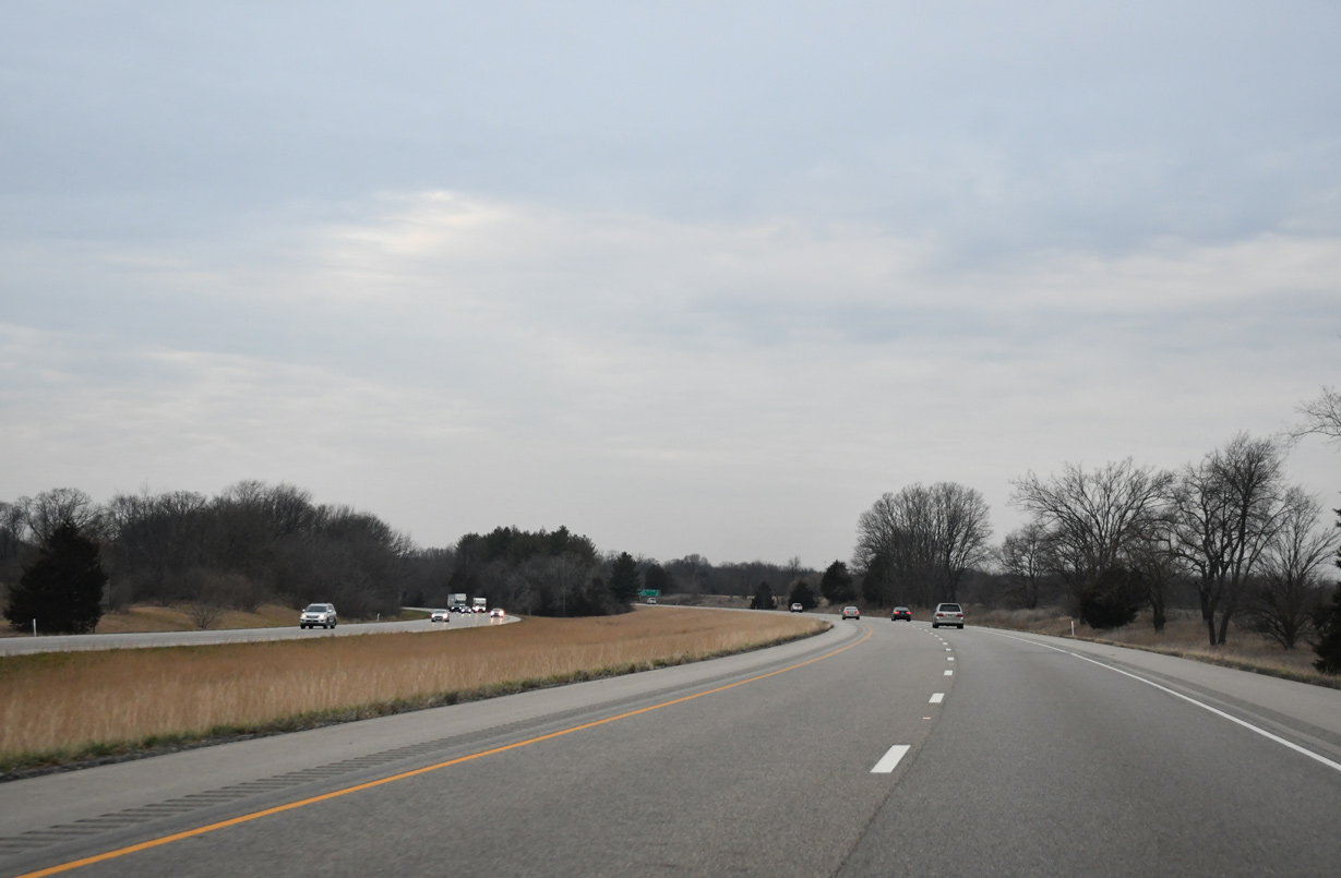
| Interstate 74 parallels U.S. 150 to the south over the ensuing stretch northwest toward Brimfield. 12/21/23 |
|
| Progressing northwestly along Interstate 74, the succeeding exit for Maher Road is in five miles followed by Galesburg in 32 miles. 12/21/23 |
|
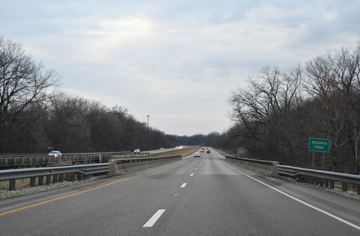
| A pair of bridges built in 1968 span Kickapoo Creek along Interstate 74. 12/21/23 |
|
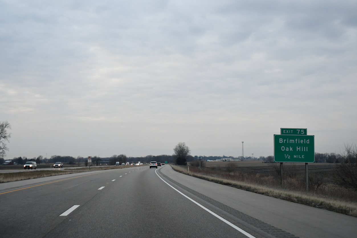
| Maher Road (Peoria County Road R25) connects Interstate 74 at Exit 75 with adjacent U.S. 150, east of Brimfield and Knoxville Street. 12/21/23 |
|
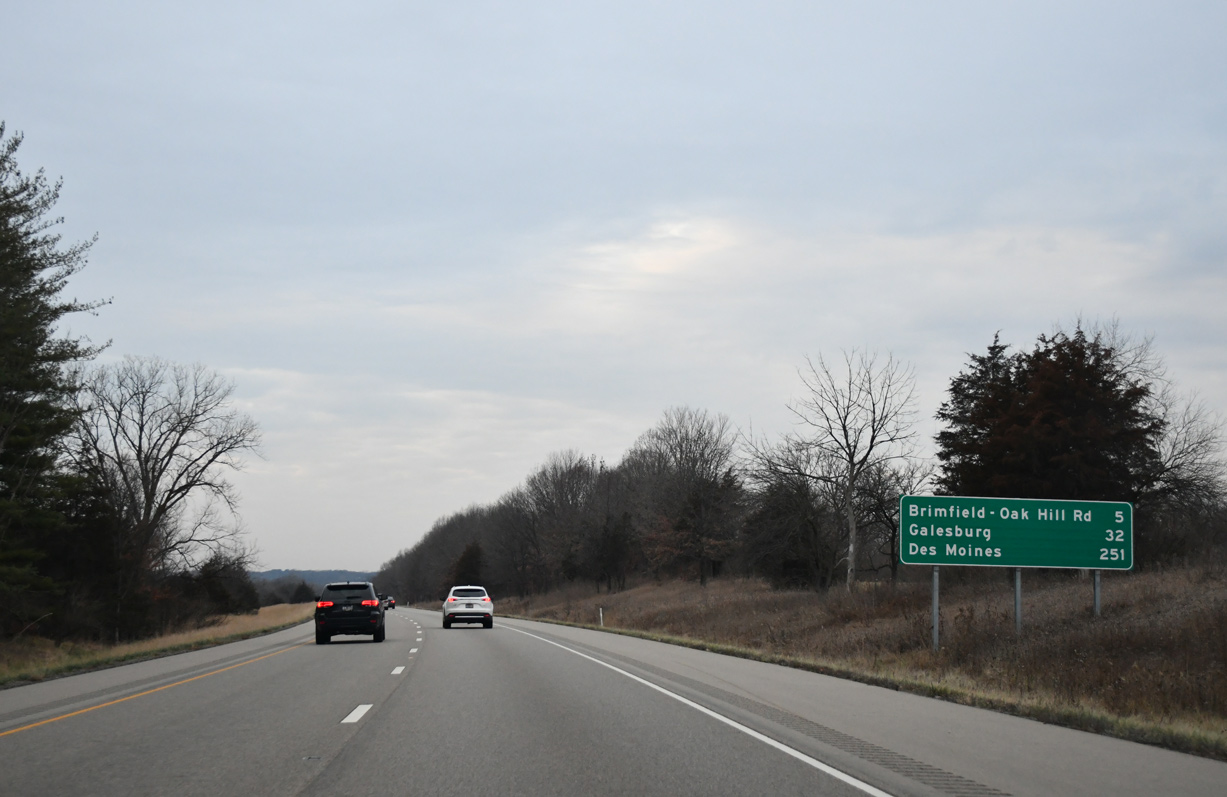
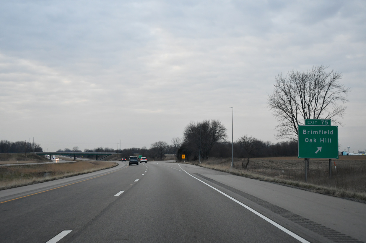
| The rural diamond interchange at Exit 75 lies amid open farm fields southeast of Brimfield. CR R25 travels south 2.8 miles to IL 8 (Southport Road) outside Oak Hill. 12/21/23 |
|
| Exit 75 parts ways with Interstate 74 west for Maher Road. U.S. 150 east from Maher Road travels to Jubilee College State Park and west from Brimfield to IL 78. 12/21/23 |
|
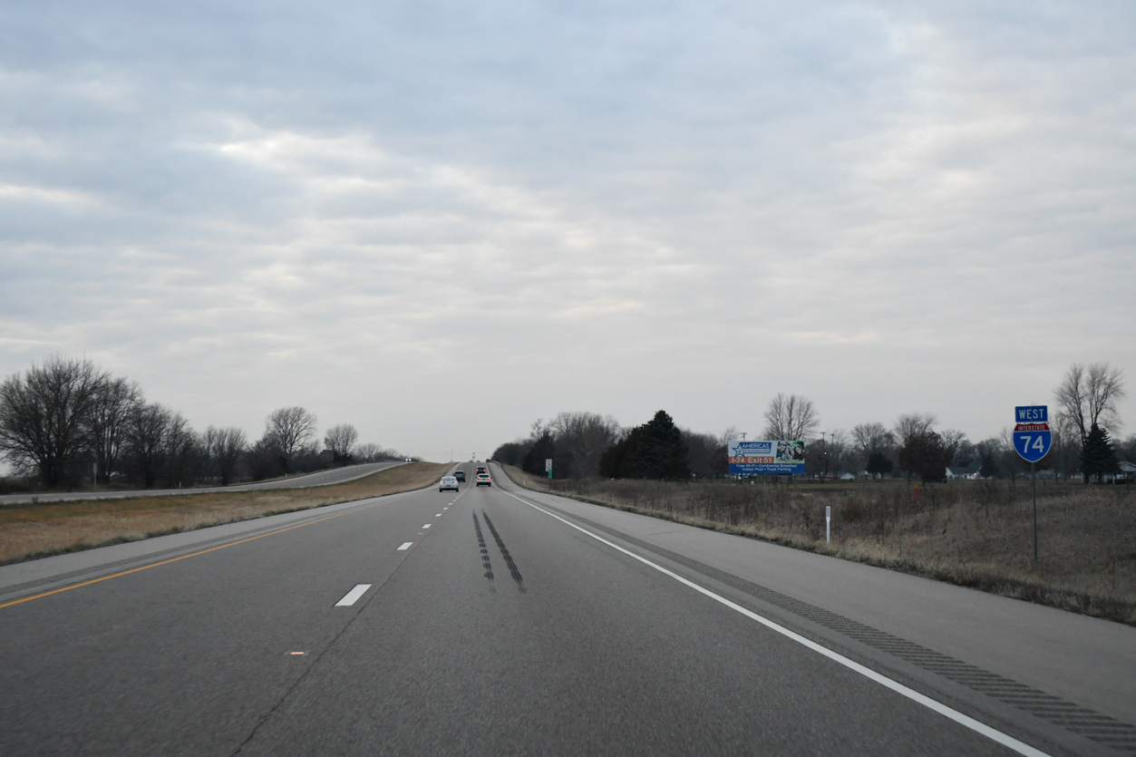
| Interstate 74 passes through southern reaches of the Brimfield village limits between Exit 75 and Walnut Creek. 12/21/23 |
|
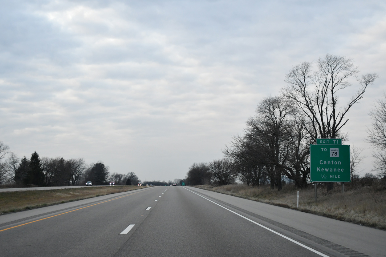
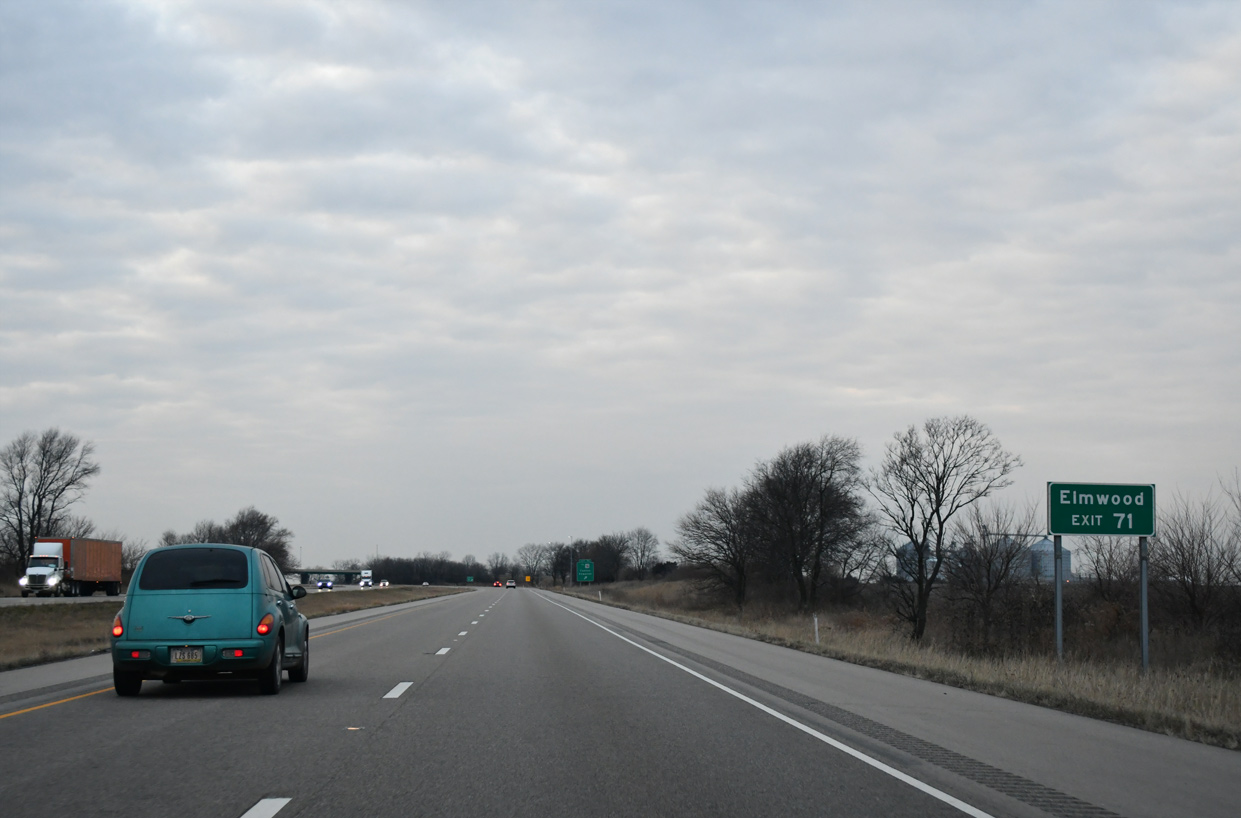
| The last exit in Peoria County, Exit 71 joins Interstate 74 with Bell School Road (Peoria County Route R18) in one mile. 12/21/23 |
|
| One half mile east of Exit 71 to Peoria County Route R18. 12/21/23 |
|
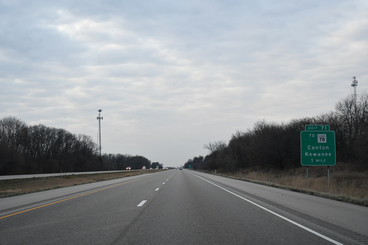
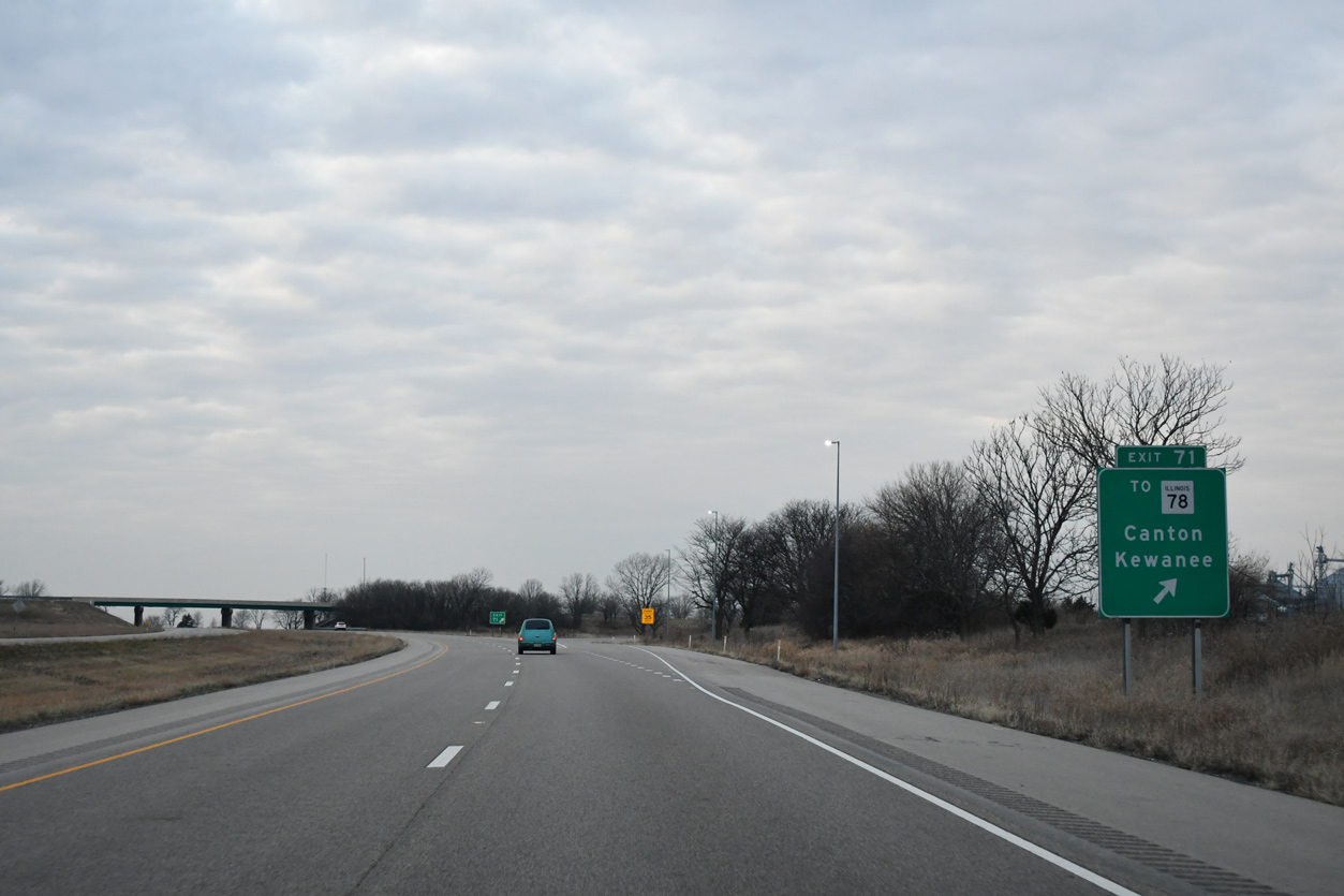
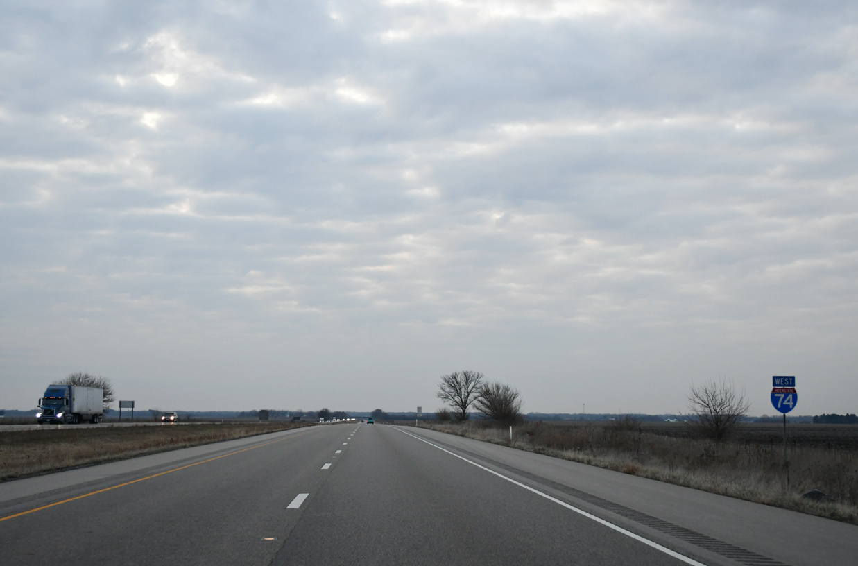
| IL 78 dog legs west from U.S. 150 and Bell School Road to pass over Interstate 74 in two miles. The state route continues south six miles to Elmwood and 25 miles to Canton. 12/21/23 |
|
| U.S. 150/IL 78 north combine for three miles near Laura. U.S. 150 resumes a westward course to Galesburg while IL 71 continues north to Kewanee. IL 78 is part of a multi state route with Wis 78, measuring 266 miles from Jacksonville, Illinois to Columbus, Wisconsin. 12/21/23 |
|
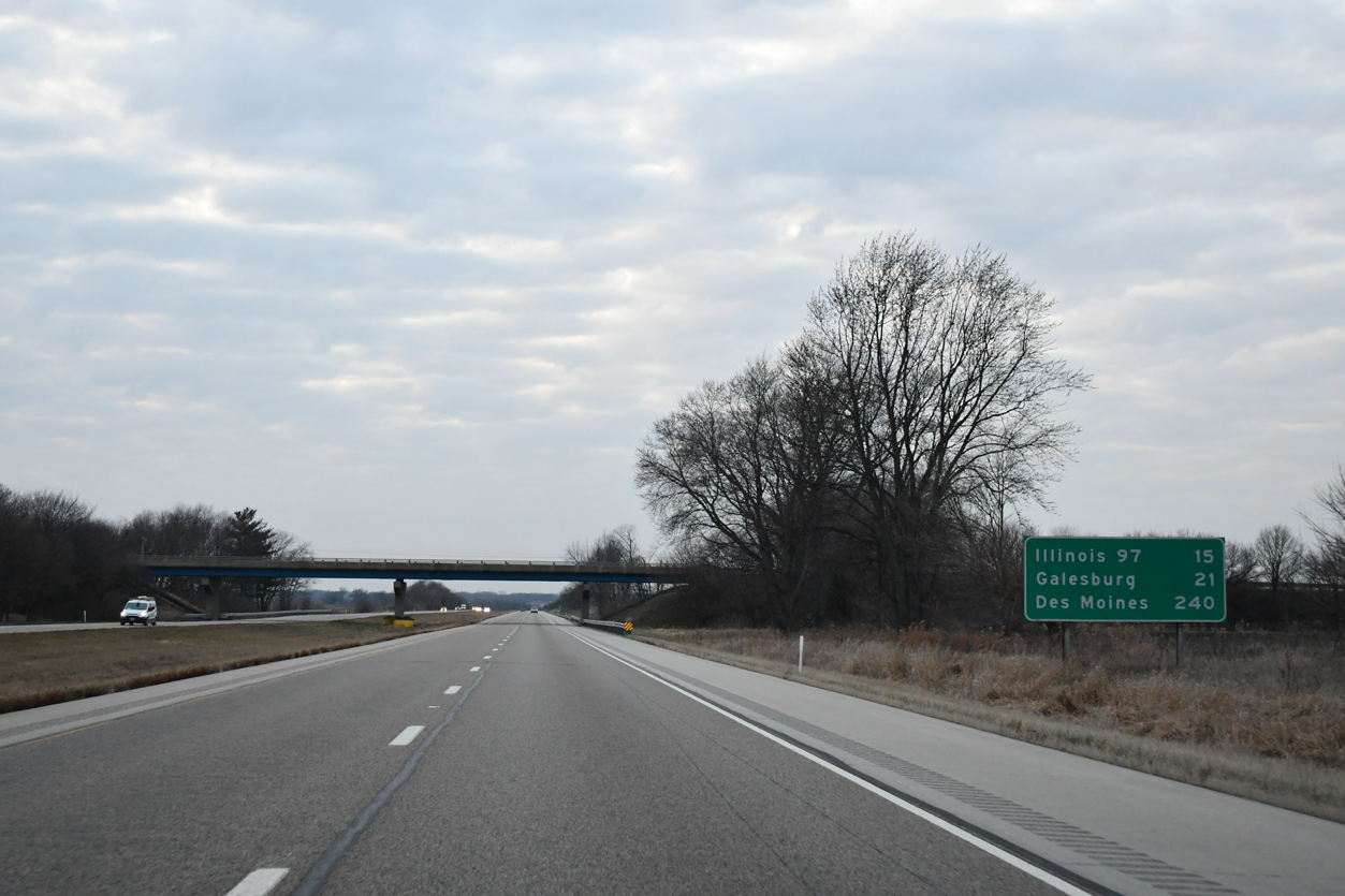
| The 15 mile section of I-74 west to U.S. 150 / IL 97 is the longest exit less stretch along the freeway in Illinois. 12/21/23 |
|
| A distance sign stands 21 miles east of Galesburg at the IL 78 overpass. 12/21/23 |
|
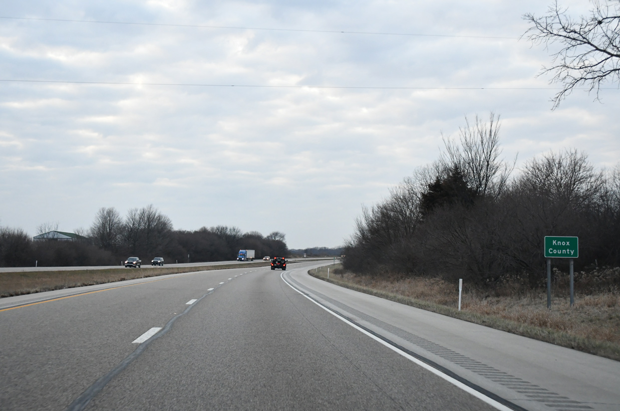
| I-74 enters Knox County just beyond Swab Run, one mile west of the IL 78 overpass. 12/21/23 |
|
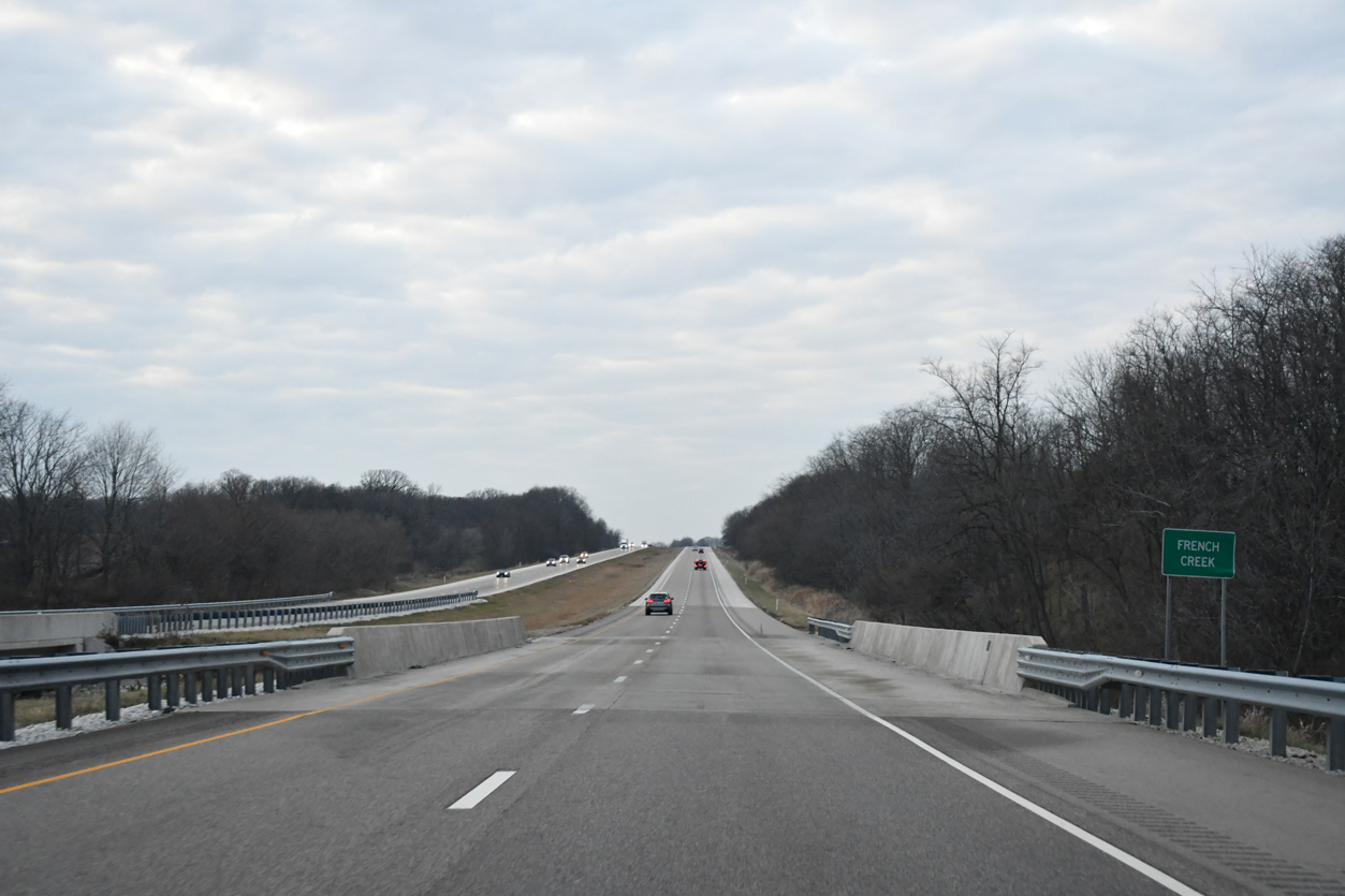
| Angling northwest from the Peoria County line, I-74 westbound continues 1.3 miles to cross French Creek. 12/21/23 |
|
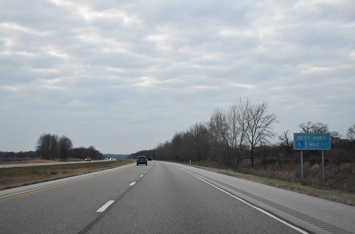
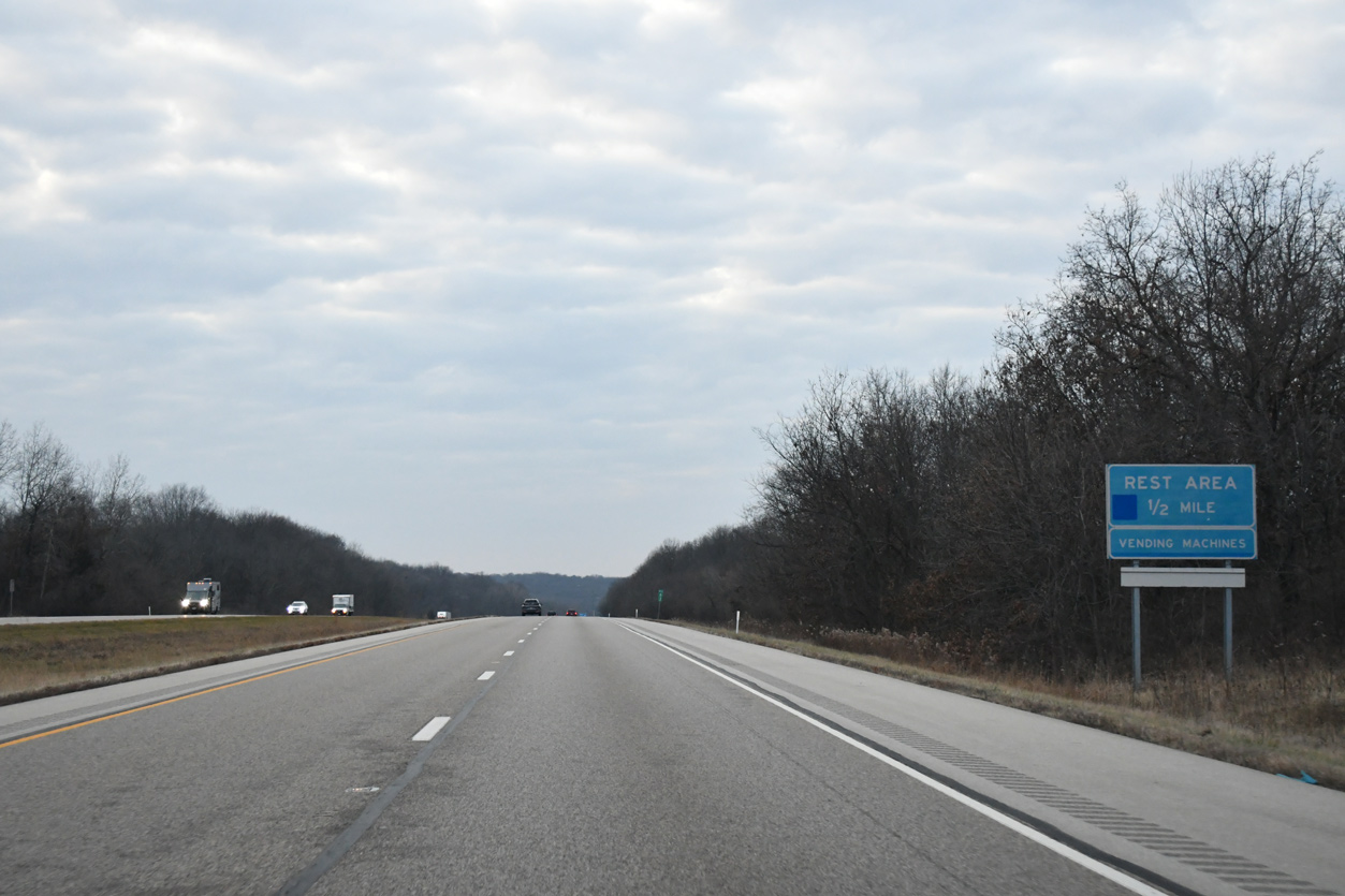
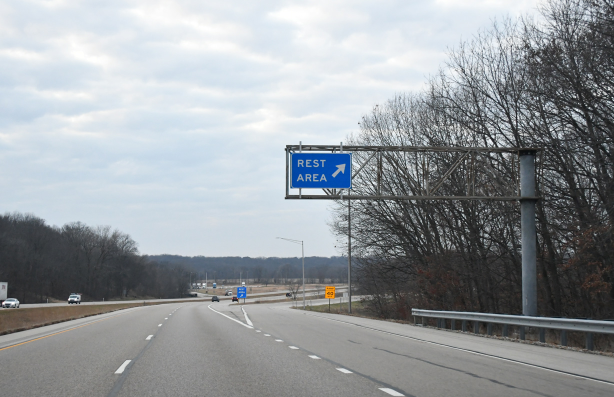
| The fourth rest area along Interstate 74 west in Illinois follows milepost 63 in one mile. 12/21/23 |
|
| The Spoon River Rest Areas line both directions of Interstate 74 east of the Spoon River. 12/21/23 |
|
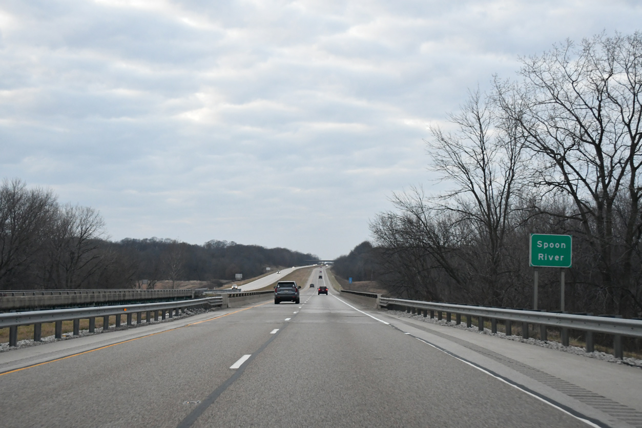
| Narrow bridges dating to 1968 carry both roadways of I-74 across the Spoon River. 12/21/23 |
|
| The Spoon River Rest Areas line both directions of Interstate 74 east of the Spoon River. 12/21/23 |
|
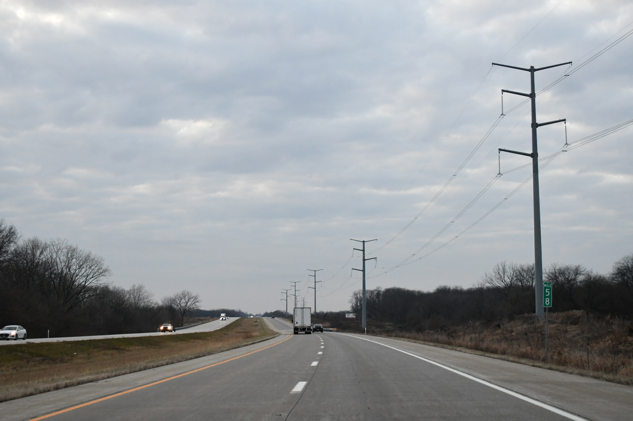
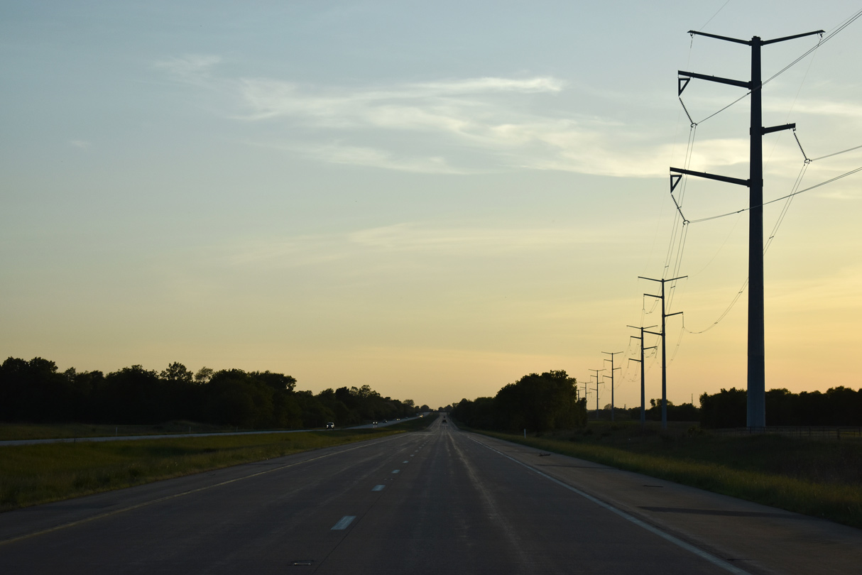
| A transmission corridor accompanies the north side of Interstate 74 west from milepost 58. 12/21/23, 05/24/18 |
|
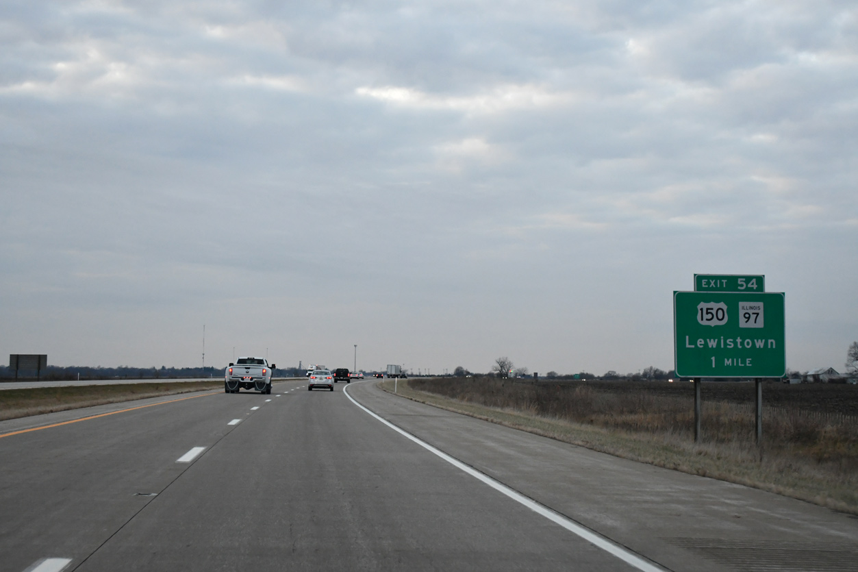
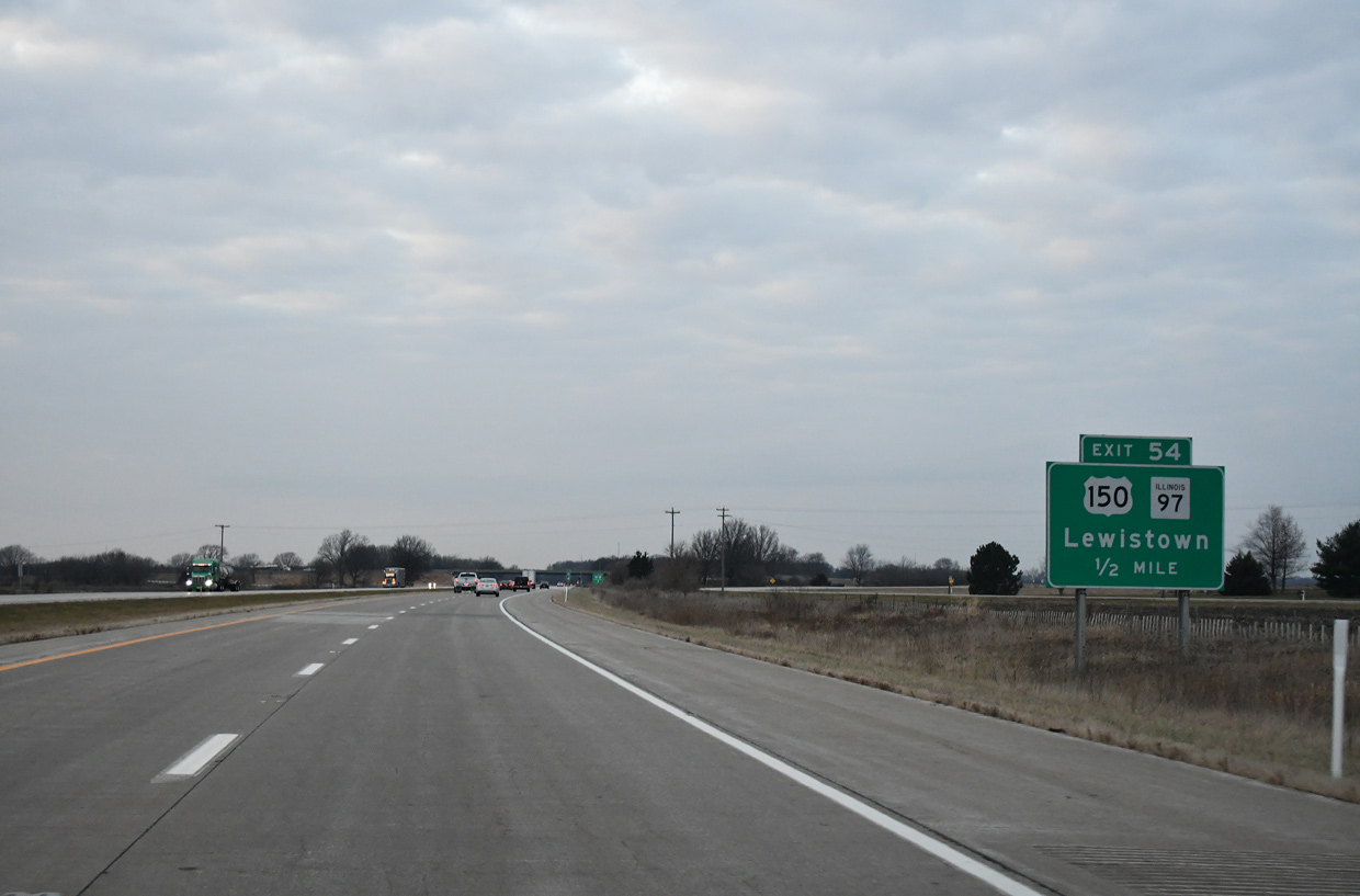
| One mile ahead of the parclo interchange (Exit 54) with U.S. 150 and the north end of IL 97 outside Knoxville. 12/21/23 |
|
| U.S. 150 shifts sides with Interstate 74, staying south of the freeway along Main Street and Galesburg Road through Knoxville. IL 97 separates with U.S. 150 and angles southeast nine miles to Maquon. 12/21/23 |
|
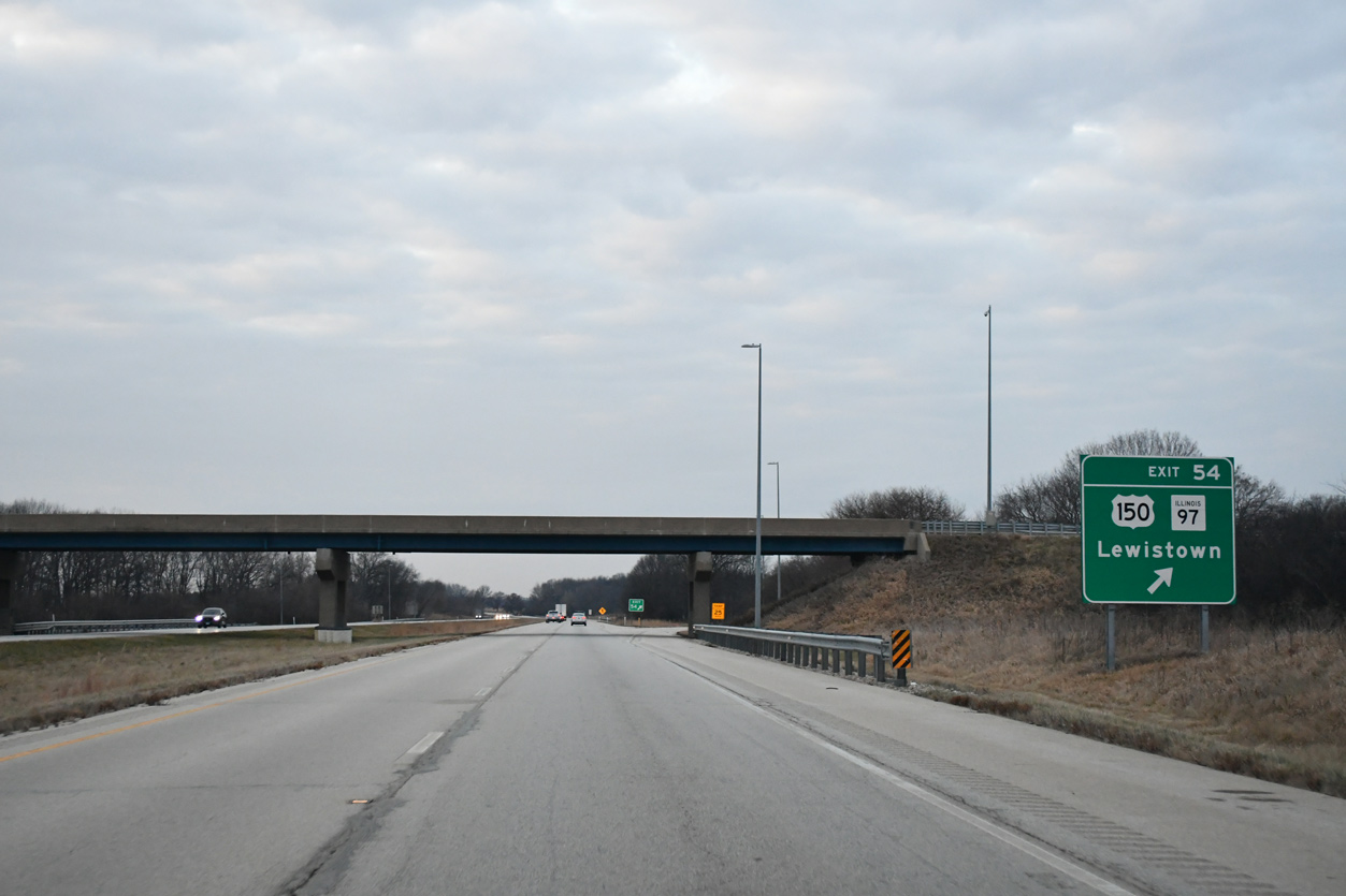
| Exit 54 ties into the intersection where U.S. 150 turns south from Knox Road 1020 East. Lewistown, the Fulton County seat, lies 41 miles to the south via IL 97 at U.S. 24. 12/21/23 |
|
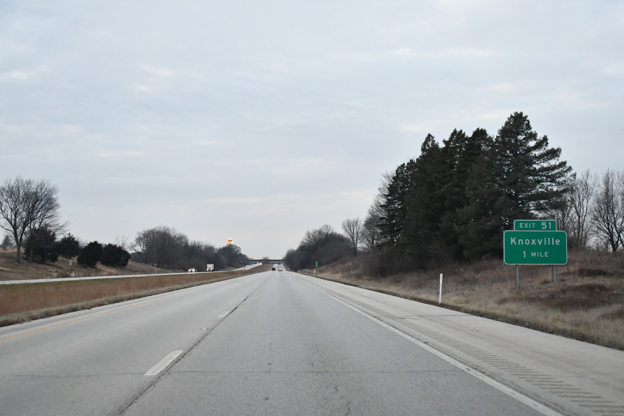
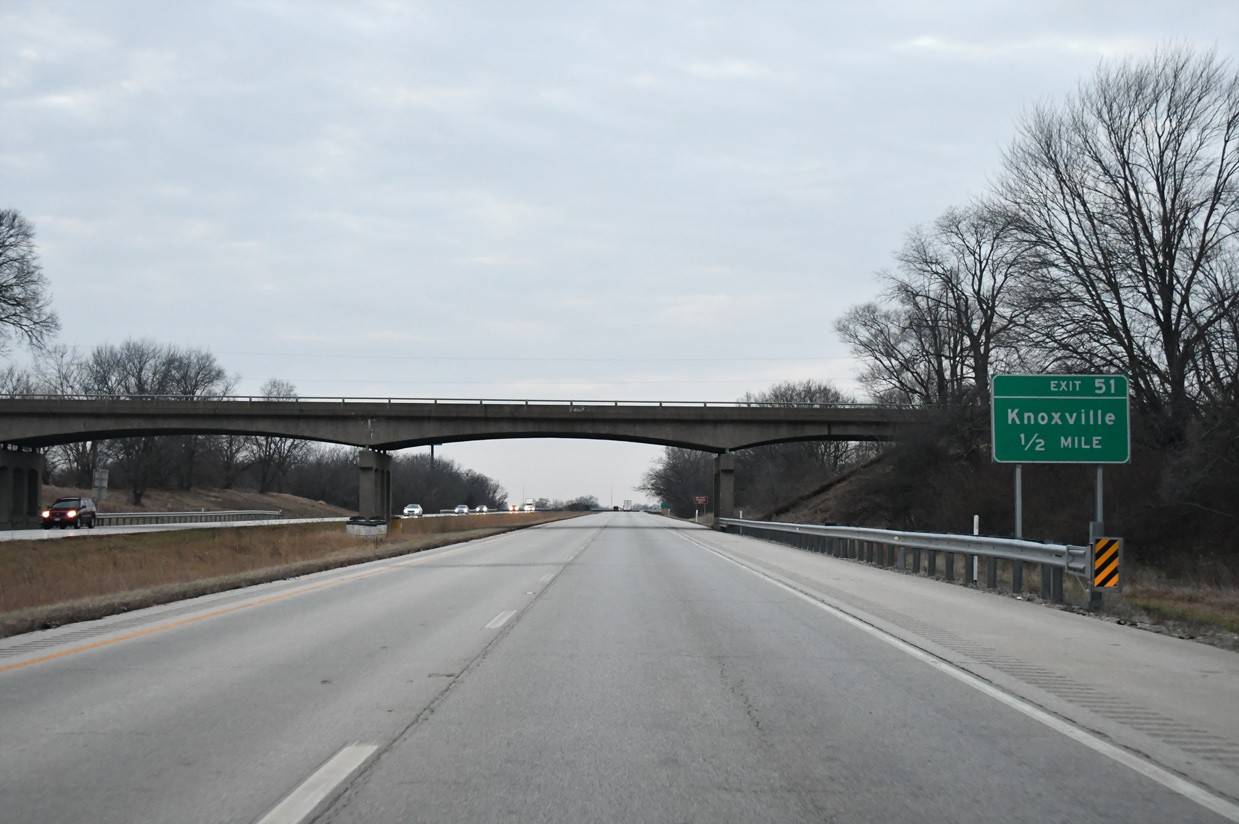
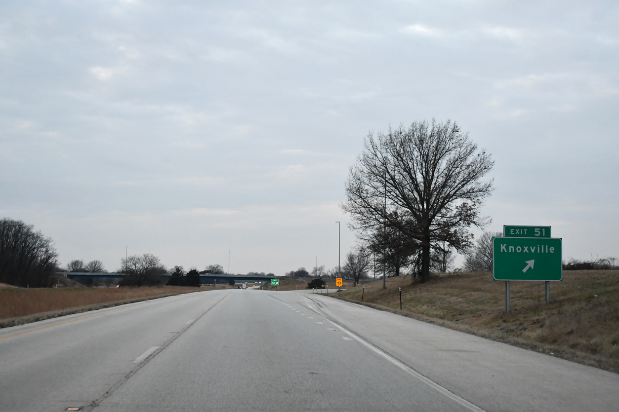
| Interstate 74 skirts north of Knoxville and meets Knox County Route 9 (Henderson Street) at a diamond interchange (Exit 51). 12/21/23 |
|
| One half mile east of Exit 51 to Knox County Route 9 at the Market Street overpass. CR 9 follows Henderson Street south to the U.S. 150 (Galesburg Road) split with West Main Street. CR 10 stems west from Henderson Street nearby to IL 41 and south Galesburg. 12/21/23 |
|
| CR 9 runs north from Exit 51 into East Galesburg, eventually meeting U.S. 34 near Interstate 74 at Exit 46.
An $8.9 million project replaced the CR 9 overpass at Exit 51 between April 2016 and August 2017.1 12/21/23 |
|
| Making the northward turn toward the Quad Cities, Interstate 74 crosses the Galesburg city line. 12/21/23 |
|
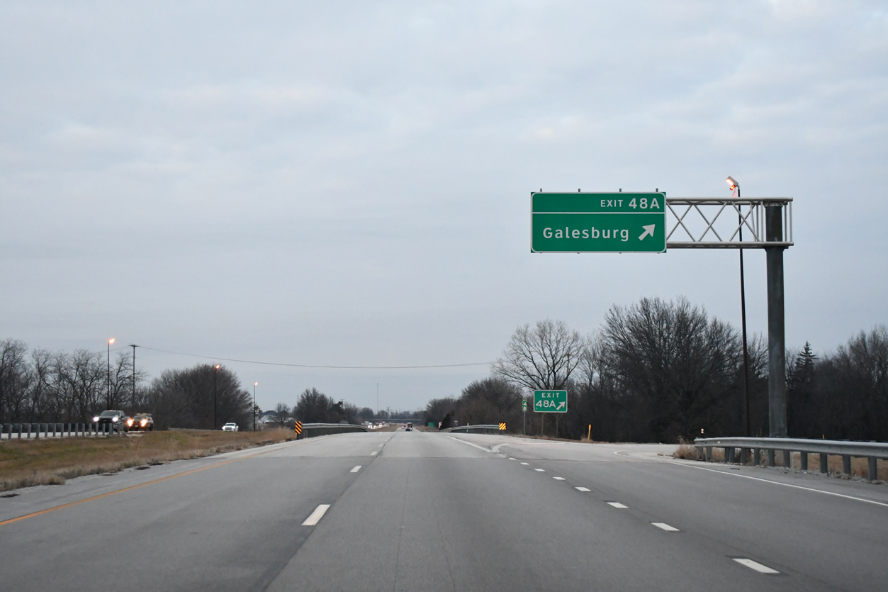
| The first of two Galesburg exits joins Interstate 74 with E Main Street at a parclo interchange in one mile. 12/21/23 |
|
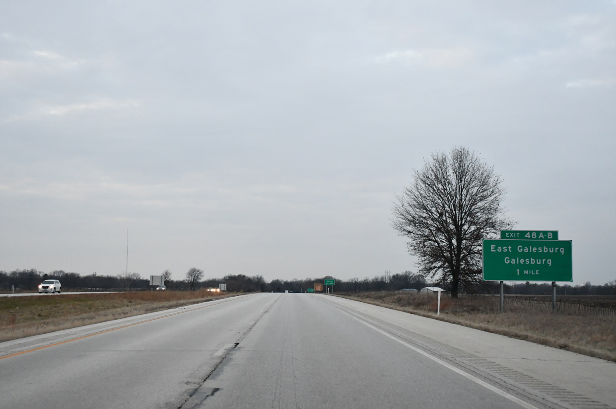
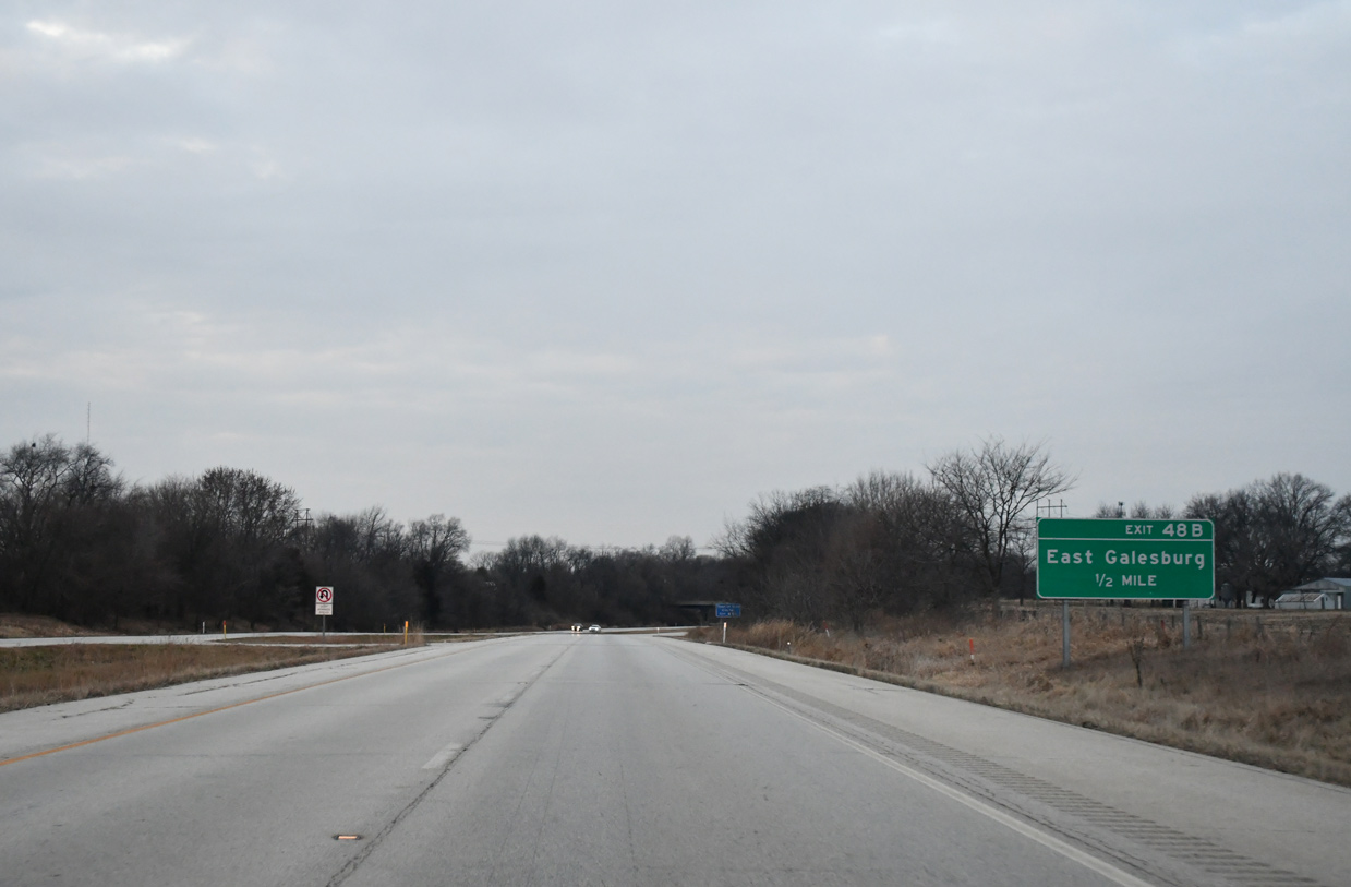
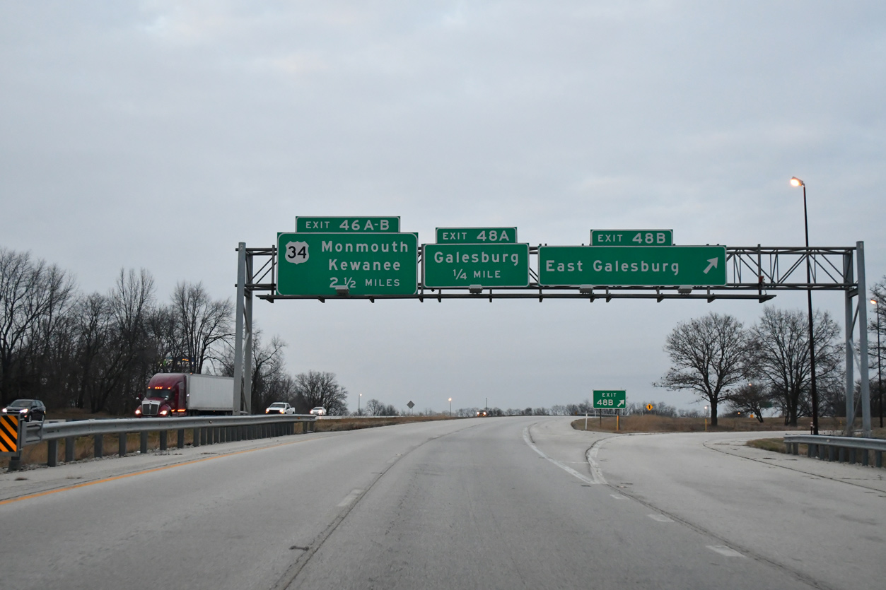
| Exit 48 B links I-74 west with eastbound East Main Street to the village of East Galesburg and State Street (CR 9). 12/21/23 |
|
| Exit 48 B leaves I-74 west for East Galesburg. Exit 48 A loops onto westbound E Main Street to Downtown Galesburg. U.S. 34 ties into Interstate 74 in 2.5 miles from a northerly bypass of the city at Exit 46. 12/21/23 |
|
| E Main Street becomes a part of U.S. 150 west from Grand Avenue to Henderson Street. The Galesburg Amtrak station lies two blocks south of U.S. 150 along Seminary Street. 12/21/23 |
|
| I-74 runs along the west side of the Soangetaha Country Club golf course community between the BNSF Railroad underpass and the CR 7 (Fremont Street) over crossing. 12/21/23 |
|
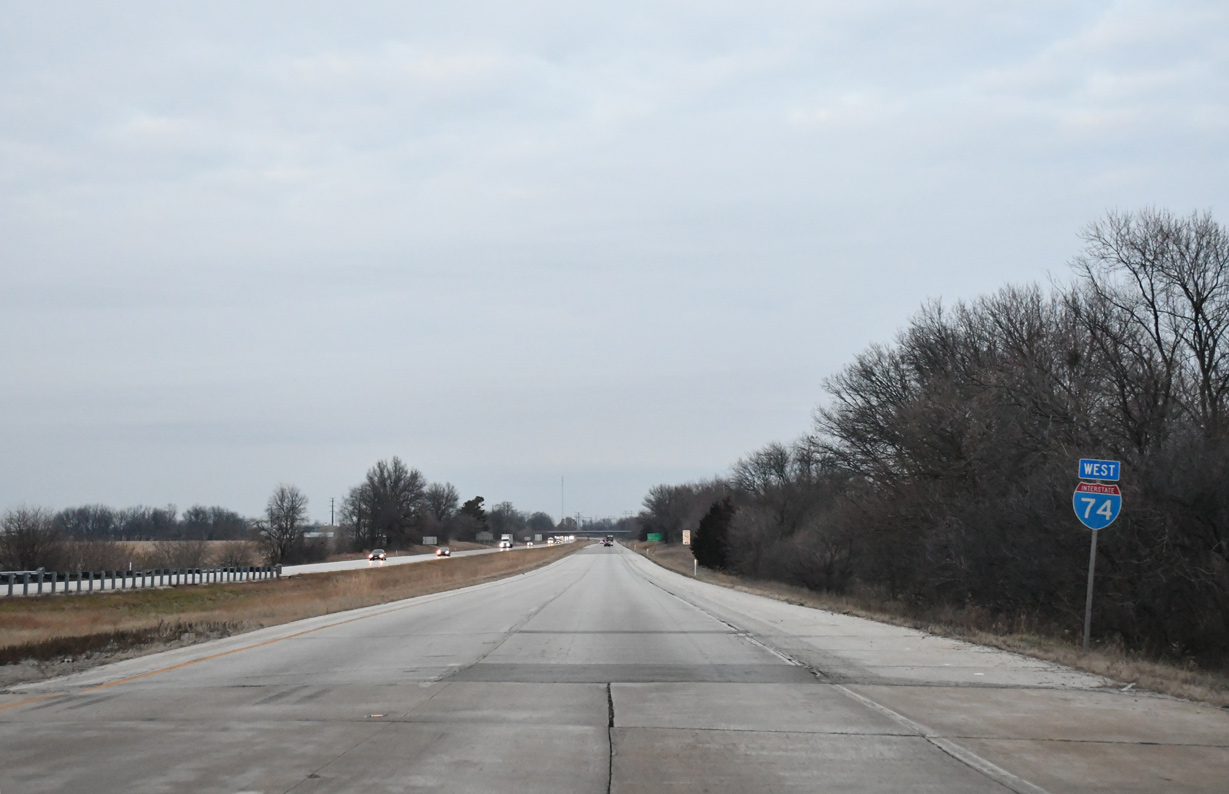
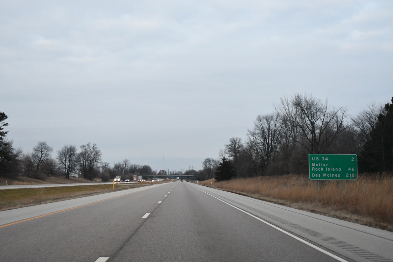
| The Illinois half of the Quad Cities debuts on Interstate 74 westbound distance signage, two miles south of Exits 46 B/A for U.S. 34. 12/21/23 |
|
| I-74 elevates across a BNSF Railroad line, AMTRAK and Lincoln Street (old U.S. 34) on the mile preceding U.S. 34. $10 million in road work replaced the I-74 bridges over Lincoln Street. The westbound structure was rebuilt in 2017, and the eastbound span was completed in 2018.2 12/21/23 |
|
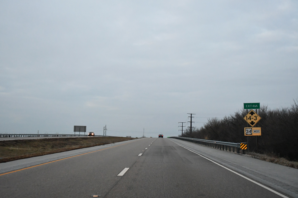
| Truckers are advised of the low clearance overpass for Knox Road 500 E, which spans the U.S. 34 freeway to the immediate west of Interstate 74. 12/21/23 |
|
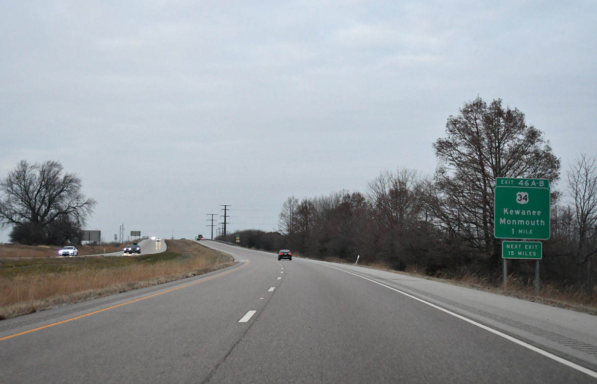
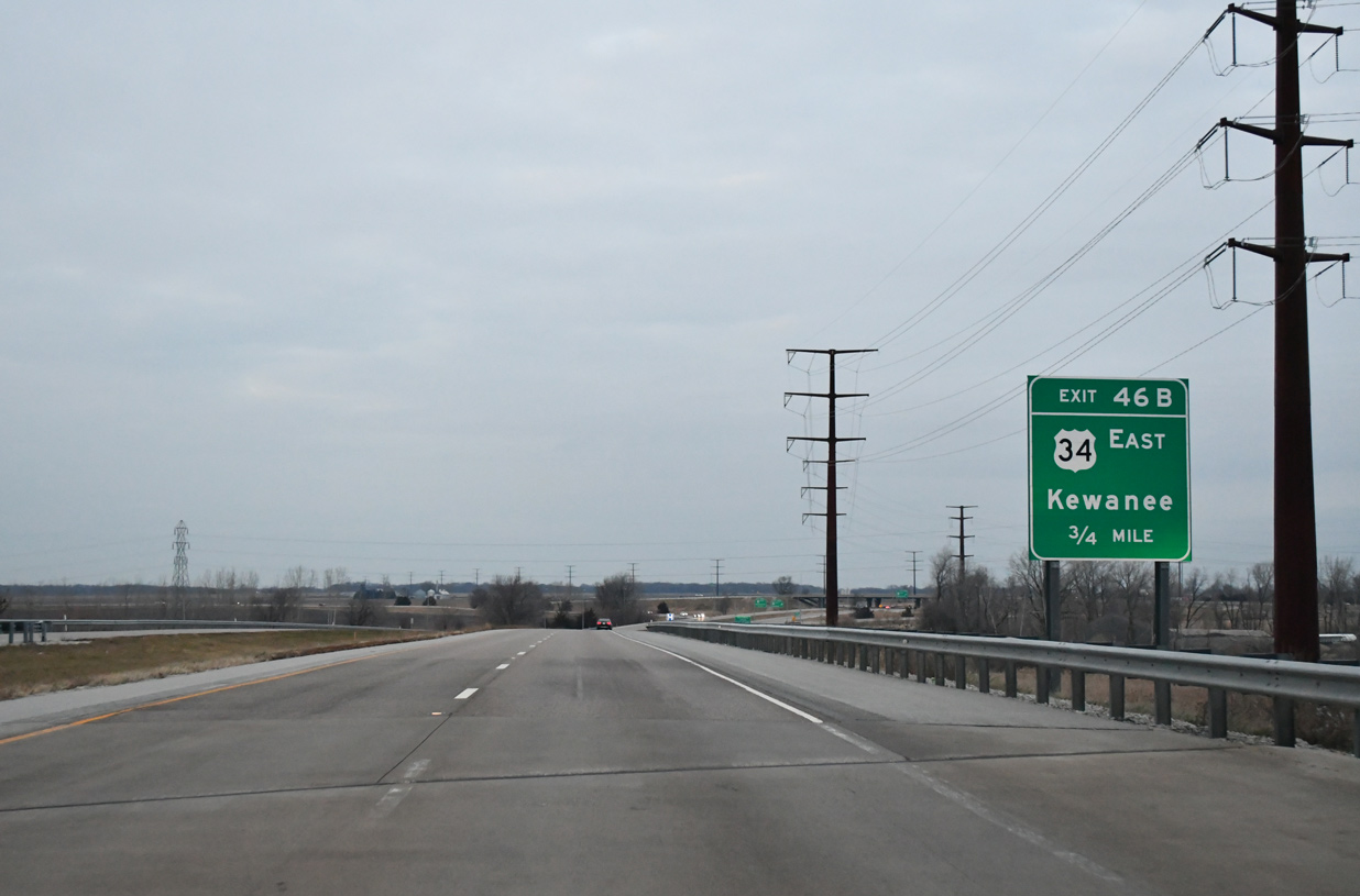
| Crossing over Lincoln Street (CR 40), 0.75 miles ahead of Exit 46 B for U.S. 34 east. Kewanee lies 38 miles to the northeast. 12/21/23 |
|
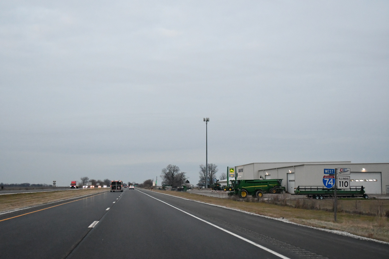
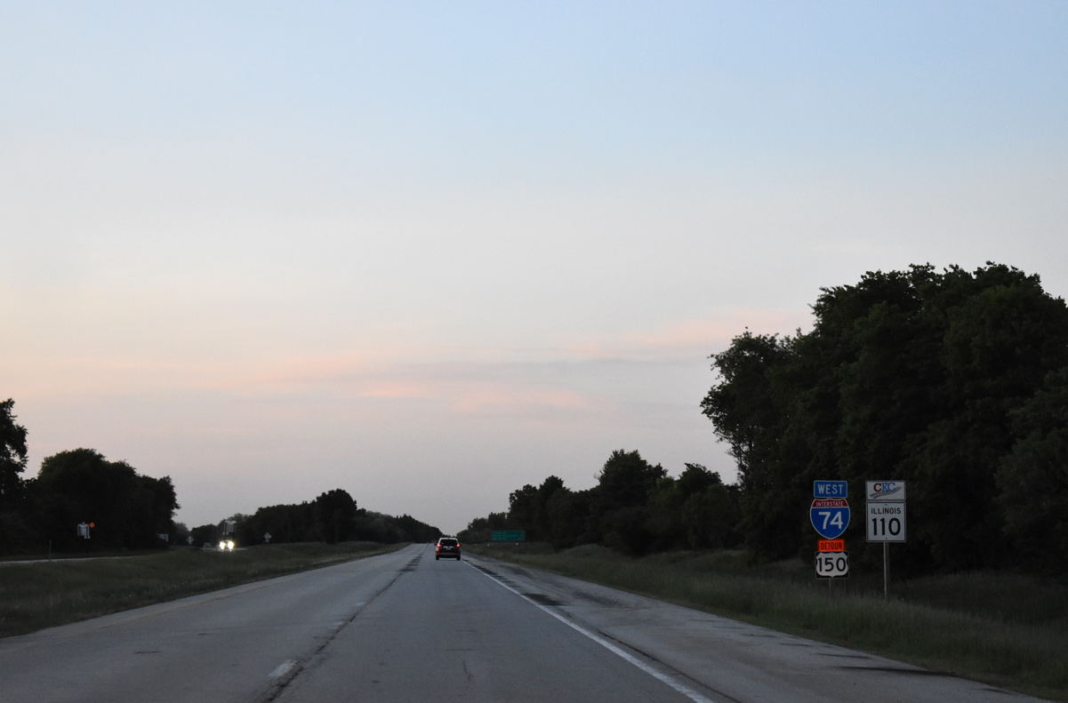
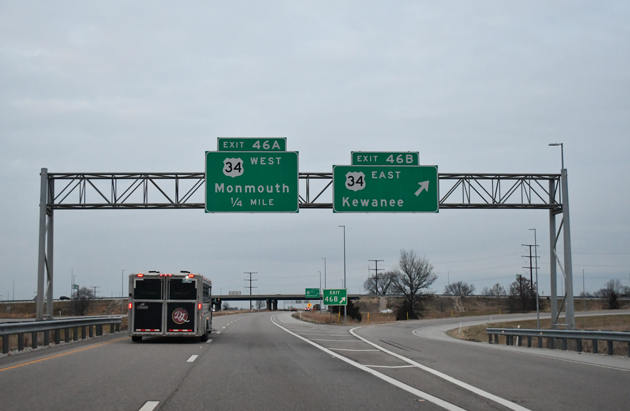
| Entering the cloverleaf interchange (Exit 46) with U.S. 34 on I-74 west. U.S. 34 constitutes a 223 mile route within the state of Illinois, ending at IL 43 near Chicago. 12/21/23 |
|
| Designated in Summer 2010, U.S. 34 west from Galesburg to Monmouth doubles as Illinois Route 110, the Chicago to Kansas City (CKC) Expressway. The CKC extends south along U.S. 67 from Monmouth toward Maccomb and north alongside I-74 to the Quad Cities.
These IL 110 trailblazers were removed after June 2023. 05/24/18 |
|
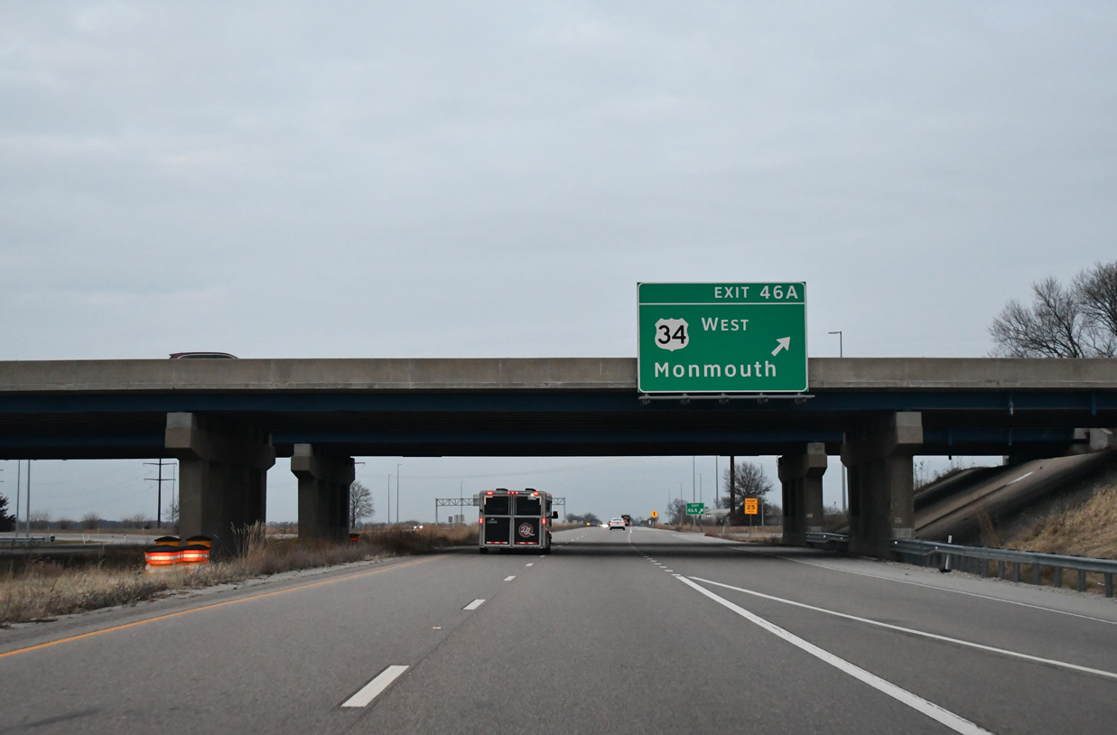
| U.S. 34 is a freeway for 11 miles from Exit 46 A around the north side of Galesburg to Monmouth in adjacent Warren County. A $13.1 million project closed the freeway from April 16 to October 1, 2018 to rebuild the roadway and make repairs to bridges and drainage systems.3 12/21/23 |
|
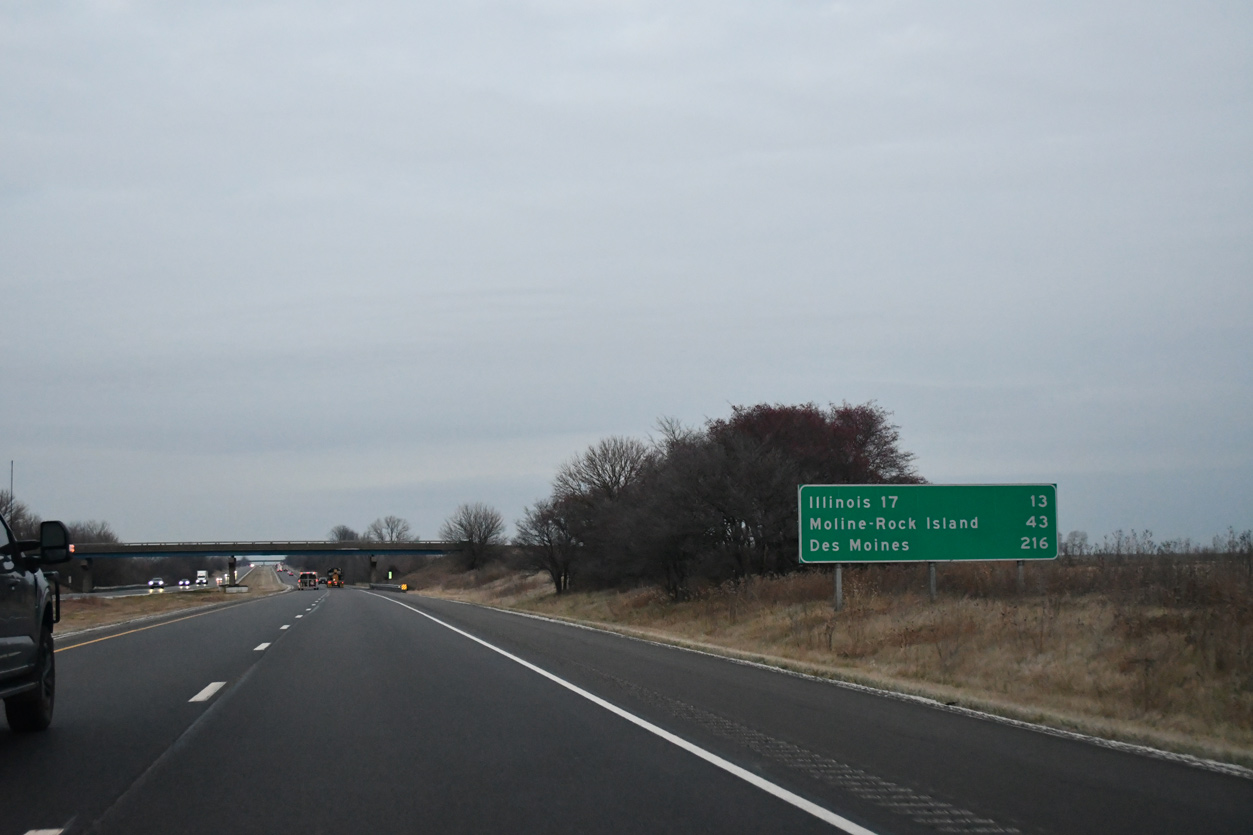
| Leaving Galesburg northward, I-74/IL 110 (CKC) pass between Henderson and Wataga along an 13 mile long uninterrupted stretch to IL 17 in southwestern Henry County. 12/21/23 |
|
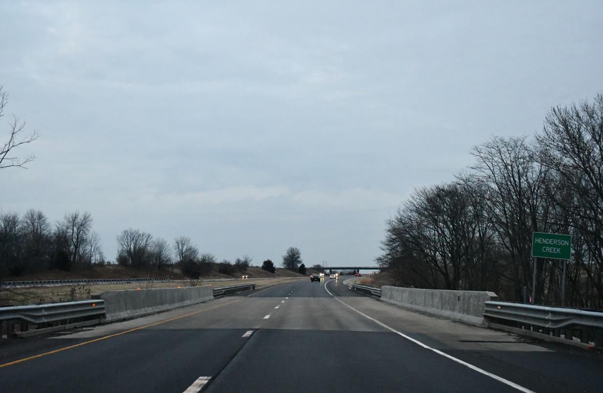
| Interstate 74 spans Henderson Creek ahead of the CR 37 overpass west of Henderson. 12/21/23 |
|
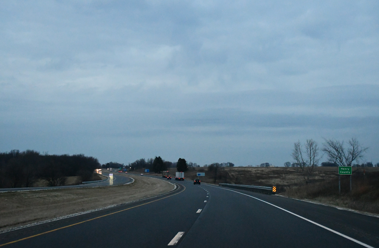
| Heading north from Pope Creek, I-74 advances across agricultural areas to the Henry County line. 05/24/18, 12/21/23 |
|
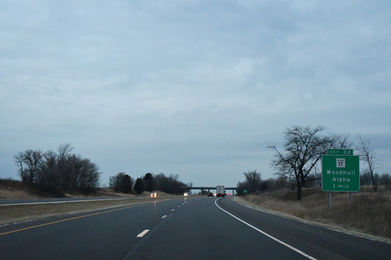
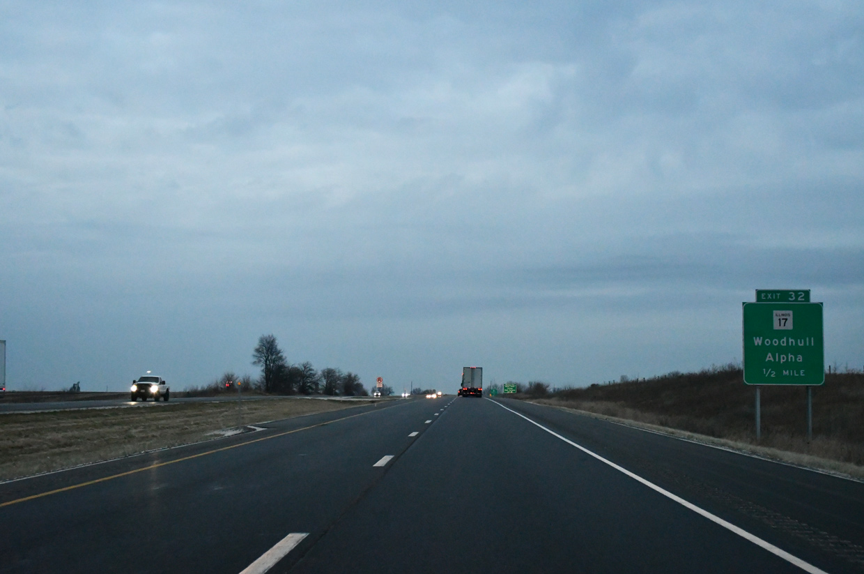
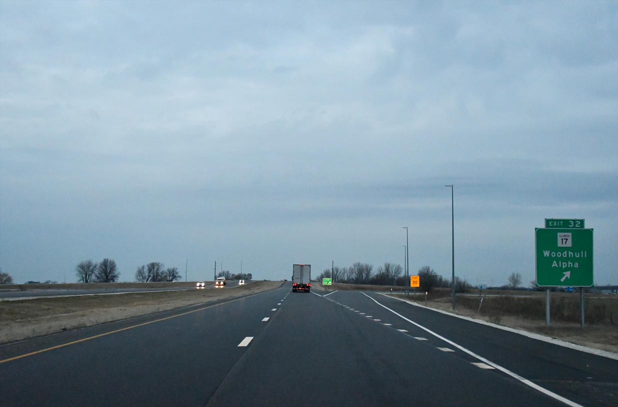
| Exit 32 is the first of three interchanges in Henry Interchange along I-74 west. Meeting the freeway in one mile is IL 17 (Highway Avenue) at the village of Woodhull. 12/21/23 |
|
| IL 17 heads west 2.5 miles to an overlap with U.S. 150 through Alpha. The state route continues west 20 miles to Aledo and 38 miles to New Boston along the Mississippi River. 12/21/23 |
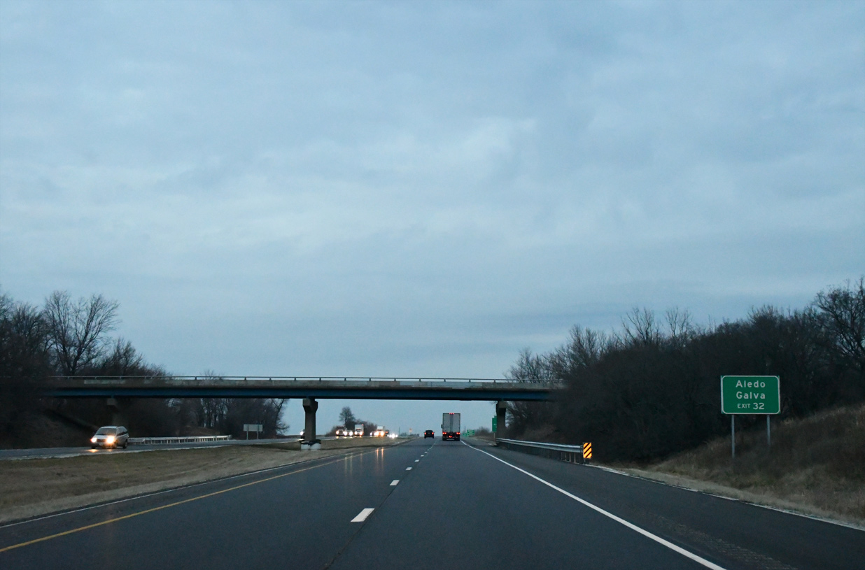
|
| A folded diamond interchange joins I-74/IL 110 (Chicago to Kansas City Expressway) with IL 17 at Exit 32. The exchange design remains from an abandoned railroad line that connected Galva with Viola. East from Woodall, IL 71 continues nine miles to combine with U.S. 34 near Bishop Hill, home of Black Hawk College East Campus. 12/21/23 |
|
| The roadways of I-74/IL 110 (CKC) separate ahead of Mud Creek. 05/24/18 |
|
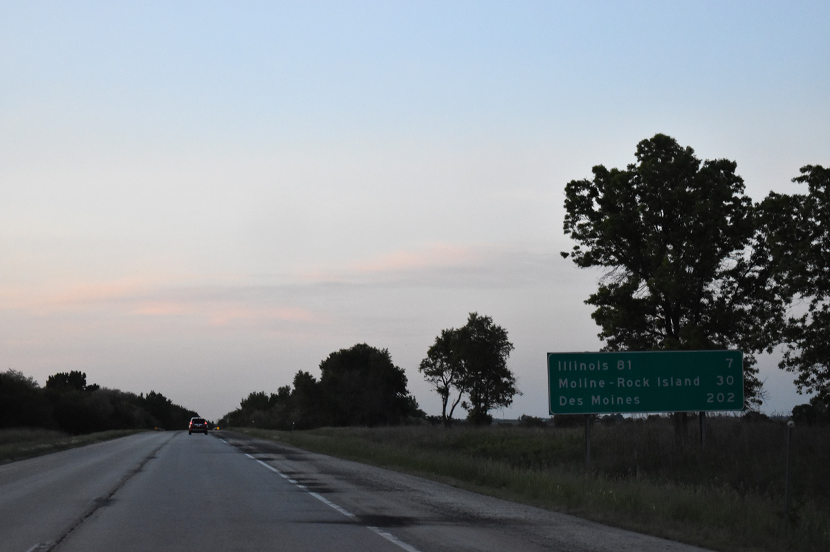
| IL 81 crosses paths with I-74/IL 110 in seven miles. Quad Cities is a half hour drive from this point. 05/24/18 |
|
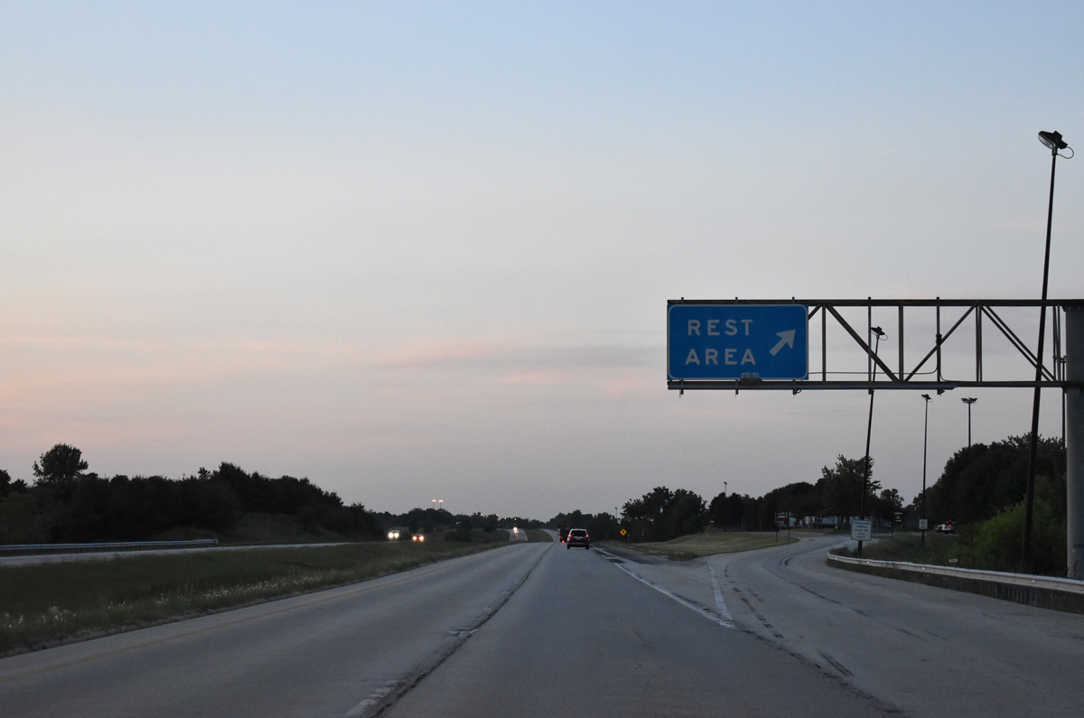
| The Krisdala Baka Rest Areas lines the westbound side of I-74/IL 110 at mile marker 28, midway between Woodall and the Edwards River. 05/24/18 |
|
| Westbound at the Krisdala Baka Rest Area. A 100 foot high wind turbine was installed at the area in March 2016 to supply the facility with electricity and cut utility costs.4 05/24/18 |
|
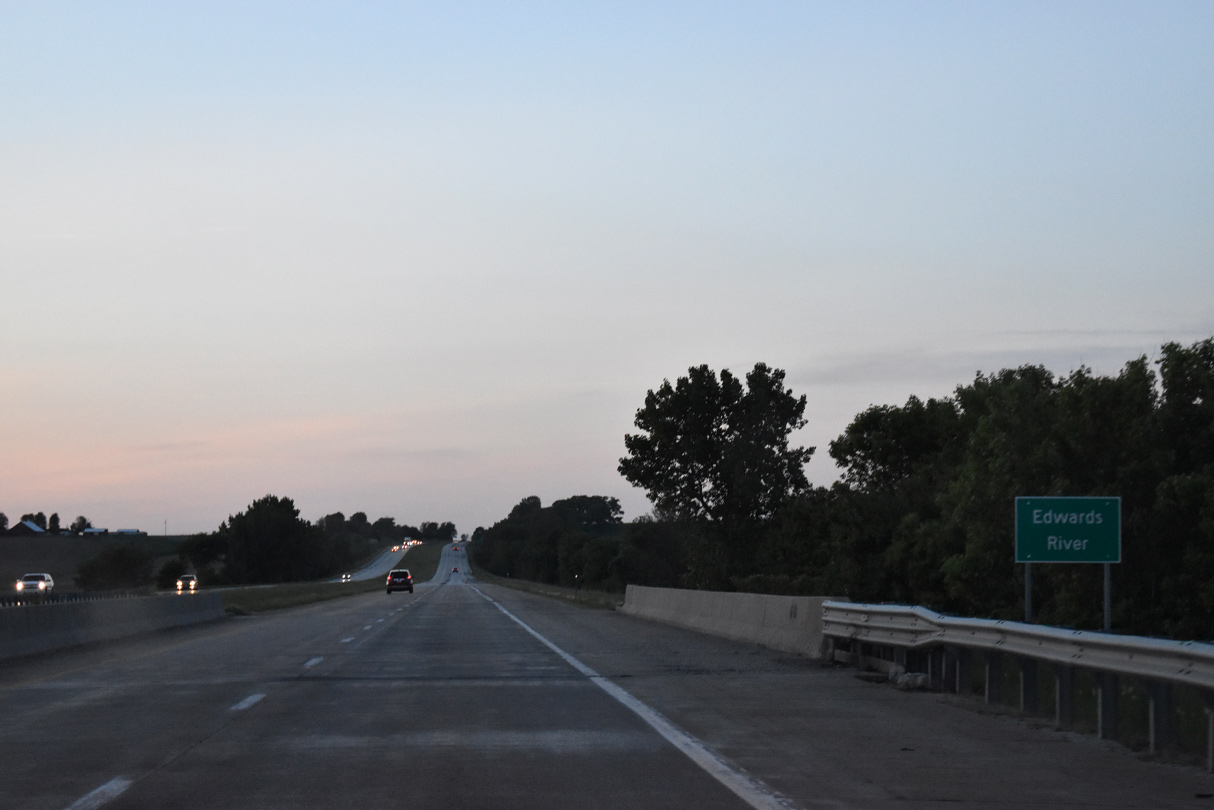
| The I-74 bridges across the Edwards River were built in 1968 and reconstructed in 1999. 05/24/18 |
|
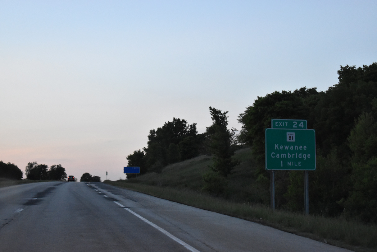
| I-74/IL 110 rise on a ridge north of the Edwards River, one mile ahead of a diamond interchange (Exit 24) with IL 81. 05/24/18 |
|
| Rural IL 81 connects I-74/IL 110 with the communities of Lynn Center to the west and Andover to the east. 05/24/18 |
|
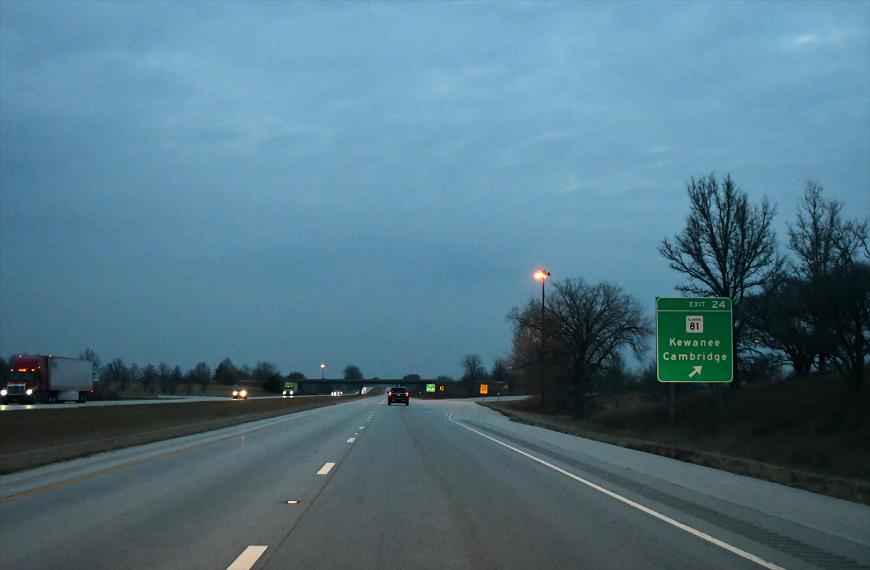
| Exit 24 parts ways with I-74 west / IL 110 east. IL 81 ends 2.4 miles to the west at U.S. 150. Eastward, the state route continues seven miles to the county seat of Cambridge and 23 miles to Kewanee, the eastern terminus. 12/21/23 |
|
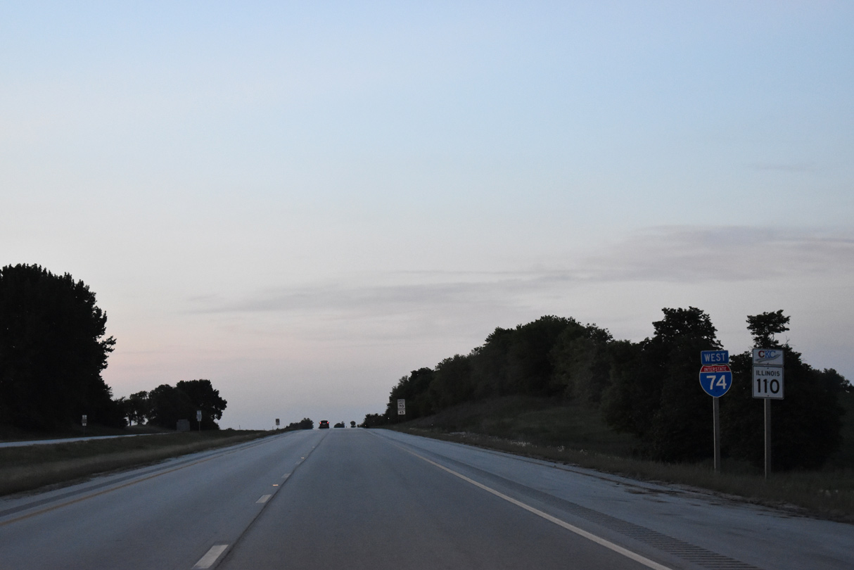
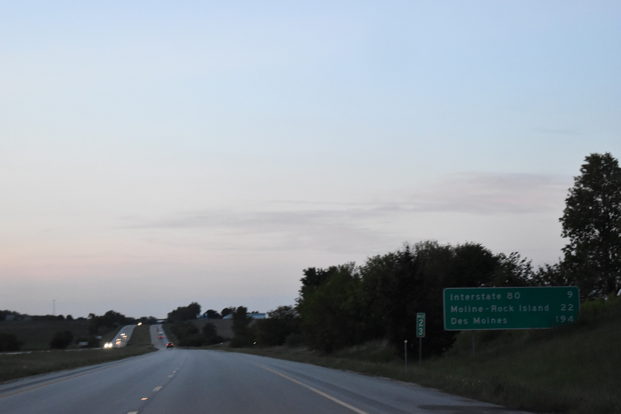
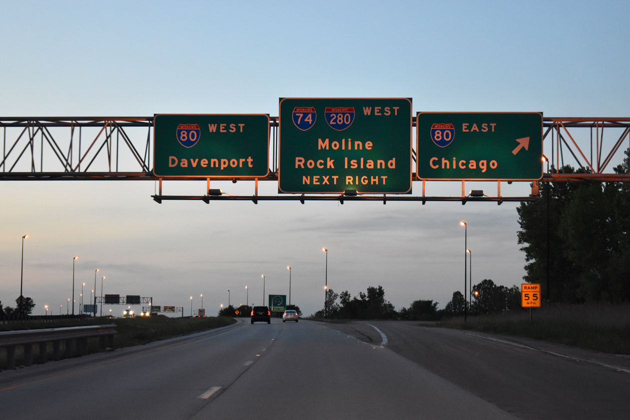
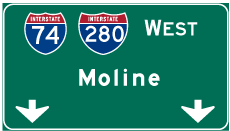
| Nine miles north, I-74/IL 110 converge with I-80 and I-280 west at the Big X interchange. Moline and Rock Island lie 22 miles to the northwest via I-74. 05/24/18 |
|
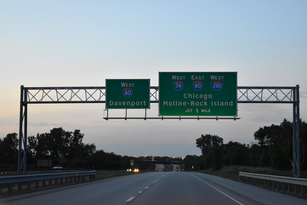
| The forthcoming cloverleaf interchange joining I-74, I-80 and I-280 is unnumbered. 05/24/18 |
|
| Constituting a 26.98 mile loop, Interstate 280 travels around the south and western side of the Quad Cities area. I-80 does the opposite to the east and north of the QCA. Travelers bound for the Iowa Capital City can use either route, as both generally bypass the urban areas of the Quad Cities. 05/24/18 |
|
| One mile south of I-80/280 near the N 1900th Avenue overpass on I-74 west / IL 110 east. Interstate 80 enters the Quad Cities area along a rural course west of from Joliet and the outskirts of Chicagoland. 05/24/18 |
|
| I-74/IL 110 lower to cross Mud Creek a half mile from Interstate 80 east to Chicago. I-80 travels 163.52 miles across Illinois from the Mississippi River to the Indiana state line by Hammond. 12/20/09 |
|
| Turning west, I-74 joins Interstate 280 for a 9.39 mile overlap to Quad City International Airport (MLI) and U.S. 6. There are no exits between I-80 and the airport. 12/20/09 |
|
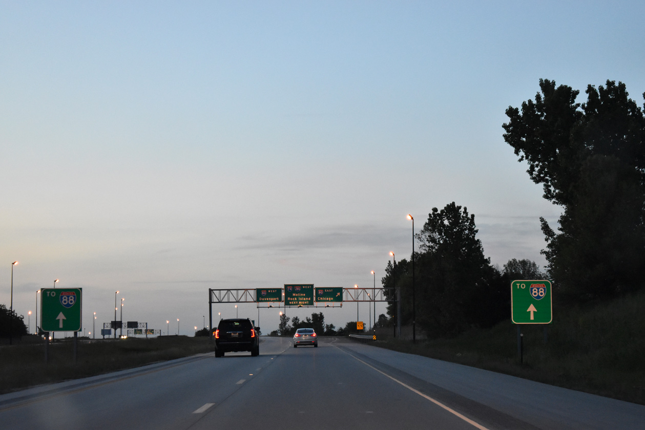
| IL 110 continues northward alongside I-80 west seven miles to Interstate 88. IL 110 (Chicago Kansas City Expressway) turns east alongside I-88 to Chicago. 05/24/18 |
|
| Interstate 80 generally stays south of Chicago, connecting with I-55, I-355, I-57, I-294 and I-94 between Joliet and Lansing City. I-80 west encircles the Quad Cities between Colona, Le Claire and northwest Davenport. 05/24/18 |
|
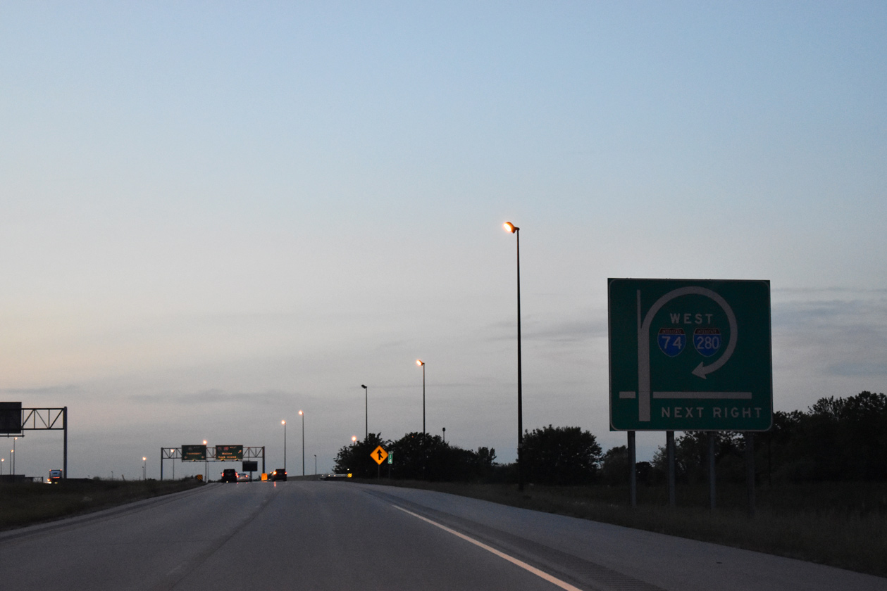
| The Interstate 74 mainline makes a TOTSO (turn off to stay on) movement via the loop ramp onto I-280 west for Moline and Rock Island. I-74 turns northward by MLI Airport, joining U.S. 6 for a northward course across the Mississippi River to Bettendorf and Davenport, Iowa. 05/24/18 |
Page Updated 01-16-2024.

 West
West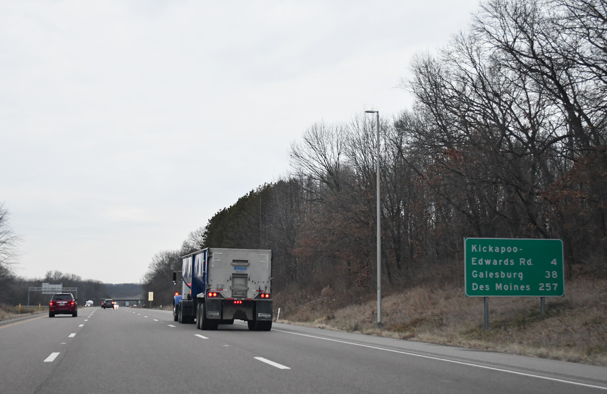


 East
East