|
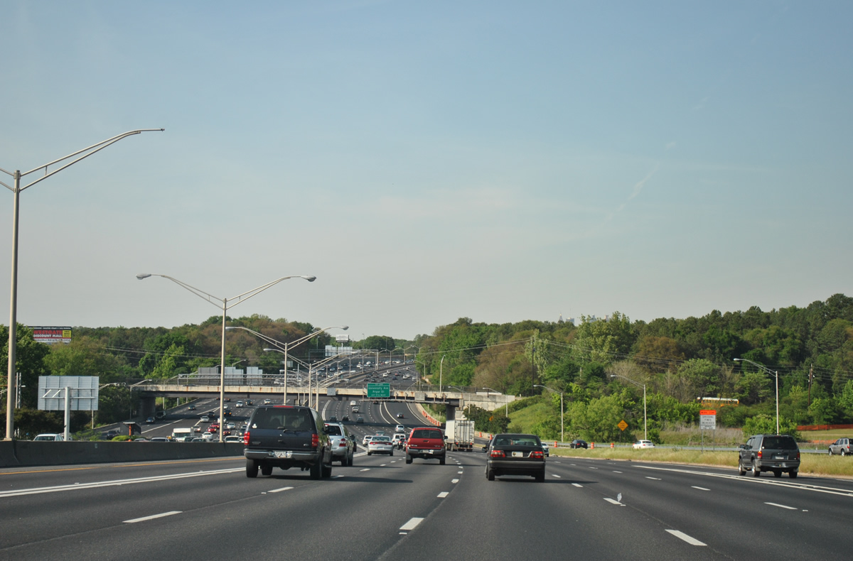
| I-75/85 expand to 12 overall lanes in the valley north of Langford Parkway (SR 166). The inside lanes of both roadways are restricted to HOV-2 eligible vehicles. 04/13/12 |
|
| Ramps from SR 166 add a seventh northbound lane to the Downtown Connector. A diamond interchange (Exit 244) follows in 1.25 miles with University Avenue (SR 54 south) by Pryor Street. 10/22/15 |
|
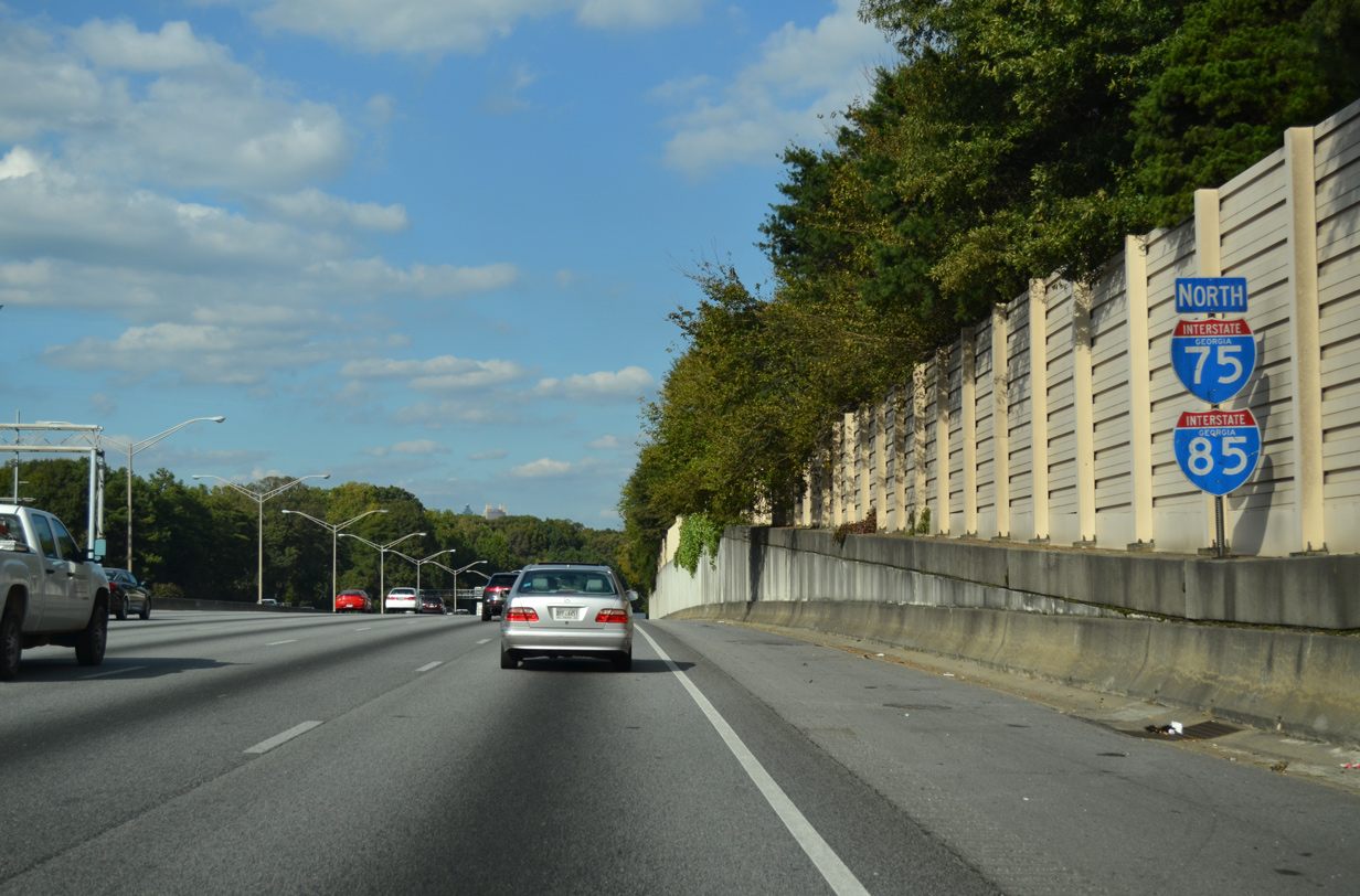
| The first set of shields for I-75/85 north stand along the 14 lane freeway below the Belmar Lavilla community. 10/22/15 |
|
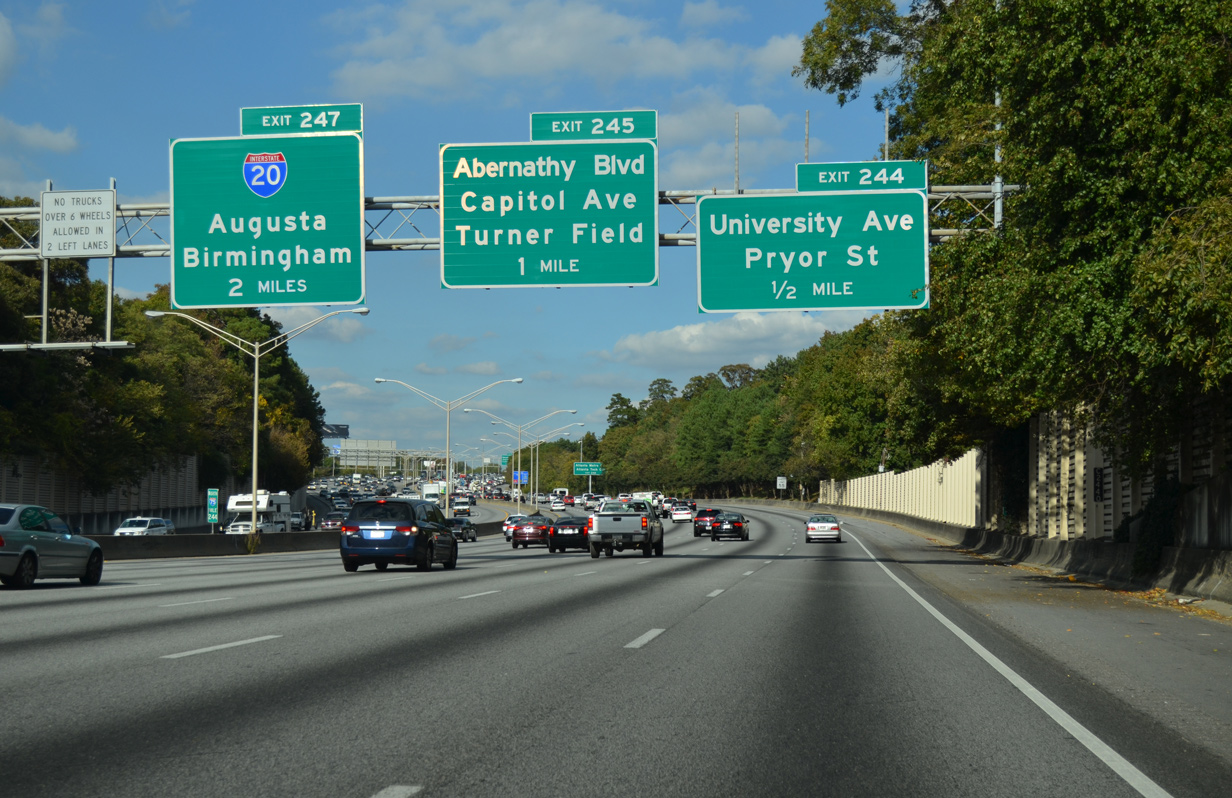
| Advancing toward the Capitol Hill Interchange (Exit 247) with I-20, the ensuing exit is for University Avenue. University Avenue leads west to U.S. 19/41 (Metropolitan Parkway) near Adair Park and Pittsburgh and east as SR 54 by High Point to McDonough Boulevard. 10/22/15 |
|
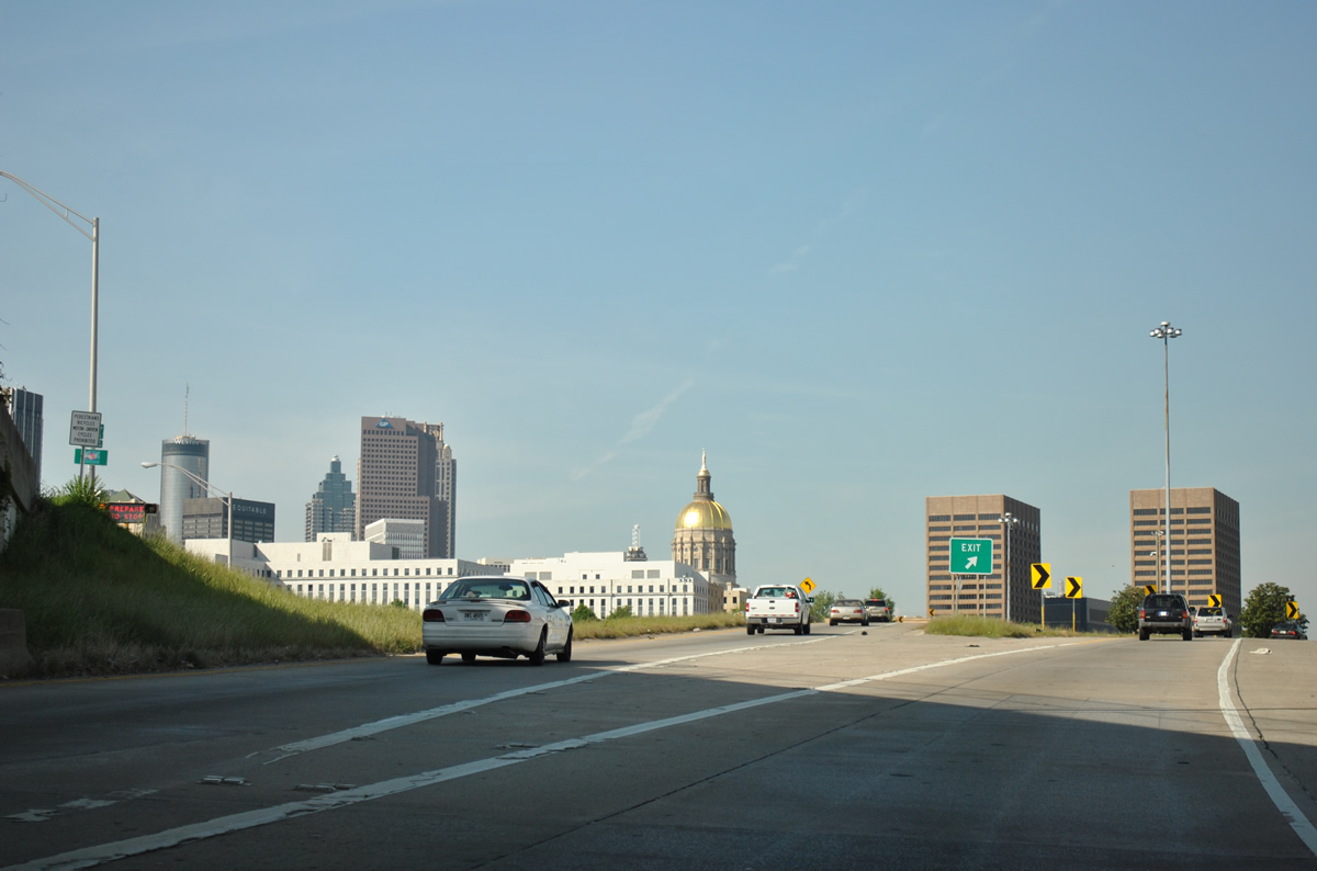
| Unmarked at Exit 244, SR 54 follows University Avenue east to McDonough Boulevard, and Jonesboro Road south through South Atlanta. The 70.50 mile long route previously met I-85 at Hogansville. Points of interest for Exit 244 include Atlanta Metro College and Atlanta Technical College. 10/22/15 |
|
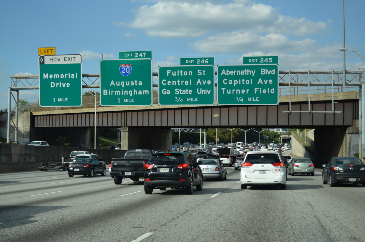
| Exit 245 links I-75/85 with Ormond Street east to Washington and Capitol Avenues. Succeeding exits follow for Fulton Street and Central Avenue north to Georgia State University, an HOV ramp for Central Avenue at Memorial Drive and Interstate 20. 10/22/15 |
|
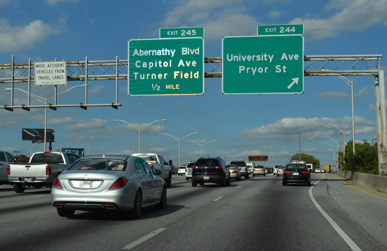
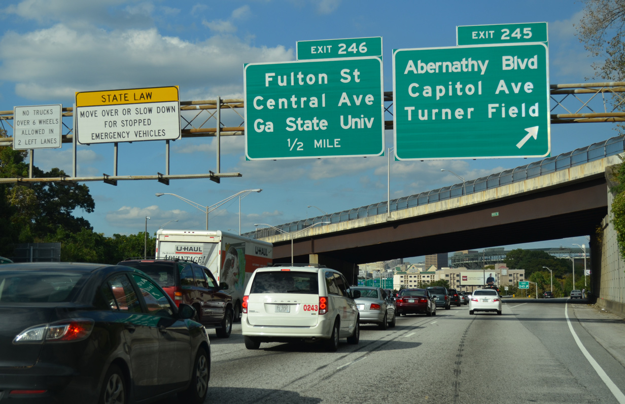
| Exit 245 leaves for Abernathy Boulevard and Capitol Avenue below Pryor Street. Center Parc Stadium, home of Georgia State University football, is located nearby. Previously named Turner Field, the stadium was built for the 1996 Olympic Games and was the home of the Atlanta Braves from 1996 to 2016. 10/22/15 |
|
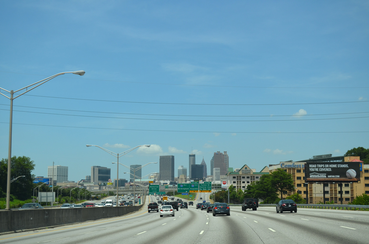
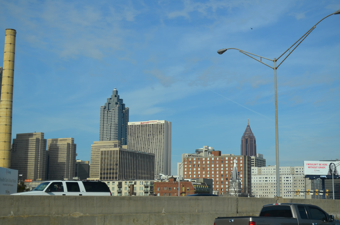
| Skyscrapers from the Atlanta central business district appear along I-75/85 north ahead of a Norfolk Southern Railroad crossing. 10/22/15 |
|
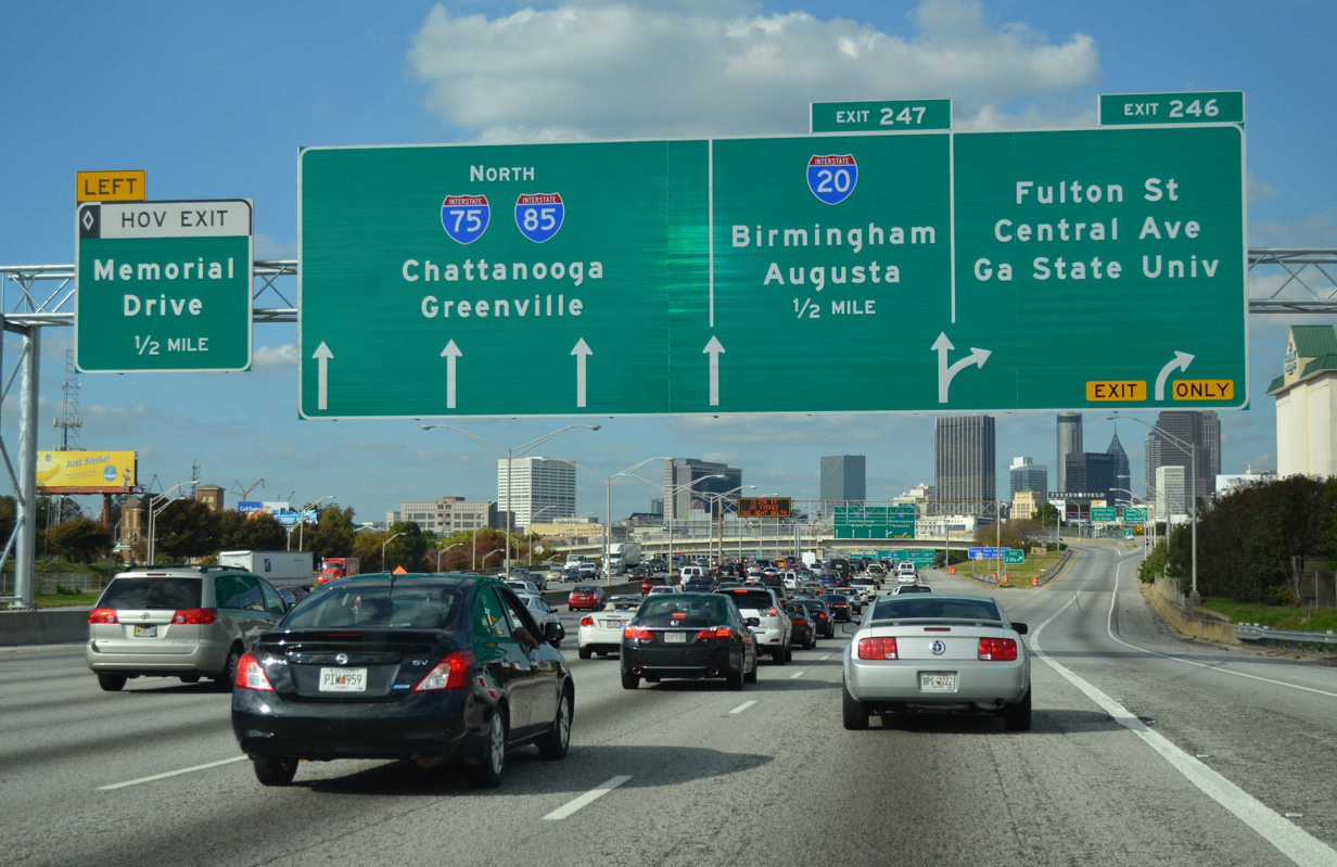
| Exit 246 partitions into a flyover for Central Avenue leading into Downtown Atlanta and a ramp north to Fulton Street between the Mechanicsville and Summerhill neighborhoods. Forthcoming I-20 leads to Douglasville and the western suburbs and east to Decatur, Conyers and Covington. 10/22/15 |
|
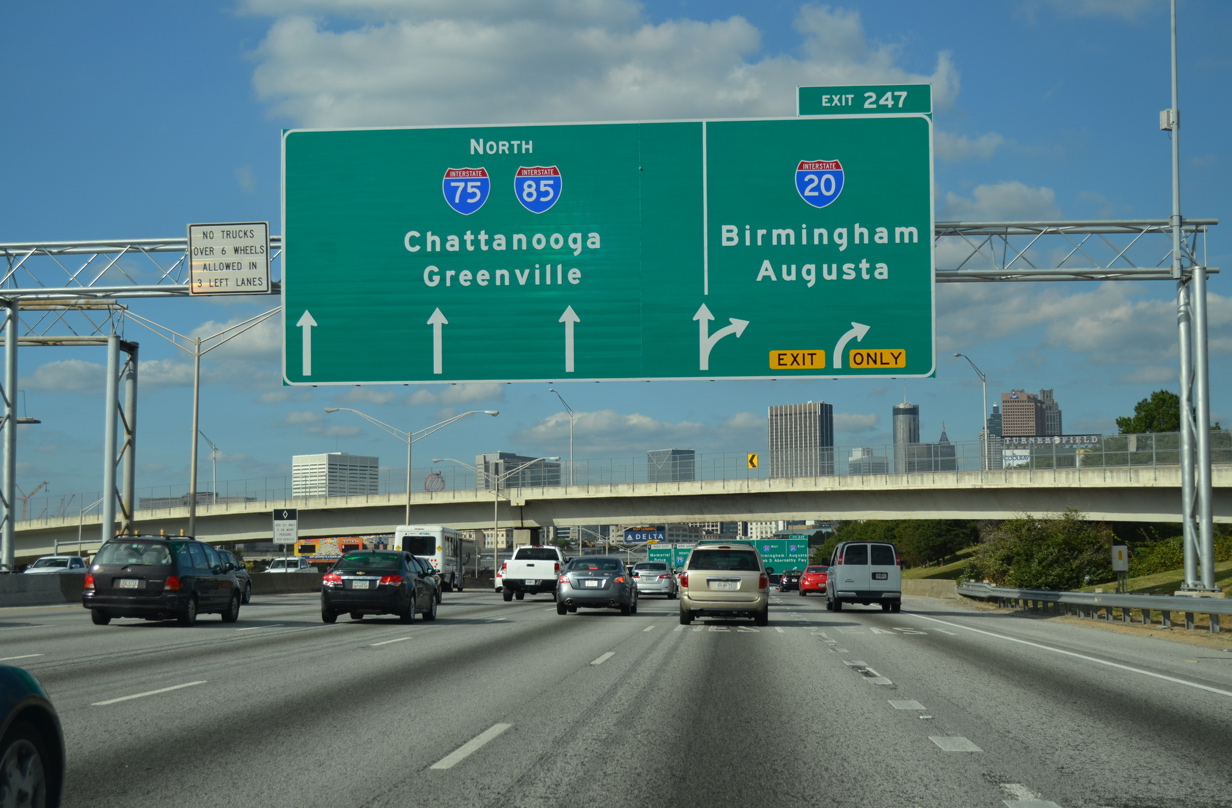
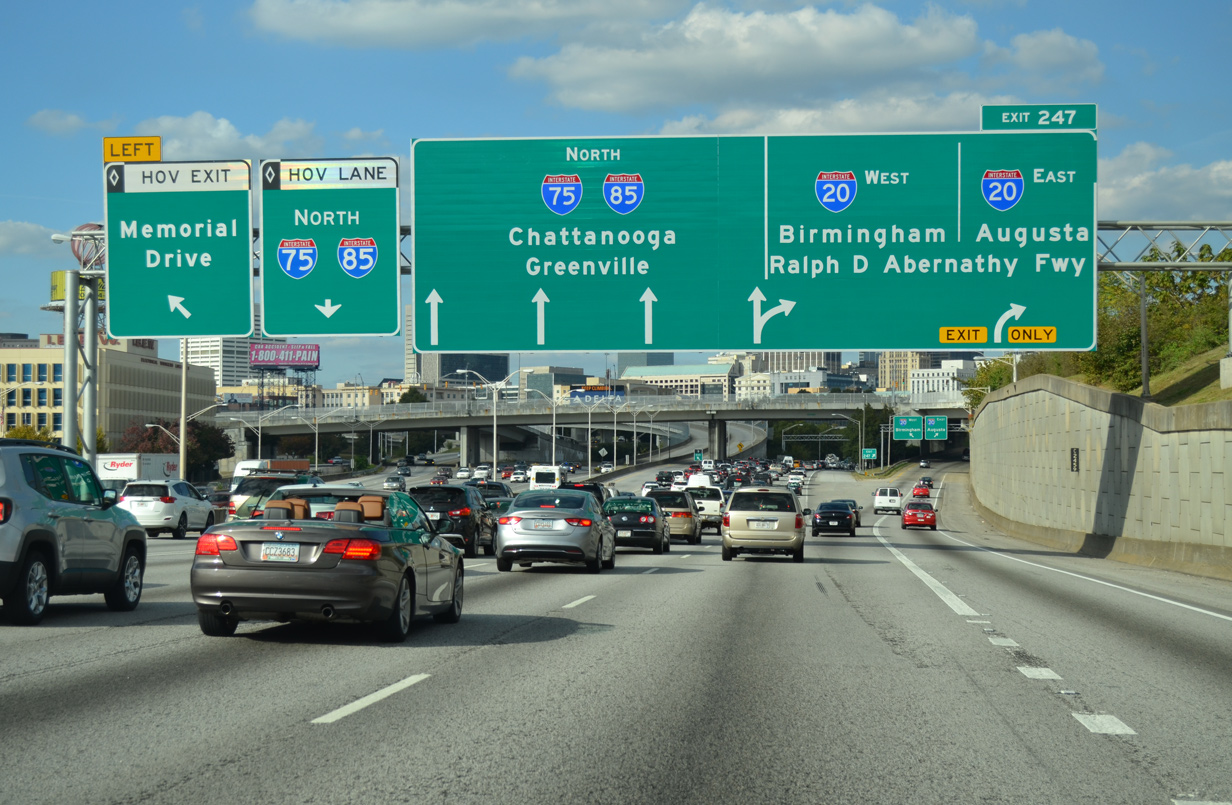
| Two lanes connect I-75/85 north with I-20 at Exit 247. Known as the Ralph D. Abernathy Freeway and formerly as the West and East Expressways, I-20 crosses the Atlanta metropolitan area between Birmingham, Alabama and Augusta along a 202 mile long course across the Peach State. 04/13/12 |
|
| Downtown Atlanta spreads to the northwest of the systems interchange with Interstate 20. 04/13/12 |
|
| A left exit departs from the HOV lane to Memorial Drive at the Capitol Hill Interchange with Interstate 20 (Ralph D. Abernathy Freeway). I-20 varies between 12 and 16 lanes through parts of Atlanta and is at least six lanes wide between mileposts 24 and 96. 10/22/15 |
|
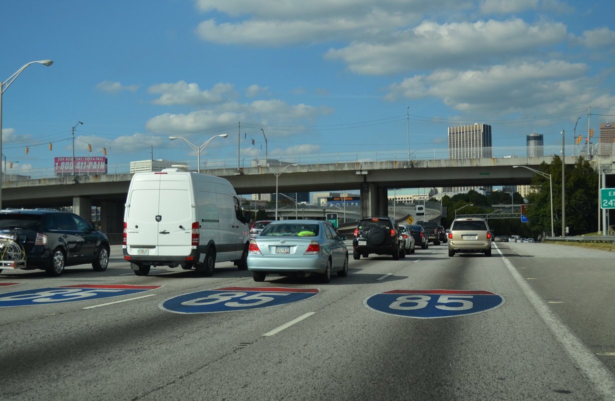
| Four general purpose lanes and one HOV-2 lane continue northward beyond I-20. Painted shields for the mainline were added in 2014. 10/22/15 |
|
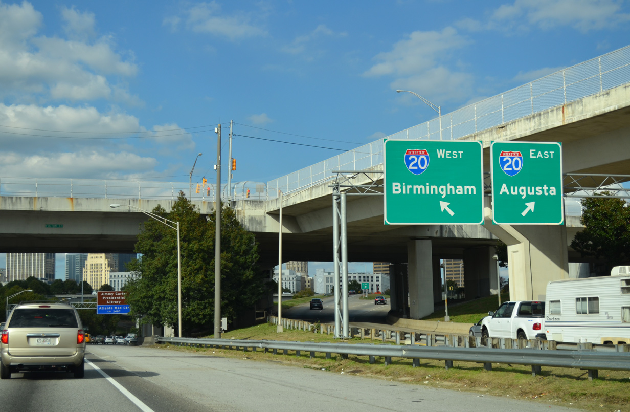
| Single lane ramps connect the Downtown Connector with I-20 west to Birmingham and east to Augusta. Overall I-20 stretches 1,539 miles from West Texas east to Dallas-Fort Worth, Shreveport, Louisiana, Jackson, Mississippi, and Columbia and Florence, South Carolina. 10/22/15 |
|
| Exit 247 partitions within view of the Georgia state capitol dome. 04/13/12 |
|
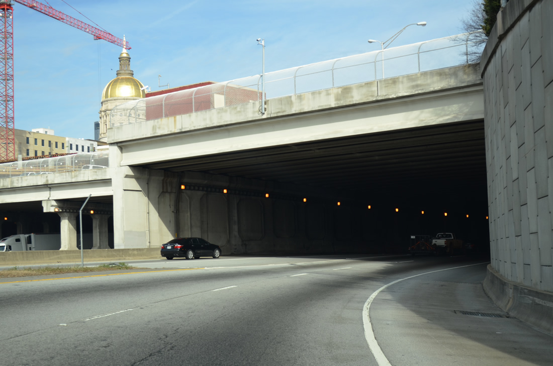
| The Georgia State Capitol dome appears as the Downtown Connector turns east by Georgia State University. The capitol complex lies at the corner of Capitol Avenue and Martin Luther King, Jr. Drive north of the forthcoming cut and cover tunnel. 10/22/15 |
|
| The Capitol Hill Interchange was redesigned as part of the "Freeing the Freeways" program between 1985 and 1988. The $107.4 million project eliminated left side ramps with the construction of new flyover ramps. 10/22/15 |
|
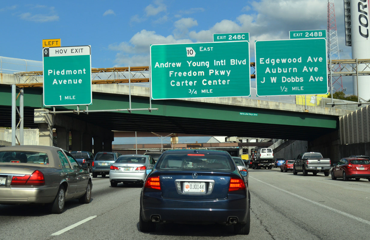
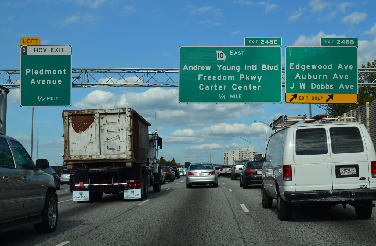
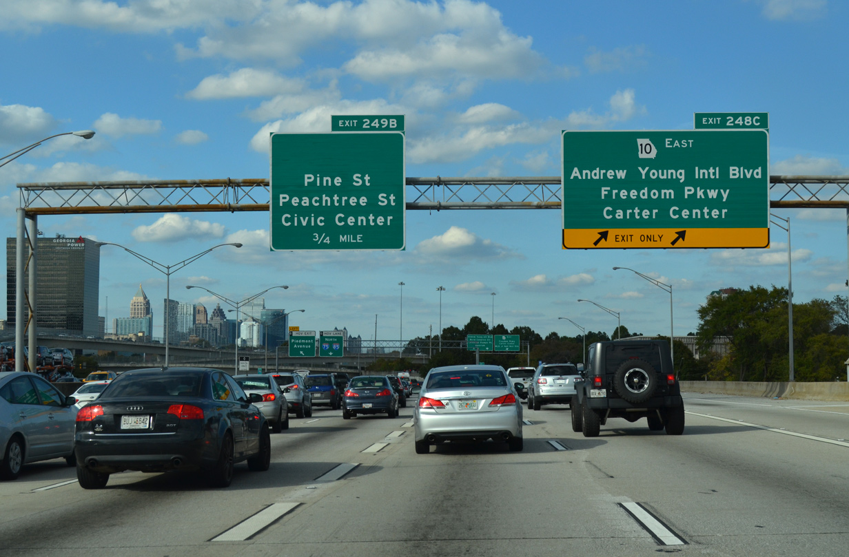
| The succeeding off ramps are for Edgewood Avenue (Exit 248 B), Anthony Young International Boulevard (Exit 248 C) and Peachtree Street (Exit 249 A). Exits 248 A and 249 A are assigned to ramps from the Downtown Connector southbound. 10/22/15 |
|
| Ramps from I-20 join I-75/85 north below a lid under the intersection of Memorial Drive and Capitol Avenue. 12/31/12 |
|
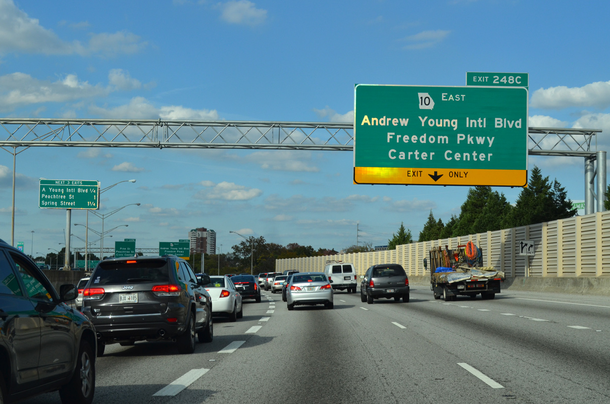
| I-75/85 continue north to a half diamond interchange (Exit 248 B) for Edgewood, Auburn and J.W. Dobbs Avenues. Exit 248 C immediately follows onto SR 10 (John Lewis Freedom Parkway) east to the Carter Center and Andrew Young International Boulevard west to Peachtree Center. 10/22/15 |
|
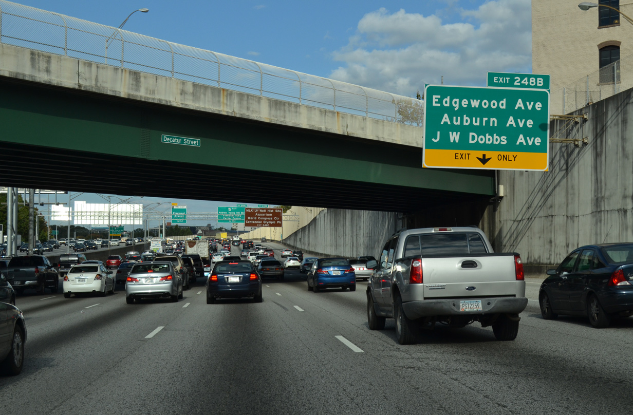
| A half diamond interchange (Exit 248 A southbound) adds an auxiliary lane from Martin Luther King, Jr. Drive north to Exit 248 B for Fort Street north at Edgewood Avenue. Edgewood Avenue leads west to Five Points. 10/22/15 |
|
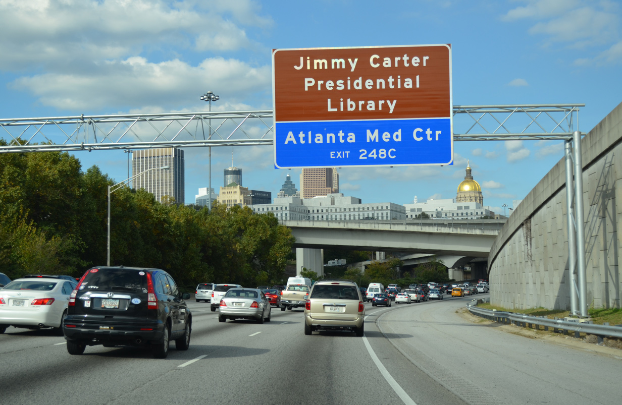
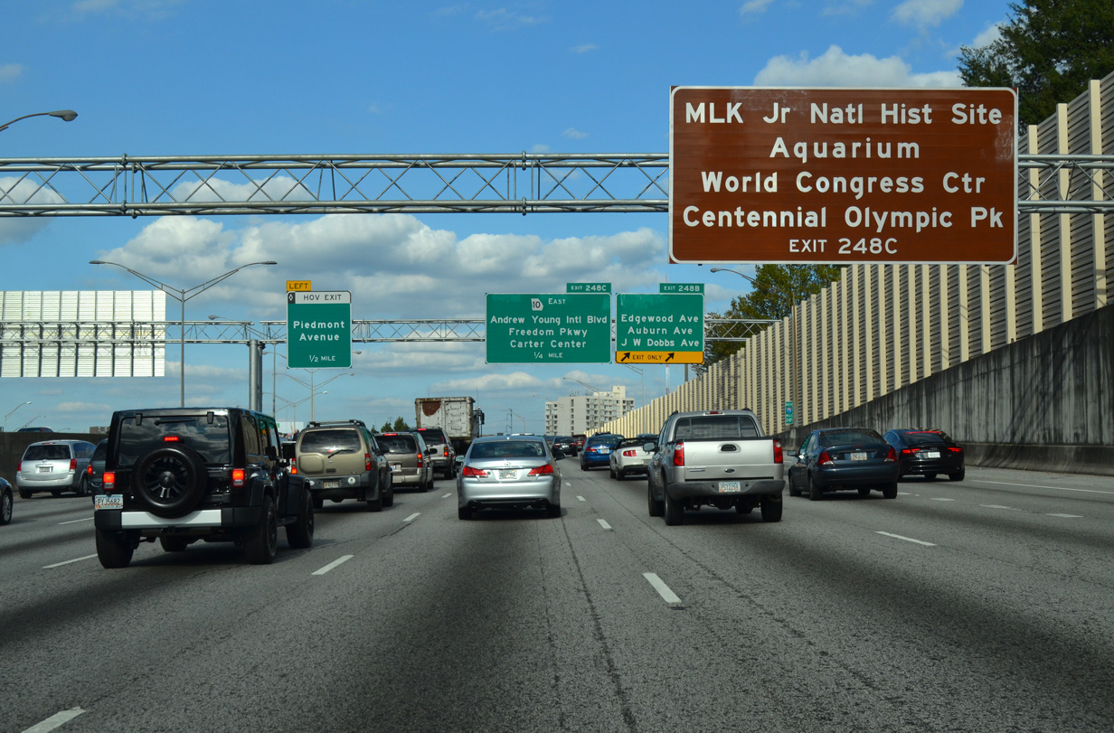
| Exit 248 C serves several points of interest including the Martin Luther King, Jr. National Historic Site, the Georgia Aquarium, Centennial Olympic Park, the Mercedes-Benz Stadium (home of the Atlanta Falcons and United FC), Phillips Arena (home of the Atlanta Hawks) and Atlanta Medical Center. 10/22/15 |
|
| Two lanes depart I-75/85 north at Exit 248 B for Fort Street and the three avenues. A pair of loop ramps originally joined Edgewood Avenue with the northbound Downtown Connector. 10/22/15 |
|
| I-75/85 pass over Auburn and Edgewood Avenues on a viaduct between two below grade sections of the Downtown Connector. 12/31/12 |
|
| Beginning at Exit 248 C, SR 10 (Freedom Parkway) east follows a short segment of the cancelled I-485. I-485 was an urban loop proposed northeast from I-75/85 through Virginia Highland and Morningside-Lenox Park to I-85 (Northeast Expressway) near the exchange with SR 400. A second proposal for I-485 paralleled Highland Avenue east to Decatur and U.S. 78 (Stone Mountain Parkway). 10/22/15 |
|
| Exit 248 C splits into ramps above Irwin Street for SR 10 (John Lewis Freedom Parkway) east to the Jimmy Carter Center and Andrew Young International Boulevard west to Centennial Olympic Park, Georgia World Congress Center and Mercedes-Benz Stadium. 10/22/15 |
|
| SR 10 passes under Jackson Street ahead of Boulevard NE. Removing the overpass for Boulevard, SR 10 was rebuilt as Freedom Parkway during construction of the Jimmy Carter Center. The at-grade parkway extends northeast to U.S. 29-78-278 (Ponce De Leon Avenue) at Virginia Highland. 12/31/12 |
|
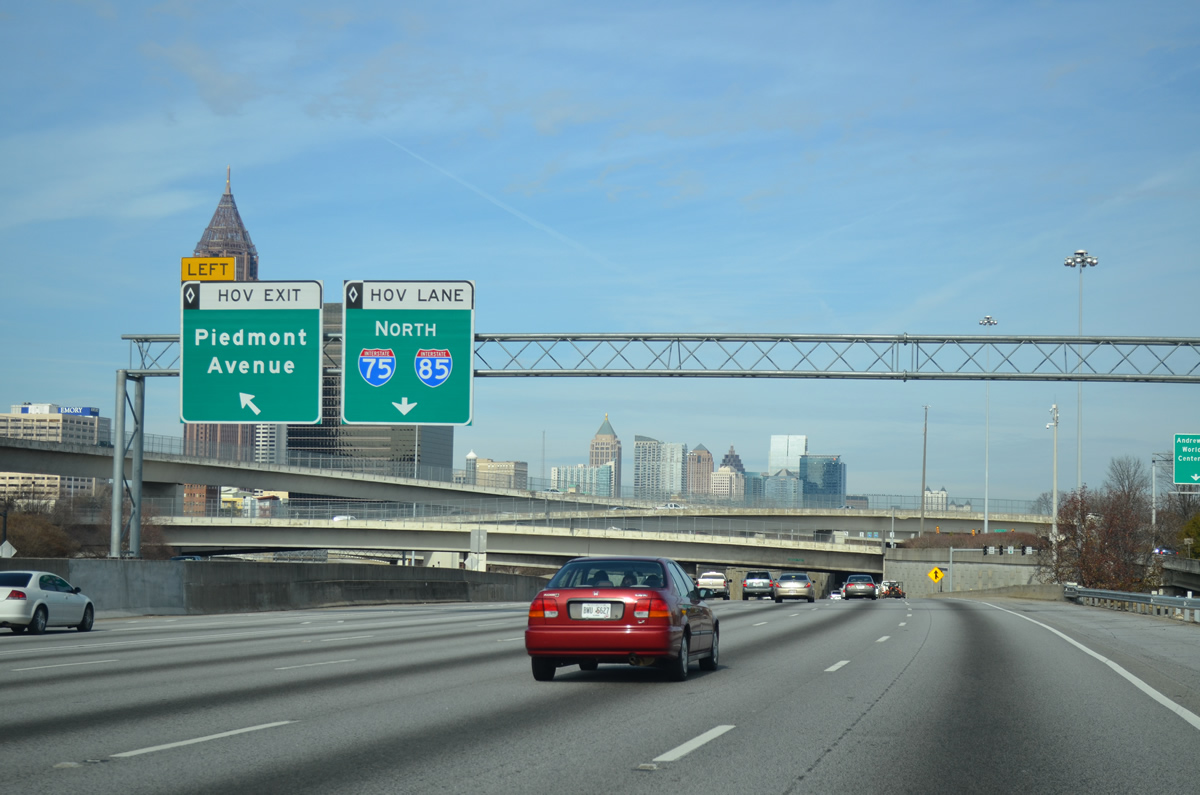
| A left exit departs from the HOV lane for nearby Piedmont Avenue at Baker Street within the directional T interchange at SR 10 (Freedom Parkway). 12/31/12 |
|
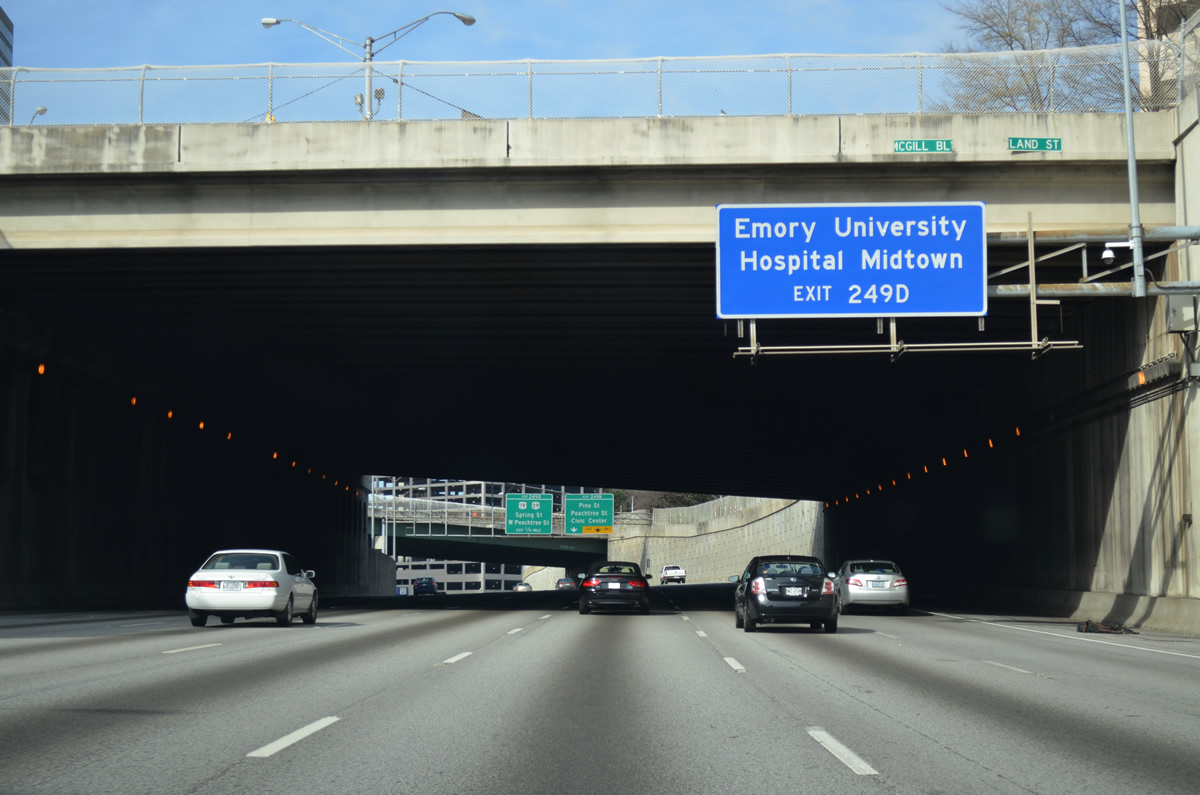
| I-75/85 passes below a lid under the intersection of Piedmont Avenue and Baker Streets. Exit 249 B follows for Pine Street east at Peachtree Street, two blocks ahead of the Atlanta Civic Center. Exit 249 D leads onto Spring Street (former U.S. 19) at Linden Avenue, one block south of U.S. 29-78-278 (North Avenue). 10/22/15 |
|
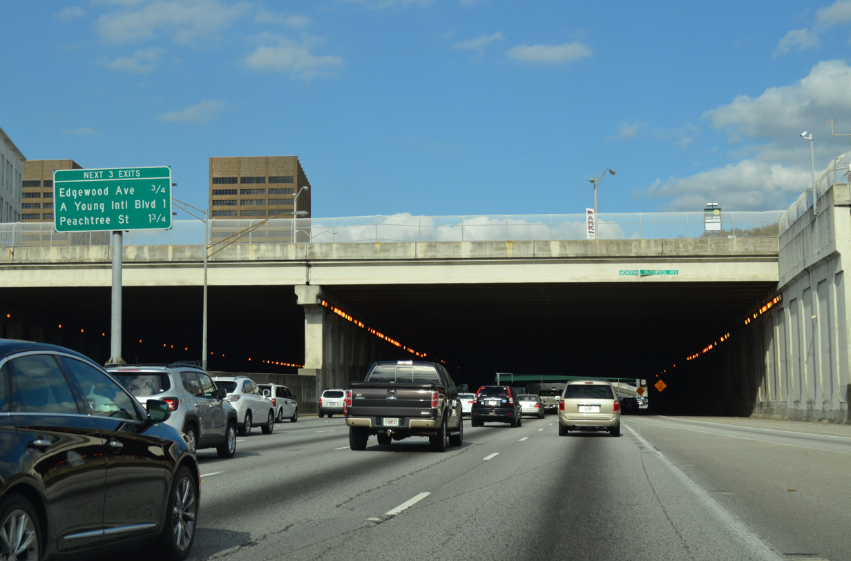
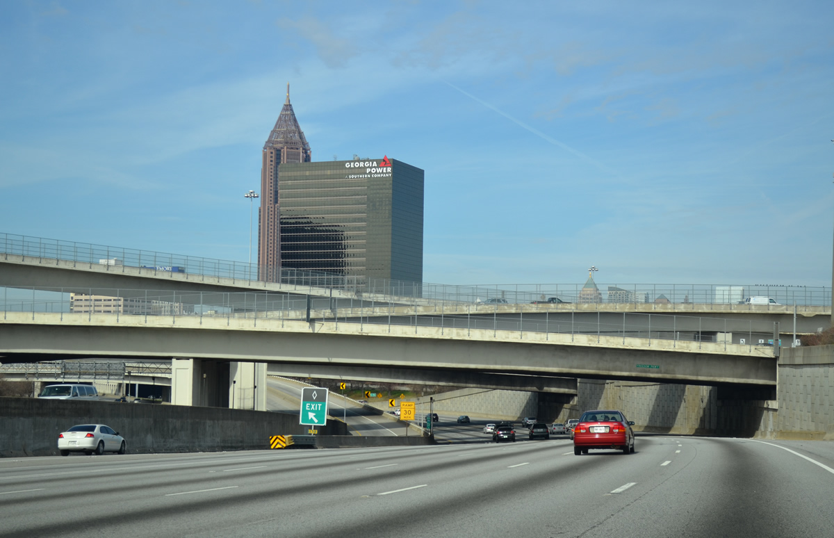
| The third tunnel on the Downtown Connector accommodates the intersection of Ralph McGill Boulevard and Courtland Street near the Civic Center. Three ramps depart I-75/85 north over the next 1.25 miles. 12/31/12 |
|
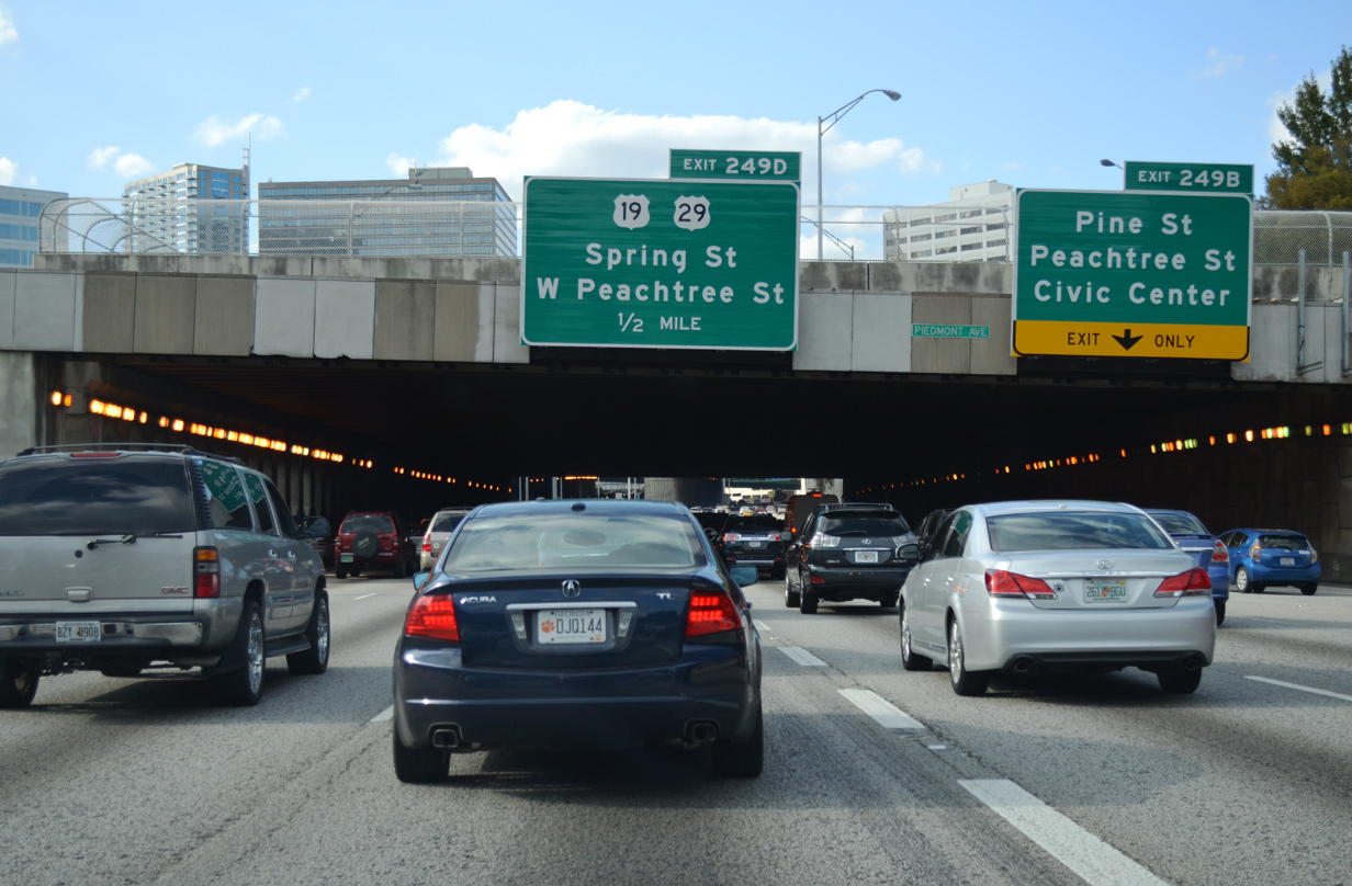
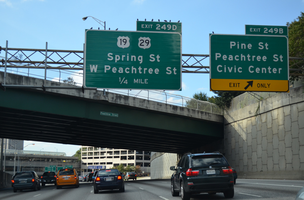
| Peachtree Street passes over I-75/85 north ahead of Exit 249 B to Pine Street. Peachtree Street splits with W Peachtree Street ahead of the Downtown Connector, with both heading north to Midtown.
Signs for Exit 249 D reference U.S. 19, which formerly lined Spring Street north from Peters Street and instead overlaps with U.S. 41 (Northside Drive) north to 14th Street. 10/22/15 |
|
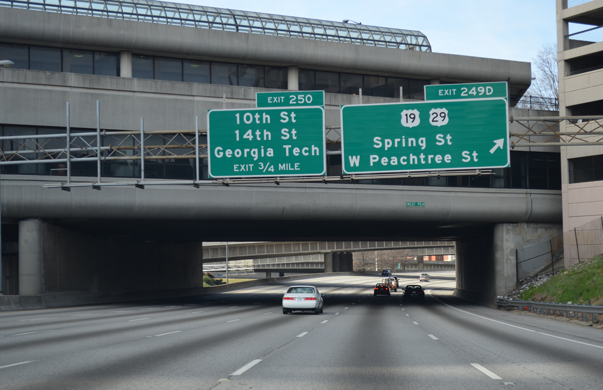
| Exit 249 D loops from I-75/85 north onto Linden Avenue east at Spring Street (former U.S. 19/29) and W Peachtree Street. U.S. 29 previously used Spring Street between Whitehall Street and North Avenue. The Downtown Connector next passes by the Georgia Institute of Technology to a half diamond interchange (Exit 250) with 10th Street. 12/31/12 |
|
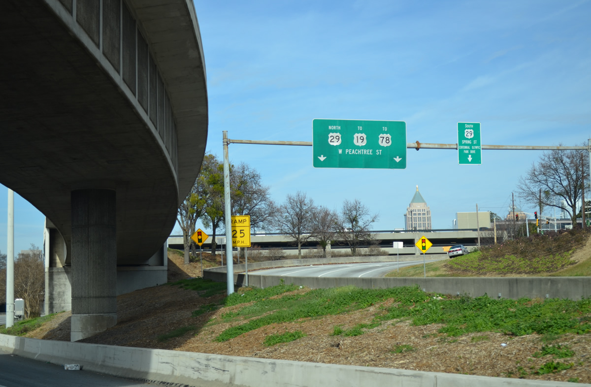
| Spring Street flows south from U.S. 29-78-278 (North Avenue) to Centennial Olympic Park Drive. This segment of the street is disconnected from section flowing north from downtown. U.S. 29 is referenced here erroneously, as the route was relocated to Northside Drive alongside U.S. 19/41 to North Avenue. 12/31/12 |
|
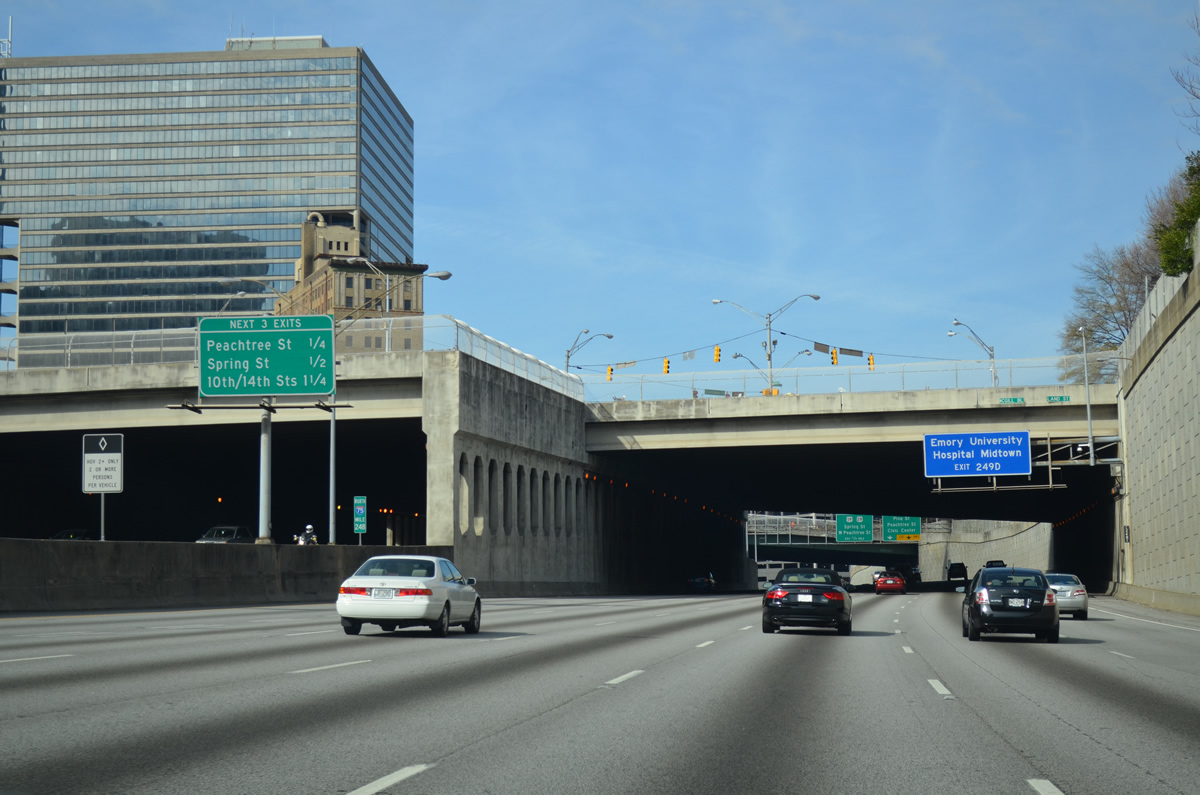
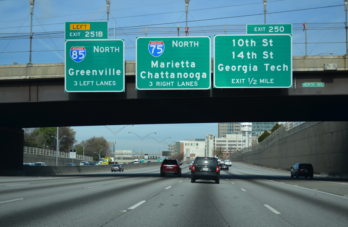
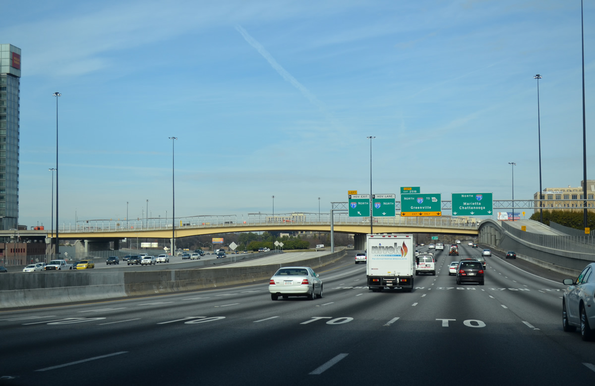
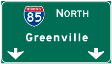
| I-75/85 north pass under U.S. 29-78-278 (North Avenue) a half mile from Exit 250 with 10th and 14th Streets. Installed in 2012, advance signs appear for the Brookwood Interchange, where Interstate 85 branches northeast to Greenville, South Carolina. 12/31/12 |
|
| Exit 250 leaves I-75/85 north below 5th Street for Williams Street north ahead of 10th and 14th Streets. There is no return access.
Overheads for I-75/85 were removed when a sign was added for the HOV exit to I-75 north for Marietta. 12/31/12 |
|
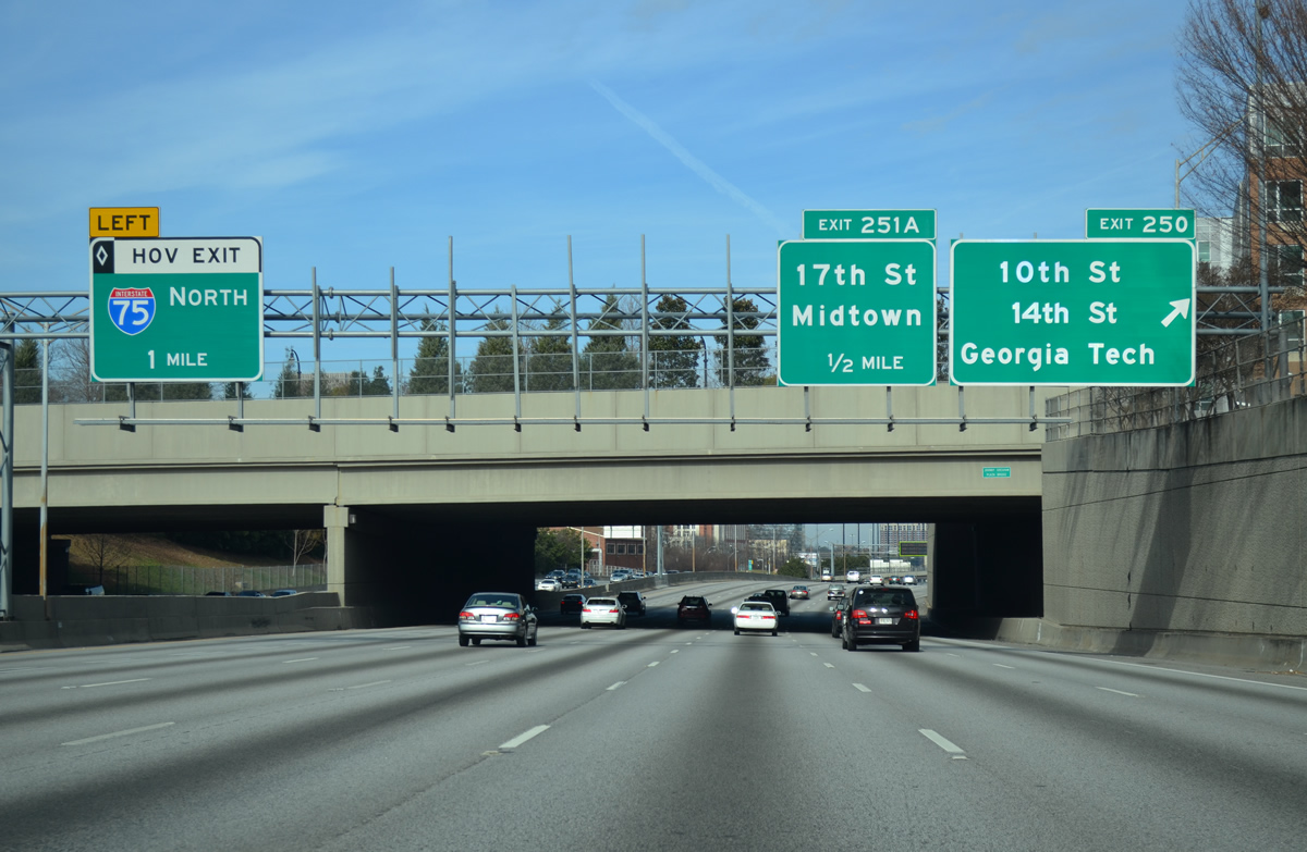
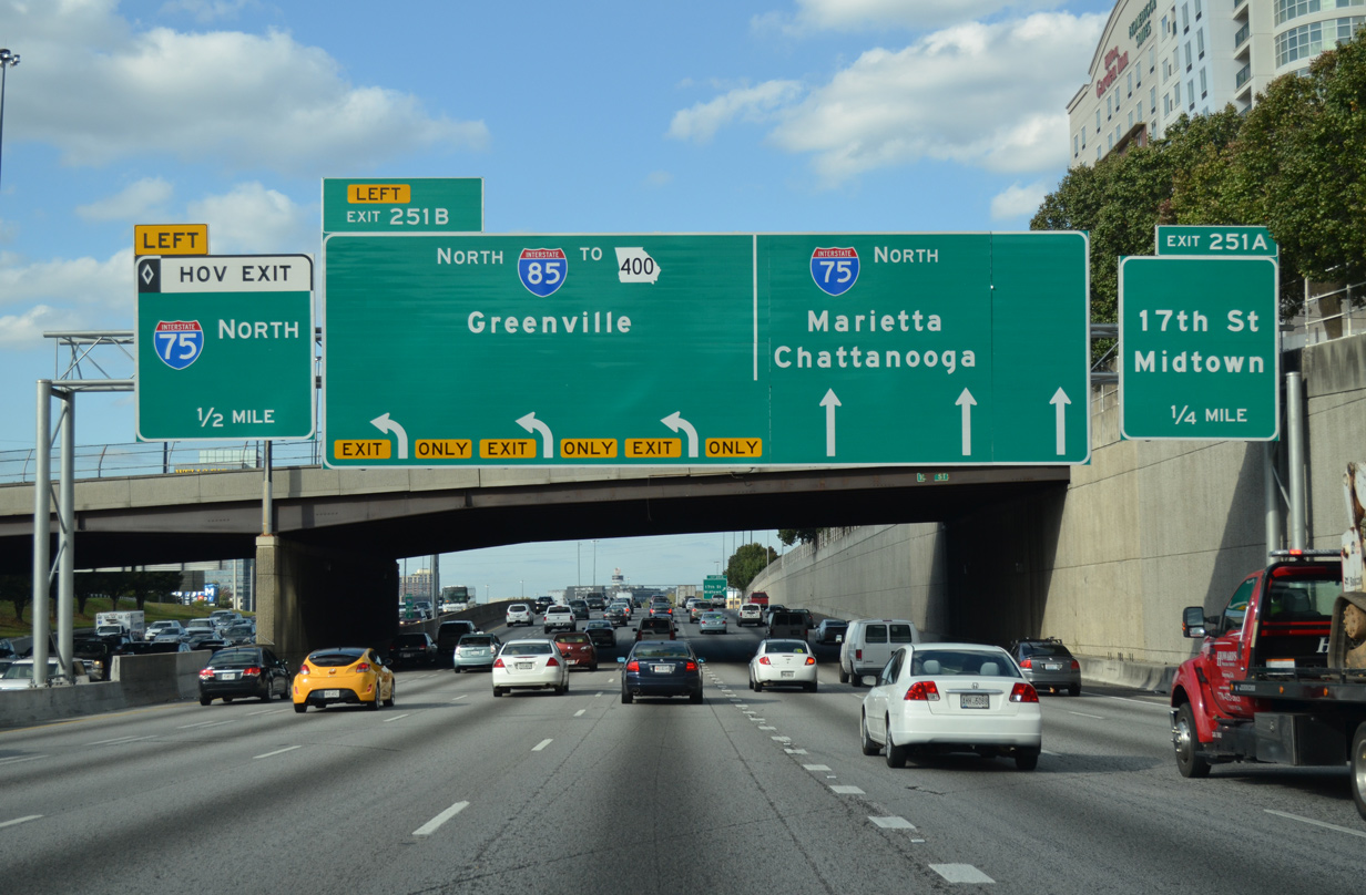
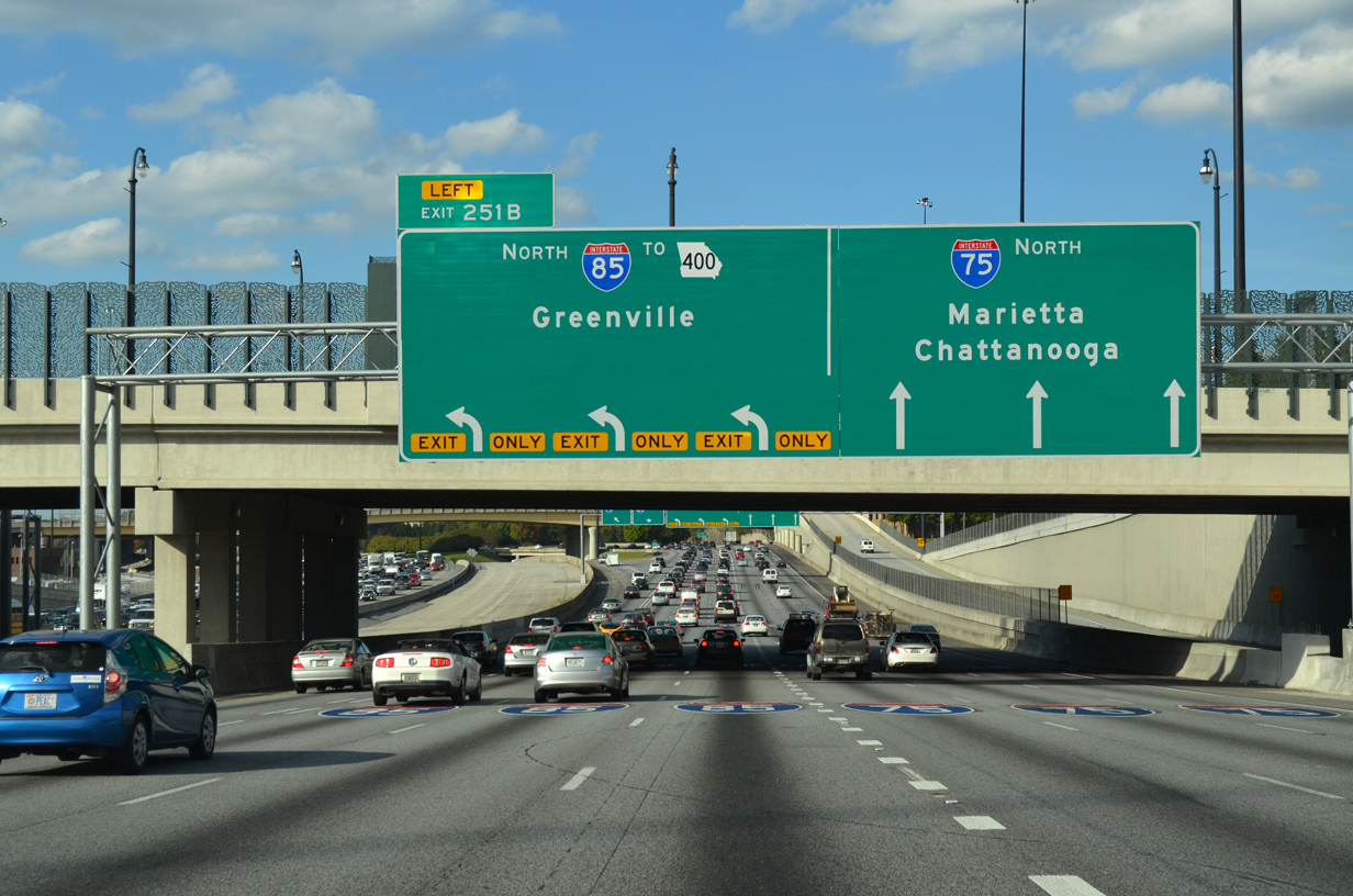
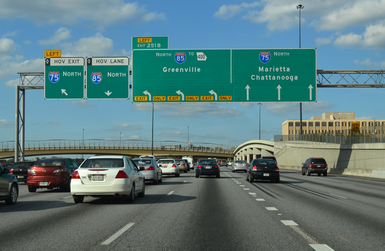
| Three lanes continue onto I-85 northbound toward Chamblee, Norcross, Duluth and Buford while I-75 turns northwesterly toward Marietta, Kennesaw and Cartersville. Exit 251 A departs next for 17th Street to U.S. 19/SR 9 (Spring / W Peachtree Streets) in Midtown. 10/22/15 |
|
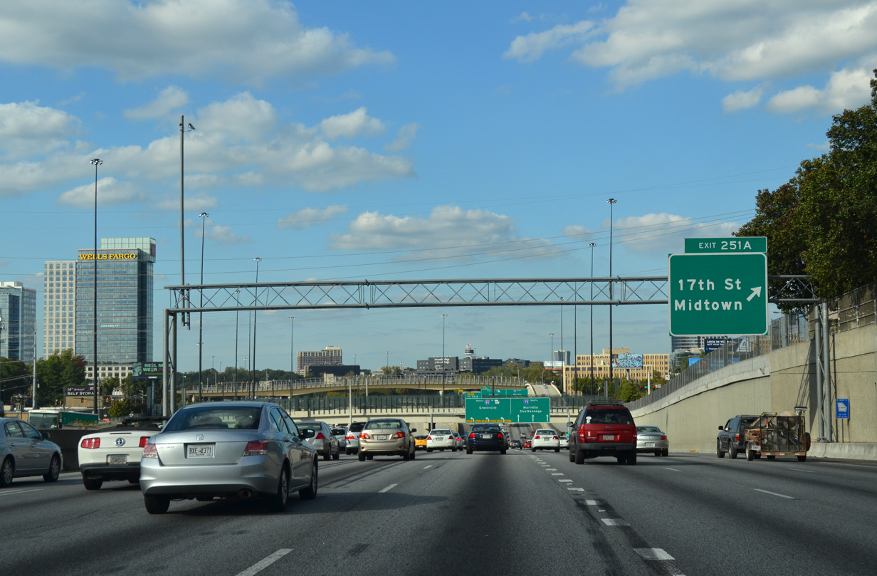
| Exit 251 A to the 17th Street Bridge departs from the Downtown Connector north. The off-ramp opened on May 28, 2010 as part of $88.5 million project that included replacement of the 14th Street Bridge and a new ramp from the Downtown Connector southbound to 10th Street.1 10/22/15 |
|
| I-75/85 separate at a trumpet interchange (Exit 251), with both maintaining at least six overall lanes. The HOV lane also partitions into ramps for I-75 and I-85 within the exchange. 10/22/15 |
|
| The 17th Street Bridge spans I-75/85 and the HOV lanes between the Atlantic Station neighborhood and adjacent U.S. 19/SR 9 (Spring / Peachtree Streets). The 829 foot long span opened to traffic in 2004. 12/31/12 |
|
| Heavy traffic is routine along I-75/85 north of Downtown, with 350,000 vpd recorded by GDOT in 2014. Connections via I-575, SR 400 (and U.S. 19), I-985, and SR 316 serve the outer suburbs of northern Atlanta. These include the communities of Alpharetta, Canton, Dunwoody, Roswell, Sandy Springs, Suwanee and Woodstock. 10/22/15 |
Page Updated 06-14-2021.


 North
North