The southernmost Business Loop for Interstate 75 serves the city of Valdosta between Exit 16 and Exit 22 in Lowndes County. Heading east from a folded diamond interchange, the business route overlays U.S. 84-221 and State Route 38 along Hill Avenue toward Downtown. Once in the business district, the four routes partition into a short one-way couplet of Hill Avenue (east) and Central Avenue (west). Business Loop I-75 splits with U.S. 84/221 and combines with U.S. 41BU/SR 7BU north.
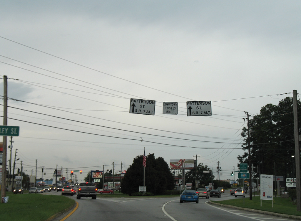
Business Loop I-75 separates through Downtown Valdosta along a one-way couplet along Ashley Street northbound and Patterson Street south from Magnolia Street west. Signs for Business Loop I-75 disappear north of this partition as U.S. 41BU/SR 7 BU follow Ashley Street north to Five Points and Valdosta Road. Valdosta Road expands the route into a four-lane divided highway, as the U.S. 41/SR 7 mainline, on the western return to Interstate 75.
|
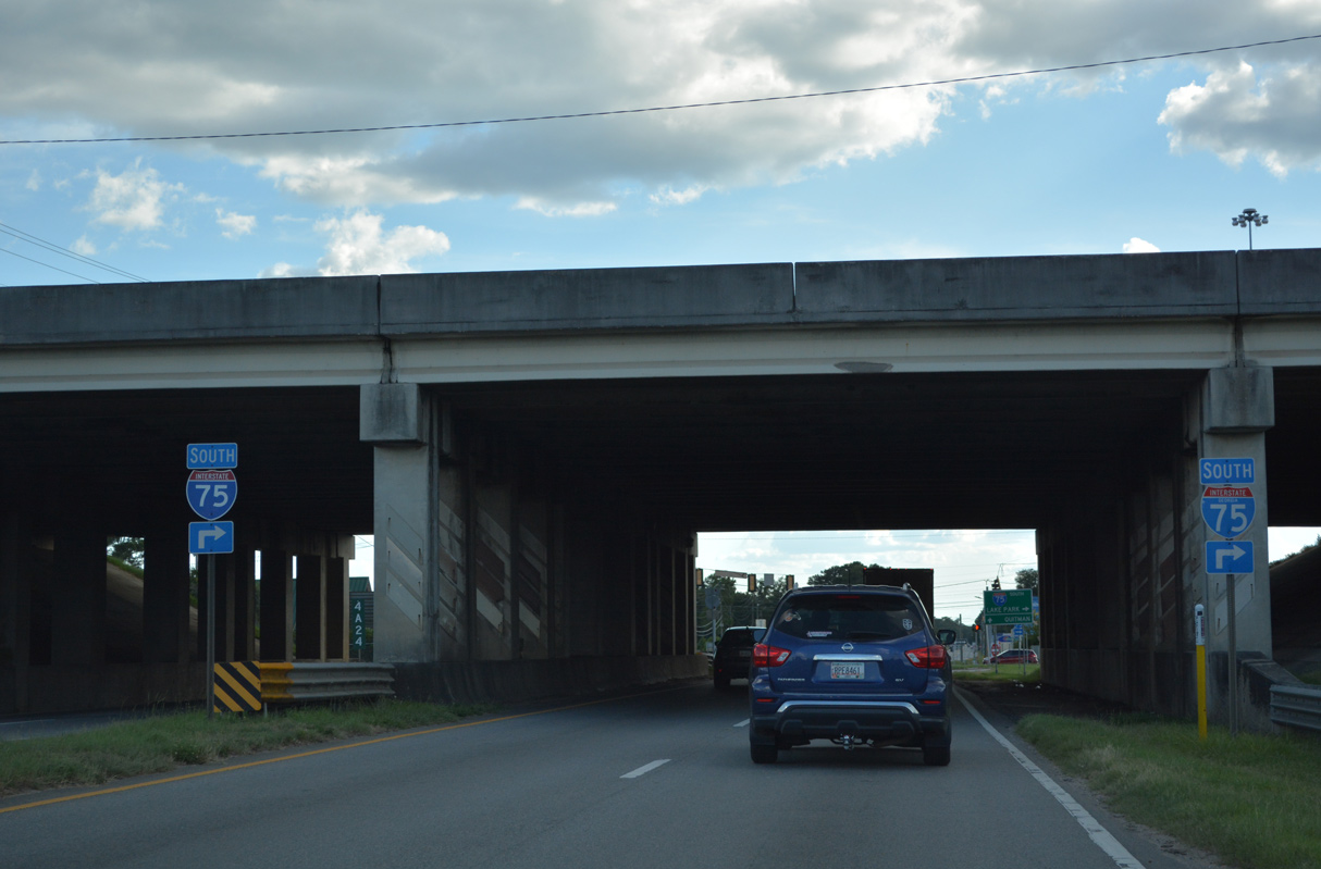
| Passing under Interstate 75, U.S. 84 east / U.S. 221 north approach the northbound entrance ramp to Tifton, Macon and Atlanta. 05/28/05 |
|
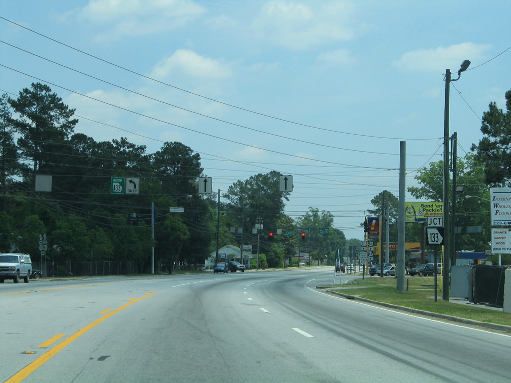
| Interstate 75 straddles western reaches of the Valdosta city limits to SR 133 by Valdosta Mall. Macon is 148 miles to the north. 04/10/10 |
|
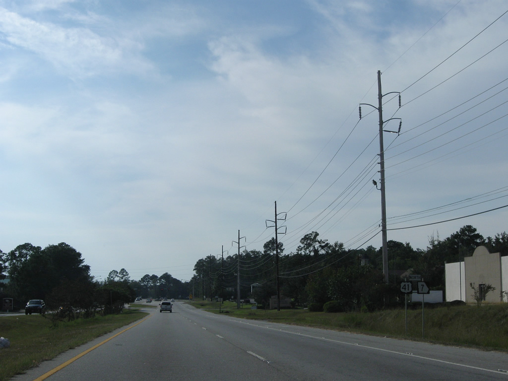
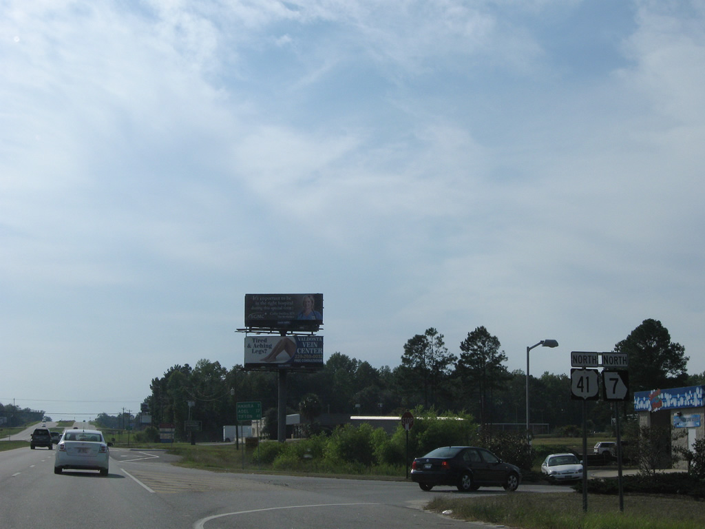
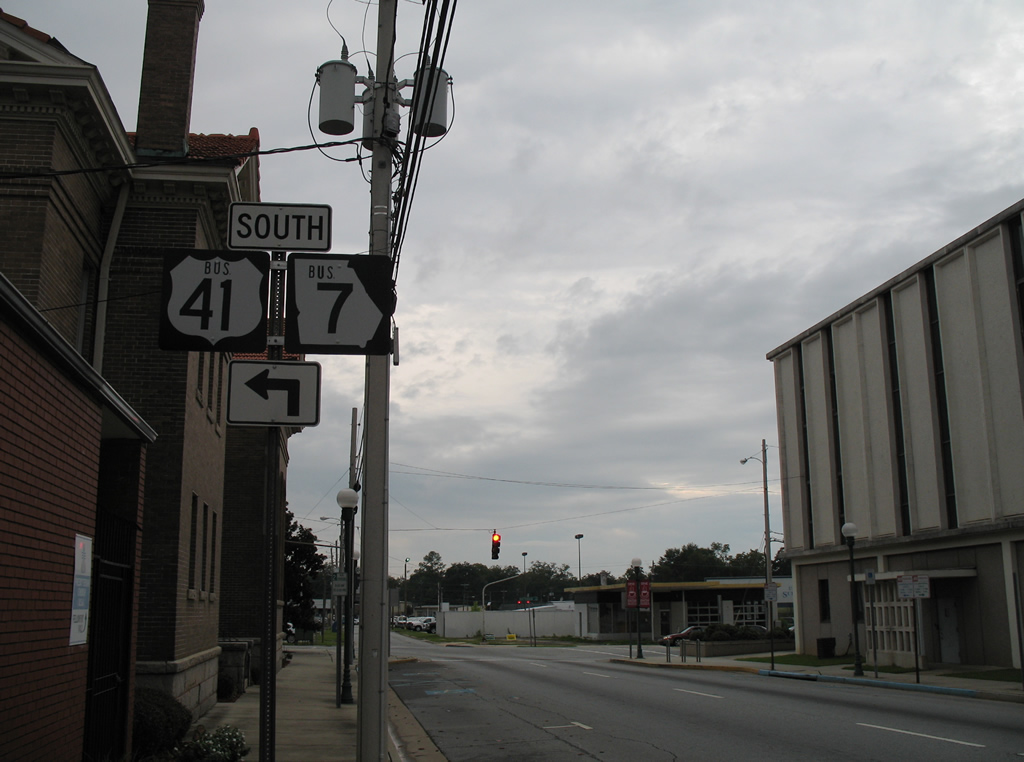
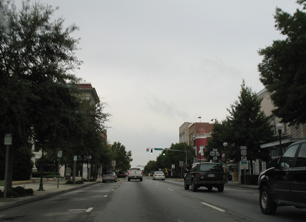
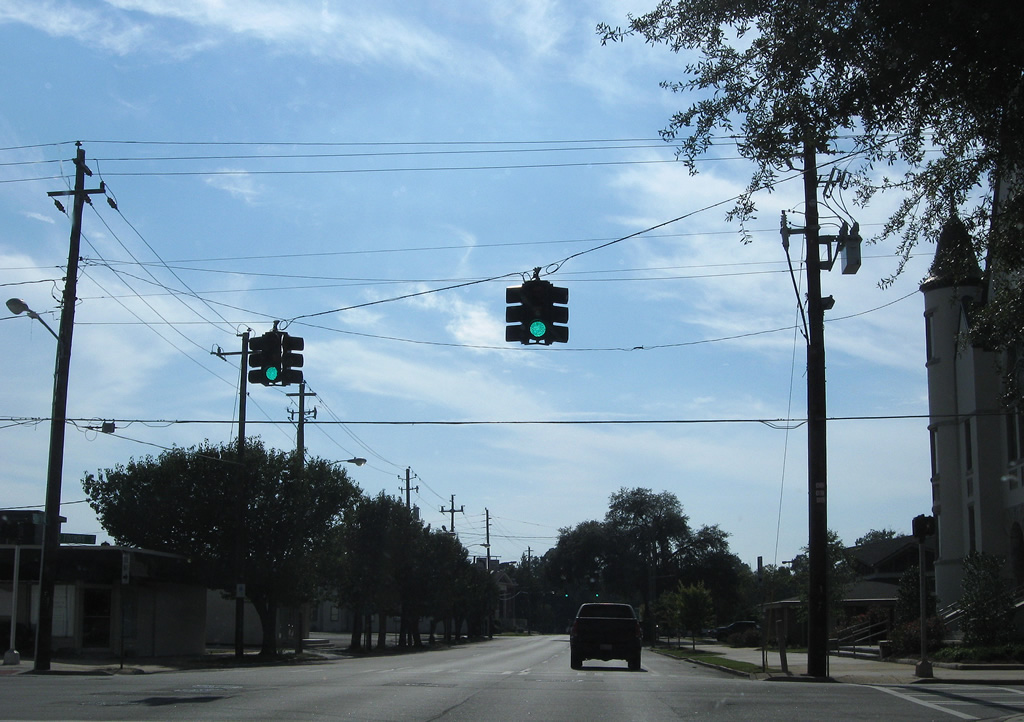
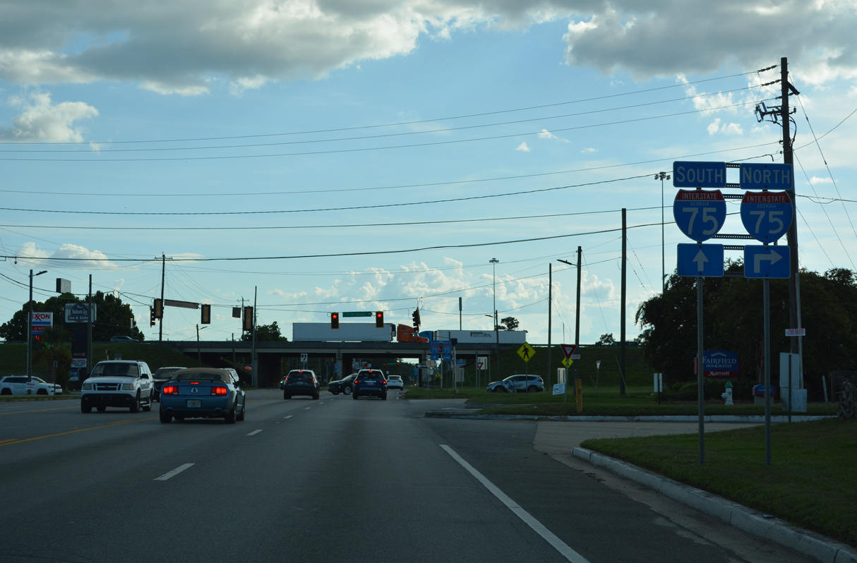
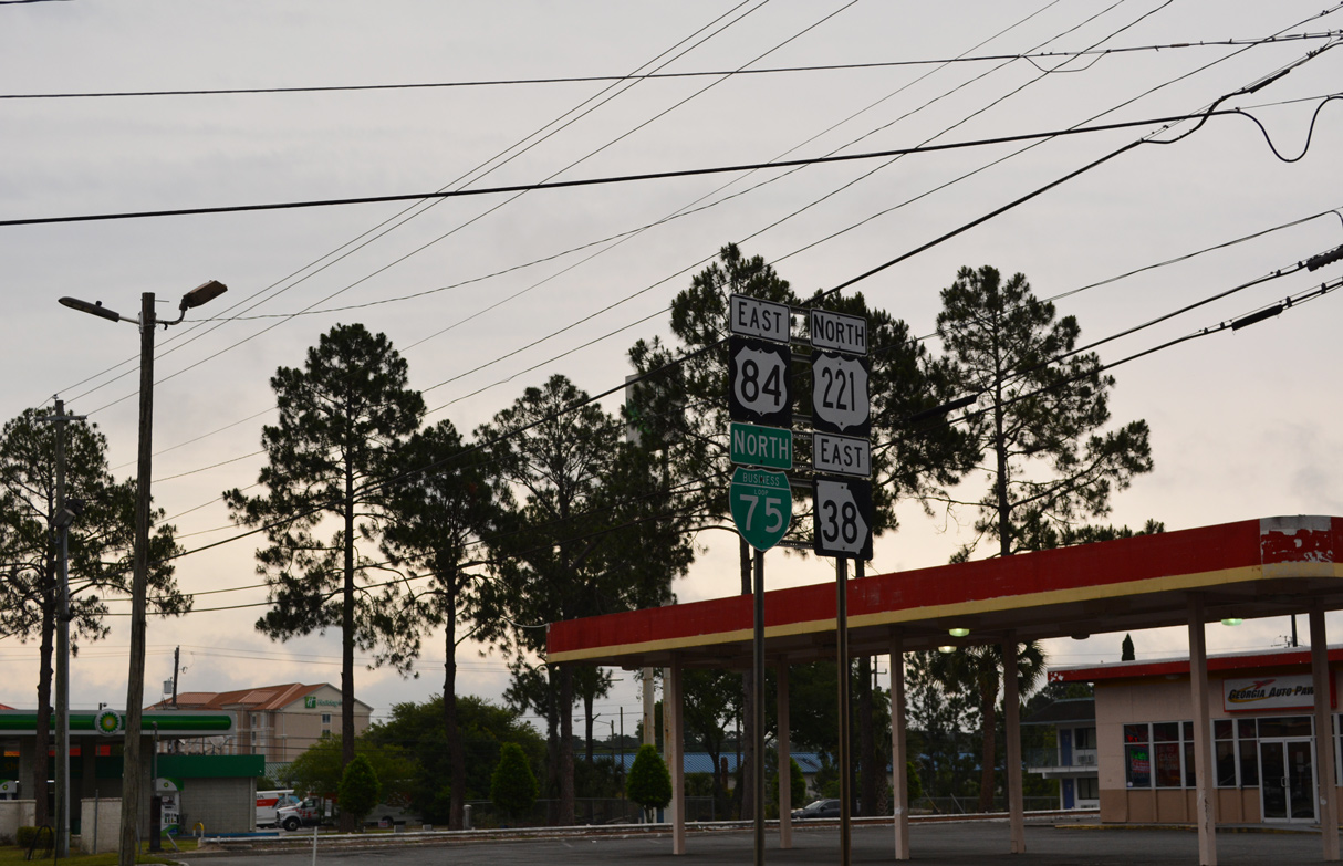
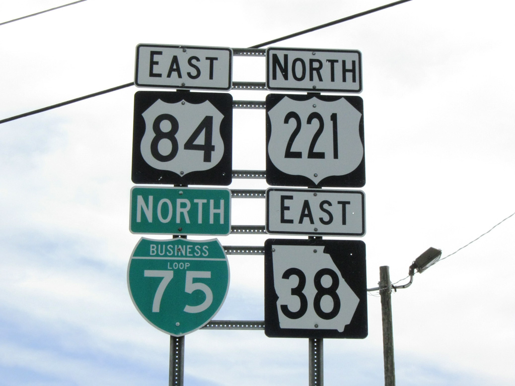
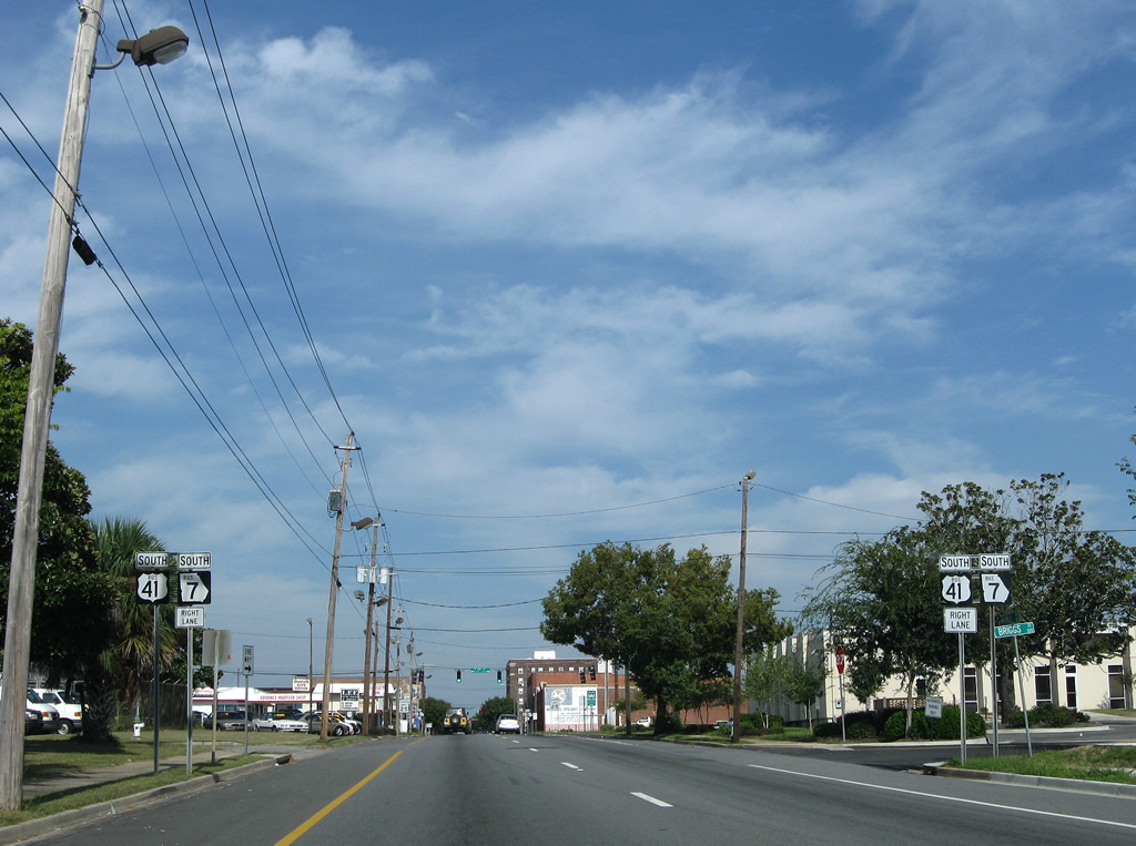
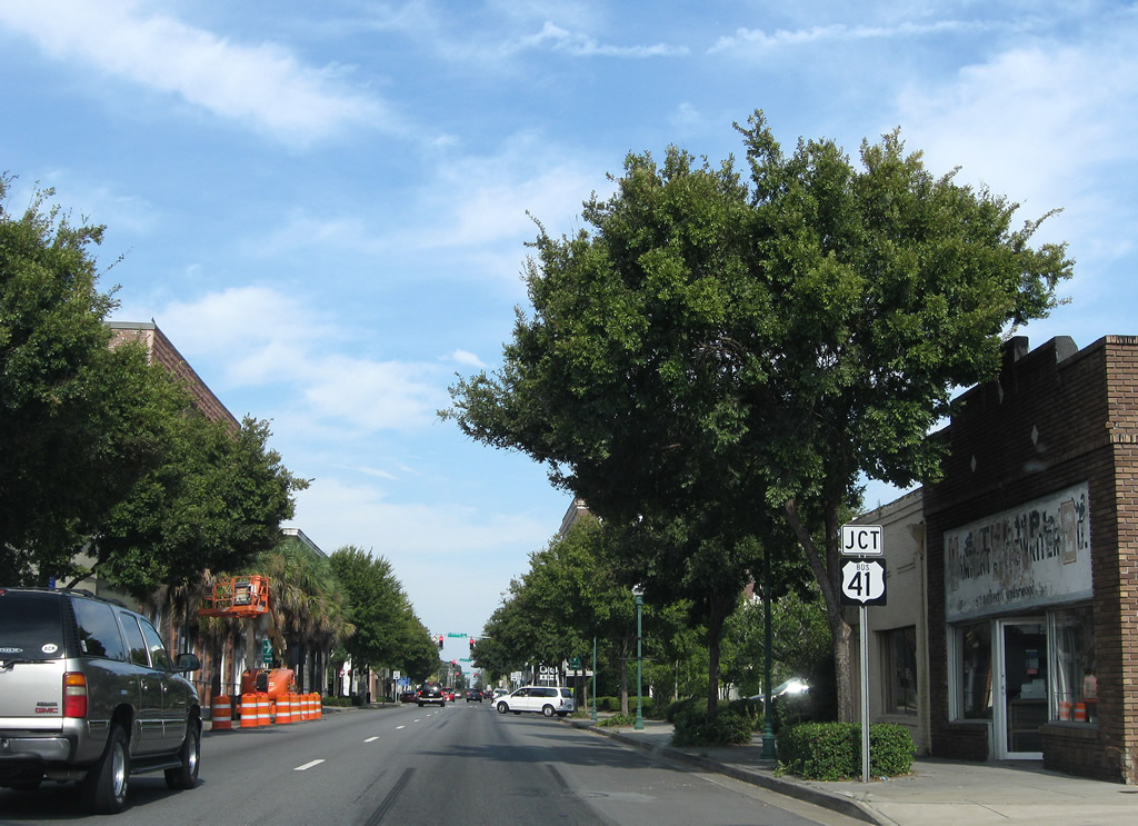
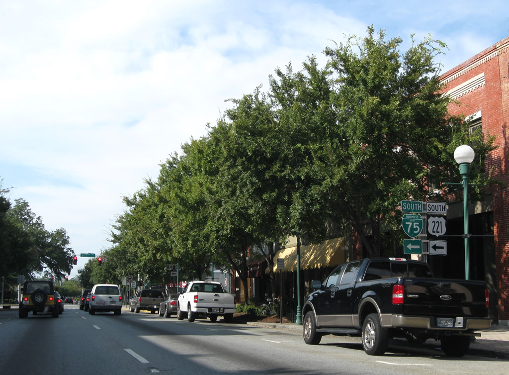
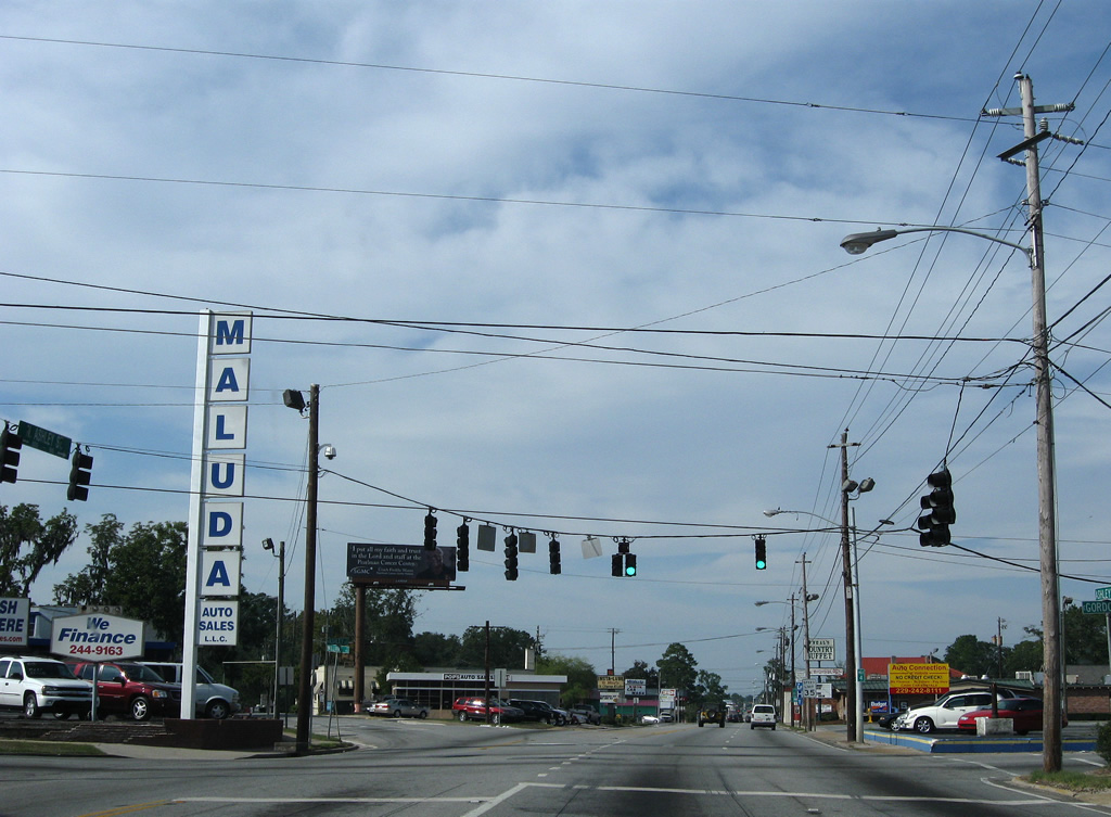
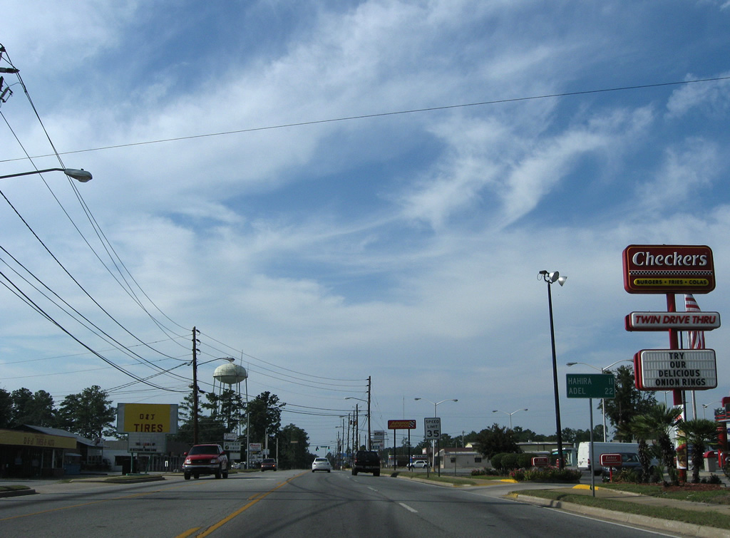
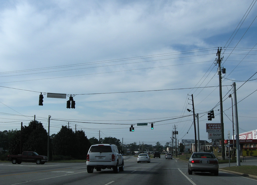
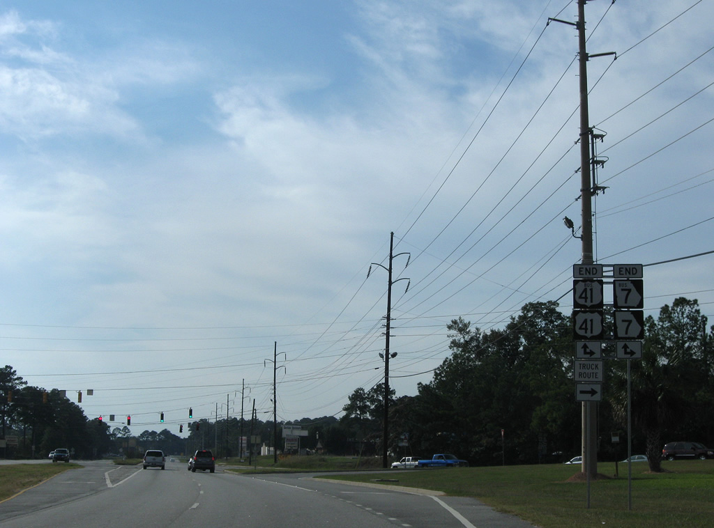
| The first shield for Business Loop I-75 north stands along U.S. 84/221 (Hill Avenue) east of Interstate 75. 05/06/22, 04/10/10 |
|
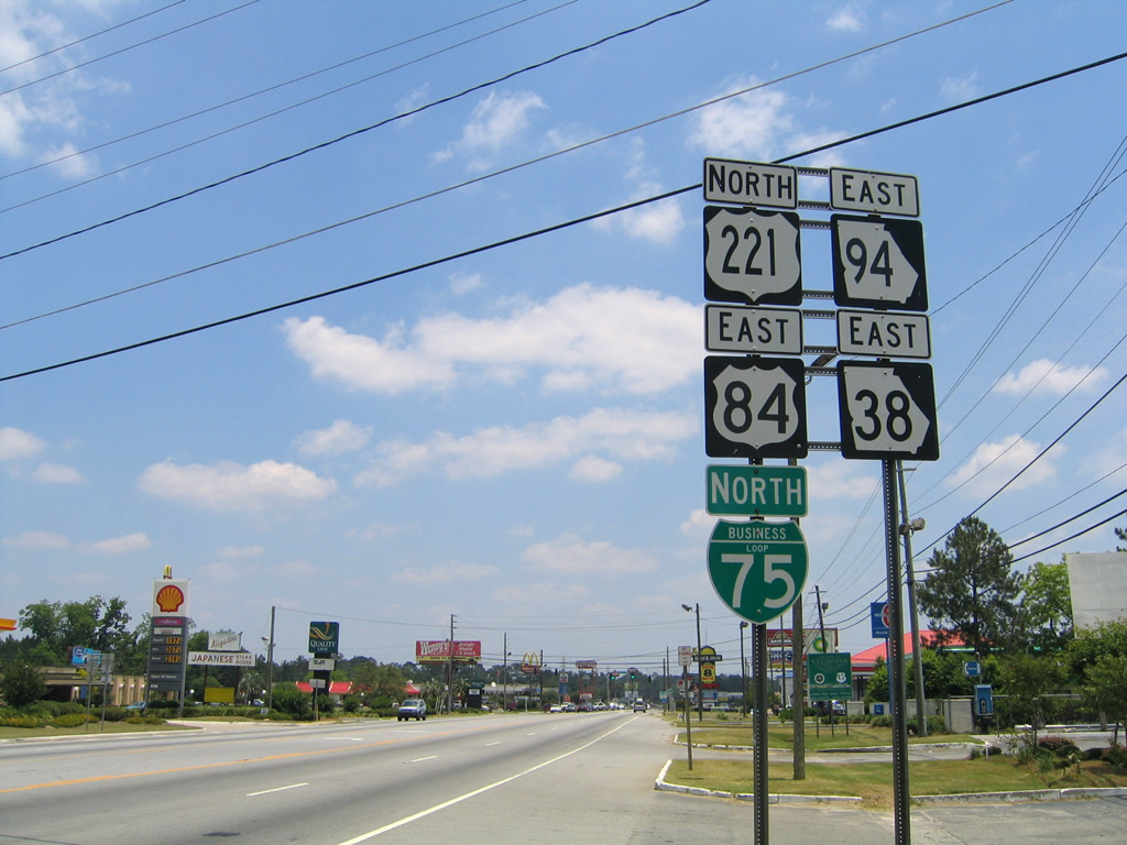
| Changes made between 2005 and 2008 removed SR 94 from the overlap with U.S. 84-221/SR 38. The state route was truncated from Brooks County eastward to Downtown Valdosta, and replaced with SR 133 southeast from Morven. 05/28/05 |
|
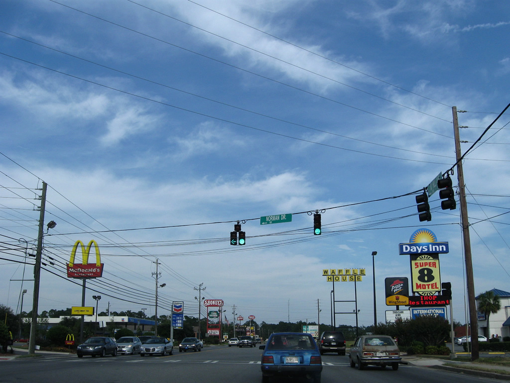
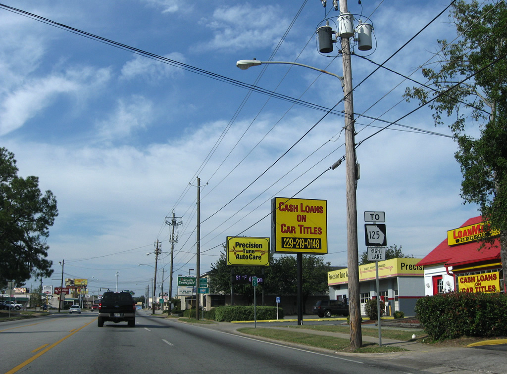
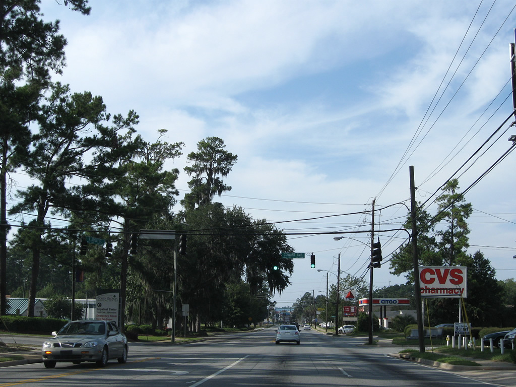
| Norman Drive leads north from Hill Avenue to Valdosta Mall and a number of big box retail centers. An array of traveler services continue alongside Business Loop I-75/U.S. 84-221 east to SR 133 (St. Augustine Road). 09/28/08 |
|
| Business Loop I-75/U.S. 84-221 next meet the south end of State Route 133 (St. Augustine Road). 05/28/05 |
|
| SR 133 travels in a northwestern trajectory from Valdosta nearly 83 miles to Moultrie and Albany. Locally the route constitutes a commercial arterial north to Valdosta Mall and I-75 at Troupville. 05/28/05 |
|
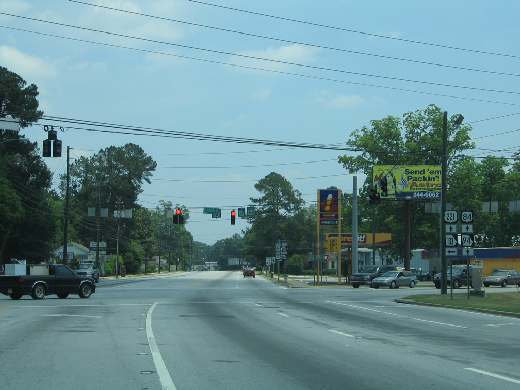
| Sign changes made between 2005 and 2008 reflect the removal of SR 94 east from SR 133 along Business Loop I-75/U.S. 84-221 (Hill Avenue). 05/28/05, 09/28/08 |
|
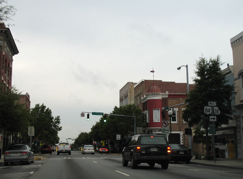
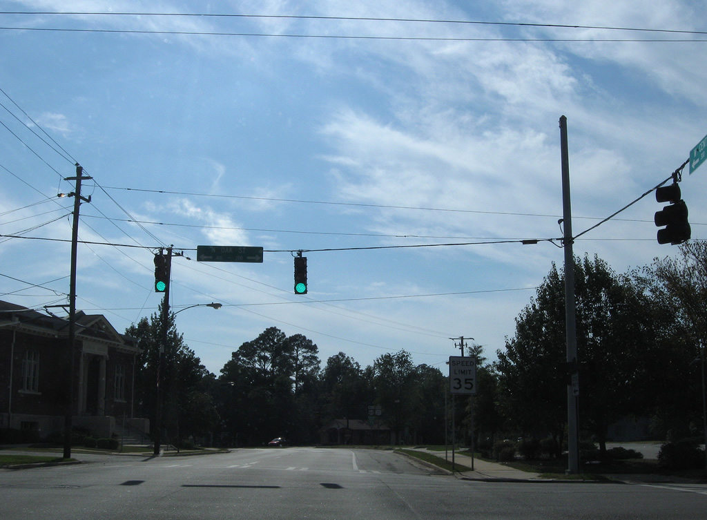
| Hill Avenue becomes eastbound only beyond Central Avenue. Business Loop I-75/U.S. 84-221 enter the business district ahead of U.S. 41BU/SR 7BU (Patterson Street south / Ashley Street north). 09/28/08 |
|
| Oak Street travels north from the Downtown area to Valdosta State University and south to Madison Highway (former SR 31). 09/28/08 |
|
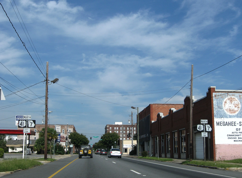
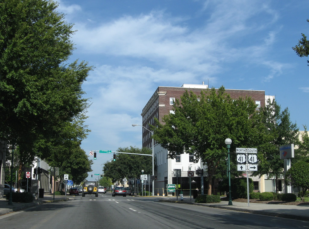
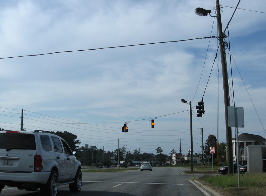
| Like U.S. 84/221, U.S. 41 Business partitions along a one way couplet through Downtown Valdosta. U.S. 41BU/SR 7BU north follow all of Ashley Street from the Jim Beck Overpass to Five Points. 09/28/08 |
|
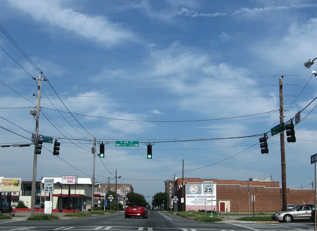
| Eastbound Hill Avenue at the traffic light with Toombs Street. 09/28/08 |
|
| U.S. 84 east / U.S. 221 north next intersect Patterson Street, which carries U.S. 41 Business south from Magnolia Street to the Jim Beck Overpass spanning Norfolk Southern and Georgia and Florida Railroad lines. 09/28/08 |
|
| U.S. 41 Business continues 0.68 miles along Patterson Street to Madison Highway (former SR 31) south to Valdosta Regional Airport (VLD) and an exit of the city beyond Little Miami and Mud Creek. 09/28/08 |
|
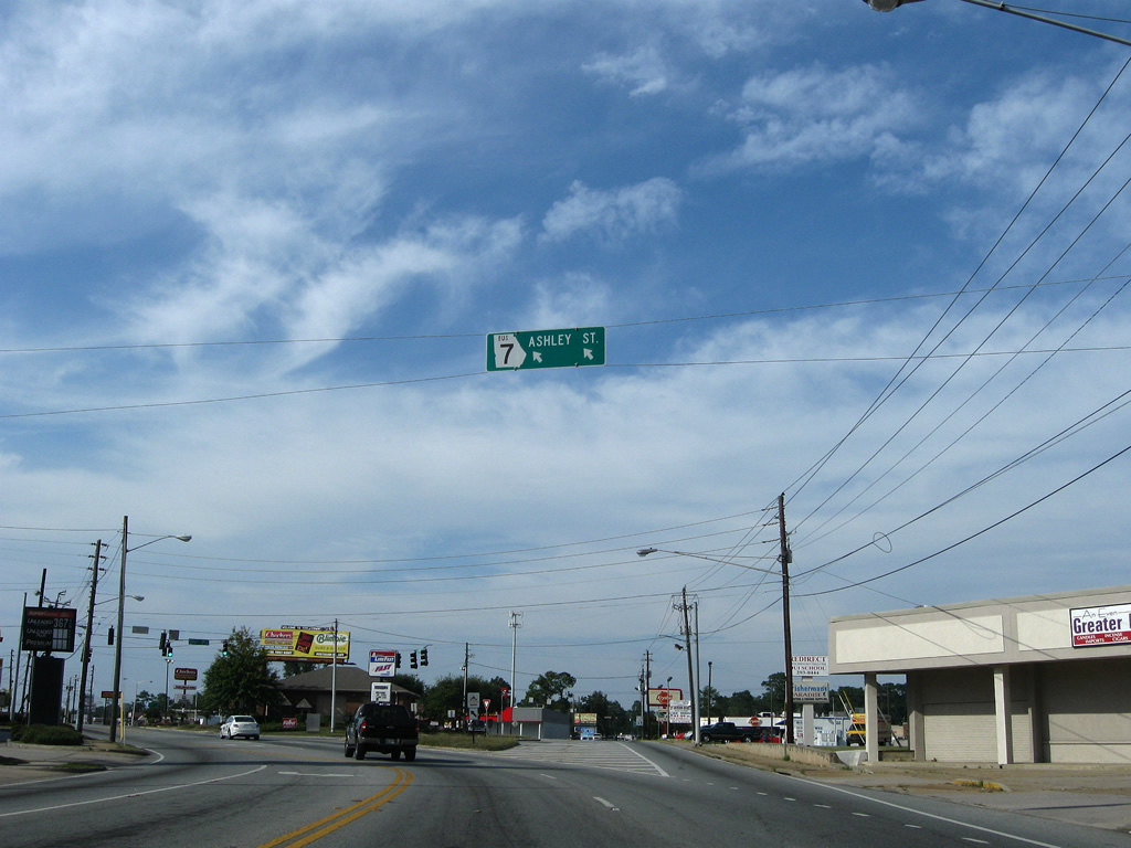
| Although not signed, Business Loop I-75 turns northward onto U.S. 41 Business (Ashley Street) at the succeeding intersection. 09/28/08 |
|
| Traveling north along Ashley Street, U.S. 41BU advances to Central Avenue, which carries U.S. 84/221 westbound between Forrest and Wells Streets through Downtown. 09/28/08 |
|
| The final reference of Business Loop I-75 appears along Ashley Street north ahead of Central Avenue on U.S. 84/221. The southbound direction of the business loop follows Patterson Street south to Central Avenue, one block to the west. 09/28/08 |
|
| Entering the signalized intersection with Central Avenue west on Business Loop I-75/U.S. 41BU (Ashley Street) north. U.S. 84/221 overlap between Valdosta and Quitman, where U.S. 84 continues to Thomasville and U.S. 221 leads south to Greenville, Florida. 09/28/08 |
|
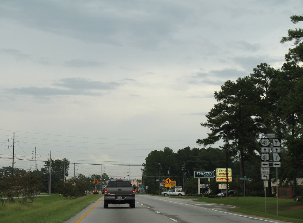
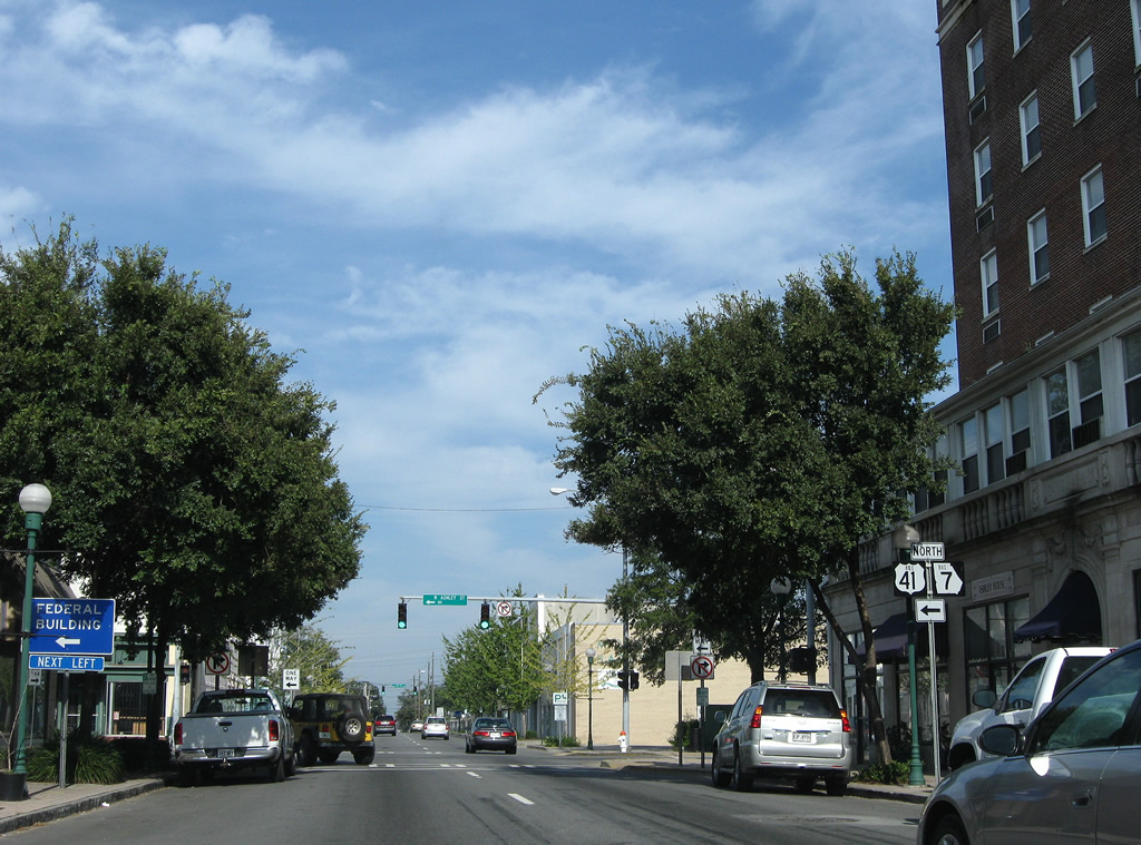
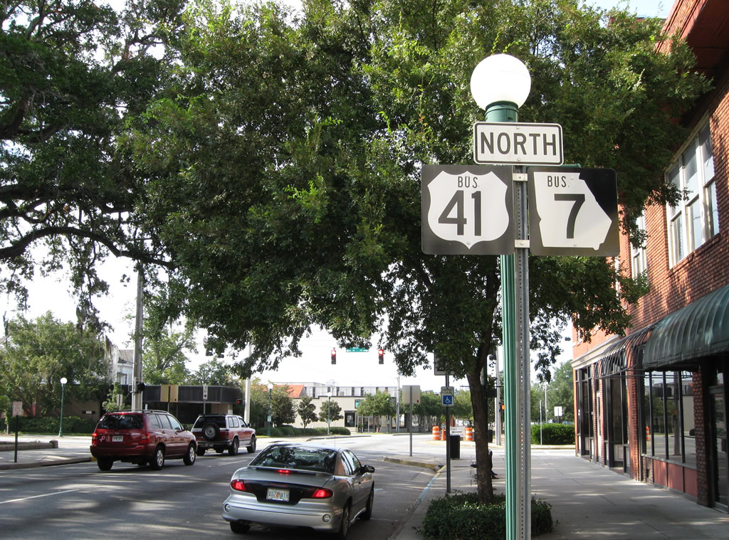
| Reassurance shields posted for U.S. 41BU/SR 7BU along Ashley Street north after U.S. 84/221 (Central Avenue). Business Loop I-75 is unsigned from this point northward. 09/28/08 |
|
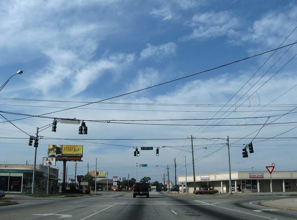
| Leaving Downtown, U.S. 41 Business (Ashley Street) turns more northward from Valley Street to East Park Avenue. This stretch, and East Park Avenue, originally carried U.S. 221 and SR 31. 09/28/08 |
|
| U.S. 41 Business (Ashley Street) meets Gordon Street and Williams Street north at a five-way intersection. Williams Street veers northwest to Bazemore-Hyder Stadium and Drexel Park. 09/28/08 |
|
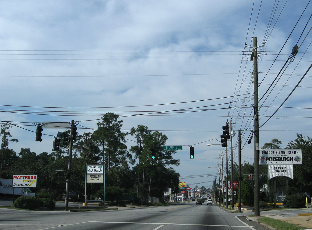
| Three blocks further north along Ashley Street at Ann Street. 09/28/08 |
|
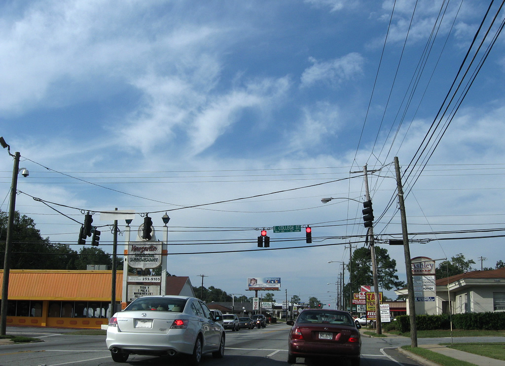
| College Street heads west from Lee Street across U.S. 41 Business to Valdosta State University at Patterson Street (SR 7 Alternate). 09/28/08 |
|
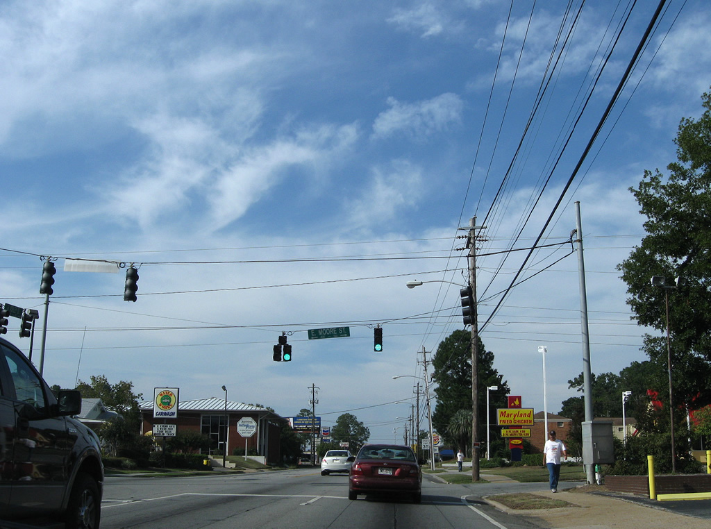
| Moore Street follows at the next signal, joining U.S. 41 Business with residential areas east to Onemile Branch and west to SR 7 Alternate. 09/28/08 |
|
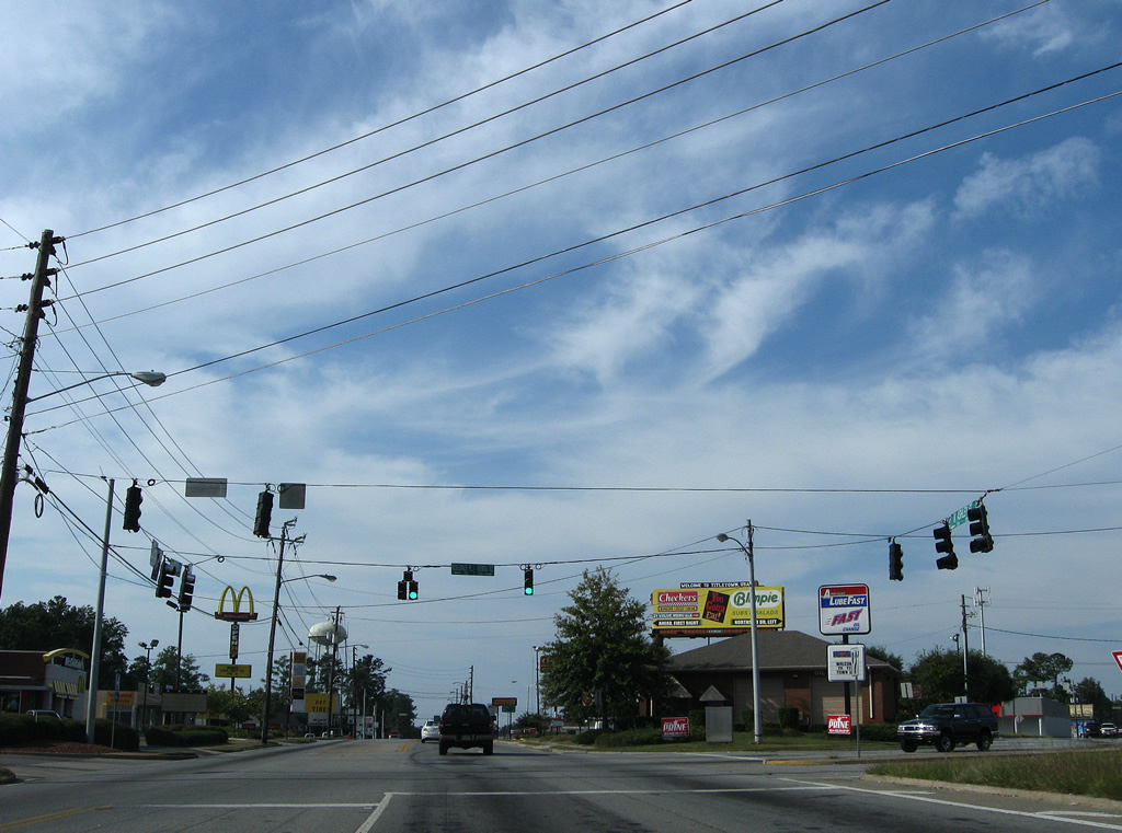
| Nearing the former split of U.S. 41/221 north at Park Avenue, a shield assembly advises motorists bound for Bemiss Road (SR 125) north to remain in the right lane. SR 125 begins a 74 mile route to Fitzgerald immediately north of Park Avenue. 09/28/08 |
|
| Park Avenue carried U.S. 221 and SR 31 east from U.S. 41 (Ashley Street) until the completion of Inner Perimeter Road (the at-grade bypass loop of Valdosta). The pair travel alongside the U.S. 41/SR 7 mainline north from Hill Avenue to Lakeland Highway. 09/28/08 |
|
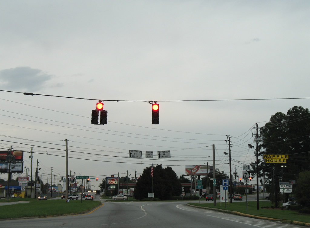
| A span wire overhead references SR 7 Business only at the split with SR 125 (Bemiss Road) north. SR 125 joins Valdosta with Bemis, Moody Air Force Base and Barretts in northern Lowdnes County. 09/28/08 |
|
| SR 125 south (Bemis Road) ends opposite Rosedale Place at U.S. 41 Business (Ashley Street). The state route meets U.S. 41 again at Tifton. 09/28/08 |
|
| A distance sign remains in use from when U.S. 221 used to split with U.S. 41 south of Bemis Road. Hahira is an 11 mile drive north along Old Highway 41 from Mineola. 09/28/08 |
|
| Woodrow Wilson Drive links SR 125 (Bemis Road) to the east with SR 7 Alternate (Patterson Street) just south of South Georgia Medical Center. 09/28/08 |
|
| Cowart Avenue, at the next traffic light, is the main entrance to South Georgia Medical Center via U.S. 41 Business (Ashley Street) north. 09/28/08 |
|
| Ashley Street becomes more commercialized from Northside Drive north into Five Points. 09/28/08 |
|
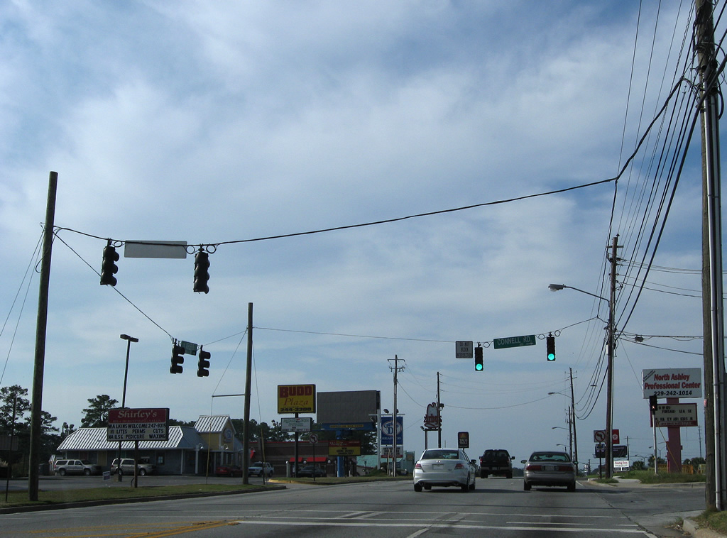
| Connell Road mirrors the course of Northside Drive east from U.S. 41 Business (Ashley Street) to SR 125 (Bemis Road) at Highland Heights. 09/28/08 |
|
| Smithbriar Drive arcs west from U.S. 41 Business to provide access to Patterson Street (SR 7 Alternate) south and Oak Street south at Five Points. 09/28/08 |
|
| Oak Street was made discontinuous by the realignment of U.S. 41 onto a four lane divided highway (Valdosta Road) west from Five Points. The street continues north and then east to SR 125 (Bemiss Road) from this signal. 09/28/08 |
|
| Turning westward, U.S. 41BU (Valdosta Road) converges with U.S. 41 from Inner Perimeter Road. Country Club Road, the pre-1961 alignment of U.S. 41, branches northward ahead of the merge. 09/28/08 |
|
| U.S. 41 overtakes Valdosta Road from the north end of Inner Perimeter Road west to Interstate 75. 09/28/08 |
|
| End shields for both U.S. 41BU/SR 7BU stand at the intersection of Valdosta Road north at Inner Perimeter Road east. 09/28/08 |
|
| U.S. 41/SR 7 (Valdosta Road) make their final push outward from Valdosta ahead of the Withlacoochee River. 09/28/08 |
|
| Country Club Drive heads north from U.S. 41 to Country Club Road (old U.S. 41) at Valdosta Country Club and south to Eager Road. 09/28/08 |
|
| U.S. 41 curves northward and overtakes Country Club Road, the former U.S. 41 alignment, on the exit of Valdosta. 09/28/08 |
|
| Advancing north of the Withlacoochee River, U.S. 41 turns west again beyond the intersection of Val Del Road north. 09/28/08 |
|
| U.S. 41 continues west along Valdosta Road to merge with Interstate 75 north to Hahira while Old Highway 41 remains as a local road through Minneola and Tillman. 09/28/08 |
|
| Shield and distance signs posted west of Old Highway 41. Hahira is seven miles to the north, followed by Adel in 17 miles and Tifton in 41 miles. 09/28/08 |
|
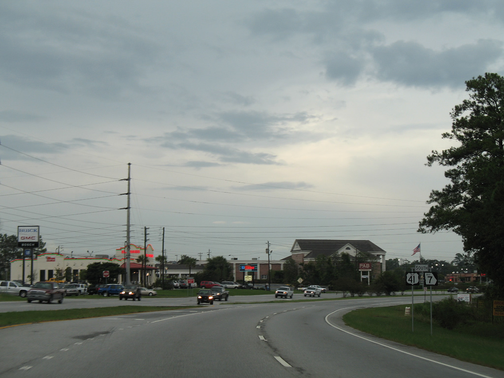
| Coleman Road intersects U.S. 41 (Valdosta Road) as unsigned Business Loop I-75 prepares to meet Interstate 75. 09/28/08 |
|
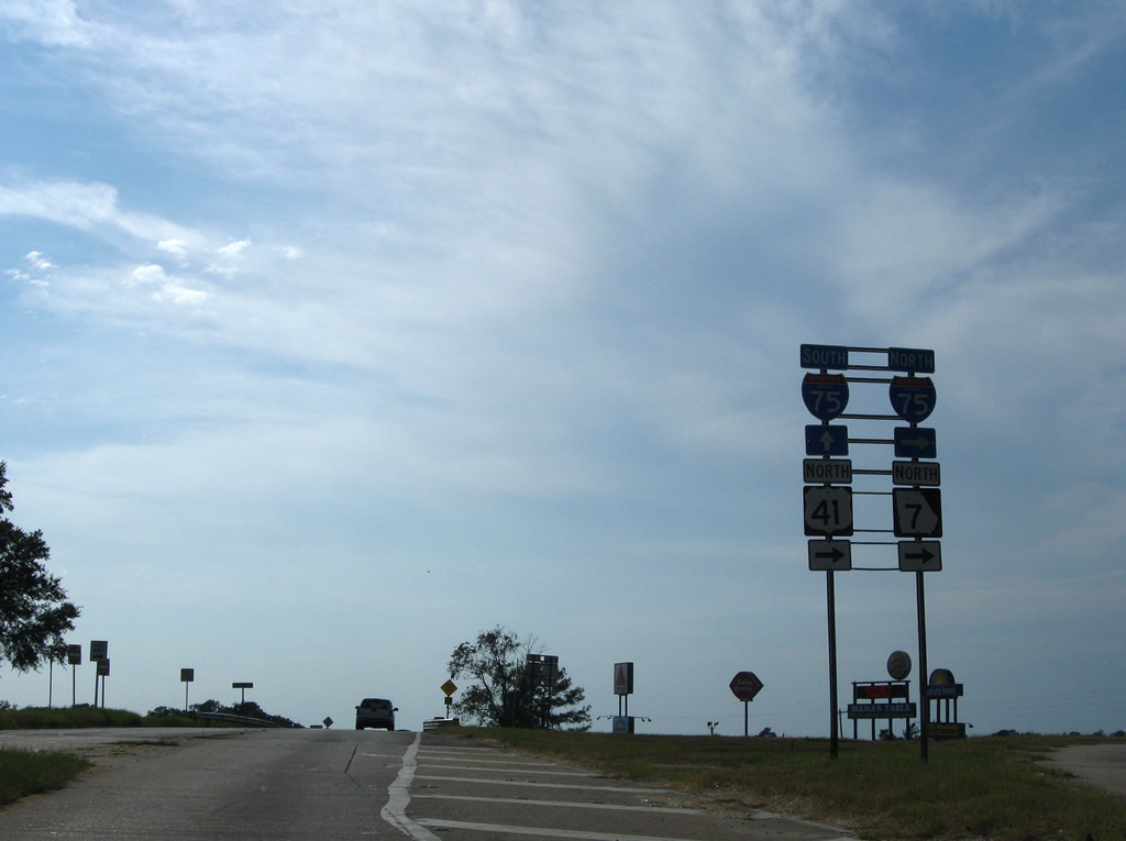
| U.S. 41/SR 7 combine with Interstate 75 north from Valdosta Road (Exit 22) north to Exit 29. 09/28/08 |
|
| Valdosta Road becomes Shiloh Road west from the parclo interchange with Interstate 75. 09/28/08 |
|
| Valdosta Road winds east as a four lane divided highway across the Withlacoochee River into northern reaches of the Valdosta city limits. The route splits with the mainline bypassing the city via Inner Perimeter Road while U.S. 41BU/SR 7BU continue Valdosta Road south to Ashley Street. 09/18/06 |
|
| Reassurance shields for U.S. 41BU/SR 7BU appear immediately east of the split with U.S. 41. Country Club Road, a former alignment of U.S. 41/SR 7, ties in from the north at the assembly. 09/18/06 |
|
| Oak Street south intersects U.S. 41BU/SR 7BU (Valdosta Road) at Five Points. Oak Street continues south, but from Smithbriar Drive west of forthcoming Patterson Street (SR 7 Alternate). 09/18/06 |
|
| U.S. 41BU/SR 7BU split with Patterson Street at Five Points. Patterson Street doubles as SR 7 Alternate to Downtown. 09/18/06 |
|
| Magnolia Street carries Business Loop I-75, U.S. 41 and SR 7 south one block west from Ashley Street to Patterson Street. 09/18/06 |
|
| Patterson Street travels north as SR 7 Alternate back to Five Points while southbound continues the business loop three blocks to U.S. 84/221 west. 09/18/06 |
|
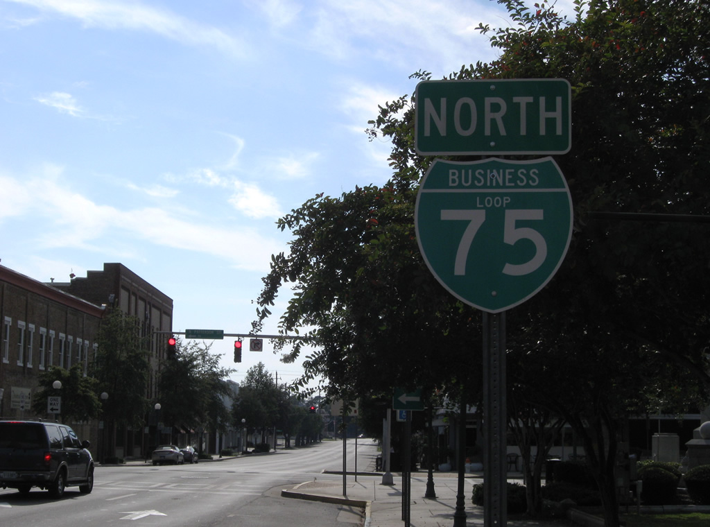
| The first reassurance marker for Business Loop I-75 appears on the block of Patterson Street between Magnolia and Jackson Streets. The business route could be considered a spur given its lack of signage to the north. 09/18/06 |
|
| Patterson Street flows southward with two lanes as U.S. 41BU/SR 7BU to the Jim Beck Overpass above sets of Georgia and Florida Railroad and Norfolk Southern Railroad tracks. 09/18/06 |
|
| South from Valley Street, Business Loop I-75 parts ways with U.S. 41BU/SR 7BU (Patterson Street) to join U.S. 84/221 west along Central Avenue. 09/18/06 |
|
| U.S. 84/221 overlap 20.6 miles west from Inner Perimeter Road in east Valdosta to the Brooks County seat of Quitman. 09/18/06 |
|
| An erroneous Business Loop I-75 north shield precedes the southbound turn of the business route from Patterson Street (U.S. 41 Business) onto Central Avenue (U.S. 84 west / U.S. 221 south). 09/28/08 |
|
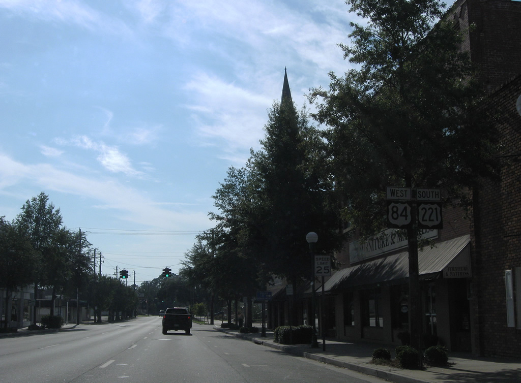
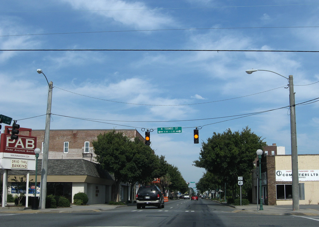
| U.S. 84/221 reassurance shields posted between Patterson and Toombs Streets along Central Avenue west. 09/28/08 |
|
| Toombs Street leads north from Business Loop I-75 (Central Avenue) to Valdosta State University and south to Olympic Park and Old Clyattville Road. 09/28/08 |
|
| Business Loop I-75 south meets Oak Street again at the next Central Avenue traffic light. 09/28/08 |
|
| Central Avenue shifts southward to combine with Hill Avenue as a five lane arterial beyond Oak Street. The final Business Loop I-75 shield is posted along this transition. 09/28/08 |
|
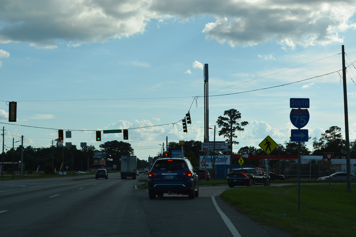
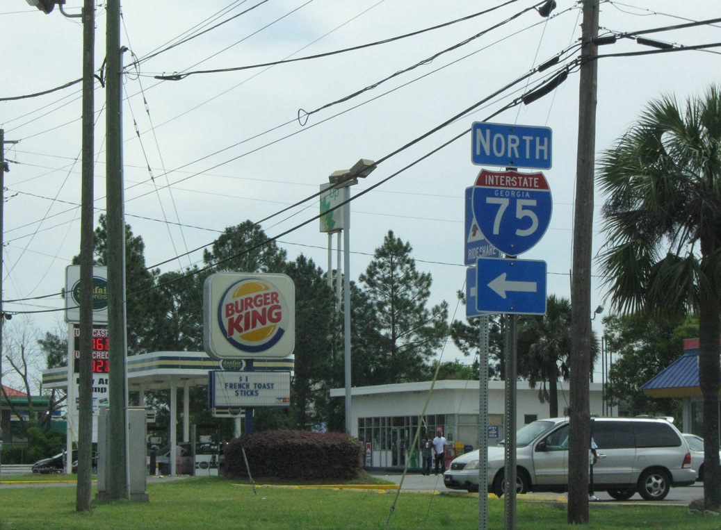
| U.S. 84/221 (Hill Avenue) west meet Interstate 75 at a folded diamond interchange (Exit 16) just west of Norman Drive. 06/26/22 |
|
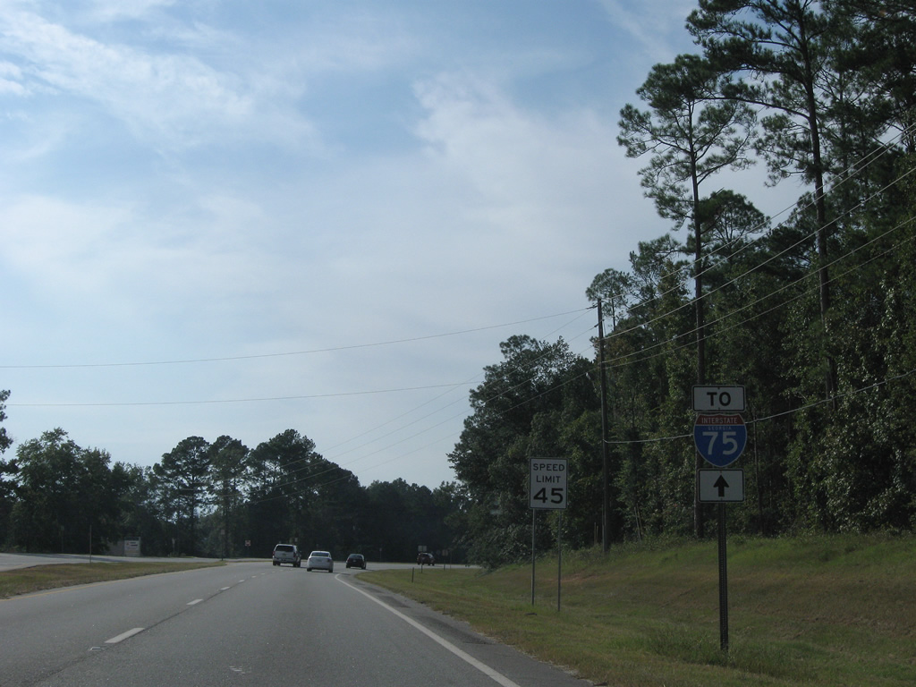
| Interstate 75 runs along the west side of Valdosta north toward Tifton and Perry. 06/26/22 |
|
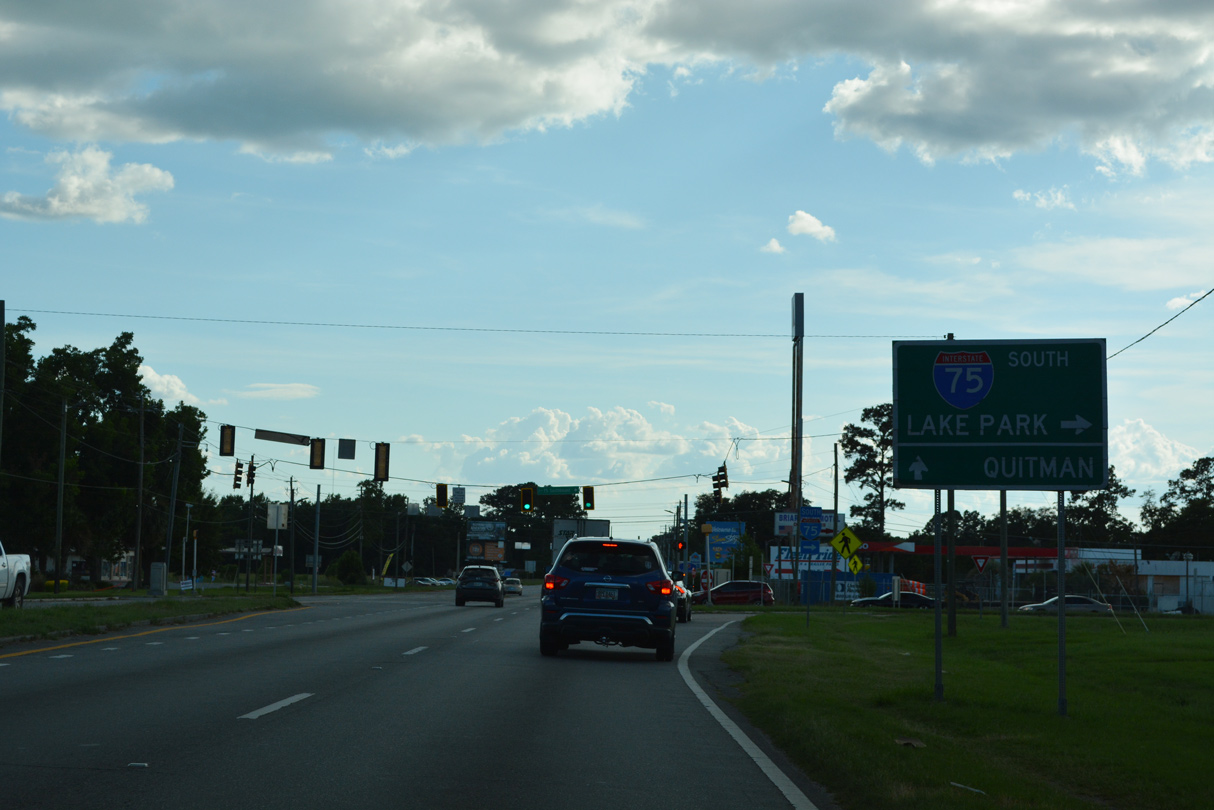
| Business Loop I-75 south concludes at the entrance ramp for Interstate 75 southbound to Lake City, Florida. 06/26/22 |
|
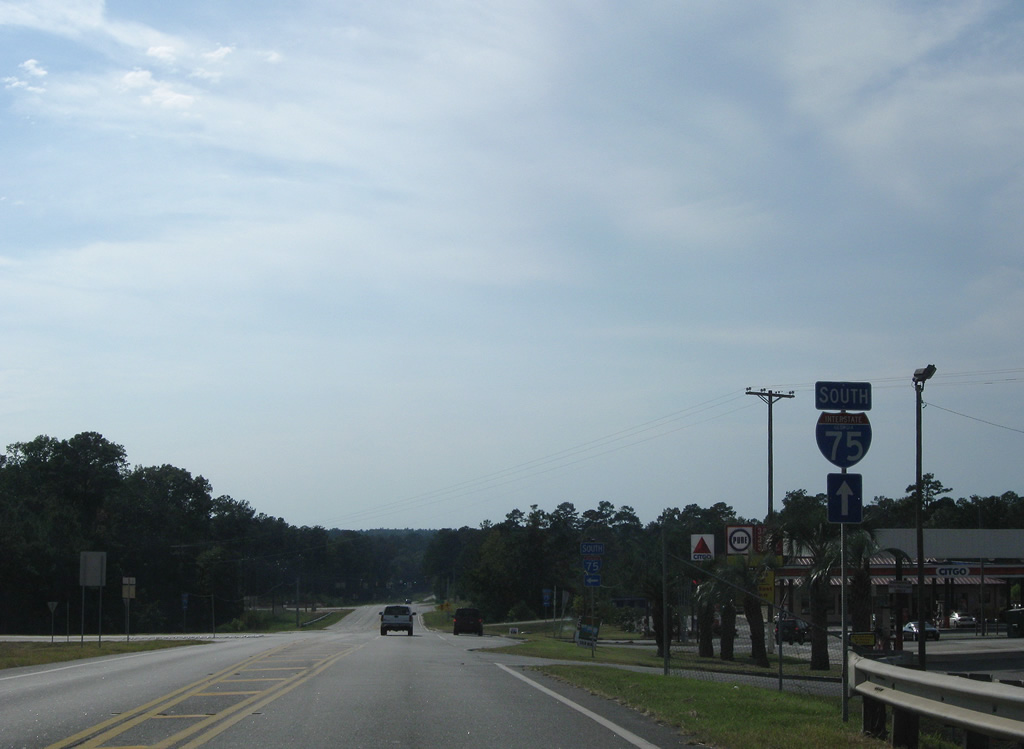
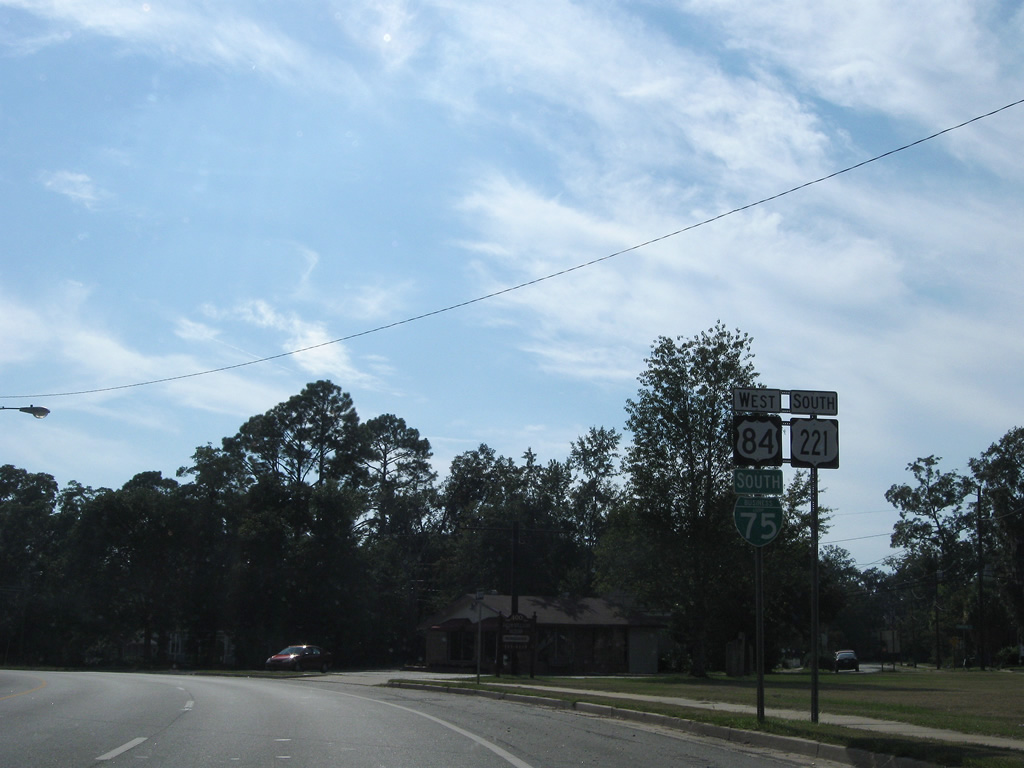
| U.S. 84/221-SR 38 overlap west from Valdosta to the Brooks County seat of Quitman. 06/26/22 |
|
| A loop ramp joins Interstate 75 south to Lake Park, Jennings and Jasper, Florida. 06/26/22 |
Photo Credits:05/28/05, 09/18/06, 09/28/08, 04/10/10, 05/06/22, 06/26/22 by AARoads
Connect with:
Interstate 75
U.S. 84
U.S. 221
Page Updated 09-22-2022.


 North
North  East
East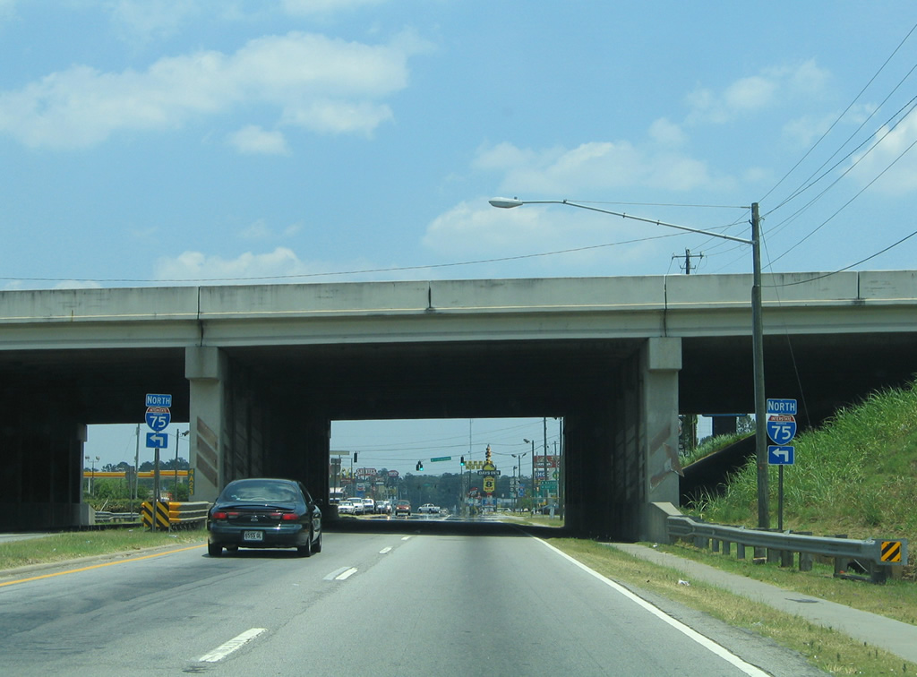

 North
North


 North
North