|
| Forthcoming SR 58 (Leavitt Road) runs north to Lorain and south to Ashland. 09/30/10 |
|
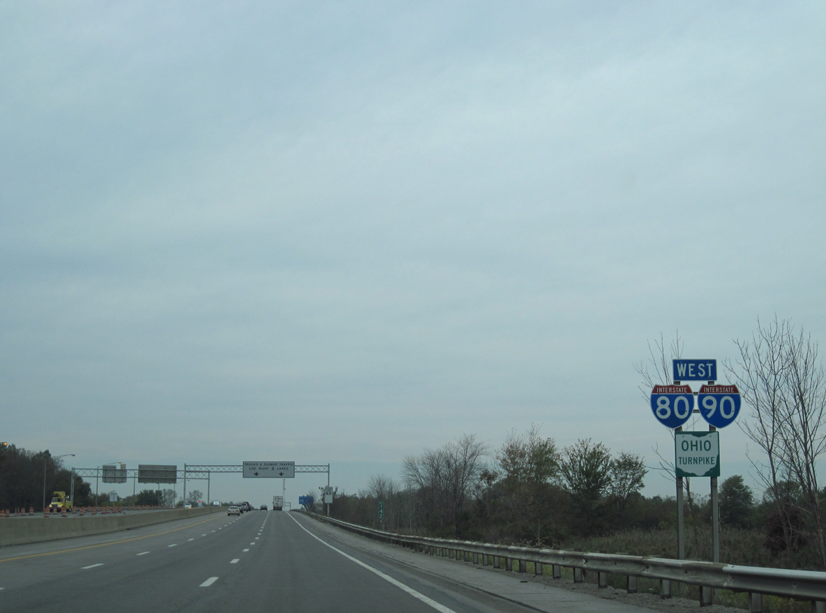
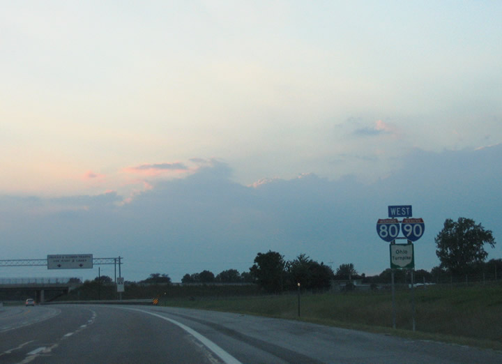
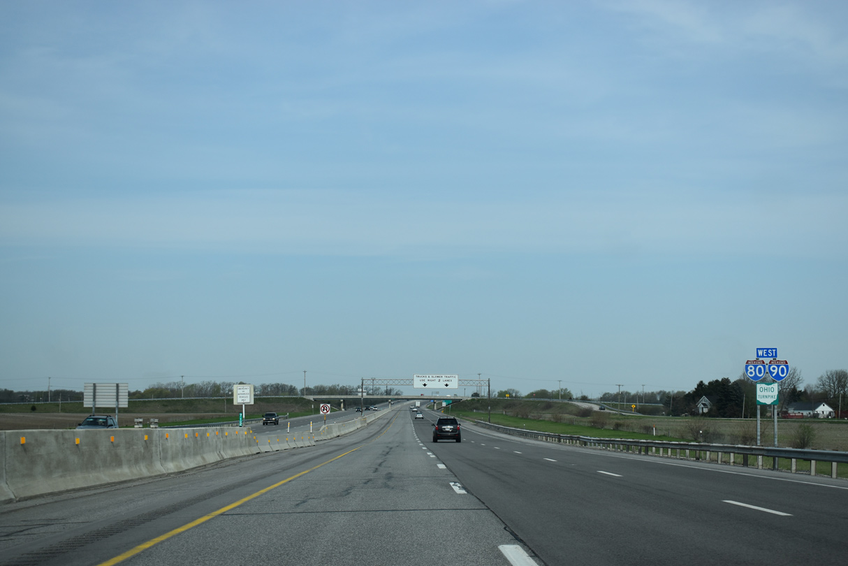
| The first westbound confirming markers for the 287 mile long overlap of I-80/90. 09/30/10 |
|
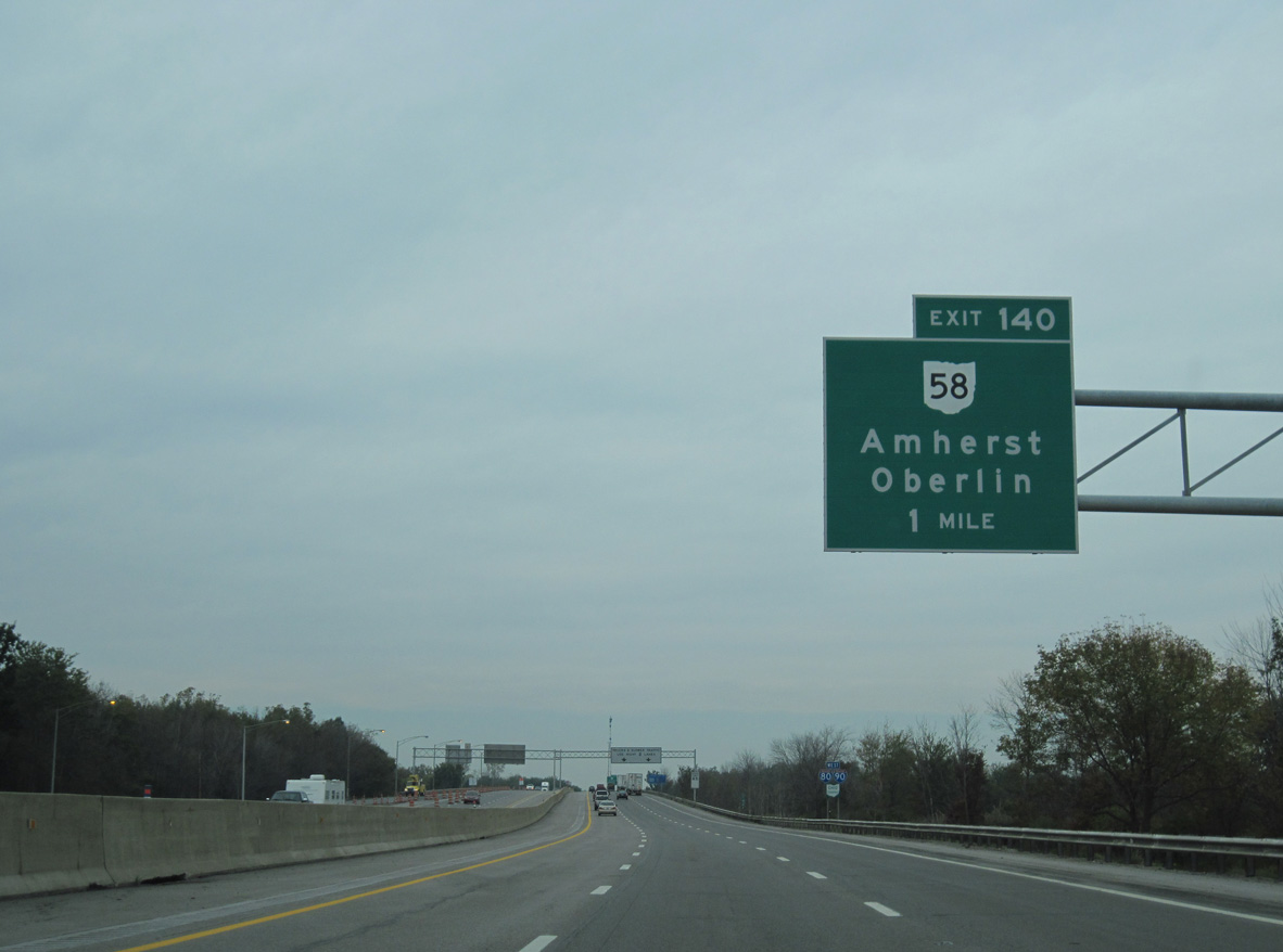
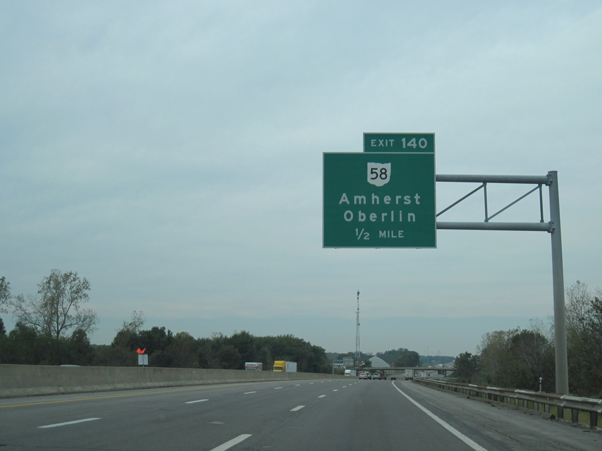
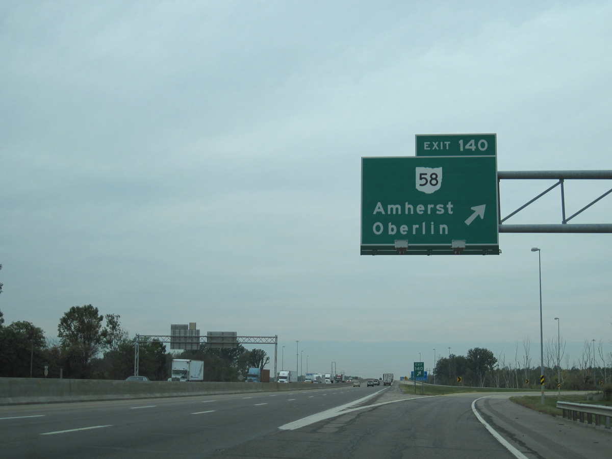
| SR 58 (Leavitt Road) heads south six miles to Oberlin and Oberlin College and north six miles to conclude at U.S. 6 (Erie Avenue) near the south shore of Lake Erie. 09/30/10 |
|
| The trumpet interchange at Exit 140 ties into SR 58 south of the Ohio Turnpike in Amherst township. 09/30/10 |
|
| SR 58 connects I-80/90 with South Amherst via SR 113 to the south and Vermilion via the freeway along SR 2 west. 09/30/10 |
|
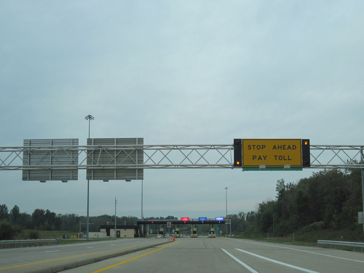
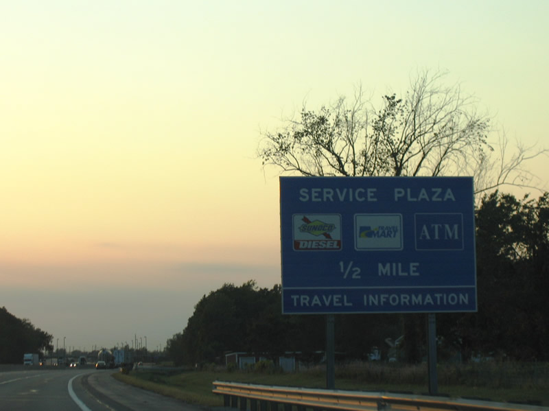
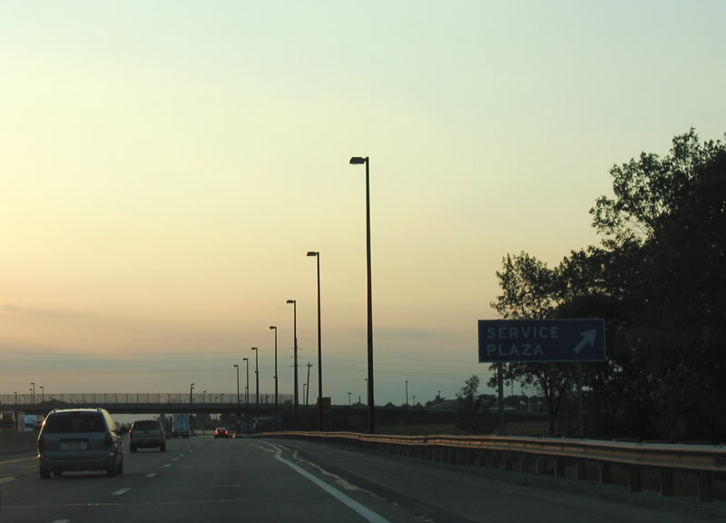
| The Middle Ridge Service Plaza lies along the Ohio Turnpike westbound at milepost 139.5. Gas, food and travel information is available at the facility located just beyond the SR 58 overpass. 09/01/05 |
|
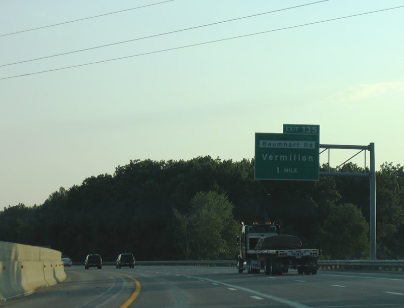
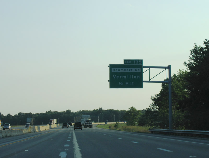
| Exit 135 links I-80/90 with Baumhart Road north to the city of Vermilion. 09/01/05 |
|
| Baumhart Road heads south from Exit 135, 5.4 miles to SR 511 and 7.3 miles to U.S. 20 between Oberlin and Kipton. 09/01/05 |
|
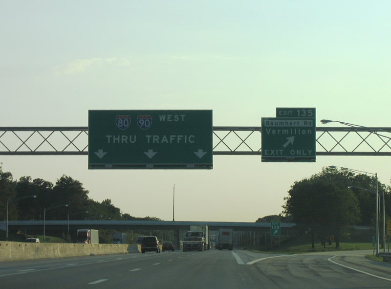
| Entering the trumpet interchange (Exit 135) with the access road to Baumhart Road. Baumhart Road meets SR 2, a freeway from I-90 west to Sandusky, and U.S. 6, 4.5 miles to the north. 09/01/05 |
|
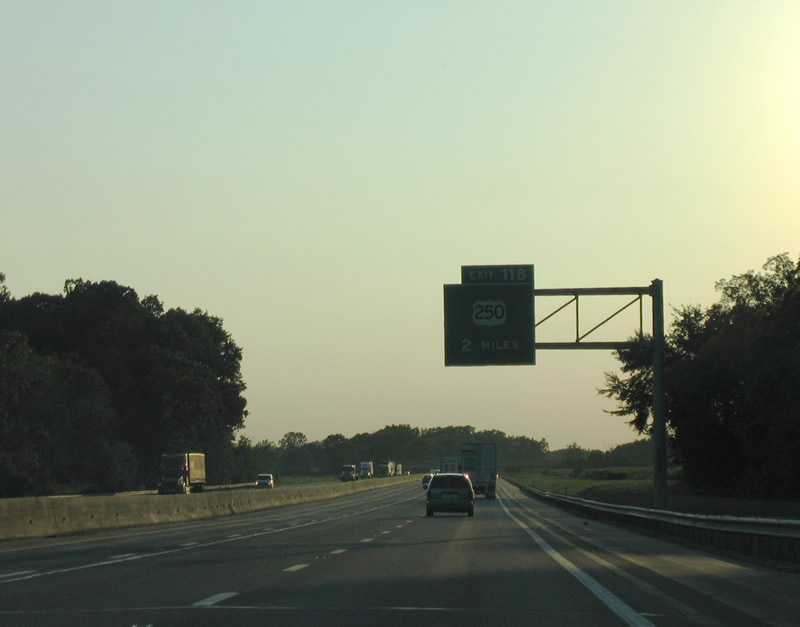
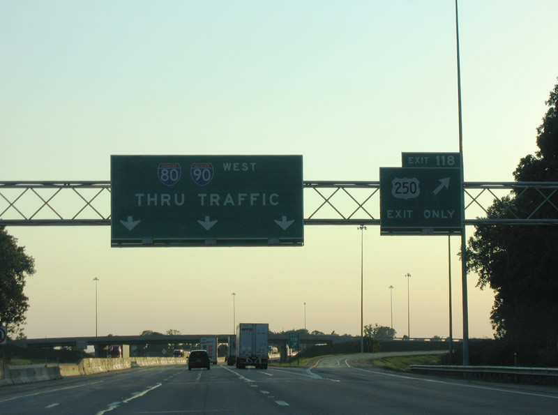
| 17 miles westward through Erie County, I-80/90 meet U.S. 250 at Avery. 09/01/05 |
|
| U.S. 250 joins the Ohio Turnpike with the cities of Sandusky and Norwalk. Sandusky, the Erie County seat, lies along the shore of Sandusky Bay and Lake Erie to the northwest. Norwalk, the Huron County seat, lies five miles to the south at U.S. 20. 09/01/05 |
|
| U.S. 250 concludes in Sandusky at U.S. 6. Milan, the birthplace of Thomas Edison, lies along U.S. 250 south between Exit 118 and Norwalk. U.S. 250 overall in Ohio travels east from to Ashland, Wooster and Wheeling, West Virginia. 09/01/05 |
|
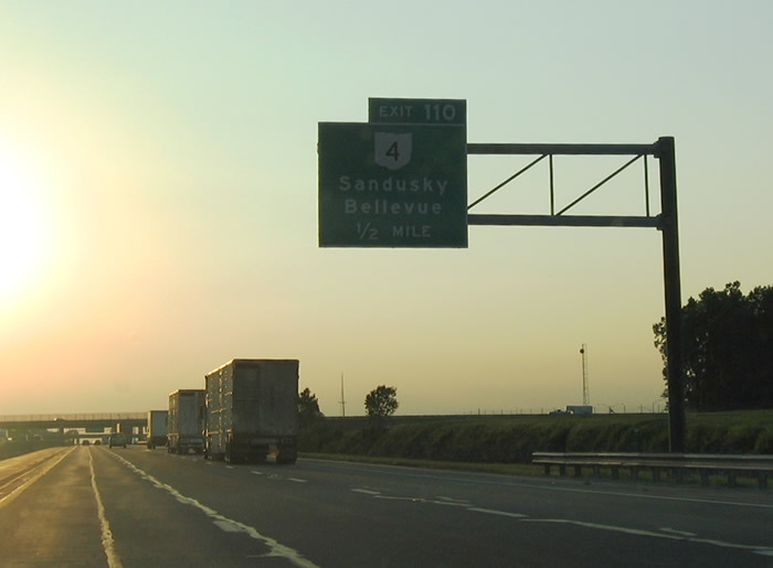
| The second interchange along the Ohio Turnpike in Erie County connects I-80/90 with SR 4 at Exit 110, eight miles southwest of Sandusky. 09/01/05 |
|
| SR 4 (Hayes Avenue) passes over the Ohio Turnpike ahead of the trumpet interchange at Exit 110. SR 4 continues southwest of I-80/90 toward the east of Bellevue. 09/01/05 |
|
| Exit 110 leaves I-80/90 westbound for SR 4 (Hayes Avenue). SR 4 runs south through Bucyrus, Marion and Marysville en route to Cincinnati. 09/01/05 |
|
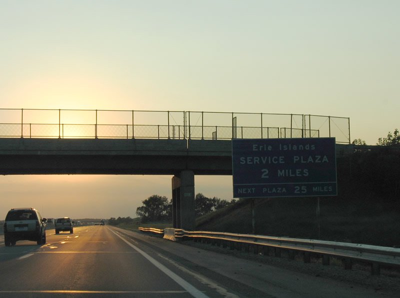
| I-80/90 advance two miles west from the Mugg Road overpass in Townsend township to the Erie Islands Service Plaza. 09/01/05 |
|
| Located southwest of Vickery and adjacent to SR 412, the Erie Islands Service Plaza provides the usual array of travel services (gas, food, tourist information). 09/01/05 |
|
| The Erie Islands Service Plaza is on the longest exit less stretch of the Ohio Turnpike at 19 miles. 09/01/05 |
|
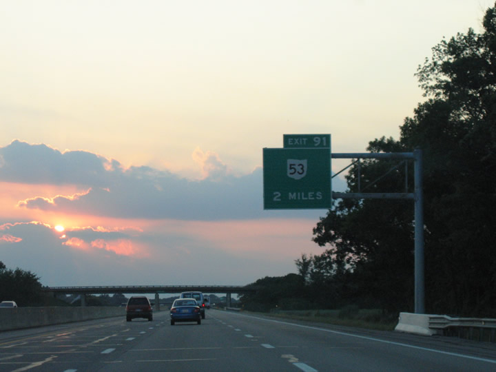
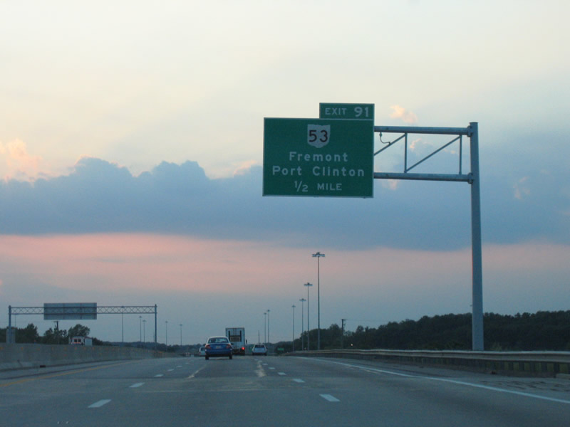
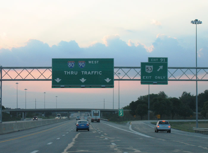
| I-80/90 west crosses the Sandusky County line ahead of the trumpet interchange (Exit 91) with SR 53. 09/01/05 |
|
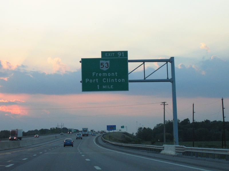
| I-80/90 rise across the Sandusky River one mile from Exit 91. SR 53 follows the river northeast from the Sandusky County seat of Fremont to Sandusky Bay and Port Clinton. 09/01/05 |
|
| SR 53 overall travels between Kenton and Catawba Island on the shores of Lake Erie. 09/01/05 |
|
| SR 53 heads 2.3 miles south to combine with U.S. 20 along a freeway bypass of Fremont at Rawson Avenue. 09/01/05 |
|
| Confirming markers posted ahead of the Fangboner Road over crossing west of SR 53. 09/01/05 |
|
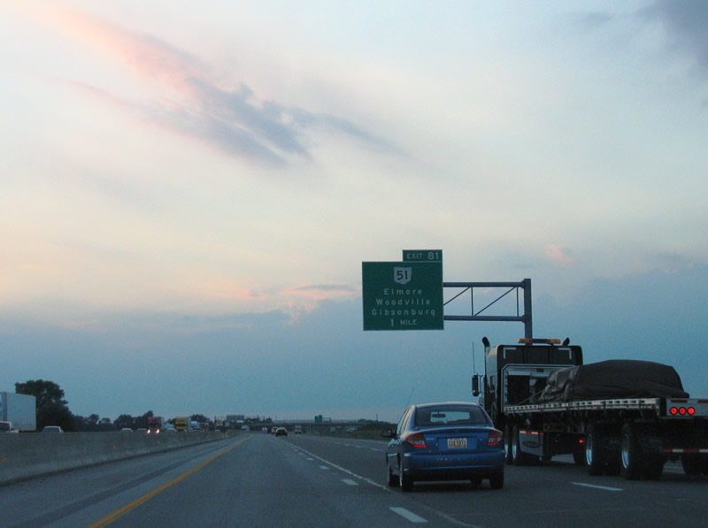
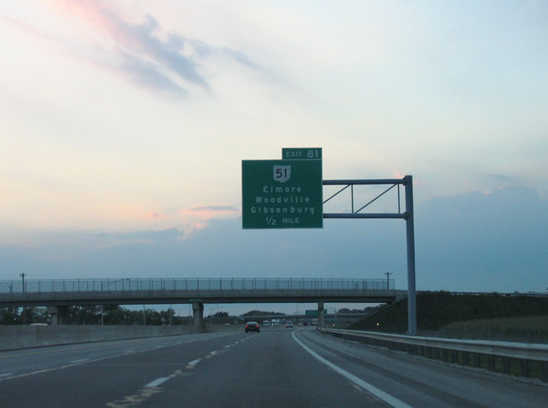
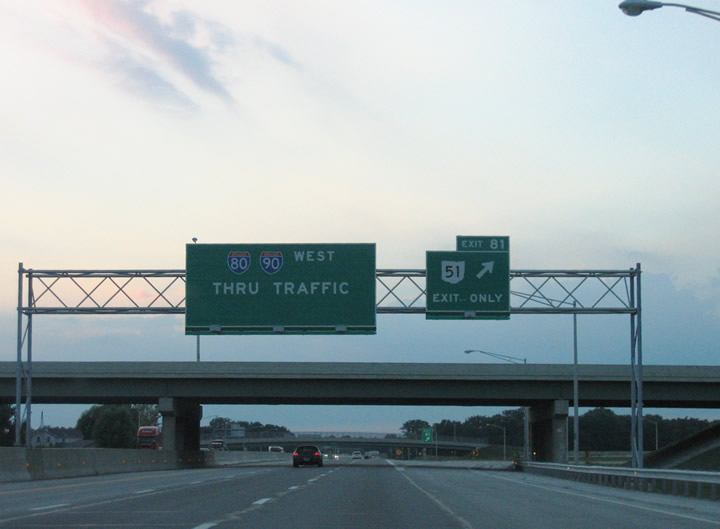
| I-80/90 progress northwest into Washington township toward Exit 81 with SR 51 and the Ottawa County line. 09/01/05 |
|
| SR 51 serves the villages of Elmore to the north and Gibsonburg to the south. Woodville lies to the west where SR 105 and U.S. 20 converge. 09/01/05 |
|
| Swartzman Road passes over the Ohio Turnpike one half mile east of the trumpet interchange at Exit 81. A long access road stems west from Exit 81 over Damschroder Road to SR 51, one mile south of Elmore and 6.5 miles northeast of Gibsonburg. 09/01/05 |
|
| SR 51 measures 30.73 miles in length from U.S. 20 along the Woodville and Washington township line northwest to Northwood, Oregon, Toledo and U.S. 23/223 at Sylvania. 09/01/05 |
|
| I-80/90 crosses Sugar Creek ahead of this shield assembly and the SR 51 overpass. 09/01/05 |
|
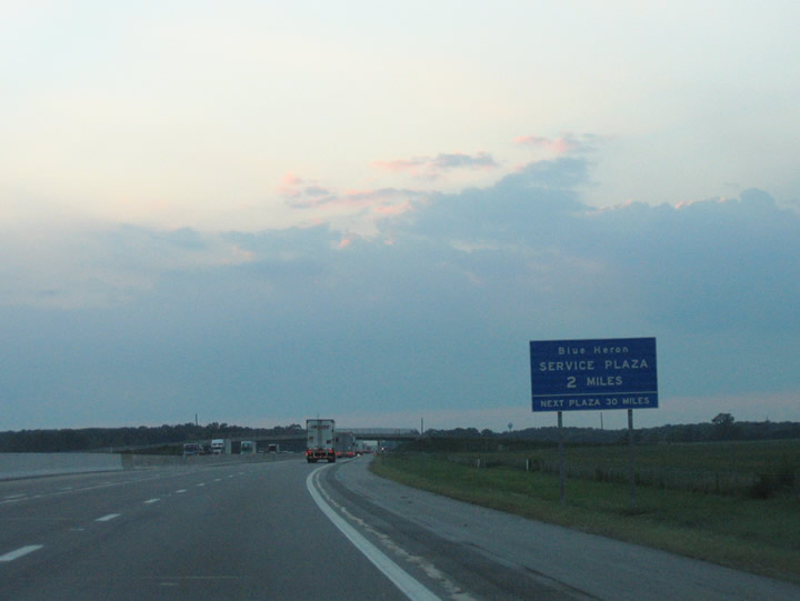
| Reentering Sandusky County, I-80/90 advances two miles northwest to the Blue Heron Service Plaza. 09/01/05 |
|
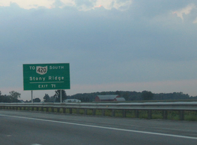
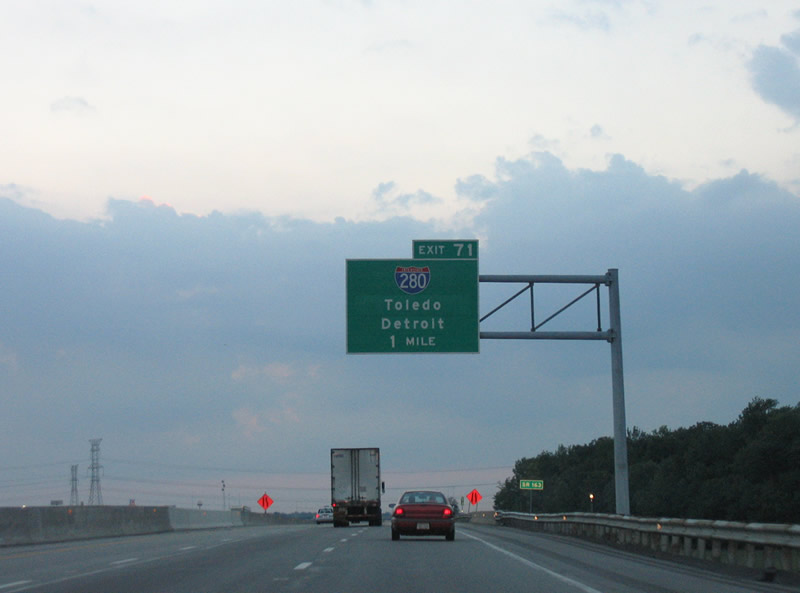
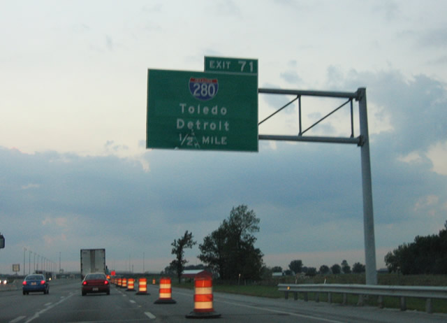
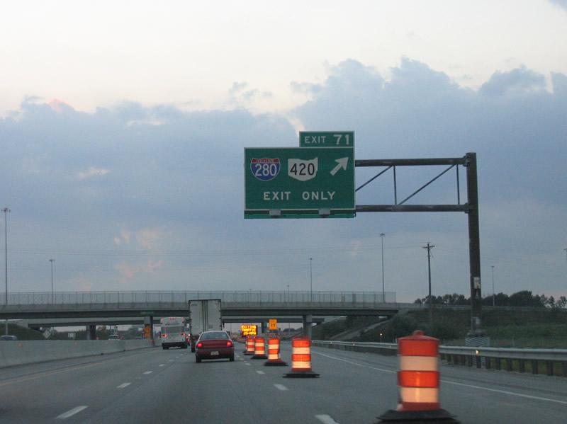
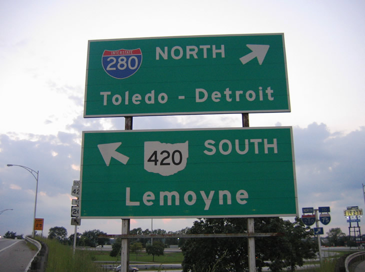
| Forthcoming Exit 71 connects the Ohio Turnpike with Interstate 280 north to Toledo and SR 420, a 2.89 mile long expressway south to U.S. 20/23. SR 420 links with SR 163 west to Stony Ridge. 09/01/05 |
|
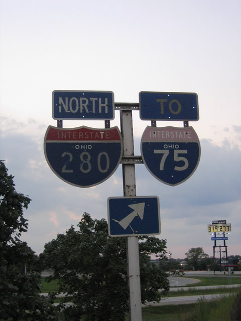
| Interstate 280 provides a direct connection to Downtown Toledo and I-75 north to Detroit from the Ohio Turnpike westbound. 09/01/05 |
|
| Exits 71, 64 and 59 join the Ohio Turnpike with the Toledo area. I-80/90 stay south of the city, crossing the Maumee River between Perrysburg and Maumee. 09/01/05 |
|
| Interstate 280 comprises a 12.38 mile long loop from I-80/90 and SR 420 north to the eastern suburbs of Walbridge, Northwood and Oregon. 09/01/05 |
|
| The trumpet interchange at Exit 71 was reconstructed from a compact design into larger foot print with sweeping ramps. 2006/07 work six laned the Ohio Turnpike between Exits 71 and 64. 09/01/05 |
|
| Guide signs at the trumpet interchange joining the access road at Exit 71 with SR 420 south to Lemoyne and I-280 north toward the Veterans' Glass City Skyway bridge spanning the Maumee River. 09/01/05 |
|
| Vintage shields formerly posted along the entrance ramp to Interstate 280. Detroit is 61 miles to the north via I-280 and I-75. 09/01/05 |
|
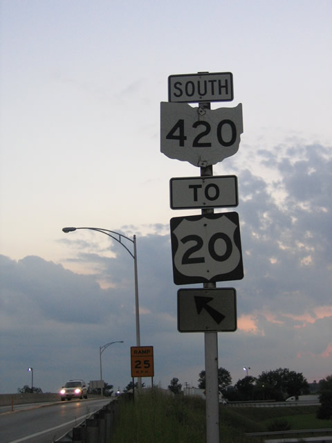
| SR 420 concludes to the south at a trumpet interchange with U.S. 20/23 at the unincorporated community of Lemoyne. U.S. 20/23 overlap 11.23 miles west from the Sandusky County line to Interstate 75 at Perrysburg. 09/01/05 |
|
| Lemoyne Road spans the Ohio Turnpike west of I-280/SR 420 in Lake township. 11/07/09 |
|
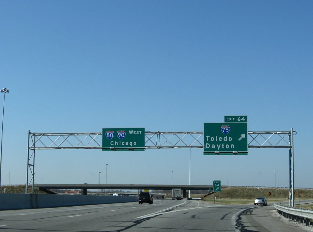
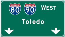
| Chicago appears for the first time along distance signs for I-80/90 west at 242 miles. 11/07/09 |
|
| The exchange with Interstate 75 north to Detroit lies 2.25 miles northwest of the Oregon Road overpass by the Meadows of Perrysburg subdivision. 11/07/09 |
|
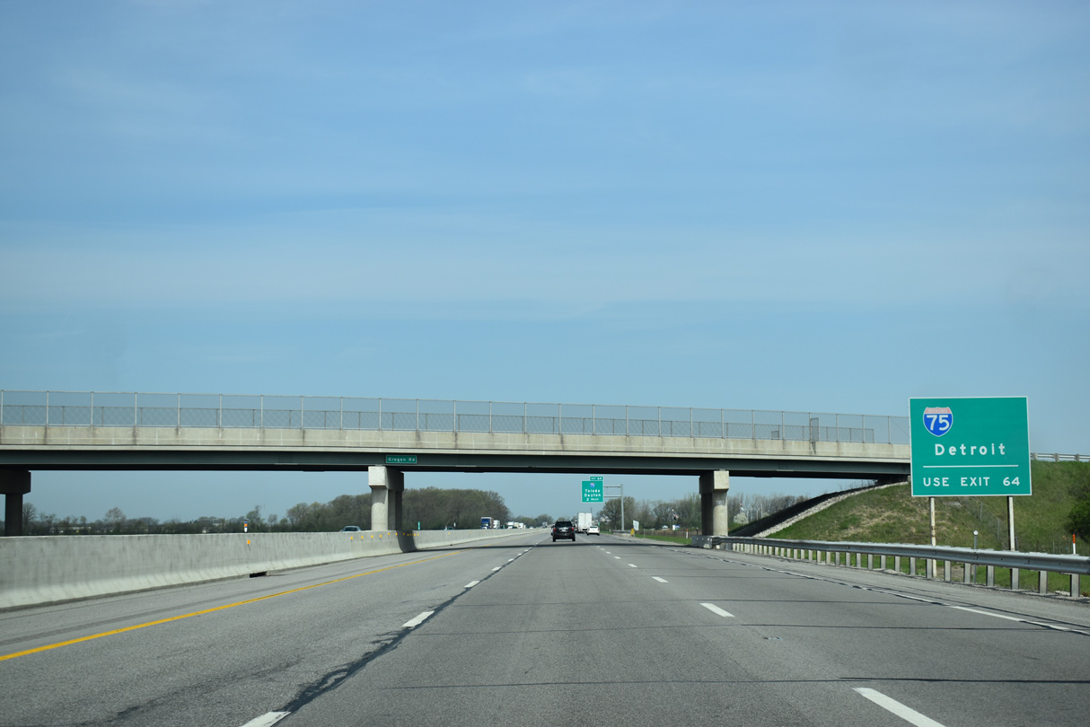
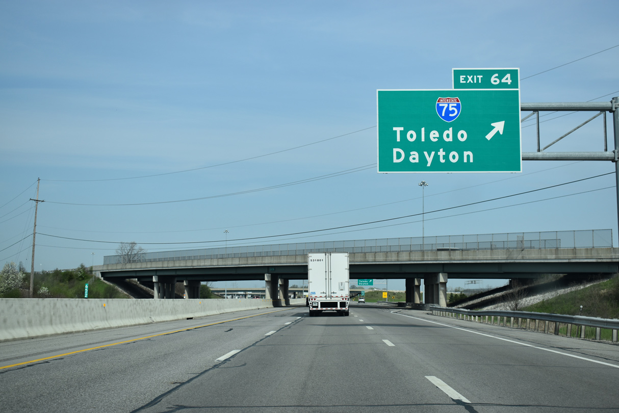
| The trumpet interchange at Exit 64 joins the Ohio Turnpike with Interstate 75 just north of SR 795 in Perrysburg township. 11/07/09 |
|
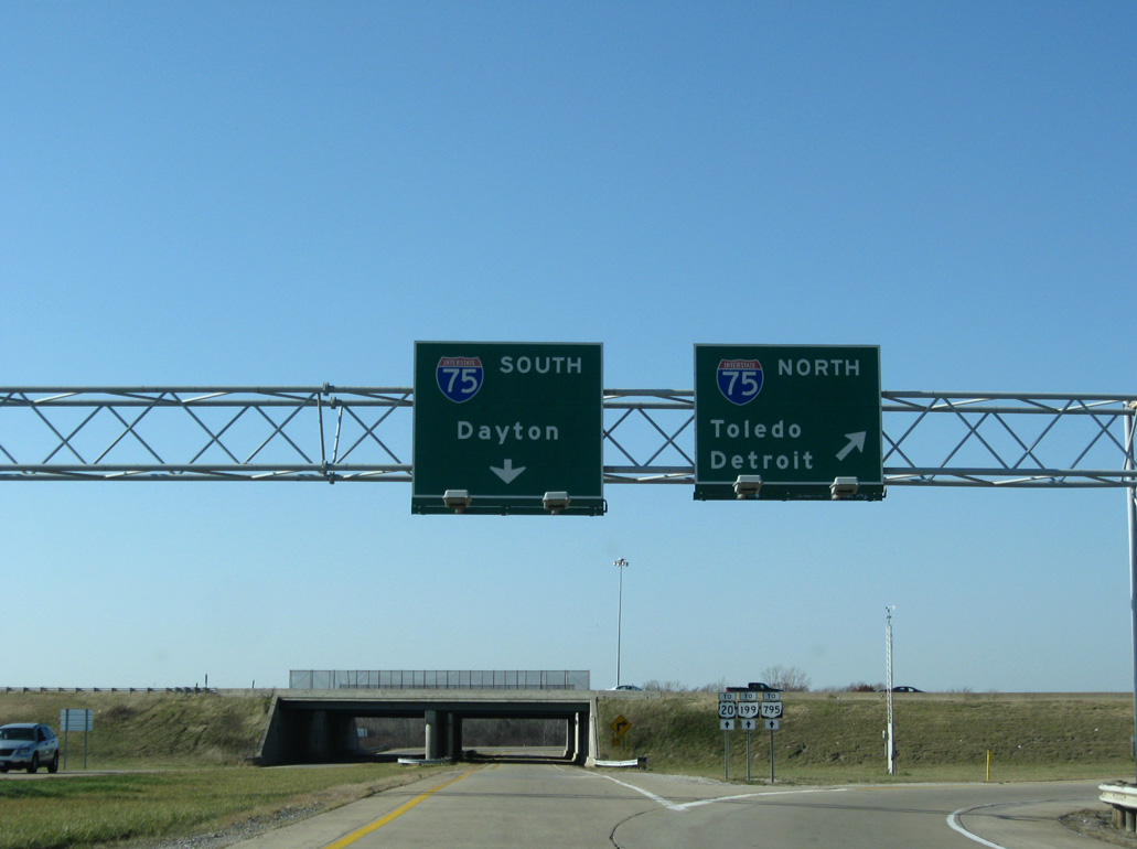
| Interstate 75 runs north from Cincinnati across western Ohio, continuing to Dayton, Lima and Toledo. 11/07/09 |
|
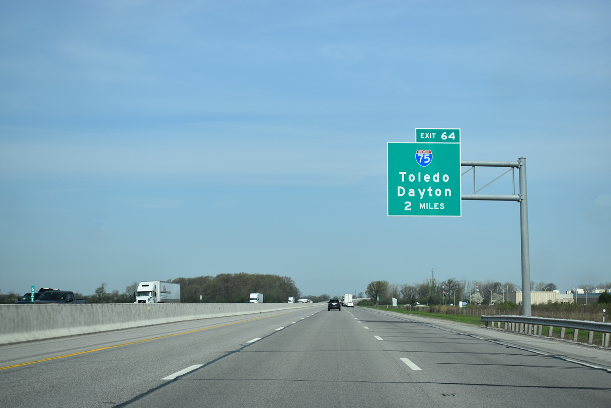
| Lime City Road and Ohio 795 (Indiana Avenue) pass over the Ohio Turnpike a half mile ahead of Exit 64. Interstate 75 travels northeast 6.5 miles to Downtown Toledo and 16.5 miles to the Michigan state line. 11/07/09 |
|
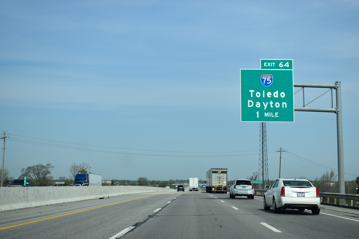
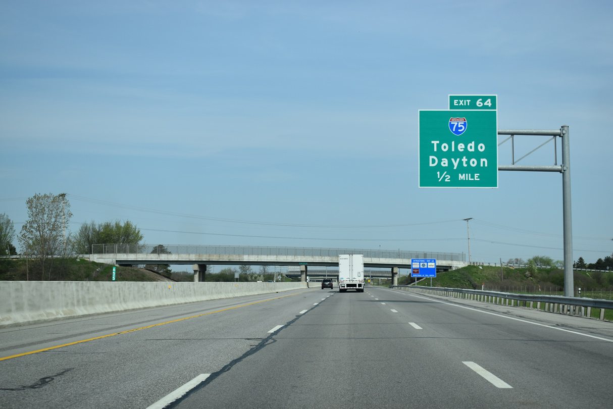
| Exit 64 leaves the Ohio Turnpike west for Interstate 75 north to Detroit, Michigan and south to Bowling Green and Findlay. 11/07/09 |
|
| Interstate 75 runs along the east side of Perrysburg south to Bowling Green and north from I-80/90 to Rossford, Northwood and East Toledo. 11/07/09 |
|
| Traffic partitions beyond the toll plaza at Exit 71 for Interstate 75. Points of interest for I-75 include to Fifth Third Field, home of the Toledo Mud Hens Minor League Baseball team, the Toledo Museum of Art and the Toledo Zoo. 11/07/09 |
|
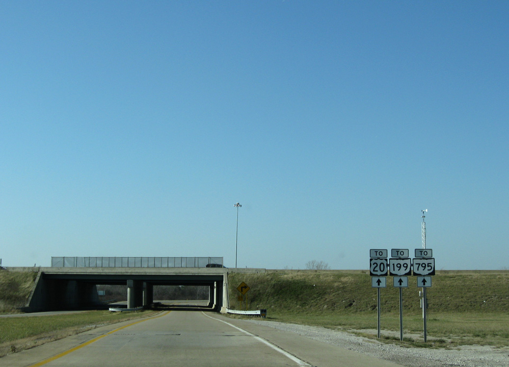
| U.S. 20 (Sandusky Street), SR 795 (Indiana Avenue) and SR 199 (Louisiana Avenue) converge in Downtown Perrysburg just off the Maumee River west of Interstate 75. 11/07/09 |
Page Updated 09-02-2021.


 West
West