|
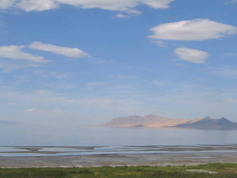
| Peering north from I-80 at Antelope and Fremont Islands from Lake Point Junction. 09/08/05 |
|
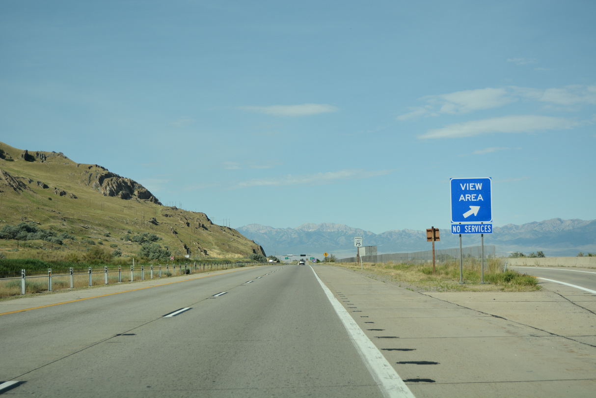
| A view area lies just beyond the wye interchange (Exit 102) where SR 201 merges with Interstate 80 west. The small parking lot affords views of Great Salt Lake and Antelope Island. 07/03/16 |
|
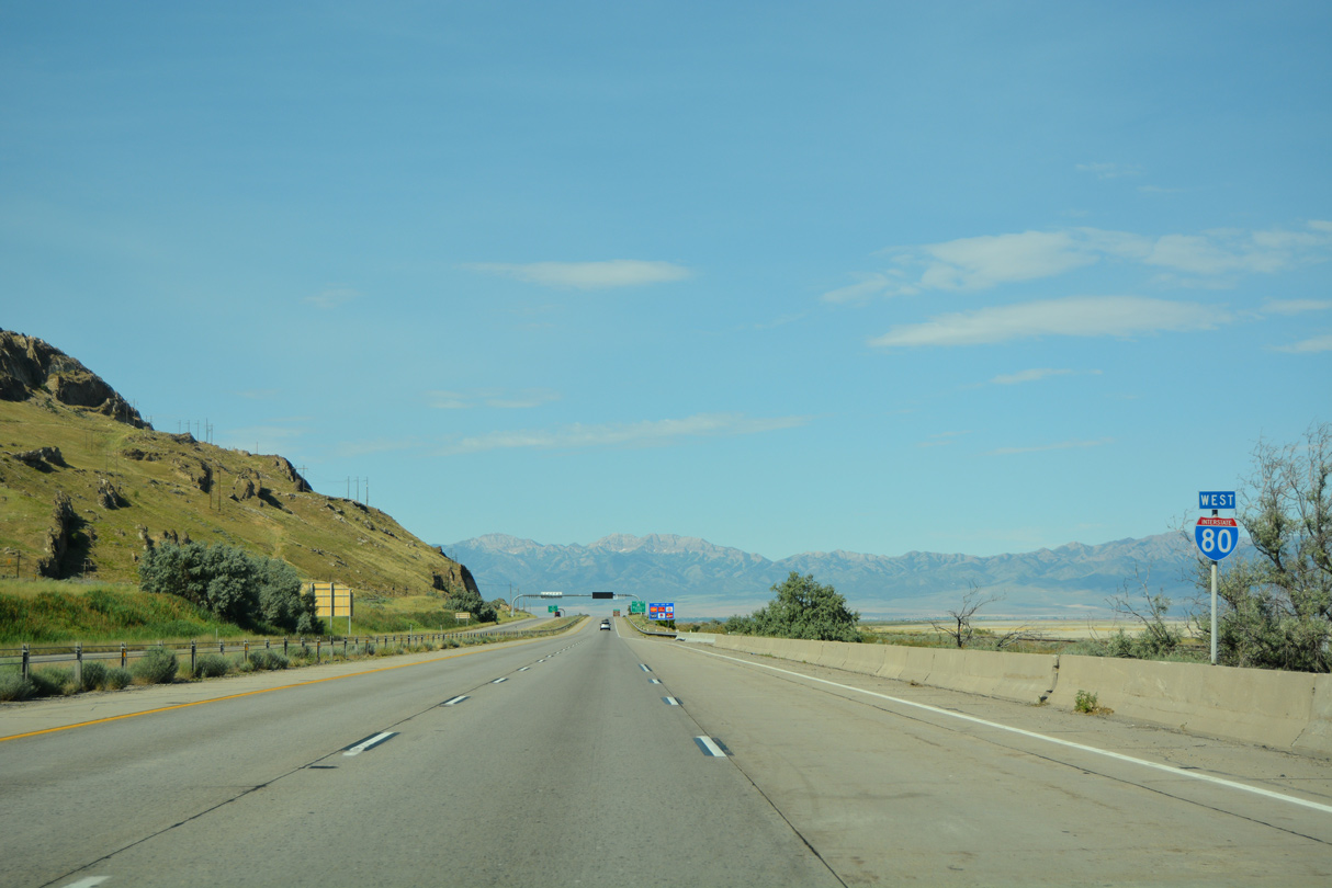
| I-80 navigates along a narrow strip of land between the 5,990 foot peak of Lake Point and Great Salt Lake. A pair of Union Pacific Railroad lines parallel the freeway here as well. 07/03/16 |
|
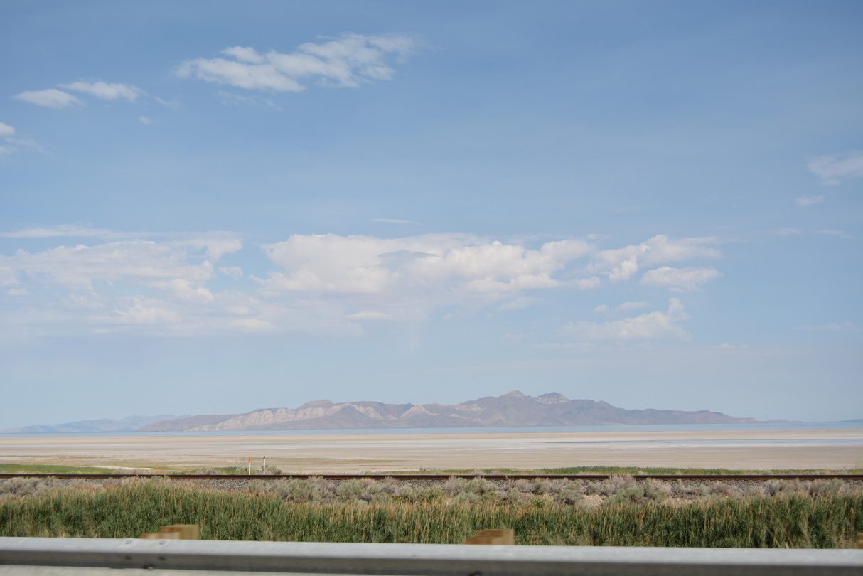
| A wide area of mud flats spread to the northwest between I-80 and the hills of Stansbury Island. 07/03/16 |
|
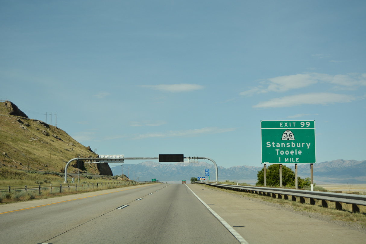
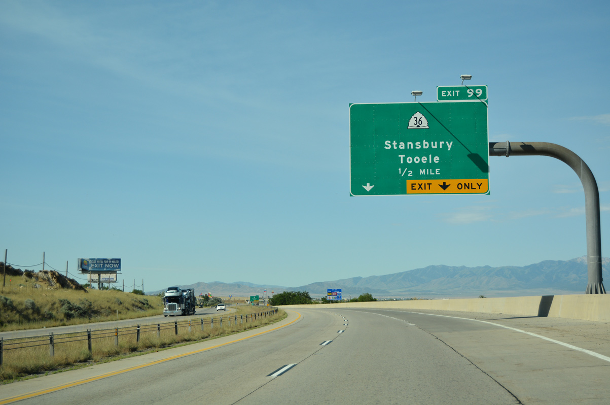
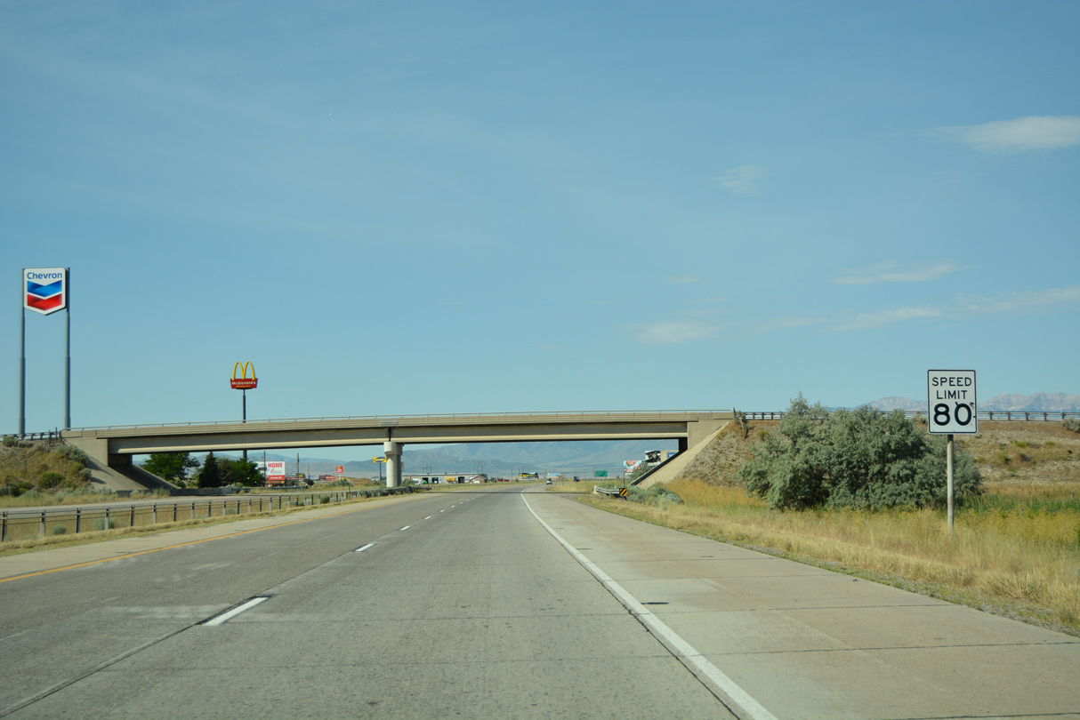
| SR 36 begins at a trumpet interchange (Exit 99) with Interstate 80 west in one mile. Exit 99 in one mile and travels 66.41 miles south to U.S. 6 at Tintic. 07/03/16 |
|
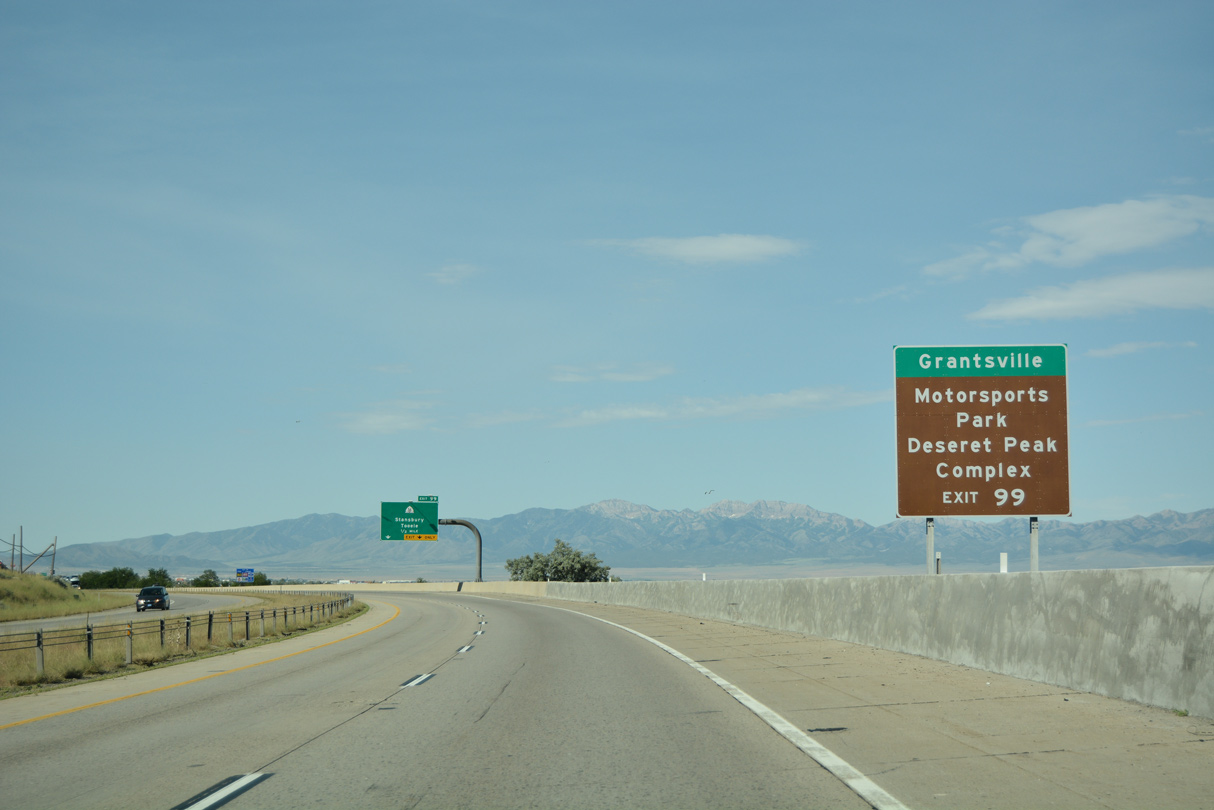
| SR 138 splits from SR 36 at Stansbury Park just south of Interstate 80. West from there, SR 138 travels to SR 112 and Grantsville. Utah Motorsports Campus and Deseret Peak Complex (a collection of sports venues) are located southeast of the city along SR 112. 07/03/16 |
|
| SR 36 travels 66.41 miles overall from Exit 99 south to Tooele, Stockton and Vernon and east to end at U.S. 6 northeast of Delta and west of Santaquin. 07/03/16 |
|
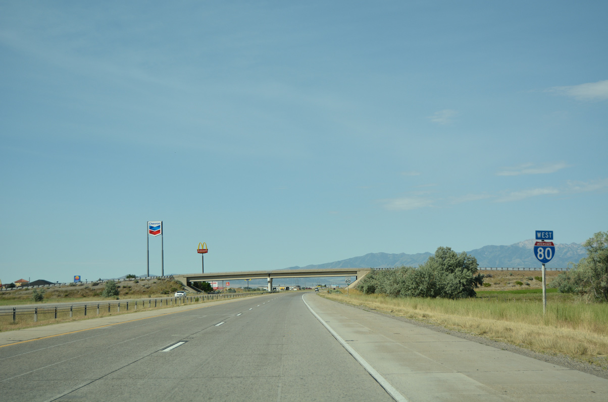
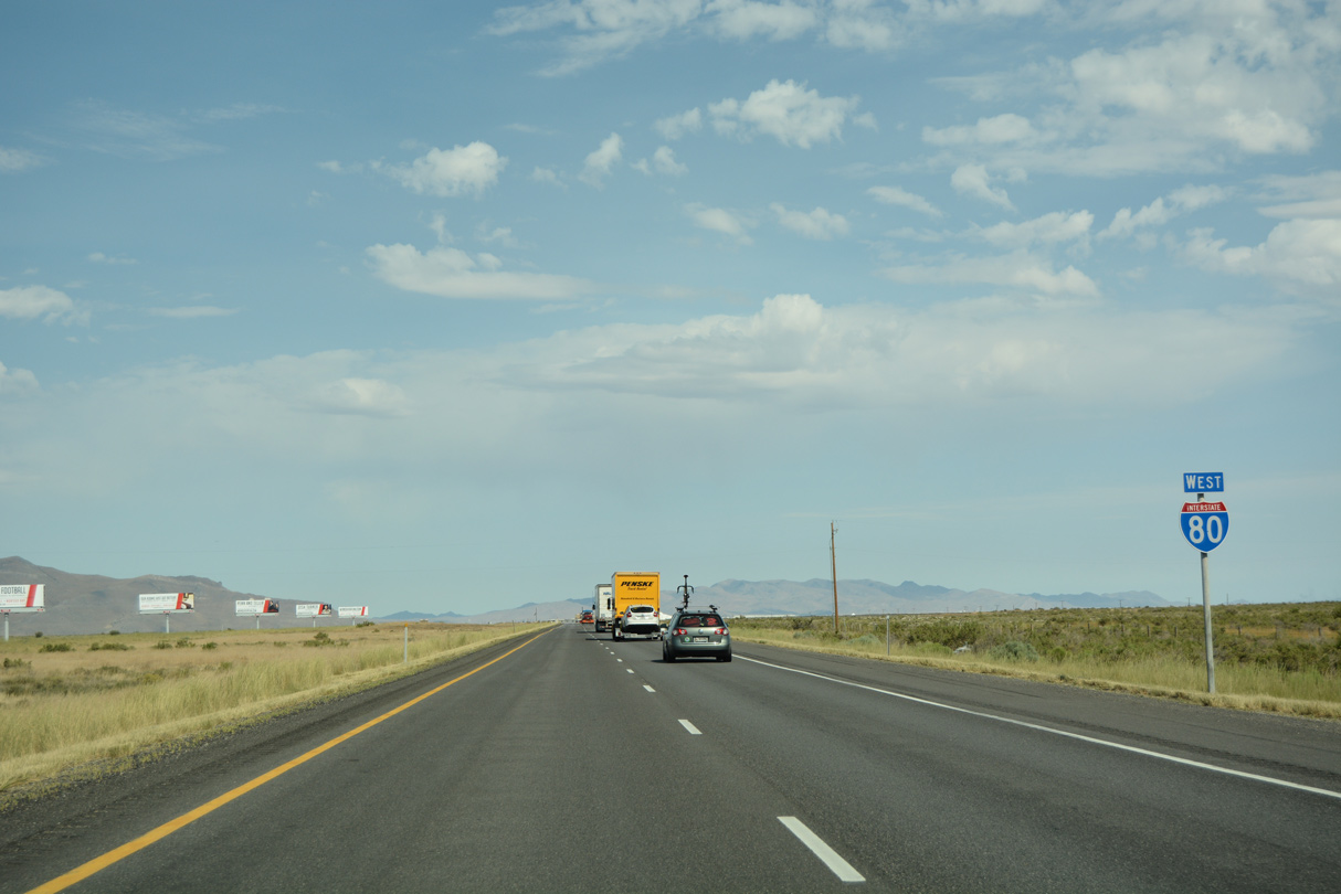
| Two lanes depart from Interstate 80 west for SR 36 south to Mills Junction, Stansbury Park and Tooele. Exit 99 provides the largest array of traveler services until I-80 reaches Wendover. 07/03/16 |
|
| Confirming marker for I-80 west posted ahead of the Hardy Road overpass. 07/03/16 |
|
| The speed limit increases from 75 to 80 miles per hour beyond Exit 99. It remains 80 mph to the Wendover. 07/03/16 |
|
| Grantsville appears again on I-80 signage at 16 miles out. The bedroom community is located along SR 138, which follows old U.S. 40 and U.S. 50 Alternate. Reno is another 504 miles west across the state of Nevada. 07/03/16 |
|
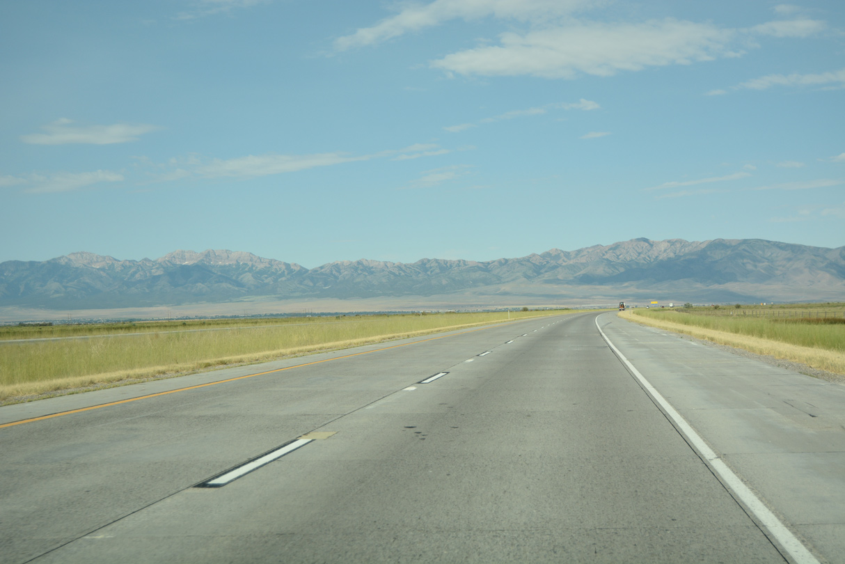
| Interstate 80 makes a sweeping turn around the southern periphery of the Great Salt Lake across Tooele Valley. 07/03/16 |
|
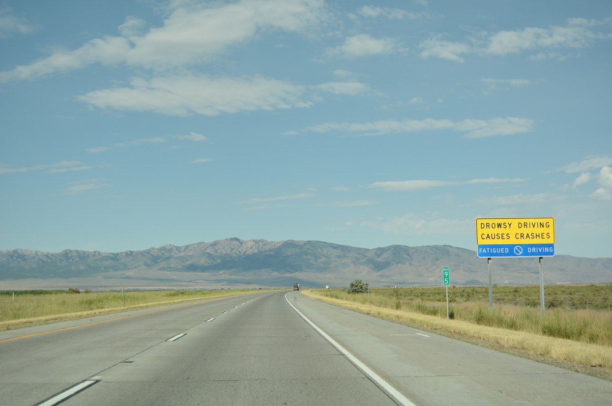
| Signs appear along remote sections of I-80 as part of a campaign by UDOT to prevent drowsy driving. The panels advocate motorists to stop at the ensuing interchange and take a break. 07/03/16 |
|
| Curving more to the north, I-80 traverses the Great Salt Lake mud flats and aim for the valley between the Stansbury and Lakeside Mountains. 07/03/16 |
|
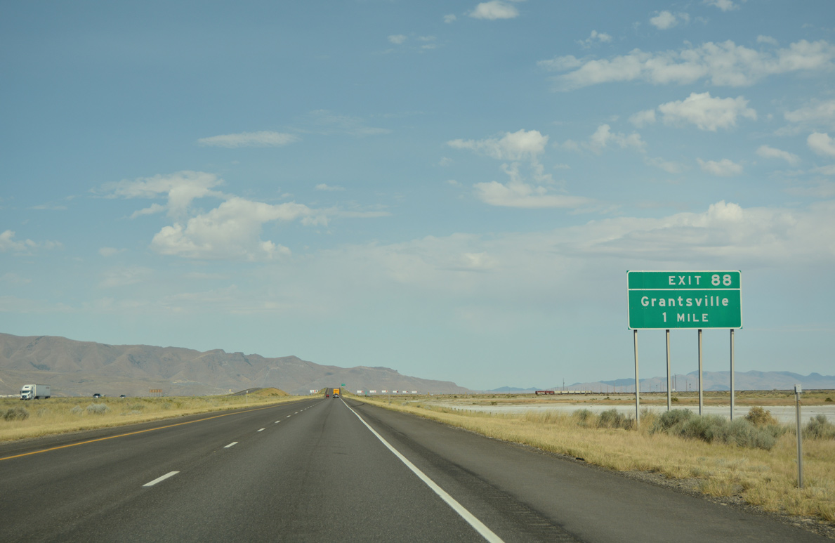
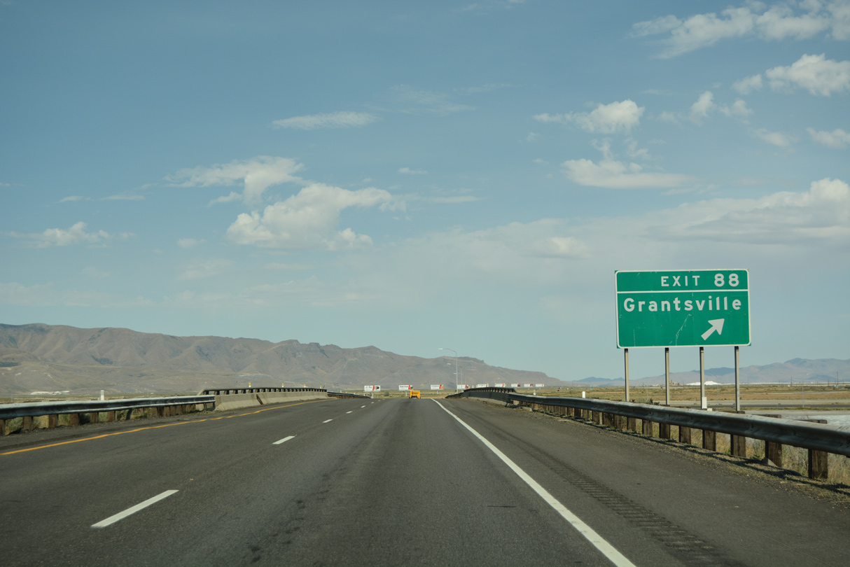
| A folded diamond interchange (Exit 88) joins Interstate 80 with Burmester Road south to Grantsville in one mile. 07/03/16 |
|
| Exit 88 loops away from I-80 west to Burmester Road at the Union Pacific Railroad siding of Burmester. Burmester Road heads south six miles to North Street in Grantsville. 07/03/16 |
|
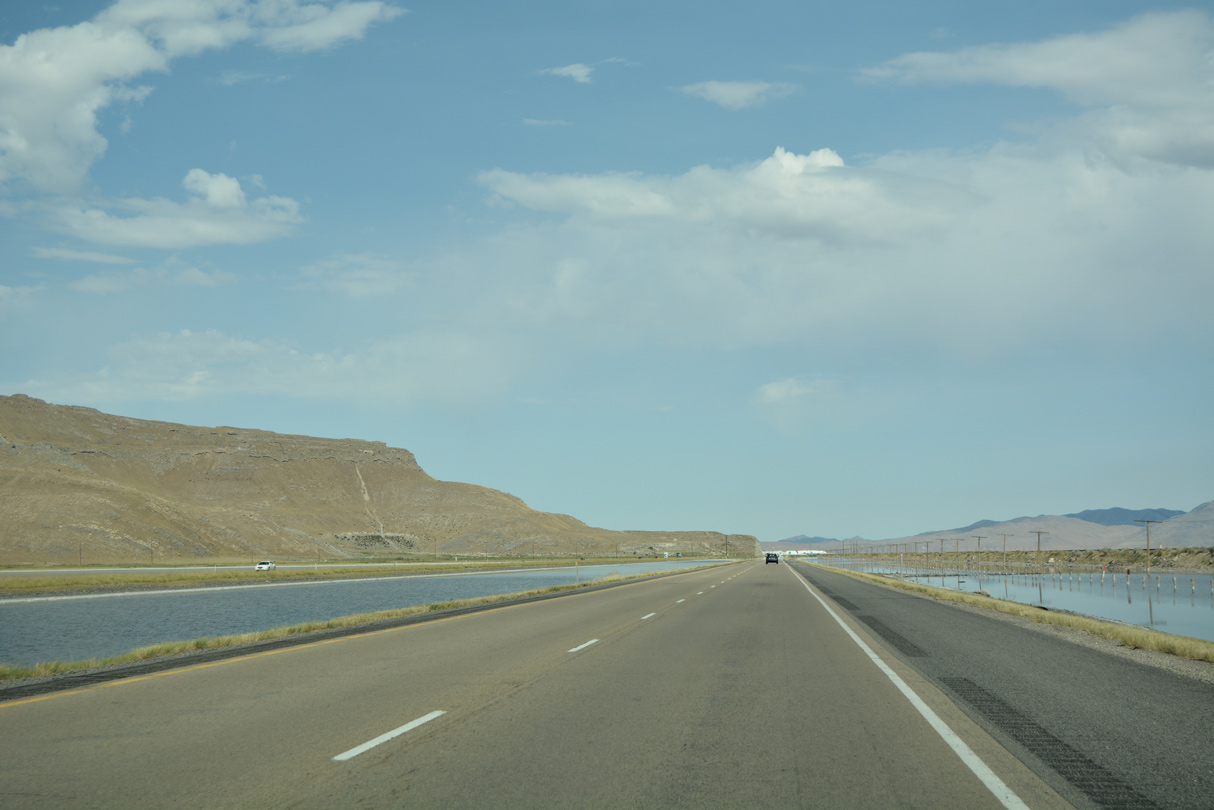
| Interstate 80 and the parallel Union Pacific Railroad line advance northwest through Tooele Valley toward Rowley Junction. 07/03/16 |
|
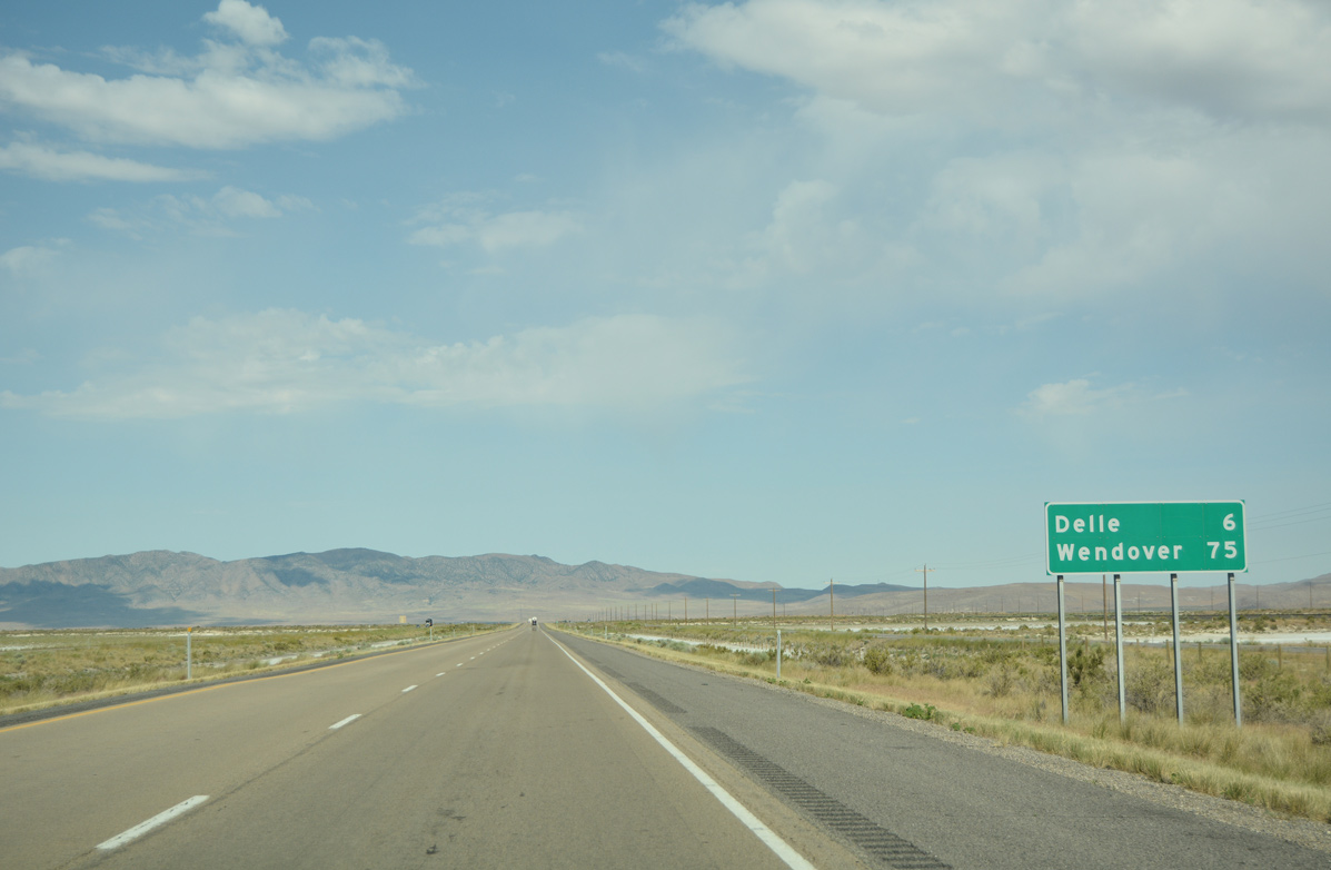
| The settlement of Delle is the succeeding destination city for I-80 west in 19 miles. Wendover is 88 miles away by the Nevada state line. 07/03/16 |
|
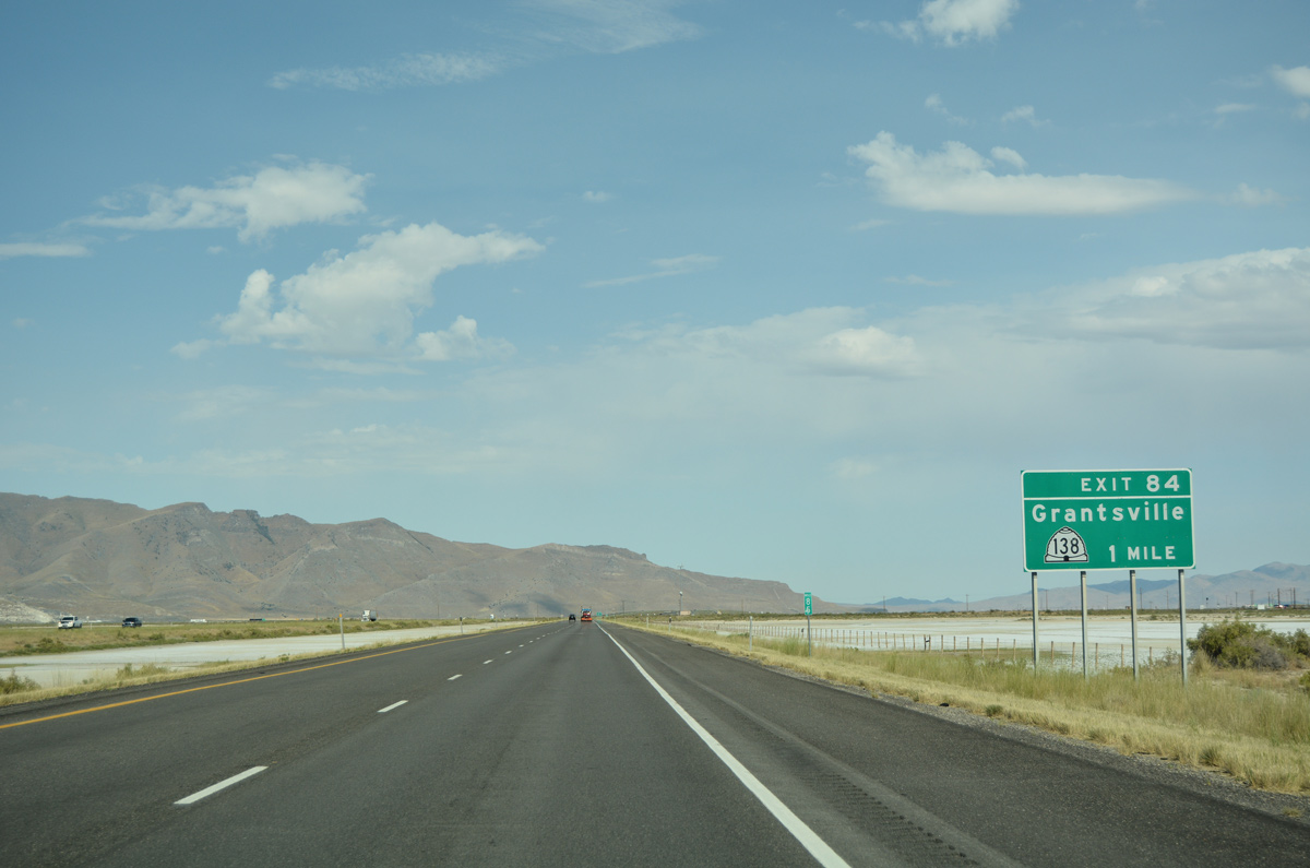
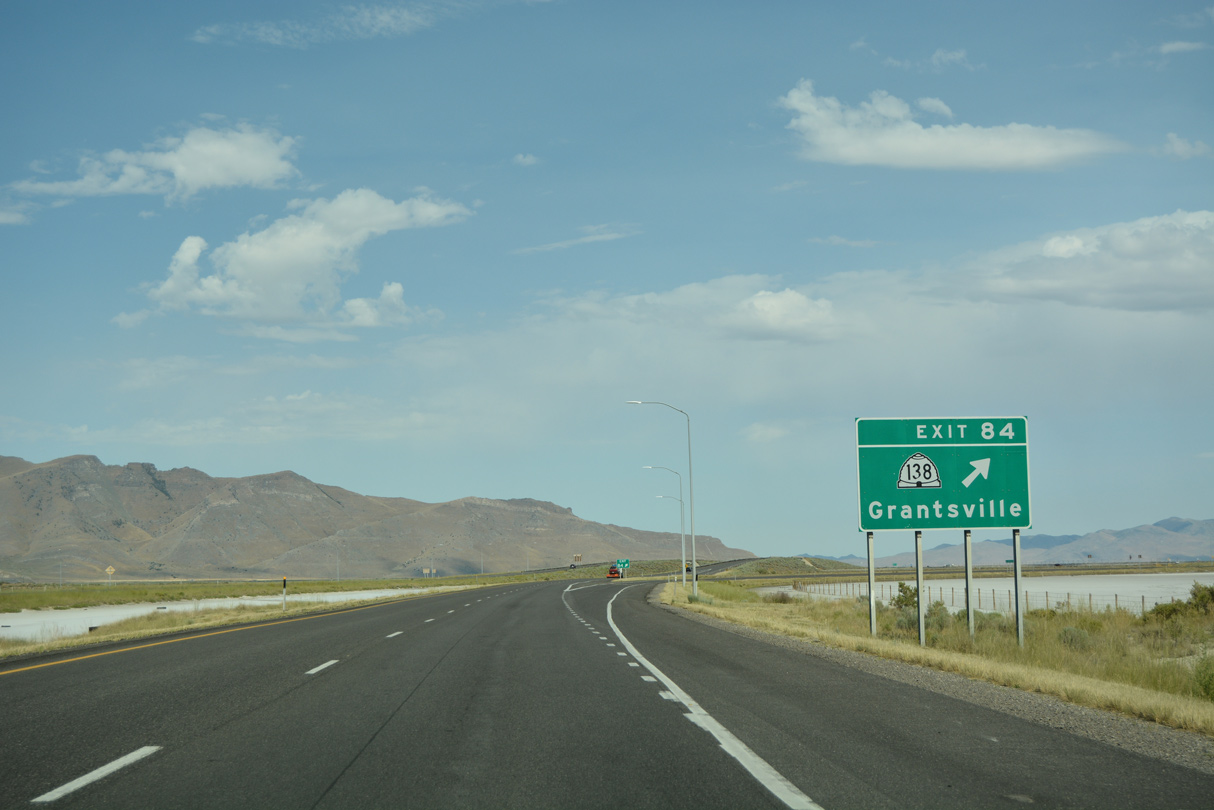
| SR 138 concludes a 20.44 mile loop from Stansbury Park at Exit 84 in one mile. Stansbury Island Road ties into the exchange from the remote island to the north. 07/03/16 |
|
| Adjacent railroad lines resulted in a folded diamond interchange design for Exit 84 with SR 138. SR 138 otherwise angles southwest to the railroad siding of Flux, where it overtakes old U.S. 40 & 50 Alternate southeast back to Grantsville. 07/03/16 |
|
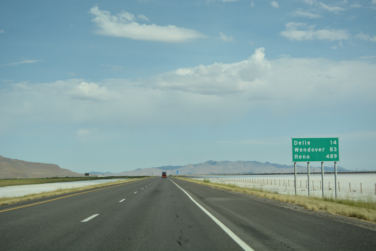
| Travelers progress westward along Interstate 80 to reach Delle in 14 miles and Wendover in 83 miles. Reno is now under 500 miles away. 07/03/16 |
|
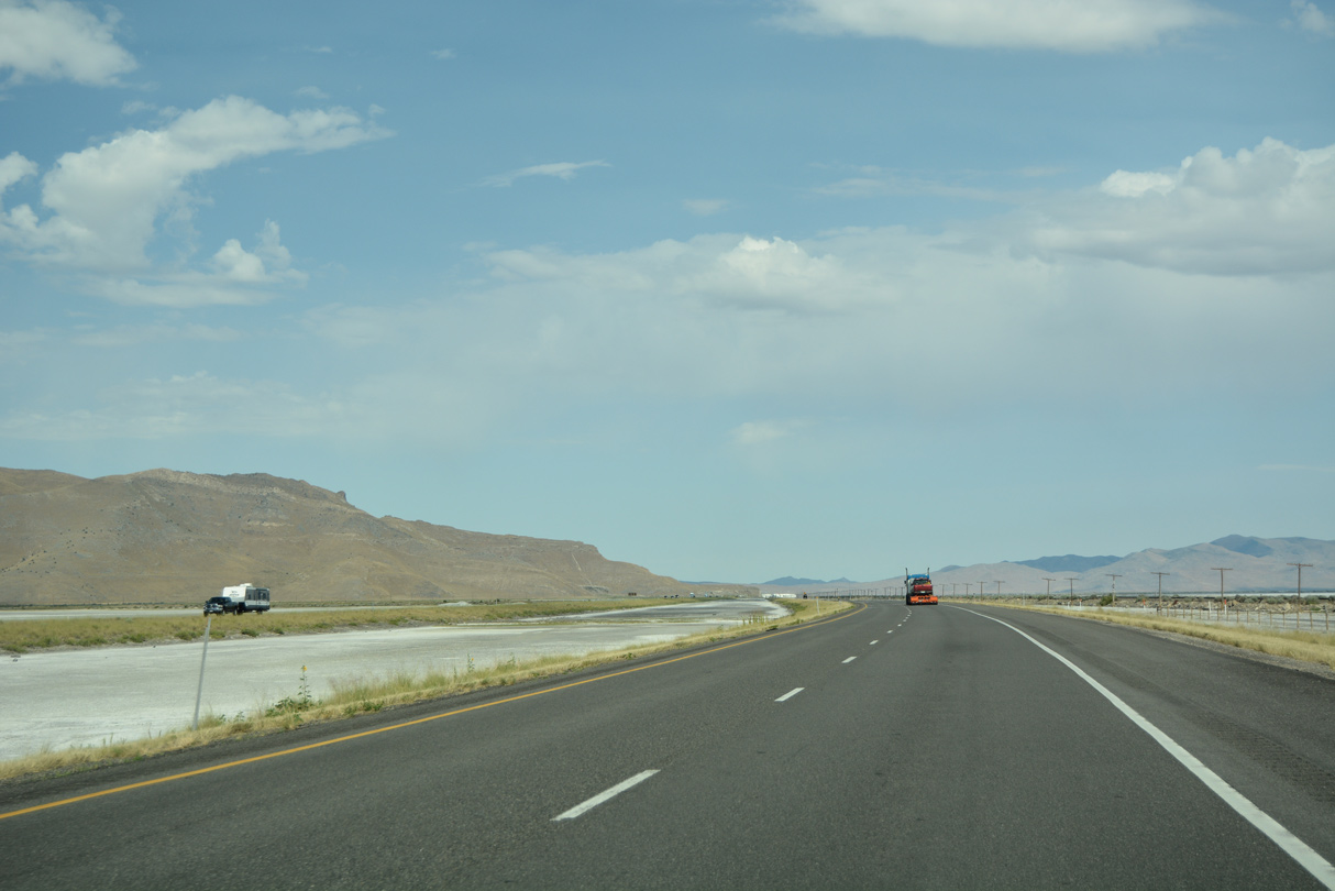
| Interstate 80 lines a causeway across additional Great Salt Lake mud flats toward the Stansbury Mountains. 07/03/16 |
|
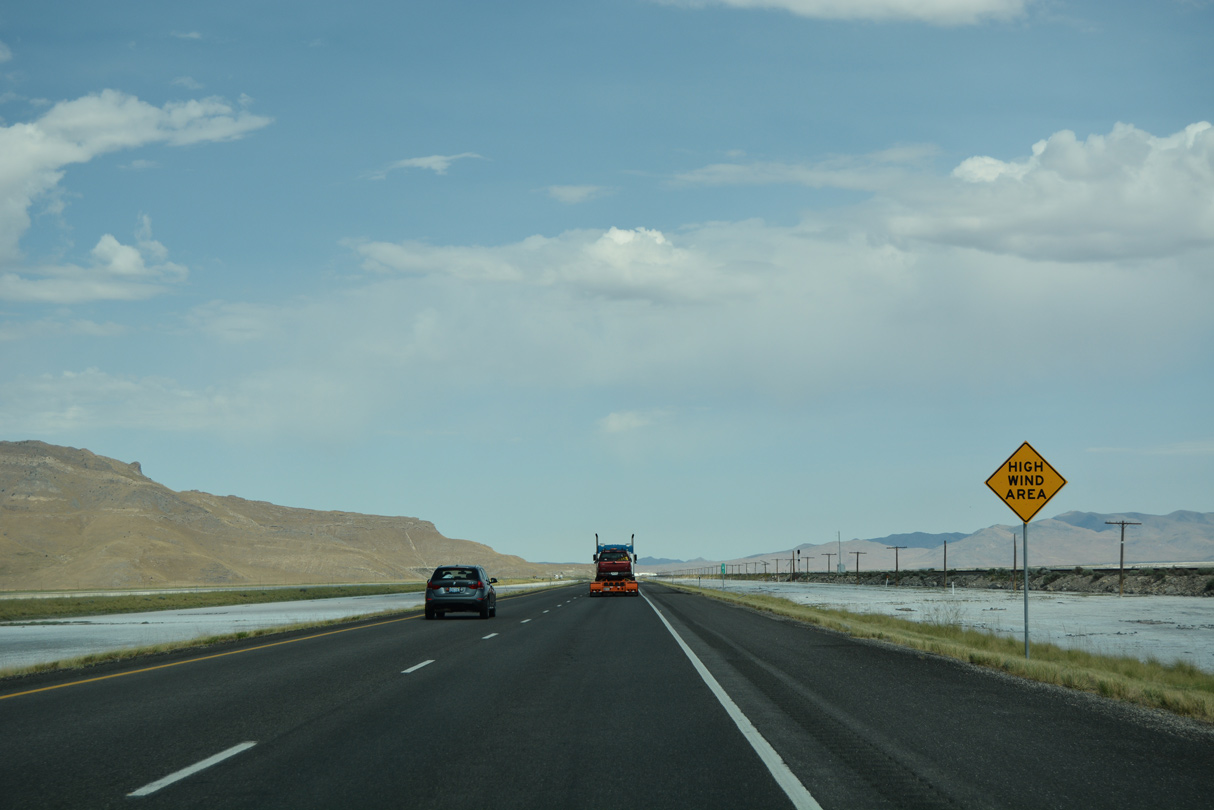
| Approaching the gap between the Stansbury Island and Stansbury Mountains, drivers of high profile vehicles are advised of potential high winds. 07/03/16 |
|
| Flooding along the southern shore of the Great Salt Lake has been a problem in the past, including along Interstate 80. 07/03/16 |
|
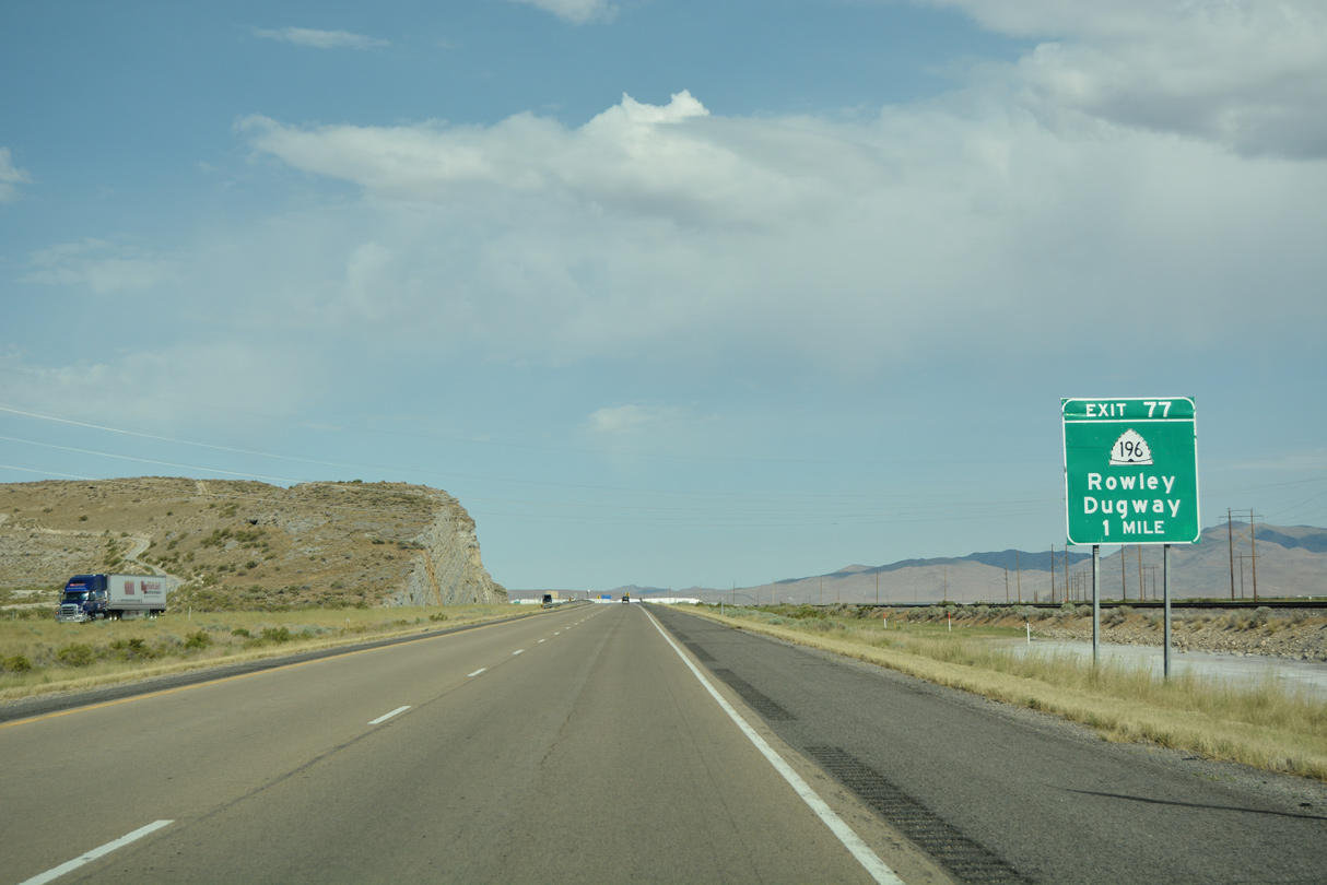
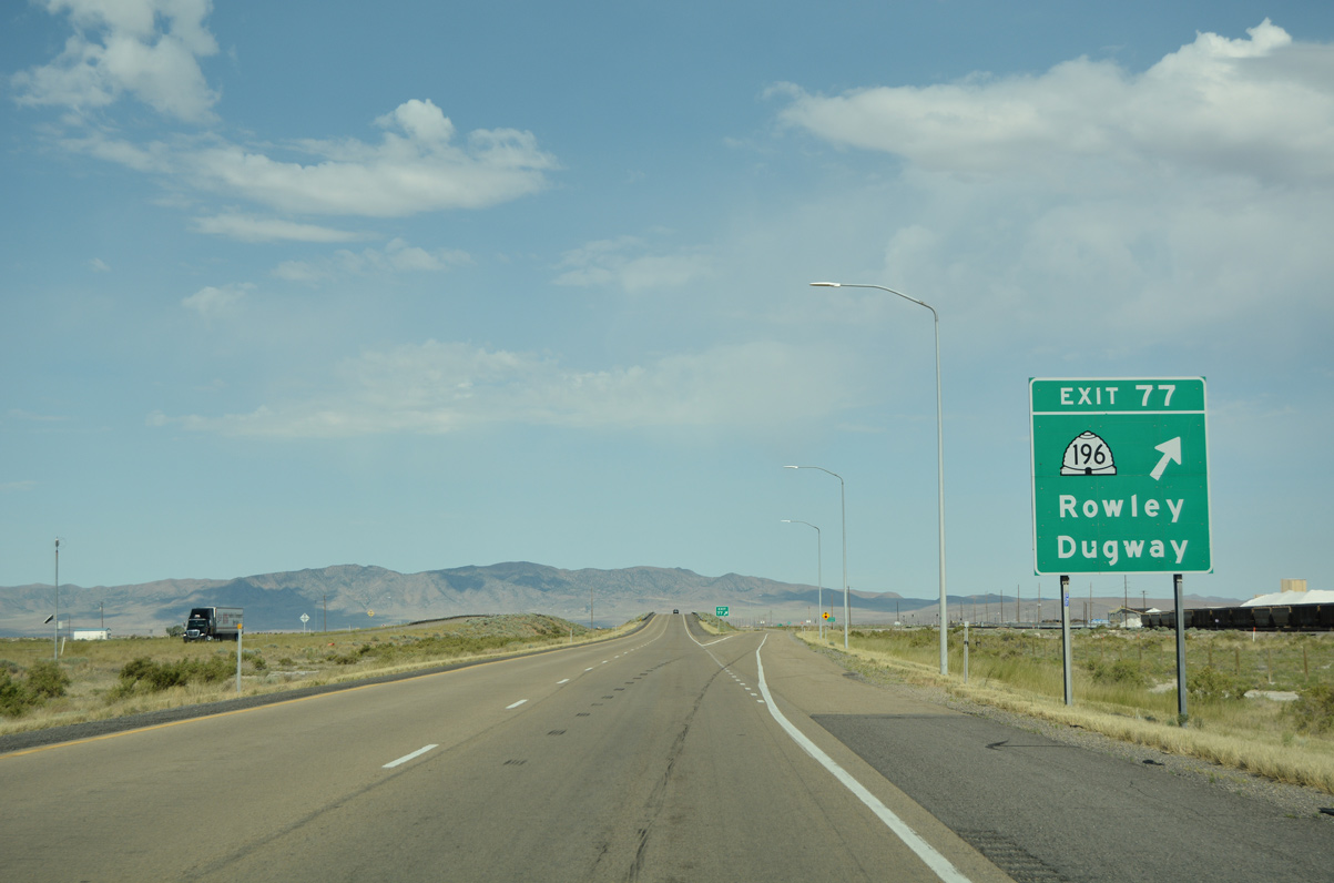
| Interstate 80 nips the northern edge of the Stansbury Mountains ahead of the diamond interchange (Exit 77) with SR 196 (Skull Valley Road) south. 07/03/16 |
|
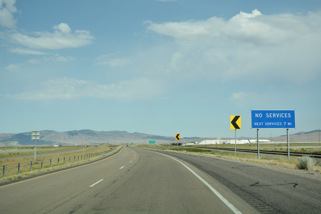
| SR 196 meets I-80 at the railroad siding of Rowley Junction. There are no services located here, and the lone gas station at Delle seven miles ahead is the last on Interstate 80 west until Wendover. 07/03/16 |
|
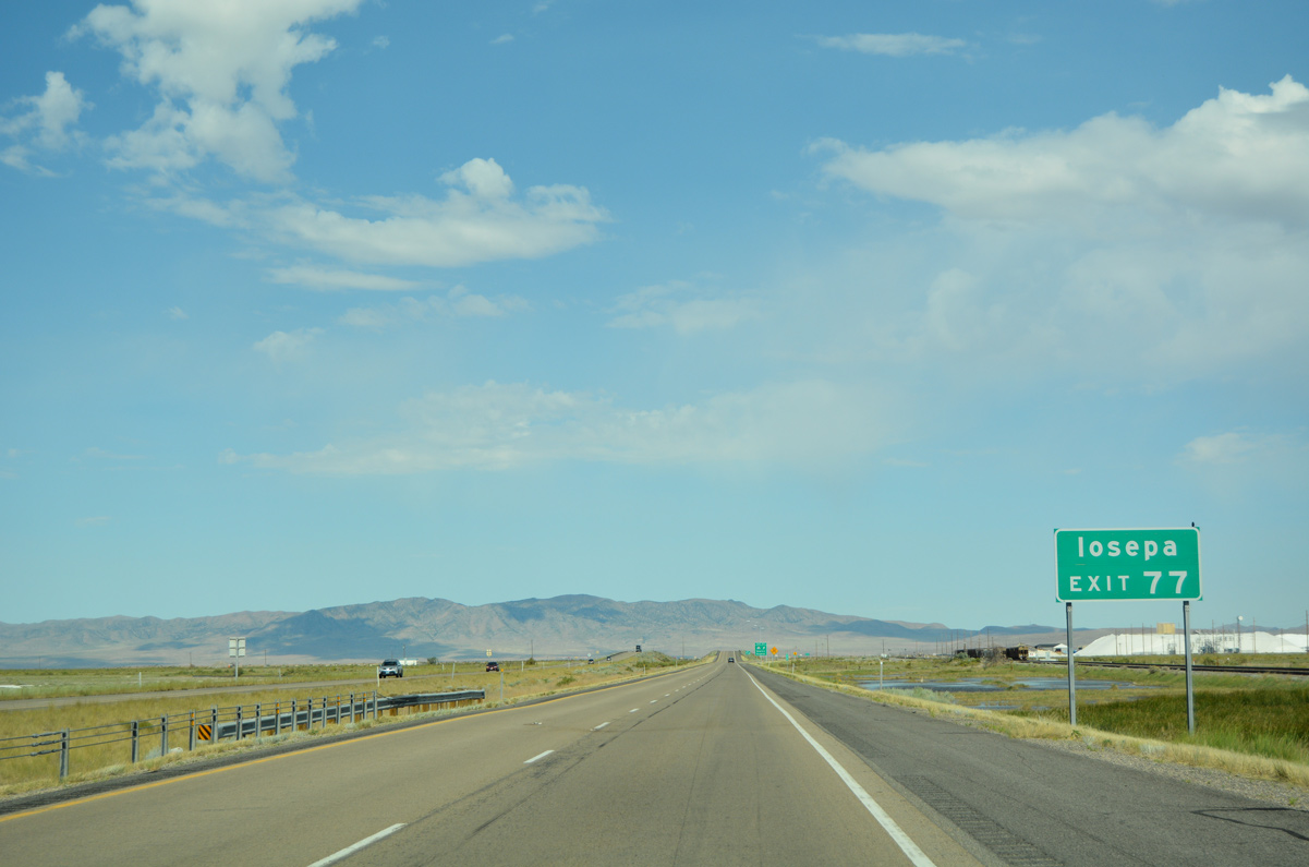
| Iosepa is a ghost town located midway along SR 196 south from Exit 77 to Dugway. Exit 77 also serves the adjacent Timpie Spring Waterfowl Management Area. 07/03/16 |
|
| Totaling 36.92 miles, SR 196 travels the length of Skull Valley from Rowley Junction south to Dugway Proving Grounds. Rowley Road emerges from the state route end at Exit 77 to run northwest to Rowley. 07/03/16 |
|
| Interstate 80 directly overlaid the old alignment of U.S. 40 and 50 Alternate across Skull Valley. 07/03/16 |
|
| Delle, six miles ahead, is the last settlement along Interstate 80 west until Wendover (75 miles). 07/03/16 |
|
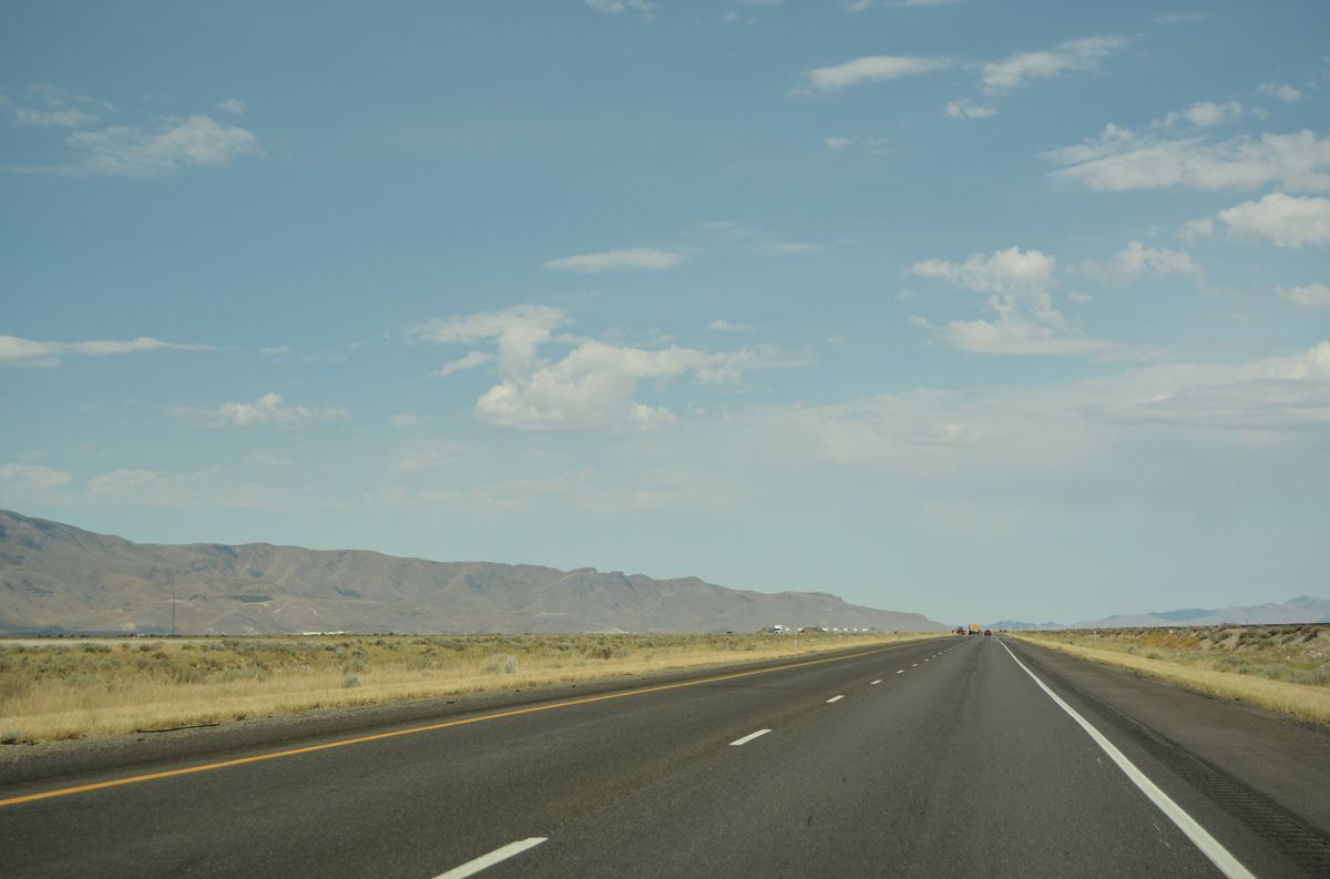
| Mud flats surround Interstate 80 as the freeway bee lines across Skull Valley. 07/03/16 |
|
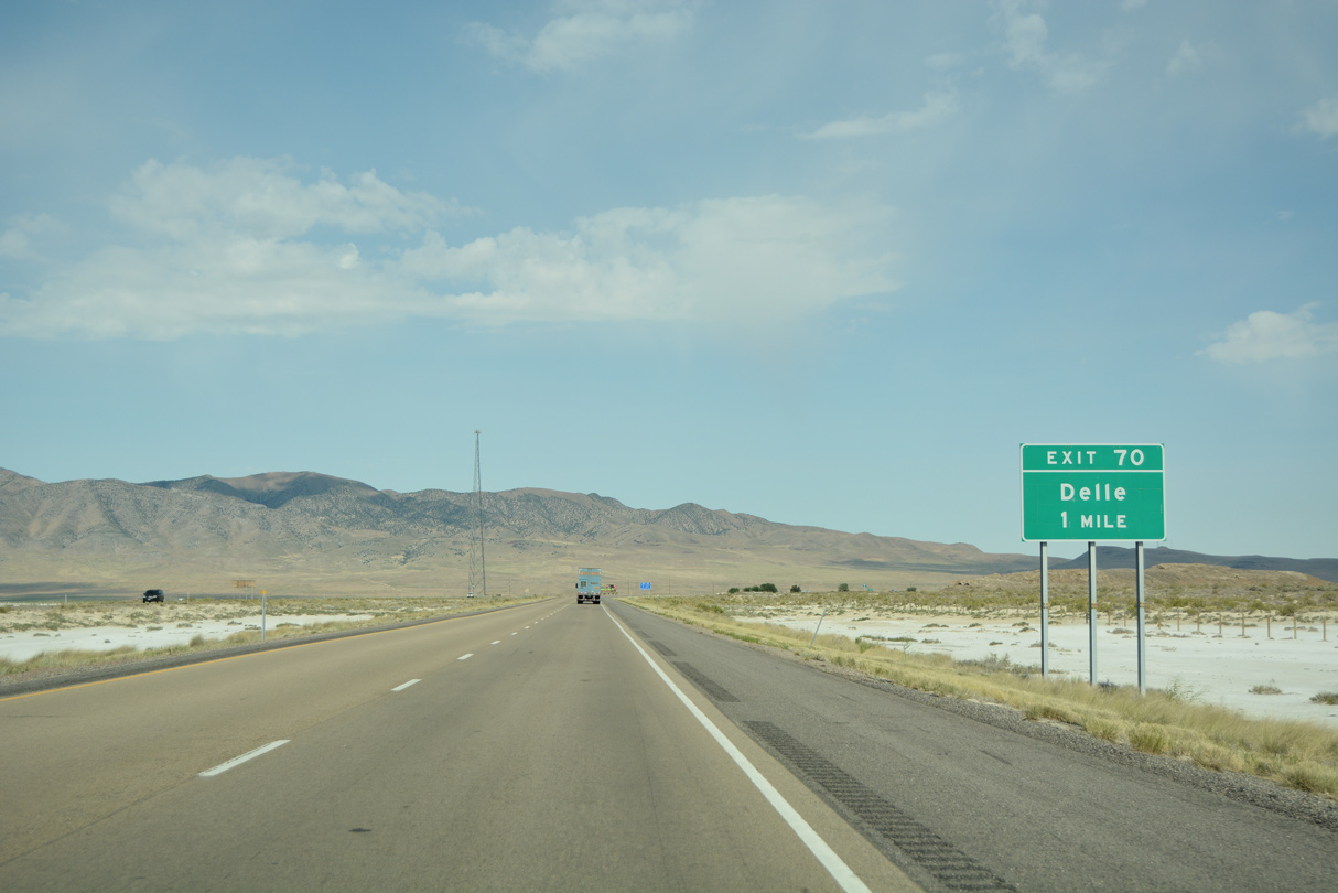
| One mile out from the diamond interchange (Exit 70) with Delle on Interstate 80 westbound. 07/03/16 |
|
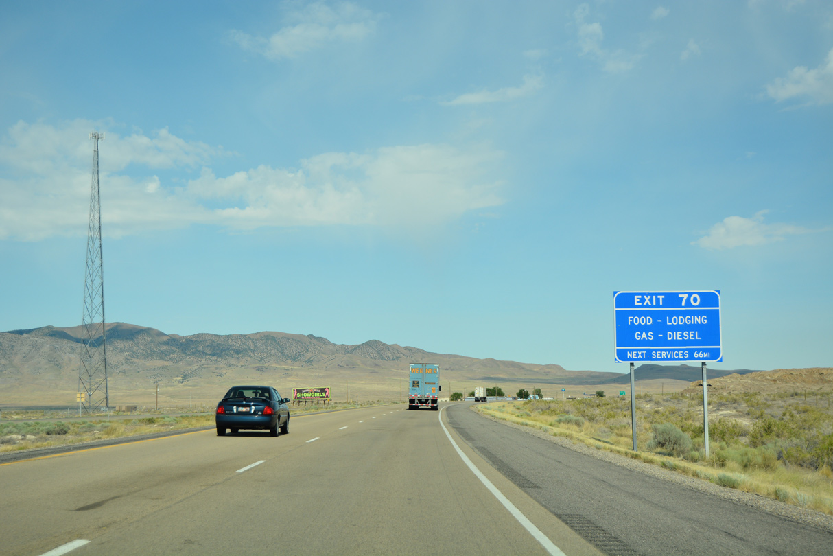
| Delle provides the last fuel option along I-80 westbound prior to Wendover. The motel and cafe cited on this sign for Exit 70 permanently closed. 07/03/16 |
|
| Exit 70 links Interstate 80 with frontage roads both west and east at the foot of the Lakeside Mountains. 07/03/16 |
|
| A long straight away ensues northwest from Delle to the north end of the Cedar Mountains. 07/03/16 |
|
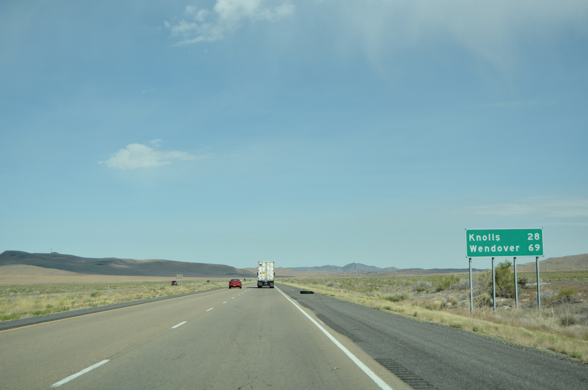
| Knolls, located south of I-80 at the entrance of the Great Salt Desert, is 28 miles to the west. Wendover is now less than an hour away. 07/03/16 |
|
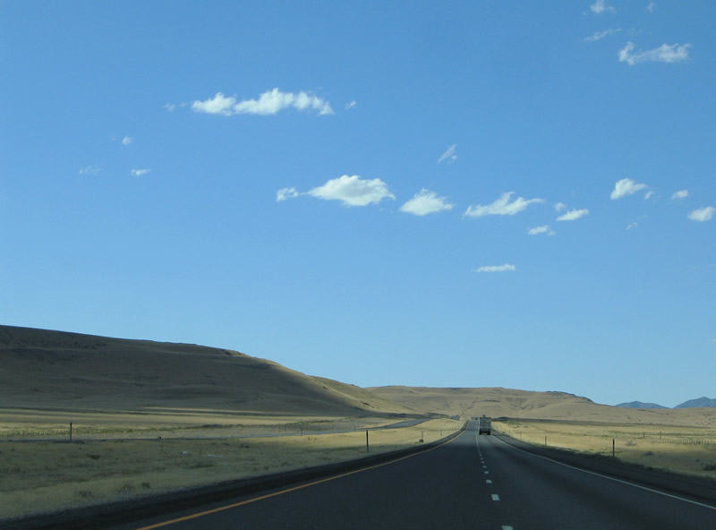
| Looking north at the parallel Union Pacific Railroad line and Lakeside Mountain foothills. The Lakeside Mountains rise along the west side of Great Salt Lake to Clyman Bay. 07/03/16 |
|
| Interstate 80 curves southwestward through a pass separating Skunk Ridge from the Cedar Mountains. 09/08/05 |
|
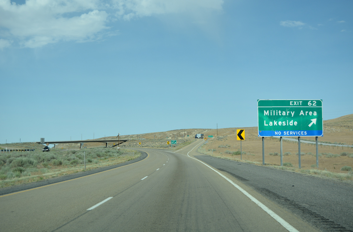
| Puddle Valley Highway stems north from Interstate 80 and a south side frontage road to the Utah Test and Training Range North military area. 07/03/16 |
|
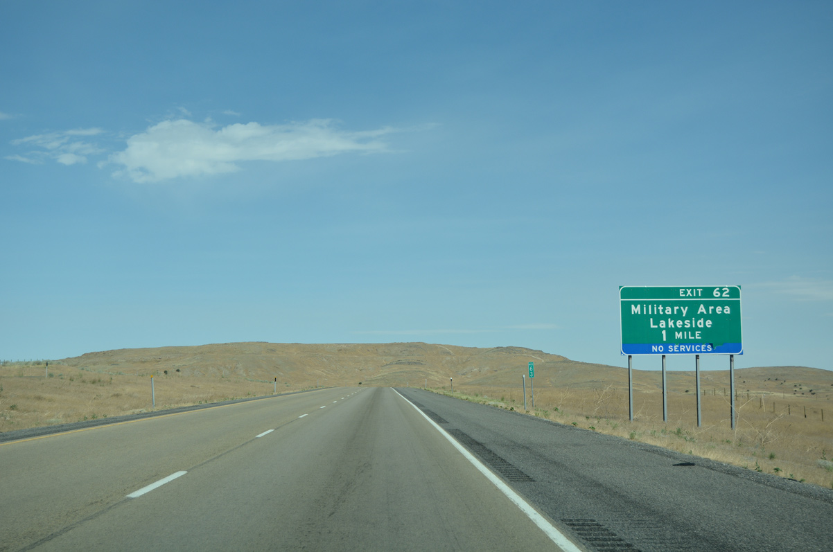
| The remote diamond interchange (Exit 62) with Puddle Valley Road connects I-80 with Lakeside, a railroad siding located 29 miles to the north in Box Elder County. 07/03/16 |
Page Updated 09-15-2016.

 West
West