|
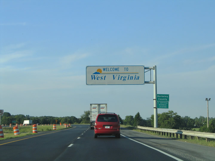
| I-81 crosses the West Virginia state line from Frederick County, Virginia near the unincorporated community of Ridgeway. 07/24/04 |
|
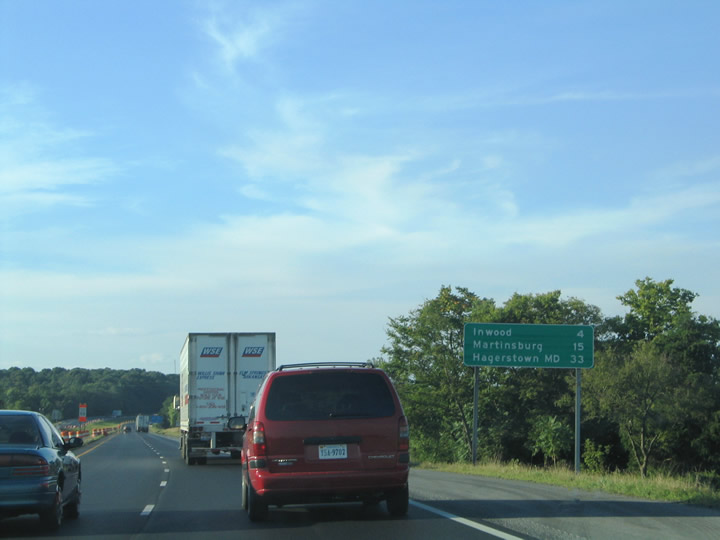
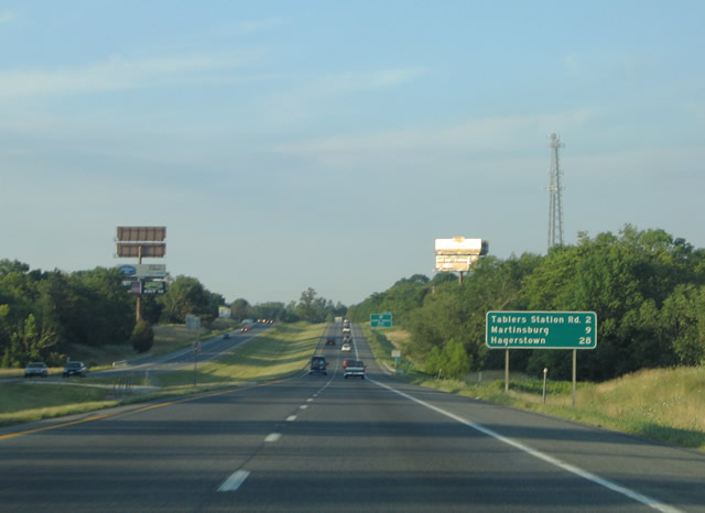
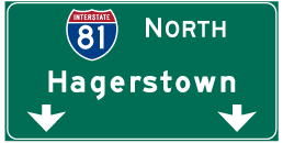
| Northbound distance sign listing the distance to Inwood (Exit 5), the Berkeley County seat of Martinsburg, and Hagerstown, Maryland (Interstate 70). 07/24/04 |
|
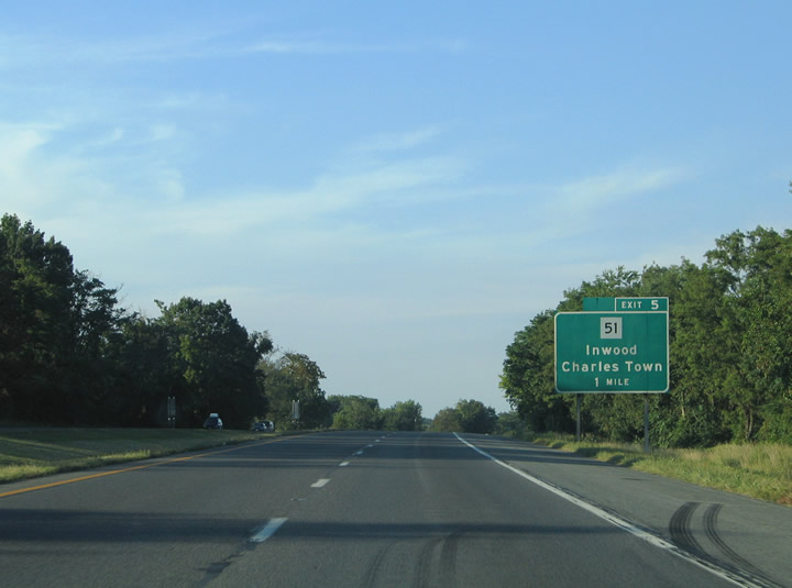
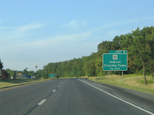
| West Virginia Route 51 (Gerrardstown Road) connects with I-81 at Inwood. Gerrardstown Road carries the state route 5.2 miles east from Route 48 through Gerrardstown to U.S. 11 (Winchester Avenue). 07/24/04 |
|
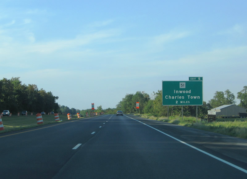
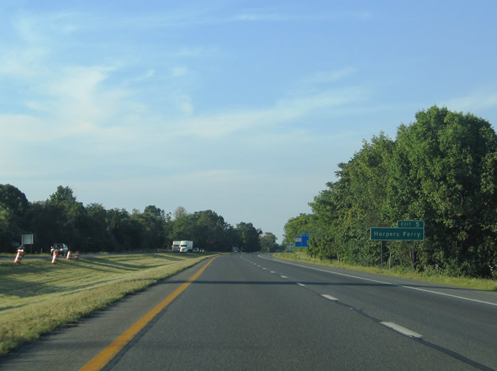
| Tourists destined for Harpers Ferry and Harper's Ferry National Historical Park are directed onto WV 51 east from Inwood to U.S. 340 at Charles Town. U.S. 340 crosses the Shenandoah and Potomac Rivers at the historic town east of the Jefferson County seat. 07/24/04 |
|
| Route 51 merges with U.S. 11 (Winchester Avenue) one half mile east of Exit 5 for a 0.3 mile overlap through Inwood. 07/24/04 |
|
| Route 51 (Gerrardstown Road) leaves Inwood along Middleway Pike and reaches Middleway in five miles and Charles Town in 11 miles. 07/24/04 |
|
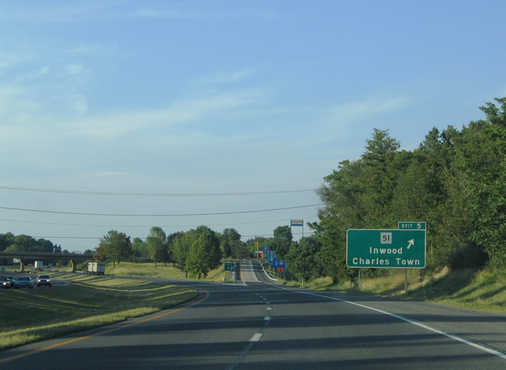
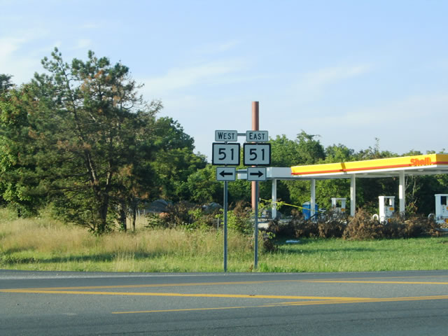
| A diamond interchange joins I-81 with Route 51 at Exit 5. Route 51 (Gerrardstown Road) west links with Route 45 (Apple Harvest Drive) south to Glengary and northern Virginia. 07/24/04 |
|
| Route 51 (Gerrardstown Road) east to U.S. 11 (Winchester Avenue) leads south to the community of Bunker Hill. 07/24/04 |
|
| Continuing northbound along Interstate 81 to within ten miles of Martinsburg. The next exit serves Eastern West Virginia Regional Airport (MRB). 07/24/04 |
|
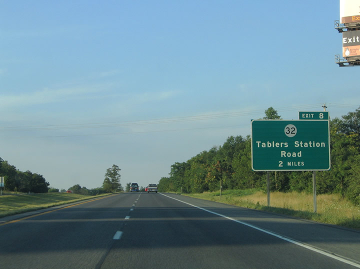
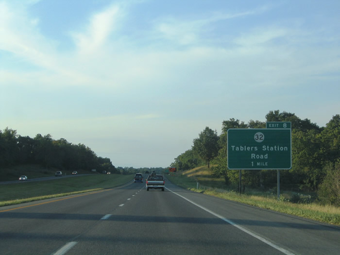
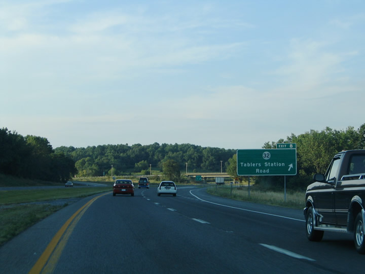
| Two miles south of the diamond interchange (Exit 8) with CR 32 (Tablers Station Road). Tablers Station Road stems 2.5 miles northwest from U.S. 11 (Winchester Avenue) at the airport to Arden Nollville Road at Arden. 07/24/04 |
|
| Tablers Station Road overall arcs 5.9 miles between U.S. 11 south of Martinsburg and West Virginia Route 45 (Apple Harvest Drive) at Union Corner. 07/24/04 |
|
| Tablers Station Road (CR 32) leads 1.3 miles east from Exit 8 to U.S. 11 (Winchester Avenue). Winchester Avenue north from there leads to Pikeside and Grubbs Corner. 07/24/04 |
|
| The next three interchanges on Interstate 81 northbound serve the Berkeley County seat of Martinsburg. Martinsburg is also a bedroom community for Washington, D.C. 07/24/04 |
|
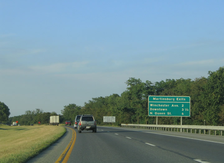
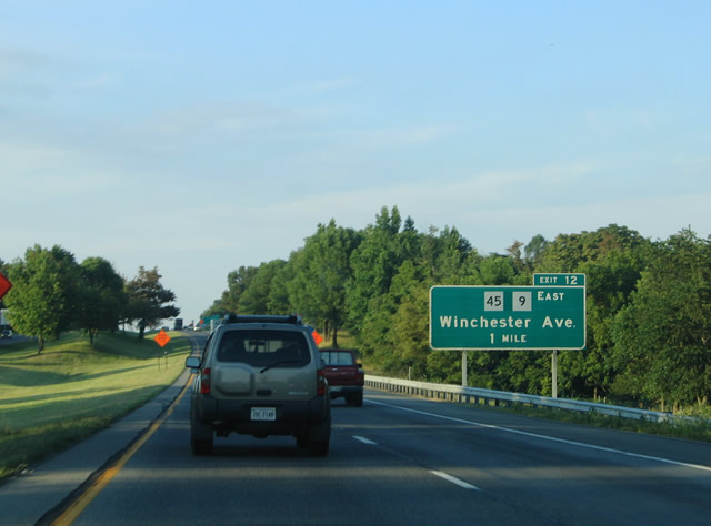
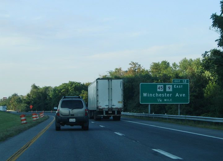
| Interstate 81 reaches the city limits of Martinsburg at Route 45 (Apple Harvest Drive). The state route travels northeast from Glengary, Union Corner and Arden to meet the freeway at Exit 12. Route 45 links Martinsburg with Shepardstown to the east. 07/24/04 |
|
| Route 45 (Apple Harvest Drive) links with U.S. 11 (Winchester Avenue) 0.3 miles to the east. U.S. 11 comprises the main roure through Downtown Martinsburg from the south. 07/24/04 |
|
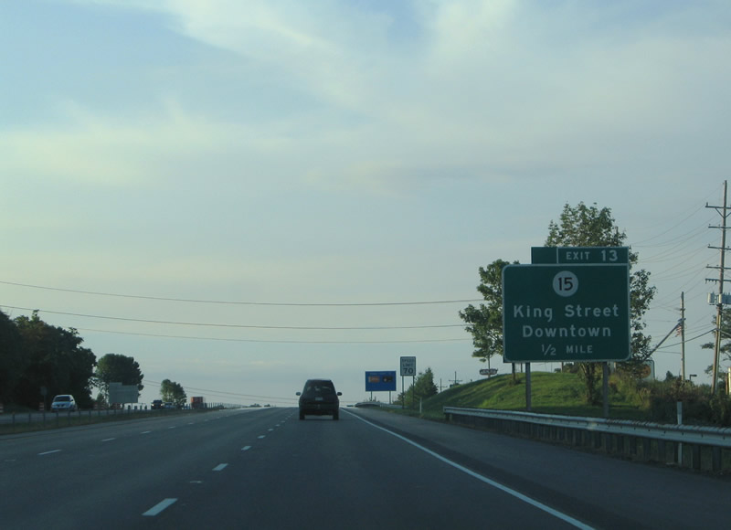
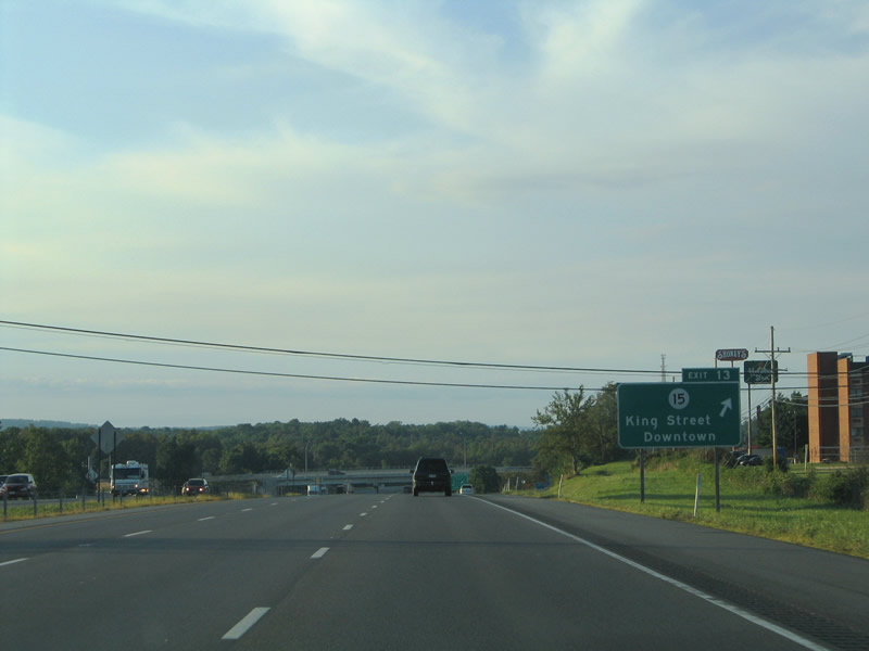
| One half mile south of the diamond interchange (Exit 13) with CR 15 (King Street). King Street enters Downtown Martinsburg and forms part of U.S. 11 between Winchester Avenue and Queen Street (Route 9/45). 07/24/04 |
|
| I-81 northbound at Exit 13 for CR 15 (King Street). Founded in 1778 and incorporated in 1868, the city of Martinsburg is home to over 17,000 people and is nicknamed the "Gateway to the Shenandoah Valley". CR 15 continues west of the city along Tuscarora Pike to Nollvile. 07/24/04 |
|
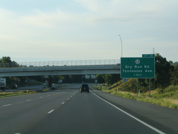
| I-81 advances north to meet CR 13 (Dry Run Road) at Exit 14. Dry Run Road continues Tennessee Avenue north to Tavern Road, City Hospital and Interstate 81. 07/24/04 |
|
| Interstate 81 maintains six lanes through the diamond interchange (Exit 14) with CR 13 (Dry Run Road). Dry Run Road leaves Martinsburg toward the Back Creek and Tomahawk. Tavern Road stems east from Dry Run Road to Rock Cliff Drive and Moler Avenue. 07/24/04 |
|
| Exit 14 leaves Interstate 81 northbound for CR 13 (Dry Run Road) at City Hospital. Dry Run Road transitions into Tennessee Avenue one half mile to the south. Tennessee Avenue continues CR 13 south from there into the Rosemont community of Martinsburg. 07/24/04 |
|
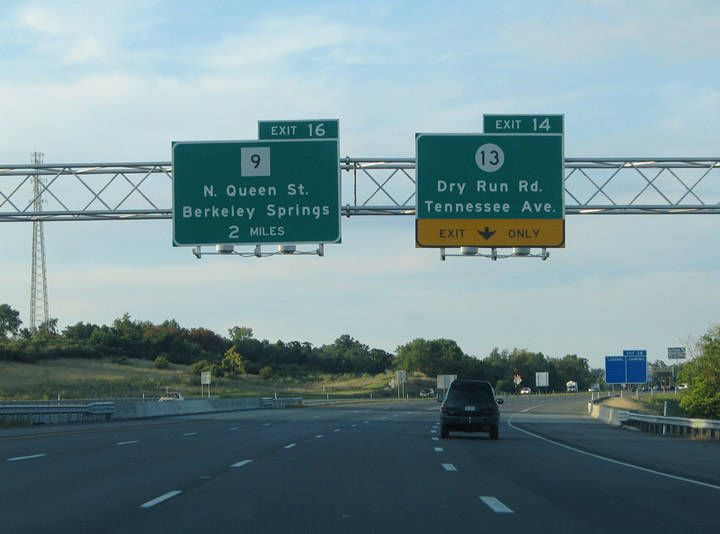
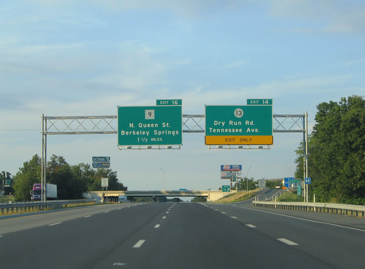
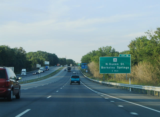
| A cloverleaf interchange joins I-81 with Route 9 (Edwin Miller Boulevard / Hedgesville Road). Route 9 overlaps with U.S. 11 (Williamsport Pike) 1.3 miles to the south along N Queen Street through Downtown Martinsburg. 07/24/04 |
|
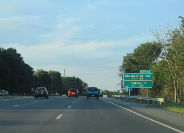
| Route 9 east from Exit 16E leads to Route 45 for Shepherd University. Hedgesville Road leads Route 9 northwest 4.4 miles from Exit 16W to Hedgesville. 07/24/04 |
|
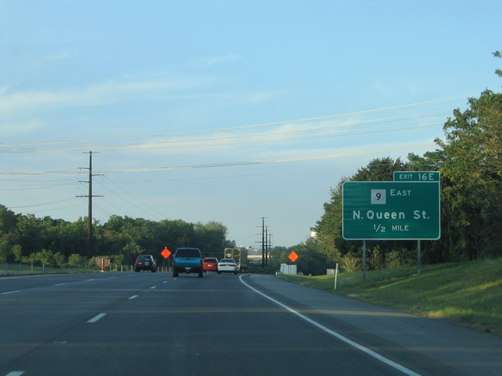
| Exit 16E leaves Interstate 81 north for Route 9 (Edwin Miller Boulevard) east to U.S. 11 (Williamsport Pike) and N Queen Street in Martinsburg. 07/24/04 |
|
| Traffic to Route 9 eastbound departs Interstate 81 north below Dry Cliff Road and the CSX Railroad. 07/24/04 |
|
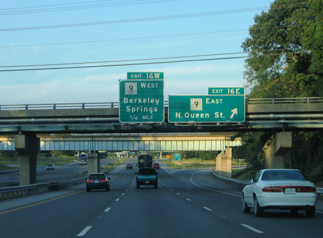
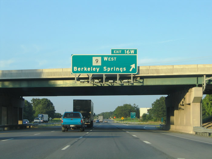
| Exit 16W loops onto Route 9 (Hedgeville Road) westbound for Hedgeville and Berkeley Springs. Berkeley Springs lies 22 miles to the northwest at U.S. 522 in Morgan County. Route 9 continues southwest from there to Great Cacapon and Route 29 near Paw Paw. 07/24/04 |
|
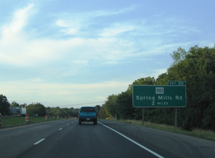
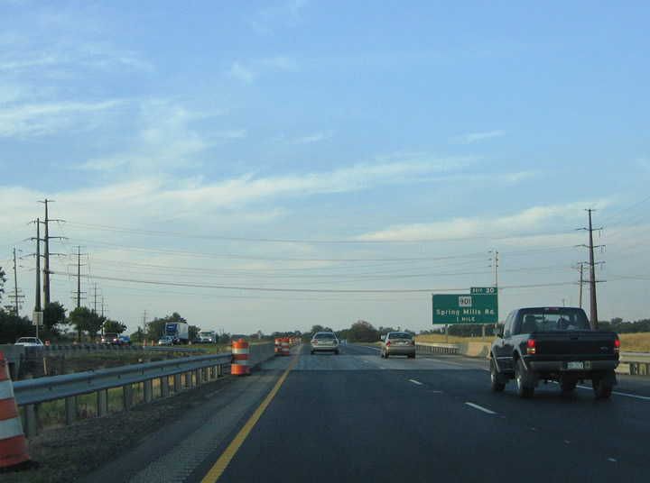
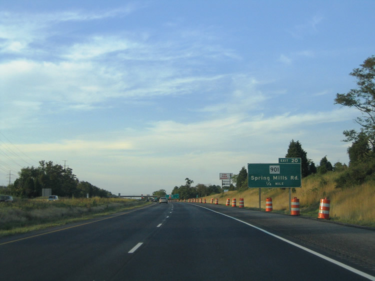
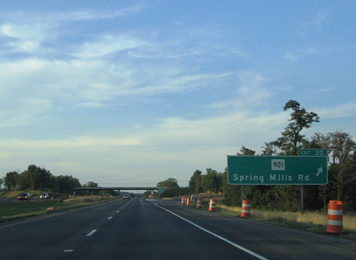
| Route 901 (Spring Mills Road) meets Interstate 81 at diamond interchange (Exit 20) near Falling Waters. 07/24/04 |
|
| Route 901 arcs 5.5 miles between Route 9 (Main Street) in Hedgesville and U.S. 11 (Williamsport Pike). 07/24/04 |
|
| Route 901 (Spring Mills Road) reaches Spring Mills 2.4 miles to the northwest at Harlan Spring Road. 07/24/04 |
|
| Exit 20 departs Interstate 81 north for Route 901 (Spring Mills Road) and the nearby communities of Nipetown, Hainesville and Bedington to the south. 07/24/04 |
|
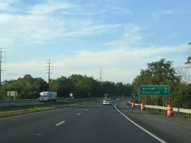
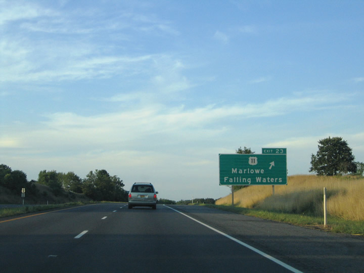
| Interstate 81 curves northeast toward Exit 23 for Marlowe and Hagerstown, Maryland. 07/24/04 |
|
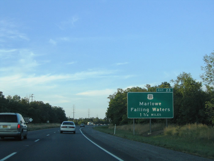
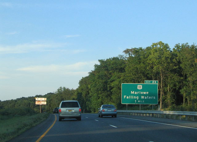
| U.S. 11 crosses paths with Interstate 81 at Exit 23 midway between Falling Waters and Marlowe. 07/24/04 |
|
| A parclo interchange (Exit 23) links I-81 with U.S. 11 (Williamsport Pike) 1.7 miles north of Falling Waters. 07/24/04 |
|
| U.S. 11 (Williamsport Pike) curves easterly 1.2 miles to Marlowe and 3.4 miles to Williamsport, Maryland. U.S. 11 and I-81 do not converge at Exit 2 in Maryland. 07/24/04 |
|
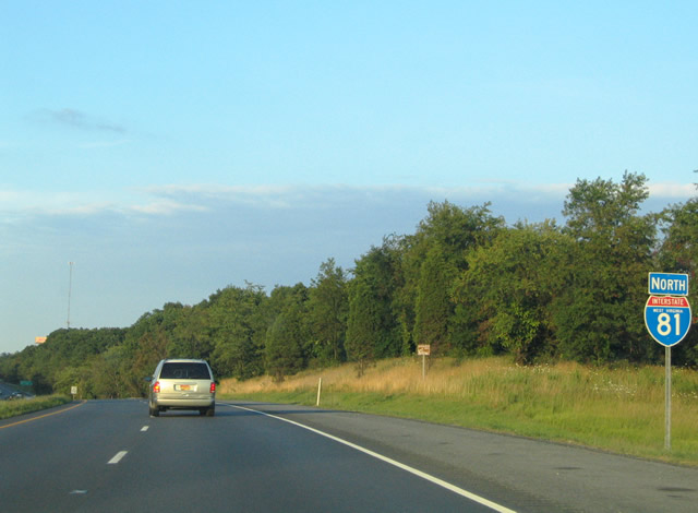
| The last eassurance shield for Interstate 81 in the Mountain State stands 2.3 miles from the Potomac River. 07/24/04 |
|
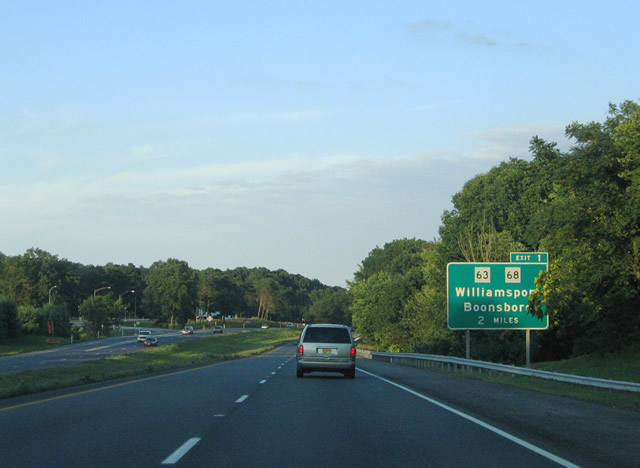
| I-81 advances two miles north to a diamond interchange (Exit 1) with MD 63/68 (Lappans Road) south of Williamsport. MD 63/68 overlap for 1.2 miles along Conococheague Street between I-81 and U.S. 11 (Potomac Street) in Downtown Williamsport. 07/24/04 |
Page Updated 03-10-2005.

 North
North