|
| The bridges spanning the Maury River south of I-64 were reconstructed in the mid-2000s to accommodate potential six lane expansion. 08/06/13 |
|
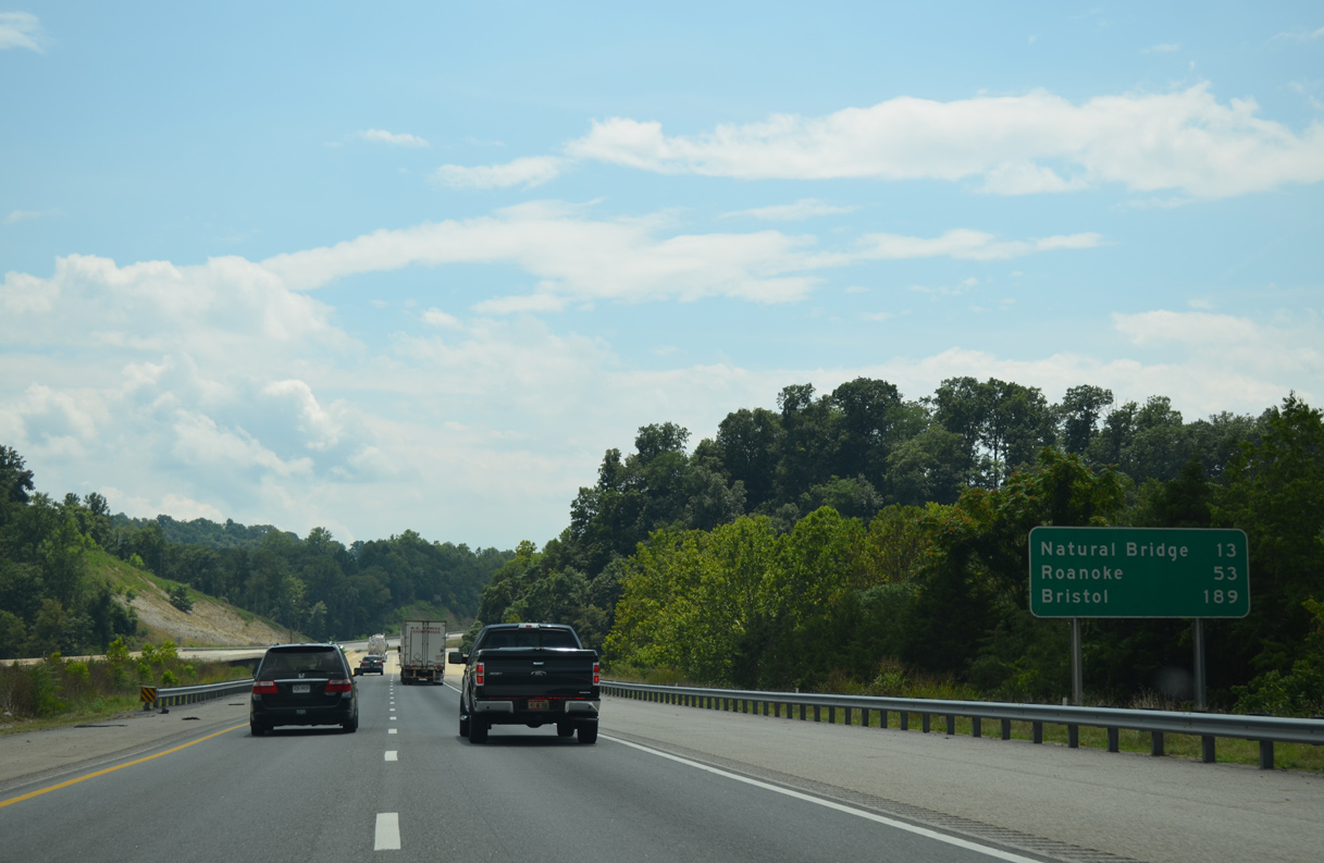
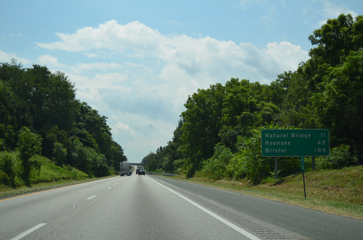
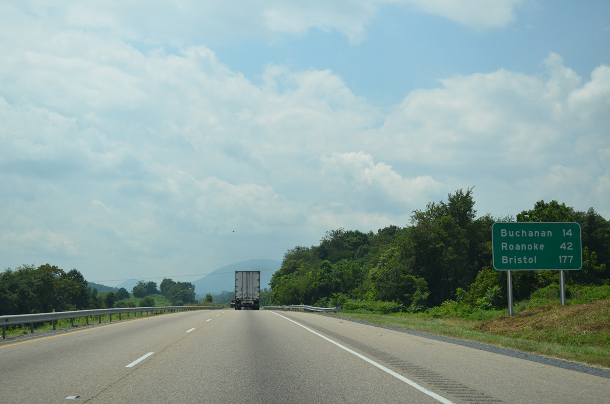
| Natural Bridge lies 13 miles to the southwest, followed by Roanoke in 53 miles via Interstate 581 south. 08/06/13 |
|
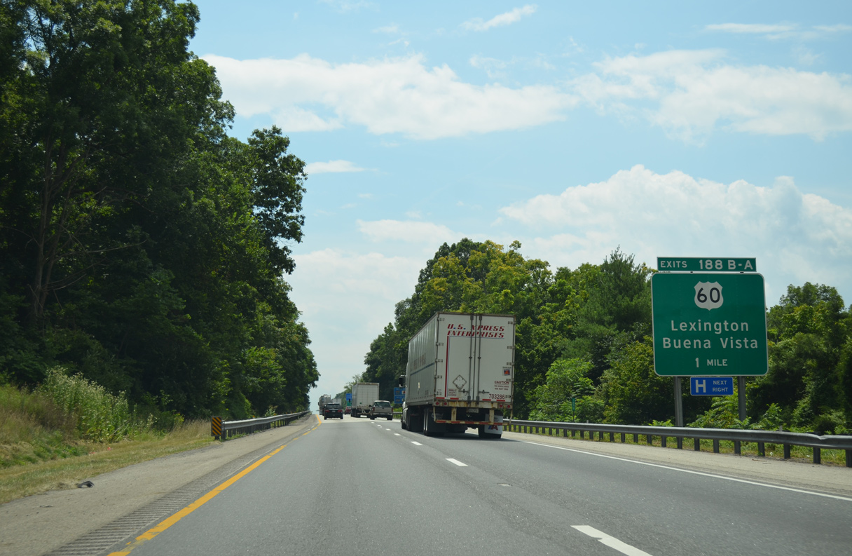
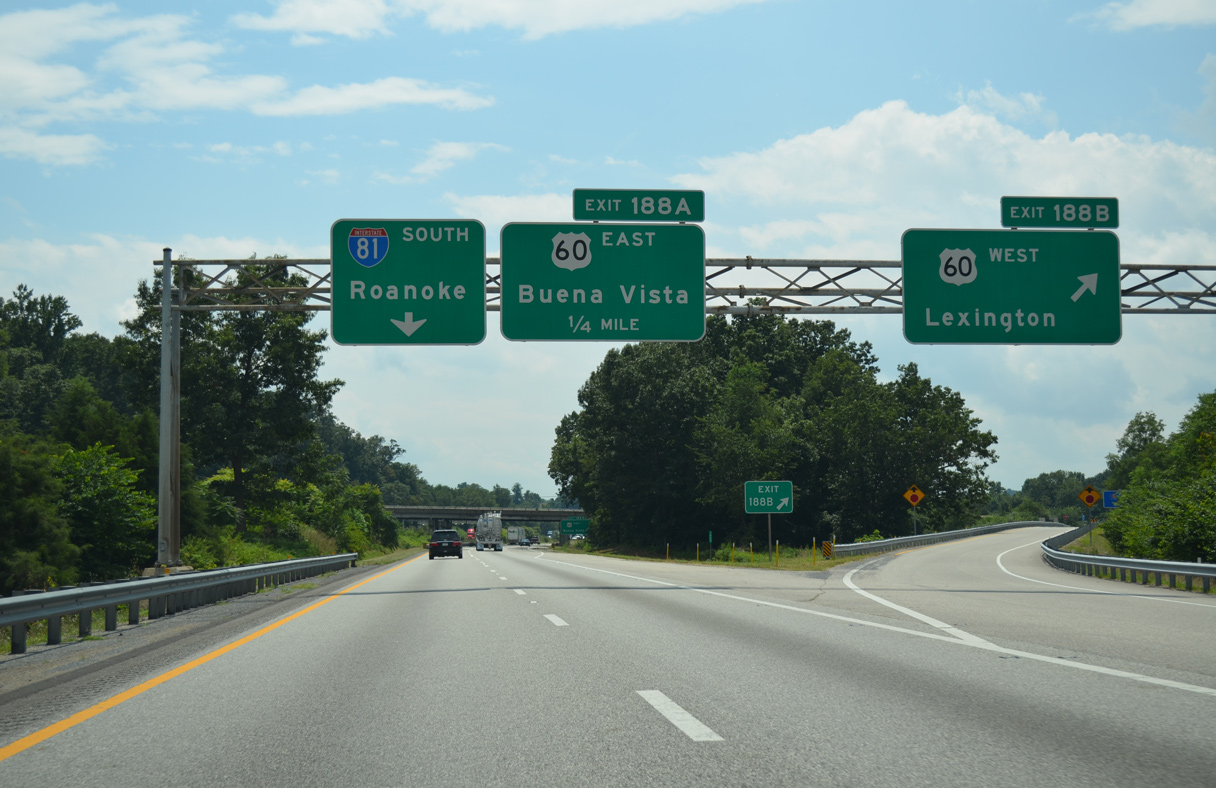
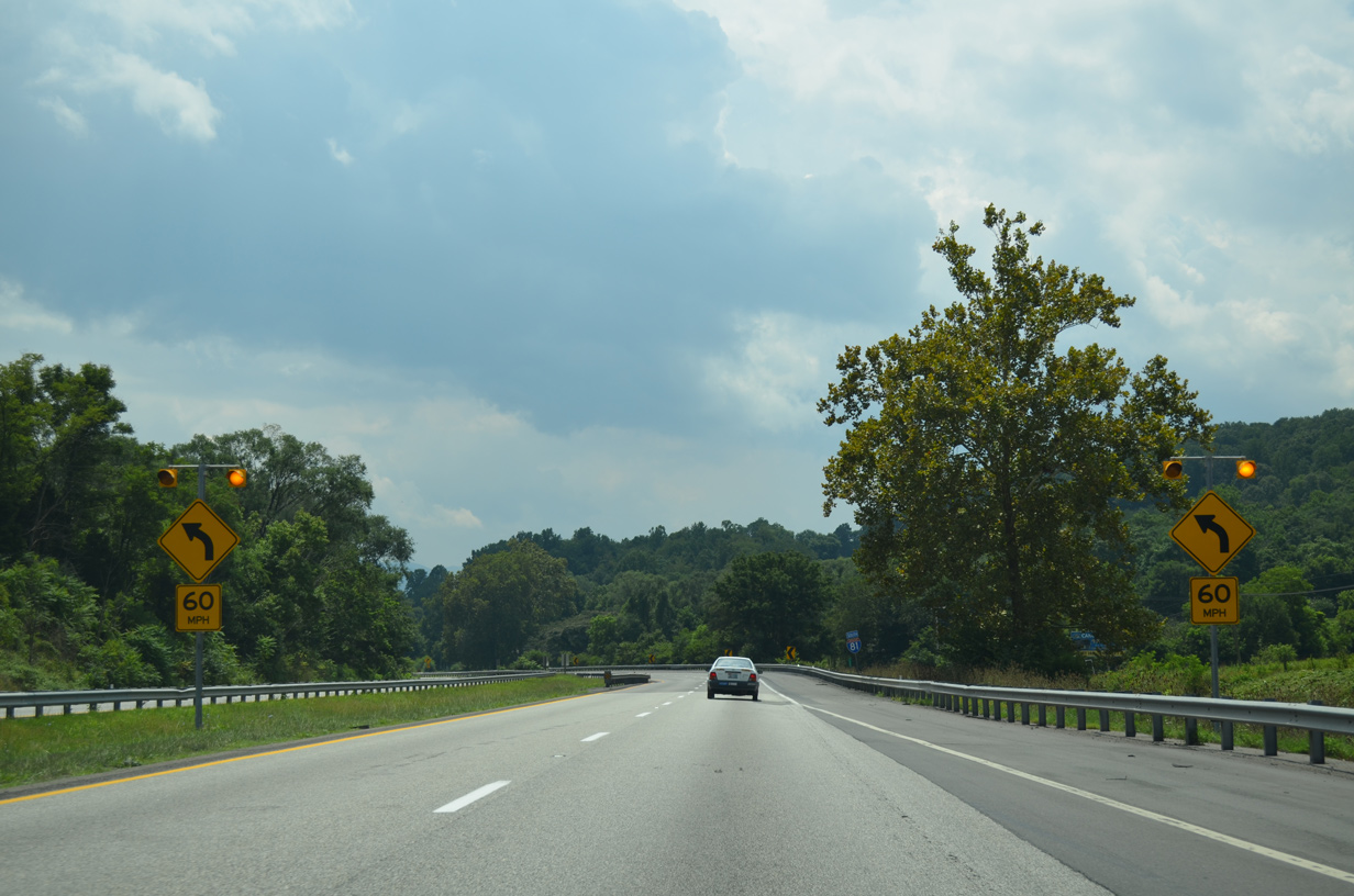
| U.S. 60 (Midland Trail) crosses paths with Interstate 81 at a six-ramp parclo interchange (Exit 188) midway between Lexington and Buena Vista. 08/06/13 |
|
| U.S. 60 follows Midland Trail west from Exit 188B to Nelson Street and Downtown Lexington. U.S. 60 loops northwest from the city to combine with Interstate 64 to Covington. 08/06/13 |
|
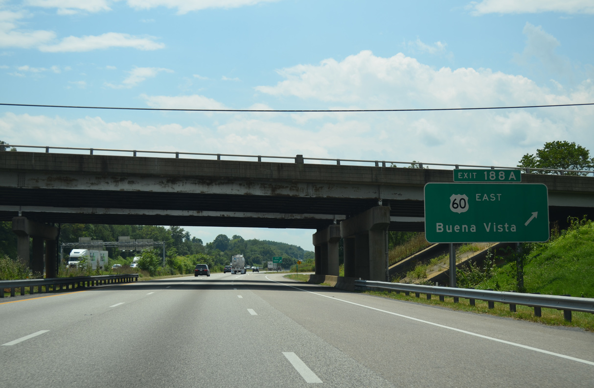
| Exit 188A loops onto U.S. 60 (Midland Trail) east to Buena Vista where U.S. 501 south begins and Southern Virginia University is located. U.S. 60 continues east to Amherst, Buckingham and Richmond. 08/06/13 |
|
| Interstate 81 was reconstructed across Buffalo Creek in the mid-2000s and can accommodate future expansion. 08/06/13 |
|
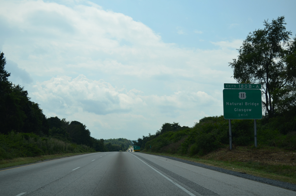
| U.S. 11 (S Lee Highway) returns alongside I-81 south from Buffalo Bend. The two highways meet at Fancy Hill and Exit 180. 08/06/13 |
|
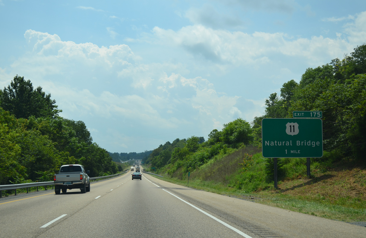
| U.S. 11 (S Lee Highway) loops east into the unincorporated community of Natural Bridge between Exit 180 and 175. 08/06/13 |
|
| U.S. 11 crosses Cedar Creek over the Natural Bridge Arch southwest of Buck Hill. 08/06/13 |
|
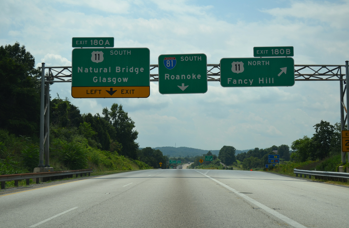
| Exit 180B connects with U.S. 11 (S Lee Highway) north to Fancy Hill and Lexington. 08/06/13 |
|
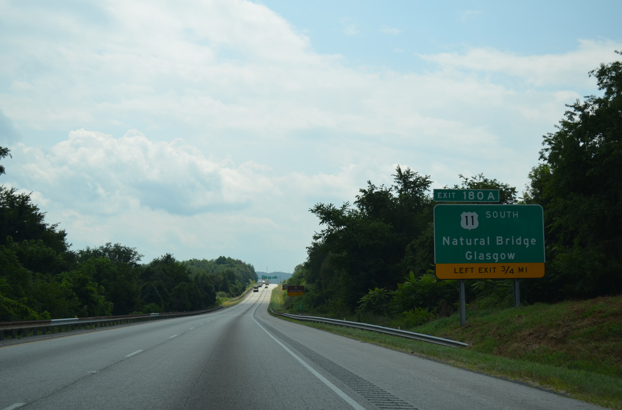
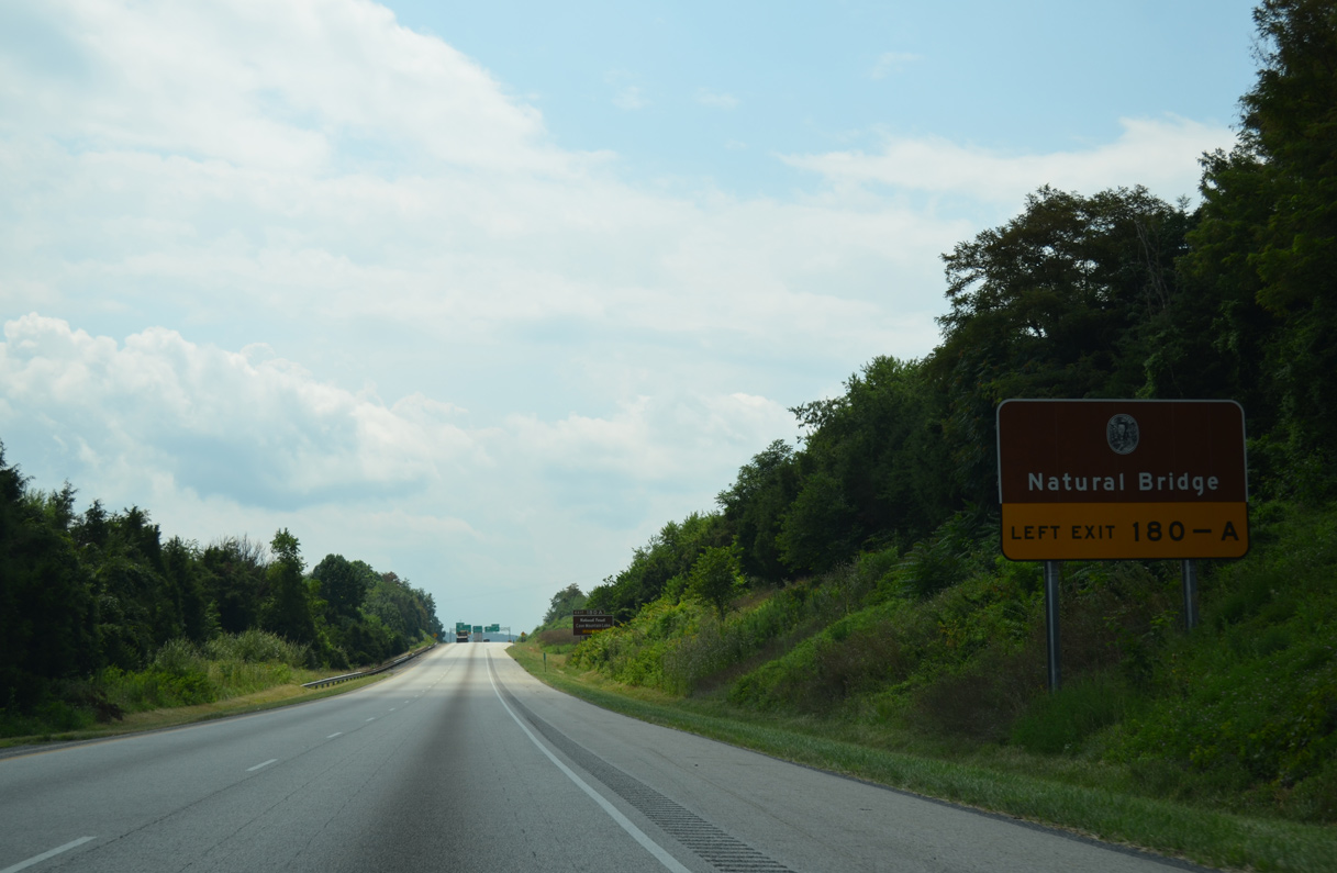
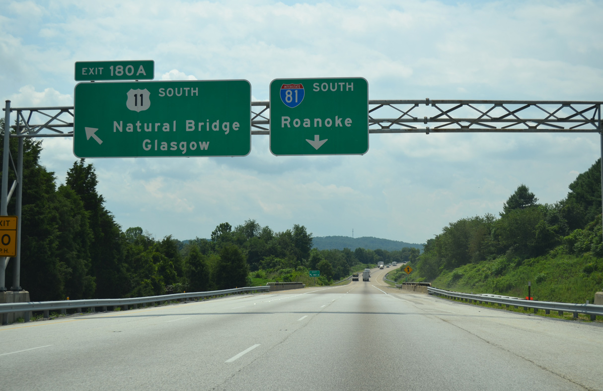
| Left Exit 180A separates from I-81 south for U.S. 11 (S Lee Highway) south to Natural Bridge. SR 130 (Wert Faulkner Highway) stems east from U.S. 11 in 3.28 miles to Glasgow. 08/06/13 |
|
| U.S. 11 (S Lee Highway) continues 1.73 miles west from SR 130 at Natural Bridge back to Interstate 81 at Exit 175. 08/06/13 |
|
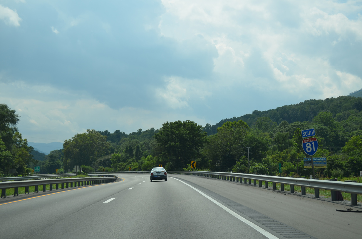
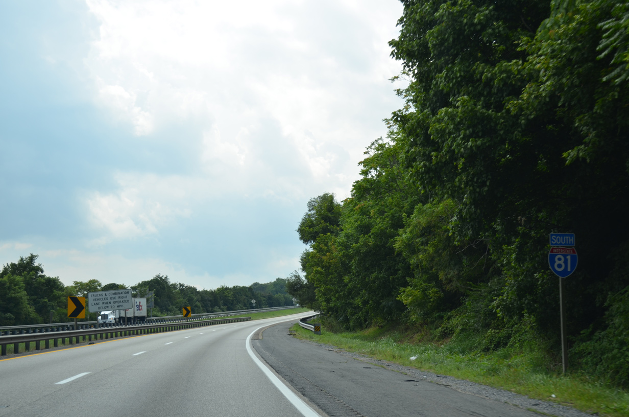
| U.S. 11 combines with I-81 south from the diamond interchange at Exit 175. S Lee Highway (old U.S. 11) constitutes the south frontage road west to Springfield. 08/06/13 |
|
| Confirming markers, including a U.S. 11 cutout, posted between Exit 175 and the SR 693 (High Bridge Church Road) overpass at Springfield. 08/06/13 |
|
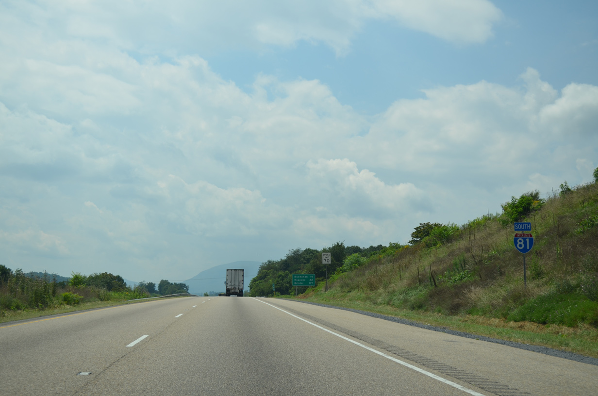
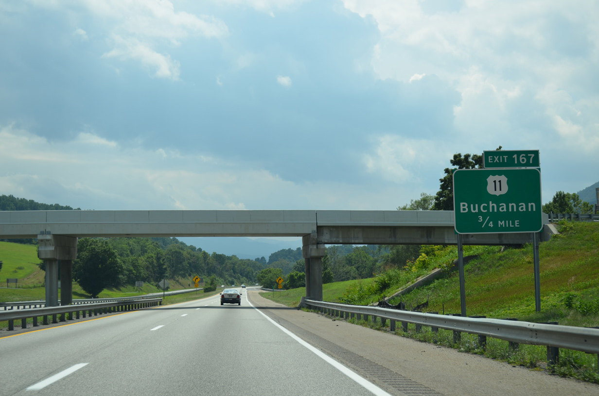
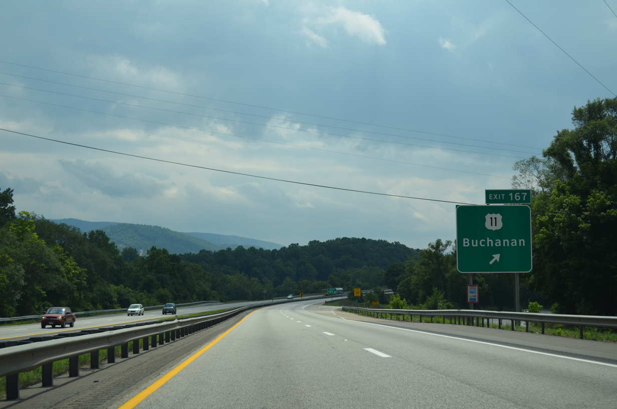
| U.S. 11 follows Interstate 81 south to Exit 167 for the town of Buchanan. 08/06/13 |
|
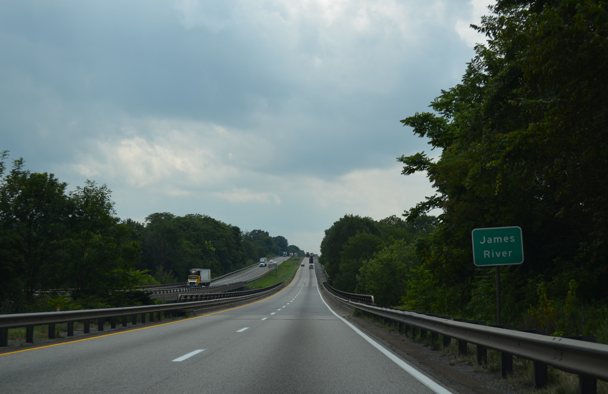
| Navigating through an S-curve between the Short Hills and James River, I-81/U.S. 11 south enter Botetourt County. 08/06/13 |
|
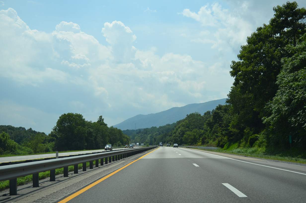
| Purgatory Mountain rises along the western horizon. 08/06/13 |
|
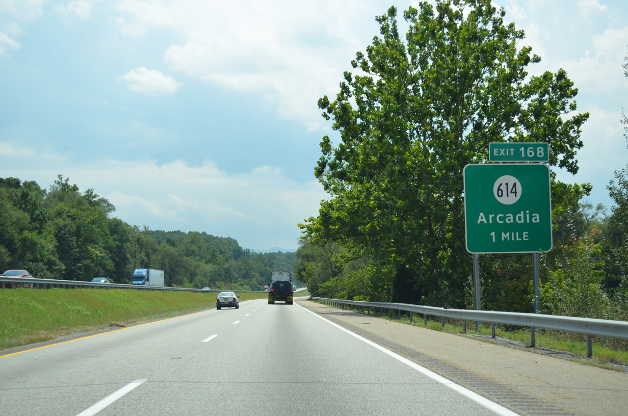
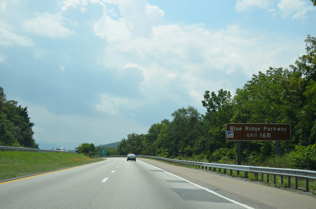
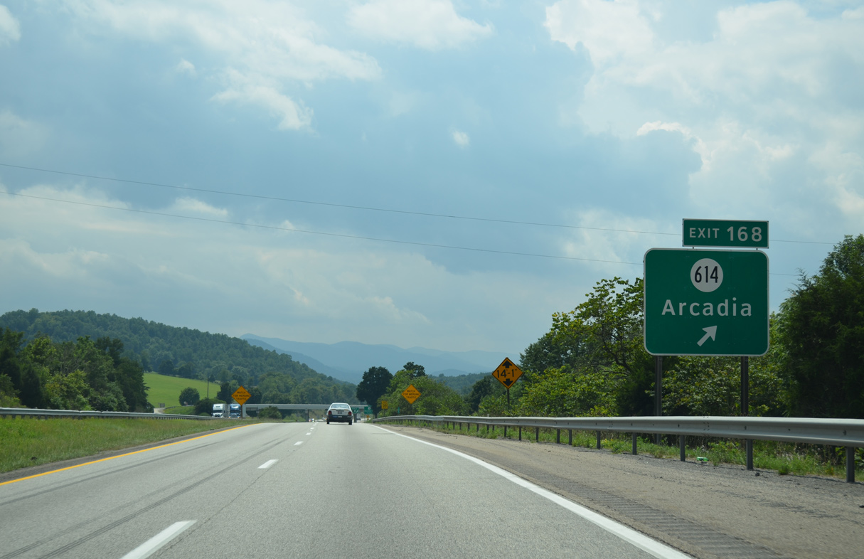
| SR 614 (Arcadia Road) stems 2.84 miles east from Old U.S. 11 (Frontage Road) at Exit 168 to the settlement of Arcadia. 08/06/13 |
|
| Entering the diamond interchange (Exit 168) with SR 614 east to Arcadia, Lee Highway and Frontage Road. 08/06/13 |
|
| U.S. 11 rejoins Lee Highway south into Buchanan from a wye interchange (Exit 167). 08/06/13 |
|
| Buchanan lies between Purgatory and Cove Mountains along the James River south of Interstate 81. U.S. 11 follows Main Street to the business district just beyond a 0.18 mile long overlap with SR 43. 08/06/13 |
|
| Interstate 81 spans the James River by the southern tip of Purgatory Mountain. 08/06/13 |
|
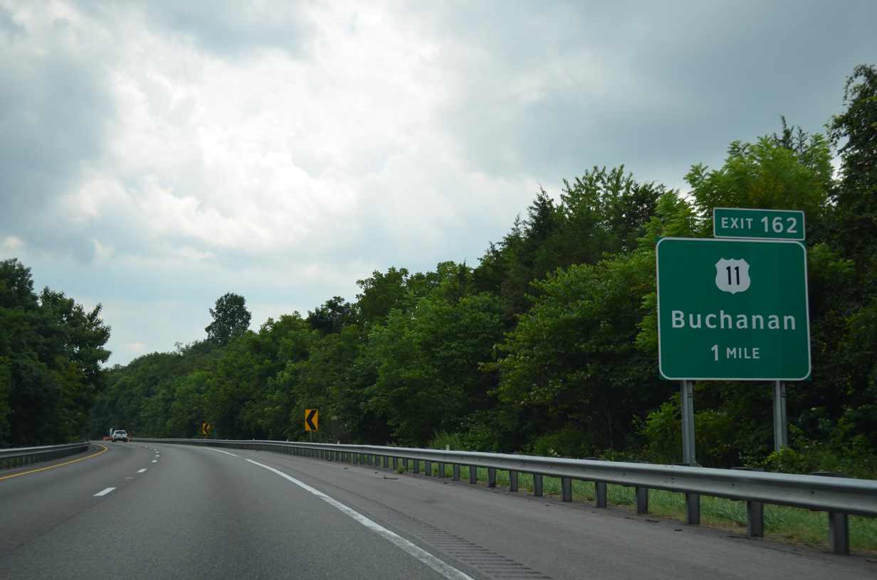
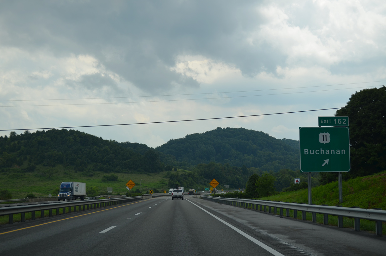
| U.S. 11 (Lee Highway) converges with Interstate 81 again at a parclo interchange (Exit 162) west of Buchanan. 08/06/13 |
|
| Exit 162 leaves Interstate 81 south for U.S. 11 (Lee Highway). U.S. 11 remains close to Interstate 81, switching sides with the freeway again in 2.6 miles. 08/06/13 |
|
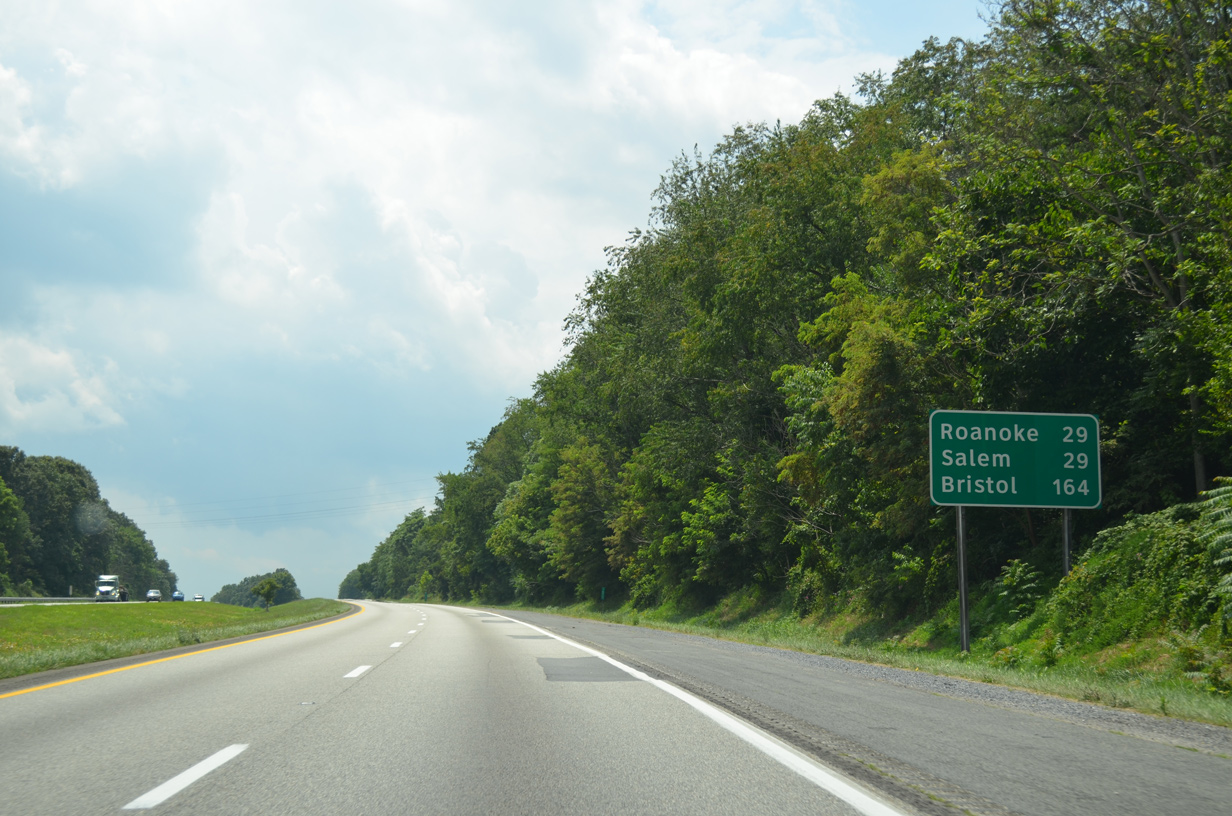
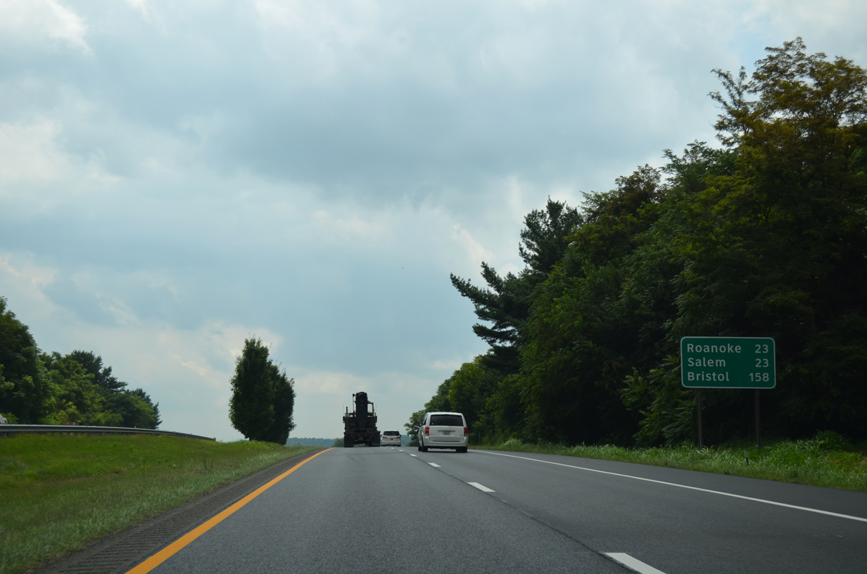
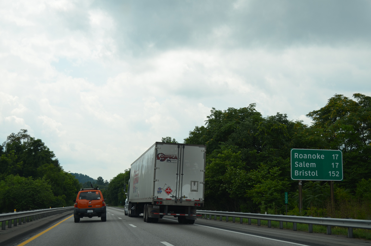
| The adjacent independent cities of Roanoke and Salem are 23 miles to the southwest. Troutdale and Cloverdale lie along U.S. 11 between Exit 162 and Interstate 581. 08/06/13 |
|
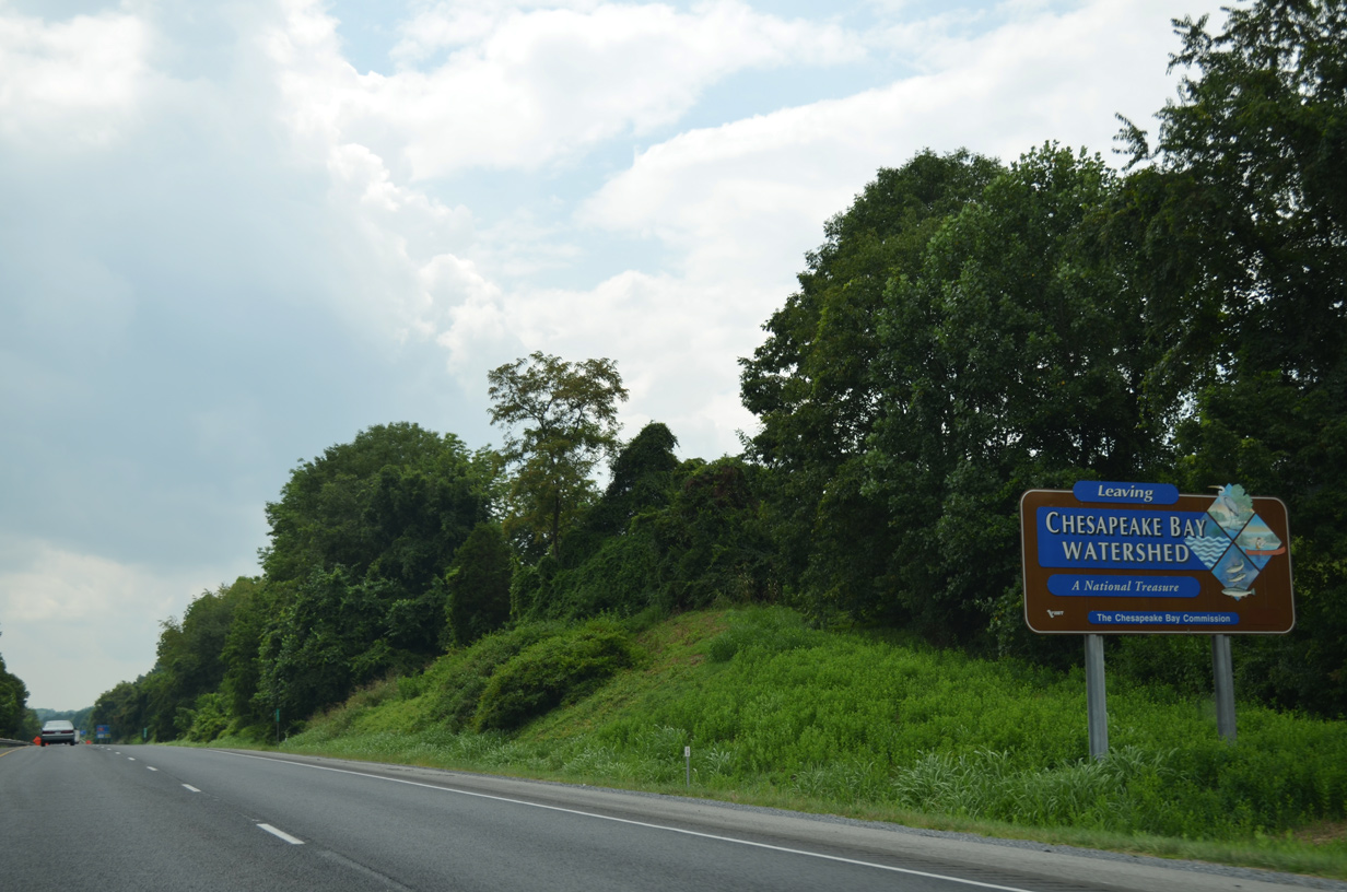
| West from Mill Creek, Interstate 81 leaves the Chesapeake Bay Watershed. 08/06/13 |
|
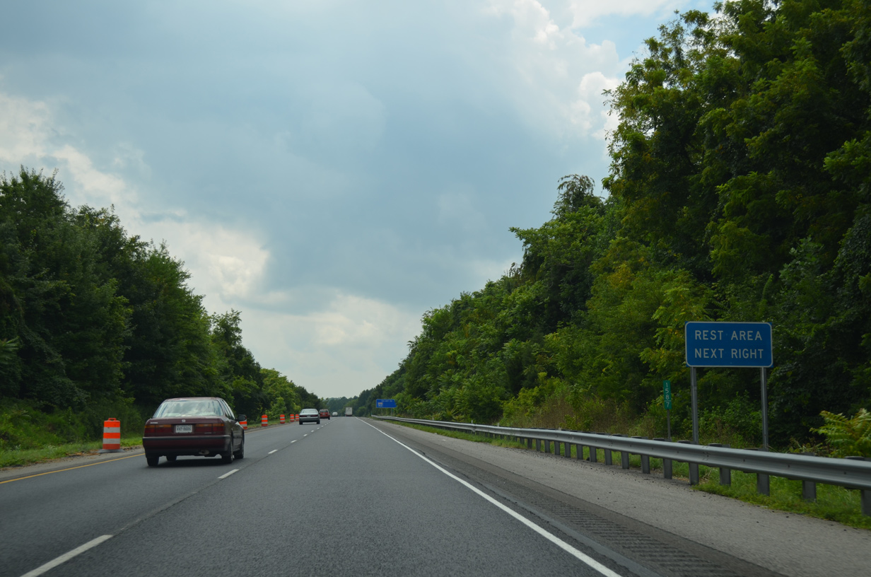
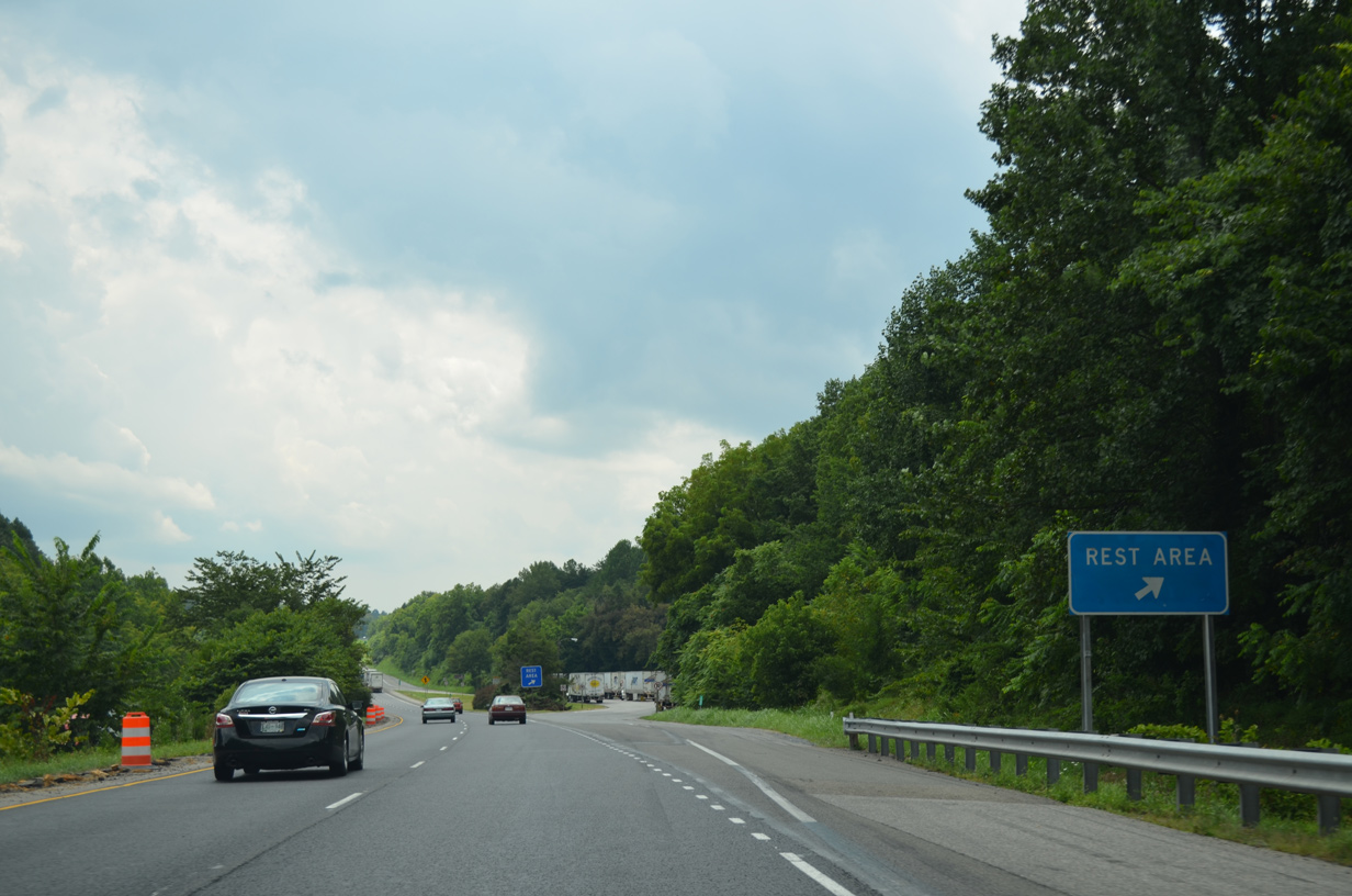
| Interstate 81 south at the Troutville Safety Rest Area. 08/06/13 |
|
| The Troutville Safety Rest Area closed during the 2009 VDOT budget cuts but reopened in 2010. 08/06/13 |
|
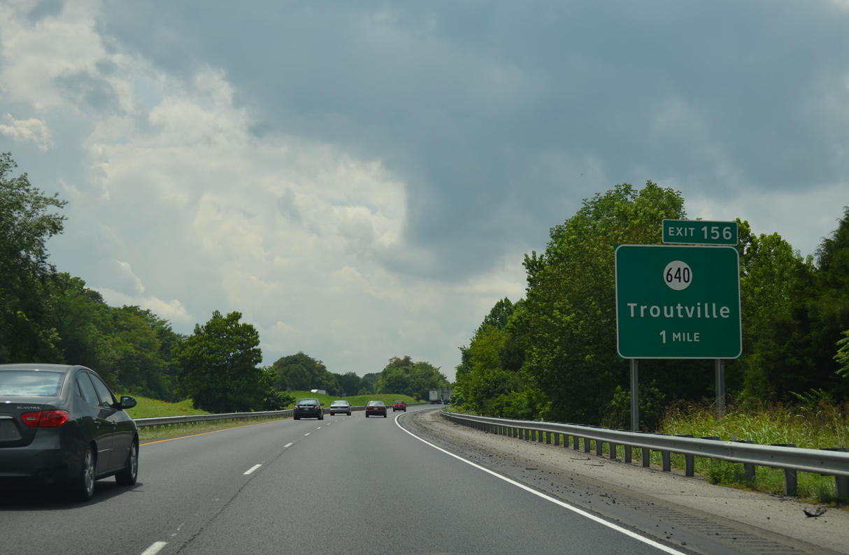
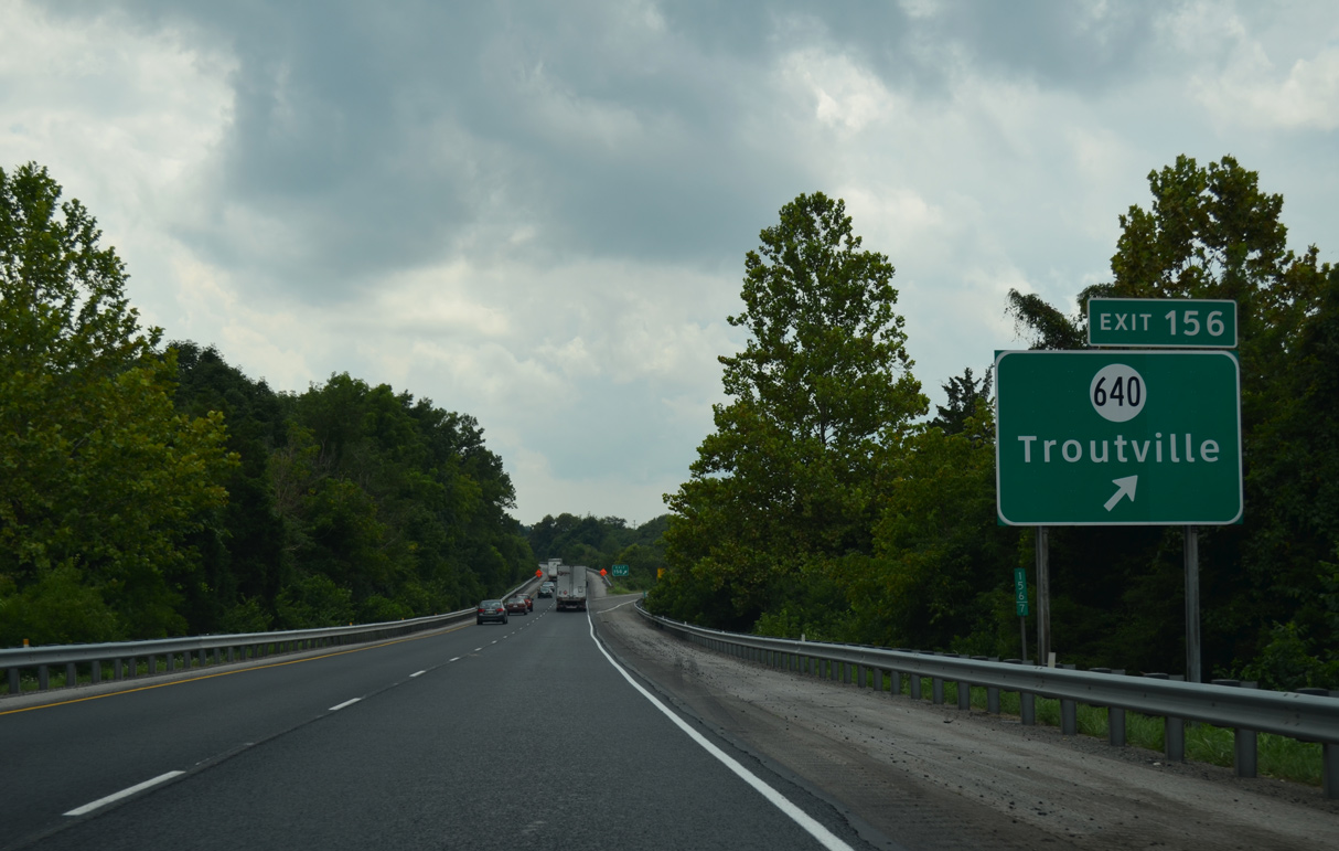
| SR 640 (Brughs Mill Road) links Interstate 81 with U.S. 11 (Lee Highway) south to the town of Troutville from the diamond interchange at Exit 156. 08/06/13 |
|
| SR 640 (Brughs Mill Road) constitutes a 3.84 mile long minor collector running north from U.S. 11 to Exit 157 and west to U.S. 220 (Roanoke Road) south of Fincastle, the Botetourt County seat. 08/06/13 |
|
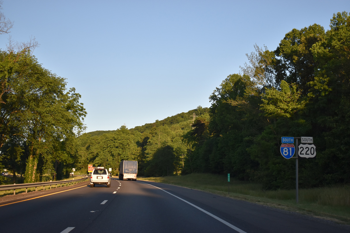
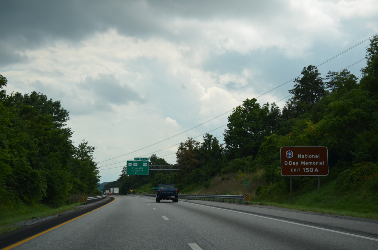
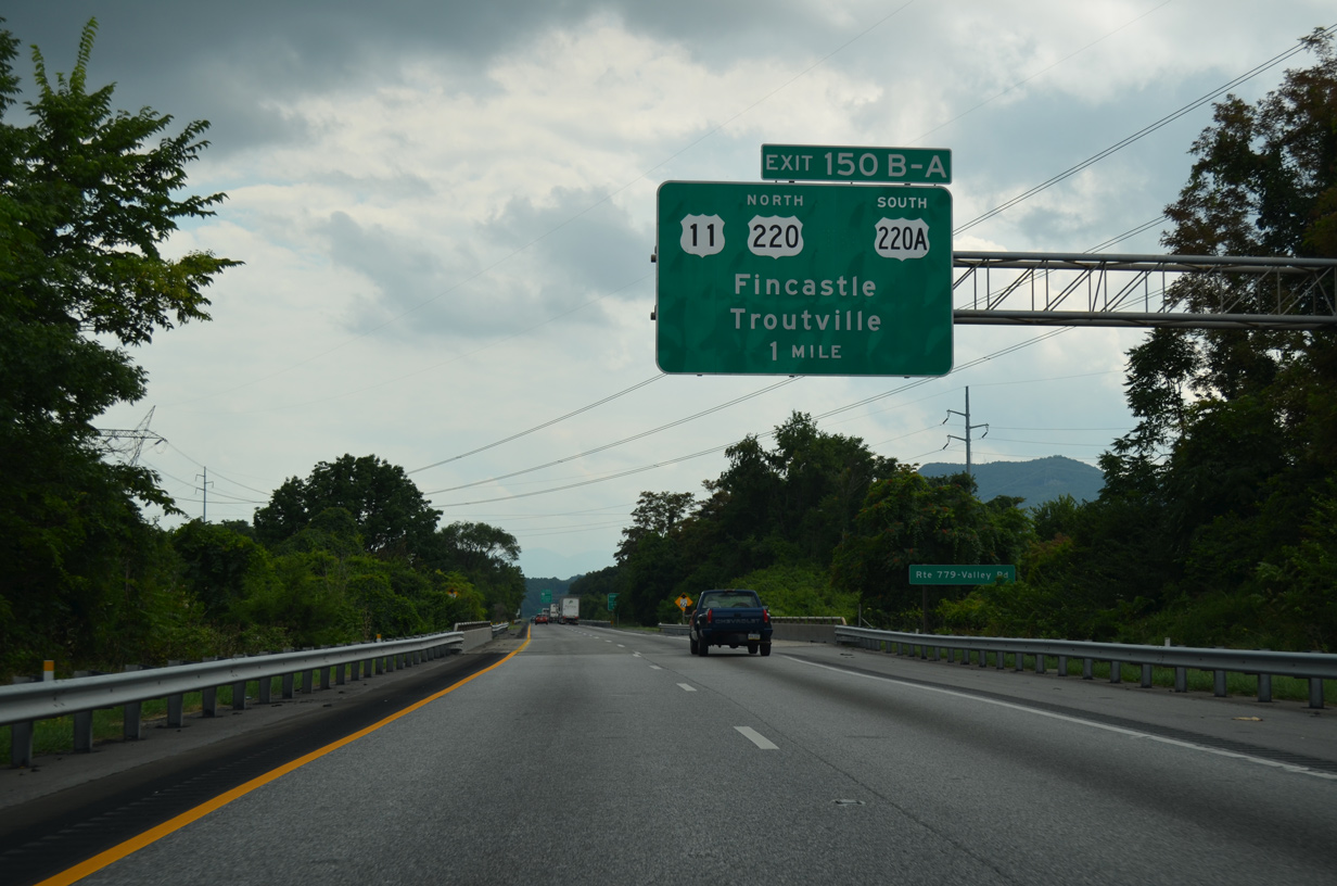
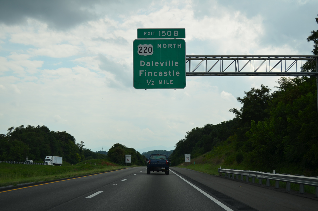
| U.S. 220 (Cloverdale Road) heads south from Fincastle and Daleville to combine with I-81 at Exit 150. U.S. 220 Alternate continues Cloverdale Road southeast to U.S. 221/460 at Bonsack. 08/06/13 |
|
| U.S. 220 travels 35 miles north from Exit 150B to Clifton Forge. 08/06/13 |
|
| U.S. 220 (Roanoke Road) north reaches the town of Fincastle in 8.6 miles. 08/06/13 |
|
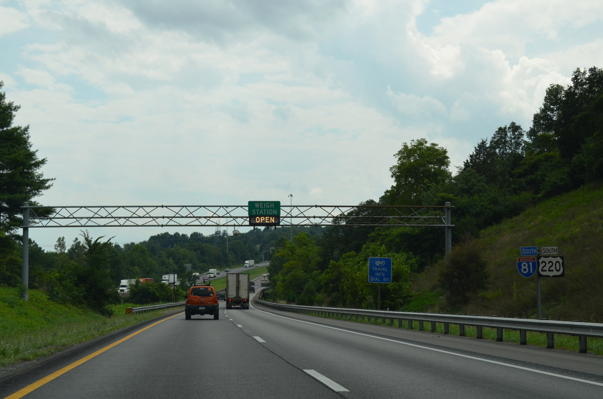
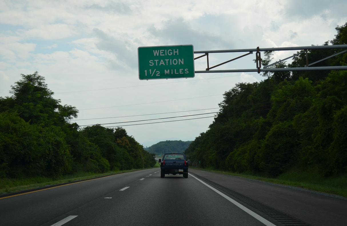
| A pair of weigh stations operate along I-81/U.S. 220 where the freeway circumvents Tinker Mountain. 08/06/13 |
|
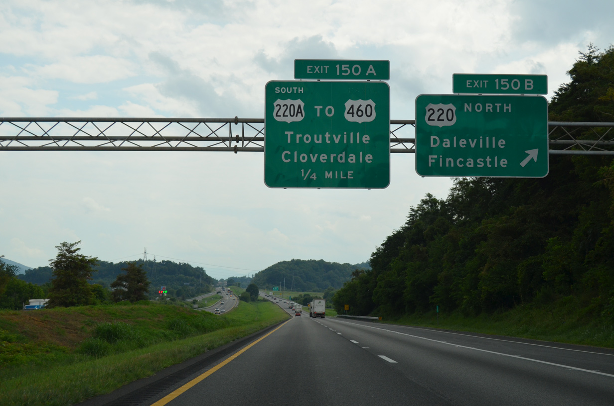
| Entering the parclo interchange (Exit 150) with U.S. 220 north to Daleville and U.S. 220 ALT (Cloverdale Road) south to Cloverdale. Overall U.S. 220 runs 187 miles in Virginia between West Virginia north of Monterrey and North Carolina south of Ridgeway. 08/06/13 |
|
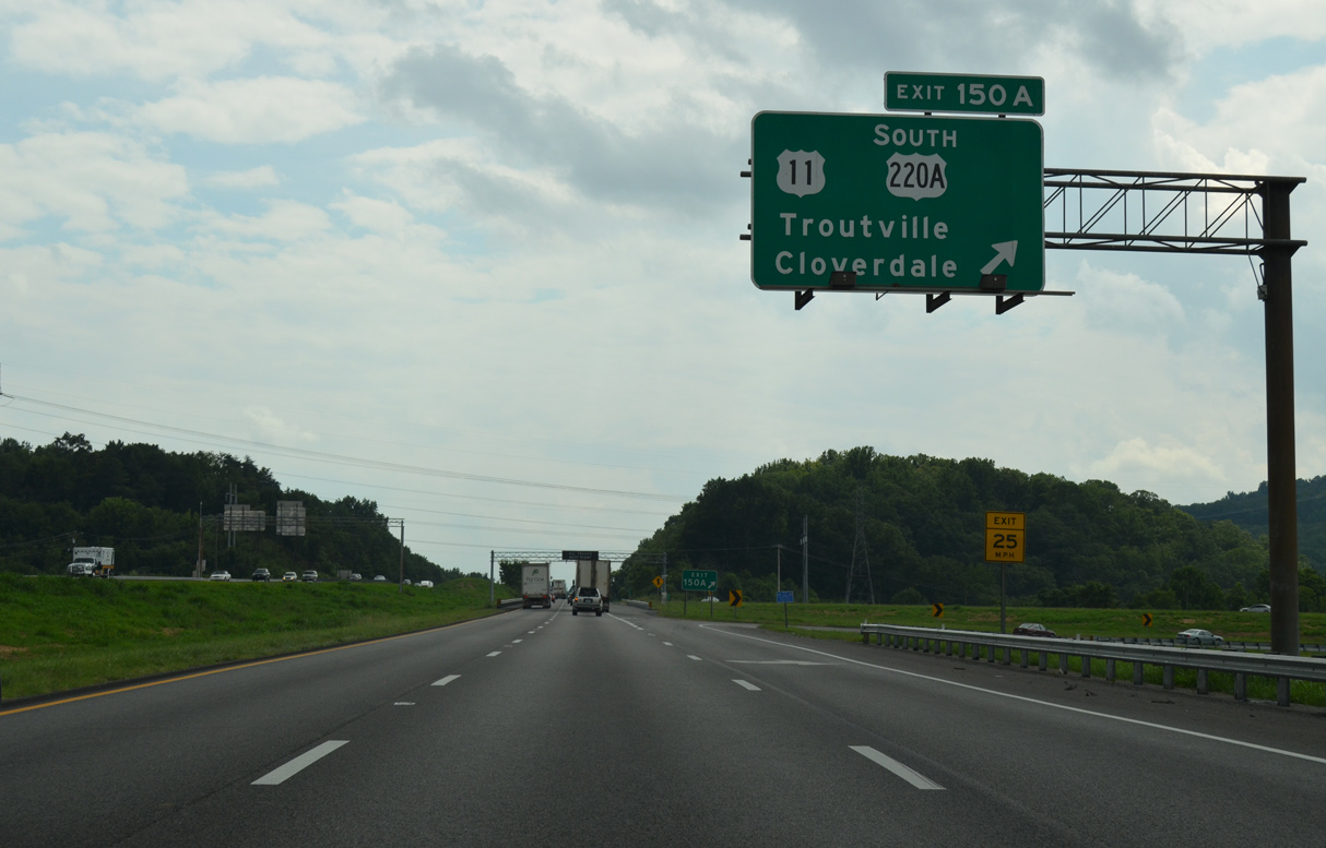
| Exit 150A loops onto U.S. 220 Alternate (Cloverdale Road) south ahead of U.S. 11 (Lee Highway). Passing through Cloverdale, U.S. 11 south leads to Hollins and Roanoke. U.S. 220A combines with U.S. 221/460 west to Roanoke in 5.11 miles. 08/06/13 |
|
| Bypassing Cloverdale and Hollins, U.S. 220 overlaps with I-81 south six miles to Interstate 581. 08/06/13 |
|
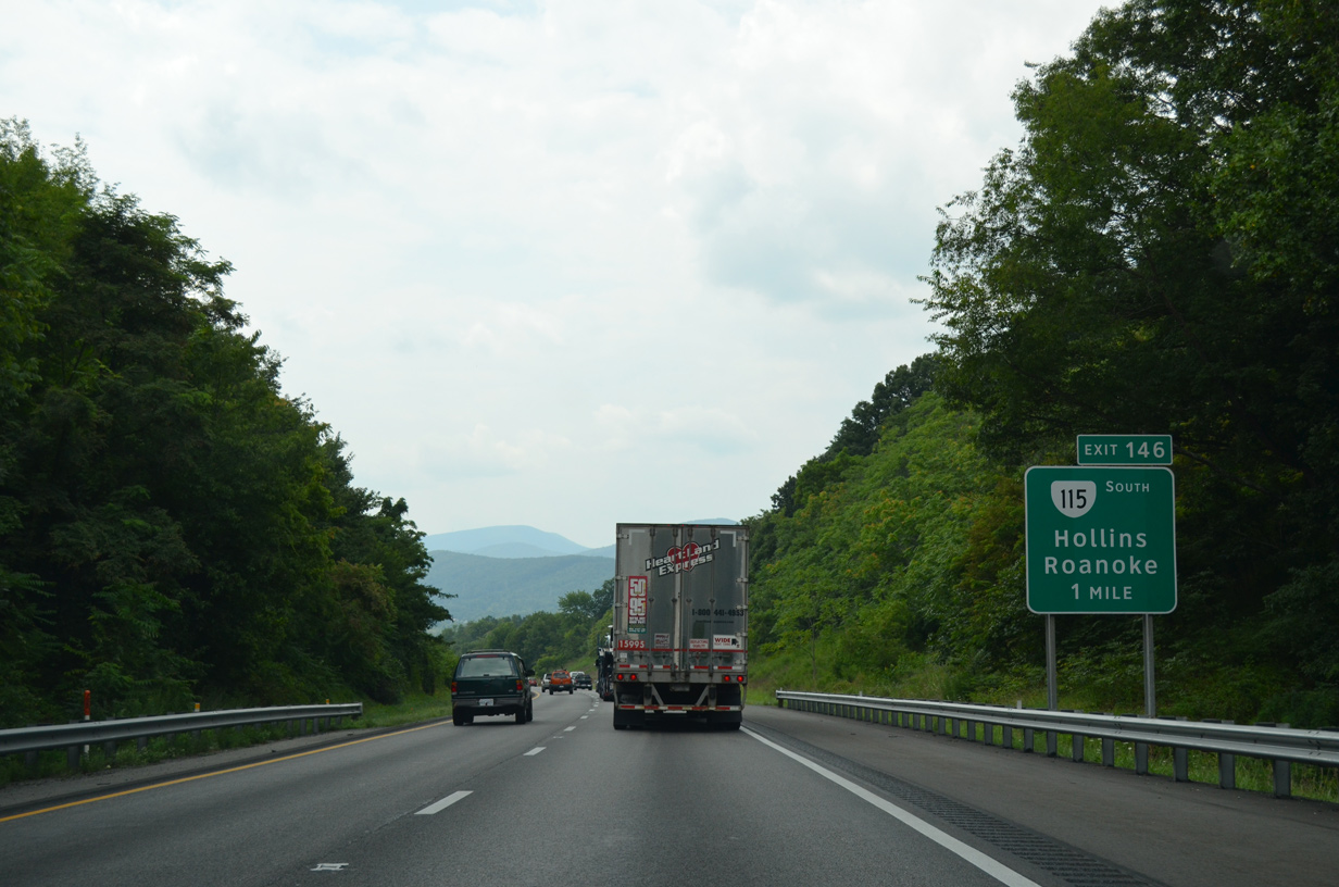
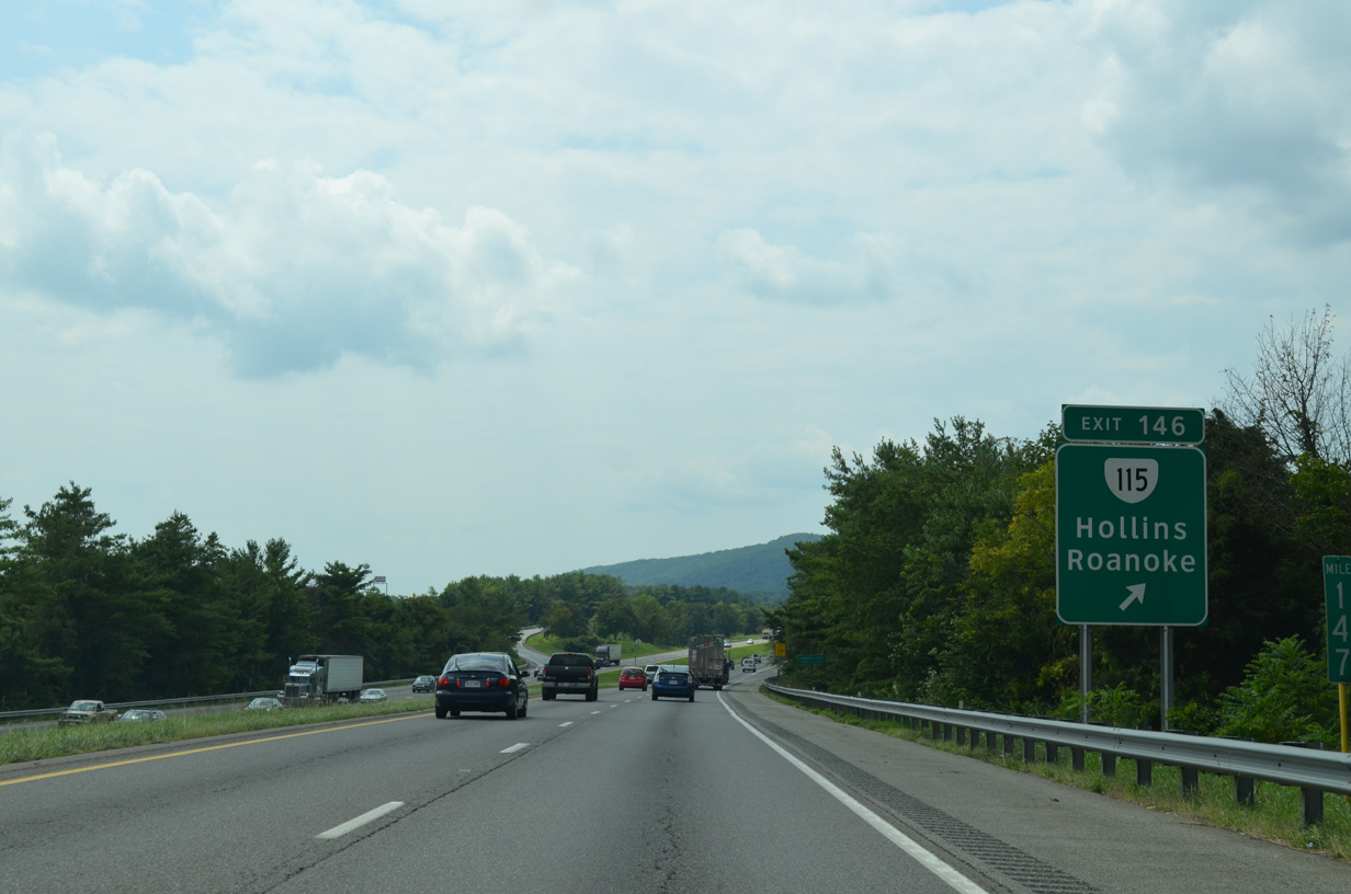
| SR 115 (Plantation Road) stems 6.00 miles south from the diamond interchange at Exit 146 to U.S. 221/460/220A (Orange Avenue) in the city of Roanoke. 08/06/13 |
|
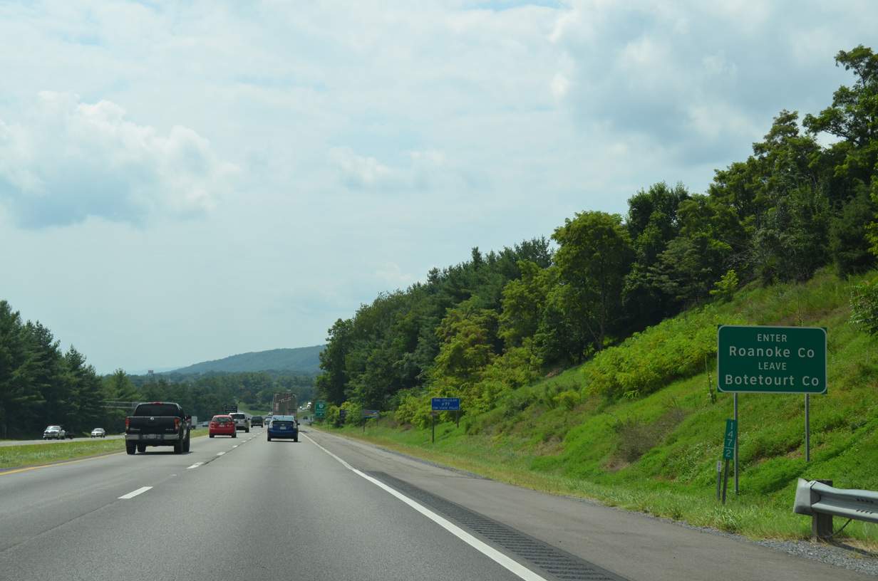
| I-81/U.S. 220 south enter Roanoke County alongside Hollins University. 08/06/13 |
|
| Exit 146 departs I-81/U.S. 220 south for SR 115 (Plantation Road) south and SR 815 northward to Carvin Cove Reservoir. 08/06/13 |
|
| I-81/U.S. 220 curve alongside Green Ridge on the ensuing stretch. 05/27/21 |
|
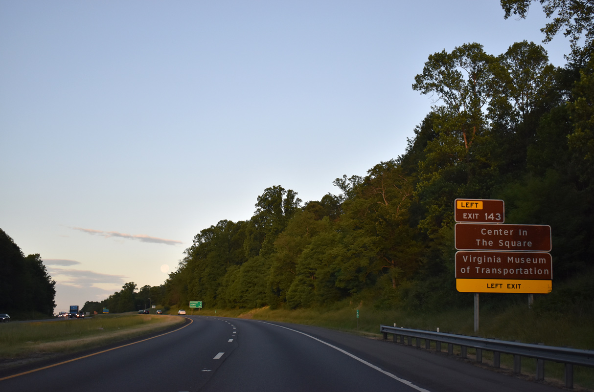
| The Virginia Museum of Transportation and the Center in the Square fall within Downtown Roanoke adjacent to I-581/U.S. 220. 05/27/21 |
|
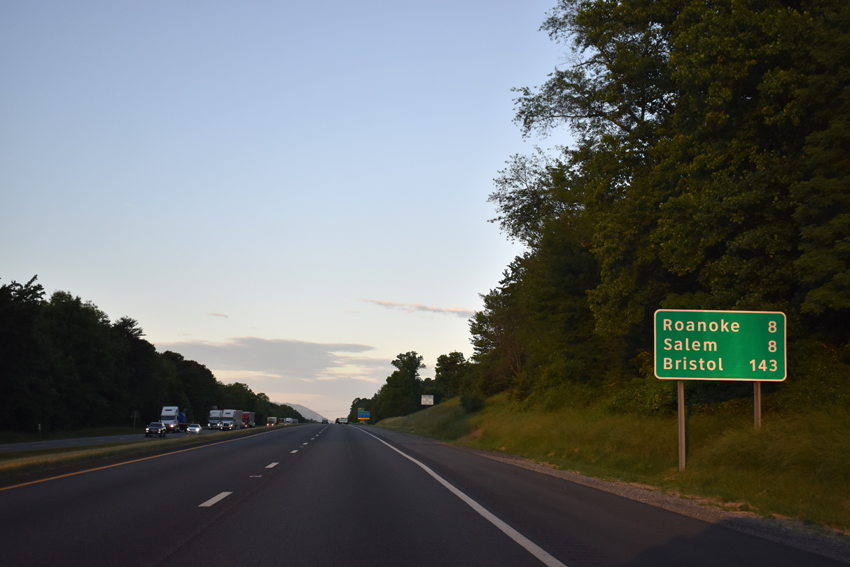
| Downtown Roanoke lies eight miles to the southeast via I-581/220. Downtown Salem is an eight mile drive via I-81 south to SR 311 (Thompson Memorial Drive). 05/27/21 |
|
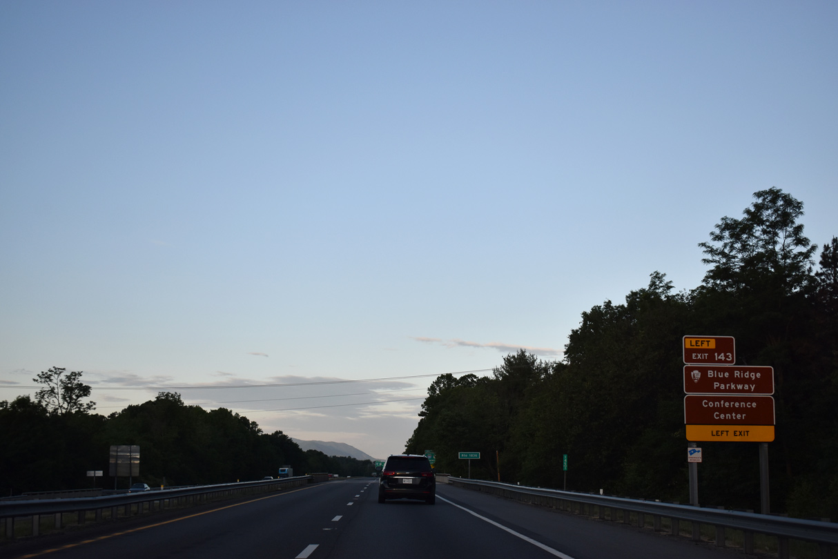
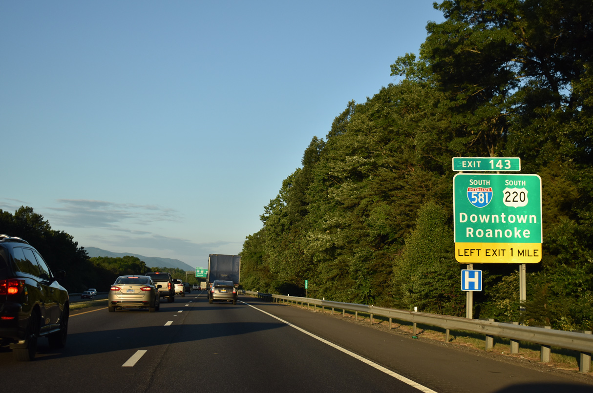
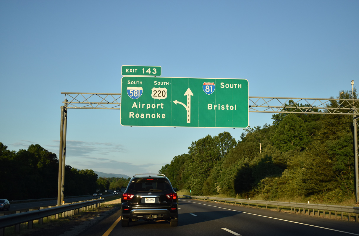
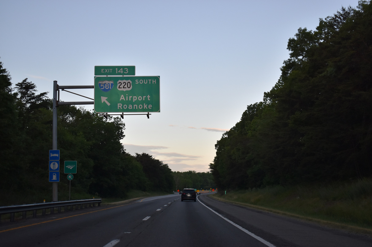
| Points of interest served by Exit 143 include the Hotel Roanoke & Conference Center and the Berglund Center, Roanoke's concert arena. 05/27/21 |
|
| Cosigned with U.S. 220, Interstate 581 constitutes a 6.64 mile long urban spur south to Downtown Roanoke from I-81 near Kingston. 05/27/21 |
|
| Utilizing left side ramps, Exit 143 is a three-wye interchange with I-581/U.S. 220 south. Part of the future I-73 corridor, U.S. 220 comprises a freeway southwest from Roanoke to Blue Ridge Parkway, Rocky Mount and Martinsville. 05/27/21 |
|
| I-581/U.S. 220 connects with SR 101 (Hershberger Road) to Roanoke-Blacksburg Regional Airport (ROA) in 2.7 miles. 05/27/21 |
|
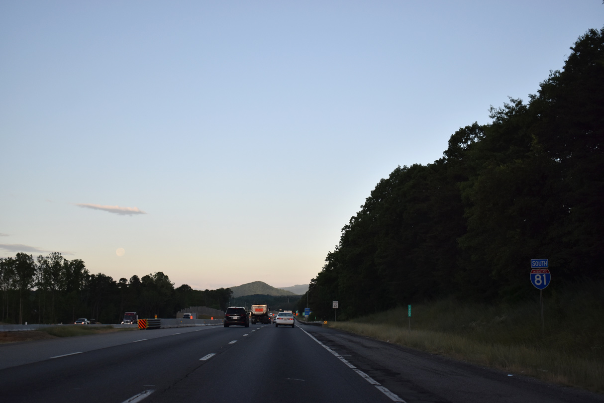
| $38 million in construction from Spring 2020 to Summer 2022 expands Interstate 81 with auxiliary lanes between the exchanges with I-581/U.S. 220 and SR 419 (Electric Road). 05/27/21 |
|
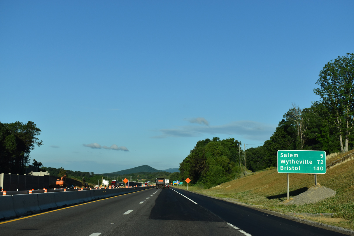
| Interstate 81 continues along Green Ridge toward the independent city of Salem. The city center lies five miles to the south where SR 311 (Thompson Memorial Drive) comes together with U.S. 460 (Main Street). 05/27/21 |
|
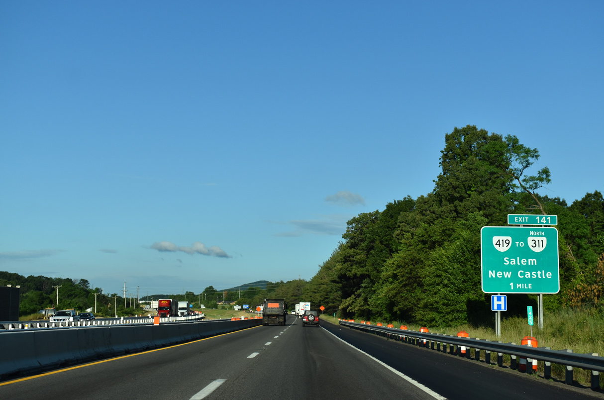
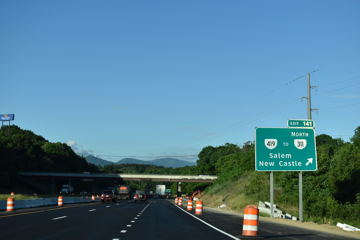
| The parclo B2 interchange (Exit 141) with SR 419 (Electric Road) connects I-81 with SR 311 (Catawba Valley Drive) at Hanging Rock. SR 311 traverses Catawba Mountain north from Bennett Spring and Mason Cove to New Castle. 05/27/21 |
|
| SR 419 (Electric Road) encircles Roanoke south to Cave Spring and U.S. 220 at U.S. 220 Business (Franklin Road). 05/27/21 |
|
| Measuring 10.54 miles overall, the arterial route of SR 419 (Electric Road) concludes 0.35 miles north of Exit 141 at SR 311 (Catawba Valley Drive). 08/06/13 |
|
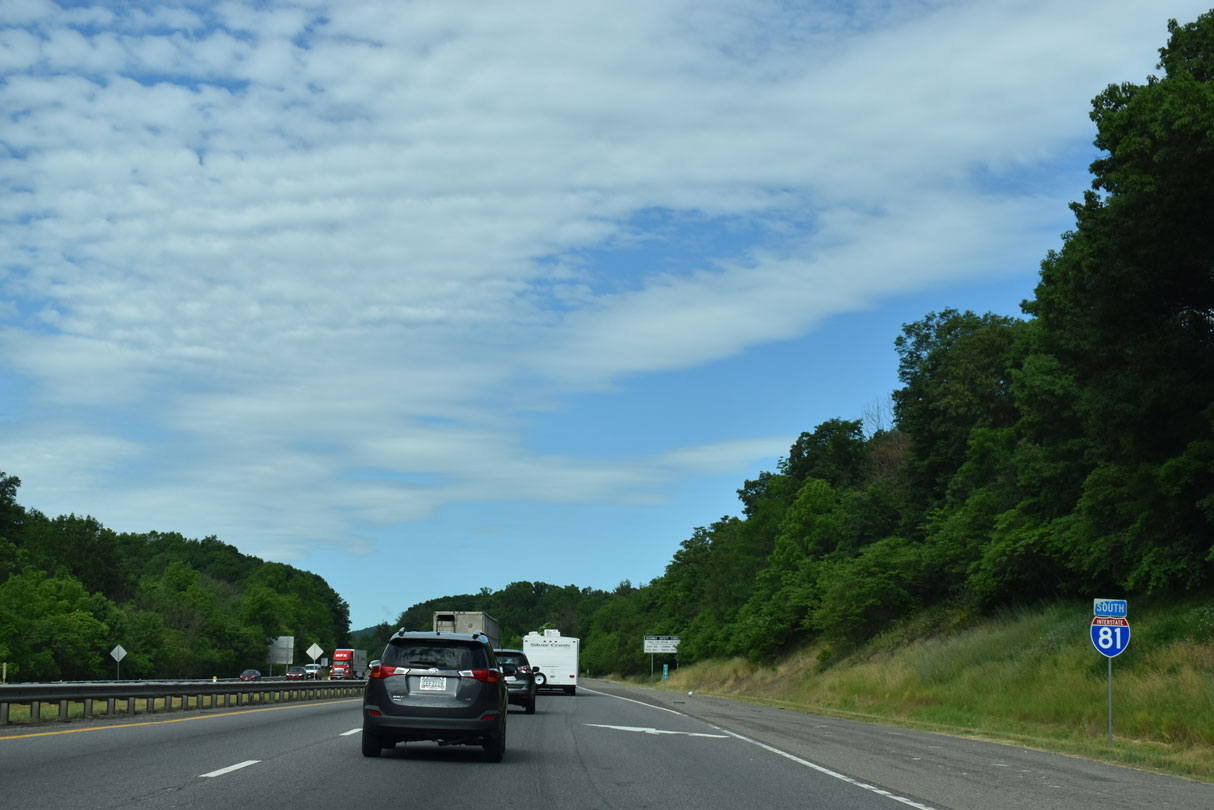
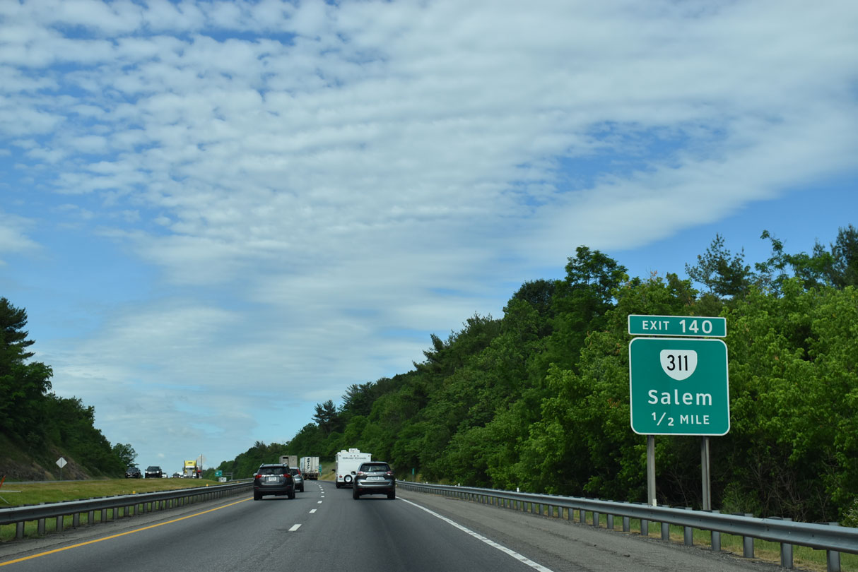
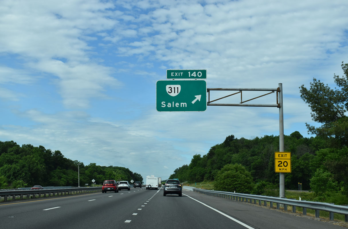
| Interstate 81 spans Mason Creek between SR 419 and parclo interchange (Exit 140) with SR 311 (Thompson Memorial Drive). 05/27/21 |
|
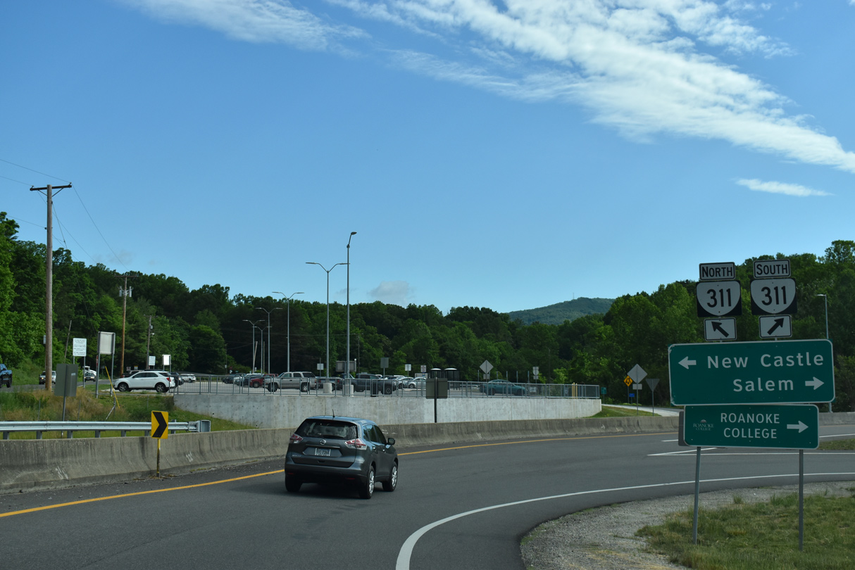
| SR 311 runs 22 miles north from Salem to the Craig County seat of New Castle. 05/27/21 |
|
| SR 311 comprises a multi state route leading north 59 miles from Salem to White Sulphur Springs, West Virginia. The route was never a part of the original U.S. 311, but rather was a state route extension of the overall corridor. Exit 141 opened by 1986.1 05/27/21 |
|
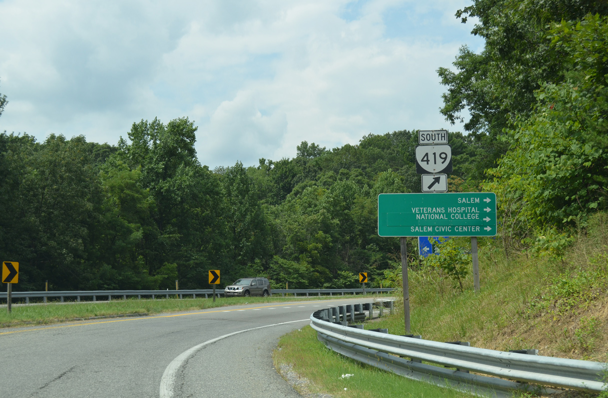
| Thompson Memorial Drive carries SR 311 southwest from SR 419 at Hanging Rock to U.S. 11 (College Avenue) in Downtown Salem. 05/27/21 |
|
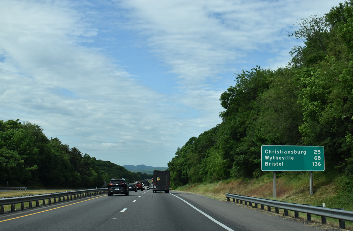
| Interstate 81 straddles the Salem city and Roanoke County line from SR 419 southwest to the Butt Hollow Road under crossing west of Exit 137. 05/27/21 |
|
| Christiansburg is 25 miles away. 05/27/21 |
|
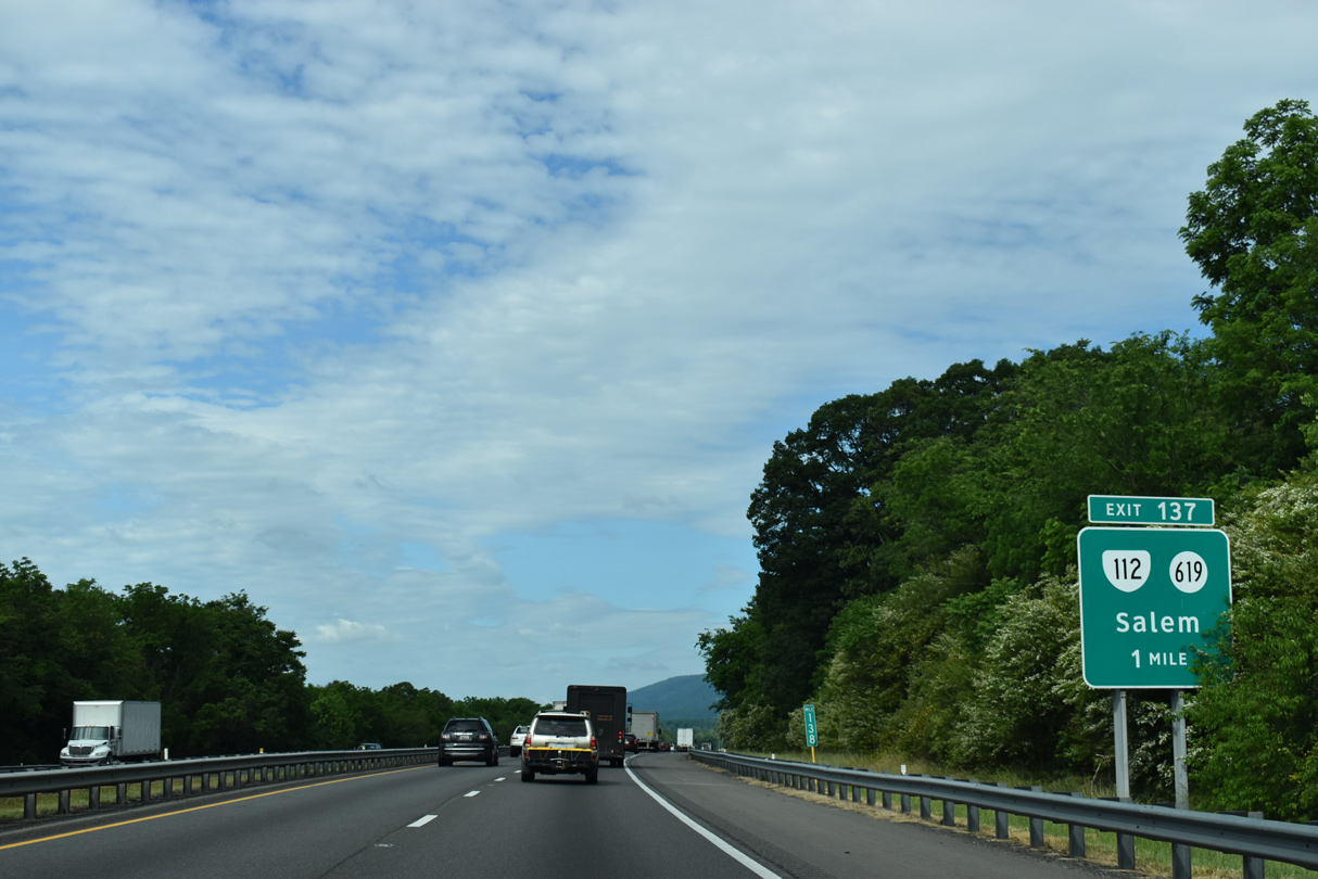
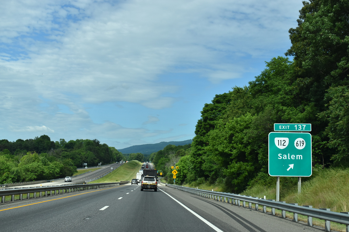
| SR 112 (Wildwood Road) connects I-81 at Exit 137 with the commercial strip along U.S. 11/460 (W Main Street) in Salem. 05/27/21 |
|
| A parclo interchange links I-81 with SR 112 (Wildwood Road) south and SR 619 north at Exit 137. SR 619 loops around Little Brushy Mountain to Academy Street in Salem. 05/27/21 |
Page Updated 08-09-2021.

 South
South

 South
South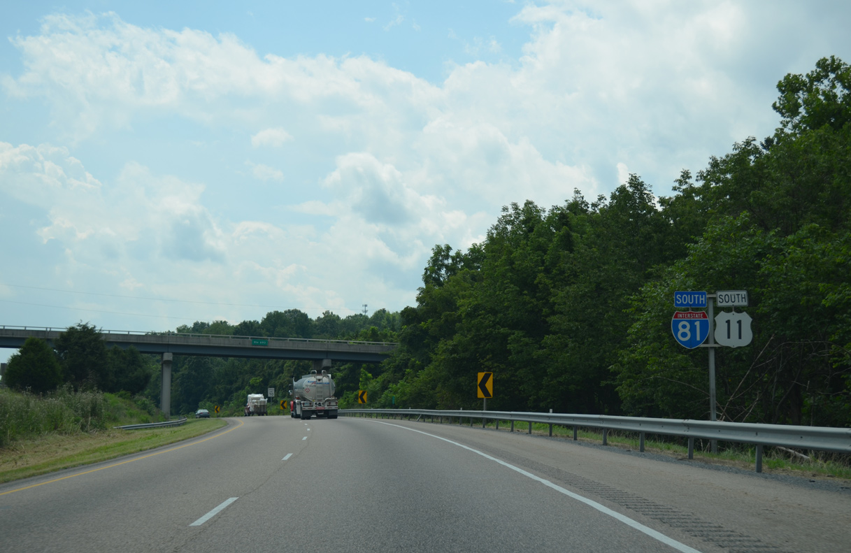


 South
South