|
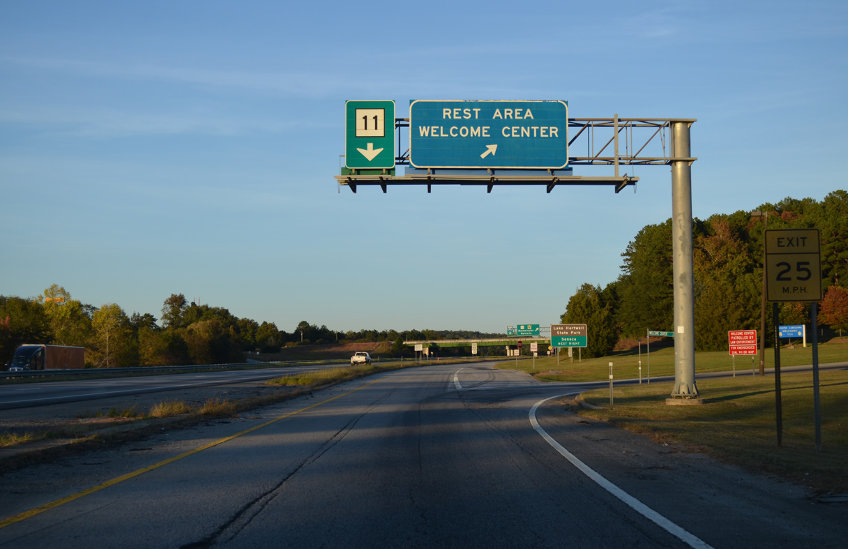
| Interstate 85 crosses the Tugaloo River and Lake Hartwell across the S. Ernest Vandiver Bridge. Built in 1961, the span leads directly to a collector distributor roadway (Exit 1) for S.C. 11 and the South Carolina Welcome Center. 10/22/15 |
|
| The c/d roadway for Exit 1 separates with the ramp to the tourist information center and rest area. There is only one additional rest area along I-85 in the state, located 18 miles to the east. 10/22/15 |
|
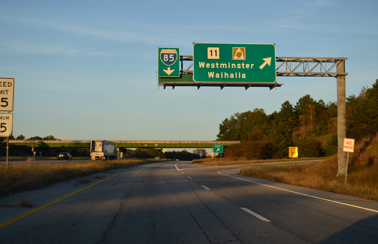
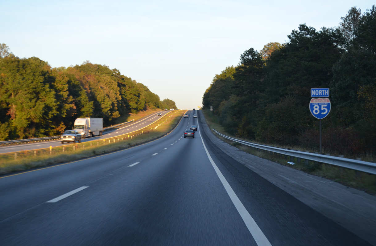
| A parclo interchange joins I-85 with the south end of S.C. 11 at Exit 1. The 119.85 mile long route is part of the Cherokee Foothills Scenic Highway north to Exit 92 at Gaffney. 10/22/15 |
|
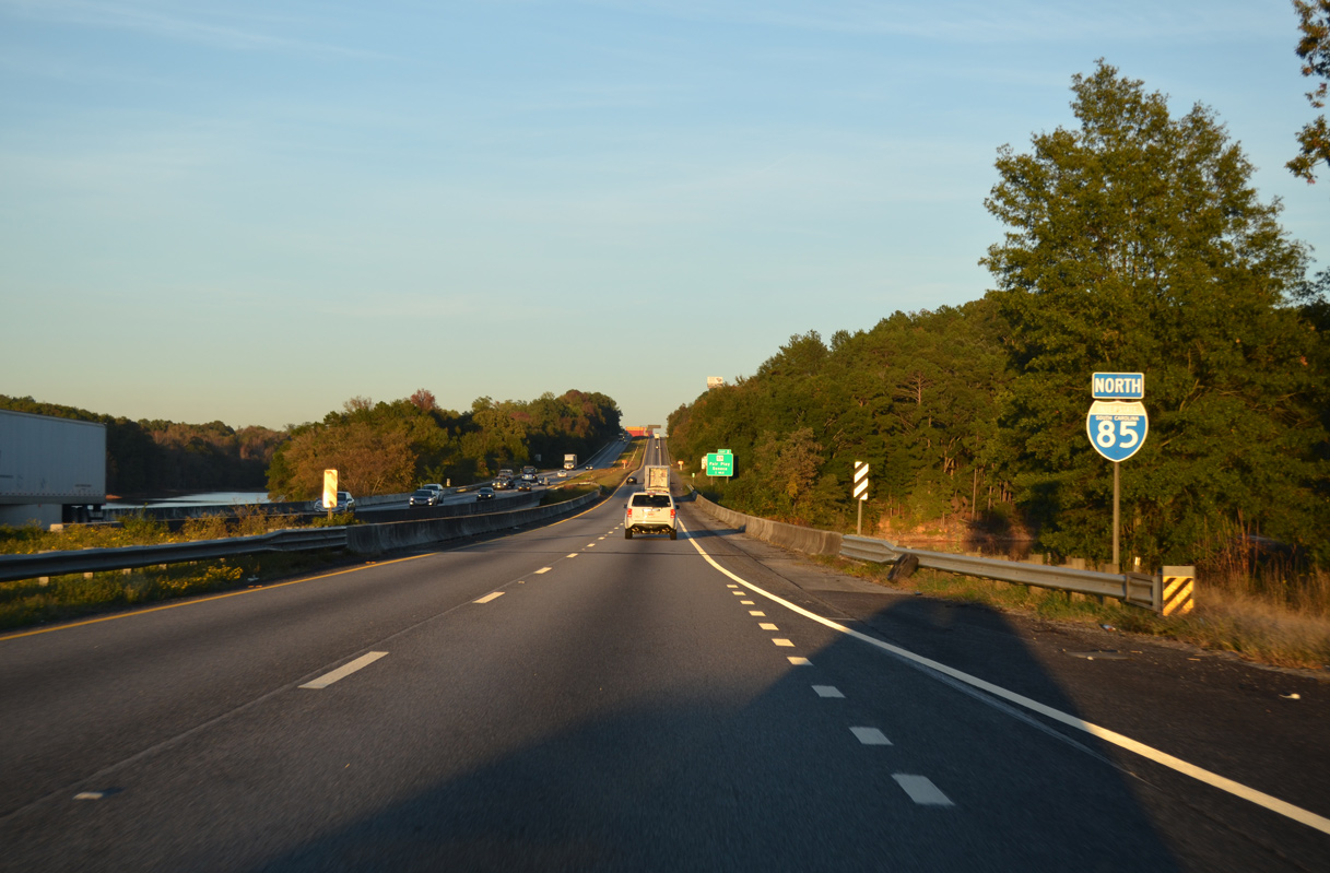
| Interstate 85 crosses another portion of Lake Hartwell just east of the exchange with S.C. 11. 10/22/15 |
|
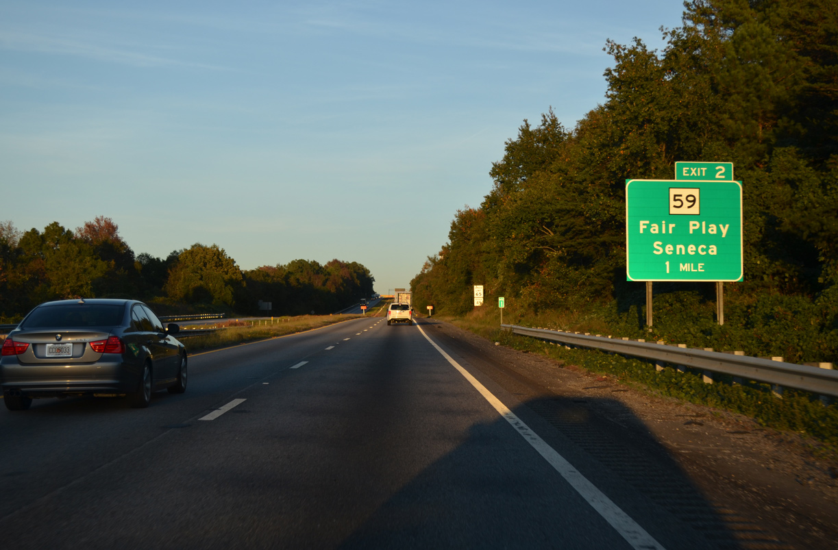
| S.C. 59 runs 15.70 miles north from Exit 2 to U.S. 76-123/S.C. 28 (Sandifer Boulevard) in Seneca. 10/22/15 |
|
| S.C. 59 (Fairplay Boulevard) leads 0.91 miles north to Fair Play, where both S.C. 182/243 begin. Lakeshore Drive spurs 0.98 miles southwest from Exit 2 to Lake Hartwell. 10/22/15 |
|
| Interstate 85 lowers to around 740 feet above sea level before climbing 100 feet by this confirming marker. 10/22/15 |
|
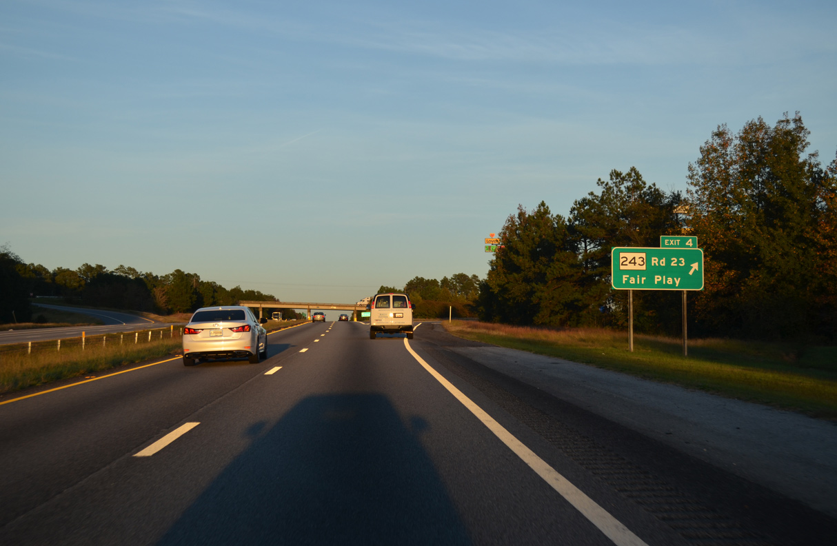
| S.C. 243 (Fairplay Boulevard) parallels I-85 east 8.38 miles from S.C. 59 at Fair Play to S.C. 24 at Exit 11. Whitfield Road links the two routes at forthcoming Exit 4. 10/22/15 |
|
| Whitfield Road branches 0.31 miles southeast from S.C. 243 to I-85, where it becomes Old Dobbins Bridge Road (Road 23). Road 23 spurs 6.40 miles east to a dead end at Lake Hartwell. Before the formation of the man-made reservoir, Old Dobbins Bridge Road continued into Anderson. 10/22/15 |
|
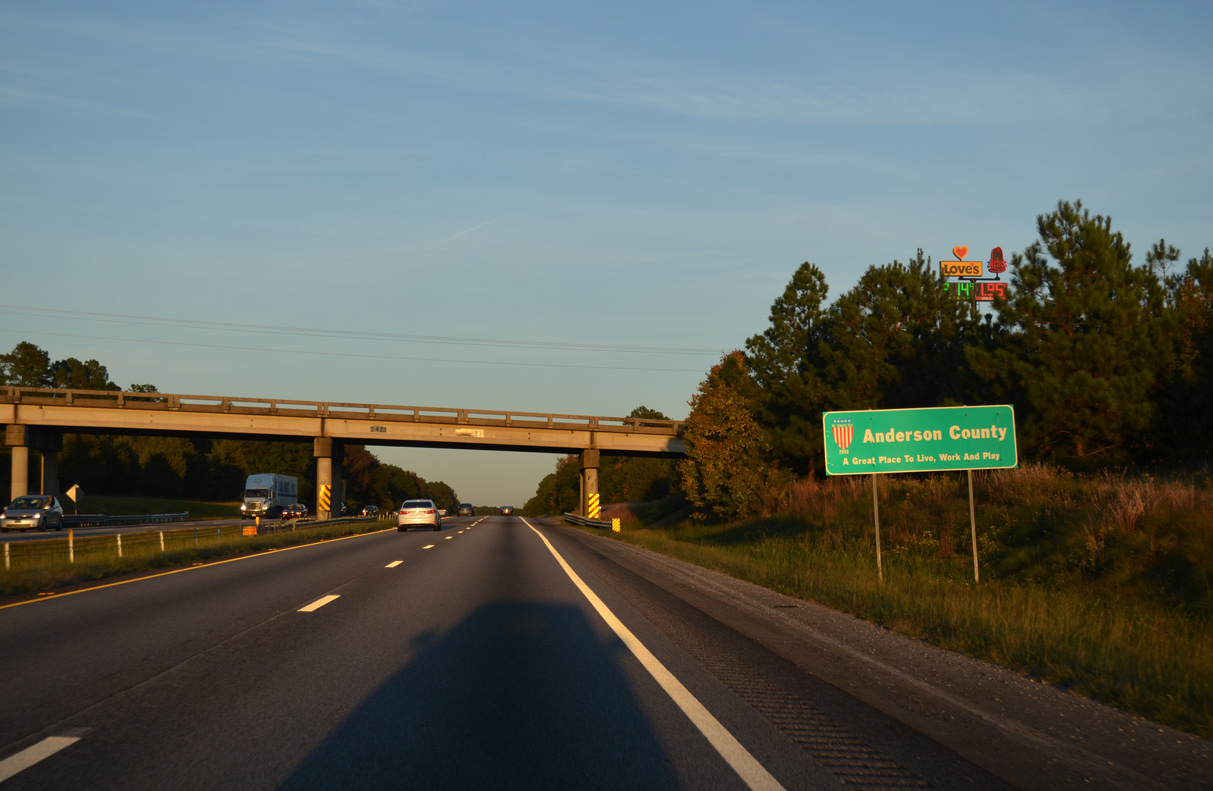
| I-85 crosses the Anderson County line within the diamond interchange at Exit 4. 10/22/15 |
|
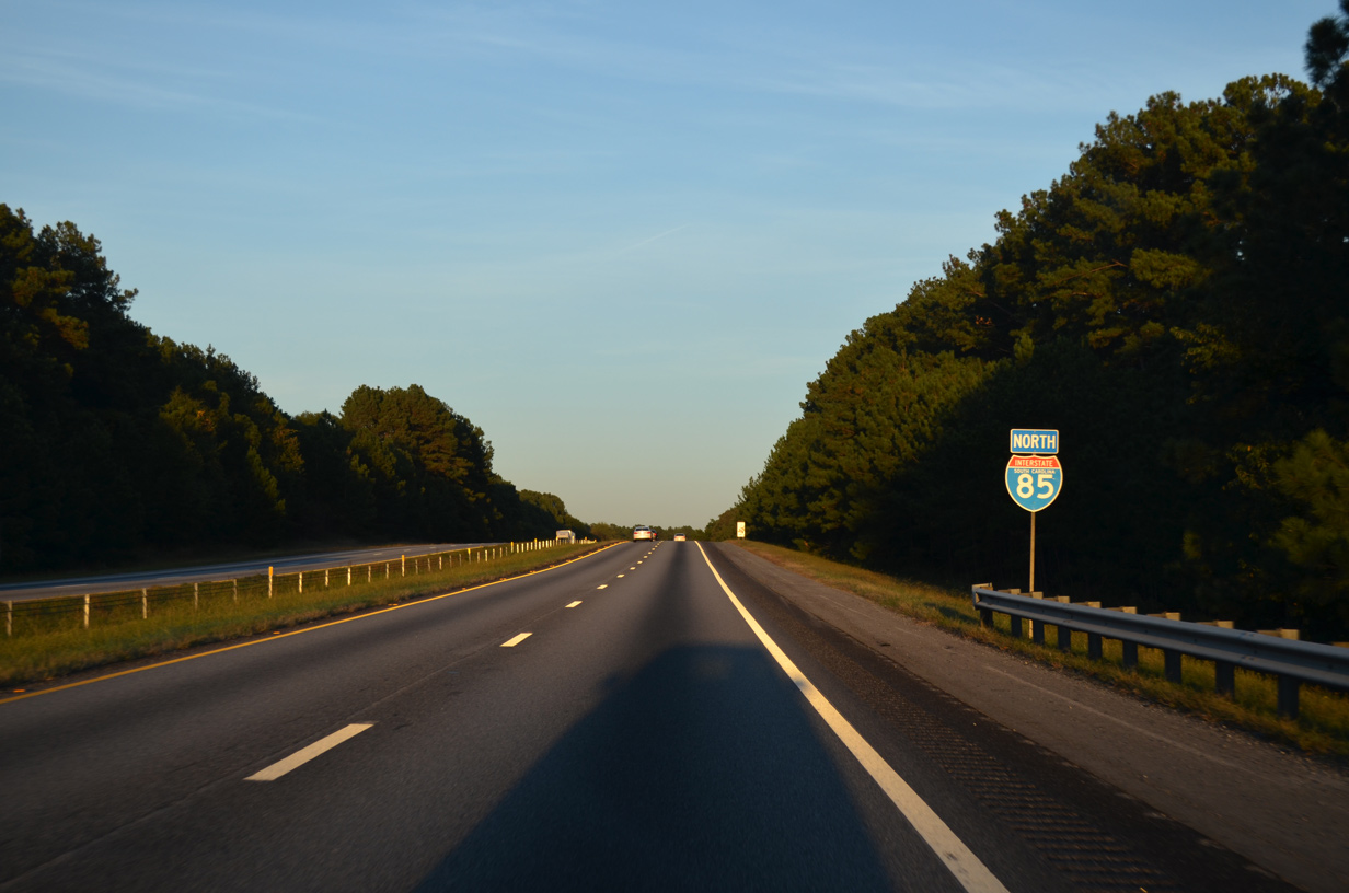
| Interstate 85 advances east across Beaverdam Creek by another arm of Lake Hartwell on the ensuing stretch. 10/22/15 |
|
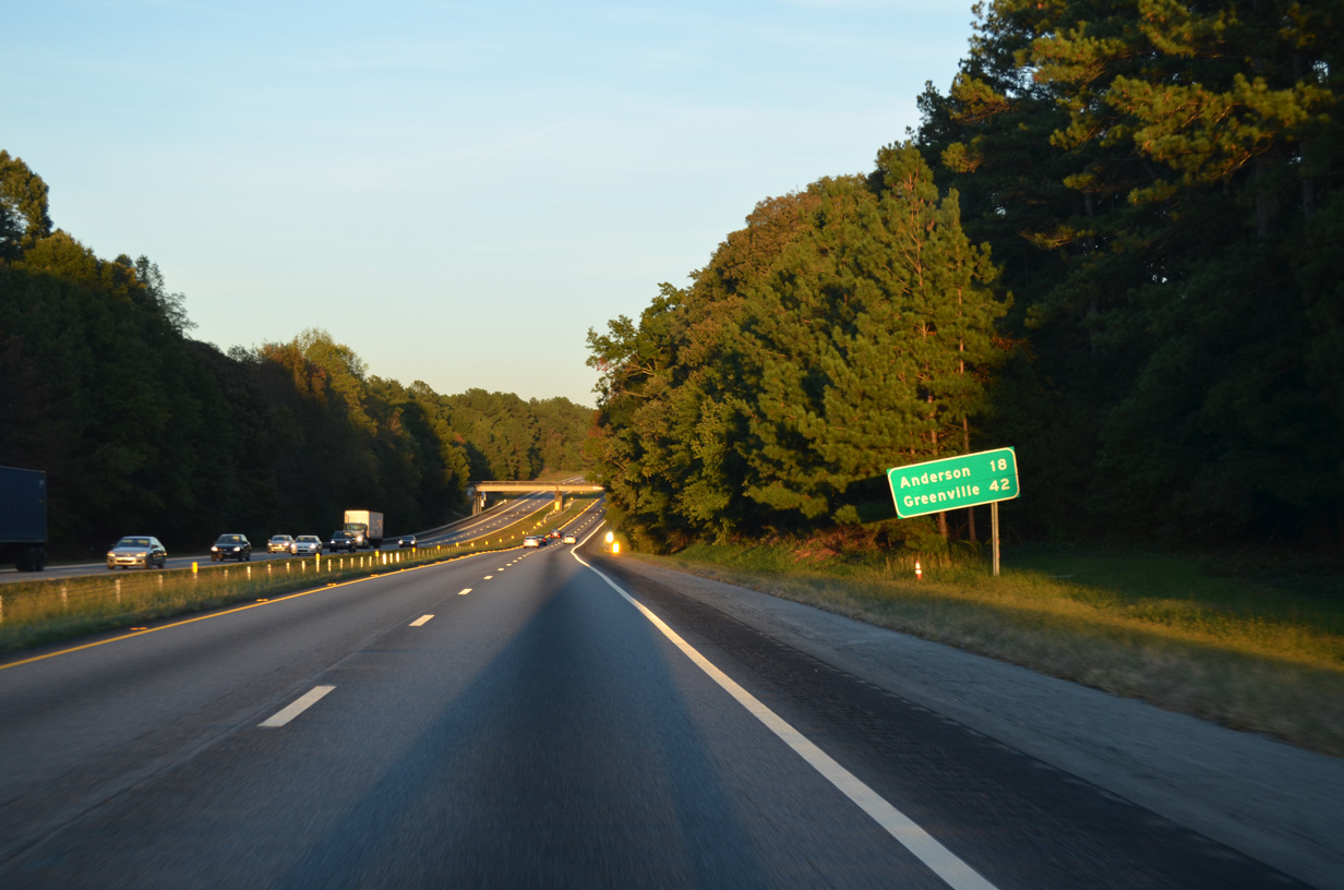
| Anderson lies 18 miles to the east from the succeeding exit. Greenville is 42 miles beyond the Wooten Road overpass and this distance sign. 10/22/15 |
|
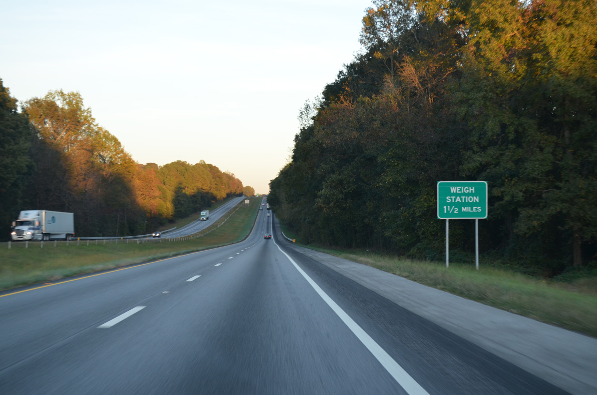
| A northbound side weigh station follows the Milford Road overpass along Interstate 85. 10/22/15 |
|
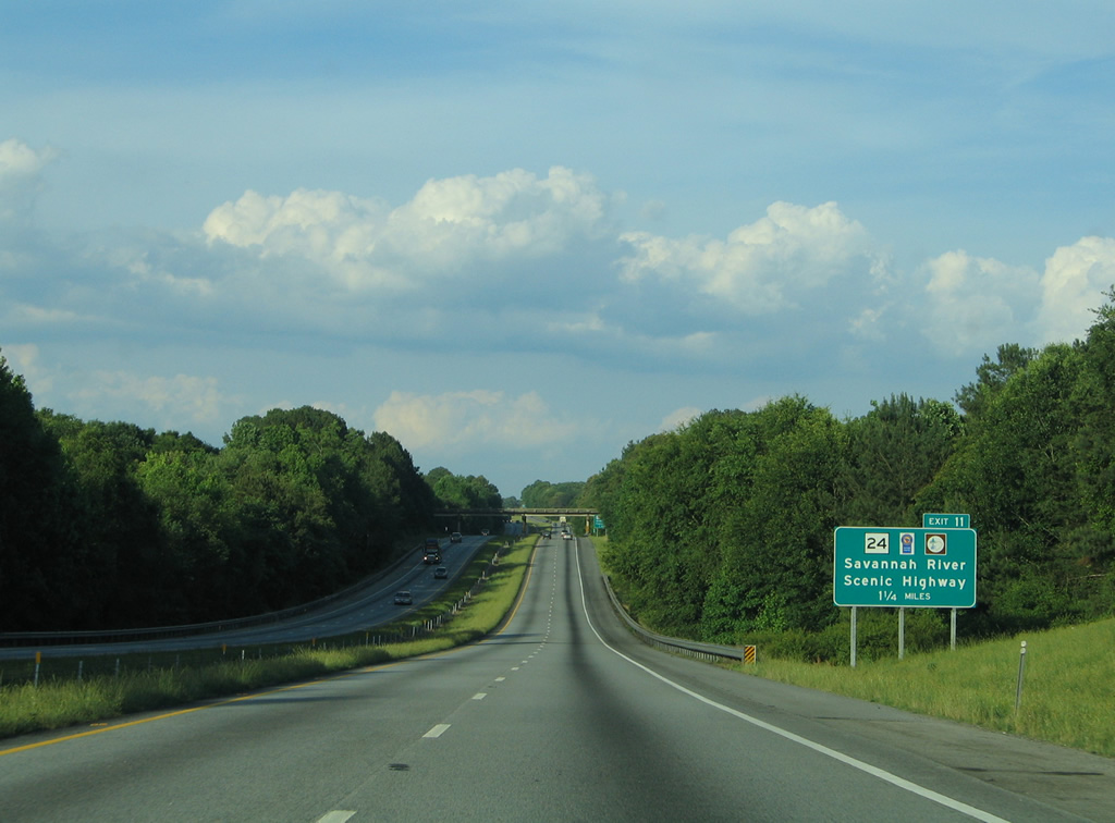
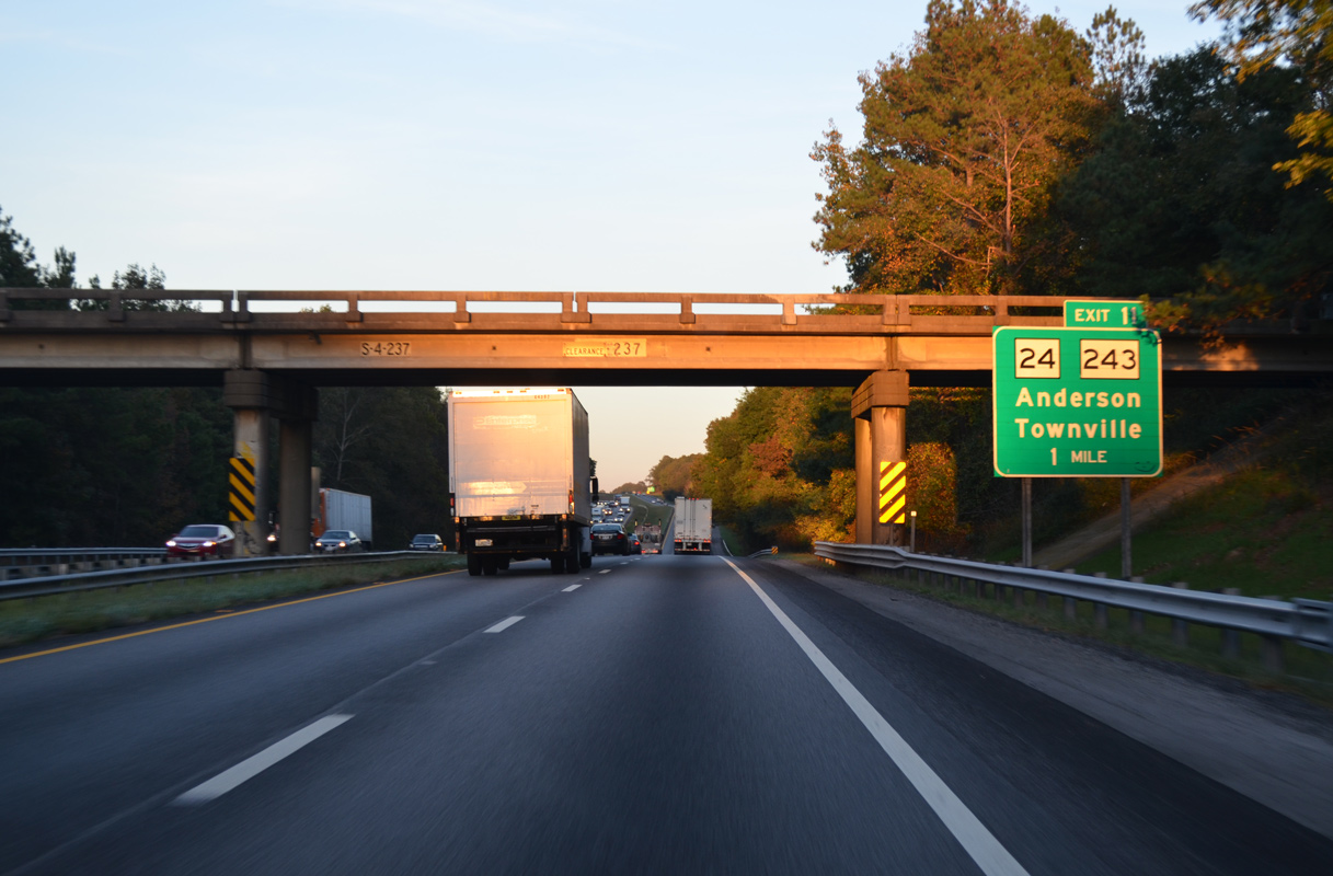
| I-85 lowers across the Little Beaverdam Creek arm of Lake Hartwell 1.25 miles from the parclo A2 interchange (Exit 11) with S.C. 24 (Savannah River Scenic Highway). 05/28/05 |
|
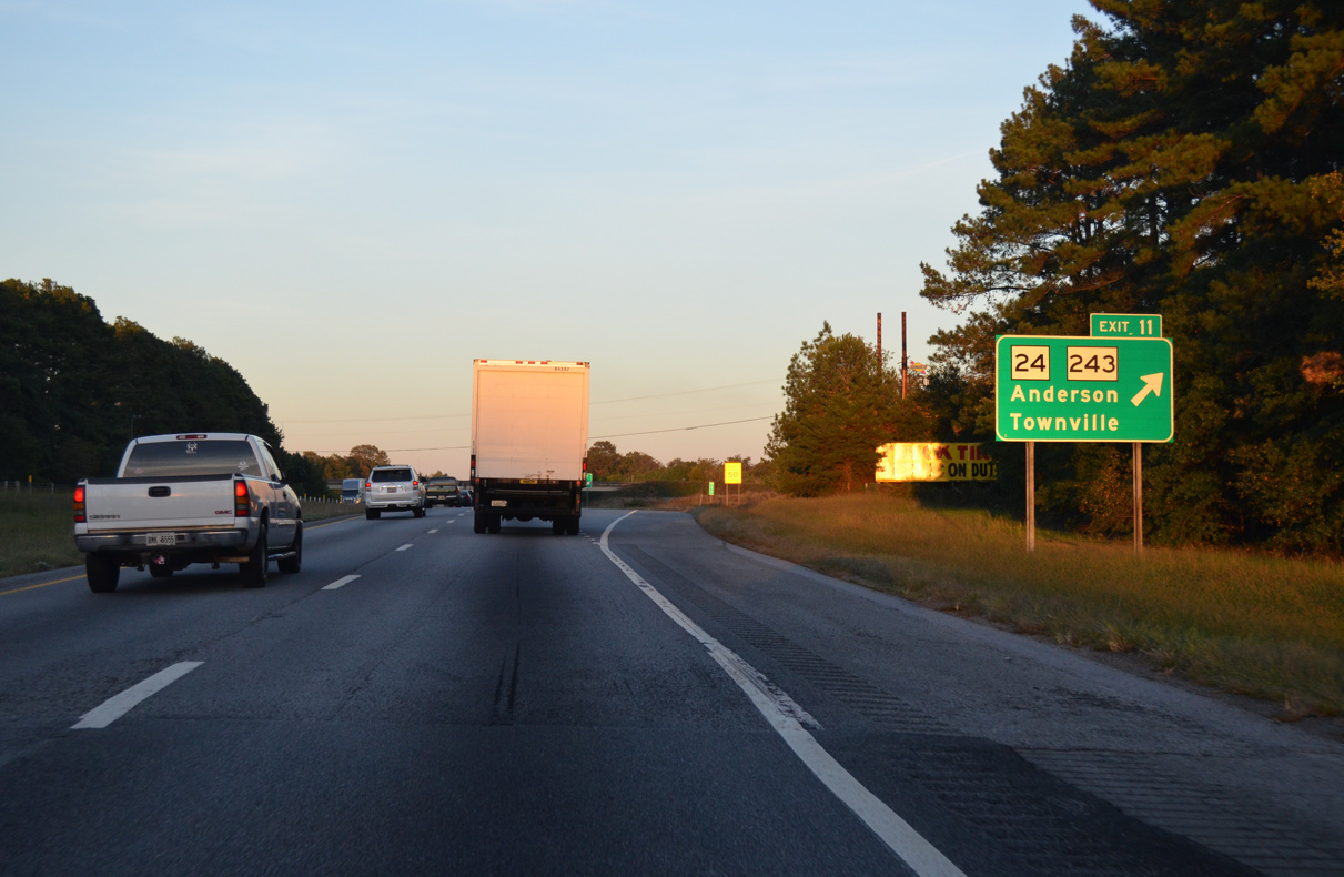
| Exit 11 links I-85 north with adjacent Hickory Ridge Road at Abercorn Lane just west of S.C. 24. S.C. 24 travels 11.67 miles east to U.S. 29 Business (Murry Avenue) in Downtown Anderson. 10/22/15 |
|
| S.C. 24 is part of the Savannah River National Scenic Byway south from S.C. 11, Oakway, Tokeena and Townville to S.C. 187. A 30.56 mile long highway, S.C. 24 originates from U.S. 76/123 (Main Street) in the city of Westminster. 10/22/15 |
|
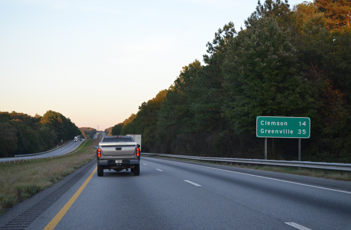
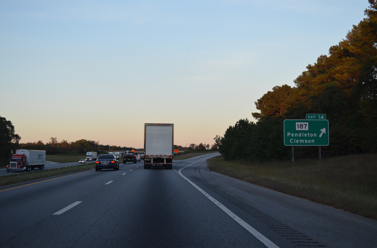
| The succeeding exit from I-85 north leads 14 miles to the city of Clemson via S.C. 187 and U.S. 76/S.C. 28 west. Greenville is a half hour away. 10/22/15 |
|
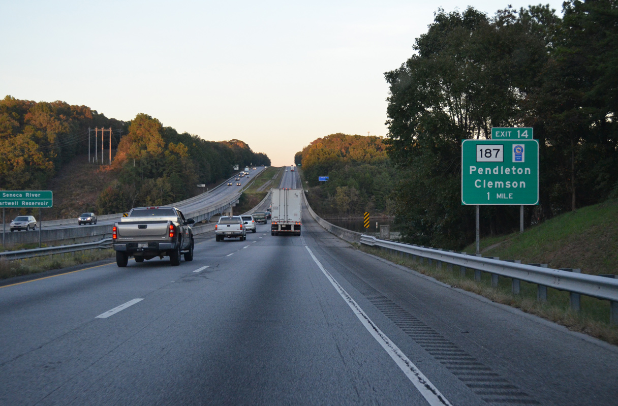
| I-85 north dips to cross the Seneca River arm of Lake Hartwell one mile from Exit 14 with S.C. 187. S.C. 187 continues the Savannah River National Scenic Byway south beyond the 2.78 mile long overlap with S.C. 24 across Lake Hartwell to S.C. 412, west of Starr. 10/22/15 |
|
| S.C. 187 heads 5.98 miles north to U.S. 76/S.C. 28 outside Pendleton. Southward the route parallels Lake Hartwell and the Savannah River 24.35 miles to S.C. 184, southwest of Iva. 10/22/15 |
|
| Interstate 85 next crosses the Three and Twenty Creek arm of Lake Hartwell. 05/28/05 |
|
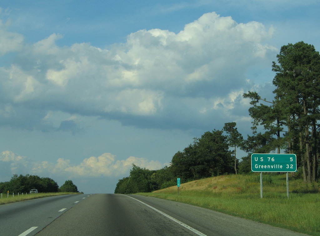
| U.S. 76/S.C. 28 cross paths with Interstate 85 in five miles outside Anderson. Greenville is 32 miles away. 05/28/05 |
|
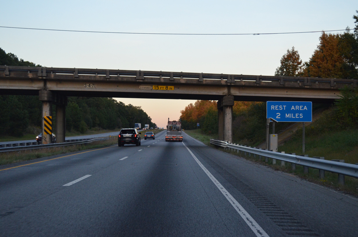
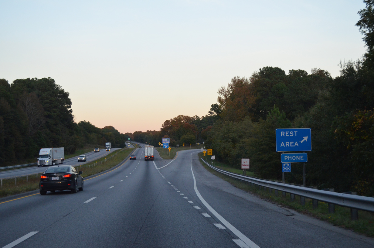
| Centerville Road (Road 71) passes overhead at Masons Crossroads, two miles west of the last South Carolina rest area on Interstate 85 north. 10/22/15 |
|
| The northbound side rest area lies in a forested area encircled by Lake Hartwell, just south of Denver. The third rest area for the Palmetto State was located near Gaffney. It closed on June 3, 2011. 10/22/15 |
|
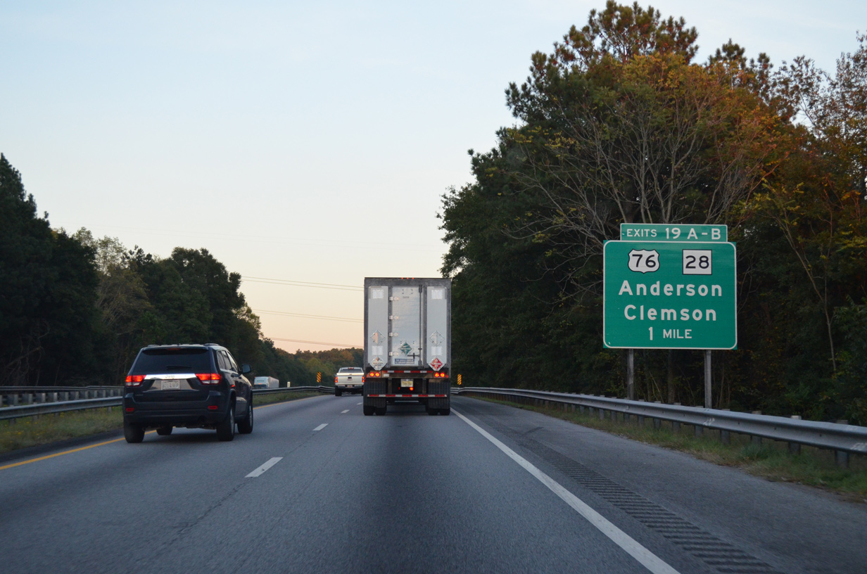
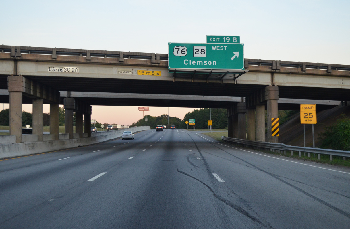
| U.S. 76/S.C. 28 overlap from Anderson northwest to Exit 19, Pendleton, Clemson and Seneca. 10/22/15 |
|
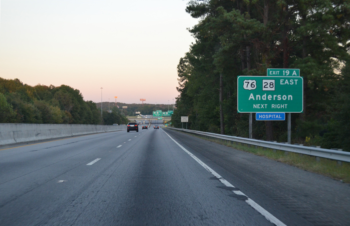
| Interstate 85 expands to six lanes from Exit 19 northeast through the Greenville area. East from Exit 19A, U.S. 76/S.C. 28 (Clemson Boulevard) cross Lake Hartwell to the community of Northlake, where they join U.S. 178 south into Anderson. 10/22/15 |
|
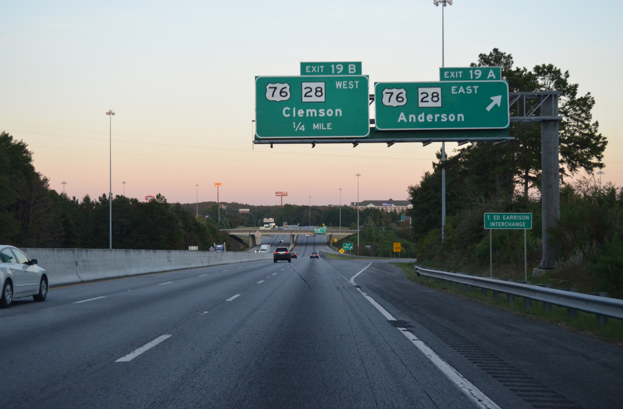
| Entering the cloverleaf interchange (Exit 19) with U.S. 76/S.C. 28 on Interstate 85 north. Leaving Anderson, S.C. 28 continues south to Abbeville while U.S. 76/178 remain together through Belton and Honea Path. 10/22/15 |
|
| Exit 19B loops onto U.S. 76/S.C. 28 west. U.S. 76 exits the Palmetto State by way of Westminster while S.C. 28 is part of a multi state route between Beech Island south of Augusta, Georgia and Deals Gap, North Carolina. 10/22/15 |
|
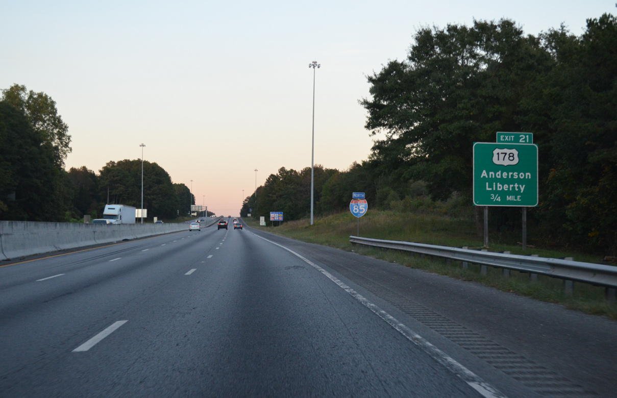
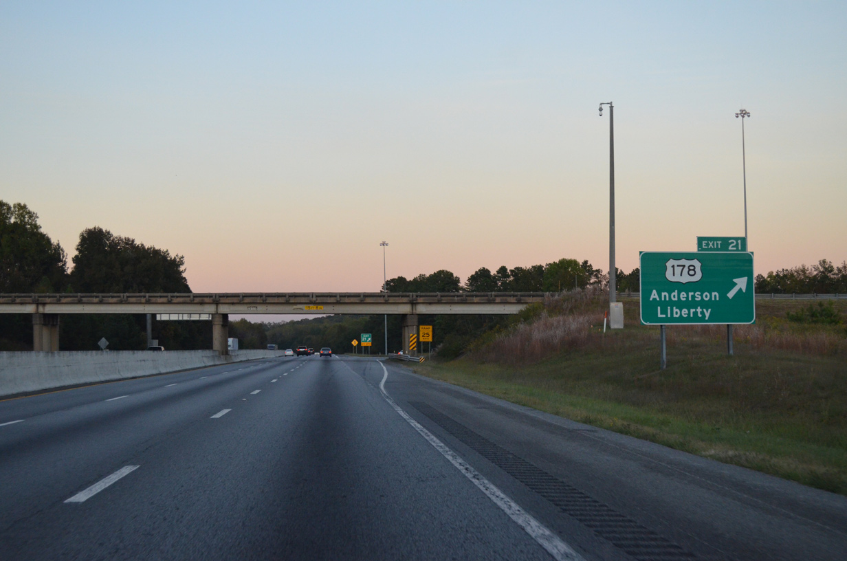
| U.S. 178 crosses Lake Hartwell north from U.S. 76/S.C. 28 at Northlake to the parclo B2 interchange at Exit 21. 10/22/15 |
|
| U.S. 178 continues north from I-85 to Lebanon and the city of Liberty. The loop ramp at Exit 21 includes access to an adjacent business. A 240 mile long highway, U.S. 178 runs north to Rosman, North Carolina and south to Dorchester in the Low Country. 10/22/15 |
|
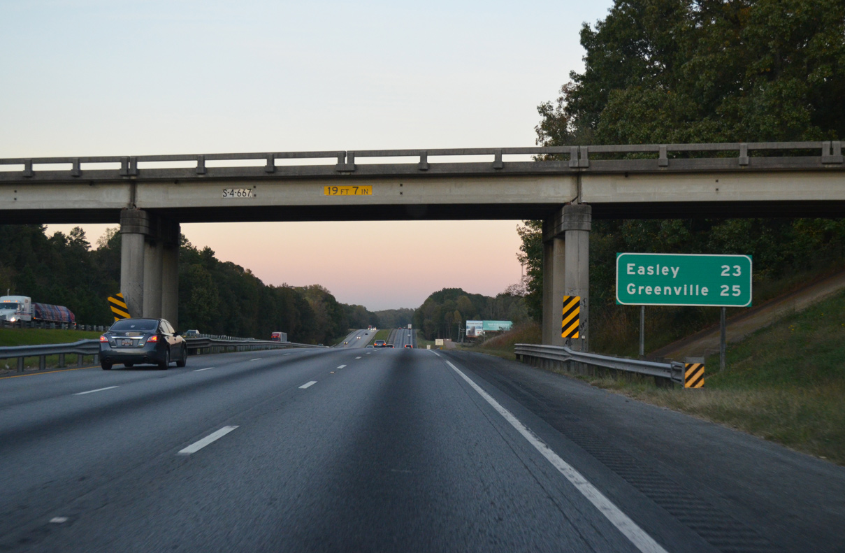
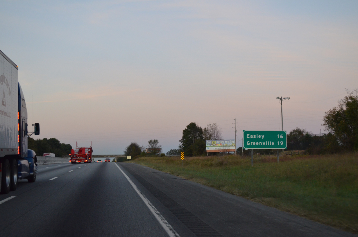
| Interstate 85 angles northeast away from Anderson 25 miles to Greenville. Easley, a city along U.S. 123 to the west of Greenville, is referenced at 23 miles out via S.C. 8 north. 10/22/15 |
|
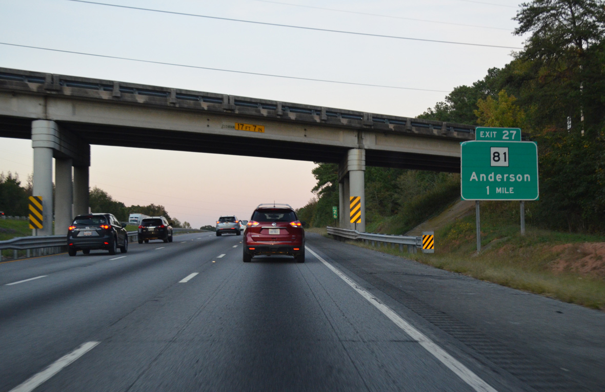
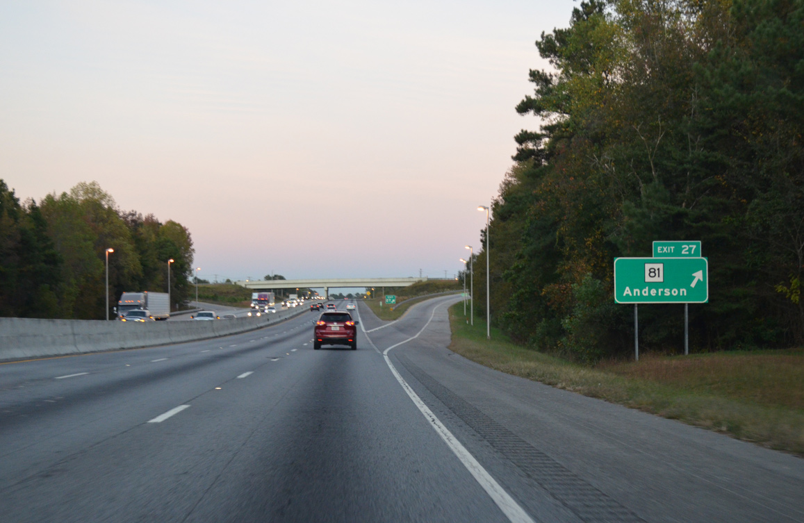
| S.C. 81 heads 8.57 miles northeast from U.S. 29 Business (Boulevard) by Anderson University in Anderson to the diamond interchange at Exit 27. 10/22/15 |
|
| North from Exit 27, S.C. 81 parallels I-85 through Piercetown to a 1.97 mile long overlap with S.C. 8 (Easley Highway). S.C. 81 continues northeast from S.C. 8 to Powderville, White Horse and the city of Greenville. 10/22/15 |
|
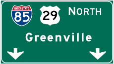
| Continuing beyond the Welcome Road (Road 96), Downtown Greenville is 19 miles away via I-85 and I-185/U.S. 29. 10/22/15 |
|
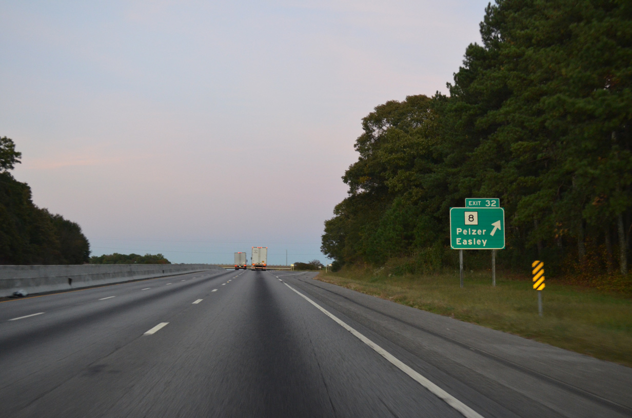
| Spearman Road crosses over Interstate 85 north one mile ahead of the diamond interchange (Exit 32) with S.C. 8 (Easley Highway). 10/22/15 |
|
| S.C. 8 leads east 4.74 miles from I-85 at White Plains to West Pelzer and S.C. 20 at Pelzer. S.C. 20 follows the original alignment of U.S. 29 north from Williamston to Piedmont, Golden Grove and Greenville. 05/28/05 |
|
| Exit 32 leaves Interstate 85 north for S.C. 8 (Easley Highway) north to Easley, Pickens, Pumpkintown and U.S. 276 south of Caesars Head. 10/22/15 |
|
| Interstate 85 converges with U.S. 29 north at a wye interchange in two miles. 10/22/15 |
|
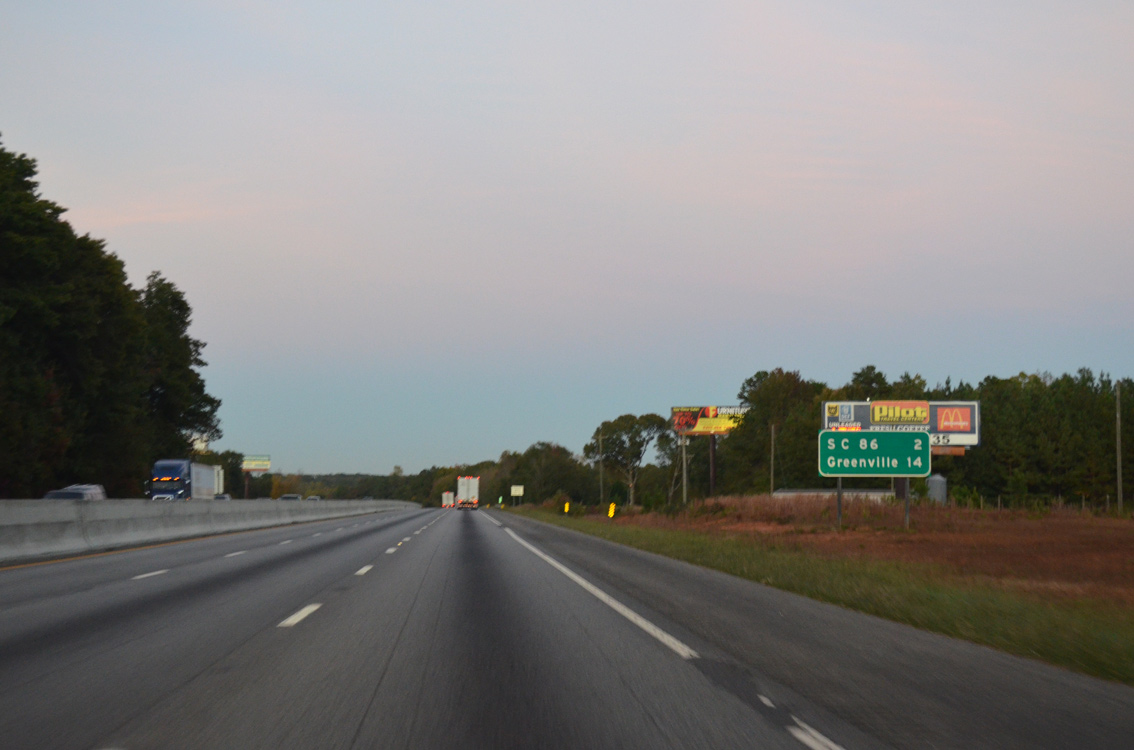
| 14 miles remain along I-85 and I-185/U.S. 29 to Downtown Greenville. S.C. 86 is the succeeding exit in two miles. 10/22/15 |
|
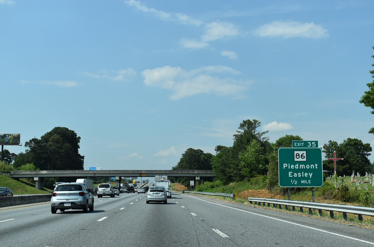
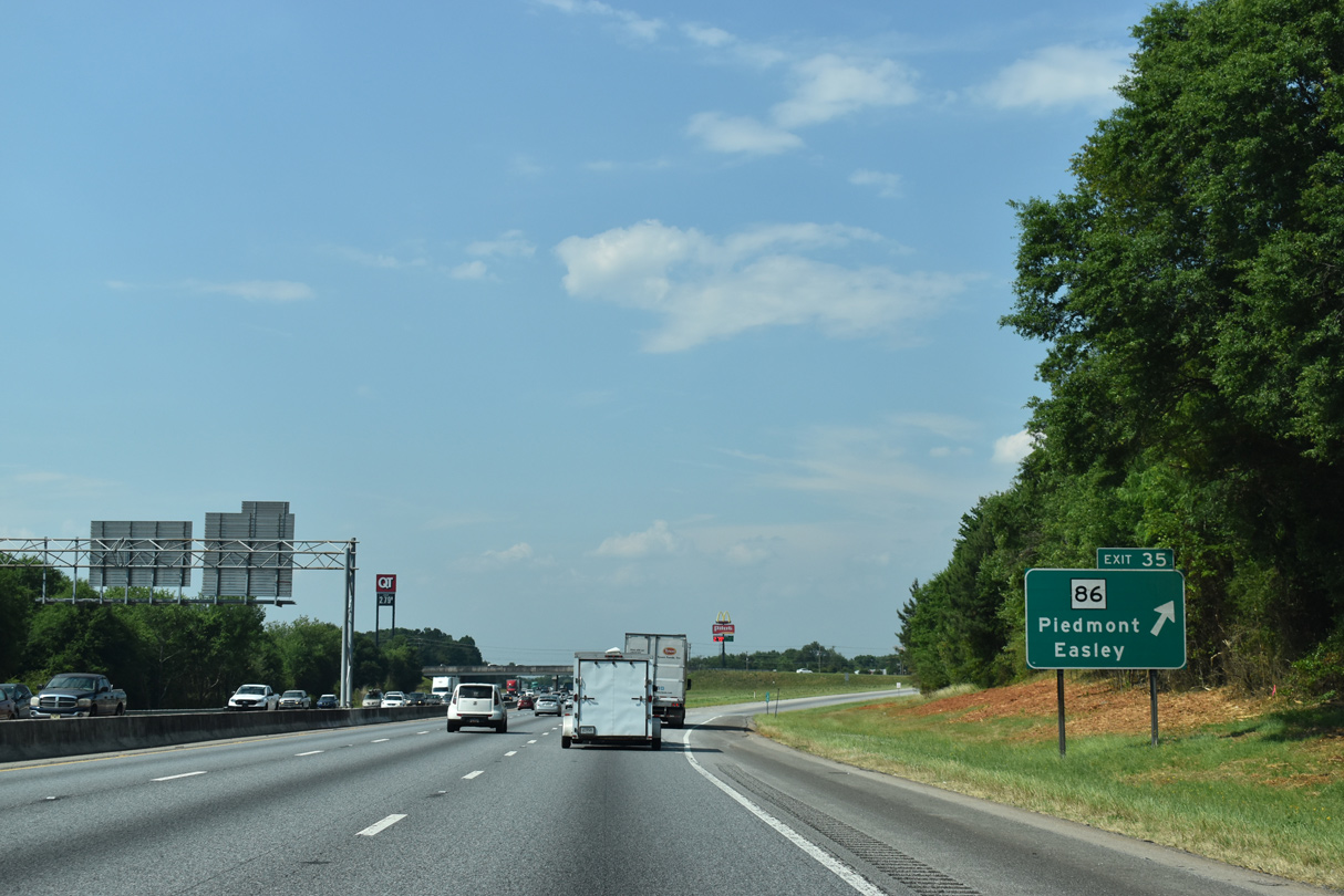
| U.S. 29 combines with I-85 north a half mile ahead of the parclo A2 interchange (Exit 35) with S.C. 86. 05/25/21 |
|
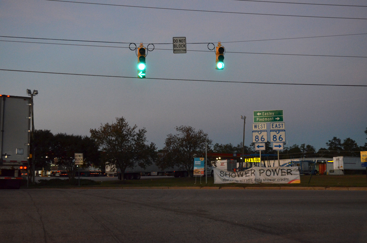
| Exit 35 departs I-85/U.S. 29 north for S.C. 86. S.C. 86 runs 12.09 miles from S.C. 8, four miles from Easley to U.S. 25 south of Moonville. 05/25/21 |
|
| A truck stop and several industrial businesses surround the exchange joining I-85 with S.C. 86. The community of Piedmont lies a short distance to the east. 10/22/15 |
|
| U.S. 29 accompanies Interstate 85 north 7.2 miles to I-185 en route to Downtown Greenville. 05/25/21 |
|
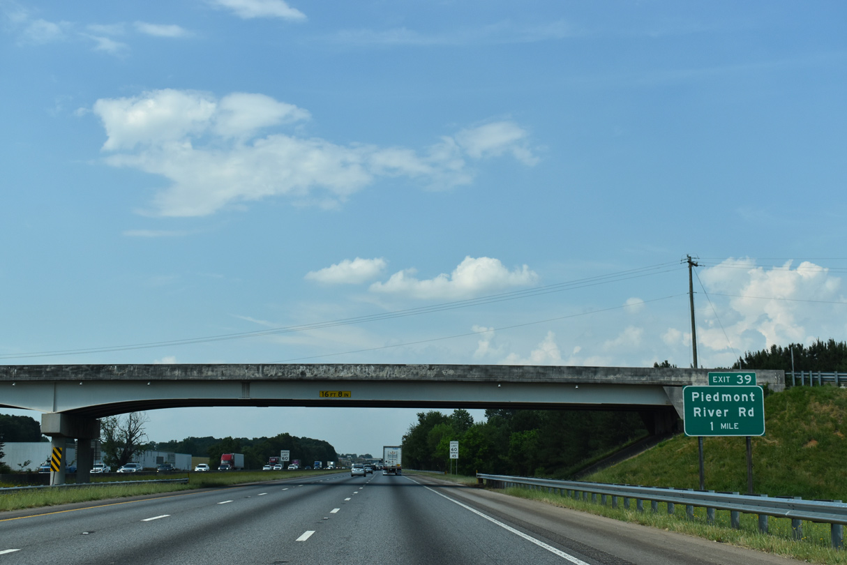
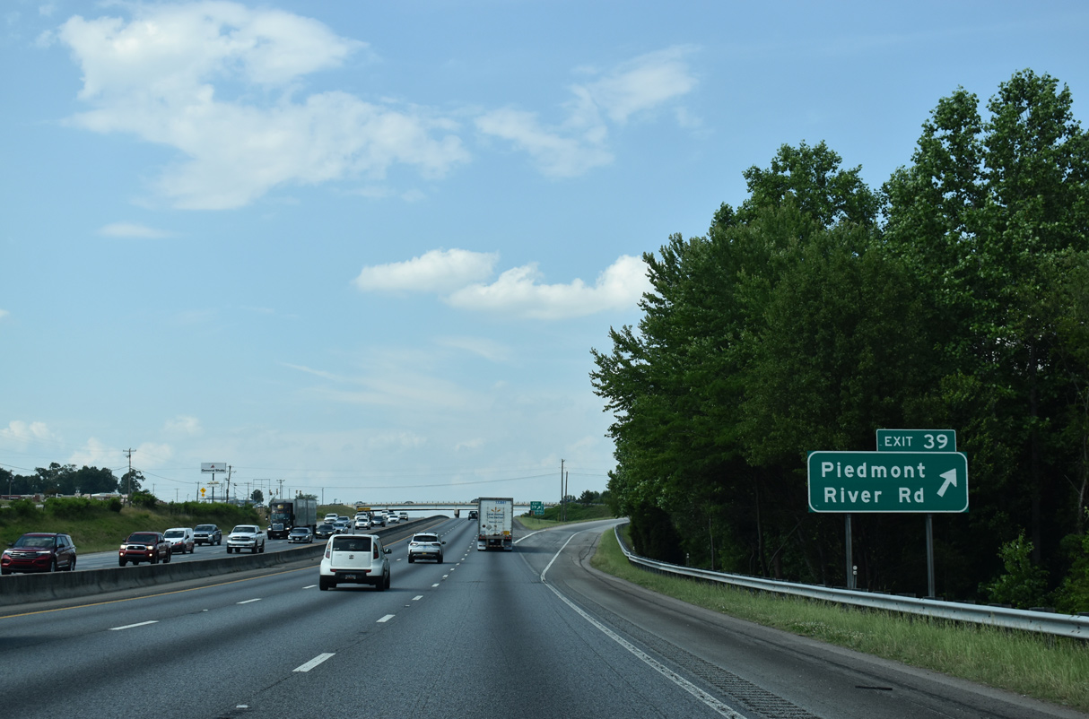
| River Road (Road 143) parallels the Saluda River north 4.32 miles from S.C. 86 in Piedmont to Interstate 85 at Exit 39. 05/25/21 |
|
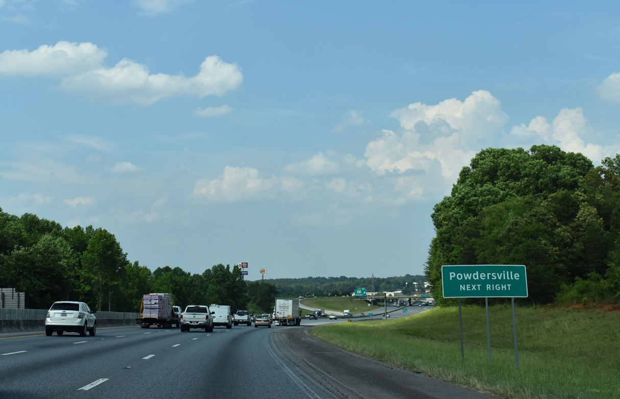
| River Road continues north from the diamond interchange at Exit 39, 1.24 miles to S.C. 153 at Powdersville and 3.41 miles to S.C. 81 (Anderson Road). 05/25/21 |
|
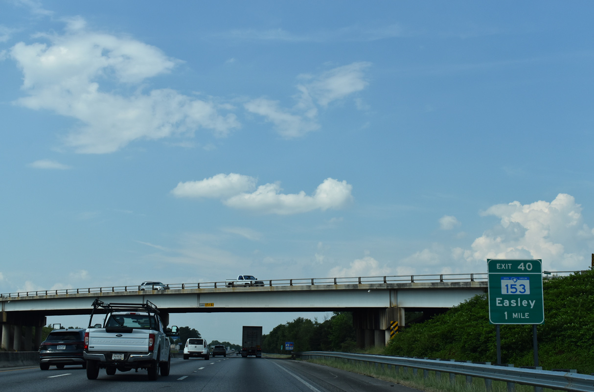
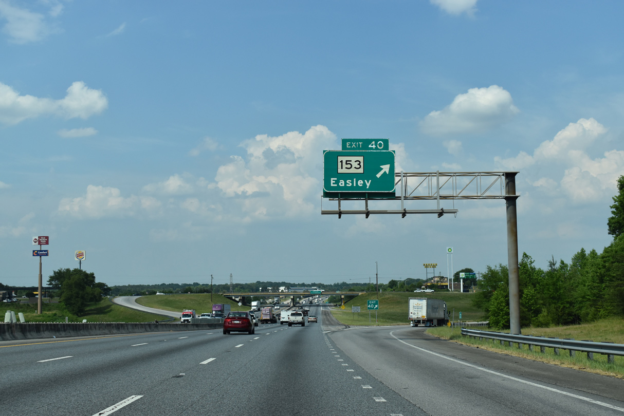
| I-85/U.S. 29 proceed one mile northeast to a parclo interchange (Exit 40) with S.C. 153. 05/25/21 |
|
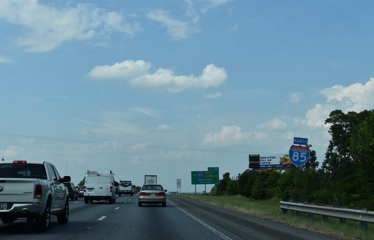
| U.S. 29 was removed from the succeeding reassurance markers in 2008. 05/25/21 |
|
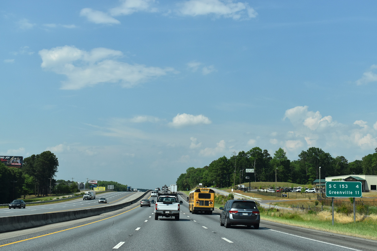
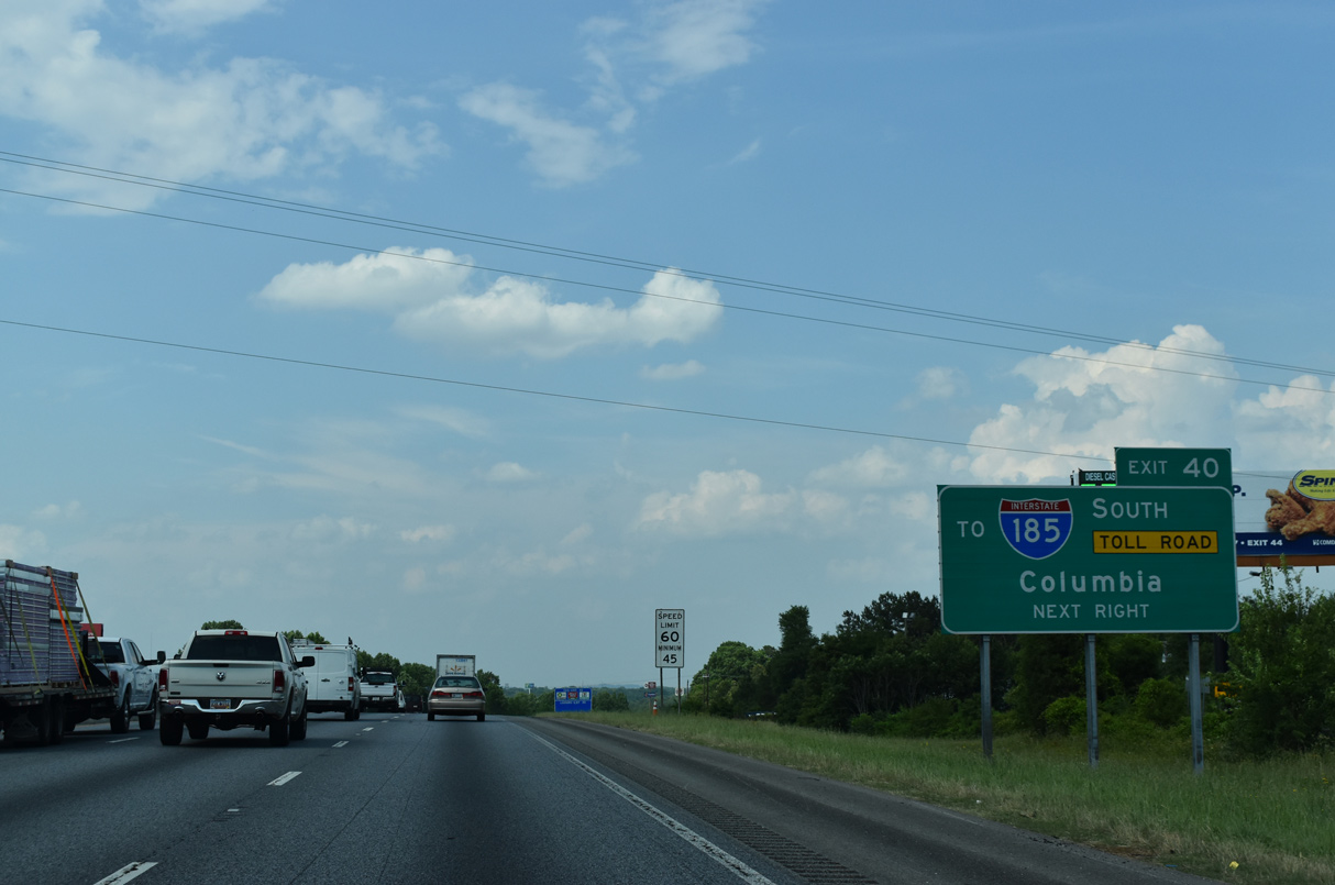
| S.C. 153 provides a cutoff from I-85 north 1.16 miles east to I-185 south along the tolled Southern Connector. 05/25/21 |
|
| S.C. 153 northwest constitutes a commercial arterial through the unincorporated community of Powdersville. 05/25/21 |
|
| S.C. 153 is a 7.11 mile long highway from Brown Road east of I-185 (Southern Connector) to U.S. 123 on the east side of the Easley city limits. 05/25/21 |
|
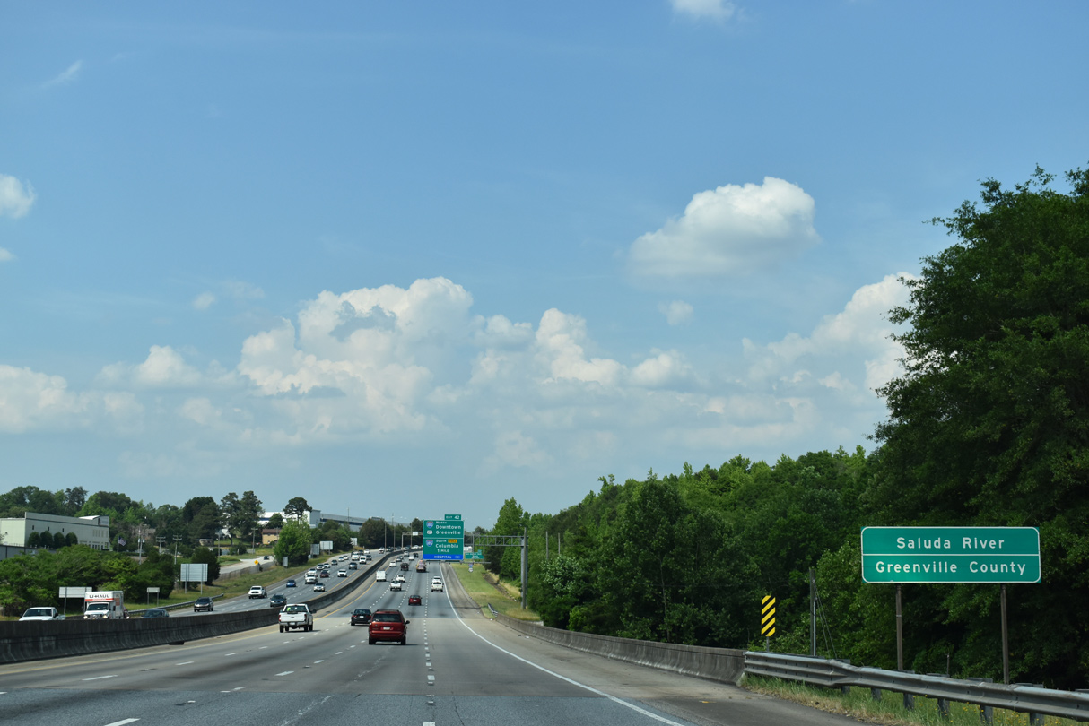
| Spanning the Saluda River, I-85/U.S. 29 north enter Greenville County 05/25/21 |
Page Updated 06-17-2021.

 North
North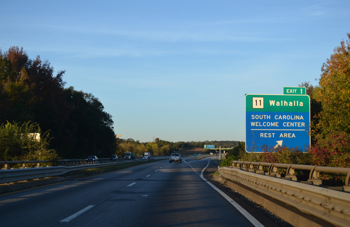


 North
North